Embed Size (px)
Citation preview

Use of Satellite Data to Improve the Physical Atmosphere in SIP Air Quality
Decision ModelsRichard McNider
Arastoo Pour BiazarKevin DotyDon Moss
Stephanie HainesUniversity of Alabama in Huntsville
William LapentaGary Jedlovec
NASA Marshall Space Flight Center
Jon PleimShawn Roselle
EPA NERL/AMD / NOAA Air Resources Laboratory

The purpose of this project is to employ satellite products to improve the physical atmosphere in air quality models used to define emission control strategies for attainment of air quality standards.
PURPOSE
Use of Satellite Data to Improve the Physical Atmosphere in SIP Air Quality Decision Models

The State Implementation Plan (SIP) Decision Making Process
Once an area exceeds the National Ambient Air Quality Standard (NAAQS) for a criteria pollutant (O3, NO, SO2, particulate matter) and is listed by the USEPA as non-attainment the state must develop a plan or strategy to lower the pollutant levels to meet the NAAQS.
A design day or design period is selected usually the period when the highest pollutant levels occur.
Model simulations are carried out to determine whether the model can reasonably replicate the episode conditions and the observed pollutant values for this period.
Next various emission reduction scenarios in these models are carried out to determine the most efficient strategy for meeting the air quality standards for the design period. This defines the SIP.
CONTEXT

Design Period Simulations
Physical Model
MM5, RAMS
Recreates the physical atmosphere (winds, temperature,
precipitation, moisture, turbulence
etc) during the design period
Chemical Model
CMAQ, UAM
Recreates the chemical atmosphere both the pollutant of
interest and precursor chemicals

Physical Model
Recreates Physical Atmosphere
Chemical Model
Recreates Chemical Atmosphere
Design Period Simulations – Inputs
Standard surface and upper air meteorological observations
Special Observations
Profiler/Sodar
Emissions
Anthopogenic
Natural
Boundary conditions
Boundary conditions
Initial conditions
Initial conditions

Physical Model
Recreates Physical Atmosphere
Chemical Model
Recreates Chemical Atmosphere
Control Strategy Simulations - Inputs
Standard surface and upper air meteorological observations
Special Observations
Profiler/Sodar
Emissions are changed to reflect control programs on industrial and mobile sources
Boundary conditions
Initial conditions
Ambient levels compared to NAAQS

Control Strategy Decisions made with MM5/CMAQ can amount to billions of dollars.
•Under the Southern Oxidant Study it was estimated that SIP control decisions involved $5 billion for 6 southeastern states
•In Texas the cost of the ozone SIP for Houston alone was estimated to be over $1 billion.
•Nationally these SIPs amount to ten’s of billions in control costs.

Physical Model
Recreates Physical Atmosphere
Chemical Model
Recreates Chemical Atmosphere
Design Period Simulations – Satellite InputsRetrospective – Data Assimilated for all Integration
Period
Geostationary Satellite Observations –•Insolation•Skin temperatures•Cloud Properties
Satellite derived properties for photolysis rates
MODIS•Surface emissivity•Surface albedo•Skin temperatures

Impact of Physical Atmosphere on SIP Control StrategiesTemperature – over prediction of temperature can bias ozone controls toward NOx controls as thermal decomposition and increases slope of ozone/NOy curves. Additionally, biogenic emissions will be overestimated.

SatelliteObservation
Assimilation Control

Photolysis Rates – Errors in photolysis rates can change response time of ozone production and change significantly levels at a given monitor

Moisture – Pollutant uptake by plants is directly related to photosynthesis and transpiration. Under-estimation of moisture and associated surface loss can overestimate the role of long range transport in local air pollution levels.

Mixing Heights – Underestimate of mixing heights can cause an over- estimate of the sensitivity of controls. Emission reductions confined to a smaller volume cause a larger reduction in pollutants. A 30% error in mixing heights can produce 30% error in emission change impacts

Model BL Heights (CNTRL)
Aug. 26, 2000, 19:00-21:00 GMT averaged
Model BL Heights (assimilated)
Aug. 26, 2000, 19:00-21:00 GMT averaged


Wind speed – In the southeast the under-prediction of wind speed can bias control strategies toward VOC sensitivity as local VOC emissions dominate over transport of biogenic emissions into the city.

Major Tasks
1. Benchmark satellite improvements in MM5/CMAQ
2. Develop model/data distribution system to serve federal/states/cities/private consultants carrying out SIP modeling.
3. Partners - EPA NERL/AMD / NOAA Air Resources Laboratory
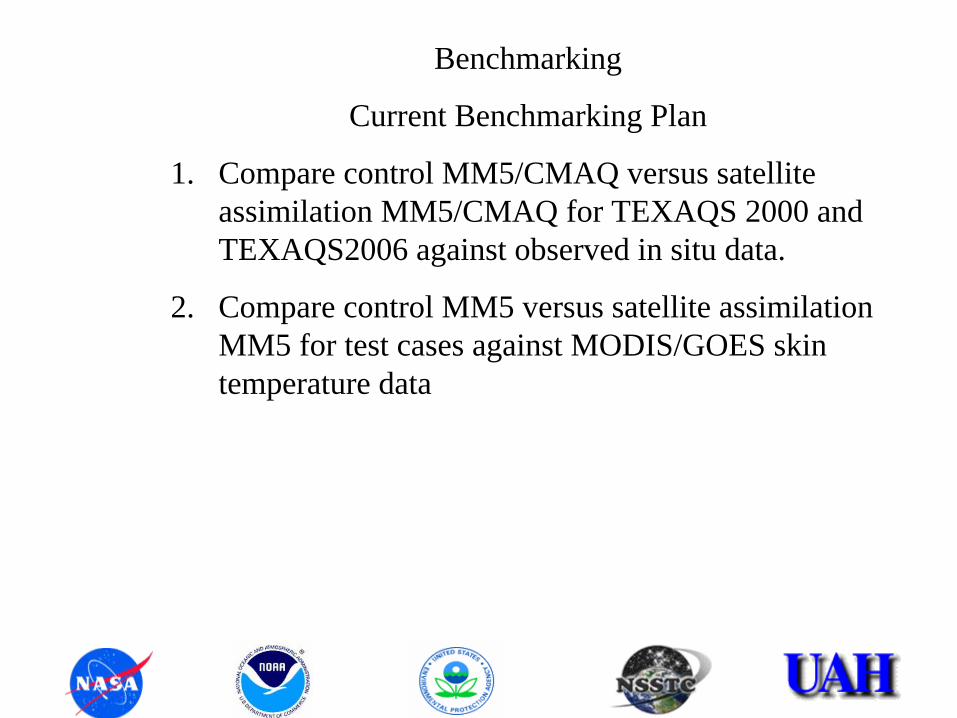
Benchmarking
Current Benchmarking Plan
1. Compare control MM5/CMAQ versus satellite assimilation MM5/CMAQ for TEXAQS 2000 and TEXAQS2006 against observed in situ data.
2. Compare control MM5 versus satellite assimilation MM5 for test cases against MODIS/GOES skin temperature data

AQ MODELING COMPONENTS IMPROVED BY THE UTILIZATION OF SATELLITE DATA
Data assimilation will improve the representation of physical atmosphere in the AQ modeling system by impacting:
1. Surface energy budget (MM5, WRF)
• Assimilating Insolation
• Assimilating surface albedo
• Recovering moisture availability
• Recovering bulk heat capacity
2. Photolysis rates (CMAQ)
3. Vertical motion and clouds (MM5, WRF)

( ) EGHRdt
dTC N
Gb +++=⎟
⎠⎞
⎜⎝⎛
Surface Energy Budget (MM5, WRF)Three Uncertain Parameters
Bulk Heat Capacity Evaporative Heat Flux
MM5 Landuse Heat Capacity MM5 Landuse Moisture Availability
Net Short-wave radiation obtained from Satellite
⎥⎦
⎤⎢⎣
⎡⎟⎠⎞
⎜⎝⎛−⎟
⎠⎞
⎜⎝⎛=
s
G
m
G
m
g
dtdT
dtdT
EC
h
( ) ms MhM )(1 δ+=
( ) ( )sat
G
m
Gmgsatg dt
dTdt
dTCC ⎟⎠⎞
⎜⎝⎛
⎟⎠⎞
⎜⎝⎛=

SUN
BL OZONE CHEMISTRY
O3 + NO -----> NO2 + O2
NO2 + hν
(λ<420 nm) -----> O3 + NOVOC + NOx + hν
-----> O3 + Nitrates(HNO3, PAN, RONO2)
αg
αc
hν
αg
)(. cldcldcld absalb1tr +−=
Cloud albedo, surface albedo, and insolation are retrieved based on Gautier et al. (1980), Diak and Gautier (1983).
Surface
Inaccurate cloud prediction results in significant under-/over- prediction of ozone. Use of satellite cloud information greatly improves O3 predictions.
Photolysis Adjustment (CMAQ)
Cloud top Determined from
satellite IR temperature

Web Based Satellite data delivery system (SAT_ASSIM.NSSTC.UAH.EDU)Archive and Distribute DataRegridding SoftwareData Processing Software
Decision Support Tools
Overview of the Data Archive & Delivery system
NSSTC Satellite Ground Station & Data Link
NSSTC Satellite Data Processing & Product GenerationInsolationSkin TemperatureSurface AlbedoCloud AlbedoCloud Top Temperature/PressureCloud TransmittanceMODIS Emissivity
MM5/WRF CMAQ/WRFCHEM
State, Local & Private Sector Users

Satellite assimilation technique for surface properties has shown that the surface/air temperature predictions can greatly be improved.
2-M Temperature Bias(12-km Domain over Texas)
-10
-8
-6
-4
-2
0
2
4
6
8
10
8/23/20000:00
8/24/20000:00
8/25/20000:00
8/26/20000:00
8/27/20000:00
8/28/20000:00
8/29/20000:00
8/30/20000:00
8/31/20000:00
9/1/20000:00
9/2/20000:00
9/3/20000:00
Date/Time
Deg.
C
CNTRL ASSIM-HCComparing model 2-M temperature predictions to the observed temperatures from National Weather Service stations shows that the satellite assimilation technique (blue line) reduces the model bias in the model (warm bias at night and cold bias during the day).
MM5 Control
ASSIMILATION Moisture and heat capacity adjusted
PROJECT VALIDATION ACTIVITY
2-m Temperature Bias (12-km domain, TexAQS2000)

Model(CNTRL)
Model(ASSIMILATION)
SatelliteObservation
Utilizing Satellite Observed Temperature for Model Evaluation
Scatter Plot
y = 0.7315x + 80.002R2 = 0.9433
y = 0.4708x + 158.09R2 = 0.8861
290
295
300
305
310
315
320
325
290 295 300 305 310 315 320 325
Satellite Retrieved (K)
MM
5_Pr
edic
tions
(K)
Sat. Assim.CNTRLLinear (Sat. Assim.)Linear (CNTRL)
Averaged Skin T scatter plot for 12-km domain (TexAQS2000).
SATELLITE
MO
DE
L
SATELLITESATELLITE
MO
DE
L
MO
DE
L
CNTRL ASSIMILATION

Largest changes in O3 concentration due to use of observed clouds for the period of August 24, 2000, to September 1, 2000.
(O3b -O3a , b=Sat. Observed Cloud, a=Control)NO, NO2, O3 & JNO2 Differences (Satellite-Control)
(Point A: x=38:39, y=30:31, lon=-95.3, lat=29.7)
-25
-20
-15
-10
-5
0
5
10
15
20
25
8/24/00 0:00 8/25/00 0:00 8/26/00 0:00 8/27/00 0:00 8/28/00 0:00 8/29/00 0:00 8/30/00 0:00 8/31/00 0:00 9/1/00 0:00
Date/Time (GMT)
Con
cent
ratio
n (p
pb)
NO NO2 O3 JNO2 (/min)
The differences between NO, NO2, O3 (ppb) and JNO2 from satellite cloud assimilation and control simulations for a selected grid cell over Houston-Galveston area.
IMPACT OF PHOTOLYSIS ADJUSTMENT
Corrections of up to 70 ppb for Ozone

Observed O3 vs Model Predictions(South MISS., lon=-89.57, lat=30.23)
-40
-20
0
20
40
60
80
100
8/30/00 0:00 8/30/00 6:00 8/30/00 12:00 8/30/00 18:00 8/31/00 0:00 8/31/00 6:00 8/31/00 12:00 8/31/00 18:00
Date/Time (GMT)
Ozo
ne C
once
ntra
tion
(ppb
)
Observed O3
Model (cntrl)
Model (satcld)
(CNTRL-SATCLD)
OBSERVED
MM5-CNTRL
MM5-ASSIM
Under-prediction
IMPACT OF PHOTOLYSIS ADJUSTMENT

Cloud Adjustment in (MM5)
Use satellite cloud top temperatures and cloud albedoes to determine a maximum vertical velocity (Wmax) in the cloud column (Multiple Linear Regression ).
Adjust divergence to comply with Wmax in a way similar to O’Brien (1970).Nudge MM5 winds toward new horizontal wind field to sustain the vertical
motion.Remove erroneous model clouds by suppressing convective initiation.
Satellite Observation Model

A
B C
Downward shortwave radiation in W m-2 at 2200 UTC 6 July 1999.
(A) Derived from GOES–8 satellite. (B) Control run with no assimilation. (C) Run with assimilation of satellite cloud information.
MODELASSIMILATION
MODELCNTRL
Satellite OBSERVED
Insolation
SATELLITE DATA IS UTILIZED TO CORRECT MODEL CLOUD FIELDS IN A DYNAMICALLY CONSISTENT MANNER

TRANSITIONING & STATUS OF THE PROJECTThe approach for transitioning is to
1) provide the satellite data to the users through a web based delivery system
2) transfer the modeling components to EPA so that they will become part of the standard release of Decision Support Tools.
STATUS OF THE PROJECT:
Developed Web Based Delivery System
Processing & archiving current data
Processing & archiving old data
Developed Regridding Software

TRANSITIONING & STATUS OF THE PROJECT (cont.)
Transfer of code to EPA/AMD
MM5 code for satellite assimilation and the preprocessors were delivered to EPA
CMAQ code for satellite assimilation and the preprocessors were delivered to EPA
Satellite data for TexAQS2000 was delivered to EPA
Worked (and continue to work) with EPA to implement the modifications for their in-house models.
Collaborating with EPA/AMD on benchmark activities
TexAQS2000 and TexAQSII periods are considered for benchmarking.
EPA/AMD has already performed simulations for TexAQS2000
Collaborating with EPA for transitioning to WRF modeling system

Web Based Delivery System
sat_assim.nsstc.uah.edu
Username: levl
Password: sparkx

SCHEDULE FOR THE REST OF THE PROJECTComplete the benchmarking activity
Complete transition to WRF
Turn over the web site to DAAC (GHRC)
Continue to work with EPA/AMD to implement other model components for satellite assimilation.

WHERE DO WE GO FROM HERECloud adjustment within MM5 needs to be completed
The inconsistency due to photolysis adjustment and insolation needs to be addressed
Photolysis adjustment can take advantage of the new satellite observations of ozone.
Calipso lidar can be used in certain situations to evaluate mixing heights