Embed Size (px)
Citation preview
OIR – GIS Services 1
Tennessee Base Mapping Program
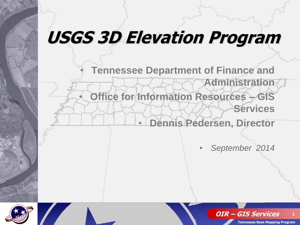
• Tennessee Department of Finance and
Administration
• Office for Information Resources – GIS
Services
• Dennis Pedersen, Director
• September 2014
USGS 3D Elevation Program
OIR – GIS Services 2
Tennessee Base Mapping Program
• Acquire nationwide high res. LiDAR elevation data
• Backed by a comprehensive business plan (2011)
• Estimated annual benefits of $1.2 billion nationwide
• Goal to start data production in January 2015
• Looking to establish partnerships/collaboration on funding the program now (Broad Area Announcement)
• USGS is proposing contributions up to 50%
• Seeking proposals from 3DEP supporters at Fed, State, and local gov. levels
3DEP Program Summary
OIR – GIS Services 3
Tennessee Base Mapping Program
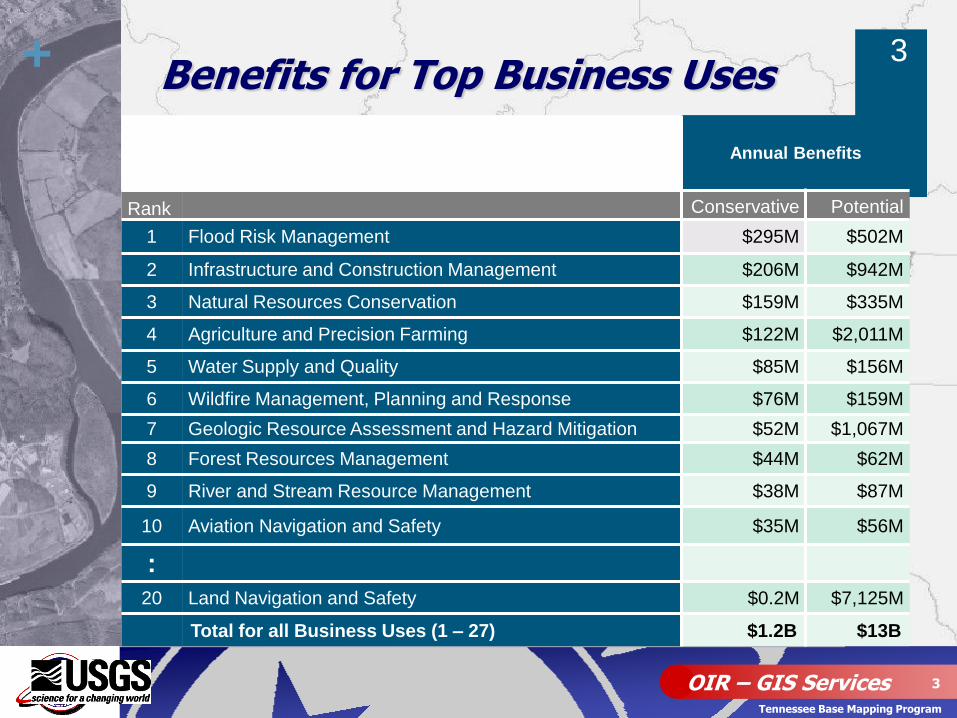
+ Benefits for Top Business Uses
Annual Benefits
Rank Conservative Potential
1 Flood Risk Management $295M $502M
2 Infrastructure and Construction Management $206M $942M
3 Natural Resources Conservation $159M $335M
4 Agriculture and Precision Farming $122M $2,011M
5 Water Supply and Quality $85M $156M
6 Wildfire Management, Planning and Response $76M $159M
7 Geologic Resource Assessment and Hazard Mitigation $52M $1,067M
8 Forest Resources Management $44M $62M
9 River and Stream Resource Management $38M $87M
10 Aviation Navigation and Safety $35M $56M
:
20 Land Navigation and Safety $0.2M $7,125M
Total for all Business Uses (1 – 27) $1.2B $13B
3
OIR – GIS Services 4
Tennessee Base Mapping Program
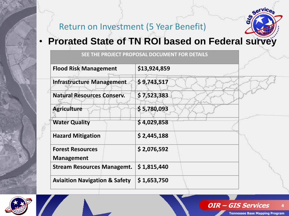
• Prorated State of TN ROI based on Federal survey
Return on Investment (5 Year Benefit)
SEE THE PROJECT PROPOSAL DOCUMENT FOR DETAILS
Flood Risk Management $13,924,859
Infrastructure Management $ 9,743,517
Natural Resources Conserv. $ 7,523,383
Agriculture $ 5,780,093
Water Quality $ 4,029,858
Hazard Mitigation $ 2,445,188
Forest Resources
Management
$ 2,076,592
Stream Resources Managemt. $ 1,815,440
Aviaition Navigation & Safety $ 1,653,750
OIR – GIS Services 6
Tennessee Base Mapping Program
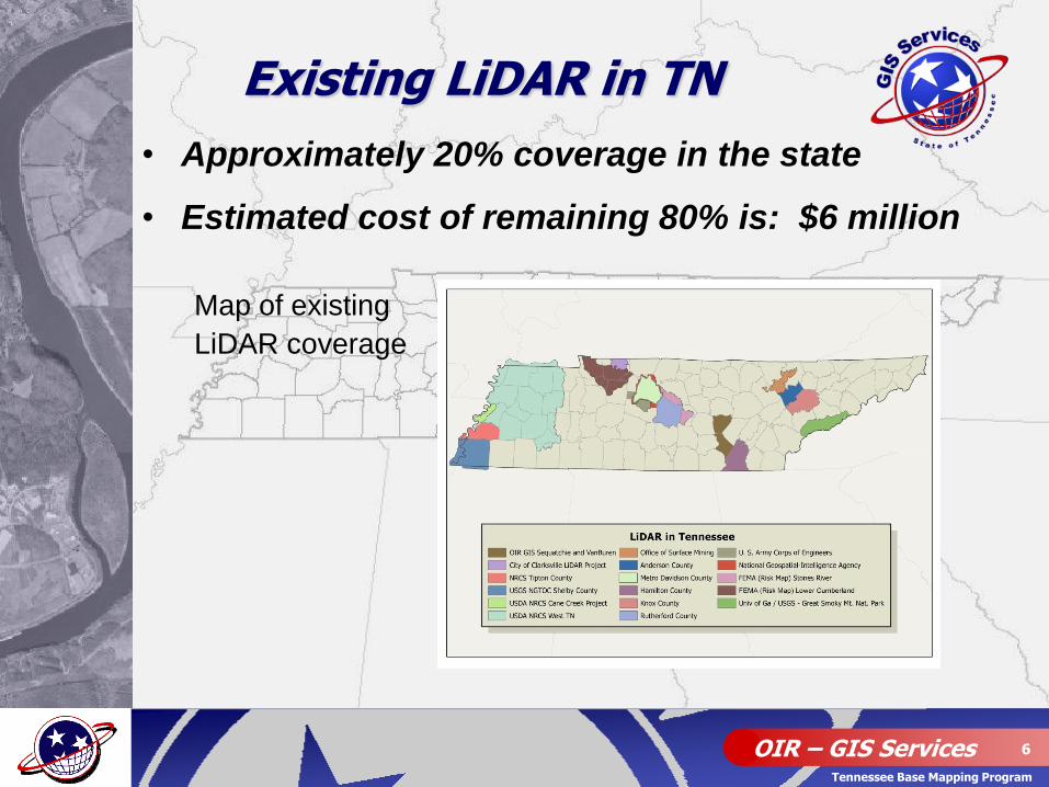
• Approximately 20% coverage in the state
• Estimated cost of remaining 80% is: $6 million
Map of existing
LiDAR coverage
Existing LiDAR in TN
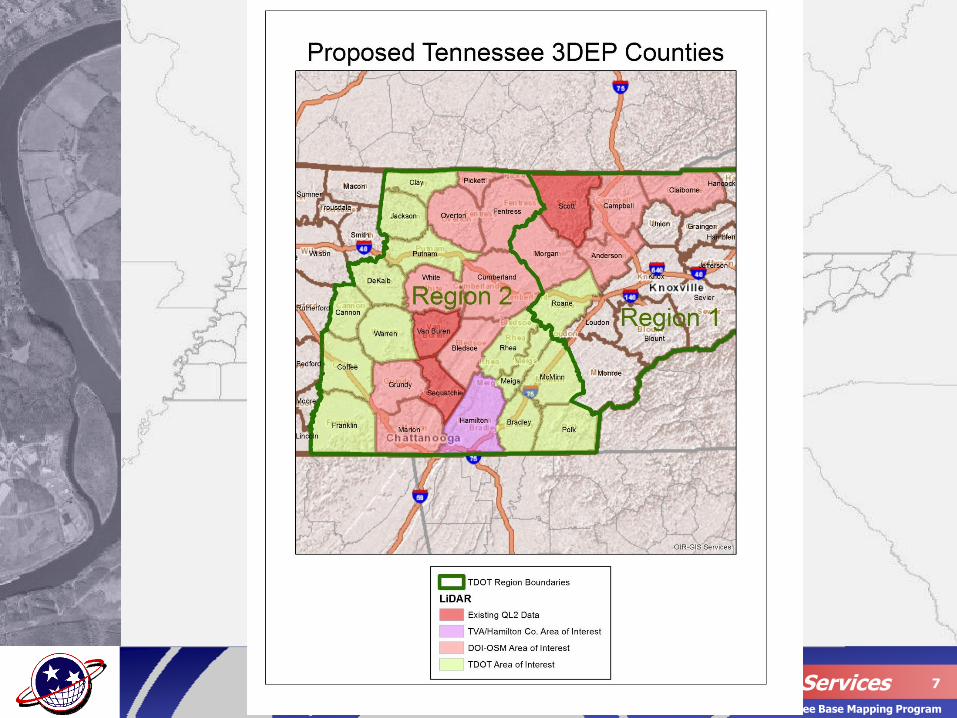
OIR – GIS Services 7
Tennessee Base Mapping Program
OIR – GIS Services 8
Tennessee Base Mapping Program
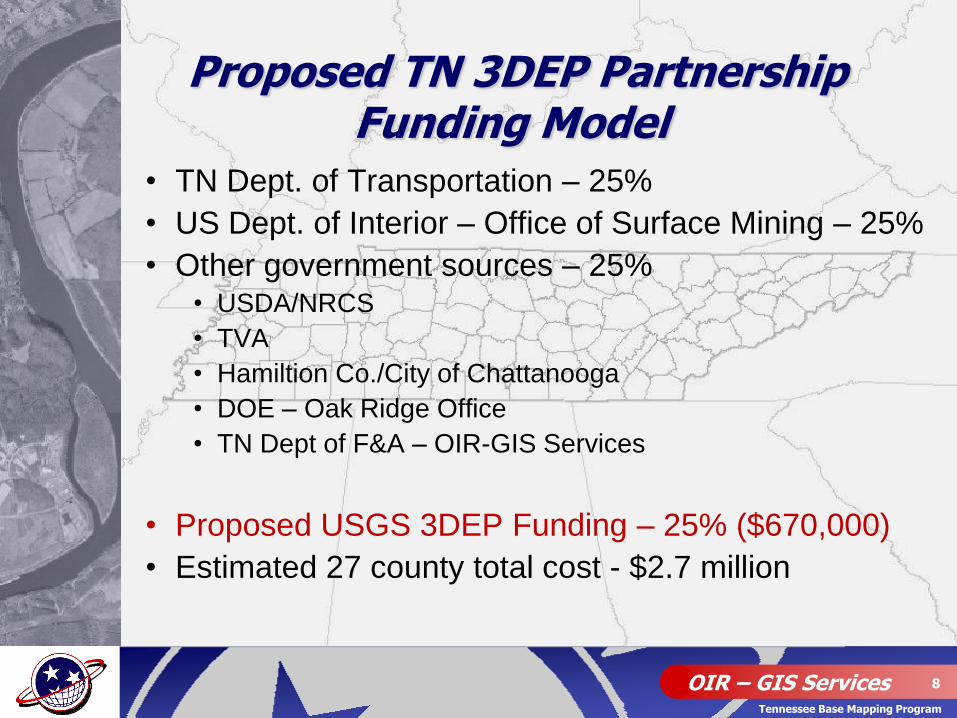
• TN Dept. of Transportation – 25%
• US Dept. of Interior – Office of Surface Mining – 25%
• Other government sources – 25% • USDA/NRCS
• TVA
• Hamiltion Co./City of Chattanooga
• DOE – Oak Ridge Office
• TN Dept of F&A – OIR-GIS Services
• Proposed USGS 3DEP Funding – 25% ($670,000)
• Estimated 27 county total cost - $2.7 million
Proposed TN 3DEP Partnership Funding Model
OIR – GIS Services 9
Tennessee Base Mapping Program
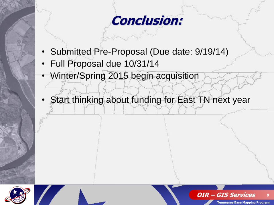
• Submitted Pre-Proposal (Due date: 9/19/14)
• Full Proposal due 10/31/14
• Winter/Spring 2015 begin acquisition
• Start thinking about funding for East TN next year
Conclusion:
OIR – GIS Services 10
Tennessee Base Mapping Program
Questions???