Embed Size (px)
Citation preview
1
Viewshed Analysis Report
Proposed Wireless Telecommunications Facility:
CT1209 Windsor780 Prospect Hill RdWindsor, CT 06095
- 139 ft AGL structure, consisting of proposed new 135 ft monopole towerwith 4 ft lightning rod
- Viewshed map completed 3/1/19
- Balloon test and viewshed verification completed 3/3/19
Viewshed analysis maps and representations contained herein depict where proposed facility may potentially be visible based on the best data available and site conditions at the time data was collected. This study does not claim to depict all locations from where the facility may be potentially visible.
Introduction At the request of Tarpon Towers II, LLC, Virtual Site Simulations, LLC (VSS) was contracted to provide a Viewshed Analysis Report for a proposed telecommunications Facility located at 810 Prospect Hill Road, Windsor, CT 06095. Hereafter referred to as “the Site”. The proposed tower facility would consist of an approximate 135 Ft. above ground level (“AGL”) Monopole type antenna structure with a max height of 139 Ft. AGL that includes a 4 Ft lightning rod. Space is available for co-location of 3 future carriers. Associated unmanned equipment will be contained within an approximately 50 ft x 50 ft fenced gravel equipment compound surrounding the base of the proposed tower.
Site Description and Setting
The proposed Monopole type telecommunications facility is located on the 5.71+/- Acre property designated by the tax assessor as parcel Code 8300 Map 17 Block 135 Lot 1 and owned by THE FERRAINA COMPANY LLC. The Site is approximately 2.4 miles due west of Interstate 91 at Exit 38, Poquonock Avenue. The site is located within a mostly rural area and the subject property contains 3 existing single story Industrial/Commercial buildings. The Proposed facility location is within an existing triangular shaped landscaped area behind an existing structure, along the Northern edge of the property. Existing tree-line on northern edge of property adjacent to proposed compound is to remain.
Development surrounding this area is a mix of farmland and residential houses to the north and northeast with commercial/industrial buildings and farmland to the south and south east. The Farmington River is approximately 1.04 miles to the northwest at its nearest point. The METROPOLITAN LEARNING CENTER is approximately 1.26 miles to the southwest. Educational Playcare Inc., a daycare facility, is approximately 1.0 +/- Miles to southeast. The Metacomet Trail is 3.3 miles to the east at its closest point. There are no CT Blue Blazed Trails within the study area. There are no schools or licensed daycare facilities within 250 ft of the proposed facility.
2
Methodology A two-mile diameter surrounding the site is defined as the study area for this Viewshed Analysis. The Viewshed Analysis was conducted within the predefined study area using two different methods: computer modeling and on-site observation. Each method was used to verify the results of the other, providing the best possible prediction of locations that will have views of proposed telecommunications facility.
Note: Balloon Test was conducted during leaf-off conditions therefore leaf-off viewshed results were verified.
Computer Modeling – Viewshed Analysis
A combination of Image based, Lidar based and Digital Elevation Model (“DEM”) based data was used to perform this analysis. The primary software used was Environmental Systems Research Institute Inc. (ERSI) ArcGIS Spatial Analysis. This software allows the user to perform spatial analysis on imported maps and datasets. The maps and datasets used are documented in the “documentation” page at the end of this report. The maps and datasets are imported as layers within the software mapping program. Once imported, spatial analysis tools are used to evaluate each position within those layers from which the proposed facility may be visible. These tools allow for the input of: viewing reference height (assumed to be 5 Ft AGL) and tower height (in this case 139 ft AGL structure, consisting of proposed new 135 ft monopole tower with 4 ft lightning rod). The tools also take into account any layers that have been imported that may affect viewing location (i.e. topography, tree canopy, ground cover, buildings, roads etc.). Lidar data was used to create a Digital Surface Model (DSM) of the existing topography. Existing tree canopy height and Building heights were not averaged or assumed but calculated from lidar data within the DSM. Image analysis was used to classify the existing tree cover for both leaf on and leaf off conditions. The Image analysis results were then used to create two different DSM’s. Visibility analysis tools were then applied, and visibility models were created. The results of this computer model were then graphically layered on topographic and aerial maps.
These maps can be found in Attachment A.
3
On-site Observation & Documentation
A balloon test was conducted on Sunday, March 3rd, 2019 and used as the visual reference for site observations from random locations throughout the study area. Note: The balloon test was conducted at 135 Ft AGL. The balloon test consisted of flying a 3 Ft. diameter helium filled balloon to the top elevation of the proposed tower. Balloon diameter was measured using a custom set of calipers. A red balloon was used to provide the best contrast between it and surrounding sky or vegetation. The balloon was tethered to the location of the proposed tower, and its elevation was set by measuring the length of the tether. The elevation was verified using the Lieca DISTO D2 Laser distometer.
Balloon test accuracy is very wind dependent. The balloon test was therefore scheduled on a day with wind conditions below the accepted threshold of 10mph. A preliminary viewshed analysis was done using the method outlined above to determine what areas were predicted to have views of the proposed site and to verify the computer model. Drive-by visual reconnaissance of the Study Area was then conducted using the preliminary viewshed analysis as a guide. Locations where the Balloon was visible and not visible were photo documented and a GPS track of reconnaissance areas was made. Reconnaissance areas were limited to public areas/roads, no private property was used in the on-site observations of this test.
Photo documentation of this test was accomplished using a Nikon P900 16Mp digital camera set to use a 50mm focal length1 2. The Nikon P900 was chosen because it has built- in XMP metadata files that embed the GPS location, light conditions and bearing to target within the image source data file. These photos document the necessary location and bearing data to ensure the accuracy of simulation location. This documentation was then incorporated into a computer model prediction. The on-site observations were used to adjust model assumptions made in 3d model as necessary.
1 “The lens that most closely approximates the view of the unaided human eye is known as the normal focal length lens. For the 35 mm camera format, which gives an 24 x 35mm image, the normal focal length is about 50mm” Warren Bruce Photography, West Publishing Company, Egan, MN c 1993 (page 70) 2 50 mm focal length is based on 35mm film photography. Since Digital photographic sensors are not the same size as 35mm film ALL digital photography focal lengths must be corrected
4
Photographic Documentation
A number of photographs were chosen from the on-site documentations photos and used to prepare photorealistic simulations of the proposed telecommunications facility. GPS coordinates and bearing information recorded within the XMP metadata file of the documentation photos was used to generate virtual camera positions within a 3d model. The balloon in the documentation photos was used as a spatial reference to verify the proportions and height of the proposed tower. Site plan information, field observations and 3D models were then used in these simulations to portray relative scale and location of the proposed structure. The photo simulations were then created using a combination of the 3d model and photo rendering software. These simulations and the existing site photographs provided for reference are attached.
Eight photographs were used for simulations and documentation. These Simulations and documentation photos are plotted on the viewshed analysis map attached and shown in the Photo Simulation Package (Attachment B)
5
Visibility Analysis Results
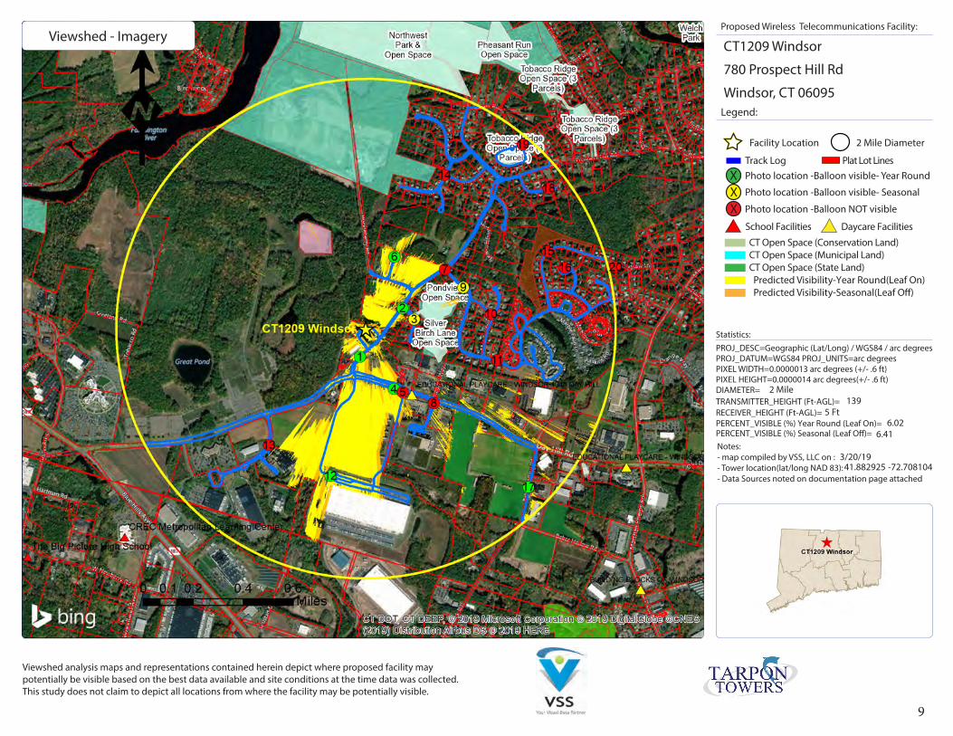
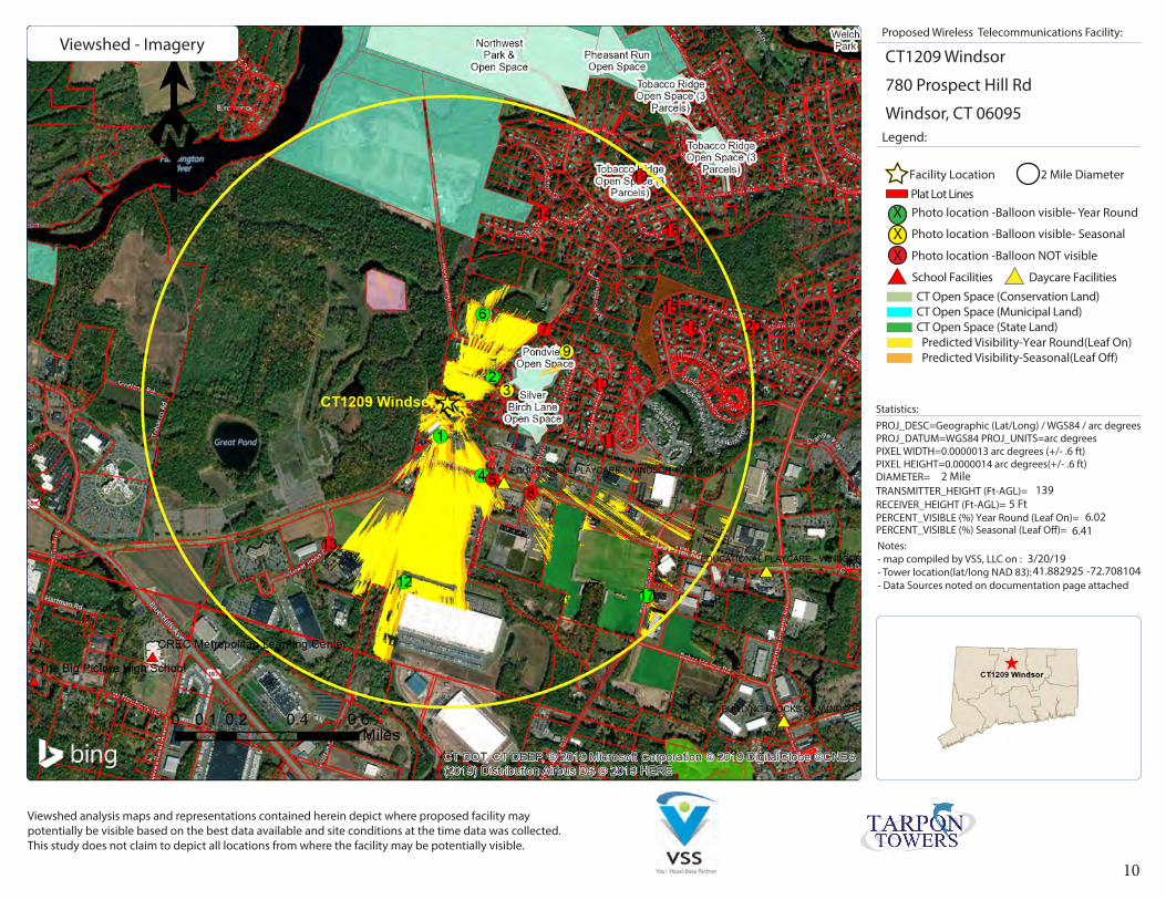
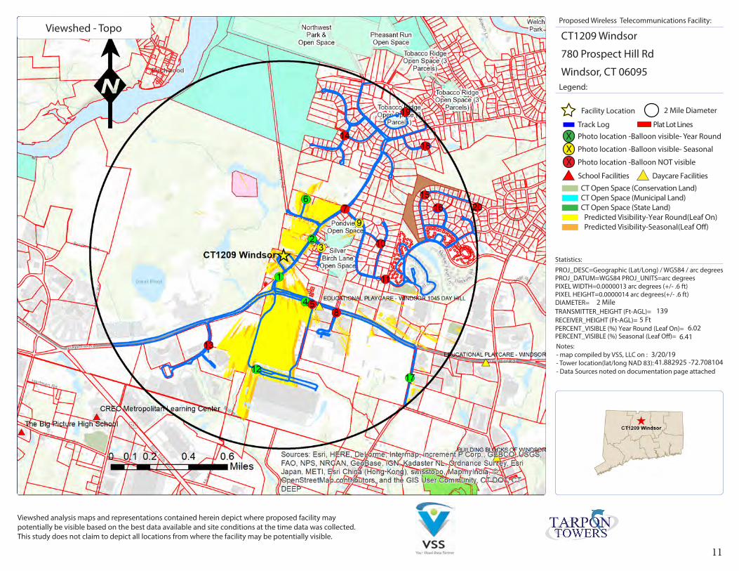
The results of the of viewshed analysis for the proposed tower are provided on the visibility analysis maps attached at the end of this report within Attachment A.
Predicted estimate of year-round views (Summer, leaf on condition) of the proposed tower facility are from approximately 121.0 acres or approximately 6.02 % of the 2-mile diameter study area. The majority of these views (85.26 Arces +/- 70.46%) are contained within the farmland/industrial/commercial area to south of the proposed site around and along Day Hill Road at Goodwin Drive. The next largest area of predicted year-round visibility is contained with a 20.26 Acre area direct to the north of proposed site. The land use in this area is farmland to the south with approximately 16 single family homes built within existing farmland along Huckleberry Road and Morello Circle to the north. The majority of the remaining 15.48 Acres of predicted year-round views mainly occur in small pockets of visibility within the commercial /farmland area to southwest of the site along Day Hill Road. These views are predicted to be of the upmost portion of the proposed tower.
Predicted seasonal views (Winter, leaf off condition) of the proposed facility are from an additional 8.00 acres (an additional .39 %). Total predicted seasonal views 129.02 Acres. These additional seasonal views mostly occur along the edges of the year-round visibility areas with some small areas (+/-300 sq. ft) of additional seasonal visibility scattered within the residential area to west. Views form these specific areas are predicted to be distant and obscured by existing tree cover.
Areas of predicted visibility, both seasonal and year-round, are mostly contained within Commercial/Industrial/Farmland areas within .35 miles surrounding the proposed Site. The most significant residential views are predicted to occur from the southern side of the six single family homes on the south side of Huckleberry Road and the first two homes at the intersection of Huckleberry road and Morello Circle. These homes are approximately .19 miles (+/- 1000 ft) from the proposed tower location and their parcels appear to have been cut from neighboring farmland and as such, contain few mature trees. Due to the existing tree-line on the proposed site that is to remain, the proposed compound and lower portion of the tower are predicted to be obscured from views in this direction. It is predicted that the upper portion of the tower will be visible from these locations. It should be noted that no significant year -round views are predicted in the large residential area to west or to the north.
6
Documentation Sources used for Visibility Analysis located at:
Proposed Wireless Telecommunications Facility CT1209 Windsor 810 Prospect Hill Road Windsor, CT 06095
Maps and datasets /consulting documents:
United States Geological Survey - USGS Topographical quadrangles (2011-2012)
National Resource Conservation Service -NAIP aerial photography (2010, 2012)
CRCOG Ortho-imagery – (2017)
UCONN- Center for Land Use Education and Research - LiDAR data (2016)
DEEP- Connecticut Department of Energy and Environmental Protection - Open Space (2010)- DEEP Property (2017)- Historic Places (2008)
United States Census (2010) – Landmark Polygon Features
Connecticut Forest & Park Association (CFPA) – Blue Blazed Trails (2016)
Connecticut.Gov eLicensing Website – Child Daycare & Group Daycare Homes Roster (2017)
Environmental Systems Research Institute Inc (ERSI) – CT state boundaries/counties (2010)
Esri, DigitalGlobe, GeoEye, i-cubed, USDA, USGS, AEX, Getmapping, Aerogrid, IGN, IGP, swisstopo
Limitations: This report and the analysis herein does not claim to depict all locations, or the only locations from which the proposed facility will be visible; it is intended to provide a representation of those areas where proposed facility is likely to be visible.
7
8
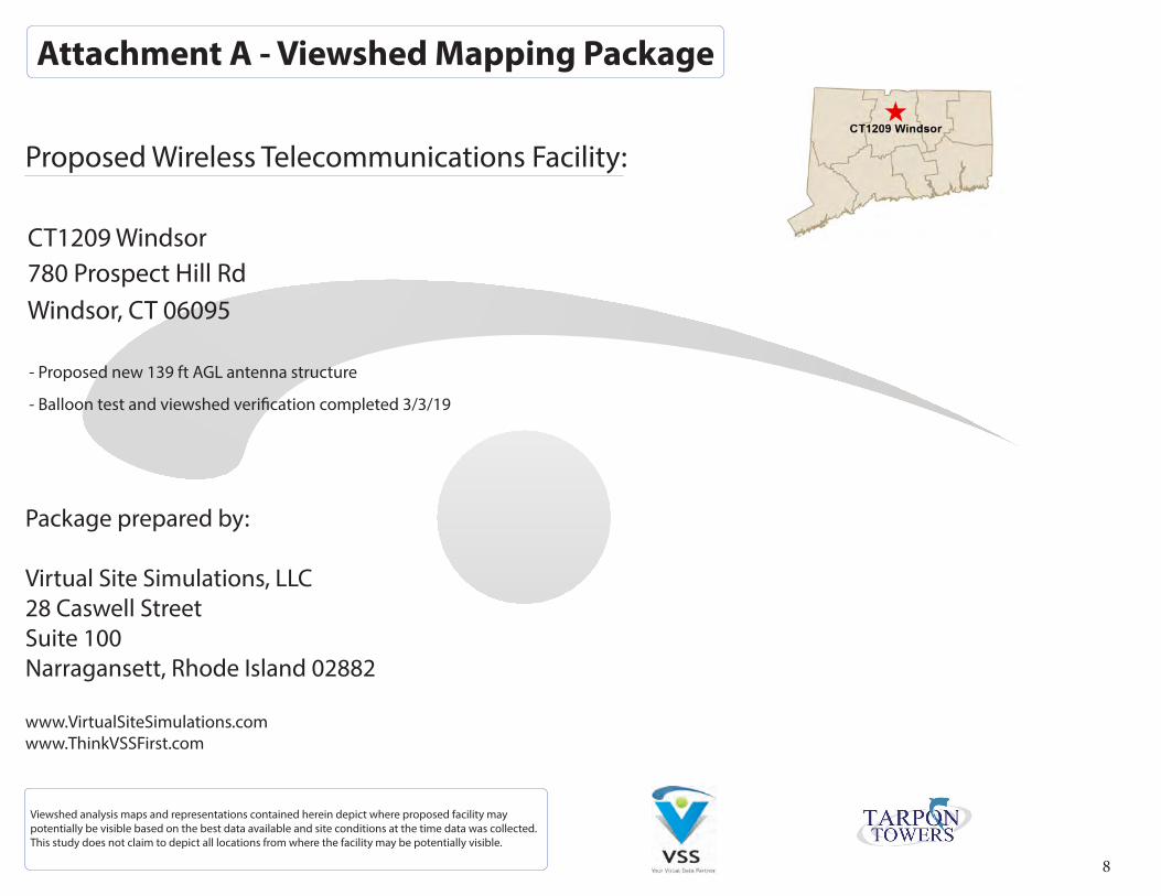
Attachment A - Viewshed Mapping Package
Proposed Wireless Telecommunications Facility:
CT1209 Windsor780 Prospect Hill RdWindsor, CT 06095
- Proposed new 139 ft AGL antenna structure
- Balloon test and viewshed verification completed 3/3/19
Viewshed analysis maps and representations contained herein depict where proposed facility may potentially be visible based on the best data available and site conditions at the time data was collected. This study does not claim to depict all locations from where the facility may be potentially visible.
Package prepared by:
Virtual Site Simulations, LLC 28 Caswell StreetSuite 100Narragansett, Rhode Island 02882
www.VirtualSiteSimulations.comwww.ThinkVSSFirst.com
9
Viewshed analysis maps and representations contained herein depict where proposed facility may potentially be visible based on the best data available and site conditions at the time data was collected. This study does not claim to depict all locations from where the facility may be potentially visible.
Proposed Wireless Telecommunications Facility:
Legend:
CT1209 Windsor
780 Prospect Hill Rd
Windsor, CT 06095
Statistics:
PERCENT_VISIBLE (%) Year Round (Leaf On)=
Notes:- map compiled by VSS, LLC on : - Tower location(lat/long NAD 83): - Data Sources noted on documentation page attached
PERCENT_VISIBLE (%) Seasonal (Leaf O�)=
-72.708104
6.02
PROJ_DESC=Geographic (Lat/Long) / WGS84 / arc degrees PROJ_DATUM=WGS84 PROJ_UNITS=arc degreesPIXEL WIDTH=0.0000013 arc degrees (+/- .6 ft)PIXEL HEIGHT=0.0000014 arc degrees(+/- .6 ft)DIAMETER=TRANSMITTER_HEIGHT (Ft-AGL)= 139RECEIVER_HEIGHT (Ft-AGL)= 5 Ft
3/20/19
6.41
41.882925
Viewshed - Imagery
Predicted Visibility-Year Round(Leaf On)
Facility Location 2 Mile Diameter
Photo location -Balloon visible- Year Round XX Photo location -Balloon visible- Seasonal
X Photo location -Balloon NOT visible
Track Log Plat Lot Lines
Predicted Visibility-Seasonal(Leaf O�)
Daycare FacilitiesSchool Facilities
CT Open Space (Conservation Land)CT Open Space (Municipal Land)CT Open Space (State Land)
2 Mile
10
Viewshed analysis maps and representations contained herein depict where proposed facility may potentially be visible based on the best data available and site conditions at the time data was collected. This study does not claim to depict all locations from where the facility may be potentially visible.
Proposed Wireless Telecommunications Facility:
Legend:
CT1209 Windsor
780 Prospect Hill Rd
Windsor, CT 06095
Statistics:
PERCENT_VISIBLE (%) Year Round (Leaf On)=
Notes:- map compiled by VSS, LLC on : - Tower location(lat/long NAD 83): - Data Sources noted on documentation page attached
PERCENT_VISIBLE (%) Seasonal (Leaf O�)=
-72.708104
6.02
PROJ_DESC=Geographic (Lat/Long) / WGS84 / arc degrees PROJ_DATUM=WGS84 PROJ_UNITS=arc degreesPIXEL WIDTH=0.0000013 arc degrees (+/- .6 ft)PIXEL HEIGHT=0.0000014 arc degrees(+/- .6 ft)DIAMETER=TRANSMITTER_HEIGHT (Ft-AGL)= 139RECEIVER_HEIGHT (Ft-AGL)= 5 Ft
3/20/19
6.41
41.882925
Viewshed - Imagery
Predicted Visibility-Year Round(Leaf On)Predicted Visibility-Seasonal(Leaf O�)
Facility Location 2 Mile Diameter
Plat Lot Lines
X Photo location -Balloon visible- Year Round
X Photo location -Balloon visible- Seasonal
X Photo location -Balloon NOT visible
School Facilities Daycare Facilities
CT Open Space (Conservation Land)CT Open Space (Municipal Land)CT Open Space (State Land)
2 Mile
11
Viewshed analysis maps and representations contained herein depict where proposed facility may potentially be visible based on the best data available and site conditions at the time data was collected. This study does not claim to depict all locations from where the facility may be potentially visible.
Proposed Wireless Telecommunications Facility:
Legend:
CT1209 Windsor
780 Prospect Hill Rd
Windsor, CT 06095
Statistics:
PERCENT_VISIBLE (%) Year Round (Leaf On)=
Notes:- map compiled by VSS, LLC on : - Tower location(lat/long NAD 83): - Data Sources noted on documentation page attached
PERCENT_VISIBLE (%) Seasonal (Leaf O�)=
-72.708104
6.02
PROJ_DESC=Geographic (Lat/Long) / WGS84 / arc degrees PROJ_DATUM=WGS84 PROJ_UNITS=arc degreesPIXEL WIDTH=0.0000013 arc degrees (+/- .6 ft)PIXEL HEIGHT=0.0000014 arc degrees(+/- .6 ft)DIAMETER=TRANSMITTER_HEIGHT (Ft-AGL)= 139RECEIVER_HEIGHT (Ft-AGL)= 5 Ft
3/20/19
6.41
41.882925
Viewshed - Topo
Predicted Visibility-Year Round(Leaf On)
Facility Location 2 Mile Diameter
Photo location -Balloon visible- Year Round XX Photo location -Balloon visible- Seasonal
X Photo location -Balloon NOT visible
Track Log Plat Lot Lines
Predicted Visibility-Seasonal(Leaf O�)
Daycare FacilitiesSchool Facilities
CT Open Space (Conservation Land)CT Open Space (Municipal Land)CT Open Space (State Land)
2 Mile

12
Viewshed analysis maps and representations contained herein depict where proposed facility may potentially be visible based on the best data available and site conditions at the time data was collected. This study does not claim to depict all locations from where the facility may be potentially visible.
Proposed Wireless Telecommunications Facility:
Legend:
CT1209 Windsor
780 Prospect Hill Rd
Windsor, CT 06095
Statistics:
PERCENT_VISIBLE (%) Year Round (Leaf On)=
Notes:- map compiled by VSS, LLC on : - Tower location(lat/long NAD 83): - Data Sources noted on documentation page attached
PERCENT_VISIBLE (%) Seasonal (Leaf O�)=
-72.708104
6.02
PROJ_DESC=Geographic (Lat/Long) / WGS84 / arc degrees PROJ_DATUM=WGS84 PROJ_UNITS=arc degreesPIXEL WIDTH=0.0000013 arc degrees (+/- .6 ft)PIXEL HEIGHT=0.0000014 arc degrees(+/- .6 ft)DIAMETER=TRANSMITTER_HEIGHT (Ft-AGL)= 139RECEIVER_HEIGHT (Ft-AGL)= 5 Ft
3/20/19
6.41
41.882925
Viewshed - Topo
Predicted Visibility-Year Round(Leaf On)Predicted Visibility-Seasonal(Leaf O�)
Facility Location 2 Mile Diameter
Plat Lot Lines
X Photo location -Balloon visible- Year Round
X Photo location -Balloon visible- Seasonal
X Photo location -Balloon NOT visible
School Facilities Daycare Facilities
CT Open Space (Conservation Land)CT Open Space (Municipal Land)CT Open Space (State Land)
2 Mile
13
Attachment B - Photographic Simulation Package
Proposed Wireless Telecommunications Facility:
CT1209 Windsor780 Prospect Hill RdWindsor, CT 06095
- Balloon Test Conducted 3/3/19
Photo Simulations are for demonstration purposes only. It should not be used in any other fashion or with any other intent. The accuracy of the resulting data is not guaranteed and is not for redistribution
Package prepared by:
Virtual Site Simulations, LLC 28 Caswell StreetSuite 100Narragansett, Rhode Island 02882
www.VirtualSiteSimulations.comwww.ThinkVSSFirst.com
14
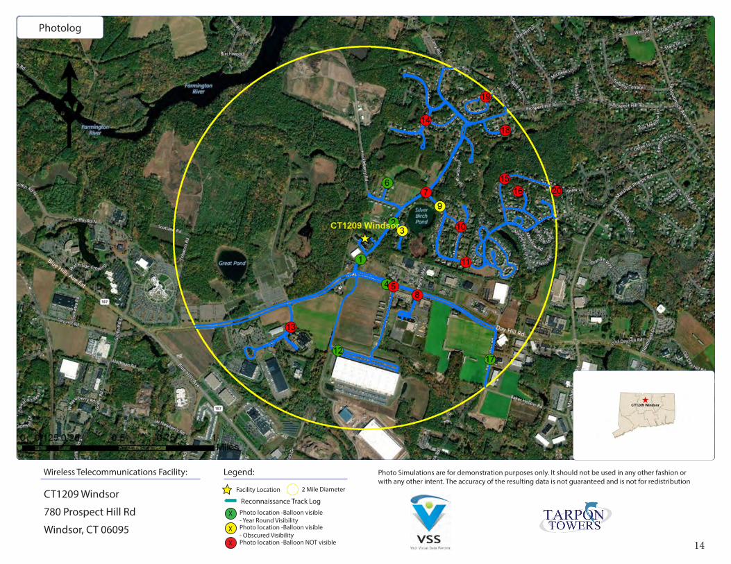
Photolog
Photo Simulations are for demonstration purposes only. It should not be used in any other fashion or with any other intent. The accuracy of the resulting data is not guaranteed and is not for redistribution
Legend:Wireless Telecommunications Facility:
CT1209 Windsor
780 Prospect Hill Rd
Windsor, CT 06095
Facility Location 2 Mile Diameter
Photo location -Balloon visible- Year Round Visibility
X
X Photo location -Balloon visible- Obscured Visibility
X Photo location -Balloon NOT visible
Reconnaissance Track Log
15
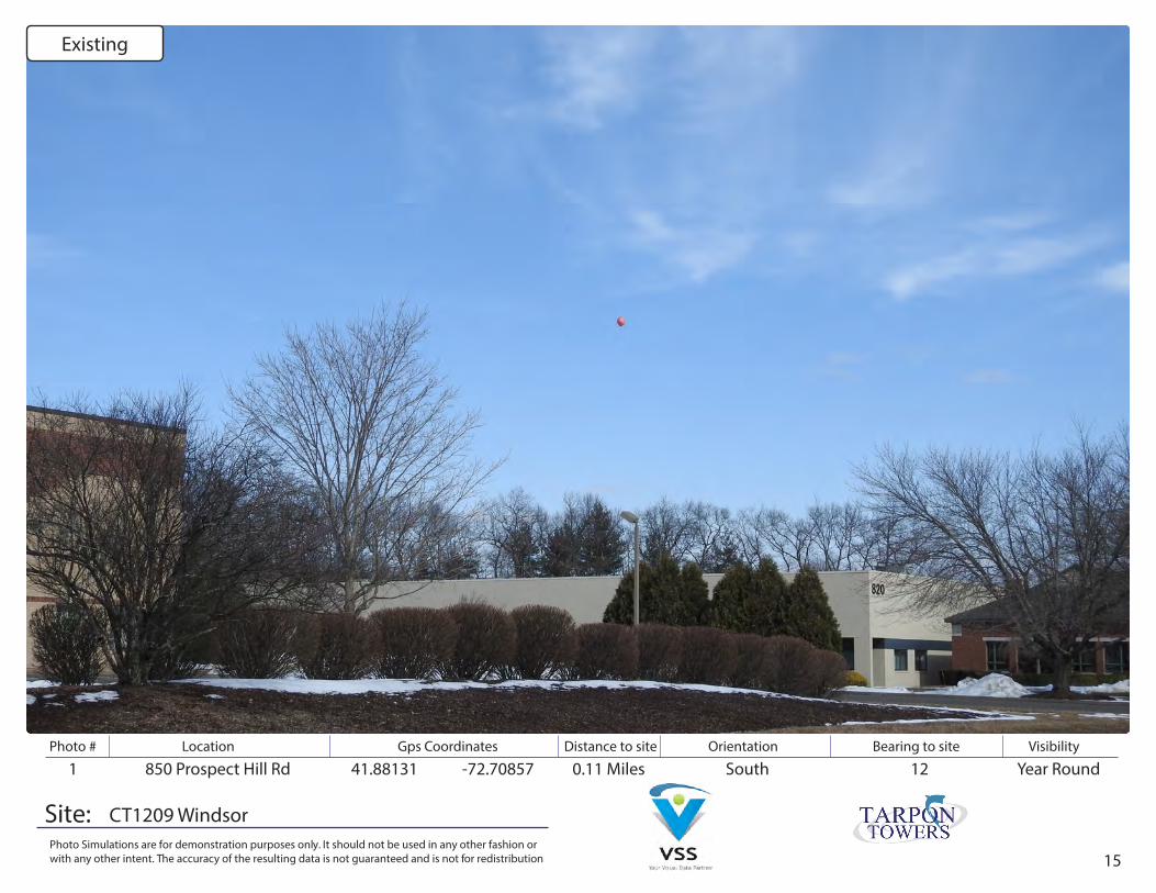
Photo # Location Gps Coordinates Distance to site Orientation Bearing to site Visibility
Site:Photo Simulations are for demonstration purposes only. It should not be used in any other fashion or with any other intent. The accuracy of the resulting data is not guaranteed and is not for redistribution
1 850 Prospect Hill Rd 41.88131 -72.70857 0.11 Miles Year RoundSouth 12
CT1209 Windsor
Existing

16
Photo # Location Gps Coordinates Distance to site Orientation Bearing to site Visibility
Site:Photo Simulations are for demonstration purposes only. It should not be used in any other fashion or with any other intent. The accuracy of the resulting data is not guaranteed and is not for redistribution
1 850 Prospect Hill Rd 41.88131 -72.70857 0.11 Miles Year RoundSouth 12
CT1209 Windsor
Simulation
17
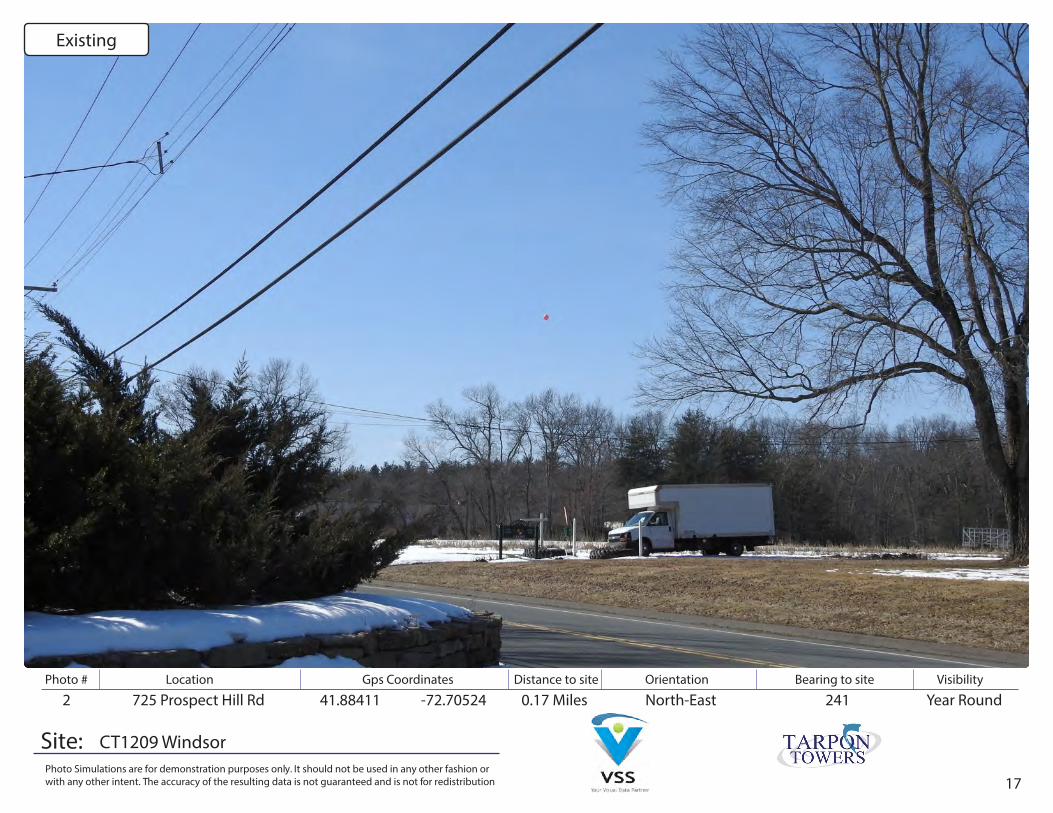
Photo # Location Gps Coordinates Distance to site Orientation Bearing to site Visibility
Site:Photo Simulations are for demonstration purposes only. It should not be used in any other fashion or with any other intent. The accuracy of the resulting data is not guaranteed and is not for redistribution
2 725 Prospect Hill Rd 41.88411 -72.70524 0.17 Miles Year RoundNorth-East 241
CT1209 Windsor
Existing

18
Photo # Location Gps Coordinates Distance to site Orientation Bearing to site Visibility
Site:Photo Simulations are for demonstration purposes only. It should not be used in any other fashion or with any other intent. The accuracy of the resulting data is not guaranteed and is not for redistribution
2 725 Prospect Hill Rd 41.88411 -72.70524 0.17 Miles Year RoundNorth-East 241
CT1209 Windsor
Simulation

19
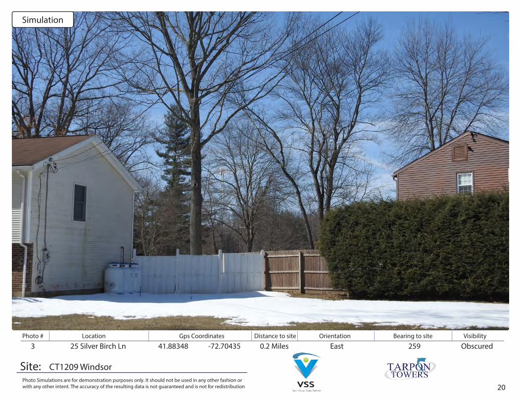
Photo # Location Gps Coordinates Distance to site Orientation Bearing to site Visibility
Site:Photo Simulations are for demonstration purposes only. It should not be used in any other fashion or with any other intent. The accuracy of the resulting data is not guaranteed and is not for redistribution
3 25 Silver Birch Ln 41.88348 -72.70435 0.2 Miles ObscuredEast 259
CT1209 Windsor
Existing
20
Photo # Location Gps Coordinates Distance to site Orientation Bearing to site Visibility
Site:Photo Simulations are for demonstration purposes only. It should not be used in any other fashion or with any other intent. The accuracy of the resulting data is not guaranteed and is not for redistribution
3 25 Silver Birch Ln 41.88348 -72.70435 0.2 Miles ObscuredEast 259
CT1209 Windsor
Simulation
21
Photo # Location Gps Coordinates Distance to site Orientation Bearing to site Visibility
Site:Photo Simulations are for demonstration purposes only. It should not be used in any other fashion or with any other intent. The accuracy of the resulting data is not guaranteed and is not for redistribution
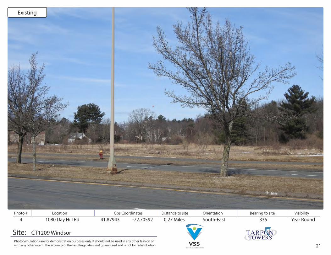
4 1080 Day Hill Rd 41.87943 -72.70592 0.27 Miles Year RoundSouth-East 335
CT1209 Windsor
Existing

22
Photo # Location Gps Coordinates Distance to site Orientation Bearing to site Visibility
Site:Photo Simulations are for demonstration purposes only. It should not be used in any other fashion or with any other intent. The accuracy of the resulting data is not guaranteed and is not for redistribution
4 1080 Day Hill Rd 41.87943 -72.70592 0.27 Miles Year RoundSouth-East 335
CT1209 Windsor
Simulation
23
Photo # Location Gps Coordinates Distance to site Orientation Bearing to site Visibility
Site:Photo Simulations are for demonstration purposes only. It should not be used in any other fashion or with any other intent. The accuracy of the resulting data is not guaranteed and is not for redistribution
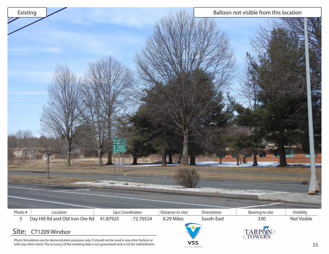
5 Day Hill Rd and Old Iron Ore Rd 41.87925 -72.70524 0.29 Miles Not VisibleSouth-East 330
CT1209 Windsor
Existing Balloon not visible from this location
24
Photo # Location Gps Coordinates Distance to site Orientation Bearing to site Visibility
Site:Photo Simulations are for demonstration purposes only. It should not be used in any other fashion or with any other intent. The accuracy of the resulting data is not guaranteed and is not for redistribution
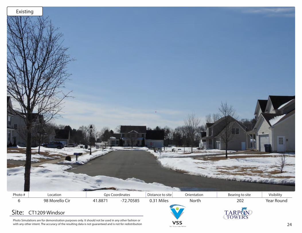
6 98 Morello Cir 41.8871 -72.70585 0.31 Miles Year RoundNorth 202
CT1209 Windsor
Existing
25
Photo # Location Gps Coordinates Distance to site Orientation Bearing to site Visibility
Site:Photo Simulations are for demonstration purposes only. It should not be used in any other fashion or with any other intent. The accuracy of the resulting data is not guaranteed and is not for redistribution
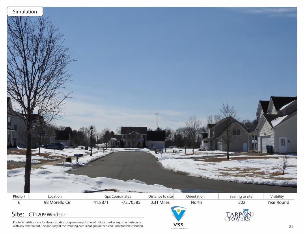
6 98 Morello Cir 41.8871 -72.70585 0.31 Miles Year RoundNorth 202
CT1209 Windsor
Simulation
26
Photo # Location Gps Coordinates Distance to site Orientation Bearing to site Visibility
Site:Photo Simulations are for demonstration purposes only. It should not be used in any other fashion or with any other intent. The accuracy of the resulting data is not guaranteed and is not for redistribution
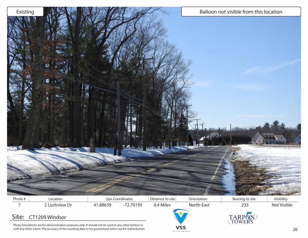
7 2 Lochview Dr 41.88639 -72.70195 0.4 Miles Not VisibleNorth-East 233
CT1209 Windsor
Existing Balloon not visible from this location
27
Photo # Location Gps Coordinates Distance to site Orientation Bearing to site Visibility
Site:Photo Simulations are for demonstration purposes only. It should not be used in any other fashion or with any other intent. The accuracy of the resulting data is not guaranteed and is not for redistribution
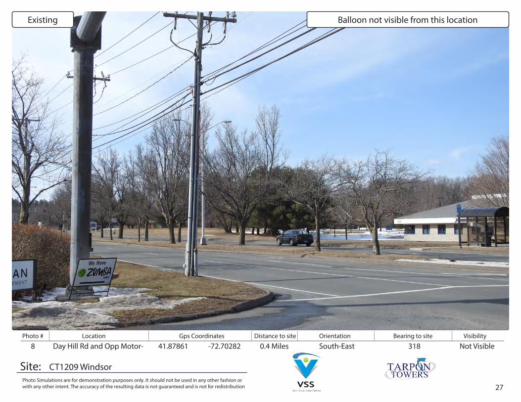
8 Day Hill Rd and Opp Motor- 41.87861 -72.70282 0.4 Miles Not VisibleSouth-East 318
CT1209 Windsor
Existing Balloon not visible from this location

28
Photo # Location Gps Coordinates Distance to site Orientation Bearing to site Visibility
Site:Photo Simulations are for demonstration purposes only. It should not be used in any other fashion or with any other intent. The accuracy of the resulting data is not guaranteed and is not for redistribution
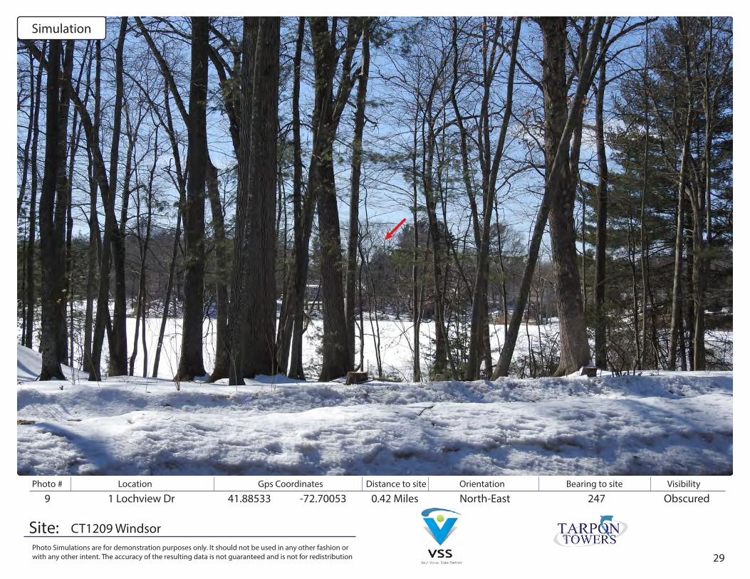
9 1 Lochview Dr 41.88533 -72.70053 0.42 Miles ObscuredNorth-East 247
CT1209 Windsor
Existing
29
Photo # Location Gps Coordinates Distance to site Orientation Bearing to site Visibility
Site:Photo Simulations are for demonstration purposes only. It should not be used in any other fashion or with any other intent. The accuracy of the resulting data is not guaranteed and is not for redistribution
9 1 Lochview Dr 41.88533 -72.70053 0.42 Miles ObscuredNorth-East 247
CT1209 Windsor
Simulation
30
Photo # Location Gps Coordinates Distance to site Orientation Bearing to site Visibility
Site:Photo Simulations are for demonstration purposes only. It should not be used in any other fashion or with any other intent. The accuracy of the resulting data is not guaranteed and is not for redistribution
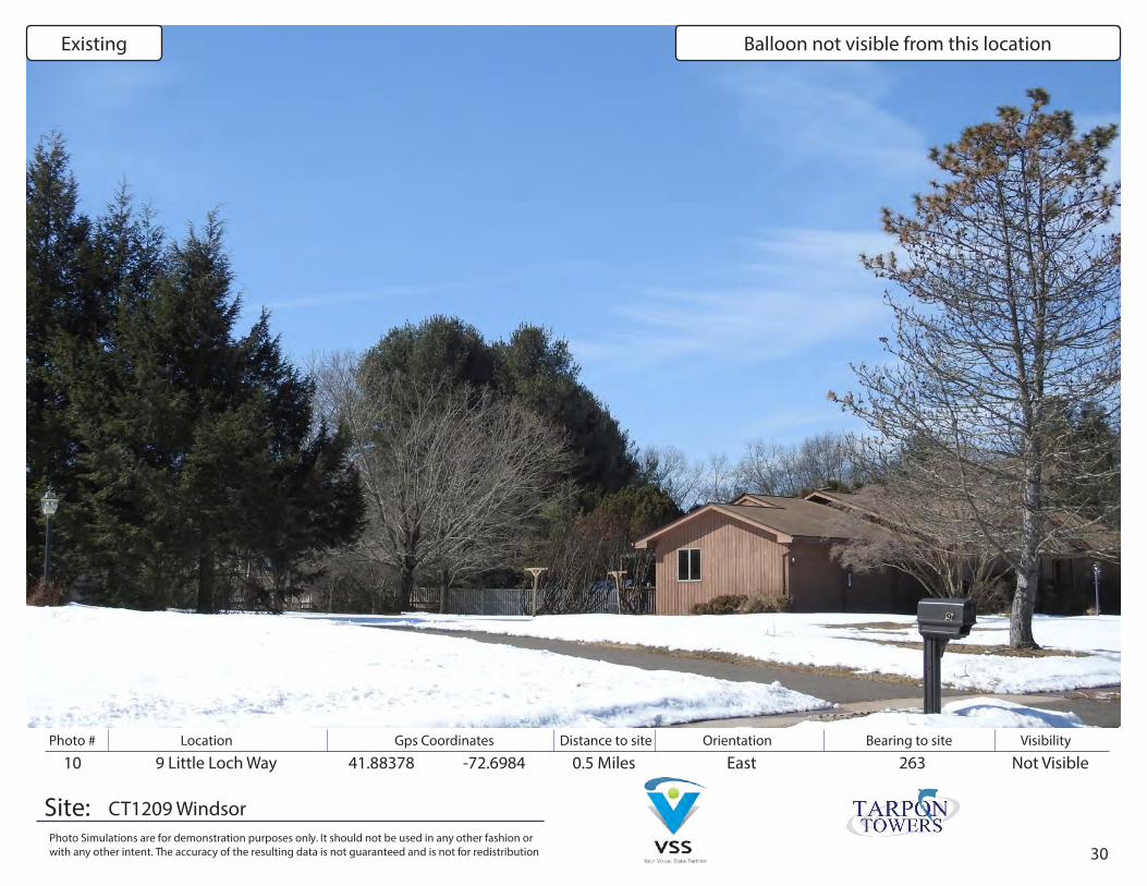
10 9 Little Loch Way 41.88378 -72.6984 0.5 Miles Not VisibleEast 263
CT1209 Windsor
Existing Balloon not visible from this location
31
Photo # Location Gps Coordinates Distance to site Orientation Bearing to site Visibility
Site:Photo Simulations are for demonstration purposes only. It should not be used in any other fashion or with any other intent. The accuracy of the resulting data is not guaranteed and is not for redistribution
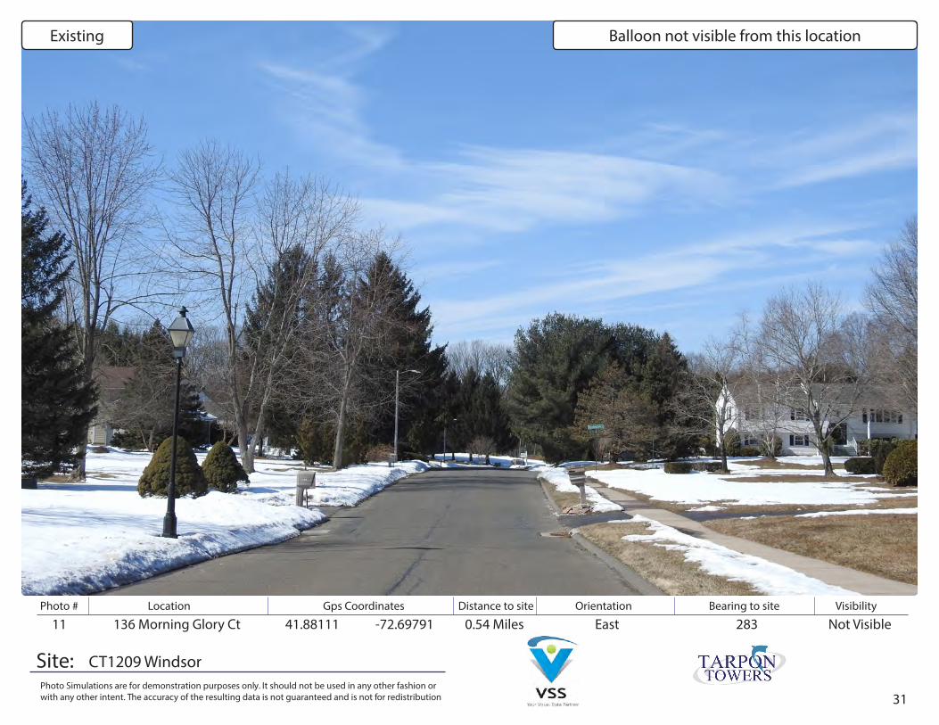
11 136 Morning Glory Ct 41.88111 -72.69791 0.54 Miles Not VisibleEast 283
CT1209 Windsor
Existing Balloon not visible from this location
32
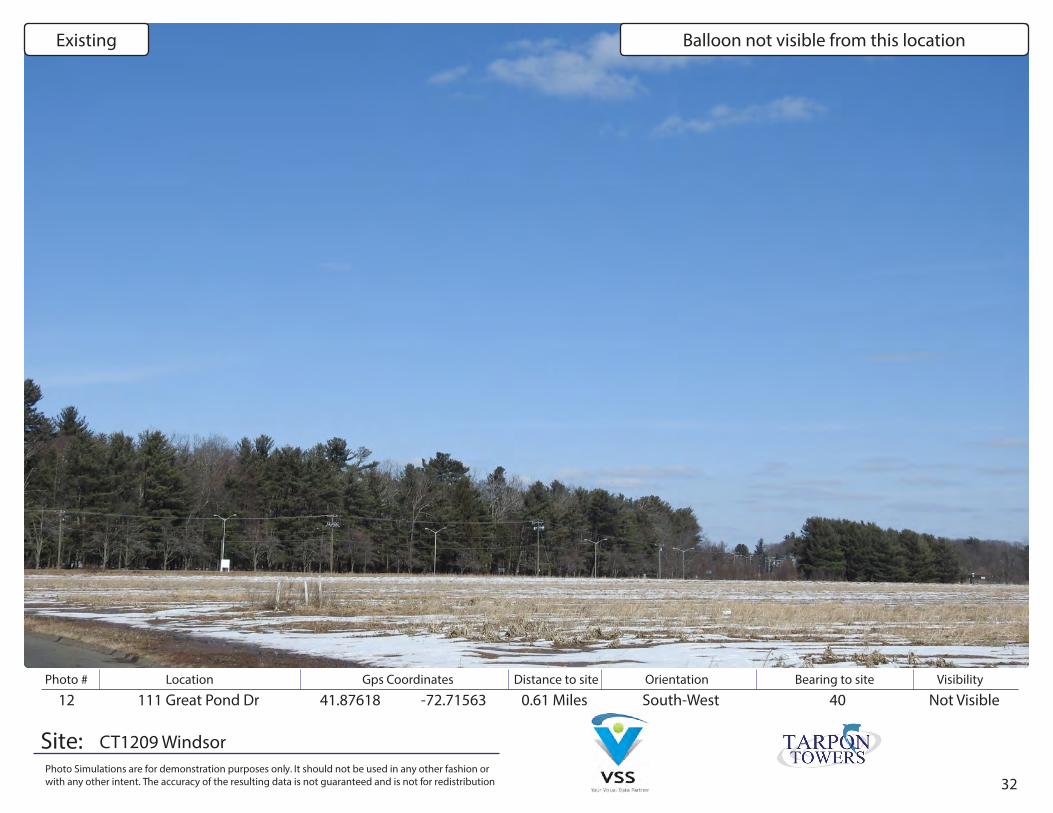
Photo # Location Gps Coordinates Distance to site Orientation Bearing to site Visibility
Site:Photo Simulations are for demonstration purposes only. It should not be used in any other fashion or with any other intent. The accuracy of the resulting data is not guaranteed and is not for redistribution
12 111 Great Pond Dr 41.87618 -72.71563 0.61 Miles Not VisibleSouth-West 40
CT1209 Windsor
Existing Balloon not visible from this location

33
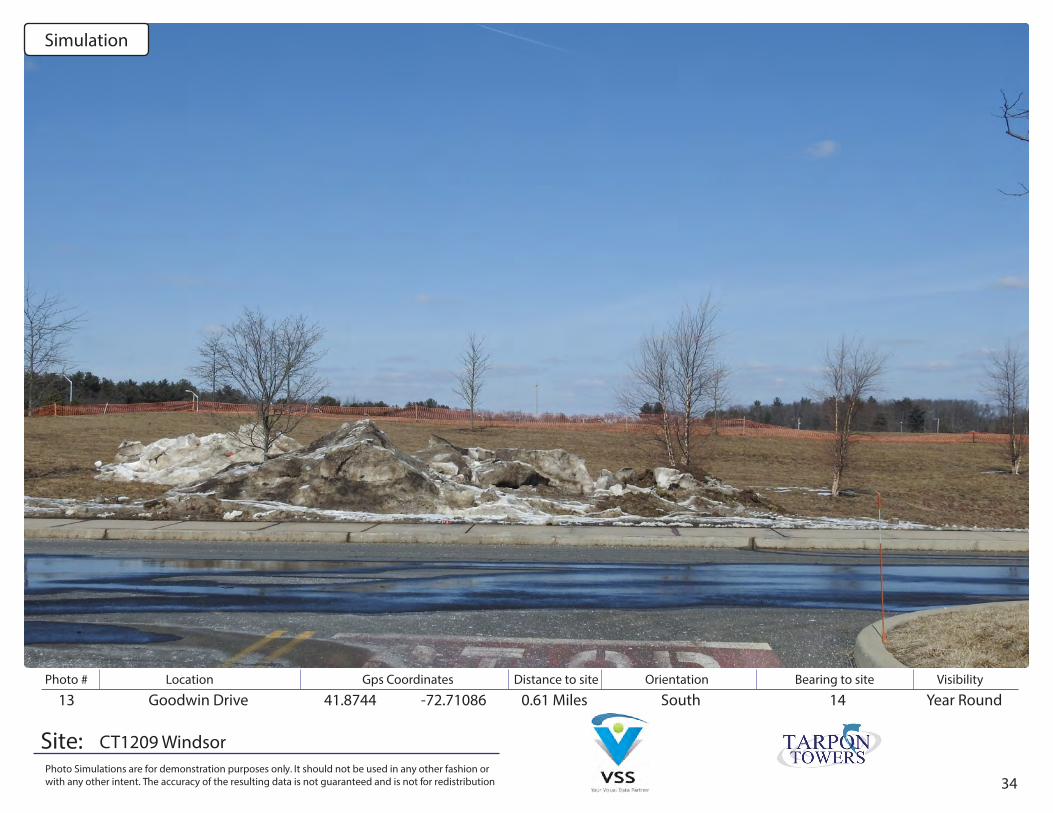
Photo # Location Gps Coordinates Distance to site Orientation Bearing to site Visibility
Site:Photo Simulations are for demonstration purposes only. It should not be used in any other fashion or with any other intent. The accuracy of the resulting data is not guaranteed and is not for redistribution
13 Goodwin Drive 41.8744 -72.71086 0.61 Miles Year RoundSouth 14
CT1209 Windsor
Existing
34
Photo # Location Gps Coordinates Distance to site Orientation Bearing to site Visibility
Site:Photo Simulations are for demonstration purposes only. It should not be used in any other fashion or with any other intent. The accuracy of the resulting data is not guaranteed and is not for redistribution
13 Goodwin Drive 41.8744 -72.71086 0.61 Miles Year RoundSouth 14
CT1209 Windsor
Simulation
35
Photo # Location Gps Coordinates Distance to site Orientation Bearing to site Visibility
Site:Photo Simulations are for demonstration purposes only. It should not be used in any other fashion or with any other intent. The accuracy of the resulting data is not guaranteed and is not for redistribution
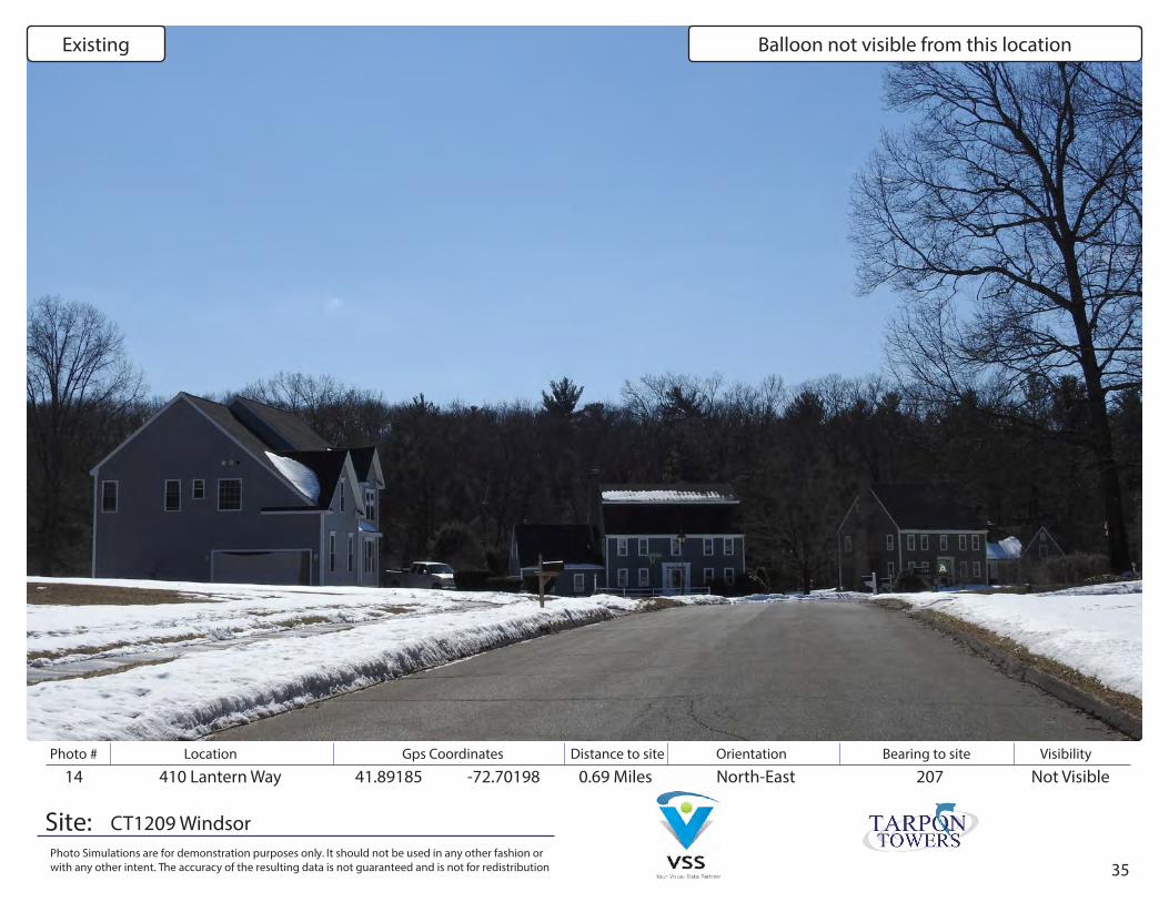
14 410 Lantern Way 41.89185 -72.70198 0.69 Miles Not VisibleNorth-East 207
CT1209 Windsor
Existing Balloon not visible from this location
36
Photo # Location Gps Coordinates Distance to site Orientation Bearing to site Visibility
Site:Photo Simulations are for demonstration purposes only. It should not be used in any other fashion or with any other intent. The accuracy of the resulting data is not guaranteed and is not for redistribution
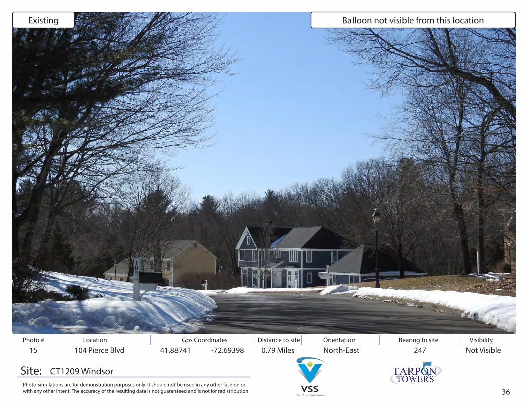
15 104 Pierce Blvd 41.88741 -72.69398 0.79 Miles Not VisibleNorth-East 247
CT1209 Windsor
Existing Balloon not visible from this location
37
Photo # Location Gps Coordinates Distance to site Orientation Bearing to site Visibility
Site:Photo Simulations are for demonstration purposes only. It should not be used in any other fashion or with any other intent. The accuracy of the resulting data is not guaranteed and is not for redistribution
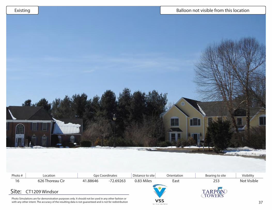
16 626 Thoreau Cir 41.88646 -72.69263 0.83 Miles Not VisibleEast 253
CT1209 Windsor
Existing Balloon not visible from this location

38
Photo # Location Gps Coordinates Distance to site Orientation Bearing to site Visibility
Site:Photo Simulations are for demonstration purposes only. It should not be used in any other fashion or with any other intent. The accuracy of the resulting data is not guaranteed and is not for redistribution
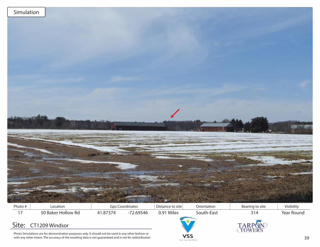
17 50 Baker Hollow Rd 41.87374 -72.69546 0.91 Miles Year RoundSouth-East 314
CT1209 Windsor
Existing
39
Photo # Location Gps Coordinates Distance to site Orientation Bearing to site Visibility
Site:Photo Simulations are for demonstration purposes only. It should not be used in any other fashion or with any other intent. The accuracy of the resulting data is not guaranteed and is not for redistribution
17 50 Baker Hollow Rd 41.87374 -72.69546 0.91 Miles Year RoundSouth-East 314
CT1209 Windsor
Simulation
40
Photo # Location Gps Coordinates Distance to site Orientation Bearing to site Visibility
Site:Photo Simulations are for demonstration purposes only. It should not be used in any other fashion or with any other intent. The accuracy of the resulting data is not guaranteed and is not for redistribution
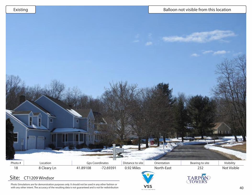
18 8 Cleary Ln 41.89108 -72.69391 0.92 Miles Not VisibleNorth-East 232
CT1209 Windsor
Existing Balloon not visible from this location
41
Photo # Location Gps Coordinates Distance to site Orientation Bearing to site Visibility
Site:Photo Simulations are for demonstration purposes only. It should not be used in any other fashion or with any other intent. The accuracy of the resulting data is not guaranteed and is not for redistribution
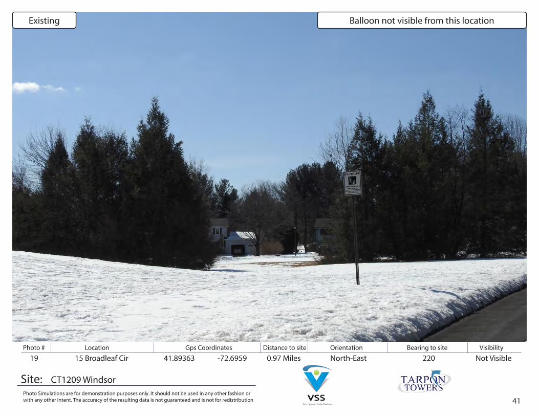
19 15 Broadleaf Cir 41.89363 -72.6959 0.97 Miles Not VisibleNorth-East 220
CT1209 Windsor
Existing Balloon not visible from this location
42
Photo # Location Gps Coordinates Distance to site Orientation Bearing to site Visibility
Site:Photo Simulations are for demonstration purposes only. It should not be used in any other fashion or with any other intent. The accuracy of the resulting data is not guaranteed and is not for redistribution
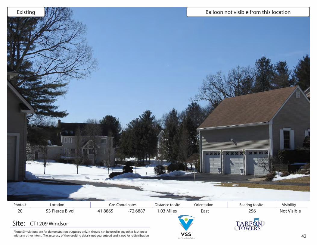
20 53 Pierce Blvd 41.8865 -72.6887 1.03 Miles Not VisibleEast 256
CT1209 Windsor
Existing Balloon not visible from this location