Embed Size (px)
Citation preview
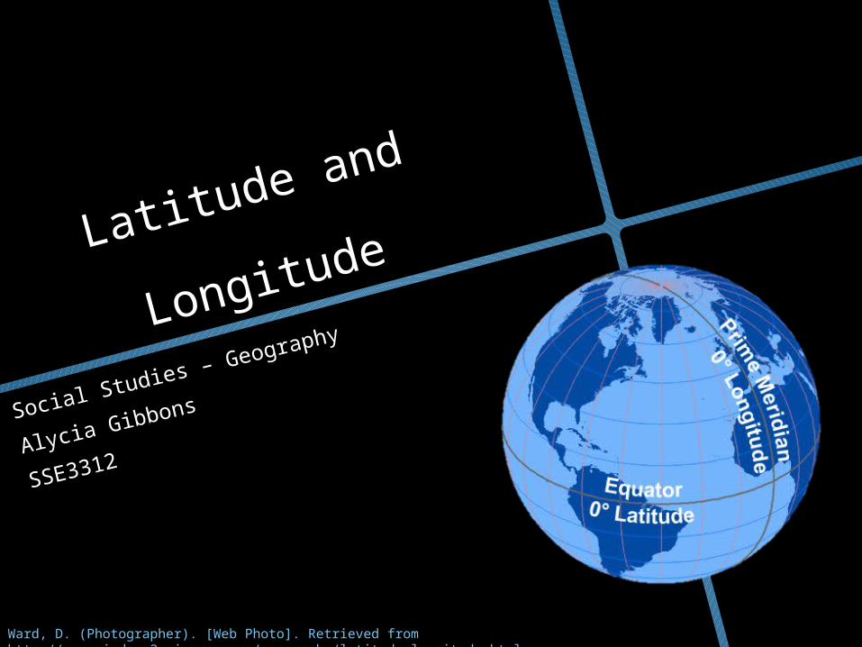
Latitude and
Longitude
Social Studies – Geography
Alycia Gibbons
SSE3312
Ward, D. (Photographer). [Web Photo]. Retrieved from http://www.windows2universe.org/geography/latitude_longitude.html
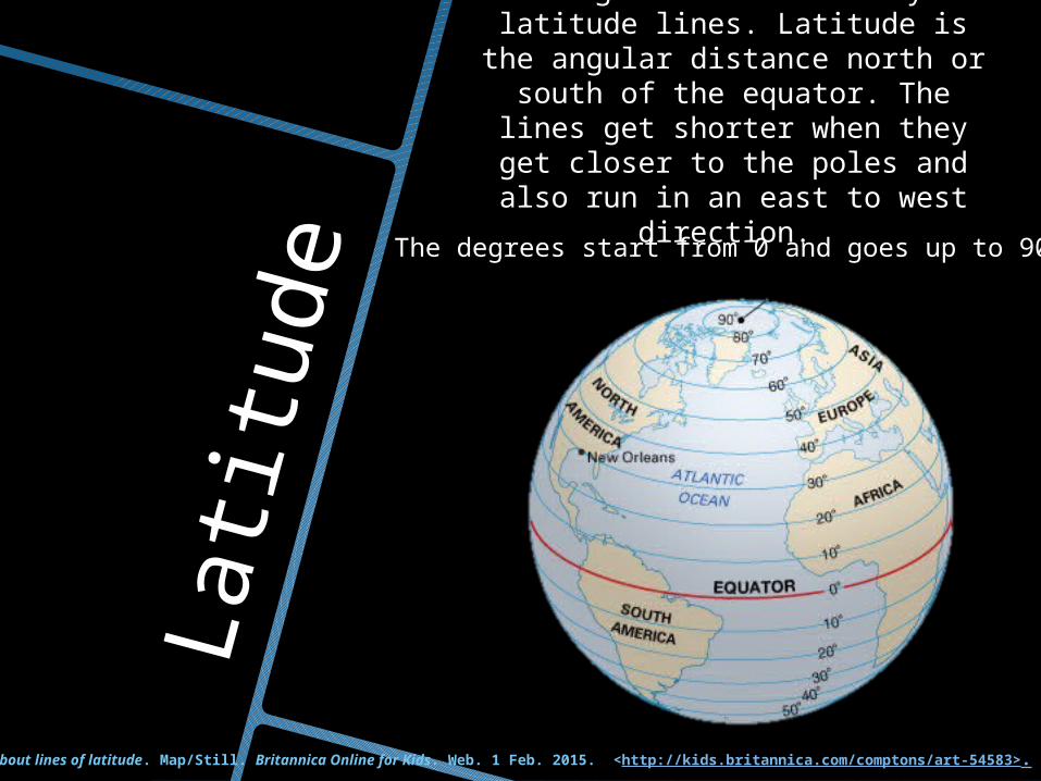
Lati
tude
The image below shows only the latitude lines. Latitude is the
angular distance north or south of the equator. The lines get shorter when they get closer to the poles
and also run in an east to west direction.
The degrees start from 0 and goes up to 90.
latitude: facts about lines of latitude. Map/Still. Britannica Online for Kids. Web. 1 Feb. 2015. <http://kids.britannica.com/comptons/art-54583>.
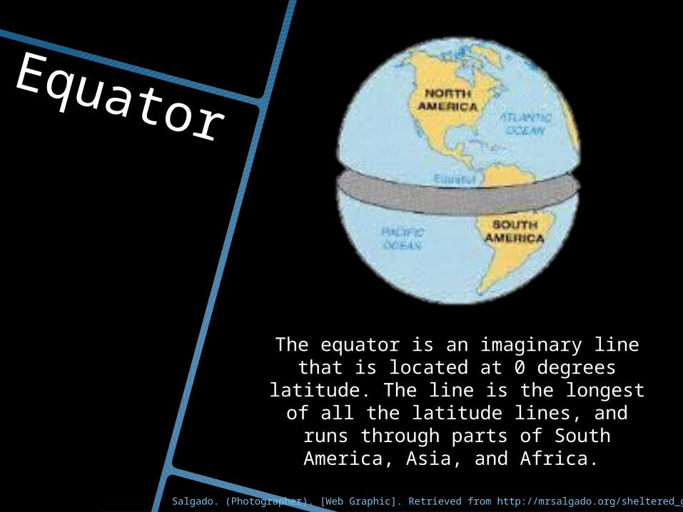
Equator
The equator is an imaginary line that is located at 0 degrees latitude. The line is the longest of all the latitude lines, and runs through parts of South America,
Asia, and Africa.
Salgado. (Photographer). [Web Graphic]. Retrieved from http://mrsalgado.org/sheltered_geography_unit2.htm
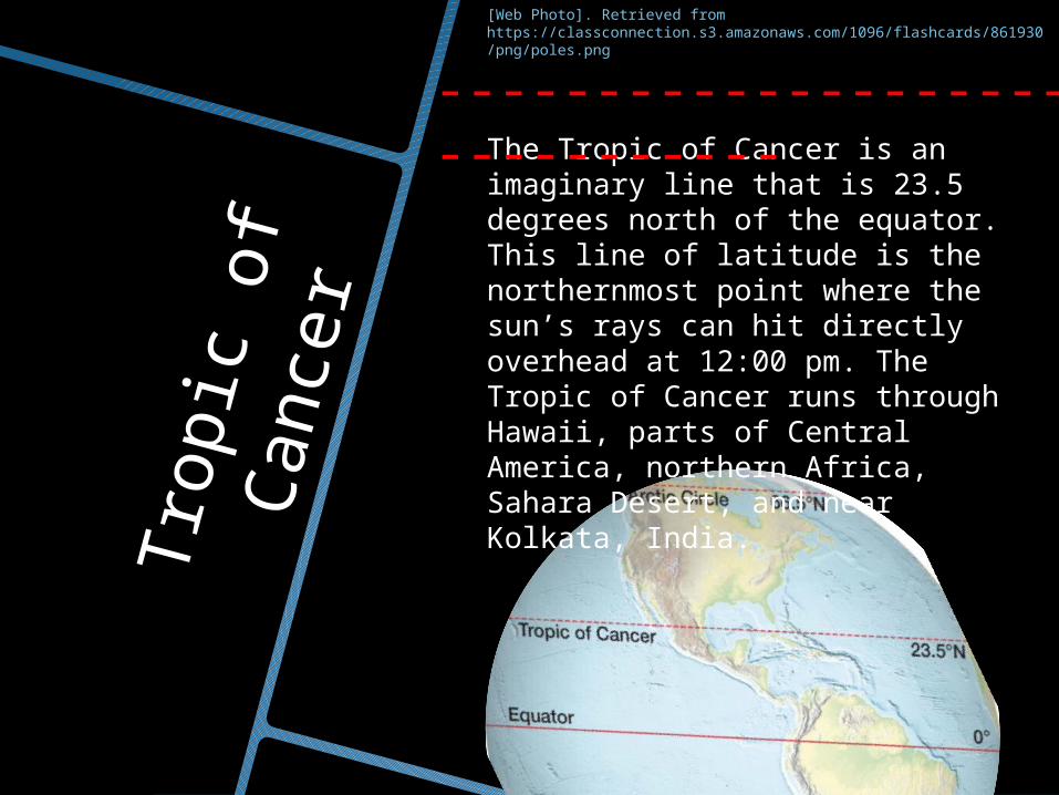
Tropic
of
Cance
r
The Tropic of Cancer is an imaginary line that is 23.5 degrees north of the equator. This line of latitude is the northernmost point where the sun’s rays can hit directly overhead at 12:00 pm. The Tropic of Cancer runs through Hawaii, parts of Central America, northern Africa, Sahara Desert, and near Kolkata, India.
---------------------------------
[Web Photo]. Retrieved from https://classconnection.s3.amazonaws.com/1096/flashcards/861930/png/poles.png
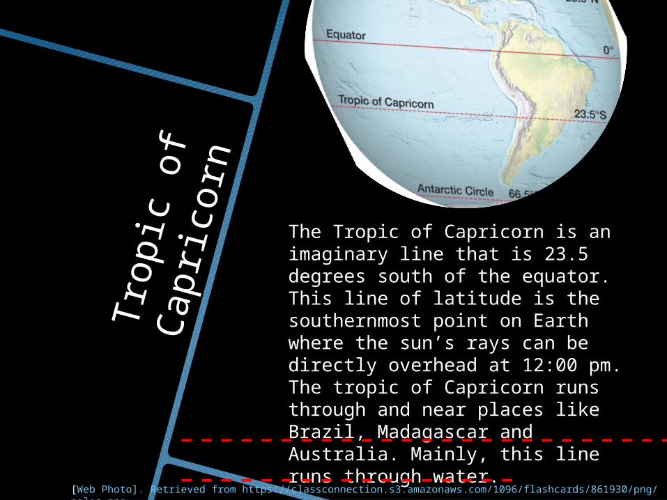
Tropic
of
Capri
corn
The Tropic of Capricorn is an imaginary line that is 23.5 degrees south of the equator. This line of latitude is the southernmost point on Earth where the sun’s rays can be directly overhead at 12:00 pm. The tropic of Capricorn runs through and near places like Brazil, Madagascar and Australia. Mainly, this line runs through water.------------------------------------------
[Web Photo]. Retrieved from https://classconnection.s3.amazonaws.com/1096/flashcards/861930/png/poles.png
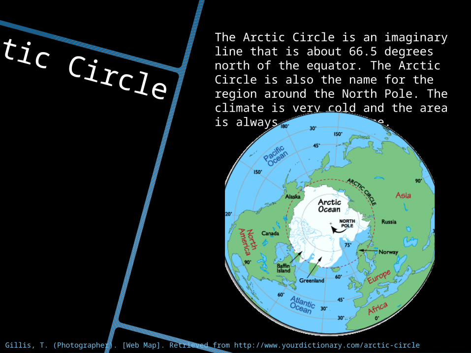
Arctic Circle
The Arctic Circle is an imaginary line that is about 66.5 degrees north of the equator. The Arctic Circle is also the name for the region around the North Pole. The climate is very cold and the area is always covered in ice.
Gillis, T. (Photographer). [Web Map]. Retrieved from http://www.yourdictionary.com/arctic-circle
Anta
rcti
c C
ircl
e
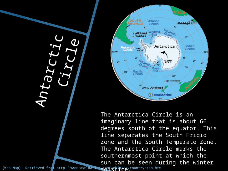
The Antarctica Circle is an imaginary line that is about 66 degrees south of the equator. This line separates the South Frigid Zone and the South Temperate Zone. The Antarctica Circle marks the southernmost point at which the sun can be seen during the winter solstice.
[Web Map]. Retrieved from http://www.worldatlas.com/webimage/countrys/an.htm
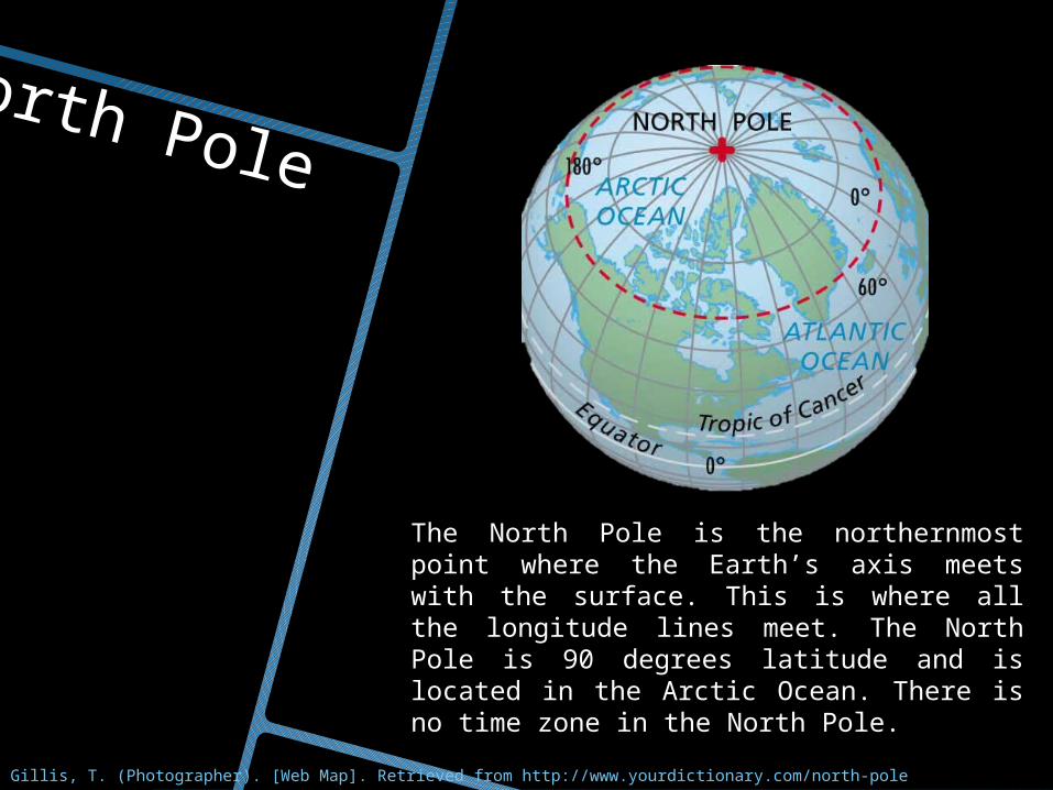
North Pole
The North Pole is the northernmost point where the Earth’s axis meets with the surface. This is where all the longitude lines meet. The North Pole is 90 degrees latitude and is located in the Arctic Ocean. There is no time zone in the North Pole.
Gillis, T. (Photographer). [Web Map]. Retrieved from http://www.yourdictionary.com/north-pole
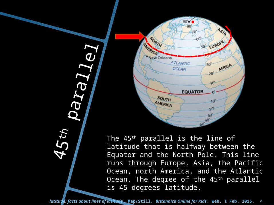
45
th p
ara
llel
The 45th parallel is the line of latitude that is halfway between the Equator and the North Pole. This line runs through Europe, Asia, the Pacific Ocean, north America, and the Atlantic Ocean. The degree of the 45th parallel is 45 degrees latitude.
latitude: facts about lines of latitude. Map/Still. Britannica Online for Kids. Web. 1 Feb. 2015. <
http://kids.britannica.com/comptons/art-54583>.
.
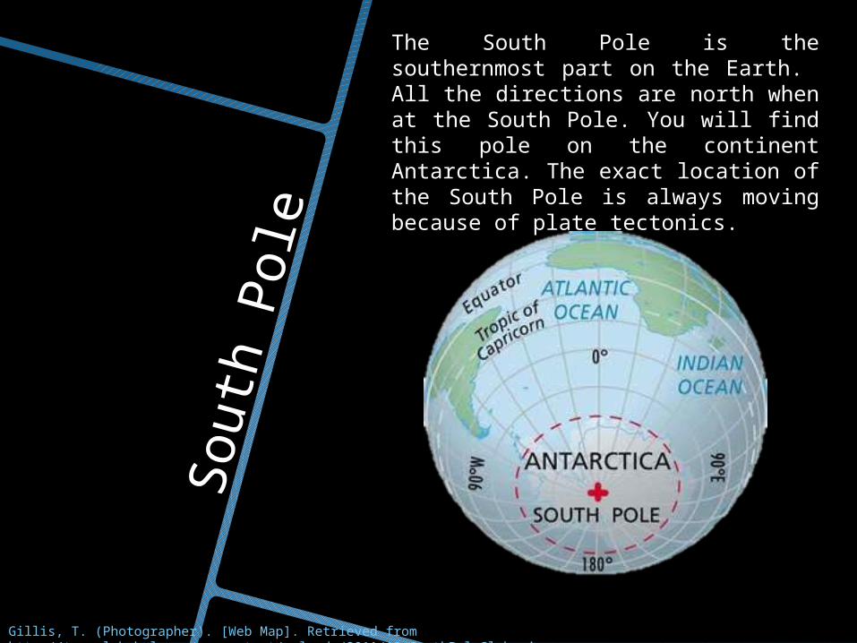
South
Pole
The South Pole is the southernmost part on the Earth. All the directions are north when at the South Pole. You will find this pole on the continent Antarctica. The exact location of the South Pole is always moving because of plate tectonics.
Gillis, T. (Photographer). [Web Map]. Retrieved from http://travel-babel.com/wp-content/uploads/2011/12/SouthPoleGlobe.jpg
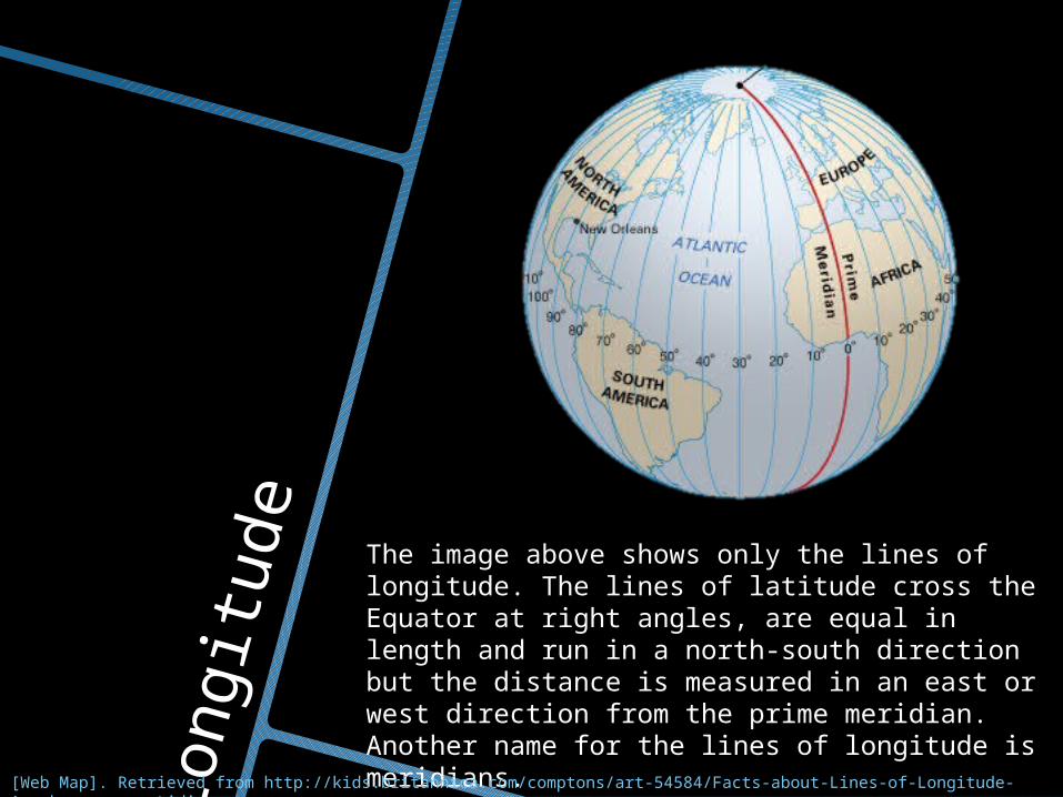
Longit
ude
The image above shows only the lines of longitude. The lines of latitude cross the Equator at right angles, are equal in length and run in a north-south direction but the distance is measured in an east or west direction from the prime meridian. Another name for the lines of longitude is meridians.
[Web Map]. Retrieved from http://kids.britannica.com/comptons/art-54584/Facts-about-Lines-of-Longitude-Are-known-as-meridians
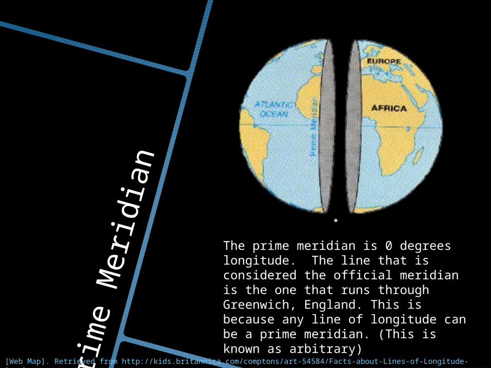
Prim
e M
eri
dia
n
[Web Map]. Retrieved from http://kids.britannica.com/comptons/art-54584/Facts-about-Lines-of-Longitude-Are-known-as-meridians
The prime meridian is 0 degrees longitude. The line that is considered the official meridian is the one that runs through Greenwich, England. This is because any line of longitude can be a prime meridian. (This is known as arbitrary)
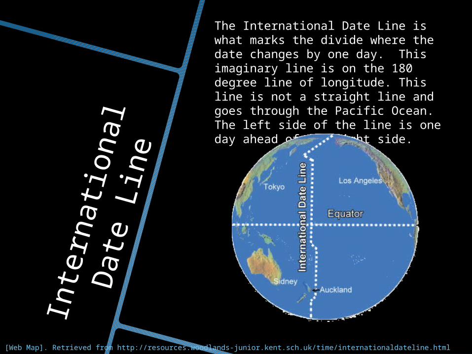
Inte
rnati
onal
Date
Lin
e
[Web Map]. Retrieved from http://resources.woodlands-junior.kent.sch.uk/time/internationaldateline.html
The International Date Line is what marks the divide where the date changes by one day. This imaginary line is on the 180 degree line of longitude. This line is not a straight line and goes through the Pacific Ocean. The left side of the line is one day ahead of the right side.
References…Information:http://kids.britannica.com/comptons/art-54583/Facts-About-Lines-of-Latitude-Are-known-as-parallels http://dictionary.reference.com/browse/latitudehttp://geography.about.com/od/locateplacesworldwide/a/tropiccancer.htmhttp://geography.about.com/od/locateplacesworldwide/a/tropiccapricorn.htmhttp://www.worldatlas.com/webimage/countrys/polar/arctic.htmhttp://fairbanks-alaska.com/arctic-circle.htmhttp://www.worldatlas.com/webimage/countrys/an.htmhttp://www.worldatlas.com/webimage/countrys/polar/arctic.htmhttp://dictionary.reference.com/browse/antarctic+circlehttp://www.infoplease.com/encyclopedia/world/antarctic-circle.htmlhttp://education.nationalgeographic.com/education/encyclopedia/longitude/?ar_a=1http://www.livescience.com/41955-north-pole.htmlhttp://education.nationalgeographic.com/education/encyclopedia/south-pole/?ar_a=1http://kids.britannica.com/comptons/art-54584/Facts-about-Lines-of-Longitude-Are-known-as-meridianshttp://education.nationalgeographic.com/education/encyclopedia/prime-meridian/?ar_a=1http://www.timeanddate.com/time/dateline.htmlhttp://www.worldatlas.com/aatlas/infopage/dateline.htm
Pictures:http://www.windows2universe.org/geography/latitude_longitude.htmlhttp://kids.britannica.com/comptons/art-54583/Facts-About-Lines-of-Latitude-Are-known-as-parallels http://mrsalgado.org/sheltered_geography_unit2.htmhttps://classconnection.s3.amazonaws.com/1096/flashcards/861930/png/poles.pnghttp://www.yourdictionary.com/arctic-circlehttp://www.worldatlas.com/webimage/countrys/an.htmhttp://kids.britannica.com/comptons/art-54584/Facts-about-Lines-of-Longitude-Are-known-as-meridianshttp://resources.woodlands-junior.kent.sch.uk/time/internationaldateline.html