Embed Size (px)
Citation preview
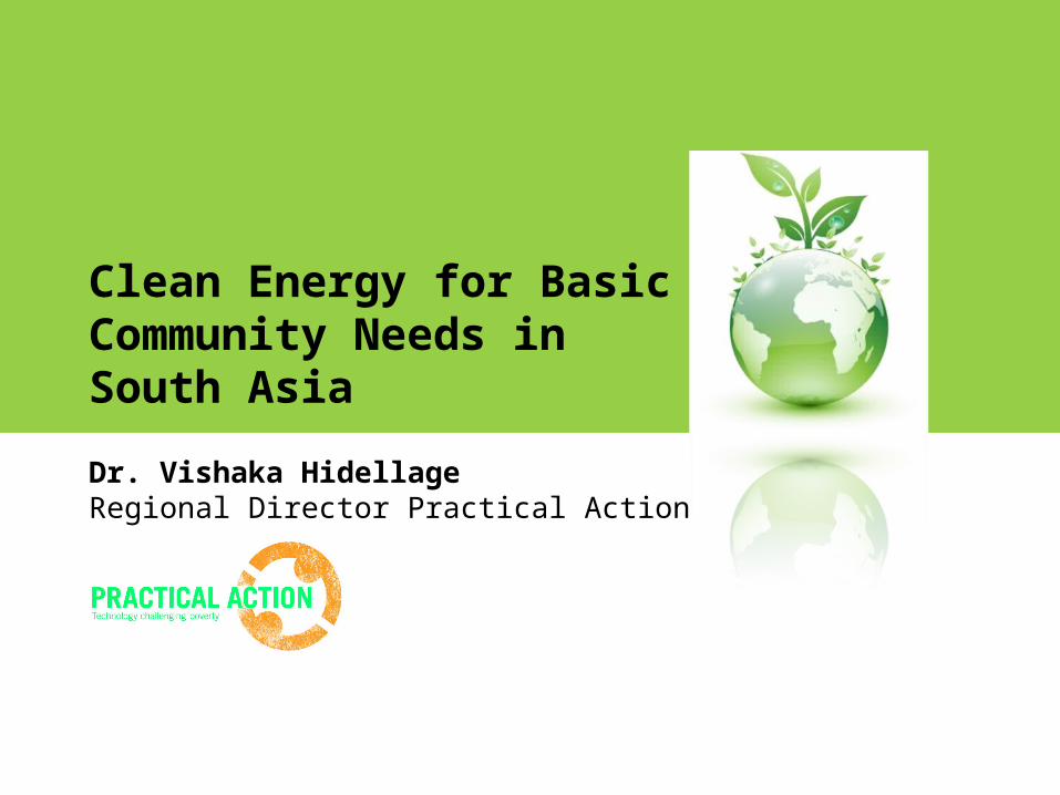
Clean Energy for Basic Community Needs in South Asia
Dr. Vishaka HidellageRegional Director Practical Action
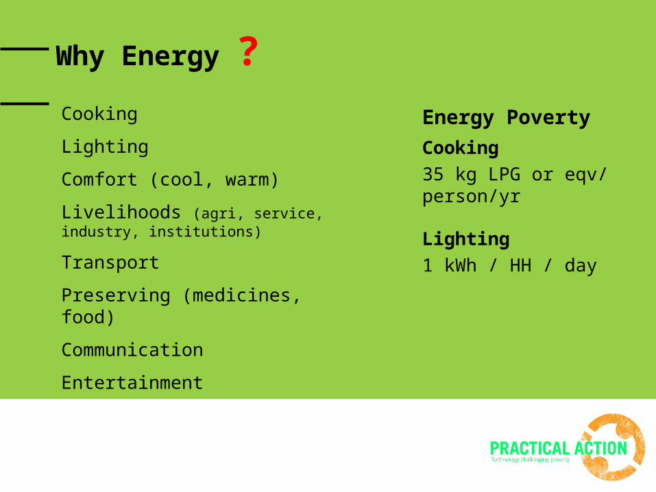
Why Energy ?Cooking
Lighting
Comfort (cool, warm)
Livelihoods (agri, service, industry, institutions)
Transport
Preserving (medicines, food)
Communication
Entertainment
Energy Poverty
Cooking35 kg LPG or eqv/ person/yr
Lighting1 kWh / HH / day
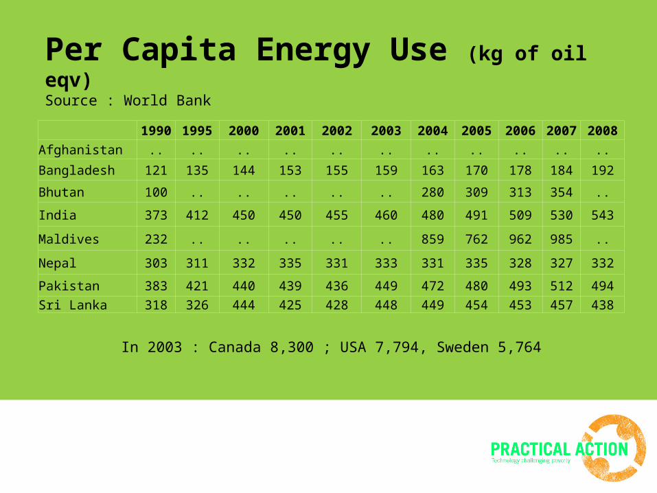
Per Capita Energy Use (kg of oil eqv)Source : World Bank
1990 1995 2000 2001 2002 2003 2004 2005 2006 2007 2008
Afghanistan .. .. .. .. .. .. .. .. .. .. ..
Bangladesh 121 135 144 153 155 159 163 170 178 184 192
Bhutan 100 .. .. .. .. .. 280 309 313 354 ..
India 373 412 450 450 455 460 480 491 509 530 543
Maldives 232 .. .. .. .. .. 859 762 962 985 ..
Nepal 303 311 332 335 331 333 331 335 328 327 332
Pakistan 383 421 440 439 436 449 472 480 493 512 494
Sri Lanka 318 326 444 425 428 448 449 454 453 457 438
In 2003 : Canada 8,300 ; USA 7,794, Sweden 5,764
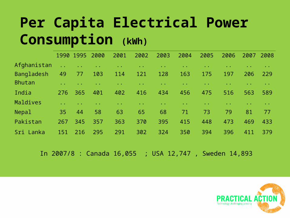
Per Capita Electrical Power Consumption (kWh)
In 2007/8 : Canada 16,055 ; USA 12,747 , Sweden 14,893
1990 1995 2000 2001 2002 2003 2004 2005 2006 2007 2008
Afghanistan .. .. .. .. .. .. .. .. .. .. ..
Bangladesh 49 77 103 114 121 128 163 175 197 206 229
Bhutan .. .. .. .. .. .. .. .. .. .. ..
India 276 365 401 402 416 434 456 475 516 563 589
Maldives .. .. .. .. .. .. .. .. .. .. ..
Nepal 35 44 58 63 65 68 71 73 79 81 77
Pakistan 267 345 357 363 370 395 415 448 473 469 433
Sri Lanka 151 216 295 291 302 324 350 394 396 411 379
The conceptual framework
“Disasters are pending issues and unresolved problems of Development and Governance” - Alternative Perspective - Duryog Nivaran (1996)
There are no ‘risk-neutral’ development investments
What we should promote
Avoid/ minimize the possibilities of increasing disaster risk
Implement development in a way that decreases the existing disaster risk of the community (Disaster Mitigation)
Participatory Disaster Risk Sensitive Land Use Planning as a tool to incorporate DRR into Development Plans
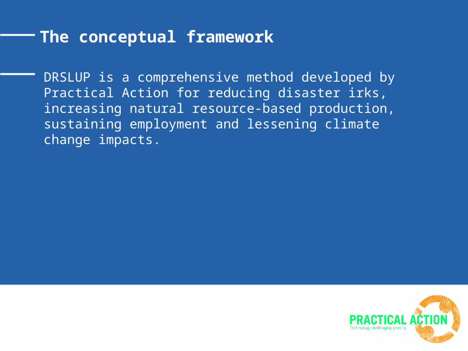
The conceptual framework
DRSLUP is a comprehensive method developed by Practical Action for reducing disaster irks, increasing natural resource-based production, sustaining employment and lessening climate change impacts.
Piloting at Ambalantota DS Division in Hambantota District in Sri Lanka
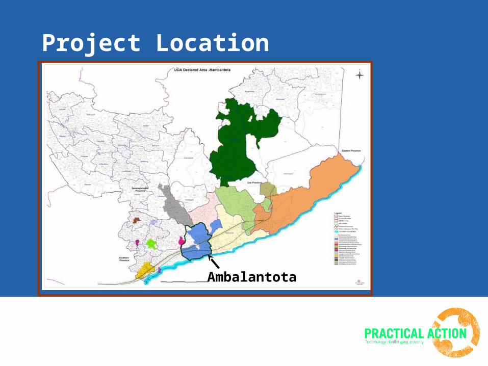
Project Location
Ambalantota
Implementation Strategy
Lead Planning Agency – Urban Development Authority
Technical Expertise – Disaster Management Centre, Department of Irrigation, Coastal Conservation Department, Agricultural Department, Agrarian Services Department
Stakeholders – Affected Community, District Secretariat, Divisional Secretariats (Hambantota, Ambalantota), Central Environment Authority, Department of Wildlife Conservation, Forest Department, Pradeshiya Sabha, Land Use Planning Department, other Civil Society Organizations
Technical Facilitation – Practical Action
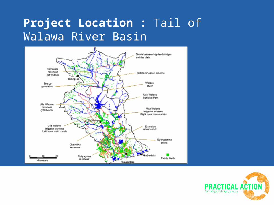
Project Location : Tail of Walawa River Basin
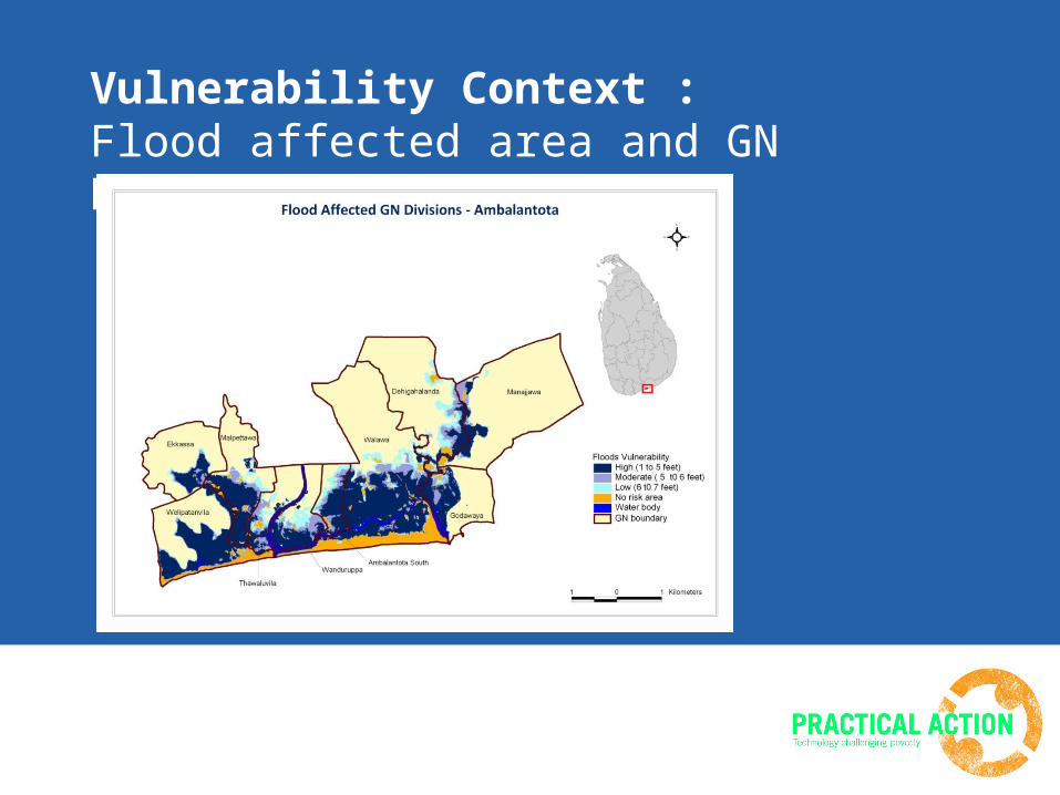
Vulnerability Context : Flood affected area and GN Divisions
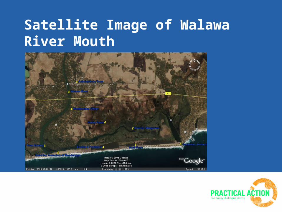
Satellite Image of Walawa River Mouth
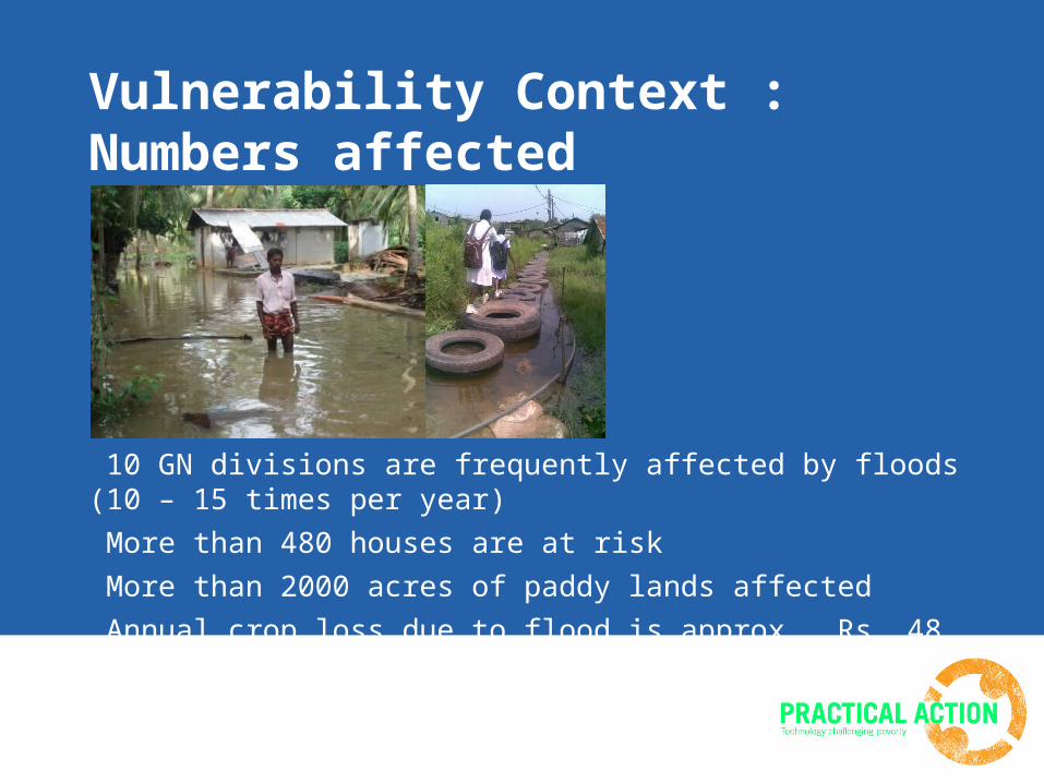
Vulnerability Context : Numbers affected
10 GN divisions are frequently affected by floods (10 – 15 times per year) More than 480 houses are at risk More than 2000 acres of paddy lands affected Annual crop loss due to flood is approx. Rs. 48 million
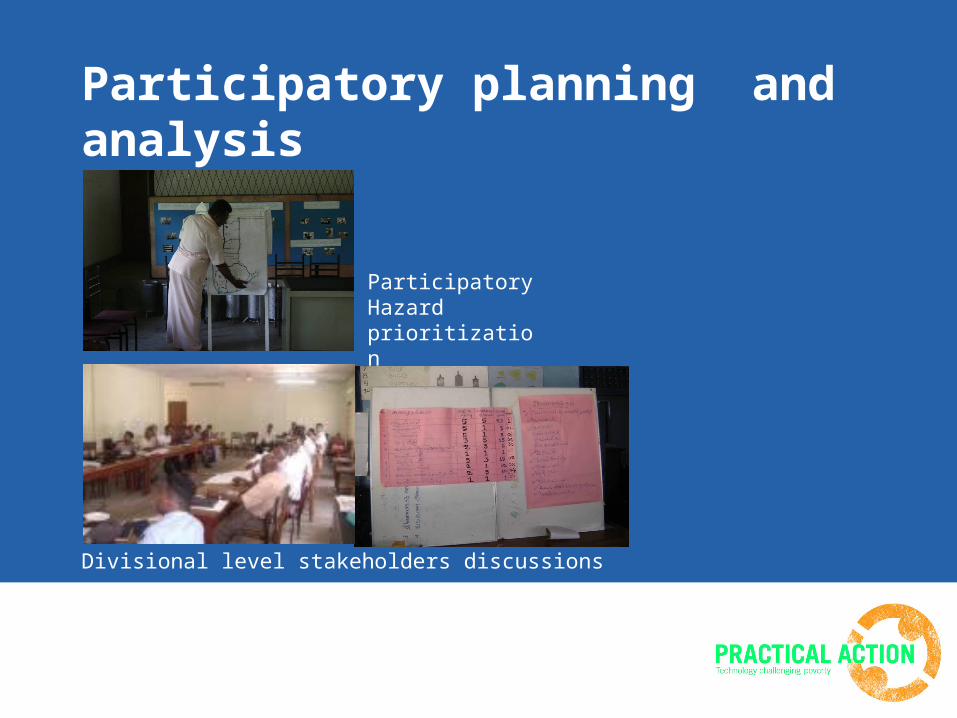
Participatory planning and analysis
Participatory Hazard prioritization
Divisional level stakeholders discussions
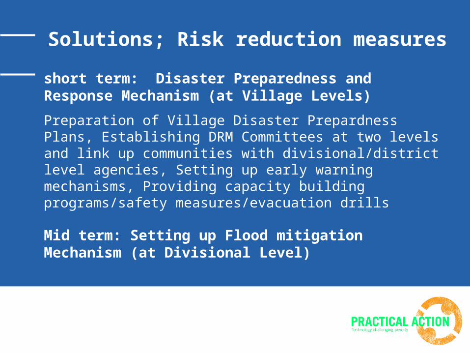
Solutions; Risk reduction measures
short term: Disaster Preparedness and Response Mechanism (at Village Levels)
Preparation of Village Disaster Prepardness Plans, Establishing DRM Committees at two levels and link up communities with divisional/district level agencies, Setting up early warning mechanisms, Providing capacity building programs/safety measures/evacuation drills
Mid term: Setting up Flood mitigation Mechanism (at Divisional Level)
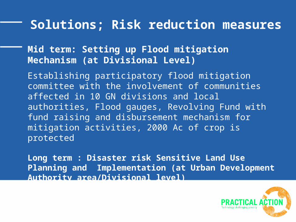
Mid term: Setting up Flood mitigation Mechanism (at Divisional Level)
Establishing participatory flood mitigation committee with the involvement of communities affected in 10 GN divisions and local authorities, Flood gauges, Revolving Fund with fund raising and disbursement mechanism for mitigation activities, 2000 Ac of crop is protected
Long term : Disaster risk Sensitive Land Use Planning and Implementation (at Urban Development Authority area/Divisional level)
Solutions; Risk reduction measures
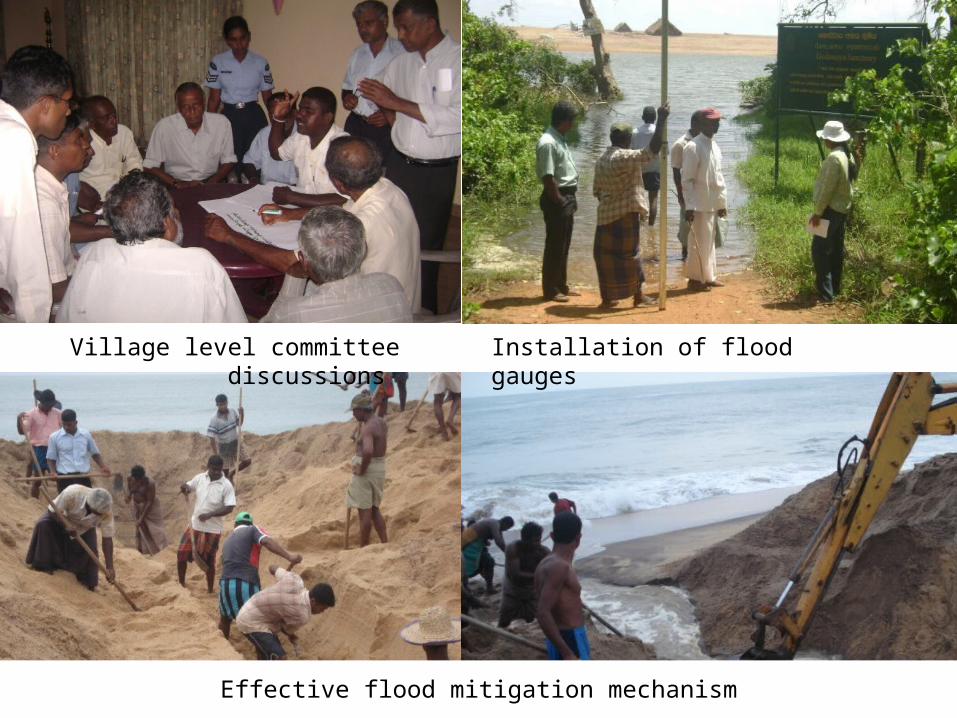
Village level committee discussions Installation of flood gauges
Effective flood mitigation mechanism
Participatory Disaster Risk Sensitive Land Use Planning Process
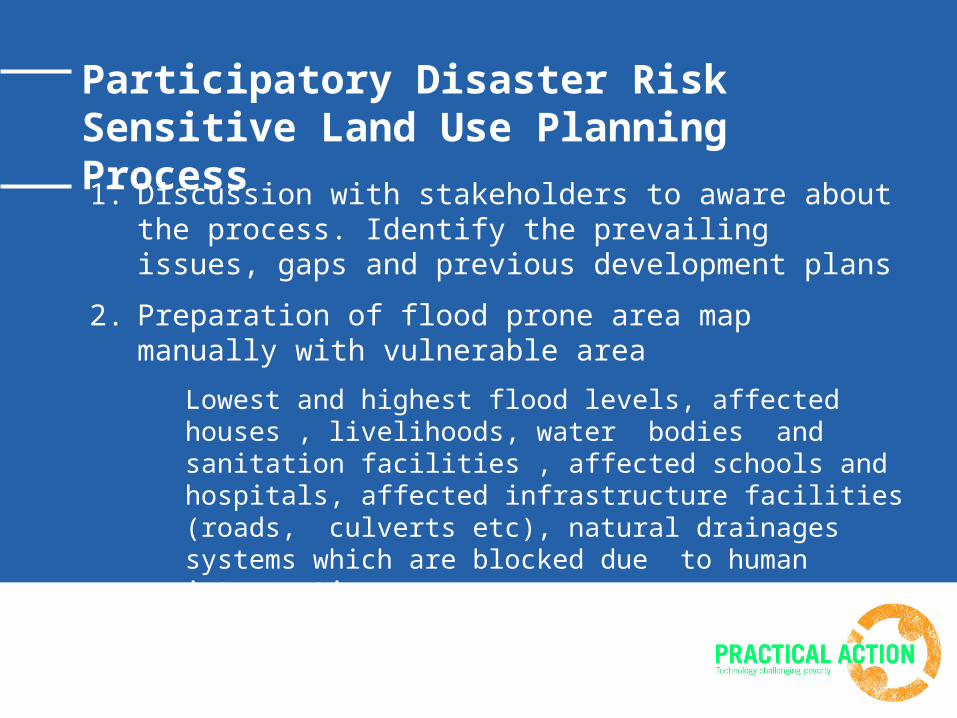
1. Discussion with stakeholders to aware about the process. Identify the prevailing issues, gaps and previous development plans
2. Preparation of flood prone area map manually with vulnerable area
Lowest and highest flood levels, affected houses , livelihoods, water bodies and sanitation facilities , affected schools and hospitals, affected infrastructure facilities (roads, culverts etc), natural drainages systems which are blocked due to human intervention.
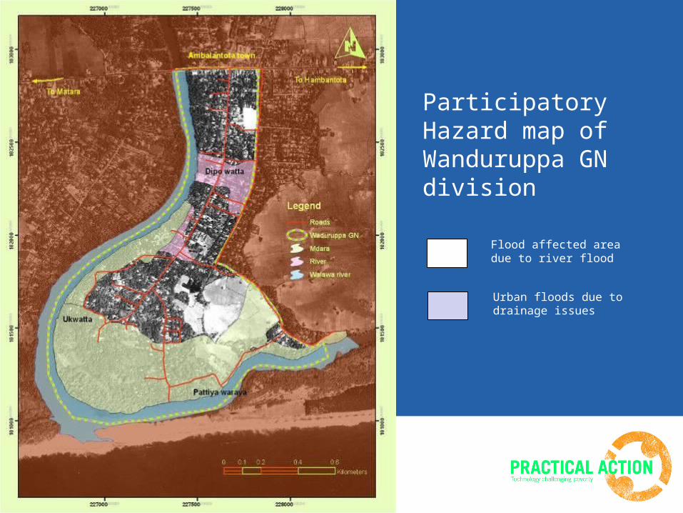
Participatory Hazard map of Wanduruppa GN division
Flood affected area due to river flood
Urban floods due to drainage issues
Participatory Disaster Risk Sensitive Land Use Planning Process
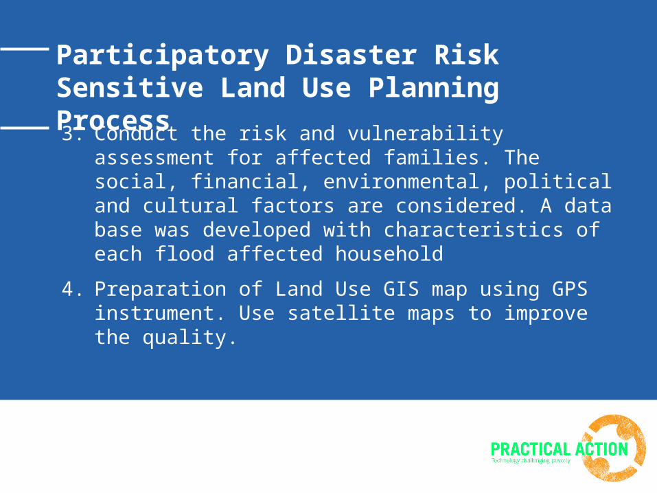
3. Conduct the risk and vulnerability assessment for affected families. The social, financial, environmental, political and cultural factors are considered. A data base was developed with characteristics of each flood affected household
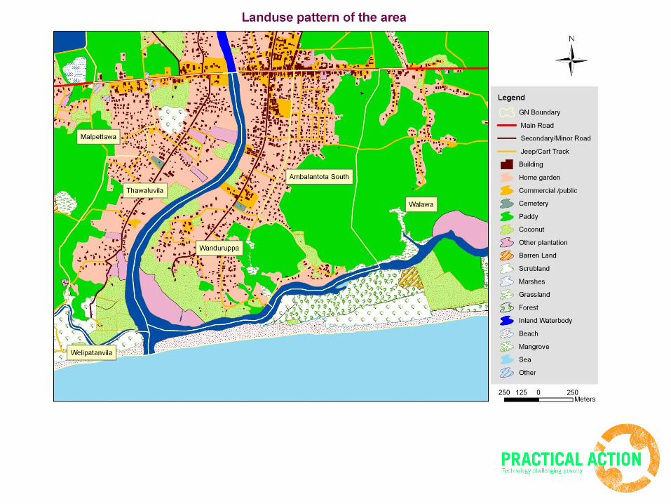
4. Preparation of Land Use GIS map using GPS instrument. Use satellite maps to improve the quality.
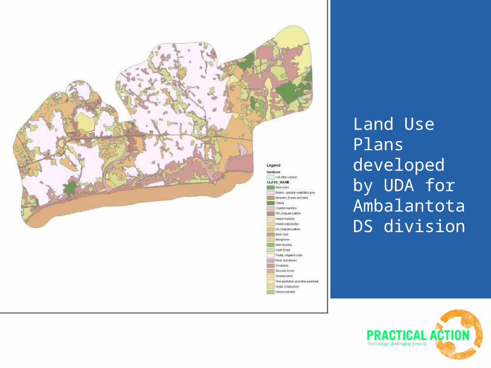
Land Use Plans developed by UDA for Ambalantota DS division
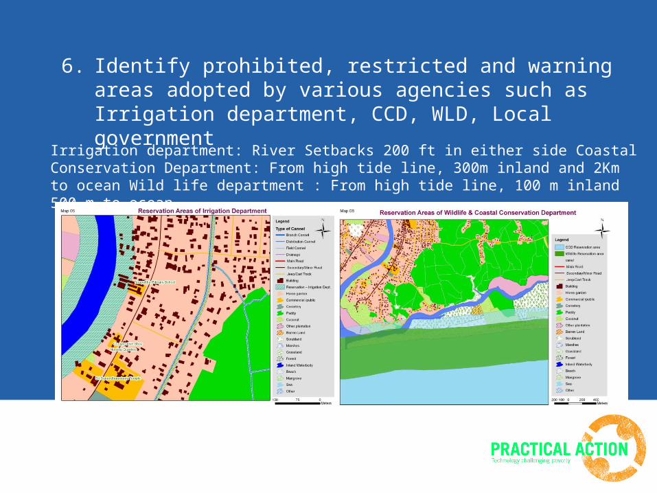
6. Identify prohibited, restricted and warning areas adopted by various agencies such as Irrigation department, CCD, WLD, Local government
Irrigation department: River Setbacks 200 ft in either side Coastal Conservation Department: From high tide line, 300m inland and 2Km to ocean Wild life department : From high tide line, 100 m inland 500 m to ocean
7. Develop flood risk model using GIS for floods and future hazards due to climate change conditions. Link risk and vulnerability assessment data with maps to refer location based data.
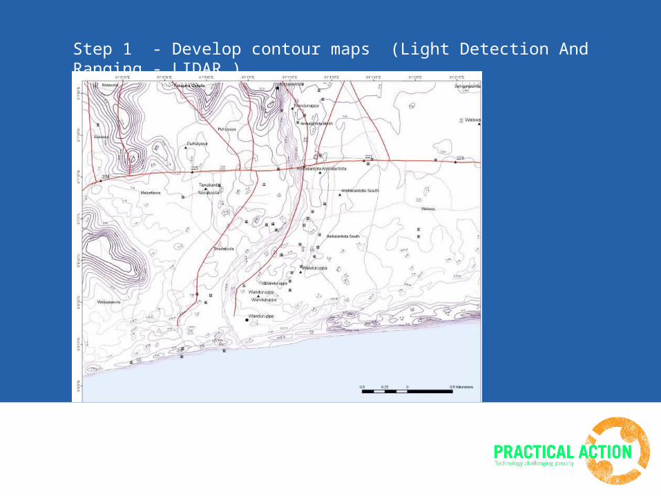
Step 1 - Develop contour maps (Light Detection And Ranging - LIDAR )
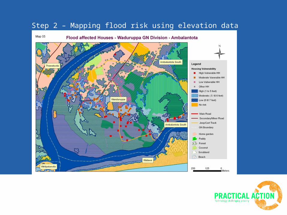
Step 2 – Mapping flood risk using elevation data
Source: UDA, Hambantota
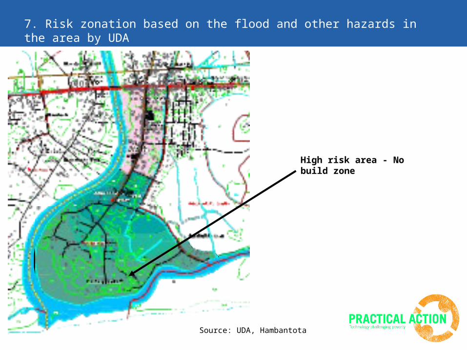
High risk area - No build zone
7. Risk zonation based on the flood and other hazards in the area by UDA
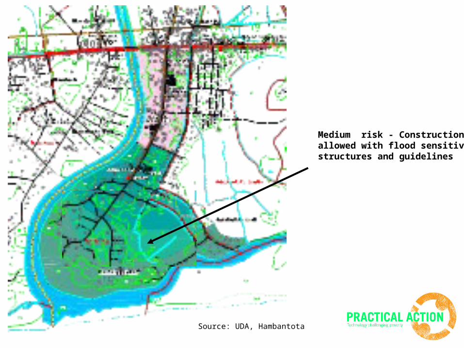
Medium risk - Constructions allowed with flood sensitive structures and guidelines
Source: UDA, Hambantota
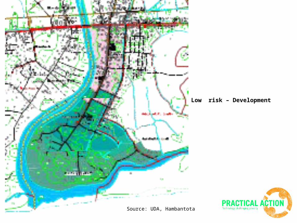
Low risk – Development
Source: UDA, Hambantota
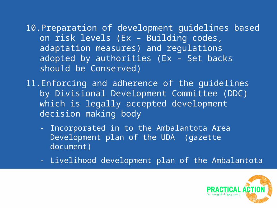
10.Preparation of development guidelines based on risk levels (Ex – Building codes, adaptation measures) and regulations adopted by authorities (Ex – Set backs should be Conserved)
11.Enforcing and adherence of the guidelines by Divisional Development Committee (DDC) which is legally accepted development decision making body
- Incorporated in to the Ambalantota Area Development plan of the UDA (gazette document)
- Livelihood development plan of the Ambalantota
- Disaster Preparedness Plans
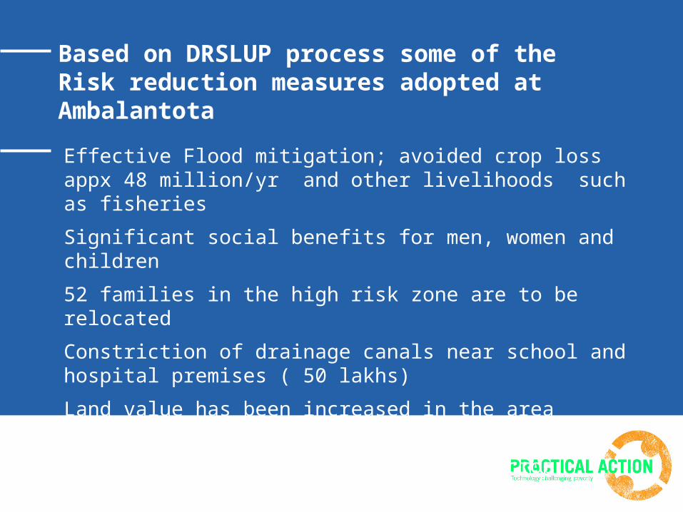
Based on DRSLUP process some of the Risk reduction measures adopted at Ambalantota
Effective Flood mitigation; avoided crop loss appx 48 million/yr and other livelihoods such as fisheries
Significant social benefits for men, women and children
52 families in the high risk zone are to be relocated
Constriction of drainage canals near school and hospital premises ( 50 lakhs)
Land value has been increased in the area
Additional livelihoods promotion; handicrafts, eco tourism, sawing, flood resistant crop varieties
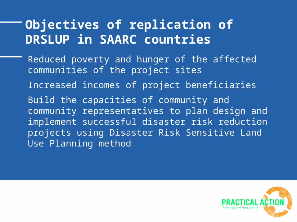
Objectives of replication of DRSLUP in SAARC countries
Reduced poverty and hunger of the affected communities of the project sites
Increased incomes of project beneficiaries
Build the capacities of community and community representatives to plan design and implement successful disaster risk reduction projects using Disaster Risk Sensitive Land Use Planning method
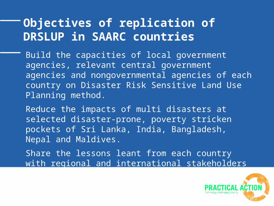
Objectives of replication of DRSLUP in SAARC countries
Build the capacities of local government agencies, relevant central government agencies and nongovernmental agencies of each country on Disaster Risk Sensitive Land Use Planning method.
Reduce the impacts of multi disasters at selected disaster-prone, poverty stricken pockets of Sri Lanka, India, Bangladesh, Nepal and Maldives.
Share the lessons leant from each country with regional and international stakeholders of DRM.
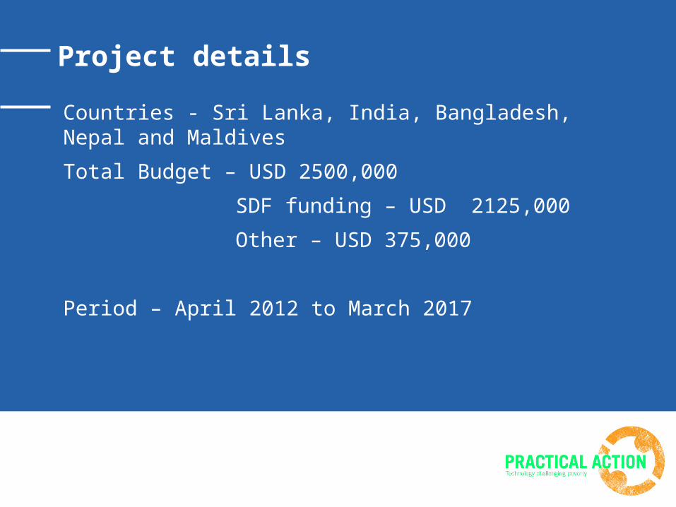
Project details
Countries - Sri Lanka, India, Bangladesh, Nepal and Maldives
Total Budget – USD 2500,000
SDF funding – USD 2125,000
Other – USD 375,000
Period – April 2012 to March 2017
Thank You
5, Lionel Edirisinghe Mawatha,Colombo 5, Sri Lanka
T | +94 - 11 – 2829412 F | +94 - 11 - 2856188E | [email protected]
W | www.practicalaction.org, www.janathakshan.net