Embed Size (px)
Citation preview
An application of Delft3D Flexible Mesh
for operational water-level forecasting on the
Northwest European Shelf and North Sea (DCSMv6)
Firmijn Zijl
NGHS Symposium, Delft Software Days
November 5, 2014
Introduction (Acceptance testing)
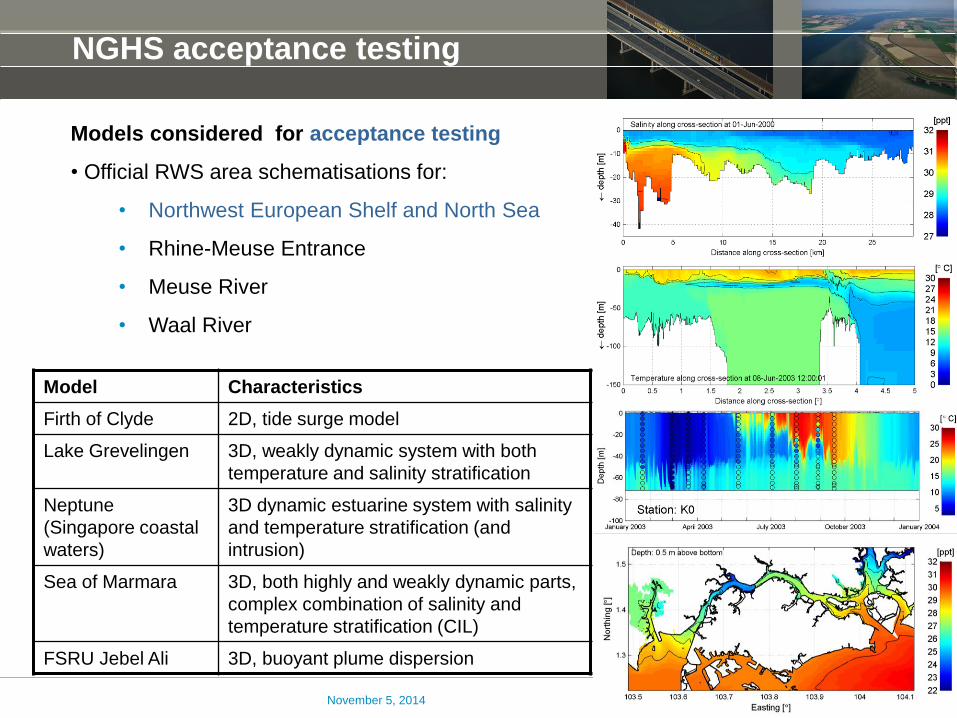
NGHS acceptance testing
Models considered for acceptance testing
• Official RWS area schematisations for:
• Northwest European Shelf and North Sea
• Rhine-Meuse Entrance
• Meuse River
• Waal River
November 5, 2014
Model Characteristics
Firth of Clyde 2D, tide surge model
Lake Grevelingen 3D, weakly dynamic system with both
temperature and salinity stratification
Neptune
(Singapore coastal
waters)
3D dynamic estuarine system with salinity
and temperature stratification (and
intrusion)
Sea of Marmara 3D, both highly and weakly dynamic parts,
complex combination of salinity and
temperature stratification (CIL)
FSRU Jebel Ali 3D, buoyant plume dispersion
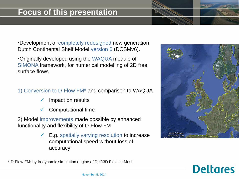
Focus of this presentation
•Development of completely redesigned new generation
Dutch Continental Shelf Model version 6 (DCSMv6).
•Originally developed using the WAQUA module of
SIMONA framework, for numerical modelling of 2D free
surface flows
1) Conversion to D-Flow FM* and comparison to WAQUA
Impact on results
Computational time
2) Model improvements made possible by enhanced
functionality and flexibility of D-Flow FM
E.g. spatially varying resolution to increase
computational speed without loss of
accuracy
November 5, 2014
* D-Flow FM: hydrodynamic simulation engine of Delft3D Flexible Mesh

Operational forecasting in The Netherlands
November 5, 2014
Introduction
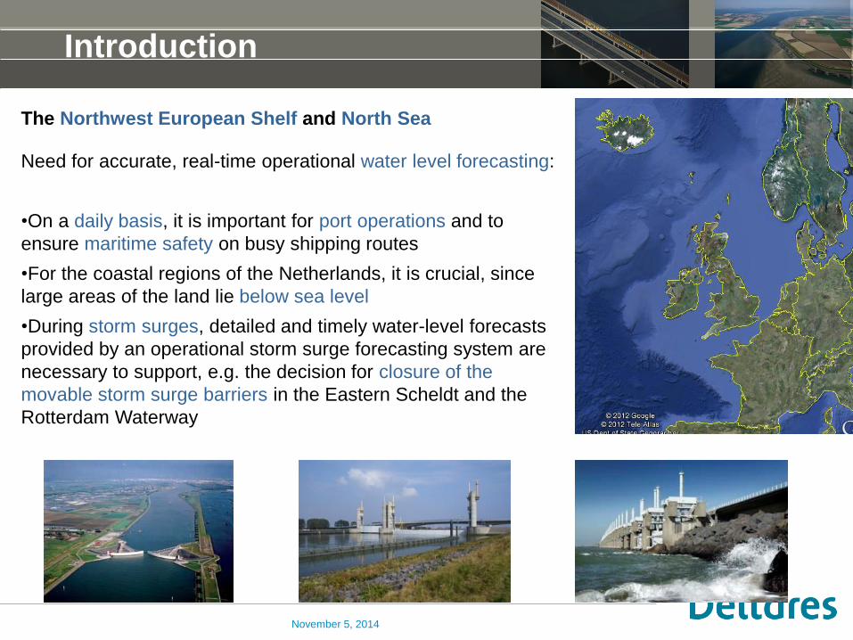
The Northwest European Shelf and North Sea
Need for accurate, real-time operational water level forecasting:
•On a daily basis, it is important for port operations and to
ensure maritime safety on busy shipping routes
•For the coastal regions of the Netherlands, it is crucial, since
large areas of the land lie below sea level
•During storm surges, detailed and timely water-level forecasts
provided by an operational storm surge forecasting system are
necessary to support, e.g. the decision for closure of the
movable storm surge barriers in the Eastern Scheldt and the
Rotterdam Waterway
November 5, 2014
Real-time forecasting in The Netherlands
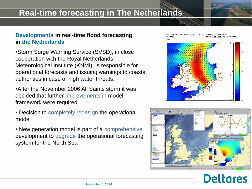
Developments in real-time flood forecasting
in the Netherlands
•Storm Surge Warning Service (SVSD), in close
cooperation with the Royal Netherlands
Meteorological Institute (KNMI), is responsible for
operational forecasts and issuing warnings to coastal
authorities in case of high water threats.
•After the November 2006 All Saints storm it was
decided that further improvements in model
framework were required
• Decision to completely redesign the operational
model
• New generation model is part of a comprehensive
development to upgrade the operational forecasting
system for the North Sea
November 5, 2014
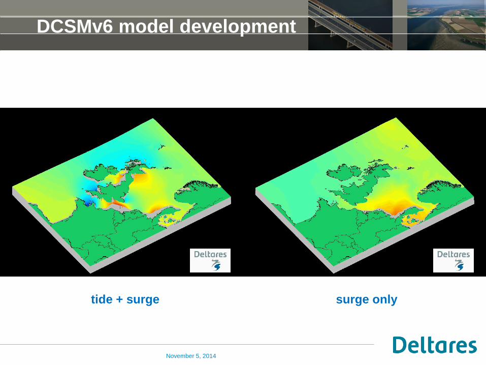
DCSMv6 model development
November 5, 2014
tide + surge surge only
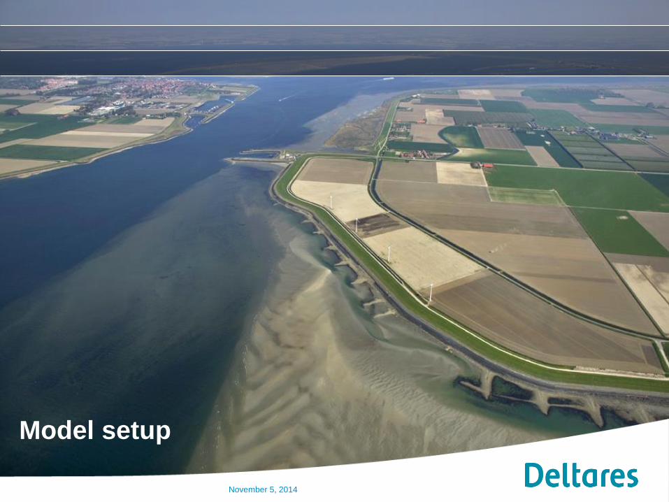
Model setup
November 5, 2014
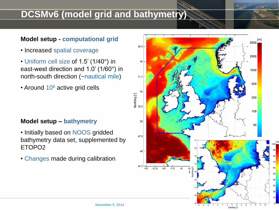
DCSMv6 (model grid and bathymetry)
Model setup - computational grid
• Increased spatial coverage
• Uniform cell size of 1.5’ (1/40°) in
east-west direction and 1.0’ (1/60°) in
north-south direction (~nautical mile)
• Around 106 active grid cells
Model setup – bathymetry
• Initially based on NOOS gridded
bathymetry data set, supplemented by
ETOPO2
• Changes made during calibration
November 5, 2014
Model setup (boundary forcing)
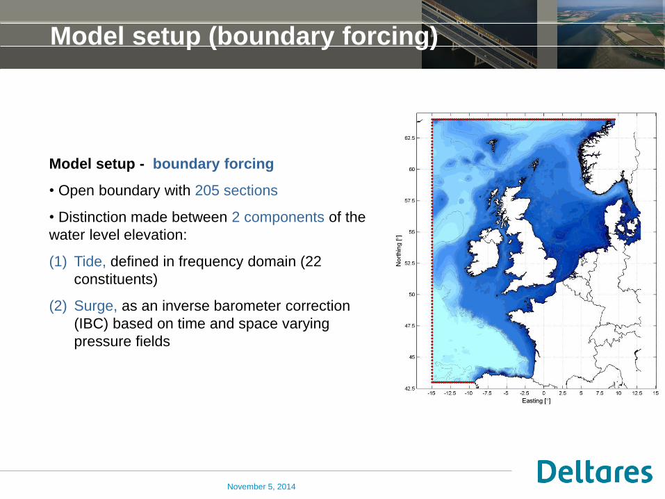
Model setup - boundary forcing
• Open boundary with 205 sections
• Distinction made between 2 components of the
water level elevation:
(1) Tide, defined in frequency domain (22
constituents)
(2) Surge, as an inverse barometer correction
(IBC) based on time and space varying
pressure fields
November 5, 2014
DCSMv6-ZUNOv4 model setup (meteo forcing)
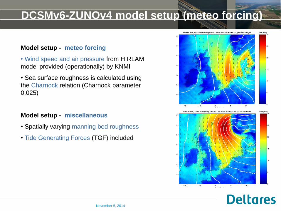
Model setup - meteo forcing
• Wind speed and air pressure from HIRLAM
model provided (operationally) by KNMI
• Sea surface roughness is calculated using
the Charnock relation (Charnock parameter
0.025)
Model setup - miscellaneous
• Spatially varying manning bed roughness
• Tide Generating Forces (TGF) included
November 5, 2014
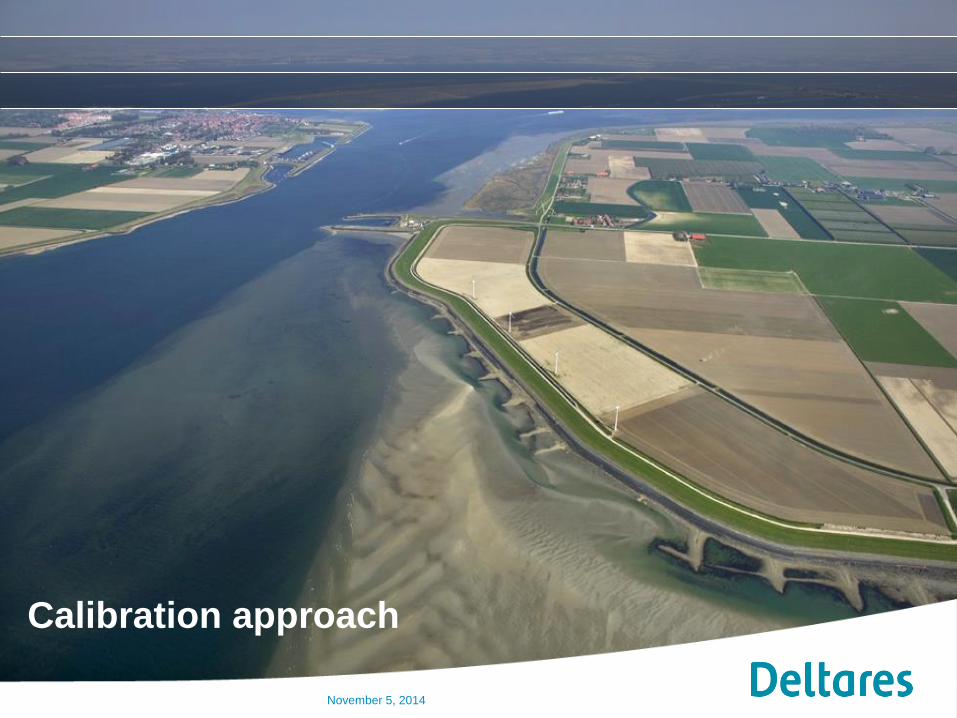
Calibration approach
November 5, 2014
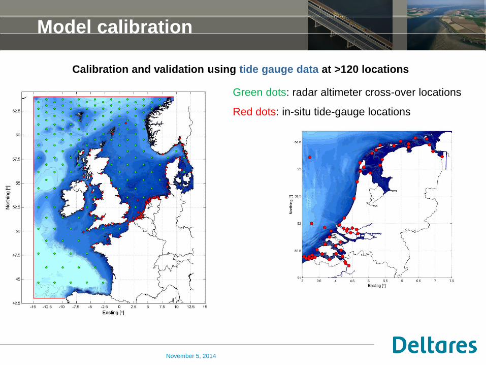
Model calibration
Calibration and validation using tide gauge data at >120 locations
Green dots: radar altimeter cross-over locations
Red dots: in-situ tide-gauge locations
November 5, 2014
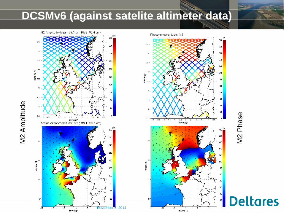
DCSMv6 (against satelite altimeter data) M
2 A
mplit
ude
M2 P
hase
November 5, 2014
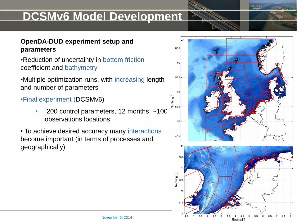
DCSMv6 Model Development
OpenDA-DUD experiment setup and
parameters
•Reduction of uncertainty in bottom friction
coefficient and bathymetry
•Multiple optimization runs, with increasing length
and number of parameters
•Final experiment (DCSMv6)
• 200 control parameters, 12 months, ~100
observations locations
• To achieve desired accuracy many interactions
become important (in terms of processes and
geographically)
November 5, 2014
Results
November 5, 2014
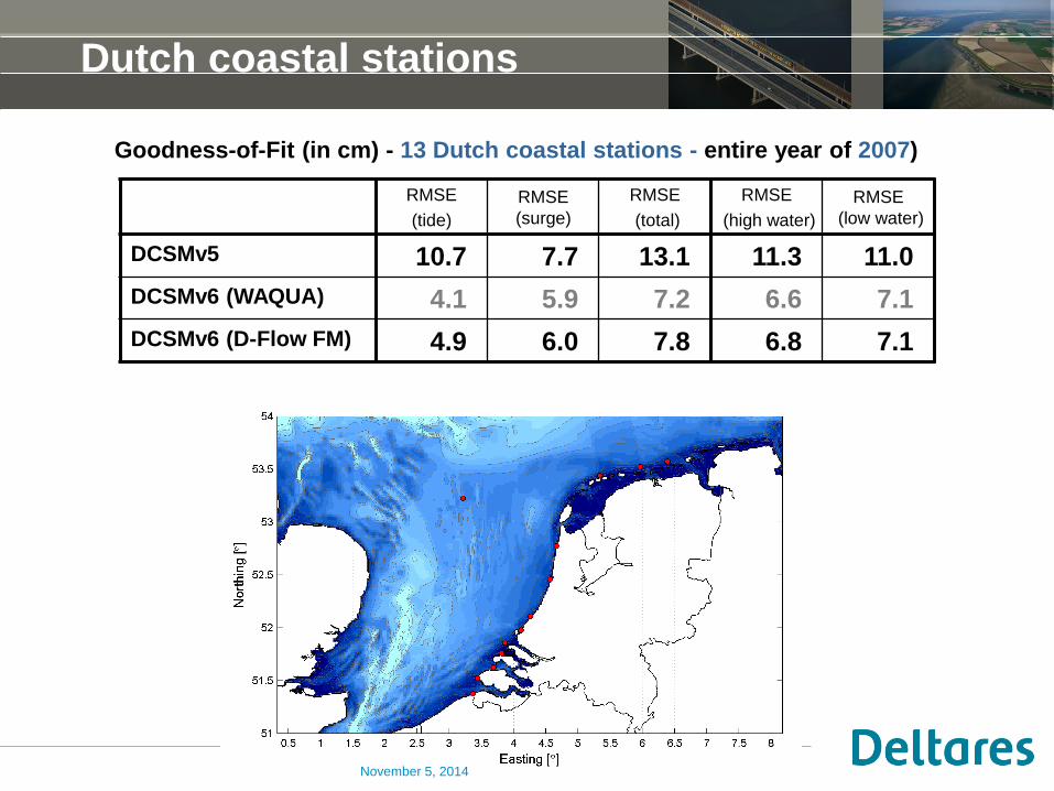
Dutch coastal stations
RMSE
(tide)
RMSE
(surge)
RMSE
(total)
RMSE
(high water)
RMSE
(low water)
DCSMv5 10.7 7.7 13.1 11.3 11.0
DCSMv6 (WAQUA) 4.1 5.9 7.2 6.6 7.1
DCSMv6 (D-Flow FM) 4.9 6.0 7.8 6.8 7.1
Goodness-of-Fit (in cm) - 13 Dutch coastal stations - entire year of 2007)
November 5, 2014
November 5, 2014
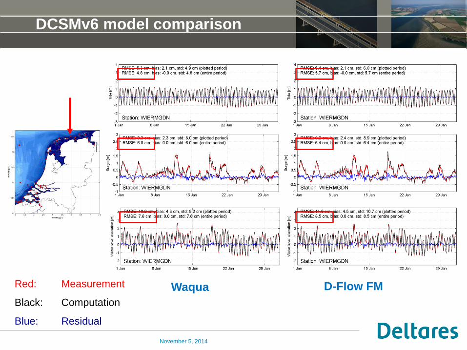
DCSMv6 model comparison
Red: Measurement
Black: Computation
Blue: Residual
Waqua D-Flow FM
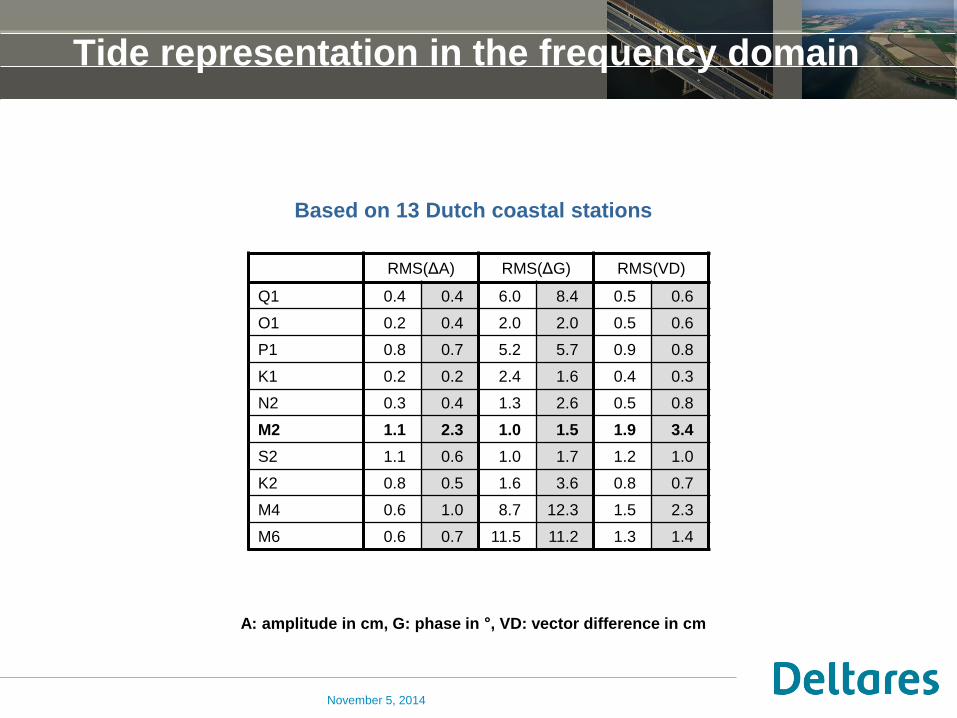
Tide representation in the frequency domain
RMS(ΔA) RMS(ΔG) RMS(VD)
Q1 0.4 0.4 6.0 8.4 0.5 0.6
O1 0.2 0.4 2.0 2.0 0.5 0.6
P1 0.8 0.7 5.2 5.7 0.9 0.8
K1 0.2 0.2 2.4 1.6 0.4 0.3
N2 0.3 0.4 1.3 2.6 0.5 0.8
M2 1.1 2.3 1.0 1.5 1.9 3.4
S2 1.1 0.6 1.0 1.7 1.2 1.0
K2 0.8 0.5 1.6 3.6 0.8 0.7
M4 0.6 1.0 8.7 12.3 1.5 2.3
M6 0.6 0.7 11.5 11.2 1.3 1.4
A: amplitude in cm, G: phase in °, VD: vector difference in cm
Based on 13 Dutch coastal stations
November 5, 2014
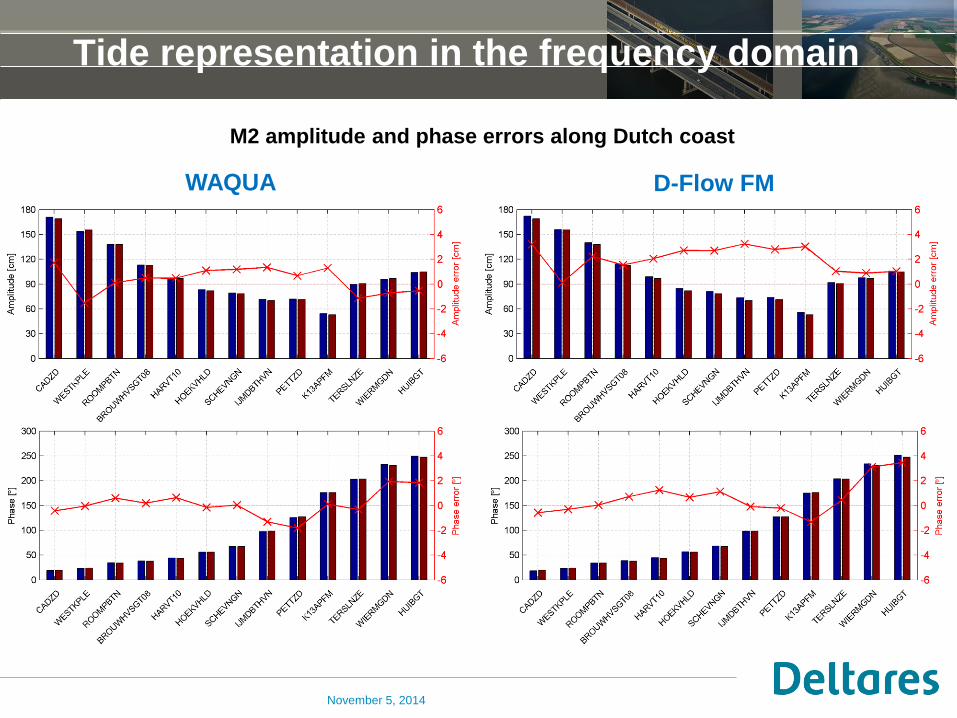
Tide representation in the frequency domain
M2 amplitude and phase errors along Dutch coast
WAQUA D-Flow FM
November 5, 2014
November 5, 2014
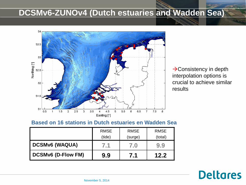
DCSMv6-ZUNOv4 (Dutch estuaries and Wadden Sea)
Based on 16 stations in Dutch estuaries en Wadden Sea
RMSE
(tide)
RMSE
(surge)
RMSE
(total)
DCSMv6 (WAQUA) 7.1 7.0 9.9
DCSMv6 (D-Flow FM) 9.9 7.1 12.2
Consistency in depth
interpolation options is
crucial to achieve similar
results

Conclusions
November 5, 2014
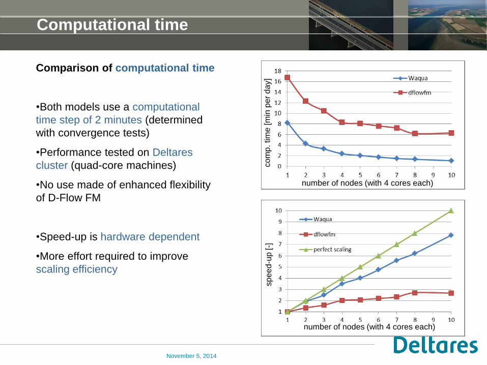
Computational time
Comparison of computational time
•Both models use a computational
time step of 2 minutes (determined
with convergence tests)
•Performance tested on Deltares
cluster (quad-core machines)
•No use made of enhanced flexibility
of D-Flow FM
•Speed-up is hardware dependent
•More effort required to improve
scaling efficiency
November 5, 2014
number of nodes (with 4 cores each)
co
mp
. tim
e [m
in p
er
da
y]
number of nodes (with 4 cores each)
sp
ee
d-u
p [-]
Summary and conclusions
•Completely redesigned, new generation Dutch Continental Shelf Model version 6
(DCSMv6) has been developed
• Year-long simulations show excellent agreement with (shelf-wide) measurements
• Running the model in D-Flow FM reduces the water level representation accuracy
• It is expected that the D-Flow FM accuracy can be improved with limited re-
calibration
• For this application D-Flow FM is twice as slow as Simona-Waqua (on one node)
• Enhanced flexibility of D-Flow FM has not been used, but will save
computational time
•Scalability of D-Flow FM is rightly getting more attention (hardware dependent)
Next step (1): make use of enhanced flexibility of D-Flow FM to reduce number of
cells and increase time step by avoiding unnecessary high resolution in the deeper
areas off the shelf
Next step (2): Acceptance testing with different models, as results are application
dependent
November 5, 2014

DCSMv6
Questions?
November 5, 2014