Embed Size (px)
Citation preview
Ch 14 sect 1 & 2
Land Use
Land Use and Land Cover
• We use land for many purposes, including farming, mining, building cities and highways, and recreation.
• Land cover is what you find on a patch of land, and it often depends on how the land is used. For example, land cover might be a forest, a field of grain, or a parking lot.
• There are different types of land cover and different human uses for each cover type.
Land Use and Land Cover
•Urban describes an area that contains a city, or an area that contains 2,500 or more people and usually has a governing body, such as a city council.
•Rural describes an area of open land that is often used for farming, or any population not classified as urban.
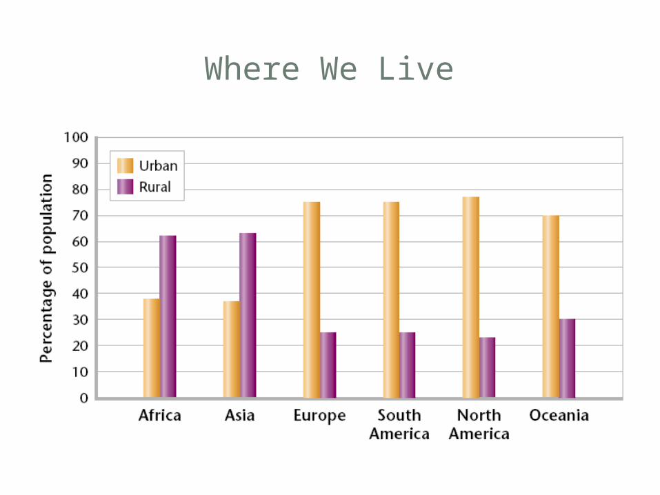
Where We Live
Supporting Urban Areas
• The area of rural land needed to support one person depends on many factors, such as the climate, the standard of living, and how efficiently resources are used.• Each person in a developed country uses the
ecosystem services provided by about 8 hectares of land. But, many people in developing countries do not have access to all the resources for a healthy life, and may use ecosystem services from less than a hectare of land per person.
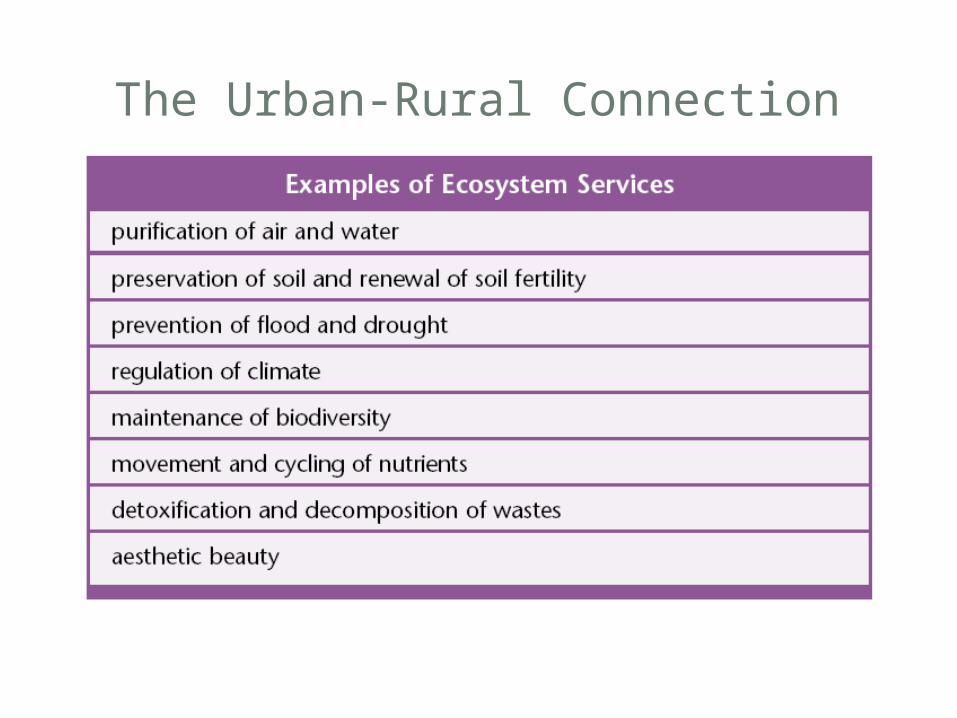
The Urban-Rural Connection
The Urban Crisis
• A rapidly growing population, however, can overwhelm the infrastructure, leading to traffic jams, substandard housing, and polluted air and water.• Infrastructure is the basic facilities of a country
or region, such as roads, bridges, sewers, and railroads.• When more people live in a city than its
infrastructure can support, the living conditions deteriorate. This growth problem has become so widespread throughout the world that the term urban crisis was coined to describe it.
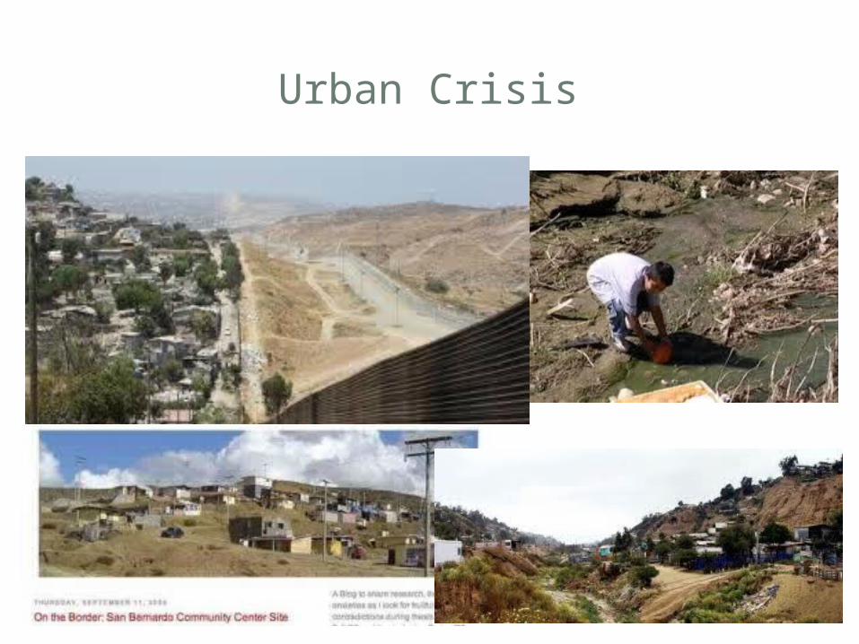
Urban Crisis
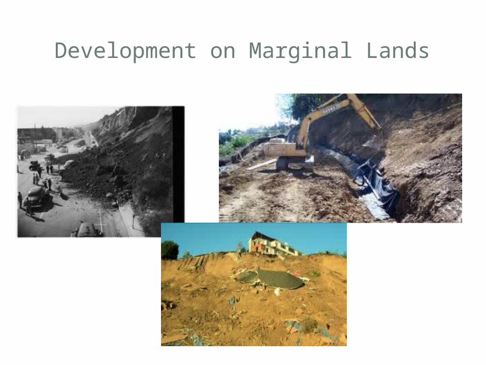
Development on Marginal Lands
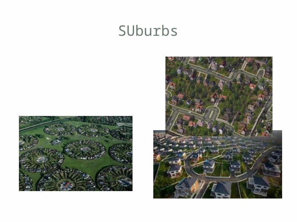
SUburbs
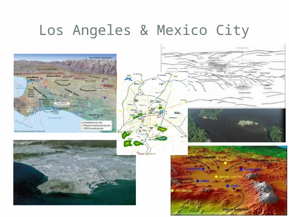
Los Angeles & Mexico City
LAN USE PLANNING
• Land-use planning is a set of policies and activities related to potential uses of land.• The public has a right to comment on
these reports.• Developers, city governments, local
businesses, and citizens often disagree about land-use plans.
LAN USE PLANNING
• Land-use planners have sophisticated methods and tools available to them today.• The most important technological tools for
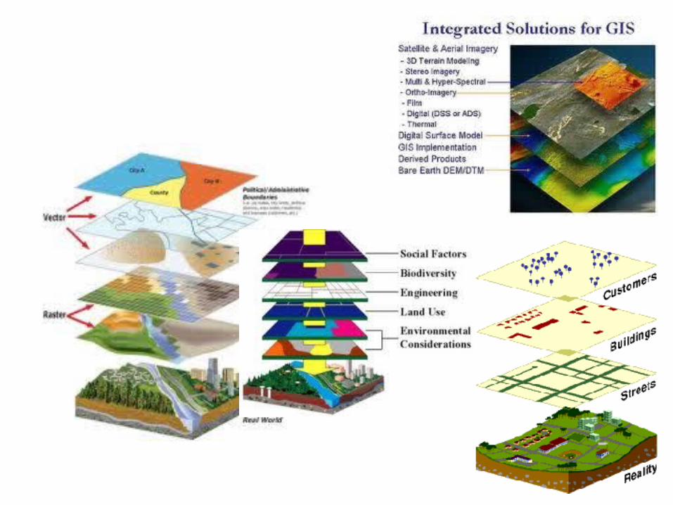
land-use planning involve –A geographical information system (GIS) is an automated system for capturing, storing, retrieving, analyzing, manipulating, and displaying geographic data.
GIS
• GIS software allows a user to enter different types of data about an area, such as the locations of sewer lines, roads, and parks, and then create maps with the data.• Each image corresponds to a different
combination of information.• The power of GIS is that it allows a user to display
layers of information about an area and to overlay these layers, like overhead transparencies, on top of one another.