Embed Size (px)
Citation preview
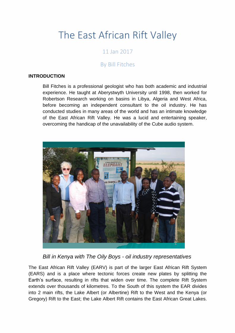
The East African Rift Valley
11 Jan 2017
By Bill Fitches
INTRODUCTION
Bill Fitches is a professional geologist who has both academic and industrial
experience. He taught at Aberystwyth University until 1998, then worked for
Robertson Research working on basins in Libya, Algeria and West Africa,
before becoming an independent consultant to the oil industry. He has
conducted studies in many areas of the world and has an intimate knowledge
of the East African Rift Valley. He was a lucid and entertaining speaker,
overcoming the handicap of the unavailability of the Cube audio system.
6
Bill in Kenya with The Oily Boys - oil industry representatives
The East African Rift Valley (EARV) is part of the larger East African Rift System
(EARS) and is a place where tectonic forces create new plates by splitting the
Earth’s surface, resulting in rifts that widen over time. The complete Rift System
extends over thousands of kilometres. To the South of this system the EAR divides
into 2 main rifts, the Lake Albert (or Albertine) Rift to the West and the Kenya (or
Gregory) Rift to the East; the Lake Albert Rift contains the East African Great Lakes.
The Eastern branch is characterised by greater volcanic activity, while the Western
Branch comprises deeper basins containing large lakes and lots of sediment.
STRUCTURE
There are two main ways that rifts can form, either by extension of the crust by plate
tectonics or the result of deep down processes in the hot ductile crust which cause
thinning but does not break the crust, and the mantle rises. The East African Rift is
relatively young and the initial process started in the Neogene era (c24m). The Rift
formation started about 11m years ago, but didn’t really get going until 5.3m. It is
thought the split into West and East branches was caused by a small core of old
metamorphic rock that was too hard for the rift to go through, so it diverged into the
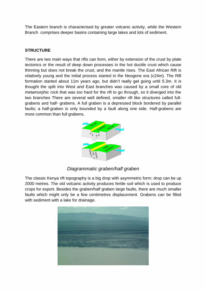
two branches There are several well defined, smaller rift like structures called full-
grabens and half- grabens. A full graben is a depressed block bordered by parallel
faults; a half-graben is only bounded by a fault along one side. Half-grabens are
more common than full grabens.
Diagrammatic graben/half graben
The classic Kenya rift topography is a big drop with asymmetric form; drop can be up
2000 metres. The old volcanic activity produces fertile soil which is used to produce
crops for export. Besides the graben/half graben large faults, there are much smaller
faults which might only be a few centimetres displacement. Grabens can be filled
with sediment with a lake for drainage.
Baringo Half Graben
VOLCANOS
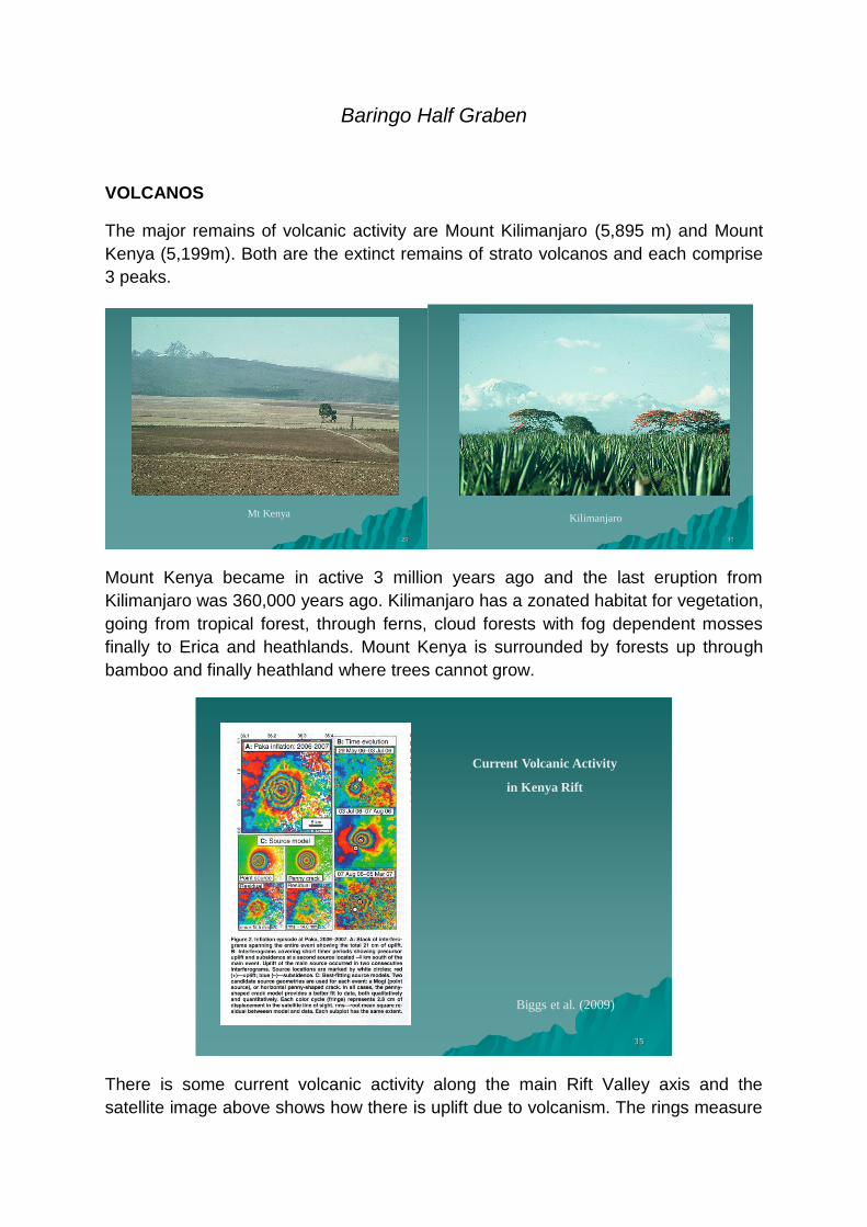
The major remains of volcanic activity are Mount Kilimanjaro (5,895 m) and Mount
Kenya (5,199m). Both are the extinct remains of strato volcanos and each comprise
3 peaks.
Mt Kenya
29
Kilimanjaro
30
Mount Kenya became in active 3 million years ago and the last eruption from
Kilimanjaro was 360,000 years ago. Kilimanjaro has a zonated habitat for vegetation,
going from tropical forest, through ferns, cloud forests with fog dependent mosses
finally to Erica and heathlands. Mount Kenya is surrounded by forests up through
bamboo and finally heathland where trees cannot grow.
Current Volcanic Activity
in Kenya Rift
Biggs et al. (2009)
35
There is some current volcanic activity along the main Rift Valley axis and the
satellite image above shows how there is uplift due to volcanism. The rings measure
how much uplift there is over time, but this uplift eventually subsides and there is no
eruption.
HOT SPRINGS
Geyser
Geothermal Energy
36
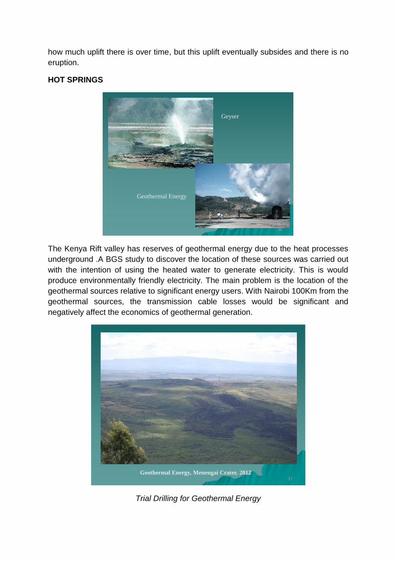
The Kenya Rift valley has reserves of geothermal energy due to the heat processes
underground .A BGS study to discover the location of these sources was carried out
with the intention of using the heated water to generate electricity. This is would
produce environmentally friendly electricity. The main problem is the location of the
geothermal sources relative to significant energy users. With Nairobi 100Km from the
geothermal sources, the transmission cable losses would be significant and
negatively affect the economics of geothermal generation.
Geothermal Energy, Menengai Crater, 201237
Trial Drilling for Geothermal Energy
SEDIMENTATION
When Rift Valley lakes dry out they leave behind sedimentary diatomic deposits,
which are the remains of microscopic organisms that us the silicon in water from
volcanos; these deposits are collected because they are commercially valuable for
use in industrial processes.
39
Diatomic Deposits
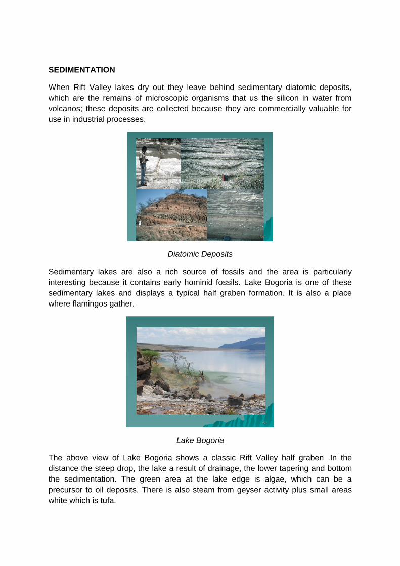
Sedimentary lakes are also a rich source of fossils and the area is particularly
interesting because it contains early hominid fossils. Lake Bogoria is one of these
sedimentary lakes and displays a typical half graben formation. It is also a place
where flamingos gather.
46
Lake Bogoria
The above view of Lake Bogoria shows a classic Rift Valley half graben .In the
distance the steep drop, the lake a result of drainage, the lower tapering and bottom
the sedimentation. The green area at the lake edge is algae, which can be a
precursor to oil deposits. There is also steam from geyser activity plus small areas
white which is tufa.
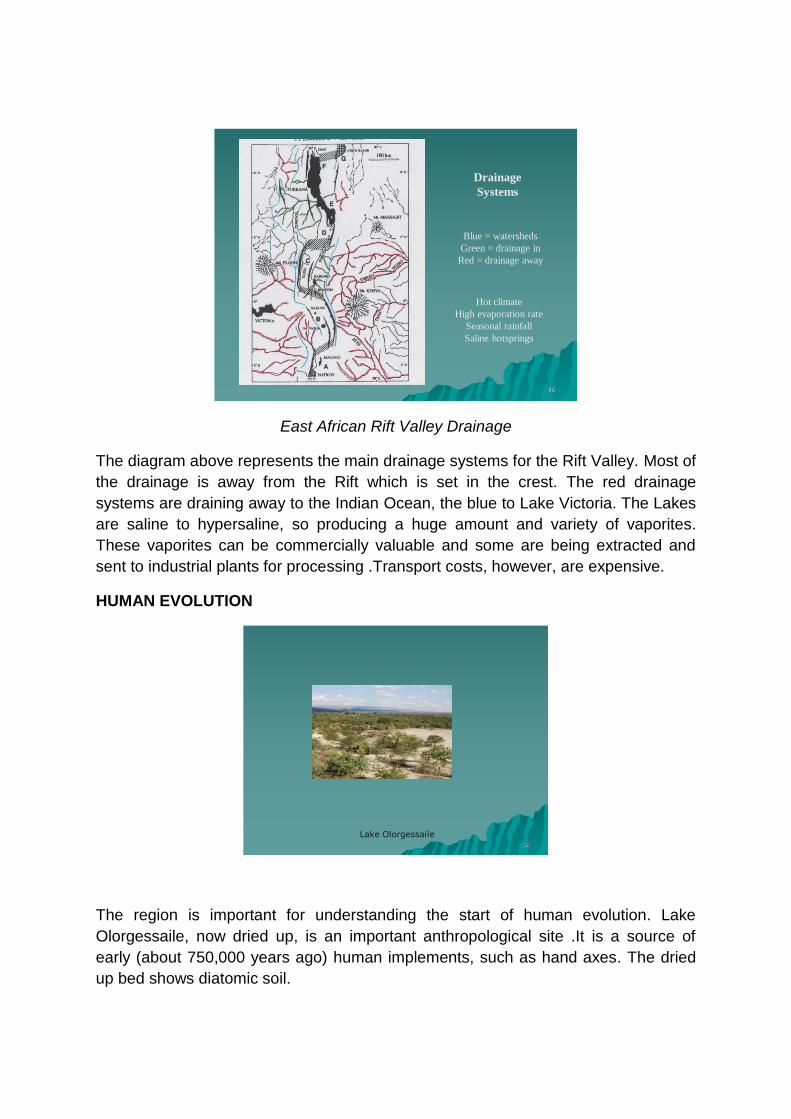
Blue = watersheds
Green = drainage in
Red = drainage away
Hot climate
High evaporation rate
Seasonal rainfall
Saline hotsprings
Drainage
Systems
46
East African Rift Valley Drainage
The diagram above represents the main drainage systems for the Rift Valley. Most of
the drainage is away from the Rift which is set in the crest. The red drainage
systems are draining away to the Indian Ocean, the blue to Lake Victoria. The Lakes
are saline to hypersaline, so producing a huge amount and variety of vaporites.
These vaporites can be commercially valuable and some are being extracted and
sent to industrial plants for processing .Transport costs, however, are expensive.
HUMAN EVOLUTION
Lake Olorgessaile50
The region is important for understanding the start of human evolution. Lake
Olorgessaile, now dried up, is an important anthropological site .It is a source of
early (about 750,000 years ago) human implements, such as hand axes. The dried
up bed shows diatomic soil.
52
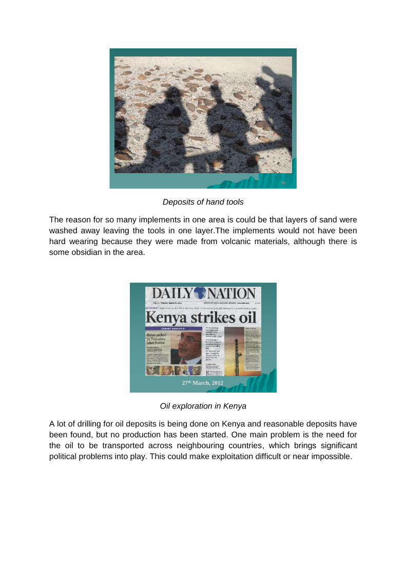
Deposits of hand tools
The reason for so many implements in one area is could be that layers of sand were
washed away leaving the tools in one layer.The implements would not have been
hard wearing because they were made from volcanic materials, although there is
some obsidian in the area.
27th March, 2012
Oil exploration in Kenya
A lot of drilling for oil deposits is being done on Kenya and reasonable deposits have
been found, but no production has been started. One main problem is the need for
the oil to be transported across neighbouring countries, which brings significant
political problems into play. This could make exploitation difficult or near impossible.
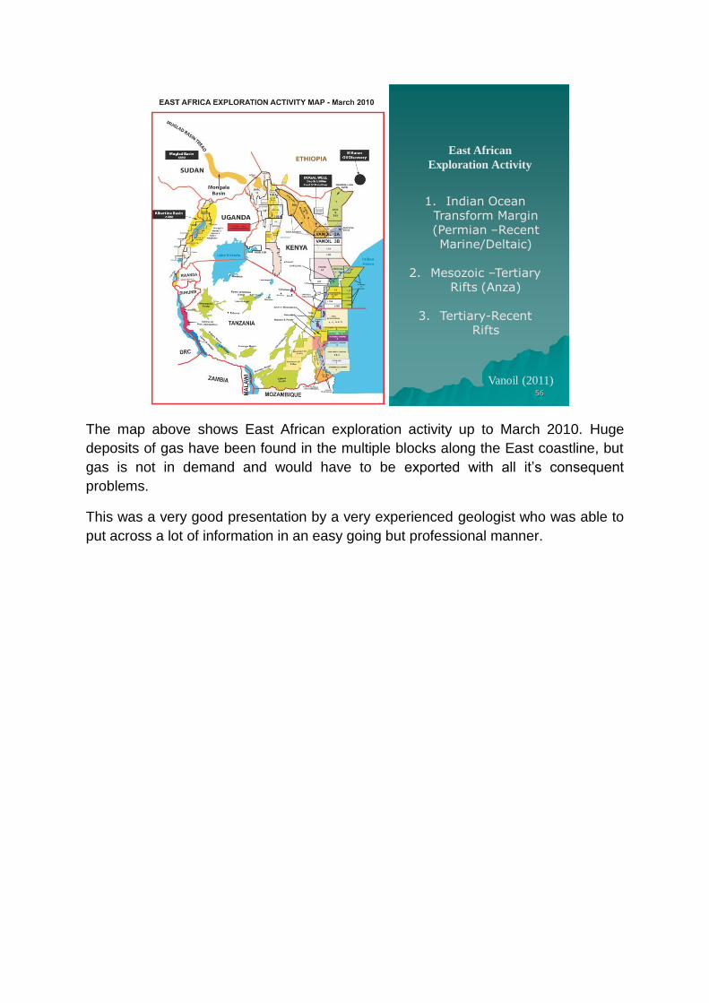
East African
Exploration Activity
Vanoil (2011)
1. Indian Ocean Transform Margin (Permian –Recent Marine/Deltaic)
2. Mesozoic –Tertiary Rifts (Anza)
3. Tertiary-Recent Rifts
56
The map above shows East African exploration activity up to March 2010. Huge
deposits of gas have been found in the multiple blocks along the East coastline, but
gas is not in demand and would have to be exported with all it’s consequent
problems.
This was a very good presentation by a very experienced geologist who was able to
put across a lot of information in an easy going but professional manner.