Embed Size (px)
Citation preview
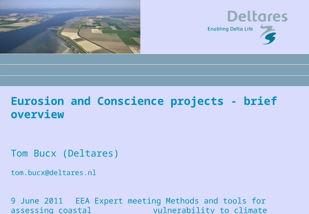
Eurosion and Conscience projects - brief overview
Tom Bucx (Deltares)
9 June 2011 EEA Expert meeting Methods and tools for assessing coastal
vulnerability to climate change

Eurosion - objectives
Coastal erosion and associated risks is major issue in many parts of EU coasts
EUROSION project (2002 – 2004, budget 5 million Euro)
to provide quantified evidence on coastal erosion in Europe
problems caused by it successes and failures of mitigation measures based on 60 case studies
to formulate recommendations for policy-making and information management practices
to address coastal erosion in Europe to bring coastal erosion into the mainstream of coastal management at
the European, national, regional and local levels
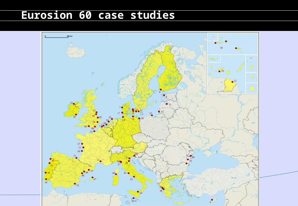
Eurosion 60 case studies
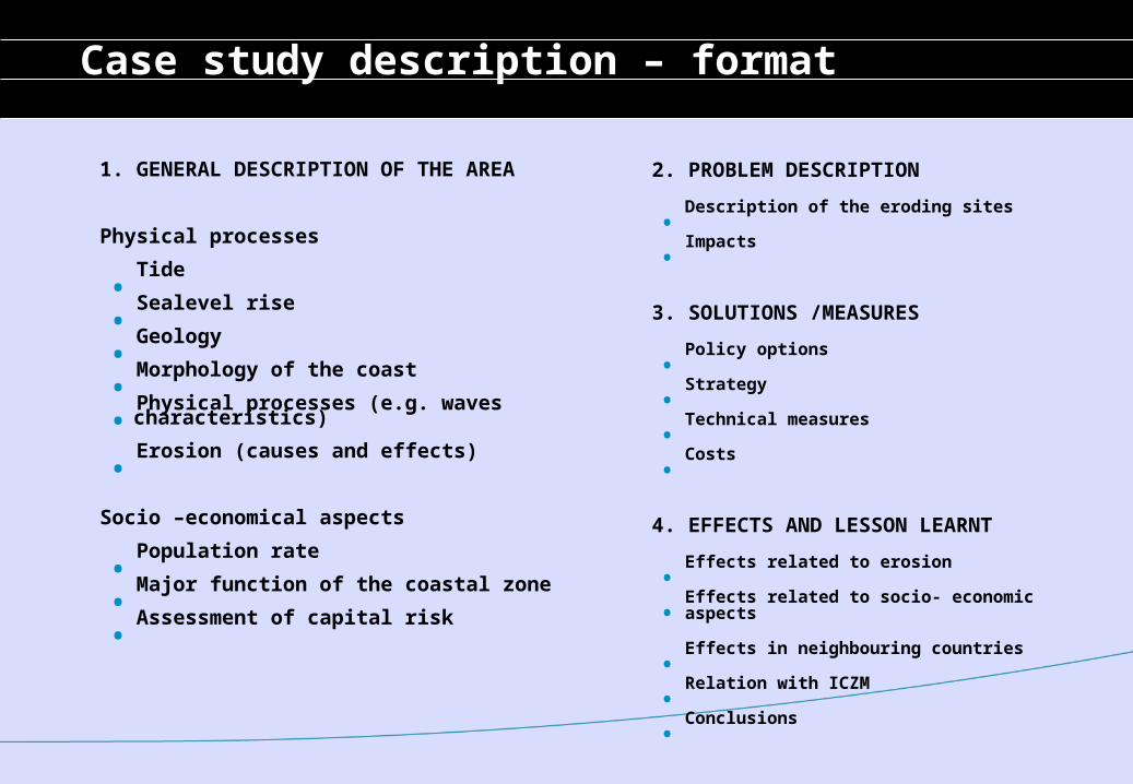
Case study description – format
1. GENERAL DESCRIPTION OF THE AREA
Physical processes
. Tide
. Sealevel rise
. Geology
. Morphology of the coast
. Physical processes (e.g. waves characteristics)
. Erosion (causes and effects)
Socio –economical aspects
. Population rate
. Major function of the coastal zone
. Assessment of capital risk
2. PROBLEM DESCRIPTION
. Description of the eroding sites
. Impacts
3. SOLUTIONS /MEASURES
. Policy options
. Strategy
. Technical measures
. Costs
4. EFFECTS AND LESSON LEARNT
. Effects related to erosion
. Effects related to socio- economic aspects
. Effects in neighbouring countries
. Relation with ICZM
. Conclusions
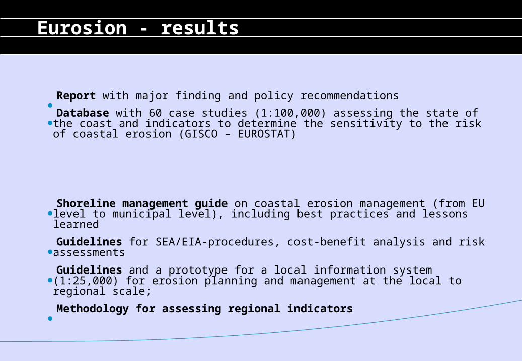
Eurosion - results
. Report with major finding and policy recommendations
. Database with 60 case studies (1:100,000) assessing the state of the coast and indicators to determine the sensitivity to the risk of coastal erosion (GISCO – EUROSTAT)
. Shoreline management guide on coastal erosion management (from EU level to municipal level), including best practices and lessons learned
. Guidelines for SEA/EIA-procedures, cost-benefit analysis and risk assessments
. Guidelines and a prototype for a local information system (1:25,000) for erosion planning and management at the local to regional scale;
. Methodology for assessing regional indicators
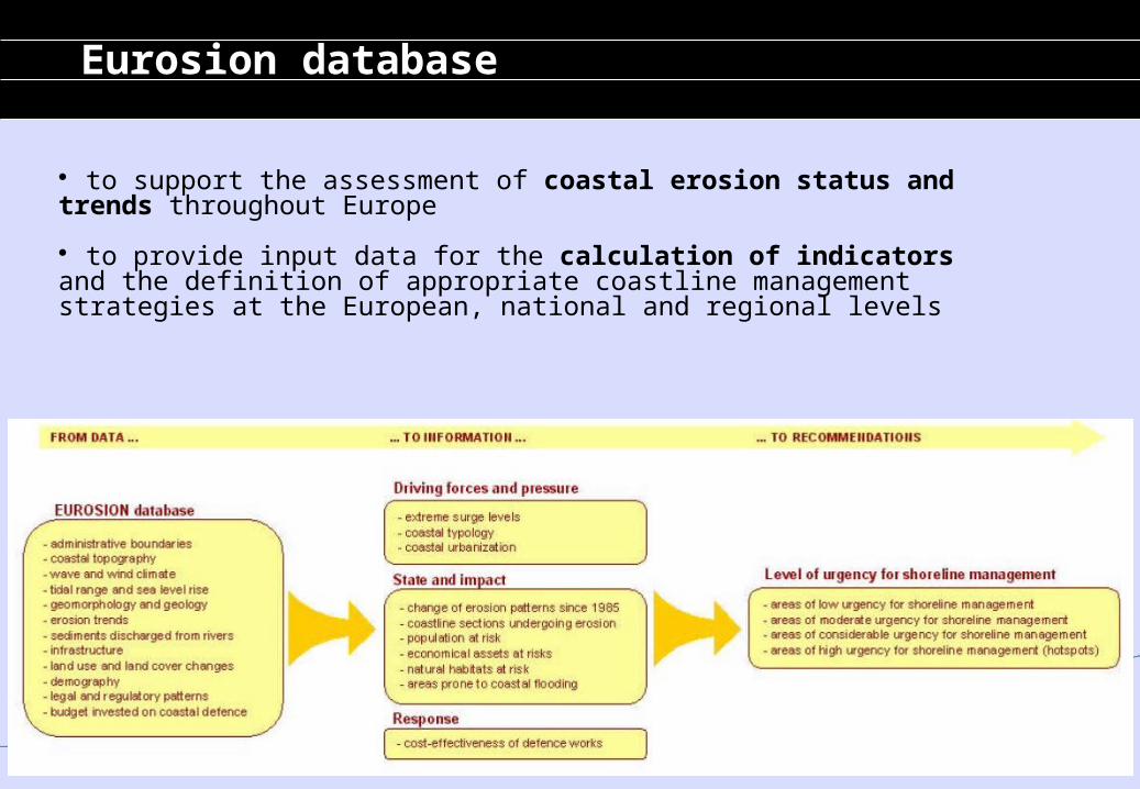
Eurosion database
to support the assessment of coastal erosion status and trends throughout Europe
to provide input data for the calculation of indicators and the definition of appropriate coastline management strategies at the European, national and regional levels
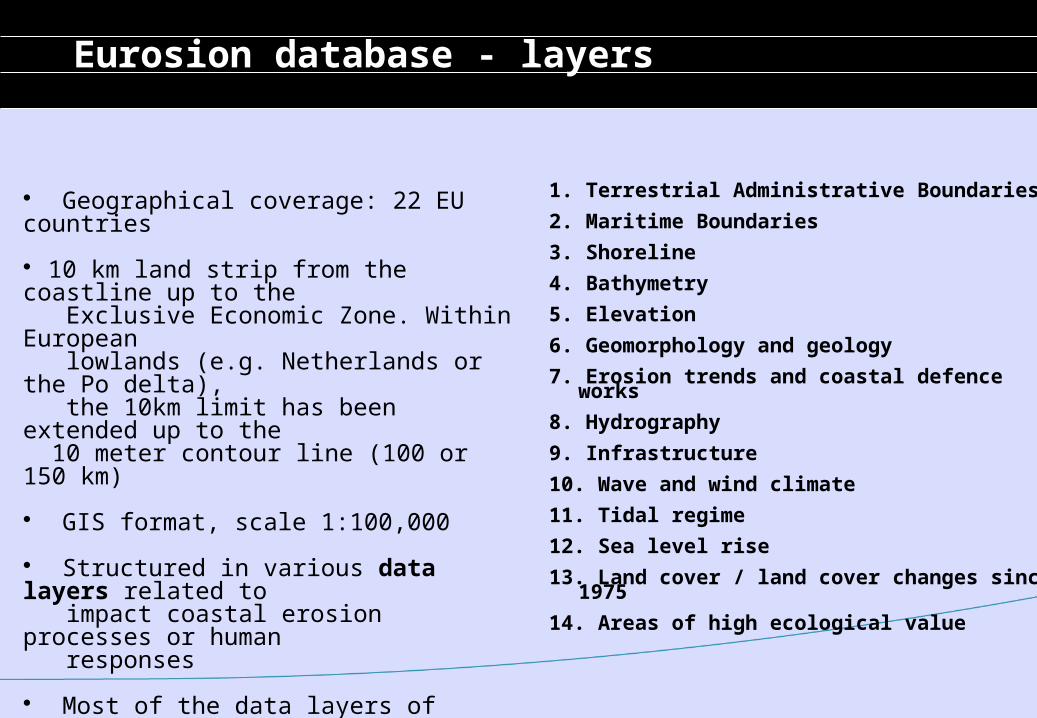
Eurosion database - layers
1. Terrestrial Administrative Boundaries
2. Maritime Boundaries
3. Shoreline
4. Bathymetry
5. Elevation
6. Geomorphology and geology
7. Erosion trends and coastal defence works
8. Hydrography
9. Infrastructure
10. Wave and wind climate
11. Tidal regime
12. Sea level rise
13. Land cover / land cover changes since 1975
14. Areas of high ecological value
Geographical coverage: 22 EU countries
10 km land strip from the coastline up to the Exclusive Economic Zone. Within European lowlands (e.g. Netherlands or the Po delta), the 10km limit has been extended up to the 10 meter contour line (100 or 150 km)
GIS format, scale 1:100,000
Structured in various data layers related to impact coastal erosion processes or human responses
Most of the data layers of information are freely accessible and may be downloadable
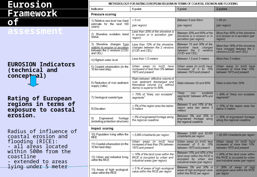
EurosionFrameworkof assessment
EUROSION Indicators(technical and conceptual)
Rating of European regions in terms of exposure to coastal erosion.
Radius of influence of coastal erosion and flooding (RICE): - all areas located within 500m from the coastline- extended to areas lying under 5 meter
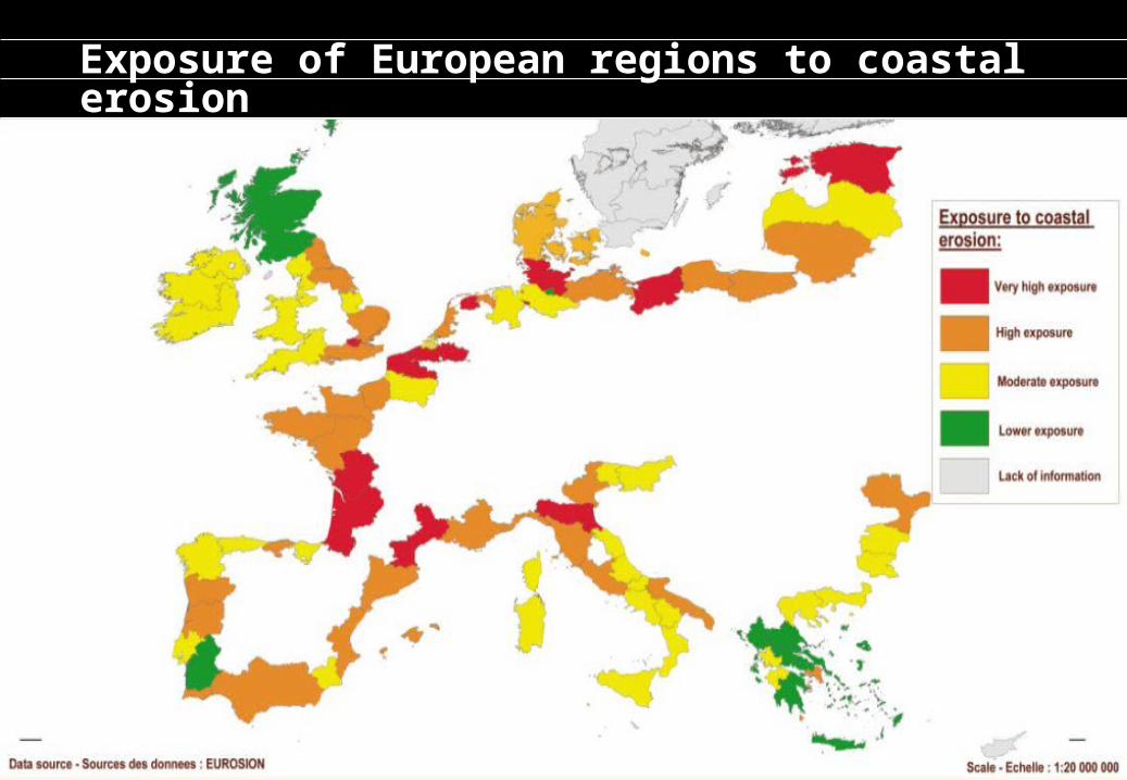
Exposure of European regions to coastal erosion
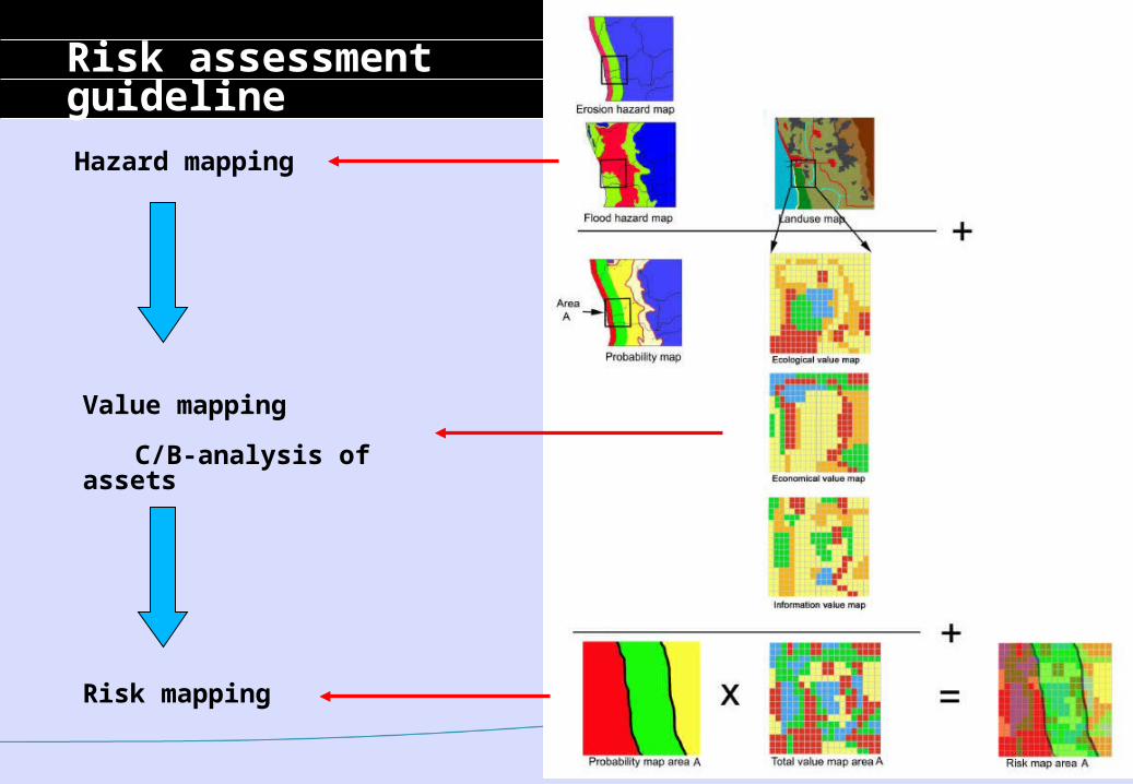
Risk assessmentguideline
Value mapping
C/B-analysis of assets
Hazard mapping
Risk mapping
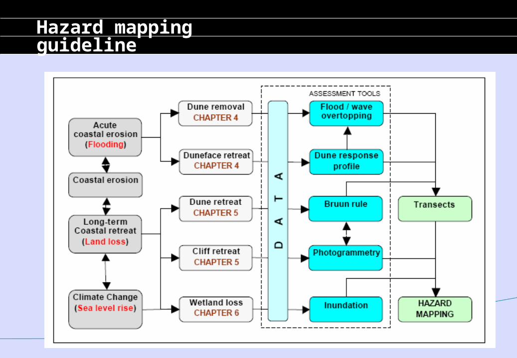
Hazard mappingguideline
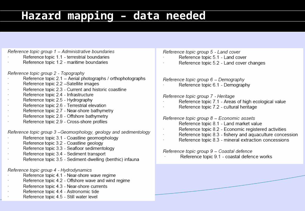
Hazard mapping – data needed
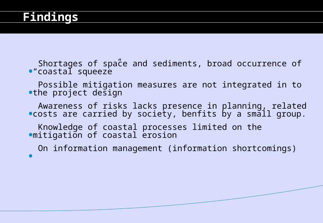
Findings
. Shortages of space and sediments, broad occurrence of “coastal squeeze”
. Possible mitigation measures are not integrated in to the project design
. Awareness of risks lacks presence in planning, related costs are carried by society, benfits by a small group.
. Knowledge of coastal processes limited on the mitigation of coastal erosion
. On information management (information shortcomings)
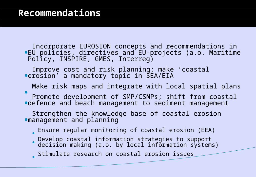
Recommendations
. Incorporate EUROSION concepts and recommendations in EU policies, directives and EU-projects (a.o. Maritime Policy, INSPIRE, GMES, Interreg)
. Improve cost and risk planning; make ‘coastal erosion’ a mandatory topic in SEA/EIA
. Make risk maps and integrate with local spatial plans
. Promote development of SMP/CSMPs; shift from coastal defence and beach management to sediment management
. Strengthen the knowledge base of coastal erosion management and planning
Ensure regular monitoring of coastal erosion (EEA) Develop coastal information strategies to support decision making (a.o. by local information systems) Stimulate research on coastal erosion issues
Conscience - objectives
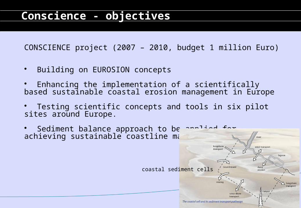
CONSCIENCE project (2007 – 2010, budget 1 million Euro)
Building on EUROSION concepts
Enhancing the implementation of a scientifically based sustainable coastal erosion management in Europe
Testing scientific concepts and tools in six pilot sites around Europe.
Sediment balance approach to be applied for achieving sustainable coastline management
coastal sediment cells

Conscience – pilot areas
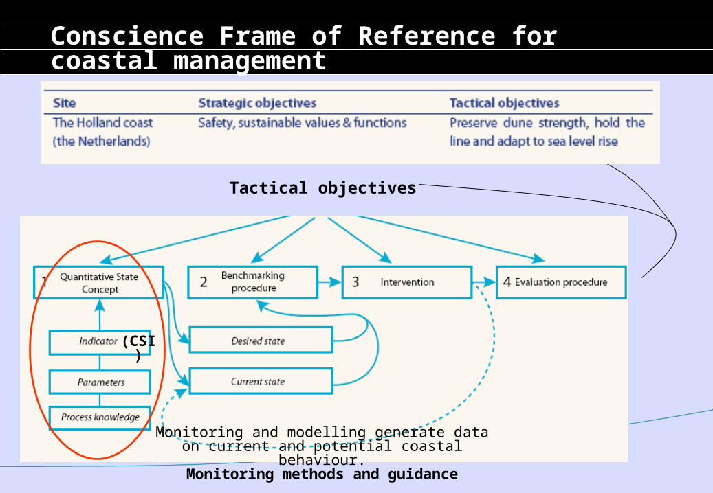
Strategic objectives
Tactical objectives
Monitoring and modelling generate dataon current and potential coastal behaviour.
Monitoring methods and guidance
Conscience Frame of Reference for coastal management
(CSI)
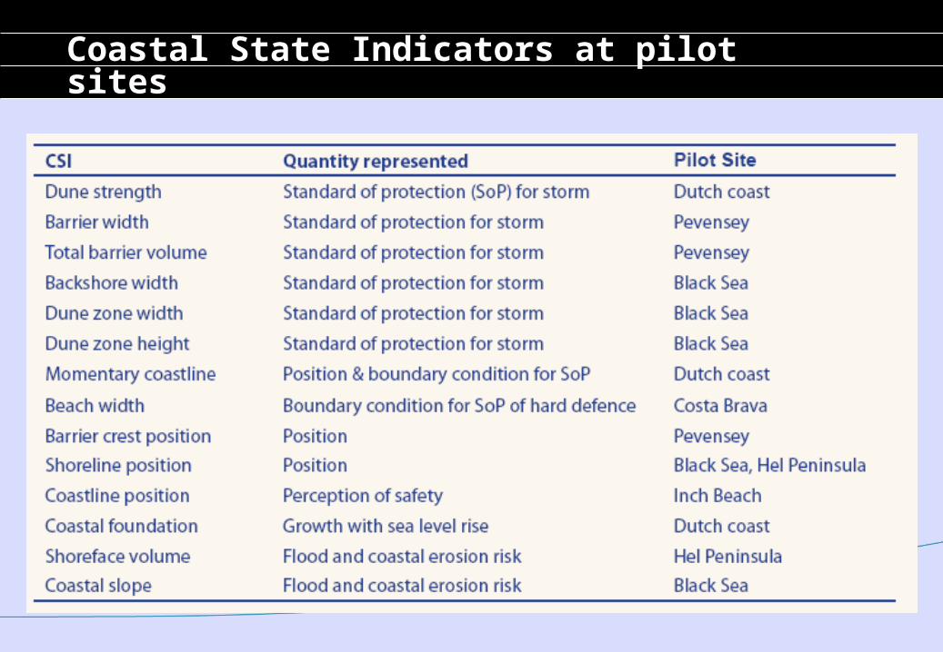
Coastal State Indicators at pilot sites
Conscience - conclusions
Frame of Reference:method for streamlining coastal erosion managementa guidance for applying the EUROSION concepts for making erosion management more sustainable
Coastal state indicators are often not monitored regularly and evaluations are seldom performed
Coastal state indicators are often not monitored regularly and evaluations are seldom performed. This hampers an effective and sustainable solution to the problem
EUROSION recommendations have not yet been implemented at EU and National levels