Embed Size (px)
DESCRIPTION
GIS Data Models. Vector Data Models Vector File Formats Raster Data Models Raster File Formats. Data Abstraction. To use GIS the real world must be abstracted into points, lines, polygons, raster cells, and attribute values - PowerPoint PPT Presentation
Citation preview
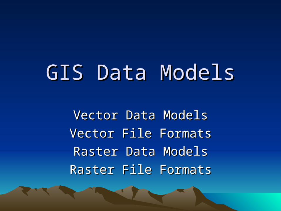
GIS Data ModelsGIS Data Models
Vector Data ModelsVector Data Models
Vector File FormatsVector File Formats
Raster Data ModelsRaster Data Models
Raster File FormatsRaster File Formats
Data AbstractionData Abstraction
• To use GIS the real world must be abstracted into points, lines, polygons, raster cells, and attribute values
• Class examples may use common object that most people will understand. If you understand how to abstract common objects you will be able to apply the same method to object in your field
What is Vector DataWhat is Vector Data
• Vector Data uses Points and their (X,Y) coordinates to represent spatial features
• Points, Lines and Polygons
PointsPoints
• A point is a 0 dimensional object and has only the property of location (x,y)
• Points can be used to Model features such as a well, building, power, pole, sample location ect.
• Other name for a point are vertex, node, 0-cell
LinesLines
• A line is a one-dimensional object that has the property of length
• Lines can be used to represent road, streams, faults, dikes, maker beds, boundary, contacts etc.
• Lines are also called an edge, link, chain, arc, 1-cell
• In an ArcInfo coverage an arc starts with a node, has zero or more vertices, and ends with a node
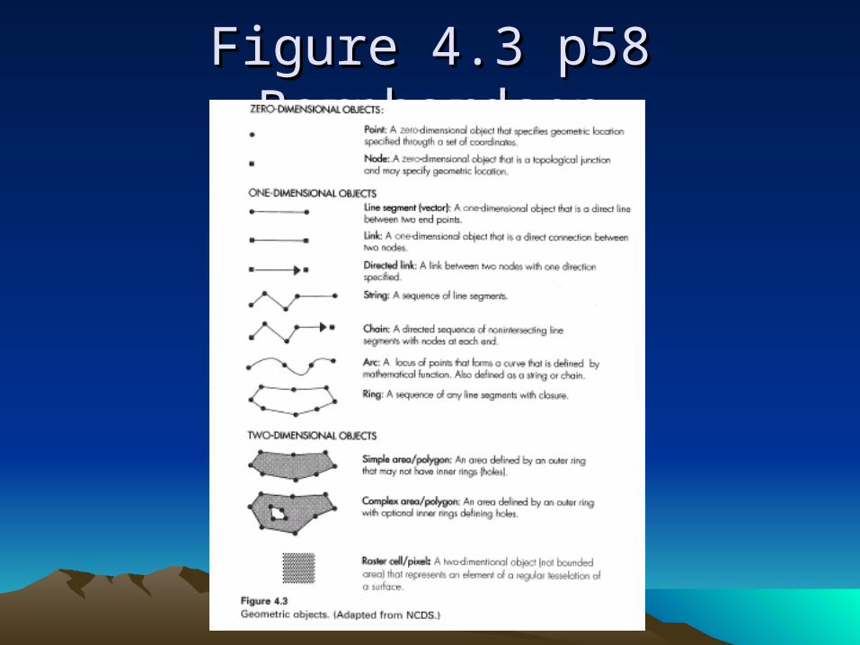
Figure 4.3 p58 BernhardsenFigure 4.3 p58 Bernhardsen
PolygonsPolygons
• A polygon is a two-dimensional object with properties of area and perimeter
• A polygon can represent a city, geologic formation, dike, lake, river, ect.
• Other name for polygons face, zone 2-cell
• Scale matters
Data Abstraction DiscussionData Abstraction Discussion
• If you do not understand this the rest of GIS will not make sense
• Scale Matters
• Intended use Matters
ExamplesExamples
• Trees
• Dikes
• Roads
• Rivers
TopologyTopology
• A set of rules on how objects relate to each other
• Major difference in file formats
• Higher level objects have special topology rules
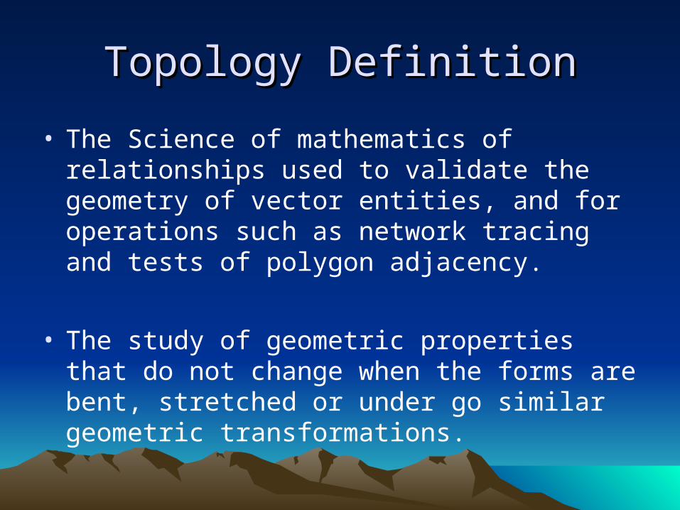
Topology DefinitionTopology Definition
• The Science of mathematics of relationships used to validate the geometry of vector entities, and for operations such as network tracing and tests of polygon adjacency.
• The study of geometric properties that do not change when the forms are bent, stretched or under go similar geometric transformations.
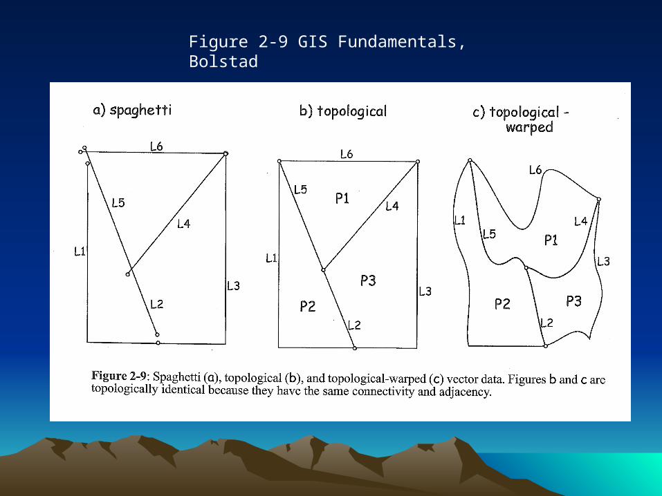
Figure 2-9 GIS Fundamentals, Bolstad
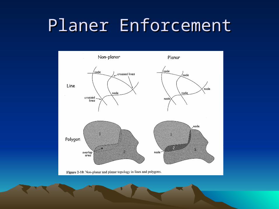
Planer EnforcementPlaner Enforcement
Why Topology MattersWhy Topology Matters
• Error Detection
open polygons
unlabeled polygons
slivers
polygons that cannot exist next to each
other
• Network Modeling
Show PlacitasShow Placitas
• Arc Node Topology– Cover#– Lpoly# and Rpoly#– Tnode fnode
• Label errors
Higher Level ObjectHigher Level Object
• Regions
• Networks
• TIN – Triangulated irregular network
• Dynamic Segmentation
RegionsRegions
Overlapping areas with different attributes
Fire history
Disconnected areas with the same attributes
Hawaii
NetworksNetworks
• Road systems, power grids, water supply sewerage systems, drainage network
• Continuous connected networks
• Rules for displacement in a network
• Attribute value accumulations due to displacements
TINTIN
• Vector Surface Model
• Triangulated Irregular Network
• A set of nonoverlapping triangles each with a constant gradient
• A TIN can honor original input elevations
Dynamic SegmentationDynamic Segmentation
• Combines a line coverage with a linear reference system
• Has event tables for point events and linear events

Fig 3.13 p52 ChangFig 3.13 p52 Chang
Examples and DemoExamples and Demo
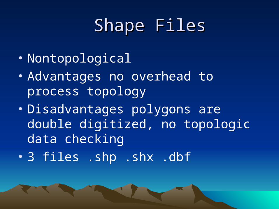
Shape FilesShape Files
• Nontopological
• Advantages no overhead to process topology
• Disadvantages polygons are double digitized, no topologic data checking
• 3 files .shp .shx .dbf
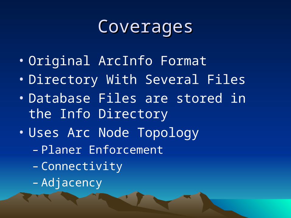
CoveragesCoverages
• Original ArcInfo Format
• Directory With Several Files
• Database Files are stored in the Info Directory
• Uses Arc Node Topology– Planer Enforcement– Connectivity– Adjacency
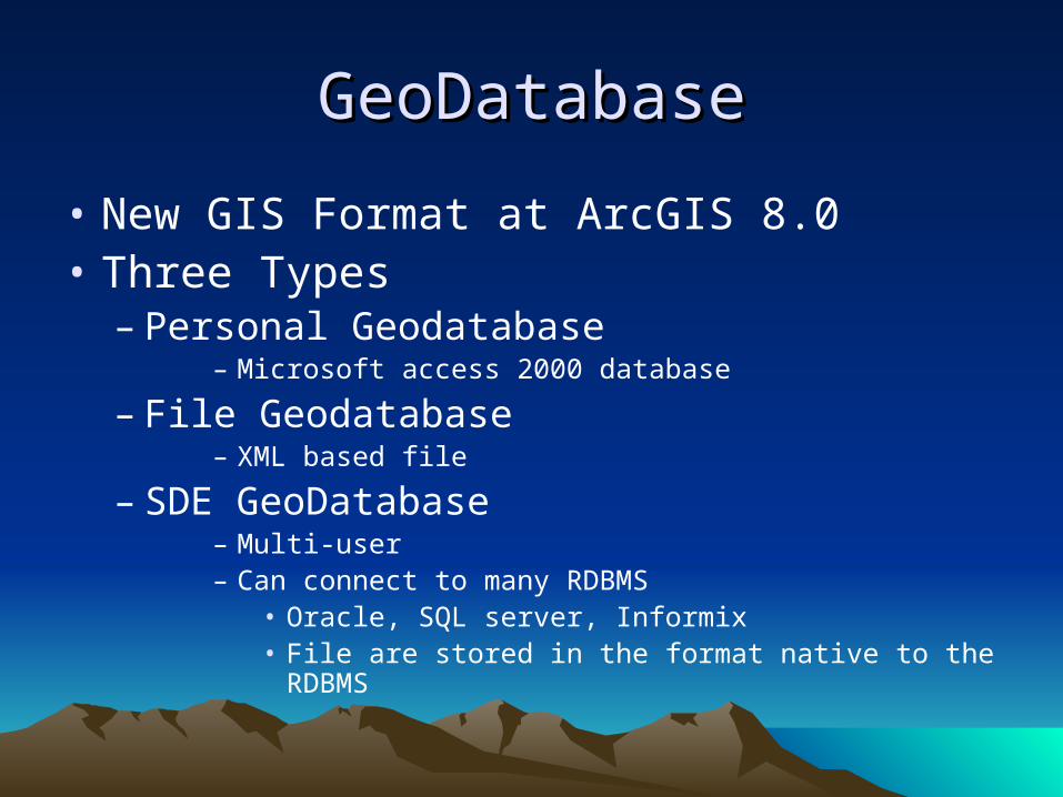
GeoDatabaseGeoDatabase
• New GIS Format at ArcGIS 8.0• Three Types
– Personal Geodatabase– Microsoft access 2000 database
– File Geodatabase– XML based file
– SDE GeoDatabase– Multi-user– Can connect to many RDBMS
• Oracle, SQL server, Informix• File are stored in the format native to the RDBMS
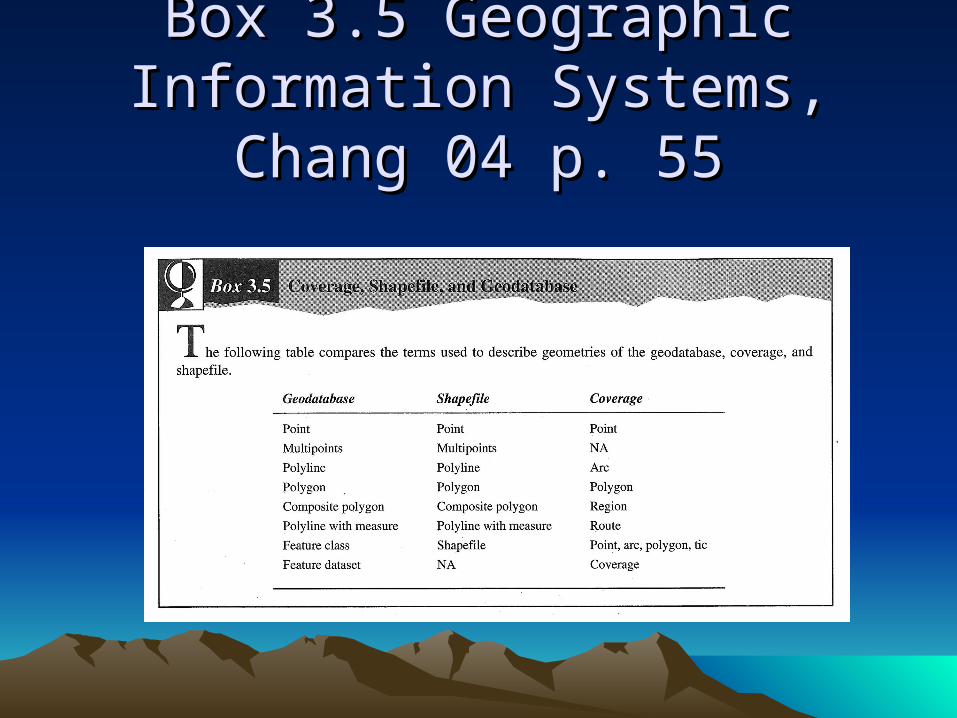
Box 3.5 Geographic Information Box 3.5 Geographic Information Systems, Chang 04 p. 55Systems, Chang 04 p. 55
GeoDatabaseGeoDatabase
• Shapes are similar to shape files
• Object-oriented model not a Geo-relational
• There are 26 topology rules than can be used to relate different layers
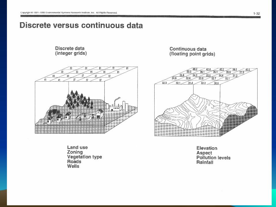
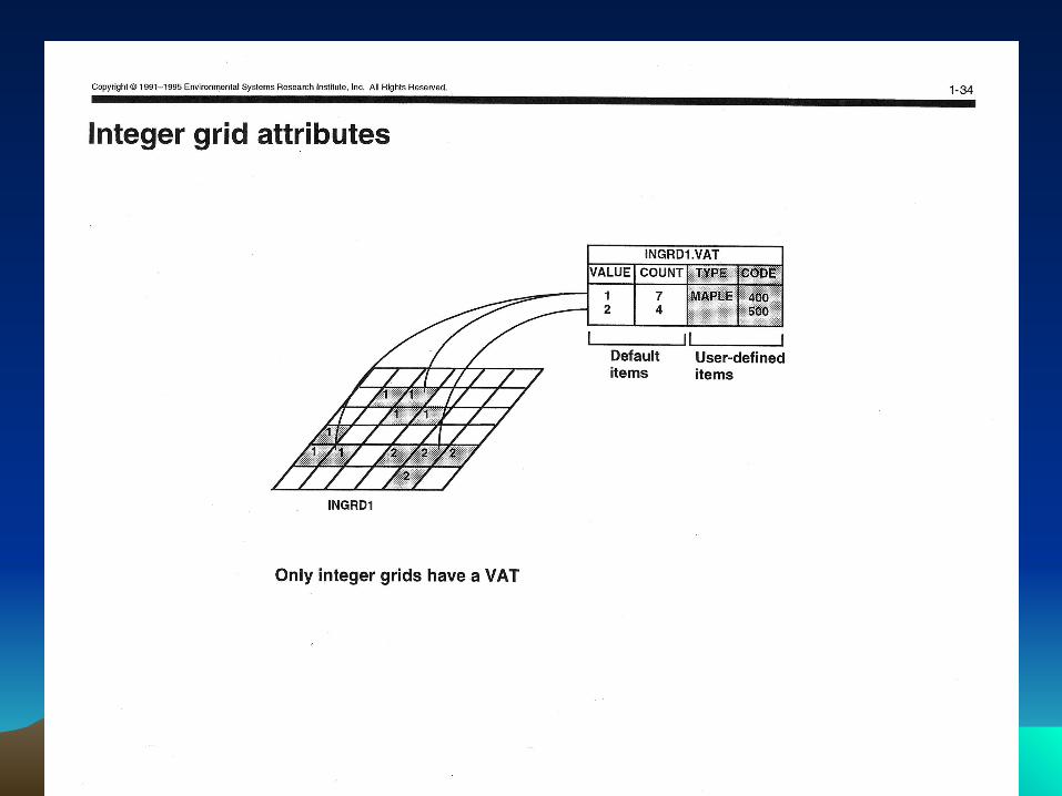
Raster Data ModelRaster Data Model
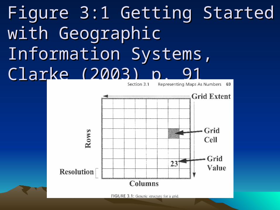
Figure 3:1 Getting Started with Figure 3:1 Getting Started with Geographic Information Systems, Geographic Information Systems, Clarke (2003) p. 91Clarke (2003) p. 91
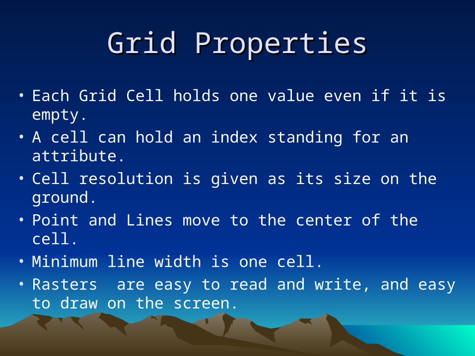
Grid PropertiesGrid Properties
• Each Grid Cell holds one value even if it is empty.• A cell can hold an index standing for an attribute.• Cell resolution is given as its size on the ground.• Point and Lines move to the center of the cell.• Minimum line width is one cell.• Rasters are easy to read and write, and easy to
draw on the screen.
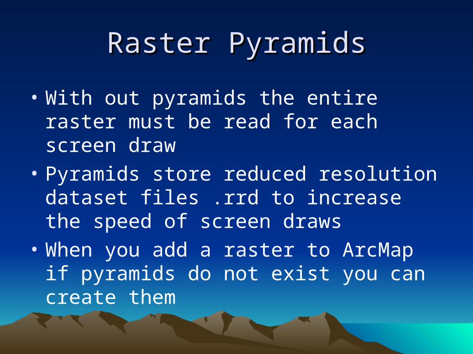
Raster PyramidsRaster Pyramids
• With out pyramids the entire raster must be read for each screen draw
• Pyramids store reduced resolution dataset files .rrd to increase the speed of screen draws
• When you add a raster to ArcMap if pyramids do not exist you can create them
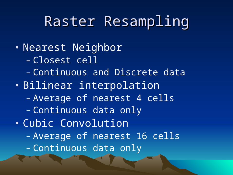
Raster ResamplingRaster Resampling
• Nearest Neighbor– Closest cell– Continuous and Discrete data
• Bilinear interpolation– Average of nearest 4 cells– Continuous data only
• Cubic Convolution– Average of nearest 16 cells– Continuous data only
Quad Tree CompressionQuad Tree Compression
• May be use to get variable resolution for imagery in the National Map
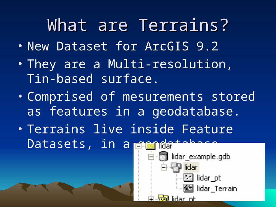
What are Terrains?What are Terrains?• New Dataset for ArcGIS 9.2
• They are a Multi-resolution, Tin-based surface.
• Comprised of mesurements stored as features in a geodatabase.
• Terrains live inside Feature Datasets, in a geodatabase.
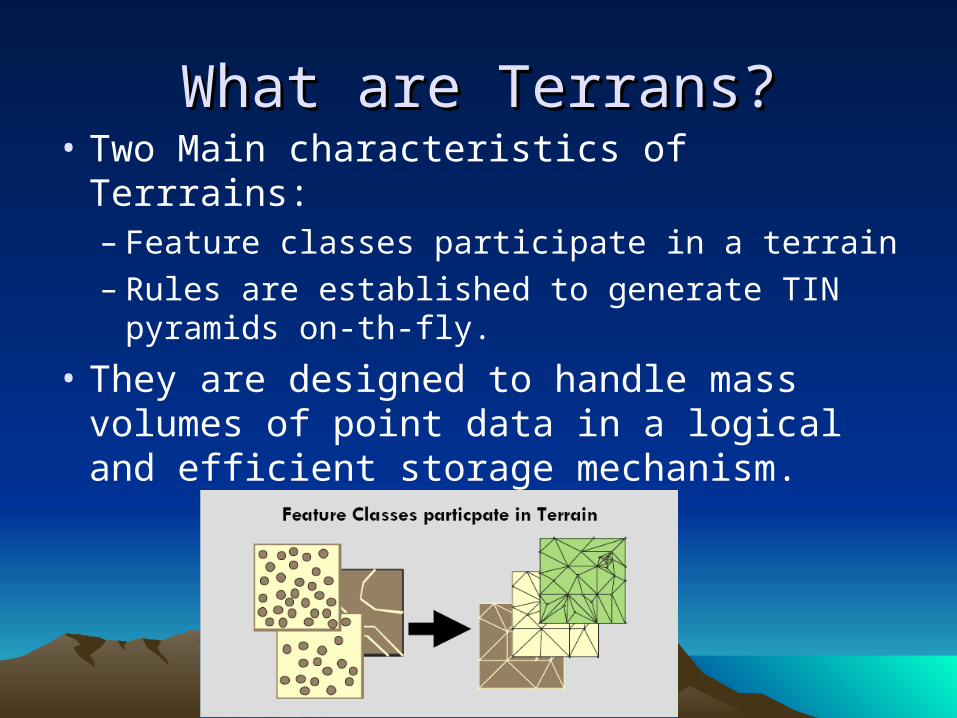
What are Terrans?What are Terrans?• Two Main characteristics of Terrrains:
– Feature classes participate in a terrain– Rules are established to generate TIN
pyramids on-th-fly.
• They are designed to handle mass volumes of point data in a logical and efficient storage mechanism.
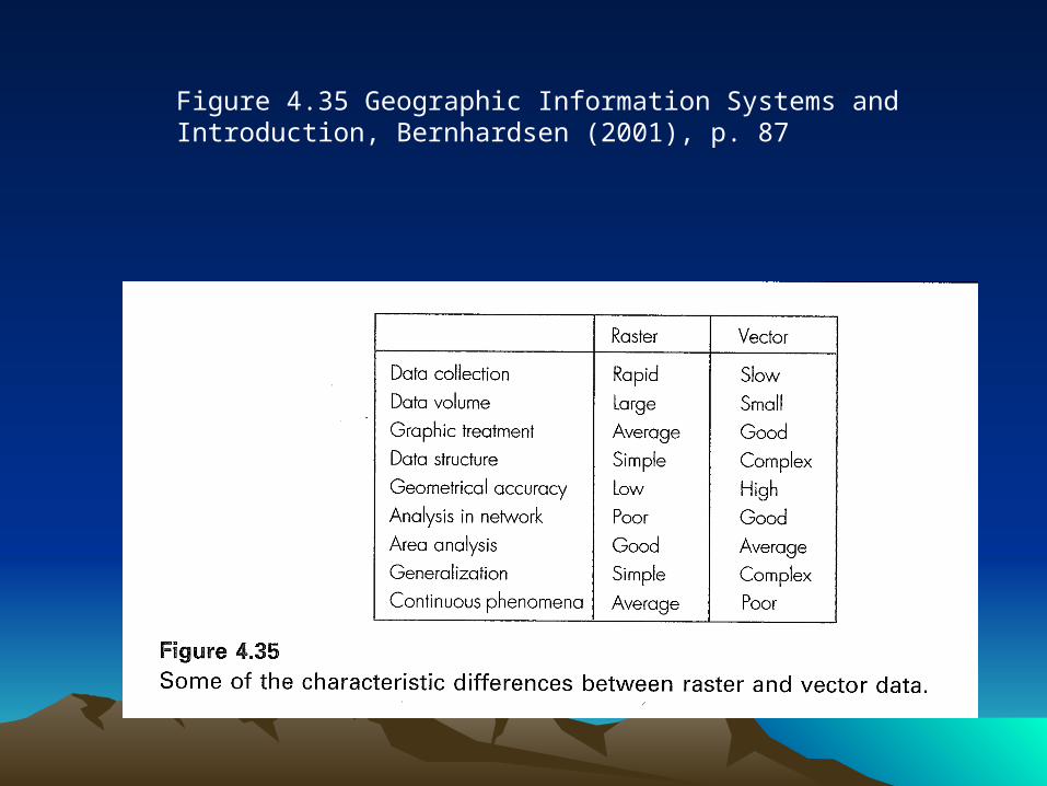
Figure 4.35 Geographic Information Systems and Introduction, Bernhardsen (2001), p. 87
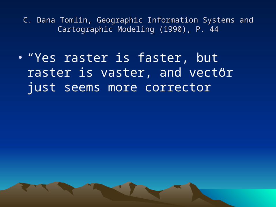
C. Dana Tomlin, Geographic Information Systems and Cartographic C. Dana Tomlin, Geographic Information Systems and Cartographic Modeling (1990), P. 44Modeling (1990), P. 44
• “Yes raster is faster, but raster is vaster, and vector just seems more corrector”
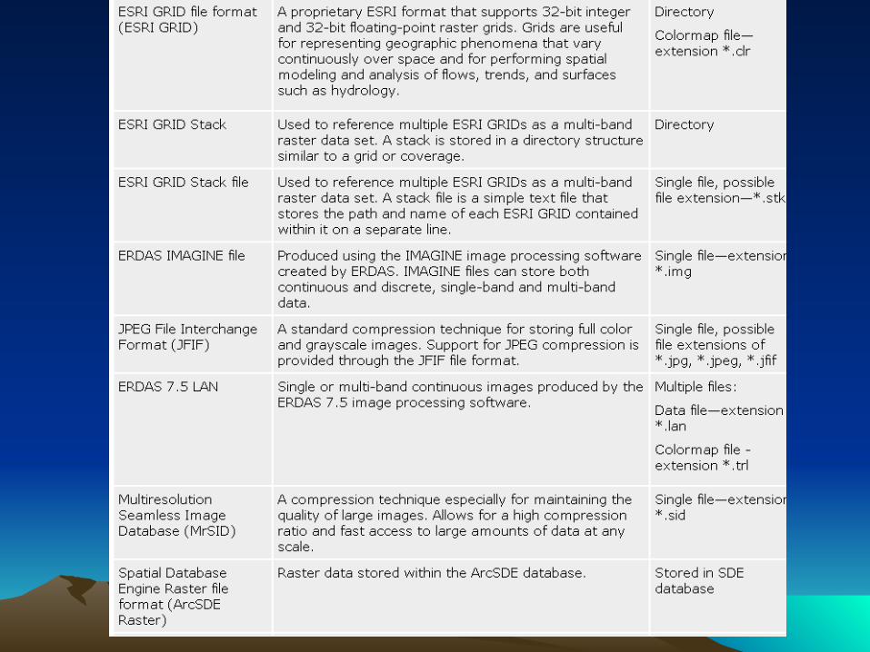
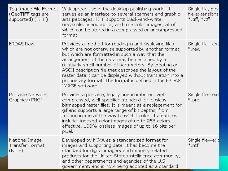
Images are a form of raster dataImages are a form of raster data
• ArcGIS can use many common image formats

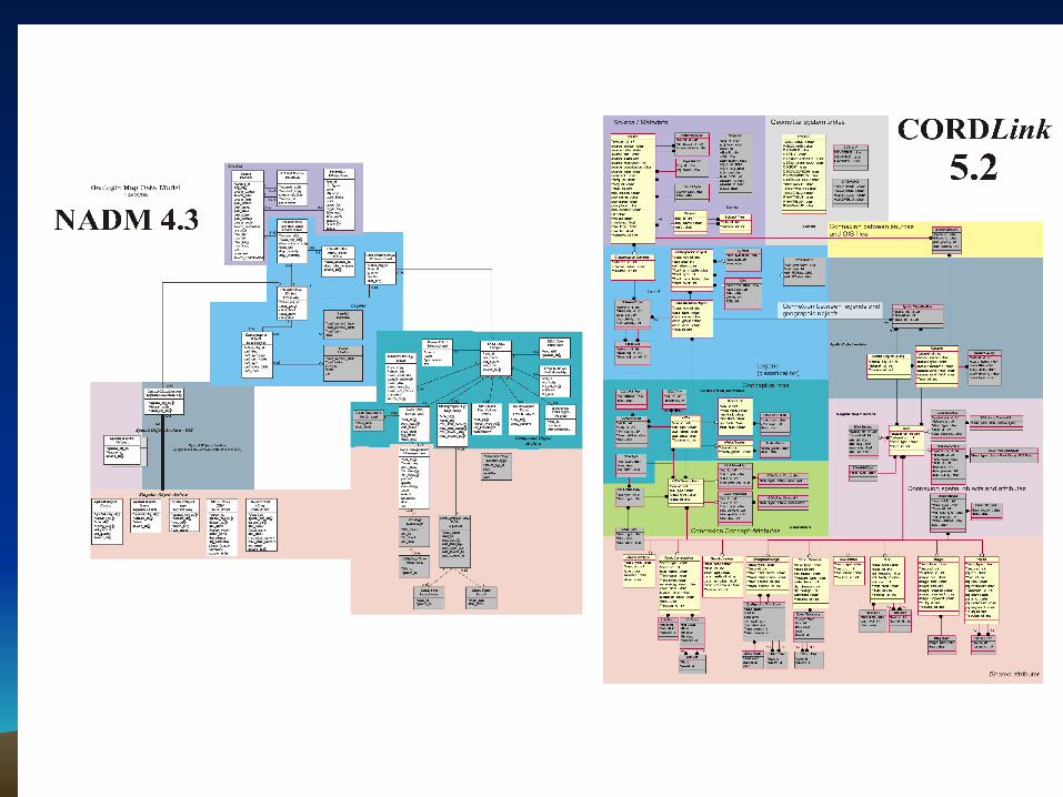
Industry Standard Data ModelsIndustry Standard Data Models
• Some Industries have created standard data models
• It is a good idea to use a standard model to promote sharing of data
• Some data models can be very complex
• Complex models require custom tools to be useful
ReferencesReferences
• Getting Started with Geographic Information Systems 4th Edition, Clark (2003)
• Geographic Information Systems an Introduction 3rd Edition, Bernhardsen (2002)
• Introduction to Geographic Information Systems 2nd Edition, Chang (2004)
• GIS Fundamentals, Bolstad (2002)• ArcGIS 8.3 Desktop Help• Using GRID with ArcInfo version 7 ESRI