Embed Size (px)
Citation preview

PRIMITIVE NAVIGATION PROJECT
By Alper Can Yildirim
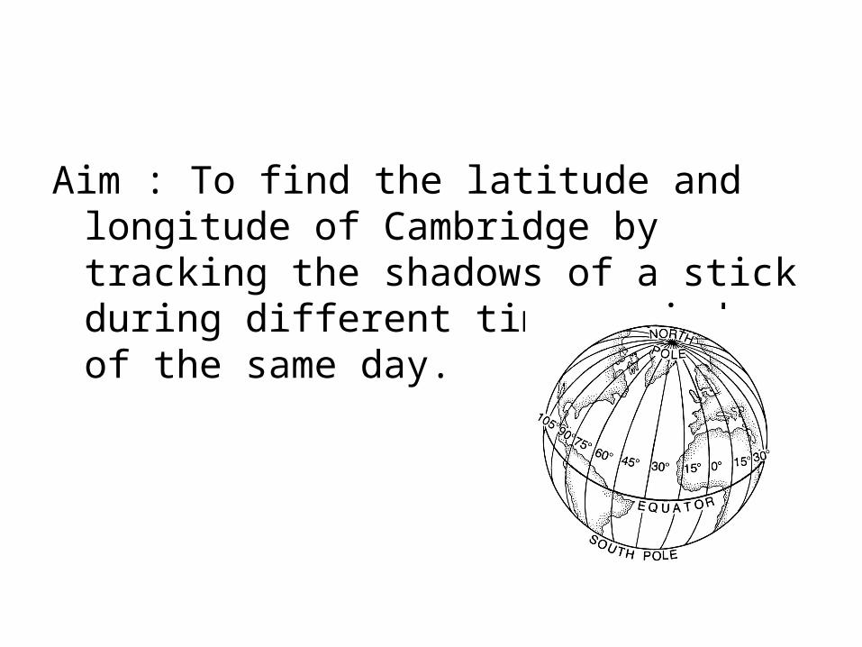
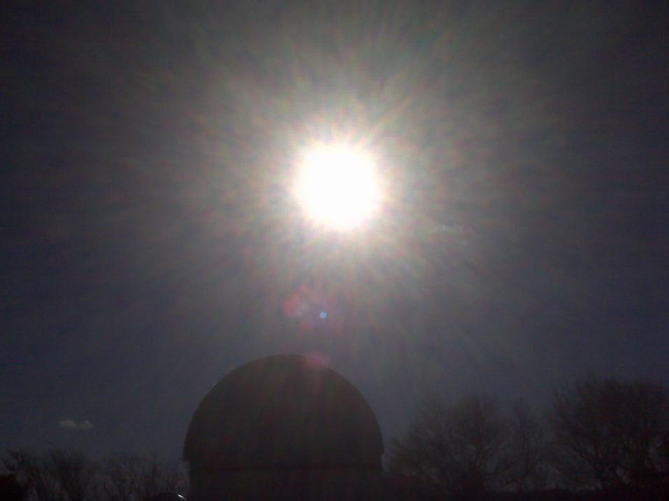
Aim : To find the latitude and longitude of Cambridge by tracking the shadows of a stick during different time periods of the same day.
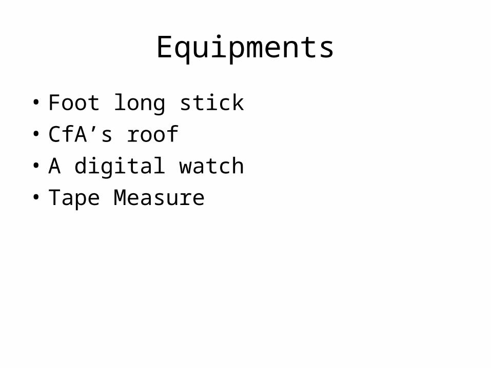
Equipments
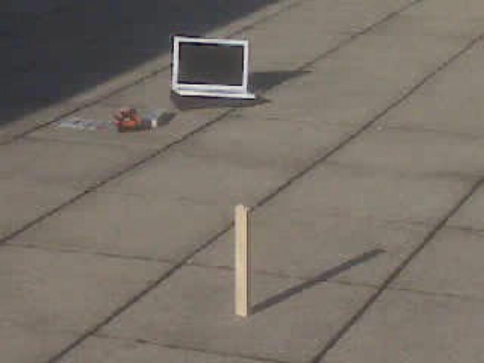
• Foot long stick• CfA’s roof• A digital watch• Tape Measure
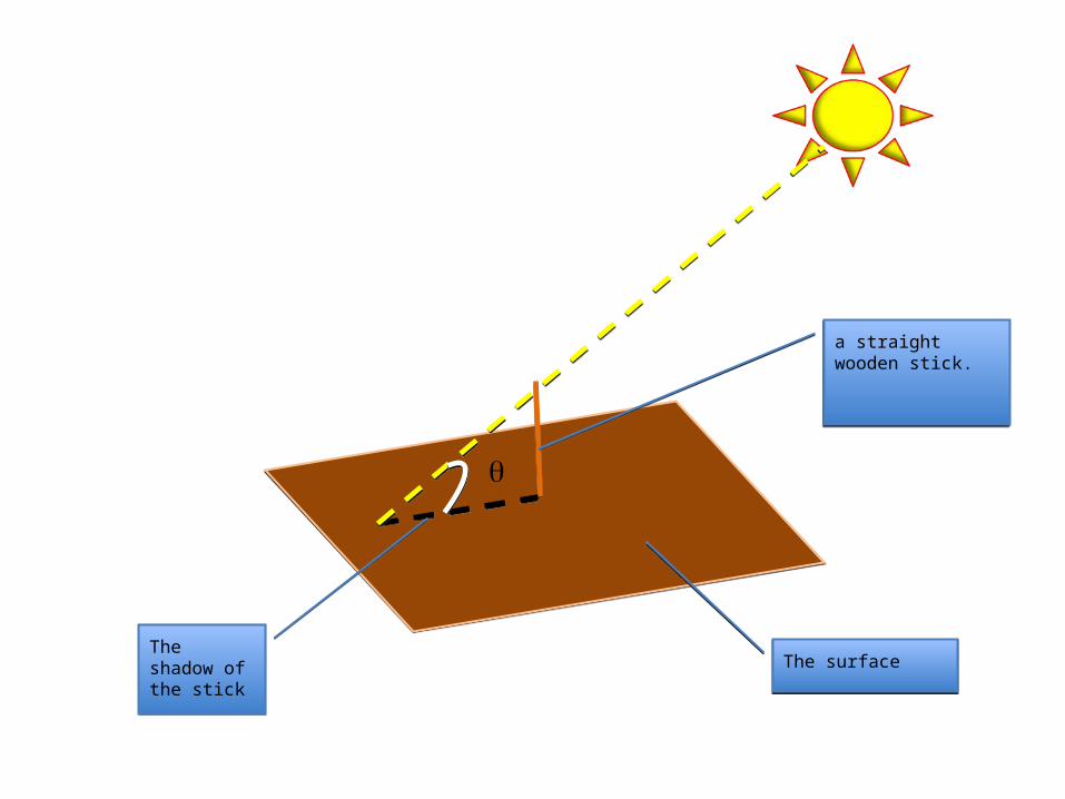
a straight wooden stick.a straight wooden stick.
The shadow of the stickThe shadow of the stick The surfaceThe surface

How do we calculate θ ?
tan θ = length of the stick / length of the shadow
So; θ = tan-1 ( Lstick / Lshadow)
tan θ = length of the stick / length of the shadow
So; θ = tan-1 ( Lstick / Lshadow)
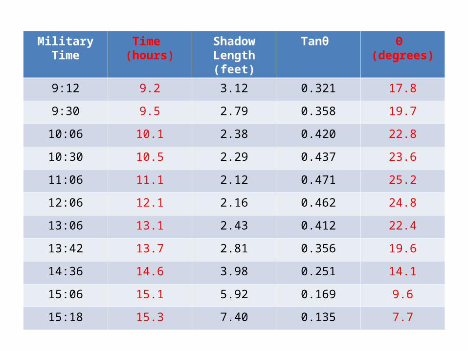
Military Time Time (hours)
Shadow Length(feet)
Tanθ Θ (degrees)
9:12 9.2 3.12 0.321 17.8
9:30 9.5 2.79 0.358 19.7
10:06 10.1 2.38 0.420 22.8
10:30 10.5 2.29 0.437 23.6
11:06 11.1 2.12 0.471 25.2
12:06 12.1 2.16 0.462 24.8
13:06 13.1 2.43 0.412 22.4
13:42 13.7 2.81 0.356 19.6
14:36 14.6 3.98 0.251 14.1
15:06 15.1 5.92 0.169 9.6
15:18 15.3 7.40 0.135 7.7
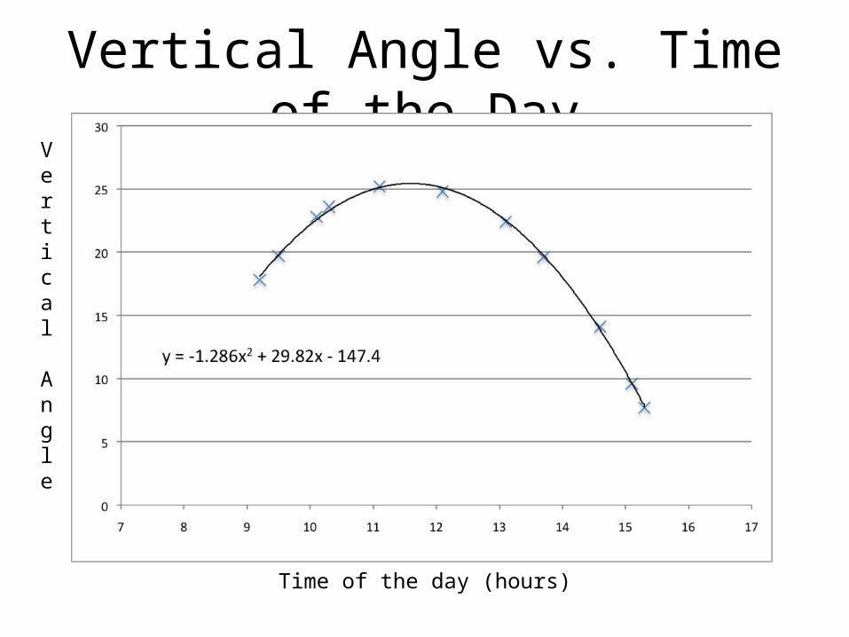
Vertical Angle vs. Time of the DayVertical Angle
Time of the day (hours)
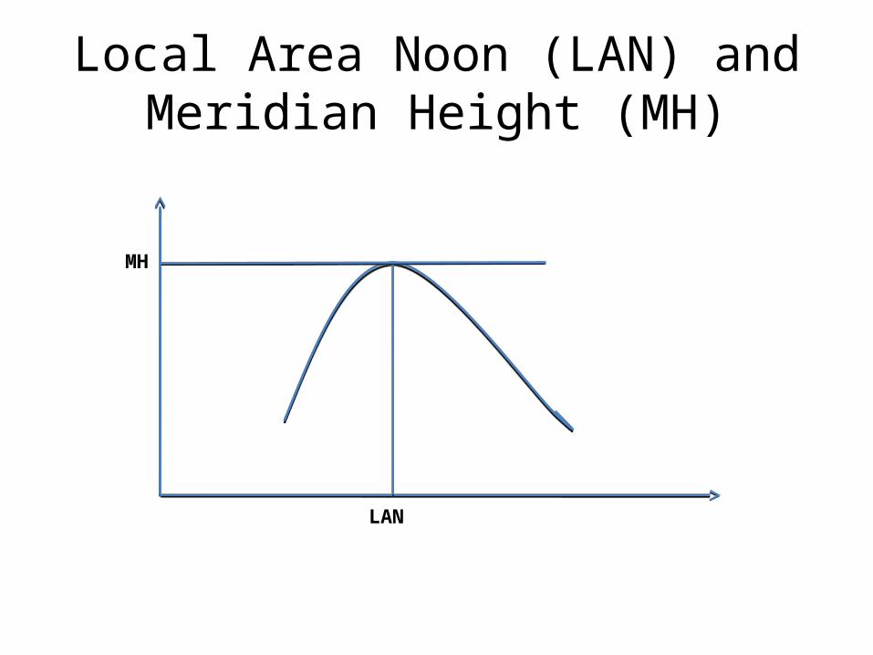
Local Area Noon (LAN) and Meridian Height (MH)
LAN
MH
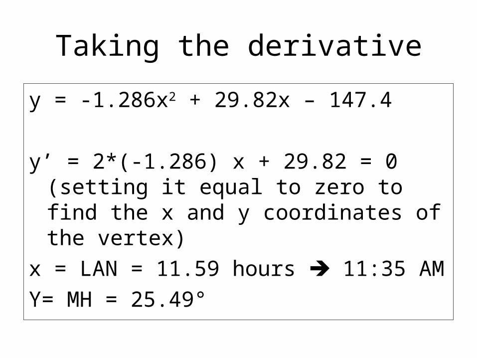
Taking the derivative
y = -1.286x2 + 29.82x – 147.4
y’ = 2*(-1.286) x + 29.82 = 0 (setting it equal to zero to find the x and y coordinates of the vertex)
x = LAN = 11.59 hours 11:35 AMY= MH = 25.49°
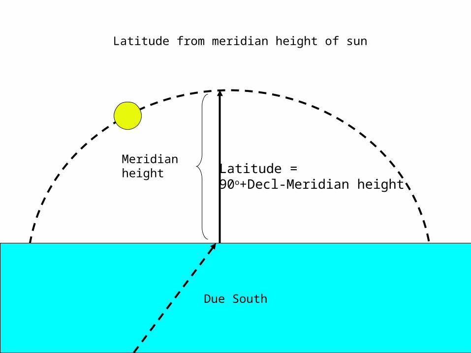
Due South
Latitude = 90o+Decl-Meridian height
Meridianheight
Latitude from meridian height of sun
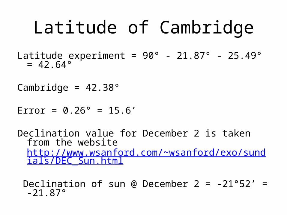
Latitude of CambridgeLatitude experiment = 90° - 21.87° - 25.49° = 42.64°
Cambridge = 42.38°
Error = 0.26° = 15.6’
Declination value for December 2 is taken from the website http://www.wsanford.com/~wsanford/exo/sundials/DEC_Sun.html
Declination of sun @ December 2 = -21°52’ = -21.87°
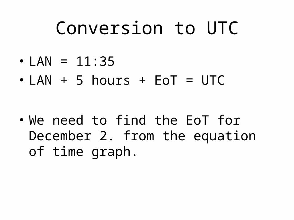
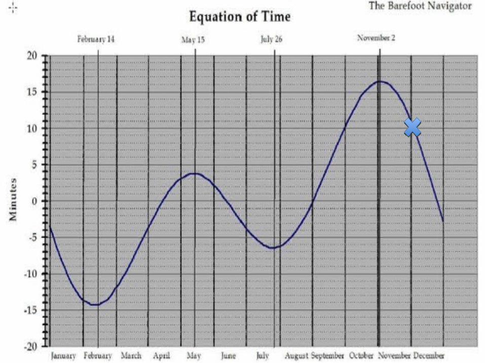
Conversion to UTC
• LAN = 11:35• LAN + 5 hours + EoT = UTC
• We need to find the EoT for December 2. from the equation of time graph.
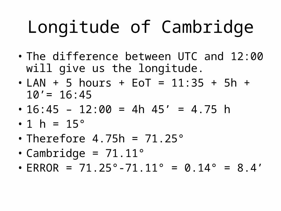
Longitude of Cambridge
• The difference between UTC and 12:00 will give us the longitude.
• LAN + 5 hours + EoT = 11:35 + 5h + 10’= 16:45• 16:45 – 12:00 = 4h 45’ = 4.75 h • 1 h = 15°• Therefore 4.75h = 71.25°• Cambridge = 71.11°• ERROR = 71.25°-71.11° = 0.14° = 8.4’