Embed Size (px)
Citation preview
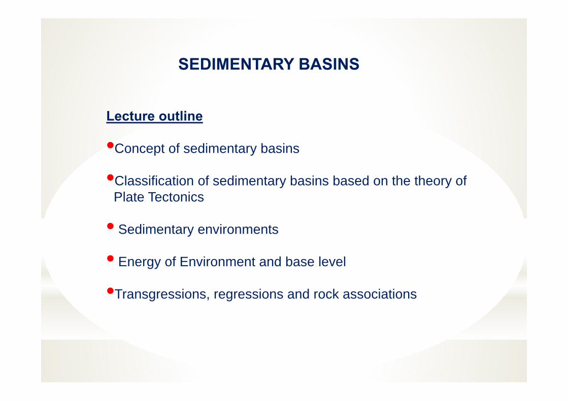
SEDIMENTARY BASINS
Lecture outline
•Concept of sedimentary basins
•Classification of sedimentary basins based on the theory ofPlate Tectonics
• Sedimentary environments
• Energy of Environment and base level
•Transgressions, regressions and rock associations
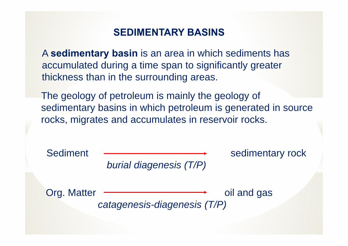
SEDIMENTARY BASINS
A sedimentary basin is an area in which sediments has accumulated during a time span to significantly greater thickness than in the surrounding areas.
The geology of petroleum is mainly the geology of sedimentary basins in which petroleum is generated in source rocks, migrates and accumulates in reservoir rocks.
Sediment sedimentary rockburial diagenesis (T/P)
Org. Matter oil and gascatagenesis-diagenesis (T/P)
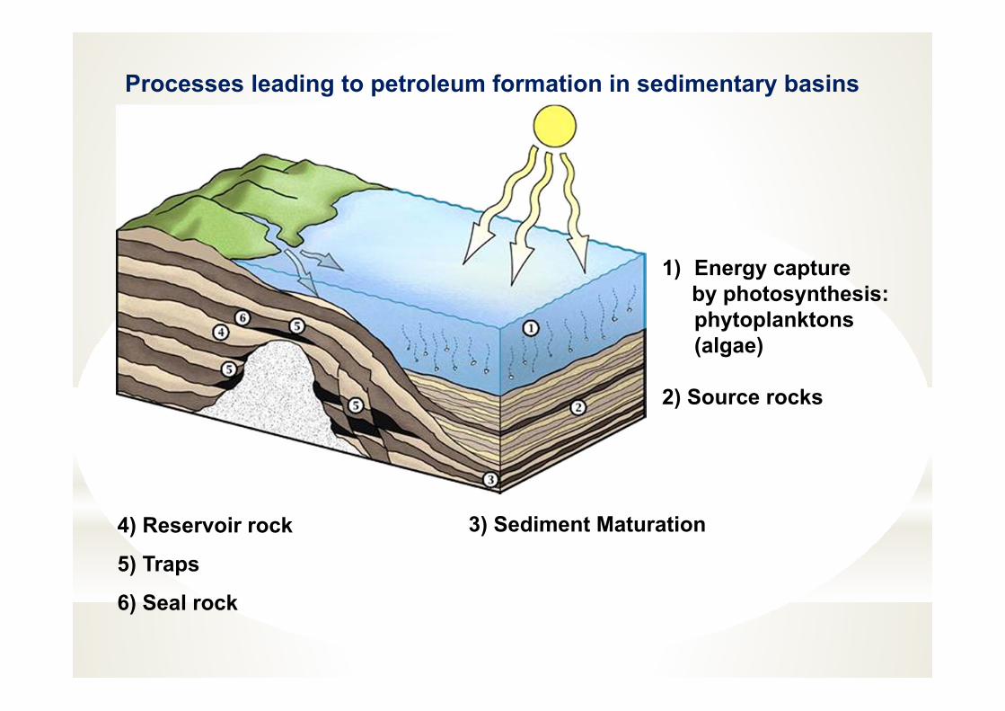
1) Energy captureby photosynthesis: phytoplanktons(algae)
2) Source rocks
3) Sediment Maturation4) Reservoir rock
5) Traps
6) Seal rock
Processes leading to petroleum formation in sedimentary basins
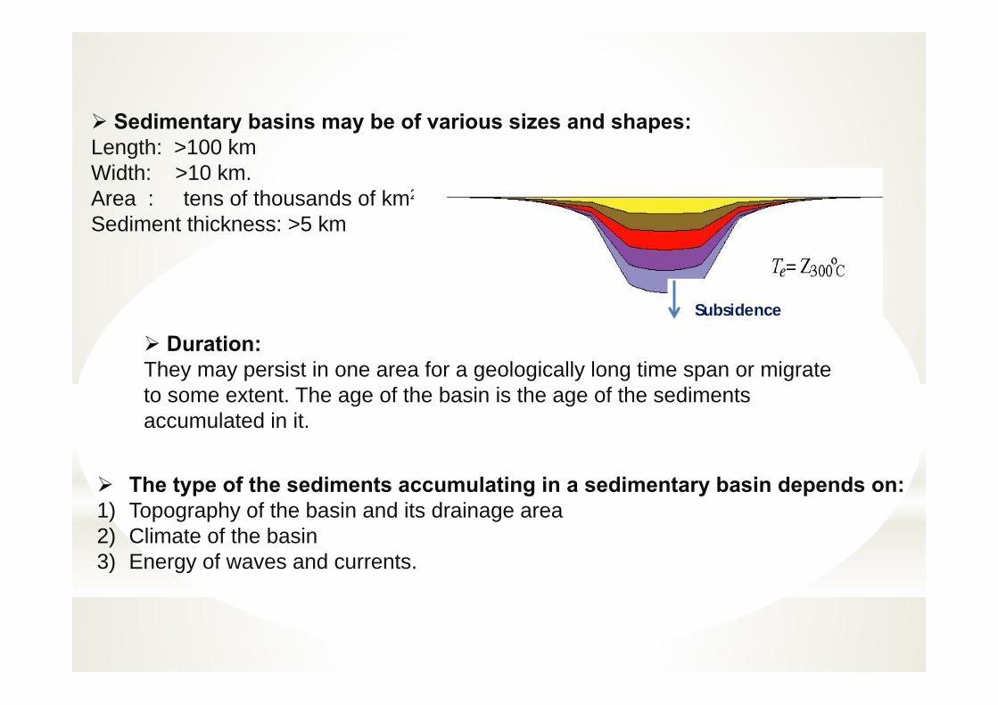
Sedimentary basins may be of various sizes and shapes:Length: >100 kmWidth: >10 km. Area : tens of thousands of km2
Sediment thickness: >5 km
Duration:They may persist in one area for a geologically long time span or migrate to some extent. The age of the basin is the age of the sediments accumulated in it.
The type of the sediments accumulating in a sedimentary basin depends on:1) Topography of the basin and its drainage area2) Climate of the basin3) Energy of waves and currents.
Subsidence
*Topographic/ Bathymetric
*Geological*Sites of Thick sediment
accumulation* (1000's of meters)
*Over Long Time Periods * (Ma--> millions of
years).
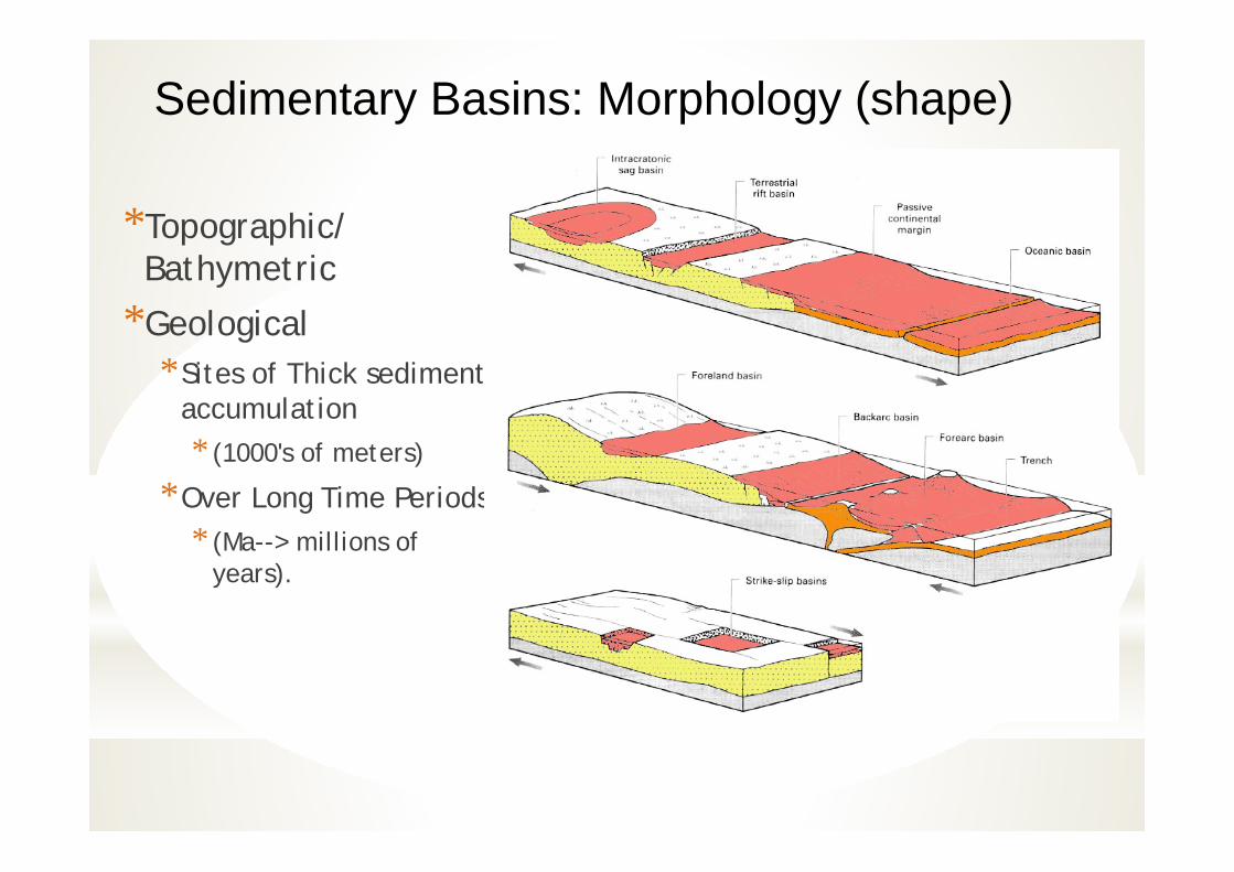
Sedimentary Basins: Morphology (shape)

Morphologically, two basins types: 1.circular (true basins) 2. elongated (trough).
The depocenter (area of greatest sediment accumulation) is not always the deepest part of the basin, but may frequently be a linear zone along the basinmargin.
For example, sediments accumulate to the greatest thikness near the edgeof the delta. Similarly in carbonate basins most sediment accumulate along theshelf margins. In many cases a depocenter may migrate across a basin, with or without the topographic axis.
Migrating depocentre
Unravelling the basin fill to understand the distribution of reservoirs, seals, and source rocks, requires understanding of basin formation processes
A sedimentary basin is defined as an area of thick sediment, with no reference to its topography.
A sedimentary basin may occur as part of a mountain chain, beneath a continental peneplain, or in an ocean.
Basins formed as a result of crustal thinning and rifting are of particularinterest to the Petroleum industry because they are an important habitatfor petroleum.
Sedimentary basins are regions of the Earth's crust dominatedby subsidence.
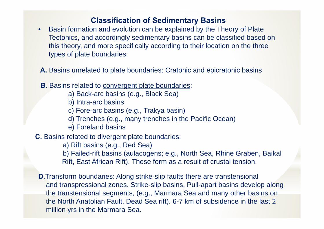
Classification of Sedimentary Basins• Basin formation and evolution can be explained by the Theory of Plate
Tectonics, and accordingly sedimentary basins can be classified based on this theory, and more specifically according to their location on the three types of plate boundaries:
D.Transform boundaries: Along strike-slip faults there are transtensionaland transpressional zones. Strike-slip basins, Pull-apart basins develop alongthe transtensional segments, (e.g., Marmara Sea and many other basins onthe North Anatolian Fault, Dead Sea rift). 6-7 km of subsidence in the last 2million yrs in the Marmara Sea.
A. Basins unrelated to plate boundaries: Cratonic and epicratonic basins
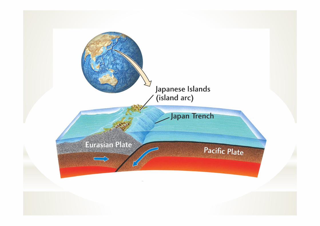
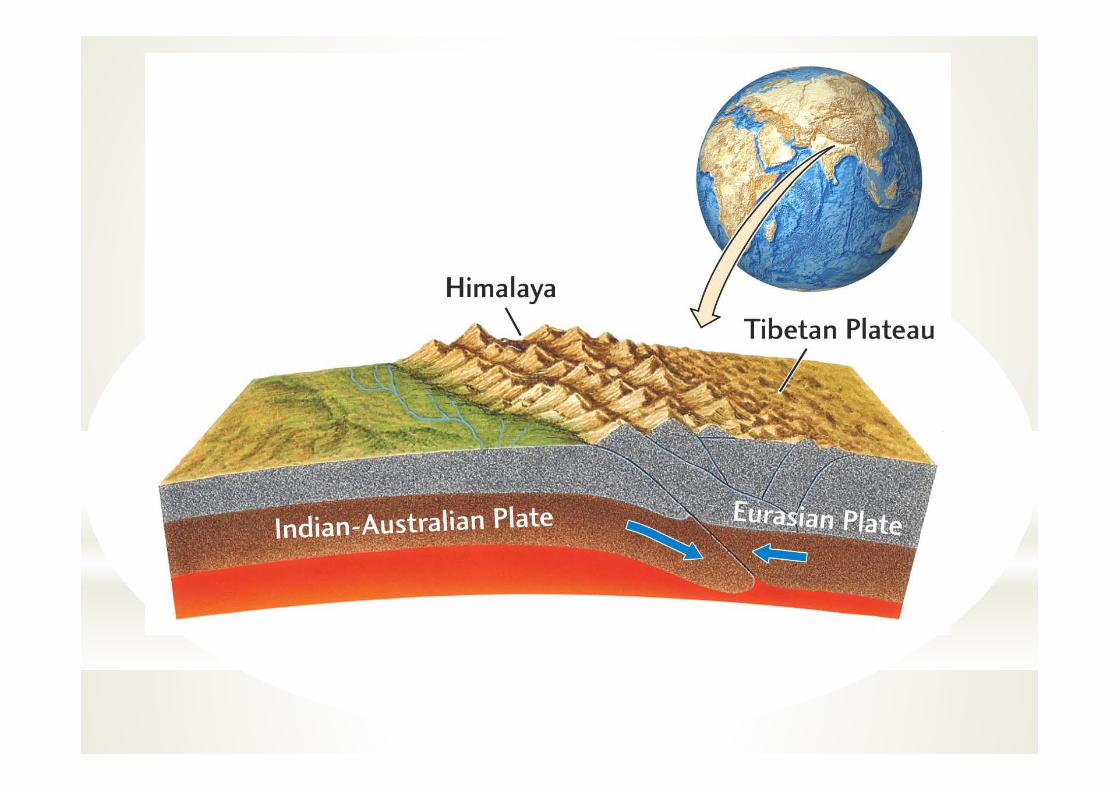
B. Basins related to convergent plate boundaries:a) Back-arc basins (e.g., Black Sea)b) Intra-arc basinsc) Fore-arc basins (e.g., Trakya basin)d) Trenches (e.g., many trenches in the Pacific Ocean)e) Foreland basins
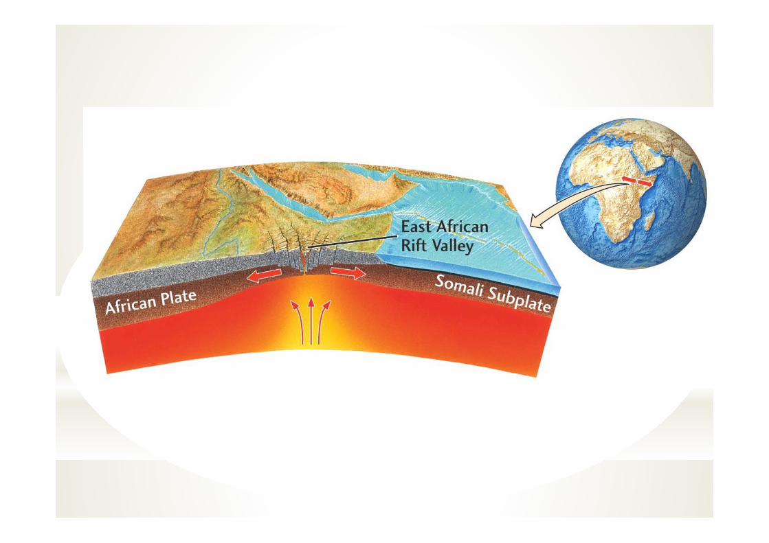
C. Basins related to divergent plate boundaries: a) Rift basins (e.g., Red Sea)b) Failed-rift basins (aulacogens; e.g., North Sea, Rhine Graben, BaikalRift, East African Rift). These form as a result of crustal tension.
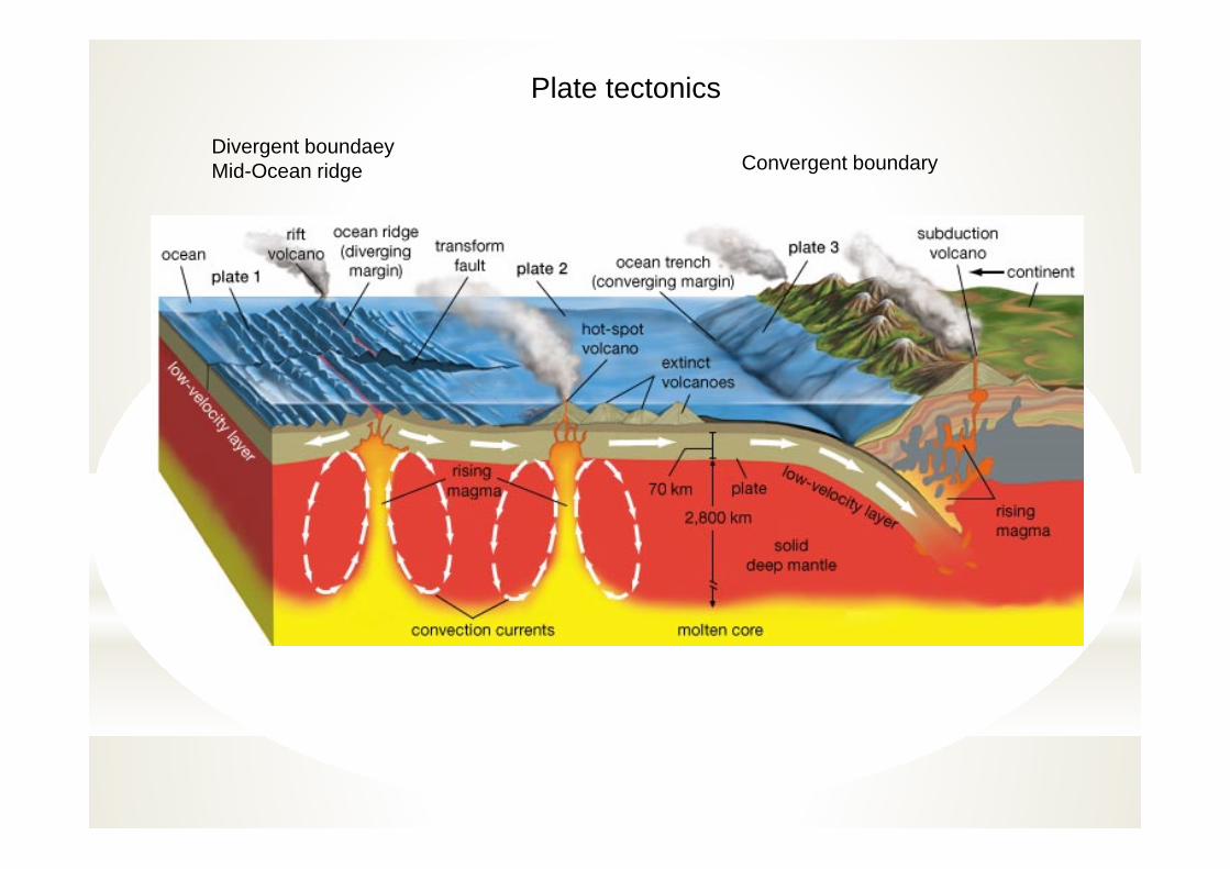
Plate tectonics
Divergent boundaeyMid-Ocean ridge Convergent boundary
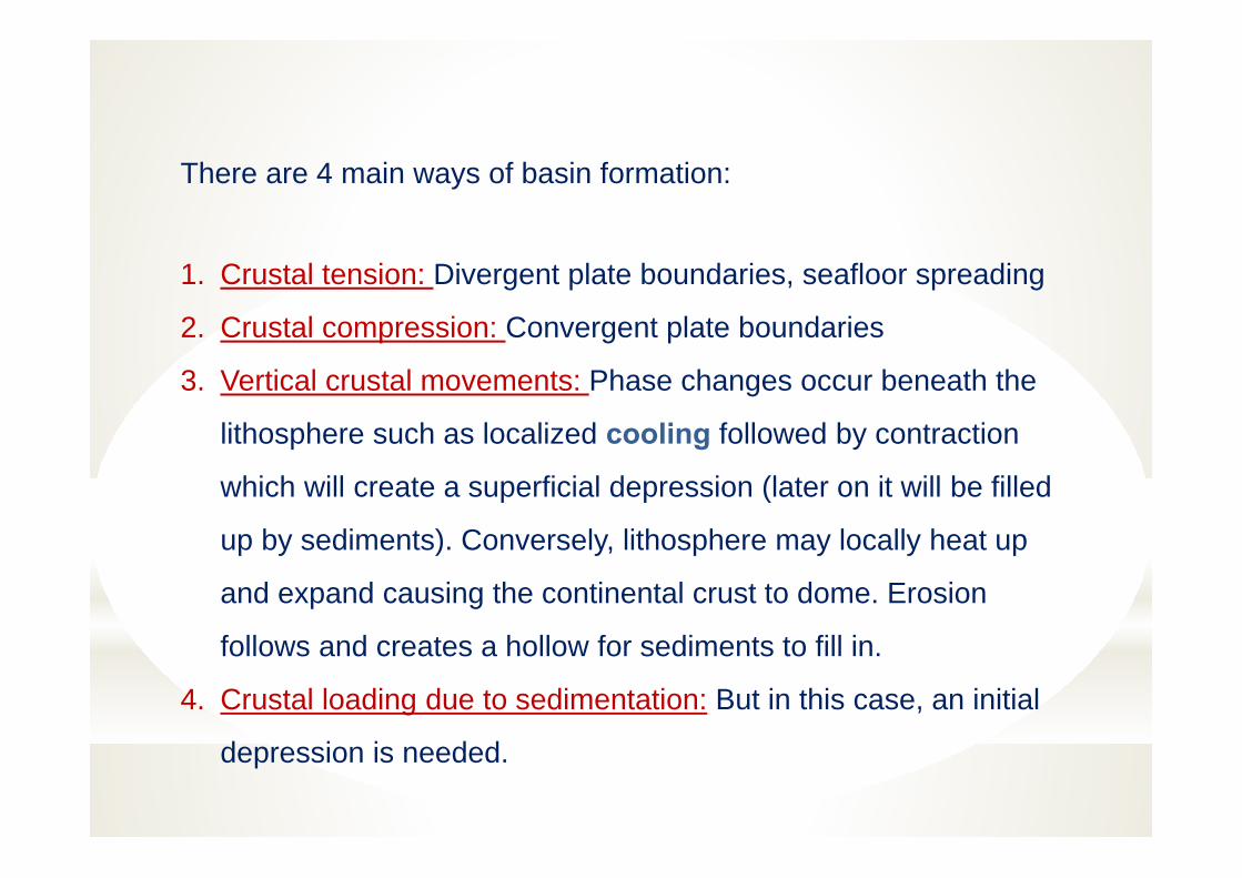
There are 4 main ways of basin formation:
1. Crustal tension: Divergent plate boundaries, seafloor spreading
2. Crustal compression: Convergent plate boundaries
3. Vertical crustal movements: Phase changes occur beneath the
lithosphere such as localized cooling followed by contraction
which will create a superficial depression (later on it will be filled
up by sediments). Conversely, lithosphere may locally heat up
and expand causing the continental crust to dome. Erosion
follows and creates a hollow for sediments to fill in.
4. Crustal loading due to sedimentation: But in this case, an initial
depression is needed.
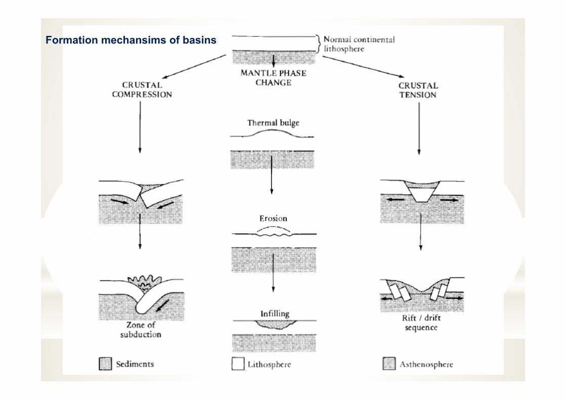
Formation mechansims of basins
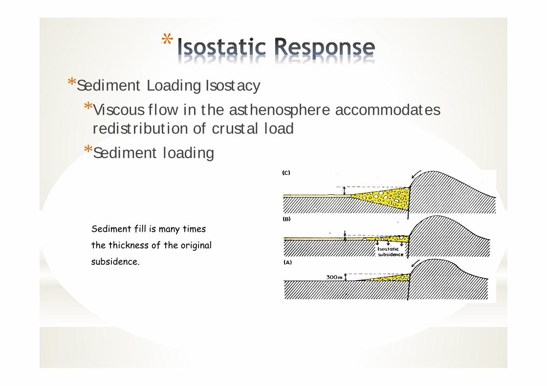
**Sediment Loading Isostacy
*Viscous flow in the asthenosphere accommodates redistribution of crustal load
*Sediment loading
Sediment fill is many times
the thickness of the original
subsidence.
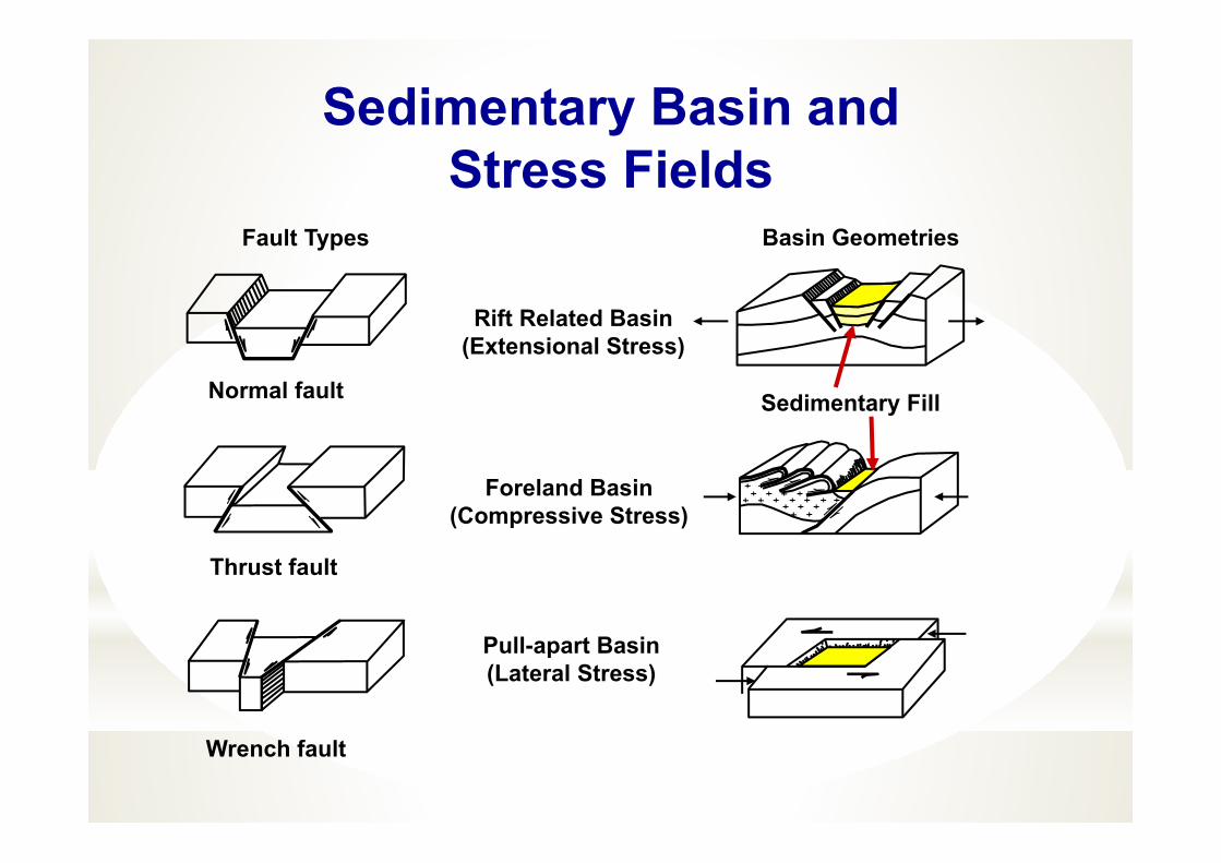
Wrench fault
Sedimentary Basin andStress Fields
Pull-apart Basin(Lateral Stress)
Normal fault
Thrust fault
Foreland Basin(Compressive Stress)
Rift Related Basin(Extensional Stress)
Fault Types Basin Geometries
Sedimentary Fill
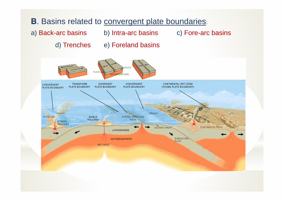
B. Basins related to convergent plate boundaries:
a) Back-arc basins b) Intra-arc basins c) Fore-arc basins
d) Trenches e) Foreland basins
INTRACRATONIC AND EPICRATONIC BASINS
This group of basins are not related to plate boundaries and occur over oldcrystalline crust, making up the cores of the continents.
b) Epicratonic basins: these occur as embayments on the edge of continental crust. E.g. Gulf Coast of USA, Niger delta, Sirte Basin of Libya.
a) Intracratonic basins: broad, shallow and round-shape (e.g., North Africanbasins, Williston and Michigan Basins)
Both intracratonic and epicratonic basins could include either siliciclastic-(shale-sandstone) or carbonate-dominated successions.
These different basin types are gradational into each other and a single basinmay be placed into more than one category.
Mechanism=Stretching and thinning of the continental lithosphere followed by
cooling and thermal contraction. This leads to slow subsidence.
MECHANISM OF FORMATION CRATONIC BASINS AND EPİCRATONİC BASINS
Cratonic basins are Intra-plate basins that are formed by Thermal/Isostatic/ Subsidence effects in the continental crust.
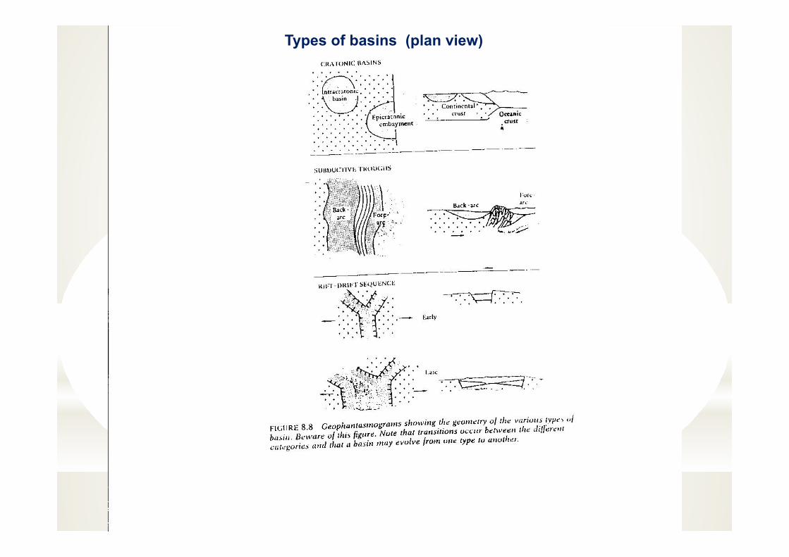
Types of basins (plan view)
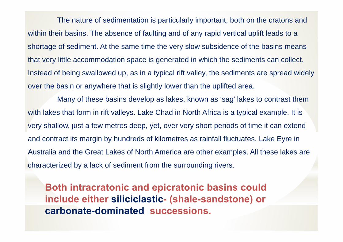
The nature of sedimentation is particularly important, both on the cratons and
within their basins. The absence of faulting and of any rapid vertical uplift leads to a
shortage of sediment. At the same time the very slow subsidence of the basins means
that very little accommodation space is generated in which the sediments can collect.
Instead of being swallowed up, as in a typical rift valley, the sediments are spread widely
over the basin or anywhere that is slightly lower than the uplifted area.
Many of these basins develop as lakes, known as ‘sag’ lakes to contrast them
with lakes that form in rift valleys. Lake Chad in North Africa is a typical example. It is
very shallow, just a few metres deep, yet, over very short periods of time it can extend
and contract its margin by hundreds of kilometres as rainfall fluctuates. Lake Eyre in
Australia and the Great Lakes of North America are other examples. All these lakes are
characterized by a lack of sediment from the surrounding rivers.
Both intracratonic and epicratonic basins could include either siliciclastic- (shale-sandstone) or carbonate-dominated successions.
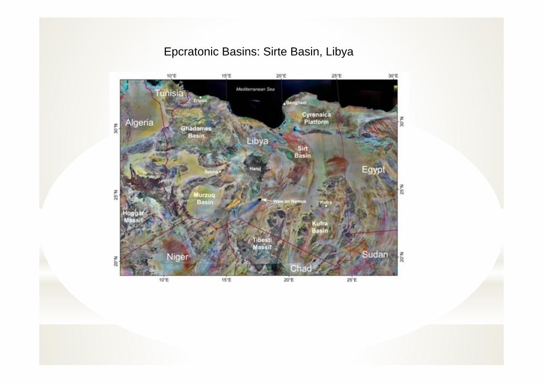
Epcratonic Basins: Sirte Basin, Libya
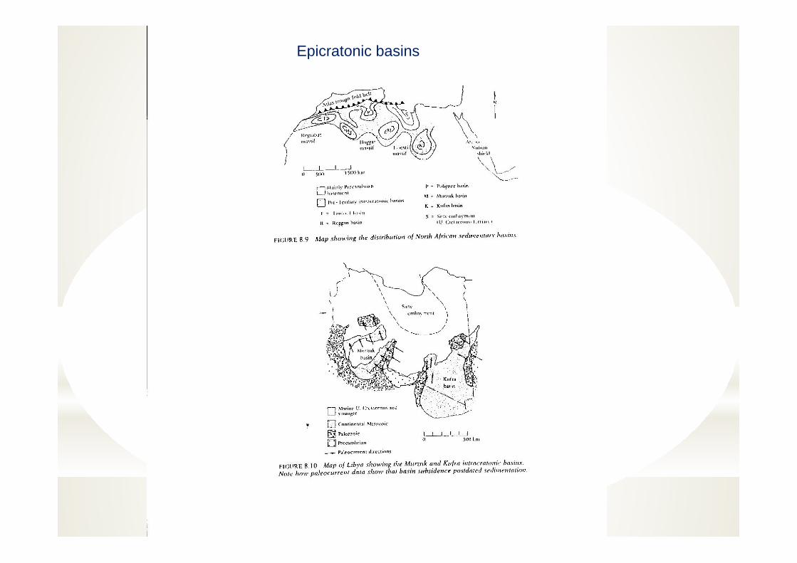
Epicratonic basins
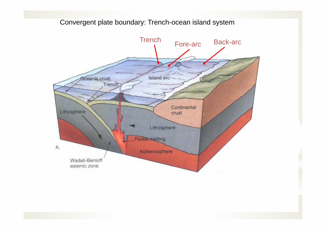
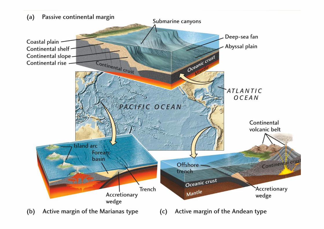
Convergent plate boundary: Trench-ocean island system
Back-arcFore-arcTrench
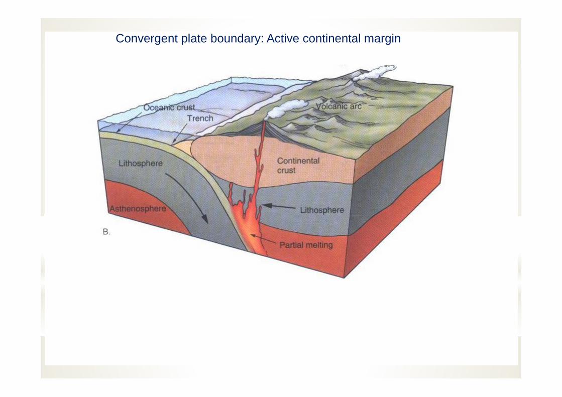
Convergent plate boundary: Active continental margin
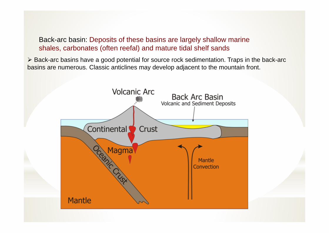
Back-arc basin: Deposits of these basins are largely shallow marine shales, carbonates (often reefal) and mature tidal shelf sands
Back-arc basins have a good potential for source rock sedimentation. Traps in the back-arc basins are numerous. Classic anticlines may develop adjacent to the mountain front.
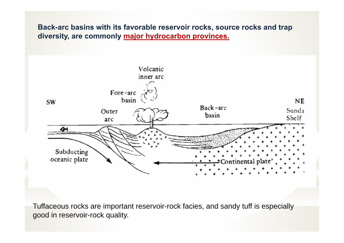
Back-arc basins with its favorable reservoir rocks, source rocks and trap diversity, are commonly major hydrocarbon provinces.
Tuffaceous rocks are important reservoir-rock facies, and sandy tuff is especially good in reservoir-rock quality.
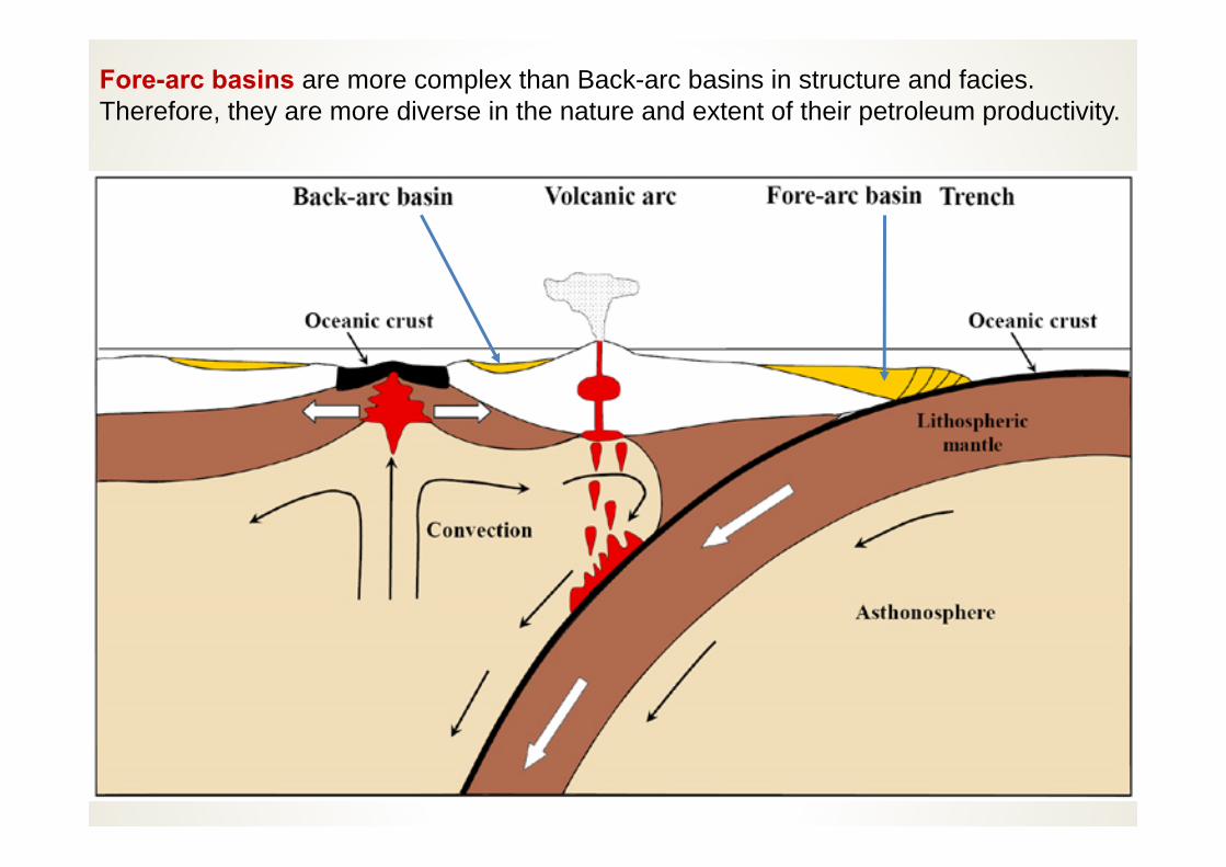
Fore-arc basins are more complex than Back-arc basins in structure and facies. Therefore, they are more diverse in the nature and extent of their petroleum productivity.
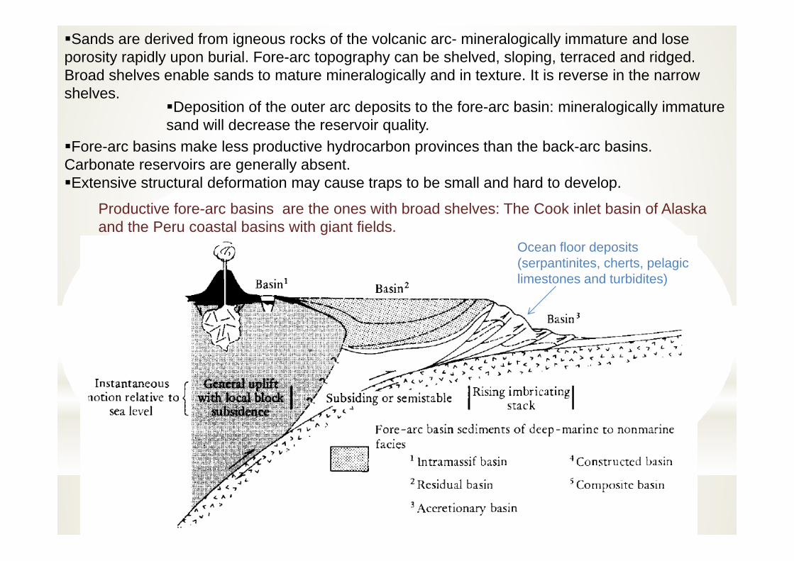
Sands are derived from igneous rocks of the volcanic arc- mineralogically immature and lose porosity rapidly upon burial. Fore-arc topography can be shelved, sloping, terraced and ridged. Broad shelves enable sands to mature mineralogically and in texture. It is reverse in the narrow shelves.
Ocean floor deposits(serpantinites, cherts, pelagic limestones and turbidites)
Deposition of the outer arc deposits to the fore-arc basin: mineralogically immature sand will decrease the reservoir quality.
Fore-arc basins make less productive hydrocarbon provinces than the back-arc basins. Carbonate reservoirs are generally absent.Extensive structural deformation may cause traps to be small and hard to develop.
Productive fore-arc basins are the ones with broad shelves: The Cook inlet basin of Alaska and the Peru coastal basins with giant fields.
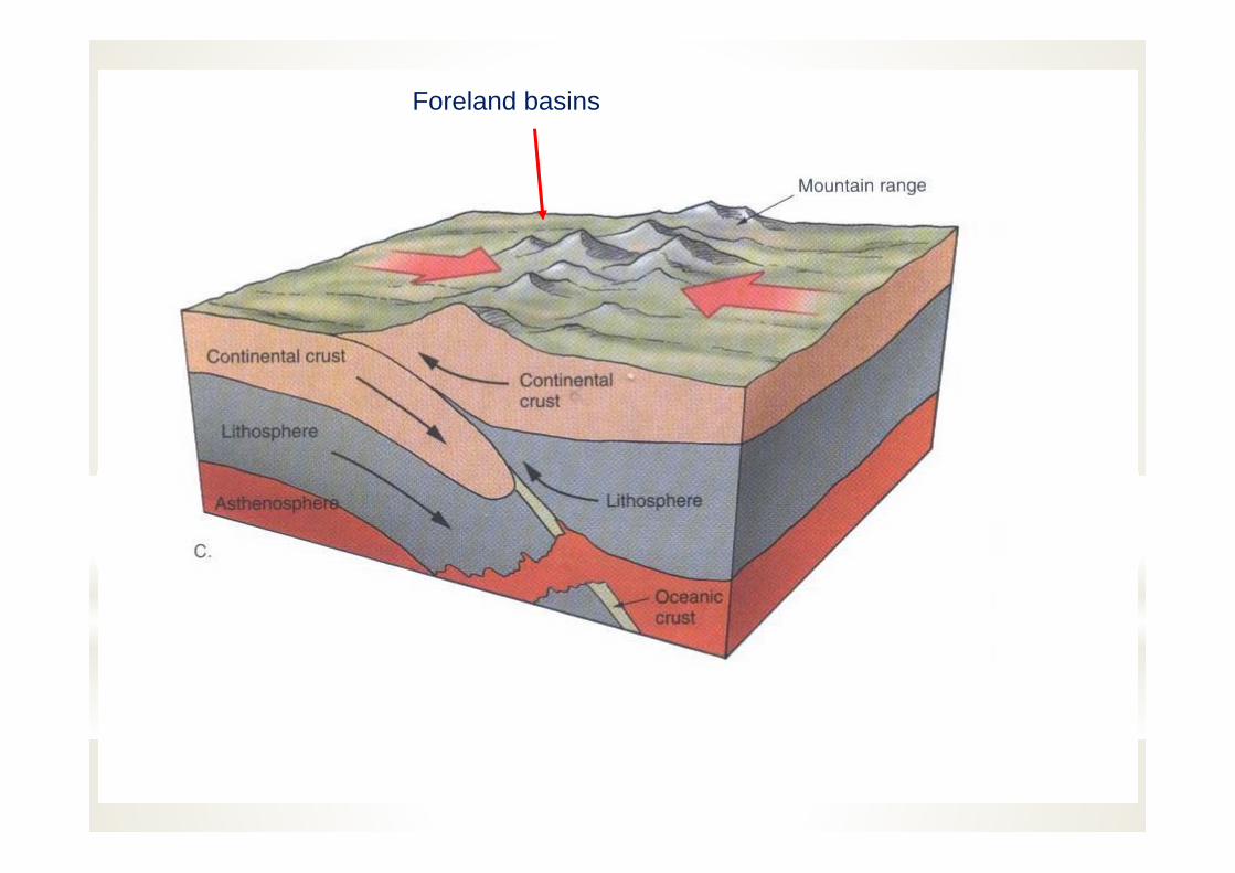
Foreland basins
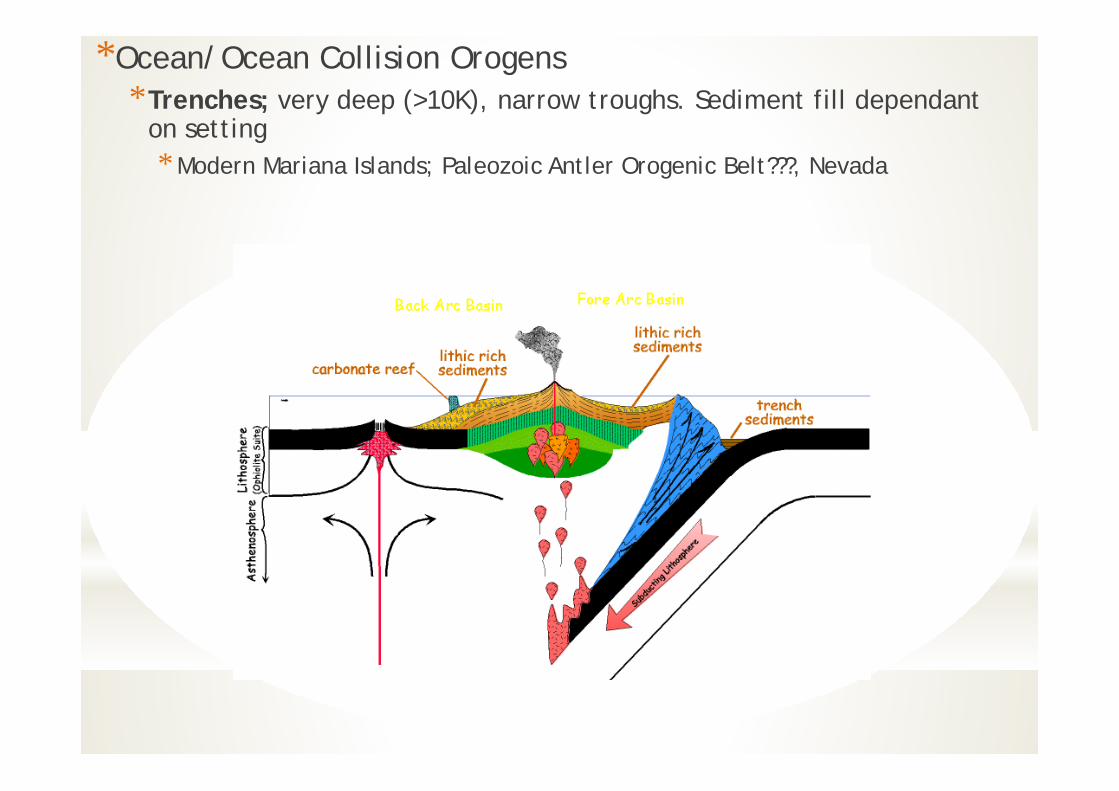
*Ocean/Ocean Collision Orogens*Trenches; very deep (>10K), narrow troughs. Sediment fill dependant
on setting* Modern Mariana Islands; Paleozoic Antler Orogenic Belt???, Nevada
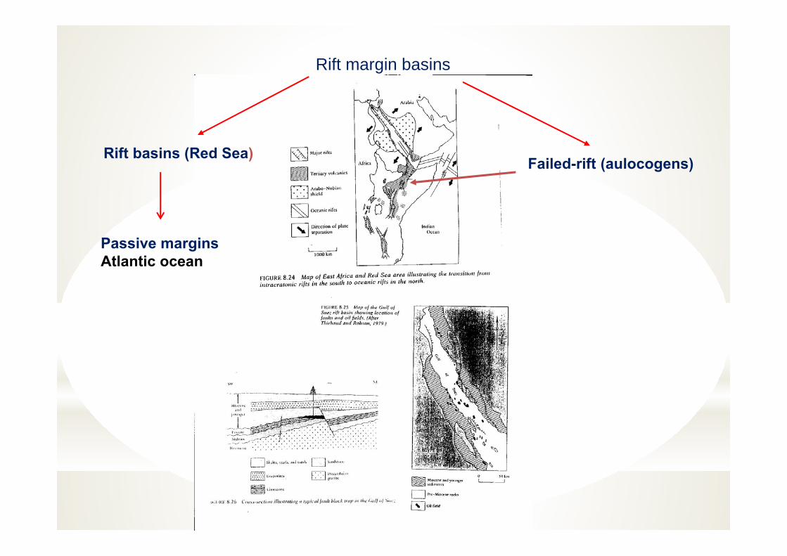
Rift margin basins
Failed-rift (aulocogens)Rift basins (Red Sea)
Passive marginsAtlantic ocean
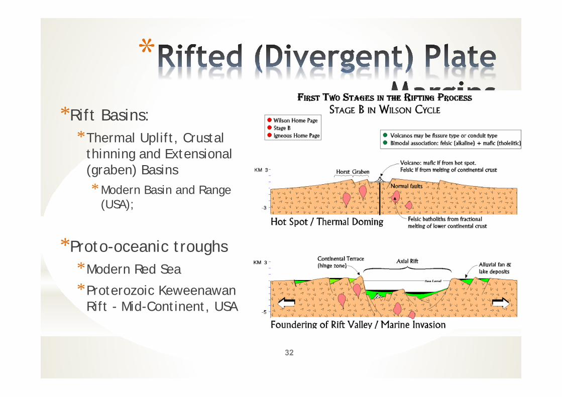
**Rift Basins:
*Thermal Uplift, Crustal thinning and Extensional (graben) Basins* Modern Basin and Range
(USA);
*Proto-oceanic troughs*Modern Red Sea
*Proterozoic Keweenawan Rift - Mid-Continent, USA
32
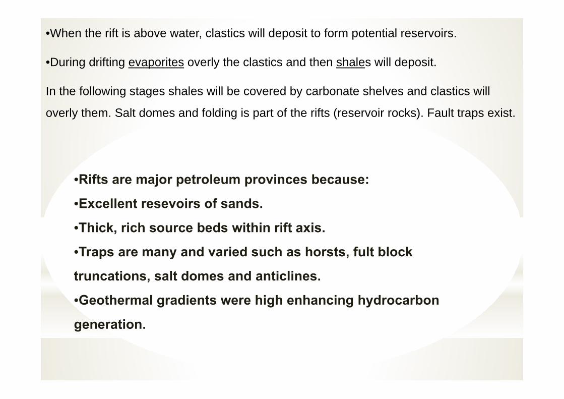
•When the rift is above water, clastics will deposit to form potential reservoirs.
•During drifting evaporites overly the clastics and then shales will deposit.
In the following stages shales will be covered by carbonate shelves and clastics will
overly them. Salt domes and folding is part of the rifts (reservoir rocks). Fault traps exist.
•Rifts are major petroleum provinces because:
•Excellent resevoirs of sands.
•Thick, rich source beds within rift axis.
•Traps are many and varied such as horsts, fult block
truncations, salt domes and anticlines.
•Geothermal gradients were high enhancing hydrocarbon
generation.
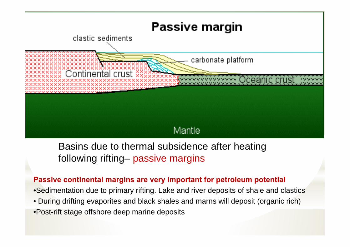
Basins due to thermal subsidence after heating following rifting– passive margins
Passive continental margins are very important for petroleum potential •Sedimentation due to primary rifting. Lake and river deposits of shale and clastics• During drifting evaporites and black shales and marns will deposit (organic rich)•Post-rift stage offshore deep marine deposits

Typical form of a passive margin
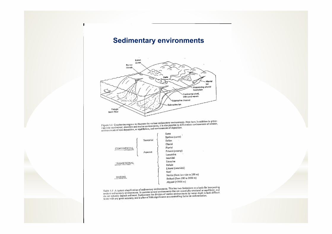
Sedimentary environments
A. Marine environments (shelf, continental slope, submarine fans, abyssal plains)
B. Continental environments (lake, alluvial fan and river channel, desert)
D.Transitional environments (beach, delta, coastal plain, lagoon)
Sedimentary environments
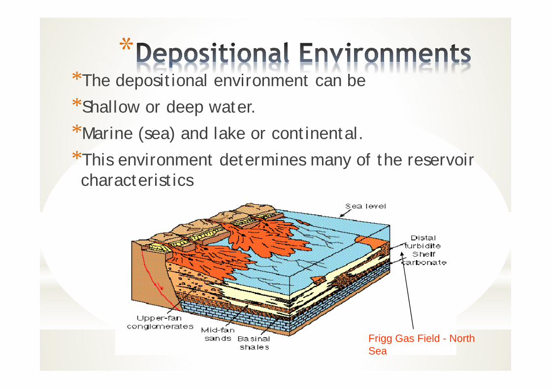
**The depositional environment can be
*Shallow or deep water.
*Marine (sea) and lake or continental.
*This environment determines many of the reservoir characteristics
Frigg Gas Field - North Sea

Energy of the Environment and Base level
There two important of concepts in sedimentation: 1. Energy of the environment (energy: waves, currents)2. Baselevel: the level at which sediment neither accumulates nor eroded. It is
determined by the energy level, relative sea level change and physical properties (grain size, density) of the sediments.
Energy of the environment in a basin controls the type and thickness of the sediments. Rivers bring large amounts of sediments to the sea, but if the waves and currents arestrong enough, very little sediment will accumulate and most sediment will betransported and deposited elsewhere, instead of forming a delta at the river mouth.
Energy of the Environment, Baselevel and Accommodation Space
These factors result in distribution of the sediments according to their grain size in different areas: sand in shallow and clay in deeper water. The baselevel will be affected by other important factors:
1. Subsidence of the basin (tectonic)2. Sea level change (mainly climatic)3. Amount of sediment input (tectonic, climatic)
These factors determine the accommodation space for the sediments to accumulate. If sea level rises or the basin subsides, the baselevel will rise and accommodation space will increase in the basin. If there is a high supply of sediment, the sediment will deposit only to the baselevel, and any extra sediment deposited will be eroded resulting in diastems (small break) and disconformities (large breaks).

Sedimentary record of sealevel change: sequence stratigraphy
mudsand
Balance between subsidence and sediment accumulation
In basins, rate of subsidence is usully balanced by rate of sediment accumulation. This is indicated by the accumulation of considerable thickness of rocks of the same facies, which indicate constancy of physiographic environments over the area of sedimentary basin.
A discontinuity of a lithological unit in a basin may indicate the sediment was not distributed over the whole area; distributed, but did not accumulate; or distrubuted and deposited, but later removed by erosion.
Transgressions and Regressions
TransgressionWhen the accommodation space increases over the depositional basins by sea level rise or subsidence, the basin deepens and the sedimentary facies tend to migrate towards the land. This the transgressive phase of basin development leading to transgessive sediment sequence with deeper water facies overlying shallower water facies, i.e., an upward fining sequence. Sedimentary basins are enlarged during transgressions.
RegressionIf the accommodation space decreases by sea level lowering or increased sediment supply, the facies and shoreline migrate seaward, the development is regressive. A regressive sequence is characterized by a coarsening upward sequence. A deltaic sequence is a typical regressive sequence. Both transgressions and regressions can be depositional or erosional, depending on the change of the base level due to the energy of environment and rate of sediment supply.
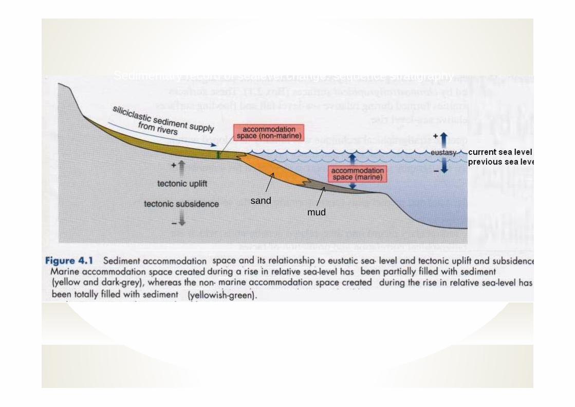
Sedimentary record of sealevel change: sequence stratigraphy
mudsand
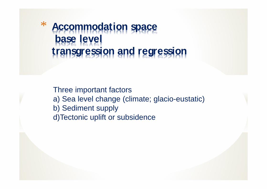
* Accommodation spacebase leveltransgression and regression
Three important factorsa) Sea level change (climate; glacio-eustatic)b) Sediment supplyd)Tectonic uplift or subsidence
In general sedimentary basins begin with a transgressive phase duringwhich the subsidence rate exceeds sediment accumulation rate, and endwith a regressive phase in which sediment accumulation rate exceeds thesubsidence.
The concept of transgressions and regressions are important in PetroleumGeology:
A. Depositional regressions tend to accumulate porous and permeablerocks (reservoir rocks) on top of fine grained, porous, impermeablerocks (souce rocks)
B. Depositional transgressions tend to accumulate potential source rockson top of potential reservoir rocks.
Transgressions and Regressions
Sedimentary Rock Associations
Sedimentary basins tend to accumulate either
1) clay/shale and sand/sandstone, or2) clay/shale and carbonate/evaporite.
In the context of transgressions and regressions, three associations are evident between:
1) Transgressions and carbonates2) Regressive sequences and evaporites3) Regressive sequences and sand/sandstone