Embed Size (px)
Citation preview
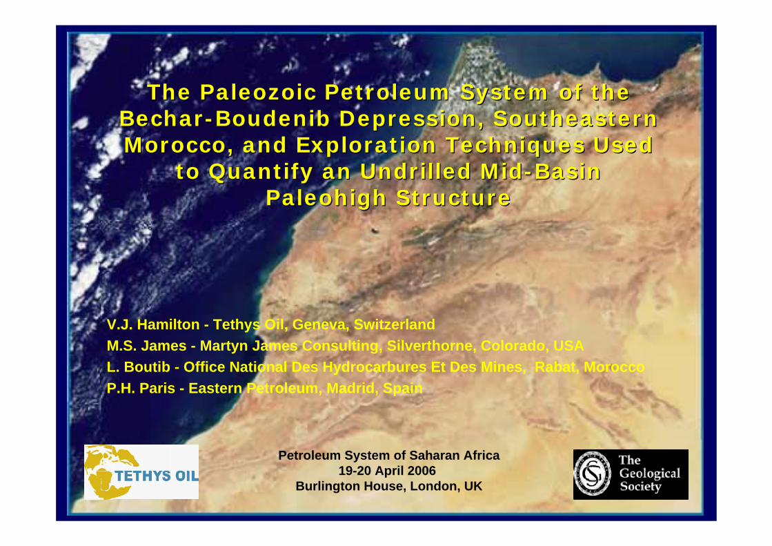
The Paleozoic Petroleum System of the The Paleozoic Petroleum System of the BecharBechar--Boudenib Depression, Southeastern Boudenib Depression, Southeastern Morocco, and Exploration Techniques Used Morocco, and Exploration Techniques Used
to Quantify an Undrilled Midto Quantify an Undrilled Mid--Basin Basin Paleohigh StructurePaleohigh Structure
V.J. Hamilton - Tethys Oil, Geneva, Switzerland M.S. James - Martyn James Consulting, Silverthorne, Colorado, USA L. Boutib - Office National Des Hydrocarbures Et Des Mines, Rabat, Morocco P.H. Paris - Eastern Petroleum, Madrid, Spain
Petroleum System of Saharan Africa19-20 April 2006
Burlington House, London, UK
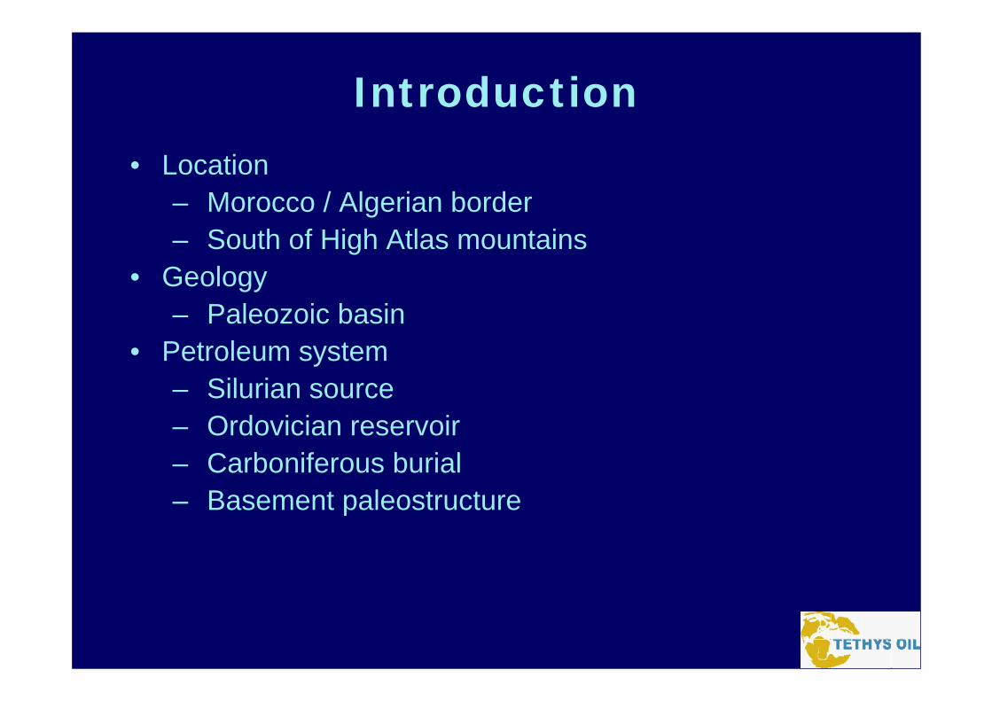
Introduction• Location
– Morocco / Algerian border– South of High Atlas mountains
• Geology– Paleozoic basin
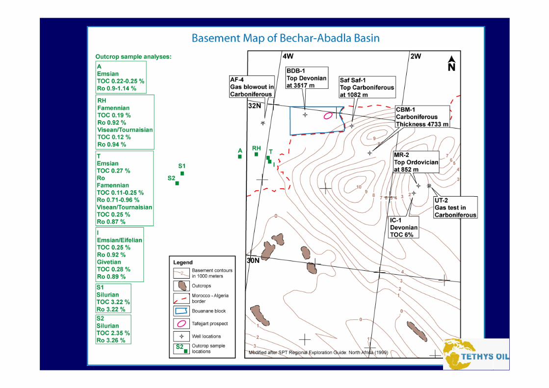
• Petroleum system– Silurian source– Ordovician reservoir– Carboniferous burial– Basement paleostructure
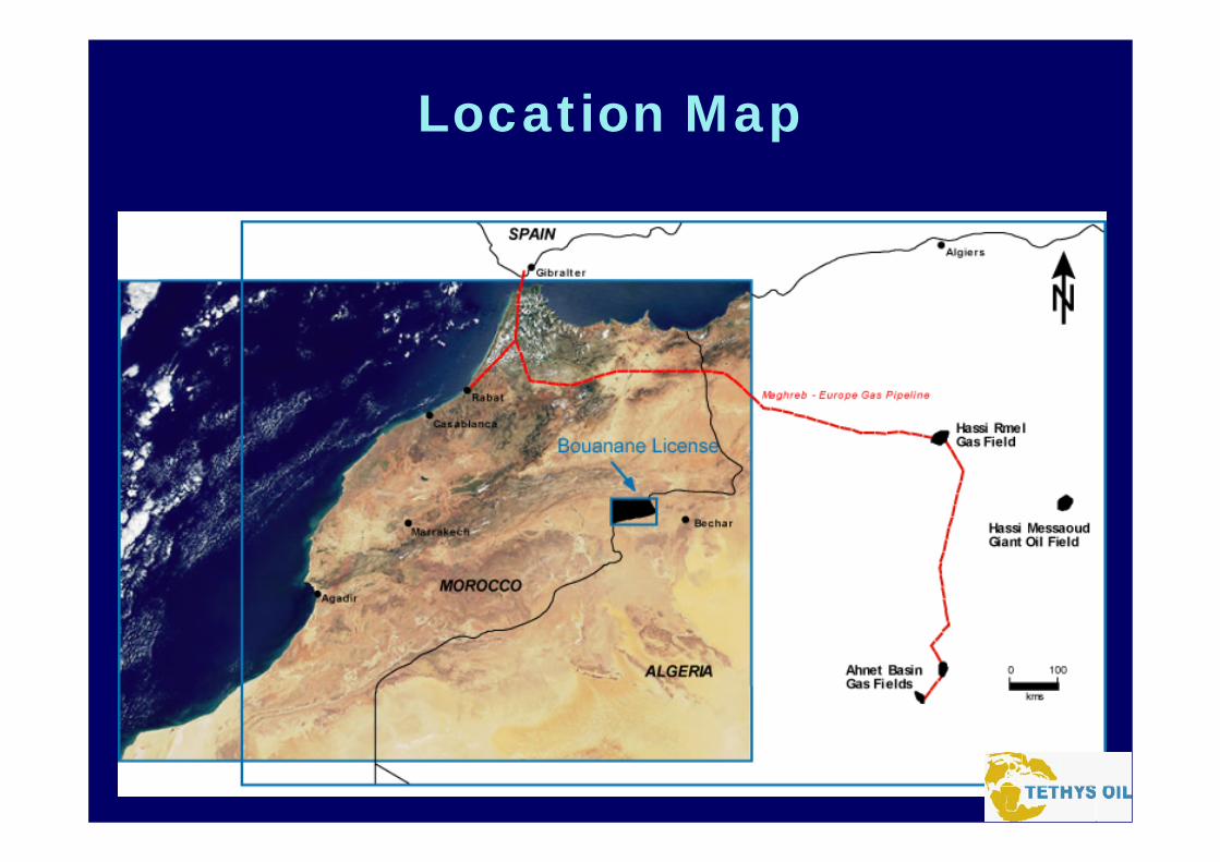
Location Map
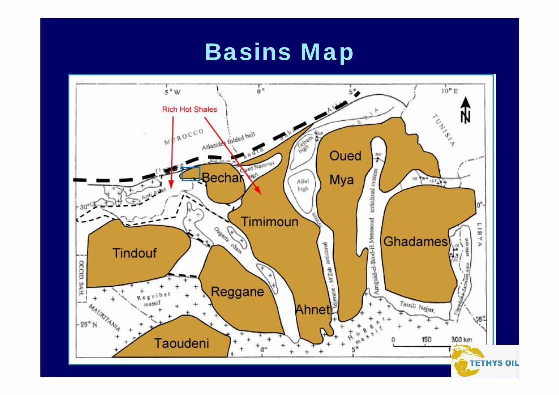
Basins Map
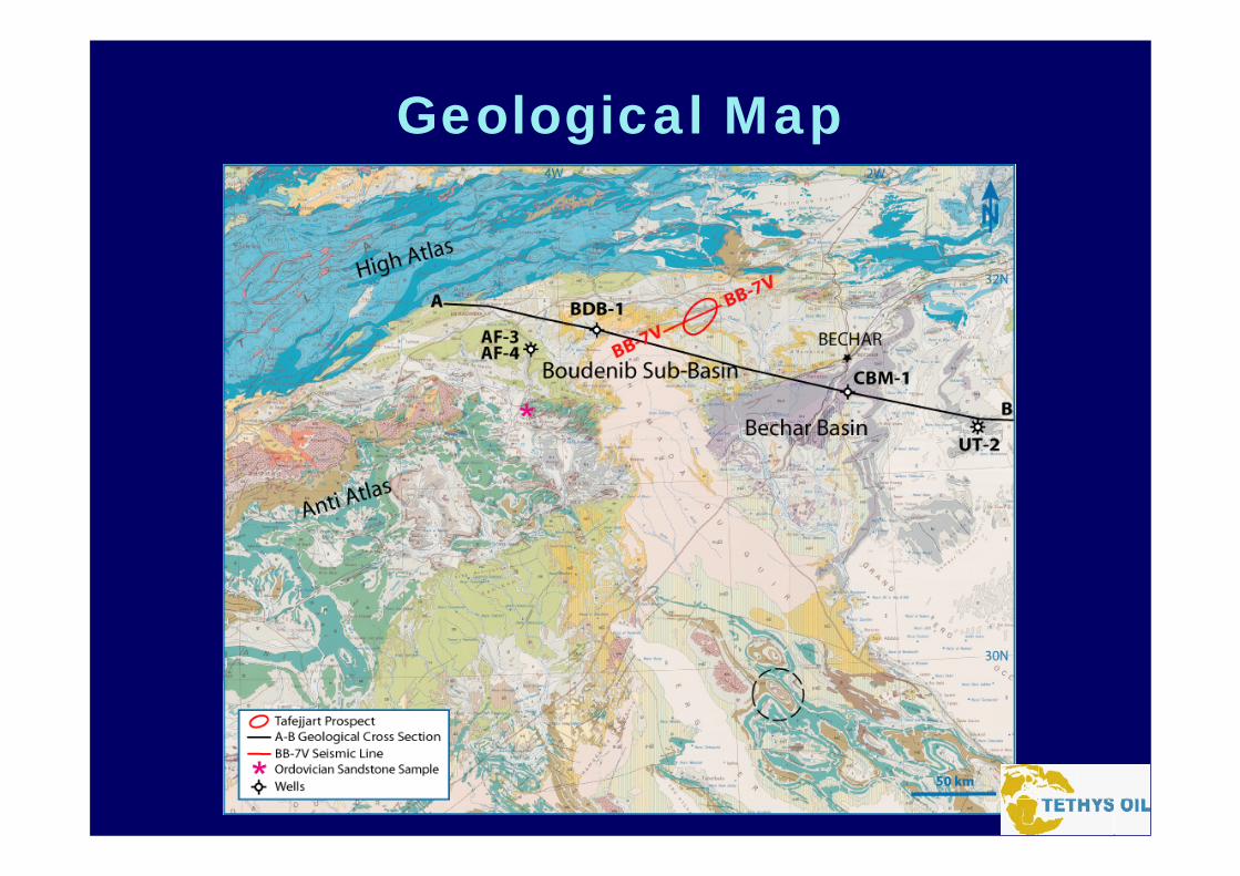
Geological Map
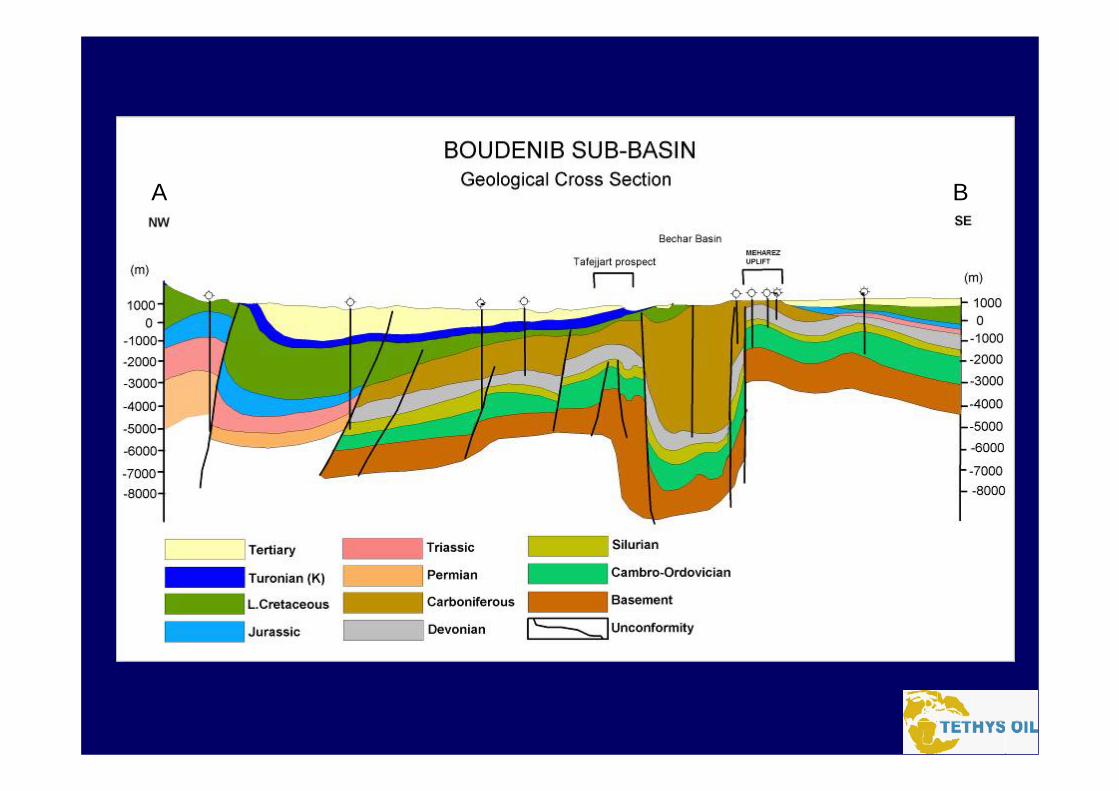
A B
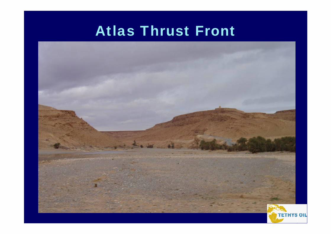
Atlas Thrust Front
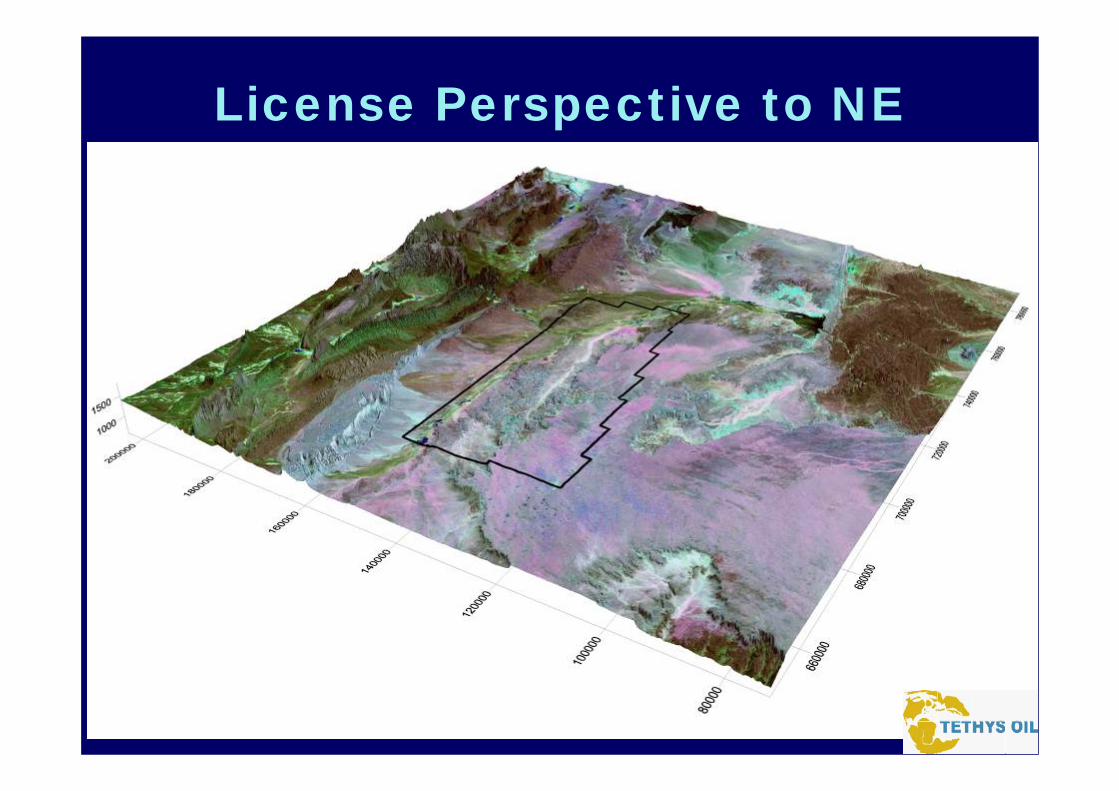
License Perspective to NE
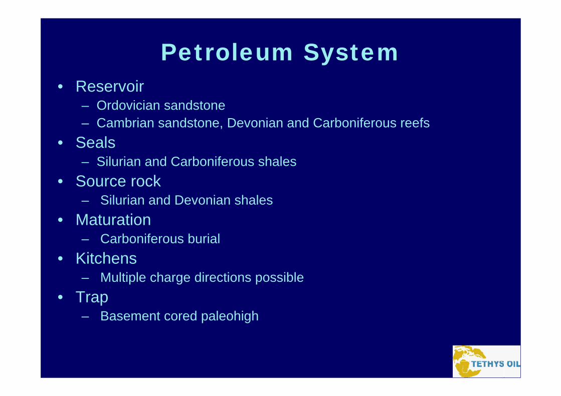
Petroleum System• Reservoir
– Ordovician sandstone– Cambrian sandstone, Devonian and Carboniferous reefs
• Seals– Silurian and Carboniferous shales
• Source rock– Silurian and Devonian shales
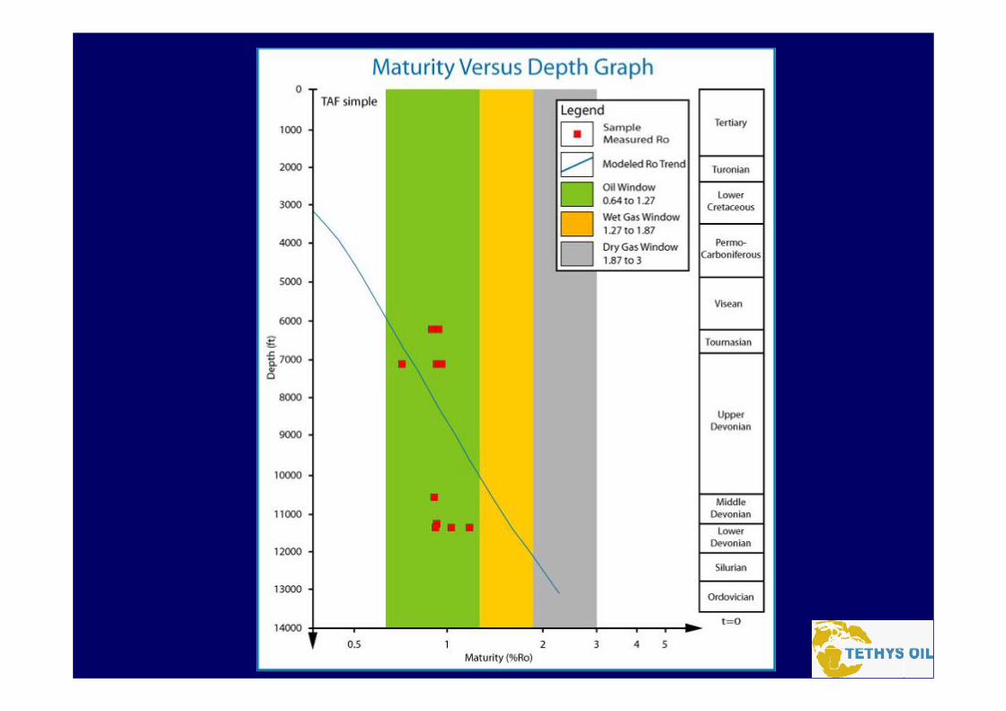
• Maturation – Carboniferous burial
• Kitchens– Multiple charge directions possible
• Trap– Basement cored paleohigh

Geological Map
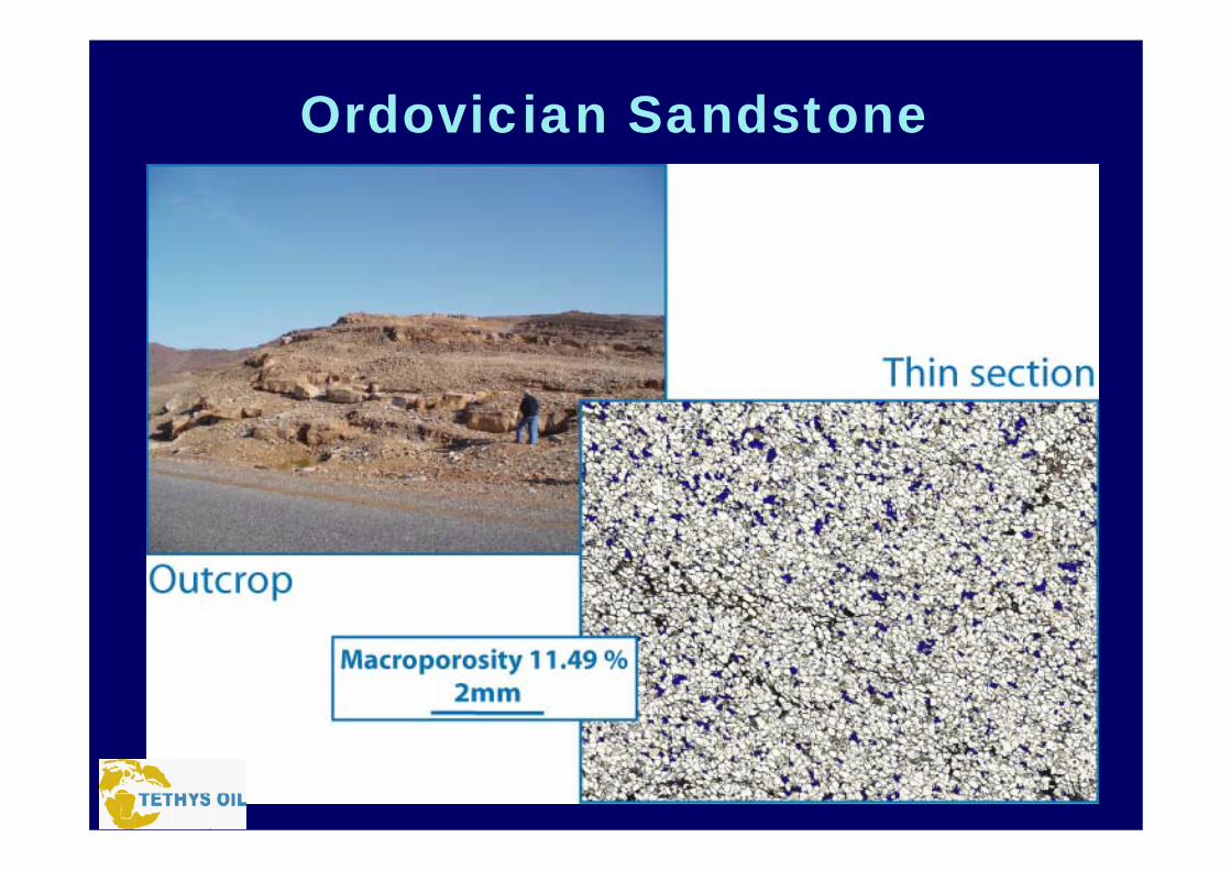
Ordovician Sandstone

Algeria Porosity Data

Outcrops
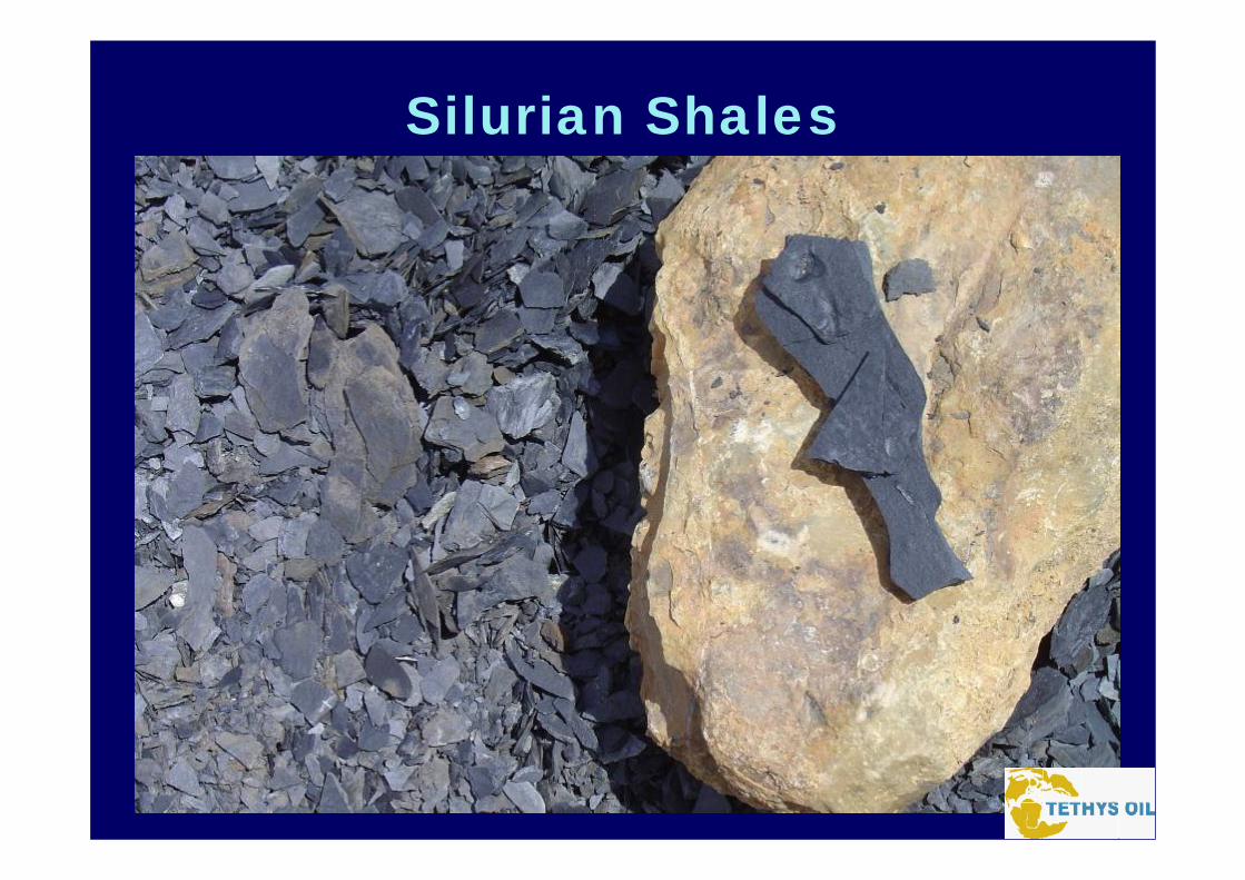
Silurian Shales
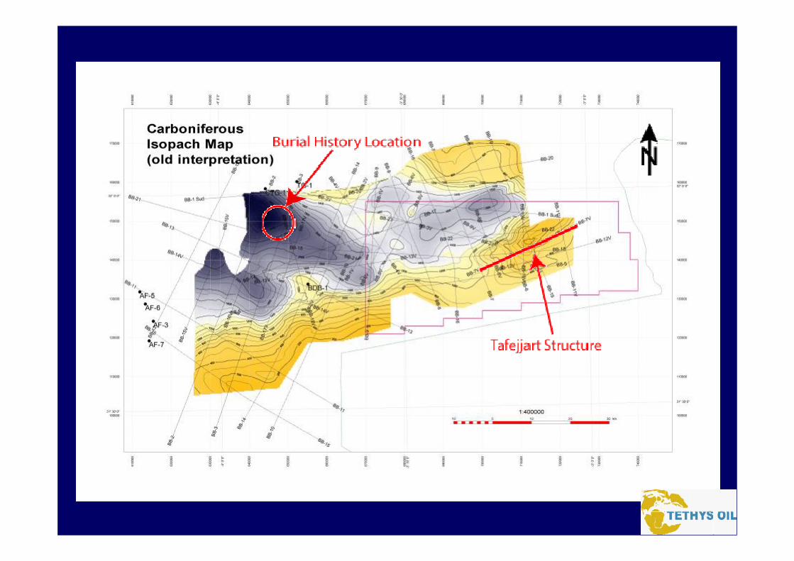

Burial History in Sub-Basin
Ordovician

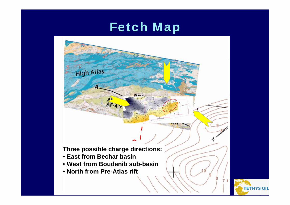
Fetch Map
Three possible charge directions:• East from Bechar basin• West from Boudenib sub-basin• North from Pre-Atlas rift
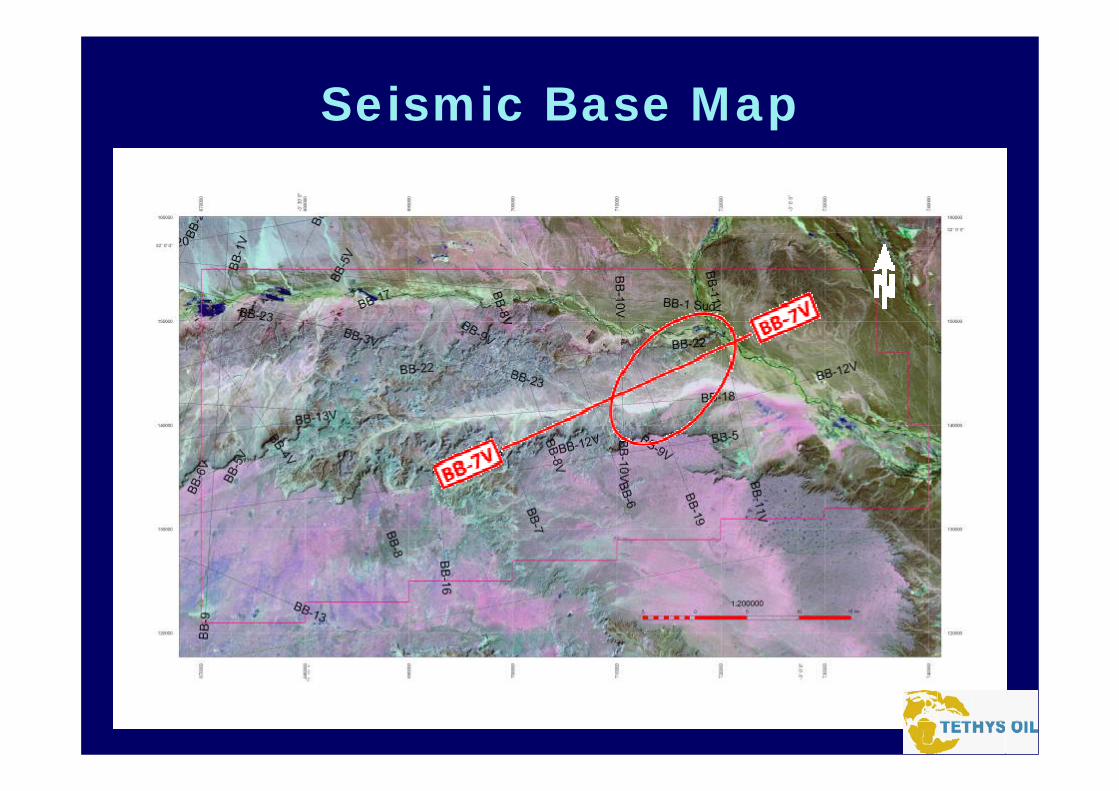
Seismic Base Map
Seismic Line BB-7V

0.00 0.00
0.20 0.20
0.40 0.40
0.60 0.60
0.80 0.80
1.00 1.00
1.20 1.20
1.40 1.40
1.60 1.60
1.80 1.80
2.00 2.00
2.20 2.20
2.40 2.40
2.60 2.60
ShotCMP
ShotCMP
310523
300503
290483
280463
270443
260423
250403
240383
230363
220343
210323
200303
190283
180263
170243
160223
150203
140183
130163
120148
110138
1110123
1100103
109083
108063
107043
106023
Old-BB10VN-BB-10V_st Old-BB19N-BB-08V_st Old-BB9V N-BB-19migrOld-BB18N-BB-07migr Old-BB8V Low Freq-BB-19mig_LFPN-BB-06mig+200msN-BB-18migrOld-BB7VOld-BB7V Old-BB7V Old-BB7V Old-BB7V Old-BB7VOld-BB7V Old-BB7VN-BB-11V_stLow Freq-BB-06mig_LFP Old-BB11VOld-BB6Low Freq-BB-07mig_LFP N-BB-09V_st
Seismic Line BB-7VSW NE
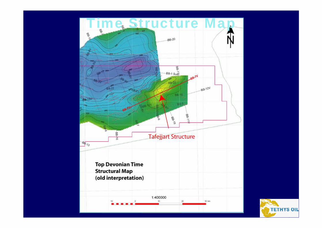
Time Structure Map

Analogous Sturcture
Reggane Basin Timimoun BasinSbaa Sub-Basin
Conclusion• Probable Petroleum System• Work in-progress• Good geology• Easy operating area• Favorable fiscal terms in Morocco• Phased future work program