Embed Size (px)
Citation preview
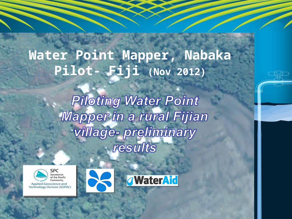
Water Point Mapper, Nabaka Pilot- Fiji (Nov 2012)
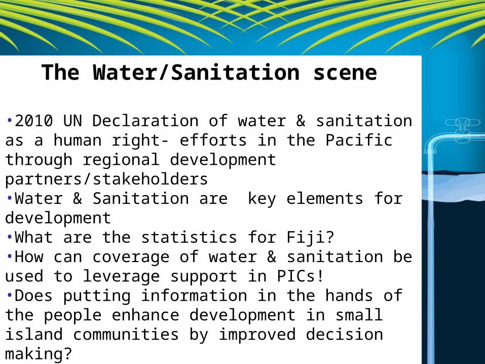
The Water/Sanitation scene
•2010 UN Declaration of water & sanitation as a human right- efforts in the Pacific through regional development partners/stakeholders •Water & Sanitation are key elements for development•What are the statistics for Fiji?•How can coverage of water & sanitation be used to leverage support in PICs!•Does putting information in the hands of the people enhance development in small island communities by improved decision making?
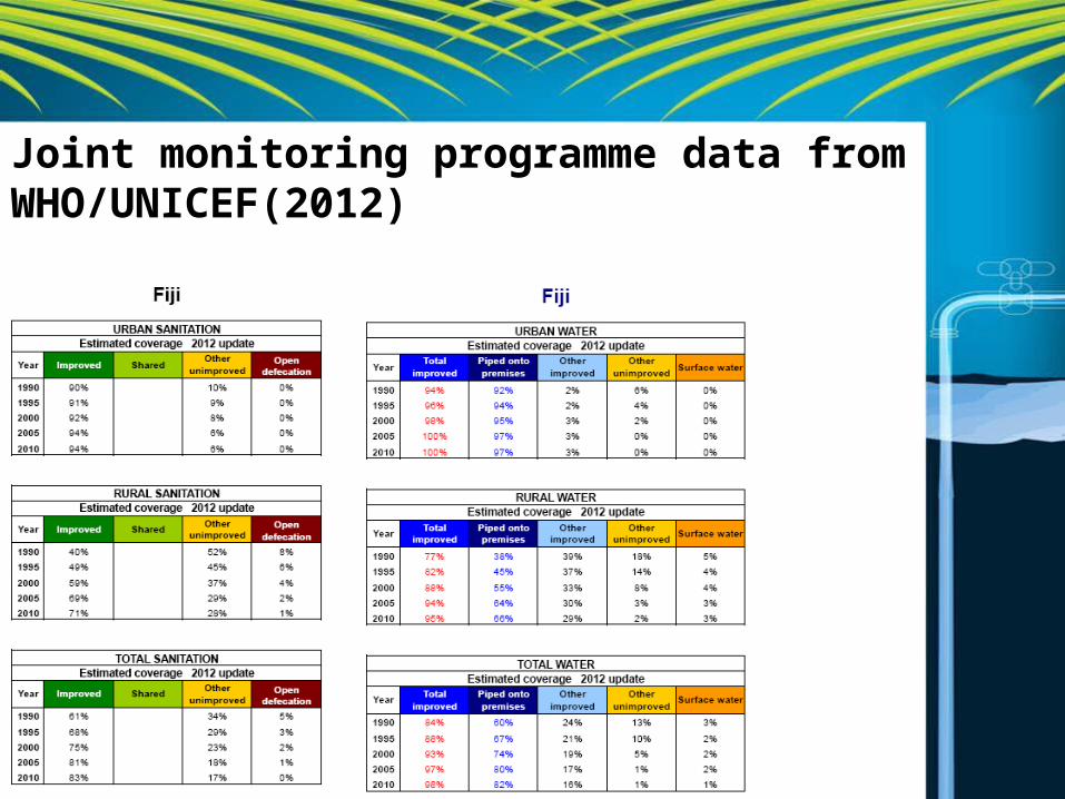
Joint monitoring programme data from WHO/UNICEF(2012)
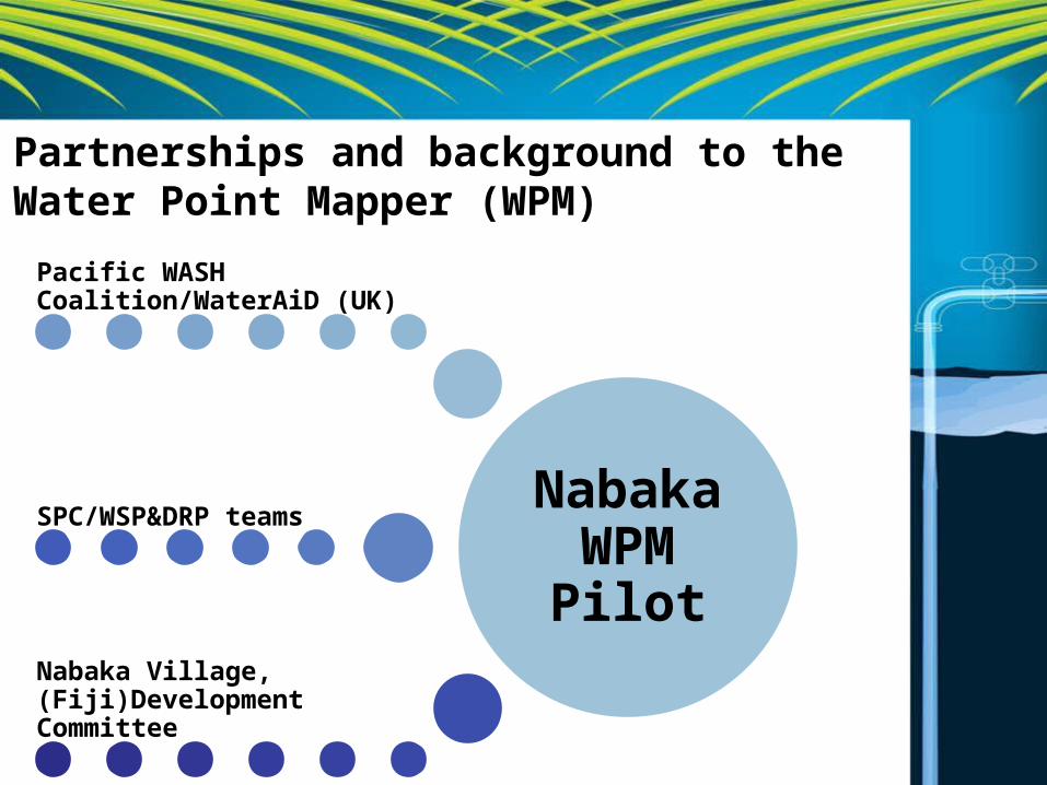
Nabaka WPM Pilot
Pacific WASH Coalition/WaterAiD (UK)
SPC/WSP&DRP teams
Nabaka Village, (Fiji)Development Committee
Partnerships and background to the Water Point Mapper (WPM)
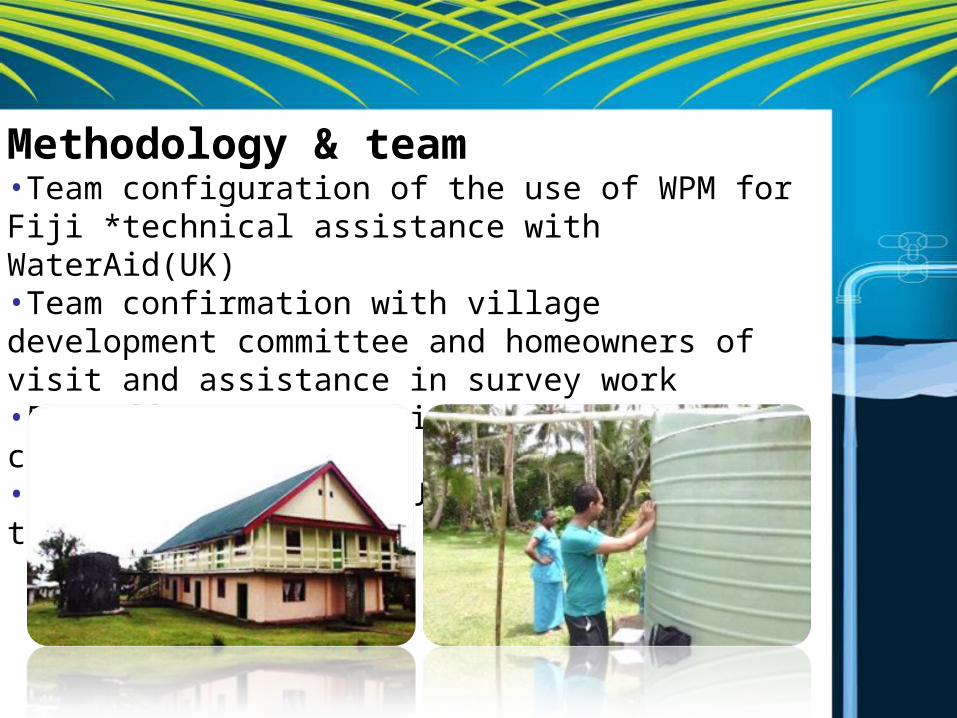
Methodology & team•Team configuration of the use of WPM for Fiji *technical assistance with WaterAid(UK)•Team confirmation with village development committee and homeowners of visit and assistance in survey work•5 staff; SPC/SOPAC with 1 local consultant•HH survey teams and Juno SB teams mapping tanks
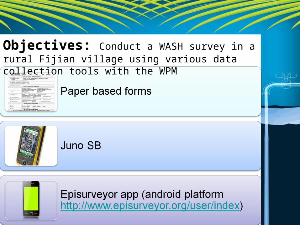
Objectives: Conduct a WASH survey in a rural Fijian village using various data collection tools with the WPM
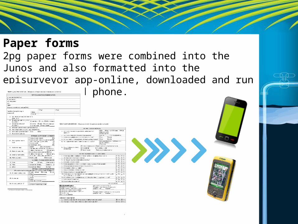
Paper forms2pg paper forms were combined into the Junos and also formatted into the episurveyor app-online, downloaded and run off an android phone.
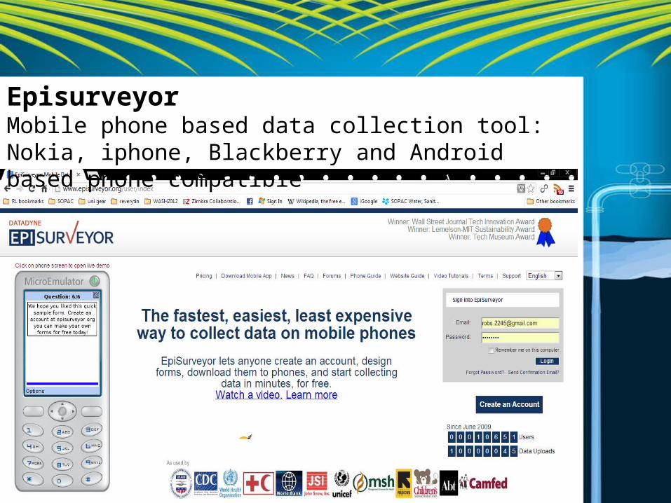
EpisurveyorMobile phone based data collection tool: Nokia, iphone, Blackberry and Android based phone compatible
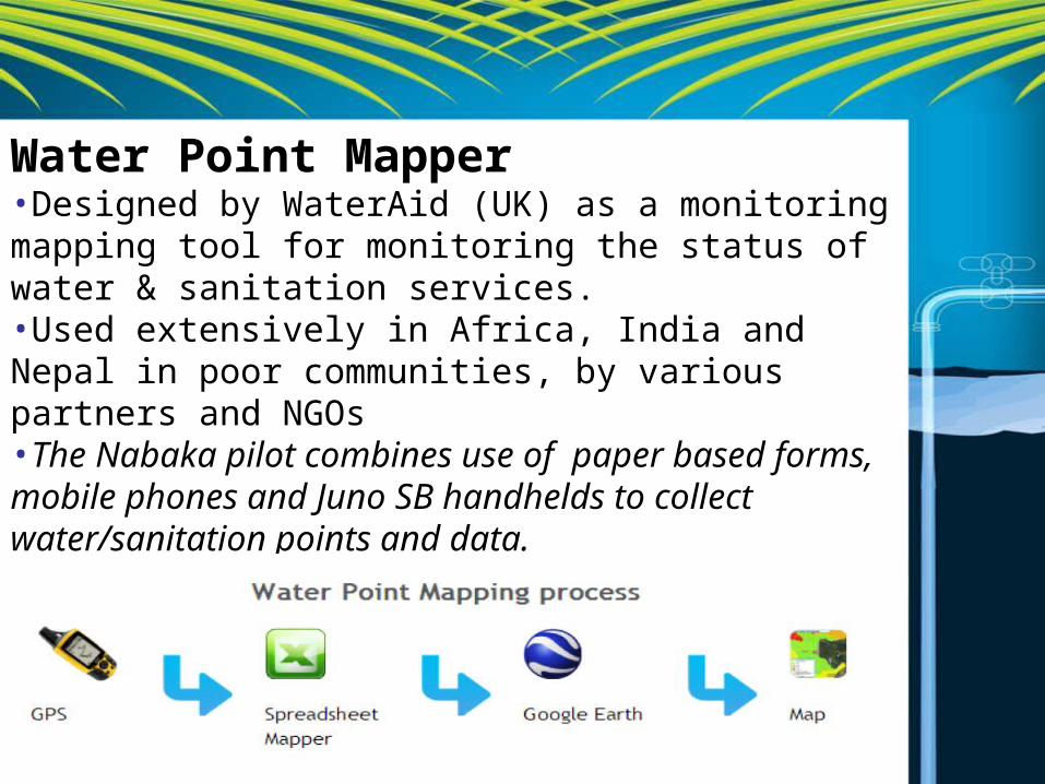
Water Point Mapper•Designed by WaterAid (UK) as a monitoring mapping tool for monitoring the status of water & sanitation services.•Used extensively in Africa, India and Nepal in poor communities, by various partners and NGOs•The Nabaka pilot combines use of paper based forms, mobile phones and Juno SB handhelds to collect water/sanitation points and data.
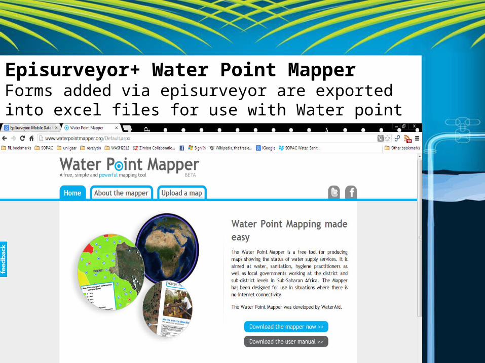
Episurveyor+ Water Point MapperForms added via episurveyor are exported into excel files for use with Water point mapper
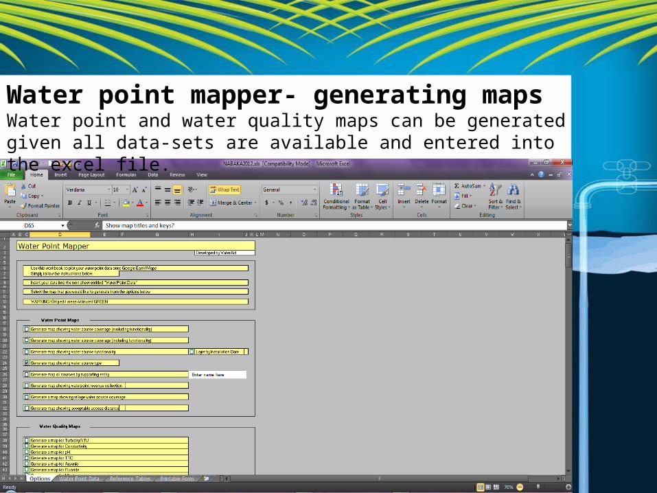
Water point mapper- generating mapsWater point and water quality maps can be generated given all data-sets are available and entered into the excel file.
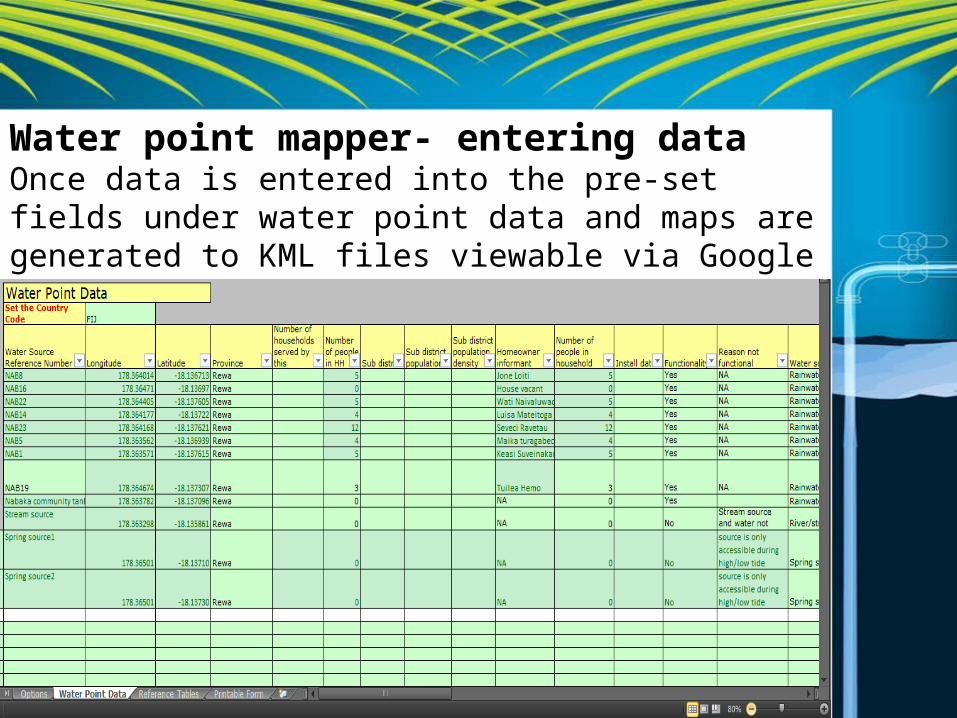
Water point mapper- entering dataOnce data is entered into the pre-set fields under water point data and maps are generated to KML files viewable via Google earth
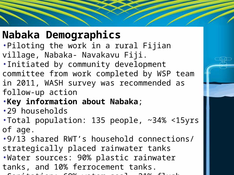
Nabaka Demographics•Piloting the work in a rural Fijian village, Nabaka- Navakavu Fiji.•Initiated by community development committee from work completed by WSP team in 2011, WASH survey was recommended as follow-up action•Key information about Nabaka;•29 households •Total population: 135 people, ~34% <15yrs of age.•9/13 shared RWT’s household connections/ strategically placed rainwater tanks•Water sources: 90% plastic rainwater tanks, and 10% ferrocement tanks. •Sanitation: 69% water seal, 21% flush toilet systems, 7% pit toilets and 3% beach/bush
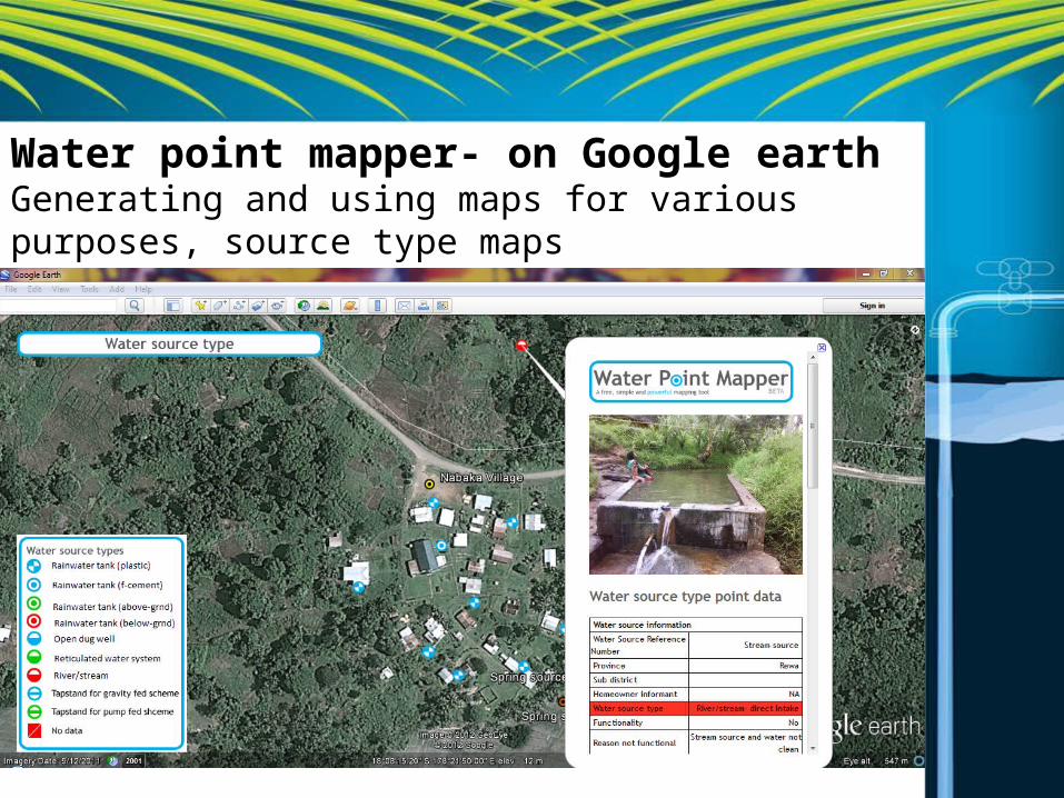
Water point mapper- on Google earthGenerating and using maps for various purposes, source type maps
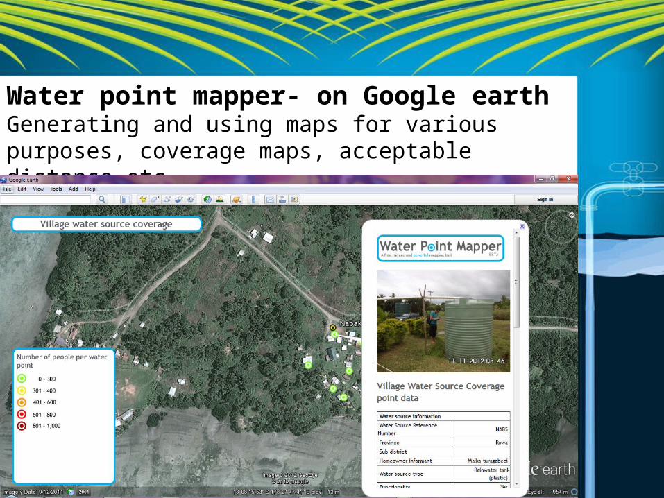
Water point mapper- on Google earthGenerating and using maps for various purposes, coverage maps, acceptable distance etc.
Water point mapper- on Google earth•Lessons learned/preliminary findings•Initial setup/troubleshooting issues•Application across PICs-Pacific WASH Coalition•Accuracy/connectivity issues with mobile phones
Next steps:•Shared results and maps with community development committee, making connections•Planned implementation of WPM for PIC communities in Tokelau (2013)
![Triple Mapper™ Triple Mapper ™ - [겜맥] 게임을 더욱 재미있게- · 2012-12-13 · Triple MapperTriple Mapper™ ™는는키보드에서사용되는키값을다른개체로옮기는키보드에서사용되는키값을다른개체로옮기는](https://img.pdfslide.net/doc/110x75/5d2afecc88c993140a8d0fdb/triple-mapper-triple-mapper-.jpg)