Embed Size (px)
Citation preview
6
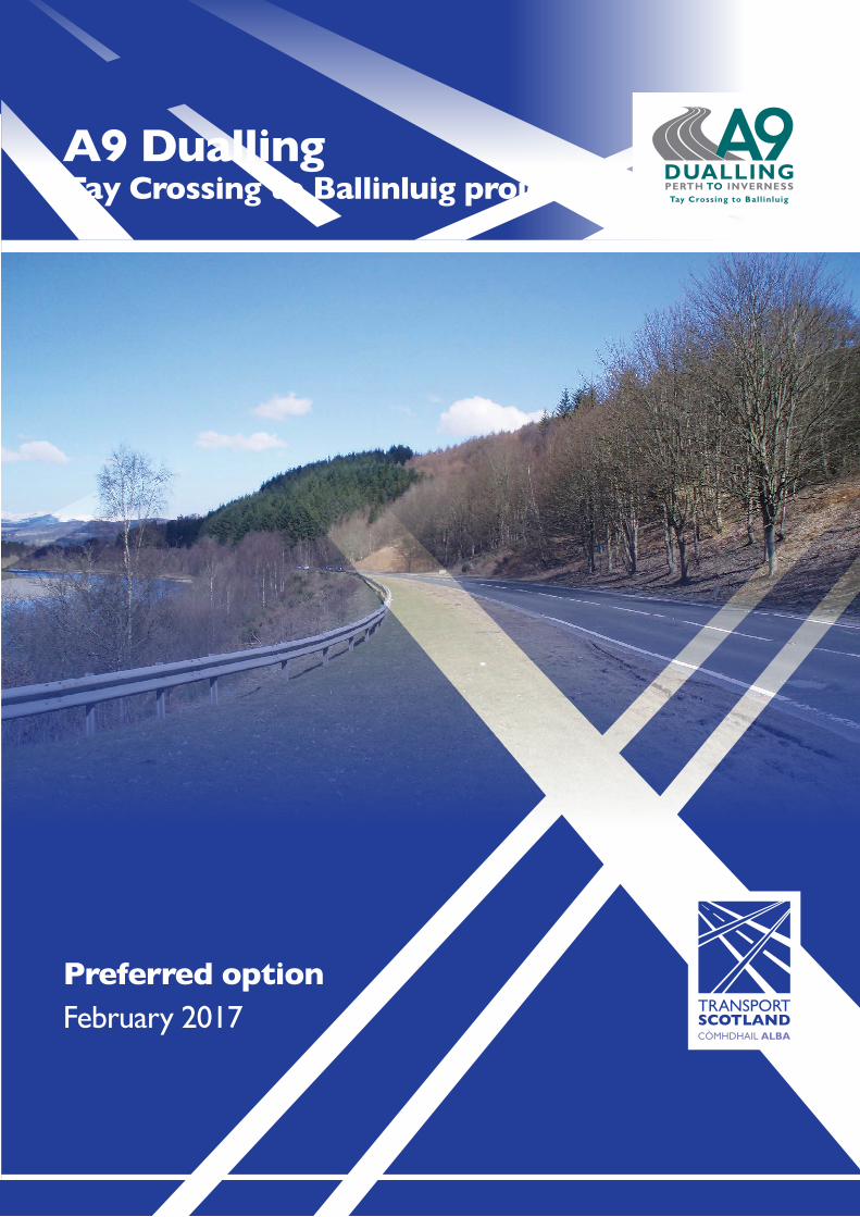
Preferred optionFebruary 2017
A9 Dualling Tay Crossing to Ballinluig project
5
What happens next?We welcome your comments and feedback on the preferred route options. This will help the ongoing development of the Tay Crossing to Ballinluig project.
Transport Scotland’s consultant will take forward the development and assessment of the preferred option for the project (DMRB Stage 3 Assessment).
Transport Scotland will look to publish draft Road Orders, Compulsory Purchase Order and an Environmental Statement for the Tay Crossing to Ballinluig project in 2017, and members of the public will have the opportunity to provide comment and feedback.
The draft Road Orders will define the line of the developed preferred option. The draft Compulsory Purchase Order will define the extent of land needed to deliver the project.
The next stage of the assessment process will include:
• consultation with affected parties such as land andproperty owners and tenants, statutory bodies,Community Councils and other relevant interestgroups
• design development• ground investigation works• identification of the land required for the project and
preparation of draft Orders• Environmental Impact Assessment of the developed
preferred option and preparation of the EnvironmentalStatement
• development of suitable mitigation measures to reduceimpact on the environment.
Flood risk managementThe approach to flood risk management on the Tay Crossing to Ballinluig project is that proposed plans will be developed to provide neutral impact. This means that while the dualling of the A9 will not resolve existing flooding issues, it will not increase overall flood risk.
We have built a project-specific flood model from south of Dowally to north of Ballinluig, covering the River Tay, River Tummel, and their smaller tributaries including Dowally Burn, Sloggan Burn and Kindallachan Burn.
The flood model is in line with industry standard practice and is capable of developing a picture of complex flooding situations. Flood flows were developed to represent rainfall events up to the 1 in 200 year flood return period including 20% for future climate change, which is considered an extreme weather event.
The baseline model for the existing situation identified extensive flooding during the 1 in 200 year flood event, plus climate change, between Tay Crossing and Ballinluig. Flooding was experienced to the west of the existing A9 over a large proportion of the existing corridor. Overall, the mainline route option, in the absence of mitigation, result in a small adverse impact (increase in flood level less than 10 millimetres).
As part of the flood model development, we have consulted with landowners to better understand the flood regime from the perspective of local residents. In addition, we have used recent flood events, including information provided by SEPA, to verify that the model is representative of these flood events.
Potential flood mitigation measuresSome further work has been carried out during DMRB Stage 2 Assessment work to ensure that mitigation is possible to help address these localised impacts.
The range of mitigation measures to be further developed will likely include:
• compensatory flood storage• side road design refinement• consideration of culvert sizes and location to control the
movement of flood water.
Preferred side road optionThe preferred side road option is Side Road Option 2.
This includes:• a southbound left-in/left-out junction connecting to the C502
Dunkeld to Rotmell road• construction of a bridge over Dowally Burn to connect the
two sections of the village• construction of side roads connecting Dowally, Guay and
Kindallachan to both sides of the A9 by means of a southboundleft-in/left-out junction north of Guay, and an overbridge andnorthbound left-in/left-out junction north of Kindallachan
• northbound left-in/left-out junction at Westhaugh of Tulliemet.Side Road Option 2 is preferred for the following reasons:• provides the highest level of connectivity between Dowally,
Guay and Kindallachan to the northbound and southboundcarriageways of the A9
• minimises diversion times, thus reducing impacts on threecommunities and a number of properties
• performs best in reducing diversion times and ease of accessfor emergency vehicles, both highlighted as important issues bylocal residents.
As we progress into the DMRB Stage 3 Assessment, there is still considerable work to be carried out. The exact location of side roads, including the overbridge north of Kindallachan, will be developed in consultation with landowners and affected residents.To view the plans of the mainline and side road options, please visit: www.transport.gov.scot/project/ a9-tay-crossing-ballinluig
Flooding at Guay to the east of the A9
Floodplain at Guay to the west of the A9
Visualisation image looking north to the proposed Kindallachan overbridge
Examples of possible mitigation measures include:• appropriate construction management plans• landscape planting• noise barriers or environmental bunds• mammal (e.g. badger and otter) underpasses, ledges and fences.
The next stage of design includes further development of:
• the preferred option alignment• the layout of the overbridge north of Kindallachan• layouts of all side roads and private means of access• proposals for lay-bys• any proposed amendments to Non-Motorised User (NMU)
paths e.g. for pedestrians, equestrians and cyclists• the location and layout of road drainage infrastructure,
including detention basins and treatment ponds.
Comments and feedbackWe invite your comments and feedback using the feedback form available at the exhibition or on the project website.
Please leave in the feedback box provided at the exhibition or email: [email protected] can also post to:
Sarah Morgan, Stakeholder Manager, Jacobs UK Ltd, 95 Bothwell Street, Glasgow, G2 7HX.
For further information on the Tay Crossing to Ballinluig project, and to view the exhibition materials, drawings and visualisations, please visit:
www.transport.gov.scot/project/ a9-tay-crossing-ballinluig
Please provide feedback as soon as possible and before Friday 31 March 2017.
For further informationFurther consultation through local drop-in events and one-to-one engagement is planned during the DMRB Stage 3 Assessment process.
We will keep you updated through a range of direct communications and consultations.
You can contact Jacobs’ Stakeholder Manager Sarah Morgan at any time by telephone or email:
Telephone: 07833 936 426 Email: [email protected]
For further information on the wider A9 Dualling Programme please visit the Transport Scotland website:
www.transport.gov.scot/a9dualling
If you have any queries or any comment on the wider programme, please contact the A9 Dualling team by telephone or email.
Telephone: 0141 272 7100 Email: [email protected]
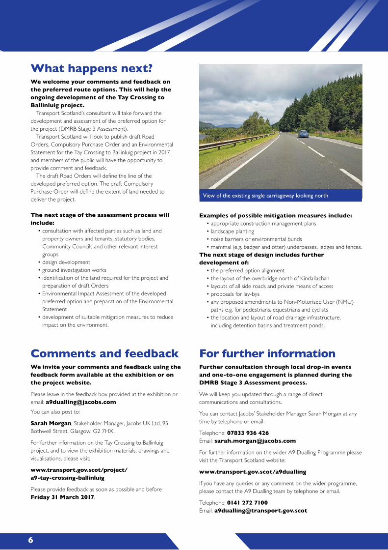
View of the existing single carriageway looking north
2 3 4
Tay Crossing to Ballinluig project
In June 2015 and February 2016, Transport Scotland held public exhibition and community engagement events to seek public feedback on the route option assessment work carried out for dualling the A9 between Tay Crossing and Ballinluig.
This leaflet provides a summary of the outcome of the route assessment work and the preferred route option for the Tay Crossing to Ballinluig project announced in December 2016.
It also summarises the work that will be carried out as part of the Design Manual for Roads and Bridges (DMRB) Stage 3 Assessment process.
We are looking for public feedback on the preferred option developed by our consultants, Jacobs, to help the ongoing development and assessment of the dualling proposals.
A feedback form is available at the exhibition or on the project website www.transport.gov.scot/project/a9-tay-crossing-ballinluig
Programme objectivesThe Scottish Government has committed to dualling the A9 between Perth and Inverness by 2025.
The A9 Dualling Programme objectives are to:• improve the operational performance of the A9 by:
- reducing journey times - improving journey time reliability
• improve safety for both Motorised and Non-Motorised Users(NMUs) e.g. pedestrians and cyclists: - reducing accident severity - reducing driver stress
• facilitate active travel within the corridor• improve integration with public transport facilities.
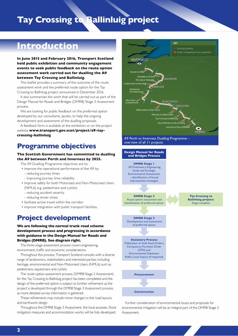
Project developmentWe are following the normal trunk road scheme development process and progressing in accordance with guidance in the Design Manual for Roads and Bridges (DMRB). See diagram right.
The three-stage assessment process covers engineering, environment, traffic and economic considerations.
Throughout this process, Transport Scotland consults with a diverse range of landowners, stakeholders and interested parties; including heritage, environmental and Non-Motorised Users (NMUs) such as pedestrians, equestrians and cyclists.
The route option assessment process (DMRB Stage 2 Assessment) for the Tay Crossing to Ballinluig project has been completed and the design of the preferred option is subject to further refinement as the project is developed through the DMRB Stage 3 Assessment process, as more detailed survey information is gathered.
These refinements may include minor changes to the road layouts and earthwork design.
Throughout the DMRB Stage 3 Assessment, the local accesses, flood mitigation measures and accommodation works will be fully developed.
Introduction
Pass of Birnam to Tay Crossing
Pitlochry to Killiecrankie
Killiecrankie to Glen Garry
Dalwhinnie to Crubenmore
Kincraig to Dalraddy
Crubenmore to Kincraig
Dalraddy to Slochd
Tomatin to Moy
Luncarty to Pass of Birnam
Tay Crossing to Ballinluig
Glen Garry to Dalwhinnie
PERTH
INVERNESS
AVIEMORE
KINGUSSIE
PITLOCHRY
BLAIR ATHOLL
Existing dualling
Single carriageway to be upgraded
KEY
Further consideration of environmental issues and proposals for environmental mitigation will be an integral part of the DMRB Stage 3 Assessment.
DMRB Stage 1 A9 Preliminary Engineering
Study and Strategic Environmental Assessment
– identification of broad improvement strategies
Design Manual for Roads and Bridges Process
DMRB Stage 2 Route option assessment and
identification of preferred option
DMRB Stage 3 Development and assessment
of preferred option
Statutory Process Publication of draft Road Orders,
Compulsory Purchase Order (CPO) and
Environmental StatementPublic Local Inquiry (if required)
Procurement
Construction
Tay Crossing to Ballinluig project:
Stage complete
Route option developmentThe Tay Crossing to Ballinluig project involves dualling 7.7km of the existing A9 from immediately north of the Tay Crossing to the existing dualled section at Ballinluig.
As part of the DMRB Stage 2 Assessment process, four different mainline options and four different side road options were considered.
Preferred mainline optionThe preferred mainline option is Mainline Option 2.
This includes:• predominantly southbound widening throughout the length of
the route, before tying in to the existing dual carriageway atBallinluig
• a ‘best fit’ alignment through Dowally to minimise impact onproperties, to accommodate access to properties on both sidesof the A9 and to achieve a safe alignment for the road.
Mainline Route Option 1 widens to the southbound side of the current A9 from the start of the project to the south of Dowally with a ‘best fit’ alignment as the route passes Dowally. The route then transitions to the northbound side for a short length between Dowally and Guay before transitioning back to the southbound side at Guay for the remainder of the route and ties in with the existing dual carriageway at Ballinluig.
Mainline Route Option 2 is identical to mainline Option 1 to a point south of Dowally with a ‘best fit’ alignment as the route passes Dowally. The route then continues on the southbound side for the remainder of the route and ties in with the existing dual carriageway at Ballinluig.
Mainline Route Option 3 is identical to Mainline Route Option 1 to a point south of Dowally with a ‘best fit’ alignment as the route passes Dowally. The route then continues on the southbound side between Dowally and Haugh Cottages before transitioning to the northbound side for the remainder of the route and ties in with the existing dual carriageway at Ballinluig.
Mainline Route Option 4 is identical to Mainline Route Option 1 to a point south of Dowally with a ‘best fit’ alignment as the route passes Dowally. The route widens to the northbound side between Dowally and Guay, transitions to the southbound side at Guay until the alignment passes Haugh Cottages before transitioning to the northbound side for the remainder of the route and ties in with the existing dual carriageway at Ballinluig.
Side Road Option 1 provides two left-in / left-out junctions with access to the northbound carriageway north of Kindallachan and left-in / left-out junctions to the southbound carriageway at Rotmell, Dowally and between Guay and Kindallachan. Side Road Option 1 provides access to both the northbound and southbound carriageways for residents in Guay and Kindallachan via an overbridge located to the north of Kindallachan. Residents in Dowally only have access the southbound carriageway.
Side Road Option 2 provides two left-in / left-out junctions with access to the northbound carriageway north of Kindallachan and left-in / left-out junctions to the southbound carriageway at Rotmell and between Guay and Kindallachan. Side Road Option 2 provides access to both the northbound and southbound carriageways for residents in Dowally, Guay and Kindallachan via an overbridge located to the north of Kindallachan.
Side Road Option 3 provides a left-in / left-out junction with access to the northbound carriageway north of Kindallachan and left-in / left-out junctions to the southbound carriageway at Rotmell, Dowally and between Guay and Kindallachan. Side Road Option 3 only provides access to the southbound carriageways for residents in Dowally, Guay and Kindallachan and provides a link road between the communities of Guay and Kindallachan.
Side Road Option 4 provides a left-in / left-out junction with access to the northbound carriageway north of Kindallachan and a left-in / left-out junction to the southbound carriageway at Rotmell and between Guay and Kindallachan. Side Road Option 4 only provides access to the southbound carriageways for residents in Dowally, Guay and Kindallachan and provides a link road between the communities of Dowally, Guay and Kindallachan.
Mainline Route Option 1 Mainline Route Option 2 Mainline Route Option 3 Mainline Route Option 4 Side Road Option 1 Side Road Option 2 Side Road Option 3 Side Road Option 4
Mainline Option 2 is preferred for the following reasons:
• lowest interaction with the baseline flood extents andflood risk zone
• most favourable in terms of constructability, as it will requirethe least number of traffic management crossovers duringconstruction
• reduces impacts on properties to the west of the A9.
Visualisation image looking north
A9 Perth to Inverness Dualling Programme – overview of all 11 projects
2 3 4
Tay Crossing to Ballinluig project
In June 2015 and February 2016, Transport Scotland held public exhibition and community engagement events to seek public feedback on the route option assessment work carried out for dualling the A9 between Tay Crossing and Ballinluig.
This leaflet provides a summary of the outcome of the route assessment work and the preferred route option for the Tay Crossing to Ballinluig project announced in December 2016.
It also summarises the work that will be carried out as part of the Design Manual for Roads and Bridges (DMRB) Stage 3 Assessment process.
We are looking for public feedback on the preferred option developed by our consultants, Jacobs, to help the ongoing development and assessment of the dualling proposals.
A feedback form is available at the exhibition or on the project website www.transport.gov.scot/project/a9-tay-crossing-ballinluig
Programme objectivesThe Scottish Government has committed to dualling the A9 between Perth and Inverness by 2025.
The A9 Dualling Programme objectives are to:• improve the operational performance of the A9 by:
- reducing journey times - improving journey time reliability
• improve safety for both Motorised and Non-Motorised Users(NMUs) e.g. pedestrians and cyclists: - reducing accident severity - reducing driver stress
• facilitate active travel within the corridor• improve integration with public transport facilities.
Project developmentWe are following the normal trunk road scheme development process and progressing in accordance with guidance in the Design Manual for Roads and Bridges (DMRB). See diagram right.
The three-stage assessment process covers engineering, environment, traffic and economic considerations.
Throughout this process, Transport Scotland consults with a diverse range of landowners, stakeholders and interested parties; including heritage, environmental and Non-Motorised Users (NMUs) such as pedestrians, equestrians and cyclists.
The route option assessment process (DMRB Stage 2 Assessment) for the Tay Crossing to Ballinluig project has been completed and the design of the preferred option is subject to further refinement as the project is developed through the DMRB Stage 3 Assessment process, as more detailed survey information is gathered.
These refinements may include minor changes to the road layouts and earthwork design.
Throughout the DMRB Stage 3 Assessment, the local accesses, flood mitigation measures and accommodation works will be fully developed.
Introduction
Pass of Birnam to Tay Crossing
Pitlochry to Killiecrankie
Killiecrankie to Glen Garry
Dalwhinnie to Crubenmore
Kincraig to Dalraddy
Crubenmore to Kincraig
Dalraddy to Slochd
Tomatin to Moy
Luncarty to Pass of Birnam
Tay Crossing to Ballinluig
Glen Garry to Dalwhinnie
PERTH
INVERNESS
AVIEMORE
KINGUSSIE
PITLOCHRY
BLAIR ATHOLL
Existing dualling
Single carriageway to be upgraded
KEY
Further consideration of environmental issues and proposals for environmental mitigation will be an integral part of the DMRB Stage 3 Assessment.
DMRB Stage 1 A9 Preliminary Engineering
Study and Strategic Environmental Assessment
– identification of broad improvement strategies
Design Manual for Roads and Bridges Process
DMRB Stage 2 Route option assessment and
identification of preferred option
DMRB Stage 3 Development and assessment
of preferred option
Statutory Process Publication of draft Road Orders,
Compulsory Purchase Order (CPO) and
Environmental StatementPublic Local Inquiry (if required)
Procurement
Construction
Tay Crossing to Ballinluig project:
Stage complete
Route option developmentThe Tay Crossing to Ballinluig project involves dualling 7.7km of the existing A9 from immediately north of the Tay Crossing to the existing dualled section at Ballinluig.
As part of the DMRB Stage 2 Assessment process, four different mainline options and four different side road options were considered.
Preferred mainline optionThe preferred mainline option is Mainline Option 2.
This includes:• predominantly southbound widening throughout the length of
the route, before tying in to the existing dual carriageway atBallinluig
• a ‘best fit’ alignment through Dowally to minimise impact onproperties, to accommodate access to properties on both sidesof the A9 and to achieve a safe alignment for the road.
Mainline Route Option 1 widens to the southbound side of the current A9 from the start of the project to the south of Dowally with a ‘best fit’ alignment as the route passes Dowally. The route then transitions to the northbound side for a short length between Dowally and Guay before transitioning back to the southbound side at Guay for the remainder of the route and ties in with the existing dual carriageway at Ballinluig.
Mainline Route Option 2 is identical to mainline Option 1 to a point south of Dowally with a ‘best fit’ alignment as the route passes Dowally. The route then continues on the southbound side for the remainder of the route and ties in with the existing dual carriageway at Ballinluig.
Mainline Route Option 3 is identical to Mainline Route Option 1 to a point south of Dowally with a ‘best fit’ alignment as the route passes Dowally. The route then continues on the southbound side between Dowally and Haugh Cottages before transitioning to the northbound side for the remainder of the route and ties in with the existing dual carriageway at Ballinluig.
Mainline Route Option 4 is identical to Mainline Route Option 1 to a point south of Dowally with a ‘best fit’ alignment as the route passes Dowally. The route widens to the northbound side between Dowally and Guay, transitions to the southbound side at Guay until the alignment passes Haugh Cottages before transitioning to the northbound side for the remainder of the route and ties in with the existing dual carriageway at Ballinluig.
Side Road Option 1 provides two left-in / left-out junctions with access to the northbound carriageway north of Kindallachan and left-in / left-out junctions to the southbound carriageway at Rotmell, Dowally and between Guay and Kindallachan. Side Road Option 1 provides access to both the northbound and southbound carriageways for residents in Guay and Kindallachan via an overbridge located to the north of Kindallachan. Residents in Dowally only have access the southbound carriageway.
Side Road Option 2 provides two left-in / left-out junctions with access to the northbound carriageway north of Kindallachan and left-in / left-out junctions to the southbound carriageway at Rotmell and between Guay and Kindallachan. Side Road Option 2 provides access to both the northbound and southbound carriageways for residents in Dowally, Guay and Kindallachan via an overbridge located to the north of Kindallachan.
Side Road Option 3 provides a left-in / left-out junction with access to the northbound carriageway north of Kindallachan and left-in / left-out junctions to the southbound carriageway at Rotmell, Dowally and between Guay and Kindallachan. Side Road Option 3 only provides access to the southbound carriageways for residents in Dowally, Guay and Kindallachan and provides a link road between the communities of Guay and Kindallachan.
Side Road Option 4 provides a left-in / left-out junction with access to the northbound carriageway north of Kindallachan and a left-in / left-out junction to the southbound carriageway at Rotmell and between Guay and Kindallachan. Side Road Option 4 only provides access to the southbound carriageways for residents in Dowally, Guay and Kindallachan and provides a link road between the communities of Dowally, Guay and Kindallachan.
Mainline Route Option 1 Mainline Route Option 2 Mainline Route Option 3 Mainline Route Option 4 Side Road Option 1 Side Road Option 2 Side Road Option 3 Side Road Option 4
Mainline Option 2 is preferred for the following reasons:
• lowest interaction with the baseline flood extents andflood risk zone
• most favourable in terms of constructability, as it will requirethe least number of traffic management crossovers duringconstruction
• reduces impacts on properties to the west of the A9.
Visualisation image looking north
A9 Perth to Inverness Dualling Programme – overview of all 11 projects
6
Preferred optionFebruary 2017
A9 Dualling Tay Crossing to Ballinluig project
5
What happens next?We welcome your comments and feedback on the preferred route options. This will help the ongoing development of the Tay Crossing to Ballinluig project.
Transport Scotland’s consultant will take forward the development and assessment of the preferred option for the project (DMRB Stage 3 Assessment).
Transport Scotland will look to publish draft Road Orders, Compulsory Purchase Order and an Environmental Statement for the Tay Crossing to Ballinluig project in 2017, and members of the public will have the opportunity to provide comment and feedback.
The draft Road Orders will define the line of the developed preferred option. The draft Compulsory Purchase Order will define the extent of land needed to deliver the project.
The next stage of the assessment process will include:
• consultation with affected parties such as land andproperty owners and tenants, statutory bodies,Community Councils and other relevant interestgroups
• design development• ground investigation works• identification of the land required for the project and
preparation of draft Orders• Environmental Impact Assessment of the developed
preferred option and preparation of the EnvironmentalStatement
• development of suitable mitigation measures to reduceimpact on the environment.
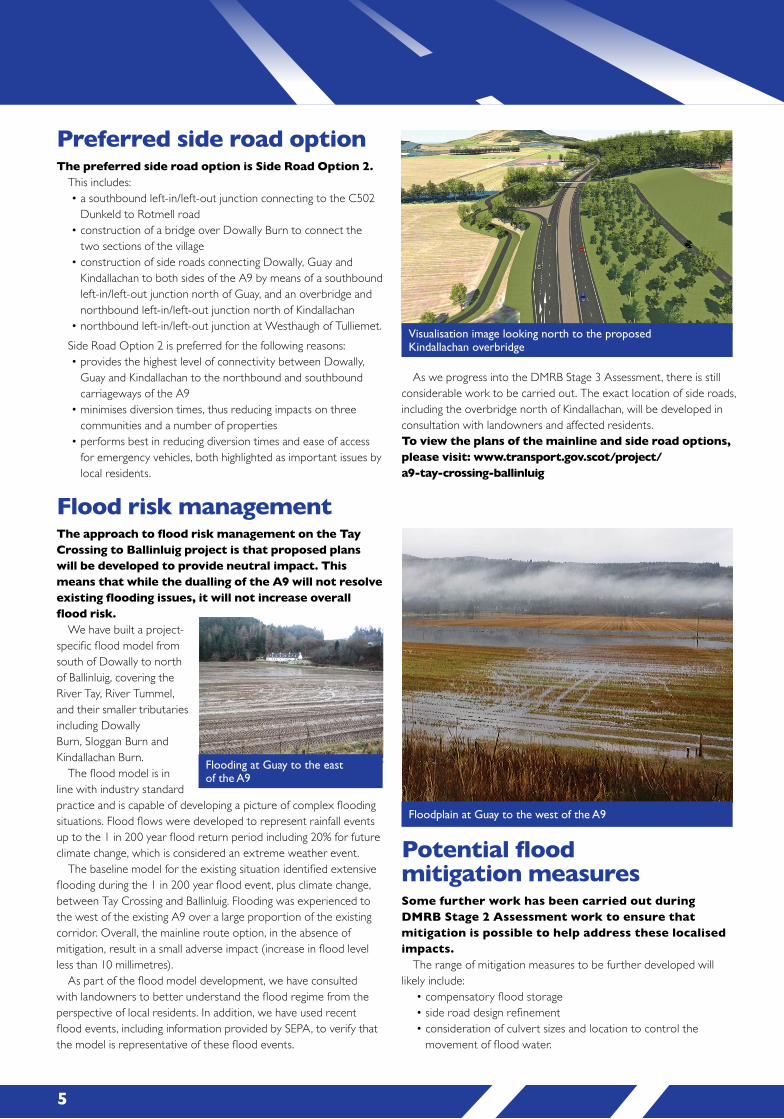
Flood risk managementThe approach to flood risk management on the Tay Crossing to Ballinluig project is that proposed plans will be developed to provide neutral impact. This means that while the dualling of the A9 will not resolve existing flooding issues, it will not increase overall flood risk.
We have built a project-specific flood model from south of Dowally to north of Ballinluig, covering the River Tay, River Tummel, and their smaller tributaries including Dowally Burn, Sloggan Burn and Kindallachan Burn.
The flood model is in line with industry standard practice and is capable of developing a picture of complex flooding situations. Flood flows were developed to represent rainfall events up to the 1 in 200 year flood return period including 20% for future climate change, which is considered an extreme weather event.
The baseline model for the existing situation identified extensive flooding during the 1 in 200 year flood event, plus climate change, between Tay Crossing and Ballinluig. Flooding was experienced to the west of the existing A9 over a large proportion of the existing corridor. Overall, the mainline route option, in the absence of mitigation, result in a small adverse impact (increase in flood level less than 10 millimetres).
As part of the flood model development, we have consulted with landowners to better understand the flood regime from the perspective of local residents. In addition, we have used recent flood events, including information provided by SEPA, to verify that the model is representative of these flood events.
Potential flood mitigation measuresSome further work has been carried out during DMRB Stage 2 Assessment work to ensure that mitigation is possible to help address these localised impacts.
The range of mitigation measures to be further developed will likely include:
• compensatory flood storage• side road design refinement• consideration of culvert sizes and location to control the
movement of flood water.
Preferred side road optionThe preferred side road option is Side Road Option 2.
This includes:• a southbound left-in/left-out junction connecting to the C502
Dunkeld to Rotmell road• construction of a bridge over Dowally Burn to connect the
two sections of the village• construction of side roads connecting Dowally, Guay and
Kindallachan to both sides of the A9 by means of a southboundleft-in/left-out junction north of Guay, and an overbridge andnorthbound left-in/left-out junction north of Kindallachan
• northbound left-in/left-out junction at Westhaugh of Tulliemet.Side Road Option 2 is preferred for the following reasons:• provides the highest level of connectivity between Dowally,
Guay and Kindallachan to the northbound and southboundcarriageways of the A9
• minimises diversion times, thus reducing impacts on threecommunities and a number of properties
• performs best in reducing diversion times and ease of accessfor emergency vehicles, both highlighted as important issues bylocal residents.
As we progress into the DMRB Stage 3 Assessment, there is still considerable work to be carried out. The exact location of side roads, including the overbridge north of Kindallachan, will be developed in consultation with landowners and affected residents.To view the plans of the mainline and side road options, please visit: www.transport.gov.scot/project/ a9-tay-crossing-ballinluig
Flooding at Guay to the east of the A9
Floodplain at Guay to the west of the A9
Visualisation image looking north to the proposed Kindallachan overbridge
Examples of possible mitigation measures include:• appropriate construction management plans• landscape planting• noise barriers or environmental bunds• mammal (e.g. badger and otter) underpasses, ledges and fences.
The next stage of design includes further development of:
• the preferred option alignment• the layout of the overbridge north of Kindallachan• layouts of all side roads and private means of access• proposals for lay-bys• any proposed amendments to Non-Motorised User (NMU)
paths e.g. for pedestrians, equestrians and cyclists• the location and layout of road drainage infrastructure,
including detention basins and treatment ponds.
Comments and feedbackWe invite your comments and feedback using the feedback form available at the exhibition or on the project website.
Please leave in the feedback box provided at the exhibition or email: [email protected] can also post to:
Sarah Morgan, Stakeholder Manager, Jacobs UK Ltd, 95 Bothwell Street, Glasgow, G2 7HX.
For further information on the Tay Crossing to Ballinluig project, and to view the exhibition materials, drawings and visualisations, please visit:
www.transport.gov.scot/project/ a9-tay-crossing-ballinluig
Please provide feedback as soon as possible and before Friday 31 March 2017.
For further informationFurther consultation through local drop-in events and one-to-one engagement is planned during the DMRB Stage 3 Assessment process.
We will keep you updated through a range of direct communications and consultations.
You can contact Jacobs’ Stakeholder Manager Sarah Morgan at any time by telephone or email:
Telephone: 07833 936 426 Email: [email protected]
For further information on the wider A9 Dualling Programme please visit the Transport Scotland website:
www.transport.gov.scot/a9dualling
If you have any queries or any comment on the wider programme, please contact the A9 Dualling team by telephone or email.
Telephone: 0141 272 7100 Email: [email protected]
View of the existing single carriageway looking north
6
Preferred optionFebruary 2017
A9 Dualling Tay Crossing to Ballinluig project
5
What happens next?We welcome your comments and feedback on the preferred route options. This will help the ongoing development of the Tay Crossing to Ballinluig project.
Transport Scotland’s consultant will take forward the development and assessment of the preferred option for the project (DMRB Stage 3 Assessment).
Transport Scotland will look to publish draft Road Orders, Compulsory Purchase Order and an Environmental Statement for the Tay Crossing to Ballinluig project in 2017, and members of the public will have the opportunity to provide comment and feedback.
The draft Road Orders will define the line of the developed preferred option. The draft Compulsory Purchase Order will define the extent of land needed to deliver the project.
The next stage of the assessment process will include:
• consultation with affected parties such as land andproperty owners and tenants, statutory bodies,Community Councils and other relevant interestgroups
• design development• ground investigation works• identification of the land required for the project and
preparation of draft Orders• Environmental Impact Assessment of the developed
preferred option and preparation of the EnvironmentalStatement
• development of suitable mitigation measures to reduceimpact on the environment.
Flood risk managementThe approach to flood risk management on the Tay Crossing to Ballinluig project is that proposed plans will be developed to provide neutral impact. This means that while the dualling of the A9 will not resolve existing flooding issues, it will not increase overall flood risk.
We have built a project-specific flood model from south of Dowally to north of Ballinluig, covering the River Tay, River Tummel, and their smaller tributaries including Dowally Burn, Sloggan Burn and Kindallachan Burn.
The flood model is in line with industry standard practice and is capable of developing a picture of complex flooding situations. Flood flows were developed to represent rainfall events up to the 1 in 200 year flood return period including 20% for future climate change, which is considered an extreme weather event.
The baseline model for the existing situation identified extensive flooding during the 1 in 200 year flood event, plus climate change, between Tay Crossing and Ballinluig. Flooding was experienced to the west of the existing A9 over a large proportion of the existing corridor. Overall, the mainline route option, in the absence of mitigation, result in a small adverse impact (increase in flood level less than 10 millimetres).
As part of the flood model development, we have consulted with landowners to better understand the flood regime from the perspective of local residents. In addition, we have used recent flood events, including information provided by SEPA, to verify that the model is representative of these flood events.
Potential flood mitigation measuresSome further work has been carried out during DMRB Stage 2 Assessment work to ensure that mitigation is possible to help address these localised impacts.
The range of mitigation measures to be further developed will likely include:
• compensatory flood storage• side road design refinement• consideration of culvert sizes and location to control the
movement of flood water.
Preferred side road optionThe preferred side road option is Side Road Option 2.
This includes:• a southbound left-in/left-out junction connecting to the C502
Dunkeld to Rotmell road• construction of a bridge over Dowally Burn to connect the
two sections of the village• construction of side roads connecting Dowally, Guay and
Kindallachan to both sides of the A9 by means of a southboundleft-in/left-out junction north of Guay, and an overbridge andnorthbound left-in/left-out junction north of Kindallachan
• northbound left-in/left-out junction at Westhaugh of Tulliemet.Side Road Option 2 is preferred for the following reasons:• provides the highest level of connectivity between Dowally,
Guay and Kindallachan to the northbound and southboundcarriageways of the A9
• minimises diversion times, thus reducing impacts on threecommunities and a number of properties
• performs best in reducing diversion times and ease of accessfor emergency vehicles, both highlighted as important issues bylocal residents.
As we progress into the DMRB Stage 3 Assessment, there is still considerable work to be carried out. The exact location of side roads, including the overbridge north of Kindallachan, will be developed in consultation with landowners and affected residents.To view the plans of the mainline and side road options, please visit: www.transport.gov.scot/project/ a9-tay-crossing-ballinluig
Flooding at Guay to the east of the A9
Floodplain at Guay to the west of the A9
Visualisation image looking north to the proposed Kindallachan overbridge
Examples of possible mitigation measures include:• appropriate construction management plans• landscape planting• noise barriers or environmental bunds• mammal (e.g. badger and otter) underpasses, ledges and fences.
The next stage of design includes further development of:
• the preferred option alignment• the layout of the overbridge north of Kindallachan• layouts of all side roads and private means of access• proposals for lay-bys• any proposed amendments to Non-Motorised User (NMU)
paths e.g. for pedestrians, equestrians and cyclists• the location and layout of road drainage infrastructure,
including detention basins and treatment ponds.
Comments and feedbackWe invite your comments and feedback using the feedback form available at the exhibition or on the project website.
Please leave in the feedback box provided at the exhibition or email: [email protected] can also post to:
Sarah Morgan, Stakeholder Manager, Jacobs UK Ltd, 95 Bothwell Street, Glasgow, G2 7HX.
For further information on the Tay Crossing to Ballinluig project, and to view the exhibition materials, drawings and visualisations, please visit:
www.transport.gov.scot/project/ a9-tay-crossing-ballinluig
Please provide feedback as soon as possible and before Friday 31 March 2017.
For further informationFurther consultation through local drop-in events and one-to-one engagement is planned during the DMRB Stage 3 Assessment process.
We will keep you updated through a range of direct communications and consultations.
You can contact Jacobs’ Stakeholder Manager Sarah Morgan at any time by telephone or email:
Telephone: 07833 936 426 Email: [email protected]
For further information on the wider A9 Dualling Programme please visit the Transport Scotland website:
www.transport.gov.scot/a9dualling
If you have any queries or any comment on the wider programme, please contact the A9 Dualling team by telephone or email.
Telephone: 0141 272 7100 Email: [email protected]
View of the existing single carriageway looking north