Roadroid 1st international Workshop 13-14.2014, Bangkok, Thailand
Ground Penetrating Radar (GPR)Using GPR in Infrastructure Condition Analysis
01
Introduction
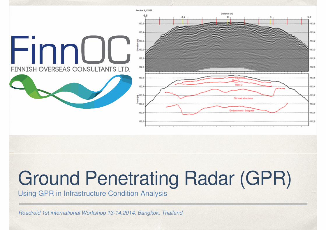
Markku KnuutiMSc Civil Engineer
Helsinki, Finland
✤ Experience: Papua New-Guinea, Azerbaijan,
Bulgaria, Kazakhstan, Russia, Pakistan,
Malaysia, Iran, Estonia, Latvia, Finland, Sweden
and Austria
01
GPR - General
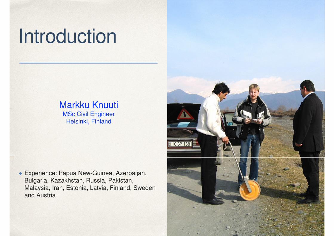
✤ Non-destructive method for efficient
pavement surveys.
✤ Only method to collect continuous data of
layer thickness
✤ Fast method to localise any anomalies in
the road structure such as bad drainage
✤ Measurement can be done in traffic speed
✤ Interpretation of the data is the biggest
work and needs experienced experts to
analyse the data. ¾ of total work time
goes to this work.
01
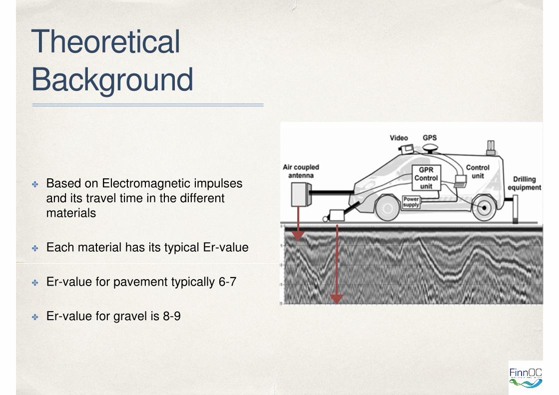
Theoretical
Background
✤ Based on Electromagnetic impulses
and its travel time in the different
materials
✤ Each material has its typical Er-value
✤ Er-value for pavement typically 6-7
✤ Er-value for gravel is 8-9
01
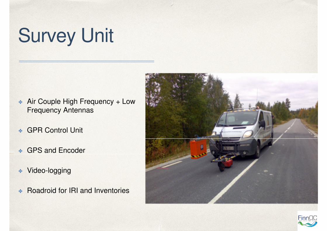
Survey Unit
✤ Air Couple High Frequency + Low
Frequency Antennas
✤ GPR Control Unit
✤ GPS and Encoder
✤ Video-logging
✤ Roadroid for IRI and Inventories
01
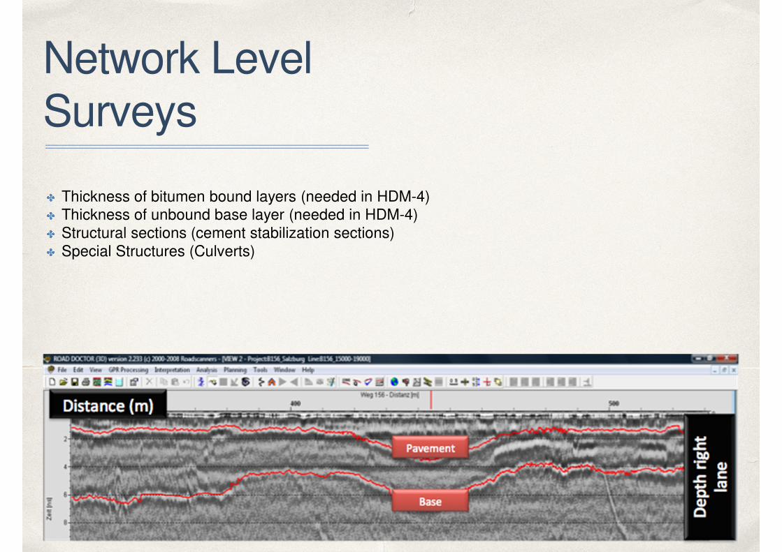
Network Level
Surveys
✤ Thickness of bitumen bound layers (needed in HDM-4)✤ Thickness of unbound base layer (needed in HDM-4)✤ Structural sections (cement stabilization sections)✤ Special Structures (Culverts)
01
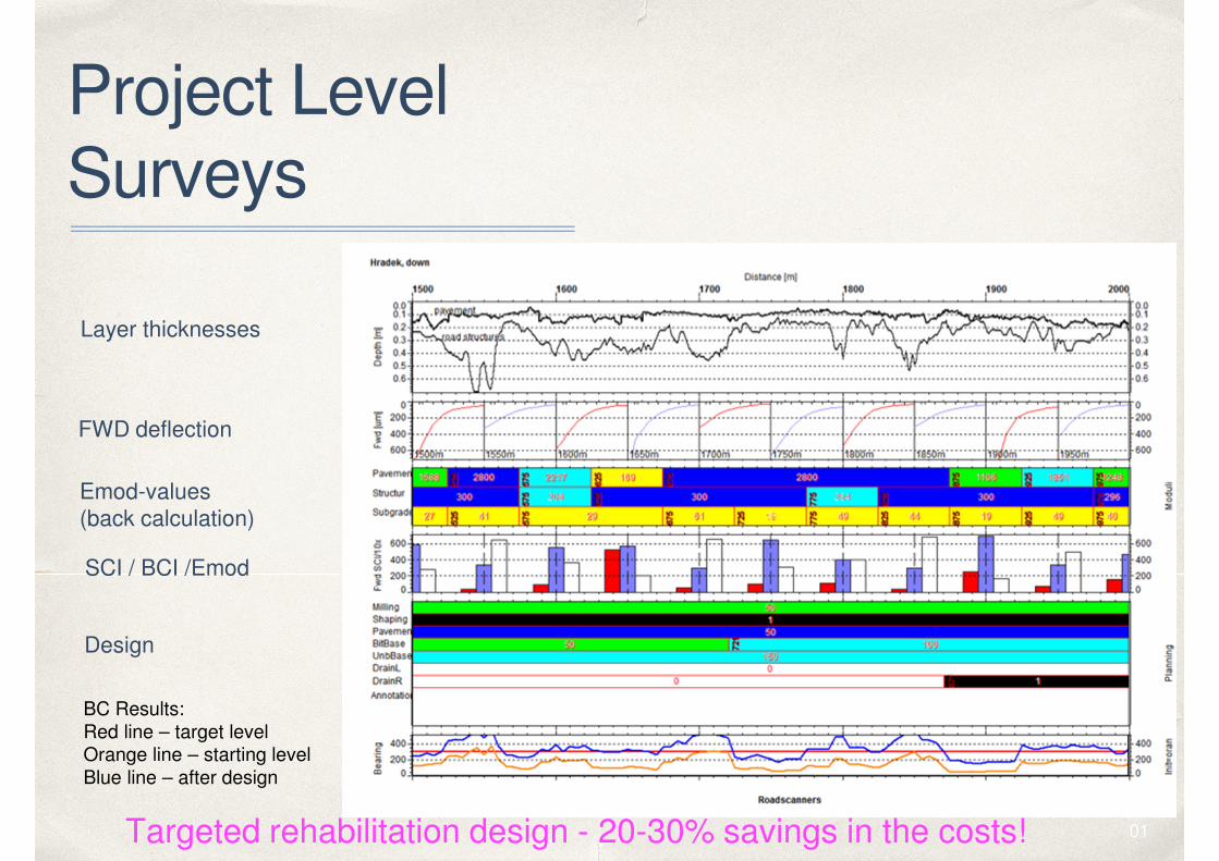
Project Level
Surveys
Layer thicknesses
FWD deflection
Emod-values
(back calculation)
SCI / BCI /Emod
Design
BC Results:
Red line – target levelOrange line – starting level
Blue line – after design
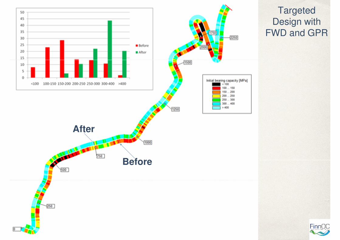
Targeted rehabilitation design - 20-30% savings in the costs!
01
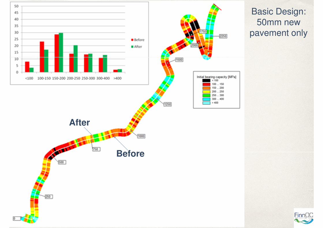
Basic Design:
50mm new pavement only
Before
After
01
Targeted
Design with FWD and GPR
After
Before
01
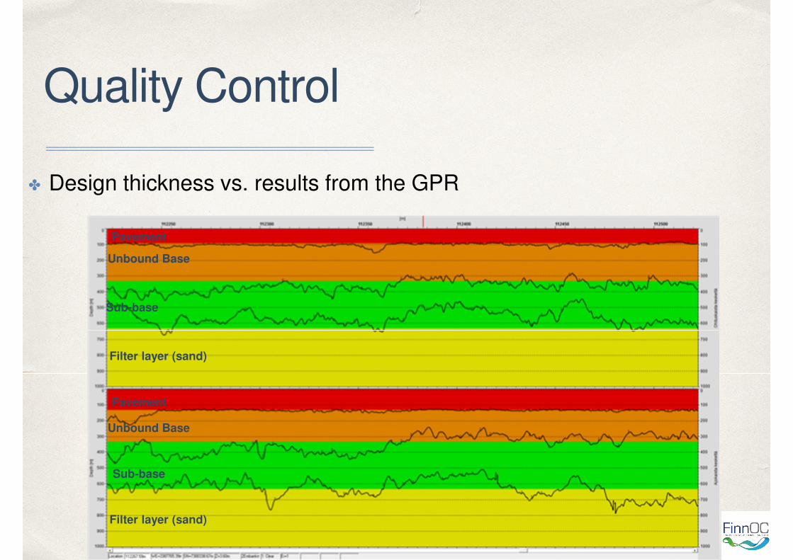
Quality Control
✤ Design thickness vs. results from the GPR
Pavement
Unbound Base
Sub-base
Filter layer (sand)
Pavement
Unbound Base
Sub-base
Filter layer (sand)
01
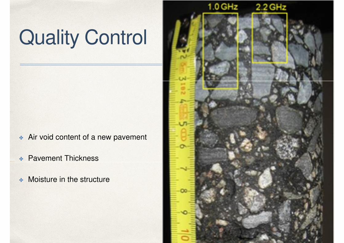
Quality Control
✤ Air void content of a new pavement
✤ Pavement Thickness
✤ Moisture in the structure
01
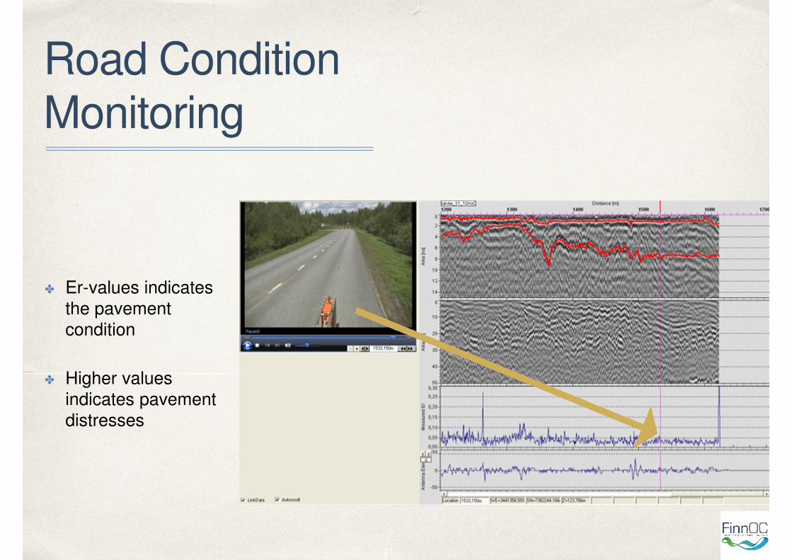
Road Condition
Monitoring
✤ Er-values indicates
the pavement
condition
✤ Higher values
indicates pavement
distresses
01
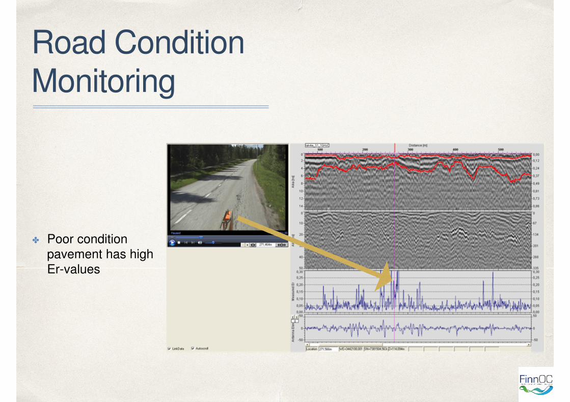
Road Condition
Monitoring
✤ Poor condition
pavement has high
Er-values

01
g{tÇ~ lÉâ4
Recommended