Embed Size (px)
Citation preview

Himachal Pradesh State Roads Transformation Program
(Funded by World Bank)
Dadhol-Ladrour (Km 0.00 to KM 13.500)
Environment and Social Impact Assessment
(Draft)
HIMACHAL PRADESH ROAD & OTHER INFRASTRUCTURE DEVELOPMENT CORPORATION LTD.
(Government of Himachal Pradesh Undertaking) (An ISO 9001:2008 QMS & ISO 14001:2004 EMS conforming company)
November 2019
1 | P a g e
TABLE OF CONTENTS
ABBREVIATIONS AND ACRONYMS ........................................................................................... 3 EXECUTIVE SUMMARY ................................................................................................................ 4
Chapter 1 – Introduction ....................................................................................................................... 10 1.1 Project Description ................................................................................................................ 10 1.2 Sub-Project Road – Dadhol to Ladrour ................................................................................. 11 1.3 Purpose of ESIA ................................................................................................................... 13 1.4 Scope of the ESIA ................................................................................................................. 14 1.5 Approach and Methodology.................................................................................................. 14
Chapter 2 – Legal and Institutional Framework ................................................................................... 18 2.1 Applicable Regulations of GOI/GoHP ................................................................................. 18 2.2 World Bank ESF Policy, Directives and Standards – Extent of Relevance ............................... 25 2.3 Comparative Analysis of key national, state and Bank policies ........................................... 33 2.4 Comparison of National Environmental Framework and ESF, 2018 ................................... 34 2.4 Institutional Framework ........................................................................................................ 36
Chapter 3 – Baseline Data ..................................................................................................................... 38 3.1 Land Environment ................................................................................................................ 39 3.2 Physical Environment ........................................................................................................... 48 3.3 Biological Environment ........................................................................................................ 57 3.4 Social Environment ............................................................................................................... 64 3.5 Cultural Environment .................................................................................................................. 77 3.6 Hazard and Vulnerability Profile .......................................................................................... 77
Chapter 4 – Stakeholder consultations & information disclosure ......................................................... 84 Chapter 5 – Analysis of Alternatives .................................................................................................... 90 Chapter 6 Environment and Social Risks and Impacts and Mitigation Measures ............................ 101
6.1 …related to Assessment and Management of E&S risk and impact (ESS 1): ................... 101 6.2 … relating to Labor and working conditions (ESS 2) ......................................................... 102 6.3 …relating to Resource Efficiency and Pollution Prevention and Management (ESS 3) .... 105 6.4 … relating to Community Health and Safety (ESS 4) ........................................................ 123 6.5 …on land & assets (ESS 5) ................................................................................................. 128 6.6 … relating to Bio-diversity & Living Natural Resources (ESS 6) ...................................... 131 6.7 … on Tribals/Indigenous Population (ESS 7) ..................................................................... 132 6.8 … on impacts on Cultural Heritage (ESS 8) ....................................................................... 132 6.9 ESMP and Budgetary Provisions ........................................................................................ 134
Chapter 7 – Key Measures and Actions for Environmental and Social Commitment Plan (ESCP) .. 135
2 | P a g e
LIST OF APPENDICES
1 List of the individuals/organizations that prepared/ contributed to ESIA.
2 References
3 Summary table of Consultations and surveys with stakeholders (affected persons other interested parties)
4 Comparison of ESF, RFCTLARR Act 2013 and GoHP Financial Commissioner Standing Order No. 28 and Measures to address gaps
5 List of applicable Labour laws
6 Details Of Settlements, Cross Drainage Structures, Junctions Along the Project Road
7 Plan & Profile of Project Road
8 Strip Plan of Project Road Showing Existing Features
9 Transect Walk Survey Formats
10 Ecological Investigations along the Project Road Corridor
11 Photographs Of Sensitive Locations of the Project Road
12 Environmental Monitoring Test Results
13 GoHP’s Strategy To Rehabilitate Areas Infested With Invasive Alien Plant Species (Exotic Weeds) In Himachal Pradesh
14 Village Wise - Census & Economic Details
15 Village Wise - Amenities
16 Census Questionnaires
17 Socio-Economic Questionnaires
18 Attendance Sheet of Stakeholder Consultations
19 Photographs of Stakeholder Consultations
20 Checklist for Community Consultations
21 Gender Based Focused Group Discussion Checklist
22 Material Quantities, Cut and Fill Areas and Volumes
3 | P a g e
ABBREVIATIONS AND ACRONYMS
CGWB Central Ground Water Board COI Corridor of Impact CPCB Central Pollution Control Board CRRI Central Road Research Institute DoE Department of Environment DC District Commissioner ESIA Environmental and Social Impact Assessment ESF Environment and Social Framework ESS Environment and Social Standard EMP Environmental Management Plan ESCP Environment and Social Commitment Plan FPIC Free Prior and Informed Consultation FGDs Focus Group Discussions GDP Gross Domestic Product GoI Government of India GoHP Government of Himachal Pradesh GRC Grievances Redress Committee GRM Grievances Redress Management HPPWD Himachal Pradesh Public Works Department HPRIDP Himachal Pradesh Road and Other Infrastructure Development Corporation HPSRTP Himachal Pradesh State Road Transformation Project/ IRC Indian Road Congress LMP Labour Management Procedure MDRs Major District Roads MoEF Ministry of Environment and Forests MSL Mean Sea Level NGO Non-Government Organization NH National Highway NOx Oxides of Nitrogen NSDP Net State Domestic Product PAP Project Affected Person PIU Project Implementation Unit PMC Project Management Consultant RAP Resettlement Action Plan RFCTLARR Act
Right to Fair Compensation and Transparency in Land Acquisition, Rehabilitation and Resettlement
ROW Right of Way SEP Stakeholder Engagement Plan SEIAA State Environmental Impact Assessment Agency SGWB State Ground Water Board SH State Highway SO2 Sulphur Dioxide SC Schedule Caste ST Schedule Tribe SDO Social Development Officer WB The World Bank
4 | P a g e
EXECUTIVE SUMMARY
1.0 Project Description
1. GoHP’s program for transforming state level transport institutions, improving mobility and logistics for horticulture and overall economic growth in HP, connecting HP to the Bharatmala network, and enhancing Road Safety, sets the goal for the institutional transformation envisaged to be implemented under the proposed project. The proposed Project Development Objective is to enhance the efficiency of the transportation, logistics and Road Safety institutions to stimulate horticulture and overall economic growth in Himachal Pradesh.
2. The proposed operation comprises the following: Component 1: Building HP’s Transport and
Logistics Institutions, and Resilience; Component 2 - Improving fruit belts stimulating HP’s horticulture and overall economic growth. This component will finance upgrading priority target collector roads/MDRs. Component 3: Enhancing Road Safety. Under Component 2 upgrading of approximately 90.95 km of roads connecting small holding farmers production and primary processing clusters to wholesale markets/SME clusters. The implementation of the core initiatives of the project is expected to result in: i) Improved efficiency of transport and logistics institutions; ii) Reduction in maintenance expenditure; iii) Reduction in transport cost for transporting products from production clusters to SME/wholesale markets along the project roads; iv) Reduction in road accident fatalities per 100,000 population in pilot areas.
2.0 Sub-project road– Dadhol-Ladrour
3. The Dadhol-Ladrour road is 13+500 Km and is designated as OSR-9 (Other State Road) is one of the four priority corridors proposed for upgradation. The project road traverses entirely within Bharari tehsil of Bilaspur district and connects to SH-32 at Ladrour end and also to National Highway (NH-103) at Dadhol. The altitude of project corridor ranges between 697-981 m above mean sea level. The existing width of carriage way (bitumen paved width) of the project road varies between 3.0 m to 3.3m in rural areas and varies between 5.0 mtr to 7.1 mtr in settlement/built-up areas. The existing pavement condition of the project road is in distress condition at several intermediate stretches, except for initial stretch of 3 kms. Other aspects observed included: severe cracking, patching & potholes, besides which the current Pavement condition surface is bad and undulations are predominant.
4. There are 15 settlements along the project road. Some of the big settlement areas along the project road are Padyalag, Gahar, Gatwar, Ladhyani, Bharari, Mihara and Ladrour. These locations do not have any schedule V areas or tribal households. The proposed improvement/widening scheme of project road comprises concentric widening, eccentric widening and as well as geometric improvements at necessary locations taking into account locations with blind spots and areas prone to landslides. Design improvement in the project road is done taking into consideration of lane configuration, widening scheme, speed, embankment height and the rural but mountainous setting of the road. There are no associated facilities in this proposed project section. Also, as no other multi-lateral or bi-lateral financing institutions are involved in this project in any of the upgradation or maintenance corridors, hence there is no requirement for a Common Approach.
3.0 Purpose and Scope of ESIA
This ESIA is based on detailed designs dated October 8, 2019. Based on this ESIA the design team is updating the designs [to reduce the proposed right of way to minimum required keeping in view safety considerations, geometric improvements, vehicular population, hill cutting with a view to minimize impacts on land, assets including structures, forest areas and trees] prior to formal WB appraisal.”
5 | P a g e
5. The overall project risk was categorized as ‘High’ as per the internal Environment and Social Risk Classification of the World Bank and hence the ESIA was prepared by an independent ESA consultant. The purpose was to: i) identify, evaluate and manage the environment and social risks and impacts of the project in a manner consistent with the ESSs; ii) adopt a mitigation hierarchy approach to the project’s E&S risks; c) help identify differentiated impacts on the disadvantaged or vulnerable and to identify differentiated measures to mitigate such impacts, wherever applicable; d) assess the relevance and applicability of environmental and social institutions, systems, laws, regulations and procedures in the assessment, development and implementation of projects, whenever appropriate; identify gaps, if any exist, and to assess borrower’s existing capacity and identify areas for enhanced capacity towards management of E&S risks.
6. The scope of the ESIA is to: i) assess the existing baseline status of the environment with in Corridor of Impact and Project Influence Area; ii) identify the probable adverse and positive E&S risk and impacts due to the planned project during its entire cycle i.e. from preconstruction to construction to operation & maintenance; iii) consider all ESHS likely in the project for further usage towards preparation of requisite mitigation plans, as may be required; iv) identify capacity constraint of HPRIDC in respect of E&S management and propose commensurate capacity enhancement measures, etc.
4.0 Legal and Institutional Framework
7. Key GoI and GoHP provisions applicable to the sub-project are summarized here and these include: Environmental Protection Act, 1986; The Forest (Conservation) Act. 1980; Biological Diversity Act, 2002; Construction & Demolition, Waste Management Rules, 2016; Air (Prevention and Control of Pollution) Act, 1981; Water (Prevention and Control of Pollution) Act, 1974; Noise Pollution (Regulation and Control Act) 1990; Right to Fair Compensation and Transparency in Land Acquisition, Rehabilitation and Resettlement Act, 2013 (RFCTLARR); Acquisition of Land by Private Negotiation and Upkeep of Land Record/General Guidelines and Instruction, 2018; The Right to Information Act, 2005. Further WB’s Environment and Social Policy and Standards 1, 2-6, 8 and 10 are relevant to this sub-project, besides the World Bank’s Guidance note on Management of Labor Influx, 2016. In addition, the project will be implemented within the framework of all applicable labor laws of GoI. Hence provisions and measures through action plans would need to be prepared to meet the requirements of the ESS.
5.0 Environment and Social Baseline
8. The proposed project is located in District Bilaspur of Himachal Pradesh state. The baseline E&S profile of project influence area covering 15 km radius of the project as well as Bilaspur district. The project road lies in the range of 248-1141 m. The maximum and minimum elevation of the project road is 981m at km 13+300 and 697 m at Km 0+900. The project road traverses majorly along agricultural lands. Millets are the most dominant agricultural crop, which can also be seen in cultivable lands along the project road. The climate of the district is temperate to sub- tropical. The project road falls within the jurisdiction of Bilaspur division, but there are no forest areas along the 13.5km long Dadhol-Ladrour road. There are no National Parks, Wildlife Sanctuaries, Biosphere Reserve and any other notified sensitive area within 15km on either side of the project road. Further, no wildlife crossing corridors are reported along the project corridor.
9. The project road passes through 15 villages of Bharari sub-tehsil (administrative unit) and the adjacent tehsil is Ghumarwin tehsil. Socio-economic data from secondary sources has been collected and analysed from Bharari sub-tehsil and Ghumarwin tehsil and it has been called as “project influence area”. The total population of Bilaspur district with 381,956 comprising 192764 (50.46%) males and 189192 (49.53%) females, shows that the male population is nearly equal to the female population. Out of the total population of the district 93.42 per cent are in
6 | P a g e
rural areas while mere 6.58 per cent are in urban areas. The male and female ratio of the district is 981 females per every 1000 males. It is higher than the national average. As per census 2011, the average sex ratio of India was 940 females per 1000 male. Among the total population of district, 2.8% (10693) are Scheduled Tribes, 25.92% (98,989) are Scheduled caste population and 71.28% (272274) people belong to other castes. Among the total population, 84.59% of the people are literate and 15.41% of the people are illiterate excluding the 0-6 age group population. This shows that most of the population is literate. Among the literates 91.16% are males and 77.97% are females. This shows that the male literates are more than the female literates. The project influence area/district had an average family size of 4.7 persons per household on 2011. This is moderate family size and comparable with the other part of the district. The density of population of the project influence area/district works out to about 327 persons per km2 in the district.
10. In respect of socio-economic profile of the affected families, 136 families were surveyed. Most of the households are staying along the roadside from a long time where in nearly 78.03% of them are living since more than 10 years. About 21.97% of them are found to have settled in the last 5-10 years.. Analysis on literacy level of the head of the affected household shows that all of them are literates except around a negligible percent 12.12 percent is illiterates. The average household size for the project affected population is 3.6. The work participation rate is 37.26 per cent in the study area is higher than the national work force participation of 39.1 per cent. Distribution of occupation wise details shows, most of them are engaged into commercial activity of trade/business, petty shop, services (44.69 %) followed by agriculture, non-agriculture labour (24.24%), household industries consists 0.76 percent. The incidence of Govt. Employees, Private Employees and Others is around 16.67 percent, 13.64 percent respectively. The income levels of majority of the households fall under higher middle-income category earning more than Rs. 4,00,000 per annum (81.77%). The incidence of lower-income families is about 3.32 percent who earn below 1,80,000 per annum. About 7.5 percent of them are middle income families who are earning Rs. 1,80,000 to 4,00,000 per annum. The expenditure pattern of the affected household’s show that majority of them have an average monthly expenditure above Rs.30,000 per month.
11. Of the total female population, around 50 percent populations are in the age group between 15-40. Around 23 percent women population is in the age group of 6-14. There are 4.63 percent women population is in the age above 60. It can be seen from the following table that of the total female population those who are in the age group above 6, are 2.14 percent are illiterate. There are 32.56 %, 15.60%, 18.64% and 14.21% are primary, middleclass, SSC and pre-university educated. Around 7.26 % are degree holder. There are 6.34% and 3.25% are technically qualified and post graduate degree holder. In respect of occupation, there are about 72.32% of women member engaged in cultivation. Only 4.24% of women members are involved in other activities, 65.25% women are involved in collection of water, 21.21% are engaged as an agricultural labors. 13.74% are helping their family members in trade and business. Only 5.25% women are in service and merely 20.81% of women are worked as allied activities.
6.0 Stakeholder Consultations
12. Consultations were also held with communities at various locations en-route and also specifically at locations where common property resources were getting affected. Consultations were also held with communities at various locations en-route and also specifically at locations where common property resources were getting affected. Key queries and concerns were relating to: what compensation will be paid to title holder and non-title holders; avoidance of impacts on CPRs such as temples used for various religious and community purposes; project authorities to consider available open land wherever it was available instead of impacting their house and land;
7 | P a g e
safety measures in hospital and school zones; construction works should lead to jobs. They suggested that project should have provisions for parking are must in the city area; should take up the structural works (bridges and culverts) in priority during the early phase of the project cycle or otherwise these works mostly gets delayed; provide for noise barriers to minimize the noise pollution; additional assistance for employment/ income restoration for locals; and necessary measures to be taken during the construction stage to reduce and/avoid pollution and health risks at the time of construction
7.0 Analysis of Alternatives
13. Lane configuration is being done in keeping in view safety considerations, geometric improvements and vehicular population. At built up/ village sections where the road width is insufficient for expansion, design alternatives include options for realignments and for modifying the proposed road designs, such as reduction of the shoulder widths, have been used. Reducing design speed in built up areas; providing suitable safety measures, such as speed reductions near schools and hospitals have been incorporated in the design. Hence in light of the ESIA, impacts were minimized at least three locations. These included: i) dense Built up area- 5+700 - 6+860 (Ladhyani & Bharari); ii) Lehri sarel, Kothi (Chainage 7+300 – 9+300) and iii) Bharari (6+700) Government Secondary School. At these locations analysis of alternatives such as keeping the lane configuration as intermediate lane; concentric widening in the built-up sections (9 – 10m); curve improvements within the available ROW and realignments to reduce impacts, have been considered. Hence, vide this approach that was considered as part of the Mitigation Hierarchy, the preliminary/draft designs are being further revised again to reduce impacts on land, assets and forest area including trees.
8.0 E&S Risks and Impacts
14. The project’s environmental and social risks and impacts likely due to the project road by each relevant standard (ESS 2-6 & 8) have been assessed based on the current designs and also measures to mitigate the same have been proposed.
15. E&S risks and impacts on Disadvantaged and Vulnerable persons: Project shall define vulnerable persons as: those ‘Below Poverty Line’ category as identified by the concerned State Govt. level, SC, ST, disabled, handicapped, orphans, destitute persons and woman heading the household are also recognized as vulnerable persons. Based on the survey, the Project shall affect 48 vulnerable households – 45 (Scheduled Caste) and 3 (Scheduled Tribe).
16. E&S risks on labor and working conditions: HPRIDC shall contract agencies to undertake civil works, agencies/firms to support core-functions; primary suppliers of material/equipment and other implementation support partners. All categories of project workers: Direct workers, Contracted workers, Migrant Workers and Community Workers would be involved. At this stage, it is estimated that the project will require to engage 560 labor (including project managers, supervisors, labor, etc.) Risks include: Non-payment of wages by Employer; Non-payment of benefits (compensation, bonus, maternity benefits etc.) by Employer; Discrimination in Employment (e.g. abrupt termination of the employment, working conditions, wages or benefits etc.); Possibility of Gender based violence as the road shall traverse through sensitive locations such as hospitals, schools, etc. that are near to habitations; Health risks of labour relating to HIV/AIDS and other sexually transmitted diseases.
17. E&S risks and impacts relating to Resource efficiency and Pollution Prevention: The assessment of impacts and risks due to road constructions has considered sensitive receptors of physical, biological, social, and cultural environment. In addition, natural calamity like landslide, earthquake and flooding were also considered during assessment due to location of road in such sensitive geography. The project’s impacts and risk would be of significance on sensitive
8 | P a g e
receptors due muck disposal; slope stability and erosion (2 locations); blocking or filling of springs and seasonal streams (3 number); construction water demand (26.7 million Liters); stressing water sources used by community (absence of perennial water sources); emission from construction vehicles, equipment and plants; dust from earth works, hill cutting, stack yard, transportation of materials;, noise pollution (2 schools) and settlements along road; damage to structure vibration from movement of machine and equipment (structure on embankment); handling of hazardous and non-hazardous wastes, quarry and borrow area. The design optimisation is still being done and options are being analyse to minimise project’s footprint on social and environment including GHG calculation, resource efficiency etc.
18. E&S risks and impacts relating to Community Health and Safety: The road will act as haul road for transporting construction materials will cause nuisance to local road users (road users and pedestrians). Additionally: i) hill cutting, landslides, road excavation, use of vibratory equipment, construction debris handling and disposal etc. during construction; ii) high likelihood of direct exposure to increased construction related traffic and equipment especially at road sections traversing settlement area with limited carriageway/roadway width, and sensitive receptors such as schools, religious place, health centre/hospitals; iii) high dust levels from earthworks/hill cutting, high noise and emission level from traffic congestion and idling of vehicles; iv) influx of migrant workers could potentially cause local discomfort or potential conflicts with local people including possible Gender based violence.
19. E&S risks and impacts on land & assets (ESS 5): As per the available right of way information
provided by PWD units and revenue officials there is no additional land that needs to be taken. The total numbers of families affected are 136– all of which are non-titleholder encroachers. These structures of these affected families are mainly residential, commercial and mix of residential and commercial, besides others such as cattle sheds, etc. In addition, there are 48 CPRs that comprise Schools (3), Religious structures (4), and Hand Pump (29). These also comprise 6 vulnerable households comprising 1from Scheduled Tribes (ST) and 5are from Scheduled Caste (SC) categories.
20. E&S risks and impacts relating to Bio-diversity & Living Natural Resources (ESS 6): There are no presence of rare, endangered and threatened flora species along project road. However, invasive species like Ageratum conyzoides, Eupatorium adenophorum, Lantana camara, Parthanium hysterophoros are observed, which are being managed through Forest Department, GoHP. The construction of road is likely to affect 75 of 3614 trees existing within right of way. No rare, endangered and threatened floral species are identified within the corridor. Monitor lizard (Varanus bengalensis) was observed along the road, which is listed under Schedule-I (part III) of Wildlife Protection Act-1972. The biodiversity investigation along the project corridor has not indicted the presence of any scheduled fauna. Hence, the project road construction is not likely to cause any impacts on the fauna.
21. E&S risks and impacts relating to Cultural Heritage: The alignment of the project road does not have any ancient monuments and/or archaeological site(s). However, 1 religious’ structures/shrines are expected to be partially impacted by the proposed road improvement activities. Extent of impact including on access on these structures, could vary depending on the final designs during preparation and potential modifications during construction stage.
22. Mitigation measures have been proposed based on current designs and these would be further revised based on the final road designs.
9 | P a g e
9.0 Key issues/findings and inputs to ESCP
23. Few gaps exist in the provisions in policies between government acts/policies and World Bank’s ESS requirements that need to be filled. Institutional arrangement to address E&S aspects are currently relatively weak and need significant strengthening. GRM is decentralized and ad-hoc and requires systematic recording of grievances and redressal
24. Further action needs to be taken to: i) to verify existing ROW and obtain clearances, licenses/approvals and permits under existing legal framework that are applicable to the Project from relevant national and/or local authorities; ii) describe the policy, institutional and implementation framework to guide the compensation for loss of land and assets and ensure that no affected persons are displaced without proper consultation and compensation; iii) develop mechanisms to foster greater participation of more passive members of the community, including disadvantaged persons, women and vulnerable groups; iv) develop clear procedures for disseminating information about the project to all affected communities and provide a feedback mechanism for these communities to voice their concerns and address these concerns during project implementation. Trainings on Environment and Social aspects including reporting requirements need to be prepared and administered to build capacity of the project staff.
25. Key measures and timeframes required for the project to meet the requirements of the ESSs are as follows: i) HPRIDC will establish and maintain an E&S organizational structure in HPRIDC with qualified staffs to support management of E&S risks including at least one Environmental Expert and one Social Expert; ii) HPRIDC to provide draft consolidated ESIA; iii) Disclose Draft Consolidated Environment and Social Impact Assessment (ESIA) for the road corridor on Department website and WB portal; iv) Disclose Draft Stakeholder Engagement Plan; v) HPRIDC to disclose approved RPF on its website and HPRIDC to develop and include the project grievance mechanism in SEP and vi) disclosure of the approved ESCP; vii) HPRIDC to prepare a Resettlement Policy Framework for the overall project including rehabilitation and maintenance corridors. These actions would need to be completed before the Project Appraisal in December 2019. The following documents - ESMP (EMP, RAP) and GBV Plan would need to be completed prior to project negotiations in January 2020.
10 | P a g e
CHAPTER 1 – INTRODUCTION
1.1 Project Description
1. GoHP’s program for transforming state level transport institutions, improving mobility and logistics for horticulture and overall economic growth in HP, connecting HP to the Bharatmala network, and enhancing Road Safety, sets the goal for the institutional transformation envisaged to be implemented under the proposed project. As such, this project will support the launching of GoHP’s program focusing on strengthening the institutional base for transportation infrastructure and logistics services administration.
2. The proposed Project Development Objective is to enhance the efficiency of the transportation, logistics and Road Safety institutions to stimulate horticulture and overall economic growth in Himachal Pradesh.
3. The proposed operation comprises the following Components and sub-components:
Component 1. Building HP’s Transport and Logistics Institutions, and Resilience, including:
Sub component 1.1: Reestablishing the Himachal Pradesh Road and Infrastructure Development Corporation (HPRIDC) and building resilience. The objective is to support GoHP’s initiative to create a corporate entity responsible for the administration of HP roads and delivering safe, resilient and well performing roads supporting the horticulture and overall economic development of the State. This involves, reestablishing HPRIDC as the road asset and other public infrastructure manager, responsible for the development and maintenance of all roads and other infrastructure under the jurisdiction of the HPPWD.
Sub component 1.2: Supporting the commercialization process of the direct labor operations and promoting competitive performance-based maintenance contracting. The objective is to support GoHP’s initiative to improve the efficiency of maintenance execution and reduce maintenance cost, by laying the ground for the full commercialization of HPPWD’s direct labor operations.
Sub component 1.3: Establishing HP Motor Vehicle Administration (HPMVA), Strengthening the Directorate of Transportation of HPDOT and developing logistics system and strategy. The objective is to deliver efficient customer services, as well as competitive, safe and clean/less pollutant transportation in HP.
Component 2. Improving fruit belts stimulating HP’s horticulture and overall economic growth.
4. This component will finance upgrading priority target collector roads/MDRs. The upgrading of approximately 90.95 km of roads connecting small holding farmers production and primary processing clusters to wholesale markets/SME clusters.
Component 3: Enhancing Road Safety, including:
Sub component 3.1: Promoting the ‘Safe System’: This support focuses on strengthening enforcement on state roads and critical accident spots along rural roads, by enhancing patrolling and establishing emergency response system.
Sub component 3.2: Promoting the ‘Safe Corridor initiative’: The Safe Corridor initiative will support the state highway patrol by providing surveillance equipment (CCTV cameras for speed control, accident recording, etc.), variable messaging system (VMS), training the police, and establishing emergency response posts.
11 | P a g e
5. The implementation of the core initiatives of the project is expected to result in: i) Improved efficiency of transport and logistics institutions; ii) Reduction in maintenance expenditure; iii) Reduction in transport cost for transporting products from production clusters to SME/wholesale markets along the project roads; iv) Reduction in road accident fatalities per 100,000 population in pilot areas.
1.2 Sub-Project Road – Dadhol to Ladrour
6. Under the project the following four corridors are being taken up for upgradation. Details are provided in Table 1.1
Table 1.1 – Roads proposed for upgradation under HPSRTP II S.No Name of the Road District Length (in Km)
1 Baddi – Sai – Ramshahr Solan 35.950 2 Dadhol – Ladrour Bilaspur 14.500
3 Mandi – Rewalsar – Kalkhar Mandi 28.000
4 Raghunathpura-Mandi-Harpura- Bharari Bilaspur 2.500
7. The Dadhol-Ladrour road is 13+500 Km and is designated as OSR-9 (Other State Road). The project road traverses entirely within Bharari tehsil of Bilaspur district and connects to SH-32 at Ladrour end and also to National Highway (NH-103) at Dadhol. The latitude of the project road at Dadhol and Ladrour are 31.29’.52” N to 31.34’.22” N respectively and Longitude is 76.29’.52” E to76.40’.07” E respectively. The altitude of project corridor ranges between 697-981 m above mean sea level.
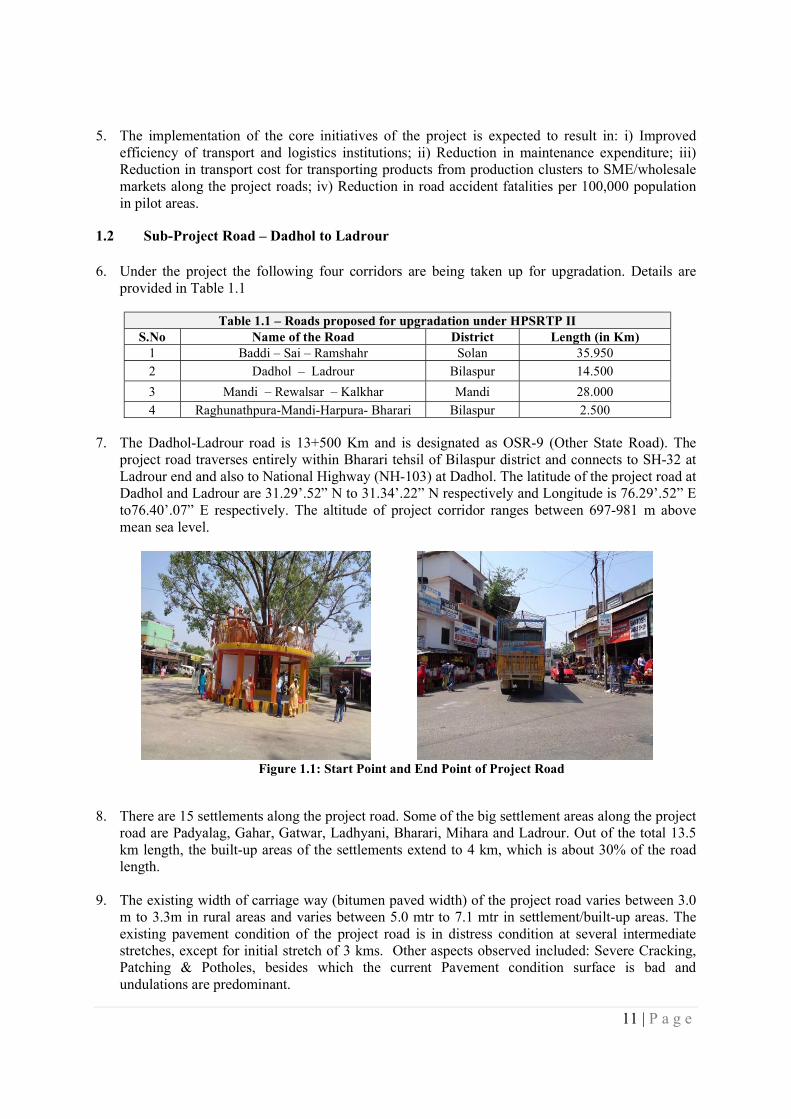
Figure 1.1: Start Point and End Point of Project Road
8. There are 15 settlements along the project road. Some of the big settlement areas along the project road are Padyalag, Gahar, Gatwar, Ladhyani, Bharari, Mihara and Ladrour. Out of the total 13.5 km length, the built-up areas of the settlements extend to 4 km, which is about 30% of the road length.
9. The existing width of carriage way (bitumen paved width) of the project road varies between 3.0 m to 3.3m in rural areas and varies between 5.0 mtr to 7.1 mtr in settlement/built-up areas. The existing pavement condition of the project road is in distress condition at several intermediate stretches, except for initial stretch of 3 kms. Other aspects observed included: Severe Cracking, Patching & Potholes, besides which the current Pavement condition surface is bad and undulations are predominant.
12 | P a g e
10. The available right of way for the project road varies between 12m to 18m, with minimum being
12m and maximum upto 25m. Thus, available right of way is adequate for the proposed widening scheme and no fresh land (either private or Govt land) is required to be acquired for the project road.
11. The project road has 10 bus stops that are also locally known as rain shelters. Under the project widening scheme, all the bus stops/rain shelters will be remodeled to provide cross ventilation as well as to prevent entry of stray animals into the bus stop and these will be reconstructed with bio-toilet provision.
12. The proposed improvement/widening scheme of project road comprises concentric widening, eccentric widening and as well as geometric improvements at necessary locations taking into account locations with blind spots and areas prone to landslides. Design improvement in the project road is done taking into consideration of lane configuration, widening scheme, speed, embankment height and the rural but mountainous setting of the road. The existing substandard geometry in rural area has been eliminated. In addition, reconstruction, retaining with minor and extension are required in minor bridges, major bridges, pipe, slab and box culverts, etc. The project road has 10 bus stops between Km 0 to Km 13.5 and these are also locally known as rain shelters. Under the project widening scheme, all the bus stops/rain shelters will be remodeled to provide cross ventilation as well as to prevent entry of stray animals into the bus stop and these will be reconstructed with bio-toilet provision.
13. Pre-construction stage of the project are likely to involve adverse impacts on land –
private/government/forest, structures, trees/crops, CPRs including religious structures that fall within the Corridor of Impact. Additionally, in hilly areas, there is a need to consider landslide depending on the type of soil in the slope and hence at such locations land & structures beyond COI may need to be taken as well. Further during construction stage, the project is expected to set up labor camps with separate but temporary facilities for housing, water & power supply and construction material storage facilities.
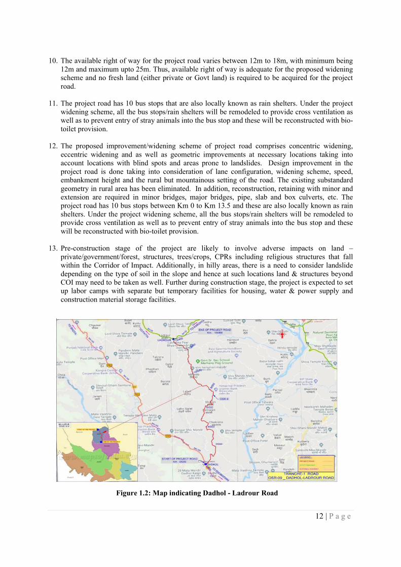
Figure 1.2: Map indicating Dadhol - Ladrour Road
13 | P a g e
14. Besides, the project will also have access roads leading to the labor camps and identified spots/locations needed for disposal of material, etc. It is anticipated that materials required i.e. primary suppliers for construction works will be sourced from government approved facilities from adjoining districts/within the state.
15. The Himachal Pradesh Road and Other Infrastructure Development Corporation (HPRIDC) is the designated nodal agency under GoHP for implementation of HPSRTP in Himachal Pradesh. HPRIDC besides having its direct own workers i.e. employees shall contract agencies1: for civil works, agencies/firms to support core-functions; primary suppliers of material/equipment and other implementation support partners, and these could be from anywhere in the country or outside. Influx of migrant labor from other states for construction works has been a norm in the state and is likely to continue in this project as well resulting in potential gender-based violence (GBV). Therefore, the project will involve a wide variety of stakeholders during its project cycle including Police Department that are associated with activities under other components of the project such as Road Safety.
16. There are no Associated facilities in this proposed project section. Also, as no other multi-lateral
or bi-lateral financing institutions are involved in this project in any of the upgradation or maintenance corridors, hence there is no requirement for a Common Approach.
17. Based on a thorough consideration of the afore-mentioned details, the following plans need to be prepared to meet the requirements of ESS.
Table 1.2 – Plan documents to meet relevant ESS requirements ESS 1 EMP and ESMP ESS 2 Labour Management Procedure for HPRIDC2 ESS 3 Waste Management Plan & Pollution Prevention Management
Plan ESS 4 Emergency Response Plan & GBV Mitigation Plan ESS 5 Resettlement Action Plan ESS 6 Bio-diversity Management Plan (Not applicable ) ESS 7 Indigenous-Peoples (Not applicable ) ESS 8 Cultural Heritage Plan (will be included as part of the ESMP) ESS 9 No Plan needed as no financial intermediaries are involved ESS 10 Stakeholder Engagement Plan
1.3 Purpose of ESIA
18. In light of the afore-mentioned impacts the overall project was categorized as High Risk as per the internal Environment and Social Risk Classification of the Bank. Hence for the preparation of the Environment and Social Assessment of all the roads and subsequent follow on mitigation, HPRIDC contracted a separate independent agency – Messrs, Deccan Consulting Engineers Private Limited.
19. The purpose of the ESIA is to use it as tool for decision-making on the sub-project so that there is sustainable development of the road construction. Specifically, the objective of the ESIA is:
i. To identify, evaluate and manage the environment and social risks and impacts of the project in a manner consistent with the ESSs;
ii. To adopt a mitigation hierarchy approach to the project’s E&S risks i.e. a) anticipate and avoid risks and impacts; b) minimize or reduce risks and impacts to acceptable levels, if not
1 e.g. Civil works contractors, Road Safety Consultants, Project Management Consultants/Construction Supervision Consultant, NGO for RAP implementation 2 Labor Management Procedure shall be applied by HPRIDC for all upgradation and maintenance roads
14 | P a g e
avoidable; c) once risks and impacts have been minimized or reduced, mitigate; and (d) where significant residual impacts remain, compensate for or offset them, where technically2 and financially3 feasible;
iii. To help identify differentiated impacts on the disadvantaged or vulnerable and to identify differentiated measures to mitigate such impacts, wherever applicable;
iv. To assess the relevance and applicability of environmental and social institutions, systems, laws, regulations and procedures in the assessment, development and implementation of projects, whenever appropriate; identify gaps, if any exist, and
v. To assess borrower’s existing capacity and identify areas for enhanced capacity towards management of E&S risks
1.4 Scope of the ESIA
20. The ESIA requires conforming to the applicable environment and social legal and regulatory framework of Government of India and Himachal Pradesh as well as World Bank’s Environmental and Social Framework Policy and relevant Standards. The scope of the ESIA is to:
i. assess the existing baseline status of the environment with in Corridor of Impact and Project Influence Area;
ii. identify the probable adverse and positive E&S risk and impacts due to the planned project during its entire cycle i.e. from preconstruction to construction to operation & maintenance;
iii. identify stakeholders and various groups/institutions who are either affected or have an interest or a stake in the project, with additional emphasis on disadvantaged and vulnerable groups and to carry out consultations with stakeholders to help elicit their concerns, suggestions and support;
iv. consider all ESHS likely in the project for further usage towards preparation of requisite mitigation plans, as may be required.
v. conduct additional studies, if any, for the enhancement of the benefit to the local community and the road users.
vi. identify capacity constraint of HPRIDC in respect of E&S management and propose commensurate capacity enhancement measures; and finally
vii. use inputs from the above to prepare appropriate mitigation measures and plans and their inclusion in cost estimates (including rate analysis), Drawings, Bill of Quantities, Technical specifications and other inputs that would be integrated with the bid documents.
1.5 Approach and Methodology
21. Study Areas: The study area is defined consideration physical space to be occupied, whether permanently or temporarily, during construction of the entire road infrastructure, associated infrastructure, as well as adjacent spaces, performance of planned activities in the various stages according to project needs, requirements on use and exploitation of natural resources, abiotic, biotic and socioeconomic components, and the area where significant environmental impacts are evident, with a view to define limit on which components involved are analyzed.
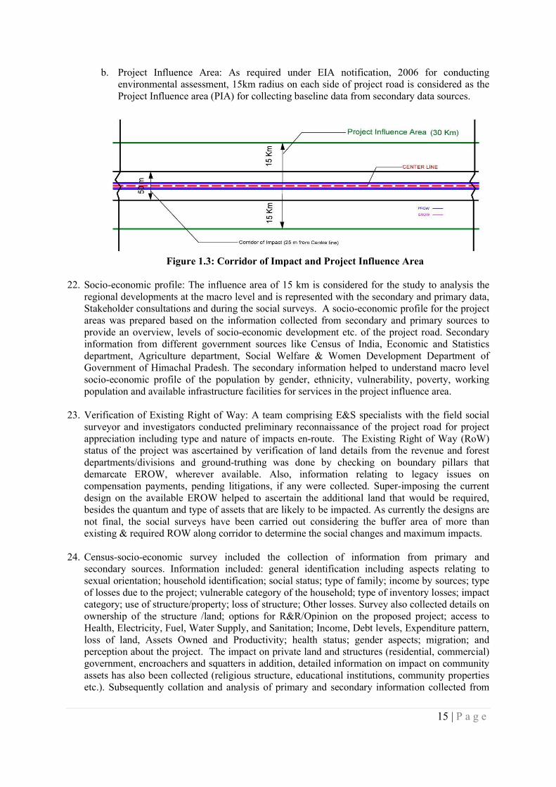
a. Corridor of Impact: The land width that would be needed during construction taking into
account full construction width, vehicle parking/movement plus safety zone on either side of centerline during construction stage is considered as Corridor of Impact. The environmental baseline inventory collected within 50 metre wide land strip i.e. 25 metre on each side of the centre line of the road has been considered as the direct corridor of impact.
15 | P a g e
b. Project Influence Area: As required under EIA notification, 2006 for conducting environmental assessment, 15km radius on each side of project road is considered as the Project Influence area (PIA) for collecting baseline data from secondary data sources.
Figure 1.3: Corridor of Impact and Project Influence Area
22. Socio-economic profile: The influence area of 15 km is considered for the study to analysis the regional developments at the macro level and is represented with the secondary and primary data, Stakeholder consultations and during the social surveys. A socio-economic profile for the project areas was prepared based on the information collected from secondary and primary sources to provide an overview, levels of socio-economic development etc. of the project road. Secondary information from different government sources like Census of India, Economic and Statistics department, Agriculture department, Social Welfare & Women Development Department of Government of Himachal Pradesh. The secondary information helped to understand macro level socio-economic profile of the population by gender, ethnicity, vulnerability, poverty, working population and available infrastructure facilities for services in the project influence area.
23. Verification of Existing Right of Way: A team comprising E&S specialists with the field social surveyor and investigators conducted preliminary reconnaissance of the project road for project appreciation including type and nature of impacts en-route. The Existing Right of Way (RoW) status of the project was ascertained by verification of land details from the revenue and forest departments/divisions and ground-truthing was done by checking on boundary pillars that demarcate EROW, wherever available. Also, information relating to legacy issues on compensation payments, pending litigations, if any were collected. Super-imposing the current design on the available EROW helped to ascertain the additional land that would be required, besides the quantum and type of assets that are likely to be impacted. As currently the designs are not final, the social surveys have been carried out considering the buffer area of more than existing & required ROW along corridor to determine the social changes and maximum impacts.
24. Census-socio-economic survey included the collection of information from primary and secondary sources. Information included: general identification including aspects relating to sexual orientation; household identification; social status; type of family; income by sources; type of losses due to the project; vulnerable category of the household; type of inventory losses; impact category; use of structure/property; loss of structure; Other losses. Survey also collected details on ownership of the structure /land; options for R&R/Opinion on the proposed project; access to Health, Electricity, Fuel, Water Supply, and Sanitation; Income, Debt levels, Expenditure pattern, loss of land, Assets Owned and Productivity; health status; gender aspects; migration; and perception about the project. The impact on private land and structures (residential, commercial) government, encroachers and squatters in addition, detailed information on impact on community assets has also been collected (religious structure, educational institutions, community properties etc.). Subsequently collation and analysis of primary and secondary information collected from
16 | P a g e
different sources has been carried out. On the basis of primary data, analysis has been done on potential social and economic impacts, categorization of impacts, risks, potentials impacts, and alternatives etc. Local level consultations and focus group discussions and key informant interviews were deployed to elicit views and opinions of different stakeholders regarding the proposed road improvements.
25. Environmental baseline and assessment: The primary baseline information on different environmental components were collected through field survey. The input to field survey i.e. identification of environmental factors to be considered for assessment is backed by a thorough desk review of literature, existing rules/regulations/acts and reconnaissance survey. Field survey were carried out to collect information on the major environmental features such as settlement facilities, drainage pattern of the area, forest, trees within RoW of the alignment, water bodies, river crossing, sensitive receptors, air, water, noise and soil quality etc. and were studied in detail, which helped in identifying areas of concern along the stretch and critical issues. After the full documentation of the baseline environmental situation, each of the environmental aspects was examined against the road upgrading component and activities. Environmental issues have been assessed to describe the potential impacts and risks that may result from road upgrading and construction. Based on baseline information impacts were identified and mitigation measures selected. Any actions required at later stage of the project is captured in Chapter 7, which will be reflected in ESCP. (See Appendix 9 :- Inventory Checklist and Environmental Screening Formats)
26. Based on an identification of stakeholder towards the preparation of a Stakeholder Engagement Plan, stakeholders were identified through systematic consultation with project beneficiaries, project affected people, women, vulnerable and poor members of the community, and other stakeholders who may have an influence over the project. Hence consultations were undertaken with primary stakeholders: beneficiaries, disadvantaged, poor and vulnerable groups, people who may potentially be impacted adversely by the project. Consultations were also carried out with secondary stakeholders: local community-based organizations (CBOs) and community representatives as well as government departments etc.
Table 1.3 – Tools of Consultations
Tools of Consultation
Stakeholders Purpose
Public meeting, Focus Group Discussion
Community, civil society organizations, NGOs, local leaders, Government officials
Discuss the objective of the project; Social impact (Land including EROW, Structure, CPR
Public meeting, Focus Group Discussion
Women groups, Truckers, vulnerable road users etc.
Social Concerns (Road Safety, Critical Junctions, Rural Roads, Slow moving vehicles, Fair/Festival Traffic; Environmental improvement/ enhancement)
Key informant interviews
Government Officials (Managers, Engineers, Supervisors etc.);
Social impact (Land/EROW, Structure, CPR)
Neighbouring communities; Disadvantaged and vulnerable Groups (women, children, person with disability, old age);Employees and Managers (Project Managers, Site Engineers, technicians, supervisors, safety staff, multipurpose staff);
Social Concern (Road Safety, accident spots, critical Junctions)
Village panchayat members/ local NGO’s and Community Organization
Rural Roads (Slow moving vehicles, importance of the road, Fair/Festival
17 | P a g e
Table 1.3 – Tools of Consultations
Tools of Consultation
Stakeholders Purpose
Traffic; Environmental improvement Social Concern (Road Safety, accident spots, critical Junctions; role in the area)
Community workers, Sarpanch, ANMs etc.
Social Concern (Road Safety, accident spots, critical Junctions)
27. Focus group discussions were conducted with a cross-section of men and women in the community. The objective of these discussions was to gain in-depth understanding of project issues and concerns from a broad group of discussants, including people who may be affected from loss of land. The consultations focused on: inclusiveness in participation of community members, perceptions and concerns about the positive and negative social impacts of the project, including impacts on land and structures.
28. Separate individual interviews were held with disadvantaged and vulnerable members of the community to disseminate information about the project and to understand their views about the project. Women at select locations were also consulted on their interest in road related livelihood activities such as providing off-carriage maintenance works and supporting the much-needed bio-engineering measures towards slope stabilization efforts. A separate questionnaire was administered to females on questions relating to Gender Based Violence (GBV) particularly at locations where labor camps and socially sensitive receptors such as Schools and hospitals are located.
29. Individual interviews were conducted during one on one interview during the social &
environment related surveys. Such a technique helped solicit views and opinions at the individual level. It enabled stakeholders to speak freely and confidentially about controversial and sensitive issues. Build personal relations with stakeholders and record the interviews. The purpose is to understand the social concerns of the directly or indirectly impacts persons. A team comprising social development professionals carried out these consultations. The outcomes of the public consultations were helpful towards providing key inputs to the DPR on adoption of the mitigation hierarchy and provide inputs for approach to management of E&S issues arising in the project road.
30. All formats used for collection of the above information, checklists used for consultations and
photographs were used for collation and compilation, analysis towards preparation of the Draft ESIA report. These documents are available in project files/records and annexed in appendices 18, 19, 20 and 21 respectively.

18 | P a g e
CHAPTER 2 – LEGAL AND INSTITUTIONAL FRAMEWORK
31. A review of the existing environmental and social legal and regulatory framework is discussed here in
terms of their relevance and applicability to the sub-project road is presented in this chapter. Following which, the chapter presents the current institutional structure of HPRIDC – the implementing agency.
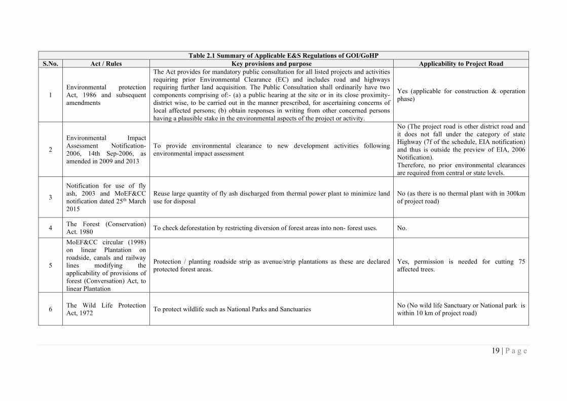
2.1 Applicable Regulations of GOI/GoHP
32. The Government of India has laid out various policy guidelines, acts and regulations pertaining to environment and social aspects. Table 2.1 lists all the applicable GOI regulations and their relevance to this sub-project.
19 | P a g e
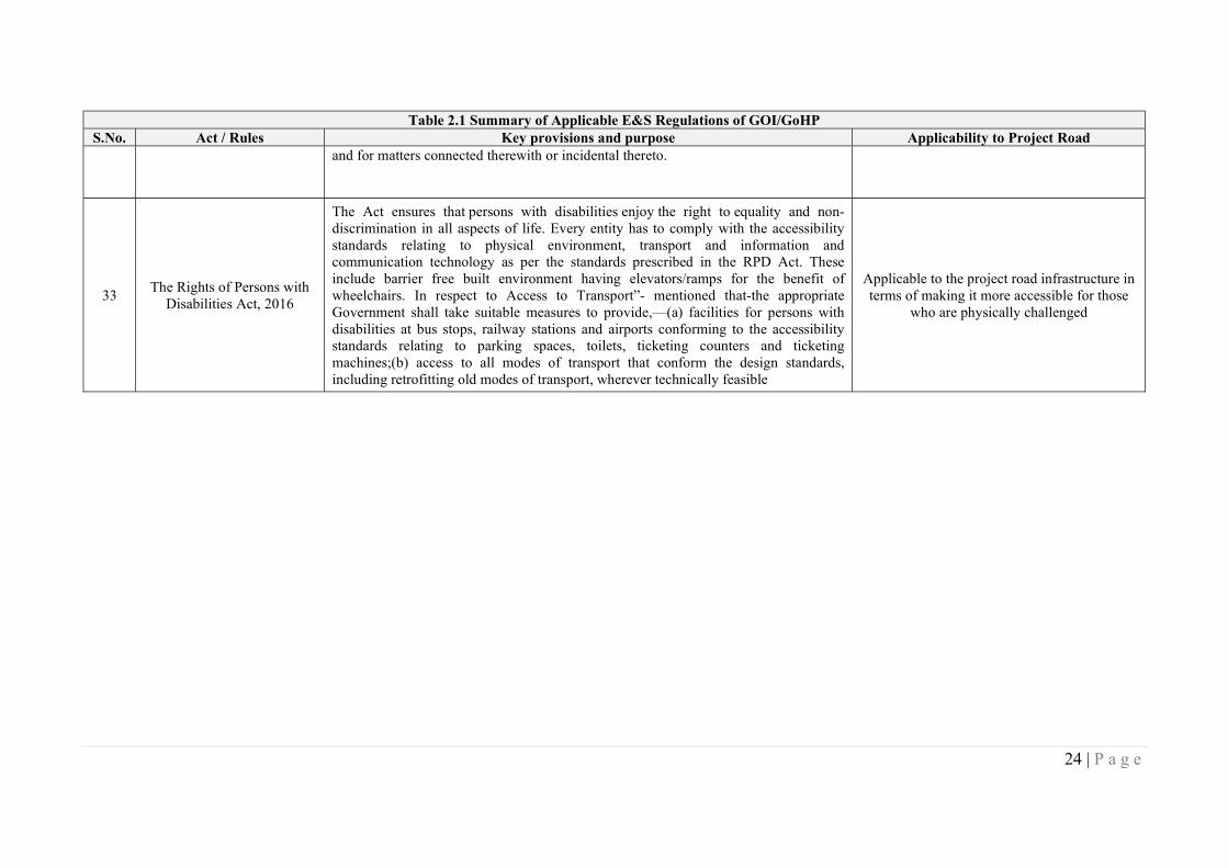
Table 2.1 Summary of Applicable E&S Regulations of GOI/GoHP S.No. Act / Rules Key provisions and purpose Applicability to Project Road
1 Environmental protection Act, 1986 and subsequent amendments
The Act provides for mandatory public consultation for all listed projects and activities requiring prior Environmental Clearance (EC) and includes road and highways requiring further land acquisition. The Public Consultation shall ordinarily have two components comprising of:- (a) a public hearing at the site or in its close proximity- district wise, to be carried out in the manner prescribed, for ascertaining concerns of local affected persons; (b) obtain responses in writing from other concerned persons having a plausible stake in the environmental aspects of the project or activity.
Yes (applicable for construction & operation phase)
2
Environmental Impact Assessment Notification-2006, 14th Sep-2006, as amended in 2009 and 2013
To provide environmental clearance to new development activities following environmental impact assessment
No (The project road is other district road and it does not fall under the category of state Highway (7f of the schedule, EIA notification) and thus is outside the preview of EIA, 2006 Notification). Therefore, no prior environmental clearances are required from central or state levels.
3
Notification for use of fly ash, 2003 and MoEF&CC notification dated 25th March 2015
Reuse large quantity of fly ash discharged from thermal power plant to minimize land use for disposal
No (as there is no thermal plant with in 300km of project road)
4 The Forest (Conservation) Act. 1980
To check deforestation by restricting diversion of forest areas into non- forest uses. No.
5
MoEF&CC circular (1998) on linear Plantation on roadside, canals and railway lines modifying the applicability of provisions of forest (Conversation) Act, to linear Plantation
Protection / planting roadside strip as avenue/strip plantations as these are declared protected forest areas.
Yes, permission is needed for cutting 75 affected trees.
6 The Wild Life Protection Act, 1972
To protect wildlife such as National Parks and Sanctuaries No (No wild life Sanctuary or National park is within 10 km of project road)
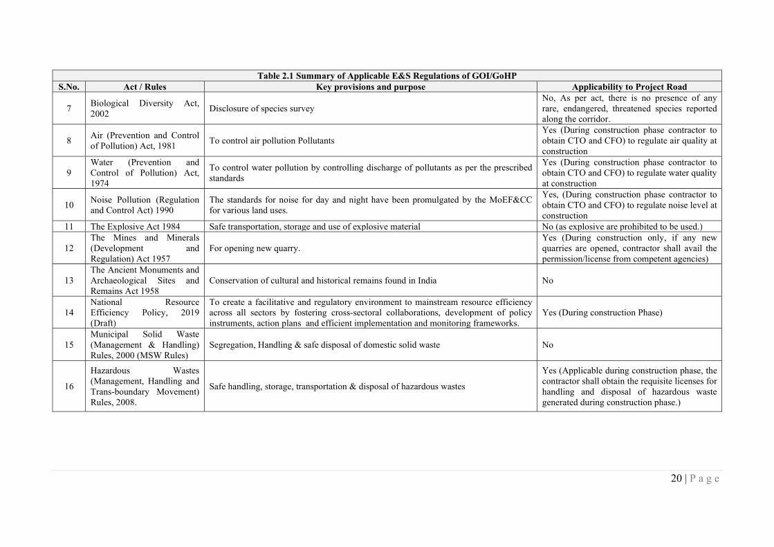
20 | P a g e
Table 2.1 Summary of Applicable E&S Regulations of GOI/GoHP S.No. Act / Rules Key provisions and purpose Applicability to Project Road
7 Biological Diversity Act, 2002
Disclosure of species survey No, As per act, there is no presence of any rare, endangered, threatened species reported along the corridor.
8 Air (Prevention and Control of Pollution) Act, 1981
To control air pollution Pollutants Yes (During construction phase contractor to obtain CTO and CFO) to regulate air quality at construction
9 Water (Prevention and Control of Pollution) Act, 1974
To control water pollution by controlling discharge of pollutants as per the prescribed standards
Yes (During construction phase contractor to obtain CTO and CFO) to regulate water quality at construction
10 Noise Pollution (Regulation and Control Act) 1990
The standards for noise for day and night have been promulgated by the MoEF&CC for various land uses.
Yes, (During construction phase contractor to obtain CTO and CFO) to regulate noise level at construction
11 The Explosive Act 1984 Safe transportation, storage and use of explosive material No (as explosive are prohibited to be used.)
12 The Mines and Minerals (Development and Regulation) Act 1957
For opening new quarry. Yes (During construction only, if any new quarries are opened, contractor shall avail the permission/license from competent agencies)
13 The Ancient Monuments and Archaeological Sites and Remains Act 1958
Conservation of cultural and historical remains found in India No
14 National Resource Efficiency Policy, 2019 (Draft)
To create a facilitative and regulatory environment to mainstream resource efficiency across all sectors by fostering cross-sectoral collaborations, development of policy instruments, action plans and efficient implementation and monitoring frameworks.
Yes (During construction Phase)
15 Municipal Solid Waste (Management & Handling) Rules, 2000 (MSW Rules)
Segregation, Handling & safe disposal of domestic solid waste No
16
Hazardous Wastes (Management, Handling and Trans-boundary Movement) Rules, 2008.
Safe handling, storage, transportation & disposal of hazardous wastes
Yes (Applicable during construction phase, the contractor shall obtain the requisite licenses for handling and disposal of hazardous waste generated during construction phase.)
21 | P a g e
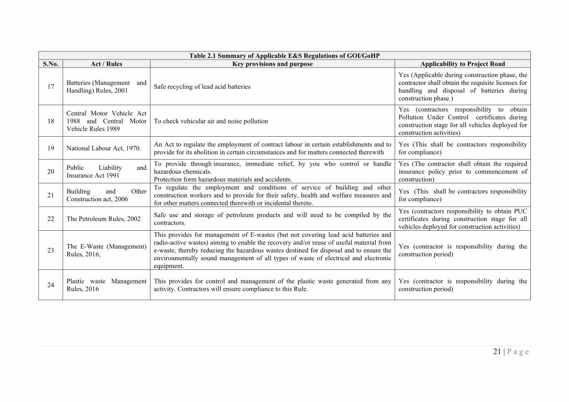
Table 2.1 Summary of Applicable E&S Regulations of GOI/GoHP S.No. Act / Rules Key provisions and purpose Applicability to Project Road
17 Batteries (Management and Handling) Rules, 2001
Safe recycling of lead acid batteries
Yes (Applicable during construction phase, the contractor shall obtain the requisite licenses for handling and disposal of batteries during construction phase.)
18 Central Motor Vehicle Act 1988 and Central Motor Vehicle Rules 1989
To check vehicular air and noise pollution
Yes (contractors responsibility to obtain Pollution Under Control certificates during construction stage for all vehicles deployed for construction activities)
19 National Labour Act, 1970. An Act to regulate the employment of contract labour in certain establishments and to provide for its abolition in certain circumstances and for matters connected therewith
Yes (This shall be contractors responsibility for compliance)
20 Public Liability and Insurance Act 1991
To provide through insurance, immediate relief, by you who control or handle hazardous chemicals. Protection form hazardous materials and accidents.
Yes (The contractor shall obtain the required insurance policy prior to commencement of construction)
21 Building and Other Construction act, 2006
To regulate the employment and conditions of service of building and other construction workers and to provide for their safety, health and welfare measures and for other matters connected therewith or incidental thereto.
Yes (This shall be contractors responsibility for compliance)
22 The Petroleum Rules, 2002 Safe use and storage of petroleum products and will need to be compiled by the contractors.
Yes (contractors responsibility to obtain PUC certificates during construction stage for all vehicles deployed for construction activities)
23 The E-Waste (Management) Rules, 2016,
This provides for management of E-wastes (but not covering lead acid batteries and radio-active wastes) aiming to enable the recovery and/or reuse of useful material from e-waste, thereby reducing the hazardous wastes destined for disposal and to ensure the environmentally sound management of all types of waste of electrical and electronic equipment.
Yes (contractor is responsibility during the construction period)
24 Plastic waste Management Rules, 2016
This provides for control and management of the plastic waste generated from any activity. Contractors will ensure compliance to this Rule.
Yes (contractor is responsibility during the construction period)
22 | P a g e
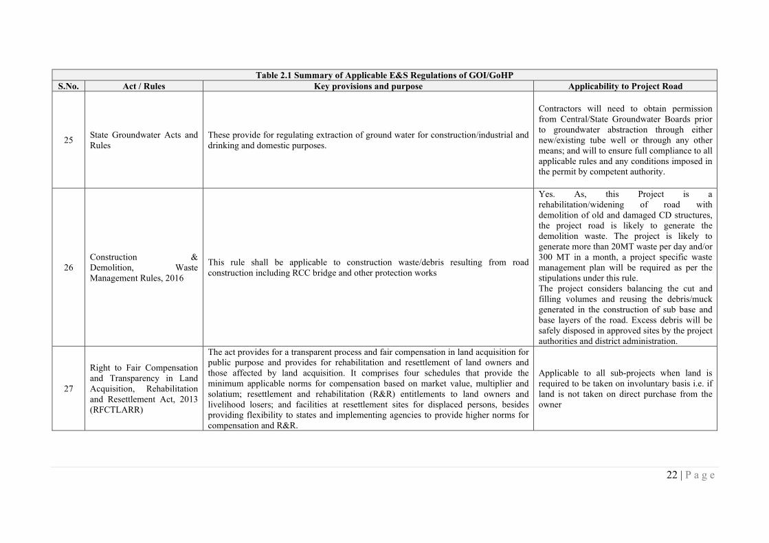
Table 2.1 Summary of Applicable E&S Regulations of GOI/GoHP S.No. Act / Rules Key provisions and purpose Applicability to Project Road
25 State Groundwater Acts and Rules
These provide for regulating extraction of ground water for construction/industrial and drinking and domestic purposes.
Contractors will need to obtain permission from Central/State Groundwater Boards prior to groundwater abstraction through either new/existing tube well or through any other means; and will to ensure full compliance to all applicable rules and any conditions imposed in the permit by competent authority.
26 Construction & Demolition, Waste Management Rules, 2016
This rule shall be applicable to construction waste/debris resulting from road construction including RCC bridge and other protection works
Yes. As, this Project is a rehabilitation/widening of road with demolition of old and damaged CD structures, the project road is likely to generate the demolition waste. The project is likely to generate more than 20MT waste per day and/or 300 MT in a month, a project specific waste management plan will be required as per the stipulations under this rule. The project considers balancing the cut and filling volumes and reusing the debris/muck generated in the construction of sub base and base layers of the road. Excess debris will be safely disposed in approved sites by the project authorities and district administration.
27
Right to Fair Compensation and Transparency in Land Acquisition, Rehabilitation and Resettlement Act, 2013 (RFCTLARR)
The act provides for a transparent process and fair compensation in land acquisition for public purpose and provides for rehabilitation and resettlement of land owners and those affected by land acquisition. It comprises four schedules that provide the minimum applicable norms for compensation based on market value, multiplier and solatium; resettlement and rehabilitation (R&R) entitlements to land owners and livelihood losers; and facilities at resettlement sites for displaced persons, besides providing flexibility to states and implementing agencies to provide higher norms for compensation and R&R.
Applicable to all sub-projects when land is required to be taken on involuntary basis i.e. if land is not taken on direct purchase from the owner
23 | P a g e
Table 2.1 Summary of Applicable E&S Regulations of GOI/GoHP S.No. Act / Rules Key provisions and purpose Applicability to Project Road
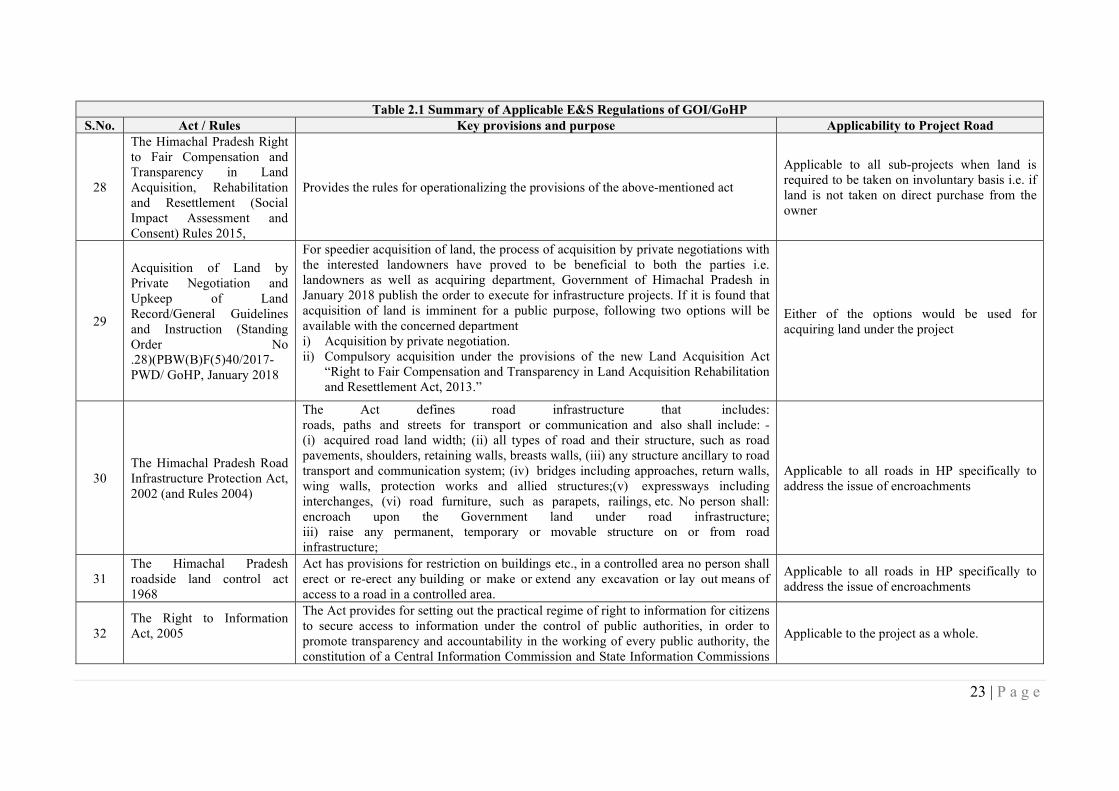
28
The Himachal Pradesh Right to Fair Compensation and Transparency in Land Acquisition, Rehabilitation and Resettlement (Social Impact Assessment and Consent) Rules 2015,
Provides the rules for operationalizing the provisions of the above-mentioned act
Applicable to all sub-projects when land is required to be taken on involuntary basis i.e. if land is not taken on direct purchase from the owner
29
Acquisition of Land by Private Negotiation and Upkeep of Land Record/General Guidelines and Instruction (Standing Order No .28)(PBW(B)F(5)40/2017-PWD/ GoHP, January 2018
For speedier acquisition of land, the process of acquisition by private negotiations with the interested landowners have proved to be beneficial to both the parties i.e. landowners as well as acquiring department, Government of Himachal Pradesh in January 2018 publish the order to execute for infrastructure projects. If it is found that acquisition of land is imminent for a public purpose, following two options will be available with the concerned department i) Acquisition by private negotiation. ii) Compulsory acquisition under the provisions of the new Land Acquisition Act
“Right to Fair Compensation and Transparency in Land Acquisition Rehabilitation and Resettlement Act, 2013.”
Either of the options would be used for acquiring land under the project
30 The Himachal Pradesh Road Infrastructure Protection Act, 2002 (and Rules 2004)
The Act defines road infrastructure that includes: roads, paths and streets for transport or communication and also shall include: - (i) acquired road land width; (ii) all types of road and their structure, such as road pavements, shoulders, retaining walls, breasts walls, (iii) any structure ancillary to road transport and communication system; (iv) bridges including approaches, return walls, wing walls, protection works and allied structures;(v) expressways including interchanges, (vi) road furniture, such as parapets, railings, etc. No person shall: encroach upon the Government land under road infrastructure; iii) raise any permanent, temporary or movable structure on or from road infrastructure;
Applicable to all roads in HP specifically to address the issue of encroachments
31 The Himachal Pradesh roadside land control act 1968
Act has provisions for restriction on buildings etc., in a controlled area no person shall erect or re-erect any building or make or extend any excavation or lay out means of access to a road in a controlled area.
Applicable to all roads in HP specifically to address the issue of encroachments
32 The Right to Information Act, 2005
The Act provides for setting out the practical regime of right to information for citizens to secure access to information under the control of public authorities, in order to promote transparency and accountability in the working of every public authority, the constitution of a Central Information Commission and State Information Commissions
Applicable to the project as a whole.
24 | P a g e
Table 2.1 Summary of Applicable E&S Regulations of GOI/GoHP S.No. Act / Rules Key provisions and purpose Applicability to Project Road
and for matters connected therewith or incidental thereto.
33 The Rights of Persons with
Disabilities Act, 2016
The Act ensures that persons with disabilities enjoy the right to equality and non-discrimination in all aspects of life. Every entity has to comply with the accessibility standards relating to physical environment, transport and information and communication technology as per the standards prescribed in the RPD Act. These include barrier free built environment having elevators/ramps for the benefit of wheelchairs. In respect to Access to Transport”- mentioned that-the appropriate Government shall take suitable measures to provide,—(a) facilities for persons with disabilities at bus stops, railway stations and airports conforming to the accessibility standards relating to parking spaces, toilets, ticketing counters and ticketing machines;(b) access to all modes of transport that conform the design standards, including retrofitting old modes of transport, wherever technically feasible
Applicable to the project road infrastructure in terms of making it more accessible for those
who are physically challenged

25 | P a g e
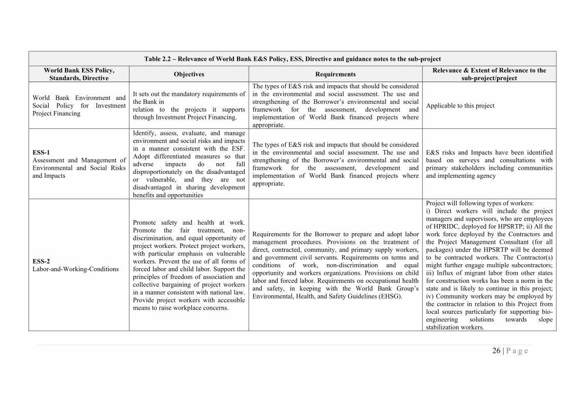
2.2 World Bank ESF Policy, Directives and Standards – Extent of Relevance
33. Section below discusses the relevance of ESF Policy, each of the ten standards (ESS1 to 10) and associated Directive; their requirements. Additionally, it also discusses the relevance and requirements relating to other guidance notes of World Bank.
26 | P a g e
Table 2.2 – Relevance of World Bank E&S Policy, ESS, Directive and guidance notes to the sub-project
World Bank ESS Policy, Standards, Directive
Objectives Requirements Relevance & Extent of Relevance to the
sub-project/project
World Bank Environment and Social Policy for Investment Project Financing
It sets out the mandatory requirements of the Bank in relation to the projects it supports through Investment Project Financing.
The types of E&S risk and impacts that should be considered in the environmental and social assessment. The use and strengthening of the Borrower’s environmental and social framework for the assessment, development and implementation of World Bank financed projects where appropriate.
Applicable to this project
ESS-1 Assessment and Management of Environmental and Social Risks and Impacts
Identify, assess, evaluate, and manage environment and social risks and impacts in a manner consistent with the ESF. Adopt differentiated measures so that adverse impacts do not fall disproportionately on the disadvantaged or vulnerable, and they are not disadvantaged in sharing development benefits and opportunities
The types of E&S risk and impacts that should be considered in the environmental and social assessment. The use and strengthening of the Borrower’s environmental and social framework for the assessment, development and implementation of World Bank financed projects where appropriate.
E&S risks and Impacts have been identified based on surveys and consultations with primary stakeholders including communities and implementing agency
ESS-2 Labor-and-Working-Conditions
Promote safety and health at work. Promote the fair treatment, non-discrimination, and equal opportunity of project workers. Protect project workers, with particular emphasis on vulnerable workers. Prevent the use of all forms of forced labor and child labor. Support the principles of freedom of association and collective bargaining of project workers in a manner consistent with national law. Provide project workers with accessible means to raise workplace concerns.
Requirements for the Borrower to prepare and adopt labor management procedures. Provisions on the treatment of direct, contracted, community, and primary supply workers, and government civil servants. Requirements on terms and conditions of work, non-discrimination and equal opportunity and workers organizations. Provisions on child labor and forced labor. Requirements on occupational health and safety, in keeping with the World Bank Group’s Environmental, Health, and Safety Guidelines (EHSG).
Project will following types of workers: i) Direct workers will include the project managers and supervisors, who are employees of HPRIDC, deployed for HPSRTP; ii) All the work force deployed by the Contractors and the Project Management Consultant (for all packages) under the HPSRTP will be deemed to be contracted workers. The Contractor(s) might further engage multiple subcontractors; iii) Influx of migrant labor from other states for construction works has been a norm in the state and is likely to continue in this project; iv) Community workers may be employed by the contractor in relation to this Project from local sources particularly for supporting bio-engineering solutions towards slope stabilization workers.
27 | P a g e
Table 2.2 – Relevance of World Bank E&S Policy, ESS, Directive and guidance notes to the sub-project
World Bank ESS Policy, Standards, Directive
Objectives Requirements Relevance & Extent of Relevance to the
sub-project/project
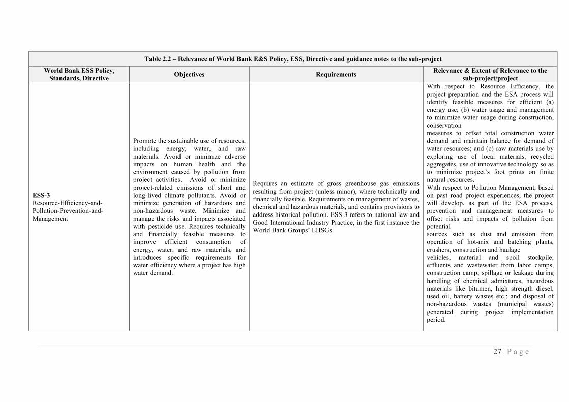
ESS-3 Resource-Efficiency-and-Pollution-Prevention-and-Management
Promote the sustainable use of resources, including energy, water, and raw materials. Avoid or minimize adverse impacts on human health and the environment caused by pollution from project activities. Avoid or minimize project-related emissions of short and long-lived climate pollutants. Avoid or minimize generation of hazardous and non-hazardous waste. Minimize and manage the risks and impacts associated with pesticide use. Requires technically and financially feasible measures to improve efficient consumption of energy, water, and raw materials, and introduces specific requirements for water efficiency where a project has high water demand.
Requires an estimate of gross greenhouse gas emissions resulting from project (unless minor), where technically and financially feasible. Requirements on management of wastes, chemical and hazardous materials, and contains provisions to address historical pollution. ESS-3 refers to national law and Good International Industry Practice, in the first instance the World Bank Groups’ EHSGs.
With respect to Resource Efficiency, the project preparation and the ESA process will identify feasible measures for efficient (a) energy use; (b) water usage and management to minimize water usage during construction, conservation measures to offset total construction water demand and maintain balance for demand of water resources; and (c) raw materials use by exploring use of local materials, recycled aggregates, use of innovative technology so as to minimize project’s foot prints on finite natural resources. With respect to Pollution Management, based on past road project experiences, the project will develop, as part of the ESA process, prevention and management measures to offset risks and impacts of pollution from potential sources such as dust and emission from operation of hot-mix and batching plants, crushers, construction and haulage vehicles, material and spoil stockpile; effluents and wastewater from labor camps, construction camp; spillage or leakage during handling of chemical admixtures, hazardous materials like bitumen, high strength diesel, used oil, battery wastes etc.; and disposal of non-hazardous wastes (municipal wastes) generated during project implementation period.
28 | P a g e
Table 2.2 – Relevance of World Bank E&S Policy, ESS, Directive and guidance notes to the sub-project
World Bank ESS Policy, Standards, Directive
Objectives Requirements Relevance & Extent of Relevance to the
sub-project/project
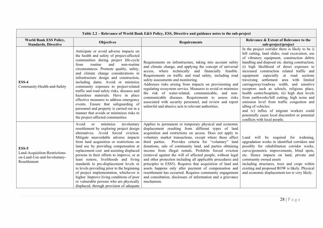
ESS-4 Community-Health-and-Safety
Anticipate or avoid adverse impacts on the health and safety of project-affected communities during project life-cycle from routine and non-routine circumstances. Promote quality, safety, and climate change considerations in infrastructure design and construction, including dams. Avoid or minimize community exposure to project-related traffic and road safety risks, diseases and hazardous materials. Have in place effective measures to address emergency events. Ensure that safeguarding of personnel and property is carried out in a manner that avoids or minimizes risks to the project-affected communities.
Requirements on infrastructure, taking into account safety and climate change, and applying the concept of universal access, where technically and financially feasible. Requirements on traffic and road safety, including road safety assessments and monitoring. Addresses risks arising from impacts on provisioning and regulating ecosystem service. Measures to avoid or minimize the risk of water-related, communicable, and non-communicable diseases. Requirements to assess risks associated with security personnel, and review and report unlawful and abusive acts to relevant authorities.
In the project corridor there is likely to be i) hill cutting, land slides, road excavation, use of vibratory equipment, construction debris handling and disposal etc. during construction; ii) high likelihood of direct exposure to increased construction related traffic and equipment especially at road sections traversing settlement area with limited carriageway/roadway width, and sensitive receptors such as schools, religious place, health centre/hospitals; iii) high dust levels from earthworks/hill cutting, high noise and emission level from traffic congestion and idling of vehicles; and iv) influx of migrant workers could potentially cause local discomfort or potential conflicts with local people.
ESS-5 Land-Acquisition-Restrictions-on-Land-Use-and-Involuntary-Resettlement
Avoid or minimize involuntary resettlement by exploring project design alternatives. Avoid forced eviction. Mitigate unavoidable adverse impacts from land acquisition or restrictions on land use by providing compensation at replacement cost and assisting displaced persons in their efforts to improve, or at least restore, livelihoods and living standards to pre-displacement levels or to levels prevailing prior to the beginning of project implementation, whichever is higher. Improve living conditions of poor or vulnerable persons who are physically displaced, through provision of adequate
Applies to permanent or temporary physical and economic displacement resulting from different types of land acquisition and restrictions on access. Does not apply to voluntary market transactions, except where these affect third parties. Provides criteria for “voluntary” land donations, sale of community land, and parties obtaining income from illegal rentals. Prohibits forced eviction (removal against the will of affected people, without legal and other protection including all applicable procedures and principles in ESS5). Requires that acquisition of land and assets happens only after payment of compensation and resettlement has occurred. Requires community engagement and consultation, disclosure of information and a grievance mechanism.
Land will be required for widening, upgradation works in identified corridors and possibly for rehabilitation corridor works, curve/geometric improvements, blind spots, etc. Hence impacts on land, private and community owned assets including structures, trees and crops within existing and proposed ROW is likely. Physical and economic displacement too is very likely.
29 | P a g e
Table 2.2 – Relevance of World Bank E&S Policy, ESS, Directive and guidance notes to the sub-project
World Bank ESS Policy, Standards, Directive
Objectives Requirements Relevance & Extent of Relevance to the
sub-project/project housing, access to services and facilities, and security of tenure. Conceive and execute resettlement activities as sustainable development programs.
ESS-6 Biodiversity-Conservation
Protect and conserve biodiversity and habitats. Apply the mitigation hierarchy and the precautionary approach in the design and implementation of projects that could have an impact on biodiversity. To promote the sustainable management of living natural resources.
Requirements for projects affecting areas that are legally protected designated for protection or regionally/internationally recognized to be of high biodiversity value. Requirements on sustainable management of living natural resources, including primary production and harvesting, distinguishing between small-scale and commercial activities. Requirements relating to primary suppliers, where a project is purchasing natural resource commodities, including food, timber and fiber.
Site clearance activities for road construction will involve removal of road side vegetation and felling of trees. The biodiversity studies has indicated that entire corridor along the project road is rich in biodiversity, interspersed with invasive species. Other than the clearance of road side vegetation, road construction will also require felling of trees.
ESS-7 Indigenous-Peoples
Ensure that the development process fosters full respect for affected parties’ human rights, dignity, aspirations, identity, culture, and natural resource-based livelihoods. Promote sustainable development benefits and opportunities in a manner that is accessible, culturally appropriate and inclusive. Improve project design and promote local support by establishing and maintaining an ongoing relationship based on meaningful consultation with affected parties. Obtain the Free, Prior, and Informed Consent (FPIC) of affected parties in three circumstances. Recognize, respect and preserve the culture, knowledge, and practices of Indigenous Peoples, and to provide them with an opportunity to adapt to changing
Applies when the Indigenous Peoples are present or have a collective attachment to the land, whether they are affected positively or negatively and regardless of economic, political or social vulnerability. The option to use different terminologies for groups that meet the criteria set out in the Standard. The use of national screening processes, providing these meet World Bank criteria and requirements. Coverage of forest dwellers, hunter gatherers, and pastoralists and other nomadic groups. Requirements for meaningful consultation tailored to affected parties and a grievance mechanism. Requirements for a process of free, prior and informed consent in three circumstances.
Not relevant to this sub-project road. Though it has 3 tribal households might be impacted across the 13.5 km corridor these households do not meet the characteristics outlined in this Standard. Hence no differential provisions will be required to address the impacts on these households.
30 | P a g e
Table 2.2 – Relevance of World Bank E&S Policy, ESS, Directive and guidance notes to the sub-project
World Bank ESS Policy, Standards, Directive
Objectives Requirements Relevance & Extent of Relevance to the
sub-project/project conditions in a manner and in a timeframe acceptable to them.
ESS-8 Cultural-Heritage
Protect cultural heritage from the adverse impacts of project activities and support its preservation. Address cultural heritage as an integral aspect of sustainable development. Promote meaningful consultation with stakeholders regarding cultural heritage. Promote the equitable sharing of benefits from the use of cultural heritage.
Requires a chance finds procedure to be established. Recognition of the need to ensure peoples’ continued access to culturally important sites, as well as the need for confidentiality when revealing information about cultural heritage assets that would compromise or jeopardize their safety or integrity. Requirement for fair and equitable sharing of benefits from commercial use of cultural resources. Provisions of archaeological sites and material, built heritage, natural features with cultural significance, and moveable cultural heritage.
The alignment of the project road does not have any ancient monuments and/or archaeological site(s), protected but it has 1 religious structures/shrines of local importance that is partially impacted by the proposed road improvement activities
ESS-9 Financial-Intermediaries
Sets out how Financial Intermediaries (FI) will assess and manage environmental and social risks and impacts associated with the subprojects it finances. Promote good environmental and social management practices in the subprojects the FI finance. Promote good environmental and sound human resources management within the FI.
Financial Intermediaries (FIs) to have an Environmental and Social Management System (ESMS) - a system for identifying, assessing, managing, and monitoring the environmental and social risks and impacts of FI subprojects on an ongoing basis. FI to develop a categorization system for all subprojects; with special provisions for subprojects categorized as high or substantial risk. FI borrowers to conduct stakeholder engagement in a manner proportionate to the risks and impacts of the FI subprojects.
Not relevant as there is no financial intermediary involved.
ESS-10 Stakeholder-Engagement-and-Information-Disclosure
Establish a systematic approach to stakeholder engagement that helps Borrowers identify stakeholders and maintain a constructive relationship with them. Assess stakeholder interest and support for the project and enable stakeholders’ views to be taken into account in project design. Promote and provide means for effective and inclusive engagement with project-affected parties
Requires stakeholder engagement throughout the project life cycle, and preparation and implementation of a Stakeholder Engagement Plan (SEP). Requires early identification of stakeholders, both project-affected parties and other interested parties, and clarification on how effective engagement takes place. Stakeholder engagement to be conducted in a manner proportionate to the nature, scale, risks and impacts of the project, and appropriate to stakeholders’ interests. Specifies what is required for information disclosure and to achieve meaningful
Relevant as the project will involve a wide variety of stakeholders during its project cycle including Police Department that are associated with activities under other components of the project such as Road Safety
31 | P a g e
Table 2.2 – Relevance of World Bank E&S Policy, ESS, Directive and guidance notes to the sub-project
World Bank ESS Policy, Standards, Directive
Objectives Requirements Relevance & Extent of Relevance to the
sub-project/project throughout the project life-cycle. Ensure that appropriate project information is disclosed to stakeholders in a timely, understandable, accessible and appropriate manner.
consultation.
Environmental and Social Directive for Investment Project Financing
This Directive applies to the Bank and sets out the mandatory requirements for the implementation of the Environmental and Social Policy for Investment Project Financing (IPF).
It lays down the following responsibilities of the Bank to manage ES risks and impacts as below: a) undertake its own due diligence of the ES risks and impacts related to the Project; b) support the Borrower to engage in meaningful consultation with stakeholders, in particular affected communities, and in providing Project-based grievance mechanisms; c) assist the Borrower in identifying appropriate methods and tools to assess and manage the potential ES risks and impacts of the Project; d) agree with the Borrower on the conditions under which the Bank is prepared to provide support to the Project, as set out in the ESCP; and e) monitor the ES performance of a Project in accordance with the ESCP and the ESSs.
Applies to Bank in addressing E&S aspects of this project
Bank Directive Addressing Risks and Impacts on Disadvantaged or Vulnerable Individuals or Groups
This Directive establishes directions for Bank staff regarding due diligence obligations relating to the identification of, and mitigation of risks and impacts on, individuals or groups who, because of their particular circumstances, may be disadvantaged or vulnerable
It requires the Bank task team to support the borrower in establishing arrangements for the undertaking and preparation of the environmental and social assessment of the project as required by ESS1. It reviews the terms of reference for the environmental and social assessment to verify that (a) identifies (or requires the identification of) groups or individuals affected by the project that may be disadvantaged or vulnerable; and (b) requires an assessment of project risks and impacts, and identification of differentiated mitigation measures, as they pertain to the disadvantaged or vulnerable individuals or groups that are identified.
Applies to Bank in addressing E&S risks and impacts on disadvantaged and vulnerable persons or groups that are identified in this project corridor
World Bank’s Guidance note on managing the risks of adverse
The document provides guidelines to address issues and risks arising from
Requires HPRIC to prepare a labor influx management and GBV risk mitigation plan
Applicable to all sub-projects, as influx of migrant labor in construction works is a norm
32 | P a g e
Table 2.2 – Relevance of World Bank E&S Policy, ESS, Directive and guidance notes to the sub-project
World Bank ESS Policy, Standards, Directive
Objectives Requirements Relevance & Extent of Relevance to the
sub-project/project impacts on communities from temporary project induced labor influx, 2016
influx of migrant labor leading to gender-based violence, forced labor etc.
in Himachal Pradesh
The project will also adhere to all the applicable labor laws of GoI. The list of laws is presented in Appendix 5
33 | P a g e
2.3 Comparative Analysis of key national, state and Bank policies
34. A comparison between RFCTLARR Act, HP Private Negotiations order and guidelines, 2018, and World Bank’s ESF that provides gap-filling measures reflected in the entitlement matrix is presented as Appendix 4. These are summarized below: The Act, like provisions of ESS, require SIAs for projects involving land acquisition with
elaborate process of consultation at every notification stage. It also expands compensation coverage of the principal act by requiring that the value of structure, trees, plants, or standing crops damaged must also be included and the solatium being 100 percent of all amounts inclusive. The Act similar to World Bank, requires compensation to be paid, prior to project taking possession of any land and provide R&R support including transitional support and moving allowances.
Act in its computation of compensation for structures takes depreciation into account and is not explicit about providing replacement cost of structures, though presumably the provision of 100% solatium will help arrive at replacement cost of structures or higher. GoHP standing order and guidelines for establishing the compensation amount upto the threshold as would have been determined under the Act, 2013
Cut-off date for determining the compensation and entitlements and assistance to all those who are affected by the project irrespective of the ownership of titles. According to the RFCTLARR Act, the cut-off date for assistance to those depending on affected private lands is three years preceding the acquisition and for the titleholders it is the date of notification under the said Act. To bring this RPF in line with World Bank requirements, RPF mandates that while in the case of land acquisition, the date of issue of public notice of intended acquisition under Section 3(a) under the Act will be treated as the cut-off date for title holders. In case of non-titleholders such as squatters and encroachers, cut-off date will be the start date of the census survey. In case of all affected non-title holders, suitable compensation (ex-gratia payments) for loss of assets and R&R assistance is proposed in the entitlement matrix. GoHP standing order does not have any provisions for non-titleholders
Also similar to provisions laid down in RFCTLARR Act 2013, World Bank ESS requires consultation with PAPs during planning and implementation of resettlement action plan, Tribal Development Plan and public disclosure of drafts.
In GoHP standing order, land compensation under private negotiations, the latest circle rate is considered and multiplied with 1 or 2 times in urban or rural areas respectively and 100% solatium is added to arrive at the final compensation upto the threshold as would have been determined under the Act, 2013. However, there could be gaps in asset valuation and resettlement assistance. There is also a gap in case of those who loose land, the lump sum payment of INR 5, 00,000 towards livelihood loss is not extended.
35. In the event of any conflict or inconsistency between the provisions of this GOI, GoHP and RPF and the provisions of World Bank’s ESF, the provisions of the ESF shall prevail.
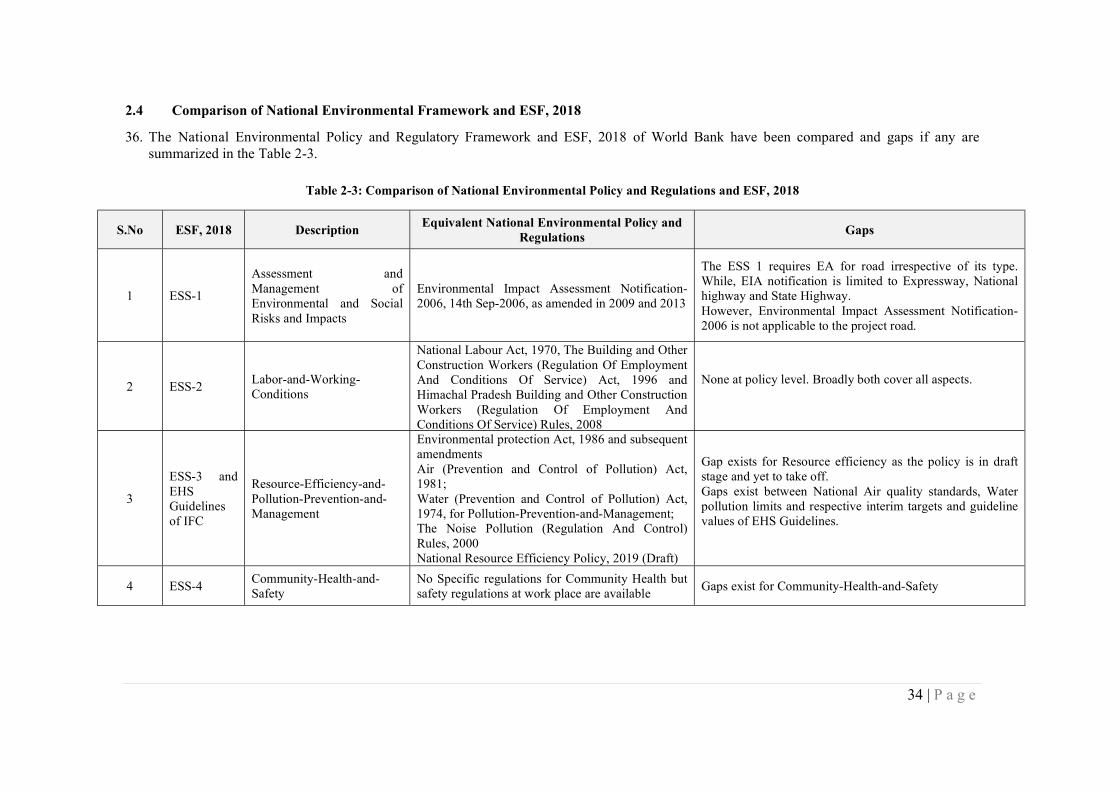
34 | P a g e
2.4 Comparison of National Environmental Framework and ESF, 2018
36. The National Environmental Policy and Regulatory Framework and ESF, 2018 of World Bank have been compared and gaps if any are summarized in the Table 2-3.
Table 2-3: Comparison of National Environmental Policy and Regulations and ESF, 2018
S.No ESF, 2018 Description Equivalent National Environmental Policy and
Regulations Gaps
1 ESS-1
Assessment and Management of Environmental and Social Risks and Impacts
Environmental Impact Assessment Notification-2006, 14th Sep-2006, as amended in 2009 and 2013
The ESS 1 requires EA for road irrespective of its type. While, EIA notification is limited to Expressway, National highway and State Highway. However, Environmental Impact Assessment Notification-2006 is not applicable to the project road.
2 ESS-2 Labor-and-Working-Conditions
National Labour Act, 1970, The Building and Other Construction Workers (Regulation Of Employment And Conditions Of Service) Act, 1996 and Himachal Pradesh Building and Other Construction Workers (Regulation Of Employment And Conditions Of Service) Rules, 2008
None at policy level. Broadly both cover all aspects.
3
ESS-3 and EHS Guidelines of IFC
Resource-Efficiency-and-Pollution-Prevention-and-Management
Environmental protection Act, 1986 and subsequent amendments Air (Prevention and Control of Pollution) Act, 1981; Water (Prevention and Control of Pollution) Act, 1974, for Pollution-Prevention-and-Management; The Noise Pollution (Regulation And Control) Rules, 2000 National Resource Efficiency Policy, 2019 (Draft)
Gap exists for Resource efficiency as the policy is in draft stage and yet to take off. Gaps exist between National Air quality standards, Water pollution limits and respective interim targets and guideline values of EHS Guidelines.
4 ESS-4 Community-Health-and-Safety
No Specific regulations for Community Health but safety regulations at work place are available
Gaps exist for Community-Health-and-Safety
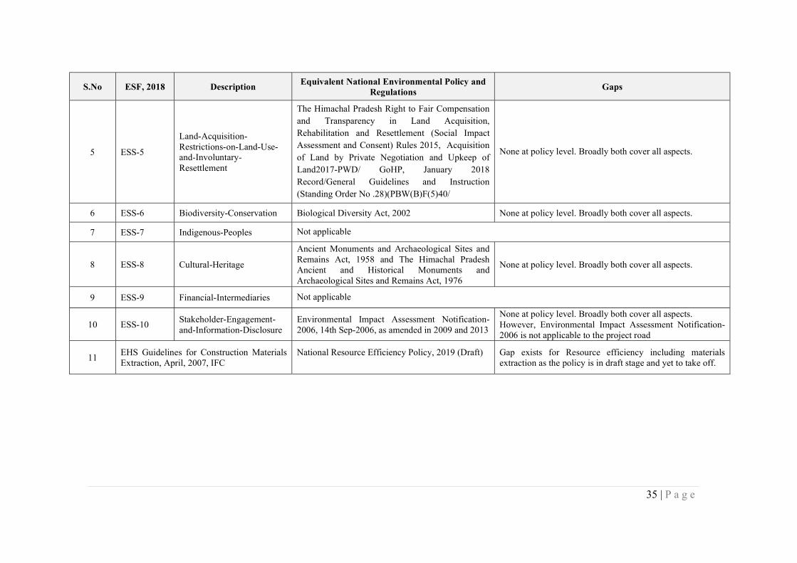
35 | P a g e
S.No ESF, 2018 Description Equivalent National Environmental Policy and
Regulations Gaps
5 ESS-5
Land-Acquisition-Restrictions-on-Land-Use-and-Involuntary-Resettlement
The Himachal Pradesh Right to Fair Compensation and Transparency in Land Acquisition, Rehabilitation and Resettlement (Social Impact Assessment and Consent) Rules 2015, Acquisition of Land by Private Negotiation and Upkeep of Land2017-PWD/ GoHP, January 2018 Record/General Guidelines and Instruction (Standing Order No .28)(PBW(B)F(5)40/
None at policy level. Broadly both cover all aspects.
6 ESS-6 Biodiversity-Conservation Biological Diversity Act, 2002 None at policy level. Broadly both cover all aspects.
7 ESS-7 Indigenous-Peoples Not applicable
8 ESS-8 Cultural-Heritage
Ancient Monuments and Archaeological Sites and Remains Act, 1958 and The Himachal Pradesh Ancient and Historical Monuments and Archaeological Sites and Remains Act, 1976
None at policy level. Broadly both cover all aspects.
9 ESS-9 Financial-Intermediaries Not applicable
10 ESS-10 Stakeholder-Engagement-and-Information-Disclosure
Environmental Impact Assessment Notification-2006, 14th Sep-2006, as amended in 2009 and 2013
None at policy level. Broadly both cover all aspects. However, Environmental Impact Assessment Notification-2006 is not applicable to the project road
11 EHS Guidelines for Construction Materials Extraction, April, 2007, IFC
National Resource Efficiency Policy, 2019 (Draft)
Gap exists for Resource efficiency including materials extraction as the policy is in draft stage and yet to take off.
36 | P a g e
2.4 Institutional Framework
37. The project implementation involves multiple institutions, namely: HPRIDC of HPPWD, HPDOT and HP State Police Commission. HPRIDC will be responsible for the overall coordination of the project implementation. The reform of HPPWD and road infrastructure improvement will be implemented by HPRIDC. HP State Police Commission will implement the Road Safety component.
38. Himachal Pradesh Road & Other Infrastructure Development Corporation Limited, a wholly owned Company of Government of Himachal Pradesh was incorporated on 10.06.1999 under the Companies Act, 1956,
39. HPRIDC is an apex organization in Himachal Pradesh engaged in fostering the growth of
infrastructure development in the State. Its objectives are to: a) construct erect build, re-model, execute, repair, develop, improve, administer, manage,
control, maintain, demolish, grade, curve, pave, macadamize, cement, Highways, Expressways, Roads, Paths, Streets, Bridges, Sideways, Bypasses, Tunnels, Pavements, Reclamation, Improvements, Road over Bridges, Road under Bridges, Underground Road, or any other structural or architectural work and also to do other similar construction, leveling or paving work at present being a part of the activity of the Himachal Pradesh Public Works Department;
b) facilitate and or undertake to construct, erect, build, renovate, develop, improve, manage, control maintain other infrastructure projects including those related to Power, Telecom Information and Technology, Transmission of Electricity, Water Supply Projects, etc.;
c) act as a special purpose vehicle for resource mobilization on behalf of the State Government for all infrastructure projects
40. HPRIDC headed by the Managing Director (Principal Secretary of HPPWD) and governed by a
Board of Directors chaired by the Chief Secretary of the State is currently the focal unit for the development of the state core roads network (SCRN) and managing upgrading and major rehabilitation contracts.
41. HPRIDC has acquired some experience from the implementation of HPSRP – I. It has built capacity and has procurement, financial management, contract administration and support staff necessary for the implementation of the proposed project.
42. HPRIDC will engage Environment and Social Safeguards officers and Project Management
Consultant (PMC), which will be responsible for quality assurance and monitoring
43. HPRIDC has established a system dealing with external complaints on procurement, fraud/corruption and construction quality. This system will include maintaining files to monitor status of follow up of each received comments, suggestions and grievances. The implementation of the system will be monitored by Chief Vigilance Officer of the PWD (who shall act Vigilance Officer (VGO) for the HPRIDC). The mechanisms will include provision for follow up investigations of substantial complaints to ensure independency and reliability of the system. For the complaint mechanism to function efficiently, the information concerning the alternative conduits for complaint (dedicated email address and physical mailing box) are being publicized. Complaints, suggestions and grievances handling system have been included at HPRIDC website: http://admis.hp.nic.in/himachal/hpridc. An Information Officer who has been designated by HPRIDC as a full-time Assistant Public Information Officer under the RTI Act is responsible for monthly updates of the system on the website
37 | P a g e
44. Responding to Complaints on Construction Quality Complaints received directly from the public relating to the quality of a specific work, good or service shall be in writing. They will be received and then reviewed by CE-cum-PD or if applicable, Zonal Chief Engineer of HPPWD concerned and dealt with in the following way. i) The CE-cum-PD shall record all complaints, whether they are referred from other recipients or directly, in a register to be maintained in a secure location in his own office. The email and physical address of the CE-cum-PD is available on web site. ii) The CE-cum-PD shall, within 5 working days of receipt of complaint, acknowledge receipt in writing to the complainant indicating that the HPRIDC is considering the issues raised and will discuss them with the concerned officers of the HPRIDC. iii) The CE-cum-PD shall then consult with the relevant officers of the HPRIDC and, after thorough review of the facts as well as interviewing of officers concerned as necessary, shall make a judgment as to the validity of the complaint. iv) Within 20 working days, the CE-cum-PD shall instruct the relevant officer to take remedial action as necessary. v) The CE-cum-PD shall write to the complainant within 30 working days of the receipt of such complaint as to the final decision of the competent authority. vi) In the event, that a complaint is received concerning an externally funded contract, the relevant funding agency shall be informed at each stage of the complaint handling process.
45. There is no specific GRM to systematically receive, record and redress complaints from project affected persons.
38 | P a g e
CHAPTER 3 – BASELINE DATA
46. The baseline environmental profile of project influence area covering 15 km radius of the project as well as Bilaspur district as a whole has been described in the following sections. The environmental profile includes key attributes like physiography, drainage, geology, soil, hydrogeology, land use, flora, fauna, forest/vegetation cover, climate, ambient air quality, water quality, ambient noise levels, hazards and vulnerability of the project region among others.
47. In order to assess the baseline environment, the data has been accessed from authentic and verifiable sources as given in Table 3-1. Due attempt has been made to source and access only the latest available data from authentic and verifiable sources.
Table 3-1: Data Sources for Baseline Environmental Assessment
Environmental Attribute Source of data / Information Date and Year of the Data
Climate/Weather Parameters like Temperature, rainfall, wind speed and other similar climatological parameters
IMD (Indian Metrological Department), Shimla and New Delhi
Last 5 years (2014-2018) data has been used
Soil & Geology
Geological Survey of India, Central Ground Water Board, State Mining Department, GoHP
District Ground Water Brochure of Bilaspur District published by the central ground water board (Northern Himalayan region-Dharamshala), in year 2013 and Ground Water Year Book of Himachal Pradesh (Northern Himalayan region-Dharamshala), in Feb – 2016.
Landslide locations/Slope stability
Physical inspections of the project road
Primary investigations of the project road during August – September 2019.
Drainage/ Flooding
Satellite Imagery/ Toposheet /Hydrology study/State Water Resource Department. Ground truth verification by Physical inspections of the project road.
District Ground Water Brochure of Bilaspur District published by the central ground water board (Northern Himalayan region-Dharamshala), in year 2013 and Ground Water Year Book of Himachal Pradesh (Northern Himalayan region-Dharamshala), in Feb – 2016.
Primary investigations of the project road during August – September 2019.
Surface Water Bodies, Surface water quality and Ground water Quality
Topography sheets/field study. Hydrological data from the CGWB Reports followed by ground truth verification by Physical inspections of the project road.
Also, Monitoring of the surface and ground water quality along the project road
District Ground Water Brochure of Bilaspur District published by the central ground water board (Northern Himalayan region-Dharamshala), in year 2013 and Ground Water Year Book of Himachal Pradesh (Northern Himalayan region-Dharamshala), in Feb – 2016.
Monitoring of the surface and ground water quality along the project road was carried out by Star Analytical Services, an NABL Accredited Laboratory during ESIA Studies (Sept-
39 | P a g e
Environmental Attribute Source of data / Information Date and Year of the Data
2019).
Ambient Air Quality and Ambient Noise levels
Monitoring of the ambient air quality and ambient noise level measurements along the project road was carried out.
Monitoring of the ambient air quality and ambient noise level measurements along the project road was carried out by Star Analytical Services, an NABL Accredited Laboratory during ESIA Studies (Sept-2019).
Forest/Protected Areas, Endangered Plant and Animal, Ecological Sensitive Area, Wildlife Corridors/Migratory routes
Department of Forest, Govt. of Himachal Pradesh, Consultations with DFOs, Forest Range Officers of forest department and with local community.
This was followed by ecological assessment of the project road corridor.
Forest area as of 2018, published by Himachal Pradesh Forest Department, GoHP and Primary investigations of the project road by ecological assessment of the project road corridor by a qualified and experienced biodiversity expert during August – September 2019.
Trees and Vegetation Cover
Department of Forest, Govt. of Himachal Pradesh, Consultations with DFOs, Forest Range Officers of forest department and with local community.
This was followed by ecological assessment of the project road corridor.
Physical inspections of the project road for ecological assessment by a qualified and experienced biodiversity expert during August – September 2019.
Population and Settlements within the RoW
Census of India, 2011 and Primary Surveys by of the project road corridor by a qualified and experienced social expert.
Census, 2011 data published by the Office of Registrar General & Census Commissioner, India and primary social economic survey of all households along the project corridor by social surveyors under guidance / supervision of key social specialist of ESIA team.
Cultural / Heritage and Ancient Structures.
Consultations with Archaeological Survey of India, State Archaeological Department, GoHP and web based data search.
Archaeological Survey of India, GoHP and web based data search for information on Cultural / Heritage and Ancient Structures within the PIA and Primary investigations of the project road during August – September 2019.
3.1 Land Environment
Physiography
48. The project road entirely traverses within Bharari Tehsil of Bilaspur district, which is bounded by Una district in north-west and Hamirpur district in the north, Mandi district in east respectively. The Bilaspur district comprises seven Tehsils (Bharari, Ghumarwin, Bilaspur Sadar, Namhol, Jhanduta and Naina Devi. The alignment of project road in Bharari Tehsil is shown in Figure 3.1.
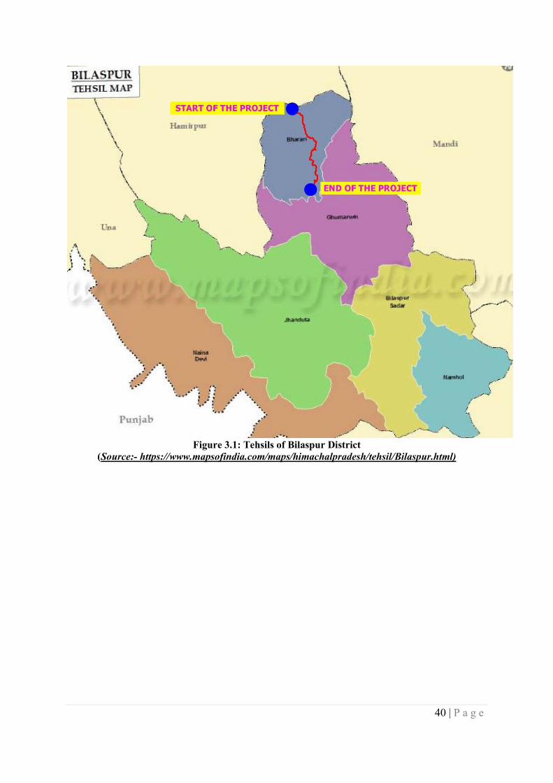
40 | P a g e
Figure 3.1: Tehsils of Bilaspur District
(Source:- https://www.mapsofindia.com/maps/himachalpradesh/tehsil/Bilaspur.html)
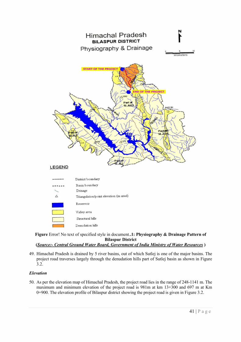
41 | P a g e
Figure Error! No text of specified style in document..1: Physiography & Drainage Pattern of Bilaspur District
(Source:- Central Ground Water Board, Government of India Ministry of Water Resources )
49. Himachal Pradesh is drained by 5 river basins, out of which Sutlej is one of the major basins. The project road traverses largely through the denudation hills part of Sutlej basin as shown in Figure 3.2.
Elevation
50. As per the elevation map of Himachal Pradesh, the project road lies in the range of 248-1141 m. The maximum and minimum elevation of the project road is 981m at km 13+300 and 697 m at Km 0+900. The elevation profile of Bilaspur district showing the project road is given in Figure 3.2.
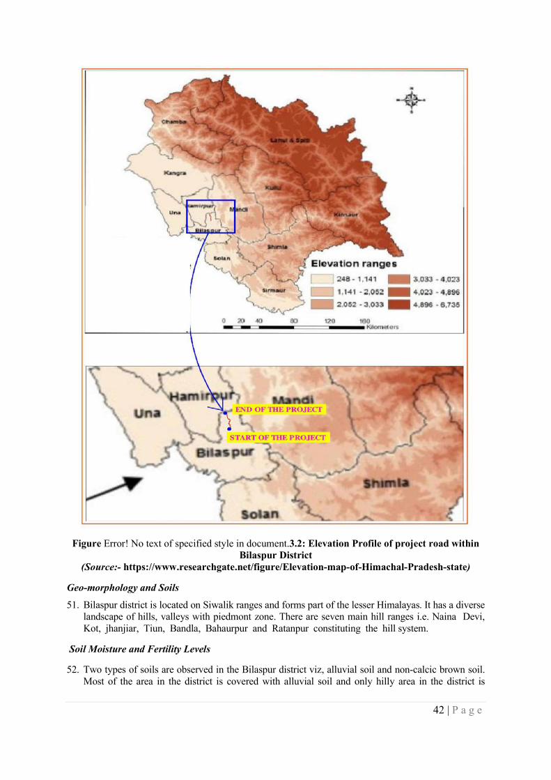
42 | P a g e
Figure Error! No text of specified style in document.3.2: Elevation Profile of project road within
Bilaspur District (Source:- https://www.researchgate.net/figure/Elevation-map-of-Himachal-Pradesh-state)
Geo-morphology and Soils
51. Bilaspur district is located on Siwalik ranges and forms part of the lesser Himalayas. It has a diverse landscape of hills, valleys with piedmont zone. There are seven main hill ranges i.e. Naina Devi, Kot, jhanjiar, Tiun, Bandla, Bahaurpur and Ratanpur constituting the hill system.
Soil Moisture and Fertility Levels
52. Two types of soils are observed in the Bilaspur district viz, alluvial soil and non-calcic brown soil. Most of the area in the district is covered with alluvial soil and only hilly area in the district is
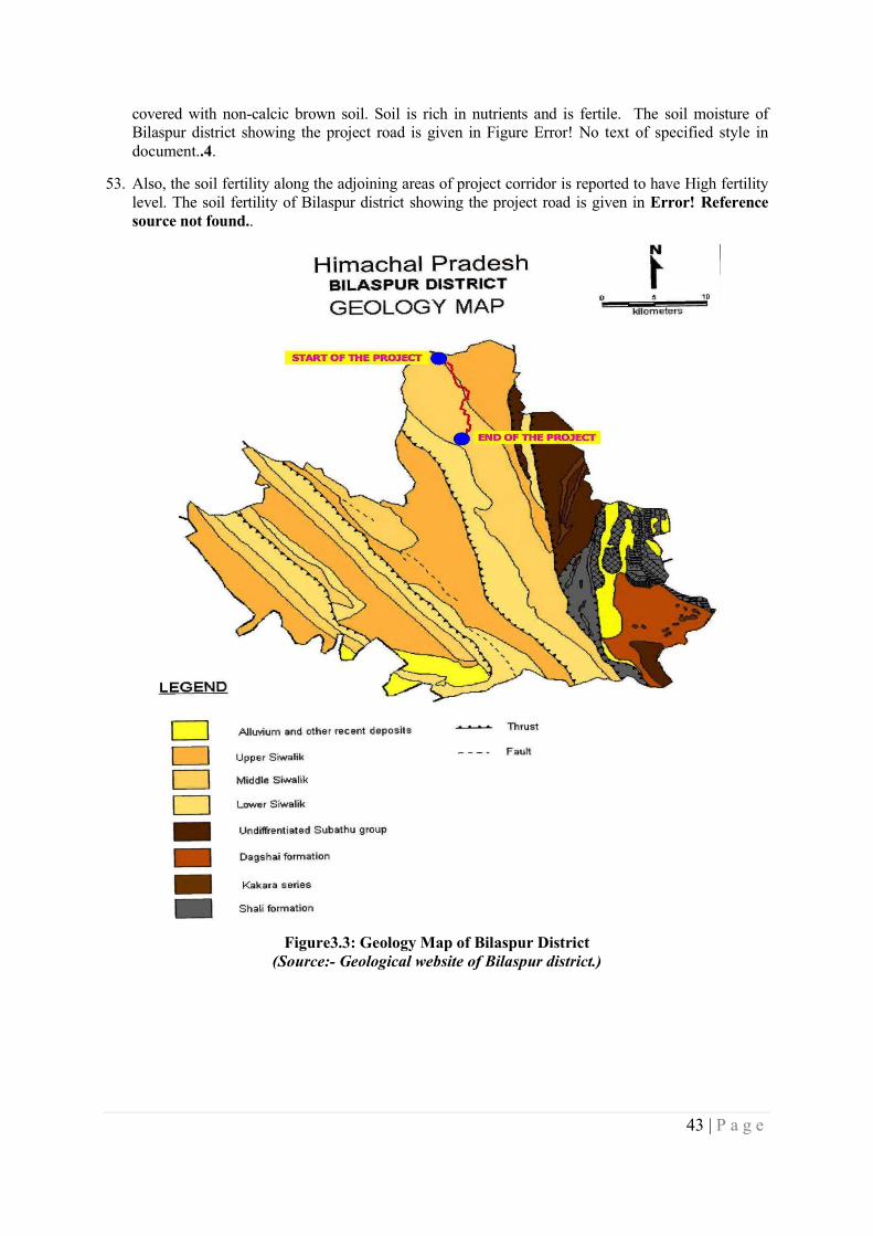
43 | P a g e
covered with non-calcic brown soil. Soil is rich in nutrients and is fertile. The soil moisture of Bilaspur district showing the project road is given in Figure Error! No text of specified style in document..4.
53. Also, the soil fertility along the adjoining areas of project corridor is reported to have High fertility level. The soil fertility of Bilaspur district showing the project road is given in Error! Reference source not found..
Figure3.3: Geology Map of Bilaspur District
(Source:- Geological website of Bilaspur district.)
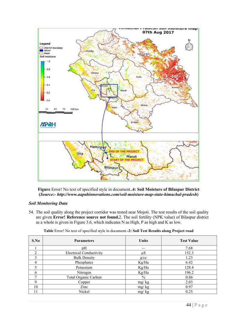
44 | P a g e
Figure Error! No text of specified style in document..4: Soil Moisture of Bilaspur District (Source:- http://www.aapahinnovations.com/soil-moisture-map-state-himachal-pradesh)
Soil Monitoring Data
54. The soil quality along the project corridor was tested near Mojoti. The test results of the soil quality are given Error! Reference source not found.2. The soil fertility (NPK value) of Bilaspur district as a whole is given in Figure 3.6, which indicates N as High, P as high and K as low.
Table Error! No text of specified style in document.-2: Soil Test Results along Project road
S.No Parameters Units Test Value
1 pH -- 7.68 2 Electrical Conductivity µS 152.3 3 Bulk Density g/cc 1.23 4 Phosphates Kg/Ha 6.42 5 Potassium Kg/Ha 128.4 6 Nitrogen Kg/Ha 196.2 7 Total Organic Carbon % 0.86 9 Copper mg/ kg 2.03 10 Zinc mg/ kg 0.97 11 Nickel mg/ kg 0.25
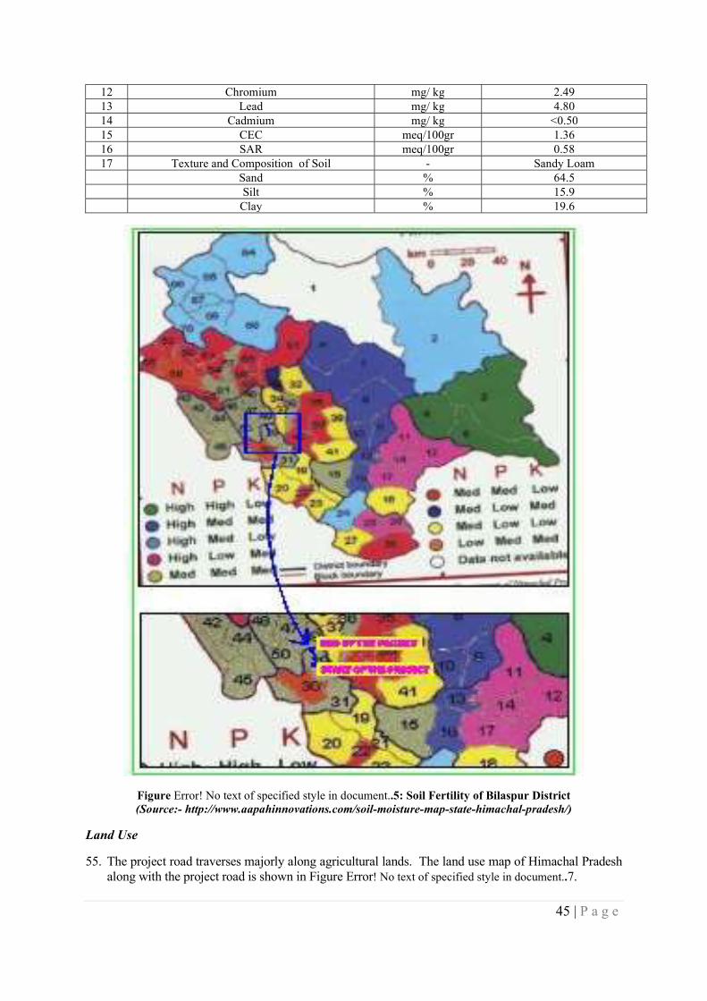
45 | P a g e
12 Chromium mg/ kg 2.49 13 Lead mg/ kg 4.80 14 Cadmium mg/ kg <0.50 15 CEC meq/100gr 1.36 16 SAR meq/100gr 0.58 17 Texture and Composition of Soil - Sandy Loam Sand % 64.5 Silt % 15.9 Clay % 19.6
Figure Error! No text of specified style in document..5: Soil Fertility of Bilaspur District (Source:- http://www.aapahinnovations.com/soil-moisture-map-state-himachal-pradesh/)
Land Use
55. The project road traverses majorly along agricultural lands. The land use map of Himachal Pradesh along with the project road is shown in Figure Error! No text of specified style in document..7.
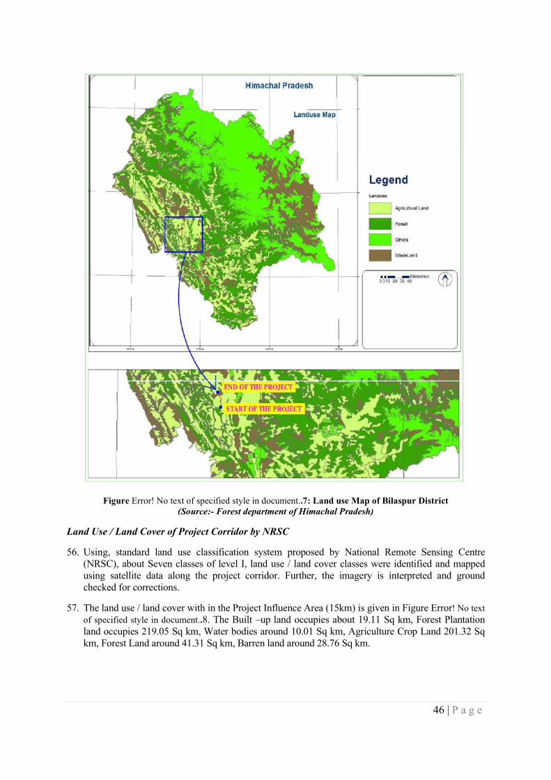
46 | P a g e
Figure Error! No text of specified style in document..7: Land use Map of Bilaspur District (Source:- Forest department of Himachal Pradesh)
Land Use / Land Cover of Project Corridor by NRSC
56. Using, standard land use classification system proposed by National Remote Sensing Centre (NRSC), about Seven classes of level I, land use / land cover classes were identified and mapped using satellite data along the project corridor. Further, the imagery is interpreted and ground checked for corrections.
57. The land use / land cover with in the Project Influence Area (15km) is given in Figure Error! No text of specified style in document..8. The Built –up land occupies about 19.11 Sq km, Forest Plantation land occupies 219.05 Sq km, Water bodies around 10.01 Sq km, Agriculture Crop Land 201.32 Sq km, Forest Land around 41.31 Sq km, Barren land around 28.76 Sq km.
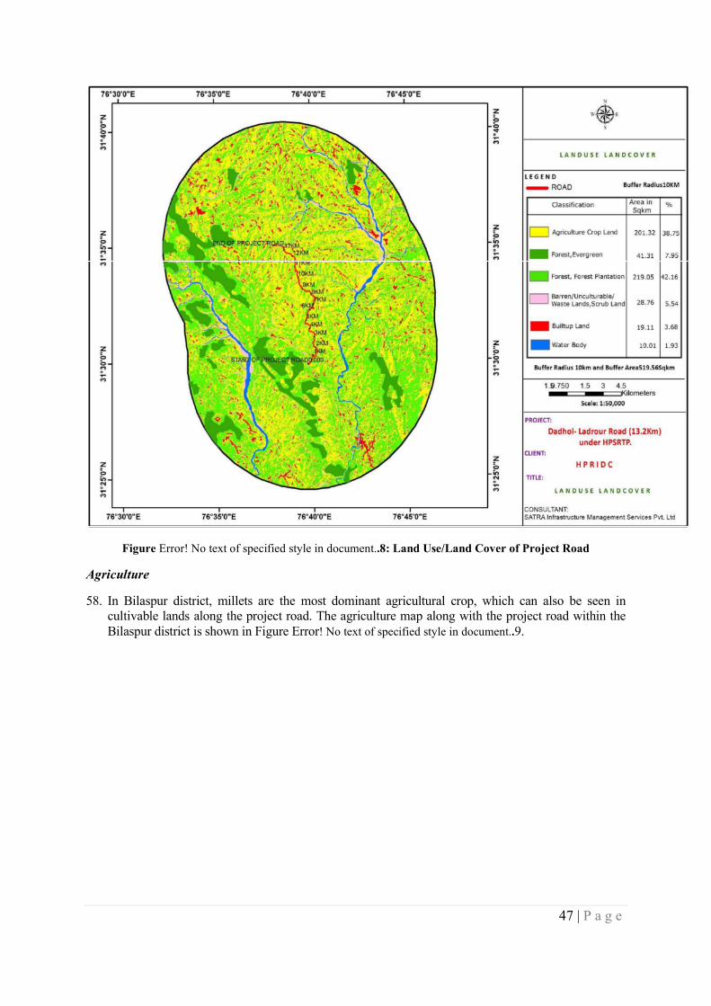
47 | P a g e
Figure Error! No text of specified style in document..8: Land Use/Land Cover of Project Road
Agriculture
58. In Bilaspur district, millets are the most dominant agricultural crop, which can also be seen in cultivable lands along the project road. The agriculture map along with the project road within the Bilaspur district is shown in Figure Error! No text of specified style in document..9.
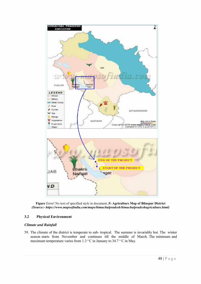
48 | P a g e
Figure Error! No text of specified style in document..9: Agriculture Map of Bilaspur District (Source:- https://www.mapsofindia.com/maps/himachalpradesh/himachalpradeshagriculture.html)
3.2 Physical Environment
Climate and Rainfall
59. The climate of the district is temperate to sub- tropical. The summer is invariably hot. The winter season starts from November and continues till the middle of March. The minimum and maximum temperature varies from 1.3 o C in January to 34.7 o C in May.
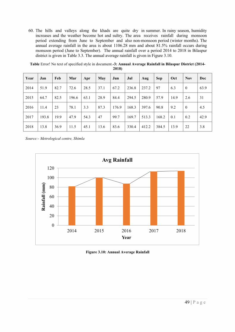
49 | P a g e
60. The hills and valleys along the khads are quite dry in summer. In rainy season, humidity increases and the weather become hot and sultry. The area receives rainfall during monsoon period extending from June to September and also non-monsoon period (winter months). The annual average rainfall in the area is about 1106.28 mm and about 81.5% rainfall occurs during monsoon period (June to September). The annual rainfall over a period 2014 to 2018 in Bilaspur district is given in Table 3.3. The annual average rainfall is given in Figure 3.10.
Table Error! No text of specified style in document.-3: Annual Average Rainfall in Bilaspur District (2014-2018)
Year Jan Feb Mar Apr May Jun Jul Aug Sep Oct Nov Dec
2014 51.9 82.7 72.6 28.5 37.1 67.2 236.8 237.2 97 6.3 0 63.9
2015 64.7 82.5 196.6 63.1 28.9 84.4 294.5 280.9 57.9 14.9 2.6 31
2016 11.4 23 78.1 3.3 87.3 176.9 168.3 397.6 90.8 9.2 0 4.5
2017 193.8 19.9 47.9 54.3 47 99.7 169.7 513.3 168.2 0.1 0.2 42.9
2018 13.8 36.9 11.5 45.1 13.6 83.6 330.4 412.2 384.5 13.9 22 3.8
Source:- Metrological centre, Shimla
Figure 3.10: Annual Average Rainfall
0
20
40
60
80
100
120
2014 2015 2016 2017 2018
Rai
nfa
ll (
mm
)
Year
Avg Rainfall
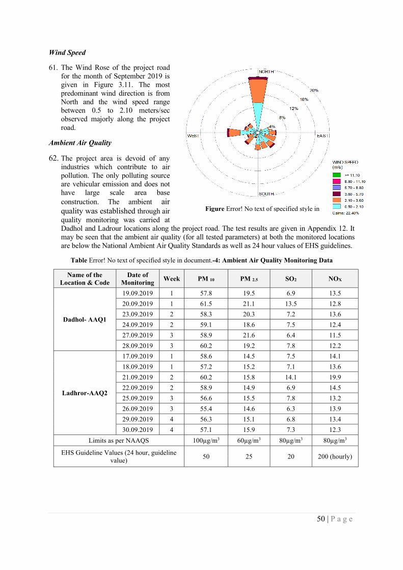
50 | P a g e
Wind Speed
61. The Wind Rose of the project road for the month of September 2019 is given in Figure 3.11. The most predominant wind direction is from North and the wind speed range between 0.5 to 2.10 meters/sec observed majorly along the project road.
Ambient Air Quality
62. The project area is devoid of any industries which contribute to air pollution. The only polluting source are vehicular emission and does not have large scale area base construction. The ambient air quality was established through air quality monitoring was carried at Dadhol and Ladrour locations along the project road. The test results are given in Appendix 12. It may be seen that the ambient air quality (for all tested parameters) at both the monitored locations are below the National Ambient Air Quality Standards as well as 24 hour values of EHS guidelines.
Table Error! No text of specified style in document.-4: Ambient Air Quality Monitoring Data
Name of the Location & Code
Date of Monitoring
Week PM 10 PM 2.5 SO2 NOX
Dadhol- AAQ1
19.09.2019 1 57.8 19.5 6.9 13.5
20.09.2019 1 61.5 21.1 13.5 12.8
23.09.2019 2 58.3 20.3 7.2 13.6
24.09.2019 2 59.1 18.6 7.5 12.4
27.09.2019 3 58.9 21.6 6.4 11.5
28.09.2019 3 60.2 19.2 7.8 12.2
Ladhror-AAQ2
17.09.2019 1 58.6 14.5 7.5 14.1
18.09.2019 1 57.2 15.2 7.1 13.6
21.09.2019 2 60.2 15.8 14.1 19.9
22.09.2019 2 58.9 14.9 6.9 14.5
25.09.2019 3 56.6 15.5 7.8 13.2
26.09.2019 3 55.4 14.6 6.3 13.9
29.09.2019 4 56.3 15.1 6.8 13.4
30.09.2019 4 57.1 15.9 7.3 12.3
Limits as per NAAQS 100µg/m3 60µg/m3 80µg/m3 80µg/m3
EHS Guideline Values (24 hour, guideline value)
50 25 20 200 (hourly)
Figure Error! No text of specified style in
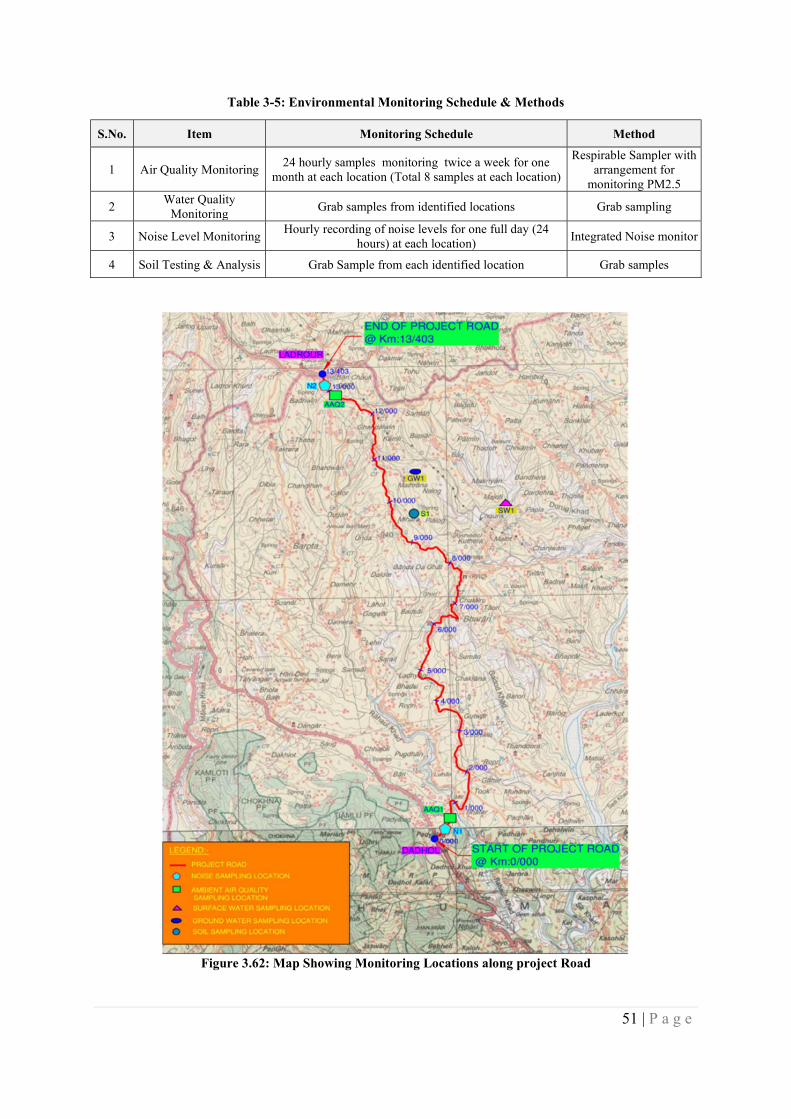
51 | P a g e
Table 3-5: Environmental Monitoring Schedule & Methods
S.No. Item Monitoring Schedule Method
1 Air Quality Monitoring 24 hourly samples monitoring twice a week for one
month at each location (Total 8 samples at each location)
Respirable Sampler with arrangement for
monitoring PM2.5
2 Water Quality
Monitoring Grab samples from identified locations Grab sampling
3 Noise Level Monitoring Hourly recording of noise levels for one full day (24
hours) at each location) Integrated Noise monitor
4 Soil Testing & Analysis Grab Sample from each identified location Grab samples
Figure 3.62: Map Showing Monitoring Locations along project Road

52 | P a g e
Ambient Noise Levels
63. Ambient Noise levels monitoring was carried at Dadhol and Ladrour locations along the project road. The test results are given in Table 3-6. It may be seen that the ambient noise levels (for both day and night times) at both the monitored locations are below the National Ambient Noise levels well as one-hour values of EHS guidelines.
Table 3-6: Noise Level Monitoring Data
S.No Date Of Monitoring Sampling Location
Noise Results
Day Time In Leq dB (A) Night Time In Leq dB
(A)
1 20.09.2019 Dadhol (C) 60.5 51.2
2 21.09.2019 Ladrour (R) 48.5 38.9
National Ambient Noise levels
Commercial (C) 65 55
Residential (R) 55 45
EHS Guideline Values (One Hour Leq (dBA))
Commercial 70 70
Residential 55 45
Surface Water
64. There are no surface water bodies in the vicinity of the project road. Therefore, the surface water quality of Seer Khadd, a surface water body at Mojoti village, which is within 15km PIA was tested during the monitoring and the test results are given in Table 3-7. It can be seen that almost all tested parameters of surface water sample are within the safe limits of drinking water standards (IS 10500 permissible Limits), without any treatment.
Table 3-7: Test Results of Surface water at Mojoti along Project Road
S.No Parameter Unit Method Result IS 10500 Test limits
1 pH -- APHA 23rd Edition; 4500 H+ B 8.21 No Relaxation
2 Turbidity NTU APHA 23rd Edition; 2130 B < 1.0 5
3 Conductivity µMho/
Cm APHA 23rd Edition; 2510 B 211.8 --
4 Total Dissolved
Solids mg/L APHA 23rd Edition ; 2540 C 136 2000
5 Color CU APHA 23rd Edition ; 2120 B < 1.0 15
6 Odor -- -- Agreeable Agreeable
7 P-Alkalinity as
CaCO3 mg/L APHA 23rd t Edition ; 2320 B < 10.0 --
8 Alkalinity as
CaCO3 mg/L APHA 23rd t Edition ; 2320 B 78.6 600
9 Total Hardness as
CaCO3 mg/L APHA 23rd Edition ; 2340 C 109.5 600
10 Calcium as Ca mg/L APHA 23rd Edition ; 3500 Ca B 22.3 200
11 Magnesium as
Mg mg/L APHA 23rd Edition ; 3500 Mg B 13.52 100
12 Sodium as Na mg/L APHA 23rd Edition ; 3500 Na B 3.96 --
13 Potassium as K mg/L APHA 23rd Edition ; 3500 K B < 1.0 --
14 Chlorides as Cl- mg/L APHA 23rd Edition ; 4500 Cl- B 8.99 1000
15 Sulphates as SO4-2 mg/L APHA 23rd Edition ; 4500 SO4
-2 E 28.63 400
53 | P a g e
S.No Parameter Unit Method Result IS 10500 Test limits
16 Nitrate Nitrogen
as N mg/L APHA 23rd Edition; 4500 NO3
- B < 1.0 No Relaxation
17 Fluorides as F- mg/L APHA 23rd Edition ; 4500 F- D < 0.1 1.5
18 Iron as Fe mg/L APHA 23rd Edition ; 3500 Fe B < 0.1 No Relaxation
19 Manganese as Mn mg/L APHA 23rd Edition ; 3500 Mn B < 0.01 0.3
20 Phenolic
Compounds as Phenols
mg/L APHA 23rd Edition; 5530 D < 0.001 0.002
21 Copper as Cu mg/L APHA 23rd Edition ; 3111 B < 0.01 No Relaxation
22 Cadmium Cd mg/L APHA 23rd Edition ; 3111 B < 0.001 1
23 Zinc as Zn mg/L APHA 23rd Edition ; 3111 B < 0.5 No Relaxation
24 Lead as Pb mg/L APHA 23rd Edition ; 3111 B < 0.001 1.5
25 Mineral Oil mg/L APHA 23rd Edition ; 5520 B < 0.001 No Relaxation
26 Mercury mg/L Instrument Manual Method < 0.001 15
27 Silver as Ag mg/L Instrument Manual Method < 0.5 No Relaxation
28 Selenium as Se mg/L APHA 23rd Edition ; 3111 D < 0.05 No Relaxation
29 Dissolved Oxygen
mg/L APHA 23rd Edition 4500-O C 8 No Relaxation
30 Chemical Oxygen
Demand mg/L APHA 23rd Edition 5220 B 5.3 No Relaxation
31
Biochemical Oxygen
Demand(3day’s at 27oC)
mg/L IS : 3025(Part-44) :2009 1 Not specified
32 Total Coli forms MPN/100
ml IS:1622 38 Not specified
33 Fecal Coli forms MPN/100
ml IS:1622 14 Not specified
Source:- Field Investigations
The test results for DO (8 mg/l), BOD (1 mg/l), Total Coliforms Organism (38 MPN/100 ml) were compared with CPCB’s permissible limits to classify Designated Best Use of Water and found to be under Class A. The designated best use of surface water classification by CPCB is given in Table 3.8.
Table 3-8: Test Results of Surface water at Mojoti along Project Road
Designated Best Use Class of Water
Criteria
Drinking water source (with conventional treatment)
A
Total Coliforms Organism MPN/100ml shall be 50 or less
pH between 6.5 and 8.5
Dissolved Oxygen 6mg/l or more
Biochemical Oxygen Demand 5 days 20C 2mg/l or less
Outdoor bathing (organised) B
Total Coliforms MPN/100ml shall be 500 or less
pH between 6.5 to 8.5
Dissolved Oxygen 5 mg/1 or more
Drinking Water Source (without C Total Coliforms MPN/100 ml shall be 5000 or less
54 | P a g e
Designated Best Use Class of Water
Criteria
conventional treatment) pH between 6 to 9
Dissolved Oxygen 4 mg/l or more
Biochemical Oxygen Demand (BOD) 5 days 20°C 3 mg/1 or less
Propagation of Wild life and Fisheries
D
pH between 6.5 to 8.5 for Fisheries
Dissolved Oxygen 4 mg/l or more
Free Ammonia (as N) 1.2 mg/l or less
Irrigation, Industrial Cooling, Controlled Waste Disposal
E
pH between 6.0 to 8.5
Electrical Conductivity at 25°C Max 2250µ mhos/cm
Sodium absorption ratio Max. 26
Boron, Max. 2 mg/l
Ground water
65. Hydro geologically, both the unconsolidated valley fill and alluvial formation are occurring in the valley area and semi-consolidated sediments belonging to Siwalik Group form aquifer system in the district. Porous alluvial formation forms the most prolific aquifer system in the valley area where as the sedimentary semi-consolidated formation forms the aquifer of low yield prospect.
66. The Ground water potential in areas along the project road mainly falls under the zone of GW under water table & semi-confined conditions with Low to moderate yields (<5 lps). The Hydrogeology of Bilaspur District showing the project road is given in Figure 3.13. The ground water development scenario in Bilaspur district has not been assessed but is expected to be under safe category and moreover the district has numerous springs and nallahs which are perennial in nature for most part of year.
Ground Water Quality 67. The quality of ground water quality along the project road was assessed through a sample collected
near Mihara (10+500km) during the monitoring and the test results are given in Table 3-9. It can be seen that almost all tested parameters of ground water sample are within the safe limits of drinking water standards (IS 10500 permissible Limits), without any treatment.
55 | P a g e
Figure 3.13: Hydrogeology of Bilaspur District (Source:- https://www.researchgate.net/figure/Elevation-map-of-Himachal-Pradesh-state)
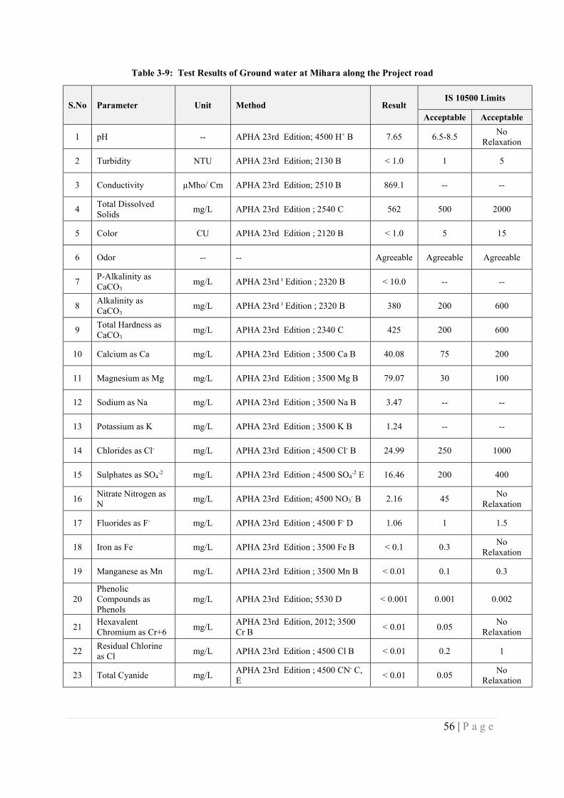
56 | P a g e
Table 3-9: Test Results of Ground water at Mihara along the Project road
S.No Parameter Unit Method Result IS 10500 Limits
Acceptable Acceptable
1 pH -- APHA 23rd Edition; 4500 H+ B 7.65 6.5-8.5 No
Relaxation
2 Turbidity NTU APHA 23rd Edition; 2130 B < 1.0 1 5
3 Conductivity µMho/ Cm APHA 23rd Edition; 2510 B 869.1 -- --
4 Total Dissolved Solids
mg/L APHA 23rd Edition ; 2540 C 562 500 2000
5 Color CU APHA 23rd Edition ; 2120 B < 1.0 5 15
6 Odor -- -- Agreeable Agreeable Agreeable
7 P-Alkalinity as CaCO3
mg/L APHA 23rd t Edition ; 2320 B < 10.0 -- --
8 Alkalinity as CaCO3
mg/L APHA 23rd t Edition ; 2320 B 380 200 600
9 Total Hardness as CaCO3
mg/L APHA 23rd Edition ; 2340 C 425 200 600
10 Calcium as Ca mg/L APHA 23rd Edition ; 3500 Ca B 40.08 75 200
11 Magnesium as Mg mg/L APHA 23rd Edition ; 3500 Mg B 79.07 30 100
12 Sodium as Na mg/L APHA 23rd Edition ; 3500 Na B 3.47 -- --
13 Potassium as K mg/L APHA 23rd Edition ; 3500 K B 1.24 -- --
14 Chlorides as Cl- mg/L APHA 23rd Edition ; 4500 Cl- B 24.99 250 1000
15 Sulphates as SO4-2 mg/L APHA 23rd Edition ; 4500 SO4
-2 E 16.46 200 400
16 Nitrate Nitrogen as N
mg/L APHA 23rd Edition; 4500 NO3- B 2.16 45
No Relaxation
17 Fluorides as F- mg/L APHA 23rd Edition ; 4500 F- D 1.06 1 1.5
18 Iron as Fe mg/L APHA 23rd Edition ; 3500 Fe B < 0.1 0.3 No
Relaxation
19 Manganese as Mn mg/L APHA 23rd Edition ; 3500 Mn B < 0.01 0.1 0.3
20 Phenolic Compounds as Phenols
mg/L APHA 23rd Edition; 5530 D < 0.001 0.001 0.002
21 Hexavalent Chromium as Cr+6
mg/L APHA 23rd Edition, 2012; 3500 Cr B
< 0.01 0.05 No
Relaxation
22 Residual Chlorine as Cl
mg/L APHA 23rd Edition ; 4500 Cl B < 0.01 0.2 1
23 Total Cyanide mg/L APHA 23rd Edition ; 4500 CN- C, E
< 0.01 0.05 No
Relaxation
57 | P a g e
S.No Parameter Unit Method Result IS 10500 Limits
Acceptable Acceptable
24 Copper as Cu mg/L APHA 23rd Edition ; 3111 B < 0.01 0.05 1.5
25 Cadmium Cd mg/L APHA 23rd Edition ; 3111 B < 0.001 0.003 No
Relaxation
26 Zinc as Zn mg/L APHA 23rd Edition ; 3111 B < 0.5 5 15
27 Lead as Pb mg/L APHA 23rd Edition ; 3111 B < 0.001 0.01 No
Relaxation
28 Mineral Oil mg/L APHA 23rd Edition ; 5520 B < 0.001 0.5 No
Relaxation
29 Mercury mg/L Instrument Manual Method < 0.001 0.001 No
Relaxation
30 Silver as Ag mg/L Instrument Manual Method < 0.5 0.1 No
Relaxation
31 Selenium as Se mg/L APHA 23rd Edition ; 3111 D < 0.05 0.01 No
Relaxation
32 Total Coli forms MPN/100ml IS:1622 2 Shall not be detectable in
any 100 ml Sample 33 Fecal Coli forms MPN/100ml IS:1622 Absent
Source:- Field Investigations
3.3 Biological Environment
Forest
68. The 80 percent of state’s geographical area is hilly and mountainous with altitude ranging from 460 meters to 6,600m AMSL. About 63.6 percent of state’s area is classified as forest area, though only 26.4 percent (ISFR, 2015) is under actual forest cover. In the state, legally forest is classified into Reserve Forest, Demarcated Protected Forest, un-demarcated protected forest, other forest, not managed by forest department.
Legal Classification of Forest areas in HP 2018
Category wise Forests Area (Km² ) Percentage
Reserved Forests 1883 4.96 Demarcated Protected Forests
12852 33.87
Un-demarcated Protected Forests
16035 42.25
Others forests (Managed by Forest Department)
7160 18.87
Not managed by Forest Department
18 0.05
Total 37948 100 Source:- https://hpforest.nic.in
69. As of year 2018, Bilaspur forest circle has a forest cover of 52,269 Ha constituting reserve forests, demarcated protected forests; un-demarcated protected forests are given in Table 3-10. The forest map of Himachal Pradesh along with the project road is shown in Figure 3.14.
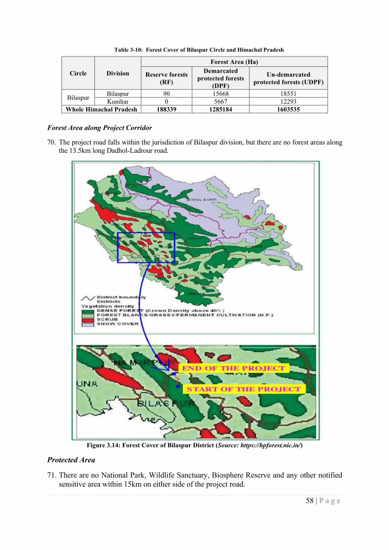
58 | P a g e
Table 3-10: Forest Cover of Bilaspur Circle and Himachal Pradesh
Circle Division
Forest Area (Ha)
Reserve forests (RF)
Demarcated protected forests
(DPF)
Un-demarcated protected forests (UDPF)
Bilaspur Bilaspur 90 15668 18551 Kunihar 0 5667 12293
Whole Himachal Pradesh 188339 1285184 1603535
Forest Area along Project Corridor
70. The project road falls within the jurisdiction of Bilaspur division, but there are no forest areas along the 13.5km long Dadhol-Ladrour road.
Figure 3.14: Forest Cover of Bilaspur District (Source: https://hpforest.nic.in/)
Protected Area
71. There are no National Park, Wildlife Sanctuary, Biosphere Reserve and any other notified sensitive area within 15km on either side of the project road.
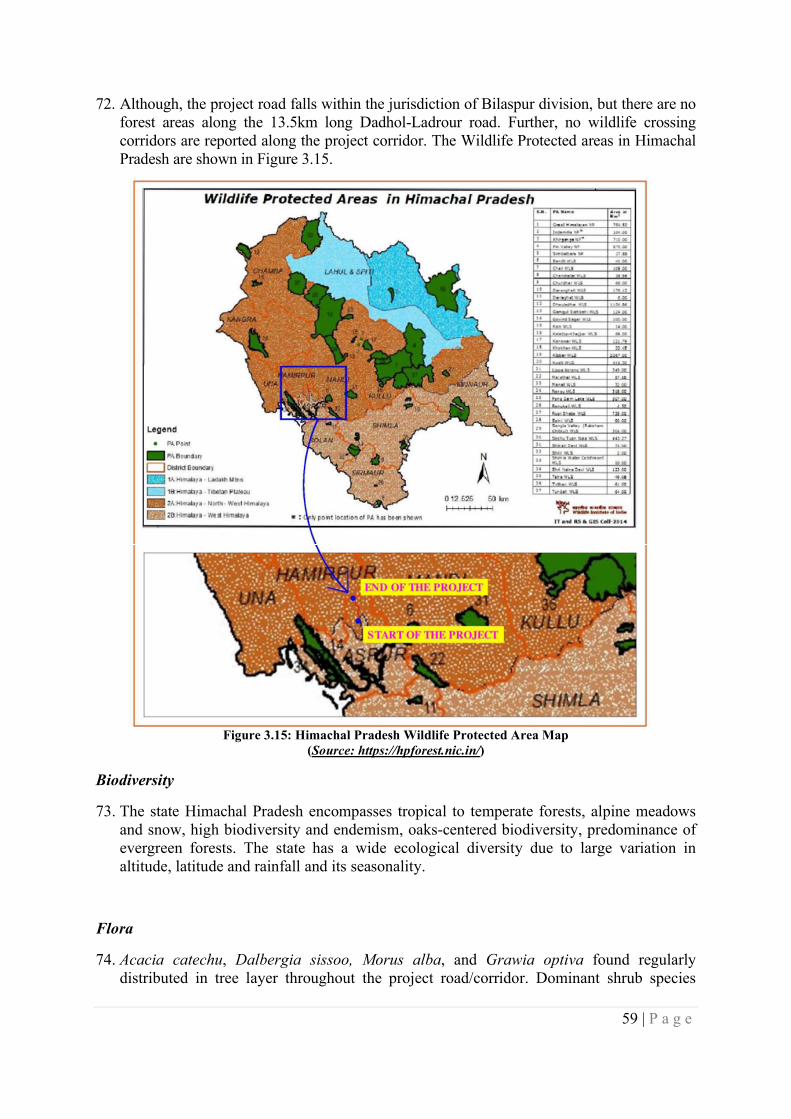
59 | P a g e
72. Although, the project road falls within the jurisdiction of Bilaspur division, but there are no forest areas along the 13.5km long Dadhol-Ladrour road. Further, no wildlife crossing corridors are reported along the project corridor. The Wildlife Protected areas in Himachal Pradesh are shown in Figure 3.15.
Figure 3.15: Himachal Pradesh Wildlife Protected Area Map
(Source: https://hpforest.nic.in/)
Biodiversity
73. The state Himachal Pradesh encompasses tropical to temperate forests, alpine meadows and snow, high biodiversity and endemism, oaks-centered biodiversity, predominance of evergreen forests. The state has a wide ecological diversity due to large variation in altitude, latitude and rainfall and its seasonality.
Flora
74. Acacia catechu, Dalbergia sissoo, Morus alba, and Grawia optiva found regularly distributed in tree layer throughout the project road/corridor. Dominant shrub species
60 | P a g e
recorded along the project road are Murraya koenigii, Adhatoda vasica, Lantana camara and Carissa opaca. A predominance of herb species like Ageratum conyzoides, Parthanium hysterophoros, Bidens biternata and Tridax procumbens was recorded in the study area along with various grass species.
75. The project road corridor has a luxuriant growth of 60 angiosperm taxonomic group, which include invasive species like Ageratum conyzoides, Eupatorium adenophorum, Lantana camara, Parthanium hysterophoros, among others. The list and number of taxonomic groups found along the project road are in Table 3-10. Acacia catechu, Adhatoda vasica, Agave Americana, Asparagus adscendens, Barleria cristata Bombax ceiba, Bauhinia vahlii, Cassia fistula, Dendrocalamus strictus, Emblica officinalis, Murraya koenigii, Solanum nigrum, Tinospora cordifolia are some of the flora having medicinal value and recorded along the project corridor.
Table 3-10: List of Taxonomic group species along the project road
S.No Taxonomic group Number
1 Angiosperm 60
2 Pteridophyta 2
Endemic & RET Species
76. The flora recorded along the project corridor were assessed for their conservation status by cross checking with Red Data Book of Indian plants (Nayar and Sastry, 1987-1990) and none of the plant taxa was found under the Rare endangered and threatened (RET) category. The recorded plant species were also assessed for their endemism in the study area and none of the species was recorded endemic to present road corridor. All the species recorded along the road corridor were distributed more frequently and vigorously even outside the RoW of the project road. Oroxylum indicum was the only species recorded from the study area comes under threatened category (CAMP, 2010).
Trees, Shrubs and Herbs along the Project road along the project Road
The ecological investigations along the project corridor as indicated the presence of variety of trees, shrubs and herbs as given in Table 3-11.
Table 3-11: List of Trees, Shrubs and Herbs along the Project road
Location Tree Shrub Herb
Location-I Acacia catechu, Dalbergia sissoo, Morus alba
Carissa opaca, Murraya koenigii, Adhatoda vasica
Ageratum conyzoides, Parthanium hysterophoros, Bidens biternata
Location-2 Dalbergia sissoo, Morus alba, Grawia optiva
Adhatoda vasica, Murraya koenigii, Lantana camara
Ageratum conyzoides, Tridax procumbens, Parthanium hysterophoros
Apart from the above, the flora reported in the project area is summarized here under: -
Trees: Annogeissus latifolia, Lannea grandis, Acacia catechu, Stephegyne parviflora, Aegle marmalos, Bombax ceiba, Syzygium cumini, Feronia limonia, Ehretia leaves, Flacourtia indica, Zizyphus zuzuba, Mangifera indica, Cassia fistula, Wendlandia exerta, Emblica officinalis, Ficus religiosa, Ficus bengalensis Terminalia tomentosa, Bauhinia variegata, Lucaenia leucocephala, Grewia optiva, Dalbergia sisso, Pinus roxburghii, Albizia lebbek, Albizia chinensis, Eucalypus
61 | P a g e
grandis, Grevillea robusta, Callistemon lanceolatus, Jacaranda mimosaefolia, Toona ciliata, Populus alba, Melia azadirachta, Morus alba and Broussonetia papyrifera.
Brush Wood: Carissa opaca, Dodonea viscosa, Woodfdordia fruticosa, Murraya koenigii, Adhatoda vasica, Nyctanthus arbortristis, Mallotus phillipensis, Euphorbia royaleana, Zizyphu nummularia and Lantana camera.
Climbers: Bauhinia Vahllii, Pueraria tuberose, Mimosa rubicaulis, Zizyphus oenoplia, Cissampelos pareira, Clematis gouriana, Caesalpinia sepiaria, Abrus precatorius, Cuscuta reflexa, Crytolepsis buchanani, Vallaris solanacea, Lohnocarous frutescens.
Grasses: Eulaliopsis binata, Eriophorum comosum, Cynadon dactylon,Chrysopogon fulvus, Heteropgon controtus, Botheriochloa intermedia, Themeda anathera, Cymopogon marthi, Aristida depressa.
During the baseline assessment, enumeration of trees with in RoW was carried out and the numbers of trees were found to be 3614 as given in Table 3-12.
Table 3-12: Enumeration of trees within RoW
S. No. Chainage (Km) Side
Total Nos. of Trees in ROW LHS RHS
1 0+000 - 1+000 119 122 241
2 1+000 - 2+000 127 168 295
3 2+000 - 3+000 133 145 278
4 3+000 - 4+000 160 164 324
5 4+000 - 5+000 155 172 327
6 5+000 - 6+000 185 166 351
7 6+000 - 7+000 177 188 365
8 7+000 - 8+000 191 164 355
9 8+000 - 9+000 81 85 166
10 9+000 -10+000 99 123 222
11 10+000 -11+000 180 59 239
12 11+000 -12+000 66 119 185
13 12+000 -13+000 47 140 187
14 13+000 -13+435 28 17 79
Total 1748 1832 3614
Fauna
There are no National Park, Wildlife Sanctuary, Biosphere Reserve and any other notified sensitive area within the 15 Km radius of the project road. Also, there are no forest areas (of any category) and no wildlife crossing corridors are reported along the project corridor. Local consultations along the project corridor indicate that they frequently face attacks from monkeys near Ladhiyani village.
As per monkey hotspot map of himachal Pradesh (Figure 3.16) prepared by department of Forests, GoHP, the project road is in low density monkey hot spot areas.
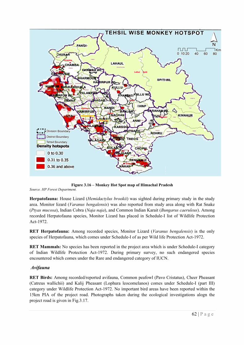
62 | P a g e
Figure 3.16 – Monkey Hot Spot map of Himachal Pradesh Source. HP Forest Department.
Herpatofauna: House Lizard (Hemidactylus brookii) was sighted during primary study in the study area. Monitor lizard (Varanus bengalensis) was also reported from study area along with Rat Snake (Ptyas mucosa), Indian Cobra (Naja naja), and Common Indian Karait (Bungarus caeruleus). Among recorded Herpatofauna species, Monitor Lizard has placed in Schedule-I list of Wildlife Protection Act-1972.
RET Herpatofauna: Among recorded species, Monitor Lizard (Varanus bengalensis) is the only species of Herpatofauna, which comes under Schedule-I of as per Wild life Protection Act-1972.
RET Mammals: No species has been reported in the project area which is under Schedule-I category of Indian Wildlife Protection Act-1972. During primary survey, no such endangered species encountered which comes under the Rare and endangered category of IUCN.
Avifauna
RET Birds: Among recorded/reported avifauna, Common peafowl (Pavo Cristatus), Cheer Pheasant (Catreus wallichii) and Kalij Pheasant (Lophura leocomelanos) comes under Schedule-I (part III) category under Wildlife Protection Act-1972. No important bird areas have been reported within the 15km PIA of the project road. Photographs taken during the ecological investigations alogn the project road is given in Fig.3.17.
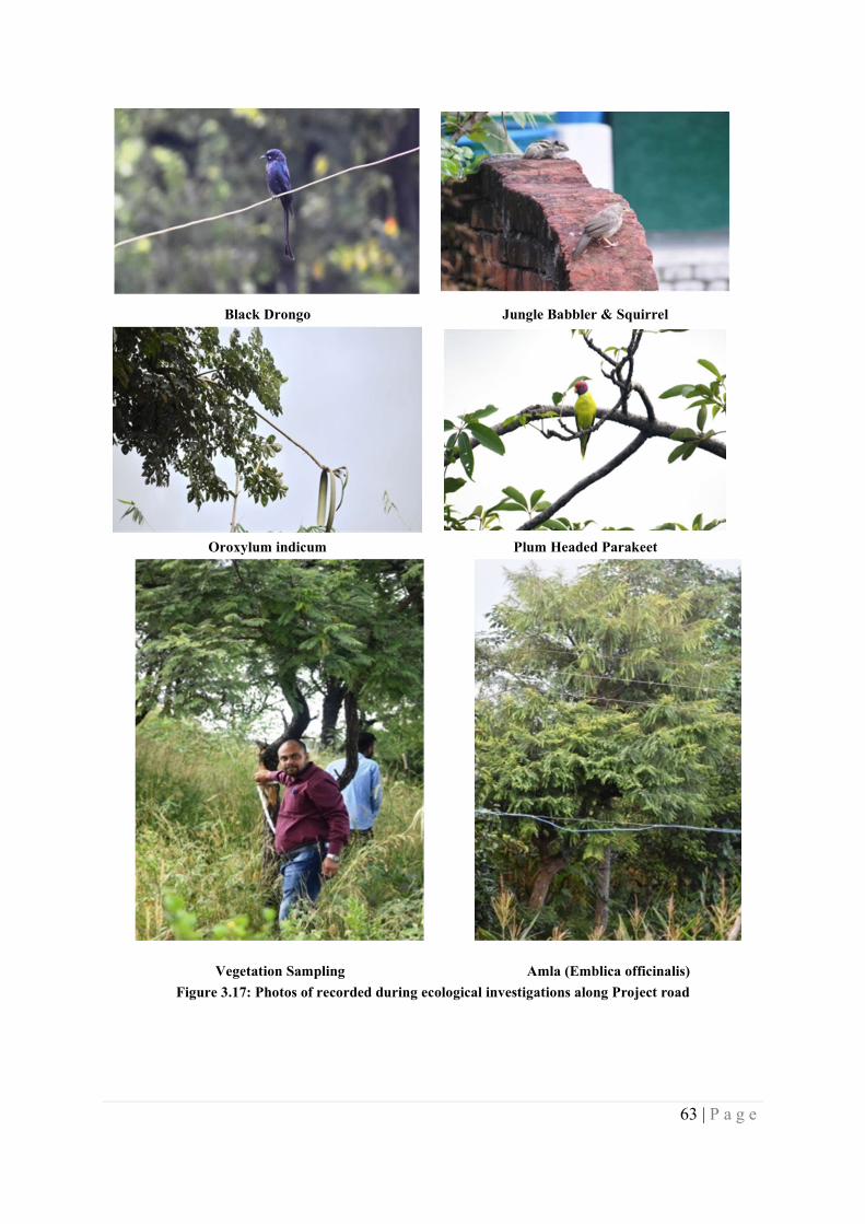
63 | P a g e
Black Drongo Jungle Babbler & Squirrel
Oroxylum indicum Plum Headed Parakeet
Vegetation Sampling Amla (Emblica officinalis)
Figure 3.17: Photos of recorded during ecological investigations along Project road
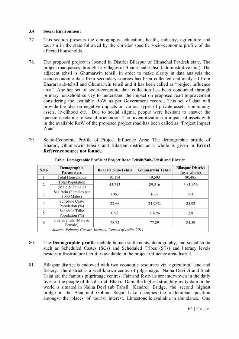
64 | P a g e
3.4 Social Environment
77. This section presents the demography, education, health, industry, agriculture and tourism in the state followed by the corridor specific socio-economic profile of the affected households.
78. The proposed project is located in District Bilaspur of Himachal Pradesh state. The project road passes through 15 villages of Bharari sub-tahsil (administrative unit). The adjacent tehsil is Ghumarwin tehsil. In order to make clarity in data analysis the socio-economic data from secondary sources has been collected and analysed from Bharari sub-tehsil and Ghumarwin tehsil and it has been called as “project influence area”. Another set of socio-economic data collection has been conducted through primary household survey to understand the impact on proposed road improvement considering the available RoW as per Government record.. This set of data will provide the idea on negative impacts on various types of private assets, community assets, livelihood etc. Due to social stigma, people were hesitant to answer the questions relating to sexual orientation. The inventorization on impact of assets with in the available RoW of the proposed project road has been called as “Project Impact Zone”.
79. Socio-Economic Profile of Project Influence Area: The demographic profile of Bharari, Ghumarwin tehsils and Bilaspur district as a whole is given in Error! Reference source not found..
Table: Demographic Profile of Project Road Tehsils/Sub-Tehsil and District
S.No Demographic Parameters
Bharari Sub-Tehsil Ghumarwin Tehsil Bilaspur District
(as a whole) 1 Total Households 10,174 19,593 80,485
2 Total Population
45,713 89,516 3,81,956 (Male & Female)
3 Sex ratio (Females per
1000 Males) 1063 1007 981
4 Schedule Caste Population (%)
22.66 24.98% 25.92
5 Schedule Tribe Population (%)
0.93 1.16% 2.8
6 Literacy rate (Male &
Female) 78.72 77.89 84.59
Source: Primary Census Abstract, Census of India, 2011
80. The Demographic profile include human settlements, demography, and social strata
such as Scheduled Castes (SCs) and Scheduled Tribes (STs) and literacy levels besides infrastructure facilities available in the project influence area/district.
81. Bilaspur district is endowed with two economic resources viz. agricultural land and fishery. The district is a well-known centre of pilgrimage. Naina Devi Ji and Shah Talai are the famous pilgrimage centres. Fair and festivals are interwoven in the daily lives of the people of this district. Bhakra Dam, the highest straight gravity dam in the world is situated in Naina Devi sub Tahsil. Kandror Bridge, the second highest bridge in the Asia and Gobind Sagar Lake occupies the predominant position amongst the places of tourist interest. Limestone is available in abundance. One
65 | P a g e
cement plant has been set up by the A.C.C. Pvt. Ltd., at Barmana. Gold, pyrite and gypsum are found in Malyawar forests Quartzite’s in Sungal, Bandla and Chamlok etc. Livestock is the main wealth next to agricultural of a large chunk of rural population. Road transport is the life of the economy of the district. All the important places are linked with roads. Bilaspuri or Kahluri is principal mother tongue of about 80 per cent of the population. The inhabitants of the district have their staple food is maize, rice and occasionally wheat. Bilaspur being situated in temperate zone, the clothing requirement is light.
82. Population: According to Census 2011, the total population of Bilaspur district is 381,956 comprising 192,764 males and 189,192 females. This population of the district forms 5.56 per cent of the state population and ranks at 10th place among the districts. Out of total population of the district, 93.4 per cent is distributed in rural areas while 6.6 per cent lives in urban areas. The rural population of the district is distributed among 4 tahsils (GHumarwan, Jandatta, Naina Deviji and Bilaspur-Sadar) and 2 sub-tahsils(Bharari and Namhol), and urban population is spread over in 4 towns.
83. Density: The density of population in Bilaspur district is 327 persons per sq. km. against the state average of 123 persons. In rural areas, the density of population works out to 310 persons per sq. km. while the density of 1,433 persons per sq. km. has been worked out in urban areas.
84. Sex Ratio: There are 981 females per 1,000 males in Bilaspur district. The Sex Ratio figures for rural and urban areas of the district are 986 and 917 respectively. It is also seen that the proportion of females in rural areas is higher than that of urban areas. Sex ratio in age-group 0-6 comes to 900 females per 1,000 males in the district, as a whole. In rural areas this proportion is 903 females while in urban areas the sex ratio of child population comes to 843.
85. Work participation rate: The work participation rate is defined as percentage of total workers to total population. Similar procedure has been adopted to define main workers and marginal workers. According to Census 2011, the total workers including main & marginal workers come to 53.9 per cent of the total population of the district. Of the total workers, 27.1 and 26.8 per cent is shared by the main and marginal workers respectively. The remaining 46.1 per cent of total population is occupied by the category of non-workers. As per Census 2011, the main workers participation among males is 38.1 and for females is 15.9 per cent. Males and females have 19.8 and 34.0 per cent in the category of marginal workers. The proportion of female marginal workers is considerably higher than that of males as the females are attending to one or more economic activities in addition to their household duties to increase the family income. It is observed that the proportion of male main workers is higher than that of female main workers in the district.
86. Literacy: A person who can read and write in any language is considered a literate in Census. All the children of age-group 0-6 years have been recorded as illiterate. As per Census 2011, Bilaspur district reported 287,620persons as literates constituting 84.6 per cent of the total population. The proportion of male and female literates in the district is 91.2 and 78.0 per cent, respectively. The literacy rate of males is higher than females in the district. The total literacy rates of rural and urban areas are 84.1
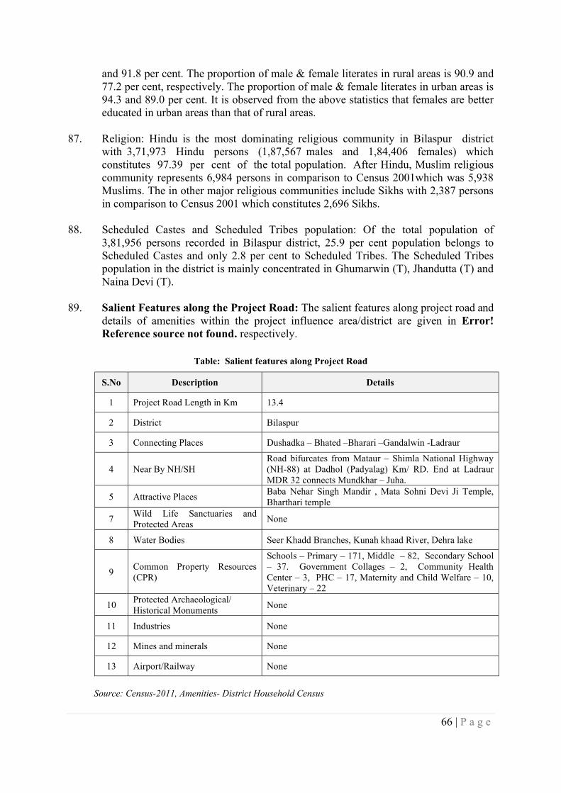
66 | P a g e
and 91.8 per cent. The proportion of male & female literates in rural areas is 90.9 and 77.2 per cent, respectively. The proportion of male & female literates in urban areas is 94.3 and 89.0 per cent. It is observed from the above statistics that females are better educated in urban areas than that of rural areas.
87. Religion: Hindu is the most dominating religious community in Bilaspur district with 3,71,973 Hindu persons (1,87,567 males and 1,84,406 females) which constitutes 97.39 per cent of the total population. After Hindu, Muslim religious community represents 6,984 persons in comparison to Census 2001which was 5,938 Muslims. The in other major religious communities include Sikhs with 2,387 persons in comparison to Census 2001 which constitutes 2,696 Sikhs.
88. Scheduled Castes and Scheduled Tribes population: Of the total population of 3,81,956 persons recorded in Bilaspur district, 25.9 per cent population belongs to Scheduled Castes and only 2.8 per cent to Scheduled Tribes. The Scheduled Tribes population in the district is mainly concentrated in Ghumarwin (T), Jhandutta (T) and Naina Devi (T).
89. Salient Features along the Project Road: The salient features along project road and details of amenities within the project influence area/district are given in Error! Reference source not found. respectively.
Table: Salient features along Project Road
S.No Description Details
1 Project Road Length in Km 13.4
2 District Bilaspur
3 Connecting Places Dushadka – Bhated –Bharari –Gandalwin -Ladraur
4 Near By NH/SH Road bifurcates from Mataur – Shimla National Highway (NH-88) at Dadhol (Padyalag) Km/ RD. End at Ladraur MDR 32 connects Mundkhar – Juha.
5 Attractive Places Baba Nehar Singh Mandir , Mata Sohni Devi Ji Temple, Bharthari temple
7 Wild Life Sanctuaries and Protected Areas
None
8 Water Bodies Seer Khadd Branches, Kunah khaad River, Dehra lake
9 Common Property Resources (CPR)
Schools – Primary – 171, Middle – 82, Secondary School – 37. Government Collages – 2, Community Health Center – 3, PHC – 17, Maternity and Child Welfare – 10, Veterinary – 22
10 Protected Archaeological/ Historical Monuments
None
11 Industries None
12 Mines and minerals None
13 Airport/Railway None
Source: Census-2011, Amenities- District Household Census
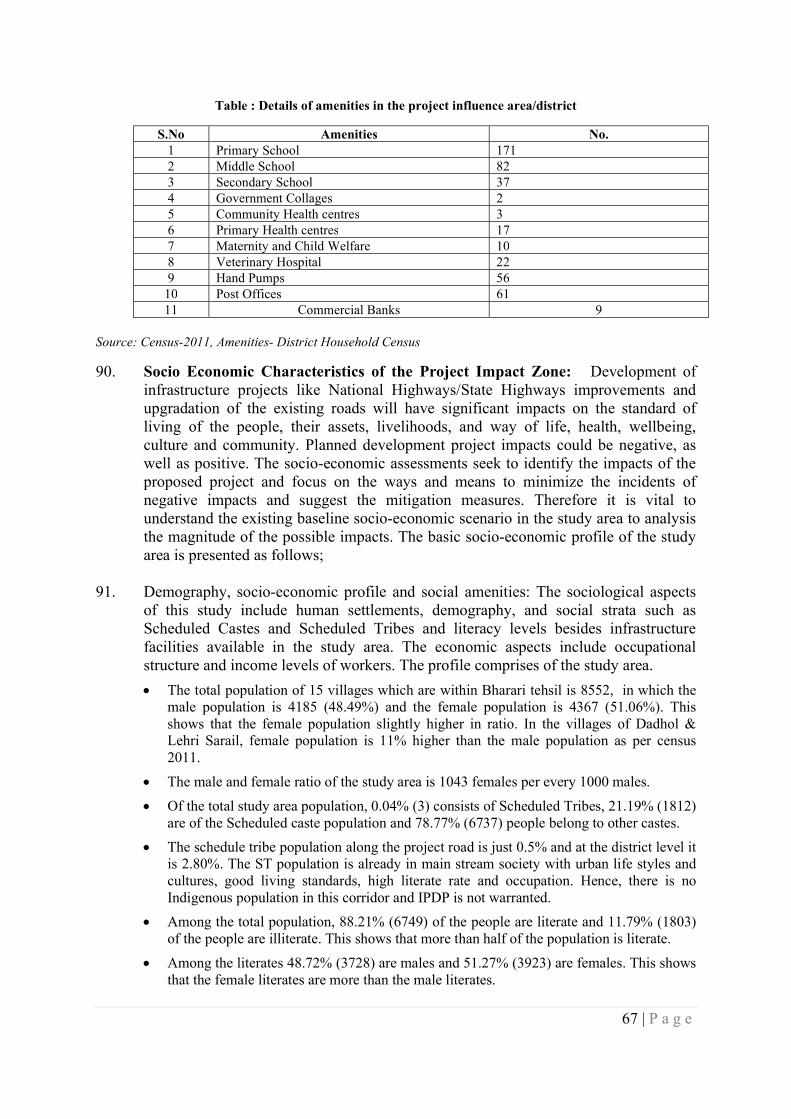
67 | P a g e
Table : Details of amenities in the project influence area/district
S.No Amenities No. 1 Primary School 171 2 Middle School 82 3 Secondary School 37 4 Government Collages 2 5 Community Health centres 3 6 Primary Health centres 17 7 Maternity and Child Welfare 10 8 Veterinary Hospital 22 9 Hand Pumps 56
10 Post Offices 61 11 Commercial Banks 9
Source: Census-2011, Amenities- District Household Census
90. Socio Economic Characteristics of the Project Impact Zone: Development of infrastructure projects like National Highways/State Highways improvements and upgradation of the existing roads will have significant impacts on the standard of living of the people, their assets, livelihoods, and way of life, health, wellbeing, culture and community. Planned development project impacts could be negative, as well as positive. The socio-economic assessments seek to identify the impacts of the proposed project and focus on the ways and means to minimize the incidents of negative impacts and suggest the mitigation measures. Therefore it is vital to understand the existing baseline socio-economic scenario in the study area to analysis the magnitude of the possible impacts. The basic socio-economic profile of the study area is presented as follows;
91. Demography, socio-economic profile and social amenities: The sociological aspects of this study include human settlements, demography, and social strata such as Scheduled Castes and Scheduled Tribes and literacy levels besides infrastructure facilities available in the study area. The economic aspects include occupational structure and income levels of workers. The profile comprises of the study area.
The total population of 15 villages which are within Bharari tehsil is 8552, in which the male population is 4185 (48.49%) and the female population is 4367 (51.06%). This shows that the female population slightly higher in ratio. In the villages of Dadhol & Lehri Sarail, female population is 11% higher than the male population as per census 2011.
The male and female ratio of the study area is 1043 females per every 1000 males.
Of the total study area population, 0.04% (3) consists of Scheduled Tribes, 21.19% (1812) are of the Scheduled caste population and 78.77% (6737) people belong to other castes.
The schedule tribe population along the project road is just 0.5% and at the district level it is 2.80%. The ST population is already in main stream society with urban life styles and cultures, good living standards, high literate rate and occupation. Hence, there is no Indigenous population in this corridor and IPDP is not warranted.
Among the total population, 88.21% (6749) of the people are literate and 11.79% (1803) of the people are illiterate. This shows that more than half of the population is literate.
Among the literates 48.72% (3728) are males and 51.27% (3923) are females. This shows that the female literates are more than the male literates.
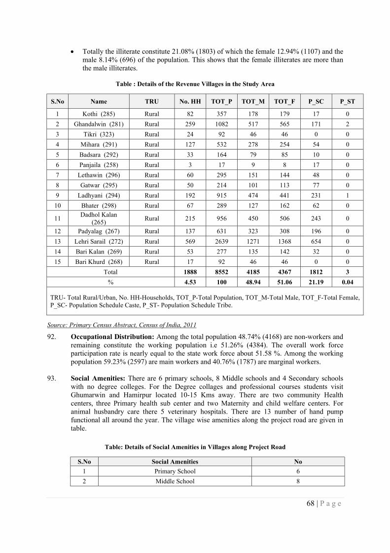
68 | P a g e
Totally the illiterate constitute 21.08% (1803) of which the female 12.94% (1107) and the male 8.14% (696) of the population. This shows that the female illiterates are more than the male illiterates.
Table : Details of the Revenue Villages in the Study Area
S.No Name TRU No. HH TOT_P TOT_M TOT_F P_SC P_ST
1 Kothi (285) Rural 82 357 178 179 17 0
2 Ghandalwin (281) Rural 259 1082 517 565 171 2
3 Tikri (323) Rural 24 92 46 46 0 0
4 Mihara (291) Rural 127 532 278 254 54 0
5 Badsara (292) Rural 33 164 79 85 10 0
6 Panjaila (258) Rural 3 17 9 8 17 0
7 Lethawin (296) Rural 60 295 151 144 48 0
8 Gatwar (295) Rural 50 214 101 113 77 0
9 Ladhyani (294) Rural 192 915 474 441 231 1
10 Bhater (298) Rural 67 289 127 162 62 0
11 Dadhol Kalan
(265) Rural 215 956 450 506 243 0
12 Padyalag (267) Rural 137 631 323 308 196 0
13 Lehri Sarail (272) Rural 569 2639 1271 1368 654 0
14 Bari Kalan (269) Rural 53 277 135 142 32 0
15 Bari Khurd (268) Rural 17 92 46 46 0 0
Total 1888 8552 4185 4367 1812 3
% 4.53 100 48.94 51.06 21.19 0.04
TRU- Total Rural/Urban, No. HH-Households, TOT_P-Total Population, TOT_M-Total Male, TOT_F-Total Female, P_SC- Population Schedule Caste, P_ST- Population Schedule Tribe.
Source: Primary Census Abstract, Census of India, 2011
92. Occupational Distribution: Among the total population 48.74% (4168) are non-workers and remaining constitute the working population i.e 51.26% (4384). The overall work force participation rate is nearly equal to the state work force about 51.58 %. Among the working population 59.23% (2597) are main workers and 40.76% (1787) are marginal workers.
93. Social Amenities: There are 6 primary schools, 8 Middle schools and 4 Secondary schools with no degree colleges. For the Degree collages and professional courses students visit Ghumarwin and Hamirpur located 10-15 Kms away. There are two community Health centers, three Primary health sub center and two Maternity and child welfare centers. For animal husbandry care there 5 veterinary hospitals. There are 13 number of hand pump functional all around the year. The village wise amenities along the project road are given in table.
Table: Details of Social Amenities in Villages along Project Road
S.No Social Amenities No
1 Primary School 6
2 Middle School 8
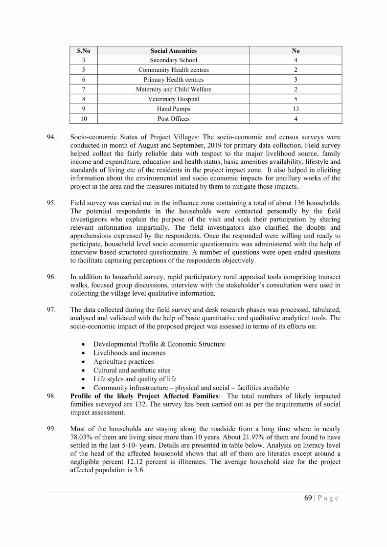
69 | P a g e
S.No Social Amenities No
3 Secondary School 4
5 Community Health centres 2
6 Primary Health centres 3
7 Maternity and Child Welfare 2
8 Veterinary Hospital 5
9 Hand Pumps 13
10 Post Offices 4
94. Socio-economic Status of Project Villages: The socio-economic and census surveys were
conducted in month of August and September, 2019 for primary data collection. Field survey helped collect the fairly reliable data with respect to the major livelihood source, family income and expenditure, education and health status, basic amenities availability, lifestyle and standards of living etc of the residents in the project impact zone. It also helped in eliciting information about the environmental and socio economic impacts for ancillary works of the project in the area and the measures initiated by them to mitigate those impacts.
95. Field survey was carried out in the influence zone containing a total of about 136 households. The potential respondents in the households were contacted personally by the field investigators who explain the purpose of the visit and seek their participation by sharing relevant information impartially. The field investigators also clarified the doubts and apprehensions expressed by the respondents. Once the responded were willing and ready to participate, household level socio economic questionnaire was administered with the help of interview based structured questionnaire. A number of questions were open ended questions to facilitate capturing perceptions of the respondents objectively.
96. In addition to household survey, rapid participatory rural appraisal tools comprising transect walks, focused group discussions, interview with the stakeholder’s consultation were used in collecting the village level qualitative information.
97. The data collected during the field survey and desk research phases was processed, tabulated, analysed and validated with the help of basic quantitative and qualitative analytical tools. The socio-economic impact of the proposed project was assessed in terms of its effects on:
Developmental Profile & Economic Structure Livelihoods and incomes Agriculture practices Cultural and aesthetic sites Life styles and quality of life Community infrastructure – physical and social – facilities available
98. Profile of the likely Project Affected Families: The total numbers of likely impacted families surveyed are 132. The survey has been carried out as per the requirements of social impact assessment.
99. Most of the households are staying along the roadside from a long time where in nearly 78.03% of them are living since more than 10 years. About 21.97% of them are found to have settled in the last 5-10- years. Details are presented in table below. Analysis on literacy level of the head of the affected household shows that all of them are literates except around a negligible percent 12.12 percent is illiterates. The average household size for the project affected population is 3.6.
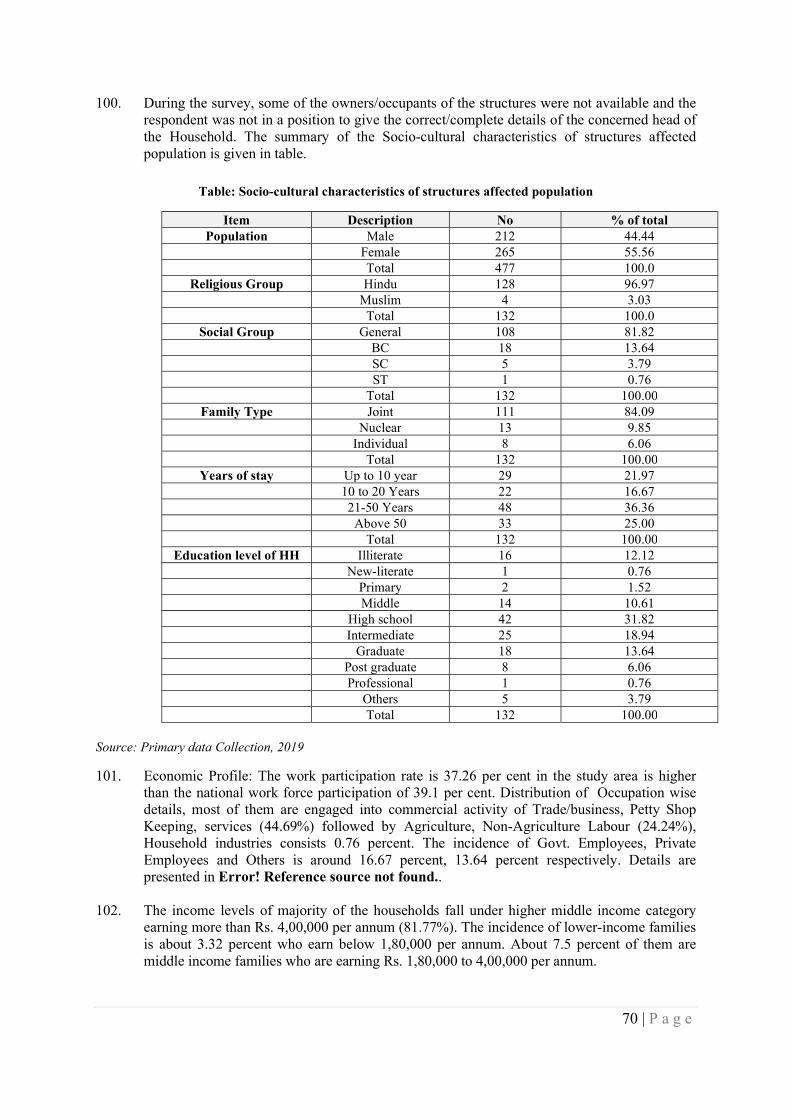
70 | P a g e
100. During the survey, some of the owners/occupants of the structures were not available and the respondent was not in a position to give the correct/complete details of the concerned head of the Household. The summary of the Socio-cultural characteristics of structures affected population is given in table.
Table: Socio-cultural characteristics of structures affected population
Item Description No % of total Population Male 212 44.44
Female 265 55.56 Total 477 100.0
Religious Group Hindu 128 96.97 Muslim 4 3.03 Total 132 100.0
Social Group General 108 81.82 BC 18 13.64 SC 5 3.79 ST 1 0.76 Total 132 100.00
Family Type Joint 111 84.09 Nuclear 13 9.85 Individual 8 6.06 Total 132 100.00
Years of stay Up to 10 year 29 21.97 10 to 20 Years 22 16.67 21-50 Years 48 36.36 Above 50 33 25.00 Total 132 100.00
Education level of HH Illiterate 16 12.12 New-literate 1 0.76 Primary 2 1.52 Middle 14 10.61 High school 42 31.82 Intermediate 25 18.94 Graduate 18 13.64 Post graduate 8 6.06 Professional 1 0.76 Others 5 3.79 Total 132 100.00
Source: Primary data Collection, 2019
101. Economic Profile: The work participation rate is 37.26 per cent in the study area is higher than the national work force participation of 39.1 per cent. Distribution of Occupation wise details, most of them are engaged into commercial activity of Trade/business, Petty Shop Keeping, services (44.69%) followed by Agriculture, Non-Agriculture Labour (24.24%), Household industries consists 0.76 percent. The incidence of Govt. Employees, Private Employees and Others is around 16.67 percent, 13.64 percent respectively. Details are presented in Error! Reference source not found..
102. The income levels of majority of the households fall under higher middle income category earning more than Rs. 4,00,000 per annum (81.77%). The incidence of lower-income families is about 3.32 percent who earn below 1,80,000 per annum. About 7.5 percent of them are middle income families who are earning Rs. 1,80,000 to 4,00,000 per annum.
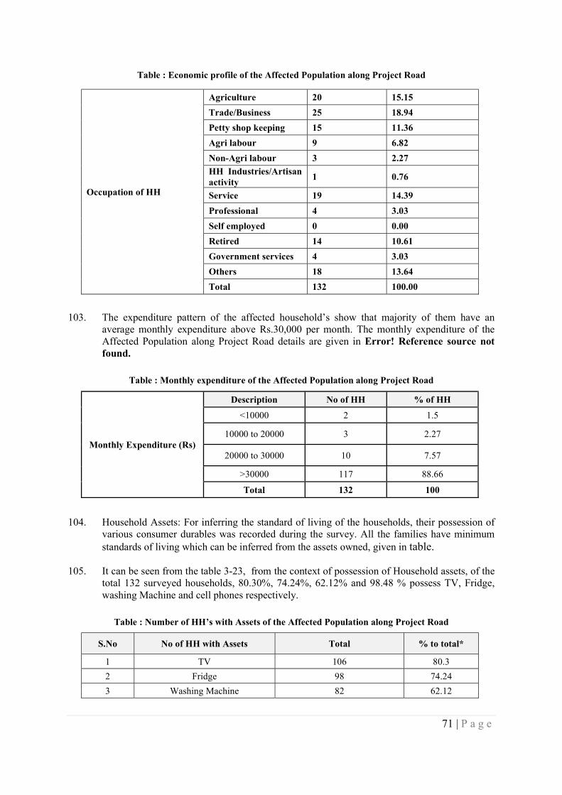
71 | P a g e
Table : Economic profile of the Affected Population along Project Road
Occupation of HH
Agriculture 20 15.15
Trade/Business 25 18.94
Petty shop keeping 15 11.36
Agri labour 9 6.82
Non-Agri labour 3 2.27
HH Industries/Artisan activity
1 0.76
Service 19 14.39
Professional 4 3.03
Self employed 0 0.00
Retired 14 10.61
Government services 4 3.03
Others 18 13.64
Total 132 100.00
103. The expenditure pattern of the affected household’s show that majority of them have an
average monthly expenditure above Rs.30,000 per month. The monthly expenditure of the Affected Population along Project Road details are given in Error! Reference source not found.
Table : Monthly expenditure of the Affected Population along Project Road
Monthly Expenditure (Rs)
Description No of HH % of HH
<10000 2 1.5
10000 to 20000 3 2.27
20000 to 30000 10 7.57
>30000 117 88.66
Total 132 100
104. Household Assets: For inferring the standard of living of the households, their possession of
various consumer durables was recorded during the survey. All the families have minimum standards of living which can be inferred from the assets owned, given in table.
105. It can be seen from the table 3-23, from the context of possession of Household assets, of the total 132 surveyed households, 80.30%, 74.24%, 62.12% and 98.48 % possess TV, Fridge, washing Machine and cell phones respectively.
Table : Number of HH’s with Assets of the Affected Population along Project Road
S.No No of HH with Assets Total % to total*
1 TV 106 80.3
2 Fridge 98 74.24
3 Washing Machine 82 62.12
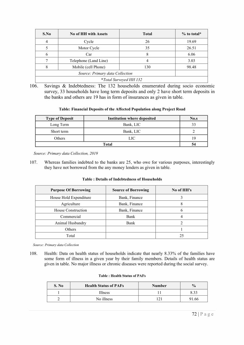
72 | P a g e
S.No No of HH with Assets Total % to total*
4 Cycle 26 19.69
5 Motor Cycle 35 26.51
6 Car 8 6.06
7 Telephone (Land Line) 4 3.03
8 Mobile (cell Phone) 130 98.48
Source: Primary data Collection
*Total Surveyed HH 132
106. Savings & Indebtedness: The 132 households enumerated during socio economic survey, 33 households have long term deposits and only 2 have short term deposits in the banks and others are 19 has in form of insurances as given in table.
Table: Financial Deposits of the Affected Population along Project Road
Type of Deposit Institution where deposited No.s
Long Term Bank, LIC 33
Short term Bank, LIC 2
Others LIC 19
Total 54
Source: Primary data Collection, 2019
107. Whereas families indebted to the banks are 25, who owe for various purposes, interestingly they have not borrowed from the any money lenders as given in table.
Table : Details of Indebtedness of Households
Purpose Of Borrowing Source of Borrowing No of HH's
House Hold Expenditure Bank, Finance 3
Agriculture Bank, Finance 8
House Construction Bank, Finance 6
Commercial Bank 4
Animal Husbandry Bank 2
Others 1
Total 25
Source: Primary data Collection
108. Health: Data on health status of households indicate that nearly 8.33% of the families have some form of illness in a given year by their family members. Details of health status are given in table. No major illness or chronic diseases were reported during the social survey.
Table : Health Status of PAFs
S. No Health Status of PAFs Number %
1 Illness 11 8.33
2 No illness 121 91.66
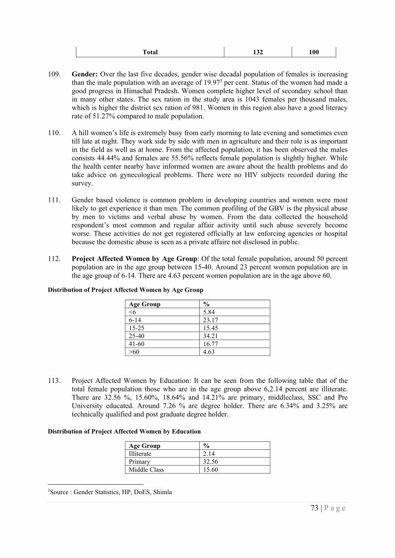
73 | P a g e
Total 132 100
109. Gender: Over the last five decades, gender wise decadal population of females is increasing
than the male population with an average of 19.973 per cent. Status of the women had made a good progress in Himachal Pradesh. Women complete higher level of secondary school than in many other states. The sex ration in the study area is 1043 females per thousand males, which is higher the district sex ration of 981. Women in this region also have a good literacy rate of 51.27% compared to male population.
110. A hill women’s life is extremely busy from early morning to late evening and sometimes even till late at night. They work side by side with men in agriculture and their role is as important in the field as well as at home. From the affected population, it has been observed the males consists 44.44% and females are 55.56% reflects female population is slightly higher. While the health center nearby have informed women are aware about the health problems and do take advice on gynecological problems. There were no HIV subjects recorded during the survey.
111. Gender based violence is common problem in developing countries and women were most likely to get experience it than men. The common profiling of the GBV is the physical abuse by men to victims and verbal abuse by women. From the data collected the household respondent’s most common and regular affair activity until such abuse severely become worse. These activities do not get registered officially at law enforcing agencies or hospital because the domestic abuse is seen as a private affaire not disclosed in public.
112. Project Affected Women by Age Group: Of the total female population, around 50 percent population are in the age group between 15-40. Around 23 percent women population are in the age group of 6-14. There are 4.63 percent women population are in the age above 60.
Distribution of Project Affected Women by Age Group
Age Group % <6 5.84 6-14 23.17 15-25 15.45 25-40 34.21 41-60 16.77 >60 4.63
113. Project Affected Women by Education: It can be seen from the following table that of the total female population those who are in the age group above 6,2.14 percent are illiterate. There are 32.56 %, 15.60%, 18.64% and 14.21% are primary, middleclass, SSC and Pre University educated. Around 7.26 % are degree holder. There are 6.34% and 3.25% are technically qualified and post graduate degree holder.
Distribution of Project Affected Women by Education
Age Group % Illiterate 2.14 Primary 32.56 Middle Class 15.60
3Source : Gender Statistics, HP, DoES, Shimla
74 | P a g e
SSC 18.64 Pre University 14.21 Degree 7.26 Post Graduate 3.25 Technical 6.34
114. Impact on women and Other Vulnerable Group: The Department of Social Justice and Empowerment Government of Himachal Pradesh is responsible for the welfare of persons with disabilities in Himachal Pradesh. The state has an estimated population of 1,55,9501 persons with disabilities in a total population of 6, 856, 5092 people. The disability classification with population break up as per Census 2011, Government of Himachal Pradesh is as follows. It can be mentioned here that there is no such data base available for district, tehsil, sub- tehsil and village level.
115. The vulnerable section of the society for the purpose of the project includes, woman headed families, transgender, scheduled families (both caste and tribes), families below poverty line, destitute, old aged and orphans. No orphan, women headed household, destitute, old aged, families below poverty line was found. Some Scheduled Caste((5) and Schedule tribe(1) families was found during the survey.
Disability category and Population in Himachal Pradesh
Disability Category Population with Disability Seeing 26076 Hearing 26700 Speech 8278 Movement 32550 Mental Retardation 8986 Mental Illness 5166 Any other 29024 Multiple Disability 18536
116. Women’s Role in Household: Participation of women in economic activity and decision making process at house and community level is a sign of general socio-economic development of the women in particular and society in general. The survey tried to collect information about various activities in which the women members of family are participating. The analysis of data revealed that women in the surveyed families engaged in activities such as cultivation, Allied Activities (Dairy, Poultry, Sheep rearing, etc.), trade & business, household work, and agriculture labour. There are families in which women members are involved in more than one activity; hence, the total figure is more than the affected household figure of 132. All women (100%) member look after household activities like any other women member in the country.
117. There are about 72.32% of women member engaged in cultivation. Only 4.24% of women members are involved in other activities, 65.25% women are involve in collection of water, 21.21% are engaged as an agricultural labors. 13.74% are helping their family members in trade and business. Only 5.25% women are in service and merely 20.81% of women are worked as allied activities. Details are provided in the Table 3.13 below. Women were involved in multiple activities in the daily life and the percentage of their involvement in various activities is given in table..
75 | P a g e
Table : Engagement of women in economic and non-economic activity
S.No Activities women engaged % Woman
1 Cultivation 72.32
2 Allie Activities, 20.81
3 Sale of forest products 1.41
4 Trade & business, 13.74
5 Agricultural labour, 21.01
6 Non Agricultural labour 5.25
7 HH Industries 1.41
8 Services 5.25
9 Household Work including cooking 54.75
10 Taking care of infants/children 71.52
11 Fetching water 65.25
118. Role of Women in Family Financial Matter: Data related to involvement of women in
various family financial matters has been collected to understand the level of involvement of women members in various financial aspects. The factors considered are education of children, health care, purchase of assets, social function etc. the details are given below table.
Table Error! No text of specified style in document.-1: Involvement of women in family
Decision Making %
Education Yes 83.48
No 10.27
Health Yes 86.61
No 7.14
Financial Yes 83.48
No 10.27
Assets Yes 81.25
No 12.5
Day Activities Yes 76.79
No 16.96
Social Yes 82.59
No 11.16
Others Yes 4.02
No 89.73
119. Women Time Disposition: This section highlights women’s involvement in various
activities throughout the day. As the table below shows, over nine hours in a day, a woman spends on household chores, and nearly 7 hours on relaxation. This leaves very little time for any other activity, which may be economically gainful. However, in rural scenario, number of activities is carried out simultaneously. As the table shows some women spend time in
76 | P a g e
wage earning or help family members in cultivation or in household industry. Table below presents average time spent by responding women in individual routes.
Women – Time Disposition
Activities Average time spent per women (hours)
Cooking 2.3 Washing 1.1 Collection of drinking water 1.3 Cleaning of house 0.5 Cattle rearing 1.6 Child rearing 2.4 Wage earning 3.2 HH industries 2.6 Support to cultivation 2.5
120. Work Participation: Himachal Pradesh has made good progress on gender issues. Women complete higher levels of secondary school than in many other states. Moreover, gender gaps in schooling are closing. It is important to note that female labor force participation in the state is the highest in the country. Despite these achievements, challenges remain. The state’s ratio of girls to boys is below the national average, having improved only slightly in recent times. While female labor force participation in the state is high, it has declined after 2005. In rural areas, there are very few non-farm jobs for women. In contrast, urban women work less, but they have the same types of jobs as urban men. The female work participation rate on an average in 991 was 38.75 percent which has increased to 46.34percent in 2001. There has been remarkable improvement in the work force participation rate of women as evident from various censuses. Similarly the male work force participation rate on an average in 1991 was 53.20 percent which has increased to 56.95 percent in 2001.
121. Literacy: Literacy rates among women in the state risen dramatically from only 4.8 percent in 1951 (males 7.5 percent and female 2 percent) to 83.87 percent in 2011 (male 90.83 percent and female 76.6 percent). Health Status There is no doubt that women’s health is affected in gender specific ways by environmental degradation and poverty.
122. Mortality: The depletion of environment leads to a scarcity of natural resources, which means women’s workload is increased as they spend more time searching for fodder and fuel wood to meet their family’s daily needs. Discrimination against a female child is evident from the fact that girls experience higher rate of mortality in younger age- groups as compared to the boys. In 2009, the female infant mortality rate was observed to be 45 as compared to male infant mortality rate of 44. Health of women is an important factor in determining the overall health of the society. If pregnant women are not well nourished they are more likely to give birth to weaker babies leading to higher infant mortality rate. It is also observed that where ever the infant and child mortality is higher, the birth rates are also higher. Women are exposed to a high risk of death due to pregnancy.
123. Empowerment: A good number of women have been elected to Panchayati Raj institution in Himachal Pradesh for the term 2011 -2016. In Himachal Pradesh there are 3243 Gram Panchyats, out of which 1639. (50.54 percent) seats have been occupied by women in 2011 panchyat elections. Out of total seats occupied by women 987 (60.21 percent) occupied by
77 | P a g e
general women, 421 (25.68 percent) scheduled cast women, 104 (6.34 percent) scheduled tribes women and 127 (7.74 percent) by OBC women.
3.5 Cultural Environment
Archaeological and Historical Monuments
124. There are no protected archaeological or historical monuments within Bharari tehsil as a whole as well as within 200m on either side of project road.
Common Property Resources
125. The Common properties along the project road are listed in table..
Table: Details of Common property resources within RoW
S.No Common Property LHS RHS Total
1 Hand pumps 10 19 29
2 Hospitals 0 1 1
3 Bus stop/ Rain shelter 4 6 10
4 Schools 1 2 3
5 Temples 1 3 4
Total 16 32 48
Utilities Within Row
126. The project road has 92 electric poles, 21 street lights/lamp poles, 76 telephone poles and 5 transformers within the right of way. The details of such utilities are given in table. As per the project road widening scheme most of these utilities, which are presently along the edge of the carriage way / shoulder will required to be shifted to the adjacent locations within the available RoW.
Table : Utilities within Right of Way of the Project Road
S.No Utility LHS RHS Total
1 Electric Poles 55 37 92
2 Street light poles 13 8 21
3 Telephone Poles 39 37 76
4 Transformers 1 4 5
Total 108 86 194
3.6 Hazard and Vulnerability Profile
127. The Hazard and Vulnerability profile of the project region and Bilaspur district, which includes the landslide hazards, wind hazards, earth quake hazards, flood hazards as a whole are summarized hereunder.
Landslide Prone Area Zones
128. As per Landslide Vulnerability map of Himachal Pradesh, the project road traverses in severe to very high landslide zones as shown in Figure . During the field investigations, 2 stretches
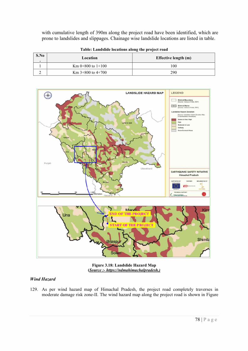
78 | P a g e
with cumulative length of 390m along the project road have been identified, which are prone to landslides and slippages. Chainage wise landslide locations are listed in table.
Table: Landslide locations along the project road
S.No.
Location Effective length (m)
1 Km 0+800 to 1+100 100
2 Km 3+800 to 4+700 290
Figure 3.18: Landslide Hazard Map (Source :- https://ndmahimachalpradesh.)
Wind Hazard
129. As per wind hazard map of Himachal Pradesh, the project road completely traverses in moderate damage risk zone-II. The wind hazard map along the project road is shown in Figure
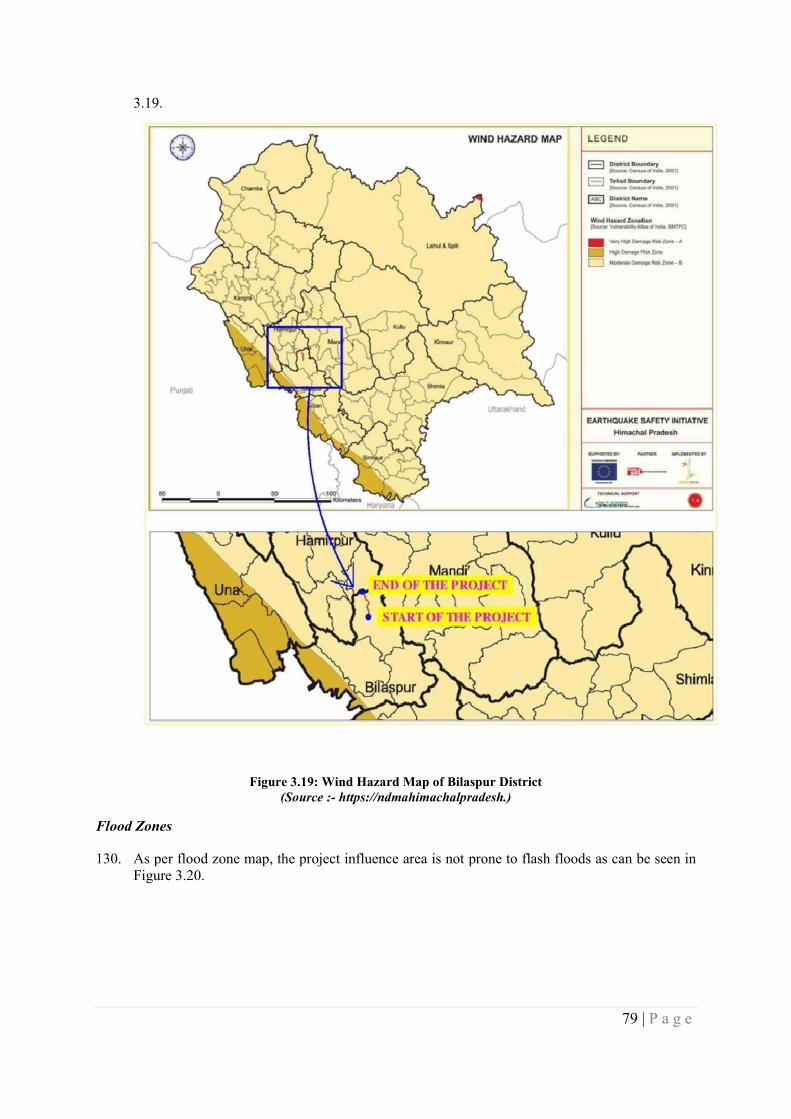
79 | P a g e
3.19.
Figure 3.19: Wind Hazard Map of Bilaspur District (Source :- https://ndmahimachalpradesh.)
Flood Zones
130. As per flood zone map, the project influence area is not prone to flash floods as can be seen in Figure 3.20.
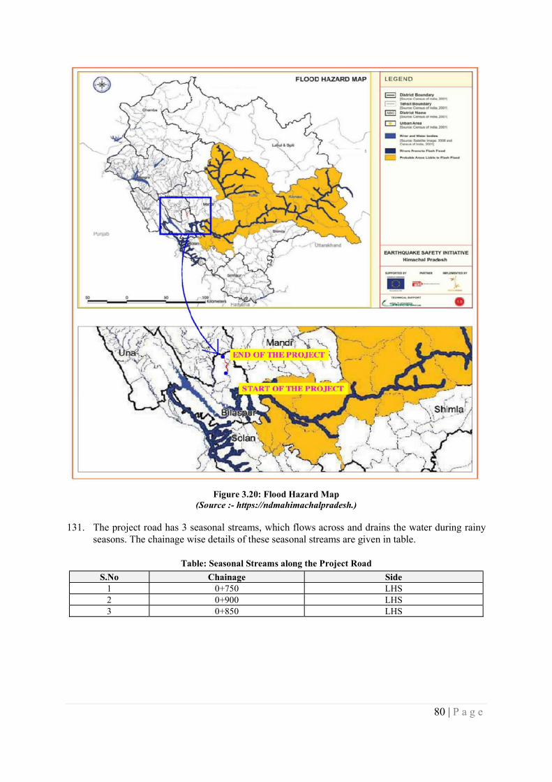
80 | P a g e
Figure 3.20: Flood Hazard Map (Source :- https://ndmahimachalpradesh.)
131. The project road has 3 seasonal streams, which flows across and drains the water during rainy seasons. The chainage wise details of these seasonal streams are given in table.
Table: Seasonal Streams along the Project Road
S.No Chainage Side 1 0+750 LHS 2 0+900 LHS 3 0+850 LHS
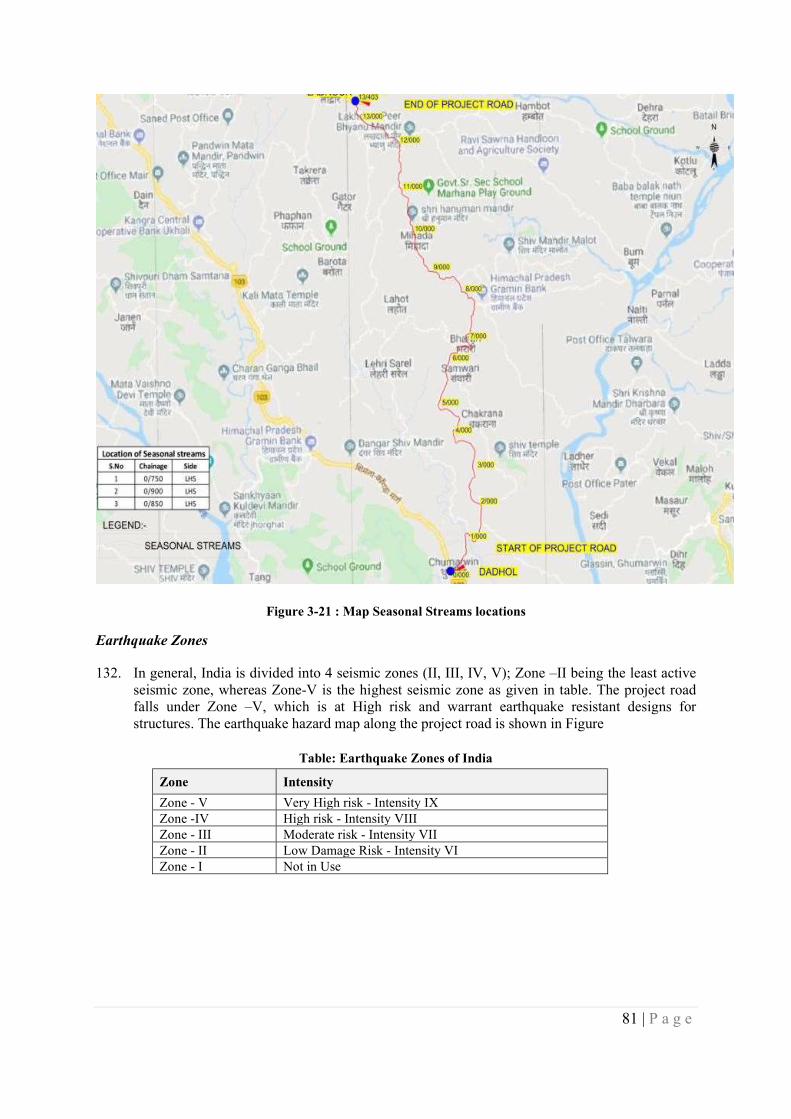
81 | P a g e
Figure 3-21 : Map Seasonal Streams locations
Earthquake Zones
132. In general, India is divided into 4 seismic zones (II, III, IV, V); Zone –II being the least active seismic zone, whereas Zone-V is the highest seismic zone as given in table. The project road falls under Zone –V, which is at High risk and warrant earthquake resistant designs for structures. The earthquake hazard map along the project road is shown in Figure
Table: Earthquake Zones of India
Zone Intensity
Zone - V Very High risk - Intensity IX Zone -IV High risk - Intensity VIII Zone - III Moderate risk - Intensity VII Zone - II Low Damage Risk - Intensity VI Zone - I Not in Use
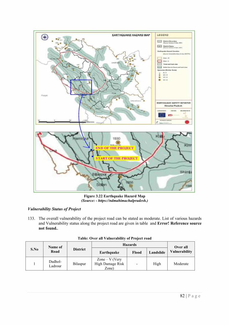
82 | P a g e
Figure 3.22 Earthquake Hazard Map
(Source: - https://ndmahimachalpradesh.)
Vulnerability Status of Project
133. The overall vulnerability of the project road can be stated as moderate. List of various hazards and Vulnerability status along the project road are given in table and Error! Reference source not found..
Table: Over all Vulnerability of Project road
S.No Name of
Road District
Hazards Over all
Vulnerability Earthquake Flood Landslide
1 Dadhol-Ladrour
Bilaspur Zone – V (Very
High Damage Risk Zone)
- High Moderate
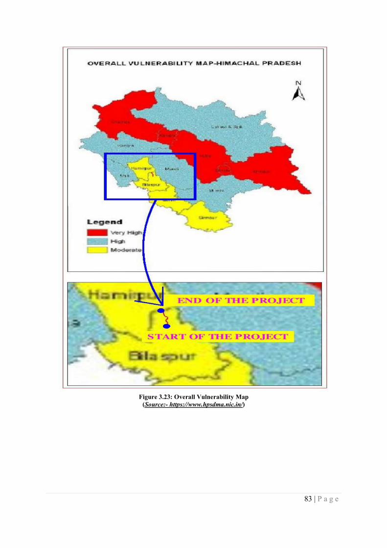
83 | P a g e
Figure 3.23: Overall Vulnerability Map
(Source:- https://www.hpsdma.nic.in/)
84 | P a g e
CHAPTER 4 – STAKEHOLDER CONSULTATIONS & INFORMATION DISCLOSURE
134. This chapter summarizes public/stakeholder consultations conducted as part of environmental and social impact assessments for the proposed road construction between Dadhol to Ladrour. Consultations were also held with communities at congested locations with impacts on buildings and where major common property resources are getting affected- such as any religious structures etc., besides institutional stakeholders were consulted. Appendix 3 presents the list of stakeholders consulted.
135. During the consultation the people were informed about:
i) HPSRTP, Phase-II, including a background on HPSRTP Phase 1 project; ii) The rural and urban design broad cross sections of the roads; iii) The people were informed about the ESF of World Bank 2018, GoI land Acquisition
Act of 2013, provisions of compensation as per GoHP regulations and the compensation and assistance therein and asked suggestion for improvement so that their suggestions can be incorporated by the project authority for the proposed HPSRTP project II;
iv) Proposed safety measures for the road; v) Likely positive and negative impacts of the road
136. The Consultations elicited from the people the following:
i) Their views on the project especially the likely adverse impacts; ii) Possible mitigation measures in case of adverse impacts; iii) Means of better delivery of compensation and assistance; iv) The assurance from the project authority not to marginalize people by depriving them
from their livelihood. v) Provision of infrastructure such as drinking water and toilets.
137. Through public participation, stakeholder’s view points and suggestions were captured as in input to the technical design, which were duly considered, and all the suggestions were incorporated in the project design to the extent feasible and /or warranted.
85 | P a g e
S.No Public Consultations Date, Place and No. of participants
Summary of Queries, Concerns and suggestions Responses provided
1
Place : Dadhol Chowk Date: 12.09.2019 No. of Participants: 21, Male 21, Female 0.
People wanted to widen the road equally from the centerline. They wanted know what compensation will be paid to title holder and non title holders
Those losing house wanted to know what alternative would be provided by the project. Most of the people asked for alternative house/site.
The people asked the project authority not to impact the temple located at the chowk, as it was considered holy place in the village, and was used for various religious and community purposes.
The people asked the project authorities to consider available open land wherever it was available instead of impacting their house and land.
The people asked for safety measures in hospital and school zones.
In Dadhol Chowk there are about 15 houses getting affected. The people asked to minimize the impact.
People said that if the existing road is maintained there will be no problem. However, they mentioned that sufficient land is available on both side of the alignment.
The Road is congested and requires improvement.
The temple in the middle of road must not be damaged, rather should be enhanced by provisions of some sitting arrangements and drainage pipe from water sink. Almost people from 50 different villages come
Communities were informed that designs will be worked out to avoid and/or minimize impacts on structures. Compensation will be paid to title holder as per the provisions of RFCTLARR Act 2013 in case land is taken using the act and in case of direct purchase, it will be decided as per the Private Negotiations committee. For non-titleholders, assets on the land will be compensated at replacement cost.
Suitable relocation spots would be identified for such purpose. However, all effort is being to avoid impacts and or only partially affect structures.
Communities were informed that their concern was noted and duly passed on Design team.
Communities were informed that designs are being so as to use all available empty land but complete avoidance may not be possible. However all efforts are being made to minimize impacts through analysis of alternatives
Communities were informed that their concern was noted and duly passed on Design team.
Communities were informed that their concern was noted and duly passed on Design team
Communities were informed that their concern was noted and duly passed on Design team
The Road is congested and requires improvement.
Communities were informed that their concern was noted and
86 | P a g e
S.No Public Consultations Date, Place and No. of participants
Summary of Queries, Concerns and suggestions Responses provided
to visit temple.
There should be no loss to the properties of the people, as adequate width is already available on roadside.
Road development will improve the socio-economic conditions of the people. During construction phase also people will be benefitted as they will get jobs.
Provisions for parking are must in the city area.
There must be a provision of street lights upto 300 m, where a controlled atmospheric system (CAS) is under construction by HPMC (HP Horticulture Produce Marketing & Processing Corporation).
The quality of the material used for road construction should be good and there must be a proper supervision.
Drainage must be provided on upgraded road.
Bus stops including bus lays must also be provided on improved road.
Executing agency should take up the structural works (bridges and culverts) in priority during the early phase of the project cycle or otherwise these works mostly gets delayed.
Junction at Dadhol must be developed.
duly passed on Design team Communities were informed that designs are being so as to use
all available existing ROW. In addition, only structures or properties in the Corridor of Impact would be affected. Analysis of alternatives is being carried out for this purpose.
Efforts would be made to ensure maximum opportunities would be available for local persons.
Communities were informed that their concern was noted and duly passed on Design team and such aspects can be incorporated provided there is adequate space.
Communities were informed that their concern was noted and duly passed on Design team.
Project authorities will ensure these aspects in their contract with the construction contractor. There will be construction supervision agency that will support the department in monitoring.
Drainage will be definitely included in the road designs
Provisions are being made for improved bus stops including toilets. Bus lays would be possible where empty land is available.
Project authorities will ensure these aspects in their contract with the construction contractor. There will be construction supervision agency that will support the department in monitoring.
Communities were informed that their concern was noted and duly passed on Design team.
2 Place: Gahar High School & Bharari
The school campus will become prone to an accident during construction and operation phase. Some measures must be provided to
Measures would be taken to avoid that.
87 | P a g e
S.No Public Consultations Date, Place and No. of participants
Summary of Queries, Concerns and suggestions Responses provided
Date: 13.09.2019 No. of Participants: Male 4, Female 2, Total 8
avoid that. Noise barrier would be required to minimize the noise pollution. Debris can be disposed off in the ground and it can be raised up but
decision for the same will be taken by SMC (School Management Committee).
Presently school has two small pits for solid and wet waste disposal, but it needs to be widened if funds are available in project road. Compost made of wet waste will be used to raise new/existing plants grown by school’s eco club members.
Noise barriers would be provided in the road design wherever
required. SMC (School Management Committee) were informed that their
concern was noted and duly passed on Design team.
SMC (School Management Committee) were informed that their concern was noted and duly passed on Design team.
3
Place: Police Station Bharari Date: 13.09.2019 No. of Participants: 3. Male 3, Female 0
accident reported are very less most of the cases registered under women related crime pertains to
dispute in land The bridge near Dadhol is an accident prone area. Sometimes, a level difference on black top (bituminous coat) and
shoulder become big in due course of time and this also leads to accidents.
Noted Noted
Communities were informed that their concern was noted and
duly passed on Design team. Communities were informed that their concern was noted and
duly passed on Design team.
4
Place: Model School Bharari Date:13.09.2019 No. of Participants: 6, Male 6, Female 0
The Road is congested and requires improvement. This school is very old and has been existing for 60 years. Any
property of the School, if damaged must be restored. There is a problem of noise pollution and it needs to ensure that noise
barrier be provided to control the same
Strength of the school is about 400 hundred and in front of the school gate there is a hospital. This has made the junction very prone to an accident. To ensure safe access of the people into school and hospital, it is required that a foot over bridge be provided here.
Precisely for this purpose the project is being taken up and will Project will replace/rebuild such impacted structures
Noise barriers would be provided in the road design wherever
required. Foot over bridge to go across 4 meter road might not be feasible;
alternatives such as shifting the current bus stop further away, providing speed breakers would be required
88 | P a g e
Consultations outcomes with communities on specific issues at the select locations are presented in Table below:-
S No. Location/Date Issue Raised and Suggestions Recommendations/ Mitigation Measures
1.
At Gram Panchayat Padyalag 11.09.2019 Total Participant 17,Male 13,Female-4
Relocation of Religious Structure at Padyalag The Religious Structure at the Dadhol junction attracts
pilgrims from 50 villages and requested not to disturb. Participants suggested that every affected religious property
(partially or fully) must be modified/ relocated and enhanced properly prior to the commencement of work.
Religious structure at the junction will not be disturbed and improvements will be proposed within the existing ROW and additional developments will be planned.
It was recommended that all the structures likely to be affected need to be modified or relocated at new places as the case is in consultation with local community. The cost of construction/ relocation will be borne through project.
2.
At all locations including (at Bharari Panchayat 12.09.2019 Total Participant 22,Male 16,Female-6
Relocation of the Households/ PDF’s At Bharari Panchayat They have requested not to disturb the settlements in the build-
up area and proposed to take bypasses. As per the social survey there are approximately 500 persons getting affected. The people requested to avoid the widening.
There have been issues raised on the compensation not given to some families for the acquired lands.
The buildup location in the rolling hilly terrain has environmental constraints and indulges in heavy costs during constructions.
As suggested the widening will be consider in view of social constraints.
Resettlement site will be identified and developed. Compensation for land, structure and other properties shall be paid as per RFCTLARR Act 2013.
It is requested by the project proponent to address the old compensation issues by the concerned authority of Revenue Department of Himachal Pradesh.
3. At all locations 04.09.2019
Compensation payment procedure: The compensation rates should be as par at market rates
Compensation for land, structure and other properties shall be paid as per RFCTLARR Act2013 and Government of Himachal Pradesh Land Acquisition Rules.
4. At all locations 03.09.2019
Road safety: The proposed intermediate lane road may be concern for safety specifically for women and children, accident risk will increase
Proper road safety measures are incorporated in the project design. Special measures like signage, speed breakers at schools, hospitals and market places will be provided by the project.
5. At all locations 04.09.2019
Provision for under pass / foot over bridges at junctions, school zones, pedestrian crossing, cattle crossing: Pedestrian crossing, cattle crossing should be provided at every habitation. Provision for foot over bridges /under pass at the sensitive areas.
It is not possible at every location but as per the design consideration, safety measures, cost considerations it will be provided where it is very necessary. No under-passes/foot over bridge propose.
89 | P a g e
S No. Location/Date Issue Raised and Suggestions Recommendations/ Mitigation Measures
6. At all the locations 12.09.2019
Provision of employment/ income restoration to the affected household: Additional assistance for employment/ income restoration for locals
Employment in the road construction work as skilled, semi- skilled and unskilled workers to be made available. Preference will be given to locals in road construction work. During the operation stage, as per the HPRIDC direct and indirect employment will be generated in the rural areas.
7. At all location 12.09.2019
Provision of road side drains, retaining walls: Road side drains are not working properly as it has been choked or damaged at some locations. Cross drainage should also be provided.
At every urban location and slopes/hilly region proper drainage system has been recommended.
8. At all location 03.09.2019, 04.09.2019
Consultation and participation: People want more consultation during project implementation and want to participate in the project
Public consultation will continue throughout the project cycle.
9. At habitation site 03.10.2019, 04.09.2019
Relocation of Water Tank/ Well/ Hand Pumps: Majority of the people living along the project corridor depend on water tank/ hand pump for drinking water and disposal of these will especially affect women folk.
Project authority will be informed about this and to carefully relocate/ install required number of water tanks/ well/ hand pumps at identified locations.
9. At market places 04.09.2019
Public toilets at market places: Lack of public toilets (ladies’ toilets) at market places as well as near bus stops
Project authority and design team will be informed about this and make provisions
10. At all locations 12.09.2019
Pollution and health risks at the time of construction work: Necessary measures to be taken during the construction stage.
Mitigation measures address in the Management plan to be followed by the contractor and necessary measures to be taken to mitigate the impacts on natural resources.
90 | P a g e
CHAPTER 5 – ANALYSIS OF ALTERNATIVES
INTRODUCTION
138. This section discusses the analysis of alternatives that have been considered for the widening/upgradation of the project road. The analysis of alternatives considers both “With” and “Without” project road improvement scenarios. Further, within project road improvement scenario, various options/alternatives for minimization of both environmental and social impacts have been considered for the final design alternative.
WITH AND WITHOUT PROJECT ALTERNATIVES
Without Project Scenario
139. The project road has many settlements on its either side, which is affecting the smooth traffic flow, causing severe conflicts between the local and the through traffic. This is further compounded by the increasing traffic volumes, poor pavement conditions, poor geometry, inadequate turning radius, land use conflicts, in terms of uncontrolled development along the road and the encroachments on to the RoW, at times extending upto carriage way. The population growth, increase in traffic volumes and the economic development along the corridor would continue to occur and will worsen the present situation, which is already critical. The existing unsafe conditions and the adverse social and environmental quality along the road would continue to worsen in the absence of any proposed improvements to the project road.
140. Moreover, if the project road improvement is not under taken, then the socioeconomic conditions will further degrade and therefore, development of this remote, relatively poorly connected area becomes warranted. Therefore, “no project road improvement” scenario is neither a reasonable nor a prudent course of action for the economic upliftment of the project region, as improved project road will contribute to overall development of the region including socio-economic aspects.
141. With the present road conditions, without any improvement would contribute to increased GHG emissions due to the decreased speed and deteriorating pavement conditions in future years.
With Project Scenario
142. The ‘with project scenario’ is anticipated to bring in beneficial impacts in the long run on social, environmental, economic, financial aspects of the region including reduced GHG emissions. Based on the present traffic and projected volumes and available RoW, widening of the present single lane road to an intermediate lane has been considered as the most feasible or warranted improvement configuration.
143. “With Project scenario” will be economically viable and would contribute to the development goals envisaged by the Government of Himachal Pradesh and enhance the growth potential of the region as a whole.“With Project scenario” considers avoiding the large-scale acquisition of land and properties, and limits the improvement option to the existing ROW. Further, the scenario does not consider significant alteration in the existing vertical profile of the road, except at critical stretches for improvement of road safety and largely follows the existing profile.
144. A Comparative assessment of the “with and without” project scenarios along with anticipated benefits with project scenario are presented in Table 6-1.
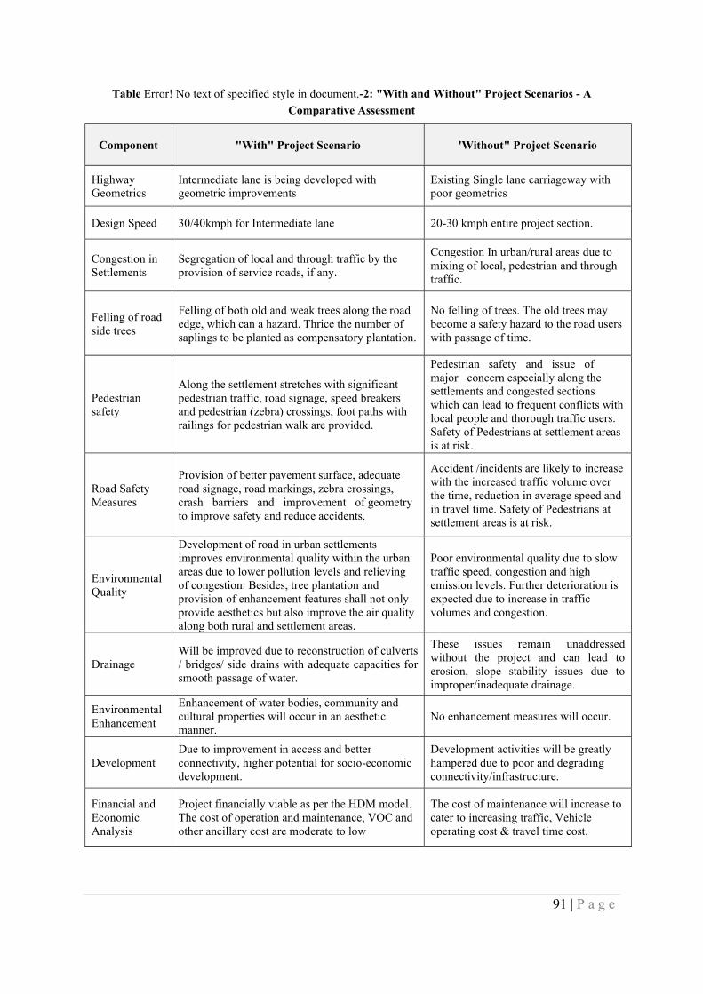
91 | P a g e
Table Error! No text of specified style in document.-2: "With and Without" Project Scenarios - A
Comparative Assessment
Component "With" Project Scenario 'Without" Project Scenario
Highway Geometrics
Intermediate lane is being developed with geometric improvements
Existing Single lane carriageway with poor geometrics
Design Speed 30/40kmph for Intermediate lane 20-30 kmph entire project section.
Congestion in Settlements
Segregation of local and through traffic by the provision of service roads, if any.
Congestion In urban/rural areas due to mixing of local, pedestrian and through traffic.
Felling of road side trees
Felling of both old and weak trees along the road edge, which can a hazard. Thrice the number of saplings to be planted as compensatory plantation.
No felling of trees. The old trees may become a safety hazard to the road users with passage of time.
Pedestrian safety
Along the settlement stretches with significant pedestrian traffic, road signage, speed breakers and pedestrian (zebra) crossings, foot paths with railings for pedestrian walk are provided.
Pedestrian safety and issue of major concern especially along the settlements and congested sections which can lead to frequent conflicts with local people and thorough traffic users. Safety of Pedestrians at settlement areas is at risk.
Road Safety Measures
Provision of better pavement surface, adequate road signage, road markings, zebra crossings, crash barriers and improvement of geometry to improve safety and reduce accidents.
Accident /incidents are likely to increase with the increased traffic volume over the time, reduction in average speed and in travel time. Safety of Pedestrians at settlement areas is at risk.
Environmental Quality
Development of road in urban settlements improves environmental quality within the urban areas due to lower pollution levels and relieving of congestion. Besides, tree plantation and provision of enhancement features shall not only provide aesthetics but also improve the air quality along both rural and settlement areas.
Poor environmental quality due to slow traffic speed, congestion and high emission levels. Further deterioration is expected due to increase in traffic volumes and congestion.
Drainage Will be improved due to reconstruction of culverts / bridges/ side drains with adequate capacities for smooth passage of water.
These issues remain unaddressed without the project and can lead to erosion, slope stability issues due to improper/inadequate drainage.
Environmental Enhancement
Enhancement of water bodies, community and cultural properties will occur in an aesthetic manner.
No enhancement measures will occur.
Development Due to improvement in access and better connectivity, higher potential for socio-economic development.
Development activities will be greatly hampered due to poor and degrading connectivity/infrastructure.
Financial and Economic Analysis
Project financially viable as per the HDM model. The cost of operation and maintenance, VOC and other ancillary cost are moderate to low
The cost of maintenance will increase to cater to increasing traffic, Vehicle operating cost & travel time cost.
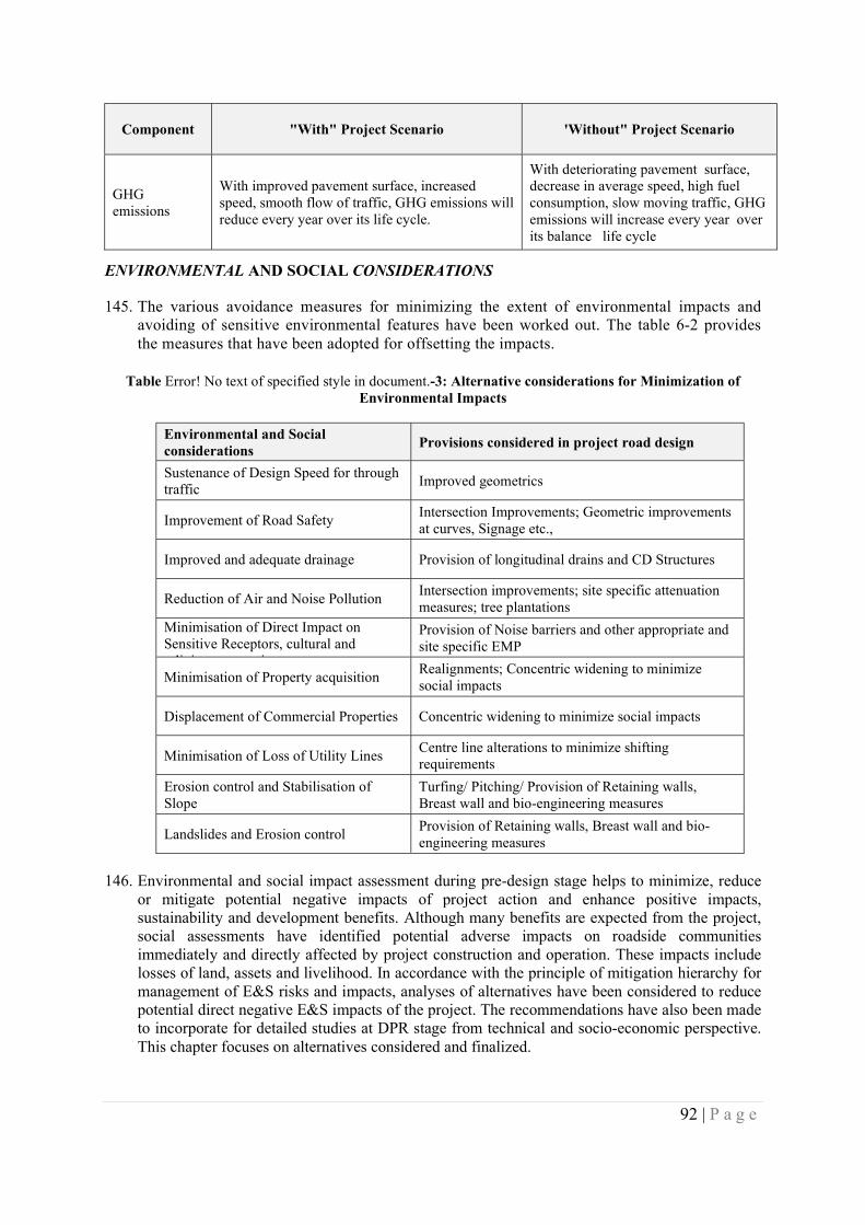
92 | P a g e
Component "With" Project Scenario 'Without" Project Scenario
GHG emissions
With improved pavement surface, increased speed, smooth flow of traffic, GHG emissions will reduce every year over its life cycle.
With deteriorating pavement surface, decrease in average speed, high fuel consumption, slow moving traffic, GHG emissions will increase every year over its balance life cycle
ENVIRONMENTAL AND SOCIAL CONSIDERATIONS
145. The various avoidance measures for minimizing the extent of environmental impacts and avoiding of sensitive environmental features have been worked out. The table 6-2 provides the measures that have been adopted for offsetting the impacts.
Table Error! No text of specified style in document.-3: Alternative considerations for Minimization of Environmental Impacts
Environmental and Social considerations
Provisions considered in project road design
Sustenance of Design Speed for through traffic
Improved geometrics
Improvement of Road Safety Intersection Improvements; Geometric improvements at curves, Signage etc.,
Improved and adequate drainage Provision of longitudinal drains and CD Structures
Reduction of Air and Noise Pollution Intersection improvements; site specific attenuation measures; tree plantations
Minimisation of Direct Impact on Sensitive Receptors, cultural and religious properties
Provision of Noise barriers and other appropriate and site specific EMP
Minimisation of Property acquisition Realignments; Concentric widening to minimize social impacts
Displacement of Commercial Properties Concentric widening to minimize social impacts
Minimisation of Loss of Utility Lines Centre line alterations to minimize shifting requirements
Erosion control and Stabilisation of Slope
Turfing/ Pitching/ Provision of Retaining walls, Breast wall and bio-engineering measures
Landslides and Erosion control Provision of Retaining walls, Breast wall and bio-engineering measures
146. Environmental and social impact assessment during pre-design stage helps to minimize, reduce or mitigate potential negative impacts of project action and enhance positive impacts, sustainability and development benefits. Although many benefits are expected from the project, social assessments have identified potential adverse impacts on roadside communities immediately and directly affected by project construction and operation. These impacts include losses of land, assets and livelihood. In accordance with the principle of mitigation hierarchy for management of E&S risks and impacts, analyses of alternatives have been considered to reduce potential direct negative E&S impacts of the project. The recommendations have also been made to incorporate for detailed studies at DPR stage from technical and socio-economic perspective. This chapter focuses on alternatives considered and finalized.
93 | P a g e
147. Public Consultations were held with the local people, likely project affected population, community leaders and government officials where the negative impacts are likely to be high in order to find out the alternatives to minimize the impact. With the help of the survey and consultations and inputs from the engineering section the mitigation measures have been worked out. Mitigation measures largely focused on settlement areas along the project roads specially villages/towns along the road or zones of maximum potential impacts. The recommendations of the stakeholders have been incorporated in designs, wherever feasible.
148. Considerations through good road designs to mitigate impacts included the following:
At built up/ village sections where the road width is insufficient for expansion, design alternatives include options for realignments and for modifying the proposed road designs, such as reduction of the shoulder widths.
Smoothening of curves and bends for better geometric design. In case where it affects settlements, alignment changes were indicated.
Paved shoulders to be maintained as far as possible to facilitate movement of non-motorised traffic.
Avoiding unnecessary displacement by modifying project alignments, reducing the width of the corridor of impact, or modifying design based on rural and urban cross sections.
Reducing design speed in built up areas;
Reducing impacts on existing shrines and worship places;
Providing suitable safety measures, such as speed reductions near schools and hospitals;
Minimizing the raising of roads in urban areas to prevent water seepage to the houses adjoining the roads and;
Providing access to businesses and residential units that would be otherwise impacted by construction; and minimizing losses of public and private property, such as tube wells, tree plantations and other common property resources within the ROW, by minimizing the width to be cleared.
149. An attempt has been made to present the details of the critical areas which require a detailed study on ‘Alternatives’ at the detailed project report stage. With the help of the survey and consultations two broad alternatives has been worked out, those are summarized in Table 6.3.
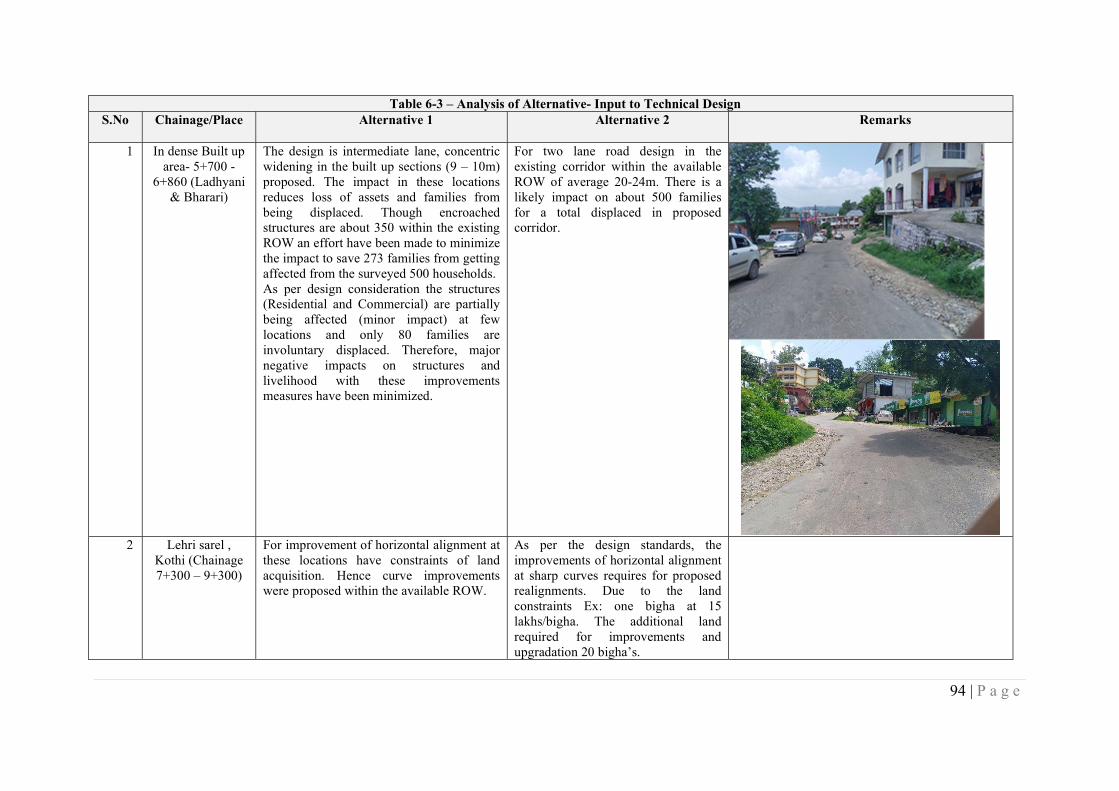
94 | P a g e
Table 6-3 – Analysis of Alternative- Input to Technical Design S.No Chainage/Place Alternative 1 Alternative 2 Remarks
1 In dense Built up area- 5+700 -
6+860 (Ladhyani & Bharari)
The design is intermediate lane, concentric widening in the built up sections (9 – 10m) proposed. The impact in these locations reduces loss of assets and families from being displaced. Though encroached structures are about 350 within the existing ROW an effort have been made to minimize the impact to save 273 families from getting affected from the surveyed 500 households. As per design consideration the structures (Residential and Commercial) are partially being affected (minor impact) at few locations and only 80 families are involuntary displaced. Therefore, major negative impacts on structures and livelihood with these improvements measures have been minimized.
For two lane road design in the existing corridor within the available ROW of average 20-24m. There is a likely impact on about 500 families for a total displaced in proposed corridor.
2 Lehri sarel ,
Kothi (Chainage 7+300 – 9+300)
For improvement of horizontal alignment at these locations have constraints of land acquisition. Hence curve improvements were proposed within the available ROW.
As per the design standards, the improvements of horizontal alignment at sharp curves requires for proposed realignments. Due to the land constraints Ex: one bigha at 15 lakhs/bigha. The additional land required for improvements and upgradation 20 bigha’s.
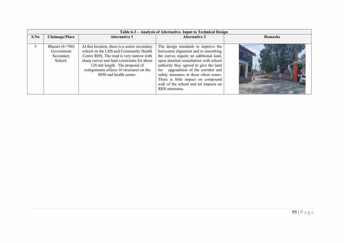
95 | P a g e
Table 6-3 – Analysis of Alternative- Input to Technical Design S.No Chainage/Place Alternative 1 Alternative 2 Remarks
3 Bharari (6+700) Government Secondary
School.
At this location, there is a senior secondary school on the LHS and Community Health Center RHS. The road is very narrow with sharp curves and land constraints for about
120 mtr length. The proposal of realignments affects 10 structures on the
RHS and health center.
The design standards to improve the horizontal alignment and to smoothing the curves require an additional land, upon detailed consultation with school authority they agreed to give the land for upgradation of the corridor and safety measures at these silent zones. There is little impact on compound wall of the school and nil impacts on RHS structures.
96 | P a g e
In order to minimise losses and impact on livelihood of the people in congested places where the likely impact would be high due to improvement of the road, alternatives/options arrived through public consultations and design consideration are given above Table . In order to minimise the impacts, Alternative – I has been preferred at all above-mentioned locations.
Table 6.4 – Analysis of Alternatives
S.No Chainage Alternatives Design Consideration and Recommendation for adoption of Alternative
1 Km. 0+000
to Km. 3+600
Option-1
With option no.-2, there will be less demolition of structure in Built-up Zone. This proposal seems to be effective and economical than the Option –1.
Under this, a Govt primary school at Gahar (Km 1+130) is adjacent to the right of way of the project road have a boundary wall with in adequate height. Therefore, re-construction of boundary wall of 5m height which can serve as both boundary wall and noise barrier will be required to limit the propagation of noise levels into school.
With existing RoW of 12 meters in these locations, there exists a strong public resistance because of more than 200 structures are getting affected.
People are insisting to confine the proposed road construction in minimum ROW to avoid the impact.
Option -2
Local Public have very less resistance to have restricted RoW in the built-up location, where the impact will be minimum.
People are ready with minimal demolition of encroached structure along with compensation for their project affected structure (encroachment).
2 Km. 3+500
to Km. 4+600
The Proposed ROW is eccentric to left as it is in the Rural zone
The proposed development will follow the type-1. Section is applicable on most of the rural sections of the project, where the expansion/rehabilitation of carriage way is proposed eccentrically, typically on left side of the existing carriageway.
Under this, school at Km 4+520 near Ladhyani is adjacent to the right of way and provision of Noise Barrier cum boundary wall will be required to limit the propagation of noise levels into school
97 | P a g e
S.No Chainage Alternatives Design Consideration and Recommendation for adoption of Alternative
3 Km. 4+600
to Km. 8+300
Option-1 With option no.-2, there will be less demolition of structure in Built-up Zone. This proposal seems to be effective and economical than the Option –1.
Under this, school at Bharari (Km 6+470) on RHS, is adjacent to the right of way of the project road, which does not have a boundary wall and the class rooms are adjacent to the right of way. Therefore, construction of boundary wall of 5m height, which can serve as both boundary wall and noise barrier, will be required to limit the propagation of noise levels into school.
Another school at Bharari (Km 6+470) on LHS, is adjacent to the right of way of the project road and 3m wide strip along with the school boundary wall is encroached into the RoW. The project design requires clearing the encroached land for design improvement of the project road. The school has constructed boundary cum retaining wall and school utility buildings like drinking water counter, kitchen of mid-day meal scheme, seating arrangement at basketball court and toilet blocks in the encroached RoW.
The school authorities at Bharari (Km 6+520) were consulted as part of stakeholder consultations and the authorities acknowledged that the school buildings have inadvertently extended into the right of way more than a decade ago. At present, the school authorities are willing to return the land, provided the existing facilities within such encroached RoW land are reconstructed elsewhere within the school complex but at no cost to school.
Provision of noise barrier cum retaining wall at Hospital near Bharari will be required.
With existing RoW of 12 meters in these locations, there exists a strong public resistance because of more than 150 structures are getting affected.
People are insisting to confine the proposed road construction in minimum ROW to avoid the impact.
Option -2
Local Public have very less resistance to have restricted RoW in the built-up location, where the impact will be minimum.
People are ready with minimal demolition of encroached structure along with compensation for their project affected structure (encroachment).
With out Project Scenario With Project Scenario (Widening Option by taking land with in School Complex at Bharari)
No Additional land to be taken, Additional land of about 3m to 5.5m for a length of 250m (3m for road component and 5.5m at the time of construction);
Follow existing Centreline Centreline shifted by 2m towards school on RHS; Footpaths provided on both sides;
Provision of Footpath based on available width, accordingly footpath provided on LHS only;
Opportunity to re-build the Retaining Wall of School premises and provision of safety grill on top of retaining wall; and
No encroachment of land from adjacent schools; and
Restoration of affected structures like Washrooms, Water kiosks, etc in school premises.
98 | P a g e
S.No Chainage Alternatives Design Consideration and Recommendation for adoption of Alternative
About 8 shops on LHS affected No impacts on Structures
4 Km. 8+300
to Km. 8+800
The available ROW is concentric and located in rural zone The proposed development will follow the type-1. Section is applicable on
most of the rural sections of the Project, where the expansion/rehabilitation of carriageway is proposed concentrically.
5 Km. 8+300
to Km. 9+300
Option-1
With option no.-2, there will be less demolition of structure in Built-up Zone. This proposal seems to be effective and economical than the Option –1.
With existing RoW of 12 meters in these locations, there exists a strong public resistance because of more than 150 structures are getting affected.
People are insisting to confine the proposed road construction in minimum ROW to avoid the impact.
Option -2
Local Public have very less resistance to have restricted RoW in the built-up location, where the impact will be minimum.
People are ready with minimal demolition of encroached structure along with compensation for their project affected structure (encroachment).
6 Km. 9+300
to Km. 10+600
The available ROW is concentric and located in rural zone The proposed development will follow the type-1. Section is applicable on most of the rural sections of the Project, where the expansion/rehabilitation of carriageway is proposed concentrically.
7 Km. 10+600 to 12+100
The Proposed ROW is eccentric to left as it is in the Rural zone
The proposed development will follow the type-1. Section is applicable on most of the rural sections of the Project, where the expansion/rehabilitation of carriageway is proposed eccentrically, typically on left side of the existing carriageway.
99 | P a g e
S.No Chainage Alternatives Design Consideration and Recommendation for adoption of Alternative
8 Km. 12+100 to 12+700
Semi Built up Zone
Type 3, section is applicable in semi built up / semi urban zone with a relatively low level of traffic congestion. Footpath drain proposed on either side for effective drainage of water.
Option -1
Eccentric widening was affecting 50 structures and resisted by local people.
Option-2
Concentric widening with provision of footpath and drainage was suggested option to avoid the impact within available Row.
9 Km. 12+700 to 13+208
Option -1
Concentric widening with 8 m ROW will have nil impact with concentric widening.
It a market and junction place of State Highway with shops on both sides of project road with a temple on left side of the road. The widening will affect nearly 50 shops and they will lose the livelihood.
Option -2
Restrict the improvement of the road within 8m will save all the shops
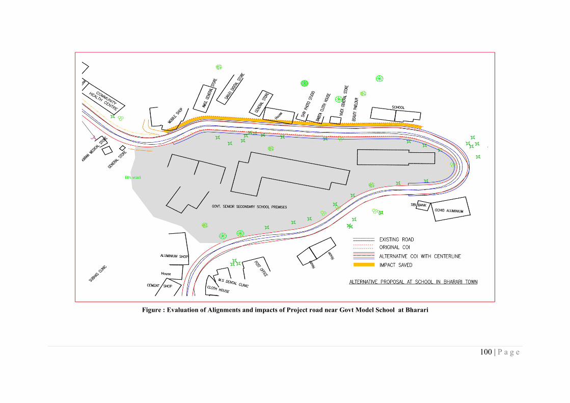
100 | P a g e
Figure : Evaluation of Alignments and impacts of Project road near Govt Model School at Bharari

101 | P a g e
CHAPTER 6 ENVIRONMENT AND SOCIAL RISKS AND IMPACTS AND MITIGATION MEASURES
150. The project will have both positive and adverse social impacts on the project road population. Since the project involves the upgradation of the existing road. The improvement/up-gradation of 13.5 Km of road will have direct impact on the village communities and other neighboring villages. Ribbon development / Congestion along the state highways and other roads are an uncontrolled Phenomenon and the project roads are no exception. These account for the most critical areas for this assessment. The assessment has also been done through a participatory process, involving the local communities, the likely PAPs, community leaders, Gram Pradhans, district level authorities, and various government organizations during impact assessment survey. This process provides the means by which public concerns, needs and values has been identified so that views of the likely affected and concerned people are reflected while working out the alternatives. The basic purpose of the assessment of likely loss and impact on assets are as follows:
i) to understand type, nature and extent of loss due to upgradation and rehabilitation of the project;
ii) the inventorisation will help in providing the input from social perspective to find out the alternatives; and
iii) this will also provide the input to prepare strategic issues while conducting public consultations/Focus Group discussions at the DPR preparation stage
iv) To adopt a mitigation hierarchy approach to the project’s E&S risks i.e. a) anticipate and avoid risks and impacts; b) minimize or reduce risks and impacts to acceptable levels, if not avoidable; c) once risks and impacts have been minimized or reduced, mitigate; and (d) where significant residual impacts remain, compensate for or offset them, where technically2 and financially3 feasible;
v) To help identify differentiated impacts on the disadvantaged or vulnerable and to identify differentiated measures to mitigate such impacts, wherever applicable
151. Ensuing sections summarize the environmental and social risks and impacts likely due to the project road by each relevant standard (ESS 2- 8), followed by the mitigation measures considered.
6.1 …related to Assessment and Management of E&S risk and impact (ESS 1):
Disadvantaged and Vulnerable persons 152. Under this project and in accordance with the ESF directive4, Project shall define vulnerable
person who has been designated under ‘Below Poverty Line’ category as identified by the concerned State Govt. level. Disadvantaged persons belonging to SC(5Nos.), ST(1Nos.), disabled, handicapped, orphans, destitute persons and woman heading the household are also recognized as vulnerable persons.
153. Mitigation measures: Mitigation of impacts on such vulnerable persons will be undertaken
through provisions and measures in the Resettlement Action Plan. Project shall consider other measures in accordance with The Rights of Persons with Disabilities Act, 2016. These could include access ramps to bus shelters.
4ESF directive on Addressing Risks and Impacts on Disadvantaged or Vulnerable Individuals or Groups
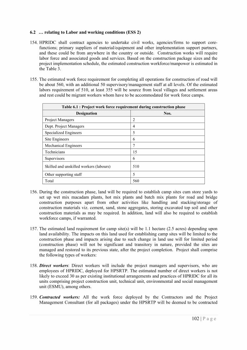
102 | P a g e
6.2 … relating to Labor and working conditions (ESS 2)
154. HPRIDC shall contract agencies to undertake civil works, agencies/firms to support core-functions; primary suppliers of material/equipment and other implementation support partners, and these could be from anywhere in the country or outside. Construction works will require labor force and associated goods and services. Based on the construction package sizes and the project implementation schedule, the estimated construction workforce/manpower is estimated in the Table 3.
155. The estimated work force requirement for completing all operations for construction of road will be about 560, with an additional 50 supervisory/management staff at all levels. Of the estimated labors requirement of 510, at least 355 will be source from local villages and settlement areas and rest could be migrant workers whom have to be accommodated for work force camps.
Table 6.1 : Project work force requirement during construction phase
Designation Nos.
Project Managers 2
Dept. Project Managers 4
Specialized Engineers 5
Site Engineers 6
Mechanical Engineers 7
Technicians 15
Supervisors 6
Skilled and unskilled workers (labours) 510
Other supporting staff 5
Total 560
156. During the construction phase, land will be required to establish camp sites cum store yards to set up wet mix macadam plants, hot mix plants and batch mix plants for road and bridge construction purposes apart from other activities like handling and stacking/storage of construction materials viz. cement, sand, stone aggregates, storing excavated top soil and other construction materials as may be required. In addition, land will also be required to establish workforce camps, if warranted.
157. The estimated land requirement for camp site(s) will be 1.1 hectare (2.5 acres) depending upon land availability. The impacts on this land used for establishing camp sites will be limited to the construction phase and impacts arising due to such change in land use will for limited period (construction phase) will not be significant and transitory in nature, provided the sites are managed and restored to its previous state, after the project completion. Project shall comprise the following types of workers:
158. Direct workers: Direct workers will include the project managers and supervisors, who are employees of HPRIDC, deployed for HPSRTP. The estimated number of direct workers is not likely to exceed 30 as per existing institutional arrangements and practices of HPRIDC for all its units comprising project construction unit, technical unit, environmental and social management unit (ESMU), among others.
159. Contracted workers: All the work force deployed by the Contractors and the Project Management Consultant (for all packages) under the HPSRTP will be deemed to be contracted
103 | P a g e
workers. The Contractor(s) might further engage multiple subcontractors. All work force of all such sub-contractors will be also deemed to be contracted workers.
160. Migrant Workers: All the required labor will not be fully supplied locally for a number of reasons, such as worker unavailability and lack of technical skills and capacity. In such cases, labor force (total or partial) needs to be brought in from outside the project area. Influx of migrant labor from other states for construction works has been a norm in the state and is likely to continue in this project as well resulting in potential gender-based violence (GBV). Past experience during implementation of Phase I - HPSRP, significant percentage number of migrant workers (more than 60%) from adjoining states of Himachal Pradesh were used and all such migrant workers were sourced through labour contractors.
161. The migrant workers are that, who are employed for the Project but does not belong to the
Project region and are not normally expected to return to their places of residence after work shift hours. The number of migrant workers in any contract package, would depend on decisions made by contractors, based on the locally available workforce and their skills for Project construction requirements. The migrant workers could be at all levels and include unskilled and semiskilled construction labour and could even comprise combination of male and women labour force. The migrant workers are either directly engaged by the contractor or through labour contractors, who supply the work force to as per the needs of the contractors. As workers on infrastructure projects are likely to be predominantly young and male, who are either single or are separated from their family or spouse, and are outside their habitual sphere of social control, the risk of sexual harassment for local women (and co-women workers, if any), is likely to be higher, in particular for younger women and girls, but also boys. In addition, this influx of labor may affect the project area adversely in the terms of additional burden on public infrastructure such as health services, utilities such as water and electricity, housing and social dynamics. Other related issues could be increased risk of spread of communicable diseases, and increased rates of illicit behavior and crime.
162. Community Workers: Community workers may be employed by the contractor in relation to this Project from local sources particularly for supporting bio-engineering solutions towards slope stabilization workers. However, a better estimate would be known only at the time of construction.
163. Potential labor risks: Following are the potential risks associated with workers/labours engaged in road construction works.
i. Safety issues, like injuries/accidents/ fatalities leading to even death, while at work; ii. Short terms effects due to exposure to dust and noise levels, while at work
iii. Long term effects on life due to exposure to chemical /hazardous wastes iv. Inadequate accommodation facilities at work force camps, including inadequate sanitation
and health facilities v. Non-payment of wages by Employer
vi. Non-payment of benefits (compensation, bonus, maternity benefits etc.) by Employer vii. Discrimination in Employment (e.g. abrupt termination of the employment, working
conditions, wages or benefits etc.) viii. Engagement of child labour
ix. Sexual harassment at work x. Forced labour trafficking
xi. Security of women work force xii. Inadequate facilities for pregnant women and lactating mothers
xiii. Inadequate facilities for the children of the workforce at workforce camp sites
104 | P a g e
xiv. Possibility of Gender based violence as the road shall traverse through sensitive locations such as hospitals, schools, etc. that are near to habitations.
xv. Absence or inadequate or in accessible emergency response system for rescue of labour/workforce in situations of natural calamities like earthquake, caving in/landslides, fire outbreak, floods and cloud bursts etc.
xvi. Health risks of labour relating to HIV/AIDS and other sexually transmitted diseases
164. In addition, other risks that would be applicable for all types of workers would be as follows:
xvii. Unclear terms and conditions of employment xviii. Discrimination and denial of equal opportunity in hiring and promotions/incentives/training
opportunities xix. Denial for workers’ rights to form workers organizations, etc. xx. Absence of a grievance mechanism for labor to seek redressal of their grievances/issues
165. Mitigation measures: The borrower – HPRIDC will prepare Labor Management Procedures
that would be applicable for the entire program. The Labour Management Procedure (LMP), will include the Environmental, Occupational Health & Safety and Social (OHSS) guideline, management system and governance controls Through this guideline and associated standard operating procedures, it is intended to integrate the environmental, social, occupational health and safety principles of Indian national and state regulations as well as the requirements outlined under ESS 2 of the ESF World Bank. ill clearly spell out the requirements relating to provision of terms and conditions of employment; promoting of non-discrimination and equal opportunity; worker’s organization.
166. The responsibility to manage these adverse impacts would be clearly reflected in the contractual obligations of the Civil Works Contractor with appropriate mechanisms for addressing non-compliance. The bid documents for construction will incorporate requirements for Environment, Social, Health and Safety (ESHS) including list of applicable labor laws5 and provisions and the metrics for periodic reporting by contractors. The bidders are required to submit the following as part of their technical bid: ESHS strategy and implementation plan; code of conduct; and declaration of past ESHS performance. The successful Bidder will submit an Environmental, Social, Health and Safety (ESHS) Performance Security @ 1% of accepted contract value.
167. In order to address labor influx, contractor will:
i. source all unskilled labor from within the project area and its vicinity to minimize labor influx into the project area. Skilled labor force, if unavailable locally, would be brought in from outside the project area either from within or outside the state.
ii. develop a Workers’ Camp Management Plan that addresses specific aspects of the establishment and operation of workers’ camps e.g. cordoning of separate areas for labor camps and material storage;
iii. conduct training programs on HIV/AIDS and other communicable diseases iv. develop a complaint handling mechanism at the project level v. provide information to communities in project area and to host communities about the
contractor’s policies and Worker Code of Conduct (where applicable).
168. In addition to the above & in accordance with the risk assessment carried out, that accorded a risk level of 12.0 (moderate) to the project, a GBV Risk Mitigation Plan will be prepared. The
5 Workmen Compensation Act, 1923, Minimum Wages Act, 1948, Payment of Wages Act, 1936, Equal Remuneration Act, 1979, Child Labour (Prohibition & Regulation) Act, 1986, Inter-State Migrant Workmen’s (Regulation of Employment & Conditions of Service) Act, 1979, etc.
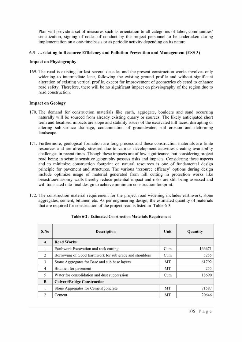
105 | P a g e
Plan will provide a set of measures such as orientation to all categories of labor, communities’ sensitization, signing of codes of conduct by the project personnel to be undertaken during implementation on a one-time basis or as periodic activity depending on its nature.
6.3 …relating to Resource Efficiency and Pollution Prevention and Management (ESS 3)
Impact on Physiography
169. The road is existing for last several decades and the present construction works involves only widening to intermediate lane, following the existing ground profile and without significant alteration of existing vertical profile, except for improvement of geometrics objected to enhance road safety. Therefore, there will be no significant impact on physiography of the region due to road construction.
Impact on Geology
170. The demand for construction materials like earth, aggregate, boulders and sand occurring naturally will be sourced from already existing quarry or sources. The likely anticipated short term and localised impacts are slope and stability issues of the excavated hill faces, disrupting or altering sub-surface drainage, contamination of groundwater, soil erosion and deforming landscape.
171. Furthermore, geological formation are long process and these construction materials are finite resources and are already stressed due to various development activities creating availability challenges in recent times. Though these impacts are of low significance, but considering project road being in seismic sensitive geography possess risks and impacts. Considering these aspects and to minimize construction footprint on natural resources is one of fundamental design principle for pavement and structures. The various ‘resource efficacy’ options during design include optimize usage of material generated from hill cutting in protection works like breast/toe/masonry walls thereby reduce potential impact and risks are still being assessed and will translated into final design to achieve minimum construction footprint.
172. The construction material requirement for the project road widening includes earthwork, stone
aggregates, cement, bitumen etc. As per engineering design, the estimated quantity of materials that are required for construction of the project road is listed in Table 6-3.
Table 6-2 : Estimated Construction Materials Requirement
S.No Description Unit Quantity
A Road Works
1 Earthwork Excavation and rock cutting Cum 166671
2 Borrowing of Good Earthwork for sub grade and shoulders Cum 5255
3 Stone Aggregates for Base and sub base layers MT 61792
4 Bitumen for pavement MT 255
5 Water for consolidation and dust suppression Cum 18690
B Culvert/Bridge Construction
1 Stone Aggregates for Cement concrete MT 71587
2 Cement MT 20646
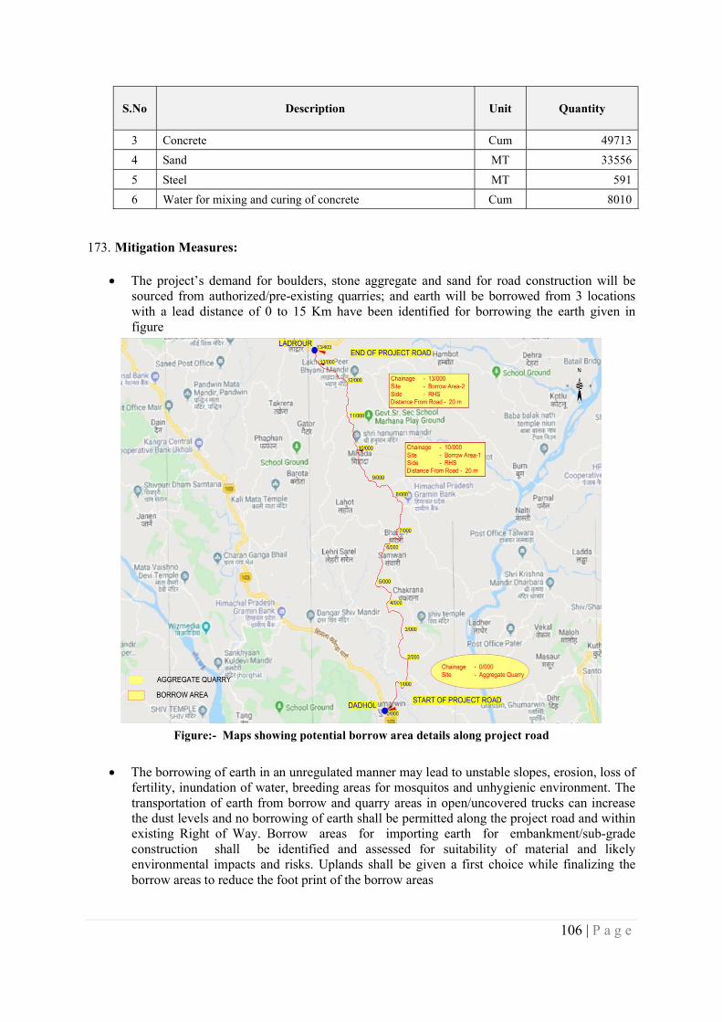
106 | P a g e
S.No Description Unit Quantity
3 Concrete Cum 49713
4 Sand MT 33556
5 Steel MT 591
6 Water for mixing and curing of concrete Cum 8010
173. Mitigation Measures:
The project’s demand for boulders, stone aggregate and sand for road construction will be sourced from authorized/pre-existing quarries; and earth will be borrowed from 3 locations with a lead distance of 0 to 15 Km have been identified for borrowing the earth given in figure
Figure:- Maps showing potential borrow area details along project road
The borrowing of earth in an unregulated manner may lead to unstable slopes, erosion, loss of fertility, inundation of water, breeding areas for mosquitos and unhygienic environment. The transportation of earth from borrow and quarry areas in open/uncovered trucks can increase the dust levels and no borrowing of earth shall be permitted along the project road and within existing Right of Way. Borrow areas for importing earth for embankment/sub-grade construction shall be identified and assessed for suitability of material and likely environmental impacts and risks. Uplands shall be given a first choice while finalizing the borrow areas to reduce the foot print of the borrow areas
107 | P a g e
Prior to commencing borrowing operations, Engineer shall approve borrow area based on compliance with existing regulations, suitability of earth, written agreement with land owner(s), likely potential environmental risks and safety hazards, and restoration/redevelopment plan. If government/panchayat land(s) have been chosen, then requisite approval/permissions from local self-government bodies shall be obtained prior to commencement of borrowing operations and conditions laid by the local bodies shall be complied thereof.
The agreement for borrowing soil shall clearly state the lease duration, depth and land area and levels up to which the borrowing of earth shall be carried out, compensation for the agreed lease period, site restoration plan as desired/required by the landowner and any other condition mutually agreed upon between contractor and land owner. The agreement shall include a site restoration plan as agreed upon with the landowner.
The Engineer shall conduct regular compliance audit during operation of borrow area and ensure prompt restoration of closed borrow area is in accordance with approved borrow area management plan.
The contractor will ensure trucks are loaded only up to permitted capacities to prevent high emission, vehicle wear and tear, road surface damage due to overloading. All haul roads either paved or unpaved used for transportation of materials shall be subjected to surveillance at regular interval and rectify any type of surface damage till operation of borrow area.
The contractor will ensure trucks used for transportation of material is covered by tarpaulin and provided tail board, so that en-route spillage and generation of fugitive dust are prevented. All haul roads (paved or unpaved) used for transportation of materials shall be subjected to daily surveillance especially settlement/residential areas for dust levels and carry out regular sprinkling of water to check air quality is compliant with NAAQS till operation of borrow area.
Trucks in good condition shall only be deployed for operations and shall adhere to pre-determined routes. The contractor will resolve any conflict arising due to contractor activities with community or individual will
The contractor shall prepare and get the borrow area management plan approved by the Engineer and operation shall strictly adhere to same. The borrow area management plan shall ensure following
Identified borrow area is inspected by Engineer. On a typical map record land area, boundary limits, estimated quantity and existing environmental settings, but not limited to topography, drainage, water bodies, settlements, trees, haul road etc. to identify likely environmental risk and safety hazards.
Borrow areas shall not be opened in an irregular shape and sizes. Indicate propose slope or any mitigation measures for the finish cut surface of
bank/embankment to prevent slide, erosion, or collapse of bank. The bottom of borrow pits shall not be left uneven and finished with a levelled
bottom and shall not have deep pits within. The propose depth of cutting shall be limited to a maximum of 1.2 meters below
surrounding ground levels. In case excavation warrants for greater depth, such borrow area location shall also include occupational health and safety measures to prevent accidental or safety hazards till completion of restoration.
Likely quantity of top soil generation and its preservation.
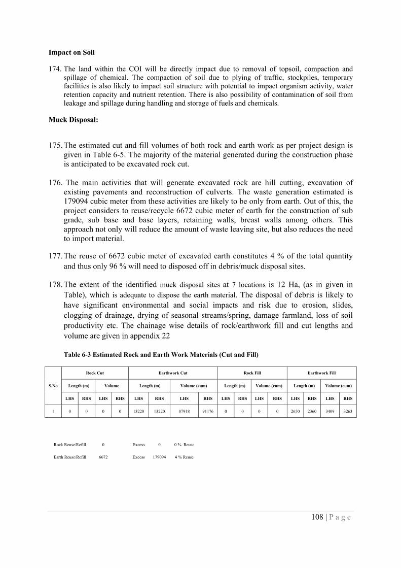
108 | P a g e
Impact on Soil
174. The land within the COI will be directly impact due to removal of topsoil, compaction and spillage of chemical. The compaction of soil due to plying of traffic, stockpiles, temporary facilities is also likely to impact soil structure with potential to impact organism activity, water retention capacity and nutrient retention. There is also possibility of contamination of soil from leakage and spillage during handling and storage of fuels and chemicals.
Muck Disposal:
175. The estimated cut and fill volumes of both rock and earth work as per project design is given in Table 6-5. The majority of the material generated during the construction phase is anticipated to be excavated rock cut.
176. The main activities that will generate excavated rock are hill cutting, excavation of existing pavements and reconstruction of culverts. The waste generation estimated is 179094 cubic meter from these activities are likely to be only from earth. Out of this, the project considers to reuse/recycle 6672 cubic meter of earth for the construction of sub grade, sub base and base layers, retaining walls, breast walls among others. This approach not only will reduce the amount of waste leaving site, but also reduces the need to import material.
177. The reuse of 6672 cubic meter of excavated earth constitutes 4 % of the total quantity and thus only 96 % will need to disposed off in debris/muck disposal sites.
178. The extent of the identified muck disposal sites at 7 locations is 12 Ha, (as in given in Table), which is adequate to dispose the earth material. The disposal of debris is likely to have significant environmental and social impacts and risk due to erosion, slides, clogging of drainage, drying of seasonal streams/spring, damage farmland, loss of soil productivity etc. The chainage wise details of rock/earthwork fill and cut lengths and volume are given in appendix 22
Table 6-3 Estimated Rock and Earth Work Materials (Cut and Fill)
S.No
Rock Cut Earthwork Cut Rock Fill Earthwork Fill
Length (m) Volume Length (m) Volume (cum) Length (m) Volume (cum) Length (m) Volume (cum)
LHS RHS LHS RHS LHS RHS LHS RHS LHS RHS LHS RHS LHS RHS LHS RHS
1 0 0 0 0 13220 13220 87918 91176 0 0 0 0 2650 2360 3409 3263
Rock Reuse/Refill 0 Excess 0 0 % Reuse
Earth Reuse/Refill 6672 Excess 179094 4 % Reuse
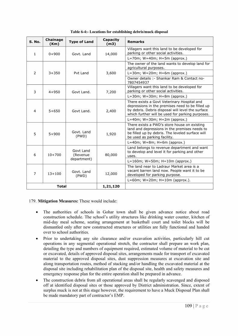
109 | P a g e
Table 6-4:- Locations for establishing debris/muck disposal
S. No. Chainage (Km) Type of Land Capacity
(m3) Remarks
1 0+900 Govt. Land 14,000 Villagers want this land to be developed for parking or other social activities.
L=70m; W=40m; H=5m (approx.)
2 3+350 Pvt Land 3,600
The owner of the land wants to develop land for agricultural purposes.
L=30m; W=20m; H=6m (approx.)
Owner details :- Shankar Ram & Contact no- 7807454937
3 4+950 Govt Land. 7,200 Villagers want this land to be developed for parking or other social activities.
L=30m; W=30m; H=8m (approx.)
4 5+650 Govt Land. 2,400
There exists a Govt Veterinary Hospital and depressions in the premises need to be filled up by debris. Debris disposal will level the surface which further will be used for parking purposes.
L=40m; W=30m; H=2m (approx.)
5 5+900 Govt. Land (PWD) 1,920
There exists a PWD’s store house on existing land and depressions in the premises needs to be filled up by debris. The leveled surface will be used as parking facility.
L=40m; W=8m; H=6m (approx.)
6 10+700 Govt Land (Revenue
department) 80,000
Land belongs to revenue department and want to develop and level it for parking and other uses.
L=160m; W=50m; H=10m (approx.)
7 13+100 Govt. Land (PWD) 12,000
The land near to Ladraur Market area is a vacant barren land now. People want it to be developed for parking purpose.
L=60m; W=20m; H=10m (approx.).
Total 1,21,120
179. Mitigation Measures: These would include:
The authorities of schools in Gohar town shall be given advance notice about road construction schedule. The school’s utility structures like drinking water counter, kitchen of mid-day meal scheme, seating arrangement at basketball court and toilet blocks will be dismantled only after new constructed structures or utilities are fully functional and handed over to school authorities.
Prior to undertaking any site clearance and/or excavation activities, particularly hill cut operations in any segmental operational stretch, the contractor shall prepare an work plan, detailing the type and numbers of equipment required, estimated volume of material to be cut or excavated, details of approved disposal sites, arrangements made for transport of excavated material to the approved disposal sites, dust suppression measures at excavation site and along transportation routes, method of stacking and/or handling the excavated material at the disposal site including rehabilitation plan of the disposal site, health and safety measures and emergency response plan for the entire operation shall be prepared in advance.
The construction debris from all operational areas shall be regularly scavenged and disposed off at identified disposal sites or those approved by District administration. Since, extent of surplus muck is not at this stage however, the requirement to have a Muck Disposal Plan shall be made mandatory part of contractor’s EMP.
110 | P a g e
The adequacy of sites suggested by stakeholders during consultations shall be verified for its suitability from potential environmental and social risk and impacts. Accordingly, the mitigation measures needed shall be prepared for Engineer approval and prior to operating the dump site.
The Engineer prior to approving contractor’s civil work plan shall ascertain preparation and inclusion of Muck Disposal Plan as one of main activity preceding hill cutting and excavation activities. The contractor shall be solely responsible to resolve any type of issues arising or related to dump site amicably with communities or individuals.
The contractor shall prepare and get the Muck Disposal Plan approved by the Engineer and operation shall strictly adhere to same. The Muck Disposal Plan shall ensure following Identified disposal site is inspected by Engineer. On a contour map record land area,
boundary limits and existing environmental settings, but not limited to topography, drainage, water bodies, settlements, trees, haul road etc. to identify likely environmental risk and safety hazards.
No dump site shall be located in forest area. In unavoidable condition, identification and approval of such dump site in forest area shall be after complying with conditions set in approval from Forest Department.
The likely environmental issues at dump site could include slope stability, blocking drainage, altering waterway, erosion etc. The mitigation measures shall include both engineering and non-engineering measures.
6.3.2 Impacts on Water Resources
180. As the project road completely traverse in hilly terrain and exists three seasonal streams and springs at different chainages. The streams are perennial with low to moderate seasonal fluctuation and drain water from hill side, which in absence of adequate cross drainage across the road can cause a tendency for flash floods on the downstream side.
181. The road construction inevitably is likely to alters, to a certain degree, the natural drainage regime by altering natural sheet run-off and stream hydrology. This will occur during construction from land clearance and construction of the road. In order to minimize the impacts, the following measures are considered. The drainage pattern along the project road with side drain flow direction to the nearest CD structures are given in Appendix -7.
182. Mitigation Measures: These would include:
The construction of 26 pipe culverts and 4 slab culverts connected with side drain on hill sides along the road is suggested for easing the drainage across the road.
Construction of check dams on the upstream side of three seasonal streams and channelizing the water on the downstream side of with protection measures will control the erosion of soil and subsequently reduce floods on downstream areas.
In addition, bio-engineering interventions are also considered at selected locations to minimize the erosion and improve the slope stability.
6.3.3 Water Resources Depletion
183. The terrain of project area is hilly and there three streams that are perennial with low to moderate seasonal fluctuation and springs. Such sources are tapped by the irrigation department for further use. The availability of water during summer is limited particularly in lean periods and requires immediate attention to augment the ground water resource. However, none of the areas within Bilaspur district has been notified as over exploited / critical by CGWA/State Ground water authorities as of 2013.
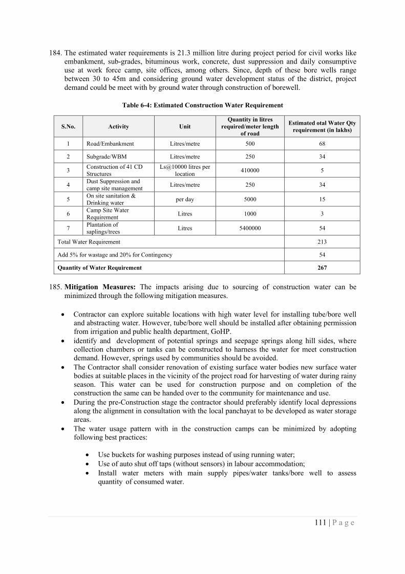
111 | P a g e
184. The estimated water requirements is 21.3 million litre during project period for civil works like embankment, sub-grades, bituminous work, concrete, dust suppression and daily consumptive use at work force camp, site offices, among others. Since, depth of these bore wells range between 30 to 45m and considering ground water development status of the district, project demand could be meet with by ground water through construction of borewell.
Table 6-4: Estimated Construction Water Requirement
S.No. Activity Unit Quantity in litres
required/meter length of road
Estimated otal Water Qty requirement (in lakhs)
1 Road/Embankment Litres/metre 500 68
2 Subgrade/WBM Litres/metre 250 34
3 Construction of 41 CD Structures
Ls@10000 litres per location
410000 5
4 Dust Suppression and camp site management
Litres/metre 250 34
5 On site sanitation & Drinking water
per day 5000 15
6 Camp Site Water Requirement
Litres 1000 3
7 Plantation of saplings/trees
Litres 5400000 54
Total Water Requirement 213
Add 5% for wastage and 20% for Contingency 54
Quantity of Water Requirement 267
185. Mitigation Measures: The impacts arising due to sourcing of construction water can be minimized through the following mitigation measures.
Contractor can explore suitable locations with high water level for installing tube/bore well and abstracting water. However, tube/bore well should be installed after obtaining permission from irrigation and public health department, GoHP.
identify and development of potential springs and seepage springs along hill sides, where collection chambers or tanks can be constructed to harness the water for meet construction demand. However, springs used by communities should be avoided.
The Contractor shall consider renovation of existing surface water bodies new surface water bodies at suitable places in the vicinity of the project road for harvesting of water during rainy season. This water can be used for construction purpose and on completion of the construction the same can be handed over to the community for maintenance and use.
During the pre-Construction stage the contractor should preferably identify local depressions along the alignment in consultation with the local panchayat to be developed as water storage areas.
The water usage pattern with in the construction camps can be minimized by adopting following best practices:
Use buckets for washing purposes instead of using running water; Use of auto shut off taps (without sensors) in labour accommodation; Install water meters with main supply pipes/water tanks/bore well to assess
quantity of consumed water.
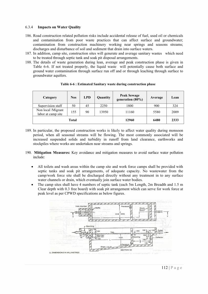
112 | P a g e
6.3.4 Impacts on Water Quality
186. Road construction related pollution risks include accidental release of fuel, used oil or chemicals and contamination from poor waste practices that can affect surface and groundwater; contamination from construction machinery working near springs and seasons streams; discharges and disturbance of soil and sediment that drain into surface waters.
187. In addition, camp site, construction sites will generate and average sanitary wastes which need to be treated through septic tank and soak pit disposal arrangements.
188. The details of waste generation during lean, average and peak construction phase is given in Table 6-6. If not treated properly, the liquid waste will potentially cause both surface and ground water contamination through surface run off and or through leaching through surface to groundwater aquifers.
Table 6-6 : Estimated Sanitary waste during construction phase
Category Nos LPD Quantity Peak Sewage
generation (80%) Average Lean
Supervision staff 50 45 2250 1800 900 324 Non local /Migrant labor at camp site
155 90 13950 11160 5580 2009
Total 12960 6480 2333
189. In particular, the proposed construction works is likely to affect water quality during monsoon period, when all seasonal streams will be flowing. The most commonly associated will be increased suspended solids and turbidity in runoff from land clearance, earthworks and stockpiles where works are undertaken near streams and springs.
190. Mitigation Measures: Key avoidance and mitigation measures to avoid surface water pollution
include:
All toilets and wash areas within the camp site and work force camps shall be provided with septic tanks and soak pit arrangements, of adequate capacity. No wastewater from the camp/work force site shall be discharged directly without any treatment in to any surface water channels or drain, which eventually join surface water bodies.
The camp sites shall have 4 numbers of septic tank (each 5m Length, 2m Breadth and 1.5 m Clear depth with 0.3 free board) with soak pit arrangement which can serve for work force at peak level as per CPWD specifications as below figures.
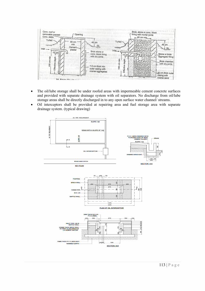
113 | P a g e
The oil/lube storage shall be under roofed areas with impermeable cement concrete surfaces
and provided with separate drainage system with oil separators. No discharge from oil/lube storage areas shall be directly discharged in to any open surface water channel/ streams.
Oil interceptors shall be provided at repairing area and fuel storage area with separate drainage system. (typical drawing)
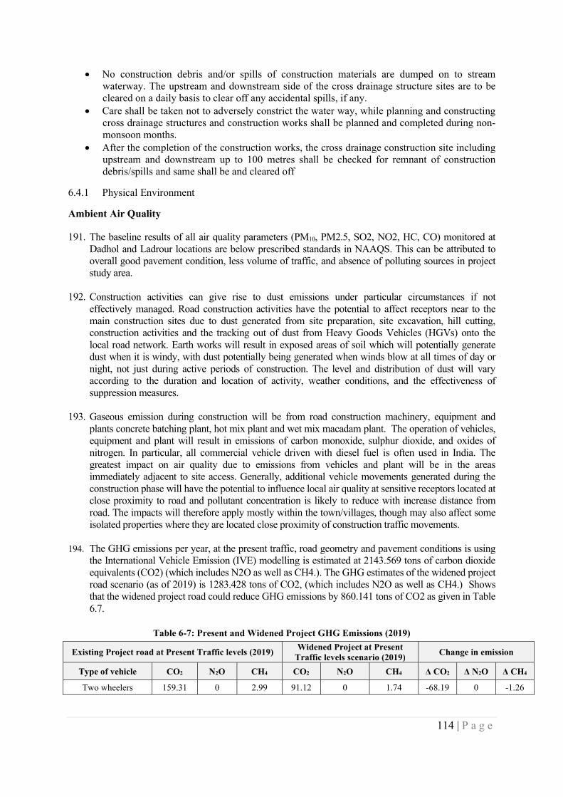
114 | P a g e
No construction debris and/or spills of construction materials are dumped on to stream waterway. The upstream and downstream side of the cross drainage structure sites are to be cleared on a daily basis to clear off any accidental spills, if any.
Care shall be taken not to adversely constrict the water way, while planning and constructing cross drainage structures and construction works shall be planned and completed during non-monsoon months.
After the completion of the construction works, the cross drainage construction site including upstream and downstream up to 100 metres shall be checked for remnant of construction debris/spills and same shall be and cleared off
6.4.1 Physical Environment
Ambient Air Quality
191. The baseline results of all air quality parameters (PM10, PM2.5, SO2, NO2, HC, CO) monitored at Dadhol and Ladrour locations are below prescribed standards in NAAQS. This can be attributed to overall good pavement condition, less volume of traffic, and absence of polluting sources in project study area.
192. Construction activities can give rise to dust emissions under particular circumstances if not effectively managed. Road construction activities have the potential to affect receptors near to the main construction sites due to dust generated from site preparation, site excavation, hill cutting, construction activities and the tracking out of dust from Heavy Goods Vehicles (HGVs) onto the local road network. Earth works will result in exposed areas of soil which will potentially generate dust when it is windy, with dust potentially being generated when winds blow at all times of day or night, not just during active periods of construction. The level and distribution of dust will vary according to the duration and location of activity, weather conditions, and the effectiveness of suppression measures.
193. Gaseous emission during construction will be from road construction machinery, equipment and plants concrete batching plant, hot mix plant and wet mix macadam plant. The operation of vehicles, equipment and plant will result in emissions of carbon monoxide, sulphur dioxide, and oxides of nitrogen. In particular, all commercial vehicle driven with diesel fuel is often used in India. The greatest impact on air quality due to emissions from vehicles and plant will be in the areas immediately adjacent to site access. Generally, additional vehicle movements generated during the construction phase will have the potential to influence local air quality at sensitive receptors located at close proximity to road and pollutant concentration is likely to reduce with increase distance from road. The impacts will therefore apply mostly within the town/villages, though may also affect some isolated properties where they are located close proximity of construction traffic movements.
194. The GHG emissions per year, at the present traffic, road geometry and pavement conditions is using the International Vehicle Emission (IVE) modelling is estimated at 2143.569 tons of carbon dioxide equivalents (CO2) (which includes N2O as well as CH4.). The GHG estimates of the widened project road scenario (as of 2019) is 1283.428 tons of CO2, (which includes N2O as well as CH4.) Shows that the widened project road could reduce GHG emissions by 860.141 tons of CO2 as given in Table 6.7.
Table 6-7: Present and Widened Project GHG Emissions (2019)
Existing Project road at Present Traffic levels (2019) Widened Project at Present
Traffic levels scenario (2019) Change in emission
Type of vehicle CO2 N2O CH4 CO2 N2O CH4 Δ CO2 Δ N2O Δ CH4
Two wheelers 159.31 0 2.99 91.12 0 1.74 -68.19 0 -1.26
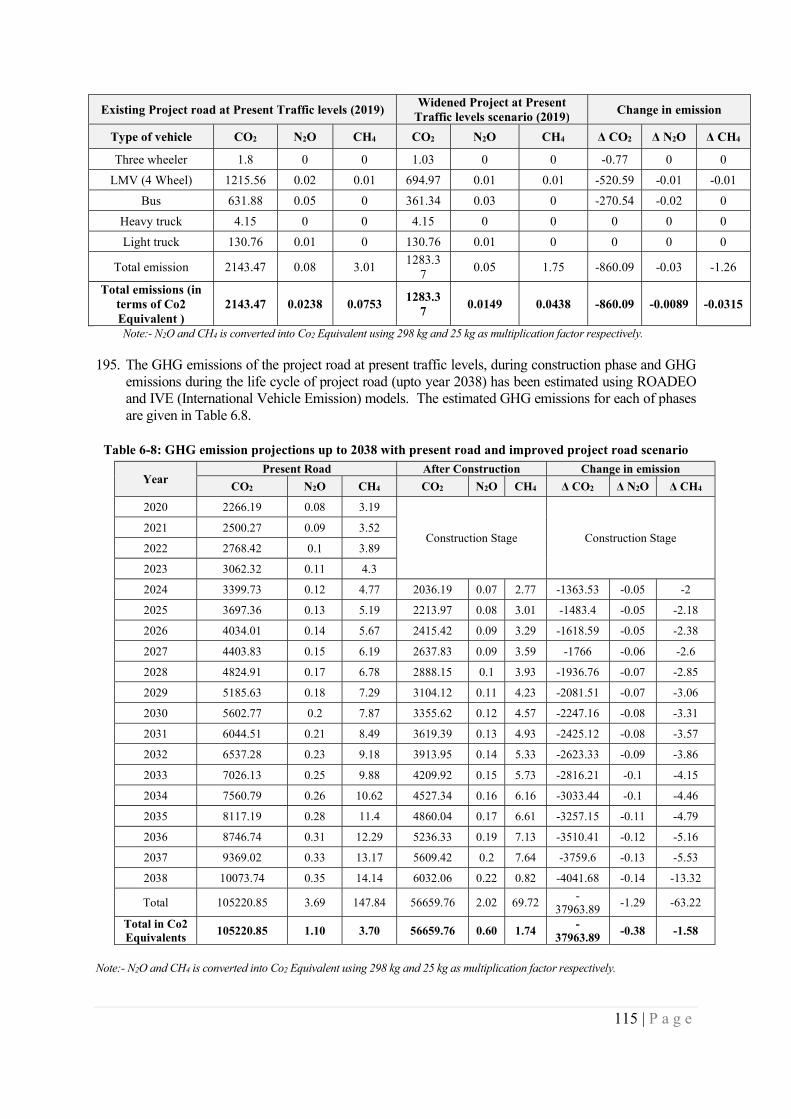
115 | P a g e
Existing Project road at Present Traffic levels (2019) Widened Project at Present
Traffic levels scenario (2019) Change in emission
Type of vehicle CO2 N2O CH4 CO2 N2O CH4 Δ CO2 Δ N2O Δ CH4
Three wheeler 1.8 0 0 1.03 0 0 -0.77 0 0
LMV (4 Wheel) 1215.56 0.02 0.01 694.97 0.01 0.01 -520.59 -0.01 -0.01
Bus 631.88 0.05 0 361.34 0.03 0 -270.54 -0.02 0
Heavy truck 4.15 0 0 4.15 0 0 0 0 0
Light truck 130.76 0.01 0 130.76 0.01 0 0 0 0
Total emission 2143.47 0.08 3.01 1283.3
7 0.05 1.75 -860.09 -0.03 -1.26
Total emissions (in terms of Co2 Equivalent )
2143.47 0.0238 0.0753 1283.3
7 0.0149 0.0438 -860.09 -0.0089 -0.0315
Note:- N2O and CH4 is converted into Co2 Equivalent using 298 kg and 25 kg as multiplication factor respectively.
195. The GHG emissions of the project road at present traffic levels, during construction phase and GHG emissions during the life cycle of project road (upto year 2038) has been estimated using ROADEO and IVE (International Vehicle Emission) models. The estimated GHG emissions for each of phases are given in Table 6.8.
Table 6-8: GHG emission projections up to 2038 with present road and improved project road scenario
Year Present Road After Construction Change in emission
CO2 N2O CH4 CO2 N2O CH4 Δ CO2 Δ N2O Δ CH4
2020 2266.19 0.08 3.19
Construction Stage Construction Stage 2021 2500.27 0.09 3.52
2022 2768.42 0.1 3.89
2023 3062.32 0.11 4.3
2024 3399.73 0.12 4.77 2036.19 0.07 2.77 -1363.53 -0.05 -2
2025 3697.36 0.13 5.19 2213.97 0.08 3.01 -1483.4 -0.05 -2.18
2026 4034.01 0.14 5.67 2415.42 0.09 3.29 -1618.59 -0.05 -2.38
2027 4403.83 0.15 6.19 2637.83 0.09 3.59 -1766 -0.06 -2.6
2028 4824.91 0.17 6.78 2888.15 0.1 3.93 -1936.76 -0.07 -2.85
2029 5185.63 0.18 7.29 3104.12 0.11 4.23 -2081.51 -0.07 -3.06
2030 5602.77 0.2 7.87 3355.62 0.12 4.57 -2247.16 -0.08 -3.31
2031 6044.51 0.21 8.49 3619.39 0.13 4.93 -2425.12 -0.08 -3.57
2032 6537.28 0.23 9.18 3913.95 0.14 5.33 -2623.33 -0.09 -3.86
2033 7026.13 0.25 9.88 4209.92 0.15 5.73 -2816.21 -0.1 -4.15
2034 7560.79 0.26 10.62 4527.34 0.16 6.16 -3033.44 -0.1 -4.46
2035 8117.19 0.28 11.4 4860.04 0.17 6.61 -3257.15 -0.11 -4.79
2036 8746.74 0.31 12.29 5236.33 0.19 7.13 -3510.41 -0.12 -5.16
2037 9369.02 0.33 13.17 5609.42 0.2 7.64 -3759.6 -0.13 -5.53
2038 10073.74 0.35 14.14 6032.06 0.22 0.82 -4041.68 -0.14 -13.32
Total 105220.85 3.69 147.84 56659.76 2.02 69.72 -
37963.89 -1.29 -63.22
Total in Co2 Equivalents
105220.85 1.10 3.70 56659.76 0.60 1.74 -
37963.89 -0.38 -1.58
Note:- N2O and CH4 is converted into Co2 Equivalent using 298 kg and 25 kg as multiplication factor respectively.
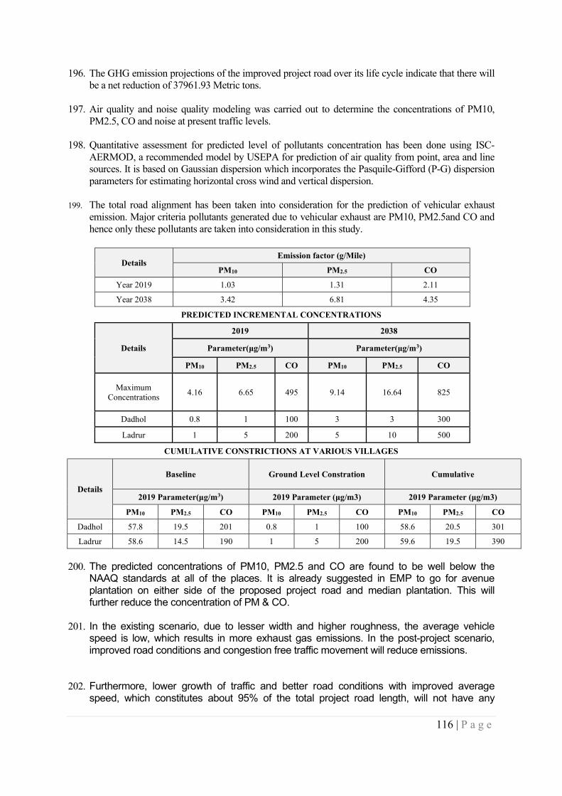
116 | P a g e
196. The GHG emission projections of the improved project road over its life cycle indicate that there will be a net reduction of 37961.93 Metric tons.
197. Air quality and noise quality modeling was carried out to determine the concentrations of PM10, PM2.5, CO and noise at present traffic levels.
198. Quantitative assessment for predicted level of pollutants concentration has been done using ISC-
AERMOD, a recommended model by USEPA for prediction of air quality from point, area and line sources. It is based on Gaussian dispersion which incorporates the Pasquile-Gifford (P-G) dispersion parameters for estimating horizontal cross wind and vertical dispersion.
199. The total road alignment has been taken into consideration for the prediction of vehicular exhaust emission. Major criteria pollutants generated due to vehicular exhaust are PM10, PM2.5and CO and hence only these pollutants are taken into consideration in this study.
Details Emission factor (g/Mile)
PM10 PM2.5 CO
Year 2019 1.03 1.31 2.11
Year 2038 3.42 6.81 4.35
PREDICTED INCREMENTAL CONCENTRATIONS
Details
2019 2038
Parameter(μg/m3) Parameter(μg/m3)
PM10 PM2.5 CO PM10 PM2.5 CO
Maximum Concentrations
4.16 6.65 495 9.14 16.64 825
Dadhol 0.8 1 100 3 3 300
Ladrur 1 5 200 5 10 500
CUMULATIVE CONSTRICTIONS AT VARIOUS VILLAGES
Details
Baseline Ground Level Constration Cumulative
2019 Parameter(μg/m3) 2019 Parameter (μg/m3) 2019 Parameter (μg/m3)
PM10 PM2.5 CO PM10 PM2.5 CO PM10 PM2.5 CO
Dadhol 57.8 19.5 201 0.8 1 100 58.6 20.5 301
Ladrur 58.6 14.5 190 1 5 200 59.6 19.5 390
200. The predicted concentrations of PM10, PM2.5 and CO are found to be well below the NAAQ standards at all of the places. It is already suggested in EMP to go for avenue plantation on either side of the proposed project road and median plantation. This will further reduce the concentration of PM & CO.
201. In the existing scenario, due to lesser width and higher roughness, the average vehicle speed is low, which results in more exhaust gas emissions. In the post-project scenario, improved road conditions and congestion free traffic movement will reduce emissions.
202. Furthermore, lower growth of traffic and better road conditions with improved average speed, which constitutes about 95% of the total project road length, will not have any
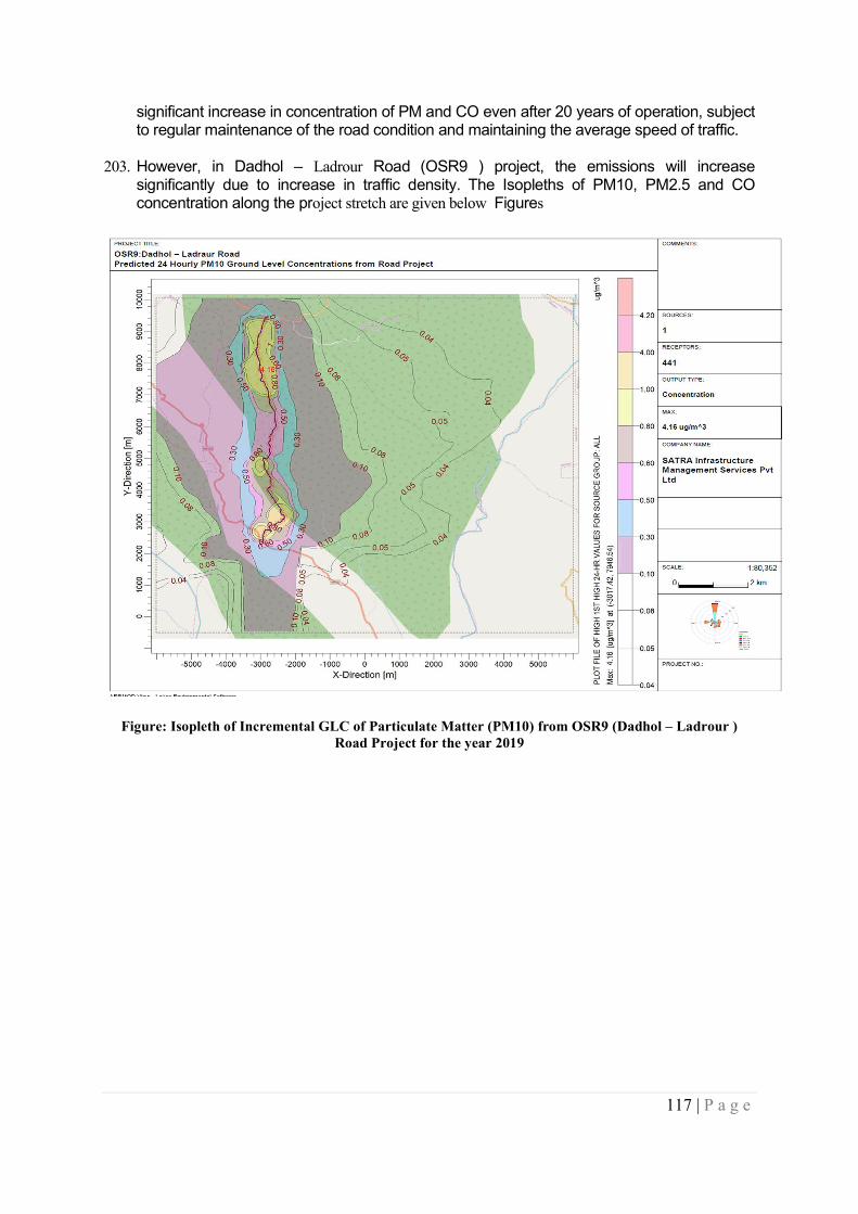
117 | P a g e
significant increase in concentration of PM and CO even after 20 years of operation, subject to regular maintenance of the road condition and maintaining the average speed of traffic.
203. However, in Dadhol – Ladrour Road (OSR9 ) project, the emissions will increase significantly due to increase in traffic density. The Isopleths of PM10, PM2.5 and CO concentration along the project stretch are given below Figures
Figure: Isopleth of Incremental GLC of Particulate Matter (PM10) from OSR9 (Dadhol – Ladrour ) Road Project for the year 2019
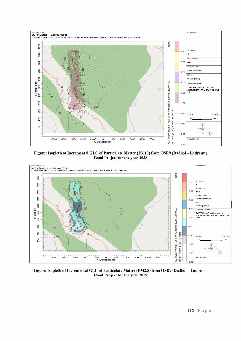
118 | P a g e
Figure: Isopleth of Incremental GLC of Particulate Matter (PM10) from OSR9 (Dadhol – Ladraur ) Road Project for the year 2038
Figure: Isopleth of Incremental GLC of Particulate Matter (PM2.5) from OSR9 (Dadhol – Ladrour ) Road Project for the year 2019
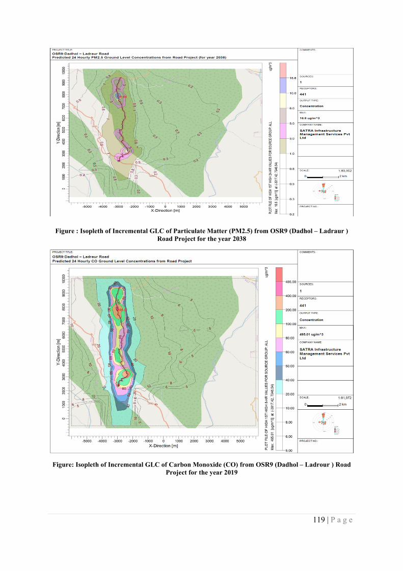
119 | P a g e
Figure : Isopleth of Incremental GLC of Particulate Matter (PM2.5) from OSR9 (Dadhol – Ladraur ) Road Project for the year 2038
Figure: Isopleth of Incremental GLC of Carbon Monoxide (CO) from OSR9 (Dadhol – Ladrour ) Road Project for the year 2019
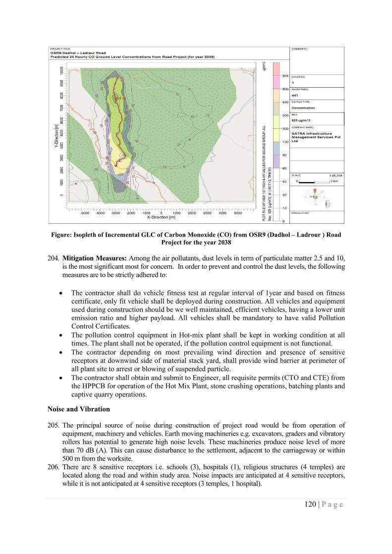
120 | P a g e
Figure: Isopleth of Incremental GLC of Carbon Monoxide (CO) from OSR9 (Dadhol – Ladrour ) Road Project for the year 2038
204. Mitigation Measures: Among the air pollutants, dust levels in term of particulate matter 2.5 and 10, is the most significant most for concern. In order to prevent and control the dust levels, the following measures are to be strictly adhered to:
The contractor shall do vehicle fitness test at regular interval of 1year and based on fitness certificate, only fit vehicle shall be deployed during construction. All vehicles and equipment used during construction should be we well maintained, efficient vehicles, having a lower unit emission ratio and higher payload. All vehicles shall be mandatory to have valid Pollution Control Certificates.
The pollution control equipment in Hot-mix plant shall be kept in working condition at all times. The plant shall not be operated, if the pollution control equipment is not functional.
The contractor depending on most prevailing wind direction and presence of sensitive receptors at downwind side of material stack yard, shall provide wind barrier at perimeter of all plant site to arrest or blowing of suspended particle.
The contractor shall obtain and submit to Engineer, all requisite permits (CTO and CTE) from the HPPCB for operation of the Hot Mix Plant, stone crushing operations, batching plants and captive quarry operations.
Noise and Vibration
205. The principal source of noise during construction of project road would be from operation of equipment, machinery and vehicles. Earth moving machineries e.g. excavators, graders and vibratory rollers has potential to generate high noise levels. These machineries produce noise level of more than 70 dB (A). This can cause disturbance to the settlement, adjacent to the carriageway or within 500 m from the worksite.
206. There are 8 sensitive receptors i.e. schools (3), hospitals (1), religious structures (4 temples) are located along the road and within study area. Noise impacts are anticipated at 4 sensitive receptors, while it is not anticipated at 4 sensitive receptors (3 temples, 1 hospital).
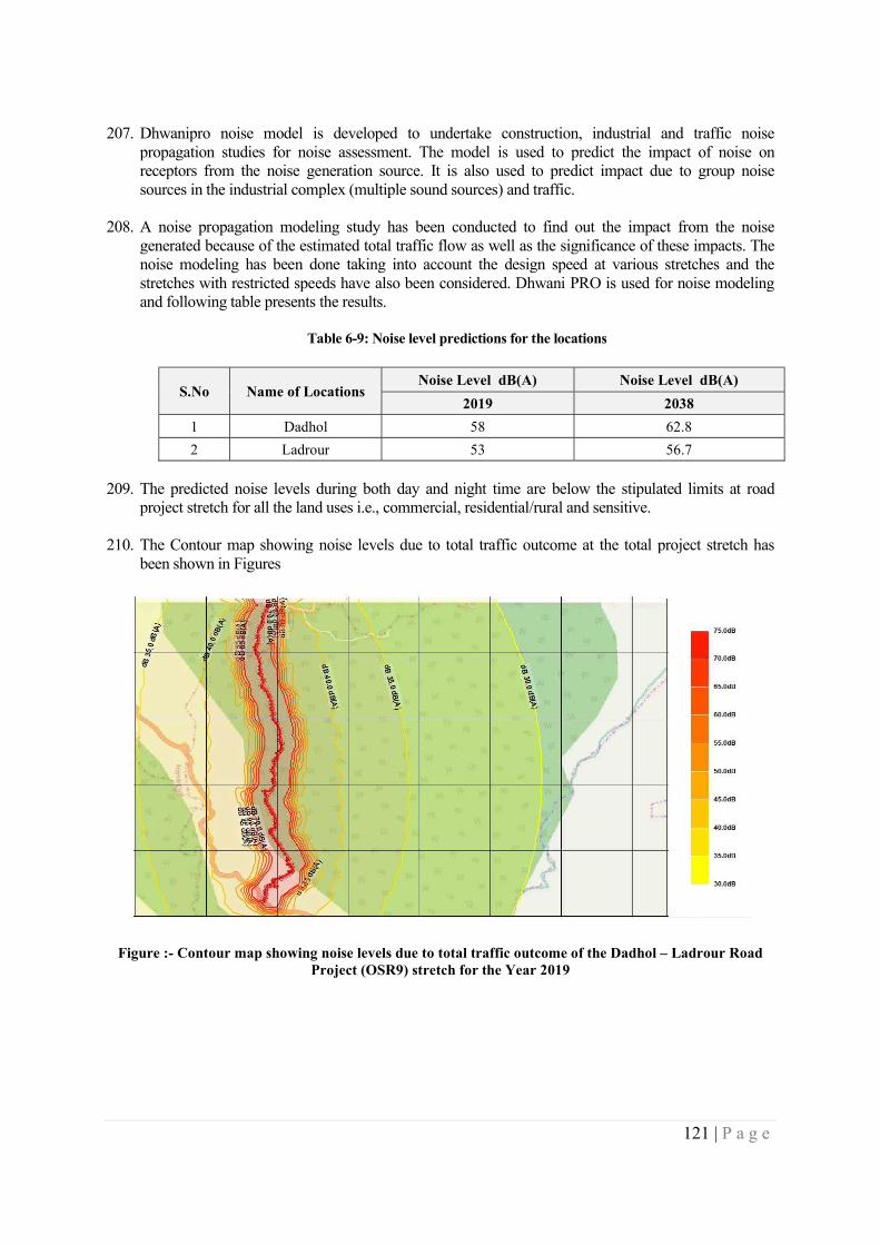
121 | P a g e
207. Dhwanipro noise model is developed to undertake construction, industrial and traffic noise
propagation studies for noise assessment. The model is used to predict the impact of noise on receptors from the noise generation source. It is also used to predict impact due to group noise sources in the industrial complex (multiple sound sources) and traffic.
208. A noise propagation modeling study has been conducted to find out the impact from the noise
generated because of the estimated total traffic flow as well as the significance of these impacts. The noise modeling has been done taking into account the design speed at various stretches and the stretches with restricted speeds have also been considered. Dhwani PRO is used for noise modeling and following table presents the results.
Table 6-9: Noise level predictions for the locations
S.No Name of Locations Noise Level dB(A) Noise Level dB(A)
2019 2038
1 Dadhol 58 62.8
2 Ladrour 53 56.7
209. The predicted noise levels during both day and night time are below the stipulated limits at road project stretch for all the land uses i.e., commercial, residential/rural and sensitive.
210. The Contour map showing noise levels due to total traffic outcome at the total project stretch has been shown in Figures
Figure :- Contour map showing noise levels due to total traffic outcome of the Dadhol – Ladrour Road Project (OSR9) stretch for the Year 2019
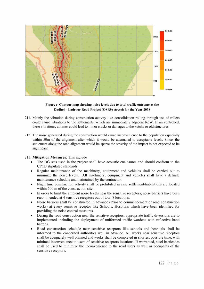
122 | P a g e
Figure :- Contour map showing noise levels due to total traffic outcome at the
Dadhol – Ladrour Road Project (OSR9) stretch for the Year 2038
211. Mainly the vibration during construction activity like consolidation rolling through use of rollers could cause vibrations to the settlements, which are immediately adjacent RoW. If un controlled, these vibrations, at times could lead to minor cracks or damages to the kutcha or old structures.
212. The noise generated during the construction would cause inconvenience to the population especially within 50m of the alignment after which it would be attenuated to acceptable levels. Since, the settlement along the road alignment would be sparse the severity of the impact is not expected to be significant.
213. Mitigation Measures: This include The DG sets used in the project shall have acoustic enclosures and should conform to the
CPCB stipulated standards. Regular maintenance of the machinery, equipment and vehicles shall be carried out to
minimize the noise levels. All machinery, equipment and vehicles shall have a definite maintenance schedule and maintained by the contractor.
Night time construction activity shall be prohibited in case settlement/habitations are located within 500 m of the construction site.
In order to limit the ambient noise levels near the sensitive receptors, noise barriers have been recommended at 4 sensitive receptors out of total 8 locations.
Noise barriers shall be constructed in advance (Prior to commencement of road construction works) at every sensitive receptor like Schools, Hospitals which have been identified for providing the noise control measures.
During the road construction near the sensitive receptors, appropriate traffic diversions are to implemented including the deployment of uniformed traffic wardens with reflective hand battens.
Road construction schedule near sensitive receptors like schools and hospitals shall be informed to the concerned authorities well in advance. All works near sensitive receptors shall be adequately well planned and works shall be completed in shortest possible time, with minimal inconvenience to users of sensitive receptors locations. If warranted, steel barricades shall be used to minimize the inconvenience to the road users as well as occupants of the sensitive receptors.
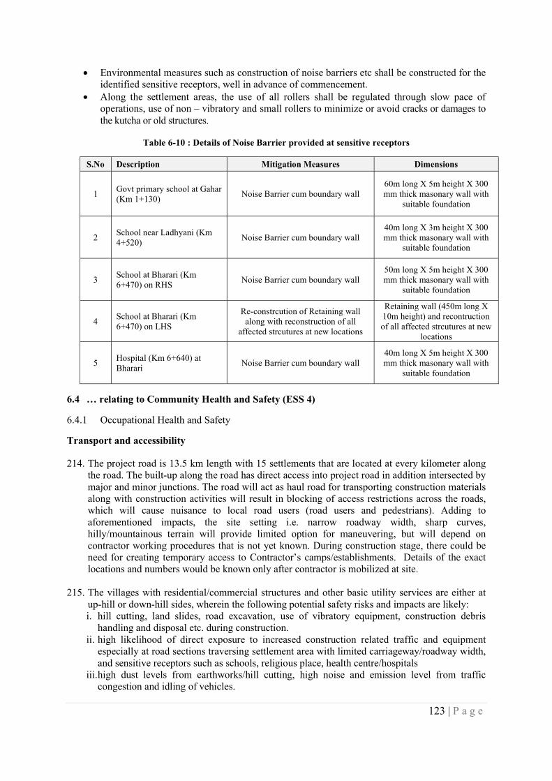
123 | P a g e
Environmental measures such as construction of noise barriers etc shall be constructed for the identified sensitive receptors, well in advance of commencement.
Along the settlement areas, the use of all rollers shall be regulated through slow pace of operations, use of non – vibratory and small rollers to minimize or avoid cracks or damages to the kutcha or old structures.
Table 6-10 : Details of Noise Barrier provided at sensitive receptors
S.No Description Mitigation Measures Dimensions
1 Govt primary school at Gahar (Km 1+130)
Noise Barrier cum boundary wall 60m long X 5m height X 300 mm thick masonary wall with
suitable foundation
2 School near Ladhyani (Km 4+520)
Noise Barrier cum boundary wall 40m long X 3m height X 300 mm thick masonary wall with
suitable foundation
3 School at Bharari (Km 6+470) on RHS
Noise Barrier cum boundary wall 50m long X 5m height X 300 mm thick masonary wall with
suitable foundation
4 School at Bharari (Km 6+470) on LHS
Re-constrcution of Retaining wall along with reconstruction of all
affected strcutures at new locations
Retaining wall (450m long X 10m height) and recontruction of all affected strcutures at new
locations
5 Hospital (Km 6+640) at Bharari
Noise Barrier cum boundary wall 40m long X 5m height X 300 mm thick masonary wall with
suitable foundation
6.4 … relating to Community Health and Safety (ESS 4)
6.4.1 Occupational Health and Safety
Transport and accessibility
214. The project road is 13.5 km length with 15 settlements that are located at every kilometer along the road. The built-up along the road has direct access into project road in addition intersected by major and minor junctions. The road will act as haul road for transporting construction materials along with construction activities will result in blocking of access restrictions across the roads, which will cause nuisance to local road users (road users and pedestrians). Adding to aforementioned impacts, the site setting i.e. narrow roadway width, sharp curves, hilly/mountainous terrain will provide limited option for maneuvering, but will depend on contractor working procedures that is not yet known. During construction stage, there could be need for creating temporary access to Contractor’s camps/establishments. Details of the exact locations and numbers would be known only after contractor is mobilized at site.
215. The villages with residential/commercial structures and other basic utility services are either at
up-hill or down-hill sides, wherein the following potential safety risks and impacts are likely: i. hill cutting, land slides, road excavation, use of vibratory equipment, construction debris
handling and disposal etc. during construction. ii. high likelihood of direct exposure to increased construction related traffic and equipment
especially at road sections traversing settlement area with limited carriageway/roadway width, and sensitive receptors such as schools, religious place, health centre/hospitals
iii. high dust levels from earthworks/hill cutting, high noise and emission level from traffic congestion and idling of vehicles.
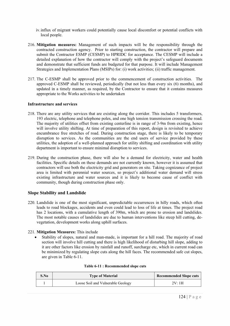
124 | P a g e
iv. influx of migrant workers could potentially cause local discomfort or potential conflicts with local people.
216. Mitigation measures: Management of such impacts will be the responsibility through the
contracted construction agency. Prior to starting construction, the contractor will prepare and submit the Contractor ESMP (CESMP) to HPRIDC for acceptance. The CESMP will include a detailed explanation of how the contractor will comply with the project’s safeguard documents and demonstrate that sufficient funds are budgeted for that purpose. It will include Management Strategies and Implementation Plans (MSIPs) for: (i) work activities; (ii) traffic management.
217. The C-ESMP shall be approved prior to the commencement of construction activities. The approved C-ESMP shall be reviewed, periodically (but not less than every six (6) months), and updated in a timely manner, as required, by the Contractor to ensure that it contains measures appropriate to the Works activities to be undertaken
Infrastructure and services
218. There are any utility services that are existing along the corridor. This includes 5 transformers, 193 electric, telephone and telephone poles, and one high tension transmission crossing the road. The majority of utilities offset from existing centerline is in range of 3-9m from existing, hence will involve utility shifting. At time of preparation of this report, design is revisited to achieve encumbrance free stretches of road. During construction stage, there is likely to be temporary disruption to services. As the communities are the end users of service provided by these utilities, the adoption of a well-planned approach for utility shifting and coordination with utility department is important to ensure minimal disruption to services.
219. During the construction phase, there will also be a demand for electricity, water and health facilities. Specific details on these demands are not currently known, however it is assumed that contractors will use both the electricity grid and generators on site. Taking cognizance of project area is limited with perennial water sources, so project’s additional water demand will stress existing infrastructure and water sources and it is likely to become cause of conflict with community, though during construction phase only.
Slope Stability and Landslide
220. Landslide is one of the most significant, unpredictable occurrences in hilly roads, which often leads to road blockages, accidents and even could lead to loss of life at times. The project road has 2 locations, with a cumulative length of 390m, which are prone to erosion and landslides. The most notable causes of landslides are due to human interventions like steep hill cutting, de-vegetation, development works along uphill surfaces.
221. Mitigation Measures: This include
Stability of slopes, natural and man-made, is important for a hill road. The majority of road section will involve hill cutting and there is high likelihood of disturbing hill slope, adding to it are other factors like erosion by rainfall and runoff, surcharge etc, which in current road can be minimized by regulating slope cuts along the hill faces. The recommended safe cut slopes, are given in Table 6-11.
Table 6-11 : Recommended slope cuts
S.No Type of Material Recommended Slope cuts
1 Loose Soil and Vulnerable Geology 2V: 1H
125 | P a g e
S.No Type of Material Recommended Slope cuts
2 Compacted Soil with Slope towards Road 4V: 1H
3 Soft Rock 6V: 1H
4 Hard Rock 8V: 1H
The landslide impact can be further minimized / mitigated through provision of engineering and non-engineering interventions. Some of engineering measures considered for the project road are breast walls along hill side and retaining walls along valley side. Apart from the engineering measures, bio-engineering measures are considered, though potential location being identified, to mitigate the impacts of erosion and slope stability along the project road.
The landslide impact can be further minimized / mitigated through provision of engineering and non-engineering interventions. Some of engineering measures considered for the project road are breast walls along hill side and retaining walls along valley side. Apart from the engineering measures, bio-engineering measures also have been proposed at some selected locations to mitigate the impacts of erosion and slope stability along the project road. The details of bio-engineering interventions considered for project road is given in Table.
Provisions made for the bioengineering interventions covers areas/locations along the RoW at
upstream and downstream of seasonal streams, CD structures, muck/debris disposal sites, areas reclaimed /open areas in RoW, areas of cleared of invasive vegetation’s among others.
Table 6-12 : Bio-Engineering measures for slope stability and erosion control for project road
S.No Item Unit Quantity
1.1 Construction of hedge brushlayer RM 1,500.00
1.2 Construction of brushlayer RM 900.00
2 Construction of live palisade RM 900.00
3 Construction of live Fascine RM 900.00
4.1 Grass slip plantation on slope <45° @ 100 drills/sqm sqm 3000
4.2 Grass slip plantation on slope 45°-60° @ 100 drills/sqm sqm 600.00
4.3 Grass slip plantation on >60° slope @ 100 drills/sqm sqm 600.00
4.4 Plantation of large sized stature grass slips at slope of <45° @ 20 slips/sqm
sqm 600.00
5 Bamboo crib wall cum 1,200.00
6 Tree plantation in plains with tree guard nos 1,000.00
7.1 Shrub Plantation in plains with tree guard nos 2,500.00
7.2 Agave plantation in slopes nos 1,500.00
8.1 Group plantation of shrubs sqm 1,200.00
8.2 Hedge Plantation (2 plants/RM) RM 900.00
8.3 Hedge Plantation (4 plants/RM) RM 900.00
9 Bamboo plantation with Bamboo tree guard nos 600.00
10 Construction of Gabion cum Under Civil Works
11 Construction of barb wire RM Under Civil Works
12.1 Grass seed sowing<40° sqm 6000
12.2 Grass seed sowing<40° with mulch sqm 5000
126 | P a g e
S.No Item Unit Quantity
12.3 Grass seed sowing on slope 40-45⁰ with mulch and jute netting
sqm 3500
13 Hydroseeding sqm 5000
Hazardous and non-hazardous wastes
222. The Project will generate both solid non-hazardous and hazardous wastes throughout the construction phase. The anticipated non-hazardous wastes types include excavated material, construction material, Municipal Solid Waste, waste waters. While hazardous waste may include used oil, empty drums or replaced parts of the construction machinery, used battery, chemical for concreting like admixture etc. There are potentially a number of risks to human health and the environment that may be associated with the handling, storage and disposal of waste, both on and off-site. Incorrect handling and storage could result in possible cross contamination of air, soil and water resources; as well as direct and indirect effects on human health. Environmental pollution with organic and non-organic waste generated from project activities may occur due to uncontrolled disposal and inadequate management of waste during road construction and operation of the camps for construction workers. Discharge of untreated waste waters can result in pollution to soils, water bodies and have adverse effects on human health, flora and fauna and surface and groundwater.
223. During the complete construction phase, an estimated 104 used batteries are likely to be discarded, which are to be disposed of in accordance with the battery management rule. The estimated generation of hazardous waste during the construction waste is given table 6-13.
Table 6-13: Estimated Hazardous waste during Project Construction Phase
Equipment Type and Capacity
No. Tank
capacity in litres
frequency 6 months
Quantity in litres
Grease and other misc
waste(10 %)
Cotton waste(0.4 Kg per service)
Dozer D-50-A15 - 200 Cum/hr Cap.
2 15 4 120 12 3.2
Motor Grader - Engine output above 150 KW Cap.
2 15 4 120 12 3.2
Long arm Hydraulic Excavator - 1.00 Cum
3 15 4 180 18 4.8
Vibratory Roller ( 2 Tandem + 1 Vibro) - Minimum 8-10T static Weight
2 12 4 96 9.6 3.2
Pneumatic Road Roller - 200-300KN Cap.
1 10 4 40 4 1.6
Smooth Wheeled Roller - 8-10T Cap.
2 15 4 120 12 3.2
Tipper - 5.5 Cum Cap. 15 15 4 900 90 24
Water Tanker - 6 KL Cap. 3 15 4 180 18 4.8
Tractor-Trolley - 50HP Cap. 3 10 4 120 12 4.8
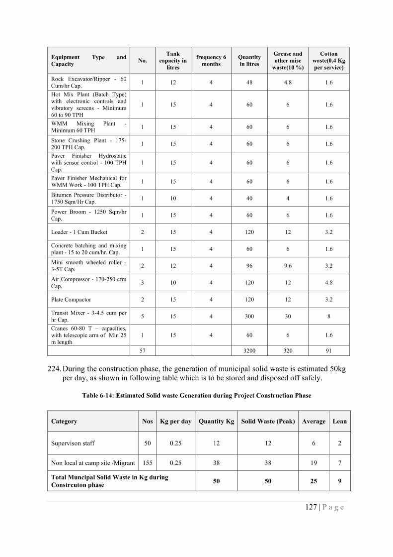
127 | P a g e
Equipment Type and Capacity
No. Tank
capacity in litres
frequency 6 months
Quantity in litres
Grease and other misc
waste(10 %)
Cotton waste(0.4 Kg per service)
Rock Excavator/Ripper - 60 Cum/hr Cap.
1 12 4 48 4.8 1.6
Hot Mix Plant (Batch Type) with electronic controls and vibratory screens - Minimum 60 to 90 TPH
1 15 4 60 6 1.6
WMM Mixing Plant - Minimum 60 TPH
1 15 4 60 6 1.6
Stone Crushing Plant - 175-200 TPH Cap.
1 15 4 60 6 1.6
Paver Finisher Hydrostatic with sensor control - 100 TPH Cap.
1 15 4 60 6 1.6
Paver Finisher Mechanical for WMM Work - 100 TPH Cap.
1 15 4 60 6 1.6
Bitumen Pressure Distributor - 1750 Sqm/Hr Cap.
1 10 4 40 4 1.6
Power Broom - 1250 Sqm/hr Cap.
1 15 4 60 6 1.6
Loader - 1 Cum Bucket 2 15 4 120 12 3.2
Concrete batching and mixing plant - 15 to 20 cum/hr. Cap.
1 15 4 60 6 1.6
Mini smooth wheeled roller - 3-5T Cap.
2 12 4 96 9.6 3.2
Air Compressor - 170-250 cfm Cap.
3 10 4 120 12 4.8
Plate Compactor 2 15 4 120 12 3.2
Transit Mixer - 3-4.5 cum per hr Cap.
5 15 4 300 30 8
Cranes 60-80 T – capacities, with telescopic arm of Min 25 m length
1 15 4 60 6 1.6
57 3200 320 91
224. During the construction phase, the generation of municipal solid waste is estimated 50kg per day, as shown in following table which is to be stored and disposed off safely.
Table 6-14: Estimated Solid waste Generation during Project Construction Phase
Category Nos Kg per day Quantity Kg Solid Waste (Peak) Average Lean
Supervison staff 50 0.25 12 12 6 2
Non local at camp site /Migrant 155 0.25 38 38 19 7
Total Muncipal Solid Waste in Kg during Constrcuton phase
50 50 25 9
128 | P a g e
Category Nos Kg per day Quantity Kg Solid Waste (Peak) Average Lean
Organic Waste (40%) 20
In organic Waste (60%) 30
Mitigation Measures:
225. The hazardous waste generated at camp sites is to be collected in steel drums and stored in a segregated roofed area and periodically disposed at approved waste disposal facilitates by HPSPCB. The nearest such facility is located at Baddi Barotiwala Nalagarh Industrial Area (BBN) in the adjoining Solan District. The discarded batteries shall be disposed only through authorized recyclers from HPSPCB.
226. The camp site shall have compost pits for treating organic waste and separate bins for collecting the inorganic waste, which shall be disposed at nearest municipal disposal sites. The nearest such sites are available at Mandi and Ghumarwin.
227. Waste management and the minimization of potential impacts during construction will depend on the implementation of appropriate procedures, protocols and monitoring of materials being delivered, handled and stored prior to disposal. The CEMP will include a Waste Management Plan prepared in accordance with requirements stipulated in (a) The Batteries (Management & Handling ) Rules, 2001 (b) Municipal Solid Wastes (Management and Handling) Rules, 2000, (c) Hazardous Waste (Management, Handling & Transboundary Movement) Rules, 2016 and (d) Construction and Demolition Waste Management Rules, 2016.
Hazard and Vulnerability
228. The vulnerability status of the Bilaspur district as a whole is moderate in terms of landslides, floods, and earthquake. However, the impact due to construction of 13.5km long project road itself does not significantly alter the vulnerability status of the district as a whole. Given site investigation observed and identified potential landslide stretches, the risk due natural calamities like earthquake, landslides and even at times landslide triggered due to road construction work cannot be overlooked. Since, such events would have potential health and safety hazard to personal or work force or labor or community in vicinity and may get stranded at operational sites.
229. Mitigation Measures: This include In order to ensure the safety of work force at operational sites, as well as safety of the
personnel at camp site, an Emergency Response Plan shall be prepared and followed, whenever the situation warrants.
All work force irrespective of levels are to be provided with training to respond in an emergency situation and periodic mock drills will be conducted to ensure the preparedness to respond any emergency situations.
The communities on regular interval shall be informed appropriate information, as well as changes in emergency preparedness and response activities.
6.5 …on land & assets (ESS 5)
230. The project design has considered the following mitigation hierarchy to avoid the impacts. Restricting the widening of the project road to the already available Right of Way and avoid
diversion of any fresh land for road construction
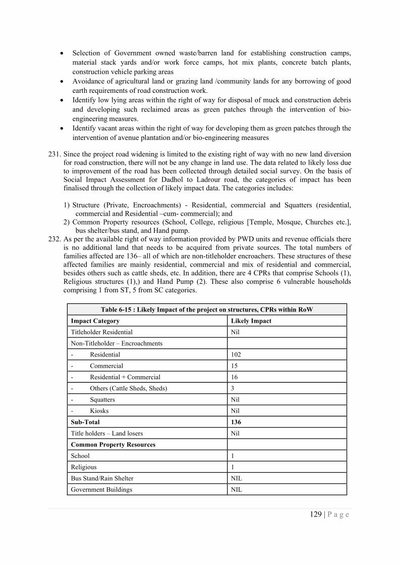
129 | P a g e
Selection of Government owned waste/barren land for establishing construction camps, material stack yards and/or work force camps, hot mix plants, concrete batch plants, construction vehicle parking areas
Avoidance of agricultural land or grazing land /community lands for any borrowing of good earth requirements of road construction work.
Identify low lying areas within the right of way for disposal of muck and construction debris and developing such reclaimed areas as green patches through the intervention of bio-engineering measures.
Identify vacant areas within the right of way for developing them as green patches through the intervention of avenue plantation and/or bio-engineering measures
231. Since the project road widening is limited to the existing right of way with no new land diversion for road construction, there will not be any change in land use. The data related to likely loss due to improvement of the road has been collected through detailed social survey. On the basis of Social Impact Assessment for Dadhol to Ladrour road, the categories of impact has been finalised through the collection of likely impact data. The categories includes: 1) Structure (Private, Encroachments) - Residential, commercial and Squatters (residential,
commercial and Residential –cum- commercial); and 2) Common Property resources (School, College, religious [Temple, Mosque, Churches etc.],
bus shelter/bus stand, and Hand pump. 232. As per the available right of way information provided by PWD units and revenue officials there
is no additional land that needs to be acquired from private sources. The total numbers of families affected are 136– all of which are non-titleholder encroachers. These structures of these affected families are mainly residential, commercial and mix of residential and commercial, besides others such as cattle sheds, etc. In addition, there are 4 CPRs that comprise Schools (1), Religious structures (1),) and Hand Pump (2). These also comprise 6 vulnerable households comprising 1 from ST, 5 from SC categories.
Table 6-15 : Likely Impact of the project on structures, CPRs within RoW
Impact Category Likely Impact
Titleholder Residential Nil
Non-Titleholder – Encroachments
- Residential 102
- Commercial 15
- Residential + Commercial 16
- Others (Cattle Sheds, Sheds) 3
- Squatters Nil
- Kiosks Nil
Sub-Total 136
Title holders – Land losers Nil
Common Property Resources
School 1
Religious 1
Bus Stand/Rain Shelter NIL
Government Buildings NIL
130 | P a g e
Table 6-15 : Likely Impact of the project on structures, CPRs within RoW
Impact Category Likely Impact
Hand Pump 2
Total 4
Estimated Land Acquisition (Dadhol- Ladraur) Nil
Vulnerability/Vulnerable Household 6
Schedule Caste 5
Schedule Tribe 1
Women headed Household 0
Below Poverty Line 0
Orphan 0
Destitute 0
Transgender 0
233. During construction stage, the temporary requirements of land either from government sources
or from private parties through lease hold basis to tune of 1.1 Ha is anticipated to establish construction camps, material stack yards, hot mix plants & machinery. While land requirement is being estimated for disposal of surplus earth from hill cutting. The impact at such location would be localized and temporary nature and these can be reversed through mitigation measures.
234. With the development of the road, avenues for economic activities and opportunities will be created with high likelihood of induced ribbon development or urbanization. Such a scenario though will take time but is likely to stress current land use i.e. predominantly forest along project road, to meet with development demand for commercial or residential usages, which might reduce the forest coverage in the state over time.
235. Mitigation Measures:
236. Impacts on land and assets arising pre-construction stage activities will require be addressing and
mitigating through a mix of measures of compensation, assistance and relocation arrangements. For this purpose, a Resettlement Action Plan will be developed that will contain details of such mitigation provisions. The mitigation provisions includes:1) Fixation of compensation at replacement cost will be paid as per the provisions mentioned in RFCTLARR Act 2013 or through negotiated settlement;2) Structure replacement cost will be calculated as per the Basic Schedule of Rate and with depcriciation;3) Each affected family shall be given a one-time "Resettlement Allowance";4) one time rehabilitation grant for reconstruction of affected assets;5) One time subsistence assistance in cash for displaced families;6) one time transportation allowance for shifting the assets for displaced families;7) Training for skill development. This assistance includes cost of training and financial assistance for travel/conveyance and food.;8) one time cash grant as vulnerability allowance; and 9) Reconstruction of community structure and common property resources, will be done in consultation with community;10) compensation for temporary impact. It will also be prepared keeping in view actions proposed under the Stakeholder Engagement Plan. In addition, in cases of impacts on livelihood, rehabilitation through appropriate skill training/financial counselling would be required as well.
237. The impacts arising due to construction over land use cannot be completely avoided. It can only
be minimized by adopting the following measures:
131 | P a g e
i. Waste lands belonging to Government or non-agricultural lands belong to private or community shall be chosen for establishing construction camps material stack yards, hot mix plants & machinery, debris or muck disposal sites. If landfill site or previously used sites are available along the road, the same sites shall be preferred and no new site shall be opened up for all establishment needed during project period.
ii. No agricultural land or grazing land or fertile community lands are to be used for project’s establishments.
iii. Use of forest area for project’s temporary establishment shall be avoided. If unavoidable, location and area with less canopy density shall be preferred and shall atleast 500m of distance maintained from high density canopy forest areas. Damages to tree or land diversion in forest area shall be compensate and compensatory afforestation of vacant lands/degraded forest are to be made as per the stipulation of the department of forests, GoHP.
6.6 … relating to Bio-diversity & Living Natural Resources (ESS 6)
As per field investigations and consultations with forest departments, there is no protected forest area along the project road.
Impact on Flora
238. The site clearance activities for road construction will involve removal of road side vegetation and felling of trees. The biodiversity studies have indicated that entire corridor along the project road is rich in biodiversity, interspersed with invasive species like Ageratum conyzoides, Eupatorium adenophorum, Lantana camara, Parthanium hysterophoros. Consultation with forest department, GoHP informed past effort for management of these weeds, through mechanical/ cultural and chemical methods. Most of the past efforts have not yielded desired results due to lack of focus on long-term follow up system. The ecological investigations have indicated that there are no rare, endangered and threatened species with in the corridor.
239. A total of 3614 has been enumerated existing within existing right of way, of which only 75 trees (2%) needs to be cut for road improvement. As per the current procedure of department of forests, GoHP, tree enumeration has to be conducted jointly with the department of forests after the marking of the center line of the proposed road improvement plan. Thus, the number of trees which will be required to be felled for road construction is not confirmed at this stage. While according the permissions for tree felling, the forest department will stipulate planting of three saplings for every tree cut and maintenance of the same for five years with 70% survival rate.
240. Mitigation Measures: In order to limit the impacts on the flora due to the road construction, the
following measures are considered: Compensatory Plantation is to be taken up either along the project corridor or at places
identified by the department of forests, GoHP in order to compensate for the tree felled. At least 3 saplings shall be planted for every tree felled or as per the stipulation of the mentioned in the permission for tree felling provided by the Department of Forest, Government of Himachal Pradesh. With this compensatory plantation measures, the tree cover lost could be regained in 5 to 7 years and thus the impacts could get mitigated.
Only local species, which are less water consuming and approved by the forest department shall be used for plantation. Normally, all such afforestation will be undertaken by the department of forest and maintained for three years as a deposit work. Therefore, cost provision for Compensatory Plantation is included in ESMP Budget.
In order to limit the propagation of invasive species, firstly all such invasive species with in the corridor of impact and/or right of way shall be removed/cleared and replanted with local
132 | P a g e
species. The department of forests, GoHP has framed a procedure for removal of invasive species and replanting of local species.
Normally, all such activities will be undertaken by the department of forest and maintained for three years as a deposit work. Therefore, cost provision for corridor plantation is included in ESMP Budget.
Impacts on Fauna
241. There is no National Park or wildlife sanctuary with in 10km from the project corridor. The biodiversity investigation along the project corridor has not indicted the presence of any scheduled faunal species, except for monkey. Local consultations along the project corridor indicate that they frequently face attacks from monkeys near Ladhyani village. Thus, the project road construction is not likely to cause any impacts on the fauna.
242. Mitigation Measures would include the following:
The camp sites and work force camps shall be access controlled and well-lit to avoid/prevent entry of wild animals.
The work force shall be oriented not to feed monkeys and to properly collect waste food in dustbins to prevent menace in camp area.
All work force shall be oriented to keep calm and walk away from the scene, in case, wild animals are sighted either during work hours/night time.
Work force shall be strictly instructed not to harm / kill and prohibited hunting of wild animals under any circumstances
The Work force shall be strictly prohibited from entering in to forest areas under any circumstances.
The Construction camp and work force camp sites shall not be established in the vicinity/nearby forest areas. Atleast 500m distance shall be kept from such areas under unavoidable circumstances.
The construction work shall be restricted to day hours only, while working established in the vicinity/nearby forest areas and work shall not be carried out in the late evening hours/night hours /early mornings.
6.7 … on Tribals/Indigenous Population (ESS 7)
243. The corridor does not have any schedule V areas. Though it has 36 tribal households might be impacted across the 13.5 km corridor these households are well mainstreamed into the general population and society and do not meet the characteristics outlined in ESS 77.
244. Mitigation measures: Hence no differential provisions will be required to address the impacts on these households. Impacts on these households shall be treated through the provisions outlined in the Resettlement Action Plan.
6.8 … on impacts on Cultural Heritage (ESS 8)
245. The alignment of the project road does not have any ancient monuments and/or archaeological site(s), protected under the Ancient Monuments and Archaeological Sites and Remains (Amendment and Validation) Act, 2010. Thus, no impacts are foreseen on ancient monuments and archaeological sites due to the construction of road project.
6 Exact number of affected tribal households will be known after the finalization of designs and field verification of impacted households 7 characteristics as outlined in ESS 7 – Indigenous Peoples/Sub-Saharan African Historically Underserved Traditional Local Communities
133 | P a g e
246. Further, 4 religious structures/shrines, which are along the project corridor are not impacted by
the proposed road improvement activities. These structures are not protected under Ancient Monuments and Archaeological Sites and Remains (Amendment and Validation) Act, 2010.
247. During excavation works, in an unforeseen and unlikely scenario of sighting of remnants or
chance find, the matter is to be immediately brought to the attention of the State/Central Department of Archaeology. All further work at the specific location shall be carried out only after the site is cleared by the competent authority of archaeological Department.
248. Extent of impact of chance finds will be addressed through a Cultural Heritage Management Plan as part of ESMP. The cultural heritage management plan will include:
i. a chance finds procedure to be established. It is a project-specific procedure which will be followed if previously unknown cultural heritage is encountered during project activities. It will be included in all contracts relating to construction of the project, including excavations, demolition, movement of earth, flooding or other changes in the physical environment.
ii. recognize the need to ensure peoples’ continued access to culturally important sites, as well as the need for confidentiality when revealing information about cultural heritage assets that would compromise or jeopardize their safety or integrity
iii. fair and equitable sharing of benefits from commercial use of cultural resources iv. and provisions for specific types of cultural heritage based on consultations with stakeholders
– affected and other interested parties, if any are identified during construction based on chance find procedure
249. The project construction will not directly positively or adversely impact any tourism activities of
the region. On the contrary, the project road after its completion may contribute to tourism by improved connectivity and reduction in travel time.
250. The right of way of the project road has 8 sensitive receptors like schools, hospitals, religious structures (temples/shrines), etc.
251. As a part of design, adequate consideration was given to minimize the impacts on most of the sensitive receptors. However, in unavoidable circumstances, noise barriers has been considered as a mitigation measure at two schools to attenuate the noise levels due to anticipated increase in the traffic after the upgradation of project road.
252. Further, all the noise barriers are to be constructed prior to the road construction work at the respective location of the sensitive receptors. Location specific traffic diversion plans will be implemented during the road construction near these sensitive receptors and all work will be swiftly completed with minimal inconvenience.
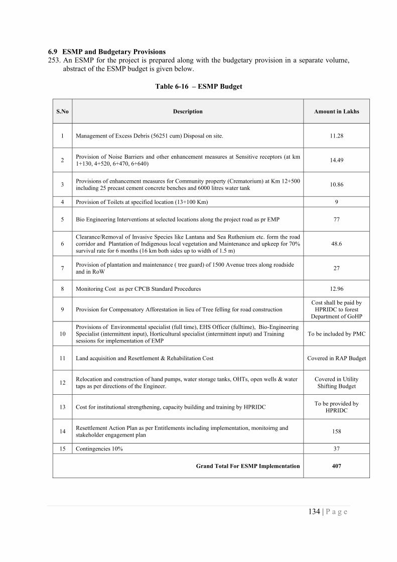
134 | P a g e
6.9 ESMP and Budgetary Provisions 253. An ESMP for the project is prepared along with the budgetary provision in a separate volume,
abstract of the ESMP budget is given below.
Table 6-16 – ESMP Budget
S.No Description Amount in Lakhs
1 Management of Excess Debris (56251 cum) Disposal on site. 11.28
2 Provision of Noise Barriers and other enhancement measures at Sensitive receptors (at km 1+130, 4+520, 6+470, 6+640)
14.49
3 Provisions of enhancement measures for Community property (Crematorium) at Km 12+500 including 25 precast cement concrete benches and 6000 litres water tank
10.86
4 Provision of Toilets at specified location (13+100 Km) 9
5 Bio Engineering Interventions at selected locations along the project road as pr EMP 77
6 Clearance/Removal of Invasive Species like Lantana and Sea Ruthenium etc. form the road corridor and Plantation of Indigenous local vegetation and Maintenance and upkeep for 70% survival rate for 6 months (16 km both sides up to width of 1.5 m)
48.6
7 Provision of plantation and maintenance ( tree guard) of 1500 Avenue trees along roadside and in RoW
27
8 Monitoring Cost as per CPCB Standard Procedures 12.96
9 Provision for Compensatory Afforestation in lieu of Tree felling for road construction Cost shall be paid by
HPRIDC to forest Department of GoHP
10 Provisions of Environmental specialist (full time), EHS Officer (fulltime), Bio-Engineering Specialist (intermittent input), Horticultural specialist (intermittent input) and Training sessions for implementation of EMP
To be included by PMC
11 Land acquisition and Resettlement & Rehabilitation Cost Covered in RAP Budget
12 Relocation and construction of hand pumps, water storage tanks, OHTs, open wells & water taps as per directions of the Engineer.
Covered in Utility Shifting Budget
13 Cost for institutional strengthening, capacity building and training by HPRIDC To be provided by
HPRIDC
14 Resettlement Action Plan as per Entitlements including implementation, monitoirng and stakeholder engagement plan
158
15 Contingencies 10% 37
Grand Total For ESMP Implementation 407
135 | P a g e
CHAPTER 7 – KEY MEASURES AND ACTIONS FOR ENVIRONMENTAL AND
SOCIAL COMMITMENT PLAN (ESCP)
254. This section summarizes the key issues and presents a list of issues, actions and measures that need to part of the ESCP. Key issues and findings:
i. Verification of land ownership at four stretches of road passing through forest area.
ii. The environmental issues highlighted by communities are related to drainage, road safety, drying of spring, protection and maintenance at landslide locations, safety concern at dump sites.
iii. Managing of construction water demand in absence of perennial water sources.
iv. Most negative social impact identified by community members was the potential for loss of land to project interventions.
v. Majority of stakeholders consulted, the benefits of the project outweigh impacts from minor losses of land.
vi. Gaps exist in the provisions in policies between government acts/policies and World Bank’s ESS relating to provisions for non-titleholders and cut-off date.
vii. Institutional arrangement to address E&S aspects are currently relatively weak and need significant strengthening
viii. Though GRM is decentralized but it presently is not tuned to receiving to respond to grievances of PAPs and requires systematic recording of grievances and redressal
255. Further action needs to be taken to:
i. To verify existing ROW and obtain clearances, licenses/approvals and permits under existing legal framework that are applicable to the Project from relevant national and/or local authorities.
ii. develop clear procedures for the land acquisition and determination of compensation/ transactions are carried out in transparent manner and satisfactorily documented;
iii. describe the policy, institutional and implementation framework to guide the compensation for loss of land and assets and ensure that no affected land is displaced without proper consultation and compensation;
iv. more consultations need to be carried out to inform communities/affected persons of the mitigation measures and entitlements once firmed to compensate them for their losses. Besides other road safety and bio-engineering measures need to be informed;
v. develop mechanisms to foster greater participation of more passive members of the community, including disadvantaged persons, women and vulnerable groups;
vi. develop clear procedures for disseminating information about the project to all affected communities and provide a feedback mechanism for these communities to voice their concerns and address these concerns during project implementation. More specifically, to facilitate community outreach and project information dissemination, as well as to enhance the knowledge of communities about entitlements to mitigate adverse social impacts, an information pamphlet in the local language summarizing the key principles of voluntary land donations and entitlements presented in the RPF, will be distributed to each village impacted by project interventions.
136 | P a g e
vii. to coordinate with forest department and verify the ownership of land over road is existing at four stretches of road traversing forest area and early resolving of the matter by processing of application for Forest Clearance, if needed.
viii. The road design to explore mitigation options for environmental concerns highlight by communities and its integration in EMP.
ix. Environment and Social impact management training modules needs to be prepared and will be delivered early in project implementation to build capacity of the project staff.
256. Key measures and actions and the timeframe required for the project to meet the requirements of the ESSs are as follows
By Appraisal
i. HPRIDC will establish and maintain an E&S organizational structure in HPRIDC with qualified staffs to support management of E&S risks including at least one Environmental Expert and one Social Expert.
ii. HPRIDC to provide draft consolidated ESIA. iii. Disclose Draft Consolidated Environment and Social Impact Assessment (ESIA) for the
road corridors on Department website and WB portal iv. Disclose Draft Stakeholder Engagement Plan v. HPRIDC to prepare Resettlement Policy Framework for the overall project including
rehabilitation and maintenance corridors vi. HPRIDC to disclose approved RPF on its website
vii. disclosure of the approved ESCP
By Project Negotiations
viii. Disclose draft corridor specific ESMP (EMP, RAP, SEP, GBV Plan) ix. HPRIDC to develop and include the project grievance mechanism in SEP x. Wherever land parcels are required, HPRIDC should initiate acquisition proceedings
using the RFTCLARR Act 2013 and simultaneously also form price fixation committees to conduct private negotiations as per the GoHP Financial Commissioner, Standing Order No. 28 so that loss of time can be avoided in case there is/are hold ups from the landowners
Table 7.1 – Plan documents to meet relevant ESS requirements ESS 1 EMP and ESMP By January 2020 ESS 2 Labor Management Procedure for HPRIDC8 By January 2020 ESS 3 Waste Management Plan & Pollution Prevention Management Plan By January 2020 ESS 4 Emergency Response Plan & GBV Mitigation Plan By January 2020 ESS 5 Resettlement Action Plan By January 2020 ESS 6 Bio-diversity Management Plan (To be determined) By January 2020 ESS 7 Not applicable ESS 8 Cultural Heritage Plan (will be included as part of the ESMP) By January 2020 ESS 9 No Plan needed as no financial intermediaries are involved ESS 10 Draft Stakeholder Engagement Plan By December 2019
The above will be used in developing the Environmental and Social Commitment Plan (ESCP).
LIST OF APPENDICES
8 Labor Management Procedure shall be applied by HPRIDC for all upgradation and maintenance roads
137 | P a g e
1 List of the individuals/organizations that prepared/ contributed to ESIA.
2 References
3 Summary table of Consultations and surveys with stakeholders (affected persons other interested parties)
4 Comparison of ESF, RFCTLARR Act 2013 and GoHP Financial Commissioner Standing Order No. 28 and Measures to address gaps
5 List of applicable Labour laws
6 Details Of Settlements, Cross Drainage Structures, Junctions Along the Project Road
7 Plan & Profile of Project Road
8 Strip Plan of Project Road Showing Existing Features
9 Transect Walk Survey Formats
10 Ecological Investigations along the Project Road Corridor
11 Photographs Of Sensitive Locations of the Project Road
12 Environmental Monitoring Test Results
13 GoHP’s Strategy To Rehabilitate Areas Infested With Invasive Alien Plant Species (Exotic Weeds) In Himachal Pradesh
14 Village Wise - Census & Economic Details
15 Village Wise - Amenities
16 Census Questionnaires
17 Socio-Economic Questionnaires
18 Attendance Sheet of Stakeholder Consultations
19 Photographs of Stakeholder Consultations
20 Checklist for Community Consultations
21 Gender Based Focused Group Discussion Checklist
22 Material Quantities, Cut and Fill Areas and Volumes
Himachal Pradesh State RoadsTransformation Program
(Funded by World Bank)
Dadhol-Ladrour (Km 0.00 to KM 13.500)
Environment and Social Impact Assessment
(Draft)
Appendices
HIMACHAL PRADESH ROAD & OTHER INFRASTRUCTUREDEVELOPMENT CORPORATION LTD.
(Government of Himachal Pradesh Undertaking)(An ISO 9001:2008 QMS & ISO 14001:2004 EMS conforming company)
November 2019
2 | P a g e
LIST OF APPENDICES
1 List of the individuals/organizations that prepared/ contributed to ESIA.
2 References
3 Summary table of Consultations and surveys with stakeholders (affected persons otherinterested parties)
4 Comparison of ESF, RFCTLARR Act 2013 and GoHP Financial CommissionerStanding Order No. 28 and Measures to address gaps
5 List of applicable Labour laws
6 Details Of Settlements, Cross Drainage Structures, Junctions Along the Project Road
7 Plan & Profile of Project Road
8 Strip Plan of Project Road Showing Existing Features
9 Transect Walk Survey Formats
10 Ecological Investigations along the Project Road Corridor
11 Photographs Of Sensitive Locations of the Project Road
12 Environmental Monitoring Test Results
13 GoHP’s Strategy To Rehabilitate Areas Infested With Invasive Alien Plant Species(Exotic Weeds) In Himachal Pradesh
14 Village Wise - Census & Economic Details
15 Village Wise - Amenities
16 Census Questionnaires
17 Socio-Economic Questionnaires
18 Attendance Sheet of Stakeholder Consultations
19 Photographs of Stakeholder Consultations
20 Checklist for Community Consultations
21 Gender Based Focused Group Discussion Checklist
22 Material Quantities, Cut and Fill Areas and Volumes
3 | P a g e
Appendix 1 – List of the individuals/organizations that prepared/ contributed to ESIA.
1. Messrs. Deccan Consulting Engineers Private Limited (Independent Environment andSocial Assessment Consultants)
2. Messrs. SATRA Infrastructure Management Services Pvt. Ltd (Detailed Project Reportconsultants)
3. Officials of Himachal Pradesh Road Infrastructure Development Consultants (HPRIDC)i. Mr. Jitender Dhiman, Chief Engineer-cum-Project Director, HPRIDCii. Mr. Pawan Sharma, Superintending Engineer, HPRIDCiii. Mr. X, Environment Expertiv. Mr. Chaman Dilta, Social Development Officer-cum-Special LAO
4. Other officials of HPRIDC and HPPWD – Concerned Divisions
4 | P a g e
Appendix 2 – References
1. Primary Census Abstract, Census of India, 20112. Amenities- District Household Census, Census of India, 20113. The World Bank Environment and Social Framework, 20164. Right to Fair Compensation and Transparency in Land Acquisition, Rehabilitation and
Resettlement, 20135. Gender Statistics, HP, DoES, Shimla6. Resettlement Action Plan for Himachal Pradesh State Roads Project – I7. Environment Management Plan for Himachal Pradesh State Roads Project – I8. Himachal Pradesh Roadside Land Control Act, 19689. The Himachal Pradesh Roads Infrastructure Protection Act 2002 (and Rules 2004)10. Environment and Social Management Framework, Himachal Pradesh Horticulture
Development Project11. Project Appraisal Document (Draft) of Himachal Pradesh State Roads Transformation
Program, The World Bank, 2019
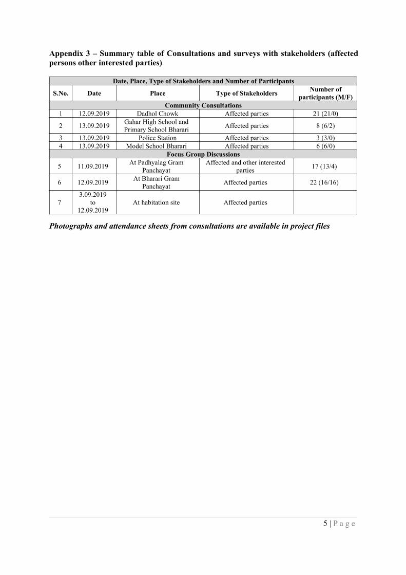
5 | P a g e
Appendix 3 – Summary table of Consultations and surveys with stakeholders (affectedpersons other interested parties)
Date, Place, Type of Stakeholders and Number of Participants
S.No. Date Place Type of Stakeholders Number ofparticipants (M/F)
Community Consultations1 12.09.2019 Dadhol Chowk Affected parties 21 (21/0)
2 13.09.2019 Gahar High School andPrimary School Bharari Affected parties 8 (6/2)
3 13.09.2019 Police Station Affected parties 3 (3/0)4 13.09.2019 Model School Bharari Affected parties 6 (6/0)
Focus Group Discussions
5 11.09.2019 At Padhyalag GramPanchayat
Affected and other interestedparties 17 (13/4)
6 12.09.2019 At Bharari GramPanchayat Affected parties 22 (16/16)
73.09.2019
to12.09.2019
At habitation site Affected parties
Photographs and attendance sheets from consultations are available in project files
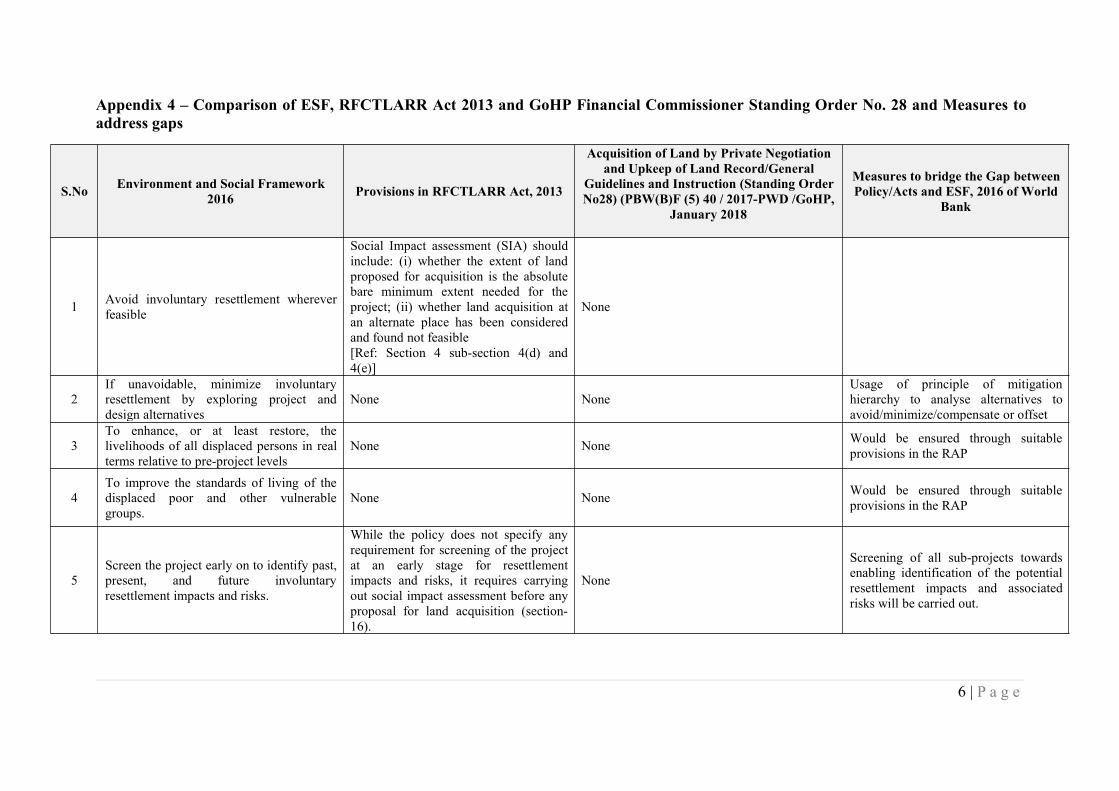
6 | P a g e
Appendix 4 – Comparison of ESF, RFCTLARR Act 2013 and GoHP Financial Commissioner Standing Order No. 28 and Measures toaddress gaps
S.No Environment and Social Framework2016 Provisions in RFCTLARR Act, 2013
Acquisition of Land by Private Negotiationand Upkeep of Land Record/General
Guidelines and Instruction (Standing OrderNo28) (PBW(B)F (5) 40 / 2017-PWD /GoHP,
January 2018
Measures to bridge the Gap betweenPolicy/Acts and ESF, 2016 of World
Bank
1 Avoid involuntary resettlement whereverfeasible
Social Impact assessment (SIA) shouldinclude: (i) whether the extent of landproposed for acquisition is the absolutebare minimum extent needed for theproject; (ii) whether land acquisition atan alternate place has been consideredand found not feasible[Ref: Section 4 sub-section 4(d) and4(e)]
None
2If unavoidable, minimize involuntaryresettlement by exploring project anddesign alternatives
None NoneUsage of principle of mitigationhierarchy to analyse alternatives toavoid/minimize/compensate or offset
3To enhance, or at least restore, thelivelihoods of all displaced persons in realterms relative to pre-project levels
None None Would be ensured through suitableprovisions in the RAP
4To improve the standards of living of thedisplaced poor and other vulnerablegroups.
None None Would be ensured through suitableprovisions in the RAP
5Screen the project early on to identify past,present, and future involuntaryresettlement impacts and risks.
While the policy does not specify anyrequirement for screening of the projectat an early stage for resettlementimpacts and risks, it requires carryingout social impact assessment before anyproposal for land acquisition (section-16).
None
Screening of all sub-projects towardsenabling identification of the potentialresettlement impacts and associatedrisks will be carried out.
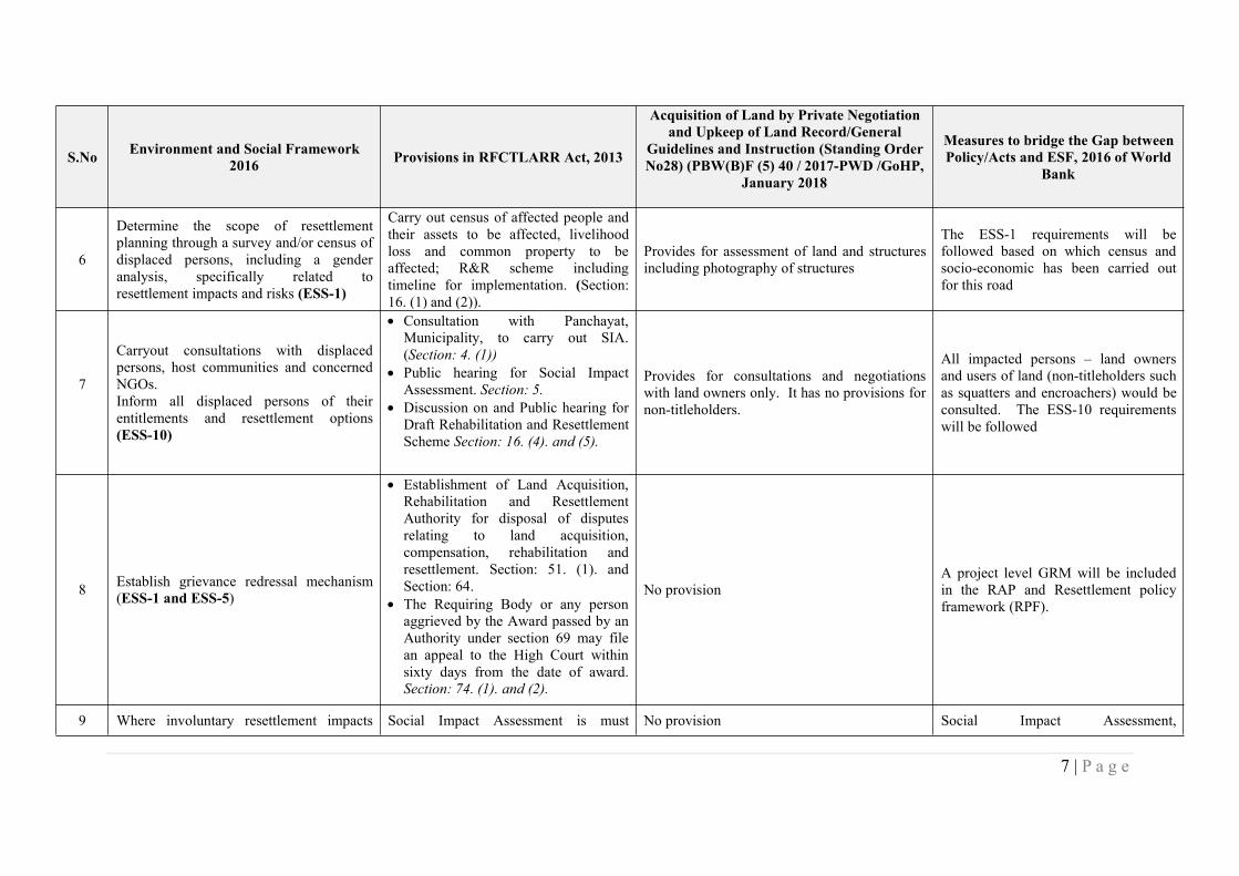
7 | P a g e
S.No Environment and Social Framework2016 Provisions in RFCTLARR Act, 2013
Acquisition of Land by Private Negotiationand Upkeep of Land Record/General
Guidelines and Instruction (Standing OrderNo28) (PBW(B)F (5) 40 / 2017-PWD /GoHP,
January 2018
Measures to bridge the Gap betweenPolicy/Acts and ESF, 2016 of World
Bank
6
Determine the scope of resettlementplanning through a survey and/or census ofdisplaced persons, including a genderanalysis, specifically related toresettlement impacts and risks (ESS-1)
Carry out census of affected people andtheir assets to be affected, livelihoodloss and common property to beaffected; R&R scheme includingtimeline for implementation. (Section:16. (1) and (2)).
Provides for assessment of land and structuresincluding photography of structures
The ESS-1 requirements will befollowed based on which census andsocio-economic has been carried outfor this road
7
Carryout consultations with displacedpersons, host communities and concernedNGOs.Inform all displaced persons of theirentitlements and resettlement options(ESS-10)
Consultation with Panchayat,Municipality, to carry out SIA.(Section: 4. (1))
Public hearing for Social ImpactAssessment. Section: 5.
Discussion on and Public hearing forDraft Rehabilitation and ResettlementScheme Section: 16. (4). and (5).
Provides for consultations and negotiationswith land owners only. It has no provisions fornon-titleholders.
All impacted persons – land ownersand users of land (non-titleholders suchas squatters and encroachers) would beconsulted. The ESS-10 requirementswill be followed
8 Establish grievance redressal mechanism(ESS-1 and ESS-5)
Establishment of Land Acquisition,Rehabilitation and ResettlementAuthority for disposal of disputesrelating to land acquisition,compensation, rehabilitation andresettlement. Section: 51. (1). andSection: 64.
The Requiring Body or any personaggrieved by the Award passed by anAuthority under section 69 may filean appeal to the High Court withinsixty days from the date of award.Section: 74. (1). and (2).
No provisionA project level GRM will be includedin the RAP and Resettlement policyframework (RPF).
9 Where involuntary resettlement impacts Social Impact Assessment is must No provision Social Impact Assessment,
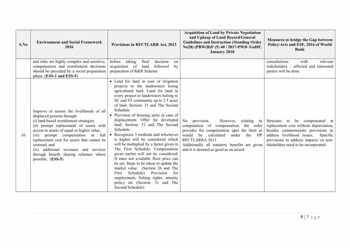
8 | P a g e
S.No Environment and Social Framework2016 Provisions in RFCTLARR Act, 2013
Acquisition of Land by Private Negotiationand Upkeep of Land Record/General
Guidelines and Instruction (Standing OrderNo28) (PBW(B)F (5) 40 / 2017-PWD /GoHP,
January 2018
Measures to bridge the Gap betweenPolicy/Acts and ESF, 2016 of World
Bank
and risks are highly complex and sensitive,compensation and resettlement decisionsshould be preceded by a social preparationphase. (ESS-1 and ESS-5)
before taking final decision onacquisition of land followed bypreparation of R&R Scheme
consultations with relevantstakeholders – affected and interestedparties will be done
10
Improve or restore the livelihoods of alldisplaced persons through(i) land-based resettlement strategies(ii) prompt replacement of assets withaccess to assets of equal or higher value,(iii) prompt compensation at fullreplacement cost for assets that cannot berestored, and(iv) additional revenues and servicesthrough benefit sharing schemes wherepossible. (ESS-5)
Land for land in case of irrigationprojects to the landowners losingagricultural land. Land for land inevery project to landowners belong toSC and ST community up to 2.5 acresof land. Section: 31 and The SecondSchedule
Provision of housing units in case ofdisplacement. Offer for developedland. Section: 31 and The SecondSchedule
Recognizes 3 methods and whicheveris higher will be considered whichwill be multiplied by a factor given inThe First Schedule. Compensationgiven earlier will not be considered;If rates not available floor price canbe set; Steps to be taken to update themarket value. (Section 26 and TheFirst Schedule) Provision foremployment, fishing rights, annuitypolicy etc (Section: 31 and TheSecond Schedule)
No provision. However, relating tocomputation of compensation, the orderprovides for compensation upto the limit aswould be calculated under the HPRFCTLARRA 2013Additionally all statutory benefits are givenand it is deemed as good as an award
Structure to be compensated atreplacement cost without depreciation,besides commensurate provisions toaddress livelihood issues. Specificprovisions to address impacts on non-titleholders need to be incorporated
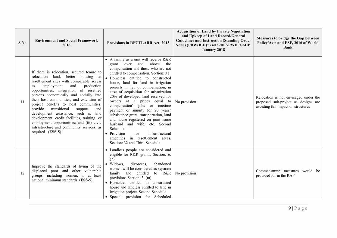
9 | P a g e
S.No Environment and Social Framework2016 Provisions in RFCTLARR Act, 2013
Acquisition of Land by Private Negotiationand Upkeep of Land Record/General
Guidelines and Instruction (Standing OrderNo28) (PBW(B)F (5) 40 / 2017-PWD /GoHP,
January 2018
Measures to bridge the Gap betweenPolicy/Acts and ESF, 2016 of World
Bank
11
If there is relocation, secured tenure torelocation land, better housing atresettlement sites with comparable accessto employment and productionopportunities, integration of resettledpersons economically and socially intotheir host communities, and extension ofproject benefits to host communities;provide transitional support anddevelopment assistance, such as landdevelopment, credit facilities, training, oremployment opportunities; and (iii) civicinfrastructure and community services, asrequired. (ESS-5)
A family as a unit will receive R&Rgrant over and above thecompensation and those who are notentitled to compensation. Section: 31
Homeless entitled to constructedhouse, land for land in irrigationprojects in lieu of compensation, incase of acquisition for urbanization20% of developed land reserved forowners at a prices equal tocompensation’ jobs or onetimepayment or annuity for 20 years’subsistence grant, transportation, landand house registered on joint namehusband and wife, etc. SecondSchedule
Provision for infrastructuralamenities in resettlement areas.Section: 32 and Third Schedule
No provisionRelocation is not envisaged under theproposed sub-project as designs areavoiding full impact on structures
12
Improve the standards of living of thedisplaced poor and other vulnerablegroups, including women, to at leastnational minimum standards. (ESS-5)
Landless people are considered andeligible for R&R grants. Section:16.(2).
Widows, divorcees, abandonedwomen will be considered as separatefamily and entitled to R&Rprovisions Section: 3. (m)
Homeless entitled to constructedhouse and landless entitled to land inirrigation project. Second Schedule
Special provision for Scheduled
No provision Commensurate measures would beprovided for in the RAP
10 | P a g e
S.No Environment and Social Framework2016 Provisions in RFCTLARR Act, 2013
Acquisition of Land by Private Negotiationand Upkeep of Land Record/General
Guidelines and Instruction (Standing OrderNo28) (PBW(B)F (5) 40 / 2017-PWD /GoHP,
January 2018
Measures to bridge the Gap betweenPolicy/Acts and ESF, 2016 of World
Bank
Caste/Scheduled Tribe; Section: 41. Additional provisions for SC&ST forland for land in irrigation projects,additional sum over and above thesubsistence grant. Second Schedule
13
If land acquisition is through negotiatedsettlement, ensure that those people whoenter into negotiated settlements willmaintain the same or better income andlivelihood status. (ESS-5)
R&R entitlements apply in case of landacquired/purchased for PPP projects andfor Private Companies. Section: 2. (2),and 46.
No specific provision
Provisions as applied in theRFTCLARR Act will be used andadditional measures where requiredwill be used
14
Ensure that displaced persons withouttitles to land or any recognizable legalrights to land are eligible for resettlementassistance and compensation for loss ofnon-land assets. (ESS-5)
The Act recognises: Section: 3 (c) a family which does not own anyland but belong to the family of anagricultural labourer, tenant,sharecroppers, or artisans or workingin affected area for three years priorto the acquisition of the land
the Scheduled Tribes and othertraditional forest dweller who havelost any of their forest rights
family whose primary source oflivelihood for three years prior to theacquisition of the land is dependenton forests or water bodies andincludes gatherers of forest produce,hunters, fisher folk and boatmen
a family residing or earninglivelihoods on any land in the urban
No specific provision
Under this project, provision would bemade to that in the case of landacquisition, the date of publication ofpreliminary notification for acquisitionunder Section 4.1 of the LAA will betreated as the cut-off date for titleholders, and for non-titleholders suchas squatters the start date of the projectcensus survey.
11 | P a g e
S.No Environment and Social Framework2016 Provisions in RFCTLARR Act, 2013
Acquisition of Land by Private Negotiationand Upkeep of Land Record/General
Guidelines and Instruction (Standing OrderNo28) (PBW(B)F (5) 40 / 2017-PWD /GoHP,
January 2018
Measures to bridge the Gap betweenPolicy/Acts and ESF, 2016 of World
Bank
areas for preceding three years ormore prior to the acquisition of theland
15
Prepare a resettlement plan / indigenouspeoples plan elaborating on displacedpersons’ entitlements, the income andlivelihood restoration strategy, institutionalarrangements, monitoring and reportingframework, budget, and time-boundimplementation schedule. (ESS-5 andESS-7)
Preparation of Rehabilitation andResettlement Scheme includingtimeline for implementation.Section: 16. (1) and (2).
Separate development plans to beprepared. Section 41
No specific provision For this corridor, RAP will beprepared. IPDP or TDP is not required.
16
Disclose a draft resettlement plan,including documentation of theconsultation process in a timely manner,before project appraisal, in an accessibleplace and a form and language(s)understandable to displaced persons andother stakeholders. Disclose the finalresettlement plan and its updates todisplaced persons and other stakeholders.(ESS-10)
The draft Rehabilitation andResettlement Scheme prepared shallbe made known locally by widepublicity in the affected area anddiscussed in the concerned GramSabhas or Municipalities and inwebsite. Section: 16. (4)
The approved Rehabilitation andResettlement Scheme to be madeavailable in the local language to thePanchayat, Municipality orMunicipal Corporation and inwebsite. Section: 18.
No specific provision
In addition to the publishing of theapproved resettlement plan, the RAPand RPF includes provision fordisclosure of the various documentspertaining to RAP implementation inaccordance with StakeholderEngagement Plan (SEP)
17
Include the full costs of measures proposedin the resettlement plan and indigenouspeoples plan as part of project’s costs andbenefits. For a project with significantinvoluntary resettlement impacts and / orindigenous peoples plan, consider
The requiring body shall bear the cost ofacquisition covering compensation andR&R cost. Section: 19. (2) and Section95. (1)
No specific provision None
12 | P a g e
S.No Environment and Social Framework2016 Provisions in RFCTLARR Act, 2013
Acquisition of Land by Private Negotiationand Upkeep of Land Record/General
Guidelines and Instruction (Standing OrderNo28) (PBW(B)F (5) 40 / 2017-PWD /GoHP,
January 2018
Measures to bridge the Gap betweenPolicy/Acts and ESF, 2016 of World
Bank
implementing the involuntary resettlementcomponent of the project as a stand-aloneoperation. (ESS-5)
18
Pay compensation and provide otherresettlement entitlements before physicalor economic displacement. Implement theresettlement plan under close supervisionthroughout project implementation. (ESS-5)
The Collector shall take possessionof land after ensuring that fullpayment of compensation as well asrehabilitation and resettlemententitlements are paid within threemonths for the compensation and aperiod of six months for themonetary part of rehabilitation andresettlement entitlements. Section:38. (1)
The Collector shall be responsible
for ensuring that the rehabilitationand resettlement process iscompleted in all its aspects beforedisplacing the affected families.Section: 38. (2)
No specific provision None
13 | P a g e
S.No Environment and Social Framework2016 Provisions in RFCTLARR Act, 2013
Acquisition of Land by Private Negotiationand Upkeep of Land Record/General
Guidelines and Instruction (Standing OrderNo28) (PBW(B)F (5) 40 / 2017-PWD /GoHP,
January 2018
Measures to bridge the Gap betweenPolicy/Acts and ESF, 2016 of World
Bank
19
Monitor and assess resettlement outcomes,their impacts on the standards of living ofdisplaced persons, and whether theobjectives of the resettlement plan havebeen achieved by taking into account thebaseline conditions and the results ofresettlement monitoring. Disclosemonitoring reports. (ESS-5)
The Rehabilitation and ResettlementCommittee, to monitor and reviewthe progress of implementation ofthe Rehabilitation and Resettlementscheme and to carry out post-implementation social audits inconsultation with the Gram Sabha inrural areas and municipality in urbanareas. Section: 45. (1)
Set up National and State levelMonitoring Committee to review andmonitor progress. Section 48-50
The ESS-5 requirements will befollowed.
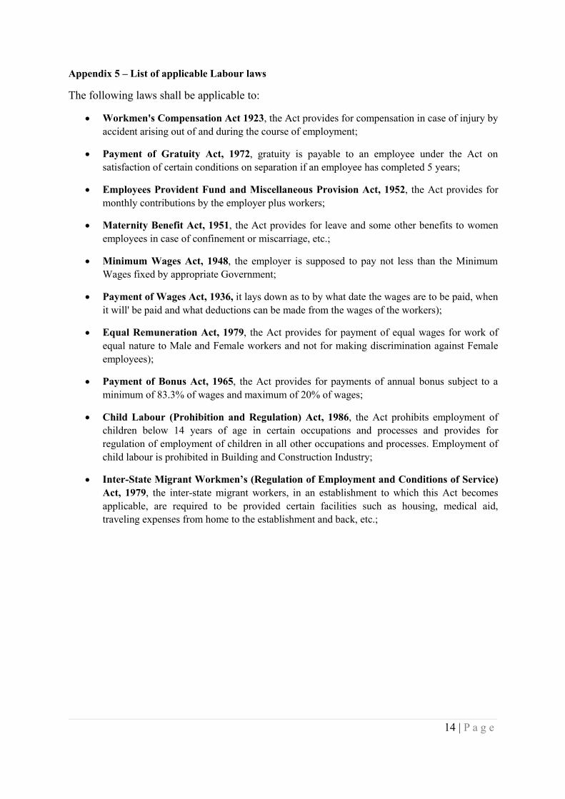
14 | P a g e
Appendix 5 – List of applicable Labour laws
The following laws shall be applicable to:
Workmen's Compensation Act 1923, the Act provides for compensation in case of injury byaccident arising out of and during the course of employment;
Payment of Gratuity Act, 1972, gratuity is payable to an employee under the Act onsatisfaction of certain conditions on separation if an employee has completed 5 years;
Employees Provident Fund and Miscellaneous Provision Act, 1952, the Act provides formonthly contributions by the employer plus workers;
Maternity Benefit Act, 1951, the Act provides for leave and some other benefits to womenemployees in case of confinement or miscarriage, etc.;
Minimum Wages Act, 1948, the employer is supposed to pay not less than the MinimumWages fixed by appropriate Government;
Payment of Wages Act, 1936, it lays down as to by what date the wages are to be paid, whenit will' be paid and what deductions can be made from the wages of the workers);
Equal Remuneration Act, 1979, the Act provides for payment of equal wages for work ofequal nature to Male and Female workers and not for making discrimination against Femaleemployees);
Payment of Bonus Act, 1965, the Act provides for payments of annual bonus subject to aminimum of 83.3% of wages and maximum of 20% of wages;
Child Labour (Prohibition and Regulation) Act, 1986, the Act prohibits employment ofchildren below 14 years of age in certain occupations and processes and provides forregulation of employment of children in all other occupations and processes. Employment ofchild labour is prohibited in Building and Construction Industry;
Inter-State Migrant Workmen’s (Regulation of Employment and Conditions of Service)Act, 1979, the inter-state migrant workers, in an establishment to which this Act becomesapplicable, are required to be provided certain facilities such as housing, medical aid,traveling expenses from home to the establishment and back, etc.;
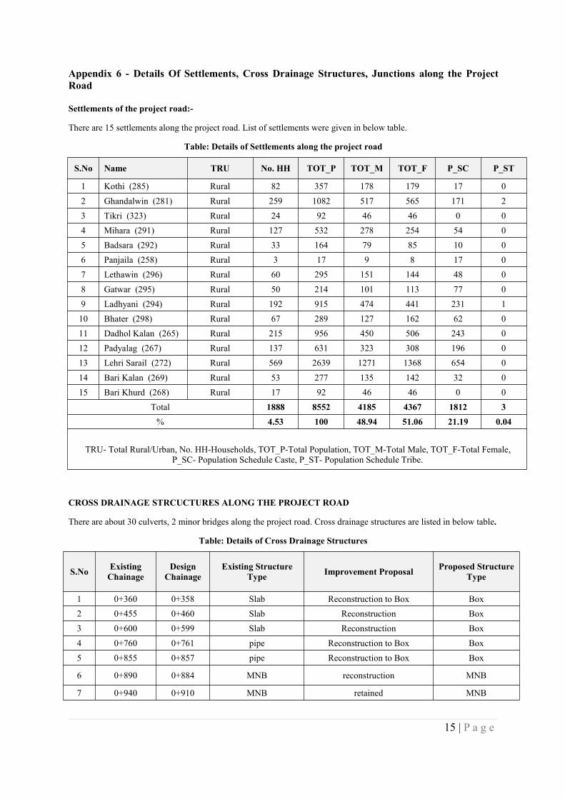
15 | P a g e
Appendix 6 - Details Of Settlements, Cross Drainage Structures, Junctions along the ProjectRoad
Settlements of the project road:-
There are 15 settlements along the project road. List of settlements were given in below table.
Table: Details of Settlements along the project road
S.No Name TRU No. HH TOT_P TOT_M TOT_F P_SC P_ST
1 Kothi (285) Rural 82 357 178 179 17 02 Ghandalwin (281) Rural 259 1082 517 565 171 23 Tikri (323) Rural 24 92 46 46 0 04 Mihara (291) Rural 127 532 278 254 54 05 Badsara (292) Rural 33 164 79 85 10 06 Panjaila (258) Rural 3 17 9 8 17 07 Lethawin (296) Rural 60 295 151 144 48 08 Gatwar (295) Rural 50 214 101 113 77 09 Ladhyani (294) Rural 192 915 474 441 231 110 Bhater (298) Rural 67 289 127 162 62 011 Dadhol Kalan (265) Rural 215 956 450 506 243 012 Padyalag (267) Rural 137 631 323 308 196 013 Lehri Sarail (272) Rural 569 2639 1271 1368 654 014 Bari Kalan (269) Rural 53 277 135 142 32 015 Bari Khurd (268) Rural 17 92 46 46 0 0
Total 1888 8552 4185 4367 1812 3% 4.53 100 48.94 51.06 21.19 0.04
TRU- Total Rural/Urban, No. HH-Households, TOT_P-Total Population, TOT_M-Total Male, TOT_F-Total Female,P_SC- Population Schedule Caste, P_ST- Population Schedule Tribe.
CROSS DRAINAGE STRCUCTURES ALONG THE PROJECT ROAD
There are about 30 culverts, 2 minor bridges along the project road. Cross drainage structures are listed in below table.
Table: Details of Cross Drainage Structures
S.No ExistingChainage
DesignChainage
Existing StructureType Improvement Proposal Proposed Structure
Type
1 0+360 0+358 Slab Reconstruction to Box Box2 0+455 0+460 Slab Reconstruction Box3 0+600 0+599 Slab Reconstruction Box4 0+760 0+761 pipe Reconstruction to Box Box5 0+855 0+857 pipe Reconstruction to Box Box
6 0+890 0+884 MNB reconstruction MNB
7 0+940 0+910 MNB retained MNB
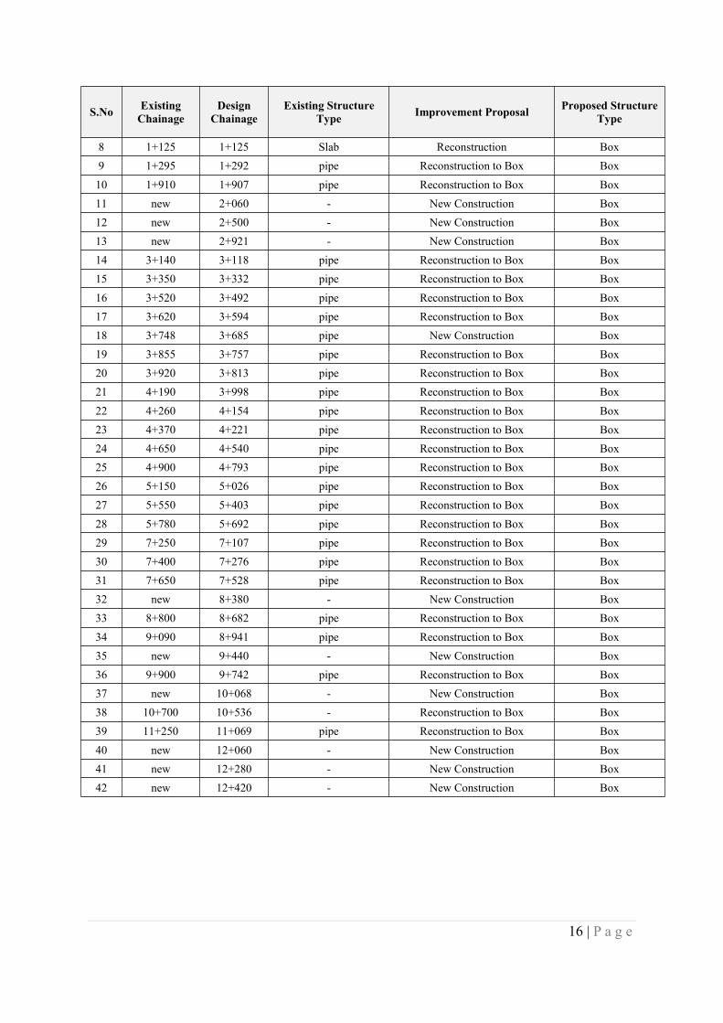
16 | P a g e
S.No ExistingChainage
DesignChainage
Existing StructureType Improvement Proposal Proposed Structure
Type
8 1+125 1+125 Slab Reconstruction Box9 1+295 1+292 pipe Reconstruction to Box Box10 1+910 1+907 pipe Reconstruction to Box Box11 new 2+060 - New Construction Box12 new 2+500 - New Construction Box13 new 2+921 - New Construction Box14 3+140 3+118 pipe Reconstruction to Box Box15 3+350 3+332 pipe Reconstruction to Box Box16 3+520 3+492 pipe Reconstruction to Box Box17 3+620 3+594 pipe Reconstruction to Box Box18 3+748 3+685 pipe New Construction Box19 3+855 3+757 pipe Reconstruction to Box Box20 3+920 3+813 pipe Reconstruction to Box Box21 4+190 3+998 pipe Reconstruction to Box Box22 4+260 4+154 pipe Reconstruction to Box Box23 4+370 4+221 pipe Reconstruction to Box Box24 4+650 4+540 pipe Reconstruction to Box Box25 4+900 4+793 pipe Reconstruction to Box Box26 5+150 5+026 pipe Reconstruction to Box Box27 5+550 5+403 pipe Reconstruction to Box Box28 5+780 5+692 pipe Reconstruction to Box Box29 7+250 7+107 pipe Reconstruction to Box Box30 7+400 7+276 pipe Reconstruction to Box Box31 7+650 7+528 pipe Reconstruction to Box Box32 new 8+380 - New Construction Box33 8+800 8+682 pipe Reconstruction to Box Box34 9+090 8+941 pipe Reconstruction to Box Box35 new 9+440 - New Construction Box36 9+900 9+742 pipe Reconstruction to Box Box37 new 10+068 - New Construction Box38 10+700 10+536 - Reconstruction to Box Box39 11+250 11+069 pipe Reconstruction to Box Box40 new 12+060 - New Construction Box41 new 12+280 - New Construction Box42 new 12+420 - New Construction Box

17 | P a g e
Appendix 7 – Plan & Profile of Project Road

18 | P a g e
Appendix 8 – Strip Plan of Project Road Showing Existing Features
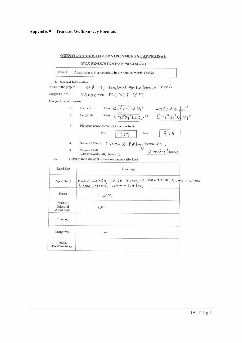
19 | P a g e
Appendix 9 – Transect Walk Survey Formats
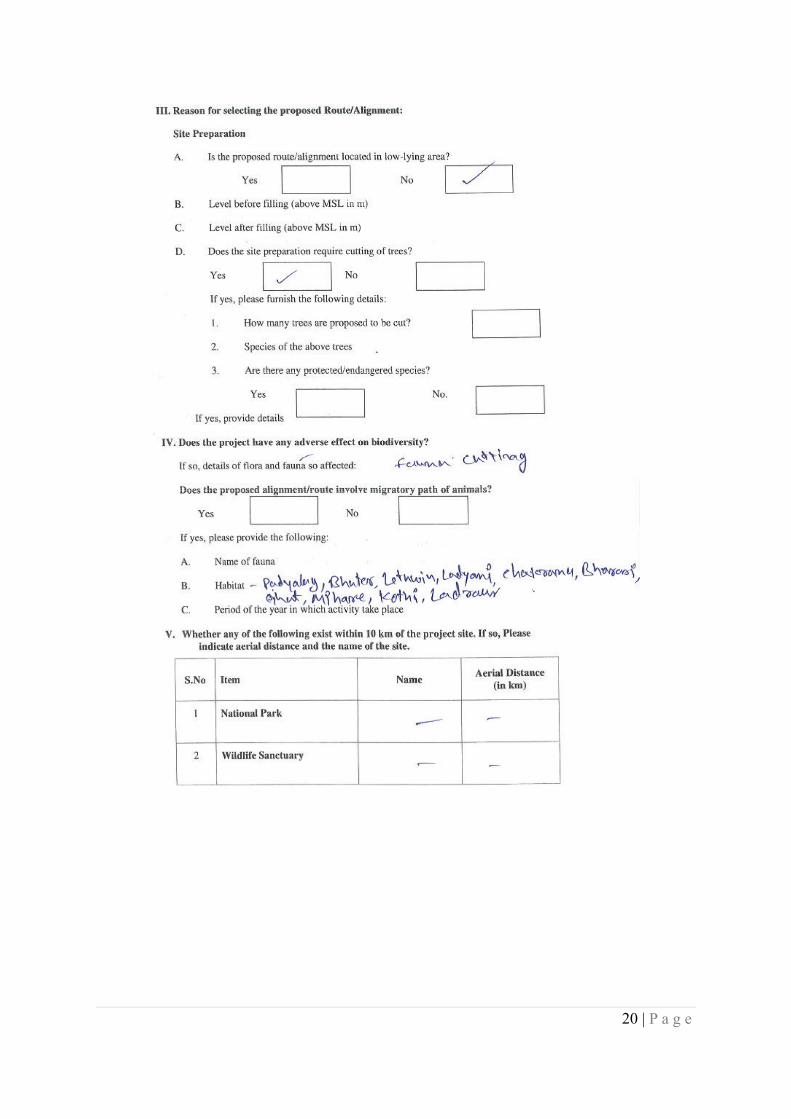
20 | P a g e
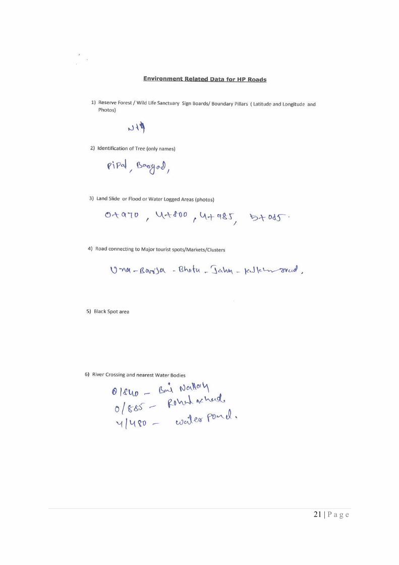
21 | P a g e
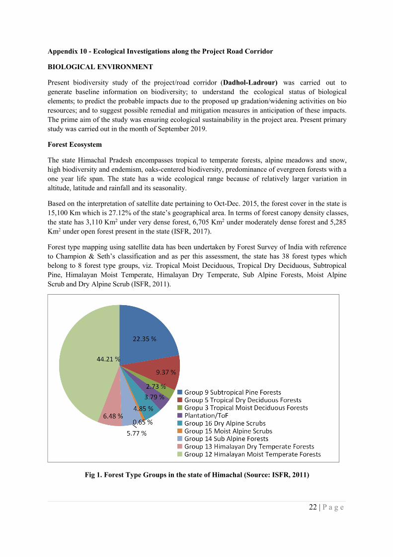
22 | P a g e
Appendix 10 - Ecological Investigations along the Project Road Corridor
BIOLOGICAL ENVIRONMENT
Present biodiversity study of the project/road corridor (Dadhol-Ladrour) was carried out togenerate baseline information on biodiversity; to understand the ecological status of biologicalelements; to predict the probable impacts due to the proposed up gradation/widening activities on bioresources; and to suggest possible remedial and mitigation measures in anticipation of these impacts.The prime aim of the study was ensuring ecological sustainability in the project area. Present primarystudy was carried out in the month of September 2019.
Forest Ecosystem
The state Himachal Pradesh encompasses tropical to temperate forests, alpine meadows and snow,high biodiversity and endemism, oaks-centered biodiversity, predominance of evergreen forests with aone year life span. The state has a wide ecological range because of relatively larger variation inaltitude, latitude and rainfall and its seasonality.
Based on the interpretation of satellite date pertaining to Oct-Dec. 2015, the forest cover in the state is15,100 Km which is 27.12% of the state’s geographical area. In terms of forest canopy density classes,the state has 3,110 Km2 under very dense forest, 6,705 Km2 under moderately dense forest and 5,285Km2 under open forest present in the state (ISFR, 2017).
Forest type mapping using satellite data has been undertaken by Forest Survey of India with referenceto Champion & Seth’s classification and as per this assessment, the state has 38 forest types whichbelong to 8 forest type groups, viz. Tropical Moist Deciduous, Tropical Dry Deciduous, SubtropicalPine, Himalayan Moist Temperate, Himalayan Dry Temperate, Sub Alpine Forests, Moist AlpineScrub and Dry Alpine Scrub (ISFR, 2011).
Fig 1. Forest Type Groups in the state of Himachal (Source: ISFR, 2011)
23 | P a g e
The Dadhol-Ladhror road corridor falls in the Bilaspur District of the Himachal Pradesh. DistrictBilaspur comprised with a forest cover of 32.13% (375 Km2) is one of the dense forested districtshaving rich floral and faunal diversity. As far as the forest classification on the basis of canopydensity classes, there is a total of 23 Km2 under very dense forest, 161 Km2 under moderatelydense forest and 191 Km2 under open forest present in the district.
There is no forest area falls within the present road corridor and Chhanjiar forest is the onlyprominent Forest recorded 2 km away from road corridor near Dadhol. Chhanjiar forest is a sub-tropical pine forest that comes under the Bharari Range of Forest Division Bilaspur. The naturalvegetation along road corridor is limited to scrub crop of Khair-Sissoo along with bamboo clumsat some places. The whole road corridor has a thin line of natural vegetation both sides. Besidenatural vegetation, prominent agro-forestry practices are also present in the project zone.
Agro-forestry Ecosystem
Agro-forestry ecosystems are the only biodiverse areas along the project corridor that are illustratedby various seasonal agriculture and horticulture crops. Many agroforestry tree species like Grewiaoptiva, Celtis australis, and many Ficus spps. are present in cropland areas. There is a very goodagriculture belt all along the project area. Wheat and mustard are the main crops whereas Maize andSpices are being cultivated in the area as cash crops.
Aquatic Ecosystem
There is no prominent aquatic ecosystem present in the study area. Govind Sagar Dam is the nearestwater body in the region which is about 8-10 km away from present project corridor.
Floral Diversity
The proposed widening zone of the project comprised with a luxuriant growth of invasive species likeAgeratum conyzoides, Eupatorium adenophorum, Parthenium hysterophorus and Lantana camaraalong with some scattered tree and shrub species. The vegetation sampling has been done adjacent toproposed widening zone of the project to enumerate species composition and understand standstructure.
Methodology for Vegetation Study
Although there is no notified forest area present in the road corridor, but a strip of natural vegetationis present both sides of road. A random sampling approach has been followed to capture the naturalvegetation in the study area.
Table 1. Details of Vegetation Sampling Locations
Sl. No. Sampling Location Lat-Long
1. Near Ghandalvi Village 31.57N, 76.63E
2. Near Ladhiyani Village 31.51N, 76.74E
24 | P a g e
The size of sampling unit (quadrat) has been determined by using the species-area-curve method.Quadrats of 10m x 10m were laid out to examine the tree layer in the direct impact zone as well asbuffer zone. Within these sample plots, two 3m x 2m plots were laid out randomly for sampling shrublayer. To collect information on ground layer and other herbaceous species, five quadrats of 1m x 1msize were laid out within the tree quadrats. Species-wise counting of all individuals has been carriedout in each quadrat along with their CBH (Circumference at Breast Height) or DRC (Diameter at RootCollar).
Data analysis: The structural aspect of vegetation such as frequency, density, abundance anddominance (basal area) were determined following Mishra (1968). Importance Value Index (IVI) wascomputed for all the species by adding the relative values of frequency, density and dominancefollowing Curtis & McIntosh (1950). Species distribution was calculated by Abundance to Frequencyratio following Curtis and Cottom (1956). Species diversity was computed using Shannon-WeaverIndex (Shannon and Wiener 1949). H′ = Σ (ni/N) × ln (ni/N) Where, H′ = Shannon’s index of speciesdiversity ni = Total number of individuals of one species N = Total number of individuals of all thespecies in one stand.
Results
Taxonomic Diversity & Species Composition
A total of 60 species of Angiosperm and one species of Pteridophyta has been recorded in primarysampling carried out for community structure in the study area. Presence of plant species is presentedin Table 2&3.
Table 2. Taxonomic diversity recorded from the study area
Angiosperm 60
Pteridophytes 01
Table 3. List of plant species recorded in primary vegetation sampling
Sl. No. Species Taxonomic Group Status(Invasive) Medicinal/NTFP
Threatened(CAMP,2010)
1 Acacia catechu Angiosperm Yes
2 Adhatoda vasica Angiosperm Yes
3 Agave americana Angiosperm Yes
4 Ageratum conyzoides Angiosperm Yes
5 Albizia chinensis Angiosperm
25 | P a g e
Sl. No. Species Taxonomic Group Status(Invasive) Medicinal/NTFP
Threatened(CAMP,2010)
6 Amaranthus viridis Angiosperm
7 Arundinella bengalensis Angiosperm
8 Asparagus adscendens Angiosperm Yes
9 Barleria cristata Angiosperm Yes
10 Bidens biternata Angiosperm
11 Boehmeria platyphylla Angiosperm
12 Bombax ceiba Angiosperm Yes
13 Carissa opaca Angiosperm
14 Cassia fistula Angiosperm Yes
15 Cassia tora Angiosperm
16 Cissampelos pareira Angiosperm
17 Clematis gouriana Angiosperm
18 Colebrookea oppositifolia Angiosperm
19 Commelina benghalensis Angiosperm
20 Cynodon dactylon Angiosperm
21 Dalbergia sissoo Angiosperm
22 Debregeasia longifolia Angiosperm
23 Dendrocalamus strictus Angiosperm Yes
24 Desmodium elegans Angiosperm
25 Dioscorea bulbifera Angiosperm
26 | P a g e
Sl. No. Species Taxonomic Group Status(Invasive) Medicinal/NTFP
Threatened(CAMP,2010)
26 Emblica officinalis Angiosperm Yes
27 Eupatorium adenophorum Angiosperm Yes
28 Euphorbia hirta Angiosperm
29 Ficus bengalensis Angiosperm
30 Ficus roxburghii Angiosperm
31 Fragaria nubicola Angiosperm
32 Gerardiana diversifolia Angiosperm
33 Grawia optiva Angiosperm
34 Ipomea carnea Angiosperm
35 Lantana Camara Angiosperm Yes
36 Morus alba Angiosperm
37 Murraya koenigii Angiosperm Yes
38 Oroxylum indicum Angiosperm Yes
39 Oxalis corniculata Angiosperm
40 Parthenium hysterophorus Angiosperm Yes
41 Phyllanthus niruri Angiosperm
42 Pilea scripta Angiosperm
43 Pilea umbrosa Angiosperm
44 Saccharum spontaneum Angiosperm
45 Sida cordata Angiosperm
27 | P a g e
Sl. No. Species Taxonomic Group Status(Invasive) Medicinal/NTFP
Threatened(CAMP,2010)
46 Smilax aspera Angiosperm
47 Solanum nigrum Angiosperm Yes
48 Stellaria media Angiosperm
49 Syzygium cumini Angiosperm
50 Thalictrum foliolosum Angiosperm
51 Thysanolaena maxima Angiosperm
52 Tinospora cordifolia Angiosperm Yes
53 Toona ciliata Angiosperm
54 Tridax procumbens Angiosperm
55 Urtica dioca Angiosperm
56 Vernonia cinerea Angiosperm
57 Vitex negundo Angiosperm
58 Woodfordia fruticosa Angiosperm
59 Xanthium indicum Angiosperm
60 Ziziphus sp Angiosperm
61 Adiantum Caudatum Pteridophyta
Dominant Plant species & Stand Density
Acacia catechu, Dalbergia sissoo, Morus alba, and Grawia optiva found regularly distributed in treelayer throughout project corridor. Dominant shrub species recorded from study area were Murrayakoenigii, Adhatoda vasica, Lantana camara and Carissa opaca. A predominance of herb species likeAgeratum conyzoides, Parthanium hysterophoros, Bidens biternata and Tridax procumbens wasrecorded in the study area along with various grass species. List of dominant vegetation at differentsampling locations is given below:
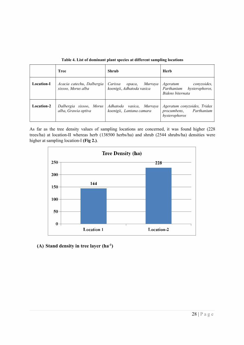
28 | P a g e
Table 4. List of dominant plant species at different sampling locations
Tree Shrub Herb
Location-I Acacia catechu, Dalbergiasissoo, Morus alba
Carissa opaca, Murrayakoenigii, Adhatoda vasica
Ageratum conyzoides,Parthanium hysterophoros,Bidens biternata
Location-2 Dalbergia sissoo, Morusalba, Grawia optiva
Adhatoda vasica, Murrayakoenigii, Lantana camara
Ageratum conyzoides, Tridaxprocumbens, Parthaniumhysterophoros
As far as the tree density values of sampling locations are concerned, it was found higher (228trees/ha) at location-II whereas herb (138500 herbs/ha) and shrub (2544 shrubs/ha) densities werehigher at sampling location-I (Fig 2.).
(A) Stand density in tree layer (ha-1)
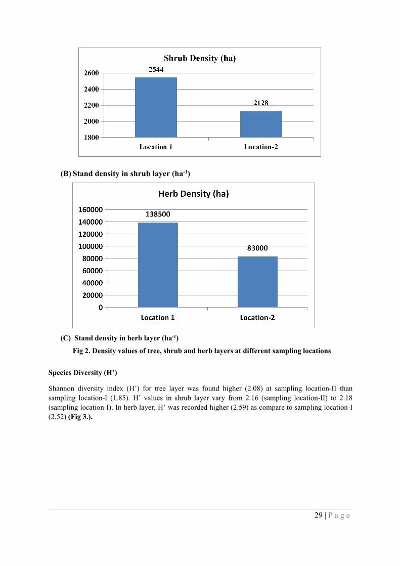
29 | P a g e
(B) Stand density in shrub layer (ha-1)
(C) Stand density in herb layer (ha-1)
Fig 2. Density values of tree, shrub and herb layers at different sampling locations
Species Diversity (H’)
Shannon diversity index (H’) for tree layer was found higher (2.08) at sampling location-II thansampling location-I (1.85). H’ values in shrub layer vary from 2.16 (sampling location-II) to 2.18(sampling location-I). In herb layer, H’ was recorded higher (2.59) as compare to sampling location-I(2.52) (Fig 3.).
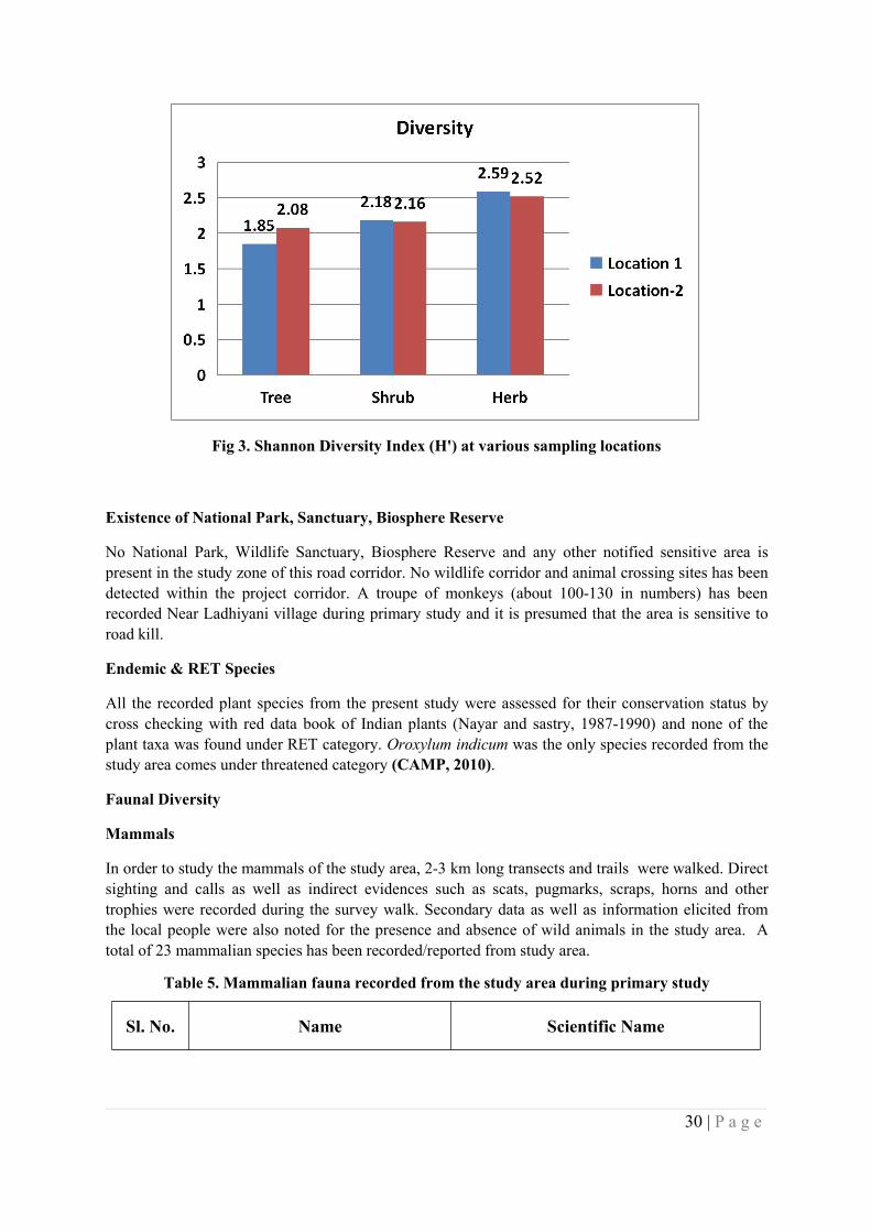
30 | P a g e
Fig 3. Shannon Diversity Index (H') at various sampling locations
Existence of National Park, Sanctuary, Biosphere Reserve
No National Park, Wildlife Sanctuary, Biosphere Reserve and any other notified sensitive area ispresent in the study zone of this road corridor. No wildlife corridor and animal crossing sites has beendetected within the project corridor. A troupe of monkeys (about 100-130 in numbers) has beenrecorded Near Ladhiyani village during primary study and it is presumed that the area is sensitive toroad kill.
Endemic & RET Species
All the recorded plant species from the present study were assessed for their conservation status bycross checking with red data book of Indian plants (Nayar and sastry, 1987-1990) and none of theplant taxa was found under RET category. Oroxylum indicum was the only species recorded from thestudy area comes under threatened category (CAMP, 2010).
Faunal Diversity
Mammals
In order to study the mammals of the study area, 2-3 km long transects and trails were walked. Directsighting and calls as well as indirect evidences such as scats, pugmarks, scraps, horns and othertrophies were recorded during the survey walk. Secondary data as well as information elicited fromthe local people were also noted for the presence and absence of wild animals in the study area. Atotal of 23 mammalian species has been recorded/reported from study area.
Table 5. Mammalian fauna recorded from the study area during primary study
Sl. No. Name Scientific Name
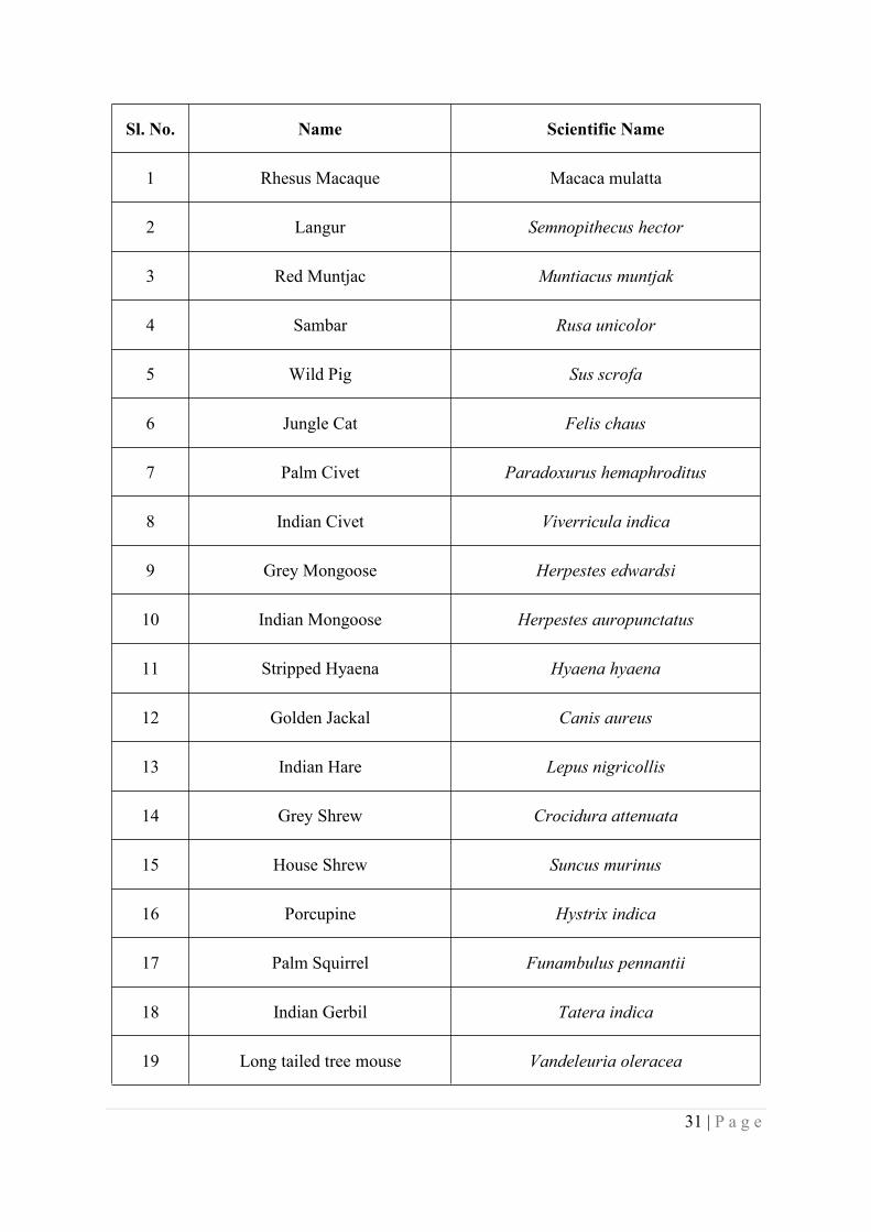
31 | P a g e
Sl. No. Name Scientific Name
1 Rhesus Macaque Macaca mulatta
2 Langur Semnopithecus hector
3 Red Muntjac Muntiacus muntjak
4 Sambar Rusa unicolor
5 Wild Pig Sus scrofa
6 Jungle Cat Felis chaus
7 Palm Civet Paradoxurus hemaphroditus
8 Indian Civet Viverricula indica
9 Grey Mongoose Herpestes edwardsi
10 Indian Mongoose Herpestes auropunctatus
11 Stripped Hyaena Hyaena hyaena
12 Golden Jackal Canis aureus
13 Indian Hare Lepus nigricollis
14 Grey Shrew Crocidura attenuata
15 House Shrew Suncus murinus
16 Porcupine Hystrix indica
17 Palm Squirrel Funambulus pennantii
18 Indian Gerbil Tatera indica
19 Long tailed tree mouse Vandeleuria oleracea
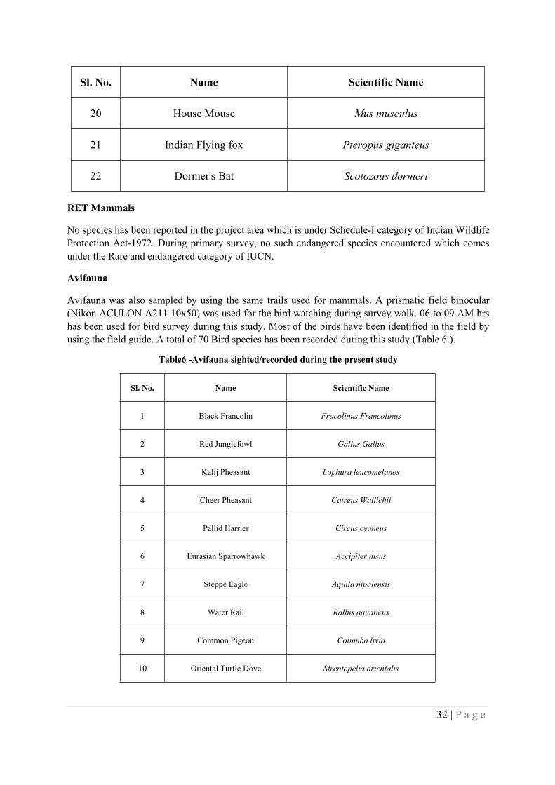
32 | P a g e
Sl. No. Name Scientific Name
20 House Mouse Mus musculus
21 Indian Flying fox Pteropus giganteus
22 Dormer's Bat Scotozous dormeri
RET Mammals
No species has been reported in the project area which is under Schedule-I category of Indian WildlifeProtection Act-1972. During primary survey, no such endangered species encountered which comesunder the Rare and endangered category of IUCN.
Avifauna
Avifauna was also sampled by using the same trails used for mammals. A prismatic field binocular(Nikon ACULON A211 10x50) was used for the bird watching during survey walk. 06 to 09 AM hrshas been used for bird survey during this study. Most of the birds have been identified in the field byusing the field guide. A total of 70 Bird species has been recorded during this study (Table 6.).
Table6 -Avifauna sighted/recorded during the present study
Sl. No. Name Scientific Name
1 Black Francolin Fracolinus Francolinus
2 Red Junglefowl Gallus Gallus
3 Kalij Pheasant Lophura leucomelanos
4 Cheer Pheasant Catreus Wallichii
5 Pallid Harrier Circus cyaneus
6 Eurasian Sparrowhawk Accipiter nisus
7 Steppe Eagle Aquila nipalensis
8 Water Rail Rallus aquaticus
9 Common Pigeon Columba livia
10 Oriental Turtle Dove Streptopelia orientalis
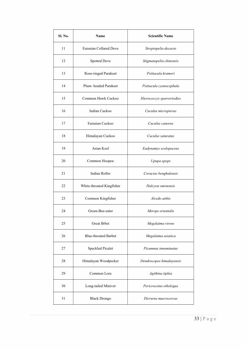
33 | P a g e
Sl. No. Name Scientific Name
11 Eurasian Collared Dove Streptopelia decacto
12 Spotted Dove Stigmatopelia chinensis
13 Rose-ringed Parakeet Psittacula krameri
14 Plum- headed Parakeet Psittacula cyanocephala
15 Common Hawk Cuckoo Hierococcyx sparveriodies
16 Indian Cuckoo Cuculus micropterus
17 Eurasian Cuckoo Cuculus canorus
18 Himalayan Cuckoo Cuculus saturatus
19 Asian Koel Eudynamys scolopaceus
20 Common Hoopoe Upupa epops
21 Indian Roller Coracias benghalensis
22 White-throated Kingfisher Halcyon smrnensis
23 Common Kingfisher Alcedo atthis
24 Green-Bee-eater Merops orientalis
25 Great Brbet Megalaima virens
26 Blue-throated Barbet Megalaima asiatica
27 Speckled Piculet Picumnus innominatus
28 Himalayan Woodpecker Dendrocopos himalayensis
29 Common Lora Agithina tiphia
30 Long-tailed Minivet Pericrocotus ethologus
31 Black Drongo Dicrurus macrocercus
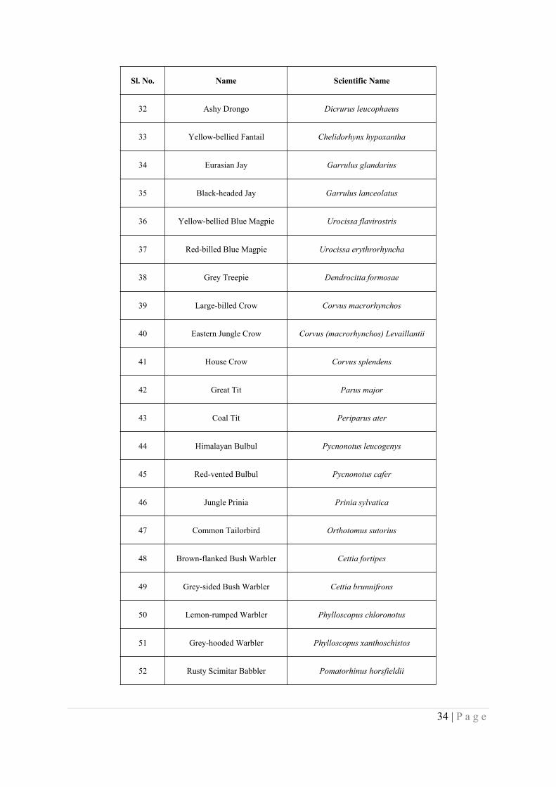
34 | P a g e
Sl. No. Name Scientific Name
32 Ashy Drongo Dicrurus leucophaeus
33 Yellow-bellied Fantail Chelidorhynx hypoxantha
34 Eurasian Jay Garrulus glandarius
35 Black-headed Jay Garrulus lanceolatus
36 Yellow-bellied Blue Magpie Urocissa flavirostris
37 Red-billed Blue Magpie Urocissa erythrorhyncha
38 Grey Treepie Dendrocitta formosae
39 Large-billed Crow Corvus macrorhynchos
40 Eastern Jungle Crow Corvus (macrorhynchos) Levaillantii
41 House Crow Corvus splendens
42 Great Tit Parus major
43 Coal Tit Periparus ater
44 Himalayan Bulbul Pycnonotus leucogenys
45 Red-vented Bulbul Pycnonotus cafer
46 Jungle Prinia Prinia sylvatica
47 Common Tailorbird Orthotomus sutorius
48 Brown-flanked Bush Warbler Cettia fortipes
49 Grey-sided Bush Warbler Cettia brunnifrons
50 Lemon-rumped Warbler Phylloscopus chloronotus
51 Grey-hooded Warbler Phylloscopus xanthoschistos
52 Rusty Scimitar Babbler Pomatorhinus horsfieldii
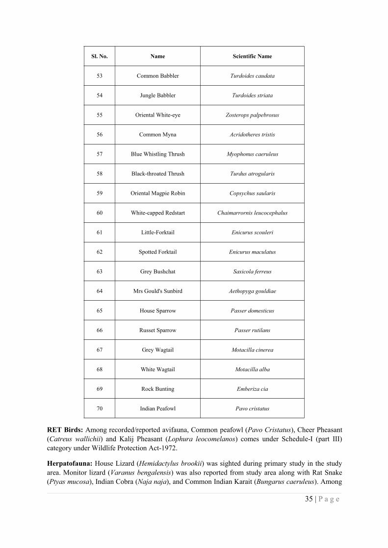
35 | P a g e
Sl. No. Name Scientific Name
53 Common Babbler Turdoides caudata
54 Jungle Babbler Turdoides striata
55 Oriental White-eye Zosterops palpebrosus
56 Common Myna Acridotheres tristis
57 Blue Whistling Thrush Myophonus caeruleus
58 Black-throated Thrush Turdus atrogularis
59 Oriental Magpie Robin Copsychus saularis
60 White-capped Redstart Chaimarrornis leucocephalus
61 Little-Forktail Enicurus scouleri
62 Spotted Forktail Enicurus maculatus
63 Grey Bushchat Saxicola ferreus
64 Mrs Gould's Sunbird Aethopyga gouldiae
65 House Sparrow Passer domesticus
66 Russet Sparrow Passer rutilans
67 Grey Wagtail Motacilla cinerea
68 White Wagtail Motacilla alba
69 Rock Bunting Emberiza cia
70 Indian Peafowl Pavo cristatus
RET Birds: Among recorded/reported avifauna, Common peafowl (Pavo Cristatus), Cheer Pheasant(Catreus wallichii) and Kalij Pheasant (Lophura leocomelanos) comes under Schedule-I (part III)category under Wildlife Protection Act-1972.
Herpatofauna: House Lizard (Hemidactylus brookii) was sighted during primary study in the studyarea. Monitor lizard (Varanus bengalensis) was also reported from study area along with Rat Snake(Ptyas mucosa), Indian Cobra (Naja naja), and Common Indian Karait (Bungarus caeruleus). Among

36 | P a g e
recorded Herpatofauna species, Monitor Lizard has placed in Schadule-I list of Wildlife ProtectionAct-1972.
Fish and Fisheries: There is no prominent water body recorded from study area hence, fishing istotally absent.
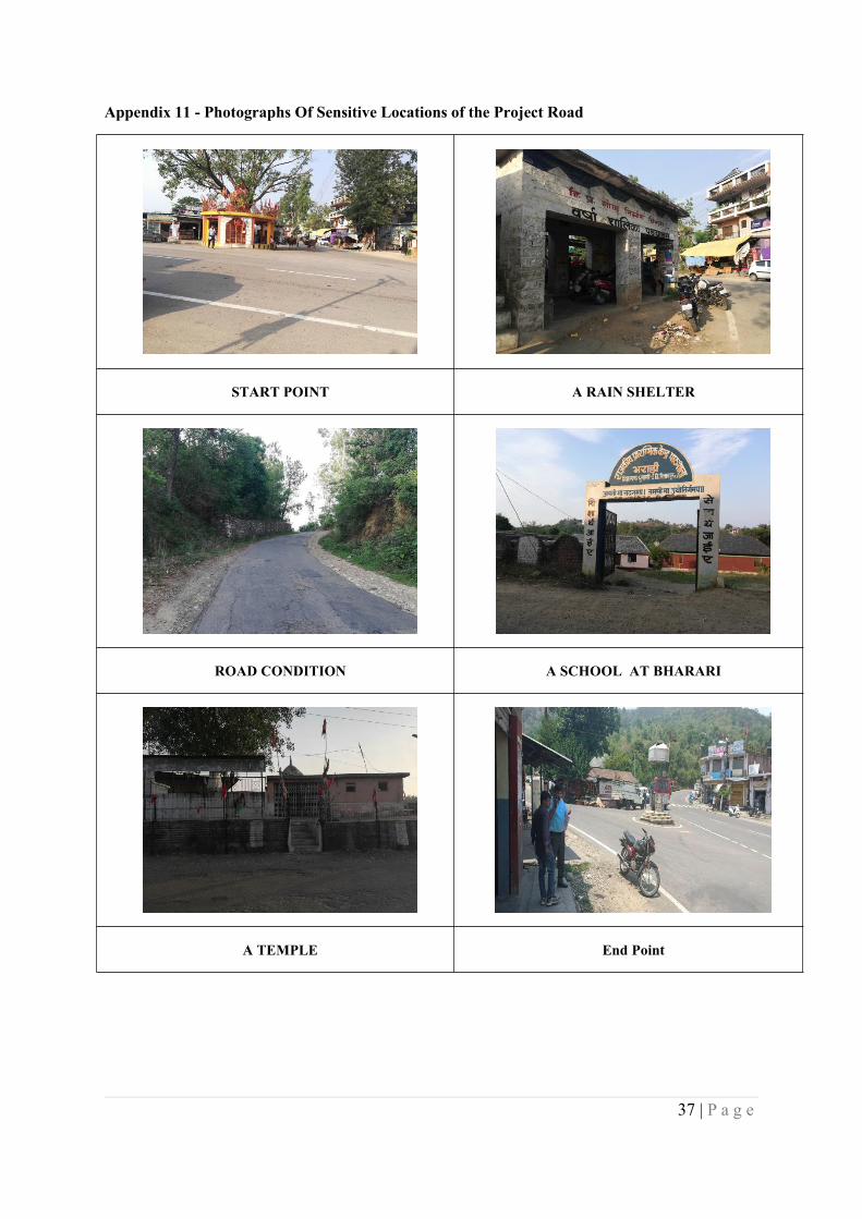
37 | P a g e
Appendix 11 - Photographs Of Sensitive Locations of the Project Road
START POINT A RAIN SHELTER
ROAD CONDITION A SCHOOL AT BHARARI
A TEMPLE End Point
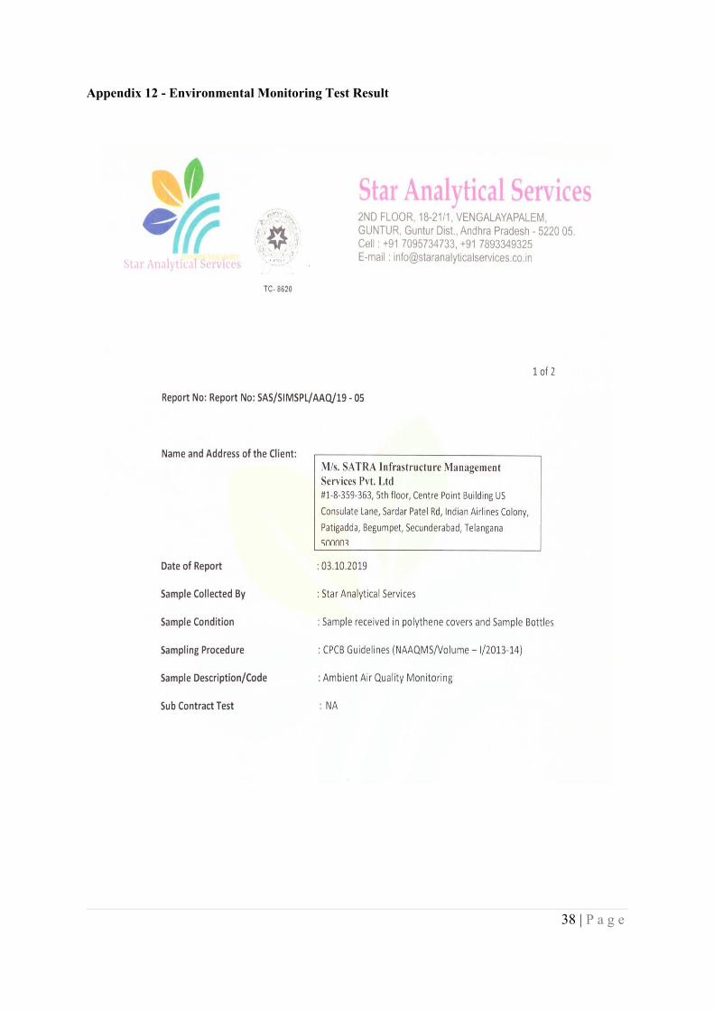
38 | P a g e
Appendix 12 - Environmental Monitoring Test Result
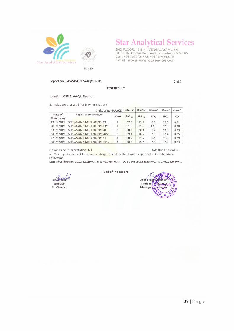
39 | P a g e
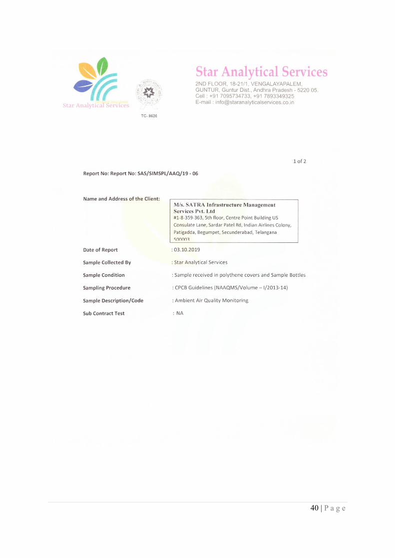
40 | P a g e
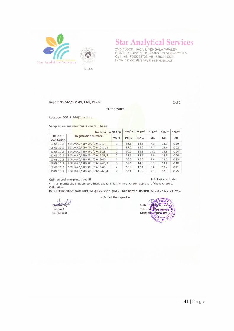
41 | P a g e
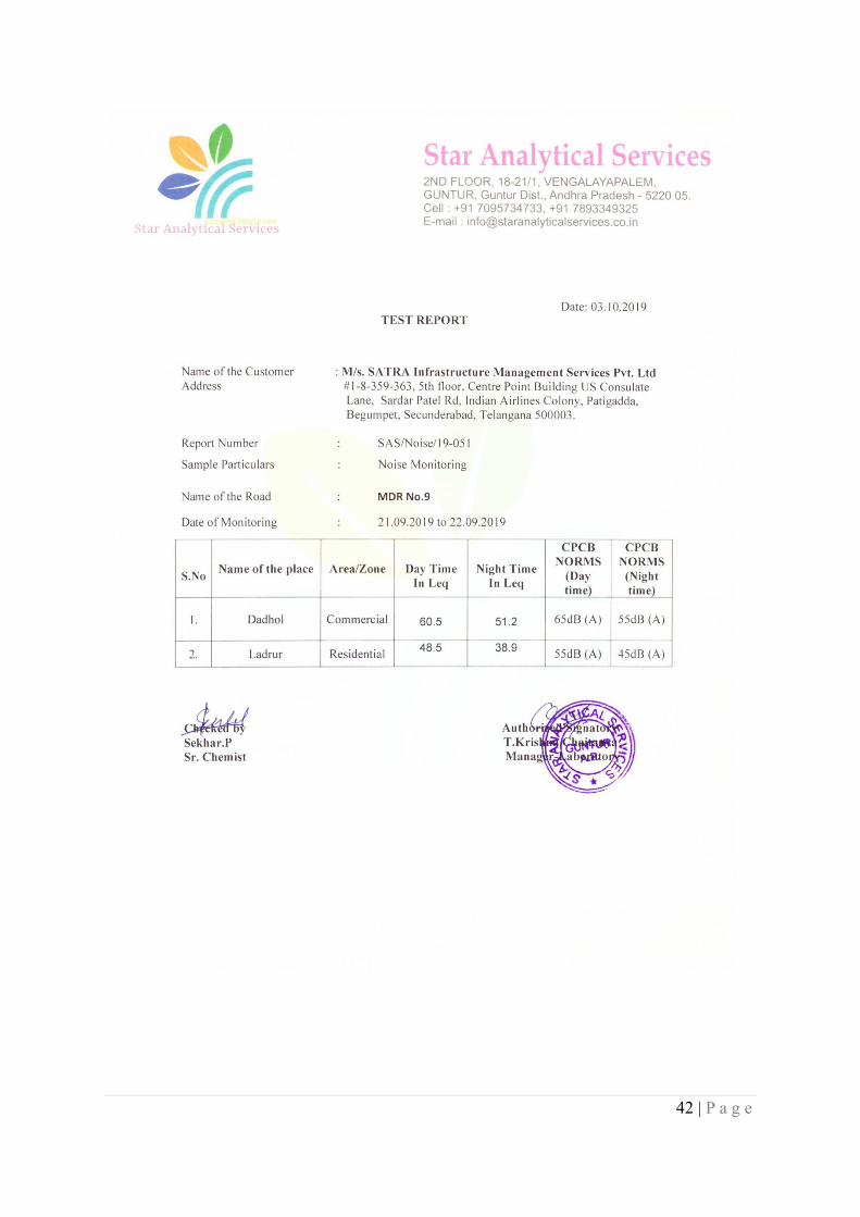
42 | P a g e
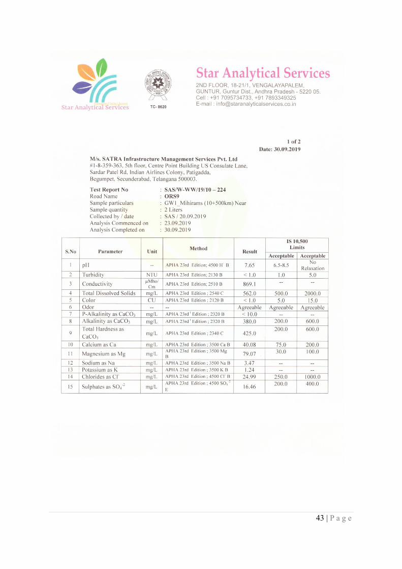
43 | P a g e
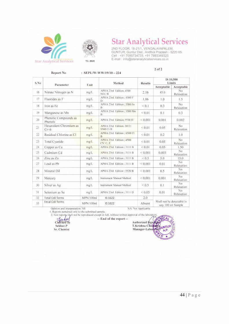
44 | P a g e
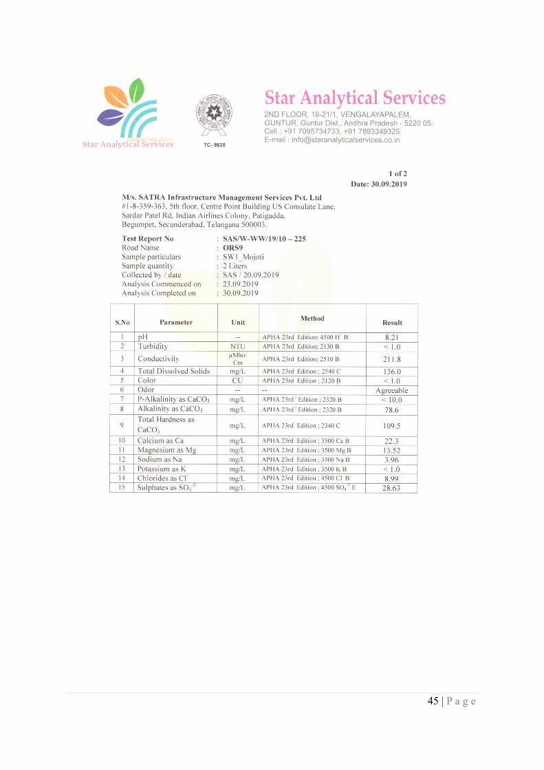
45 | P a g e
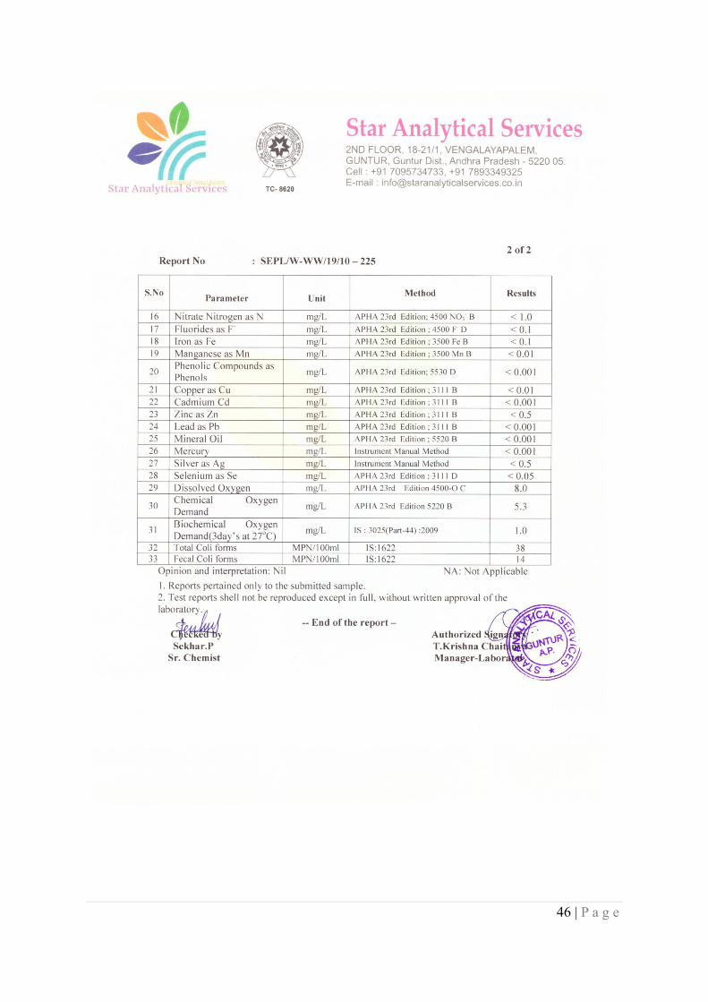
46 | P a g e
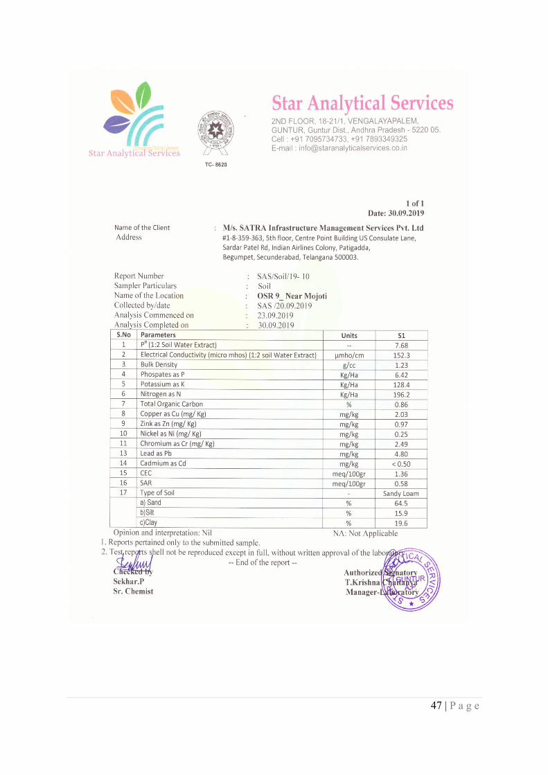
47 | P a g e
48 | P a g e
Appendix 13 - GoHP’s Strategy To Rehabilitate Areas Infested With Invasive Alien Plant Species (ExoticWeeds) In Himachal Pradesh
Strategy to Rehabilitate Areas Infested with Invasive Alien Plant Species (Exotic Weeds) inHimachal Pradesh: A Concept Note
Introduction
Large scale invasion of the Himachal’s landscape by alien plant species over the past 20 odd years hasbecome a cause of serious concern from the ecological, biodiversity, socio-economic and health point ofview. Even as the list of alien plant species having become invasive in the State is fairly long, it is thefollowing four exotic weed species that need priority attention:
a. Lantana camara L. (Lantana, Fulnu-buti, Panch-phulli, Ujrhu): This Tropical American speciesbelongs to family Verbenaceae and has been declared as Weed of National Significance by morethan 60 countries across the globe. It has come to occupy almost all the forest and non-forest areasin the sub-tropical belt in the State badly affecting the native floral diversity and availability ofgrass.
b. Parthenium hysterophorus L. (Carrot Weed, Congress Grass, Gajar ghas, Chatak Chandni): Amember of family Asteraceae and a native of Tropical America, this herb is an aggressivecolonizer of degraded areas with poor ground cover and exposed soil such as agricultural fallows,wastelands, roadsides, soil dumps, overgrazed pastures and degraded forests. The species, inaddition to its adverse ecological impacts, has become a serious health hazard, causing allergicreactions in human beings.
c. Ageratum conyzoides L. (Goat Weed, Neel-phulnu): This noxious herb, a member of familyAsteraceae, is a native of Tropical America. It has come to occupy agricultural fields, wastelands,plantations, pastures and all forest types, posing a serious threat to the indigenous vegetation in theState.
d. Eupatorium adenophorum Sp. (Crofton Weed): A member of family Asteraceae, this shrub isa native of Mexico. It forms dense thickets in fallow and wastelands, degraded forests and forestfringes out-spacing the indigenous species. The plant also causes allergic reactions and is apotential health hazard.
The above invasive alien plant species, with major incidence in the subtropical and lower temperate areasin the State, have come to affect the quality of forests and the pasture lands. What is more worrying is thattheir incidence seems to be increasing every year at a quite fast ‘Speed of Spread’. No wonder that theproblem of alien weeds has been recognized as the priority management subject during this InternationalYear of Forests, 2011. State’s Grazing Advisory Committee has also been raising concerns about thespread of these weeds and their affect on the pasture lands and grass availability. The issue has alsobecome a subject of regular discussion in the State Assembly.
Extent of Spread
A forest-wise reconnaissance, carried out during March 2011 across the State, has brought out thatLantana alone has invaded 1.5 lakh hectares of forest lands. Similarly, the other three main exotic weeds(Parthenium, Ageratum, Eupatorium) have been recorded to occur over 0.50 lakh hectares of forests,especially pastures.
In addition, these exotic weeds have also come to occupy most of the roadsides and the waste lands. Theroad length, passing through the sub-tropical/ lower temperate zone in the State being approximately20,000 kms with an average of 2.5 m berm on either side of these roads, the area under the exotic weeds
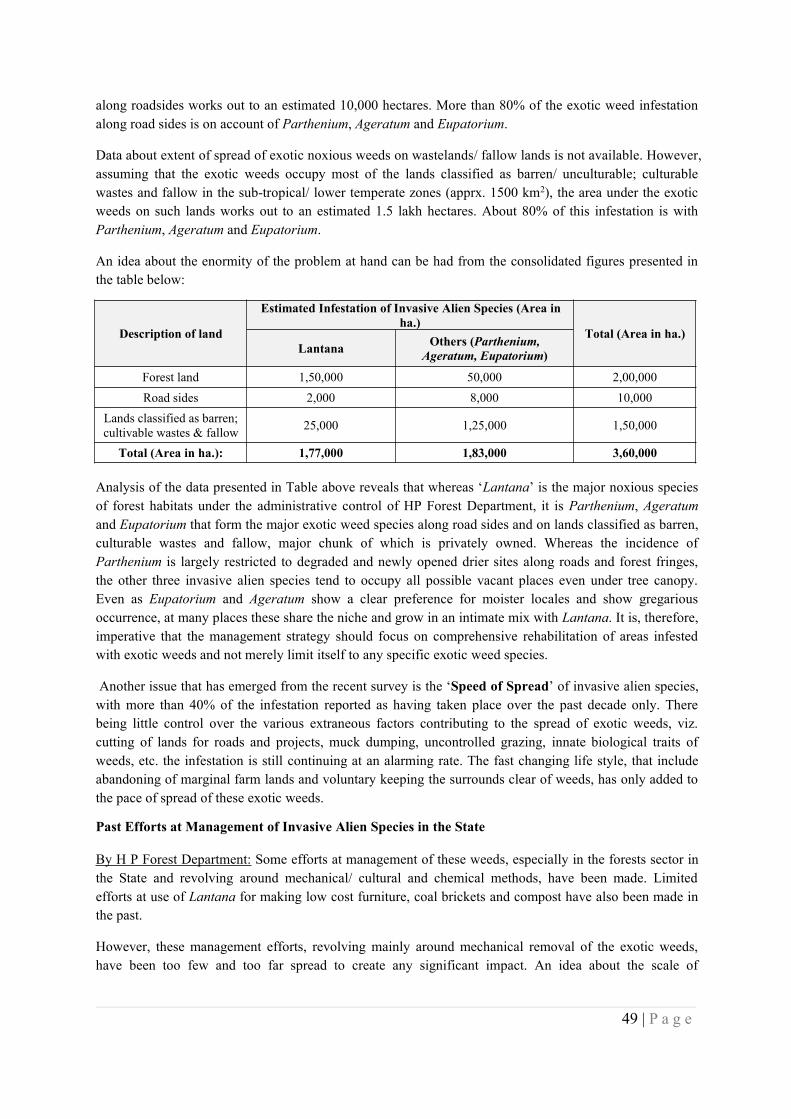
49 | P a g e
along roadsides works out to an estimated 10,000 hectares. More than 80% of the exotic weed infestationalong road sides is on account of Parthenium, Ageratum and Eupatorium.
Data about extent of spread of exotic noxious weeds on wastelands/ fallow lands is not available. However,assuming that the exotic weeds occupy most of the lands classified as barren/ unculturable; culturablewastes and fallow in the sub-tropical/ lower temperate zones (apprx. 1500 km2), the area under the exoticweeds on such lands works out to an estimated 1.5 lakh hectares. About 80% of this infestation is withParthenium, Ageratum and Eupatorium.
An idea about the enormity of the problem at hand can be had from the consolidated figures presented inthe table below:
Description of land
Estimated Infestation of Invasive Alien Species (Area inha.)
Total (Area in ha.)Lantana Others (Parthenium,
Ageratum, Eupatorium)
Forest land 1,50,000 50,000 2,00,000Road sides 2,000 8,000 10,000
Lands classified as barren;cultivable wastes & fallow 25,000 1,25,000 1,50,000
Total (Area in ha.): 1,77,000 1,83,000 3,60,000
Analysis of the data presented in Table above reveals that whereas ‘Lantana’ is the major noxious speciesof forest habitats under the administrative control of HP Forest Department, it is Parthenium, Ageratumand Eupatorium that form the major exotic weed species along road sides and on lands classified as barren,culturable wastes and fallow, major chunk of which is privately owned. Whereas the incidence ofParthenium is largely restricted to degraded and newly opened drier sites along roads and forest fringes,the other three invasive alien species tend to occupy all possible vacant places even under tree canopy.Even as Eupatorium and Ageratum show a clear preference for moister locales and show gregariousoccurrence, at many places these share the niche and grow in an intimate mix with Lantana. It is, therefore,imperative that the management strategy should focus on comprehensive rehabilitation of areas infestedwith exotic weeds and not merely limit itself to any specific exotic weed species.
Another issue that has emerged from the recent survey is the ‘Speed of Spread’ of invasive alien species,with more than 40% of the infestation reported as having taken place over the past decade only. Therebeing little control over the various extraneous factors contributing to the spread of exotic weeds, viz.cutting of lands for roads and projects, muck dumping, uncontrolled grazing, innate biological traits ofweeds, etc. the infestation is still continuing at an alarming rate. The fast changing life style, that includeabandoning of marginal farm lands and voluntary keeping the surrounds clear of weeds, has only added tothe pace of spread of these exotic weeds.
Past Efforts at Management of Invasive Alien Species in the State
By H P Forest Department: Some efforts at management of these weeds, especially in the forests sector inthe State and revolving around mechanical/ cultural and chemical methods, have been made. Limitedefforts at use of Lantana for making low cost furniture, coal brickets and compost have also been made inthe past.
However, these management efforts, revolving mainly around mechanical removal of the exotic weeds,have been too few and too far spread to create any significant impact. An idea about the scale of
50 | P a g e
intervention can be had from the fact that over the past three years, only about 1,700 hectare of forest areahas been tackled under the weed management program.
Moreover, these efforts were largely taken up as one time interventions at weed removal and were notfocused on rehabilitation of the treated area. Most of the past efforts have not yielded desired results due tolack of focus on long-term follow up system.
Chemical methods (involving mainly application of glyphosate) at control of Lantana/ Parthenium wereabandoned after initial trials due to concerns about their adverse environmental implications. AssociatingLantana removal to use has also not found favour with the local communities, the outputs/ returns fromusing cut Lantana for furniture, bricketting or composting being not considered commensurate with theeffort required for its use.
By Other Organisations: The Himachal Pradesh Agriculture University has been working to developsuccessful models of managing exotic weeds. It has also been, around Palampur, spearheading Partheniumeradication campaigns in association with educational institutions and civil society organisations. However,these campaigns have been too limited to create large scale impact.
Major learning from the past efforts at eradication of invasive alien plant species is that such efforts needto be integrated with rehabilitation of treated areas and should be of long-term duration for effective results.
Strategy for Management of Invasive Alien Species on Forest Lands
A two-day workshop was organized by the Himachal Pradesh Forest Department at Sundernagar on 22-23April 2011 with a view to come out with the following broad outputs –
1) documentation of species-wise/ forest-wise spread of major exotic weed species
2) documentation and review of the past efforts at weed management
3) emergence of a comprehensive strategy to rehabilitate the areas infested with the major weedspecies
The workshop was attended by the subject matter experts from within and outside Himachal Pradesh,forest managers, researchers, academicians, representatives of line departments and representatives ofCivil Society Organisations. The workshop was inaugurated by Mr. Vinay Tandon, Pr. Chief Conservatorof Forests, Himcahal Pradesh. Prof. R. K. Kohli, Chairman Botany Department, Punjab University andIUFRO Chair on Invasive Alien Species delivered the Key Note address. The highlight of the technicalsessions was forest Circle-wise presentations by the Conservators of Forests, giving detailed status ofexotic weeds on forest lands in their respective circles. The invited subject matter experts included Prof. NN Angiras (KV, Palampur), Prof. M K Seth (HPU, Shimla), Dr. S S Samant (G B Pant Institute, Mohal)and Dr. Kuldip Dogra (Research Fellow), who shared their experience related to the status andmanagement strategies of exotic weeds. Mr. Santosh Kumar, Conservator of Forests, Chandigarh presenteda case study about successful Lantana management interventions in Sukhna Wildlife Sanctuary. Dr. AnjanKalia (representing CSO, Palampur) shared his perspective regarding the need to undertake eradication ofParthenium through ‘people’s movement’.
The two day deliberations on the issue resulted in the emergence of a draft strategy for management ofexotic weeds in the State, highlights of which are presented below:
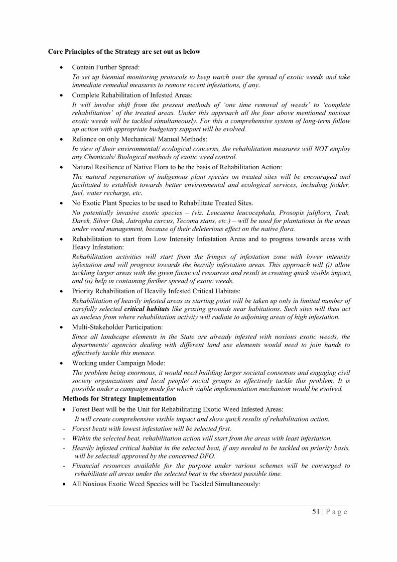
51 | P a g e
Core Principles of the Strategy are set out as below
Contain Further Spread:To set up biennial monitoring protocols to keep watch over the spread of exotic weeds and takeimmediate remedial measures to remove recent infestations, if any.
Complete Rehabilitation of Infested Areas:It will involve shift from the present methods of ‘one time removal of weeds’ to ‘completerehabilitation’ of the treated areas. Under this approach all the four above mentioned noxiousexotic weeds will be tackled simultaneously. For this a comprehensive system of long-term followup action with appropriate budgetary support will be evolved.
Reliance on only Mechanical/ Manual Methods:In view of their environmental/ ecological concerns, the rehabilitation measures will NOT employany Chemicals/ Biological methods of exotic weed control.
Natural Resilience of Native Flora to be the basis of Rehabilitation Action:The natural regeneration of indigenous plant species on treated sites will be encouraged andfacilitated to establish towards better environmental and ecological services, including fodder,fuel, water recharge, etc.
No Exotic Plant Species to be used to Rehabilitate Treated Sites.No potentially invasive exotic species – (viz. Leucaena leucocephala, Prosopis juliflora, Teak,Darek, Silver Oak, Jatropha curcus, Tecoma stans, etc.) – will be used for plantations in the areasunder weed management, because of their deleterious effect on the native flora.
Rehabilitation to start from Low Intensity Infestation Areas and to progress towards areas withHeavy Infestation:Rehabilitation activities will start from the fringes of infestation zone with lower intensityinfestation and will progress towards the heavily infestation areas. This approach will (i) allowtackling larger areas with the given financial resources and result in creating quick visible impact,and (ii) help in containing further spread of exotic weeds.
Priority Rehabilitation of Heavily Infested Critical Habitats:Rehabilitation of heavily infested areas as starting point will be taken up only in limited number ofcarefully selected critical habitats like grazing grounds near habitations. Such sites will then actas nucleus from where rehabilitation activity will radiate to adjoining areas of high infestation.
Multi-Stakeholder Participation:Since all landscape elements in the State are already infested with noxious exotic weeds, thedepartments/ agencies dealing with different land use elements would need to join hands toeffectively tackle this menace.
Working under Campaign Mode:The problem being enormous, it would need building larger societal consensus and engaging civilsociety organizations and local people/ social groups to effectively tackle this problem. It ispossible under a campaign mode for which viable implementation mechanism would be evolved.
Methods for Strategy Implementation Forest Beat will be the Unit for Rehabilitating Exotic Weed Infested Areas:
It will create comprehensive visible impact and show quick results of rehabilitation action.- Forest beats with lowest infestation will be selected first.- Within the selected beat, rehabilitation action will start from the areas with least infestation.- Heavily infested critical habitat in the selected beat, if any needed to be tackled on priority basis,
will be selected/ approved by the concerned DFO.- Financial resources available for the purpose under various schemes will be converged to
rehabilitate all areas under the selected beat in the shortest possible time. All Noxious Exotic Weed Species will be Tackled Simultaneously:
52 | P a g e
All the noxious exotic weeds will be tackled simultaneously on the selected area to ensurecomplete rehabilitation of the infested areas.
Method of Removing Exotic Weeds will be as under:The invasive plant species will be removed by employing only mechanical/ manual methods, asgiven below:
- Lantana will be cut by using Cut Root Stock (CRS) method i.e. cutting the bushes below the soil toprevent coppicing (Annexure-II).
- Other exotic weeds will be uprooted/ cut along the ground. The following will be standardized for effective implementation of exotic weed management
initiative:- Cutting tools/ techniques- Calendar of rehabilitation activities- Cost models A three year intensive maintenance of the treated areas and periodic follow up (every 3 years?)
thereafter will form integral part of the rehabilitation program till the areas gets fully rehabilitated. Local people, through existing community groups, will be actively engaged to participate in
rehabilitation of exotic weed infested areas.
Funding Options
The State Forest Department will explore funding possibilities for this initiative under State CAMPA/NPV funds; Centrally Sponsored Schemes (‘Control & Eradication of Forest Invasive Species’ underIntensification of Forest Management Program); Regular Departmental Plantation Schemes; andMNREGA.
State CAMPA/ NPV: An initial allocation for rehabilitation of 1000 hectares per year under StateCAMPA/ NPV funds has already been made.
CAT Plans: Rehabilitation of areas infested with invasive alien plant species also forms integral part ofsome of the CAT Plans (e.g. UHL Stage-III). There is a need to work out the total areas to be tackled forthe purpose under various CAT Plans in the State to know the total extent of areas being tackled under thisbudget head.
MNREGA: This scheme offers a great potential for management of exotic weed infested areas. However,there are certain issues that need to be sorted out for achieving effective results. The major issues being (a)inclusion of exotic weed removal as integral part of the Panchayat’s annual development agenda, (b)making available able bodied registered beneficiaries at right time of the year to handle this strenuouswork, often away from the habitations (c) incorporation of nursery raising as one of the approved activitiesunder the scheme, (d) provision for at least three year maintenance of the treated areas.
Management of Invasive Alien Species on Non-Forest Lands
As already brought out, a large chunk of non-forest land mass in the State is also facing increasinginvasion of alien plant species. The situation is especially severe along road sides and waste lands/ fallowlands where heavy infestation by noxious exotic weeds has not only resulted in reduction in the traditionalgrazing grounds but has also become a cause of serious health hazard.
The State Rural Development Department, Agriculture Department, Horticulture Department, PublicWorks Department and the Municipal bodies will initiate appropriate measures for management of noxiousweeds on non-forest areas based on the broad strategy principles as brought out above.
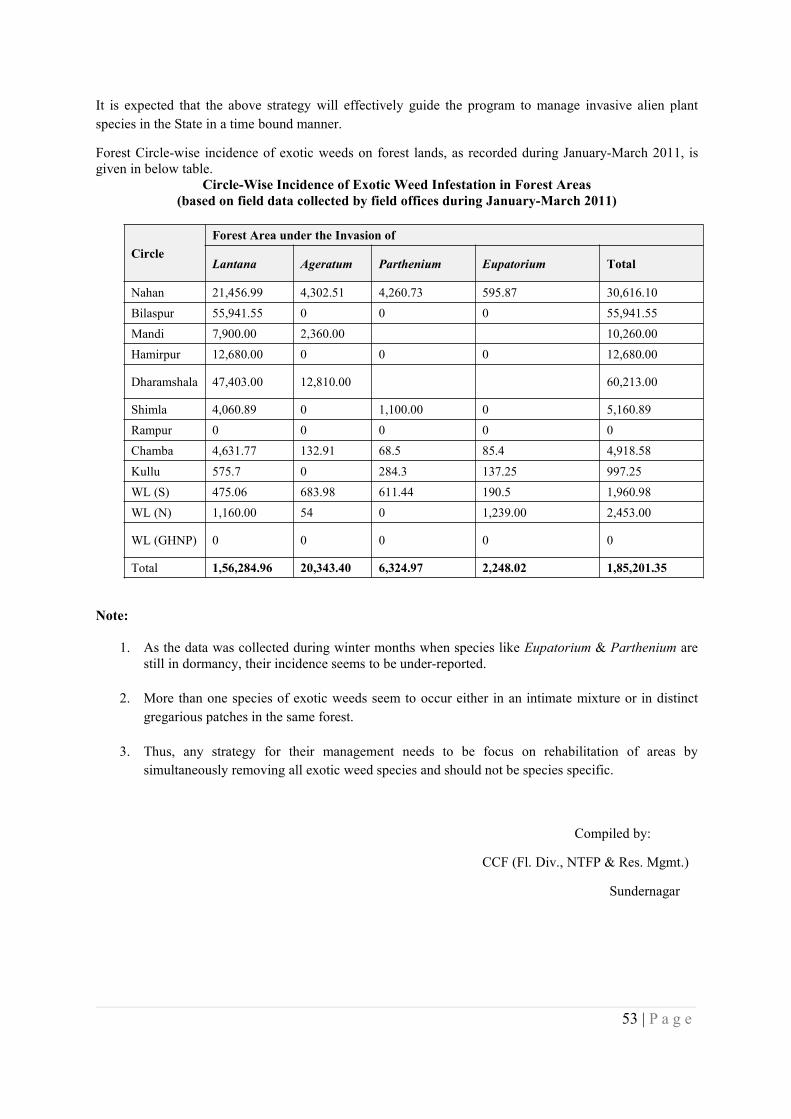
53 | P a g e
It is expected that the above strategy will effectively guide the program to manage invasive alien plantspecies in the State in a time bound manner.
Forest Circle-wise incidence of exotic weeds on forest lands, as recorded during January-March 2011, isgiven in below table.
Circle-Wise Incidence of Exotic Weed Infestation in Forest Areas(based on field data collected by field offices during January-March 2011)
CircleForest Area under the Invasion of
Lantana Ageratum Parthenium Eupatorium Total
Nahan 21,456.99 4,302.51 4,260.73 595.87 30,616.10Bilaspur 55,941.55 0 0 0 55,941.55Mandi 7,900.00 2,360.00 10,260.00Hamirpur 12,680.00 0 0 0 12,680.00
Dharamshala 47,403.00 12,810.00 60,213.00
Shimla 4,060.89 0 1,100.00 0 5,160.89Rampur 0 0 0 0 0Chamba 4,631.77 132.91 68.5 85.4 4,918.58Kullu 575.7 0 284.3 137.25 997.25WL (S) 475.06 683.98 611.44 190.5 1,960.98WL (N) 1,160.00 54 0 1,239.00 2,453.00
WL (GHNP) 0 0 0 0 0
Total 1,56,284.96 20,343.40 6,324.97 2,248.02 1,85,201.35
Note:
1. As the data was collected during winter months when species like Eupatorium & Parthenium arestill in dormancy, their incidence seems to be under-reported.
2. More than one species of exotic weeds seem to occur either in an intimate mixture or in distinctgregarious patches in the same forest.
3. Thus, any strategy for their management needs to be focus on rehabilitation of areas bysimultaneously removing all exotic weed species and should not be species specific.
Compiled by:
CCF (Fl. Div., NTFP & Res. Mgmt.)
Sundernagar
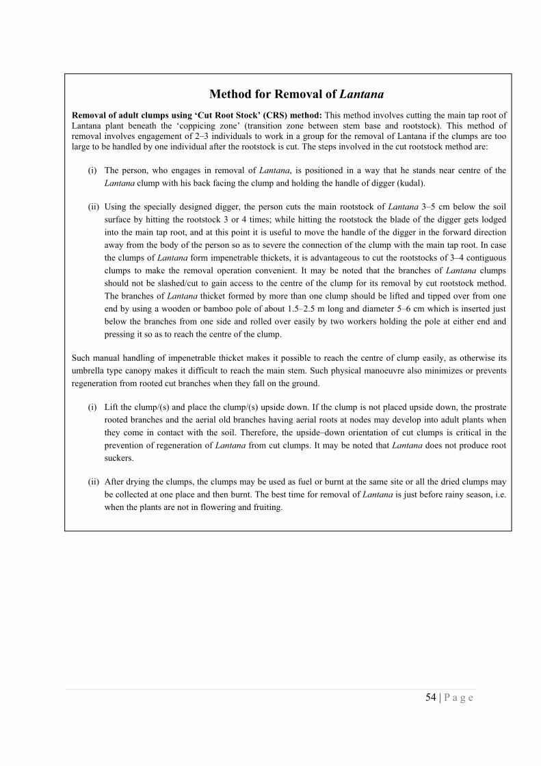
54 | P a g e
Appendix 14 - Village Wise - Census & Economic Details
Method for Removal of LantanaRemoval of adult clumps using ‘Cut Root Stock’ (CRS) method: This method involves cutting the main tap root ofLantana plant beneath the ‘coppicing zone’ (transition zone between stem base and rootstock). This method ofremoval involves engagement of 2–3 individuals to work in a group for the removal of Lantana if the clumps are toolarge to be handled by one individual after the rootstock is cut. The steps involved in the cut rootstock method are:
(i) The person, who engages in removal of Lantana, is positioned in a way that he stands near centre of theLantana clump with his back facing the clump and holding the handle of digger (kudal).
(ii) Using the specially designed digger, the person cuts the main rootstock of Lantana 3–5 cm below the soilsurface by hitting the rootstock 3 or 4 times; while hitting the rootstock the blade of the digger gets lodgedinto the main tap root, and at this point it is useful to move the handle of the digger in the forward directionaway from the body of the person so as to severe the connection of the clump with the main tap root. In casethe clumps of Lantana form impenetrable thickets, it is advantageous to cut the rootstocks of 3–4 contiguousclumps to make the removal operation convenient. It may be noted that the branches of Lantana clumpsshould not be slashed/cut to gain access to the centre of the clump for its removal by cut rootstock method.The branches of Lantana thicket formed by more than one clump should be lifted and tipped over from oneend by using a wooden or bamboo pole of about 1.5–2.5 m long and diameter 5–6 cm which is inserted justbelow the branches from one side and rolled over easily by two workers holding the pole at either end andpressing it so as to reach the centre of the clump.
Such manual handling of impenetrable thicket makes it possible to reach the centre of clump easily, as otherwise itsumbrella type canopy makes it difficult to reach the main stem. Such physical manoeuvre also minimizes or preventsregeneration from rooted cut branches when they fall on the ground.
(i) Lift the clump/(s) and place the clump/(s) upside down. If the clump is not placed upside down, the prostraterooted branches and the aerial old branches having aerial roots at nodes may develop into adult plants whenthey come in contact with the soil. Therefore, the upside–down orientation of cut clumps is critical in theprevention of regeneration of Lantana from cut clumps. It may be noted that Lantana does not produce rootsuckers.
(ii) After drying the clumps, the clumps may be used as fuel or burnt at the same site or all the dried clumps maybe collected at one place and then burnt. The best time for removal of Lantana is just before rainy season, i.e.when the plants are not in flowering and fruiting.
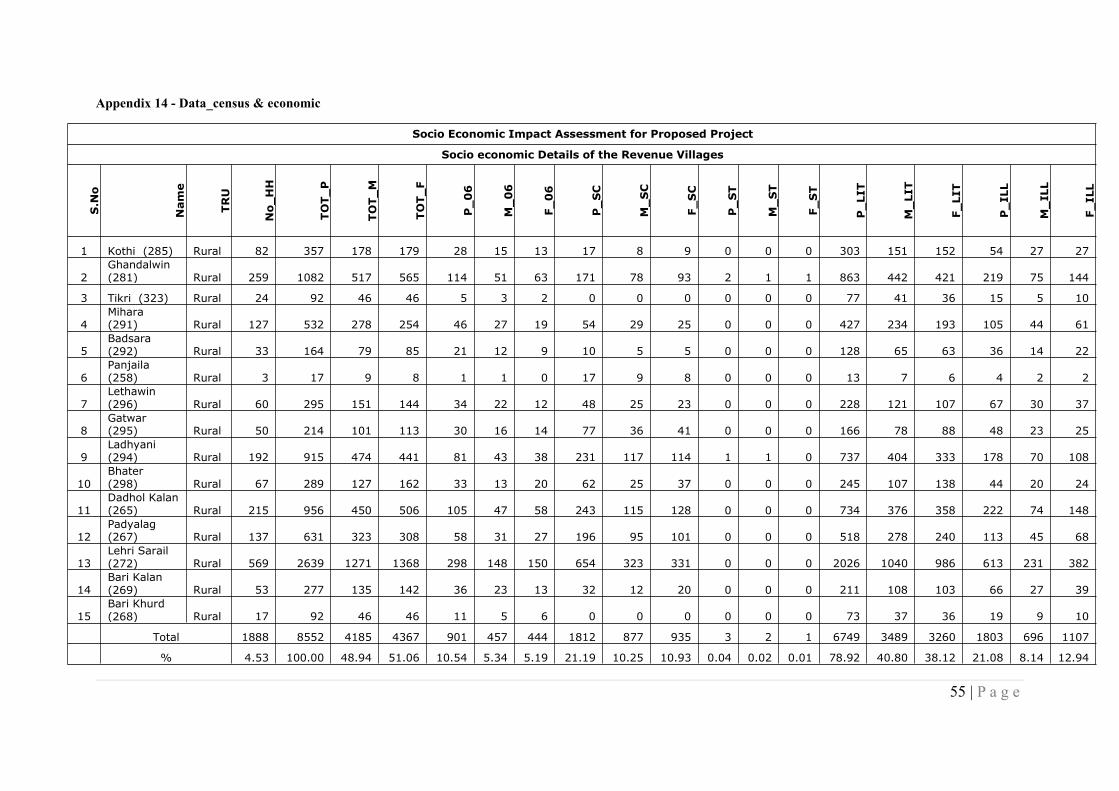
55 | P a g e
Appendix 14 - Data_census & economic
Socio Economic Impact Assessment for Proposed Project
Socio economic Details of the Revenue Villages
S.No
Name
TRU
No_HH
TOT_P
TOT_M
TOT_F
P_06
M_06
F_06
P_SC
M_SC
F_SC
P_ST
M_ST
F_ST
P_LIT
M_LIT
F_LIT
P_ILL
M_ILL
F_ILL
1 Kothi (285) Rural 82 357 178 179 28 15 13 17 8 9 0 0 0 303 151 152 54 27 27
2Ghandalwin(281) Rural 259 1082 517 565 114 51 63 171 78 93 2 1 1 863 442 421 219 75 144
3 Tikri (323) Rural 24 92 46 46 5 3 2 0 0 0 0 0 0 77 41 36 15 5 10
4Mihara(291) Rural 127 532 278 254 46 27 19 54 29 25 0 0 0 427 234 193 105 44 61
5Badsara(292) Rural 33 164 79 85 21 12 9 10 5 5 0 0 0 128 65 63 36 14 22
6Panjaila(258) Rural 3 17 9 8 1 1 0 17 9 8 0 0 0 13 7 6 4 2 2
7Lethawin(296) Rural 60 295 151 144 34 22 12 48 25 23 0 0 0 228 121 107 67 30 37
8Gatwar(295) Rural 50 214 101 113 30 16 14 77 36 41 0 0 0 166 78 88 48 23 25
9Ladhyani(294) Rural 192 915 474 441 81 43 38 231 117 114 1 1 0 737 404 333 178 70 108
10Bhater(298) Rural 67 289 127 162 33 13 20 62 25 37 0 0 0 245 107 138 44 20 24
11Dadhol Kalan(265) Rural 215 956 450 506 105 47 58 243 115 128 0 0 0 734 376 358 222 74 148
12Padyalag(267) Rural 137 631 323 308 58 31 27 196 95 101 0 0 0 518 278 240 113 45 68
13Lehri Sarail(272) Rural 569 2639 1271 1368 298 148 150 654 323 331 0 0 0 2026 1040 986 613 231 382
14Bari Kalan(269) Rural 53 277 135 142 36 23 13 32 12 20 0 0 0 211 108 103 66 27 39
15Bari Khurd(268) Rural 17 92 46 46 11 5 6 0 0 0 0 0 0 73 37 36 19 9 10
Total 1888 8552 4185 4367 901 457 444 1812 877 935 3 2 1 6749 3489 3260 1803 696 1107
% 4.53 100.00 48.94 51.06 10.54 5.34 5.19 21.19 10.25 10.93 0.04 0.02 0.01 78.92 40.80 38.12 21.08 8.14 12.94

56 | P a g e
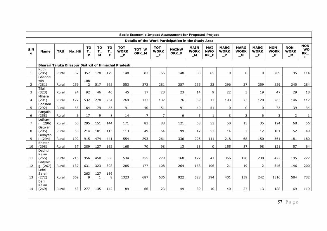
57 | P a g e
Socio Economic Impact Assessment for Proposed Project
Details of the Work Participation in the Study Area
S.No Name TRU No_HH
TOT_P
TOT_M
TOT_F
TOT_WORK_P
TOT_WORK_M
TOT_WORK_F
MAINWORK_P
MAINWORK_M
MAINWORK_F
MARGWORK_P
MARGWORK_M
MARGWORK_F
NON_WORK_P
NON_WORK_M
NON_WORK_F
Bharari Taluka Bilaspur Distrcit of Himachal Pradesh
1Kothi(285) Rural 82 357 178 179 148 83 65 148 83 65 0 0 0 209 95 114
2
Ghandalwin(281) Rural 259
1082 517 565 553 272 281 257 235 22 296 37 259 529 245 284
3Tikri(323) Rural 24 92 46 46 45 17 28 23 14 9 22 3 19 47 29 18
4Mihara(291) Rural 127 532 278 254 269 132 137 76 59 17 193 73 120 263 146 117
5Badsara(292) Rural 33 164 79 85 91 40 51 91 40 51 0 0 0 73 39 34
6Panjaila(258) Rural 3 17 9 8 14 7 7 6 5 1 8 2 6 3 2 1
7Lethawin (296) Rural 60 295 151 144 171 83 88 121 68 53 50 15 35 124 68 56
8Gatwar(295) Rural 50 214 101 113 113 49 64 99 47 52 14 2 12 101 52 49
9Ladhyani (294) Rural 192 915 474 441 554 293 261 336 225 111 218 68 150 361 181 180
10Bhater(298) Rural 67 289 127 162 168 70 98 13 13 0 155 57 98 121 57 64
11
DadholKalan(265) Rural 215 956 450 506 534 255 279 168 127 41 366 128 238 422 195 227
12Padyalag (267) Rural 137 631 323 308 285 177 108 264 158 106 21 19 2 346 146 200
13
LehriSarail(272) Rural 569
2639
1271
1368 1323 687 636 922 528 394 401 159 242 1316 584 732
14
BariKalan(269) Rural 53 277 135 142 89 66 23 49 39 10 40 27 13 188 69 119
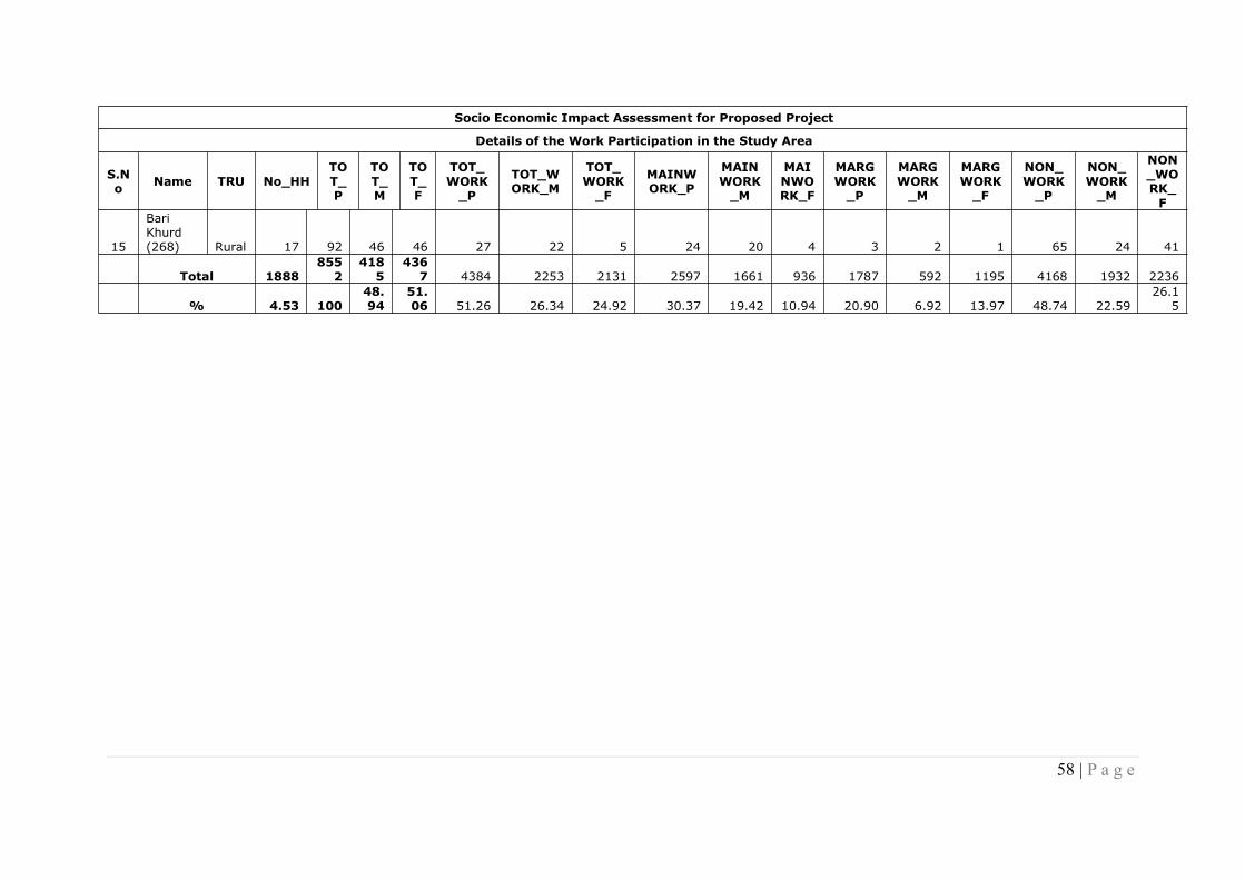
58 | P a g e
Socio Economic Impact Assessment for Proposed Project
Details of the Work Participation in the Study Area
S.No Name TRU No_HH
TOT_P
TOT_M
TOT_F
TOT_WORK_P
TOT_WORK_M
TOT_WORK_F
MAINWORK_P
MAINWORK_M
MAINWORK_F
MARGWORK_P
MARGWORK_M
MARGWORK_F
NON_WORK_P
NON_WORK_M
NON_WORK_F
15
BariKhurd(268) Rural 17 92 46 46 27 22 5 24 20 4 3 2 1 65 24 41
Total 18888552
4185
4367 4384 2253 2131 2597 1661 936 1787 592 1195 4168 1932 2236
% 4.53 10048.94
51.06 51.26 26.34 24.92 30.37 19.42 10.94 20.90 6.92 13.97 48.74 22.59
26.15
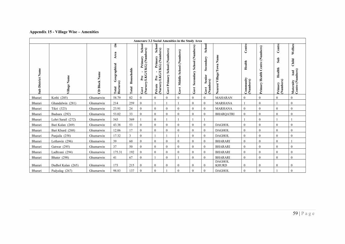
59 | P a g e
Appendix 15 - Village Wise – Amenities
Annexure 3.2 Social Amenities in the Study AreaSubDistrictN
ame
VillageNam
e
CDBlock
Nam
e
Total
Geographical
Area
(inHectares)
Total
Households
Govt
Pre
-Primary
School
(Nursery/LKG/UKG)(Num
bers)
Private
Pre
-Primary
School
(Nursery/LKG/UKG)(Num
bers)
GovtP
rimarySchool(Num
bers)
GovtMiddleSchool(Num
bers)
GovtSecondarySchool(Num
bers)
Govt
Senior
Secondary
School
(Num
bers)
NearestVillage/To
wnNam
e
Com
munity
Health
Centre
(Num
bers)
PrimaryHealth
Centre(Num
bers)
Primary
Heallth
Sub
Centre
(Num
bers)
Maternity
And
Child
Welfare
Centre(Num
bers)
Bharari Kothi (285) Ghumarwin 58.79 82 0 0 0 0 0 0 MAHARAN 0 0 0 0Bharari Ghandalwin (281) Ghumarwin 214 259 0 1 1 1 0 0 MARHANA 1 0 1 0Bharari Tikri (323) Ghumarwin 23.91 24 0 0 0 0 0 0 MARHANA 0 0 0 0Bharari Badsara (292) Ghumarwin 53.02 33 0 0 0 0 0 0 BHARQATRI 0 0 0 0Bharari Lehri Sarail (272) Ghumarwin 543 569 1 0 1 1 1 1 1 0 1 1Bharari Bari Kalan (269) Ghumarwin 43.38 53 0 0 0 0 0 0 DAGHOL 0 0 0 0Bharari Bari Khurd (268) Ghumarwin 12.06 17 0 0 0 0 0 0 DAGHOL 0 0 0 0Bharari Panjaila (258) Ghumarwin 17.32 3 0 1 1 1 0 0 DAGHOL 0 0 0 0Bharari Lethawin (296) Ghumarwin 39 60 0 0 0 0 0 0 BHARARI 0 0 0 1Bharari Gatwar (295) Ghumarwin 37 50 0 0 0 0 0 0 BHARARI 0 0 0 0Bharari Ladhyani (294) Ghumarwin 175.31 192 0 0 0 0 0 0 BHARARI 0 0 0 0Bharari Bhater (298) Ghumarwin 41 67 0 1 0 1 0 0 BHARARI 0 0 0 0
Bharari Dadhol Kalan (265) Ghumarwin 173 215 0 0 0 0 0 0DAGHOLKHURD 0 0 0 0
Bharari Padyalag (267) Ghumarwin 98.83 137 0 0 1 0 0 0 DAGHOL 0 0 1 0
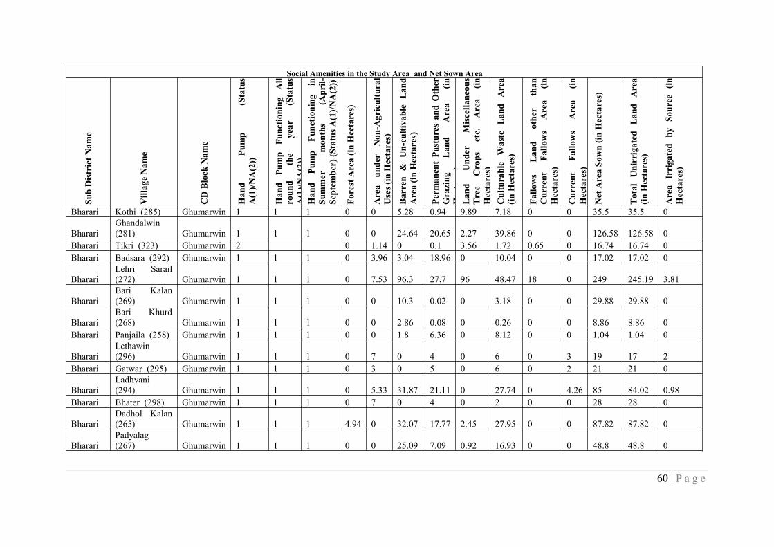
60 | P a g e
Social Amenities in the Study Area and Net Sown Area
SubDistrictN
ame
VillageNam
e
CDBlock
Nam
e
Hand
Pump
(Status
A(1)/N
A(2))
Hand
Pump
Functioning
All
round
the
year
(Status
A(1)/N
A(2))
Hand
Pump
Functioning
inSummer
months
(April-
Septem
ber)(StatusA
(1)/N
A(2))
ForestArea(in
Hectares)
Area
under
Non-Agricultural
Uses(inHectares)
Barren
&Un-cultivableLand
Area(in
Hectares)
Perm
anentPastures
andOther
Grazing
Land
Area
(inHectares)
Land
Under
Miscellaneous
Tree
Crops
etc.
Area
(inHectares)
Culturable
Waste
Land
Area
(inHectares)
Fallows
Land
other
than
Current
Fallows
Area
(inHectares)
Current
Fallows
Area
(inHectares)
NetAreaSown(in
Hectares)
Total
Unirrigated
Land
Area
(inHectares)
Area
Irrigated
bySource
(inHectares)
Bharari Kothi (285) Ghumarwin 1 1 1 0 0 5.28 0.94 9.89 7.18 0 0 35.5 35.5 0
BharariGhandalwin(281) Ghumarwin 1 1 1 0 0 24.64 20.65 2.27 39.86 0 0 126.58 126.58 0
Bharari Tikri (323) Ghumarwin 2 0 1.14 0 0.1 3.56 1.72 0.65 0 16.74 16.74 0Bharari Badsara (292) Ghumarwin 1 1 1 0 3.96 3.04 18.96 0 10.04 0 0 17.02 17.02 0
BharariLehri Sarail(272) Ghumarwin 1 1 1 0 7.53 96.3 27.7 96 48.47 18 0 249 245.19 3.81
BharariBari Kalan(269) Ghumarwin 1 1 1 0 0 10.3 0.02 0 3.18 0 0 29.88 29.88 0
BharariBari Khurd(268) Ghumarwin 1 1 1 0 0 2.86 0.08 0 0.26 0 0 8.86 8.86 0
Bharari Panjaila (258) Ghumarwin 1 1 1 0 0 1.8 6.36 0 8.12 0 0 1.04 1.04 0
BharariLethawin(296) Ghumarwin 1 1 1 0 7 0 4 0 6 0 3 19 17 2
Bharari Gatwar (295) Ghumarwin 1 1 1 0 3 0 5 0 6 0 2 21 21 0
BharariLadhyani(294) Ghumarwin 1 1 1 0 5.33 31.87 21.11 0 27.74 0 4.26 85 84.02 0.98
Bharari Bhater (298) Ghumarwin 1 1 1 0 7 0 4 0 2 0 0 28 28 0
BharariDadhol Kalan(265) Ghumarwin 1 1 1 4.94 0 32.07 17.77 2.45 27.95 0 0 87.82 87.82 0
BharariPadyalag(267) Ghumarwin 1 1 1 0 0 25.09 7.09 0.92 16.93 0 0 48.8 48.8 0
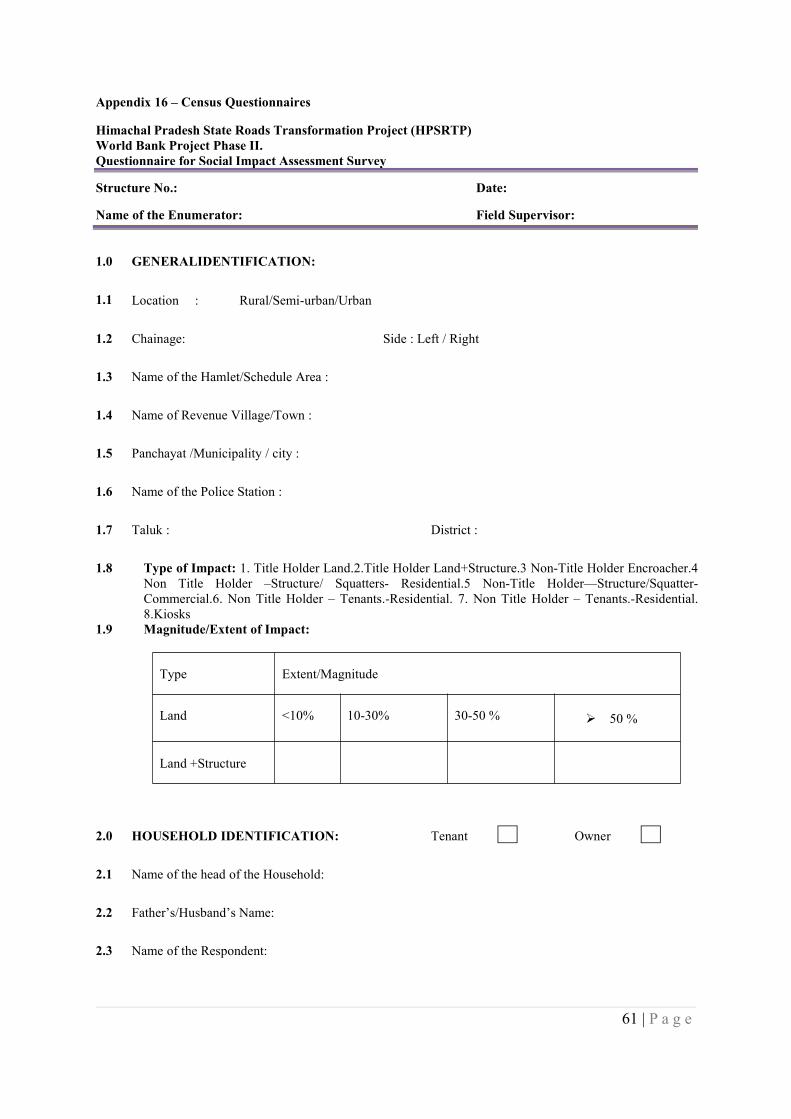
61 | P a g e
Appendix 16 – Census Questionnaires
Himachal Pradesh State Roads Transformation Project (HPSRTP)World Bank Project Phase II.Questionnaire for Social Impact Assessment Survey
Structure No.: Date:
Name of the Enumerator: Field Supervisor:
1.0 GENERALIDENTIFICATION:
1.1 Location : Rural/Semi-urban/Urban
1.2 Chainage: Side : Left / Right
1.3 Name of the Hamlet/Schedule Area :
1.4 Name of Revenue Village/Town :
1.5 Panchayat /Municipality / city :
1.6 Name of the Police Station :
1.7 Taluk : District :
1.8 Type of Impact: 1. Title Holder Land.2.Title Holder Land+Structure.3 Non-Title Holder Encroacher.4Non Title Holder –Structure/ Squatters- Residential.5 Non-Title Holder—Structure/Squatter-Commercial.6. Non Title Holder – Tenants.-Residential. 7. Non Title Holder – Tenants.-Residential.8.Kiosks
1.9 Magnitude/Extent of Impact:
Type Extent/Magnitude
Land <10% 10-30% 30-50 % 50 %
Land +Structure
2.0 HOUSEHOLD IDENTIFICATION: Tenant Owner
2.1 Name of the head of the Household:
2.2 Father’s/Husband’s Name:
2.3 Name of the Respondent:
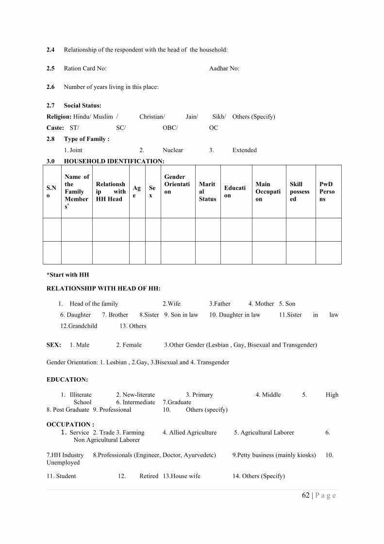
62 | P a g e
2.4 Relationship of the respondent with the head of the household:
2.5 Ration Card No: Aadhar No:
2.6 Number of years living in this place:
2.7 Social Status:
Religion: Hindu/ Muslim / Christian/ Jain/ Sikh/ Others (Specify)
Caste: ST/ SC/ OBC/ OC
2.8 Type of Family :
1. Joint 2. Nuclear 3. Extended
3.0 HOUSEHOLD IDENTIFICATION:
S.No
Name oftheFamilyMembers*
Relationship withHH Head
Age
Sex
GenderOrientation
MaritalStatus
Education
MainOccupation
Skillpossessed
PwDPersons
*Start with HH
RELATIONSHIP WITH HEAD OF HH:
1. Head of the family 2.Wife 3.Father 4. Mother 5. Son
6. Daughter 7. Brother 8.Sister 9. Son in law 10. Daughter in law 11.Sister in law
12.Grandchild 13. Others
SEX: 1. Male 2. Female 3.Other Gender (Lesbian , Gay, Bisexual and Transgender)
Gender Orientation: 1. Lesbian , 2.Gay, 3.Bisexual and 4. Transgender
EDUCATION:
1. Illiterate 2. New-literate 3. Primary 4. Middle 5. HighSchool 6. Intermediate 7.Graduate
8. Post Graduate 9. Professional 10. Others (specify)
OCCUPATION :1. Service 2. Trade 3. Farming 4. Allied Agriculture 5. Agricultural Laborer 6.
Non Agricultural Laborer
7.HH Industry 8.Professionals (Engineer, Doctor, Ayurvedetc) 9.Petty business (mainly kiosks) 10.Unemployed
11. Student 12. Retired 13.House wife 14. Others (Specify)
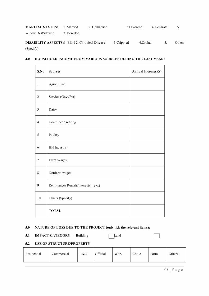
63 | P a g e
MARITAL STATUS: 1. Married 2. Unmarried 3.Divorced 4. Separate 5.
Widow 6.Widower 7. Deserted
DISABILITY ASPECTS:1. Blind 2. Chronical Disease 3.Crippled 4.Orphan 5. Others
(Specify)
4.0 HOUSEHOLD INCOME FROM VARIOUS SOURCES DURING THE LAST YEAR:
S.No Sources Annual Income(Rs)
1 Agriculture
2 Service (Govt/Pvt)
3 Dairy
4 Goat/Sheep rearing
5 Poultry
6 HH Industry
7 Farm Wages
8 Nonfarm wages
9 Remittances Rentals/interests…etc.)
10 Others (Specify)
TOTAL
5.0 NATURE OF LOSS DUE TO THE PROJECT (only tick the relevant items):
5.1 IMPACT CATEGORY – Building Land
5.2 USE OF STRUCTURE/PROPERTY
Residential Commercial R&C Official Work Cattle Farm Others

64 | P a g e
Shade Shed House
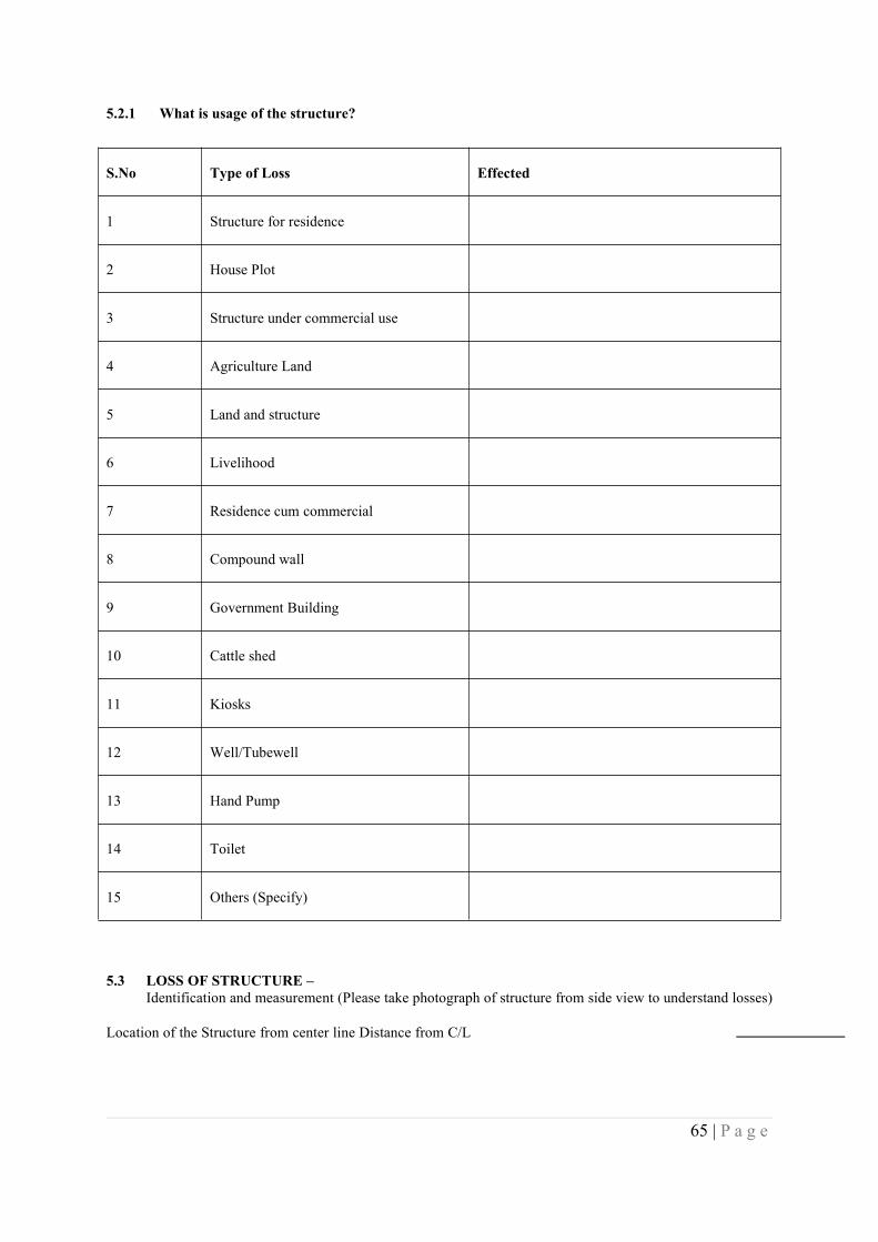
65 | P a g e
5.2.1 What is usage of the structure?
S.No Type of Loss Effected
1 Structure for residence
2 House Plot
3 Structure under commercial use
4 Agriculture Land
5 Land and structure
6 Livelihood
7 Residence cum commercial
8 Compound wall
9 Government Building
10 Cattle shed
11 Kiosks
12 Well/Tubewell
13 Hand Pump
14 Toilet
15 Others (Specify)
5.3 LOSS OF STRUCTURE –Identification and measurement (Please take photograph of structure from side view to understand losses)
Location of the Structure from center line Distance from C/L
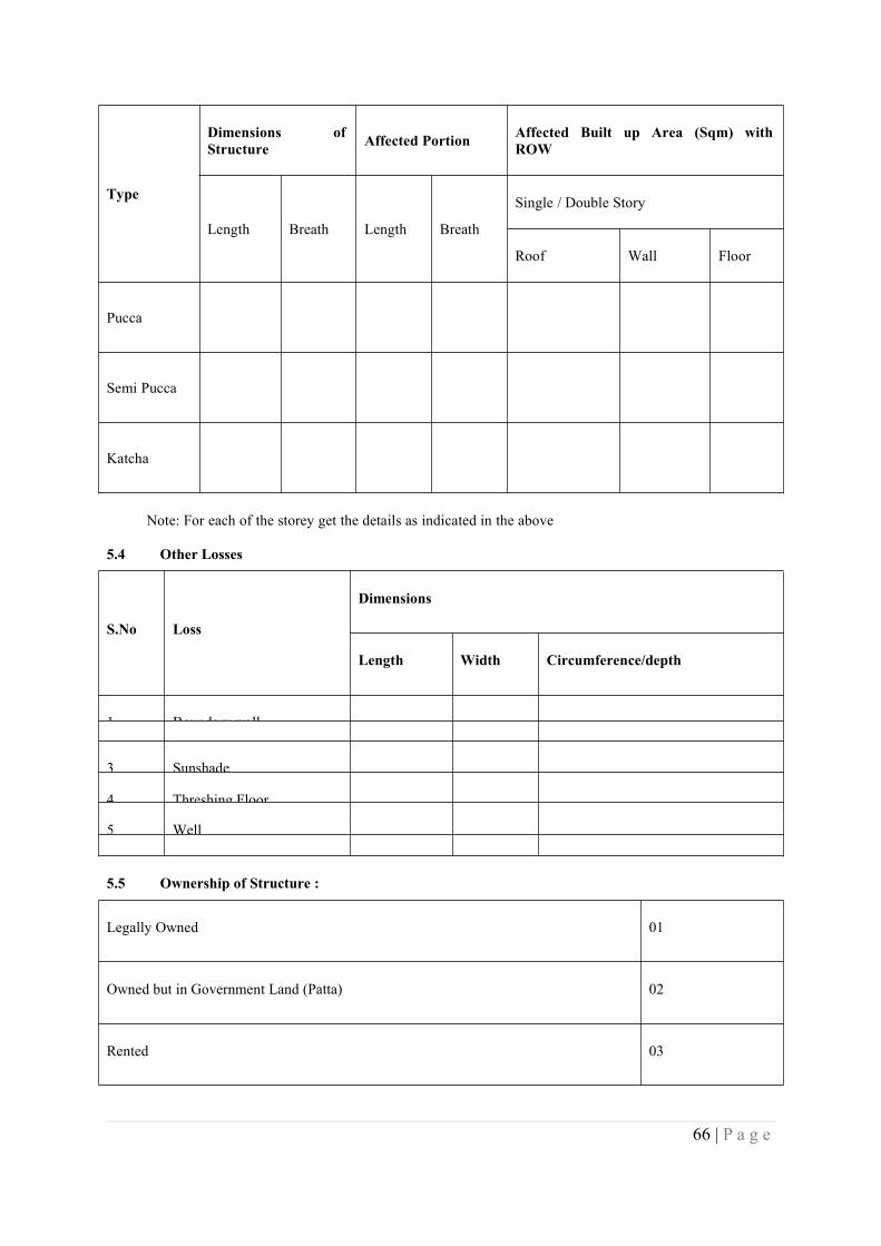
66 | P a g e
Type
Dimensions ofStructure Affected Portion Affected Built up Area (Sqm) with
ROW
Length Breath Length Breath
Single / Double Story
Roof Wall Floor
Pucca
Semi Pucca
Katcha
Note: For each of the storey get the details as indicated in the above
5.4 Other Losses
S.No Loss
Dimensions
Length Width Circumference/depth
1 Boundary wall
2 Wire fencing3 Sunshade
4 Threshing Floor
5 Well
6 Others5.5 Ownership of Structure :
Legally Owned 01
Owned but in Government Land (Patta) 02
Rented 03
67 | P a g e
Encroached 04
Squatter 05
Others 06
5.6 Loss of Land:
5.6.1 Ownership of Land
Owned Govt Leased Trust Temple Church Mosque
Bus stop Pond Community Hall Arch Hand Pump Public Tap Tank
Statue Govt School Others (specify)
5.6.2 Please give details of loss of the land
Type ofLand Owned Leased in Leased Out Encroached Total Area
cultivatedExtent ofLoss (%)
Irrigated
Un irrigated
Orchard
Others
Total
Extent ofLoss
6.0 Options for Resettlement and Rehabilitation (Please ask only to PAF other than Kiosks)
6.1 Resettlement :- if structure is lost
6.1.1 As a result of the loss you need to be relocated, how do you like to be shifted?
68 | P a g e
1) Self-Relocated.
2) Project to make arrange for relocation.
6.1.2 If 2 in 6.1 above where do you want to be relocated?
Within the village/Town 1
Outside the village/ Town 2
Within the district 3
Outside the district 4
6.1.3 What should be distance from the present location:-
Within 5 km 1
Within 5-10 km 2
More than 10 km 3
6.1.4 What type of support expected from the project in your relocation?
Compensation of the structure 1
Assistance in shifting house hold materials 2
Assistance for alternative house side 3
Assistance in construction of house 4
Permission to salvage of building materials 5
Support in trans position in salvage material 6
Other support (Specify) 7
6.1.5 If self-relocated, what arrangement you will make?
Extend existing structure 1
Construct (home in vacant plot) 2
69 | P a g e
Move out of the area 3
Stay at relatives/ friends place 4
Any other (Specify) 5
6.2 Rehabilitation :- Ask those PAPs whose livelihood would be affected
6.2.1 What type of support do you expect from the project in restoration of your livelihood lost?
Compensation at replacement value 1
Assistance in shifting 2
Assistance in Transition 3
Alternative site for shop 4
Grant for restarting the operation 5
Assistance in accessing loans 6
Employment during project construction 7
Employment during maintenance 8
Training to improve the skill level 9
Others 10
6.2.2 If more than 25 % agricultural land is lost, ask the support required in restoring their income level
Land for land 1
Adequate compensation for replacing land 2
Grants to take-up alternate self-employment activity 3
Employment during Project construction 4
Employment during maintenance 5
70 | P a g e
Training to upgrade the skill level 6
Others (specify) 7
6.3 R&R Support for Tenant
6.3.1 If structure is getting affected what support you expect
Shifting Allowance 1
Cash grant for sustenance 2
Self- Relocation Others (specify) 3
Others (Specify) 4
6.4 R & R support to shareholders
6.4.1 What type of support you expect from the project for loss of share cropping or leasing in land.
1 Crash grant for the unexpired lease period
2 Support in improving farm production
3 Others (specify)
6.5 Income Restoration Options
1 Land for land 5 Employment during construction
2 Allied Agri. Activities 6 Training for self employment
3 Petty shops 7 Household Industry
4 Cash Grant 8 Others (specify)
Q. No: Date:
Name of the Investigator:

71 | P a g e
Field Supervisor:
Name of the Signature/Fingerprint of respondent:
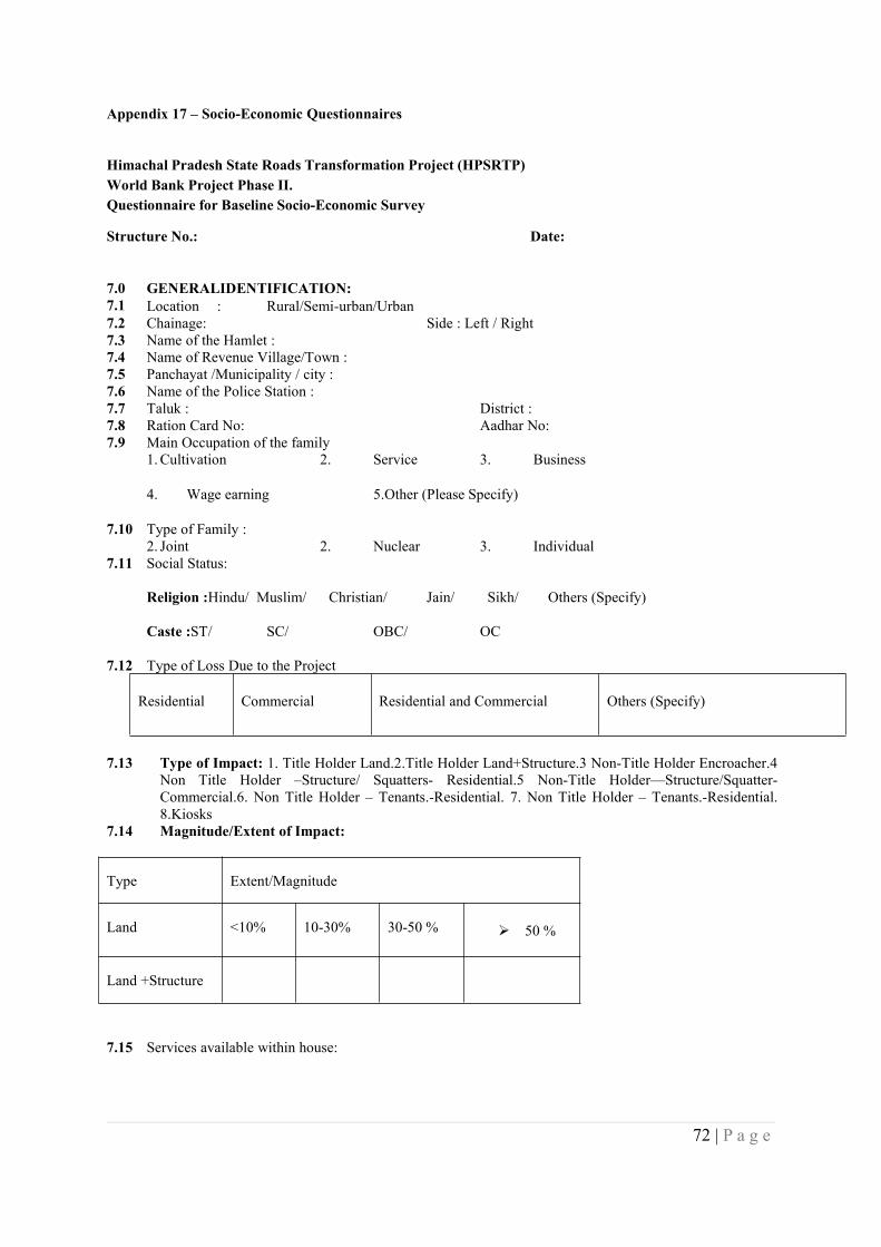
72 | P a g e
Appendix 17 – Socio-Economic Questionnaires
Himachal Pradesh State Roads Transformation Project (HPSRTP)World Bank Project Phase II.Questionnaire for Baseline Socio-Economic Survey
Structure No.: Date:
7.0 GENERALIDENTIFICATION:7.1 Location : Rural/Semi-urban/Urban7.2 Chainage: Side : Left / Right7.3 Name of the Hamlet :7.4 Name of Revenue Village/Town :7.5 Panchayat /Municipality / city :7.6 Name of the Police Station :7.7 Taluk : District :7.8 Ration Card No: Aadhar No:7.9 Main Occupation of the family
1.Cultivation 2. Service 3. Business
4. Wage earning 5.Other (Please Specify)
7.10 Type of Family :2. Joint 2. Nuclear 3. Individual
7.11 Social Status:
Religion :Hindu/ Muslim/ Christian/ Jain/ Sikh/ Others (Specify)
Caste :ST/ SC/ OBC/ OC
7.12 Type of Loss Due to the Project
Residential Commercial Residential and Commercial Others (Specify)
7.13 Type of Impact: 1. Title Holder Land.2.Title Holder Land+Structure.3 Non-Title Holder Encroacher.4Non Title Holder –Structure/ Squatters- Residential.5 Non-Title Holder—Structure/Squatter-Commercial.6. Non Title Holder – Tenants.-Residential. 7. Non Title Holder – Tenants.-Residential.8.Kiosks
7.14 Magnitude/Extent of Impact:
Type Extent/Magnitude
Land <10% 10-30% 30-50 % 50 %
Land +Structure
7.15 Services available within house:
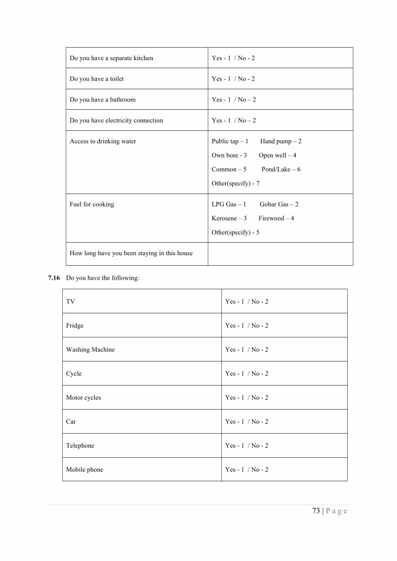
73 | P a g e
Do you have a separate kitchen Yes - 1 / No - 2
Do you have a toilet Yes - 1 / No - 2
Do you have a bathroom Yes - 1 / No – 2
Do you have electricity connection Yes - 1 / No – 2
Access to drinking water Public tap – 1 Hand pump – 2
Own bore - 3 Open well – 4
Common – 5 Pond/Lake – 6
Other(specify) - 7
Fuel for cooking LPG Gas – 1 Gobar Gas – 2
Kerosene – 3 Firewood – 4
Other(specify) - 5
How long have you been staying in this house
7.16 Do you have the following:
TV Yes - 1 / No - 2
Fridge Yes - 1 / No - 2
Washing Machine Yes - 1 / No - 2
Cycle Yes - 1 / No - 2
Motor cycles Yes - 1 / No - 2
Car Yes - 1 / No - 2
Telephone Yes - 1 / No - 2
Mobile phone Yes - 1 / No - 2

74 | P a g e
Cattles Yes - 1 / No – 2If Yes, Number_________
Buffalo Yes - 1 / No – 2If Yes, Number_________
Goat / Sheep Yes - 1 / No – 2If Yes, Number_________
8.0 HOUSEHOLD IDENTIFICATION:
S.No
Name of theFamilyMembers*
Relationship withHH Head
Age
Sex
GenderOrientation
MaritalStatus
Education
MainOccupation
Skillpossessed
DisabledPersons
*Start with HH
RELATIONSHIP WITH HEAD OF HH:
1Head of the family 2.Wife 3.Father 4.Mother 5.Son 6.Daughter7.Brother 8.Sister
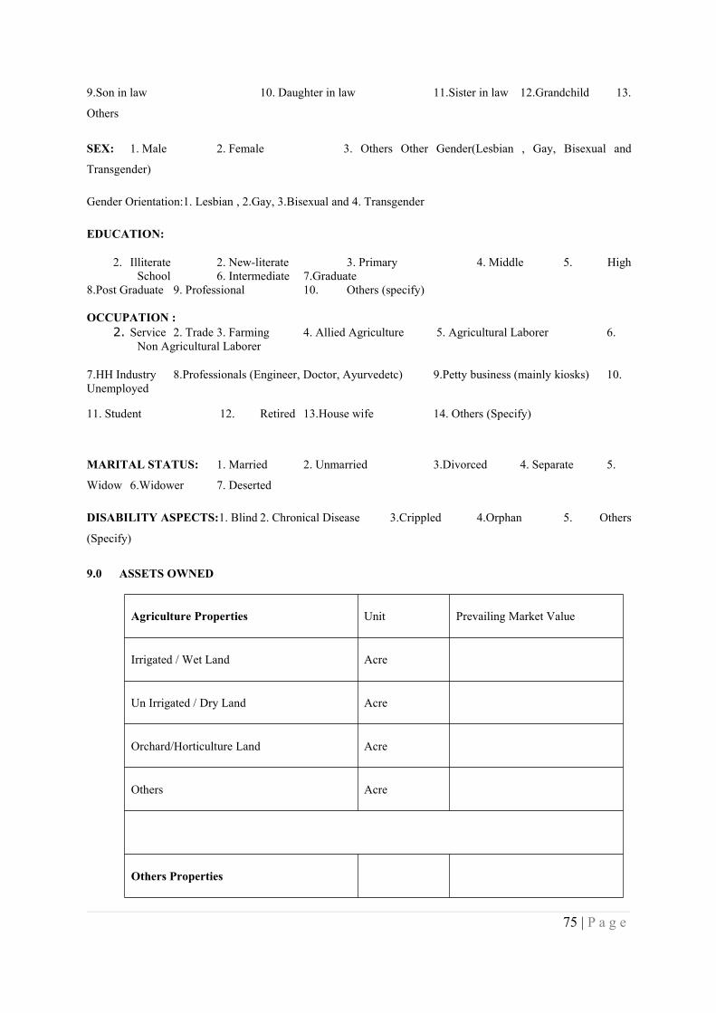
75 | P a g e
9.Son in law 10. Daughter in law 11.Sister in law 12.Grandchild 13.
Others
SEX: 1. Male 2. Female 3. Others Other Gender(Lesbian , Gay, Bisexual and
Transgender)
Gender Orientation:1. Lesbian , 2.Gay, 3.Bisexual and 4. Transgender
EDUCATION:
2. Illiterate 2. New-literate 3. Primary 4. Middle 5. HighSchool 6. Intermediate 7.Graduate
8.Post Graduate 9. Professional 10. Others (specify)
OCCUPATION :2. Service 2. Trade 3. Farming 4. Allied Agriculture 5. Agricultural Laborer 6.
Non Agricultural Laborer
7.HH Industry 8.Professionals (Engineer, Doctor, Ayurvedetc) 9.Petty business (mainly kiosks) 10.Unemployed
11. Student 12. Retired 13.House wife 14. Others (Specify)
MARITAL STATUS: 1. Married 2. Unmarried 3.Divorced 4. Separate 5.
Widow 6.Widower 7. Deserted
DISABILITY ASPECTS:1. Blind 2. Chronical Disease 3.Crippled 4.Orphan 5. Others
(Specify)
9.0 ASSETS OWNED
Agriculture Properties Unit Prevailing Market Value
Irrigated / Wet Land Acre
Un Irrigated / Dry Land Acre
Orchard/Horticulture Land Acre
Others Acre
Others Properties
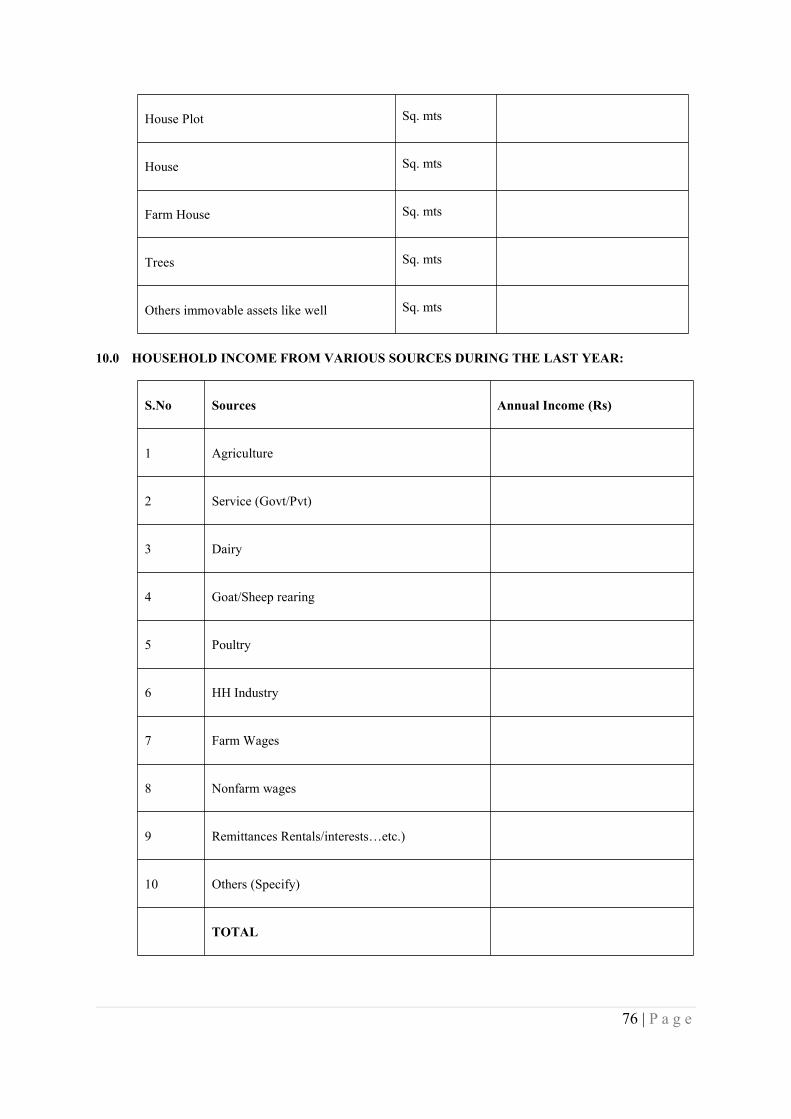
76 | P a g e
House Plot Sq. mts
House Sq. mts
Farm House Sq. mts
Trees Sq. mts
Others immovable assets like well Sq. mts
10.0 HOUSEHOLD INCOME FROM VARIOUS SOURCES DURING THE LAST YEAR:
S.No Sources Annual Income (Rs)
1 Agriculture
2 Service (Govt/Pvt)
3 Dairy
4 Goat/Sheep rearing
5 Poultry
6 HH Industry
7 Farm Wages
8 Nonfarm wages
9 Remittances Rentals/interests…etc.)
10 Others (Specify)
TOTAL
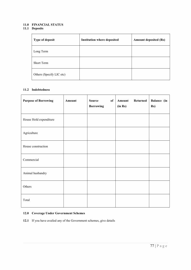
77 | P a g e
11.0 FINANCIAL STATUS11.1 Deposits
Type of deposit Institution where deposited Amount deposited (Rs)
Long Term
Short Term
Others (Specify LIC etc)
11.2 Indebtedness
12.0 Coverage Under Government Schemes
12.1 If you have availed any of the Government schemes, give details
Purpose of Borrowing Amount Source of
Borrowing
Amount Returned
(in Rs)
Balance (in
Rs)
House Hold expenditure
Agriculture
House construction
Commercial
Animal husbandry
Others
Total
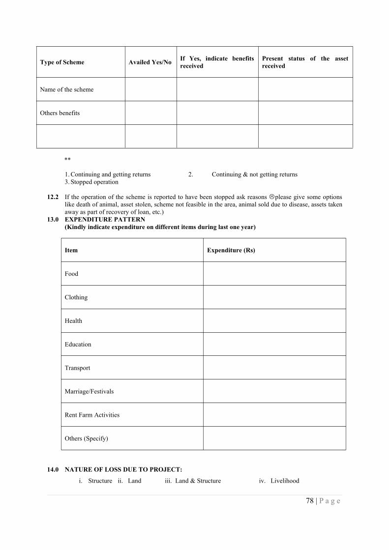
78 | P a g e
Type of Scheme Availed Yes/No If Yes, indicate benefitsreceived
Present status of the assetreceived
Name of the scheme
Others benefits
1.Continuing and getting returns 2. Continuing & not getting returns3. Stopped operation
12.2 If the operation of the scheme is reported to have been stopped ask reasons please give some optionslike death of animal, asset stolen, scheme not feasible in the area, animal sold due to disease, assets takenaway as part of recovery of loan, etc.)
13.0 EXPENDITURE PATTERN(Kindly indicate expenditure on different items during last one year)
Item Expenditure (Rs)
Food
Clothing
Health
Education
Transport
Marriage/Festivals
Rent Farm Activities
Others (Specify)
14.0 NATURE OF LOSS DUE TO PROJECT:
i. Structure ii. Land iii. Land & Structure iv. Livelihood
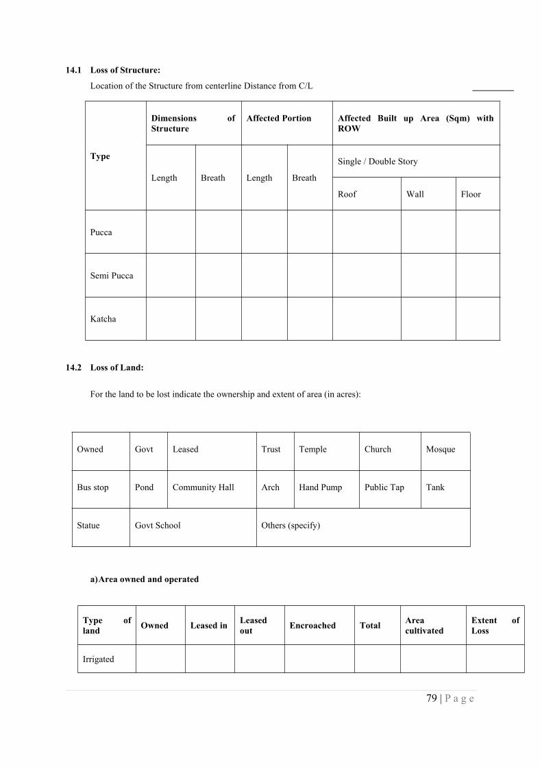
79 | P a g e
14.1 Loss of Structure:
Location of the Structure from centerline Distance from C/L
Type
Dimensions ofStructure
Affected Portion Affected Built up Area (Sqm) withROW
Length Breath Length Breath
Single / Double Story
Roof Wall Floor
Pucca
Semi Pucca
Katcha
14.2 Loss of Land:
For the land to be lost indicate the ownership and extent of area (in acres):
Owned Govt Leased Trust Temple Church Mosque
Bus stop Pond Community Hall Arch Hand Pump Public Tap Tank
Statue Govt School Others (specify)
a)Area owned and operated
Type ofland Owned Leased in Leased
out Encroached Total Areacultivated
Extent ofLoss
Irrigated

80 | P a g e
Un irrigated
Orchard
Others
Total
Extent ofLoss
b)Productivity
Area (Ha)
Irrigated Un irrigated Orchard
Kharif
Rabi
Others
Value of Land
Type of Land Prevailing Rate of Land (Rs / acre)
Residential Land
Commercial land
Irrigated
Un Irrigated

81 | P a g e
Orchard
Others
15.0 HEALTH STATUS
15.1 Was any member of your family affected by any illness in last one year?
15.2 If ‘Yes’ please indicate the details
S. No Type of Disease Treatment taken
1
2
3
Allopathic – 1 Homeopathic – 2 Ayurvedic – 3 Unani – 4
Other traditional methods – 5 No treatment – 6
15.3 Have you heard of HIV/AIDS Yes / No
15.4 If Yes, do you know how it spreads and prevention methods Yes / No
15.5 If Yes, what was the source of information
1. Print media 2. Radio 3. TV
4. Govt. Campaign 5. NGO 6. Other (Specify)
16.0 MIGRATION
16.1 Do you or any of your family members migrate for work? Yes / No
16.2 If ‘Yes’ how many members and for how many days / months in a year
No. of members______________ No. of Days___________
16.3 Where do you migrate?
1.Within district 2. Outside district 3. Outside the state 4. Other Country
16.4 What kind of jobs is undertaken?
1.Agricultural Labour 2. Non Agricultural Labour
3. Trade & Business 4. Others (Specify)
16.5 How much do you earn? Rs/month:_____________________
16.6 Trend of Migration
1.Once in a year 2. Twice in a year 3. Every alternative year
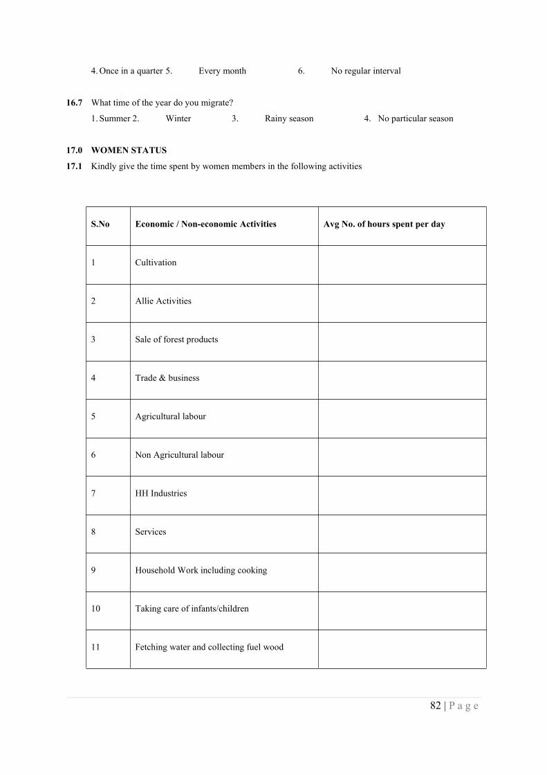
82 | P a g e
4.Once in a quarter 5. Every month 6. No regular interval
16.7 What time of the year do you migrate?
1. Summer 2. Winter 3. Rainy season 4. No particular season
17.0 WOMEN STATUS
17.1 Kindly give the time spent by women members in the following activities
S.No Economic / Non-economic Activities Avg No. of hours spent per day
1 Cultivation
2 Allie Activities
3 Sale of forest products
4 Trade & business
5 Agricultural labour
6 Non Agricultural labour
7 HH Industries
8 Services
9 Household Work including cooking
10 Taking care of infants/children
11 Fetching water and collecting fuel wood
83 | P a g e
S.No Economic / Non-economic Activities Avg No. of hours spent per day
12 Relaxation & Entertainment
13 Others (Specify)
Dairy, Poultry, Piggery, Sheep rearing, Goatry etc.
17.2 If, engaged in economic activities total income Rs_____________year/month___________
17.3 Does your women member have any say in the decision making of household matters?
Yes / No
17.4 If ‘Yes’ indicate their role in the following:
S. No Issues Yes No
1 Financial Matters
2 Education Matters
3 Health care of child
4 Purchase of assets
5 Day to day activities
6 On social function and marriages
7 Others
17.5 Income Restoration Options
1 Land for land 5 Employment during construction
2 Allied Agri. Activities 6 Training for self employment
84 | P a g e
3 Petty shops 7 Household Industry
4 Cash Grant 8 Others (specify)
18.0 PERCEPTION ABOUT THE PROJECT
18.1 Are you aware that the state road passing through your area in under development?
Yes / No
18.2 If No, explain them about the project. If yes and after explanation, ask the following
18.3 What benefits do you fore see from the project?
a) Improved mobility
b) Grater accessibility to education / health services
c) Greater opportunities for economic activities
d) Improved employment opportunities
e) Higher wages
f) Greater access to markets
g) Realization of higher prices for the produce
h) Increase in the value of the land and structures
i) Any others (specify)
18.4 Do you also expect any adverse or negative impacts of the project?
Yes / No (if No, draw the attention to the potential losses expected and if he response is still No, end the
interview)
18.5 If Yes, what are these?
a) Loss of land and other assets
b) Vulnerability to accidents
c) Loss of common civic infrastructure
d) Loss of access to common properties
e) Increased water logging
f) Increased incidence of HIV/AIDS and other diseases
g) Women, children and ages are at risk
h) Dusting and pollution during construction
i) Increased noise pollution
j) Any other (specify)
18.6 How do you think women will affect or benefit differently from the project?
Q.No: Date:

85 | P a g e
Name of the Investigator:
Field Supervisor:
Name of the Signature/Fingerprint of respondent:
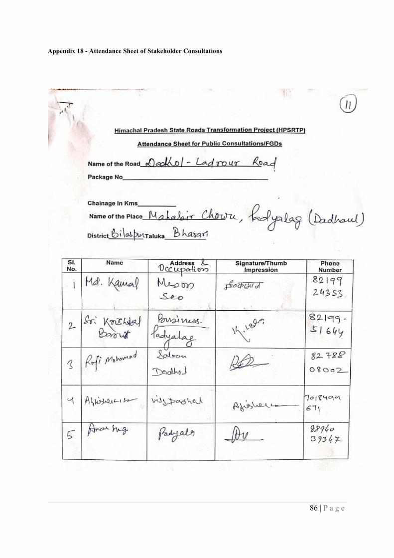
86 | P a g e
Appendix 18 - Attendance Sheet of Stakeholder Consultations
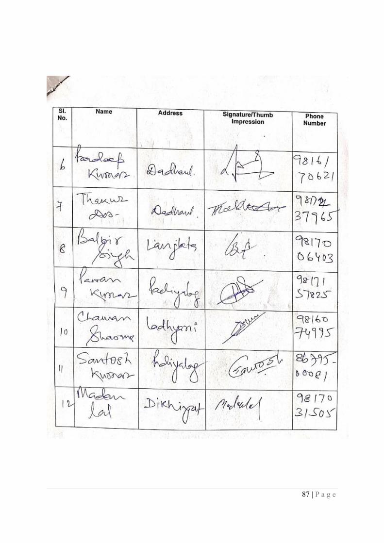
87 | P a g e
88 | P a g e
89 | P a g e
90 | P a g e
91 | P a g e
92 | P a g e
93 | P a g e
94 | P a g e
95 | P a g e
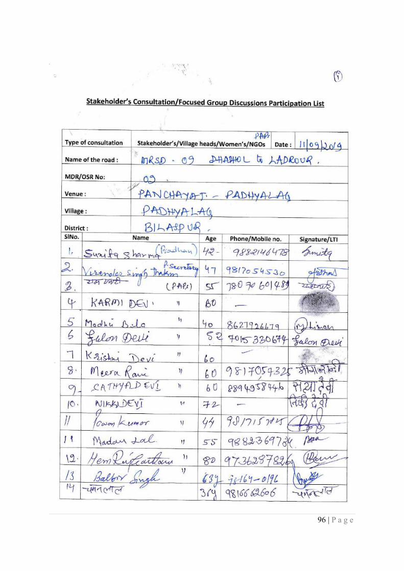
96 | P a g e
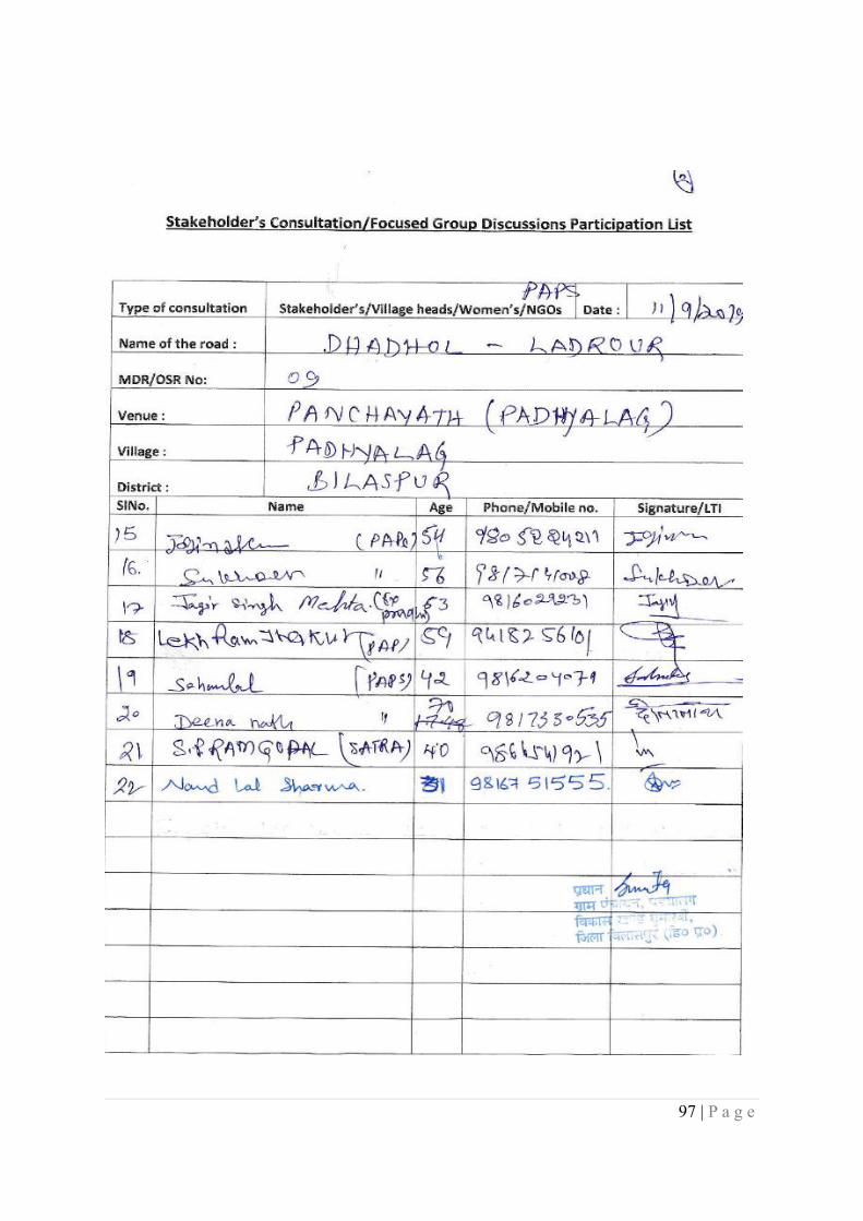
97 | P a g e
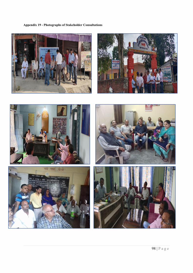
98 | P a g e
Appendix 19 - Photographs of Stakeholder Consultations

99 | P a g e
Appendix 20 - Checklist for Community Consultations
Himachal Pradesh State Roads Transformation Project (HPSRTP)Checklist for Community Level Consultations
1.1 What would be the impact on Private or CPR structures that are to be removed?
1.2 What would be the impact on land utilization (agriculture, commercial use etc.)?
1.3 What would be the impacts on occupation and incomes due to the project?
1.4 What would be the project impact on the village community in general?
1.5 Perception of people regarding- Access to amenities- would it be changed after the project?
Amenity Distance Reduction on time Quantity/Amount
Present After theProject
Present After theProject
Present After theProject
Market
School
College
Religious Place
Post office/Bank
Railway/Bus stand
Going to outside Districtfor Relatives/friends
Value of Land/Property
Any other(Specify)
1.6 What would be the direct and indirect Positive and negative impacts of the project?
1.7. What would be the improvement of the market connectivity?
100 | P a g e
1.8. What would be the improvement for the connectivity for religious place/tourism etc?
1.9 Community perceptions about safety of women and adolescent girls:
a. Do women in the community regularly venture out?
b. What are the typical reasons that require women tostep out of the house?
c. Are women engaged in income-generating activities?
d. If yes, what is the nature of those activities?e. What are the typical timings when women are spotted
outdoors in the neighborhood?(morning/afternoon/late afternoon/evening)
f. Is the neighborhood well-lit? Are there adequatestreet lights?
g. Are there any areas known for eve-teasing/harassment?
h. Are community centers/any other kind of publicspaces used by women on a regular basis?
i. Is it an established community (families staying in thesame house for generations) or is there considerablepresence of migrants (first generation/secondgeneration)? (Please provide socio-culturalspecifications – dominant caste, other castes,language spoken, prevalent gender norms, etc.)
1.10. Migration of Men, women and Children for Work
a. Do men migrate out for work and women andchildren remain in the community?
b. Do local women work in construction activities?
c. Do children work in construction activities?
d. Is there any in migration of men in the project area?
e. What are the vulnerabilities and Risks such womenand children face?
1.11 SHGs: Strength and functionality
- Do SHG members meet regularly?- What are the broad community issues they
have taken up, if any? (Example: alcoholism,teacher attendance, etc.)
- Have SHG members come across any casesof physical abuse, harassment at thecommunity level? If yes, what was thecommunity’s reaction? Did the SHG groupplay a role in helping the victim and/ordealing with the culprit?
101 | P a g e
1.12 Toilets
Has the village/town been declared as open defecationfree (ODF)?
Are toilets being used regularly by both women andmen?
Is water available for toilet usage?
Do women continue to defecate in the open?
1.13 Mobility: Physical and virtual
What is the principal mode of transport used bywomen in the area?
Is it common for women to travel alone inbuses/tempos?
Do women ride cycles?
Is it common to find adolescent girls and boys usingscooter/motorbikes?
Do women own their individual mobile phones?
Do adolescent girls and boys own smart phones?
Do they regularly access social media platforms likeFacebook, WhatsApp, etc.?College and secondary school
How far is the secondary school located from thehabitation?
What is the enrollment number of girls v/s boys inclass 8th-10th (average figure)
How far is the nearest degree college located?What is the enrollment number of girl’s v/s boys in adegree course? (average figure)
How do students travel to the schools? If they walk, isthat road well-lit?
What is the mode of transport typically used to reachthe college?
Do school-going girls, enrolled in class 8-12th, findthe commute safe?
Do girls, enrolled in the degree course, find thejourney safe?
1.14 Health facilities
Is the sub-centre/PHC easily accessible?
102 | P a g e
Do women patients go to a sub-centre or PHC aloneor are they generally accompanied by someone?
Do women patients find it to be a safe and secureenvironment?
Have ANMs and ASHA workers come across anycases of physical abuse, harassment that led tosubstantial injuries at the community level?Participation of women in public meetings
Do women participate actively inWUAs/aamsabhasand other such public meetings?
When community level disputes (give an examplehere) are resolved, how are women consulted?
Do women hold positions such as treasurer, sarpanch,etc.?
1.15 Land and ownership of assets
Do women have say in sale/purchase of land?
Do ownership of land and assets/lack of make womenvulnerable to forms of violence?
Can land acquisition and compensation make womenvulnerable to harassment/violence?
103 | P a g e
Appendix 21 - Gender Based Focused Group Discussion Checklist
Himachal Pradesh State Roads Transformation Project (HPSRTP)Checklist for Community Level Consultations for GBV
1 Community perceptions about safety of women and adolescent girls:
a. Do women in the community regularly venture out?
b. What are the typical reasons that require women tostep out of the house?
c. Are women engaged in income-generating activities?
d. If yes, what is the nature of those activities?e. What are the typical timings when women are spotted
outdoors in the neighborhood?(morning/afternoon/late afternoon/evening)
f. Is the neighborhood well-lit? Are there adequatestreet lights?
g. Are there any areas known for eve-teasing/harassment?
h. Are community centers/any other kind of publicspaces used by women on a regular basis?
i. Is it an established community (families staying in thesame house for generations) or is there considerablepresence of migrants (first generation/secondgeneration)? (Please provide socio-culturalspecifications – dominant caste, other castes,language spoken, prevalent gender norms, etc.)
2. Migration of Men, women and Children for Work
a. Do men migrate out for work and women andchildren remain in the community?
b. Do local women work in construction activities?
c. Do children work in construction activities?
d. Is there any in migration of men in the project area?
e. What are the vulnerabilities and Risks such womenand children face?
3 SHGs: Strength and functionality
- Do SHG members meet regularly?- What are the broad community issues they
have taken up, if any? (Example: alcoholism,teacher attendance, etc.)
- Have SHG members come across any casesof physical abuse, harassment at thecommunity level? If yes, what was thecommunity’s reaction?
104 | P a g e
- Did the SHG group play a role in helping thevictim and/or dealing with the culprit?
4 Toilets
Has the village/town been declared as open defecationfree (ODF)?
Are toilets being used regularly by both women andmen?
Is water available for toilet usage?
Do women continue to defecate in the open?
5 Mobility: Physical and virtual
What is the principal mode of transport used bywomen in the area?
Is it common for women to travel alone inbuses/tempos?
Do women ride cycles?
Is it common to find adolescent girls and boys usingscooter/motorbikes?
Do women own their individual mobile phones?
Do adolescent girls and boys own smart phones?
Do they regularly access social media platforms likeFacebook, WhatsApp, etc.?College and secondary school
How far is the secondary school located from thehabitation?
What is the enrollment number of girls v/s boys inclass 8th-10th (average figure)
How far is the nearest degree college located?What is the enrollment number of girl’s v/s boys in adegree course? (average figure)
How do students travel to the schools? If they walk, isthat road well-lit?
What is the mode of transport typically used to reachthe college?
Do school-going girls, enrolled in class 8-12th, findthe commute safe?
Do girls, enrolled in the degree course, find thejourney safe?
6 Health facilities
105 | P a g e
Is the sub-centre/PHC easily accessible?
Do women patients go to a sub-centre or PHC aloneor are they generally accompanied by someone?
Do women patients find it to be a safe and secureenvironment?
Have ANMs and ASHA workers come across anycases of physical abuse, harassment that led tosubstantial injuries at the community level?Participation of women in public meetings
Do women participate actively in WUAs/aamsabhasand other such public meetings?
When community level disputes (give an examplehere) are resolved, how are women consulted?
Do women hold positions such as treasurer, sarpanch,etc.?
7 Land and ownership of assets
Do women have say in sale/purchase of land?
Do ownership of land and assets/lack of make womenvulnerable to forms of violence?
Can land acquisition and compensation make womenvulnerable to harassment/violence?
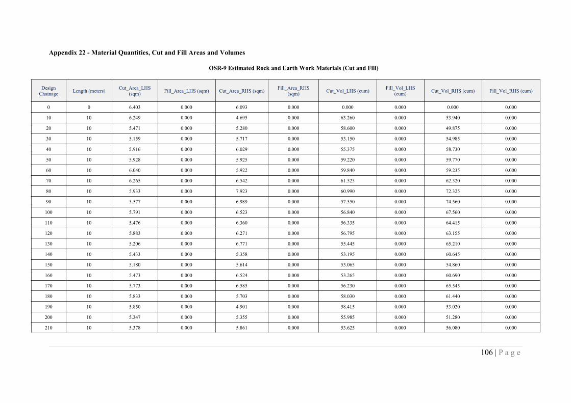
106 | P a g e
Appendix 22 - Material Quantities, Cut and Fill Areas and Volumes
OSR-9 Estimated Rock and Earth Work Materials (Cut and Fill)
DesignChainage Length (meters) Cut_Area_LHS
(sqm) Fill_Area_LHS (sqm) Cut_Area_RHS (sqm) Fill_Area_RHS(sqm) Cut_Vol_LHS (cum) Fill_Vol_LHS
(cum) Cut_Vol_RHS (cum) Fill_Vol_RHS (cum)
0 0 6.403 0.000 6.093 0.000 0.000 0.000 0.000 0.000
10 10 6.249 0.000 4.695 0.000 63.260 0.000 53.940 0.000
20 10 5.471 0.000 5.280 0.000 58.600 0.000 49.875 0.000
30 10 5.159 0.000 5.717 0.000 53.150 0.000 54.985 0.000
40 10 5.916 0.000 6.029 0.000 55.375 0.000 58.730 0.000
50 10 5.928 0.000 5.925 0.000 59.220 0.000 59.770 0.000
60 10 6.040 0.000 5.922 0.000 59.840 0.000 59.235 0.000
70 10 6.265 0.000 6.542 0.000 61.525 0.000 62.320 0.000
80 10 5.933 0.000 7.923 0.000 60.990 0.000 72.325 0.000
90 10 5.577 0.000 6.989 0.000 57.550 0.000 74.560 0.000
100 10 5.791 0.000 6.523 0.000 56.840 0.000 67.560 0.000
110 10 5.476 0.000 6.360 0.000 56.335 0.000 64.415 0.000
120 10 5.883 0.000 6.271 0.000 56.795 0.000 63.155 0.000
130 10 5.206 0.000 6.771 0.000 55.445 0.000 65.210 0.000
140 10 5.433 0.000 5.358 0.000 53.195 0.000 60.645 0.000
150 10 5.180 0.000 5.614 0.000 53.065 0.000 54.860 0.000
160 10 5.473 0.000 6.524 0.000 53.265 0.000 60.690 0.000
170 10 5.773 0.000 6.585 0.000 56.230 0.000 65.545 0.000
180 10 5.833 0.000 5.703 0.000 58.030 0.000 61.440 0.000
190 10 5.850 0.000 4.901 0.000 58.415 0.000 53.020 0.000
200 10 5.347 0.000 5.355 0.000 55.985 0.000 51.280 0.000
210 10 5.378 0.000 5.861 0.000 53.625 0.000 56.080 0.000

107 | P a g e
DesignChainage Length (meters) Cut_Area_LHS
(sqm) Fill_Area_LHS (sqm) Cut_Area_RHS (sqm) Fill_Area_RHS(sqm) Cut_Vol_LHS (cum) Fill_Vol_LHS
(cum) Cut_Vol_RHS (cum) Fill_Vol_RHS (cum)
220 10 6.002 0.000 5.196 0.000 56.900 0.000 55.285 0.000
230 10 7.057 0.000 6.157 0.000 65.295 0.000 56.765 0.000
240 10 6.512 0.000 6.467 0.000 67.845 0.000 63.120 0.000
250 10 4.526 0.000 4.567 0.000 55.190 0.000 55.170 0.000
260 10 4.617 0.000 4.647 0.000 45.715 0.000 46.070 0.000
270 10 5.860 0.000 5.574 0.000 52.385 0.000 51.105 0.000
280 10 4.258 0.000 5.019 0.000 50.590 0.000 52.965 0.000
290 10 4.950 0.000 6.001 0.000 46.040 0.000 55.100 0.000
300 10 4.188 0.000 6.106 0.000 45.690 0.000 60.535 0.000
310 10 4.140 0.000 4.631 0.000 41.640 0.000 53.685 0.000
320 10 4.269 0.000 5.540 0.000 42.045 0.000 50.855 0.000
330 10 5.048 0.000 5.033 0.000 46.585 0.000 52.865 0.000
340 10 6.150 0.000 6.899 0.000 55.990 0.000 59.660 0.000
350 10 6.721 0.000 6.914 0.000 64.355 0.000 69.065 0.000
360 10 5.005 0.000 5.997 0.000 58.630 0.000 64.555 0.000
370 10 3.307 0.000 2.589 0.000 41.560 0.000 42.930 0.000
380 10 2.854 0.000 4.318 0.000 30.805 0.000 34.535 0.000
390 10 2.727 0.000 5.118 0.000 27.905 0.000 47.180 0.000
400 10 3.597 0.000 6.648 0.000 31.620 0.000 58.830 0.000
410 10 3.060 0.000 6.748 0.000 33.285 0.000 66.980 0.000
420 10 2.346 0.000 7.718 0.000 27.030 0.000 72.330 0.000
430 10 3.204 0.000 5.466 0.000 27.750 0.000 65.920 0.000
440 10 4.002 0.000 9.156 0.000 36.030 0.000 73.110 0.000
450 10 5.312 0.000 11.091 0.000 46.570 0.000 101.235 0.000
460 10 5.710 0.000 10.610 0.000 55.110 0.000 108.505 0.000

108 | P a g e
DesignChainage Length (meters) Cut_Area_LHS
(sqm) Fill_Area_LHS (sqm) Cut_Area_RHS (sqm) Fill_Area_RHS(sqm) Cut_Vol_LHS (cum) Fill_Vol_LHS
(cum) Cut_Vol_RHS (cum) Fill_Vol_RHS (cum)
470 10 3.892 0.000 10.561 0.000 48.010 0.000 105.855 0.000
480 10 2.509 0.000 8.375 0.000 32.005 0.000 94.680 0.000
490 10 1.681 0.976 4.103 0.000 20.950 4.880 62.390 0.000
500 10 2.666 0.089 2.684 0.137 21.735 5.325 33.935 0.685
510 10 4.424 0.000 3.209 0.000 35.450 0.445 29.465 0.685
520 10 5.122 0.000 2.912 0.084 47.730 0.000 30.605 0.420
530 10 6.228 0.000 4.085 0.000 56.750 0.000 34.985 0.420
540 10 8.184 0.000 5.178 0.000 72.060 0.000 46.315 0.000
550 10 10.958 0.000 5.313 0.000 95.710 0.000 52.455 0.000
560 10 10.772 0.000 5.309 0.000 108.650 0.000 53.110 0.000
570 10 8.741 0.000 4.921 0.000 97.565 0.000 51.150 0.000
580 10 7.906 0.000 4.671 0.000 83.235 0.000 47.960 0.000
590 10 6.434 0.000 4.799 0.000 71.700 0.000 47.350 0.000
600 10 5.039 0.000 5.581 0.000 57.365 0.000 51.900 0.000
610 10 4.680 0.000 6.975 0.000 48.595 0.000 62.780 0.000
620 10 5.331 0.000 8.776 0.000 50.055 0.000 78.755 0.000
630 10 4.676 0.000 1.593 0.124 50.035 0.000 51.845 0.620
640 10 2.798 3.064 0.000 9.939 37.370 15.320 7.965 50.315
650 10 3.981 0.000 3.434 0.000 33.895 15.320 17.170 49.695
660 10 4.197 0.000 4.566 0.000 40.890 0.000 40.000 0.000
670 10 4.038 0.000 3.788 0.000 41.175 0.000 41.770 0.000
680 10 4.485 0.000 0.993 0.782 42.615 0.000 23.905 3.910
690 10 5.060 0.000 1.933 0.000 47.725 0.000 14.630 3.910
700 10 4.963 0.000 5.493 0.000 50.115 0.000 37.130 0.000
710 10 5.090 0.000 7.111 0.000 50.265 0.000 63.020 0.000
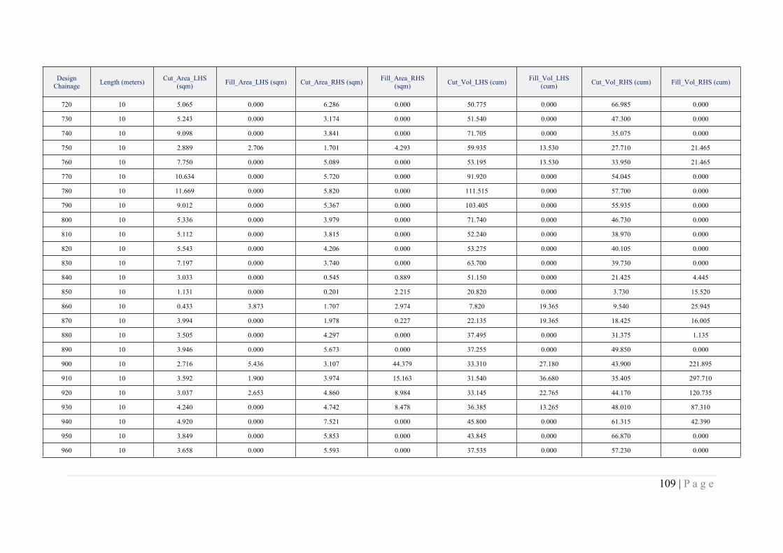
109 | P a g e
DesignChainage Length (meters) Cut_Area_LHS
(sqm) Fill_Area_LHS (sqm) Cut_Area_RHS (sqm) Fill_Area_RHS(sqm) Cut_Vol_LHS (cum) Fill_Vol_LHS
(cum) Cut_Vol_RHS (cum) Fill_Vol_RHS (cum)
720 10 5.065 0.000 6.286 0.000 50.775 0.000 66.985 0.000
730 10 5.243 0.000 3.174 0.000 51.540 0.000 47.300 0.000
740 10 9.098 0.000 3.841 0.000 71.705 0.000 35.075 0.000
750 10 2.889 2.706 1.701 4.293 59.935 13.530 27.710 21.465
760 10 7.750 0.000 5.089 0.000 53.195 13.530 33.950 21.465
770 10 10.634 0.000 5.720 0.000 91.920 0.000 54.045 0.000
780 10 11.669 0.000 5.820 0.000 111.515 0.000 57.700 0.000
790 10 9.012 0.000 5.367 0.000 103.405 0.000 55.935 0.000
800 10 5.336 0.000 3.979 0.000 71.740 0.000 46.730 0.000
810 10 5.112 0.000 3.815 0.000 52.240 0.000 38.970 0.000
820 10 5.543 0.000 4.206 0.000 53.275 0.000 40.105 0.000
830 10 7.197 0.000 3.740 0.000 63.700 0.000 39.730 0.000
840 10 3.033 0.000 0.545 0.889 51.150 0.000 21.425 4.445
850 10 1.131 0.000 0.201 2.215 20.820 0.000 3.730 15.520
860 10 0.433 3.873 1.707 2.974 7.820 19.365 9.540 25.945
870 10 3.994 0.000 1.978 0.227 22.135 19.365 18.425 16.005
880 10 3.505 0.000 4.297 0.000 37.495 0.000 31.375 1.135
890 10 3.946 0.000 5.673 0.000 37.255 0.000 49.850 0.000
900 10 2.716 5.436 3.107 44.379 33.310 27.180 43.900 221.895
910 10 3.592 1.900 3.974 15.163 31.540 36.680 35.405 297.710
920 10 3.037 2.653 4.860 8.984 33.145 22.765 44.170 120.735
930 10 4.240 0.000 4.742 8.478 36.385 13.265 48.010 87.310
940 10 4.920 0.000 7.521 0.000 45.800 0.000 61.315 42.390
950 10 3.849 0.000 5.853 0.000 43.845 0.000 66.870 0.000
960 10 3.658 0.000 5.593 0.000 37.535 0.000 57.230 0.000

110 | P a g e
DesignChainage Length (meters) Cut_Area_LHS
(sqm) Fill_Area_LHS (sqm) Cut_Area_RHS (sqm) Fill_Area_RHS(sqm) Cut_Vol_LHS (cum) Fill_Vol_LHS
(cum) Cut_Vol_RHS (cum) Fill_Vol_RHS (cum)
970 10 4.536 0.000 5.013 0.000 40.970 0.000 53.030 0.000
980 10 6.092 0.000 4.378 0.000 53.140 0.000 46.955 0.000
990 10 5.718 0.000 3.604 0.000 59.050 0.000 39.910 0.000
1000 10 5.090 0.000 3.050 0.000 54.040 0.000 33.270 0.000
1010 10 4.377 0.000 1.919 0.272 47.335 0.000 24.845 1.360
1020 10 4.515 0.000 1.820 0.425 44.460 0.000 18.695 3.485
1030 10 5.736 0.000 2.125 0.422 51.255 0.000 19.725 4.235
1040 10 6.603 0.000 3.277 0.000 61.695 0.000 27.010 2.110
1050 10 7.022 0.000 3.439 0.000 68.125 0.000 33.580 0.000
1060 10 7.132 0.000 3.721 0.000 70.770 0.000 35.800 0.000
1070 10 6.784 0.000 3.732 0.000 69.580 0.000 37.265 0.000
1080 10 5.610 0.000 4.446 0.000 61.970 0.000 40.890 0.000
1090 10 5.362 0.000 4.262 0.000 54.860 0.000 43.540 0.000
1100 10 6.581 0.000 3.725 0.000 59.715 0.000 39.935 0.000
1110 10 7.895 0.000 3.862 0.000 72.380 0.000 37.935 0.000
1120 10 7.002 0.000 3.519 0.000 74.485 0.000 36.905 0.000
1130 10 6.482 0.000 4.103 0.000 67.420 0.000 38.110 0.000
1140 10 7.219 0.000 4.590 0.000 68.505 0.000 43.465 0.000
1150 10 5.928 0.000 6.263 0.000 65.735 0.000 54.265 0.000
1160 10 3.634 0.000 5.678 0.000 47.810 0.000 59.705 0.000
1170 10 6.754 0.000 5.527 0.000 51.940 0.000 56.025 0.000
1180 10 6.732 0.000 5.843 0.000 67.430 0.000 56.850 0.000
1190 10 9.331 0.000 5.508 0.000 80.315 0.000 56.755 0.000
1200 10 14.055 0.000 4.661 0.000 116.930 0.000 50.845 0.000
1210 10 13.257 0.000 4.260 0.000 136.560 0.000 44.605 0.000

111 | P a g e
DesignChainage Length (meters) Cut_Area_LHS
(sqm) Fill_Area_LHS (sqm) Cut_Area_RHS (sqm) Fill_Area_RHS(sqm) Cut_Vol_LHS (cum) Fill_Vol_LHS
(cum) Cut_Vol_RHS (cum) Fill_Vol_RHS (cum)
1220 10 5.922 0.000 4.841 0.000 95.895 0.000 45.505 0.000
1230 10 6.280 0.000 4.678 0.000 61.010 0.000 47.595 0.000
1240 10 6.689 0.000 5.541 0.000 64.845 0.000 51.095 0.000
1250 10 6.428 0.000 5.274 0.000 65.585 0.000 54.075 0.000
1260 10 5.726 0.000 3.773 0.000 60.770 0.000 45.235 0.000
1270 10 5.384 0.012 1.399 2.103 55.550 0.060 25.860 10.515
1280 10 4.772 0.000 4.837 0.000 50.780 0.060 31.180 10.515
1290 10 5.760 0.000 5.990 0.000 52.660 0.000 54.135 0.000
1300 10 5.395 0.000 6.093 0.000 55.775 0.000 60.415 0.000
1310 10 5.280 0.000 5.731 0.000 53.375 0.000 59.120 0.000
1320 10 5.444 0.000 5.749 0.000 53.620 0.000 57.400 0.000
1330 10 5.804 0.000 5.350 0.000 56.240 0.000 55.495 0.000
1340 10 5.618 0.000 5.064 0.000 57.110 0.000 52.070 0.000
1350 10 5.255 0.000 4.948 0.000 54.365 0.000 50.060 0.000
1360 10 6.721 0.000 5.889 0.000 59.880 0.000 54.185 0.000
1370 10 5.533 0.000 6.347 0.000 61.270 0.000 61.180 0.000
1380 10 5.364 0.000 5.943 0.000 54.485 0.000 61.450 0.000
1390 10 5.250 0.000 5.640 0.000 53.070 0.000 57.915 0.000
1400 10 5.285 0.000 5.206 0.000 52.675 0.000 54.230 0.000
1410 10 5.984 0.000 5.349 0.000 56.345 0.000 52.775 0.000
1420 10 5.961 0.000 5.301 0.000 59.725 0.000 53.250 0.000
1430 10 5.518 0.000 5.206 0.000 57.395 0.000 52.535 0.000
1440 10 5.919 0.000 5.928 0.000 57.185 0.000 55.670 0.000
1450 10 5.671 0.000 5.692 0.000 57.950 0.000 58.100 0.000
1460 10 5.115 0.000 4.965 0.000 53.930 0.000 53.285 0.000

112 | P a g e
DesignChainage Length (meters) Cut_Area_LHS
(sqm) Fill_Area_LHS (sqm) Cut_Area_RHS (sqm) Fill_Area_RHS(sqm) Cut_Vol_LHS (cum) Fill_Vol_LHS
(cum) Cut_Vol_RHS (cum) Fill_Vol_RHS (cum)
1470 10 5.236 0.000 5.301 0.000 51.755 0.000 51.330 0.000
1480 10 5.149 0.000 5.290 0.000 51.925 0.000 52.955 0.000
1490 10 4.860 0.000 4.789 0.000 50.045 0.000 50.395 0.000
1500 10 5.314 0.000 5.108 0.000 50.870 0.000 49.485 0.000
1510 10 5.406 0.000 5.637 0.000 53.600 0.000 53.725 0.000
1520 10 5.811 0.000 5.481 0.000 56.085 0.000 55.590 0.000
1530 10 6.416 0.000 5.431 0.000 61.135 0.000 54.560 0.000
1540 10 6.057 0.000 5.332 0.000 62.365 0.000 53.815 0.000
1550 10 4.757 0.000 4.907 0.000 54.070 0.000 51.195 0.000
1560 10 6.158 0.000 5.942 0.000 54.575 0.000 54.245 0.000
1570 10 6.586 0.000 5.641 0.000 63.720 0.000 57.915 0.000
1580 10 5.448 0.000 5.509 0.000 60.170 0.000 55.750 0.000
1590 10 6.165 0.000 7.357 0.000 58.065 0.000 64.330 0.000
1600 10 5.359 0.000 6.503 0.000 57.620 0.000 69.300 0.000
1610 10 4.318 0.000 4.496 0.000 48.385 0.000 54.995 0.000
1620 10 4.740 0.000 4.995 0.000 45.290 0.000 47.455 0.000
1630 10 5.482 0.000 4.918 0.000 51.110 0.000 49.565 0.000
1640 10 6.118 0.000 5.453 0.000 58.000 0.000 51.855 0.000
1650 10 7.715 0.000 7.742 0.000 69.165 0.000 65.975 0.000
1660 10 5.369 0.000 8.581 0.000 65.420 0.000 81.615 0.000
1670 10 5.898 0.000 5.220 0.000 56.335 0.000 69.005 0.000
1680 10 6.104 0.000 6.325 0.000 60.010 0.000 57.725 0.000
1690 10 5.717 0.000 6.690 0.000 59.105 0.000 65.075 0.000
1700 10 5.452 0.000 6.054 0.000 55.845 0.000 63.720 0.000
1710 10 4.676 0.000 6.894 0.000 50.640 0.000 64.740 0.000
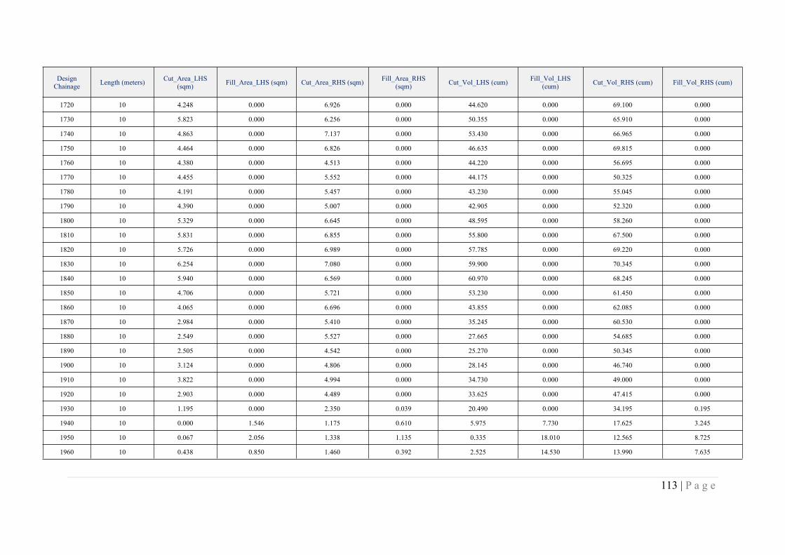
113 | P a g e
DesignChainage Length (meters) Cut_Area_LHS
(sqm) Fill_Area_LHS (sqm) Cut_Area_RHS (sqm) Fill_Area_RHS(sqm) Cut_Vol_LHS (cum) Fill_Vol_LHS
(cum) Cut_Vol_RHS (cum) Fill_Vol_RHS (cum)
1720 10 4.248 0.000 6.926 0.000 44.620 0.000 69.100 0.000
1730 10 5.823 0.000 6.256 0.000 50.355 0.000 65.910 0.000
1740 10 4.863 0.000 7.137 0.000 53.430 0.000 66.965 0.000
1750 10 4.464 0.000 6.826 0.000 46.635 0.000 69.815 0.000
1760 10 4.380 0.000 4.513 0.000 44.220 0.000 56.695 0.000
1770 10 4.455 0.000 5.552 0.000 44.175 0.000 50.325 0.000
1780 10 4.191 0.000 5.457 0.000 43.230 0.000 55.045 0.000
1790 10 4.390 0.000 5.007 0.000 42.905 0.000 52.320 0.000
1800 10 5.329 0.000 6.645 0.000 48.595 0.000 58.260 0.000
1810 10 5.831 0.000 6.855 0.000 55.800 0.000 67.500 0.000
1820 10 5.726 0.000 6.989 0.000 57.785 0.000 69.220 0.000
1830 10 6.254 0.000 7.080 0.000 59.900 0.000 70.345 0.000
1840 10 5.940 0.000 6.569 0.000 60.970 0.000 68.245 0.000
1850 10 4.706 0.000 5.721 0.000 53.230 0.000 61.450 0.000
1860 10 4.065 0.000 6.696 0.000 43.855 0.000 62.085 0.000
1870 10 2.984 0.000 5.410 0.000 35.245 0.000 60.530 0.000
1880 10 2.549 0.000 5.527 0.000 27.665 0.000 54.685 0.000
1890 10 2.505 0.000 4.542 0.000 25.270 0.000 50.345 0.000
1900 10 3.124 0.000 4.806 0.000 28.145 0.000 46.740 0.000
1910 10 3.822 0.000 4.994 0.000 34.730 0.000 49.000 0.000
1920 10 2.903 0.000 4.489 0.000 33.625 0.000 47.415 0.000
1930 10 1.195 0.000 2.350 0.039 20.490 0.000 34.195 0.195
1940 10 0.000 1.546 1.175 0.610 5.975 7.730 17.625 3.245
1950 10 0.067 2.056 1.338 1.135 0.335 18.010 12.565 8.725
1960 10 0.438 0.850 1.460 0.392 2.525 14.530 13.990 7.635
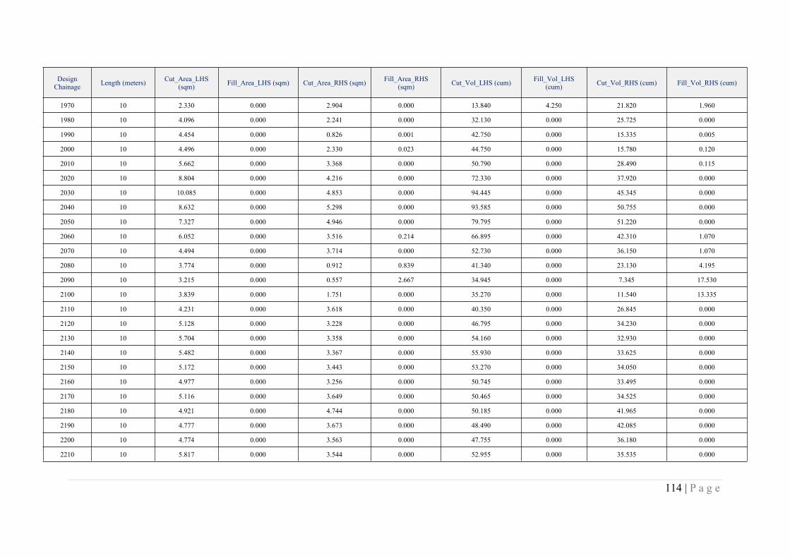
114 | P a g e
DesignChainage Length (meters) Cut_Area_LHS
(sqm) Fill_Area_LHS (sqm) Cut_Area_RHS (sqm) Fill_Area_RHS(sqm) Cut_Vol_LHS (cum) Fill_Vol_LHS
(cum) Cut_Vol_RHS (cum) Fill_Vol_RHS (cum)
1970 10 2.330 0.000 2.904 0.000 13.840 4.250 21.820 1.960
1980 10 4.096 0.000 2.241 0.000 32.130 0.000 25.725 0.000
1990 10 4.454 0.000 0.826 0.001 42.750 0.000 15.335 0.005
2000 10 4.496 0.000 2.330 0.023 44.750 0.000 15.780 0.120
2010 10 5.662 0.000 3.368 0.000 50.790 0.000 28.490 0.115
2020 10 8.804 0.000 4.216 0.000 72.330 0.000 37.920 0.000
2030 10 10.085 0.000 4.853 0.000 94.445 0.000 45.345 0.000
2040 10 8.632 0.000 5.298 0.000 93.585 0.000 50.755 0.000
2050 10 7.327 0.000 4.946 0.000 79.795 0.000 51.220 0.000
2060 10 6.052 0.000 3.516 0.214 66.895 0.000 42.310 1.070
2070 10 4.494 0.000 3.714 0.000 52.730 0.000 36.150 1.070
2080 10 3.774 0.000 0.912 0.839 41.340 0.000 23.130 4.195
2090 10 3.215 0.000 0.557 2.667 34.945 0.000 7.345 17.530
2100 10 3.839 0.000 1.751 0.000 35.270 0.000 11.540 13.335
2110 10 4.231 0.000 3.618 0.000 40.350 0.000 26.845 0.000
2120 10 5.128 0.000 3.228 0.000 46.795 0.000 34.230 0.000
2130 10 5.704 0.000 3.358 0.000 54.160 0.000 32.930 0.000
2140 10 5.482 0.000 3.367 0.000 55.930 0.000 33.625 0.000
2150 10 5.172 0.000 3.443 0.000 53.270 0.000 34.050 0.000
2160 10 4.977 0.000 3.256 0.000 50.745 0.000 33.495 0.000
2170 10 5.116 0.000 3.649 0.000 50.465 0.000 34.525 0.000
2180 10 4.921 0.000 4.744 0.000 50.185 0.000 41.965 0.000
2190 10 4.777 0.000 3.673 0.000 48.490 0.000 42.085 0.000
2200 10 4.774 0.000 3.563 0.000 47.755 0.000 36.180 0.000
2210 10 5.817 0.000 3.544 0.000 52.955 0.000 35.535 0.000

115 | P a g e
DesignChainage Length (meters) Cut_Area_LHS
(sqm) Fill_Area_LHS (sqm) Cut_Area_RHS (sqm) Fill_Area_RHS(sqm) Cut_Vol_LHS (cum) Fill_Vol_LHS
(cum) Cut_Vol_RHS (cum) Fill_Vol_RHS (cum)
2220 10 5.582 0.000 3.295 0.000 56.995 0.000 34.195 0.000
2230 10 6.431 0.000 3.157 0.000 60.065 0.000 32.260 0.000
2240 10 5.461 0.000 2.990 0.000 59.460 0.000 30.735 0.000
2250 10 5.357 0.000 2.499 0.000 54.090 0.000 27.445 0.000
2260 10 5.888 0.000 2.837 0.000 56.225 0.000 26.680 0.000
2270 10 5.541 0.000 2.902 0.000 57.145 0.000 28.695 0.000
2280 10 4.499 0.000 2.018 0.000 50.200 0.000 24.600 0.000
2290 10 4.988 0.000 2.088 0.117 47.435 0.000 20.530 0.585
2300 10 5.698 0.000 2.497 0.223 53.430 0.000 22.925 1.700
2310 10 7.230 0.000 3.223 0.000 64.640 0.000 28.600 1.115
2320 10 13.363 0.000 4.843 0.000 102.965 0.000 40.330 0.000
2330 10 29.042 0.000 5.874 0.000 212.025 0.000 53.585 0.000
2340 10 23.385 0.000 3.723 0.000 262.135 0.000 47.985 0.000
2350 10 17.766 0.000 2.487 0.034 205.755 0.000 31.050 0.170
2360 10 15.377 0.000 2.215 0.000 165.715 0.000 23.510 0.170
2370 10 11.915 0.000 2.885 0.000 136.460 0.000 25.500 0.000
2380 10 9.897 0.000 4.934 0.000 109.060 0.000 39.095 0.000
2390 10 8.102 0.000 4.794 0.000 89.995 0.000 48.640 0.000
2400 10 7.044 0.000 4.935 0.000 75.730 0.000 48.645 0.000
2410 10 4.924 0.000 3.067 0.000 59.840 0.000 40.010 0.000
2420 10 5.796 0.000 3.322 0.000 53.600 0.000 31.945 0.000
2430 10 4.075 0.000 1.506 0.000 49.355 0.000 24.140 0.000
2440 10 3.154 0.000 0.625 0.486 36.145 0.000 10.655 2.430
2450 10 3.012 0.000 1.547 0.121 30.830 0.000 10.860 3.035
2460 10 3.450 0.000 1.839 0.037 32.310 0.000 16.930 0.790

116 | P a g e
DesignChainage Length (meters) Cut_Area_LHS
(sqm) Fill_Area_LHS (sqm) Cut_Area_RHS (sqm) Fill_Area_RHS(sqm) Cut_Vol_LHS (cum) Fill_Vol_LHS
(cum) Cut_Vol_RHS (cum) Fill_Vol_RHS (cum)
2470 10 5.637 0.000 4.020 0.000 45.435 0.000 29.295 0.185
2480 10 6.020 0.000 4.365 0.000 58.285 0.000 41.925 0.000
2490 10 5.718 0.000 4.183 0.000 58.690 0.000 42.740 0.000
2500 10 5.658 0.000 4.914 0.000 56.880 0.000 45.485 0.000
2510 10 4.798 0.000 4.674 0.000 52.280 0.000 47.940 0.000
2520 10 5.484 0.000 4.473 0.000 51.410 0.000 45.735 0.000
2530 10 5.792 0.000 4.552 0.000 56.380 0.000 45.125 0.000
2540 10 6.985 0.000 4.331 0.000 63.885 0.000 44.415 0.000
2550 10 5.773 0.000 4.188 0.000 63.790 0.000 42.595 0.000
2560 10 5.647 0.000 3.857 0.000 57.100 0.000 40.225 0.000
2570 10 4.893 0.000 4.365 0.000 52.700 0.000 41.110 0.000
2580 10 4.644 0.000 5.373 0.000 47.685 0.000 48.690 0.000
2590 10 5.192 0.000 5.668 0.000 49.180 0.000 55.205 0.000
2600 10 4.591 0.000 6.455 0.000 48.915 0.000 60.615 0.000
2610 10 4.943 0.000 8.592 0.000 47.670 0.000 75.235 0.000
2620 10 7.558 0.000 8.636 0.000 62.505 0.000 86.140 0.000
2630 10 8.947 0.000 9.417 0.000 82.525 0.000 90.265 0.000
2640 10 9.922 0.000 8.571 0.000 94.345 0.000 89.940 0.000
2650 10 8.481 0.000 4.460 0.000 92.015 0.000 65.155 0.000
2660 10 4.716 0.000 2.595 0.000 65.985 0.000 35.275 0.000
2670 10 3.467 0.000 0.391 0.000 40.915 0.000 14.930 0.000
2680 10 3.276 0.049 0.057 0.811 33.715 0.245 2.240 4.055
2690 10 8.279 0.000 0.233 0.535 57.775 0.245 1.450 6.730
2700 10 8.147 0.000 3.102 0.000 82.130 0.000 16.675 2.675
2710 10 9.452 0.000 4.992 0.000 87.995 0.000 40.470 0.000
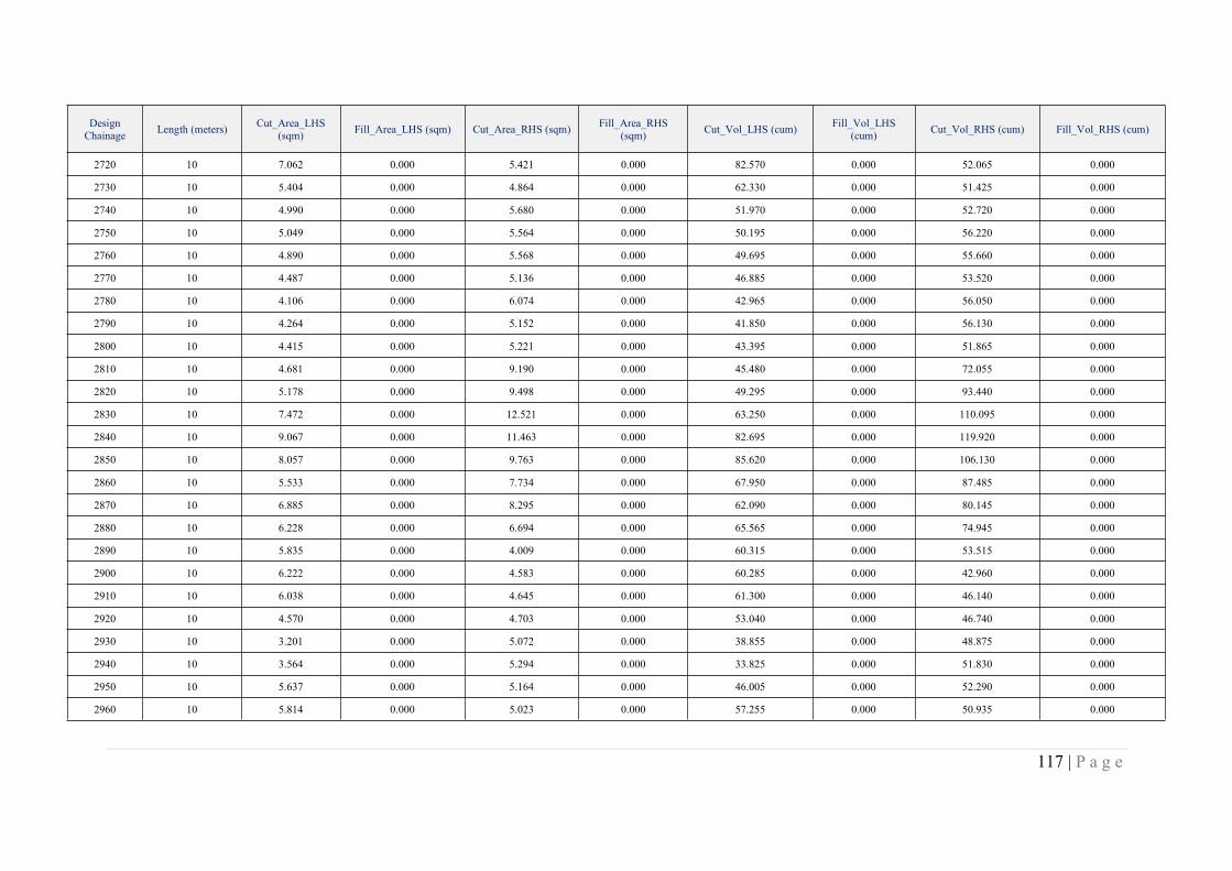
117 | P a g e
DesignChainage Length (meters) Cut_Area_LHS
(sqm) Fill_Area_LHS (sqm) Cut_Area_RHS (sqm) Fill_Area_RHS(sqm) Cut_Vol_LHS (cum) Fill_Vol_LHS
(cum) Cut_Vol_RHS (cum) Fill_Vol_RHS (cum)
2720 10 7.062 0.000 5.421 0.000 82.570 0.000 52.065 0.000
2730 10 5.404 0.000 4.864 0.000 62.330 0.000 51.425 0.000
2740 10 4.990 0.000 5.680 0.000 51.970 0.000 52.720 0.000
2750 10 5.049 0.000 5.564 0.000 50.195 0.000 56.220 0.000
2760 10 4.890 0.000 5.568 0.000 49.695 0.000 55.660 0.000
2770 10 4.487 0.000 5.136 0.000 46.885 0.000 53.520 0.000
2780 10 4.106 0.000 6.074 0.000 42.965 0.000 56.050 0.000
2790 10 4.264 0.000 5.152 0.000 41.850 0.000 56.130 0.000
2800 10 4.415 0.000 5.221 0.000 43.395 0.000 51.865 0.000
2810 10 4.681 0.000 9.190 0.000 45.480 0.000 72.055 0.000
2820 10 5.178 0.000 9.498 0.000 49.295 0.000 93.440 0.000
2830 10 7.472 0.000 12.521 0.000 63.250 0.000 110.095 0.000
2840 10 9.067 0.000 11.463 0.000 82.695 0.000 119.920 0.000
2850 10 8.057 0.000 9.763 0.000 85.620 0.000 106.130 0.000
2860 10 5.533 0.000 7.734 0.000 67.950 0.000 87.485 0.000
2870 10 6.885 0.000 8.295 0.000 62.090 0.000 80.145 0.000
2880 10 6.228 0.000 6.694 0.000 65.565 0.000 74.945 0.000
2890 10 5.835 0.000 4.009 0.000 60.315 0.000 53.515 0.000
2900 10 6.222 0.000 4.583 0.000 60.285 0.000 42.960 0.000
2910 10 6.038 0.000 4.645 0.000 61.300 0.000 46.140 0.000
2920 10 4.570 0.000 4.703 0.000 53.040 0.000 46.740 0.000
2930 10 3.201 0.000 5.072 0.000 38.855 0.000 48.875 0.000
2940 10 3.564 0.000 5.294 0.000 33.825 0.000 51.830 0.000
2950 10 5.637 0.000 5.164 0.000 46.005 0.000 52.290 0.000
2960 10 5.814 0.000 5.023 0.000 57.255 0.000 50.935 0.000
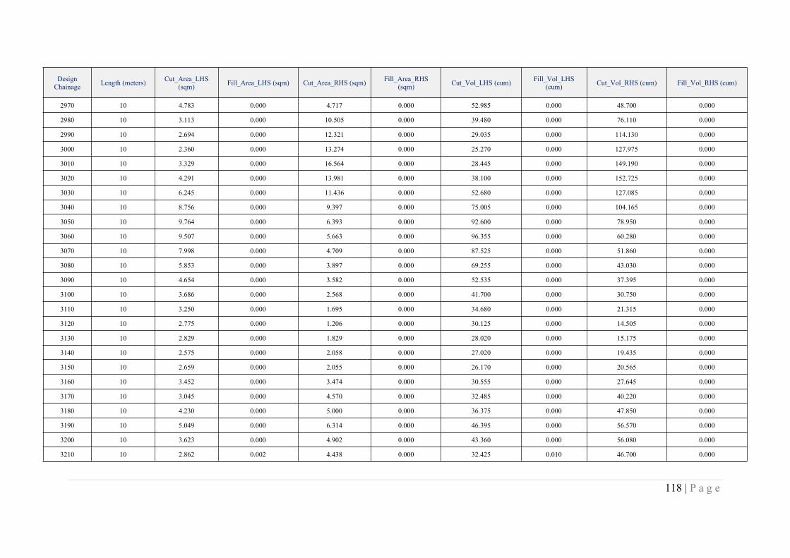
118 | P a g e
DesignChainage Length (meters) Cut_Area_LHS
(sqm) Fill_Area_LHS (sqm) Cut_Area_RHS (sqm) Fill_Area_RHS(sqm) Cut_Vol_LHS (cum) Fill_Vol_LHS
(cum) Cut_Vol_RHS (cum) Fill_Vol_RHS (cum)
2970 10 4.783 0.000 4.717 0.000 52.985 0.000 48.700 0.000
2980 10 3.113 0.000 10.505 0.000 39.480 0.000 76.110 0.000
2990 10 2.694 0.000 12.321 0.000 29.035 0.000 114.130 0.000
3000 10 2.360 0.000 13.274 0.000 25.270 0.000 127.975 0.000
3010 10 3.329 0.000 16.564 0.000 28.445 0.000 149.190 0.000
3020 10 4.291 0.000 13.981 0.000 38.100 0.000 152.725 0.000
3030 10 6.245 0.000 11.436 0.000 52.680 0.000 127.085 0.000
3040 10 8.756 0.000 9.397 0.000 75.005 0.000 104.165 0.000
3050 10 9.764 0.000 6.393 0.000 92.600 0.000 78.950 0.000
3060 10 9.507 0.000 5.663 0.000 96.355 0.000 60.280 0.000
3070 10 7.998 0.000 4.709 0.000 87.525 0.000 51.860 0.000
3080 10 5.853 0.000 3.897 0.000 69.255 0.000 43.030 0.000
3090 10 4.654 0.000 3.582 0.000 52.535 0.000 37.395 0.000
3100 10 3.686 0.000 2.568 0.000 41.700 0.000 30.750 0.000
3110 10 3.250 0.000 1.695 0.000 34.680 0.000 21.315 0.000
3120 10 2.775 0.000 1.206 0.000 30.125 0.000 14.505 0.000
3130 10 2.829 0.000 1.829 0.000 28.020 0.000 15.175 0.000
3140 10 2.575 0.000 2.058 0.000 27.020 0.000 19.435 0.000
3150 10 2.659 0.000 2.055 0.000 26.170 0.000 20.565 0.000
3160 10 3.452 0.000 3.474 0.000 30.555 0.000 27.645 0.000
3170 10 3.045 0.000 4.570 0.000 32.485 0.000 40.220 0.000
3180 10 4.230 0.000 5.000 0.000 36.375 0.000 47.850 0.000
3190 10 5.049 0.000 6.314 0.000 46.395 0.000 56.570 0.000
3200 10 3.623 0.000 4.902 0.000 43.360 0.000 56.080 0.000
3210 10 2.862 0.002 4.438 0.000 32.425 0.010 46.700 0.000
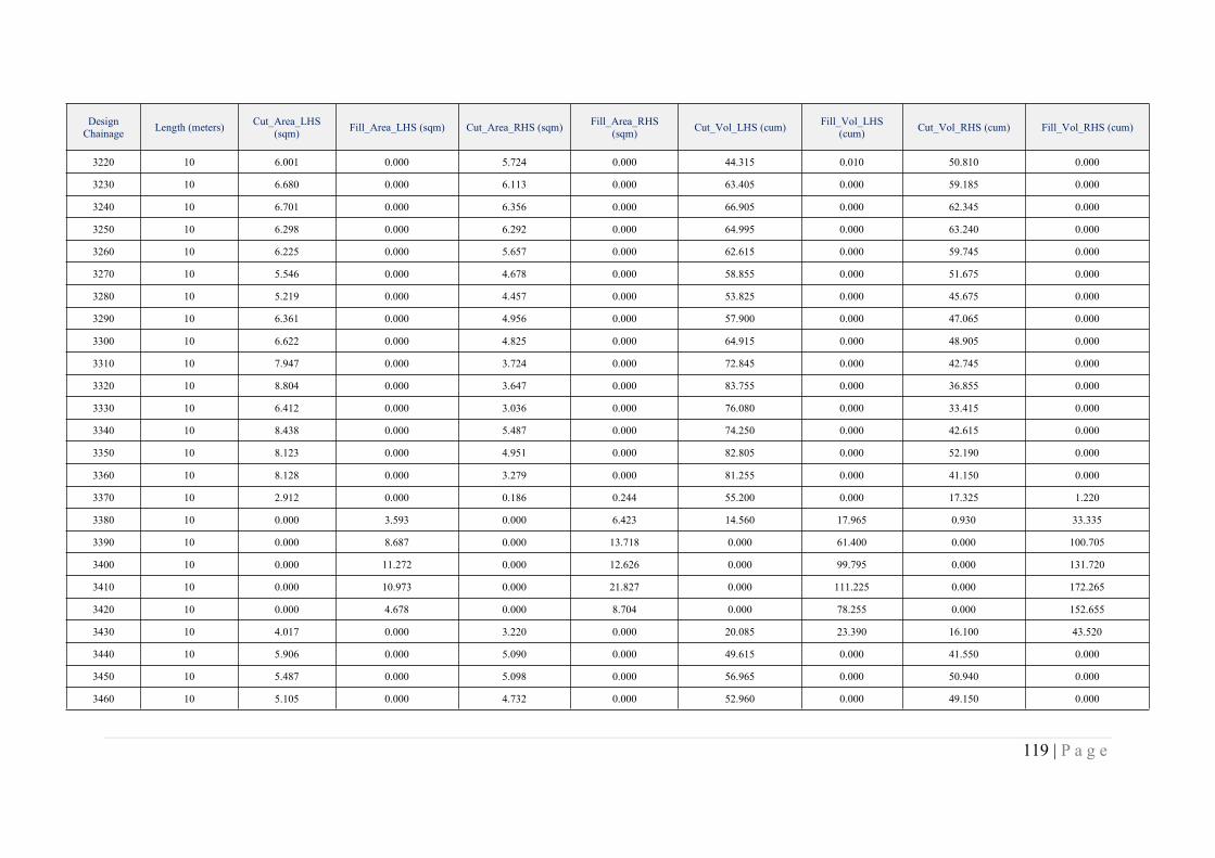
119 | P a g e
DesignChainage Length (meters) Cut_Area_LHS
(sqm) Fill_Area_LHS (sqm) Cut_Area_RHS (sqm) Fill_Area_RHS(sqm) Cut_Vol_LHS (cum) Fill_Vol_LHS
(cum) Cut_Vol_RHS (cum) Fill_Vol_RHS (cum)
3220 10 6.001 0.000 5.724 0.000 44.315 0.010 50.810 0.000
3230 10 6.680 0.000 6.113 0.000 63.405 0.000 59.185 0.000
3240 10 6.701 0.000 6.356 0.000 66.905 0.000 62.345 0.000
3250 10 6.298 0.000 6.292 0.000 64.995 0.000 63.240 0.000
3260 10 6.225 0.000 5.657 0.000 62.615 0.000 59.745 0.000
3270 10 5.546 0.000 4.678 0.000 58.855 0.000 51.675 0.000
3280 10 5.219 0.000 4.457 0.000 53.825 0.000 45.675 0.000
3290 10 6.361 0.000 4.956 0.000 57.900 0.000 47.065 0.000
3300 10 6.622 0.000 4.825 0.000 64.915 0.000 48.905 0.000
3310 10 7.947 0.000 3.724 0.000 72.845 0.000 42.745 0.000
3320 10 8.804 0.000 3.647 0.000 83.755 0.000 36.855 0.000
3330 10 6.412 0.000 3.036 0.000 76.080 0.000 33.415 0.000
3340 10 8.438 0.000 5.487 0.000 74.250 0.000 42.615 0.000
3350 10 8.123 0.000 4.951 0.000 82.805 0.000 52.190 0.000
3360 10 8.128 0.000 3.279 0.000 81.255 0.000 41.150 0.000
3370 10 2.912 0.000 0.186 0.244 55.200 0.000 17.325 1.220
3380 10 0.000 3.593 0.000 6.423 14.560 17.965 0.930 33.335
3390 10 0.000 8.687 0.000 13.718 0.000 61.400 0.000 100.705
3400 10 0.000 11.272 0.000 12.626 0.000 99.795 0.000 131.720
3410 10 0.000 10.973 0.000 21.827 0.000 111.225 0.000 172.265
3420 10 0.000 4.678 0.000 8.704 0.000 78.255 0.000 152.655
3430 10 4.017 0.000 3.220 0.000 20.085 23.390 16.100 43.520
3440 10 5.906 0.000 5.090 0.000 49.615 0.000 41.550 0.000
3450 10 5.487 0.000 5.098 0.000 56.965 0.000 50.940 0.000
3460 10 5.105 0.000 4.732 0.000 52.960 0.000 49.150 0.000
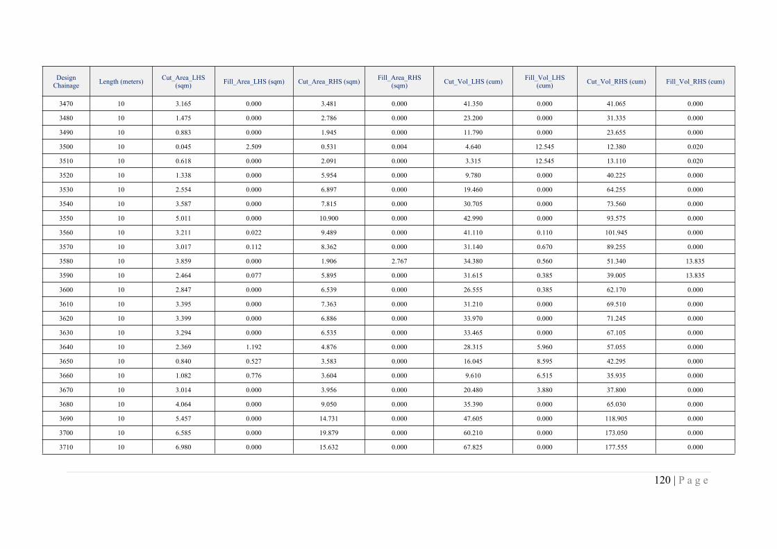
120 | P a g e
DesignChainage Length (meters) Cut_Area_LHS
(sqm) Fill_Area_LHS (sqm) Cut_Area_RHS (sqm) Fill_Area_RHS(sqm) Cut_Vol_LHS (cum) Fill_Vol_LHS
(cum) Cut_Vol_RHS (cum) Fill_Vol_RHS (cum)
3470 10 3.165 0.000 3.481 0.000 41.350 0.000 41.065 0.000
3480 10 1.475 0.000 2.786 0.000 23.200 0.000 31.335 0.000
3490 10 0.883 0.000 1.945 0.000 11.790 0.000 23.655 0.000
3500 10 0.045 2.509 0.531 0.004 4.640 12.545 12.380 0.020
3510 10 0.618 0.000 2.091 0.000 3.315 12.545 13.110 0.020
3520 10 1.338 0.000 5.954 0.000 9.780 0.000 40.225 0.000
3530 10 2.554 0.000 6.897 0.000 19.460 0.000 64.255 0.000
3540 10 3.587 0.000 7.815 0.000 30.705 0.000 73.560 0.000
3550 10 5.011 0.000 10.900 0.000 42.990 0.000 93.575 0.000
3560 10 3.211 0.022 9.489 0.000 41.110 0.110 101.945 0.000
3570 10 3.017 0.112 8.362 0.000 31.140 0.670 89.255 0.000
3580 10 3.859 0.000 1.906 2.767 34.380 0.560 51.340 13.835
3590 10 2.464 0.077 5.895 0.000 31.615 0.385 39.005 13.835
3600 10 2.847 0.000 6.539 0.000 26.555 0.385 62.170 0.000
3610 10 3.395 0.000 7.363 0.000 31.210 0.000 69.510 0.000
3620 10 3.399 0.000 6.886 0.000 33.970 0.000 71.245 0.000
3630 10 3.294 0.000 6.535 0.000 33.465 0.000 67.105 0.000
3640 10 2.369 1.192 4.876 0.000 28.315 5.960 57.055 0.000
3650 10 0.840 0.527 3.583 0.000 16.045 8.595 42.295 0.000
3660 10 1.082 0.776 3.604 0.000 9.610 6.515 35.935 0.000
3670 10 3.014 0.000 3.956 0.000 20.480 3.880 37.800 0.000
3680 10 4.064 0.000 9.050 0.000 35.390 0.000 65.030 0.000
3690 10 5.457 0.000 14.731 0.000 47.605 0.000 118.905 0.000
3700 10 6.585 0.000 19.879 0.000 60.210 0.000 173.050 0.000
3710 10 6.980 0.000 15.632 0.000 67.825 0.000 177.555 0.000
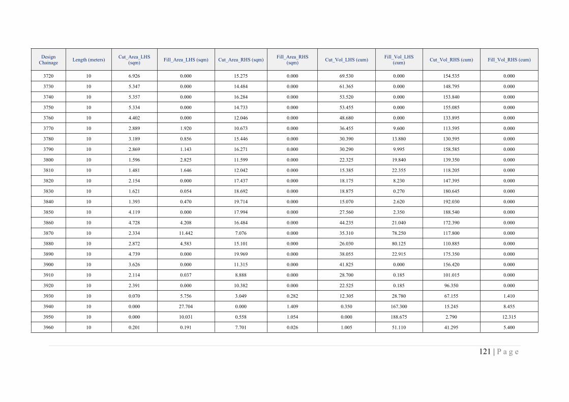
121 | P a g e
DesignChainage Length (meters) Cut_Area_LHS
(sqm) Fill_Area_LHS (sqm) Cut_Area_RHS (sqm) Fill_Area_RHS(sqm) Cut_Vol_LHS (cum) Fill_Vol_LHS
(cum) Cut_Vol_RHS (cum) Fill_Vol_RHS (cum)
3720 10 6.926 0.000 15.275 0.000 69.530 0.000 154.535 0.000
3730 10 5.347 0.000 14.484 0.000 61.365 0.000 148.795 0.000
3740 10 5.357 0.000 16.284 0.000 53.520 0.000 153.840 0.000
3750 10 5.334 0.000 14.733 0.000 53.455 0.000 155.085 0.000
3760 10 4.402 0.000 12.046 0.000 48.680 0.000 133.895 0.000
3770 10 2.889 1.920 10.673 0.000 36.455 9.600 113.595 0.000
3780 10 3.189 0.856 15.446 0.000 30.390 13.880 130.595 0.000
3790 10 2.869 1.143 16.271 0.000 30.290 9.995 158.585 0.000
3800 10 1.596 2.825 11.599 0.000 22.325 19.840 139.350 0.000
3810 10 1.481 1.646 12.042 0.000 15.385 22.355 118.205 0.000
3820 10 2.154 0.000 17.437 0.000 18.175 8.230 147.395 0.000
3830 10 1.621 0.054 18.692 0.000 18.875 0.270 180.645 0.000
3840 10 1.393 0.470 19.714 0.000 15.070 2.620 192.030 0.000
3850 10 4.119 0.000 17.994 0.000 27.560 2.350 188.540 0.000
3860 10 4.728 4.208 16.484 0.000 44.235 21.040 172.390 0.000
3870 10 2.334 11.442 7.076 0.000 35.310 78.250 117.800 0.000
3880 10 2.872 4.583 15.101 0.000 26.030 80.125 110.885 0.000
3890 10 4.739 0.000 19.969 0.000 38.055 22.915 175.350 0.000
3900 10 3.626 0.000 11.315 0.000 41.825 0.000 156.420 0.000
3910 10 2.114 0.037 8.888 0.000 28.700 0.185 101.015 0.000
3920 10 2.391 0.000 10.382 0.000 22.525 0.185 96.350 0.000
3930 10 0.070 5.756 3.049 0.282 12.305 28.780 67.155 1.410
3940 10 0.000 27.704 0.000 1.409 0.350 167.300 15.245 8.455
3950 10 0.000 10.031 0.558 1.054 0.000 188.675 2.790 12.315
3960 10 0.201 0.191 7.701 0.026 1.005 51.110 41.295 5.400
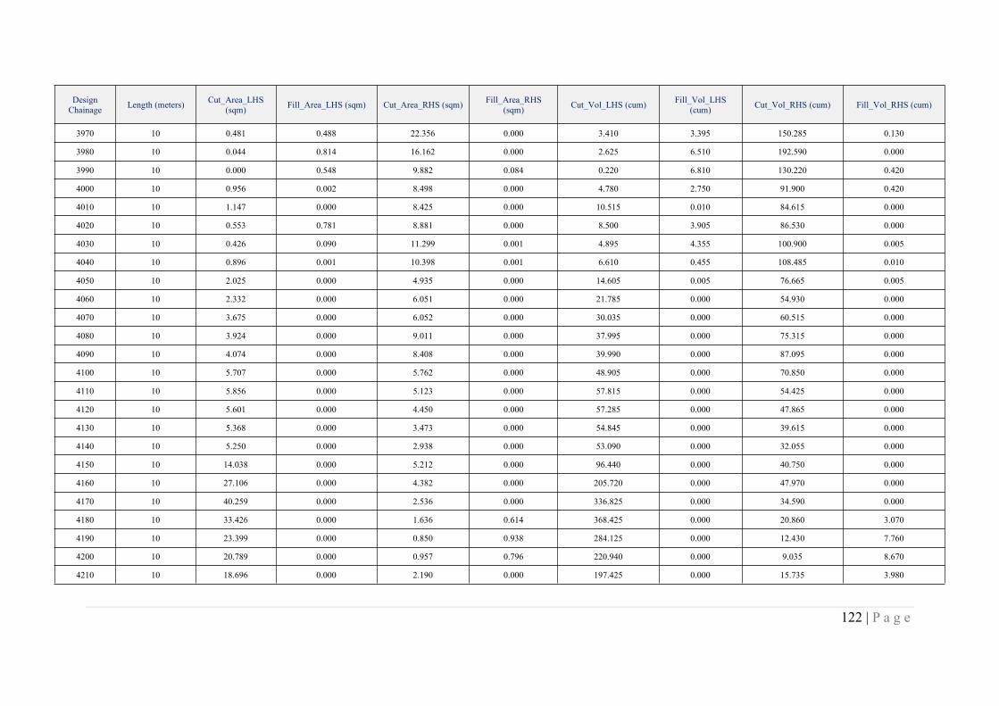
122 | P a g e
DesignChainage Length (meters) Cut_Area_LHS
(sqm) Fill_Area_LHS (sqm) Cut_Area_RHS (sqm) Fill_Area_RHS(sqm) Cut_Vol_LHS (cum) Fill_Vol_LHS
(cum) Cut_Vol_RHS (cum) Fill_Vol_RHS (cum)
3970 10 0.481 0.488 22.356 0.000 3.410 3.395 150.285 0.130
3980 10 0.044 0.814 16.162 0.000 2.625 6.510 192.590 0.000
3990 10 0.000 0.548 9.882 0.084 0.220 6.810 130.220 0.420
4000 10 0.956 0.002 8.498 0.000 4.780 2.750 91.900 0.420
4010 10 1.147 0.000 8.425 0.000 10.515 0.010 84.615 0.000
4020 10 0.553 0.781 8.881 0.000 8.500 3.905 86.530 0.000
4030 10 0.426 0.090 11.299 0.001 4.895 4.355 100.900 0.005
4040 10 0.896 0.001 10.398 0.001 6.610 0.455 108.485 0.010
4050 10 2.025 0.000 4.935 0.000 14.605 0.005 76.665 0.005
4060 10 2.332 0.000 6.051 0.000 21.785 0.000 54.930 0.000
4070 10 3.675 0.000 6.052 0.000 30.035 0.000 60.515 0.000
4080 10 3.924 0.000 9.011 0.000 37.995 0.000 75.315 0.000
4090 10 4.074 0.000 8.408 0.000 39.990 0.000 87.095 0.000
4100 10 5.707 0.000 5.762 0.000 48.905 0.000 70.850 0.000
4110 10 5.856 0.000 5.123 0.000 57.815 0.000 54.425 0.000
4120 10 5.601 0.000 4.450 0.000 57.285 0.000 47.865 0.000
4130 10 5.368 0.000 3.473 0.000 54.845 0.000 39.615 0.000
4140 10 5.250 0.000 2.938 0.000 53.090 0.000 32.055 0.000
4150 10 14.038 0.000 5.212 0.000 96.440 0.000 40.750 0.000
4160 10 27.106 0.000 4.382 0.000 205.720 0.000 47.970 0.000
4170 10 40.259 0.000 2.536 0.000 336.825 0.000 34.590 0.000
4180 10 33.426 0.000 1.636 0.614 368.425 0.000 20.860 3.070
4190 10 23.399 0.000 0.850 0.938 284.125 0.000 12.430 7.760
4200 10 20.789 0.000 0.957 0.796 220.940 0.000 9.035 8.670
4210 10 18.696 0.000 2.190 0.000 197.425 0.000 15.735 3.980
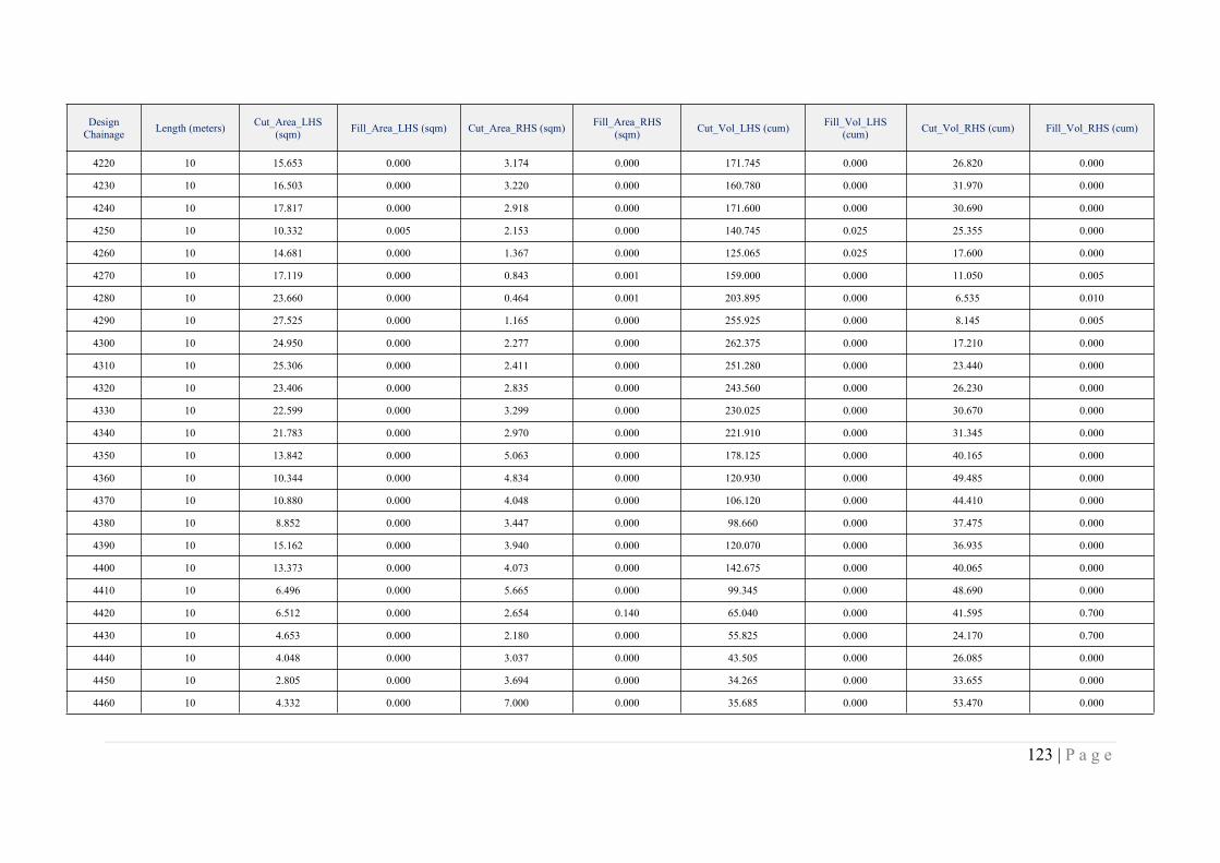
123 | P a g e
DesignChainage Length (meters) Cut_Area_LHS
(sqm) Fill_Area_LHS (sqm) Cut_Area_RHS (sqm) Fill_Area_RHS(sqm) Cut_Vol_LHS (cum) Fill_Vol_LHS
(cum) Cut_Vol_RHS (cum) Fill_Vol_RHS (cum)
4220 10 15.653 0.000 3.174 0.000 171.745 0.000 26.820 0.000
4230 10 16.503 0.000 3.220 0.000 160.780 0.000 31.970 0.000
4240 10 17.817 0.000 2.918 0.000 171.600 0.000 30.690 0.000
4250 10 10.332 0.005 2.153 0.000 140.745 0.025 25.355 0.000
4260 10 14.681 0.000 1.367 0.000 125.065 0.025 17.600 0.000
4270 10 17.119 0.000 0.843 0.001 159.000 0.000 11.050 0.005
4280 10 23.660 0.000 0.464 0.001 203.895 0.000 6.535 0.010
4290 10 27.525 0.000 1.165 0.000 255.925 0.000 8.145 0.005
4300 10 24.950 0.000 2.277 0.000 262.375 0.000 17.210 0.000
4310 10 25.306 0.000 2.411 0.000 251.280 0.000 23.440 0.000
4320 10 23.406 0.000 2.835 0.000 243.560 0.000 26.230 0.000
4330 10 22.599 0.000 3.299 0.000 230.025 0.000 30.670 0.000
4340 10 21.783 0.000 2.970 0.000 221.910 0.000 31.345 0.000
4350 10 13.842 0.000 5.063 0.000 178.125 0.000 40.165 0.000
4360 10 10.344 0.000 4.834 0.000 120.930 0.000 49.485 0.000
4370 10 10.880 0.000 4.048 0.000 106.120 0.000 44.410 0.000
4380 10 8.852 0.000 3.447 0.000 98.660 0.000 37.475 0.000
4390 10 15.162 0.000 3.940 0.000 120.070 0.000 36.935 0.000
4400 10 13.373 0.000 4.073 0.000 142.675 0.000 40.065 0.000
4410 10 6.496 0.000 5.665 0.000 99.345 0.000 48.690 0.000
4420 10 6.512 0.000 2.654 0.140 65.040 0.000 41.595 0.700
4430 10 4.653 0.000 2.180 0.000 55.825 0.000 24.170 0.700
4440 10 4.048 0.000 3.037 0.000 43.505 0.000 26.085 0.000
4450 10 2.805 0.000 3.694 0.000 34.265 0.000 33.655 0.000
4460 10 4.332 0.000 7.000 0.000 35.685 0.000 53.470 0.000
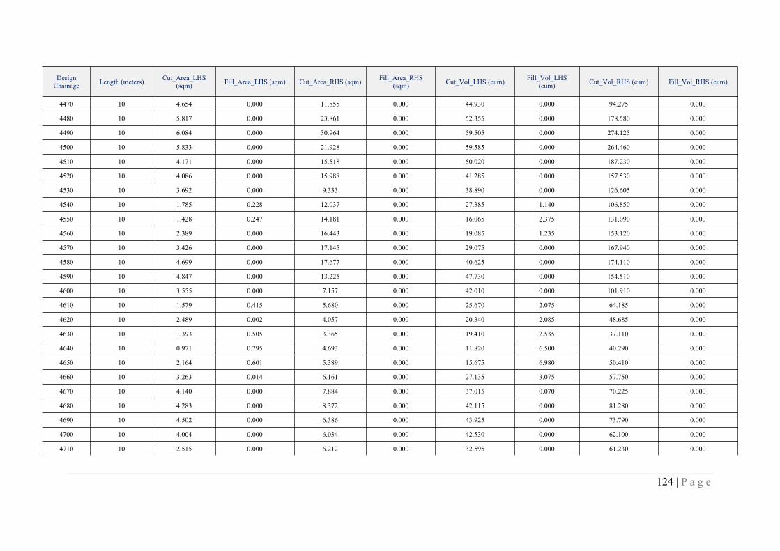
124 | P a g e
DesignChainage Length (meters) Cut_Area_LHS
(sqm) Fill_Area_LHS (sqm) Cut_Area_RHS (sqm) Fill_Area_RHS(sqm) Cut_Vol_LHS (cum) Fill_Vol_LHS
(cum) Cut_Vol_RHS (cum) Fill_Vol_RHS (cum)
4470 10 4.654 0.000 11.855 0.000 44.930 0.000 94.275 0.000
4480 10 5.817 0.000 23.861 0.000 52.355 0.000 178.580 0.000
4490 10 6.084 0.000 30.964 0.000 59.505 0.000 274.125 0.000
4500 10 5.833 0.000 21.928 0.000 59.585 0.000 264.460 0.000
4510 10 4.171 0.000 15.518 0.000 50.020 0.000 187.230 0.000
4520 10 4.086 0.000 15.988 0.000 41.285 0.000 157.530 0.000
4530 10 3.692 0.000 9.333 0.000 38.890 0.000 126.605 0.000
4540 10 1.785 0.228 12.037 0.000 27.385 1.140 106.850 0.000
4550 10 1.428 0.247 14.181 0.000 16.065 2.375 131.090 0.000
4560 10 2.389 0.000 16.443 0.000 19.085 1.235 153.120 0.000
4570 10 3.426 0.000 17.145 0.000 29.075 0.000 167.940 0.000
4580 10 4.699 0.000 17.677 0.000 40.625 0.000 174.110 0.000
4590 10 4.847 0.000 13.225 0.000 47.730 0.000 154.510 0.000
4600 10 3.555 0.000 7.157 0.000 42.010 0.000 101.910 0.000
4610 10 1.579 0.415 5.680 0.000 25.670 2.075 64.185 0.000
4620 10 2.489 0.002 4.057 0.000 20.340 2.085 48.685 0.000
4630 10 1.393 0.505 3.365 0.000 19.410 2.535 37.110 0.000
4640 10 0.971 0.795 4.693 0.000 11.820 6.500 40.290 0.000
4650 10 2.164 0.601 5.389 0.000 15.675 6.980 50.410 0.000
4660 10 3.263 0.014 6.161 0.000 27.135 3.075 57.750 0.000
4670 10 4.140 0.000 7.884 0.000 37.015 0.070 70.225 0.000
4680 10 4.283 0.000 8.372 0.000 42.115 0.000 81.280 0.000
4690 10 4.502 0.000 6.386 0.000 43.925 0.000 73.790 0.000
4700 10 4.004 0.000 6.034 0.000 42.530 0.000 62.100 0.000
4710 10 2.515 0.000 6.212 0.000 32.595 0.000 61.230 0.000
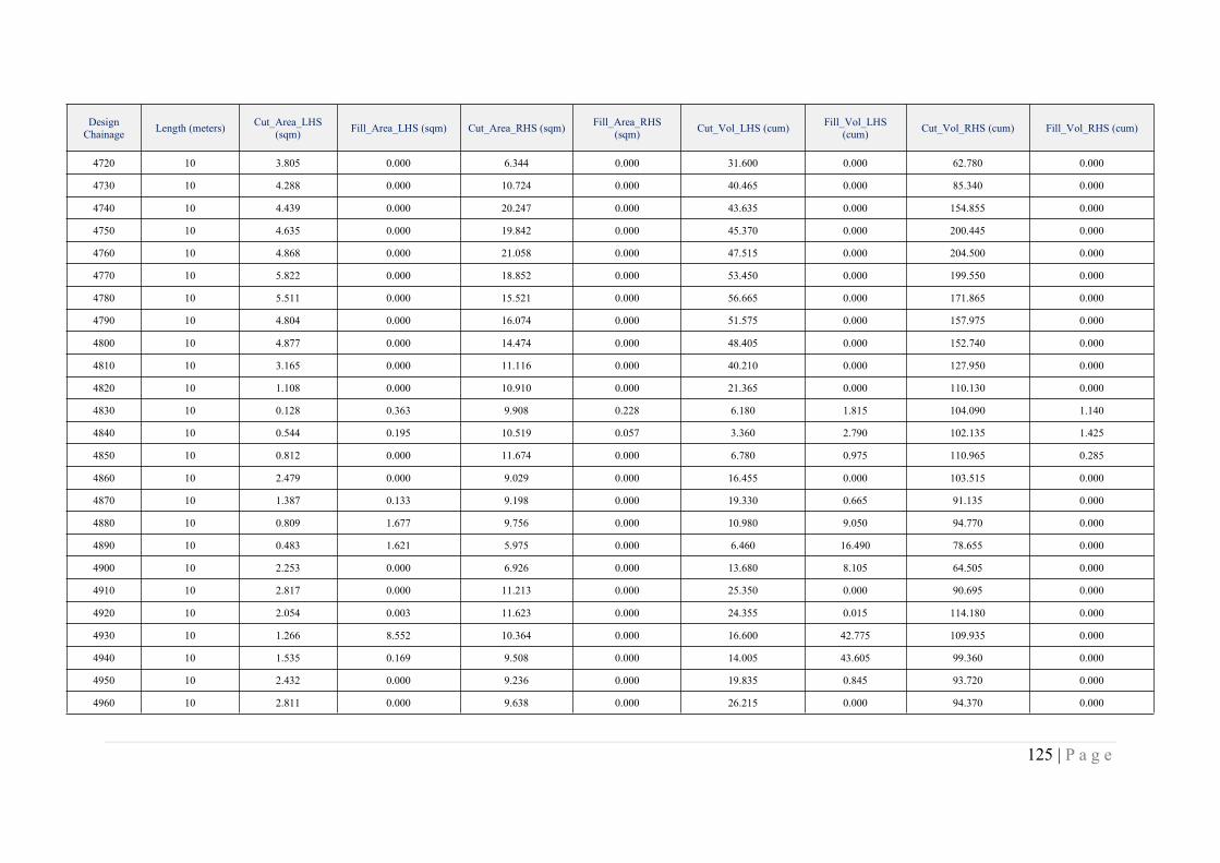
125 | P a g e
DesignChainage Length (meters) Cut_Area_LHS
(sqm) Fill_Area_LHS (sqm) Cut_Area_RHS (sqm) Fill_Area_RHS(sqm) Cut_Vol_LHS (cum) Fill_Vol_LHS
(cum) Cut_Vol_RHS (cum) Fill_Vol_RHS (cum)
4720 10 3.805 0.000 6.344 0.000 31.600 0.000 62.780 0.000
4730 10 4.288 0.000 10.724 0.000 40.465 0.000 85.340 0.000
4740 10 4.439 0.000 20.247 0.000 43.635 0.000 154.855 0.000
4750 10 4.635 0.000 19.842 0.000 45.370 0.000 200.445 0.000
4760 10 4.868 0.000 21.058 0.000 47.515 0.000 204.500 0.000
4770 10 5.822 0.000 18.852 0.000 53.450 0.000 199.550 0.000
4780 10 5.511 0.000 15.521 0.000 56.665 0.000 171.865 0.000
4790 10 4.804 0.000 16.074 0.000 51.575 0.000 157.975 0.000
4800 10 4.877 0.000 14.474 0.000 48.405 0.000 152.740 0.000
4810 10 3.165 0.000 11.116 0.000 40.210 0.000 127.950 0.000
4820 10 1.108 0.000 10.910 0.000 21.365 0.000 110.130 0.000
4830 10 0.128 0.363 9.908 0.228 6.180 1.815 104.090 1.140
4840 10 0.544 0.195 10.519 0.057 3.360 2.790 102.135 1.425
4850 10 0.812 0.000 11.674 0.000 6.780 0.975 110.965 0.285
4860 10 2.479 0.000 9.029 0.000 16.455 0.000 103.515 0.000
4870 10 1.387 0.133 9.198 0.000 19.330 0.665 91.135 0.000
4880 10 0.809 1.677 9.756 0.000 10.980 9.050 94.770 0.000
4890 10 0.483 1.621 5.975 0.000 6.460 16.490 78.655 0.000
4900 10 2.253 0.000 6.926 0.000 13.680 8.105 64.505 0.000
4910 10 2.817 0.000 11.213 0.000 25.350 0.000 90.695 0.000
4920 10 2.054 0.003 11.623 0.000 24.355 0.015 114.180 0.000
4930 10 1.266 8.552 10.364 0.000 16.600 42.775 109.935 0.000
4940 10 1.535 0.169 9.508 0.000 14.005 43.605 99.360 0.000
4950 10 2.432 0.000 9.236 0.000 19.835 0.845 93.720 0.000
4960 10 2.811 0.000 9.638 0.000 26.215 0.000 94.370 0.000
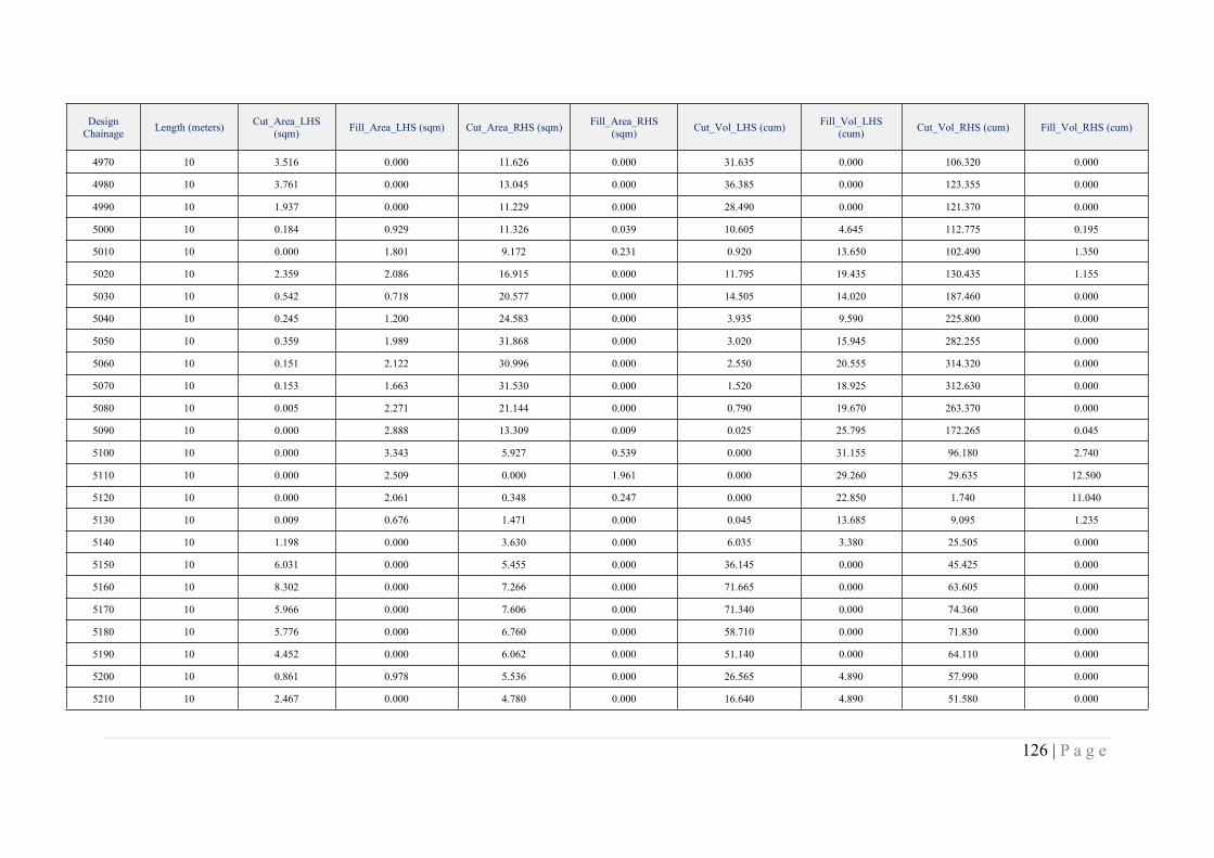
126 | P a g e
DesignChainage Length (meters) Cut_Area_LHS
(sqm) Fill_Area_LHS (sqm) Cut_Area_RHS (sqm) Fill_Area_RHS(sqm) Cut_Vol_LHS (cum) Fill_Vol_LHS
(cum) Cut_Vol_RHS (cum) Fill_Vol_RHS (cum)
4970 10 3.516 0.000 11.626 0.000 31.635 0.000 106.320 0.000
4980 10 3.761 0.000 13.045 0.000 36.385 0.000 123.355 0.000
4990 10 1.937 0.000 11.229 0.000 28.490 0.000 121.370 0.000
5000 10 0.184 0.929 11.326 0.039 10.605 4.645 112.775 0.195
5010 10 0.000 1.801 9.172 0.231 0.920 13.650 102.490 1.350
5020 10 2.359 2.086 16.915 0.000 11.795 19.435 130.435 1.155
5030 10 0.542 0.718 20.577 0.000 14.505 14.020 187.460 0.000
5040 10 0.245 1.200 24.583 0.000 3.935 9.590 225.800 0.000
5050 10 0.359 1.989 31.868 0.000 3.020 15.945 282.255 0.000
5060 10 0.151 2.122 30.996 0.000 2.550 20.555 314.320 0.000
5070 10 0.153 1.663 31.530 0.000 1.520 18.925 312.630 0.000
5080 10 0.005 2.271 21.144 0.000 0.790 19.670 263.370 0.000
5090 10 0.000 2.888 13.309 0.009 0.025 25.795 172.265 0.045
5100 10 0.000 3.343 5.927 0.539 0.000 31.155 96.180 2.740
5110 10 0.000 2.509 0.000 1.961 0.000 29.260 29.635 12.500
5120 10 0.000 2.061 0.348 0.247 0.000 22.850 1.740 11.040
5130 10 0.009 0.676 1.471 0.000 0.045 13.685 9.095 1.235
5140 10 1.198 0.000 3.630 0.000 6.035 3.380 25.505 0.000
5150 10 6.031 0.000 5.455 0.000 36.145 0.000 45.425 0.000
5160 10 8.302 0.000 7.266 0.000 71.665 0.000 63.605 0.000
5170 10 5.966 0.000 7.606 0.000 71.340 0.000 74.360 0.000
5180 10 5.776 0.000 6.760 0.000 58.710 0.000 71.830 0.000
5190 10 4.452 0.000 6.062 0.000 51.140 0.000 64.110 0.000
5200 10 0.861 0.978 5.536 0.000 26.565 4.890 57.990 0.000
5210 10 2.467 0.000 4.780 0.000 16.640 4.890 51.580 0.000
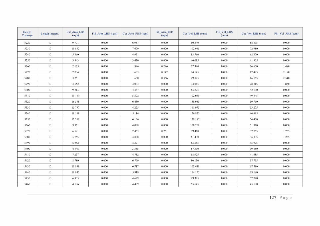
127 | P a g e
DesignChainage Length (meters) Cut_Area_LHS
(sqm) Fill_Area_LHS (sqm) Cut_Area_RHS (sqm) Fill_Area_RHS(sqm) Cut_Vol_LHS (cum) Fill_Vol_LHS
(cum) Cut_Vol_RHS (cum) Fill_Vol_RHS (cum)
5220 10 9.701 0.000 6.987 0.000 60.840 0.000 58.835 0.000
5230 10 10.892 0.000 7.609 0.000 102.965 0.000 72.980 0.000
5240 10 5.860 0.000 4.951 0.000 83.760 0.000 62.800 0.000
5250 10 3.343 0.000 3.430 0.000 46.015 0.000 41.905 0.000
5260 10 2.125 0.000 1.896 0.296 27.340 0.000 26.630 1.480
5270 10 2.704 0.000 1.603 0.142 24.145 0.000 17.495 2.190
5280 10 3.261 0.000 1.630 0.366 29.825 0.000 16.165 2.540
5290 10 3.552 0.000 4.033 0.000 34.065 0.000 28.315 1.830
5300 10 9.213 0.000 4.387 0.000 63.825 0.000 42.100 0.000
5310 10 11.199 0.000 5.522 0.000 102.060 0.000 49.545 0.000
5320 10 16.598 0.000 6.430 0.000 138.985 0.000 59.760 0.000
5330 10 15.797 0.000 4.225 0.000 161.975 0.000 53.275 0.000
5340 10 19.568 0.000 5.114 0.000 176.825 0.000 46.695 0.000
5350 10 12.269 0.000 6.166 0.000 159.185 0.000 56.400 0.000
5360 10 9.371 0.000 4.098 0.000 108.200 0.000 51.320 0.000
5370 10 6.521 0.000 2.453 0.251 79.460 0.000 32.755 1.255
5380 10 5.765 0.000 4.808 0.000 61.430 0.000 36.305 1.255
5390 10 6.952 0.000 4.391 0.000 63.585 0.000 45.995 0.000
5400 10 4.548 0.000 3.585 0.000 57.500 0.000 39.880 0.000
5410 10 7.237 0.000 4.752 0.000 58.925 0.000 41.685 0.000
5420 10 8.789 0.000 6.799 0.000 80.130 0.000 57.755 0.000
5430 10 11.899 0.000 6.717 0.000 103.440 0.000 67.580 0.000
5440 10 10.932 0.000 5.919 0.000 114.155 0.000 63.180 0.000
5450 10 6.933 0.000 4.629 0.000 89.325 0.000 52.740 0.000
5460 10 4.196 0.000 4.409 0.000 55.645 0.000 45.190 0.000

128 | P a g e
DesignChainage Length (meters) Cut_Area_LHS
(sqm) Fill_Area_LHS (sqm) Cut_Area_RHS (sqm) Fill_Area_RHS(sqm) Cut_Vol_LHS (cum) Fill_Vol_LHS
(cum) Cut_Vol_RHS (cum) Fill_Vol_RHS (cum)
5470 10 4.920 0.000 6.178 0.000 45.580 0.000 52.935 0.000
5480 10 5.522 0.000 5.772 0.000 52.210 0.000 59.750 0.000
5490 10 6.155 0.000 6.056 0.000 58.385 0.000 59.140 0.000
5500 10 5.890 0.000 5.667 0.000 60.225 0.000 58.615 0.000
5510 10 5.548 0.000 5.289 0.000 57.190 0.000 54.780 0.000
5520 10 5.524 0.000 5.040 0.000 55.360 0.000 51.645 0.000
5530 10 5.064 0.000 3.367 0.000 52.940 0.000 42.035 0.000
5540 10 5.581 0.000 4.131 0.000 53.225 0.000 37.490 0.000
5550 10 6.022 0.000 4.673 0.000 58.015 0.000 44.020 0.000
5560 10 8.325 0.000 6.475 0.000 71.735 0.000 55.740 0.000
5570 10 7.088 0.000 5.681 0.000 77.065 0.000 60.780 0.000
5580 10 6.247 0.000 5.142 0.000 66.675 0.000 54.115 0.000
5590 10 5.913 0.000 5.862 0.000 60.800 0.000 55.020 0.000
5600 10 5.416 0.000 5.633 0.000 56.645 0.000 57.475 0.000
5610 10 6.050 0.000 6.462 0.000 57.330 0.000 60.475 0.000
5620 10 5.832 0.000 7.105 0.000 59.410 0.000 67.835 0.000
5630 10 6.025 0.000 6.503 0.000 59.285 0.000 68.040 0.000
5640 10 6.623 0.000 5.197 0.000 63.240 0.000 58.500 0.000
5650 10 5.961 0.000 6.057 0.000 62.920 0.000 56.270 0.000
5660 10 6.495 0.000 6.930 0.000 62.280 0.000 64.935 0.000
5670 10 5.887 0.000 6.036 0.000 61.910 0.000 64.830 0.000
5680 10 6.242 0.000 4.155 0.000 60.645 0.000 50.955 0.000
5690 10 6.265 0.000 3.717 0.000 62.535 0.000 39.360 0.000
5700 10 5.911 0.000 3.381 0.000 60.880 0.000 35.490 0.000
5710 10 5.852 0.000 4.508 0.000 58.815 0.000 39.445 0.000

129 | P a g e
DesignChainage Length (meters) Cut_Area_LHS
(sqm) Fill_Area_LHS (sqm) Cut_Area_RHS (sqm) Fill_Area_RHS(sqm) Cut_Vol_LHS (cum) Fill_Vol_LHS
(cum) Cut_Vol_RHS (cum) Fill_Vol_RHS (cum)
5720 10 6.208 0.000 5.533 0.000 60.300 0.000 50.205 0.000
5730 10 5.987 0.000 5.375 0.000 60.975 0.000 54.540 0.000
5740 10 5.838 0.000 4.903 0.000 59.125 0.000 51.390 0.000
5750 10 4.992 0.000 4.736 0.000 54.150 0.000 48.195 0.000
5760 10 5.069 0.000 4.530 0.000 50.305 0.000 46.330 0.000
5770 10 5.448 0.000 4.870 0.000 52.585 0.000 47.000 0.000
5780 10 4.637 0.000 5.137 0.076 50.425 0.000 50.035 0.380
5790 10 6.141 0.000 6.247 0.000 53.890 0.000 56.920 0.380
5800 10 6.621 0.000 5.608 0.000 63.810 0.000 59.275 0.000
5810 10 5.588 0.000 7.784 0.000 61.045 0.000 66.960 0.000
5820 10 4.965 0.000 7.258 0.000 52.765 0.000 75.210 0.000
5830 10 5.304 0.000 6.459 0.000 51.345 0.000 68.585 0.000
5840 10 5.190 0.000 7.220 0.000 52.470 0.000 68.395 0.000
5850 10 6.160 0.000 7.748 0.000 56.750 0.000 74.840 0.000
5860 10 5.892 0.000 5.754 0.000 60.260 0.000 67.510 0.000
5870 10 6.380 0.000 6.566 0.000 61.360 0.000 61.600 0.000
5880 10 6.689 0.000 6.485 0.000 65.345 0.000 65.255 0.000
5890 10 6.790 0.000 6.298 0.000 67.395 0.000 63.915 0.000
5900 10 7.396 0.000 7.159 0.000 70.930 0.000 67.285 0.000
5910 10 7.257 0.000 6.721 0.000 73.265 0.000 69.400 0.000
5920 10 8.736 0.000 7.484 0.000 79.965 0.000 71.025 0.000
5930 10 6.727 0.000 7.067 0.000 77.315 0.000 72.755 0.000
5940 10 6.733 0.000 7.086 0.000 67.300 0.000 70.765 0.000
5950 10 7.022 0.000 5.359 0.000 68.775 0.000 62.225 0.000
5960 10 6.499 0.000 4.693 0.000 67.605 0.000 50.260 0.000
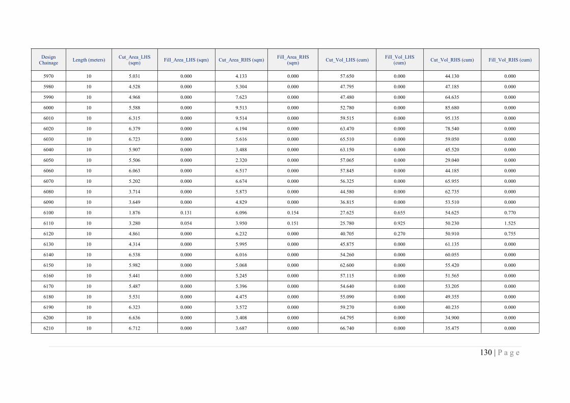
130 | P a g e
DesignChainage Length (meters) Cut_Area_LHS
(sqm) Fill_Area_LHS (sqm) Cut_Area_RHS (sqm) Fill_Area_RHS(sqm) Cut_Vol_LHS (cum) Fill_Vol_LHS
(cum) Cut_Vol_RHS (cum) Fill_Vol_RHS (cum)
5970 10 5.031 0.000 4.133 0.000 57.650 0.000 44.130 0.000
5980 10 4.528 0.000 5.304 0.000 47.795 0.000 47.185 0.000
5990 10 4.968 0.000 7.623 0.000 47.480 0.000 64.635 0.000
6000 10 5.588 0.000 9.513 0.000 52.780 0.000 85.680 0.000
6010 10 6.315 0.000 9.514 0.000 59.515 0.000 95.135 0.000
6020 10 6.379 0.000 6.194 0.000 63.470 0.000 78.540 0.000
6030 10 6.723 0.000 5.616 0.000 65.510 0.000 59.050 0.000
6040 10 5.907 0.000 3.488 0.000 63.150 0.000 45.520 0.000
6050 10 5.506 0.000 2.320 0.000 57.065 0.000 29.040 0.000
6060 10 6.063 0.000 6.517 0.000 57.845 0.000 44.185 0.000
6070 10 5.202 0.000 6.674 0.000 56.325 0.000 65.955 0.000
6080 10 3.714 0.000 5.873 0.000 44.580 0.000 62.735 0.000
6090 10 3.649 0.000 4.829 0.000 36.815 0.000 53.510 0.000
6100 10 1.876 0.131 6.096 0.154 27.625 0.655 54.625 0.770
6110 10 3.280 0.054 3.950 0.151 25.780 0.925 50.230 1.525
6120 10 4.861 0.000 6.232 0.000 40.705 0.270 50.910 0.755
6130 10 4.314 0.000 5.995 0.000 45.875 0.000 61.135 0.000
6140 10 6.538 0.000 6.016 0.000 54.260 0.000 60.055 0.000
6150 10 5.982 0.000 5.068 0.000 62.600 0.000 55.420 0.000
6160 10 5.441 0.000 5.245 0.000 57.115 0.000 51.565 0.000
6170 10 5.487 0.000 5.396 0.000 54.640 0.000 53.205 0.000
6180 10 5.531 0.000 4.475 0.000 55.090 0.000 49.355 0.000
6190 10 6.323 0.000 3.572 0.000 59.270 0.000 40.235 0.000
6200 10 6.636 0.000 3.408 0.000 64.795 0.000 34.900 0.000
6210 10 6.712 0.000 3.687 0.000 66.740 0.000 35.475 0.000
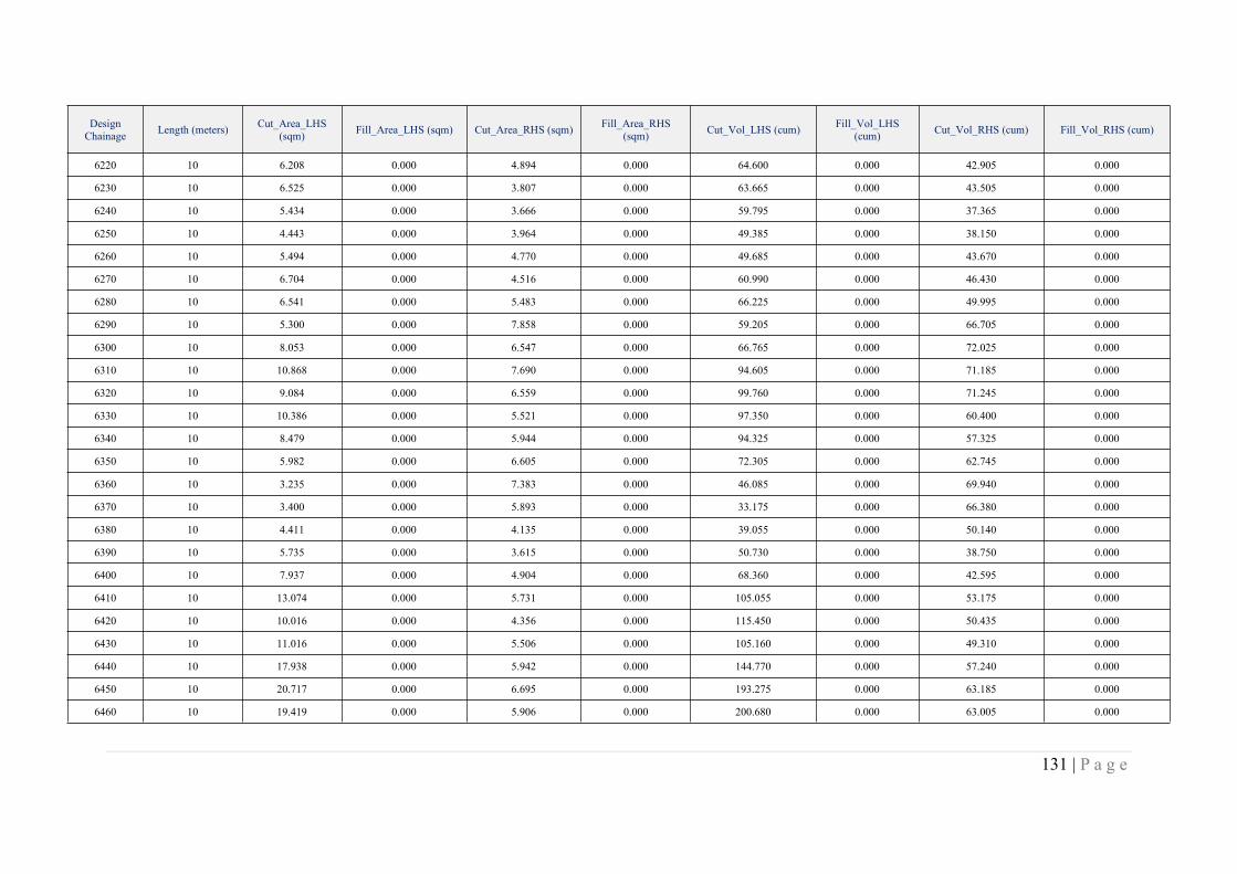
131 | P a g e
DesignChainage Length (meters) Cut_Area_LHS
(sqm) Fill_Area_LHS (sqm) Cut_Area_RHS (sqm) Fill_Area_RHS(sqm) Cut_Vol_LHS (cum) Fill_Vol_LHS
(cum) Cut_Vol_RHS (cum) Fill_Vol_RHS (cum)
6220 10 6.208 0.000 4.894 0.000 64.600 0.000 42.905 0.000
6230 10 6.525 0.000 3.807 0.000 63.665 0.000 43.505 0.000
6240 10 5.434 0.000 3.666 0.000 59.795 0.000 37.365 0.000
6250 10 4.443 0.000 3.964 0.000 49.385 0.000 38.150 0.000
6260 10 5.494 0.000 4.770 0.000 49.685 0.000 43.670 0.000
6270 10 6.704 0.000 4.516 0.000 60.990 0.000 46.430 0.000
6280 10 6.541 0.000 5.483 0.000 66.225 0.000 49.995 0.000
6290 10 5.300 0.000 7.858 0.000 59.205 0.000 66.705 0.000
6300 10 8.053 0.000 6.547 0.000 66.765 0.000 72.025 0.000
6310 10 10.868 0.000 7.690 0.000 94.605 0.000 71.185 0.000
6320 10 9.084 0.000 6.559 0.000 99.760 0.000 71.245 0.000
6330 10 10.386 0.000 5.521 0.000 97.350 0.000 60.400 0.000
6340 10 8.479 0.000 5.944 0.000 94.325 0.000 57.325 0.000
6350 10 5.982 0.000 6.605 0.000 72.305 0.000 62.745 0.000
6360 10 3.235 0.000 7.383 0.000 46.085 0.000 69.940 0.000
6370 10 3.400 0.000 5.893 0.000 33.175 0.000 66.380 0.000
6380 10 4.411 0.000 4.135 0.000 39.055 0.000 50.140 0.000
6390 10 5.735 0.000 3.615 0.000 50.730 0.000 38.750 0.000
6400 10 7.937 0.000 4.904 0.000 68.360 0.000 42.595 0.000
6410 10 13.074 0.000 5.731 0.000 105.055 0.000 53.175 0.000
6420 10 10.016 0.000 4.356 0.000 115.450 0.000 50.435 0.000
6430 10 11.016 0.000 5.506 0.000 105.160 0.000 49.310 0.000
6440 10 17.938 0.000 5.942 0.000 144.770 0.000 57.240 0.000
6450 10 20.717 0.000 6.695 0.000 193.275 0.000 63.185 0.000
6460 10 19.419 0.000 5.906 0.000 200.680 0.000 63.005 0.000
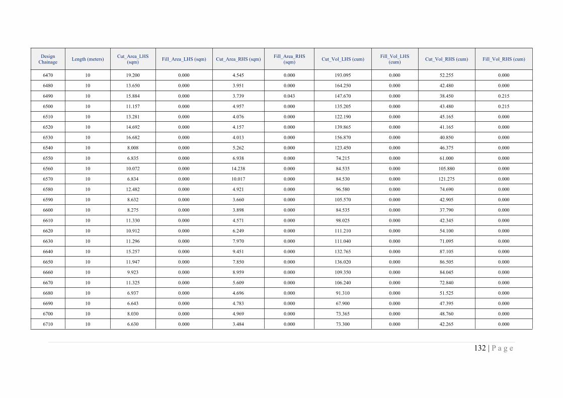
132 | P a g e
DesignChainage Length (meters) Cut_Area_LHS
(sqm) Fill_Area_LHS (sqm) Cut_Area_RHS (sqm) Fill_Area_RHS(sqm) Cut_Vol_LHS (cum) Fill_Vol_LHS
(cum) Cut_Vol_RHS (cum) Fill_Vol_RHS (cum)
6470 10 19.200 0.000 4.545 0.000 193.095 0.000 52.255 0.000
6480 10 13.650 0.000 3.951 0.000 164.250 0.000 42.480 0.000
6490 10 15.884 0.000 3.739 0.043 147.670 0.000 38.450 0.215
6500 10 11.157 0.000 4.957 0.000 135.205 0.000 43.480 0.215
6510 10 13.281 0.000 4.076 0.000 122.190 0.000 45.165 0.000
6520 10 14.692 0.000 4.157 0.000 139.865 0.000 41.165 0.000
6530 10 16.682 0.000 4.013 0.000 156.870 0.000 40.850 0.000
6540 10 8.008 0.000 5.262 0.000 123.450 0.000 46.375 0.000
6550 10 6.835 0.000 6.938 0.000 74.215 0.000 61.000 0.000
6560 10 10.072 0.000 14.238 0.000 84.535 0.000 105.880 0.000
6570 10 6.834 0.000 10.017 0.000 84.530 0.000 121.275 0.000
6580 10 12.482 0.000 4.921 0.000 96.580 0.000 74.690 0.000
6590 10 8.632 0.000 3.660 0.000 105.570 0.000 42.905 0.000
6600 10 8.275 0.000 3.898 0.000 84.535 0.000 37.790 0.000
6610 10 11.330 0.000 4.571 0.000 98.025 0.000 42.345 0.000
6620 10 10.912 0.000 6.249 0.000 111.210 0.000 54.100 0.000
6630 10 11.296 0.000 7.970 0.000 111.040 0.000 71.095 0.000
6640 10 15.257 0.000 9.451 0.000 132.765 0.000 87.105 0.000
6650 10 11.947 0.000 7.850 0.000 136.020 0.000 86.505 0.000
6660 10 9.923 0.000 8.959 0.000 109.350 0.000 84.045 0.000
6670 10 11.325 0.000 5.609 0.000 106.240 0.000 72.840 0.000
6680 10 6.937 0.000 4.696 0.000 91.310 0.000 51.525 0.000
6690 10 6.643 0.000 4.783 0.000 67.900 0.000 47.395 0.000
6700 10 8.030 0.000 4.969 0.000 73.365 0.000 48.760 0.000
6710 10 6.630 0.000 3.484 0.000 73.300 0.000 42.265 0.000
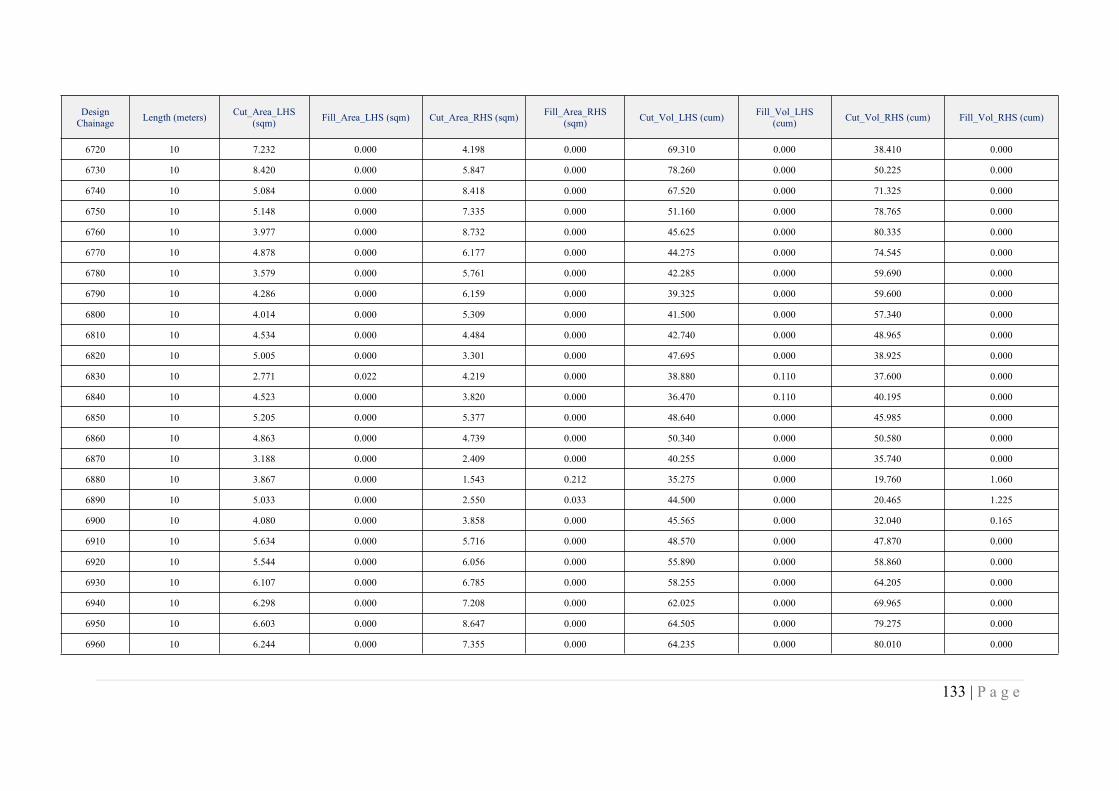
133 | P a g e
DesignChainage Length (meters) Cut_Area_LHS
(sqm) Fill_Area_LHS (sqm) Cut_Area_RHS (sqm) Fill_Area_RHS(sqm) Cut_Vol_LHS (cum) Fill_Vol_LHS
(cum) Cut_Vol_RHS (cum) Fill_Vol_RHS (cum)
6720 10 7.232 0.000 4.198 0.000 69.310 0.000 38.410 0.000
6730 10 8.420 0.000 5.847 0.000 78.260 0.000 50.225 0.000
6740 10 5.084 0.000 8.418 0.000 67.520 0.000 71.325 0.000
6750 10 5.148 0.000 7.335 0.000 51.160 0.000 78.765 0.000
6760 10 3.977 0.000 8.732 0.000 45.625 0.000 80.335 0.000
6770 10 4.878 0.000 6.177 0.000 44.275 0.000 74.545 0.000
6780 10 3.579 0.000 5.761 0.000 42.285 0.000 59.690 0.000
6790 10 4.286 0.000 6.159 0.000 39.325 0.000 59.600 0.000
6800 10 4.014 0.000 5.309 0.000 41.500 0.000 57.340 0.000
6810 10 4.534 0.000 4.484 0.000 42.740 0.000 48.965 0.000
6820 10 5.005 0.000 3.301 0.000 47.695 0.000 38.925 0.000
6830 10 2.771 0.022 4.219 0.000 38.880 0.110 37.600 0.000
6840 10 4.523 0.000 3.820 0.000 36.470 0.110 40.195 0.000
6850 10 5.205 0.000 5.377 0.000 48.640 0.000 45.985 0.000
6860 10 4.863 0.000 4.739 0.000 50.340 0.000 50.580 0.000
6870 10 3.188 0.000 2.409 0.000 40.255 0.000 35.740 0.000
6880 10 3.867 0.000 1.543 0.212 35.275 0.000 19.760 1.060
6890 10 5.033 0.000 2.550 0.033 44.500 0.000 20.465 1.225
6900 10 4.080 0.000 3.858 0.000 45.565 0.000 32.040 0.165
6910 10 5.634 0.000 5.716 0.000 48.570 0.000 47.870 0.000
6920 10 5.544 0.000 6.056 0.000 55.890 0.000 58.860 0.000
6930 10 6.107 0.000 6.785 0.000 58.255 0.000 64.205 0.000
6940 10 6.298 0.000 7.208 0.000 62.025 0.000 69.965 0.000
6950 10 6.603 0.000 8.647 0.000 64.505 0.000 79.275 0.000
6960 10 6.244 0.000 7.355 0.000 64.235 0.000 80.010 0.000
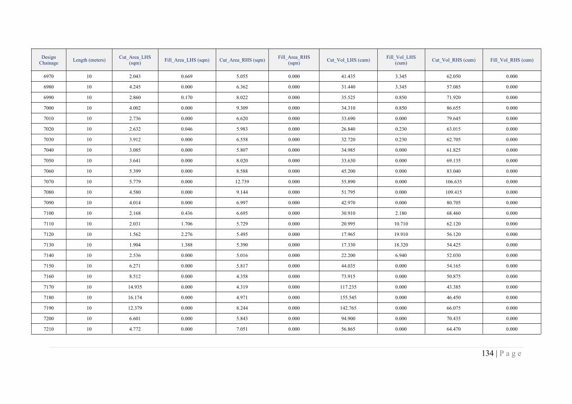
134 | P a g e
DesignChainage Length (meters) Cut_Area_LHS
(sqm) Fill_Area_LHS (sqm) Cut_Area_RHS (sqm) Fill_Area_RHS(sqm) Cut_Vol_LHS (cum) Fill_Vol_LHS
(cum) Cut_Vol_RHS (cum) Fill_Vol_RHS (cum)
6970 10 2.043 0.669 5.055 0.000 41.435 3.345 62.050 0.000
6980 10 4.245 0.000 6.362 0.000 31.440 3.345 57.085 0.000
6990 10 2.860 0.170 8.022 0.000 35.525 0.850 71.920 0.000
7000 10 4.002 0.000 9.309 0.000 34.310 0.850 86.655 0.000
7010 10 2.736 0.000 6.620 0.000 33.690 0.000 79.645 0.000
7020 10 2.632 0.046 5.983 0.000 26.840 0.230 63.015 0.000
7030 10 3.912 0.000 6.558 0.000 32.720 0.230 62.705 0.000
7040 10 3.085 0.000 5.807 0.000 34.985 0.000 61.825 0.000
7050 10 3.641 0.000 8.020 0.000 33.630 0.000 69.135 0.000
7060 10 5.399 0.000 8.588 0.000 45.200 0.000 83.040 0.000
7070 10 5.779 0.000 12.739 0.000 55.890 0.000 106.635 0.000
7080 10 4.580 0.000 9.144 0.000 51.795 0.000 109.415 0.000
7090 10 4.014 0.000 6.997 0.000 42.970 0.000 80.705 0.000
7100 10 2.168 0.436 6.695 0.000 30.910 2.180 68.460 0.000
7110 10 2.031 1.706 5.729 0.000 20.995 10.710 62.120 0.000
7120 10 1.562 2.276 5.495 0.000 17.965 19.910 56.120 0.000
7130 10 1.904 1.388 5.390 0.000 17.330 18.320 54.425 0.000
7140 10 2.536 0.000 5.016 0.000 22.200 6.940 52.030 0.000
7150 10 6.271 0.000 5.817 0.000 44.035 0.000 54.165 0.000
7160 10 8.512 0.000 4.358 0.000 73.915 0.000 50.875 0.000
7170 10 14.935 0.000 4.319 0.000 117.235 0.000 43.385 0.000
7180 10 16.174 0.000 4.971 0.000 155.545 0.000 46.450 0.000
7190 10 12.379 0.000 8.244 0.000 142.765 0.000 66.075 0.000
7200 10 6.601 0.000 5.843 0.000 94.900 0.000 70.435 0.000
7210 10 4.772 0.000 7.051 0.000 56.865 0.000 64.470 0.000
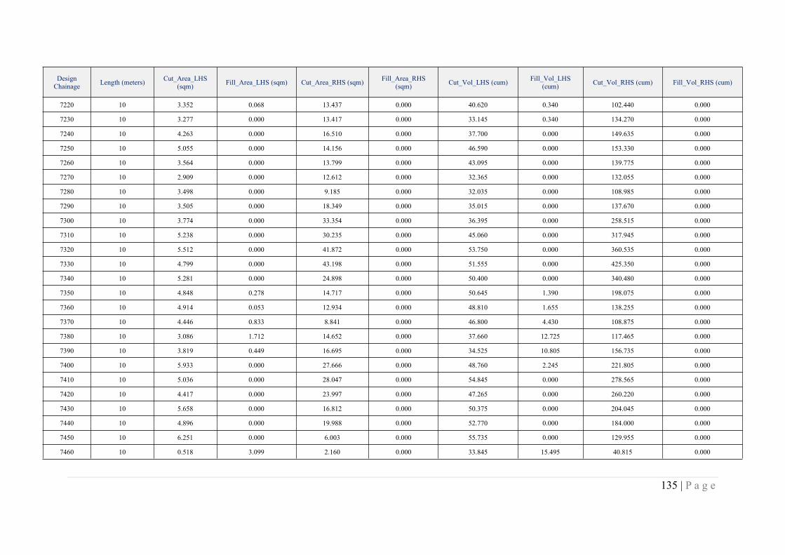
135 | P a g e
DesignChainage Length (meters) Cut_Area_LHS
(sqm) Fill_Area_LHS (sqm) Cut_Area_RHS (sqm) Fill_Area_RHS(sqm) Cut_Vol_LHS (cum) Fill_Vol_LHS
(cum) Cut_Vol_RHS (cum) Fill_Vol_RHS (cum)
7220 10 3.352 0.068 13.437 0.000 40.620 0.340 102.440 0.000
7230 10 3.277 0.000 13.417 0.000 33.145 0.340 134.270 0.000
7240 10 4.263 0.000 16.510 0.000 37.700 0.000 149.635 0.000
7250 10 5.055 0.000 14.156 0.000 46.590 0.000 153.330 0.000
7260 10 3.564 0.000 13.799 0.000 43.095 0.000 139.775 0.000
7270 10 2.909 0.000 12.612 0.000 32.365 0.000 132.055 0.000
7280 10 3.498 0.000 9.185 0.000 32.035 0.000 108.985 0.000
7290 10 3.505 0.000 18.349 0.000 35.015 0.000 137.670 0.000
7300 10 3.774 0.000 33.354 0.000 36.395 0.000 258.515 0.000
7310 10 5.238 0.000 30.235 0.000 45.060 0.000 317.945 0.000
7320 10 5.512 0.000 41.872 0.000 53.750 0.000 360.535 0.000
7330 10 4.799 0.000 43.198 0.000 51.555 0.000 425.350 0.000
7340 10 5.281 0.000 24.898 0.000 50.400 0.000 340.480 0.000
7350 10 4.848 0.278 14.717 0.000 50.645 1.390 198.075 0.000
7360 10 4.914 0.053 12.934 0.000 48.810 1.655 138.255 0.000
7370 10 4.446 0.833 8.841 0.000 46.800 4.430 108.875 0.000
7380 10 3.086 1.712 14.652 0.000 37.660 12.725 117.465 0.000
7390 10 3.819 0.449 16.695 0.000 34.525 10.805 156.735 0.000
7400 10 5.933 0.000 27.666 0.000 48.760 2.245 221.805 0.000
7410 10 5.036 0.000 28.047 0.000 54.845 0.000 278.565 0.000
7420 10 4.417 0.000 23.997 0.000 47.265 0.000 260.220 0.000
7430 10 5.658 0.000 16.812 0.000 50.375 0.000 204.045 0.000
7440 10 4.896 0.000 19.988 0.000 52.770 0.000 184.000 0.000
7450 10 6.251 0.000 6.003 0.000 55.735 0.000 129.955 0.000
7460 10 0.518 3.099 2.160 0.000 33.845 15.495 40.815 0.000
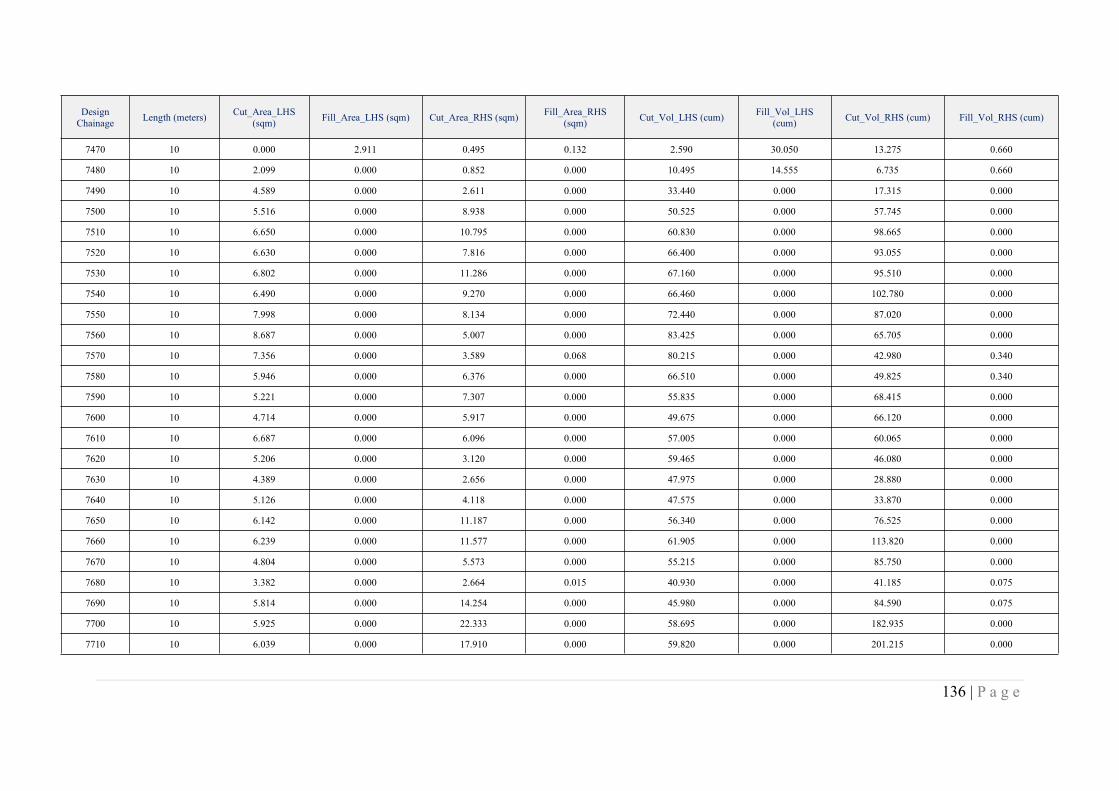
136 | P a g e
DesignChainage Length (meters) Cut_Area_LHS
(sqm) Fill_Area_LHS (sqm) Cut_Area_RHS (sqm) Fill_Area_RHS(sqm) Cut_Vol_LHS (cum) Fill_Vol_LHS
(cum) Cut_Vol_RHS (cum) Fill_Vol_RHS (cum)
7470 10 0.000 2.911 0.495 0.132 2.590 30.050 13.275 0.660
7480 10 2.099 0.000 0.852 0.000 10.495 14.555 6.735 0.660
7490 10 4.589 0.000 2.611 0.000 33.440 0.000 17.315 0.000
7500 10 5.516 0.000 8.938 0.000 50.525 0.000 57.745 0.000
7510 10 6.650 0.000 10.795 0.000 60.830 0.000 98.665 0.000
7520 10 6.630 0.000 7.816 0.000 66.400 0.000 93.055 0.000
7530 10 6.802 0.000 11.286 0.000 67.160 0.000 95.510 0.000
7540 10 6.490 0.000 9.270 0.000 66.460 0.000 102.780 0.000
7550 10 7.998 0.000 8.134 0.000 72.440 0.000 87.020 0.000
7560 10 8.687 0.000 5.007 0.000 83.425 0.000 65.705 0.000
7570 10 7.356 0.000 3.589 0.068 80.215 0.000 42.980 0.340
7580 10 5.946 0.000 6.376 0.000 66.510 0.000 49.825 0.340
7590 10 5.221 0.000 7.307 0.000 55.835 0.000 68.415 0.000
7600 10 4.714 0.000 5.917 0.000 49.675 0.000 66.120 0.000
7610 10 6.687 0.000 6.096 0.000 57.005 0.000 60.065 0.000
7620 10 5.206 0.000 3.120 0.000 59.465 0.000 46.080 0.000
7630 10 4.389 0.000 2.656 0.000 47.975 0.000 28.880 0.000
7640 10 5.126 0.000 4.118 0.000 47.575 0.000 33.870 0.000
7650 10 6.142 0.000 11.187 0.000 56.340 0.000 76.525 0.000
7660 10 6.239 0.000 11.577 0.000 61.905 0.000 113.820 0.000
7670 10 4.804 0.000 5.573 0.000 55.215 0.000 85.750 0.000
7680 10 3.382 0.000 2.664 0.015 40.930 0.000 41.185 0.075
7690 10 5.814 0.000 14.254 0.000 45.980 0.000 84.590 0.075
7700 10 5.925 0.000 22.333 0.000 58.695 0.000 182.935 0.000
7710 10 6.039 0.000 17.910 0.000 59.820 0.000 201.215 0.000
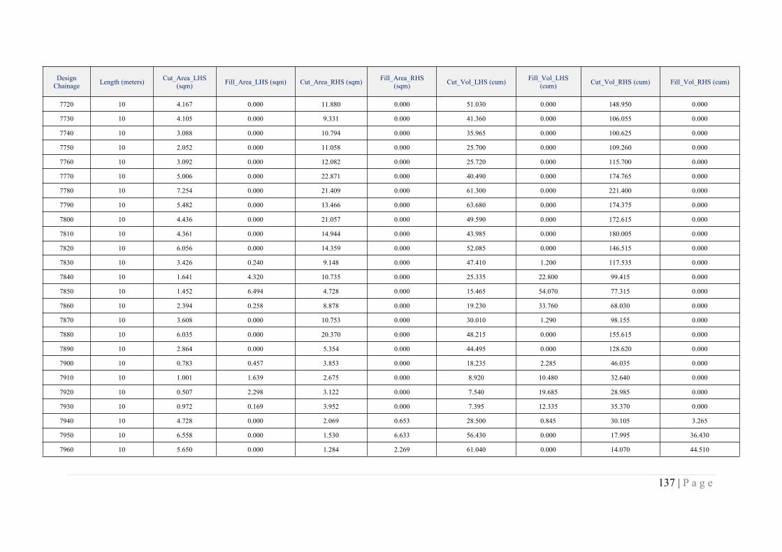
137 | P a g e
DesignChainage Length (meters) Cut_Area_LHS
(sqm) Fill_Area_LHS (sqm) Cut_Area_RHS (sqm) Fill_Area_RHS(sqm) Cut_Vol_LHS (cum) Fill_Vol_LHS
(cum) Cut_Vol_RHS (cum) Fill_Vol_RHS (cum)
7720 10 4.167 0.000 11.880 0.000 51.030 0.000 148.950 0.000
7730 10 4.105 0.000 9.331 0.000 41.360 0.000 106.055 0.000
7740 10 3.088 0.000 10.794 0.000 35.965 0.000 100.625 0.000
7750 10 2.052 0.000 11.058 0.000 25.700 0.000 109.260 0.000
7760 10 3.092 0.000 12.082 0.000 25.720 0.000 115.700 0.000
7770 10 5.006 0.000 22.871 0.000 40.490 0.000 174.765 0.000
7780 10 7.254 0.000 21.409 0.000 61.300 0.000 221.400 0.000
7790 10 5.482 0.000 13.466 0.000 63.680 0.000 174.375 0.000
7800 10 4.436 0.000 21.057 0.000 49.590 0.000 172.615 0.000
7810 10 4.361 0.000 14.944 0.000 43.985 0.000 180.005 0.000
7820 10 6.056 0.000 14.359 0.000 52.085 0.000 146.515 0.000
7830 10 3.426 0.240 9.148 0.000 47.410 1.200 117.535 0.000
7840 10 1.641 4.320 10.735 0.000 25.335 22.800 99.415 0.000
7850 10 1.452 6.494 4.728 0.000 15.465 54.070 77.315 0.000
7860 10 2.394 0.258 8.878 0.000 19.230 33.760 68.030 0.000
7870 10 3.608 0.000 10.753 0.000 30.010 1.290 98.155 0.000
7880 10 6.035 0.000 20.370 0.000 48.215 0.000 155.615 0.000
7890 10 2.864 0.000 5.354 0.000 44.495 0.000 128.620 0.000
7900 10 0.783 0.457 3.853 0.000 18.235 2.285 46.035 0.000
7910 10 1.001 1.639 2.675 0.000 8.920 10.480 32.640 0.000
7920 10 0.507 2.298 3.122 0.000 7.540 19.685 28.985 0.000
7930 10 0.972 0.169 3.952 0.000 7.395 12.335 35.370 0.000
7940 10 4.728 0.000 2.069 0.653 28.500 0.845 30.105 3.265
7950 10 6.558 0.000 1.530 6.633 56.430 0.000 17.995 36.430
7960 10 5.650 0.000 1.284 2.269 61.040 0.000 14.070 44.510
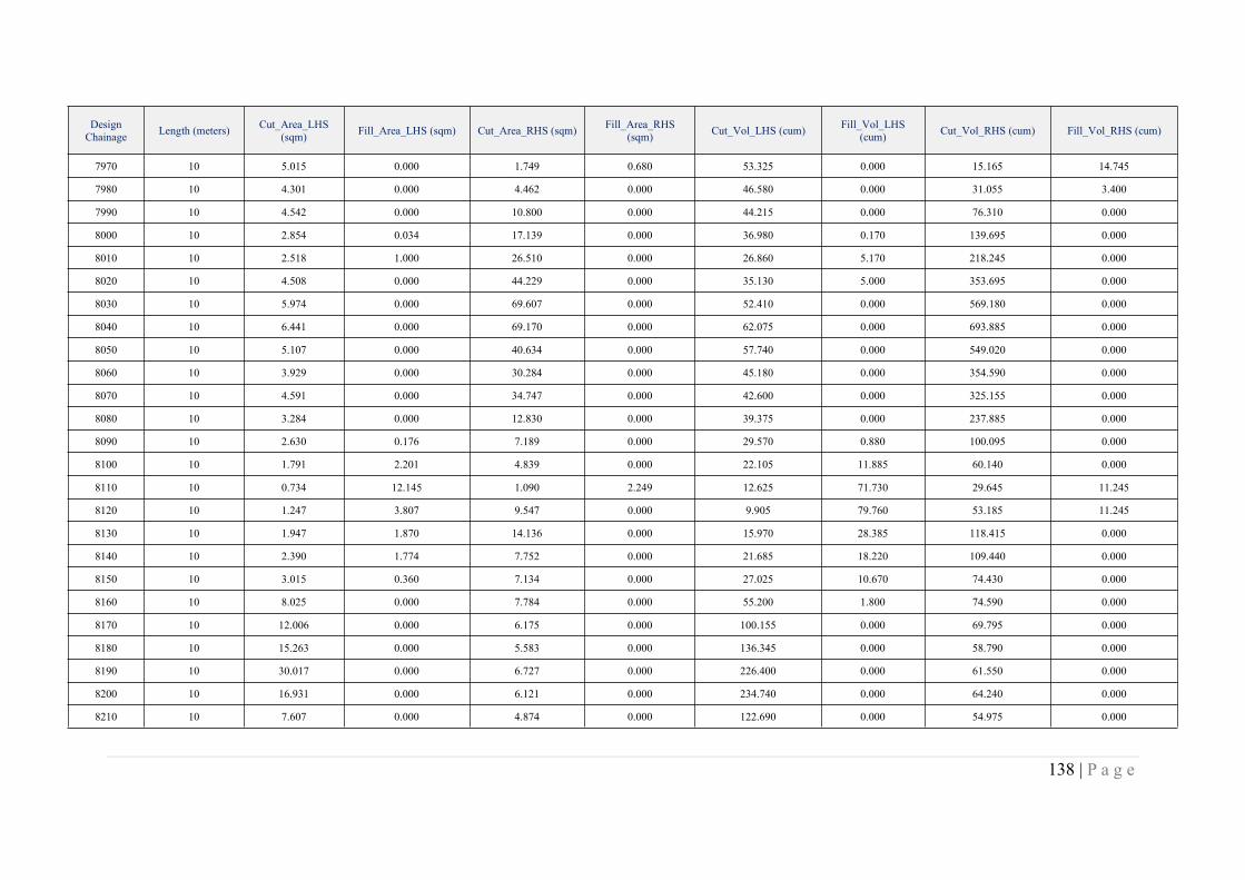
138 | P a g e
DesignChainage Length (meters) Cut_Area_LHS
(sqm) Fill_Area_LHS (sqm) Cut_Area_RHS (sqm) Fill_Area_RHS(sqm) Cut_Vol_LHS (cum) Fill_Vol_LHS
(cum) Cut_Vol_RHS (cum) Fill_Vol_RHS (cum)
7970 10 5.015 0.000 1.749 0.680 53.325 0.000 15.165 14.745
7980 10 4.301 0.000 4.462 0.000 46.580 0.000 31.055 3.400
7990 10 4.542 0.000 10.800 0.000 44.215 0.000 76.310 0.000
8000 10 2.854 0.034 17.139 0.000 36.980 0.170 139.695 0.000
8010 10 2.518 1.000 26.510 0.000 26.860 5.170 218.245 0.000
8020 10 4.508 0.000 44.229 0.000 35.130 5.000 353.695 0.000
8030 10 5.974 0.000 69.607 0.000 52.410 0.000 569.180 0.000
8040 10 6.441 0.000 69.170 0.000 62.075 0.000 693.885 0.000
8050 10 5.107 0.000 40.634 0.000 57.740 0.000 549.020 0.000
8060 10 3.929 0.000 30.284 0.000 45.180 0.000 354.590 0.000
8070 10 4.591 0.000 34.747 0.000 42.600 0.000 325.155 0.000
8080 10 3.284 0.000 12.830 0.000 39.375 0.000 237.885 0.000
8090 10 2.630 0.176 7.189 0.000 29.570 0.880 100.095 0.000
8100 10 1.791 2.201 4.839 0.000 22.105 11.885 60.140 0.000
8110 10 0.734 12.145 1.090 2.249 12.625 71.730 29.645 11.245
8120 10 1.247 3.807 9.547 0.000 9.905 79.760 53.185 11.245
8130 10 1.947 1.870 14.136 0.000 15.970 28.385 118.415 0.000
8140 10 2.390 1.774 7.752 0.000 21.685 18.220 109.440 0.000
8150 10 3.015 0.360 7.134 0.000 27.025 10.670 74.430 0.000
8160 10 8.025 0.000 7.784 0.000 55.200 1.800 74.590 0.000
8170 10 12.006 0.000 6.175 0.000 100.155 0.000 69.795 0.000
8180 10 15.263 0.000 5.583 0.000 136.345 0.000 58.790 0.000
8190 10 30.017 0.000 6.727 0.000 226.400 0.000 61.550 0.000
8200 10 16.931 0.000 6.121 0.000 234.740 0.000 64.240 0.000
8210 10 7.607 0.000 4.874 0.000 122.690 0.000 54.975 0.000

139 | P a g e
DesignChainage Length (meters) Cut_Area_LHS
(sqm) Fill_Area_LHS (sqm) Cut_Area_RHS (sqm) Fill_Area_RHS(sqm) Cut_Vol_LHS (cum) Fill_Vol_LHS
(cum) Cut_Vol_RHS (cum) Fill_Vol_RHS (cum)
8220 10 3.328 0.000 4.194 0.000 54.675 0.000 45.340 0.000
8230 10 4.037 0.000 4.037 0.000 36.825 0.000 41.155 0.000
8240 10 5.139 0.000 4.186 0.000 45.880 0.000 41.115 0.000
8250 10 3.844 0.000 4.414 0.000 44.915 0.000 43.000 0.000
8260 10 4.377 0.000 5.541 0.000 41.105 0.000 49.775 0.000
8270 10 5.409 0.000 5.656 0.000 48.930 0.000 55.985 0.000
8280 10 6.188 0.000 4.590 0.000 57.985 0.000 51.230 0.000
8290 10 7.454 0.000 5.499 0.000 68.210 0.000 50.445 0.000
8300 10 10.221 0.000 5.010 0.000 88.375 0.000 52.545 0.000
8310 10 12.882 0.000 5.058 0.000 115.515 0.000 50.340 0.000
8320 10 6.112 0.000 4.779 0.000 94.970 0.000 49.185 0.000
8330 10 5.834 0.000 4.654 0.000 59.730 0.000 47.165 0.000
8340 10 7.451 0.000 5.372 0.000 66.425 0.000 50.130 0.000
8350 10 5.440 0.000 4.284 0.000 64.455 0.000 48.280 0.000
8360 10 5.116 0.000 4.088 0.000 52.780 0.000 41.860 0.000
8370 10 5.079 0.000 4.245 0.000 50.975 0.000 41.665 0.000
8380 10 4.859 0.000 3.025 0.000 49.690 0.000 36.350 0.000
8390 10 3.695 0.000 1.568 0.484 42.770 0.000 22.965 2.420
8400 10 1.374 0.024 2.395 0.000 25.345 0.120 19.815 2.420
8410 10 0.553 0.862 2.535 0.000 9.635 4.430 24.650 0.000
8420 10 0.904 0.738 2.601 0.000 7.285 8.000 25.680 0.000
8430 10 1.590 2.313 6.024 0.000 12.470 15.255 43.125 0.000
8440 10 2.015 2.530 5.302 0.000 18.025 24.215 56.630 0.000
8450 10 2.807 0.763 6.139 0.000 24.110 16.465 57.205 0.000
8460 10 5.141 0.000 4.684 0.000 39.740 3.815 54.115 0.000

140 | P a g e
DesignChainage Length (meters) Cut_Area_LHS
(sqm) Fill_Area_LHS (sqm) Cut_Area_RHS (sqm) Fill_Area_RHS(sqm) Cut_Vol_LHS (cum) Fill_Vol_LHS
(cum) Cut_Vol_RHS (cum) Fill_Vol_RHS (cum)
8470 10 3.880 0.000 1.372 1.987 45.105 0.000 30.280 9.935
8480 10 3.057 0.000 0.886 2.953 34.685 0.000 11.290 24.700
8490 10 2.373 0.001 1.189 1.271 27.150 0.005 10.375 21.120
8500 10 2.052 1.363 1.691 0.094 22.125 6.820 14.400 6.825
8510 10 2.400 0.447 2.180 0.000 22.260 9.050 19.355 0.470
8520 10 3.320 0.000 1.477 1.018 28.600 2.235 18.285 5.090
8530 10 4.332 0.000 1.502 0.231 38.260 0.000 14.895 6.245
8540 10 4.545 0.000 3.553 0.000 44.385 0.000 25.275 1.155
8550 10 9.577 0.000 5.192 0.000 70.610 0.000 43.725 0.000
8560 10 8.198 0.000 5.157 0.000 88.875 0.000 51.745 0.000
8570 10 6.747 0.000 6.858 0.000 74.725 0.000 60.075 0.000
8580 10 9.401 0.000 8.398 0.000 80.740 0.000 76.280 0.000
8590 10 18.936 0.000 5.825 0.000 141.685 0.000 71.115 0.000
8600 10 21.840 0.000 3.887 0.032 203.880 0.000 48.560 0.160
8610 10 7.146 0.000 5.604 0.000 144.930 0.000 47.455 0.160
8620 10 7.429 0.000 4.429 0.000 72.875 0.000 50.165 0.000
8630 10 9.260 0.000 5.184 0.000 83.445 0.000 48.065 0.000
8640 10 12.236 0.000 5.510 0.000 107.480 0.000 53.470 0.000
8650 10 13.445 0.000 5.646 0.000 128.405 0.000 55.780 0.000
8660 10 13.411 0.000 5.546 0.000 134.280 0.000 55.960 0.000
8670 10 16.089 0.000 5.493 0.000 147.500 0.000 55.195 0.000
8680 10 11.234 0.000 5.710 0.000 136.615 0.000 56.015 0.000
8690 10 6.550 0.000 6.347 0.000 88.920 0.000 60.285 0.000
8700 10 5.405 0.000 7.259 0.000 59.775 0.000 68.030 0.000
8710 10 4.170 0.000 13.407 0.000 47.875 0.000 103.330 0.000
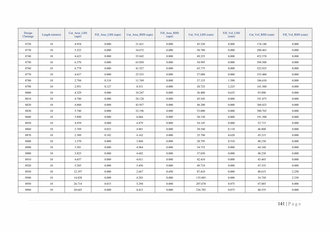
141 | P a g e
DesignChainage Length (meters) Cut_Area_LHS
(sqm) Fill_Area_LHS (sqm) Cut_Area_RHS (sqm) Fill_Area_RHS(sqm) Cut_Vol_LHS (cum) Fill_Vol_LHS
(cum) Cut_Vol_RHS (cum) Fill_Vol_RHS (cum)
8720 10 4.934 0.000 21.421 0.000 45.520 0.000 174.140 0.000
8730 10 5.222 0.000 34.672 0.000 50.780 0.000 280.465 0.000
8740 10 4.623 0.000 55.842 0.000 49.225 0.000 452.570 0.000
8750 10 6.376 0.000 63.058 0.000 54.995 0.000 594.500 0.000
8760 10 6.779 0.000 41.527 0.000 65.775 0.000 522.925 0.000
8770 10 4.637 0.000 25.553 0.000 57.080 0.000 335.400 0.000
8780 10 2.794 0.318 11.769 0.000 37.155 1.590 186.610 0.000
8790 10 2.951 0.127 8.531 0.000 28.725 2.225 101.500 0.000
8800 10 4.329 0.000 10.247 0.000 36.400 0.635 93.890 0.000
8810 10 4.780 0.000 28.128 0.000 45.545 0.000 191.875 0.000
8820 10 4.860 0.000 43.957 0.000 48.200 0.000 360.425 0.000
8830 10 5.740 0.000 32.196 0.000 53.000 0.000 380.765 0.000
8840 10 5.890 0.000 6.064 0.000 58.150 0.000 191.300 0.000
8850 10 4.939 0.000 4.479 0.000 54.145 0.000 52.715 0.000
8860 10 2.769 0.022 4.881 0.000 38.540 0.110 46.800 0.000
8870 10 2.389 0.102 4.162 0.000 25.790 0.620 45.215 0.000
8880 10 3.370 0.000 3.868 0.000 28.795 0.510 40.150 0.000
8890 10 3.581 0.000 4.964 0.000 34.755 0.000 44.160 0.000
8900 10 3.825 0.000 4.682 0.000 37.030 0.000 48.230 0.000
8910 10 4.657 0.000 4.011 0.000 42.410 0.000 43.465 0.000
8920 10 5.285 0.000 5.456 0.000 49.710 0.000 47.335 0.000
8930 10 12.197 0.000 2.667 0.450 87.410 0.000 40.615 2.250
8940 10 14.820 0.000 4.283 0.000 135.085 0.000 34.750 2.250
8950 10 26.714 0.015 5.294 0.000 207.670 0.075 47.885 0.000
8960 10 20.643 0.000 4.413 0.000 236.785 0.075 48.535 0.000
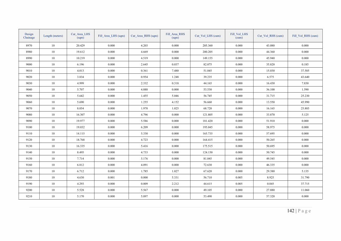
142 | P a g e
DesignChainage Length (meters) Cut_Area_LHS
(sqm) Fill_Area_LHS (sqm) Cut_Area_RHS (sqm) Fill_Area_RHS(sqm) Cut_Vol_LHS (cum) Fill_Vol_LHS
(cum) Cut_Vol_RHS (cum) Fill_Vol_RHS (cum)
8970 10 20.429 0.000 4.203 0.000 205.360 0.000 43.080 0.000
8980 10 19.612 0.000 4.669 0.000 200.205 0.000 44.360 0.000
8990 10 10.219 0.000 4.519 0.000 149.155 0.000 45.940 0.000
9000 10 6.196 0.000 2.645 0.037 82.075 0.000 35.820 0.185
9010 10 4.013 0.000 0.361 7.480 51.045 0.000 15.030 37.585
9020 10 3.834 0.000 0.954 1.248 39.235 0.000 6.575 43.640
9030 10 4.999 0.000 2.332 0.318 44.165 0.000 16.430 7.830
9040 10 5.707 0.000 4.888 0.000 53.530 0.000 36.100 1.590
9050 10 5.642 0.000 1.455 5.046 56.745 0.000 31.715 25.230
9060 10 5.690 0.000 1.255 4.152 56.660 0.000 13.550 45.990
9070 10 8.054 0.000 1.978 1.025 68.720 0.000 16.165 25.885
9080 10 16.307 0.000 4.796 0.000 121.805 0.000 33.870 5.125
9090 10 19.977 0.000 5.586 0.000 181.420 0.000 51.910 0.000
9100 10 19.032 0.000 6.209 0.000 195.045 0.000 58.975 0.000
9110 10 14.115 0.000 5.330 0.000 165.735 0.000 57.695 0.000
9120 10 18.768 0.000 4.723 0.000 164.415 0.000 50.265 0.000
9130 10 16.335 0.000 5.416 0.000 175.515 0.000 50.695 0.000
9140 10 8.495 0.000 4.733 0.000 124.150 0.000 50.745 0.000
9150 10 7.714 0.000 5.176 0.000 81.045 0.000 49.545 0.000
9160 10 6.812 0.000 4.091 0.000 72.630 0.000 46.335 0.000
9170 10 6.712 0.000 1.785 1.027 67.620 0.000 29.380 5.135
9180 10 4.630 0.001 0.000 5.331 56.710 0.005 8.925 31.790
9190 10 4.293 0.000 0.009 2.212 44.615 0.005 0.045 37.715
9200 10 5.528 0.000 5.567 0.000 49.105 0.000 27.880 11.060
9210 10 5.170 0.000 5.897 0.000 53.490 0.000 57.320 0.000
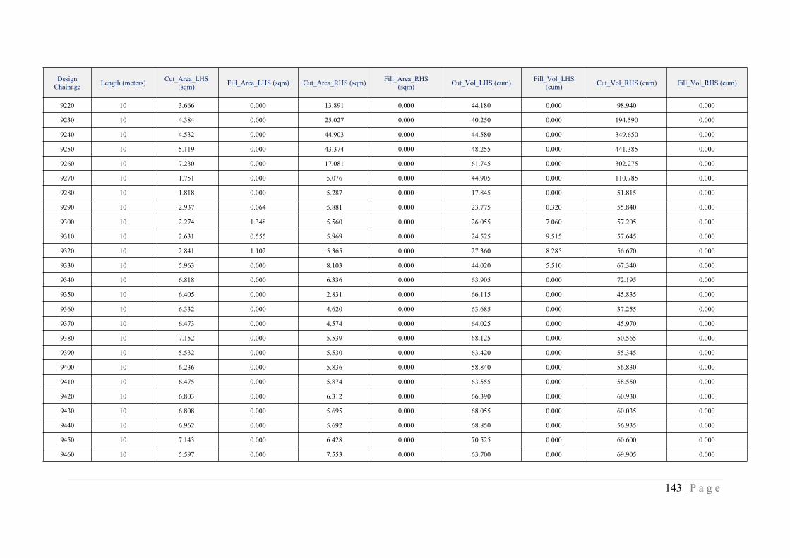
143 | P a g e
DesignChainage Length (meters) Cut_Area_LHS
(sqm) Fill_Area_LHS (sqm) Cut_Area_RHS (sqm) Fill_Area_RHS(sqm) Cut_Vol_LHS (cum) Fill_Vol_LHS
(cum) Cut_Vol_RHS (cum) Fill_Vol_RHS (cum)
9220 10 3.666 0.000 13.891 0.000 44.180 0.000 98.940 0.000
9230 10 4.384 0.000 25.027 0.000 40.250 0.000 194.590 0.000
9240 10 4.532 0.000 44.903 0.000 44.580 0.000 349.650 0.000
9250 10 5.119 0.000 43.374 0.000 48.255 0.000 441.385 0.000
9260 10 7.230 0.000 17.081 0.000 61.745 0.000 302.275 0.000
9270 10 1.751 0.000 5.076 0.000 44.905 0.000 110.785 0.000
9280 10 1.818 0.000 5.287 0.000 17.845 0.000 51.815 0.000
9290 10 2.937 0.064 5.881 0.000 23.775 0.320 55.840 0.000
9300 10 2.274 1.348 5.560 0.000 26.055 7.060 57.205 0.000
9310 10 2.631 0.555 5.969 0.000 24.525 9.515 57.645 0.000
9320 10 2.841 1.102 5.365 0.000 27.360 8.285 56.670 0.000
9330 10 5.963 0.000 8.103 0.000 44.020 5.510 67.340 0.000
9340 10 6.818 0.000 6.336 0.000 63.905 0.000 72.195 0.000
9350 10 6.405 0.000 2.831 0.000 66.115 0.000 45.835 0.000
9360 10 6.332 0.000 4.620 0.000 63.685 0.000 37.255 0.000
9370 10 6.473 0.000 4.574 0.000 64.025 0.000 45.970 0.000
9380 10 7.152 0.000 5.539 0.000 68.125 0.000 50.565 0.000
9390 10 5.532 0.000 5.530 0.000 63.420 0.000 55.345 0.000
9400 10 6.236 0.000 5.836 0.000 58.840 0.000 56.830 0.000
9410 10 6.475 0.000 5.874 0.000 63.555 0.000 58.550 0.000
9420 10 6.803 0.000 6.312 0.000 66.390 0.000 60.930 0.000
9430 10 6.808 0.000 5.695 0.000 68.055 0.000 60.035 0.000
9440 10 6.962 0.000 5.692 0.000 68.850 0.000 56.935 0.000
9450 10 7.143 0.000 6.428 0.000 70.525 0.000 60.600 0.000
9460 10 5.597 0.000 7.553 0.000 63.700 0.000 69.905 0.000

144 | P a g e
DesignChainage Length (meters) Cut_Area_LHS
(sqm) Fill_Area_LHS (sqm) Cut_Area_RHS (sqm) Fill_Area_RHS(sqm) Cut_Vol_LHS (cum) Fill_Vol_LHS
(cum) Cut_Vol_RHS (cum) Fill_Vol_RHS (cum)
9470 10 3.785 0.010 7.259 0.000 46.910 0.050 74.060 0.000
9480 10 4.378 0.000 7.710 0.000 40.815 0.050 74.845 0.000
9490 10 4.402 0.000 6.533 0.000 43.900 0.000 71.215 0.000
9500 10 5.502 0.000 6.549 0.000 49.520 0.000 65.410 0.000
9510 10 6.505 0.000 6.526 0.000 60.035 0.000 65.375 0.000
9520 10 3.141 0.000 6.626 0.000 48.230 0.000 65.760 0.000
9530 10 2.440 0.644 7.407 0.000 27.905 3.220 70.165 0.000
9540 10 4.965 0.000 12.025 0.000 37.025 3.220 97.160 0.000
9550 10 2.075 2.373 7.865 0.000 35.200 11.865 99.450 0.000
9560 10 1.623 8.061 7.716 0.000 18.490 52.170 77.905 0.000
9570 10 2.763 0.741 9.999 0.000 21.930 44.010 88.575 0.000
9580 10 5.911 0.000 9.791 0.000 43.370 3.705 98.950 0.000
9590 10 6.008 0.000 13.356 0.000 59.595 0.000 115.735 0.000
9600 10 5.787 0.000 8.231 0.000 58.975 0.000 107.935 0.000
9610 10 6.856 0.000 6.826 0.000 63.215 0.000 75.285 0.000
9620 10 7.386 0.000 8.502 0.000 71.210 0.000 76.640 0.000
9630 10 6.620 0.000 14.107 0.000 70.030 0.000 113.045 0.000
9640 10 6.590 0.000 30.300 0.000 66.050 0.000 222.035 0.000
9650 10 9.669 0.000 46.175 0.000 81.295 0.000 382.375 0.000
9660 10 22.899 0.000 59.876 0.000 162.840 0.000 530.255 0.000
9670 10 8.370 0.000 37.426 0.000 156.345 0.000 486.510 0.000
9680 10 7.980 0.000 18.947 0.000 81.750 0.000 281.865 0.000
9690 10 14.609 0.000 7.281 0.000 112.945 0.000 131.140 0.000
9700 10 7.879 0.000 4.280 0.000 112.440 0.000 57.805 0.000
9710 10 7.755 0.000 4.225 0.000 78.170 0.000 42.525 0.000
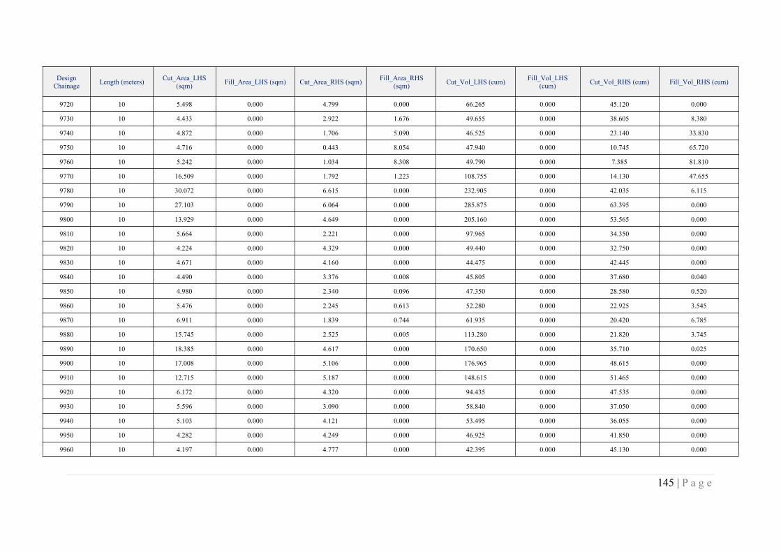
145 | P a g e
DesignChainage Length (meters) Cut_Area_LHS
(sqm) Fill_Area_LHS (sqm) Cut_Area_RHS (sqm) Fill_Area_RHS(sqm) Cut_Vol_LHS (cum) Fill_Vol_LHS
(cum) Cut_Vol_RHS (cum) Fill_Vol_RHS (cum)
9720 10 5.498 0.000 4.799 0.000 66.265 0.000 45.120 0.000
9730 10 4.433 0.000 2.922 1.676 49.655 0.000 38.605 8.380
9740 10 4.872 0.000 1.706 5.090 46.525 0.000 23.140 33.830
9750 10 4.716 0.000 0.443 8.054 47.940 0.000 10.745 65.720
9760 10 5.242 0.000 1.034 8.308 49.790 0.000 7.385 81.810
9770 10 16.509 0.000 1.792 1.223 108.755 0.000 14.130 47.655
9780 10 30.072 0.000 6.615 0.000 232.905 0.000 42.035 6.115
9790 10 27.103 0.000 6.064 0.000 285.875 0.000 63.395 0.000
9800 10 13.929 0.000 4.649 0.000 205.160 0.000 53.565 0.000
9810 10 5.664 0.000 2.221 0.000 97.965 0.000 34.350 0.000
9820 10 4.224 0.000 4.329 0.000 49.440 0.000 32.750 0.000
9830 10 4.671 0.000 4.160 0.000 44.475 0.000 42.445 0.000
9840 10 4.490 0.000 3.376 0.008 45.805 0.000 37.680 0.040
9850 10 4.980 0.000 2.340 0.096 47.350 0.000 28.580 0.520
9860 10 5.476 0.000 2.245 0.613 52.280 0.000 22.925 3.545
9870 10 6.911 0.000 1.839 0.744 61.935 0.000 20.420 6.785
9880 10 15.745 0.000 2.525 0.005 113.280 0.000 21.820 3.745
9890 10 18.385 0.000 4.617 0.000 170.650 0.000 35.710 0.025
9900 10 17.008 0.000 5.106 0.000 176.965 0.000 48.615 0.000
9910 10 12.715 0.000 5.187 0.000 148.615 0.000 51.465 0.000
9920 10 6.172 0.000 4.320 0.000 94.435 0.000 47.535 0.000
9930 10 5.596 0.000 3.090 0.000 58.840 0.000 37.050 0.000
9940 10 5.103 0.000 4.121 0.000 53.495 0.000 36.055 0.000
9950 10 4.282 0.000 4.249 0.000 46.925 0.000 41.850 0.000
9960 10 4.197 0.000 4.777 0.000 42.395 0.000 45.130 0.000
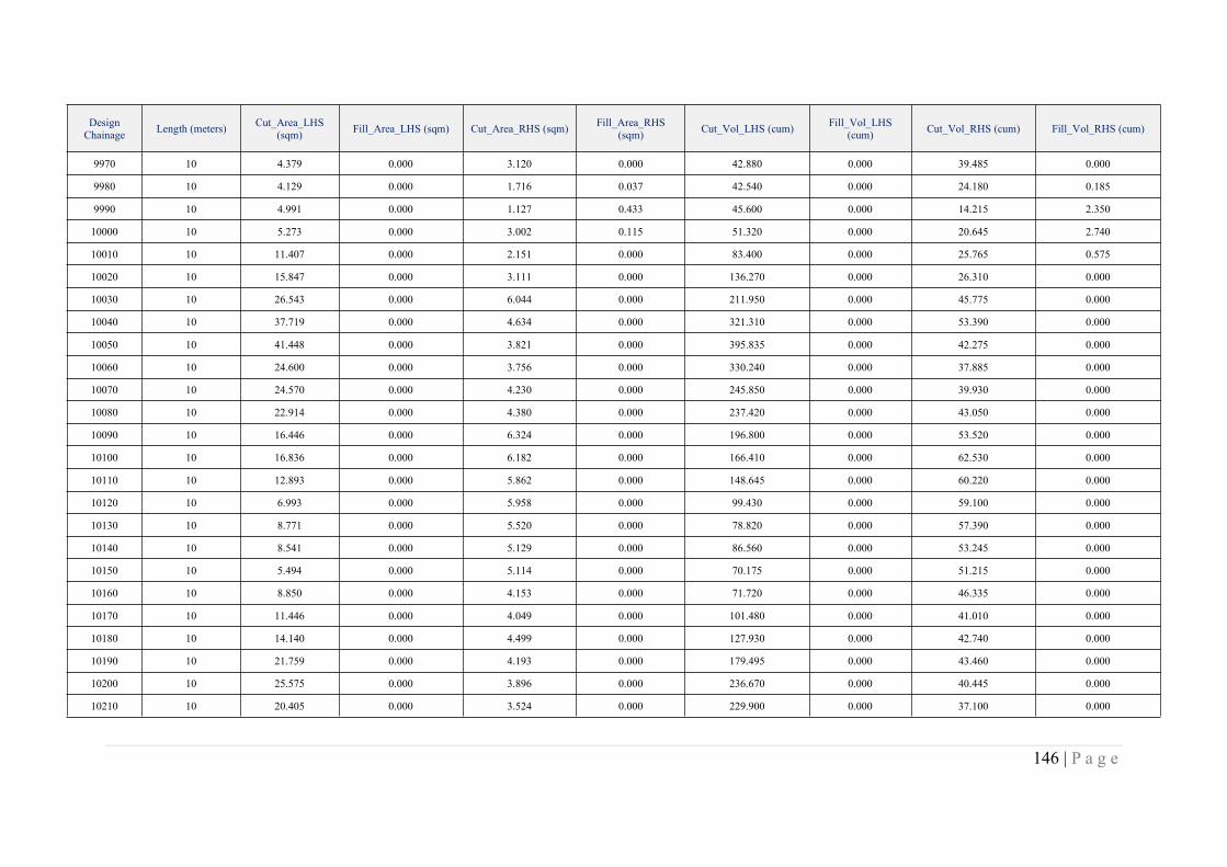
146 | P a g e
DesignChainage Length (meters) Cut_Area_LHS
(sqm) Fill_Area_LHS (sqm) Cut_Area_RHS (sqm) Fill_Area_RHS(sqm) Cut_Vol_LHS (cum) Fill_Vol_LHS
(cum) Cut_Vol_RHS (cum) Fill_Vol_RHS (cum)
9970 10 4.379 0.000 3.120 0.000 42.880 0.000 39.485 0.000
9980 10 4.129 0.000 1.716 0.037 42.540 0.000 24.180 0.185
9990 10 4.991 0.000 1.127 0.433 45.600 0.000 14.215 2.350
10000 10 5.273 0.000 3.002 0.115 51.320 0.000 20.645 2.740
10010 10 11.407 0.000 2.151 0.000 83.400 0.000 25.765 0.575
10020 10 15.847 0.000 3.111 0.000 136.270 0.000 26.310 0.000
10030 10 26.543 0.000 6.044 0.000 211.950 0.000 45.775 0.000
10040 10 37.719 0.000 4.634 0.000 321.310 0.000 53.390 0.000
10050 10 41.448 0.000 3.821 0.000 395.835 0.000 42.275 0.000
10060 10 24.600 0.000 3.756 0.000 330.240 0.000 37.885 0.000
10070 10 24.570 0.000 4.230 0.000 245.850 0.000 39.930 0.000
10080 10 22.914 0.000 4.380 0.000 237.420 0.000 43.050 0.000
10090 10 16.446 0.000 6.324 0.000 196.800 0.000 53.520 0.000
10100 10 16.836 0.000 6.182 0.000 166.410 0.000 62.530 0.000
10110 10 12.893 0.000 5.862 0.000 148.645 0.000 60.220 0.000
10120 10 6.993 0.000 5.958 0.000 99.430 0.000 59.100 0.000
10130 10 8.771 0.000 5.520 0.000 78.820 0.000 57.390 0.000
10140 10 8.541 0.000 5.129 0.000 86.560 0.000 53.245 0.000
10150 10 5.494 0.000 5.114 0.000 70.175 0.000 51.215 0.000
10160 10 8.850 0.000 4.153 0.000 71.720 0.000 46.335 0.000
10170 10 11.446 0.000 4.049 0.000 101.480 0.000 41.010 0.000
10180 10 14.140 0.000 4.499 0.000 127.930 0.000 42.740 0.000
10190 10 21.759 0.000 4.193 0.000 179.495 0.000 43.460 0.000
10200 10 25.575 0.000 3.896 0.000 236.670 0.000 40.445 0.000
10210 10 20.405 0.000 3.524 0.000 229.900 0.000 37.100 0.000
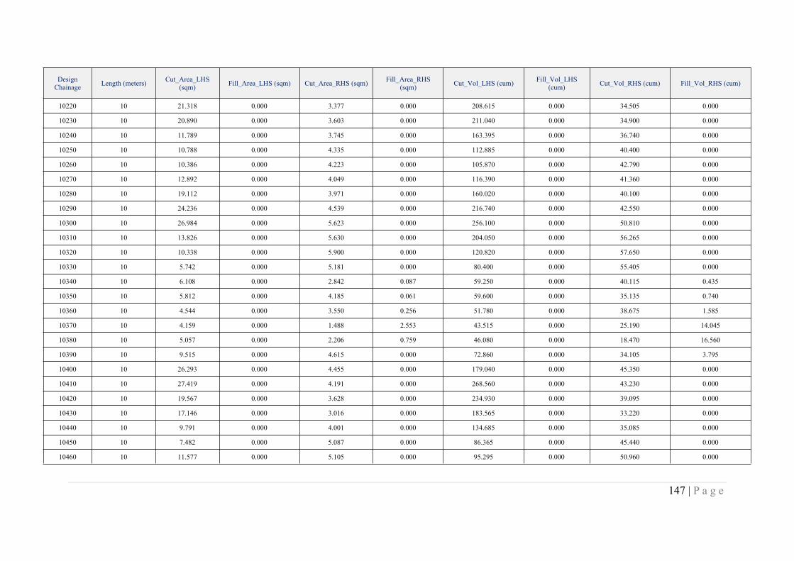
147 | P a g e
DesignChainage Length (meters) Cut_Area_LHS
(sqm) Fill_Area_LHS (sqm) Cut_Area_RHS (sqm) Fill_Area_RHS(sqm) Cut_Vol_LHS (cum) Fill_Vol_LHS
(cum) Cut_Vol_RHS (cum) Fill_Vol_RHS (cum)
10220 10 21.318 0.000 3.377 0.000 208.615 0.000 34.505 0.000
10230 10 20.890 0.000 3.603 0.000 211.040 0.000 34.900 0.000
10240 10 11.789 0.000 3.745 0.000 163.395 0.000 36.740 0.000
10250 10 10.788 0.000 4.335 0.000 112.885 0.000 40.400 0.000
10260 10 10.386 0.000 4.223 0.000 105.870 0.000 42.790 0.000
10270 10 12.892 0.000 4.049 0.000 116.390 0.000 41.360 0.000
10280 10 19.112 0.000 3.971 0.000 160.020 0.000 40.100 0.000
10290 10 24.236 0.000 4.539 0.000 216.740 0.000 42.550 0.000
10300 10 26.984 0.000 5.623 0.000 256.100 0.000 50.810 0.000
10310 10 13.826 0.000 5.630 0.000 204.050 0.000 56.265 0.000
10320 10 10.338 0.000 5.900 0.000 120.820 0.000 57.650 0.000
10330 10 5.742 0.000 5.181 0.000 80.400 0.000 55.405 0.000
10340 10 6.108 0.000 2.842 0.087 59.250 0.000 40.115 0.435
10350 10 5.812 0.000 4.185 0.061 59.600 0.000 35.135 0.740
10360 10 4.544 0.000 3.550 0.256 51.780 0.000 38.675 1.585
10370 10 4.159 0.000 1.488 2.553 43.515 0.000 25.190 14.045
10380 10 5.057 0.000 2.206 0.759 46.080 0.000 18.470 16.560
10390 10 9.515 0.000 4.615 0.000 72.860 0.000 34.105 3.795
10400 10 26.293 0.000 4.455 0.000 179.040 0.000 45.350 0.000
10410 10 27.419 0.000 4.191 0.000 268.560 0.000 43.230 0.000
10420 10 19.567 0.000 3.628 0.000 234.930 0.000 39.095 0.000
10430 10 17.146 0.000 3.016 0.000 183.565 0.000 33.220 0.000
10440 10 9.791 0.000 4.001 0.000 134.685 0.000 35.085 0.000
10450 10 7.482 0.000 5.087 0.000 86.365 0.000 45.440 0.000
10460 10 11.577 0.000 5.105 0.000 95.295 0.000 50.960 0.000
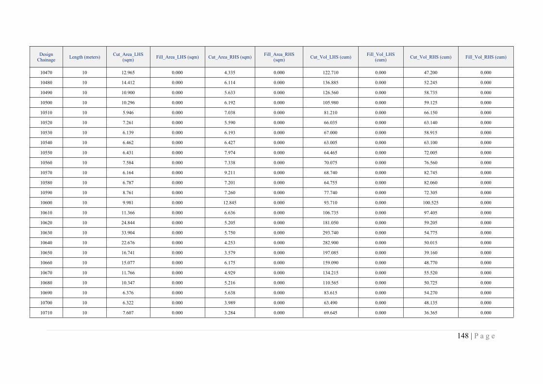
148 | P a g e
DesignChainage Length (meters) Cut_Area_LHS
(sqm) Fill_Area_LHS (sqm) Cut_Area_RHS (sqm) Fill_Area_RHS(sqm) Cut_Vol_LHS (cum) Fill_Vol_LHS
(cum) Cut_Vol_RHS (cum) Fill_Vol_RHS (cum)
10470 10 12.965 0.000 4.335 0.000 122.710 0.000 47.200 0.000
10480 10 14.412 0.000 6.114 0.000 136.885 0.000 52.245 0.000
10490 10 10.900 0.000 5.633 0.000 126.560 0.000 58.735 0.000
10500 10 10.296 0.000 6.192 0.000 105.980 0.000 59.125 0.000
10510 10 5.946 0.000 7.038 0.000 81.210 0.000 66.150 0.000
10520 10 7.261 0.000 5.590 0.000 66.035 0.000 63.140 0.000
10530 10 6.139 0.000 6.193 0.000 67.000 0.000 58.915 0.000
10540 10 6.462 0.000 6.427 0.000 63.005 0.000 63.100 0.000
10550 10 6.431 0.000 7.974 0.000 64.465 0.000 72.005 0.000
10560 10 7.584 0.000 7.338 0.000 70.075 0.000 76.560 0.000
10570 10 6.164 0.000 9.211 0.000 68.740 0.000 82.745 0.000
10580 10 6.787 0.000 7.201 0.000 64.755 0.000 82.060 0.000
10590 10 8.761 0.000 7.260 0.000 77.740 0.000 72.305 0.000
10600 10 9.981 0.000 12.845 0.000 93.710 0.000 100.525 0.000
10610 10 11.366 0.000 6.636 0.000 106.735 0.000 97.405 0.000
10620 10 24.844 0.000 5.205 0.000 181.050 0.000 59.205 0.000
10630 10 33.904 0.000 5.750 0.000 293.740 0.000 54.775 0.000
10640 10 22.676 0.000 4.253 0.000 282.900 0.000 50.015 0.000
10650 10 16.741 0.000 3.579 0.000 197.085 0.000 39.160 0.000
10660 10 15.077 0.000 6.175 0.000 159.090 0.000 48.770 0.000
10670 10 11.766 0.000 4.929 0.000 134.215 0.000 55.520 0.000
10680 10 10.347 0.000 5.216 0.000 110.565 0.000 50.725 0.000
10690 10 6.376 0.000 5.638 0.000 83.615 0.000 54.270 0.000
10700 10 6.322 0.000 3.989 0.000 63.490 0.000 48.135 0.000
10710 10 7.607 0.000 3.284 0.000 69.645 0.000 36.365 0.000

149 | P a g e
DesignChainage Length (meters) Cut_Area_LHS
(sqm) Fill_Area_LHS (sqm) Cut_Area_RHS (sqm) Fill_Area_RHS(sqm) Cut_Vol_LHS (cum) Fill_Vol_LHS
(cum) Cut_Vol_RHS (cum) Fill_Vol_RHS (cum)
10720 10 11.245 0.000 5.120 0.000 94.260 0.000 42.020 0.000
10730 10 18.588 0.000 5.127 0.000 149.165 0.000 51.235 0.000
10740 10 17.803 0.000 6.150 0.000 181.955 0.000 56.385 0.000
10750 10 21.011 0.000 6.218 0.000 194.070 0.000 61.840 0.000
10760 10 10.343 0.000 5.352 0.000 156.770 0.000 57.850 0.000
10770 10 5.303 0.000 5.052 0.000 78.230 0.000 52.020 0.000
10780 10 4.266 0.000 4.428 0.000 47.845 0.000 47.400 0.000
10790 10 4.917 0.000 2.489 0.012 45.915 0.000 34.585 0.060
10800 10 7.005 0.000 4.357 0.000 59.610 0.000 34.230 0.060
10810 10 5.557 0.000 7.438 0.000 62.810 0.000 58.975 0.000
10820 10 5.905 0.000 6.245 0.000 57.310 0.000 68.415 0.000
10830 10 6.236 0.000 5.871 0.000 60.705 0.000 60.580 0.000
10840 10 5.694 0.000 2.369 0.205 59.650 0.000 41.200 1.025
10850 10 8.475 0.000 4.570 0.000 70.845 0.000 34.695 1.025
10860 10 21.703 0.000 4.401 0.000 150.890 0.000 44.855 0.000
10870 10 23.618 0.000 5.080 0.000 226.605 0.000 47.405 0.000
10880 10 25.169 0.000 4.605 0.000 243.935 0.000 48.425 0.000
10890 10 15.336 0.000 5.051 0.000 202.525 0.000 48.280 0.000
10900 10 18.769 0.000 4.628 0.000 170.525 0.000 48.395 0.000
10910 10 10.909 0.000 5.525 0.000 148.390 0.000 50.765 0.000
10920 10 8.753 0.000 5.734 0.000 98.310 0.000 56.295 0.000
10930 10 9.177 0.000 5.746 0.000 89.650 0.000 57.400 0.000
10940 10 9.762 0.000 5.368 0.000 94.695 0.000 55.570 0.000
10950 10 13.438 0.000 5.364 0.000 116.000 0.000 53.660 0.000
10960 10 15.033 0.000 4.933 0.000 142.355 0.000 51.485 0.000
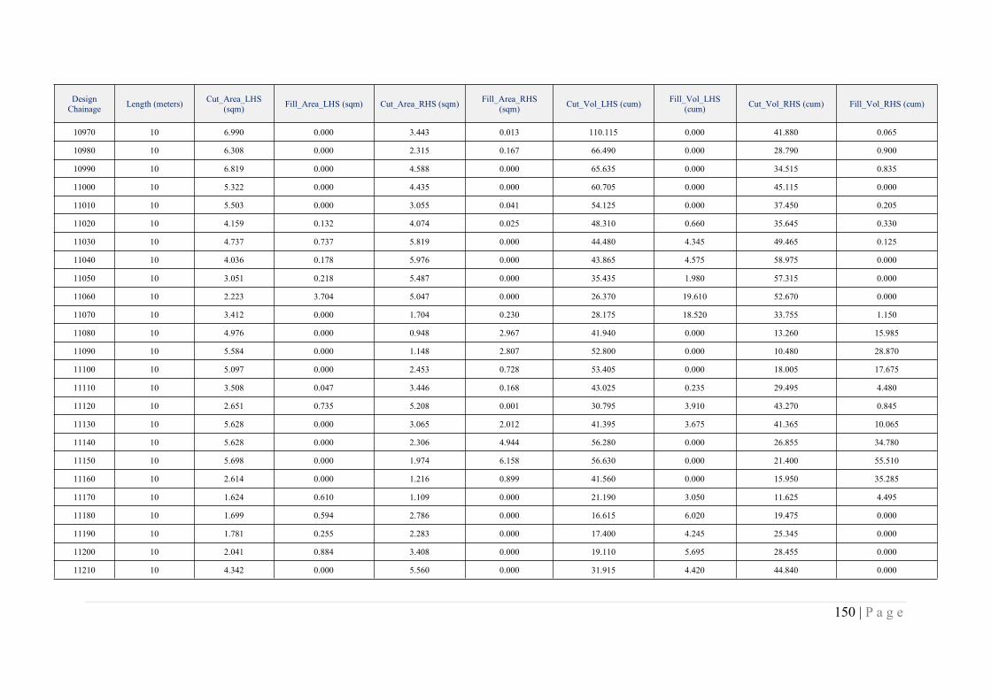
150 | P a g e
DesignChainage Length (meters) Cut_Area_LHS
(sqm) Fill_Area_LHS (sqm) Cut_Area_RHS (sqm) Fill_Area_RHS(sqm) Cut_Vol_LHS (cum) Fill_Vol_LHS
(cum) Cut_Vol_RHS (cum) Fill_Vol_RHS (cum)
10970 10 6.990 0.000 3.443 0.013 110.115 0.000 41.880 0.065
10980 10 6.308 0.000 2.315 0.167 66.490 0.000 28.790 0.900
10990 10 6.819 0.000 4.588 0.000 65.635 0.000 34.515 0.835
11000 10 5.322 0.000 4.435 0.000 60.705 0.000 45.115 0.000
11010 10 5.503 0.000 3.055 0.041 54.125 0.000 37.450 0.205
11020 10 4.159 0.132 4.074 0.025 48.310 0.660 35.645 0.330
11030 10 4.737 0.737 5.819 0.000 44.480 4.345 49.465 0.125
11040 10 4.036 0.178 5.976 0.000 43.865 4.575 58.975 0.000
11050 10 3.051 0.218 5.487 0.000 35.435 1.980 57.315 0.000
11060 10 2.223 3.704 5.047 0.000 26.370 19.610 52.670 0.000
11070 10 3.412 0.000 1.704 0.230 28.175 18.520 33.755 1.150
11080 10 4.976 0.000 0.948 2.967 41.940 0.000 13.260 15.985
11090 10 5.584 0.000 1.148 2.807 52.800 0.000 10.480 28.870
11100 10 5.097 0.000 2.453 0.728 53.405 0.000 18.005 17.675
11110 10 3.508 0.047 3.446 0.168 43.025 0.235 29.495 4.480
11120 10 2.651 0.735 5.208 0.001 30.795 3.910 43.270 0.845
11130 10 5.628 0.000 3.065 2.012 41.395 3.675 41.365 10.065
11140 10 5.628 0.000 2.306 4.944 56.280 0.000 26.855 34.780
11150 10 5.698 0.000 1.974 6.158 56.630 0.000 21.400 55.510
11160 10 2.614 0.000 1.216 0.899 41.560 0.000 15.950 35.285
11170 10 1.624 0.610 1.109 0.000 21.190 3.050 11.625 4.495
11180 10 1.699 0.594 2.786 0.000 16.615 6.020 19.475 0.000
11190 10 1.781 0.255 2.283 0.000 17.400 4.245 25.345 0.000
11200 10 2.041 0.884 3.408 0.000 19.110 5.695 28.455 0.000
11210 10 4.342 0.000 5.560 0.000 31.915 4.420 44.840 0.000

151 | P a g e
DesignChainage Length (meters) Cut_Area_LHS
(sqm) Fill_Area_LHS (sqm) Cut_Area_RHS (sqm) Fill_Area_RHS(sqm) Cut_Vol_LHS (cum) Fill_Vol_LHS
(cum) Cut_Vol_RHS (cum) Fill_Vol_RHS (cum)
11220 10 5.388 0.000 5.587 0.000 48.650 0.000 55.735 0.000
11230 10 5.947 0.000 5.704 0.000 56.675 0.000 56.455 0.000
11240 10 6.611 0.000 5.833 0.000 62.790 0.000 57.685 0.000
11250 10 5.353 0.000 5.037 0.000 59.820 0.000 54.350 0.000
11260 10 5.647 0.000 3.947 0.000 55.000 0.000 44.920 0.000
11270 10 5.022 0.000 3.210 0.000 53.345 0.000 35.785 0.000
11280 10 1.686 0.819 3.838 0.000 33.540 4.095 35.240 0.000
11290 10 1.137 0.046 3.538 0.000 14.115 4.325 36.880 0.000
11300 10 2.781 0.364 4.693 0.000 19.590 2.050 41.155 0.000
11310 10 3.632 0.135 8.108 0.000 32.065 2.495 64.005 0.000
11320 10 2.995 0.014 10.076 0.000 33.135 0.745 90.920 0.000
11330 10 4.297 0.000 11.059 0.000 36.460 0.070 105.675 0.000
11340 10 6.442 0.000 19.879 0.000 53.695 0.000 154.690 0.000
11350 10 5.372 0.000 16.494 0.000 59.070 0.000 181.865 0.000
11360 10 3.866 0.000 13.103 0.000 46.190 0.000 147.985 0.000
11370 10 2.381 0.836 8.950 0.000 31.235 4.180 110.265 0.000
11380 10 2.012 0.353 13.305 0.000 21.965 5.945 111.275 0.000
11390 10 4.440 0.000 21.011 0.000 32.260 1.765 171.580 0.000
11400 10 5.336 0.000 19.787 0.000 48.880 0.000 203.990 0.000
11410 10 2.969 0.000 18.833 0.000 41.525 0.000 193.100 0.000
11420 10 2.622 0.001 15.692 0.000 27.955 0.005 172.625 0.000
11430 10 4.111 0.000 17.406 0.000 33.665 0.005 165.490 0.000
11440 10 3.090 1.039 13.692 0.000 36.005 5.195 155.490 0.000
11450 10 3.163 0.255 10.564 0.000 31.265 6.470 121.280 0.000
11460 10 3.750 0.057 5.150 0.000 34.565 1.560 78.570 0.000
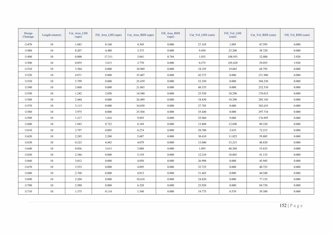
152 | P a g e
DesignChainage Length (meters) Cut_Area_LHS
(sqm) Fill_Area_LHS (sqm) Cut_Area_RHS (sqm) Fill_Area_RHS(sqm) Cut_Vol_LHS (cum) Fill_Vol_LHS
(cum) Cut_Vol_RHS (cum) Fill_Vol_RHS (cum)
11470 10 1.683 0.160 4.369 0.000 27.165 1.085 47.595 0.000
11480 10 0.207 4.480 3.375 0.000 9.450 23.200 38.720 0.000
11490 10 0.000 17.311 3.041 0.784 1.035 108.955 32.080 3.920
11500 10 0.055 3.813 2.770 0.000 0.275 105.620 29.055 3.920
11510 10 3.584 0.000 10.989 0.000 18.195 19.065 68.795 0.000
11520 10 4.871 0.000 35.407 0.000 42.275 0.000 231.980 0.000
11530 10 5.799 0.000 25.439 0.000 53.350 0.000 304.230 0.000
11540 10 3.868 0.000 21.063 0.000 48.335 0.000 232.510 0.000
11550 10 1.242 2.058 14.540 0.000 25.550 10.290 178.015 0.000
11560 10 2.444 0.000 26.489 0.000 18.430 10.290 205.145 0.000
11570 10 3.113 0.000 34.038 0.000 27.785 0.000 302.635 0.000
11580 10 3.975 0.000 25.504 0.000 35.440 0.000 297.710 0.000
11590 10 1.217 1.816 9.895 0.000 25.960 9.080 176.995 0.000
11600 10 1.943 0.722 8.169 0.000 15.800 12.690 90.320 0.000
11610 10 3.797 0.005 6.274 0.000 28.700 3.635 72.215 0.000
11620 10 2.285 2.200 5.687 0.000 30.410 11.025 59.805 0.000
11630 10 0.323 4.443 4.079 0.000 13.040 33.215 48.830 0.000
11640 10 0.056 3.613 3.088 0.000 1.895 40.280 35.835 0.000
11650 10 2.386 0.000 5.139 0.000 12.210 18.065 41.135 0.000
11660 10 3.012 0.000 4.050 0.000 26.990 0.000 45.945 0.000
11670 10 3.533 0.000 4.095 0.000 32.725 0.000 40.725 0.000
11680 10 2.760 0.000 4.813 0.000 31.465 0.000 44.540 0.000
11690 10 2.204 0.000 10.618 0.000 24.820 0.000 77.155 0.000
11700 10 2.580 0.000 6.328 0.000 23.920 0.000 84.730 0.000
11710 10 1.375 0.114 1.548 0.000 19.775 0.570 39.380 0.000
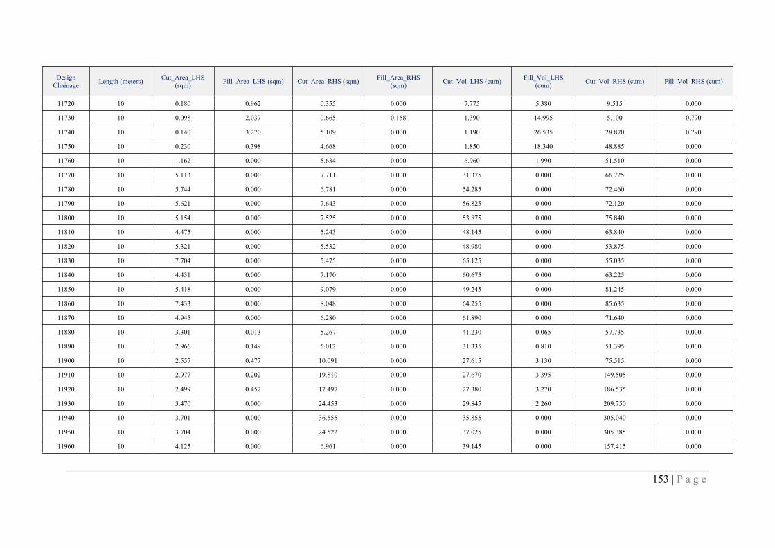
153 | P a g e
DesignChainage Length (meters) Cut_Area_LHS
(sqm) Fill_Area_LHS (sqm) Cut_Area_RHS (sqm) Fill_Area_RHS(sqm) Cut_Vol_LHS (cum) Fill_Vol_LHS
(cum) Cut_Vol_RHS (cum) Fill_Vol_RHS (cum)
11720 10 0.180 0.962 0.355 0.000 7.775 5.380 9.515 0.000
11730 10 0.098 2.037 0.665 0.158 1.390 14.995 5.100 0.790
11740 10 0.140 3.270 5.109 0.000 1.190 26.535 28.870 0.790
11750 10 0.230 0.398 4.668 0.000 1.850 18.340 48.885 0.000
11760 10 1.162 0.000 5.634 0.000 6.960 1.990 51.510 0.000
11770 10 5.113 0.000 7.711 0.000 31.375 0.000 66.725 0.000
11780 10 5.744 0.000 6.781 0.000 54.285 0.000 72.460 0.000
11790 10 5.621 0.000 7.643 0.000 56.825 0.000 72.120 0.000
11800 10 5.154 0.000 7.525 0.000 53.875 0.000 75.840 0.000
11810 10 4.475 0.000 5.243 0.000 48.145 0.000 63.840 0.000
11820 10 5.321 0.000 5.532 0.000 48.980 0.000 53.875 0.000
11830 10 7.704 0.000 5.475 0.000 65.125 0.000 55.035 0.000
11840 10 4.431 0.000 7.170 0.000 60.675 0.000 63.225 0.000
11850 10 5.418 0.000 9.079 0.000 49.245 0.000 81.245 0.000
11860 10 7.433 0.000 8.048 0.000 64.255 0.000 85.635 0.000
11870 10 4.945 0.000 6.280 0.000 61.890 0.000 71.640 0.000
11880 10 3.301 0.013 5.267 0.000 41.230 0.065 57.735 0.000
11890 10 2.966 0.149 5.012 0.000 31.335 0.810 51.395 0.000
11900 10 2.557 0.477 10.091 0.000 27.615 3.130 75.515 0.000
11910 10 2.977 0.202 19.810 0.000 27.670 3.395 149.505 0.000
11920 10 2.499 0.452 17.497 0.000 27.380 3.270 186.535 0.000
11930 10 3.470 0.000 24.453 0.000 29.845 2.260 209.750 0.000
11940 10 3.701 0.000 36.555 0.000 35.855 0.000 305.040 0.000
11950 10 3.704 0.000 24.522 0.000 37.025 0.000 305.385 0.000
11960 10 4.125 0.000 6.961 0.000 39.145 0.000 157.415 0.000
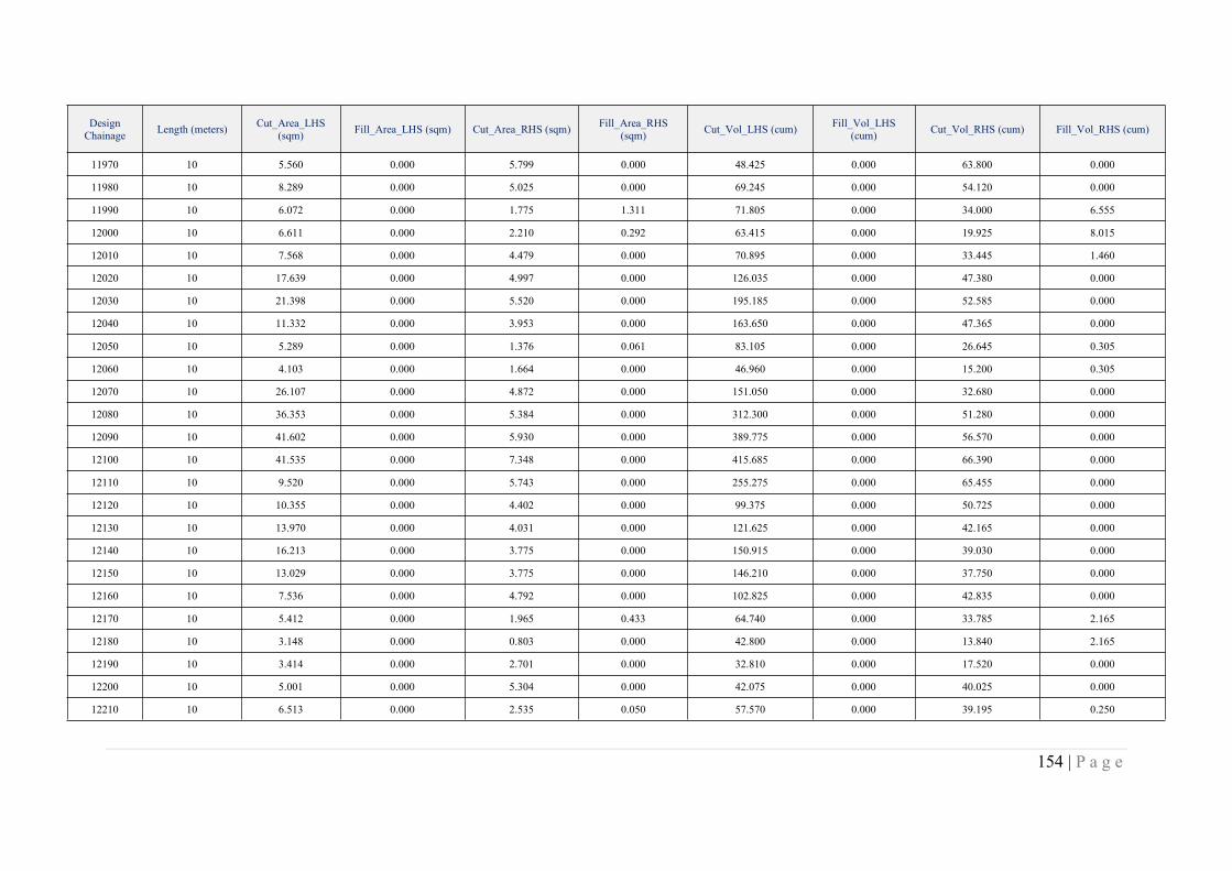
154 | P a g e
DesignChainage Length (meters) Cut_Area_LHS
(sqm) Fill_Area_LHS (sqm) Cut_Area_RHS (sqm) Fill_Area_RHS(sqm) Cut_Vol_LHS (cum) Fill_Vol_LHS
(cum) Cut_Vol_RHS (cum) Fill_Vol_RHS (cum)
11970 10 5.560 0.000 5.799 0.000 48.425 0.000 63.800 0.000
11980 10 8.289 0.000 5.025 0.000 69.245 0.000 54.120 0.000
11990 10 6.072 0.000 1.775 1.311 71.805 0.000 34.000 6.555
12000 10 6.611 0.000 2.210 0.292 63.415 0.000 19.925 8.015
12010 10 7.568 0.000 4.479 0.000 70.895 0.000 33.445 1.460
12020 10 17.639 0.000 4.997 0.000 126.035 0.000 47.380 0.000
12030 10 21.398 0.000 5.520 0.000 195.185 0.000 52.585 0.000
12040 10 11.332 0.000 3.953 0.000 163.650 0.000 47.365 0.000
12050 10 5.289 0.000 1.376 0.061 83.105 0.000 26.645 0.305
12060 10 4.103 0.000 1.664 0.000 46.960 0.000 15.200 0.305
12070 10 26.107 0.000 4.872 0.000 151.050 0.000 32.680 0.000
12080 10 36.353 0.000 5.384 0.000 312.300 0.000 51.280 0.000
12090 10 41.602 0.000 5.930 0.000 389.775 0.000 56.570 0.000
12100 10 41.535 0.000 7.348 0.000 415.685 0.000 66.390 0.000
12110 10 9.520 0.000 5.743 0.000 255.275 0.000 65.455 0.000
12120 10 10.355 0.000 4.402 0.000 99.375 0.000 50.725 0.000
12130 10 13.970 0.000 4.031 0.000 121.625 0.000 42.165 0.000
12140 10 16.213 0.000 3.775 0.000 150.915 0.000 39.030 0.000
12150 10 13.029 0.000 3.775 0.000 146.210 0.000 37.750 0.000
12160 10 7.536 0.000 4.792 0.000 102.825 0.000 42.835 0.000
12170 10 5.412 0.000 1.965 0.433 64.740 0.000 33.785 2.165
12180 10 3.148 0.000 0.803 0.000 42.800 0.000 13.840 2.165
12190 10 3.414 0.000 2.701 0.000 32.810 0.000 17.520 0.000
12200 10 5.001 0.000 5.304 0.000 42.075 0.000 40.025 0.000
12210 10 6.513 0.000 2.535 0.050 57.570 0.000 39.195 0.250
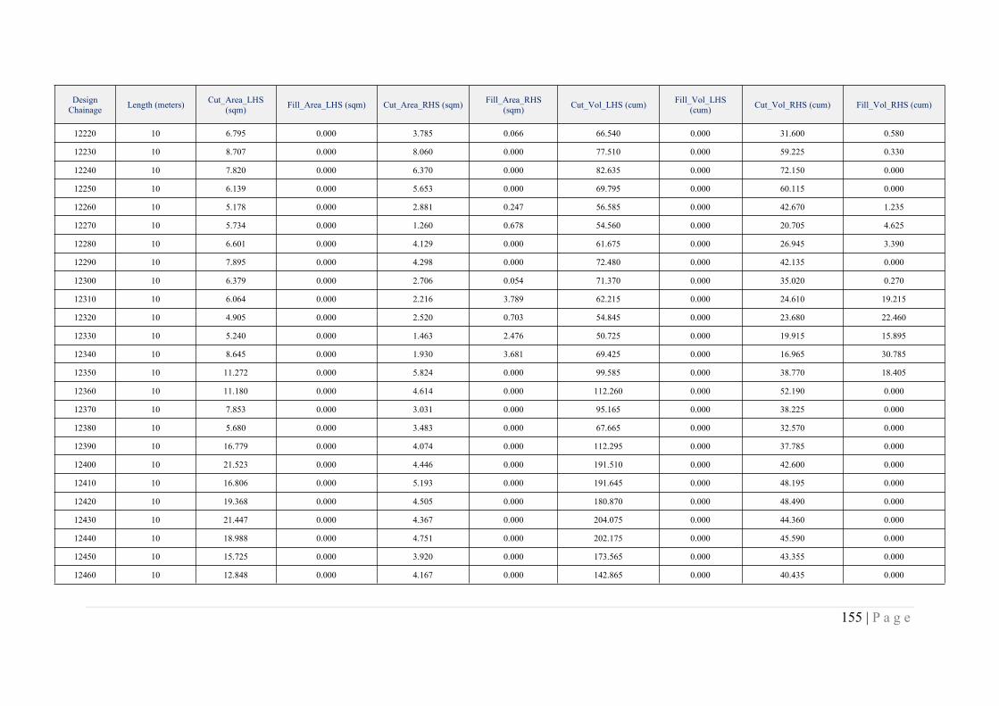
155 | P a g e
DesignChainage Length (meters) Cut_Area_LHS
(sqm) Fill_Area_LHS (sqm) Cut_Area_RHS (sqm) Fill_Area_RHS(sqm) Cut_Vol_LHS (cum) Fill_Vol_LHS
(cum) Cut_Vol_RHS (cum) Fill_Vol_RHS (cum)
12220 10 6.795 0.000 3.785 0.066 66.540 0.000 31.600 0.580
12230 10 8.707 0.000 8.060 0.000 77.510 0.000 59.225 0.330
12240 10 7.820 0.000 6.370 0.000 82.635 0.000 72.150 0.000
12250 10 6.139 0.000 5.653 0.000 69.795 0.000 60.115 0.000
12260 10 5.178 0.000 2.881 0.247 56.585 0.000 42.670 1.235
12270 10 5.734 0.000 1.260 0.678 54.560 0.000 20.705 4.625
12280 10 6.601 0.000 4.129 0.000 61.675 0.000 26.945 3.390
12290 10 7.895 0.000 4.298 0.000 72.480 0.000 42.135 0.000
12300 10 6.379 0.000 2.706 0.054 71.370 0.000 35.020 0.270
12310 10 6.064 0.000 2.216 3.789 62.215 0.000 24.610 19.215
12320 10 4.905 0.000 2.520 0.703 54.845 0.000 23.680 22.460
12330 10 5.240 0.000 1.463 2.476 50.725 0.000 19.915 15.895
12340 10 8.645 0.000 1.930 3.681 69.425 0.000 16.965 30.785
12350 10 11.272 0.000 5.824 0.000 99.585 0.000 38.770 18.405
12360 10 11.180 0.000 4.614 0.000 112.260 0.000 52.190 0.000
12370 10 7.853 0.000 3.031 0.000 95.165 0.000 38.225 0.000
12380 10 5.680 0.000 3.483 0.000 67.665 0.000 32.570 0.000
12390 10 16.779 0.000 4.074 0.000 112.295 0.000 37.785 0.000
12400 10 21.523 0.000 4.446 0.000 191.510 0.000 42.600 0.000
12410 10 16.806 0.000 5.193 0.000 191.645 0.000 48.195 0.000
12420 10 19.368 0.000 4.505 0.000 180.870 0.000 48.490 0.000
12430 10 21.447 0.000 4.367 0.000 204.075 0.000 44.360 0.000
12440 10 18.988 0.000 4.751 0.000 202.175 0.000 45.590 0.000
12450 10 15.725 0.000 3.920 0.000 173.565 0.000 43.355 0.000
12460 10 12.848 0.000 4.167 0.000 142.865 0.000 40.435 0.000
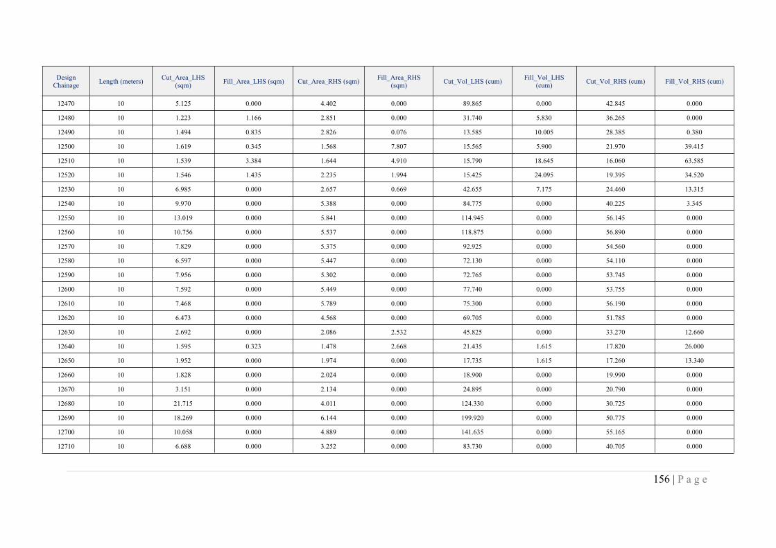
156 | P a g e
DesignChainage Length (meters) Cut_Area_LHS
(sqm) Fill_Area_LHS (sqm) Cut_Area_RHS (sqm) Fill_Area_RHS(sqm) Cut_Vol_LHS (cum) Fill_Vol_LHS
(cum) Cut_Vol_RHS (cum) Fill_Vol_RHS (cum)
12470 10 5.125 0.000 4.402 0.000 89.865 0.000 42.845 0.000
12480 10 1.223 1.166 2.851 0.000 31.740 5.830 36.265 0.000
12490 10 1.494 0.835 2.826 0.076 13.585 10.005 28.385 0.380
12500 10 1.619 0.345 1.568 7.807 15.565 5.900 21.970 39.415
12510 10 1.539 3.384 1.644 4.910 15.790 18.645 16.060 63.585
12520 10 1.546 1.435 2.235 1.994 15.425 24.095 19.395 34.520
12530 10 6.985 0.000 2.657 0.669 42.655 7.175 24.460 13.315
12540 10 9.970 0.000 5.388 0.000 84.775 0.000 40.225 3.345
12550 10 13.019 0.000 5.841 0.000 114.945 0.000 56.145 0.000
12560 10 10.756 0.000 5.537 0.000 118.875 0.000 56.890 0.000
12570 10 7.829 0.000 5.375 0.000 92.925 0.000 54.560 0.000
12580 10 6.597 0.000 5.447 0.000 72.130 0.000 54.110 0.000
12590 10 7.956 0.000 5.302 0.000 72.765 0.000 53.745 0.000
12600 10 7.592 0.000 5.449 0.000 77.740 0.000 53.755 0.000
12610 10 7.468 0.000 5.789 0.000 75.300 0.000 56.190 0.000
12620 10 6.473 0.000 4.568 0.000 69.705 0.000 51.785 0.000
12630 10 2.692 0.000 2.086 2.532 45.825 0.000 33.270 12.660
12640 10 1.595 0.323 1.478 2.668 21.435 1.615 17.820 26.000
12650 10 1.952 0.000 1.974 0.000 17.735 1.615 17.260 13.340
12660 10 1.828 0.000 2.024 0.000 18.900 0.000 19.990 0.000
12670 10 3.151 0.000 2.134 0.000 24.895 0.000 20.790 0.000
12680 10 21.715 0.000 4.011 0.000 124.330 0.000 30.725 0.000
12690 10 18.269 0.000 6.144 0.000 199.920 0.000 50.775 0.000
12700 10 10.058 0.000 4.889 0.000 141.635 0.000 55.165 0.000
12710 10 6.688 0.000 3.252 0.000 83.730 0.000 40.705 0.000
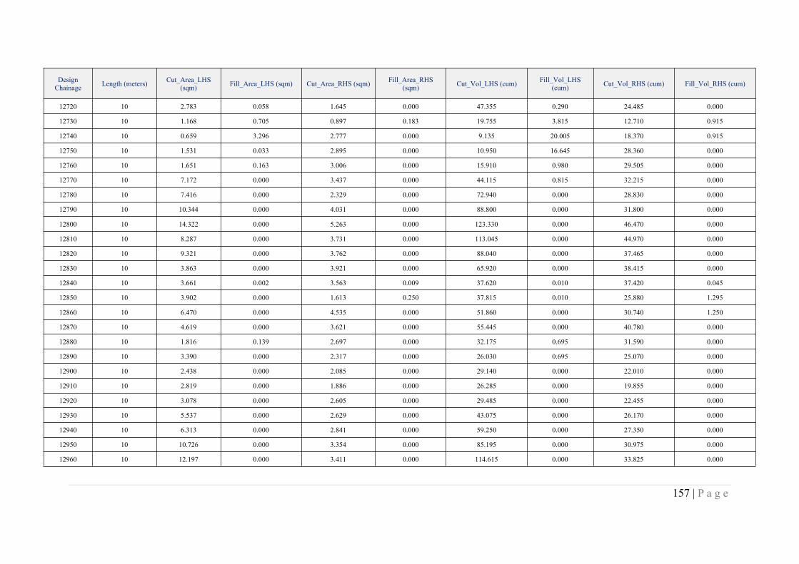
157 | P a g e
DesignChainage Length (meters) Cut_Area_LHS
(sqm) Fill_Area_LHS (sqm) Cut_Area_RHS (sqm) Fill_Area_RHS(sqm) Cut_Vol_LHS (cum) Fill_Vol_LHS
(cum) Cut_Vol_RHS (cum) Fill_Vol_RHS (cum)
12720 10 2.783 0.058 1.645 0.000 47.355 0.290 24.485 0.000
12730 10 1.168 0.705 0.897 0.183 19.755 3.815 12.710 0.915
12740 10 0.659 3.296 2.777 0.000 9.135 20.005 18.370 0.915
12750 10 1.531 0.033 2.895 0.000 10.950 16.645 28.360 0.000
12760 10 1.651 0.163 3.006 0.000 15.910 0.980 29.505 0.000
12770 10 7.172 0.000 3.437 0.000 44.115 0.815 32.215 0.000
12780 10 7.416 0.000 2.329 0.000 72.940 0.000 28.830 0.000
12790 10 10.344 0.000 4.031 0.000 88.800 0.000 31.800 0.000
12800 10 14.322 0.000 5.263 0.000 123.330 0.000 46.470 0.000
12810 10 8.287 0.000 3.731 0.000 113.045 0.000 44.970 0.000
12820 10 9.321 0.000 3.762 0.000 88.040 0.000 37.465 0.000
12830 10 3.863 0.000 3.921 0.000 65.920 0.000 38.415 0.000
12840 10 3.661 0.002 3.563 0.009 37.620 0.010 37.420 0.045
12850 10 3.902 0.000 1.613 0.250 37.815 0.010 25.880 1.295
12860 10 6.470 0.000 4.535 0.000 51.860 0.000 30.740 1.250
12870 10 4.619 0.000 3.621 0.000 55.445 0.000 40.780 0.000
12880 10 1.816 0.139 2.697 0.000 32.175 0.695 31.590 0.000
12890 10 3.390 0.000 2.317 0.000 26.030 0.695 25.070 0.000
12900 10 2.438 0.000 2.085 0.000 29.140 0.000 22.010 0.000
12910 10 2.819 0.000 1.886 0.000 26.285 0.000 19.855 0.000
12920 10 3.078 0.000 2.605 0.000 29.485 0.000 22.455 0.000
12930 10 5.537 0.000 2.629 0.000 43.075 0.000 26.170 0.000
12940 10 6.313 0.000 2.841 0.000 59.250 0.000 27.350 0.000
12950 10 10.726 0.000 3.354 0.000 85.195 0.000 30.975 0.000
12960 10 12.197 0.000 3.411 0.000 114.615 0.000 33.825 0.000

158 | P a g e
DesignChainage Length (meters) Cut_Area_LHS
(sqm) Fill_Area_LHS (sqm) Cut_Area_RHS (sqm) Fill_Area_RHS(sqm) Cut_Vol_LHS (cum) Fill_Vol_LHS
(cum) Cut_Vol_RHS (cum) Fill_Vol_RHS (cum)
12970 10 9.695 0.000 3.094 0.000 109.460 0.000 32.525 0.000
12980 10 5.664 0.000 3.360 0.000 76.795 0.000 32.270 0.000
12990 10 3.447 0.000 2.579 0.000 45.555 0.000 29.695 0.000
13000 10 2.414 0.000 2.094 0.000 29.305 0.000 23.365 0.000
13010 10 2.854 0.000 0.988 0.000 26.340 0.000 15.410 0.000
13020 10 2.964 0.000 0.135 1.962 29.090 0.000 5.615 9.810
13030 10 3.050 0.000 0.146 0.742 30.070 0.000 1.405 13.520
13040 10 3.807 0.000 2.112 0.000 34.285 0.000 11.290 3.710
13050 10 5.160 0.000 2.276 0.000 44.835 0.000 21.940 0.000
13060 10 5.387 0.000 2.633 0.000 52.735 0.000 24.545 0.000
13070 10 5.075 0.000 2.944 0.000 52.310 0.000 27.885 0.000
13080 10 5.154 0.000 3.474 0.000 51.145 0.000 32.090 0.000
13090 10 5.295 0.000 2.819 0.000 52.245 0.000 31.465 0.000
13100 10 6.444 0.000 3.255 0.000 58.695 0.000 30.370 0.000
13110 10 5.468 0.000 3.759 0.000 59.560 0.000 35.070 0.000
13120 10 4.410 0.000 4.376 0.000 49.390 0.000 40.675 0.000
13130 10 4.007 0.000 4.747 0.000 42.085 0.000 45.615 0.000
13140 10 4.590 0.000 4.892 0.000 42.985 0.000 48.195 0.000
13150 10 5.075 0.000 6.765 0.000 48.325 0.000 58.285 0.000
13160 10 4.674 0.000 6.122 0.000 48.745 0.000 64.435 0.000
13170 10 2.770 0.027 4.796 0.000 37.220 0.135 54.590 0.000
13180 10 1.098 0.270 3.596 0.000 19.340 1.485 41.960 0.000
13190 10 3.160 0.000 4.443 0.000 21.290 1.350 40.195 0.000
13200 10 4.944 0.000 6.365 0.000 40.520 0.000 54.040 0.000
13210 10 5.543 0.000 2.818 0.000 52.435 0.000 45.915 0.000
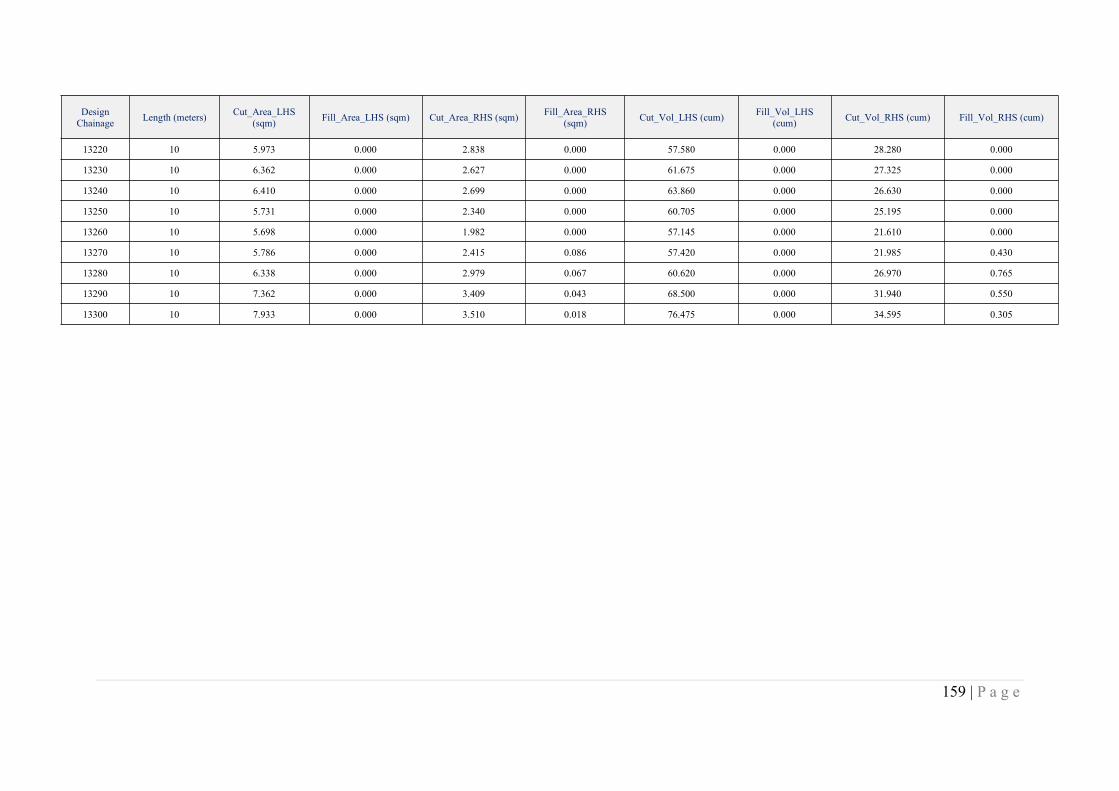
159 | P a g e
DesignChainage Length (meters) Cut_Area_LHS
(sqm) Fill_Area_LHS (sqm) Cut_Area_RHS (sqm) Fill_Area_RHS(sqm) Cut_Vol_LHS (cum) Fill_Vol_LHS
(cum) Cut_Vol_RHS (cum) Fill_Vol_RHS (cum)
13220 10 5.973 0.000 2.838 0.000 57.580 0.000 28.280 0.000
13230 10 6.362 0.000 2.627 0.000 61.675 0.000 27.325 0.000
13240 10 6.410 0.000 2.699 0.000 63.860 0.000 26.630 0.000
13250 10 5.731 0.000 2.340 0.000 60.705 0.000 25.195 0.000
13260 10 5.698 0.000 1.982 0.000 57.145 0.000 21.610 0.000
13270 10 5.786 0.000 2.415 0.086 57.420 0.000 21.985 0.430
13280 10 6.338 0.000 2.979 0.067 60.620 0.000 26.970 0.765
13290 10 7.362 0.000 3.409 0.043 68.500 0.000 31.940 0.550
13300 10 7.933 0.000 3.510 0.018 76.475 0.000 34.595 0.305