Embed Size (px)
Citation preview
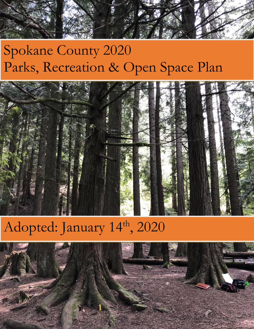
Spokane County 2020 Parks, Recreation & Open Space Plan
Adopted: January 14th, 2020
2020 Spokane County Parks, Recreation and Open Space Plan 1
Acknowledgements A special thanks to the following Spokane County personnel, volunteers, and community members whose involvement is and will continue to be critical to the ongoing success of Spokane County Parks, Recreation, & Golf.
County Commissioners Mary L. Kuney
Al French Josh Kerns
Parks Advisory Committee Eric Johnson Eric Sawyer
Tom MacKenzie Doug Kelley
Dave Schaub Mel Fowler
Parks Department
Doug Chase, Director
Planning Department John Pederson, Director
2020 Spokane County Parks, Recreation Open Space Plan 2
TABLE OF CONTENTS
Contents
TABLE OF CONTENTS ................................................................................................... 2
EXECUTIVE SUMMARY ................................................................................................ 5
CHAPTER 1 - Introduction .............................................................................................. 7 MISSION STATEMENT .......................................................................................................................................7 HISTORY ...............................................................................................................................................................7 OBJECTIVES ........................................................................................................................................................8
CHAPTER 2 – Planning Context ..................................................................................... 9 SPOKANE COUNTY PROFILE ...........................................................................................................................9
Geography .....................................................................................................................................................9 Demography ..................................................................................................................................................9 Population Growth Trends ..........................................................................................................................10 GMA Allocations .........................................................................................................................................11 Economy ......................................................................................................................................................11 Government .................................................................................................................................................13
RECREATIONAL TRENDS ...............................................................................................................................14 GROWTH MANAGEMENT ...............................................................................................................................15
CHAPTER 3 – Current Inventory & Resources .......................................................... 16 INTRODUCTION ................................................................................................................................................16 ORGANIZATION ................................................................................................................................................16
Spokane County Parks Department Organization ......................................................................................16 Parks Advisory Committee ..........................................................................................................................16 Golf Course Operations ..............................................................................................................................17 Adult Softball ...............................................................................................................................................17 Adult Volleyball ...........................................................................................................................................18 Adult Basketball ..........................................................................................................................................18 Aquatics Program ........................................................................................................................................18
FACILITY INVENTORY ....................................................................................................................................18 Community Parks Inventory ........................................................................................................................19 Regional Parks Inventory ............................................................................................................................19 Open Space ..................................................................................................................................................20 Special Use Facilities Inventory ..................................................................................................................20 Campground Facilities Inventory ................................................................................................................21 Aquatic Facilities Inventory ........................................................................................................................21 Softball Field Inventory ...............................................................................................................................22
CHAPTER 4 - Goals and Policies ................................................................................... 27 INTRODUCTION ................................................................................................................................................27 VISION AND OVERALL GOAL .......................................................................................................................27
2020 Spokane County Parks, Recreation Open Space Plan 3
GOALS & POLICIES ..........................................................................................................................................27
CHAPTER 5 – Demand and Need Analysis .................................................................. 34 INTRODUCTION ................................................................................................................................................34 COMMUNITY PARKS .......................................................................................................................................36
Individual UGA Need ..................................................................................................................................36 REGIONAL PARKS ............................................................................................................................................39 OPEN SPACE ......................................................................................................................................................39 TRAILS ................................................................................................................................................................40 SOFTBALL FIELDS ...........................................................................................................................................40 CAMPGROUNDS ...............................................................................................................................................40 AQUATIC FACILITIES ......................................................................................................................................41
CHAPTER 6- Capital Facilities Plan & Future Funding ............................................ 42 INTRODUCTION ................................................................................................................................................42 CAPITAL PROJECTS & FINANCING PLAN ...................................................................................................50 FUNDING SOURCES .........................................................................................................................................50
The General Fund .......................................................................................................................................50 Real Estate Excise Tax (REET) ...................................................................................................................50 Enterprise Funds .........................................................................................................................................50 Special Revenue Funds ................................................................................................................................50 Recreation Fund (122) ................................................................................................................................50 Car Rental Tax ............................................................................................................................................51 Conservation Futures Tax ...........................................................................................................................51 Borrowing: Types of Bonds .........................................................................................................................51 Recreation and Conservation Office ...........................................................................................................52 Other Sources ..............................................................................................................................................52
CHAPTER 7 – Public Participation ............................................................................... 53 INTRODUCTION ................................................................................................................................................53
Summary of Public Input .............................................................................................................................53 PUBLIC INPUT SOURCES ................................................................................................................................54
Online Survey ..............................................................................................................................................54 Open Houses ................................................................................................................................................54 Stakeholder Interviews ................................................................................................................................54
CONCLUSION ....................................................................................................................................................54 Maps M1 – Spokane County Parks and Open Space System M2 – Spokane County Population Density Map M3 – Spokane County Softball Field Inventory M4 – Spokane County Campground Inventory M5 – Spokane County Aquatic Facility Inventory M6 – Community Parks Level of Service (Proximity and Acreage) Analysis
2020 Spokane County Parks, Recreation Open Space Plan 4
Appendices A – Spokane County Parks Property Inventory B – Select Facility Inventory C – Other Agency Parks Inventory D – Public Participation Record Please Note: All photographs used in the Parks, Recreation & Open Space Plan were taken by Spokane County Parks staff unless otherwise noted.
2020 Spokane County Parks, Recreation Open Space Plan 5
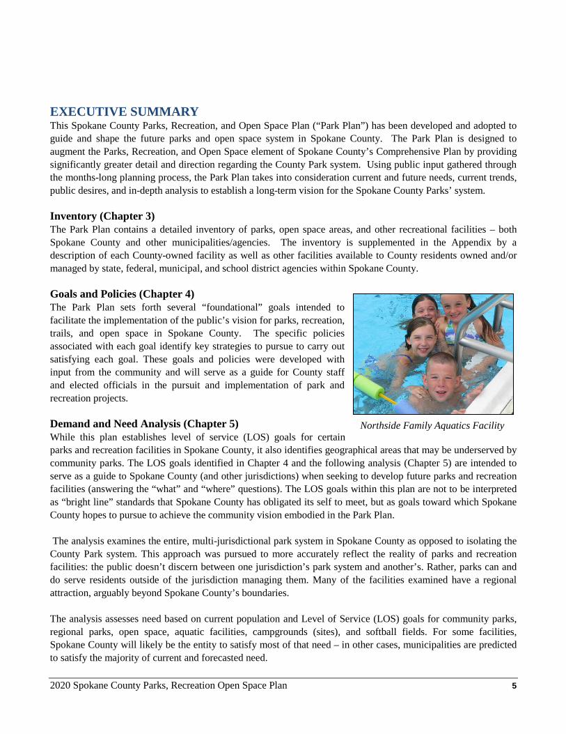
EXECUTIVE SUMMARY This Spokane County Parks, Recreation, and Open Space Plan (“Park Plan”) has been developed and adopted to guide and shape the future parks and open space system in Spokane County. The Park Plan is designed to augment the Parks, Recreation, and Open Space element of Spokane County’s Comprehensive Plan by providing significantly greater detail and direction regarding the County Park system. Using public input gathered through the months-long planning process, the Park Plan takes into consideration current and future needs, current trends, public desires, and in-depth analysis to establish a long-term vision for the Spokane County Parks’ system. Inventory (Chapter 3) The Park Plan contains a detailed inventory of parks, open space areas, and other recreational facilities – both Spokane County and other municipalities/agencies. The inventory is supplemented in the Appendix by a description of each County-owned facility as well as other facilities available to County residents owned and/or managed by state, federal, municipal, and school district agencies within Spokane County. Goals and Policies (Chapter 4) The Park Plan sets forth several “foundational” goals intended to facilitate the implementation of the public’s vision for parks, recreation, trails, and open space in Spokane County. The specific policies associated with each goal identify key strategies to pursue to carry out satisfying each goal. These goals and policies were developed with input from the community and will serve as a guide for County staff and elected officials in the pursuit and implementation of park and recreation projects. Demand and Need Analysis (Chapter 5) While this plan establishes level of service (LOS) goals for certain parks and recreation facilities in Spokane County, it also identifies geographical areas that may be underserved by community parks. The LOS goals identified in Chapter 4 and the following analysis (Chapter 5) are intended to serve as a guide to Spokane County (and other jurisdictions) when seeking to develop future parks and recreation facilities (answering the “what” and “where” questions). The LOS goals within this plan are not to be interpreted as “bright line” standards that Spokane County has obligated its self to meet, but as goals toward which Spokane County hopes to pursue to achieve the community vision embodied in the Park Plan. The analysis examines the entire, multi-jurisdictional park system in Spokane County as opposed to isolating the County Park system. This approach was pursued to more accurately reflect the reality of parks and recreation facilities: the public doesn’t discern between one jurisdiction’s park system and another’s. Rather, parks can and do serve residents outside of the jurisdiction managing them. Many of the facilities examined have a regional attraction, arguably beyond Spokane County’s boundaries. The analysis assesses need based on current population and Level of Service (LOS) goals for community parks, regional parks, open space, aquatic facilities, campgrounds (sites), and softball fields. For some facilities, Spokane County will likely be the entity to satisfy most of that need – in other cases, municipalities are predicted to satisfy the majority of current and forecasted need.
Northside Family Aquatics Facility
2020 Spokane County Parks, Recreation Open Space Plan 6
Lastly, while this is the “2020 Park Plan,” the 2020 Census results were not available for analysis during this update. Therefore, while the LOS analysis can rely on Washington State Office of Financial Management’s (OFM) annual population estimates to update the County-wide LOS analysis, the in-depth Community Parks Level of Service Spatial Analysis performed in the 2014 Park Plan update cannot be updated until the 2020 Census data becomes available because it relies on census tract data. With that said, staff has reviewed the previous analysis and concurs that the results of it are still valid as of this update. Capital Facilities Plan (Chapter 6) The Park Plan contains a Capital Facilities Plan (CFP) that identifies future projects supported by the Goals and Policies (Chapter 4), Demand and Need Analysis (Chapter 5) as well as the Community Priorities Survey (see Appendix) completed in 2015 while identifying potential funding sources. CFP relies heavily on Real Estate Excise Tax (REET) as well outside grant funding administered by Washington State Recreation and Conservation Office (RCO).The CFP will be utilized in future updates of Spokane County’s overall Capital Facilities Plan to continue a program of meeting the needs identified in this plan. At the time of this update (2019), the economic outlook for Spokane County is favorable with a steady increase in the median sales price for a single-family home, larger employers locating to this area, including Amazon and Katerra, and the expansion of Fairchild Airforce Base. Public Participation (Chapter 7) The Park Plan was developed pursuant to a public involvement process that sought to actively engage citizens from all geographical areas of Spokane County. In order to maximize the collection of public input, County Parks:
• Conducted stakeholder interviews with park agencies and park user groups; • Held six public open houses – two in each Commissioner’s District; • Provided an online survey that generated 549 responses to 16 questions.
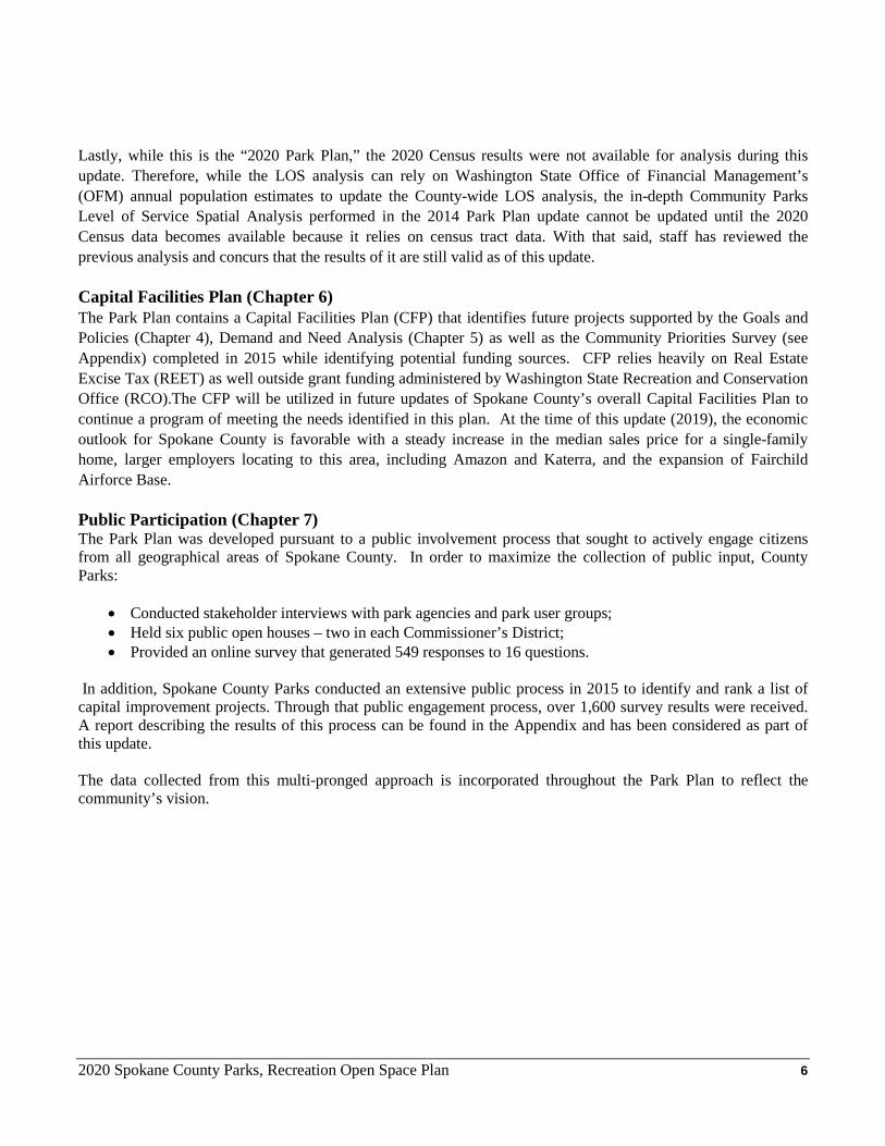
In addition, Spokane County Parks conducted an extensive public process in 2015 to identify and rank a list of capital improvement projects. Through that public engagement process, over 1,600 survey results were received. A report describing the results of this process can be found in the Appendix and has been considered as part of this update. The data collected from this multi-pronged approach is incorporated throughout the Park Plan to reflect the community’s vision.
Spokane County Parks, Recreation and Open Space Plan 7
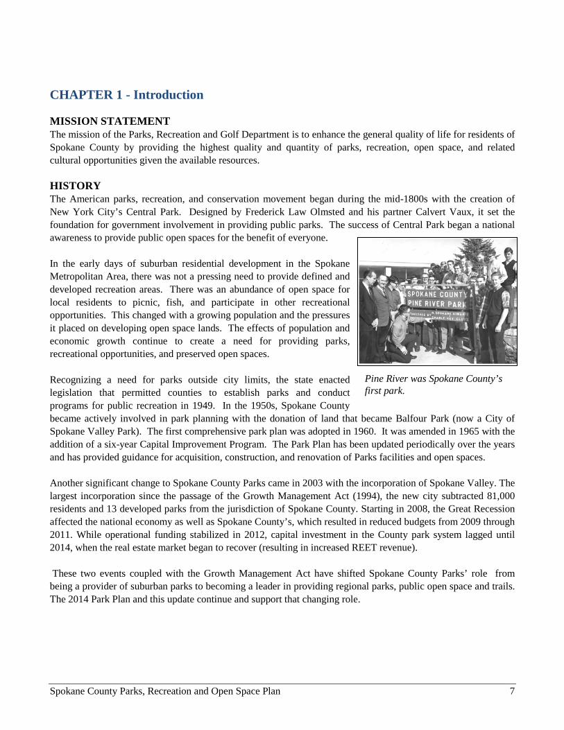
CHAPTER 1 - Introduction MISSION STATEMENT The mission of the Parks, Recreation and Golf Department is to enhance the general quality of life for residents of Spokane County by providing the highest quality and quantity of parks, recreation, open space, and related cultural opportunities given the available resources. HISTORY The American parks, recreation, and conservation movement began during the mid-1800s with the creation of New York City’s Central Park. Designed by Frederick Law Olmsted and his partner Calvert Vaux, it set the foundation for government involvement in providing public parks. The success of Central Park began a national awareness to provide public open spaces for the benefit of everyone. In the early days of suburban residential development in the Spokane Metropolitan Area, there was not a pressing need to provide defined and developed recreation areas. There was an abundance of open space for local residents to picnic, fish, and participate in other recreational opportunities. This changed with a growing population and the pressures it placed on developing open space lands. The effects of population and economic growth continue to create a need for providing parks, recreational opportunities, and preserved open spaces. Recognizing a need for parks outside city limits, the state enacted legislation that permitted counties to establish parks and conduct programs for public recreation in 1949. In the 1950s, Spokane County became actively involved in park planning with the donation of land that became Balfour Park (now a City of Spokane Valley Park). The first comprehensive park plan was adopted in 1960. It was amended in 1965 with the addition of a six-year Capital Improvement Program. The Park Plan has been updated periodically over the years and has provided guidance for acquisition, construction, and renovation of Parks facilities and open spaces. Another significant change to Spokane County Parks came in 2003 with the incorporation of Spokane Valley. The largest incorporation since the passage of the Growth Management Act (1994), the new city subtracted 81,000 residents and 13 developed parks from the jurisdiction of Spokane County. Starting in 2008, the Great Recession affected the national economy as well as Spokane County’s, which resulted in reduced budgets from 2009 through 2011. While operational funding stabilized in 2012, capital investment in the County park system lagged until 2014, when the real estate market began to recover (resulting in increased REET revenue). These two events coupled with the Growth Management Act have shifted Spokane County Parks’ role from being a provider of suburban parks to becoming a leader in providing regional parks, public open space and trails. The 2014 Park Plan and this update continue and support that changing role.
Pine River was Spokane County’s first park.
2020 Spokane County Parks, Recreation Open Space Plan 8
OBJECTIVES The purpose of the Park Plan is to ensure that Spokane County takes the necessary steps to plan for the park, recreational and open space needs of its citizens. It provides information and direction for decision makers on impending park issues and it suggests strategies for the protection and acquisition of future parklands. The Park Plan crafts public input into a future vision for parks and identifies areas of need (current and future). Finally, it serves as a source of information for users of the County’s park system. The Park Plan lays the groundwork for the future of the County’s park system by: • Planning for and developing a park, recreation, and open space system that serves the diverse interests of
Spokane County’s citizens; • Ascertaining local public sentiment on parks, recreation, and open space on current and future needs; • Establishing goals and policies that will guide the acquisition, development, and provision of outdoor
recreational facilities; • Establishing renovation, acquisition and development priorities that will
influence the County’s Capital Facilities Plan; and • Determining where the current park system adequately serves residents
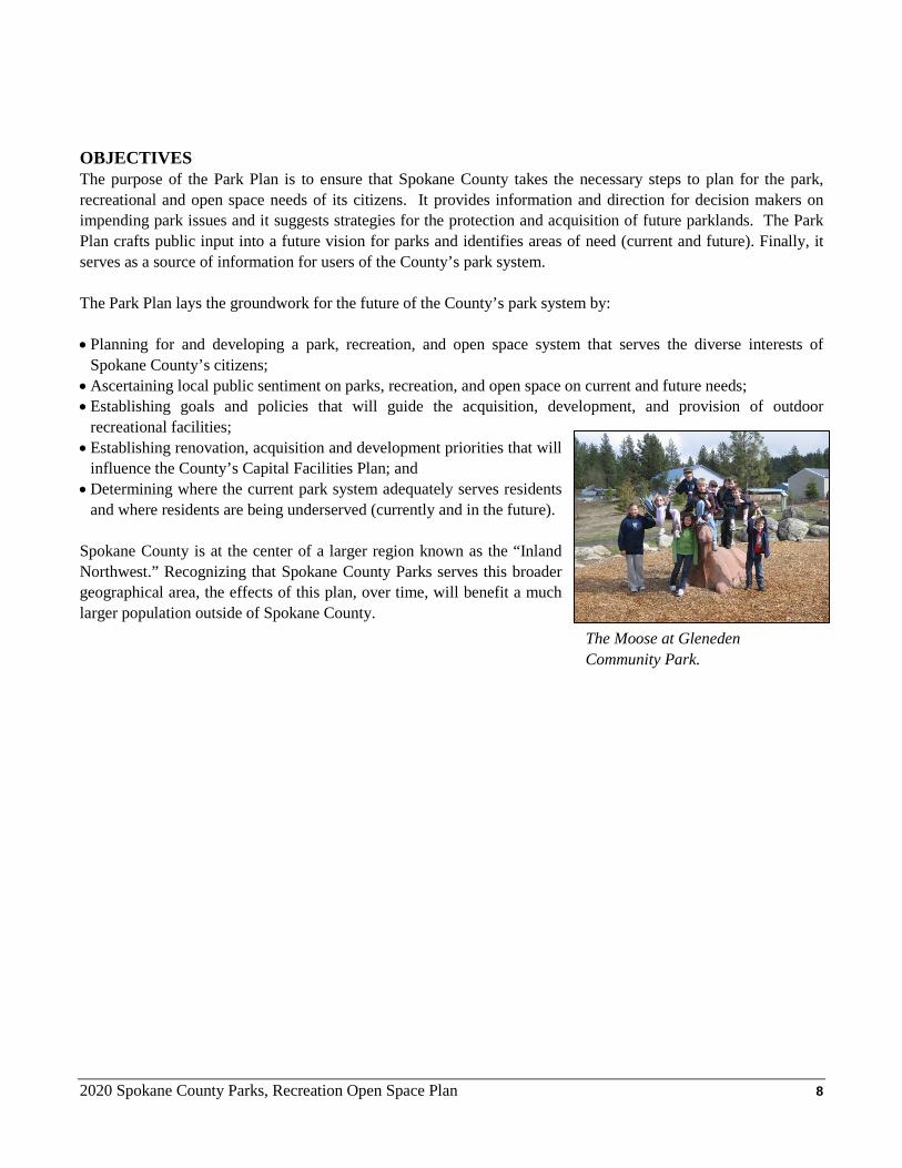
and where residents are being underserved (currently and in the future). Spokane County is at the center of a larger region known as the “Inland Northwest.” Recognizing that Spokane County Parks serves this broader geographical area, the effects of this plan, over time, will benefit a much larger population outside of Spokane County. The Moose at Gleneden
Community Park.
2020 Spokane County Parks, Recreation Open Space Plan 9
CHAPTER 2 – Planning Context SPOKANE COUNTY PROFILE Geography Spokane County is one of four eastern Washington counties set along the Washington-Idaho border. It serves as the economic and social center for the Inland Northwest – a region that encompasses parts of four states and Canada. The County is 54 miles long from north to south, and 36 miles wide from east to west. It comprises an area of 1,764 square miles (or 2.7 percent of the state’s total landmass). This ranks it 19th in area size among Washington State counties, but is over 500 square miles larger than the State of Rhode Island (1,214 square miles). The County is rectangular in shape except for a jagged northwest corner. It is bounded to the north and west by Pend Oreille and Lincoln counties, respectively. Its northwest corner is shared with Stevens County. To the south is Whitman County and to the east is Kootenai County, Idaho. The topography of Spokane County is extremely varied. The terrain in the north is increasingly forested, with mountains (an extension of the Selkirk Mountains) in the northeast. The central region is defined by the Spokane River Valley. The southwest areas are defined by the channeled scablands, noted for their rock outcroppings, basalt cliffs and hundreds of ponds and lakes - evidence of a series of Ice Age floods known collectively as the Missoula Floods. The southeast region includes the Palouse, hills of windblown loess that supports productive dryland agriculture.
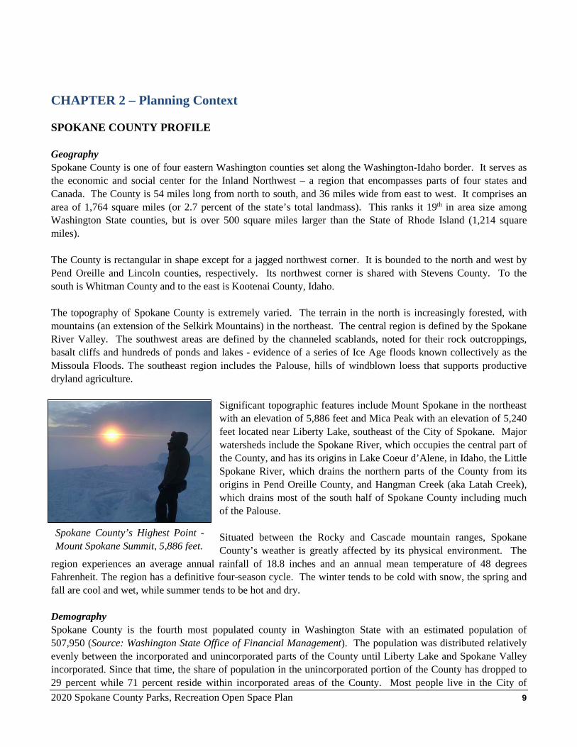
Significant topographic features include Mount Spokane in the northeast with an elevation of 5,886 feet and Mica Peak with an elevation of 5,240 feet located near Liberty Lake, southeast of the City of Spokane. Major watersheds include the Spokane River, which occupies the central part of the County, and has its origins in Lake Coeur d’Alene, in Idaho, the Little Spokane River, which drains the northern parts of the County from its origins in Pend Oreille County, and Hangman Creek (aka Latah Creek), which drains most of the south half of Spokane County including much of the Palouse. Situated between the Rocky and Cascade mountain ranges, Spokane County’s weather is greatly affected by its physical environment. The
region experiences an average annual rainfall of 18.8 inches and an annual mean temperature of 48 degrees Fahrenheit. The region has a definitive four-season cycle. The winter tends to be cold with snow, the spring and fall are cool and wet, while summer tends to be hot and dry. Demography Spokane County is the fourth most populated county in Washington State with an estimated population of 507,950 (Source: Washington State Office of Financial Management). The population was distributed relatively evenly between the incorporated and unincorporated parts of the County until Liberty Lake and Spokane Valley incorporated. Since that time, the share of population in the unincorporated portion of the County has dropped to 29 percent while 71 percent reside within incorporated areas of the County. Most people live in the City of
Spokane County’s Highest Point - Mount Spokane Summit, 5,886 feet.
2020 Spokane County Parks, Recreation Open Space Plan 10
Spokane, the second largest city in Washington State with a population of 220,100. (Source: Washington State Office of Financial Management). The population density for the County is estimated at 267.2 persons per square mile, ranking it the eighth most densely populated county in the state. According to the 2010 US Census, the cultural make-up of Spokane County’s population is relatively homogenous, with people of “White Caucasian” background making up 89% of the population. Significant immigrant communities include Ukrainian, Russian, Marshallese, and Vietnamese. The gender makeup of Spokane County remained virtually unchanged from 1990 to 2010. Females hold a modest proportional advantage over males. In 2010 the ratio was 50.6% female to 49.4% male. Like most areas in the United States, Spokane County’s demographics show a “baby boom bulge” that has aged, increasing the proportion of the population over the age of 50. Population Growth Trends Between 2000 and 2010, Spokane County’s entire population grew by approximately 53,000, or by 12.7%. This compares to the faster growth in the 1990’s of 56,606, 15.7% over the decade. The majority of the population increase (62%) came from new people (net migration) moving into the area. Between 2010 and 2018, the population grew by an estimated 7.8%. During the 1990’s, new population growth occurred primarily in the unincorporated areas of the County, which was the trend throughout the state. However, with the adoption of the Growth Management Act (GMA), that trend has shifted in favor of the incorporated and urban growth areas within Spokane County. Current building permits trends suggest that this is likely to continue.
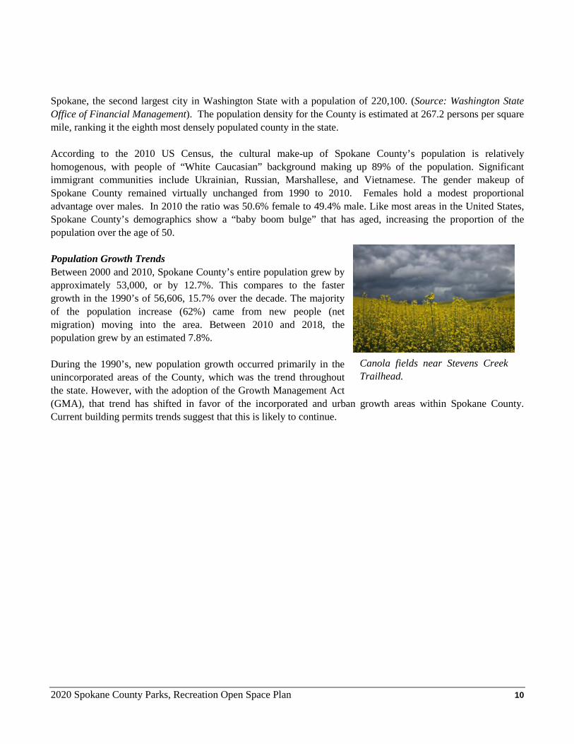
Canola fields near Stevens Creek Trailhead.

2020 Spokane County Parks, Recreation Open Space Plan 11
GMA Allocations Spokane County through its Comprehensive Plan has targeted future population growth to be allocated into both incorporated and unincorporated areas. The Spokane County Board of County Commissioners in Resolution 16-0553 adopted a population projection of 583,409 by the year 2037. A year 2037 breakdown shows the unincorporated areas having 176,780 and the incorporated areas having 406,629 people. This represents an increase of 31,877 people in the unincorporated County from the 2017 estimated or a 22 percent increase and 52,184 people (14.7 percent increase) in the incorporated areas. The Spokane County Comprehensive Plan further divides these population increases into more manageable sub-areas. Included in the sub-areas are Joint
Planning Areas (JPA), which are areas adjacent to cities and included in those cities’ Urban Growth Area (UGA). The County and the respective cities agreed to the size and location of these JPAs during the development of local comprehensive plans. These are prime areas for annexation by cities, but will continue to fall under County jurisdiction until such annexation takes place. These areas are subject to coordinated city-county planning efforts, including planning for parks, recreation facilities, and open space areas. These population projections and allocations are important if Spokane County Parks is going to be able to plan effectively to meet future Level of Service (LOS) goals for parks and open space. Populations with special needs must be considered when planning for public open spaces. The aging of the population will require efforts to accommodate their special needs. Perhaps the largest group that warrants consideration is that of low-income individuals and families. These groups have the greatest need for using parks, but they have some of the greatest challenges to accessing the parks. Economy The Spokane Metropolitan Service Area (MSA) is the largest urban center between Seattle, Washington, and the twin cities of Minneapolis/St. Paul, Minnesota. Spokane is the economic and cultural center of the region known
Jurisdiction 2017 Population Estimate
2037 Population Estimate
2017-2037 Population Allocation
Spokane County (Total) 499,348 583,409 84,061
Unincorporated Spokane County 144,903 176,780 31,877 Unincorporated UGA 53,893 68,117 14,224 Unincorporated Rural 91,010 108,663 17,653
Incorporated Spokane County 354,445 406,629 52,184 Airway Heights 9,071 14,298 5,226 Cheney 11,827 14,776 2,949 Deer Park 4,110 5,325 1,215 Fairfield 620 660 40 Latah 195 195 - Liberty Lake 9,780 15,909 6,129 Medical Lake 5,072 6,042 970 Millwood 1,808 1,947 139 Rockford 470 470 - Spangle 281 288 7 Spokane 215,839 236,698 20,859 Spokane Valley 95,264 109,913 14,650 Waverly 108 108 -
Table 1 – Population Projections & Allocations Through 2037
2020 Spokane County Parks, Recreation Open Space Plan 12
as the “Inland Northwest.” This is a vast area that covers most of eastern Washington, northern Idaho, western Montana, portions of northeastern Oregon and parts of two southern Canadian providences. Historically, the local economy has been a business service center to natural resource industries of agriculture, timber, and mining. Lumber and food processing activities continue to be important to the economy, but are
becoming less significant with the increasing diversification of the economy. High technology and service industry growth from companies such as Itron and Providence Health Care have led to a declining dependency on natural resources for jobs. In 2018, Amazon announced that it will open a new fulfillment center, bringing an estimated 1,500 new jobs to the area and becoming the ninth largest employer in Spokane County. Amazon and other companies moving to the area will continue to push the regional economy towards the service sector. Table 2 shows the current top 10 employers in Spokane County. The table indicates that seven of the top ten employers are government
agencies or schools. There are two health care providers within the top ten. Transportation, communications, and utilities make up less than 5 percent of the area’s non-agricultural employment. One of the important employment trends in Spokane is its role as the regional medical center of the Inland Northwest. Spokane has five major hospitals, including Sacred Heart and Veteran Affairs (“VA”) hospitals. There are also numerous smaller hospitals and medical clinics that serve the needs of the region. Recently, Washington State University has expanded their Riverpoint Campus to include their pharmacy school and the new medical school to continue supporting health care in this region.
Table 2 - Top Ten Employers in Spokane County
Company Name Full Time Employees Business Activity
Fairchild Air Force Base 5,935 Military Providence Health Care 5,425 Health Care
State of Washington 5,100 Government Spokane Public Schools 3,568 Education
Multicare 3,110 Health Care City of Spokane 2,174 Government Spokane County 2,124 Government
Kalispel Tribal Economic Authority 1,882 Entertainment
Central Valley School District 1,614 Education
Wal-Mart Stores, Inc. 1,431 Retail Source: Spokane Journal of Business Book of Lists - 2019
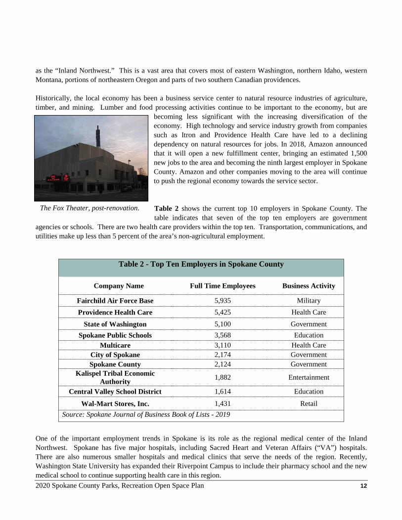
The Fox Theater, post-renovation.
2020 Spokane County Parks, Recreation Open Space Plan 13
Spokane County’s economy has experienced much economic growth throughout the 2000s. While the recent economic recession severely impacted many counties’ economic health, Spokane County has seen only moderate to slight declines in most economic indicators. A more long-term outlook based on past trends suggests that the region will continue to experience growth while diversifying its economy. More and more, businesses are basing their decisions to locate future facilities by the quality of life an area has to offer for its employees. Parks, trails and public open space play a key role in maintaining the area’s quality of life. Therefore, Spokane County Parks, Recreation & Golf will continue to play an important role in Spokane County’s economic future. Government Policy-making for local government rests with the three-member Board of County Commissioners and the members of various boards of special purpose districts and other single-purpose agencies. The Commissioners are responsible for each County resolution which is, in effect, the County’s equivalent of state legislation. In addition to their legislative responsibilities, the Commissioners also administer various departments, including several that provide municipal services. Another important local policy making entity is the City of Spokane, which has a strong Mayor/City Council form of government. Other incorporated cities include Airway Heights, Cheney, Deer Park, Fairfield, Latah, Medical Lake, Millwood, Rockford, Spangle, Waverly and newly incorporated cities of Liberty Lake (2001) and Spokane Valley (2003). Each has a Mayor and a Council that make policy for their local jurisdictions. It should be noted that all residents of incorporated cities and towns are also residents of Spokane County, and thus vote on county-wide ballot proposals, including County park issues. Formal coordination between the County, the City of Spokane, the City of Spokane Valley, and the small towns is accomplished through various inter-local agreements and the Spokane Regional Transportation Council (SRTC). SRTC assists with those planning needs that transcend political boundaries and are of a regional nature; as the name implies, particularly transportation issues.
2020 Spokane County Parks, Recreation Open Space Plan 14
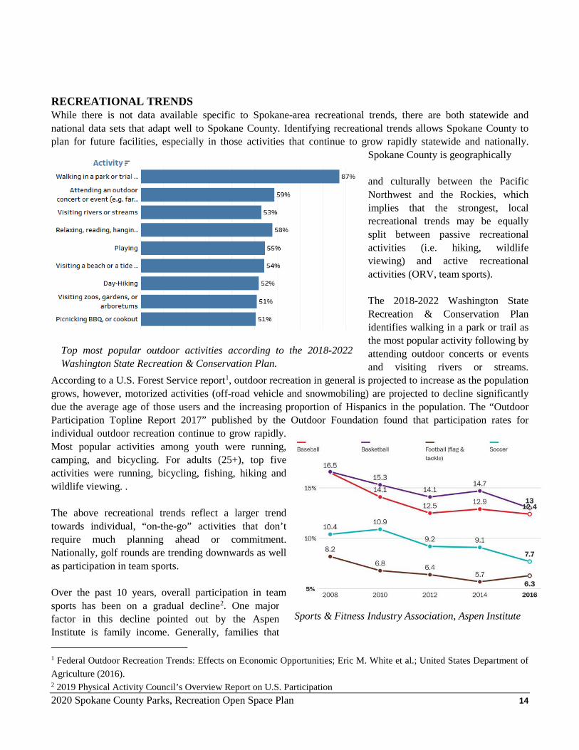
RECREATIONAL TRENDS While there is not data available specific to Spokane-area recreational trends, there are both statewide and national data sets that adapt well to Spokane County. Identifying recreational trends allows Spokane County to plan for future facilities, especially in those activities that continue to grow rapidly statewide and nationally.
Spokane County is geographically and culturally between the Pacific Northwest and the Rockies, which implies that the strongest, local recreational trends may be equally split between passive recreational activities (i.e. hiking, wildlife viewing) and active recreational activities (ORV, team sports). The 2018-2022 Washington State Recreation & Conservation Plan identifies walking in a park or trail as the most popular activity following by attending outdoor concerts or events and visiting rivers or streams.
According to a U.S. Forest Service report1, outdoor recreation in general is projected to increase as the population grows, however, motorized activities (off-road vehicle and snowmobiling) are projected to decline significantly due the average age of those users and the increasing proportion of Hispanics in the population. The “Outdoor Participation Topline Report 2017” published by the Outdoor Foundation found that participation rates for individual outdoor recreation continue to grow rapidly. Most popular activities among youth were running, camping, and bicycling. For adults (25+), top five activities were running, bicycling, fishing, hiking and wildlife viewing. . The above recreational trends reflect a larger trend towards individual, “on-the-go” activities that don’t require much planning ahead or commitment. Nationally, golf rounds are trending downwards as well as participation in team sports. Over the past 10 years, overall participation in team sports has been on a gradual decline2. One major factor in this decline pointed out by the Aspen Institute is family income. Generally, families that 1 Federal Outdoor Recreation Trends: Effects on Economic Opportunities; Eric M. White et al.; United States Department of Agriculture (2016). 2 2019 Physical Activity Council’s Overview Report on U.S. Participation
Top most popular outdoor activities according to the 2018-2022 Washington State Recreation & Conservation Plan.
Sports & Fitness Industry Association, Aspen Institute
2020 Spokane County Parks, Recreation Open Space Plan 15
have greater financial means are more likely to have kids participating in sports. The goals and policies of the Park Plan acknowledge and incorporate these trends. GROWTH MANAGEMENT The State of Washington Growth Management Act (GMA), RCW 36.70A, requires that cities and counties plan for their future growth. It requires that appropriate provisions be made for a range of public facility needs including parks and open spaces. Planning for parks and preserving open space are part of those efforts in preparing for the future. GMA requires that communities shall: Identify open space corridors within and between urban growth areas including lands useful for recreation, wildlife habitat, trails, and connection of critical areas (RCW 36.70A.110(2) and (RCW 36.70A. 160). In addition, GMA provides as a guideline as one of its fourteen goals: Open space and recreation. Retain open space, enhance recreational opportunities, conserve fish and wildlife habitat, increase access to natural resource lands and water, and develop parks and recreation facilities. Counties planning under GMA must adopt an Urban Growth Area (UGA), which establishes boundaries that regulate where the majority of population growth can occur in the future. These boundaries are required to
include sufficient lands and potential development densities to absorb projected population growth in the County for the next 20 years. UGAs are intended to reduce urban sprawl, which is characterized by low-density developments along the edges of a community, and preserve rural agricultural and natural resource lands. The UGA has important implications for park planning. It provides a predictable area where growth will occur and future community parks, athletic fields, pools, and other facilities will be needed. Adopted County-wide planning policies require that growth be located first in those UGA areas where existing public facilities and service capacities exist, and second, in areas that can be connected to existing facilities and
services with additional help from public and private sources.
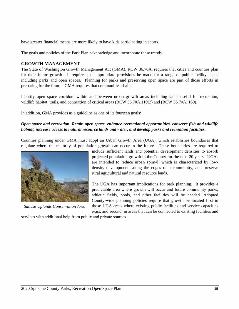
Saltese Uplands Conservation Area
2020 Spokane County Parks, Recreation Open Space Plan 16
CHAPTER 3 – Current Inventory & Resources INTRODUCTION The Spokane County Park system’s inception came in 1951 – late in the history of parks, but early in Washington State history (Washington State counties were allowed to buy, develop, and maintain parks after 1949). Since then, the park system has grown from its initial park, Pine River County Park; to a system comprised of dozens of facilities spread over 14,787 acres. This system continues to expand to keep up with population growth and subsequent demand. ORGANIZATION Spokane County Parks Department Organization The Department of Parks and Recreation was officially established as a County Department with a salaried director in the spring of 1951. The Department took its current name in early 2001 when the County golf course operations were organizationally merged to create the Spokane County Parks, Recreation and Golf Department. The Parks, Recreation and Golf Department is staffed by 34 full-time employees. This includes 11 golf employees, 13 park maintenance employees and 10 administrative employees. The Parks, Recreation and Golf Director is responsible for management of the system and reports to the Board of County Commissioners. The golf course operations are maintained as an enterprise fund and have three Superintendents maintaining the three County golf courses as well as three golf course professionals who operate the courses. Parks Advisory Committee The Parks Advisory Committee (PAC) serves as a citizen’s advisory board to the Parks and Recreation Department. Following passage of the $2.2 million bond issue to improve County Parks in 1987, the Spokane Board of County Commissioners passed a resolution creating the nine-member PAC. The resolution (87-1229) recognizes the positive role that citizens play in support of County Parks and Park programs. It establishes an on-going means of linking park policy with the broader interests of County residents. The Board of County Commissioners appoints members for four-year terms. The PAC’s composition is designed to provide geographic distribution. Nine members total are selected, three from each Commissioner’s District, plus one non-voting youth at large member. Since its first official meeting in March of 1988, the PAC has assumed an increasingly active role in matters of policy direction. Officially, duties include advice and recommendations on policy, parkland purchases and sales, capital improvements, programs, maintenance and operation, regulations, funding, and staffing. Regular meetings are held bi-monthly in the Parks and Recreation Department meeting rooms. Both regular and special meetings are open to the public. In addition, there are currently two subcommittees of the Parks Advisory Committee that were formed to assist in the administration of the Conservation Futures Program and the Sponsorship Program. The Land Evaluation Committee (LEC) advises County Parks on all matters related to the Conservation Futures Program. The Sponsorship Committee advises staff on the overall sponsorship program, which is intended to generate additional revenue for County Parks through various sponsorships.
2020 Spokane County Parks, Recreation Open Space Plan 17
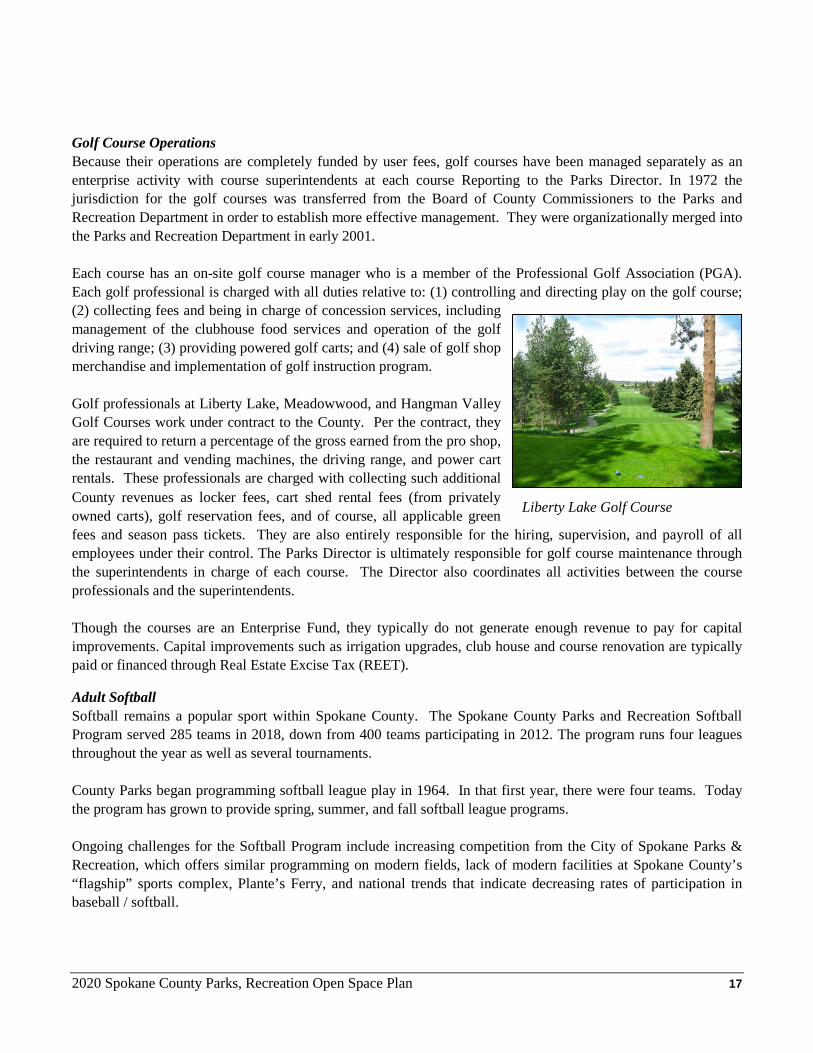
Golf Course Operations Because their operations are completely funded by user fees, golf courses have been managed separately as an enterprise activity with course superintendents at each course Reporting to the Parks Director. In 1972 the jurisdiction for the golf courses was transferred from the Board of County Commissioners to the Parks and Recreation Department in order to establish more effective management. They were organizationally merged into the Parks and Recreation Department in early 2001. Each course has an on-site golf course manager who is a member of the Professional Golf Association (PGA). Each golf professional is charged with all duties relative to: (1) controlling and directing play on the golf course; (2) collecting fees and being in charge of concession services, including management of the clubhouse food services and operation of the golf driving range; (3) providing powered golf carts; and (4) sale of golf shop merchandise and implementation of golf instruction program. Golf professionals at Liberty Lake, Meadowwood, and Hangman Valley Golf Courses work under contract to the County. Per the contract, they are required to return a percentage of the gross earned from the pro shop, the restaurant and vending machines, the driving range, and power cart rentals. These professionals are charged with collecting such additional County revenues as locker fees, cart shed rental fees (from privately owned carts), golf reservation fees, and of course, all applicable green fees and season pass tickets. They are also entirely responsible for the hiring, supervision, and payroll of all employees under their control. The Parks Director is ultimately responsible for golf course maintenance through the superintendents in charge of each course. The Director also coordinates all activities between the course professionals and the superintendents. Though the courses are an Enterprise Fund, they typically do not generate enough revenue to pay for capital improvements. Capital improvements such as irrigation upgrades, club house and course renovation are typically paid or financed through Real Estate Excise Tax (REET). Adult Softball Softball remains a popular sport within Spokane County. The Spokane County Parks and Recreation Softball Program served 285 teams in 2018, down from 400 teams participating in 2012. The program runs four leagues throughout the year as well as several tournaments. County Parks began programming softball league play in 1964. In that first year, there were four teams. Today the program has grown to provide spring, summer, and fall softball league programs. Ongoing challenges for the Softball Program include increasing competition from the City of Spokane Parks & Recreation, which offers similar programming on modern fields, lack of modern facilities at Spokane County’s “flagship” sports complex, Plante’s Ferry, and national trends that indicate decreasing rates of participation in baseball / softball.
Liberty Lake Golf Course
2020 Spokane County Parks, Recreation Open Space Plan 18
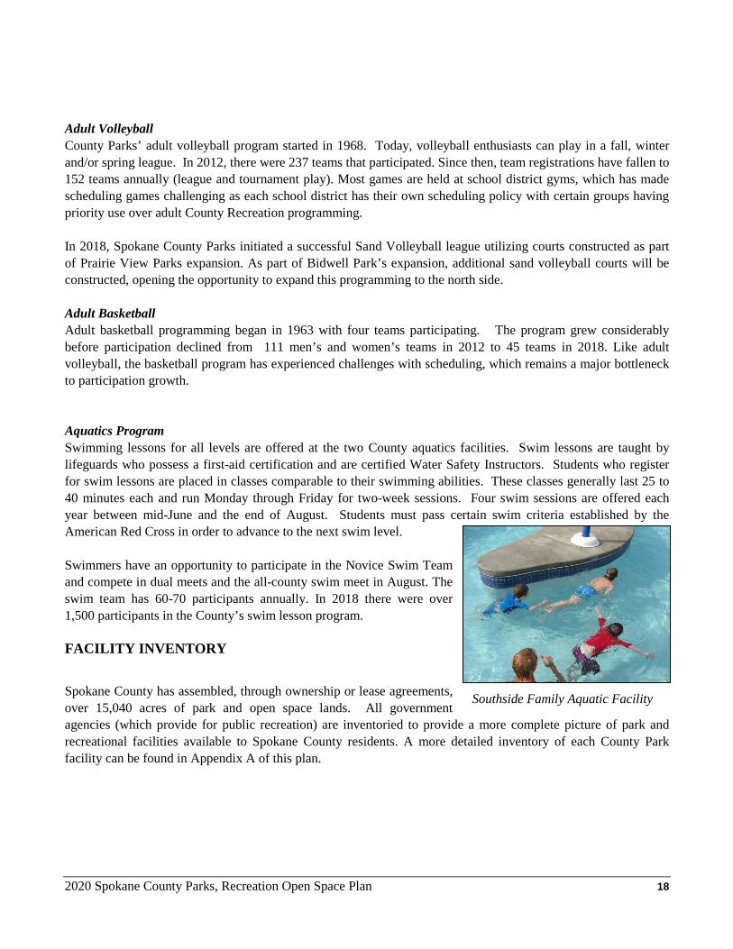
Adult Volleyball County Parks’ adult volleyball program started in 1968. Today, volleyball enthusiasts can play in a fall, winter and/or spring league. In 2012, there were 237 teams that participated. Since then, team registrations have fallen to 152 teams annually (league and tournament play). Most games are held at school district gyms, which has made scheduling games challenging as each school district has their own scheduling policy with certain groups having priority use over adult County Recreation programming. In 2018, Spokane County Parks initiated a successful Sand Volleyball league utilizing courts constructed as part of Prairie View Parks expansion. As part of Bidwell Park’s expansion, additional sand volleyball courts will be constructed, opening the opportunity to expand this programming to the north side. Adult Basketball Adult basketball programming began in 1963 with four teams participating. The program grew considerably before participation declined from 111 men’s and women’s teams in 2012 to 45 teams in 2018. Like adult volleyball, the basketball program has experienced challenges with scheduling, which remains a major bottleneck to participation growth. Aquatics Program Swimming lessons for all levels are offered at the two County aquatics facilities. Swim lessons are taught by lifeguards who possess a first-aid certification and are certified Water Safety Instructors. Students who register for swim lessons are placed in classes comparable to their swimming abilities. These classes generally last 25 to 40 minutes each and run Monday through Friday for two-week sessions. Four swim sessions are offered each year between mid-June and the end of August. Students must pass certain swim criteria established by the American Red Cross in order to advance to the next swim level. Swimmers have an opportunity to participate in the Novice Swim Team and compete in dual meets and the all-county swim meet in August. The swim team has 60-70 participants annually. In 2018 there were over 1,500 participants in the County’s swim lesson program. FACILITY INVENTORY
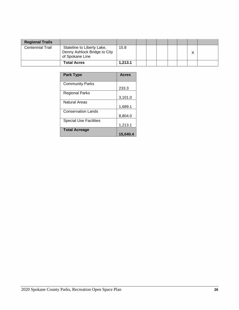
Spokane County has assembled, through ownership or lease agreements, over 15,040 acres of park and open space lands. All government agencies (which provide for public recreation) are inventoried to provide a more complete picture of park and recreational facilities available to Spokane County residents. A more detailed inventory of each County Park facility can be found in Appendix A of this plan.
Southside Family Aquatic Facility
2020 Spokane County Parks, Recreation Open Space Plan 19
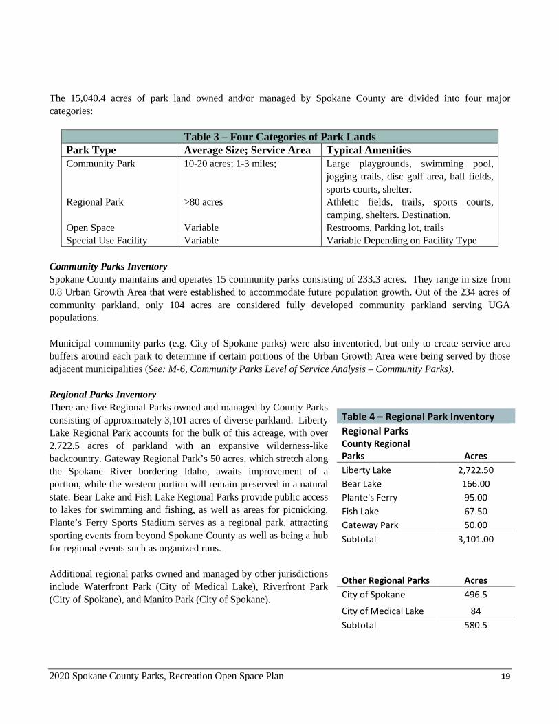
The 15,040.4 acres of park land owned and/or managed by Spokane County are divided into four major categories:
Table 3 – Four Categories of Park Lands Park Type Average Size; Service Area Typical Amenities Community Park 10-20 acres; 1-3 miles; Large playgrounds, swimming pool,
jogging trails, disc golf area, ball fields, sports courts, shelter.
Regional Park >80 acres Athletic fields, trails, sports courts, camping, shelters. Destination.
Open Space Variable Restrooms, Parking lot, trails Special Use Facility Variable Variable Depending on Facility Type
Community Parks Inventory Spokane County maintains and operates 15 community parks consisting of 233.3 acres. They range in size from 0.8 Urban Growth Area that were established to accommodate future population growth. Out of the 234 acres of community parkland, only 104 acres are considered fully developed community parkland serving UGA populations. Municipal community parks (e.g. City of Spokane parks) were also inventoried, but only to create service area buffers around each park to determine if certain portions of the Urban Growth Area were being served by those adjacent municipalities (See: M-6, Community Parks Level of Service Analysis – Community Parks). Regional Parks Inventory There are five Regional Parks owned and managed by County Parks consisting of approximately 3,101 acres of diverse parkland. Liberty Lake Regional Park accounts for the bulk of this acreage, with over 2,722.5 acres of parkland with an expansive wilderness-like backcountry. Gateway Regional Park’s 50 acres, which stretch along the Spokane River bordering Idaho, awaits improvement of a portion, while the western portion will remain preserved in a natural state. Bear Lake and Fish Lake Regional Parks provide public access to lakes for swimming and fishing, as well as areas for picnicking. Plante’s Ferry Sports Stadium serves as a regional park, attracting sporting events from beyond Spokane County as well as being a hub for regional events such as organized runs. Additional regional parks owned and managed by other jurisdictions include Waterfront Park (City of Medical Lake), Riverfront Park (City of Spokane), and Manito Park (City of Spokane).
Table 4 – Regional Park Inventory Regional Parks
County Regional Parks Acres Liberty Lake 2,722.50 Bear Lake 166.00 Plante's Ferry 95.00 Fish Lake 67.50 Gateway Park 50.00 Subtotal 3,101.00
Other Regional Parks Acres City of Spokane 496.5
City of Medical Lake 84 Subtotal 580.5
2020 Spokane County Parks, Recreation Open Space Plan 20
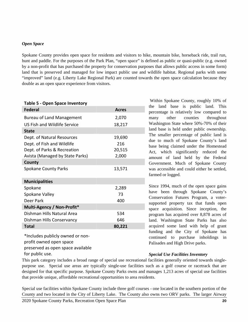
Open Space
Spokane County provides open space for residents and visitors to hike, mountain bike, horseback ride, trail run, hunt and paddle. For the purposes of the Park Plan, “open space” is defined as public or quasi-public (e.g. owned by a non-profit that has purchased the property for conservation purposes that allows public access in some form) land that is preserved and managed for low impact public use and wildlife habitat. Regional parks with some “improved” land (e.g. Liberty Lake Regional Park) are counted towards the open space calculation because they double as an open space experience from visitors.
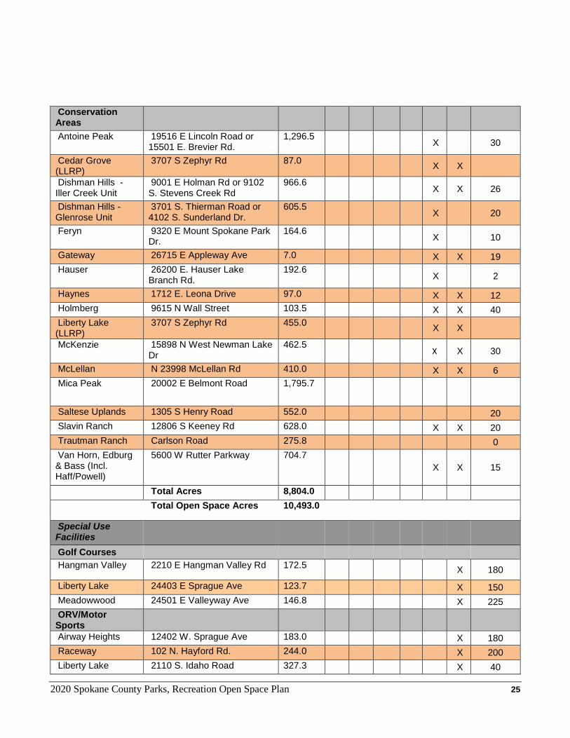
Within Spokane County, roughly 10% of the land base is public land. This percentage is relatively low compared to many other counties throughout Washington State where 50%-70% of their land base is held under public ownership. The smaller percentage of public land is due to much of Spokane County’s land base being claimed under the Homestead Act, which significantly reduced the amount of land held by the Federal Government. Much of Spokane County was accessible and could either be settled, farmed or logged. Since 1994, much of the open space gains have been through Spokane County’s Conservation Futures Program, a voter-supported property tax that funds open space acquisition. Since inception, the program has acquired over 8,878 acres of land. Washington State Parks has also acquired some land with help of grant funding and the City of Spokane has continued to purchase inholdings in Palisades and High Drive parks. Special Use Facilities Inventory
This park category includes a broad range of special use recreational facilities generally oriented towards single-purpose use. Special use areas are typically single-use facilities such as a golf course or racetrack that are designed for that specific purpose. Spokane County Parks owns and manages 1,213 acres of special use facilities that provide unique, affordable recreational opportunities to area residents. Special use facilities within Spokane County include three golf courses - one located in the southern portion of the County and two located in the City of Liberty Lake. The County also owns two ORV parks. The larger Airway
Table 5 - Open Space Inventory Federal Acres
Bureau of Land Management 2,070 US Fish and Wildlife Service 18,217 State Dept. of Natural Resources 19,690 Dept. of Fish and Wildlife 216 Dept. of Parks & Recreation 20,515 Avista (Managed by State Parks) 2,000 County Spokane County Parks 13,571
Municipalities Spokane 2,289 Spokane Valley 73 Deer Park 400 Multi-Agency / Non-Profit* Dishman Hills Natural Area 534 Dishman Hills Conservancy 646 Total 80,221
*Includes publicly owned or non-profit owned open space preserved as open space available for public use.
2020 Spokane County Parks, Recreation Open Space Plan 21
Heights ORV Sports Park has more recreational opportunities for off-road vehicles and is located in the West Plains area. The second ORV Park is located at Liberty Lake Regional Park and currently does not allow four-wheel drive cars and trucks. More recently, Spokane County acquired the County Raceway and assigned the Parks, Recreation & Golf Department with the administration of the facility. Currently, the facility is being operated by a third party through the Raceway Operators Agreement. Campground Facilities Inventory County Parks currently operates one campground at Liberty Lake Regional Park. That campground features 35 sites with a mix of tent and RV sites, cabins, electricity, restrooms, fire pits, and restrooms. There is an online reservation system that’s been in place since 2012. Within Spokane County, there are four additional public campgrounds, listed below:
Table 6 – Public Campgrounds in Spokane County Agency Facility Address # of Sites Detail Spokane County Liberty Lake
Campground 3707 S Zephyr Road, Liberty Lake, WA
35 14 Tent, 17 RV, 4 Cabins
Washington State Parks Bowl and Pitcher Campground (Incl. Equestrian CG)
4427 N Aubrey L White Parkway, Spokane, 99205
53 16 Tent, 16 RV, 21 Equestrian
Washington State Parks Nine Mile Campground
11226 W Charles Road, Nine Mile Falls, 99026
24 3 Tent, 21 RV
Washington State Parks Mount Spokane Campground
N. 26107 Mt. Spokane Park Dr., Mead, 99021
8 Tent
WA Department of Natural Resources
Dragoon Creek Campground
North Dragoon Drive, Deer Park
22 Tent
Total # of Camp Sites 142 Aquatic Facilities Inventory Spokane County currently operates two aquatic facilities: the Northside Family Aquatics Facility and the Southside Family Aquatics Facility. Both facilities have waterslides and other water features. The Northside has a 25-yard pool for lap swim and swim team. Holmberg Pool, which operated for decades near Whitworth University, was closed at the end of 2010 due to the need for costly repairs. The pool cannot be repaired in the foreseeable future without significant funding – therefore, it has not been included in the inventory. The inventory below also includes other public or quasi-public aquatic facilities in Spokane County, including City of Airway Heights new Recreation Center, which opened in 2019.
2020 Spokane County Parks, Recreation Open Space Plan 22
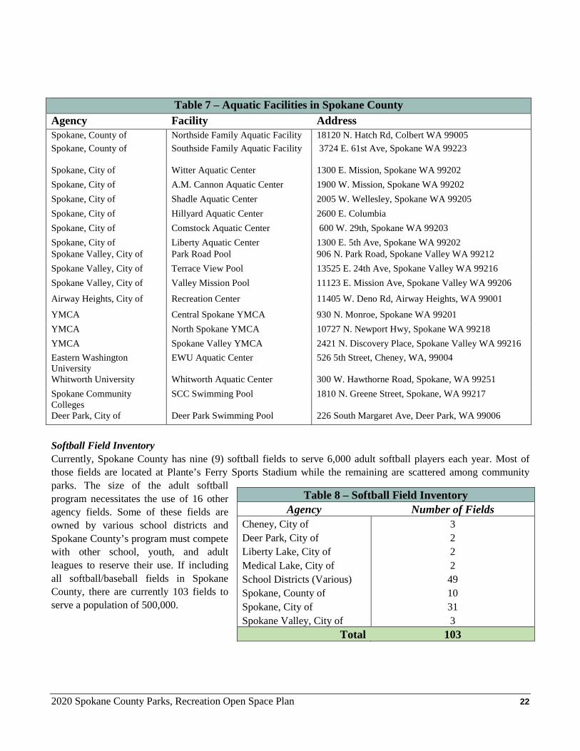
Softball Field Inventory Currently, Spokane County has nine (9) softball fields to serve 6,000 adult softball players each year. Most of those fields are located at Plante’s Ferry Sports Stadium while the remaining are scattered among community parks. The size of the adult softball program necessitates the use of 16 other agency fields. Some of these fields are owned by various school districts and Spokane County’s program must compete with other school, youth, and adult leagues to reserve their use. If including all softball/baseball fields in Spokane County, there are currently 103 fields to serve a population of 500,000.
Table 7 – Aquatic Facilities in Spokane County Agency Facility Address Spokane, County of Northside Family Aquatic Facility 18120 N. Hatch Rd, Colbert WA 99005 Spokane, County of Southside Family Aquatic Facility
3724 E. 61st Ave, Spokane WA 99223
Spokane, City of Witter Aquatic Center 1300 E. Mission, Spokane WA 99202 Spokane, City of A.M. Cannon Aquatic Center 1900 W. Mission, Spokane WA 99202 Spokane, City of Shadle Aquatic Center 2005 W. Wellesley, Spokane WA 99205 Spokane, City of Hillyard Aquatic Center 2600 E. Columbia Spokane, City of Comstock Aquatic Center 600 W. 29th, Spokane WA 99203 Spokane, City of Liberty Aquatic Center 1300 E. 5th Ave, Spokane WA 99202 Spokane Valley, City of Park Road Pool 906 N. Park Road, Spokane Valley WA 99212 Spokane Valley, City of Terrace View Pool 13525 E. 24th Ave, Spokane Valley WA 99216 Spokane Valley, City of Valley Mission Pool 11123 E. Mission Ave, Spokane Valley WA 99206
Airway Heights, City of Recreation Center 11405 W. Deno Rd, Airway Heights, WA 99001
YMCA Central Spokane YMCA 930 N. Monroe, Spokane WA 99201 YMCA North Spokane YMCA 10727 N. Newport Hwy, Spokane WA 99218 YMCA Spokane Valley YMCA 2421 N. Discovery Place, Spokane Valley WA 99216 Eastern Washington University
EWU Aquatic Center 526 5th Street, Cheney, WA, 99004
Whitworth University Whitworth Aquatic Center 300 W. Hawthorne Road, Spokane, WA 99251 Spokane Community Colleges
SCC Swimming Pool 1810 N. Greene Street, Spokane, WA 99217
Deer Park, City of Deer Park Swimming Pool 226 South Margaret Ave, Deer Park, WA 99006
Table 8 – Softball Field Inventory Agency Number of Fields
Cheney, City of 3 Deer Park, City of 2 Liberty Lake, City of 2 Medical Lake, City of 2 School Districts (Various) 49 Spokane, County of 10 Spokane, City of 31 Spokane Valley, City of 3
Total 103
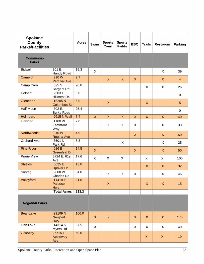
Spokane County Parks, Recreation and Open Space Plan 23
Spokane County
Parks/Facilities
Acres Swim
Sports Court
Sports Fields
BBQ
Trails
Restroom
Parking
Community Parks
Bidwell 801 E. Handy Road
19.3 X X 39
Camelot 910 W Percival Ave
9.7 X X X X 4
Camp Caro 625 S Sargent Rd
20.0 X X 26
Colbert 2503 E Hillcrest Dr.
0.8 0
Gleneden 15205 N Columbus St
5.0 X X 5
Half Moon 302 E. Burke Road
25.4 0
Holmberg 9615 N Wall 7.4 X X X X X X 40 Linwood 1100 W
Eastmont Way
7.0 X X X X 33
Northwoods 310 W Regina Ave
4.9 X X 50
Orchard Ave 3501 N Park Rd
3.8 X X 25
Pine River 626 E Greenleaf Dr
14.5 X X X 50
Prarie View 3724 E. 61st Ave
17.6 X X X X X 105
Shields 5625 E Upriver Dr
13.0 X X 32
Sontag 9808 W Charles Rd
64.0 X X X X 46
Valleyford 11418 E Palouse Hwy
21.0 X X X 15
Total Acres 233.3
Regional Parks
Bear Lake 29109 N Newport Hwy
166.0 X X X X X 175
Fish Lake 14314 S Myers Rd
67.5 X X X X 40
Gateway 26715 E Appleway Ave.
50.0 X X 19
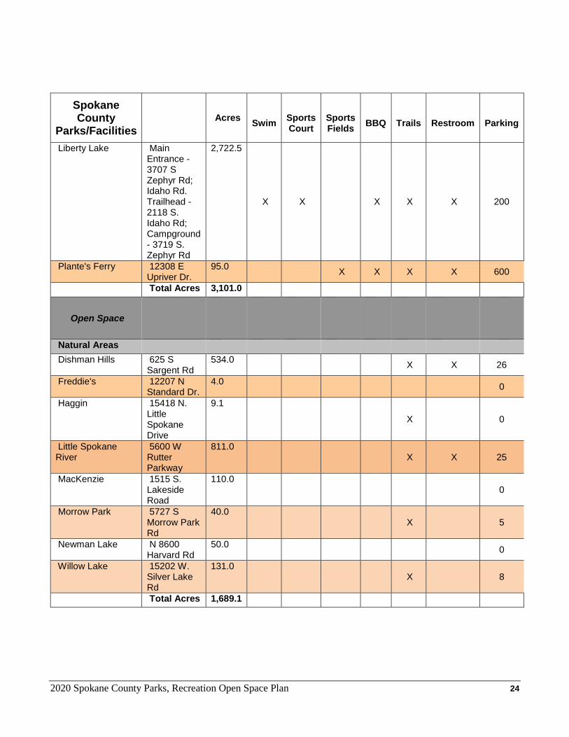
2020 Spokane County Parks, Recreation Open Space Plan 24
Spokane County
Parks/Facilities
Acres Swim
Sports Court
Sports Fields
BBQ
Trails
Restroom
Parking
Liberty Lake Main Entrance - 3707 S Zephyr Rd; Idaho Rd. Trailhead - 2118 S. Idaho Rd; Campground - 3719 S. Zephyr Rd
2,722.5
X X X X X 200
Plante's Ferry 12308 E Upriver Dr.
95.0 X X X X 600
Total Acres 3,101.0
Open Space
Natural Areas
Dishman Hills 625 S Sargent Rd
534.0 X X 26
Freddie's 12207 N Standard Dr.
4.0 0
Haggin 15418 N. Little Spokane Drive
9.1
X 0
Little Spokane River
5600 W Rutter Parkway
811.0 X X 25
MacKenzie 1515 S. Lakeside Road
110.0 0
Morrow Park 5727 S Morrow Park Rd
40.0 X 5
Newman Lake N 8600 Harvard Rd
50.0 0
Willow Lake 15202 W. Silver Lake Rd
131.0 X 8
Total Acres 1,689.1
2020 Spokane County Parks, Recreation Open Space Plan 25
Conservation Areas
Antoine Peak 19516 E Lincoln Road or 15501 E. Brevier Rd.
1,296.5 X 30
Cedar Grove (LLRP)
3707 S Zephyr Rd 87.0 X X
Dishman Hills - Iller Creek Unit
9001 E Holman Rd or 9102 S. Stevens Creek Rd
966.6 X X 26
Dishman Hills - Glenrose Unit
3701 S. Thierman Road or 4102 S. Sunderland Dr.
605.5 X 20
Feryn 9320 E Mount Spokane Park Dr.
164.6 X 10
Gateway 26715 E Appleway Ave 7.0 X X 19 Hauser 26200 E. Hauser Lake
Branch Rd. 192.6
X 2
Haynes 1712 E. Leona Drive 97.0 X X 12 Holmberg 9615 N Wall Street 103.5 X X 40 Liberty Lake (LLRP)
3707 S Zephyr Rd 455.0 X X
McKenzie 15898 N West Newman Lake Dr
462.5 X X 30
McLellan N 23998 McLellan Rd 410.0 X X 6 Mica Peak 20002 E Belmont Road 1,795.7
Saltese Uplands 1305 S Henry Road 552.0 20 Slavin Ranch 12806 S Keeney Rd 628.0 X X 20 Trautman Ranch Carlson Road 275.8 0 Van Horn, Edburg & Bass (Incl. Haff/Powell)
5600 W Rutter Parkway 704.7 X X 15
Total Acres 8,804.0 Total Open Space Acres 10,493.0
Special Use Facilities
Golf Courses Hangman Valley 2210 E Hangman Valley Rd 172.5 X 180
Liberty Lake 24403 E Sprague Ave 123.7 X 150 Meadowwood 24501 E Valleyway Ave 146.8 X 225 ORV/Motor Sports
Airway Heights 12402 W. Sprague Ave 183.0 X 180 Raceway 102 N. Hayford Rd. 244.0 X 200 Liberty Lake 2110 S. Idaho Road 327.3 X 40
2020 Spokane County Parks, Recreation Open Space Plan 26
Regional Trails Centennial Trail Stateline to Liberty Lake,
Denny Ashlock Bridge to City of Spokane Line
15.8 X
Total Acres 1,213.1 Park Type Acres
Community Parks 233.3
Regional Parks 3,101.0
Natural Areas 1,689.1
Conservation Lands 8,804.0
Special Use Facilities 1,213.1
Total Acreage 15,040.4
2020 Spokane County Parks, Recreation Open Space Plan 27
CHAPTER 4 - Goals and Policies INTRODUCTION The Goals and Policies of Spokane County’s Parks, Recreation and Open Space Plan were developed through public input to reflect which direction County Parks should move in for future development and acquisition of community parks, open space, trails, and other recreational facilities. VISION AND OVERALL GOAL The vision for Parks, Recreation, and Open Space is: To preserve and create viable natural habitat and trail corridors integrated with and whenever possible, connected to, a well-distributed system of well-maintained community and regional parks designed to enhance the quality of life by providing recreational opportunity, preserving open spaces and protecting important elements of Spokane’s natural heritage for future generations. This vision was developed through the citizen participation process and provides guidance to the goals and objectives that are outlined in this section. The vision has a single overall goal for the Parks and Recreation Program, which is: To enhance the quality of life for the residents of Spokane County by providing the highest quality and quantity of parks, open space, trails, and recreational facilities. This vision is accomplished through the preservation, acquisition, enhancement, and maintenance of a well-sited network of parks, open spaces, trails, and recreational facilities to be available to Spokane County residents. GOALS & POLICIES Goal PO.1 Provide an inclusive park system that benefits the broadest range of age, social, economic and
special group interests and abilities.
Policies PO.1.1 Development of new parks and recreation facilities shall be consistent with the Spokane County
Comprehensive Plan and the Spokane County Park Plan.
PO.1.2 Park and recreation facilities should be developed, renovated and maintained within available resources to serve the widest possible cross-section of resident needs and interests, including accessibility for disabled persons.
PO.1.3 Locate parks to provide for a variety of outdoor activities and to preserve and protect important habitat areas, corridors and linkages, natural amenities (e.g., wetlands and shorelines), unique landscape features (e.g., cliffs and bluffs) or other outstanding natural features.
PO.1.4 Allocate parks and recreation facilities throughout the County in a manner that provides an equitable distribution based on population density considering operational efficiencies.
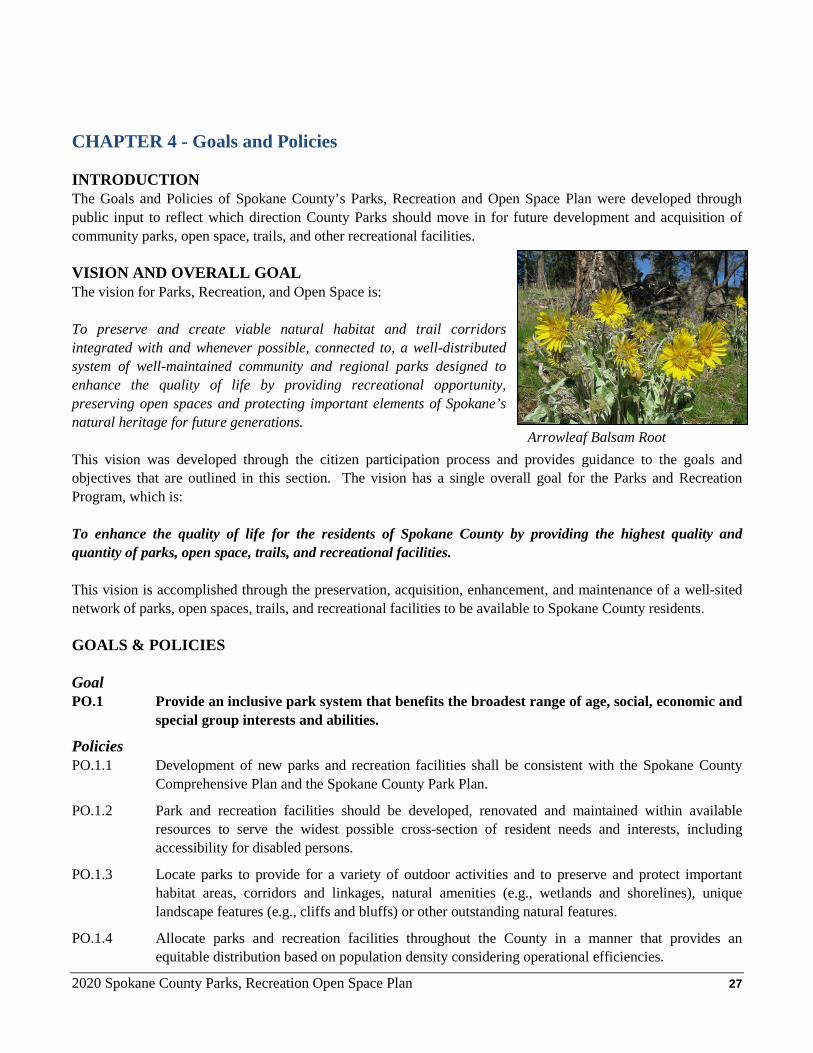
Arrowleaf Balsam Root
2020 Spokane County Parks, Recreation Open Space Plan 28
PO.1.5 Respond to the diversity of public needs by offering a range of recreational experiences from passive to active, to unstructured activity to organized recreation programs.
PO.1.6 Whenever possible, involve the public and other agencies with expertise in the decision-making process regarding the acquisition, design, development and enhancement of parks, recreation facilities and programs.
PO.1.7 Design parks, facilities, amenities and enhancements for maximum programming opportunities to serve the greatest number of residents.
PO.1.8 Improve accessibility to the park system through replacement of aging park infrastructure, design and incorporation of features which make parks safe and accessible for all.
PO.1.9 Consider ways to reduce costs and eliminate financial barriers for participation in recreation program and use of the park system facilities.
PO.1.10 Include youth in the planning and development of community parks.
PO.1.11 Parks should be located to provide ease of access for pedestrians, persons with disabilities, bicycles, autos and public transit.
Goal PO.2 Continue to develop a sustainable and efficient park system that meets the growing needs of a
growing population while recognizing historic budgetary trends and other long-term trends.
Policies PO.2.1 Partner with public park providers where possible to create a consolidated, connected and efficient
park system through land exchanges, leases, and future acquisitions.
PO.2.2 Coordinate park planning and land acquisition efforts across jurisdictional boundaries and consider existing and planned infrastructure, population served, environmental constraints, and available resources.
PO.2.3 Partner with nonprofit and for-profit recreation providers to enhance the quality and quantity of available recreation facilities at the lowest possible expense to the taxpayer.
PO.2.4 Develop facilities and layout park improvements to retain maximum flexibility for programming and adjusting to park use trends.
PO.2.5 Consider environmental factors, including long-term climate trends, geomorphology, fire and other natural impacts when acquiring, siting, designing and / or building or renovating parks, park facilities and amenities.
PO.2.6 Pursue forest management guided by a professionally developed forest management plan to enhance forest health and reduce the risk of catastrophic fire.
PO.2.7 Consider and install a diversity of trees and plant species when developing or renovating park land to reduce the risk of catastrophic impacts related to disease, insects or climate. For example, species
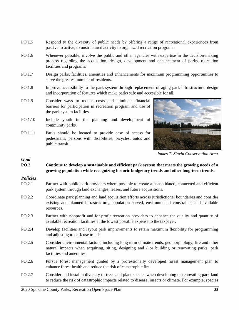
James T. Slavin Conservation Area
2020 Spokane County Parks, Recreation Open Space Plan 29
should be a combination of native and hardy non-native species that have proven to thrive in Spokane County’s climate zone(s).
PO.2.8 Maximize the benefit of each park facility whenever possible by considering multiple purposes for a site when selecting a new park location or when a major park renovation is occurring. For example, a park location may provide stormwater treatment benefits if located and design to include that function.
PO.2.9 When budgets are limited, maintenance of existing park and recreation facilities should take precedence over acquisition and development of new facilities.
PO.2.10 Budgets for facility maintenance should be prepared and considered as plans are made for acquisition.
PO.2.11 Design standards for parks should ensure safety, security, cleanliness, accessibility, and ease of maintenance.
Goal PO.3 Monitor and support efforts to maintain a level of service (LOS) goal for developed
community parks of 1.4 acres per 1,000 population for the Urban Growth Areas (UGA) and update / enhance existing County community parks.
Policies PO.3.1 Utilize the Level of Service (LOS) Analysis to identify current and future residential areas within
the UGA that may be underserved by community parks and strive to acquire and develop new community park land in those areas.
PO.3.2 Support the acquisition of a new community park property to serve the West Plains UGA. Said property should be greater than 10 acres in size and ideally 20 acres to accommodate current and future demand for community parkland in that area.
PO.3.3 Whenever possible, work cooperatively with other jurisdictions and agencies to identify, acquire, and develop community parkland that provides a range of benefits.
PO.3.4 Future community parks should be greater than 10 acres in size to adequately serve current and projected population and provide a diverse range of recreational opportunities unless current land use patterns prevent a larger property from being acquired in an area of need.
PO.3.5 Monitor the availability of state, federal, and other sources to fund the acquisition and development of community and regional parks. Work with other departments, jurisdictions, non-profit organizations, and private individuals to secure local match.
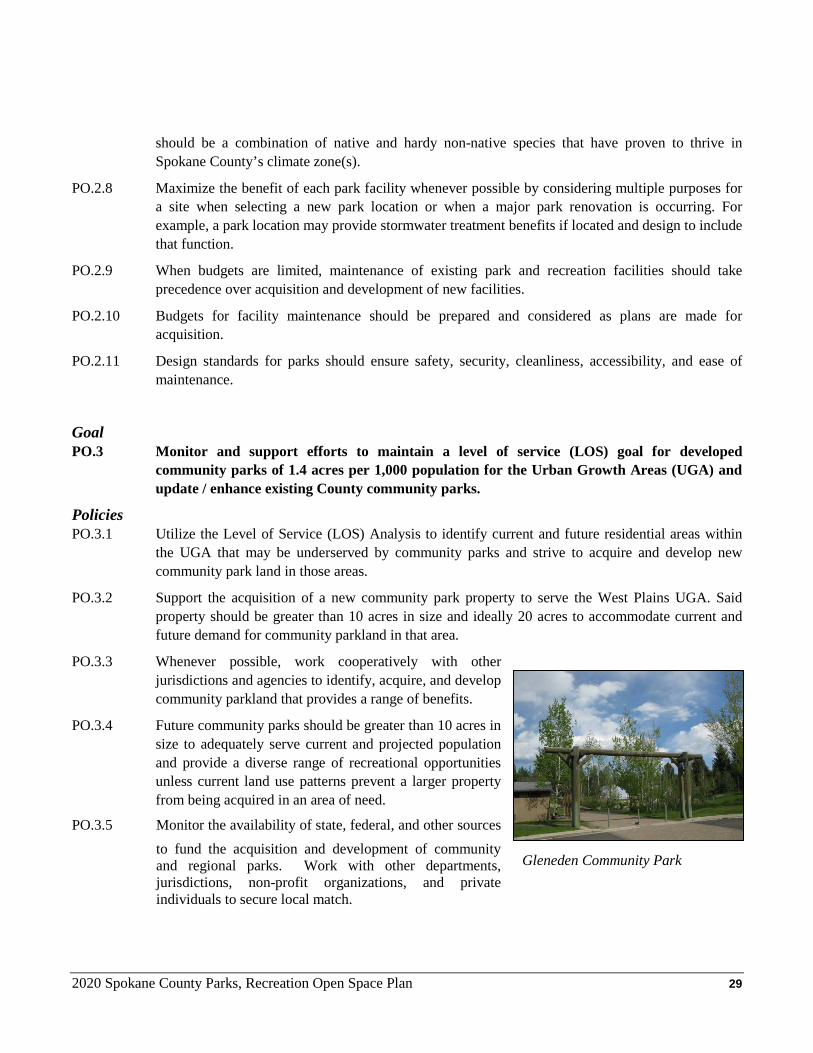
Gleneden Community Park
2020 Spokane County Parks, Recreation Open Space Plan 30
PO.3.6 Where current level of service within an Urban Growth Area is zero or deficient, staff should analyze that UGA to determine if current population is either deficient to warrant a new community park and/or is being served sufficiently by adjacent jurisdiction(s).
PO.3.7 Existing community parks should be systematically updated and enhanced to meet current and future needs as well as current standards, including compliance with the Americans with Disabilities Acts et seq.
PO.3.8 When planning enhancements for a County community park, Spokane County should prioritize (1) the addition, enhancement and replacement of restrooms, (2) addition of nature-play playground features, (3) enhancement landscaping and (4) the creation of off-leash areas for dogs (where feasible).
Goal
PO.4 Enhance Spokane County’s regional parks through the pursuit of publicly-developed master plans and implementation of the recommendations therein.
PO.4.1 Support the implementation of the Liberty Lake Regional Park Master Plan (2018) and the recommendations therein.
PO.4.2 Support and pursue the development of masters plans for Bear Lake, Fish Lake, Gateway and Plante’s Ferry regional parks starting with Bear Lake.
PO.4.3 Master plans developed for each regional park should consider local / neighborhood use and well as regional visitor use when proposing enhancements.
PO.4.4 Spokane County should consider purchase or acceptance of land adjacent to regional parks if land would directly support recommendations in a respective park’s master plan.
PO.4.5 Where practical and supported by an approved master plan, regional park enhancements should help maintain a level of service (LOS) goal of 0.32 campsites per 1,000 Spokane County residents through the addition of camp / RV sites.
PO.4.6 When planning enhancements for a County regional parks, Spokane County should prioritize (1) the expansion and enhancement of non-motorized trails, (2) the enhancement or replacement of restrooms, (3) enhancement of water access, swimming areas and docks and (4) enhancement of day-use areas.
Goals PO.5 Support and pursue the expansion and connection of open space areas and corridors that
ensure long-term viability and connectivity for wildlife & trail-based recreation in Spokane County.
Policies
PO.5.1 Continue to work with residents, agencies, jurisdictions, and non-profit groups to identify priorities for open space preservation within Spokane County.
2020 Spokane County Parks, Recreation Open Space Plan 31
PO.5.2 Utilize the Conservation Futures Tax (CFT) to purchase, preserve, and protect critical habitat and open space corridors throughout Spokane County.
PO.5.3 Consider other funding mechanisms to support continued acquisition and maintenance of open space, including Real Estate Excise Tax (RCW 82.46.070).
PO.5.4 Continue to acquire and support efforts to preserve and connect Dishman Hills Natural Area with Dishman Hills Conservation Area (Iller Creek Unit), expand existing preserved areas within this corridor and provide access to the public through a system of developed trailheads designed to serve multiple communities.
PO.5.5 Support efforts to acquire and preserve land along the Lower Little Spokane River to expand the Little Spokane River Natural Area and the current water trail system therein from St. George’s School to Fairwood.
PO.5.6 Continue to acquire and support efforts to preserve land around Mica Peak to expand Liberty Lake Regional Park and Mica Peak Conservation Area. This effort should be coordinated with Inland Empire Paper, Washington State DNR and other major land owners in this focus area.
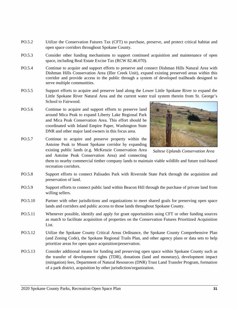
PO.5.7 Continue to acquire and preserve property within the Antoine Peak to Mount Spokane corridor by expanding existing public lands (e.g. McKenzie Conservation Area and Antoine Peak Conservation Area) and connecting them to nearby commercial timber company lands to maintain viable wildlife and future trail-based recreation corridors.
PO.5.8 Support efforts to connect Palisades Park with Riverside State Park through the acquisition and preservation of land.
PO.5.9 Support efforts to connect public land within Beacon Hill through the purchase of private land from willing sellers.
PO.5.10 Partner with other jurisdictions and organizations to meet shared goals for preserving open space lands and corridors and public access to those lands throughout Spokane County.
PO.5.11 Whenever possible, identify and apply for grant opportunities using CFT or other funding sources as match to facilitate acquisition of properties on the Conservation Futures Prioritized Acquisition List.
PO.5.12 Utilize the Spokane County Critical Areas Ordinance, the Spokane County Comprehensive Plan (and Zoning Code), the Spokane Regional Trails Plan, and other agency plans or data sets to help prioritize areas for open space acquisition/preservation.
PO.5.13 Consider additional means for funding and preserving open space within Spokane County such as the transfer of development rights (TDR), donations (land and monetary), development impact (mitigation) fees, Department of Natural Resources (DNR) Trust Land Transfer Program, formation of a park district, acquisition by other jurisdiction/organization.
Saltese Uplands Conservation Area
2020 Spokane County Parks, Recreation Open Space Plan 32
PO.5.14 The Conservation Futures Program should be flexible enough to take advantage of unforeseen opportunities as they become available. Such unforeseen opportunities may be of local, regional, or of state significance and/or provide a once-in-a-lifetime opportunity to preserve and provide connectivity, high quality wildlife habitat and passive recreational opportunities.
PO.5.15 Encourage the retention of all publicly owned open space areas.
PO.5.16 Encourage the inclusion of functional open space within planned unit developments for residential, commercial and industrial development.
PO.5.17 Level of service for open space should be maintained at 161 acres per 1,000 residents and increased when feasible.
PO.5.18 Support other agencies’ efforts to acquire, preserve, enhance, and connect geologic sites identified
on the Ice Age Floods National Recreational Trail.
Goal PO.6 Manage open space area lands to balance wildlife,
recreational and community needs.
Policies PO.6.1 Ensure that recreational uses are consistent with the
protection and preservation of environmentally sensitive open spaces and wildlife corridors.
PO.6.2 Manage all open space areas to maintain a balance of recreational uses that maintain a positive user experience for all public users.
PO.6.3 Close, rehabilitate, or relocate trails that are determined to be unsustainable, promote erosion, and/or bisect critical sections of wildlife habitat within open space areas.
PO.6.4 Provide when feasible trailhead parking areas that allow safe parking for visitors that helps promote legal, passive recreational uses within open space areas. Such parking areas should be equipped with a public webcam, portable restroom, kiosk and entrance sign to provide for a positive visitor experience.
PO.6.5 Review development (subdivision) proposals to evaluate potential impacts on Levels of Service and to identify opportunities for multiple use of proposed open space set aside through development regulations.
PO.6.6 Utilize current Best Management Practices (BMPs) and seek input from experts (e.g. Washington Department of Fish and Wildlife biologists) to help guide stewardship of open space areas.
PO.6.7 When possible, develop forest management plans (utilizing a professional forester) to guide active forest management that enhances forest health while reducing the risk of catastrophic fire.
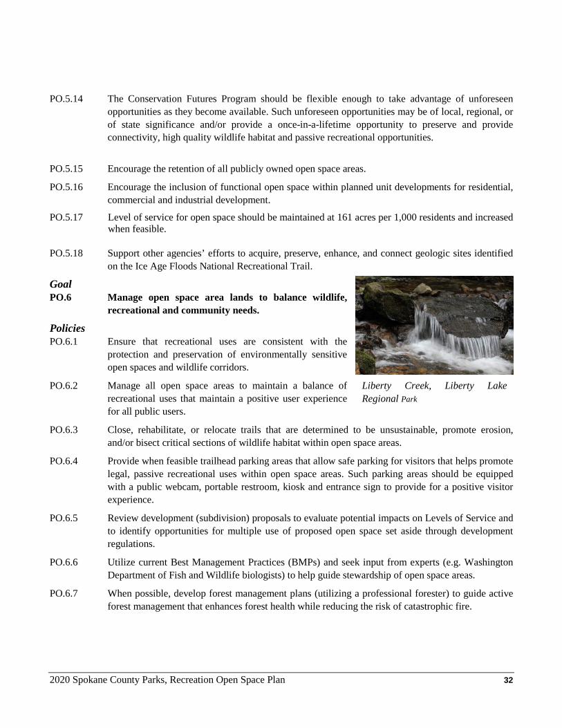
Liberty Creek, Liberty Lake Regional Park
2020 Spokane County Parks, Recreation Open Space Plan 33
Goal PO.7 Utilize the Spokane County Regional Trail Plan that envisions a county-wide system of
multipurpose non-motorized trails to secure, preserve, and develop a network of trails throughout Spokane County that connect communities and provide easily accessed recreational opportunities.
Policies PO.7.1 Maintain and update at least every 6 years the Spokane County Regional Trail Plan (“Trail Plan”).
PO. 7.2 Provide trails for pedestrians (including, where feasible, access for persons with disabilities), bicyclists, equestrians, cross-country skiers and other non-motorized vehicle users as identified in the Trail Plan.
PO.7.2 Connect communities, community facilities, workplaces, neighborhoods, schools, recreation areas, open space and cultural/historical areas as identified in the Trail Plan.
PO.7.3 Support efforts to separate recreational trails and pathways from motorized vehicle traffic as a part of larger projects, including Spokane County Public Works and Washington State Department of Transportation projects.
PO.7.4 Support efforts to preserve when possible existing rights-of-way (including abandoned rail and utility easements) for possible use as multipurpose non-motorized trails.
PO.7.5 Include and design whenever possible pathway systems within Spokane County’s developed parks (Community and Regional) that create logical connections, attain key distances (e.g. ½ mile increments) for jogging / exercise, and maintain an asphalt or compacted gravel surface that can be comfortably biked and jogged on.
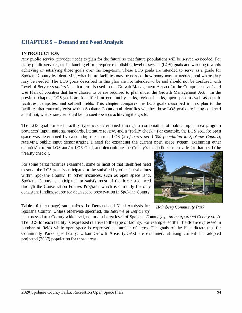
2020 Spokane County Parks, Recreation Open Space Plan 34
CHAPTER 5 – Demand and Need Analysis INTRODUCTION Any public service provider needs to plan for the future so that future populations will be served as needed. For many public services, such planning efforts require establishing level of service (LOS) goals and working towards achieving or satisfying those goals over the long-term. These LOS goals are intended to serve as a guide for Spokane County by identifying what future facilities may be needed, how many may be needed, and where they may be needed. The LOS goals described in this plan are not intended to be and should not be confused with Level of Service standards as that term is used in the Growth Management Act and/or the Comprehensive Land Use Plan of counties that have chosen to or are required to plan under the Growth Management Act. In the previous chapter, LOS goals are identified for community parks, regional parks, open space as well as aquatic facilities, campsites, and softball fields. This chapter compares the LOS goals described in this plan to the facilities that currently exist within Spokane County and identifies whether those LOS goals are being achieved and if not, what strategies could be pursued towards achieving the goals. The LOS goal for each facility type was determined through a combination of public input, area program providers’ input, national standards, literature review, and a “reality check.” For example, the LOS goal for open space was determined by calculating the current LOS (# of acres per 1,000 population in Spokane County), receiving public input demonstrating a need for expanding the current open space system, examining other counties’ current LOS and/or LOS Goal, and determining the County’s capabilities to provide for that need (the “reality check”). For some parks facilities examined, some or most of that identified need to serve the LOS goal is anticipated to be satisfied by other jurisdictions within Spokane County. In other instances, such as open space land, Spokane County is anticipated to satisfy most of the forecasted need through the Conservation Futures Program, which is currently the only consistent funding source for open space preservation in Spokane County.
Table 10 (next page) summarizes the Demand and Need Analysis for Spokane County. Unless otherwise specified, the Reserve or Deficiency is expressed at a County-wide level, not at a subarea level of Spokane County (e.g. unincorporated County only). The LOS for each facility is expressed relative to the type of facility. For example, softball fields are expressed in number of fields while open space is expressed in number of acres. The goals of the Plan dictate that for Community Parks specifically, Urban Growth Areas (UGAs) are examined, utilizing current and adopted projected (2037) population for those areas.
Holmberg Community Park
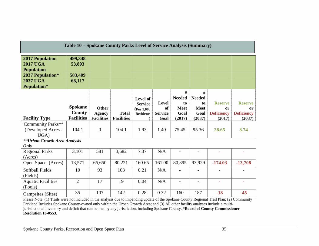
Spokane County Parks, Recreation and Open Space Plan 35
2017 Population 499,348 2017 UGA Population
53,893
2037 Population* 583,409 2037 UGA Population*
68,117
Facility Type
Spokane County
Facilities
Other Agency
Facilities Total
Facilities
Level of Service
(Per 1,000 Residents
)
Level of
Service Goal
# Needed
to Meet Goal
(2017)
# Needed
to Meet Goal
(2037)
Reserve or
Deficiency (2017)
Reserve or
Deficiency (2037)
Community Parks** (Developed Acres -
UGA) 104.1 0 104.1 1.93 1.40 75.45 95.36 28.65 8.74
**Urban Growth Area Analysis Only Regional Parks (Acres)
3,101 581 3,682 7.37 N/A - - - -
Open Space (Acres) 13,571 66,650 80,221 160.65 161.00 80,395 93,929 -174.03 -13,708 Softball Fields (Fields)
10 93 103 0.21 N/A - - - -
Aquatic Facilities (Pools)
2 17 19 0.04 N/A - - - -
Campsites (Sites) 35 107 142 0.28 0.32 160 187 -18 -45 Please Note: (1) Trails were not included in the analysis due to impending update of the Spokane County Regional Trail Plan; (2) Community Parkland Includes Spokane County-owned only within the Urban Growth Area; and (3) All other facility analyses include a multi-jurisdictional inventory and deficit that can be met by any jurisdiction, including Spokane County. *Board of County Commissioner Resolution 16-0553.
Table 10 – Spokane County Parks Level of Service Analysis (Summary)
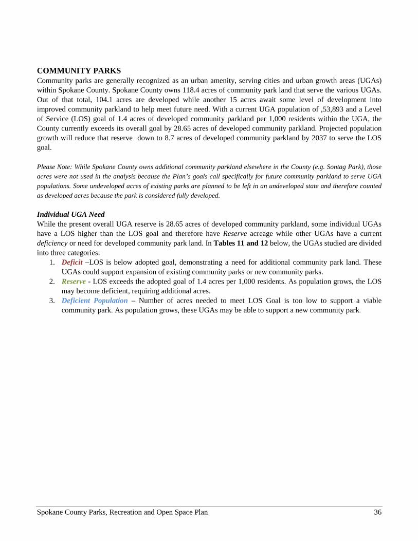
Spokane County Parks, Recreation and Open Space Plan 36
COMMUNITY PARKS Community parks are generally recognized as an urban amenity, serving cities and urban growth areas (UGAs) within Spokane County. Spokane County owns 118.4 acres of community park land that serve the various UGAs. Out of that total, 104.1 acres are developed while another 15 acres await some level of development into improved community parkland to help meet future need. With a current UGA population of ,53,893 and a Level of Service (LOS) goal of 1.4 acres of developed community parkland per 1,000 residents within the UGA, the County currently exceeds its overall goal by 28.65 acres of developed community parkland. Projected population growth will reduce that reserve down to 8.7 acres of developed community parkland by 2037 to serve the LOS goal. Please Note: While Spokane County owns additional community parkland elsewhere in the County (e.g. Sontag Park), those acres were not used in the analysis because the Plan’s goals call specifically for future community parkland to serve UGA populations. Some undeveloped acres of existing parks are planned to be left in an undeveloped state and therefore counted as developed acres because the park is considered fully developed.
Individual UGA Need While the present overall UGA reserve is 28.65 acres of developed community parkland, some individual UGAs have a LOS higher than the LOS goal and therefore have Reserve acreage while other UGAs have a current deficiency or need for developed community park land. In Tables 11 and 12 below, the UGAs studied are divided into three categories:
1. Deficit –LOS is below adopted goal, demonstrating a need for additional community park land. These UGAs could support expansion of existing community parks or new community parks.
2. Reserve - LOS exceeds the adopted goal of 1.4 acres per 1,000 residents. As population grows, the LOS may become deficient, requiring additional acres.
3. Deficient Population – Number of acres needed to meet LOS Goal is too low to support a viable community park. As population grows, these UGAs may be able to support a new community park.
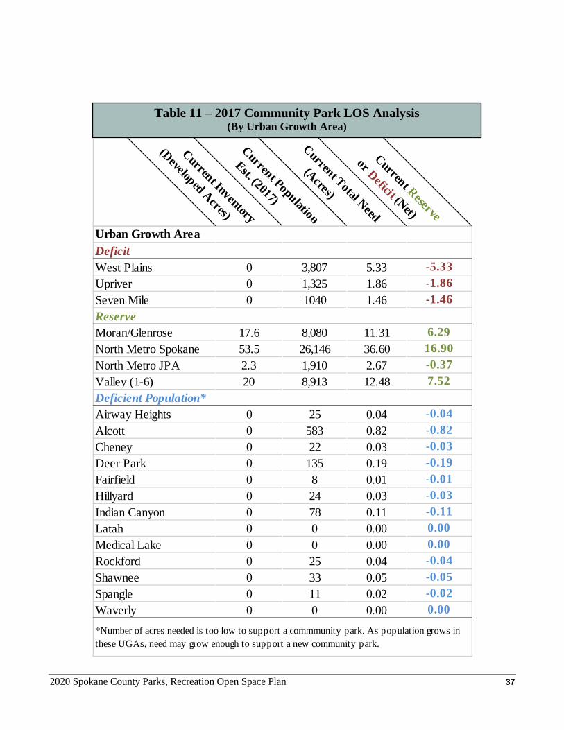
2020 Spokane County Parks, Recreation Open Space Plan 37
Table 11 – 2017 Community Park LOS Analysis (By Urban Growth Area)
Current Inventory
(Developed Acres)
Current Population
Est. (2017)
Current Total Need
(Acres)
Current Reserve
or Deficit (Net)
Urban Growth AreaDeficitWest Plains 0 3,807 5.33 -5.33Upriver 0 1,325 1.86 -1.86Seven Mile 0 1040 1.46 -1.46ReserveMoran/Glenrose 17.6 8,080 11.31 6.29North Metro Spokane 53.5 26,146 36.60 16.90North Metro JPA 2.3 1,910 2.67 -0.37Valley (1-6) 20 8,913 12.48 7.52Deficient Population*Airway Heights 0 25 0.04 -0.04Alcott 0 583 0.82 -0.82Cheney 0 22 0.03 -0.03Deer Park 0 135 0.19 -0.19Fairfield 0 8 0.01 -0.01Hillyard 0 24 0.03 -0.03Indian Canyon 0 78 0.11 -0.11Latah 0 0 0.00 0.00Medical Lake 0 0 0.00 0.00Rockford 0 25 0.04 -0.04Shawnee 0 33 0.05 -0.05Spangle 0 11 0.02 -0.02Waverly 0 0 0.00 0.00
*Number of acres needed is too low to support a commmunity park. As population grows in these UGAs, need may grow enough to support a new community park.
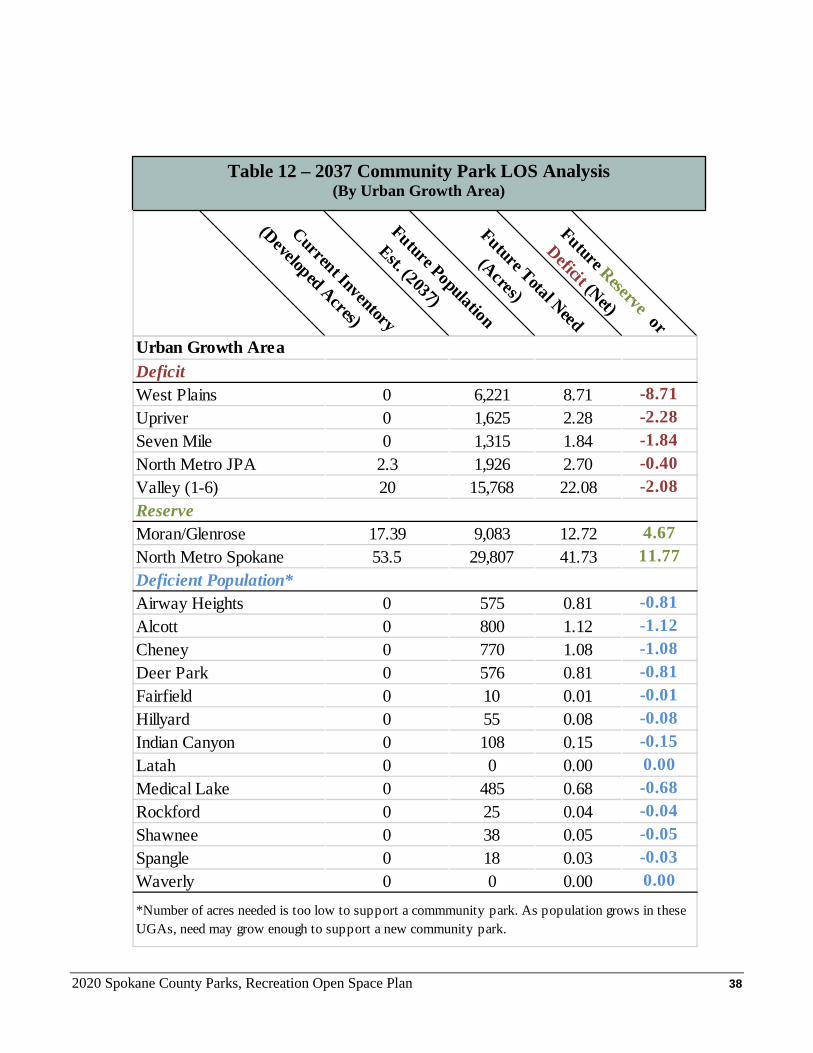
2020 Spokane County Parks, Recreation Open Space Plan 38
Table 12 – 2037 Community Park LOS Analysis (By Urban Growth Area)
Current Inventory
(Developed Acres)
Future Population
Est. (2037)
Future Total Need
(Acres)
Future Reserve or
Deficit (Net)
Urban Growth AreaDeficitWest Plains 0 6,221 8.71 -8.71Upriver 0 1,625 2.28 -2.28Seven Mile 0 1,315 1.84 -1.84North Metro JPA 2.3 1,926 2.70 -0.40Valley (1-6) 20 15,768 22.08 -2.08ReserveMoran/Glenrose 17.39 9,083 12.72 4.67North Metro Spokane 53.5 29,807 41.73 11.77Deficient Population*Airway Heights 0 575 0.81 -0.81Alcott 0 800 1.12 -1.12Cheney 0 770 1.08 -1.08Deer Park 0 576 0.81 -0.81Fairfield 0 10 0.01 -0.01Hillyard 0 55 0.08 -0.08Indian Canyon 0 108 0.15 -0.15Latah 0 0 0.00 0.00Medical Lake 0 485 0.68 -0.68Rockford 0 25 0.04 -0.04Shawnee 0 38 0.05 -0.05Spangle 0 18 0.03 -0.03Waverly 0 0 0.00 0.00
*Number of acres needed is too low to support a commmunity park. As population grows in these UGAs, need may grow enough to support a new community park.
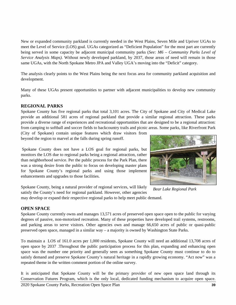
2020 Spokane County Parks, Recreation Open Space Plan 39
New or expanded community parkland is currently needed in the West Plains, Seven Mile and Upriver UGAs to meet the Level of Service (LOS) goal. UGAs categorized as “Deficient Population” for the most part are currently being served in some capacity be adjacent municipal community parks (See: M6 – Community Parks Level of Service Analysis Maps). Without newly developed parkland, by 2037, those areas of need will remain in those same UGAs, with the North Spokane Metro JPA and Valley UGA’s moving into the “Deficit” category. The analysis clearly points to the West Plains being the next focus area for community parkland acquisition and development. Many of these UGAs present opportunities to partner with adjacent municipalities to develop new community parks. REGIONAL PARKS Spokane County has five regional parks that total 3,101 acres. The City of Spokane and City of Medical Lake provide an additional 581 acres of regional parkland that provide a similar regional attraction. These parks provide a diverse range of experiences and recreational opportunities that are designed to be a regional attraction: from camping to softball and soccer fields to backcountry trails and picnic areas. Some parks, like Riverfront Park (City of Spokane) contain unique features which draw visitors from beyond the region to marvel at the falls during spring runoff. Spokane County does not have a LOS goal for regional parks, but monitors the LOS due to regional parks being a regional attraction, rather than neighborhood service. Per the public process for the Park Plan, there was a strong desire from the public to focus on developing master plans for Spokane County’s regional parks and using those implement enhancements and upgrades to those facilities. Spokane County, being a natural provider of regional services, will likely satisfy the County’s need for regional parkland. However, other agencies may develop or expand their respective regional parks to help meet public demand. OPEN SPACE Spokane County currently owns and manages 13,571 acres of preserved open space open to the public for varying degrees of passive, non-motorized recreation. Many of these properties have developed trail systems, restrooms, and parking areas to serve visitors. Other agencies own and manage 66,650 acres of public or quasi-public preserved open space, managed in a similar way – a majority is owned by Washington State Parks. To maintain a LOS of 161.0 acres per 1,000 residents, Spokane County will need an additional 13,708 acres of open space by 2037 .Throughout the public participation process for this plan, expanding and enhancing open space was the number one priority and generally seen as something Spokane County must continue to do to satisfy demand and preserve Spokane County’s natural heritage in a rapidly growing economy. “Act now” was a repeated theme in the written comment portion of the online survey. It is anticipated that Spokane County will be the primary provider of new open space land through its Conservation Futures Program, which is the only local, dedicated funding mechanism to acquire open space.
Bear Lake Regional Park
2020 Spokane County Parks, Recreation Open Space Plan 40
However, other agencies, such as Washington State Parks, are anticipated to acquire some additional acreage that will help meet future need. TRAILS Trails are a growing component of Spokane County’s inventory. With the pending update of the 2014 Spokane County Regional Trail Plan (RTP), the comprehensive inventory of Spokane County’s trail system will be updated. Generally, through the public participation process, trails (expansion, enhancement and maintenance) were identified as a number 1 or number 2 priority for a majority of online survey respondents and open house attendees. SOFTBALL FIELDS Spokane County operates the largest adult softball league in Spokane County. Since the last plan update, the number of teams participating annually in Spokane County’s softball league has dropped from 400 teams to 285 teams (2018). This precipitous drop is due to two main factors: the City of Spokane Parks and Recreation Department starting their own adult softball league and lack of modern facilities for Spokane County’s participants to play on. Another factor includes a national trend of decreasing participation rates among many team sports, including baseball / softball. Spokane County Parks’ Recreation Division utilizes 10 County fields for scheduling play with 5 of those at Plante’s Ferry. Other fields are secured from the City of Spokane Valley or area school districts as needed, however, those are subject to owner scheduling policies, programming and fees. The current Level of Service (LOS) is 0.21 fields per 1,000 residents. Generally, developing new sports fields was a low priority for open house attendees and online survey respondents.
Spokane County may pursue satisfying much of the current demand through the renovation of Plante’s Ferry. Currently, Plante’s Ferry’s scheduling is restricted by field conditions and lighting. Renovating Plane’s Ferry by modernizing that facility with synthetic turf infields, lights and re-grading should boost the hours of potential use on those fields. Given the central location of Plante’s Ferry, modernizing this facility may provide the most “bang for the buck” to meet current demand. Spokane County doesn’t foresee constructing any additional softball fields over the next six years (outside of what may result from the renovation of Plante’s Ferry). CAMPGROUNDS A total of six (6) public campgrounds provide 142 camp sites (tent & RV) throughout Spokane County. Three are operated by Washington State Parks, one by Washington Department of Natural Resources, and one by Spokane County. Outside of Spokane County, the closest campgrounds can be found at Farragut State Park and Heyburn State Park, both in Idaho and a 1 ½ hour drive from downtown Spokane. “The Special Report on Camping 2012” (Outdoor Industry Association) reported that a majority of respondents surveyed prefer camping within a two-hour drive from their home and closer if the option is available. With a LOS goal of 0.32 campsites per 1,000 residents, there may be a current deficiency of 18 campsites and 45 sites by 2031. Generally, public input supports the need for additional camping capacity, though not as high as open space and trails.
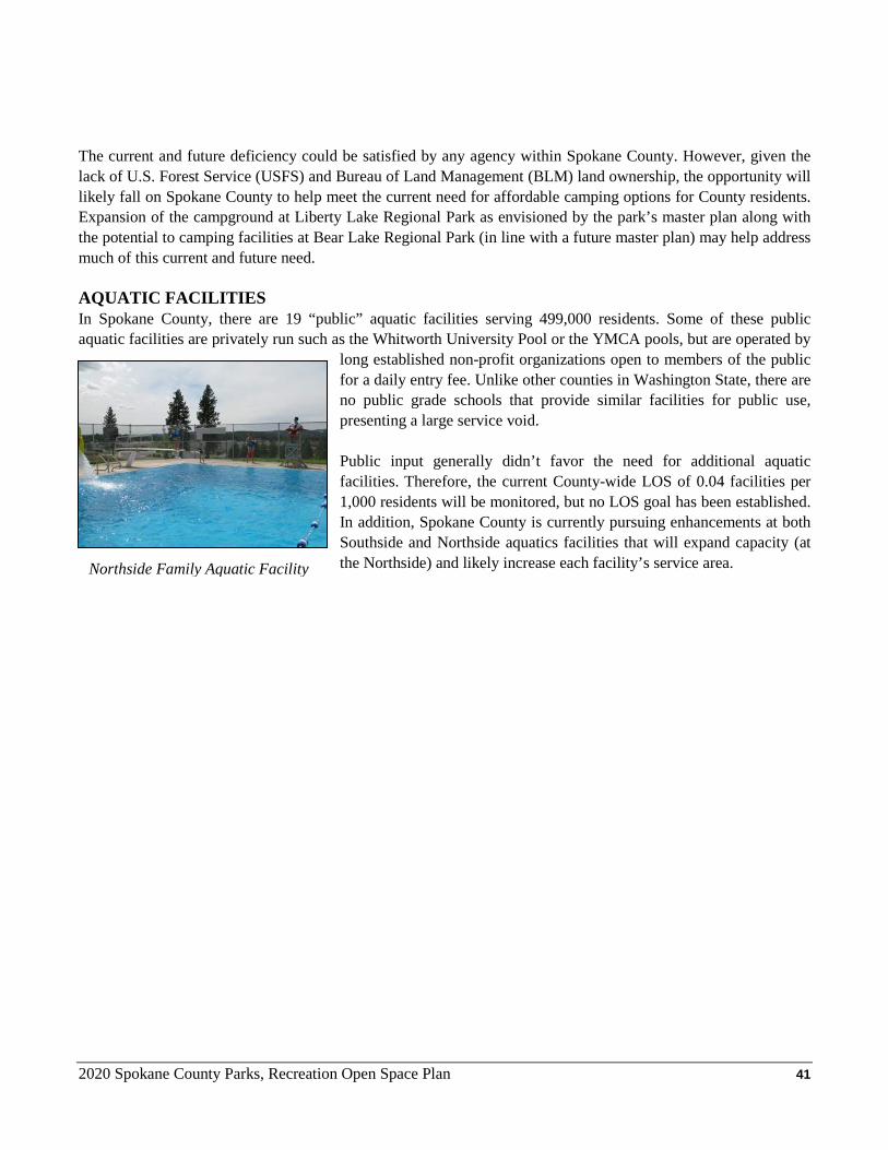
2020 Spokane County Parks, Recreation Open Space Plan 41
The current and future deficiency could be satisfied by any agency within Spokane County. However, given the lack of U.S. Forest Service (USFS) and Bureau of Land Management (BLM) land ownership, the opportunity will likely fall on Spokane County to help meet the current need for affordable camping options for County residents. Expansion of the campground at Liberty Lake Regional Park as envisioned by the park’s master plan along with the potential to camping facilities at Bear Lake Regional Park (in line with a future master plan) may help address much of this current and future need. AQUATIC FACILITIES In Spokane County, there are 19 “public” aquatic facilities serving 499,000 residents. Some of these public aquatic facilities are privately run such as the Whitworth University Pool or the YMCA pools, but are operated by
long established non-profit organizations open to members of the public for a daily entry fee. Unlike other counties in Washington State, there are no public grade schools that provide similar facilities for public use, presenting a large service void. Public input generally didn’t favor the need for additional aquatic facilities. Therefore, the current County-wide LOS of 0.04 facilities per 1,000 residents will be monitored, but no LOS goal has been established. In addition, Spokane County is currently pursuing enhancements at both Southside and Northside aquatics facilities that will expand capacity (at the Northside) and likely increase each facility’s service area.
Northside Family Aquatic Facility
2020 Spokane County Parks, Recreation Open Space Plan 42
CHAPTER 6- Capital Facilities Plan & Future Funding INTRODUCTION Using the projects and need identified in the previous chapters, the Spokane County Parks Capital Facilities Plan (CFP) identifies dozens of capital projects with $34 million in projected funding needs. The Plan takes into account current needs, meeting those needs, and forecasting future Conservation Futures Program open space acquisitions. All projects are intended to work towards achieving the goals and policies of the Plan and align with public input received through the Plan’s public participation process. These projects are anticipated to be funded through three major sources: Real Estate Excise Tax (REET) funds, Conservation Futures Tax (CFT) funds, and Washington State Recreation & Conservation Office (RCO) grants. Other funding sources in the form of bonds, donations, and other competitive grants may materialize to supplement those major funding sources described above. Please Note: The Six-Year CFP on the proceeding pages is intended to be a living document that may be updated on a case-by-case basis to include revised project scopes, new projects that are unforeseen at this time and / or remove projects that are no longer needed (e.g. a municipality annexes a portion of the UGA that includes one or more Spokane County park facilities).
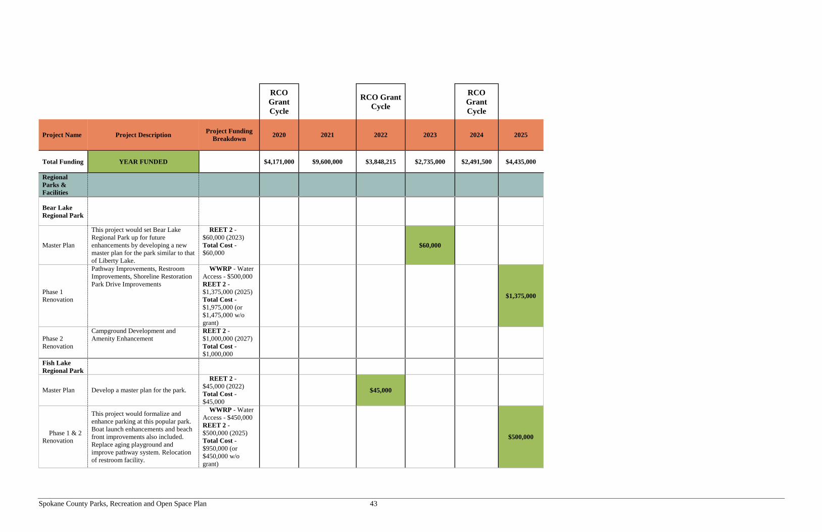
Spokane County Parks, Recreation and Open Space Plan 43
RCO Grant Cycle
RCO Grant Cycle
RCO Grant Cycle
Project Name Project Description Project Funding
Breakdown 2020 2021 2022 2023 2024 2025
Total Funding YEAR FUNDED $4,171,000 $9,600,000 $3,848,215 $2,735,000 $2,491,500 $4,435,000
Regional Parks & Facilities
Bear Lake Regional Park
Master Plan
This project would set Bear Lake Regional Park up for future enhancements by developing a new master plan for the park similar to that of Liberty Lake.
REET 2 - $60,000 (2023) Total Cost - $60,000
$60,000
Phase 1 Renovation
Pathway Improvements, Restroom Improvements, Shoreline Restoration Park Drive Improvements
WWRP - Water Access - $500,000 REET 2 - $1,375,000 (2025) Total Cost - $1,975,000 (or $1,475,000 w/o grant)
$1,375,000
Phase 2 Renovation
Campground Development and Amenity Enhancement
REET 2 - $1,000,000 (2027) Total Cost - $1,000,000
Fish Lake Regional Park
Master Plan Develop a master plan for the park.
REET 2 - $45,000 (2022) Total Cost - $45,000
$45,000
Phase 1 & 2 Renovation
This project would formalize and enhance parking at this popular park. Boat launch enhancements and beach front improvements also included. Replace aging playground and improve pathway system. Relocation of restroom facility.
WWRP - Water Access - $450,000 REET 2 - $500,000 (2025) Total Cost - $950,000 (or $450,000 w/o grant)
$500,000
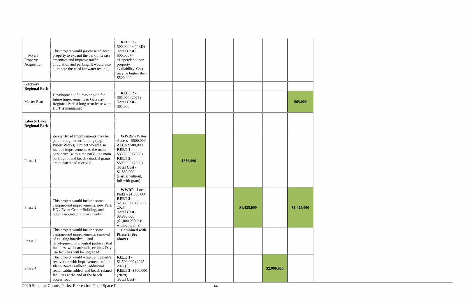
2020 Spokane County Parks, Recreation Open Space Plan 44
Myers Property Acquisition
This project would purchase adjacent property to expand the park, increase amenities and improve traffic circulation and parking. It would also eliminate the need for water testing.
REET 1 - 500,0000+ (TBD) Total Cost - 500,000+* *Dependent upon property availability. Cost may be higher than $500,000
Gateway Regional Park
Master Plan
Development of a master plan for future improvements to Gateway Regional Park if long term lease with DOT is maintained.
REET 2 - $65,000 (2025) Total Cost - $65,000
$65,000
Liberty Lake Regional Park
Phase 1
Zephyr Road Improvements may be paid through other funding (e.g. Public Works). Project would also include improvements to the main park drive (within the park), the main parking lot and beach / dock if grants are pursued and received.
WWRP - Water Access - $500,000 | ALEA $500,000 REET 1 - $350,000 (2020) REET 2 - $500,000 (2020) Total Cost - $1,850,000 (Partial without, full with grant)
$850,000
Phase 2
This project would include some campground improvements, new Park HQ / Event Center Building, and other associated improvements.
WWRP - Local Parks - $1,000,000 REET 2 - $2,850,000 (2023 / 2025 Total Cost - $3,850,000 ($1,000,000 less without grants)
$1,425,000 $1,425,000
Phase 3
This project would include some campground improvements, removal of existing boardwalk and development of a central pathway that includes two boardwalk sections. Day use facilities will be upgraded.
Combined with Phase 2 (See above)
Phase 4
This project would wrap up the park's renovation with improvements of the Idaho Road Trailhead, additional rental cabins added, and beach related facilities at the end of the beach access road.
REET 1 - $1,500,000 (2025 - 2027) REET 2 -$500,000 (2028) Total Cost -
$2,000,000
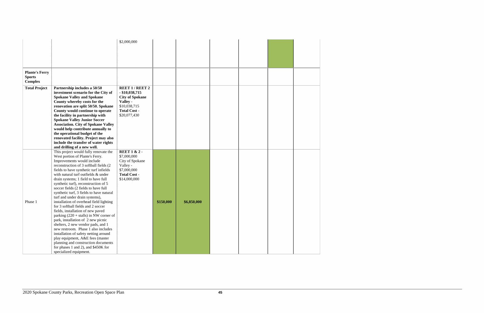
2020 Spokane County Parks, Recreation Open Space Plan 45
$2,000,000
Plante's Ferry Sports Complex
Total Project Partnership includes a 50/50 investment scenario for the City of Spokane Valley and Spokane County whereby costs for the renovation are split 50/50. Spokane County would continue to operate the facility in partnership with Spokane Valley Junior Soccer Association. City of Spokane Valley would help contribute annually to the operational budget of the renovated facility. Project may also include the transfer of water rights and drilling of a new well.
REET 1 / REET 2 - $10,038,715 City of Spokane Valley - $10,038,715 Total Cost - $20,077,430
Phase 1
This project would fully renovate the West portion of Plante's Ferry. Improvements would include reconstruction of 3 softball fields (2 fields to have synthetic turf infields with natural turf outfields & under drain systems; 1 field to have full synthetic turf), reconstruction of 5 soccer fields (2 fields to have full synthetic turf, 3 fields to have natural turf and under drain systems), installation of overhead field lighting for 3 softball fields and 2 soccer fields, installation of new paved parking (220 + stalls) in NW corner of park, installation of 2 new picnic shelters, 2 new vendor pads, and 1 new restroom. Phase 1 also includes installation of safety netting around play equipment, A&E fees (master planning and construction documents for phases 1 and 2), and $450K for specialized equipment.
REET 1 & 2 - $7,000,000 City of Spokane Valley - $7,000,000 Total Cost - $14,000,000
$150,000 $6,850,000
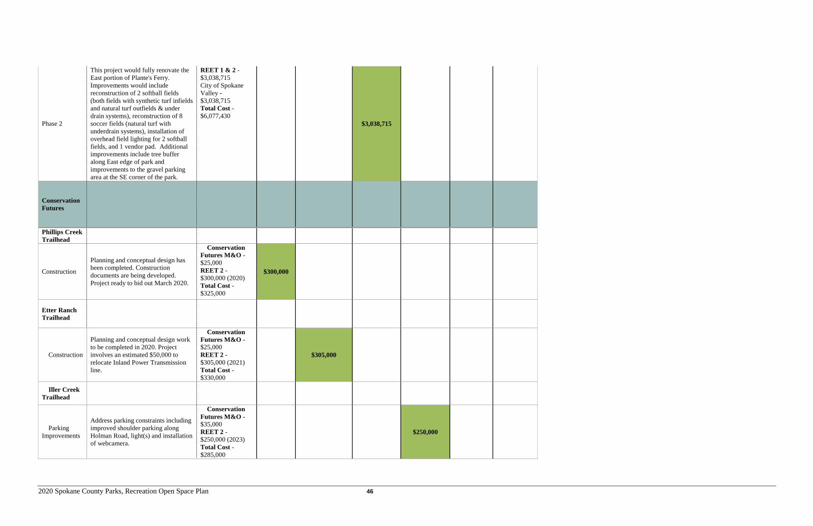
2020 Spokane County Parks, Recreation Open Space Plan 46
Phase 2
This project would fully renovate the East portion of Plante's Ferry. Improvements would include reconstruction of 2 softball fields (both fields with synthetic turf infields and natural turf outfields & under drain systems), reconstruction of 8 soccer fields (natural turf with underdrain systems), installation of overhead field lighting for 2 softball fields, and 1 vendor pad. Additional improvements include tree buffer along East edge of park and improvements to the gravel parking area at the SE corner of the park.
REET 1 & 2 - $3,038,715 City of Spokane Valley - $3,038,715 Total Cost - $6,077,430
$3,038,715
Conservation Futures
Phillips Creek Trailhead
Construction
Planning and conceptual design has been completed. Construction documents are being developed. Project ready to bid out March 2020.
Conservation Futures M&O - $25,000 REET 2 - $300,000 (2020) Total Cost - $325,000
$300,000
Etter Ranch Trailhead
Construction
Planning and conceptual design work to be completed in 2020. Project involves an estimated $50,000 to relocate Inland Power Transmission line.
Conservation Futures M&O - $25,000 REET 2 - $305,000 (2021) Total Cost - $330,000
$305,000
Iller Creek Trailhead
Parking Improvements
Address parking constraints including improved shoulder parking along Holman Road, light(s) and installation of webcamera.
Conservation Futures M&O - $35,000 REET 2 - $250,000 (2023) Total Cost - $285,000
$250,000
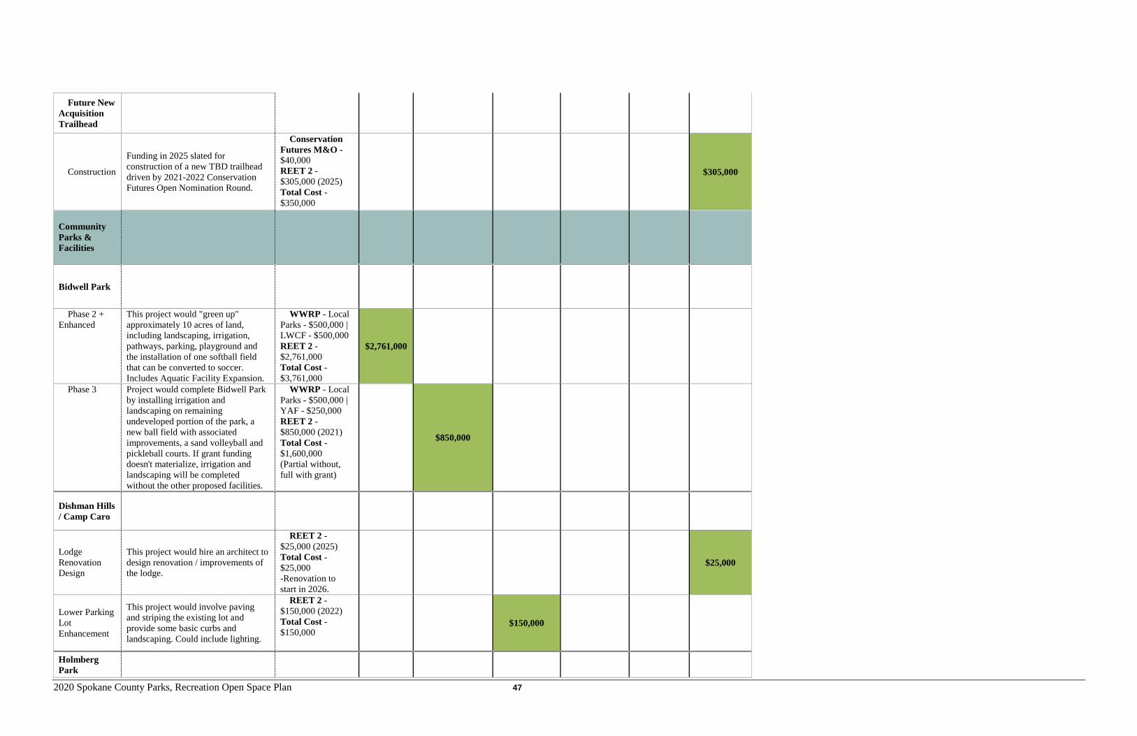
2020 Spokane County Parks, Recreation Open Space Plan 47
Future New Acquisition Trailhead
Construction
Funding in 2025 slated for construction of a new TBD trailhead driven by 2021-2022 Conservation Futures Open Nomination Round.
Conservation Futures M&O - $40,000 REET 2 - $305,000 (2025) Total Cost - $350,000
$305,000
Community Parks & Facilities
Bidwell Park
Phase 2 + Enhanced
This project would "green up" approximately 10 acres of land, including landscaping, irrigation, pathways, parking, playground and the installation of one softball field that can be converted to soccer. Includes Aquatic Facility Expansion.
WWRP - Local Parks - $500,000 | LWCF - $500,000 REET 2 - $2,761,000 Total Cost - $3,761,000
$2,761,000
Phase 3 Project would complete Bidwell Park by installing irrigation and landscaping on remaining undeveloped portion of the park, a new ball field with associated improvements, a sand volleyball and pickleball courts. If grant funding doesn't materialize, irrigation and landscaping will be completed without the other proposed facilities.
WWRP - Local Parks - $500,000 | YAF - $250,000 REET 2 - $850,000 (2021) Total Cost - $1,600,000 (Partial without, full with grant)
$850,000
Dishman Hills / Camp Caro
Lodge Renovation Design
This project would hire an architect to design renovation / improvements of the lodge.
REET 2 - $25,000 (2025) Total Cost - $25,000 -Renovation to start in 2026.
$25,000
Lower Parking Lot Enhancement
This project would involve paving and striping the existing lot and provide some basic curbs and landscaping. Could include lighting.
REET 2 - $150,000 (2022) Total Cost - $150,000
$150,000
Holmberg Park
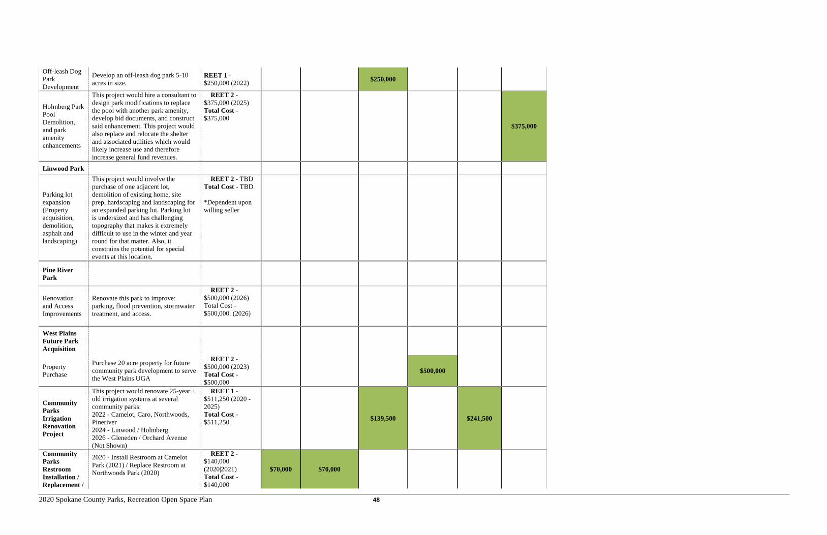
2020 Spokane County Parks, Recreation Open Space Plan 48
Off-leash Dog Park Development
Develop an off-leash dog park 5-10 acres in size.
REET 1 - $250,000 (2022) $250,000
Holmberg Park Pool Demolition, and park amenity enhancements
This project would hire a consultant to design park modifications to replace the pool with another park amenity, develop bid documents, and construct said enhancement. This project would also replace and relocate the shelter and associated utilities which would likely increase use and therefore increase general fund revenues.
REET 2 - $375,000 (2025) Total Cost - $375,000
$375,000
Linwood Park
Parking lot expansion (Property acquisition, demolition, asphalt and landscaping)
This project would involve the purchase of one adjacent lot, demolition of existing home, site prep, hardscaping and landscaping for an expanded parking lot. Parking lot is undersized and has challenging topography that makes it extremely difficult to use in the winter and year round for that matter. Also, it constrains the potential for special events at this location.
REET 2 - TBD Total Cost - TBD *Dependent upon willing seller
Pine River Park
Renovation and Access Improvements
Renovate this park to improve: parking, flood prevention, stormwater treatment, and access.
REET 2 - $500,000 (2026) Total Cost - $500,000. (2026)
West Plains Future Park Acquisition
Property Purchase
Purchase 20 acre property for future community park development to serve the West Plains UGA
REET 2 - $500,000 (2023) Total Cost - $500,000
$500,000
Community Parks Irrigation Renovation Project
This project would renovate 25-year + old irrigation systems at several community parks: 2022 - Camelot, Caro, Northwoods, Pineriver 2024 - Linwood / Holmberg 2026 - Gleneden / Orchard Avenue (Not Shown)
REET 1 - $511,250 (2020 - 2025) Total Cost - $511,250 $139,500 $241,500
Community Parks Restroom Installation / Replacement /
2020 - Install Restroom at Camelot Park (2021) / Replace Restroom at Northwoods Park (2020)
REET 2 - $140,000 (2020|2021) Total Cost - $140,000
$70,000 $70,000
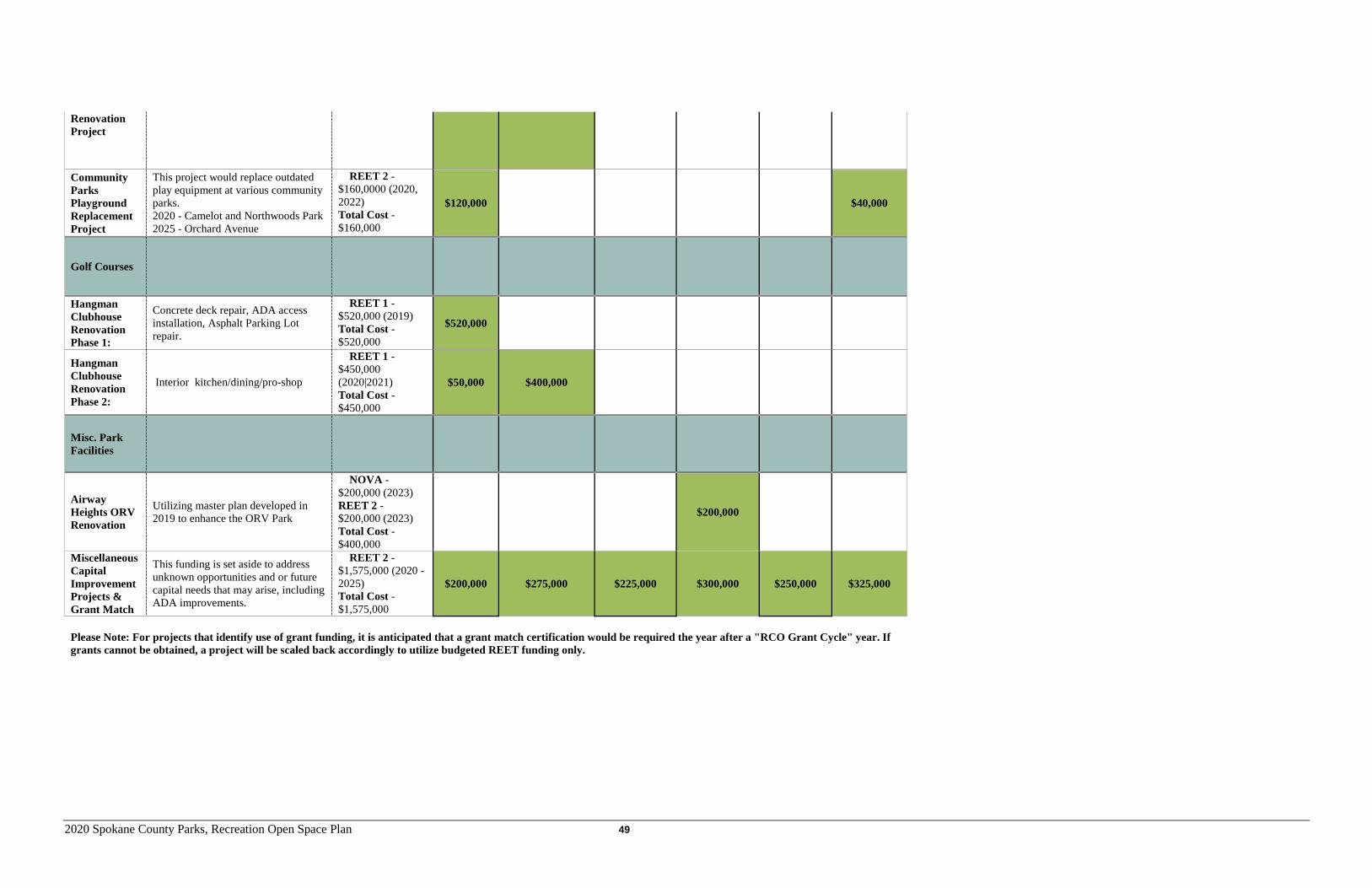
2020 Spokane County Parks, Recreation Open Space Plan 49
Renovation Project
Community Parks Playground Replacement Project
This project would replace outdated play equipment at various community parks. 2020 - Camelot and Northwoods Park 2025 - Orchard Avenue
REET 2 - $160,0000 (2020, 2022) Total Cost - $160,000
$120,000 $40,000
Golf Courses
Hangman Clubhouse Renovation Phase 1:
Concrete deck repair, ADA access installation, Asphalt Parking Lot repair.
REET 1 - $520,000 (2019) Total Cost - $520,000
$520,000
Hangman Clubhouse Renovation Phase 2:
Interior kitchen/dining/pro-shop
REET 1 - $450,000 (2020|2021) Total Cost - $450,000
$50,000 $400,000
Misc. Park Facilities
Airway Heights ORV Renovation
Utilizing master plan developed in 2019 to enhance the ORV Park
NOVA - $200,000 (2023) REET 2 - $200,000 (2023) Total Cost - $400,000
$200,000
Miscellaneous Capital Improvement Projects & Grant Match
This funding is set aside to address unknown opportunities and or future capital needs that may arise, including ADA improvements.
REET 2 - $1,575,000 (2020 - 2025) Total Cost - $1,575,000
$200,000 $275,000 $225,000 $300,000 $250,000 $325,000
Please Note: For projects that identify use of grant funding, it is anticipated that a grant match certification would be required the year after a "RCO Grant Cycle" year. If grants cannot be obtained, a project will be scaled back accordingly to utilize budgeted REET funding only.
Spokane County Parks, Recreation and Open Space Plan 50
CAPITAL PROJECTS & FINANCING PLAN FUNDING SOURCES Washington State does not mandate by law a provision to fund parks and recreation. When County voters have not established park districts with taxing authority, departments rely on annual appropriations from the County General Fund, the real estate excise tax (REET), a Conservation Futures Tax (CFT), and various grant funding sources. Spokane County Parks, Recreation & Golf relies on an assortment of public fund types as well as state and federal grant programs to finance the services that it provides.
The General Fund Spokane County’s park maintenance, operations and staffing needs are primarily funded with the County’s General Fund. The General Fund is supported primarily by property tax and retail sales tax. This funding source reflects current local economic trends, revenues and spending priorities. General Fund allocations are year to year and generally does not allow for parkland acquisitions or capital improvements.
Real Estate Excise Tax (REET) RCW 82.46.010 authorizes all cities and counties to levy a 0.25% real estate excise tax (REET), known as the "first quarter percent" or "REET 1," on all sales of real estate. In addition, RCW 82.46.035 authorizes all cities and counties that are planning under the Growth Management Act (GMA) to levy a second 0.25% real estate excise tax, known as the "second quarter percent" or "REET 2." Both funding sources can be used for park capital improvement project, including park development. Because of its more regulated use, park projects are more likely to be funded through REET 2. In addition to these two options, RCW 82.46.070 allows counties to assess a 1% excise tax on the buyer for acquisition and maintenance of “Conservation areas.” REET 1 and 2 are assessed on the seller. To date, only San Juan County has elected to assess this tax. Enterprise Funds Enterprise funds are services that are financed and operated in a manner similar to private business enterprises. The golf course operations are financed through an enterprise fund. The green fees and concessionaire revenues are used to operate and maintain the facilities. As a result, golf courses are generally self-sufficient and generally do not rely on public tax dollars. Revenue surpluses are reinvested back into the golf course operations. Special Revenue Funds Special revenue funds are legally restricted expenditures for specified purposes. These funds come from a variety of authorized sources. For example, the Recreation Program is significantly funded through the revenue it generates from registration fees. Recreation Fund (122) This fund is dedicated towards the provision of Spokane County’s Recreation Programs. Those program generate revenue for that fund, which in turn is used to provide programs and staffing.
2020 Spokane County Parks, Recreation Open Space Plan 51
Car Rental Tax This funding source comes from a tax on car rentals. More recently, Spokane County’s Recreation Program has relied on a subsidy from the County’s Car Rental Tax to fully fund itself. Conservation Futures Tax The State Legislature’s passage of RCW 84.34.200 (Conservation Futures) enabled counties throughout Washington State to levy a tax of up to 6.25 cents per $1,000 of assessed property valuation to acquire, preserve, and protect open space. The Conservation Futures Program was established and developed to carry out the intent of the enabling legislation – to preserve open space in Spokane County. The Legislative Declaration states the following: “The legislature finds that the haphazard growth and spread of urban development is encroaching upon, or eliminating, numerous open areas and spaces of varied size and character, including many devoted to agriculture, the cultivation of timber, and other productive activities, and many others having significant recreational, social, scenic, or esthetic values. Such areas and spaces, if preserved and maintained in their present open state, would constitute important assets to existing and impending urban and metropolitan development, at the same time that they would continue to contribute to the welfare and well-being of the citizens of the state as a whole. The acquisition of interests or rights in real property for the preservation of such open spaces and areas constitutes a public purpose for which public funds may properly be expended or advanced.” In 1994 the Spokane County Board of County Commissioners established the program for a 3-year term. Spokane County chose to levy a 6.25-cent per $1,000 of property value. In 1997, County residents voted to advise the County Commissioners to approve the tax for a five-year period due to expire December 31, 2002. In November 2002 county residents again voted to approve continuing the Conservation Futures tax for another five-year period. In November 2007, County residents passed an advisory vote to approve continuing the tax indefinitely (no “sunset clause”). The purpose of the program is to acquire various types of open space to be preserved in perpetuity for the benefit of wildlife and recreation in Spokane County. In 2005, the State Legislature authorized 15% of the annual Conservation Futures levy revenue collected to be applied towards the maintenance and improvement of Conservation Futures-acquired properties. In 2017, the Legislature increased that percentage to 25%. Since 1994 more than 9,000 acres of open space have been acquired throughout Spokane County and opened for passive recreation activities such as hiking. The current assessed levy amount is 4.2 cents per $1,000 of property value (2019), which generated $2.02 million dollars for acquisition of open space and maintenance of existing Conservation Futures-acquired properties. Borrowing: Types of Bonds For the purpose of funding capital improvement projects, such as land acquisitions, renovations, expansions or facility construction, counties have the authority to borrow money by selling bonds. There are 3 general types of bonds that may be sold: voter-approved General Obligation bonds, Agency-approved Council manic bonds, and Revenue bonds. Voter-approved General Obligation Bonds can be generated by the County for acquisition and development of parkland. Unlimited General Obligation Bonds may be sold only after receiving 60 percent voter approval at the
2020 Spokane County Parks, Recreation Open Space Plan 52
general election and must have voter turnout of 40 percent of the number of votes in the preceding general election. If approved, an excess property tax is levied each year for the life of the bond to pay both principal and interest. The bonds usually have a maturity period of 15 to 30 years. Agency-approved Council manic bonds may be generated by counties without a public vote. They are paid for through the general fund. Recreation and Conservation Office The Recreation and Conservation Funding Board, which is administered through the Recreation and Conservation Office (RCO), and was formerly named the Interagency Committee for Outdoor Recreation (IAC), combines funds from several federal and state sources to distribute in the form of grants to eligible application sponsors for outdoor recreation and conservation projects. The amount of money available to applicants statewide varies from year to year depending on the Washington State budget. Grants are awarded to state and local agencies through a highly competitive process that often requires local matching funds. County Parks has been successful with past applications and intends on furthering such success for future projects. Other Sources The Spokane Parks Foundation is another source for small (typically $5,000 or less) grants to fund park enhancement projects, including accessibility improvements. Grants are available on an annual basis.
2020 Spokane County Parks, Recreation Open Space Plan 53
CHAPTER 7 – Public Participation INTRODUCTION The public’s involvement is an essential component to the success of any public plan. Spokane County Parks, Recreation & Golf Department strives to meet the needs of Spokane County residents and without such input from the public, those needs can only be guessed at. Public input drives the goals and policies of the Park Plan. It also establishes something more profound – a community vision that emphasizes the need for accessible, well-maintain public spaces, recreational opportunities, and a connected network of trails and open space for the benefit of all Spokane County’s residents – people and wildlife alike. To gather that critical public input, Spokane County Parks pursued several avenues in an attempt to reach a general representation of the public. Those avenues included: an online survey, six advertised public open houses, and stakeholder interviews. Summary of Public Input Many of the comments received expressed many common themes that could be identified and incorporated into the Plan. The main themes distilled from public comments received included the following:
1. Spokane County Parks’ priority should be to continue to acquire and preserve a connected system of open space through the Conservation Futures Program and other means that may be available.
2. Connecting and preserving the Dishman Hills was the number one priority followed by connecting Palisades to Riverside State Park. Generally, all conservation “focus areas” were consistently supported by public input;
3. A majority attendees/ respondents participate in trail-based recreation; 4. Expanding and enhancing trails and particularly regional trails (e.g. Centennial Trail) was seen as a top
priority to below open space preservation. This corresponds to the 2015 Community Priority Survey, where the Centennial Trail was the number one project;
5. Spokane County Parks should maintain and enhance County community parks, but also look to the future to acquire future park sites, especially in the West Plains, while there’s still an opportunity to do so;
6. Restrooms (replacement, enhancement or addition) were consistently the top priority for a specific enhancement to a park, but also nature-play playgrounds and landscape enhancements; and
7. The community strongly supports the development of a master plan for each regional park and the County’s pursuit of enhancements to those facilities as recommended in each specific plan.
8. Accessibility improvements were well supported in all input gathering methods.
Argonne Library Open House
2020 Spokane County Parks, Recreation Open Space Plan 54
PUBLIC INPUT SOURCES Online Survey An online survey was developed by staff and included 16 questions, which on average took nine minutes to complete. . The survey published online on July 23rd, 2019 and closed on August 7th, 2019. Spokane County Parks received 549 responses that generated valuable data for future parks, trails, maintenance and other aspects of Parks operations. The survey questions and the results can be found in Appendix D. Please note: the survey was created by the Parks Department and posted on the website – therefore, it is not considered to be a scientific survey ensuring responses from the broadest spectrum of Spokane County’s residents. In addition to the 2019 online survey, the Park Plan also utilizes and references the 2015 Community Priorities Survey, which is also incorporated into Appendix D. Open Houses Six open houses were conducted in June and July of 2019 with advertising for those events occurring two weeks in advance (See Appendix D for example of advertisement). The six open houses were held at the following locations:
• Deer Park Library – June 25th • Cheney Library – June 26th • North Spokane Library – June 27th • Airway Heights Recreation Center – July 8th • Moran Prairie Library – July 9th • Argonne Library – July 10th
At these open houses, several themed posters were set up to gather public input (votes) on preferences. The themes included: park facilities, park amenities, activities/hobbies, and a “Dream a Park System” mapping exercise. Some of the participants were library patrons, which included a
wide demographic range and a diversity of opinions. Stakeholder Interviews Between January and March, 2019, Spokane County Parks staff conducted interviews with: Airway Heights, Cheney, Liberty Lake, Spokane Valley, Deer Park, Eastern Washington University Outdoors, Inland NW Land Conservancy, REI, Rockford, Visit Spokane and Washington State Parks. Staff also interviewed Spokane County Parks’ Recreation Program staff. A summary of those interviews can be found in Appendix D. CONCLUSION The Park Plan’s public participation events yielded valuable data on local demand for various aspects of parks, recreation, open space, and trails. More importantly, that data revealed strong local trends and specific detail that have been incorporated into the Plan, including how Spokane County Parks should prioritize projects.
Argonne Library Open House
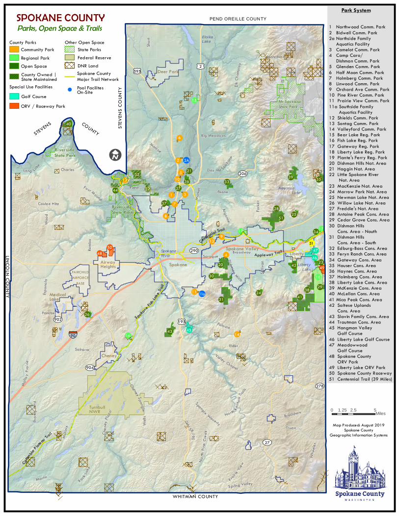
!
!!
!
!
!!
!
!
!
!
!
!!
!
!!! !!
! !!
!
!
!!!
! !
!
!
!
!!
!
!
!!
!
!
!
!
!
!!
!
!
!
!
!
EloikaLake
Newman Lake
SpokaneRiver
LibertyLake
¿À904
¿À902
¿À278
¿À206
¿À290
¿À27
£¤195
£¤2£¤395
§̈¦90
Sprague
Prairie
View
Argonne
Sulliv
an
Espan
ola
Rutter
Truax
Mullin
ix
Coulee Hite
Blanchard
Marke
t
Broadway
Long Lake
ElkC h
a ttaro
y
Spangle Waverly
Monroe
Martin
Che ney Spangle
N orth
Pi ne
C re e
k
Salnave
Di shman Mica
Day Mt Spokan
e
Palouse
Charles
Well
s Ol d
SR195
Spring Valley
Peone
Che n
e yPl a
za
Valley Chapel
FancherW
heele
r
Big Meadows
North Kentu
ckTra
ils
Shor
t
Forke
r
Mal lo
yPra
irie
Elder
Ramb
o
Four Mound
Woo
d
P ine Spring
R ockLak
e
Bradshaw
Betz
Centennial Trail
Spoka
neF ish
Lake Tra
il
Appleway Trail
Colum
biaP late
auTrail
15
179
12
48
2911
40
16
2
14
24
2132
8
395
10 3627
1 322
33
25
73728
19 34
420
31
4543
38
49
4746
26
50
51
35
6
2342
13
18
41
30
44
STEV
ENS C
OUNT
Y
I
PEND OREILLE COUNTY
LINCOLN COUNTY
FAIRCHILDAIRFORCE
BASE
WHITMAN COUNTY
RiversideState Park
RiversideState Park
1 Northwood Comm. Park2 Bidwell Comm. Park2a Northside Family Aquatics Facility3 Camelot Comm. Park4 Camp Caro/ Dishman Comm. Park5 Glenden Comm. Park6 Half Moon Comm. Park7 Holmberg Comm. Park8 Linwood Comm. Park9 Orchard Ave Comm. Park10 Pine River Comm. Park11 Prairie View Comm. Park11a Southside Family Aquatics Facility 12 Shields Comm. Park13 Sontag Comm. Park14 Valleyford Comm. Park15 Bear Lake Reg. Park16 Fish Lake Reg. Park17 Gateway Reg. Park18 Liberty Lake Reg. Park19 Plante's Ferry Reg. Park20 Dishman Hills Nat. Area21 Haggin Nat. Area22 Little Spokane River Nat. Area23 MacKenzie Nat. Area24 Morrow Park Nat. Area25 Newman Lake Nat. Area26 Willow Lake Nat. Area27 Freddie's Nat. Area28 Antoine Peak Cons. Area29 Cedar Grove Cons. Area30 Dishman Hills Cons. Area - Nouth31 Dishman Hills Cons. Area - South32 Edburg-Bass Cons. Area33 Feryn Ranch Cons. Area34 Gateway Cons. Area35 Hauser Cons. Area36 Haynes Cons. Area37 Holmberg Cons. Area38 Liberty Lake Cons. Area39 McKenzie Cons. Area40 McLellan Cons. Area41 Mica Peak Cons. Area42 Saltese Uplands Cons. Area43 Slavin Family Cons. Area44 Trautman Cons. Area45 Hangman Valley Golf Course46 Liberty Lake Golf Course47 Meadowwood Golf Course48 Spokane County ORV Park49 Liberty Lake ORV Park50 Spokane County Raceway51 Centennial Trail (39 Miles)
SPOKANE COUNTYParks, Open Space & Trails
Mt SpokaneState Park
STEVENS COUNTY
Other Open Space
Special Use Facilities
County Parks
Pool FacilitesOn-Site
Community Park
Golf Course
DNR LandFederal ReserveState Parks
Spokane CountyMajor Trail Network
Park System
Map Produced: August 2019Spokane County
Geographic Information Systems
5
52A
511a
County Owned |State Maintained
Open SpaceRegional Park
551
0 2.5 51.25 Miles
ORV / Raceway Park
MedicalLake
AirwayHeights Spokane
Spokane ValleyLibertyLake
Deer Park
Cheney
TurnbullNWR
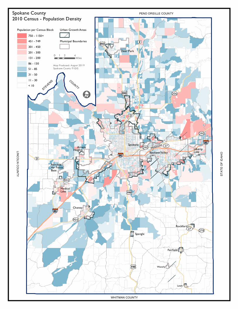
§̈¦90
§̈¦90
§̈¦90
£¤195
£¤395
£¤2
£¤2£¤395
£¤2
£¤195
¿À904
¿À902
¿À278
¿À290
¿À206
¿À27
¿À290 ¿À27
Population per Census Block750 - 1150+451 - 749301 - 450201 - 300131 - 20086 - 13051 - 8531 - 5011 - 30< 10
Urban Growth Areas
Municipal Boundaries
Spokane ValleyLiberty Lake
Millwood AirwayHeightsSpokane
FairchildAir Force Base
Medical Lake
Cheney
Spangle
Rockford
Fairfield
Latah
Waverly
Deer Park
Spokane County2010 Census - Population Density
PEND OREILLE COUNTY
WHITMAN COUNTY
STAT
E OF I
DAHO
LINCOLN COUNTY
STEVENS COUNTY
I
0 2 41 Miles
Map Produced: August 2019Spokane County IT-GIS
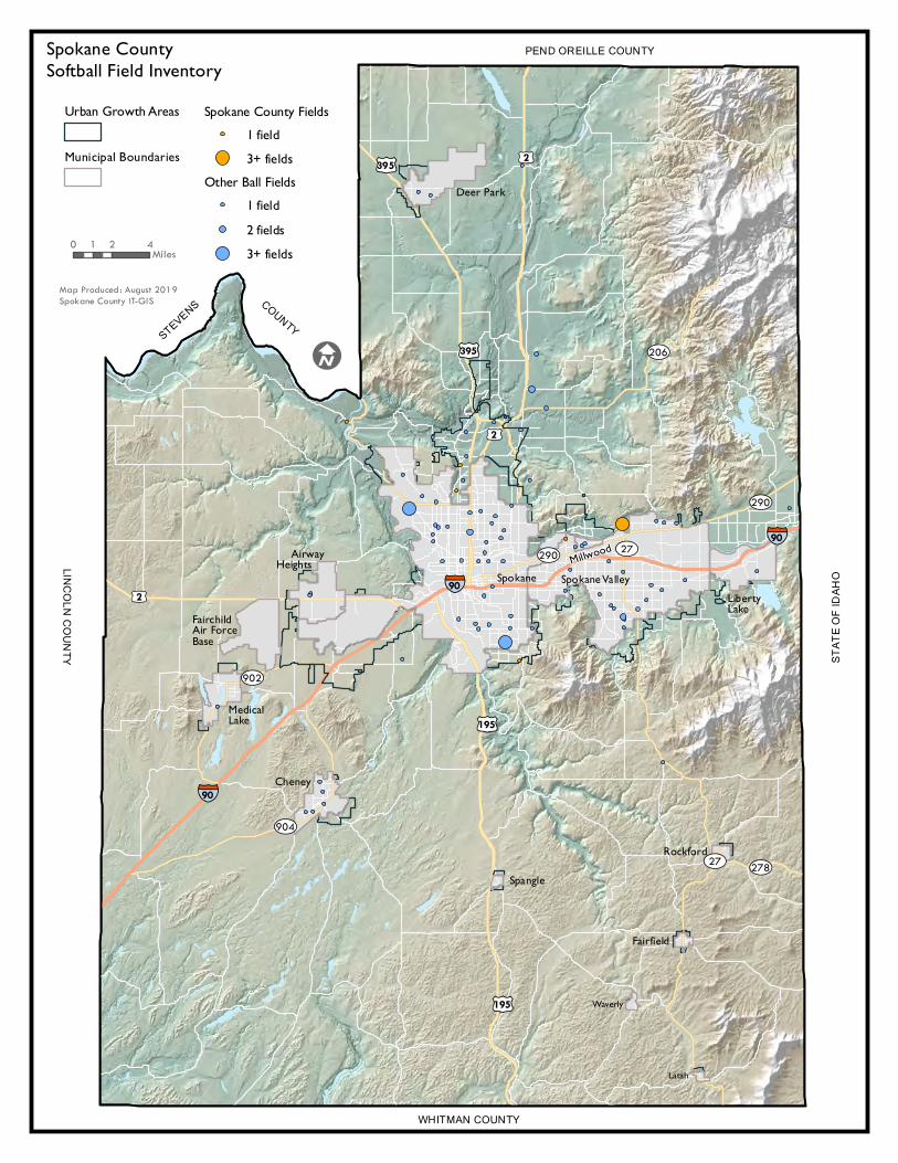
Working DRAFT
§̈¦90
§̈¦90
§̈¦90
£¤195
£¤395
£¤2
£¤2£¤395
£¤2
£¤195
¿À904
¿À902
¿À278
¿À290
¿À206
¿À27
¿À290 ¿À27
Urban Growth Areas
Municipal Boundaries
Spokane County Fields1 field3+ fields
Other Ball Fields1 field2 fields3+ fields
Spokane ValleyLiberty Lake
Millwood AirwayHeightsSpokane
FairchildAir Force Base
Medical Lake
Cheney
Spangle
Rockford
Fairfield
Latah
Waverly
Deer Park
Spokane CountySoftball Field Inventory
PEND OREILLE COUNTY
WHITMAN COUNTY
STAT
E OF I
DAHO
LINCOLN COUNTY
STEVENS COUNTY
I
0 2 41 Miles
Map Produced: August 2019Spokane County IT-GIS
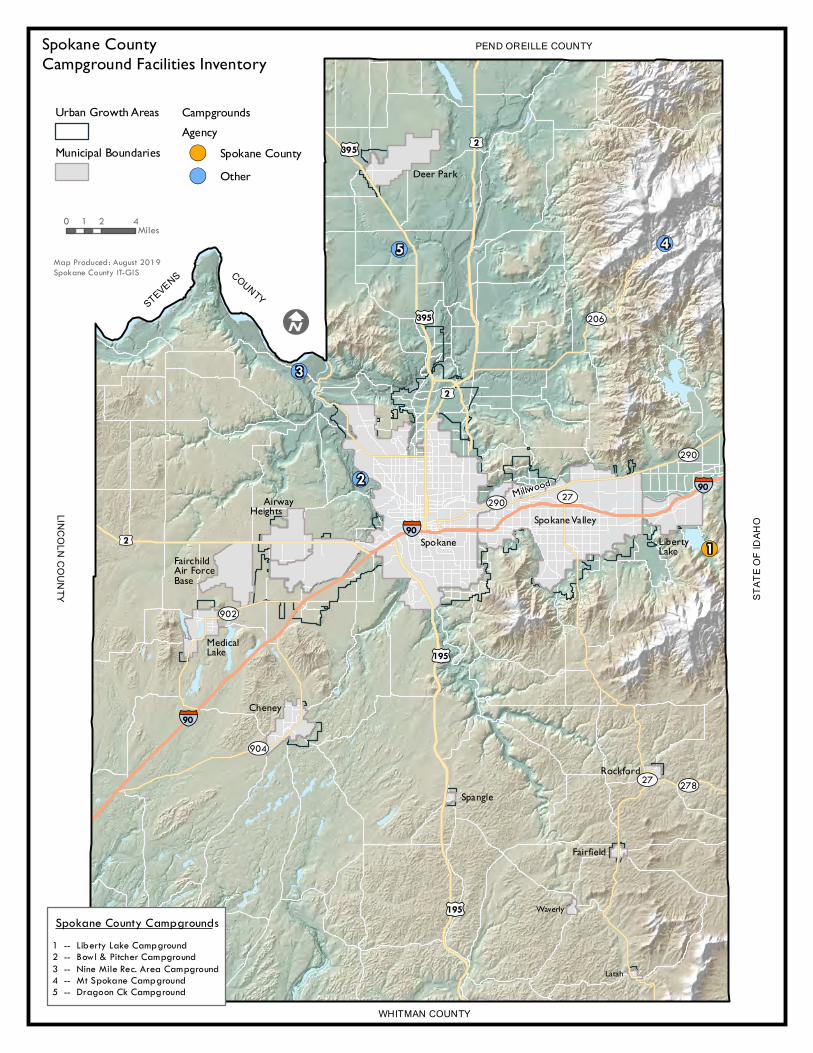
!(
!(
!(
!(!(
§̈¦90
§̈¦90
§̈¦90
£¤195
£¤395
£¤2
£¤2£¤395
£¤2
£¤195
¿À904
¿À902
¿À278
¿À290
¿À206
¿À27
¿À290 ¿À27
1
2
3
45
Urban Growth Areas
Municipal Boundaries
CampgroundsAgency!( Spokane County!( Other
Spokane ValleyLiberty Lake
Millwood AirwayHeights
SpokaneFairchildAir Force Base
Medical Lake
Cheney
Spangle
Rockford
Fairfield
Latah
Waverly
Deer Park
Spokane CountyCampground Facilities Inventory
PEND OREILLE COUNTY
WHITMAN COUNTY
STAT
E OF I
DAHO
LINCOLN COUNTY
STEVENS COUNTY
I
0 2 41 Miles
Map Produced: August 2019Spokane County IT-GIS
1 -- Liberty Lake Campground2 -- Bowl & Pitcher Campground3 -- Nine Mile Rec. Area Campground4 -- Mt Spokane Campground5 -- Dragoon Ck Campground
Spokane County Campgrounds
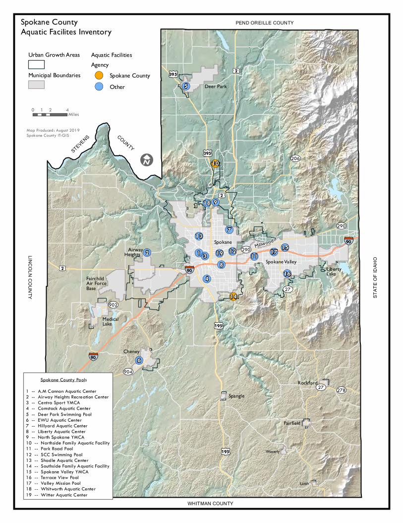
!
!
(
(
!!
!!
!
!!
!
!!
!
!
!
!
!
!
! ((
((
(
((
(
((
(
(
(
(
(
(
(
§̈¦90
§̈¦90
§̈¦90
£¤195
£¤395
£¤2
£¤2£¤395
£¤2
£¤195
¿À904
¿À902
¿À278
¿À290
¿À206
¿À27
¿À290
¿À27
10
14
191
137
48
11
16
173
9
15
6
18
12
5
2
Urban Growth Areas
Municipal Boundaries
Aquatic FacilitiesAgency!( Spokane County!( Other
Spokane ValleyLiberty Lake
Millwood AirwayHeights
Spokane
FairchildAir Force Base
Medical Lake
Cheney
Spangle
Rockford
Fairfield
Latah
Waverly
Deer Park
Spokane CountyAquatic Facilites Inventory
PEND OREILLE COUNTY
WHITMAN COUNTY
STAT
E OF I
DAHO
LINCOLN COUNTY
STEVENS COUNTY
I
0 2 41 Miles
Map Produced: August 2019Spokane County IT-GIS
Spokane County Pools
1 -- A.M Cannon Aquatic Center2 -- Airway Heights Recreation Center3 -- Centra Sport YMCA4 -- Comstock Aquatic Center5 -- Deer Park Swimming Pool6 -- EWU Aquatic Center7 -- Hillyard Aquatic Center8 -- Liberty Aquatic Center9 -- North Spokane YMCA10 -- Northside Family Aquatic Facility11 -- Park Road Pool12 -- SCC Swimming Pool13 -- Shadle Aquatic Center14 -- Southside Family Aquatic Facility15 -- Spokane Valley YMCA16 -- Terrace View Pool17 -- Valley Mission Pool18 -- Whitworth Aquatic Center19 -- Witter Aquatic Center
Spokane County Community Parks
Level of Service Analysis 2019*
Spokane County Parks, Recreation and Golf Plan M6
*Note: The following pages have been updated from the 2013 version to reflect 10.3 acres of additional developed community parkland at Prairie View Park that was added since this analysis was completed. However, the spatial analysis has not been updated as part of the 2020 Park Plan due to the pending 2020 Census and the subsequent lack of new census tract population data since the last analysis was completed.
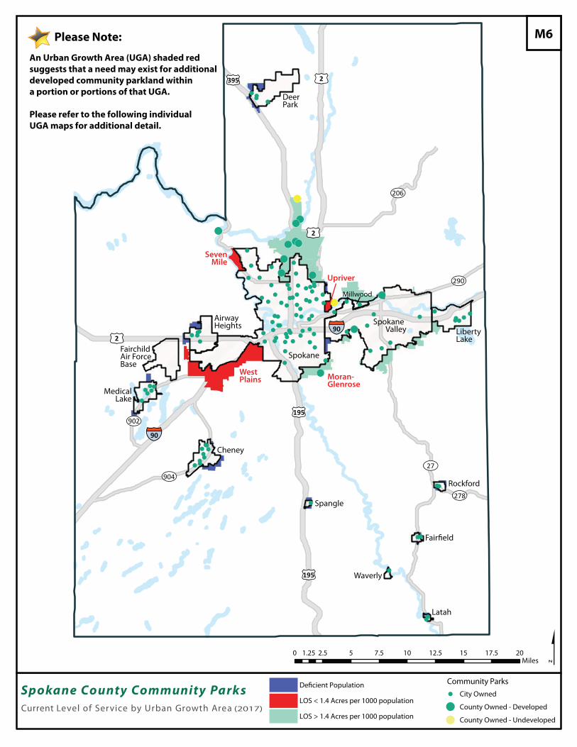
!!(
!(
!(
!(
!(!(
!(!( !(
!(
!(
!(
!(
!
!!
!!!
!
!
!
!!
!! !
! ! !! !!
!!!
!!
!!
!!!
!
!!
!
!
!!
!!
!
!
!
!!!
!!
!
!
!!
! !!
!!
!
!!!
!!! !
!
!
!
!
!
!
!!
!
!!
!
!!
!
!!!
!!
!!!!
!
!!!
!!!
!!
!
!
!!
!!
!
!
!
!
!(
¿À904
¿À902
¿À278
¿À290
¿À206
¿À27
£¤195
£¤2
£¤2£¤395
£¤2
£¤195
§̈¦90
§̈¦90
$0 2.5 5 7.5 10 12.5 15 17.5 201.25Miles
Spokane County Community ParksCurrent Level of Service by Urban Growth Area (2017)
! City Owned
!
! County Owned - Developed
County Owned - Undeveloped
Community Parks
LOS < 1.4 Acres per 1000 population
LOS > 1.4 Acres per 1000 population
Deer Park
Spokane
Spokane Valley Liberty
Lake
AirwayHeights
FairchildAir ForceBase
MedicalLake
Cheney
Spangle
Rockford
Waverly
Latah
West Plains Moran-
Glenrose
Millwood
SevenMile
Upriver
M6
An Urban Growth Area (UGA) shaded red suggests that a need may exist for additional developed community parkland within a portion or portions of that UGA.
Please refer to the following individual UGA maps for additional detail.
Please Note:
De�cient Population
!
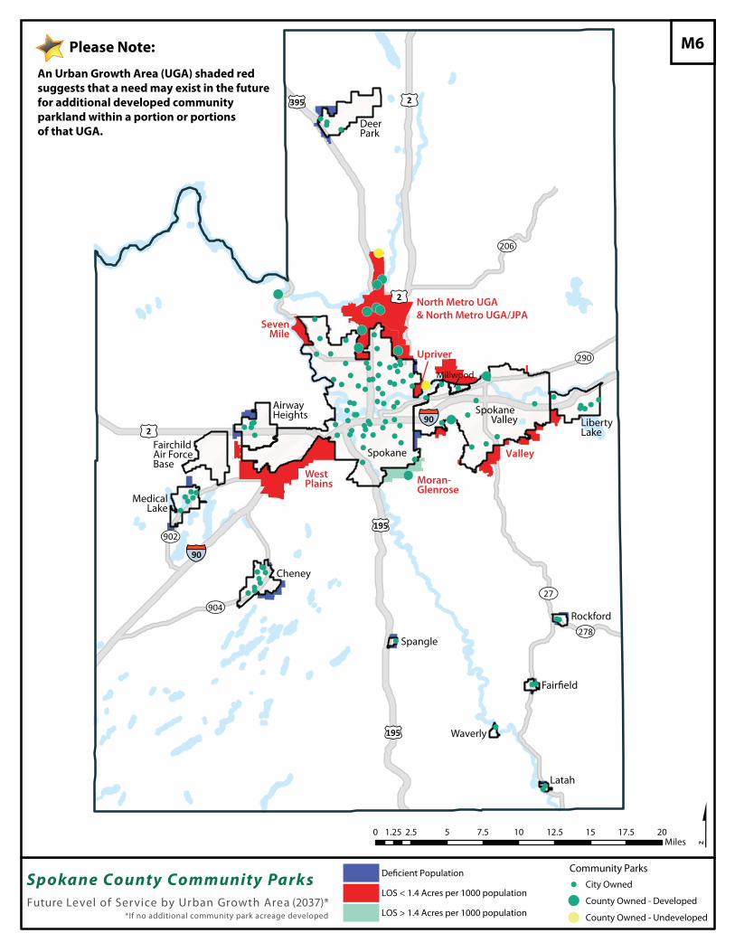
!!(
!(
!(
!(
!(!(
!(!( !(
!(
!(
!(
!(
!
!!
!!!
!
!
!
!!
!! !
! ! !! !!
!!!
!!
!!
!!!
!
!!
!
!
!!
!!
!
!
!
!!!
!!
!
!
!!
! !!
!!
!
!!!
!!! !
!
!
!
!
!
!
!!
!
!!
!
!!
!
!!!
!!
!!!!
!
!!!
!!!
!!
!
!
!!
!!
!
!
!
!
!(!
¿À904
¿À902
¿À278
¿À290
¿À206
¿À27
£¤195
£¤2
£¤2£¤395
£¤2
£¤195
§̈¦90
§̈¦90
$0 2.5 5 7.5 10 12.5 15 17.5 201.25Miles
Deer Park
Spokane
Spokane Valley Liberty
Lake
AirwayHeights
FairchildAir ForceBase
MedicalLake
Cheney
Spangle
Rockford
Waverly
Latah
West Plains Moran-
Glenrose
Millwood
SevenMile
Upriver
North Metro UGA& North Metro UGA/JPA
Valley
Future Level of Service by Urban Growth Area (2037)**If no additional community park acreage developed
M6
An Urban Growth Area (UGA) shaded red suggests that a need may exist in the futurefor additional developed community parkland within a portion or portions of that UGA.
Please Note:
Spokane County Community Parks ! City Owned
!
! County Owned - Developed
County Owned - Undeveloped
Community Parks
LOS < 1.4 Acres per 1000 population
LOS > 1.4 Acres per 1000 population
De�cient Population
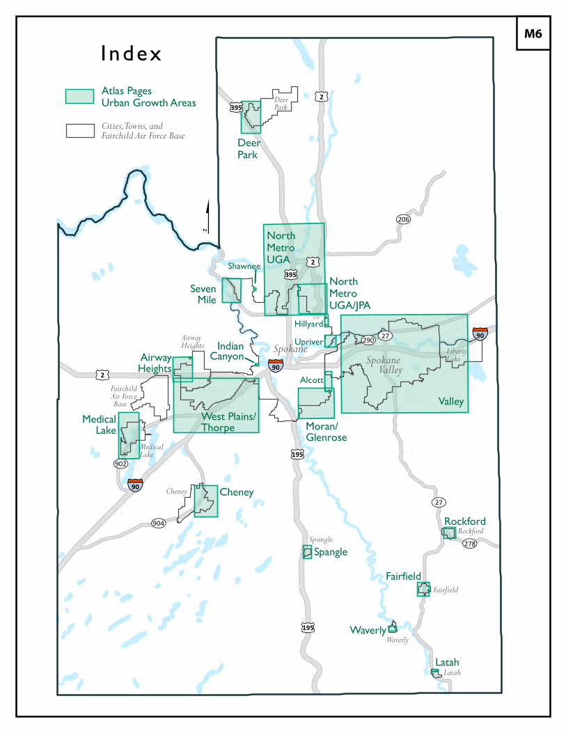
§̈¦90
§̈¦90
§̈¦90
£¤195
£¤395£¤2
£¤2£¤395
£¤2
£¤195
¿À904
¿À902
¿À278
¿À206
¿À290
¿À27
¿À27
NorthMetroUGA
NorthMetroUGA/JPA
DeerPark
ValleyMoran/Glenrose
West Plains/Thorpe
SevenMile
Shawnee
AirwayHeights
MedicalLake
Cheney
IndianCanyonAlcott
UpriverHillyard
Spangle
Rockford
Fairfield
Waverly
Latah
DeerPark
Spokane SpokaneValleyLibertyLake
AirwayHeights
FairchildAir ForceBase
MedicalLake
Cheney
Spangle
Waverly
Rockford
Fairfield
Latah
I ndexAtlas PagesUrban Growth AreasCities, Towns, andFairchild Air Force Base
$
M6
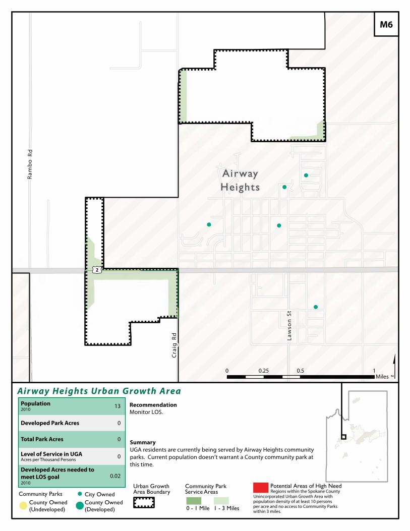
!
!
!
!
!
£¤2
AirwayHeights
Air way Heights Urban Growth Area
$Recommendation
Community Parks ! City OwnedCounty Owned(Undeveloped)!( !(
County Owned(Developed)
Urban Growth Area Boundary
Community Park Service Areas
1 - 3 Miles0 - 1 Mile
Summary
M6
Potential Areas of High Need
Developed Park Acres
Total Park Acres
Population2010
Level of Service in UGAAcres per Thousand Persons
Developed Acres needed to
meet LOS goal2010
13
0
0
0
0.02
UGA residents are currently being served by Airway Heights communityparks. Current population doesn’t warrant a County community park atthis time.
Monitor LOS.
Regions within the Spokane CountyUnincorporated Urban Growth Area withpopulation density of at least 10 personsper acre and no access to Community Parkswithin 3 miles.
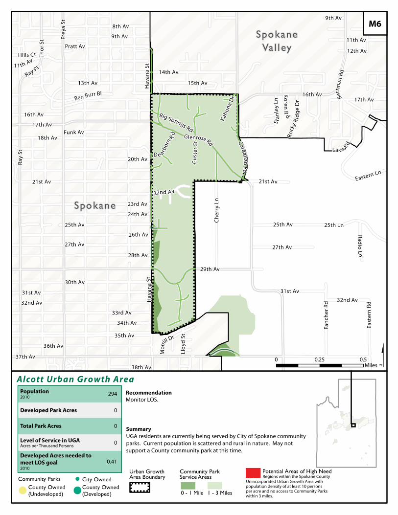
Eastern Ln
Ray
St
28th Av
Hav
ana
St
21st Av
37th Av
Thor
St
16th Av
21st Av
Big Springs Rd
15th Av
Frey
a St
12th Av
22nd Av
Fanc
her R
d
Llo y
d St
Hills C t
Ray Pl11 th Av
Bett
man
Rd
D e arbor
n Rd
Mor
rill Dr
9th Av
Rock
y R i
dge
Dr
East
ern
Rd
8th Av
17th Av
18th Av Carnaha n Rd
9th Av
27th Av
25th Av
30th Av
34th Av
31st Av
36th Av
32nd Av
Glenrose Rd
Funk Av
35th Av
11th Av
26th Av
20th Av
33rd Av
23rd Av
24th Av
38th Av
14th Av
Pratt Av
Hav
ana
St
Kahu
na D
r
13th Av
Stan
ley
Ln
Cus t
e r St
Lak e Rd
Ben Burr Bl Koren
Rd
25th Ln
29th Av
Radio Ln
32nd Av
17th Av
16th Av
31st Av
27th Av
25th AvC
herr
y Ln
SpokaneVal ley
Spokane
Alcott Urban Growth Area
$Recommendation
0 0.50.25Miles
Community Parks ! City OwnedCounty Owned(Undeveloped)!( !(
County Owned(Developed)
Urban Growth Area Boundary
Community Park Service Areas
1 - 3 Miles0 - 1 Mile
Summary
M6
Potential Areas of High Need
Developed Park Acres
Total Park Acres
Population2010
Level of Service in UGAAcres per Thousand Persons
Developed Acres needed to
meet LOS goal2010
294
0
0
0
0.41
UGA residents are currently being served by City of Spokane communityparks. Current population is scattered and rural in nature. May not support a County community park at this time.
Monitor LOS.
Regions within the Spokane CountyUnincorporated Urban Growth Area withpopulation density of at least 10 personsper acre and no access to Community Parkswithin 3 miles.
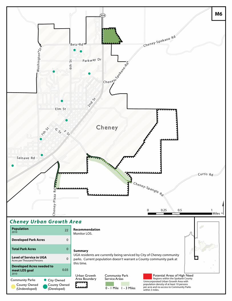
!
!
!
!
!
!
!
!
!
¿À904
Cheney
Cheney Urban Growth Area
$Recommendation
Community Parks ! City OwnedCounty Owned(Undeveloped)!( !(
County Owned(Developed)
Urban Growth Area Boundary
Community Park Service Areas
1 - 3 Miles0 - 1 Mile
Summary
M6
Potential Areas of High Need
Developed Park Acres
Total Park Acres
Population2010
Level of Service in UGAAcres per Thousand Persons
Developed Acres needed to
meet LOS goal2010
22
0
0
0
0.03
UGA residents are currently being serviced by City of Cheney communityparks. Current population doesn’t warrant a County community park atthis time.
Monitor LOS.
Regions within the Spokane CountyUnincorporated Urban Growth Area withpopulation density of at least 10 personsper acre and no access to Community Parkswithin 3 miles.
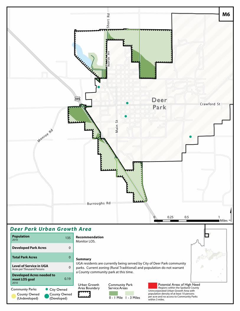
!
!
!
!
£¤395
No
rth
Av
Mai
n St
Crawford St
Burroughs Rd
Sho
r t R
d
M
onroe Rd
DeerPark
Deer Park Urban Growth Area
$Recommendation
0 0.5 10.25Miles
Community Parks ! City OwnedCounty Owned(Undeveloped)!( !(
County Owned(Developed)
Urban Growth Area Boundary
Community Park Service Areas
1 - 3 Miles0 - 1 Mile
Summary
M6
Potential Areas of High Need
Developed Park Acres
Total Park Acres
Population2010
Level of Service in UGAAcres per Thousand Persons
Developed Acres needed to
meet LOS goal2010
135
0
0
0
0.19
UGA residents are currently being served by City of Deer Park communityparks. Current zoning (Rural Traditional) and population do not warranta County community park at this time.
Monitor LOS.
Regions within the Spokane CountyUnincorporated Urban Growth Area withpopulation density of at least 10 personsper acre and no access to Community Parkswithin 3 miles.
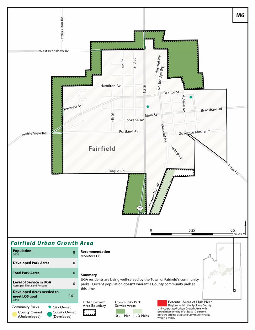
!
!
¿À27
Fa ir f ie ld
Fair field Urban Growth Area
$Recommendation
Community Parks ! City OwnedCounty Owned(Undeveloped)!( !(
County Owned(Developed)
Urban Growth Area Boundary
Community Park Service Areas
1 - 3 Miles0 - 1 Mile
Summary
M6
Potential Areas of High Need
Developed Park Acres
Total Park Acres
Population2010
Level of Service in UGAAcres per Thousand Persons
Developed Acres needed to
meet LOS goal2010
8
0
0
0
0.01
UGA residents are being well-served by the Town of Fairfield’s community
parks. Current population doesn’t warrant a County community park at
this time.
Monitor LOS.
Regions within the Spokane CountyUnincorporated Urban Growth Area withpopulation density of at least 10 personsper acre and no access to Community Parkswithin 3 miles.
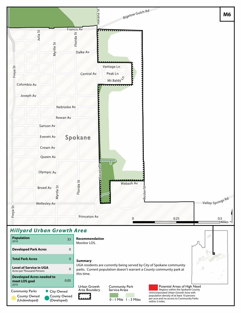
!
Spokane
Hillyard Urban Growth Area
$Recommendation
Community Parks ! City OwnedCounty Owned(Undeveloped)!( !(
County Owned(Developed)
Urban Growth Area Boundary
Community Park Service Areas
1 - 3 Miles0 - 1 Mile
Summary
M6
Potential Areas of High Need
Developed Park Acres
Total Park Acres
Population2010
Level of Service in UGAAcres per Thousand Persons
Developed Acres needed to
meet LOS goal2010
33
0
0
0
0.05
UGA residents are currently being served by City of Spokane communityparks. Current population doesn’t warrant a County community park atthis time.
Monitor LOS.
Regions within the Spokane CountyUnincorporated Urban Growth Area withpopulation density of at least 10 personsper acre and no access to Community Parkswithin 3 miles.
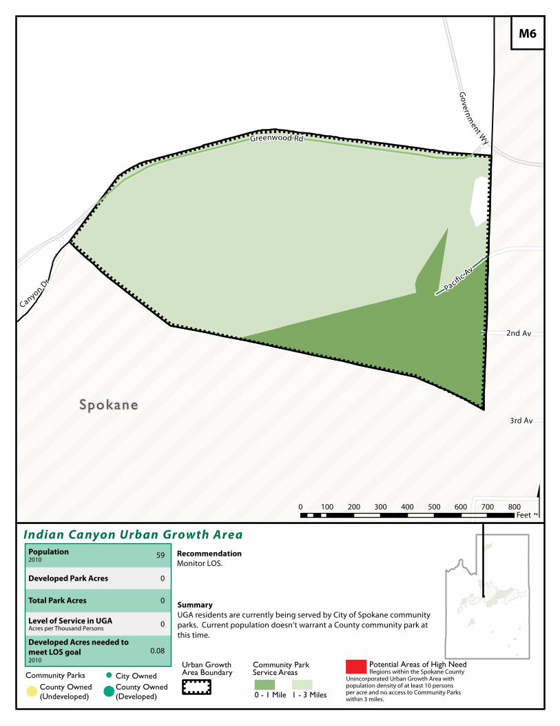
Spokane
Indian Ca nyon Urban Growth Area
$Recommendation
Community Parks ! City OwnedCounty Owned(Undeveloped)!( !(
County Owned(Developed)
Urban Growth Area Boundary
Community Park Service Areas
1 - 3 Miles0 - 1 Mile
Summary
M6
Potential Areas of High Need
Developed Park Acres
Total Park Acres
Population2010
Level of Service in UGAAcres per Thousand Persons
Developed Acres needed to
meet LOS goal2010
59
0
0
0
0.08
UGA residents are currently being served by City of Spokane communityparks. Current population doesn’t warrant a County community park atthis time.
Monitor LOS.
Regions within the Spokane CountyUnincorporated Urban Growth Area withpopulation density of at least 10 personsper acre and no access to Community Parkswithin 3 miles.
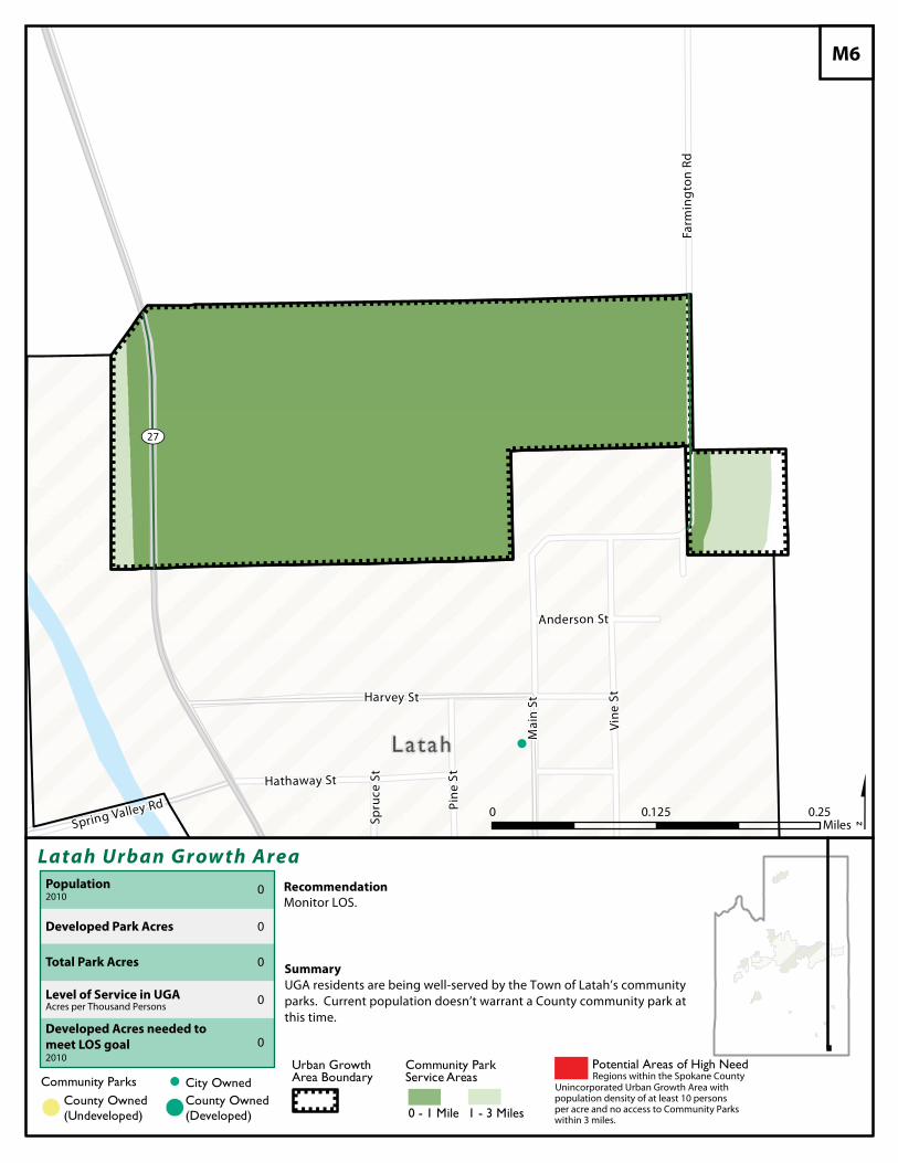
!
¿À27
Latah
Latah Urban Grow th Area
$Recommendation
Community Parks ! City OwnedCounty Owned(Undeveloped)!( !(
County Owned(Developed)
Urban Growth Area Boundary
Community Park Service Areas
1 - 3 Miles0 - 1 Mile
Summary
M6
Potential Areas of High Need
Developed Park Acres
Total Park Acres
Population2010
Level of Service in UGAAcres per Thousand Persons
Developed Acres needed to
meet LOS goal2010
0
0
0
0
0
UGA residents are being well-served by the Town of Latah’s communityparks. Current population doesn’t warrant a County community park atthis time.
Monitor LOS.
Regions within the Spokane CountyUnincorporated Urban Growth Area withpopulation density of at least 10 personsper acre and no access to Community Parkswithin 3 miles.
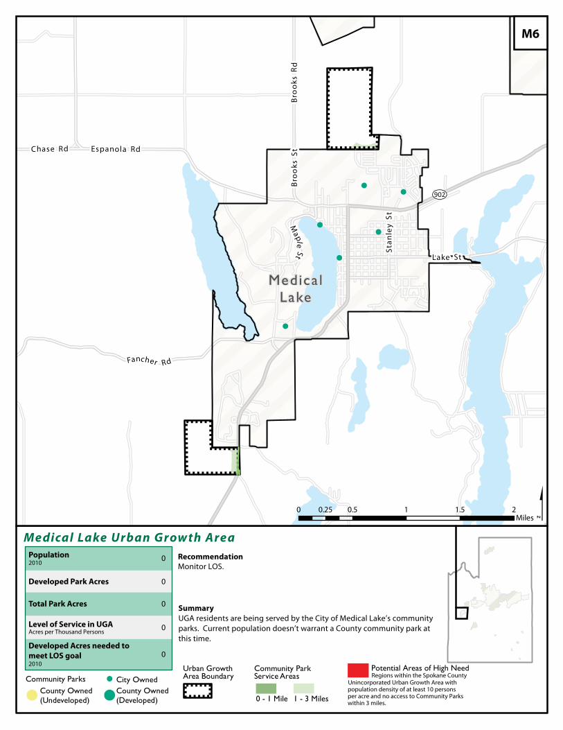
!
!!
!
!
!
¿À902
Medica lLake
Medical Lake Urban Grow th Area
$Recommendation
Community Parks ! City OwnedCounty Owned(Undeveloped)!( !(
County Owned(Developed)
Urban Growth Area Boundary
Community Park Service Areas
1 - 3 Miles0 - 1 Mile
Summary
M6
Potential Areas of High Need
Developed Park Acres
Total Park Acres
Population2010
Level of Service in UGAAcres per Thousand Persons
Developed Acres needed to
meet LOS goal2010
0
0
0
0
0
UGA residents are being served by the City of Medical Lake’s communityparks. Current population doesn’t warrant a County community park atthis time.
Monitor LOS.
Regions within the Spokane CountyUnincorporated Urban Growth Area withpopulation density of at least 10 personsper acre and no access to Community Parkswithin 3 miles.
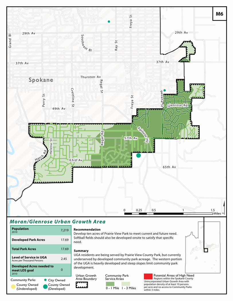
!(
!
!
49th Av
Havana
St
Ray
S t
37th Av
Frey
a St
57th Av
Thurston Av
Gra
nd
Bl
Cr est li n
e St
Hatc h
Rd
29th Av
Reg
a lS t
65th Av
63rd Av
37th Av
Perr
y S
t
S ou
the
a s t B l
Reg
a lR
dGlenrose Rd
Frey
a St
Hel
e na
St
Pa louse H
y
29th Av
Spokane
Moran/Glen rose Urban Growth Area
$Recommendation
0 0.5 1 1.50.25Miles
Community Parks ! City OwnedCounty Owned(Undeveloped)!( !(
County Owned(Developed)
Urban Growth Area Boundary
Community Park Service Areas
1 - 3 Miles0 - 1 Mile
Summary
M6
Potential Areas of High Need
Developed Park Acres
Total Park Acres
Population2010
Level of Service in UGAAcres per Thousand Persons
Developed Acres needed to meet LOS goal2010
7,219
17.69
17.69
2.45
0
UGA residents are being served by Prairie View County Park, but currentlyunderserved by developed community park acreage. The western portionof the UGA is heavily developed and steep slopes limit community parkdevelopment.
Develop ten acres of Prairie View Park to meet current and future need.
need.
Regions within the Spokane CountyUnincorporated Urban Growth Area withpopulation density of at least 10 personsper acre and no access to Community Parkswithin 3 miles.
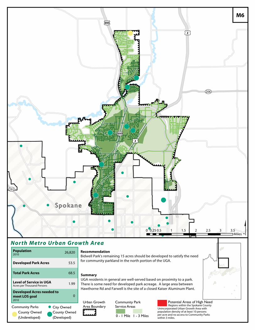
!(
!(
!(
!(!( !(
!(
!(
!
!
!
!
!
! !
! ! !
! !!
!
!
!
!(
¿À206
¿À291
£¤395
£¤2
£¤395
£¤2
Spokane
Nor th Metro Urban Growth Area
$Recommendation
Potential Areas of High Need
Developed Park Acres
Total Park Acres
Population2010
Level of Service in UGAAcres per Thousand Persons
Developed Acres needed to
meet LOS goal2010
26,820
53.5
68.5
1.99
0
UGA residents in general are well-served based on proximity to a park.There is some need for developed park acreage. A large area between Hawthorne Rd and Farwell is the site of a closed Kaiser Aluminum Plant.
Bidwell Park’s remaining 15 acres should be developed to satisfy the needfor community parkland in the north portion of the UGA.
Regions within the Spokane CountyUnincorporated Urban Growth Area withpopulation density of at least 10 personsper acre and no access to Community Parkswithin 3 miles.
0 0.5 1 1.5 2 2.5 3 3.50.25Miles
Community Parks ! City OwnedCounty Owned(Undeveloped)!( !(
County Owned(Developed)
Urban Growth Area Boundary
Community Park Service Areas
1 - 3 Miles0 - 1 Mile
Summary
M6
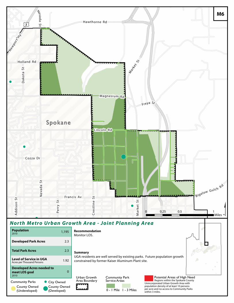
!(
!
!
!
!
£¤2
Ad
dis
on
St
Perr
y St
Freya St
New
por t H
y
Cre
stli
ne
S t
Dak
ota
St
Ma r
k et
St
Nevada
St
Cozza Dr
Nev
ada
St
Francis Av
Holland Rd
Mark
et St
B igelow Gulch Rd
Magnesium Rd
Lincoln Rd
Hawthorne Rd
Spokane
Nor th Metro Urban Growth Area - Joint Plann ing Area
$Recommendation
0 0.5 10.25Miles
Community Parks ! City OwnedCounty Owned(Undeveloped)!( !(
County Owned(Developed)
Urban Growth Area Boundary
Community Park Service Areas
1 - 3 Miles0 - 1 Mile
Summary
M6
Potential Areas of High Need
Developed Park Acres
Total Park Acres
Population2010
Level of Service in UGAAcres per Thousand Persons
Developed Acres needed to
meet LOS goal2010
1,195
2.3
2.3
1.92
0
UGA residents are well served by existing parks. Future population growthconstrained by former Kaiser Aluminum Plant site.
Monitor LOS.
Regions within the Spokane CountyUnincorporated Urban Growth Area withpopulation density of at least 10 personsper acre and no access to Community Parkswithin 3 miles.
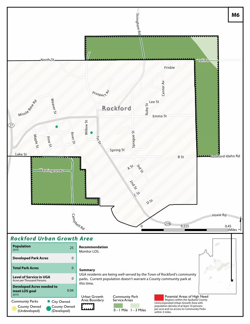
!
!
¿À27
¿À278
Rockford
Ro ckford Urb an Grow th Area
$Recommendation
Community Parks ! City OwnedCounty Owned(Undeveloped)!( !(
County Owned(Developed)
Urban Growth Area Boundary
Community Park Service Areas
1 - 3 Miles0 - 1 Mile
Summary
M6
Potential Areas of High Need
Developed Park Acres
Total Park Acres
Population2010
Level of Service in UGAAcres per Thousand Persons
Developed Acres needed to
meet LOS goal2010
25
0
0
0
0.04
UGA residents are being well-served by the Town of Rockford’s communityparks. Current population doesn’t warrant a County community park at this time.
Monitor LOS.
Regions within the Spokane CountyUnincorporated Urban Growth Area withpopulation density of at least 10 personsper acre and no access to Community Parkswithin 3 miles.
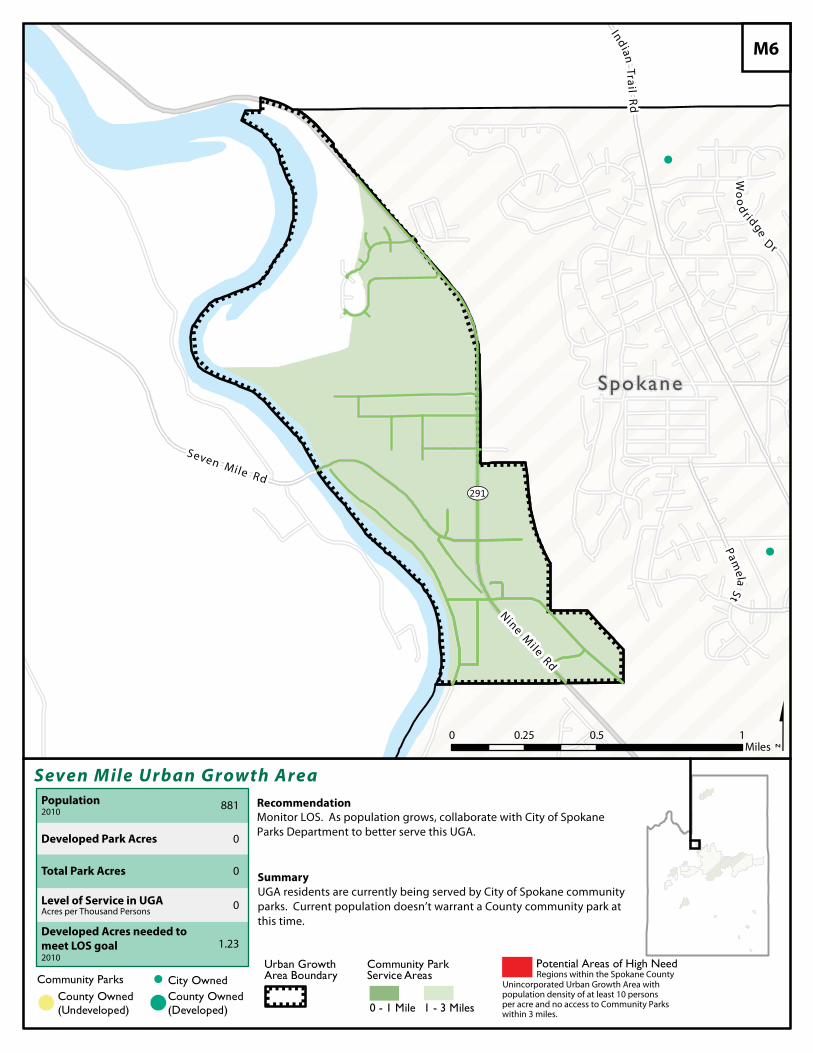
!
!
¿À291
Spokane
Seven M ile Urban Growth Area
$Recommendation
Community Parks ! City OwnedCounty Owned(Undeveloped)!( !(
County Owned(Developed)
Urban Growth Area Boundary
Community Park Service Areas
1 - 3 Miles0 - 1 Mile
Summary
M6
Potential Areas of High Need
Developed Park Acres
Total Park Acres
Population2010
Level of Service in UGAAcres per Thousand Persons
Developed Acres needed to
meet LOS goal2010
881
0
0
0
1.23
UGA residents are currently being served by City of Spokane communityparks. Current population doesn’t warrant a County community park atthis time.
Monitor LOS. As population grows, collaborate with City of SpokaneParks Department to better serve this UGA.
Regions within the Spokane CountyUnincorporated Urban Growth Area withpopulation density of at least 10 personsper acre and no access to Community Parkswithin 3 miles.
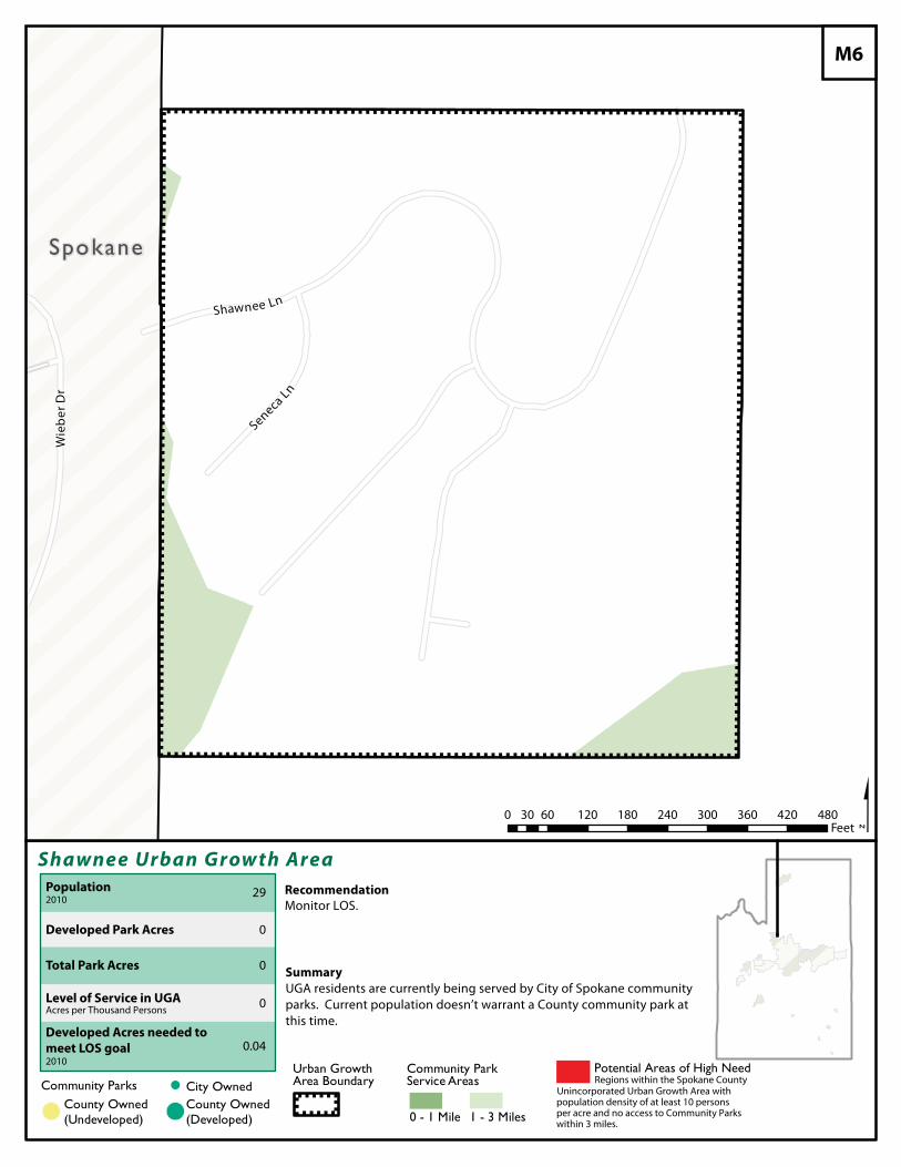
Spokane
Shawnee Urban Grow th Area
$Recommendation
Community Parks ! City OwnedCounty Owned(Undeveloped)!( !(
County Owned(Developed)
Urban Growth Area Boundary
Community Park Service Areas
1 - 3 Miles0 - 1 Mile
Summary
M6
Potential Areas of High Need
Developed Park Acres
Total Park Acres
Population2010
Level of Service in UGAAcres per Thousand Persons
Developed Acres needed to
meet LOS goal2010
29
0
0
0
0.04
UGA residents are currently being served by City of Spokane communityparks. Current population doesn’t warrant a County community park atthis time.
Monitor LOS.
Regions within the Spokane CountyUnincorporated Urban Growth Area withpopulation density of at least 10 personsper acre and no access to Community Parkswithin 3 miles.
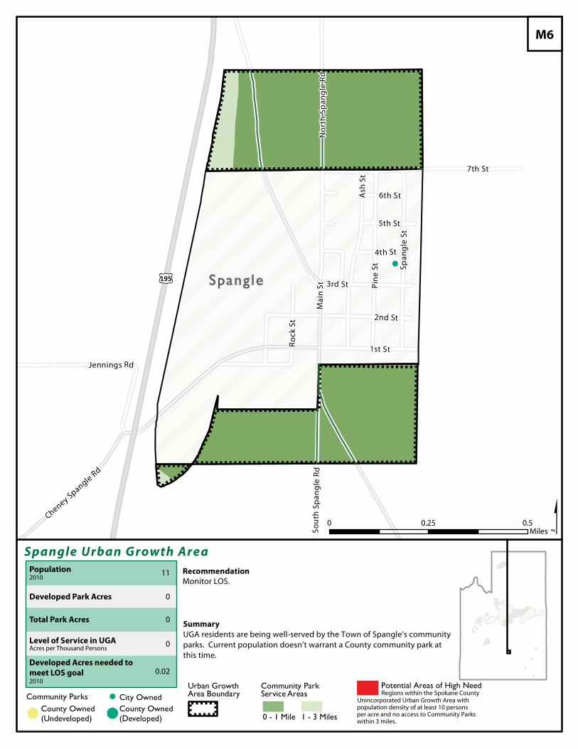
!
£¤195 Spang le
Spangle Urban Growth Area
$Recommendation
Community Parks ! City OwnedCounty Owned(Undeveloped)!( !(
County Owned(Developed)
Urban Growth Area Boundary
Community Park Service Areas
1 - 3 Miles0 - 1 Mile
Summary
M6
Potential Areas of High Need
Developed Park Acres
Total Park Acres
Population2010
Level of Service in UGAAcres per Thousand Persons
Developed Acres needed to
meet LOS goal2010
11
0
0
0
0.02
UGA residents are being well-served by the Town of Spangle’s communityparks. Current population doesn’t warrant a County community park atthis time.
Monitor LOS.
Regions within the Spokane CountyUnincorporated Urban Growth Area withpopulation density of at least 10 personsper acre and no access to Community Parkswithin 3 miles.
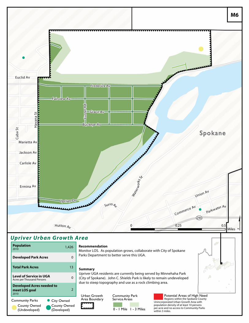
!
!
!(
Wat
erw
orks
St
Hav
ana
St
Cub
a St
Buckeye Av
Cust
er Rd
Parkwater Av
Euclid Av
Hutton Av
Marietta Av
Jackson Av
Ermina Av
Carlisle Av
Union Av
Fairview Av
Grace Av
Commerce Av
Frederick Av
Surro Av
Upriver Dr
¿À290
Spokane
Upriver Urb an Grow th Area
$Recommendation
0 0.50.25Miles
Community Parks ! City OwnedCounty Owned(Undeveloped)!( !(
County Owned(Developed)
Urban Growth Area Boundary
Community Park Service Areas
1 - 3 Miles0 - 1 Mile
Summary
M6
Potential Areas of High Need
Developed Park Acres
Total Park Acres
Population2010
Level of Service in UGAAcres per Thousand Persons
Developed Acres needed to
meet LOS goal2010
1,426
0
13
0
2
Upriver UGA residents are currently being served by Minnehaha Park (City of Spokane). John C. Shields Park is likely to remain undeveloped due to steep topography and use as a rock climbing area.
Monitor LOS. As population grows, collaborate with City of SpokaneParks Department to better serve this UGA.
Regions within the Spokane CountyUnincorporated Urban Growth Area withpopulation density of at least 10 personsper acre and no access to Community Parkswithin 3 miles.
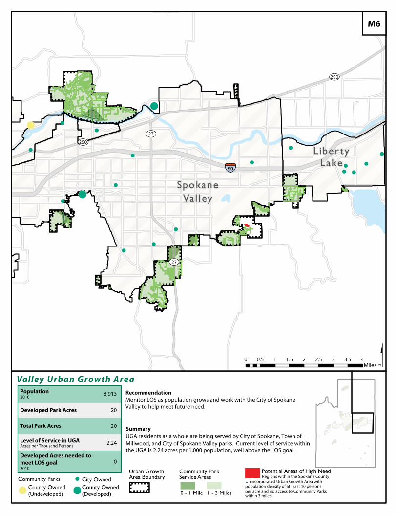
!
!(
!(
!
!
!
!
!
!
!
!
!
!
!
!
!
!
!
!(
¿À290
¿À27
¿À290¿À27
§̈¦90
Liber tyLake
SpokaneVal ley
Valley Urban Growth Area
$Recommendation
0 0.5 1 1.5 2 2.5 3 3.5 4Miles
Community Parks ! City OwnedCounty Owned(Undeveloped)!( !(
County Owned(Developed)
Urban Growth Area Boundary
Community Park Service Areas
1 - 3 Miles0 - 1 Mile
Summary
M6
Potential Areas of High Need
Developed Park Acres
Total Park Acres
Population2010
Level of Service in UGAAcres per Thousand Persons
Developed Acres needed to
meet LOS goal2010
8,913
20
20
2.24
0
UGA residents as a whole are being served by City of Spokane, Town ofMillwood, and City of Spokane Valley parks. Current level of service withinthe UGA is 2.24 acres per 1,000 population, well above the LOS goal.
Monitor LOS as population grows and work with the City of SpokaneValley to help meet future need.
Regions within the Spokane CountyUnincorporated Urban Growth Area withpopulation density of at least 10 personsper acre and no access to Community Parkswithin 3 miles.
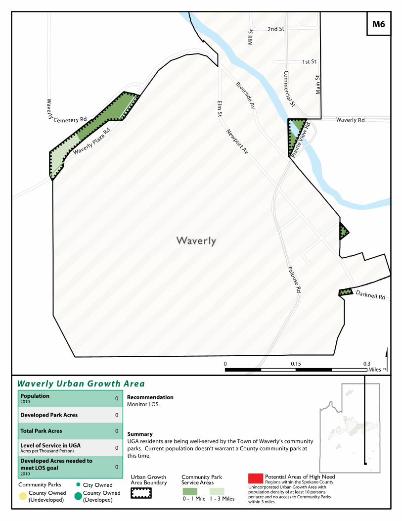
Waverly
Waver ly Urban Growth Area
$Recommendation
Community Parks ! City OwnedCounty Owned(Undeveloped)!( !(
County Owned(Developed)
Urban Growth Area Boundary
Community Park Service Areas
1 - 3 Miles0 - 1 Mile
Summary
M6
Potential Areas of High Need
Developed Park Acres
Total Park Acres
Population2010
Level of Service in UGAAcres per Thousand Persons
Developed Acres needed to
meet LOS goal2010
0
0
0
0
0
UGA residents are being well-served by the Town of Waverly’s communityparks. Current population doesn’t warrant a County community park atthis time.
Monitor LOS.
Regions within the Spokane CountyUnincorporated Urban Growth Area withpopulation density of at least 10 personsper acre and no access to Community Parkswithin 3 miles.
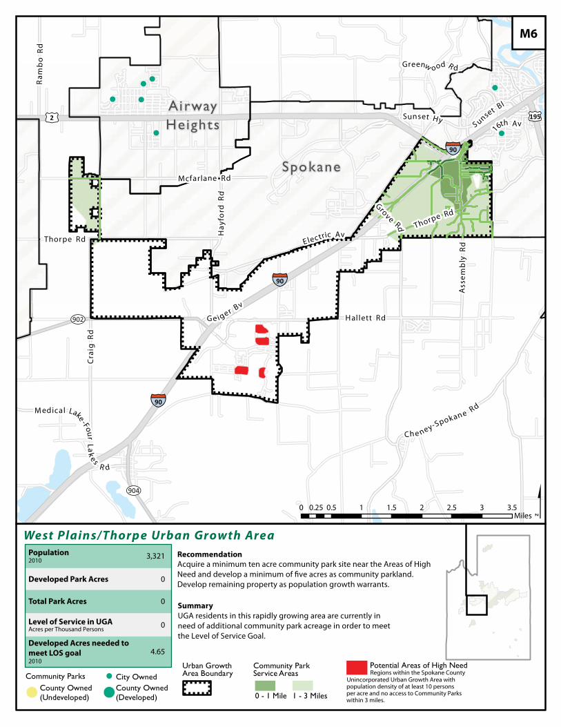
!
!
!
!!
!
!!
!
¿À902
¿À904
£¤2 £¤195
§̈¦90
§̈¦90
§̈¦90
Thorpe RdH
ay
ford
Rd
Ra
mb
o R
d
Thorpe Rd
Hallett Rd
S unset Bl
G e i ger Bv
Sunset Hy
Che ney-Spokane Rd
Greenw ood R d
Grove Rd
16th Av
M edical Lake-Fou
r L
ak
e s R d
Mcfarlane Rd
As
sem
bly
Rd
Cra
ig R
d
E lectric Av
AirwayHeights
Spokane
West Plains/Thorp e Urban Growth Area
$Recommendation
0 0.5 1 1.5 2 2.5 3 3.50.25Miles
Community Parks ! City OwnedCounty Owned(Undeveloped)!( !(
County Owned(Developed)
Urban Growth Area Boundary
Community Park Service Areas
1 - 3 Miles0 - 1 Mile
Summary
M6
Potential Areas of High Need
Developed Park Acres
Total Park Acres
Population2010
Level of Service in UGAAcres per Thousand Persons
Developed Acres needed to
meet LOS goal2010
3,321
0
0
0
4.65
UGA residents in this rapidly growing area are currently in
need of additional community park acreage in order to meet
the Level of Service Goal.
Acquire a minimum ten acre community park site near the Areas of High
Need and develop a minimum of five acres as community parkland.
Develop remaining property as population growth warrants.
Regions within the Spokane CountyUnincorporated Urban Growth Area withpopulation density of at least 10 personsper acre and no access to Community Parkswithin 3 miles.
Appendix
Spokane County
2020 Parks, Recreation & Open Space Plan
Spokane County Parks, Recreation & Open Space Plan - Appendix 2
Contents
APPENDIX A – Spokane County Parks Property Inventory ....................................... 5 BIDWELL PARK ..................................................................................................................................................5 CAMELOT PARK .................................................................................................................................................6 CAMP CARO PARK* ...........................................................................................................................................7 COLBERT PARK ..................................................................................................................................................8 GLENEDEN PARK ...............................................................................................................................................9 HALF MOON FUTURE PARK ..........................................................................................................................10 HOLMBERG PARK ............................................................................................................................................11 JOHN H. SHIELDS PARK (MINNEHAHA ROCKS) .......................................................................................12 LINWOOD PARK ...............................................................................................................................................13 NORTHWOODS PARK ......................................................................................................................................14 ORCHARD AVENUE PARK .............................................................................................................................15 PINE RIVER PARK.............................................................................................................................................16 PRAIRIEVIEW PARK ........................................................................................................................................17 SONTAG PARK ..................................................................................................................................................18 VALLEYFORD PARK ........................................................................................................................................19 BEAR LAKE REGIONAL PARK .......................................................................................................................20 FISH LAKE REGIONAL PARK .........................................................................................................................21 LIBERTY LAKE REGIONAL PARK.................................................................................................................22 PLANTE’S FERRY SPORTS COMPLEX ..........................................................................................................23 GATEWAY REGIONAL PARK .........................................................................................................................24 DISHMAN HILLS NATURAL AREA ...............................................................................................................25 FREDDY’S NATURAL AREA ...........................................................................................................................26 HAGGIN NATURAL AREA ..............................................................................................................................27 LITTLE SPOKANE RIVER NATURAL AREA ................................................................................................28 MORROW PARK NATURAL AREA ................................................................................................................29 NEWMAN LAKE NATURAL AREA ................................................................................................................30 WILLOW LAKE NATURAL AREA ..................................................................................................................31 ANTOINE PEAK CONSERVATION AREA .....................................................................................................32 CEDAR GROVE CONSERVATION AREA* ....................................................................................................33 FERYN RANCH CONSERVATION AREA* ....................................................................................................34 GATEWAY CONSERVATION AREA* ............................................................................................................35 HAUSER CONSERVATION AREA* ................................................................................................................36 HAYNES CONSERVATION AREA ..................................................................................................................37 HOLMBERG CONSERVATION AREA ............................................................................................................38 DISHMAN HILLS CONSERVATION AREA – GLENROSE UNIT ................................................................39 DISHMAN HILLS CONSERVATION AREA – ILLER CREEK UNIT ...........................................................40 JAMES T. SLAVIN CONSERVATION AREA .................................................................................................41 LIBERTY LAKE CONSERVATION AREA ......................................................................................................42 MCLELLAN CONSERVATION AREA ............................................................................................................43 MCKENZIE CONSERVATION AREA..............................................................................................................44 MICA PEAK CONSERVATION AREA ............................................................................................................45 SALTESE UPLANDS CONSERVATION AREA ..............................................................................................46
Spokane County Parks, Recreation & Open Space Plan - Appendix 3
TRAUTMAN RANCH CONSERVATION AREA .............................................................................................47 VAN HORN, EDBURG BASS CONSERVATION AREA ................................................................................48 HANGMAN VALLEY GOLF COURSE* ..........................................................................................................49 LIBERTY LAKE GOLF COURSE .....................................................................................................................50 MEADOWWOOD GOLF COURSE ...................................................................................................................51 AIRWAY HEIGHTS ORV SPORTS PARK* .....................................................................................................52 LIBERTY LAKE ORV PARK* ..........................................................................................................................53 NORTHSIDE FAMILY AQUATIC FACILITY .................................................................................................54 SOUTHSIDE FAMILY AQUATIC FACILITY .................................................................................................55 CENTENNIAL TRAIL ........................................................................................................................................56 SPOKANE COUNTY RACEWAY .....................................................................................................................57 BATTLE OF FOUR LAKES (SPOKANE PLAINS) MONUMENT ..................................................................58 SPOKANE COUNCIL MONUMENT ................................................................................................................58 FATHER CATALDO MONUMENT ..................................................................................................................59
APPENDIX B – Facility Inventory Detail ..................................................................... 60 Aquatic Facility Inventory ...........................................................................................................................60 Campground Inventory ................................................................................................................................61 Softball/Baseball Field Inventory ................................................................................................................61
APPENDIX C – Other Agency Parks & Recreation Facility Inventory .................... 66 FEDERAL AGENCIES .......................................................................................................................................66
U.S. Department of Interior, Bureau of Land Management ........................................................................66 U.S. National Department of Interior, Fish and Wildlife Service, Turnbull Wildlife Refuge ......................66 Fairchild Air Force Base.............................................................................................................................66 U.S. Department of Agriculture, Forest Service .........................................................................................66
WASHINGTON STATE AGENCIES .................................................................................................................67 Department of Fish and Wildlife .................................................................................................................67 Department of Natural Resources ...............................................................................................................67 Washington State Parks ...............................................................................................................................67 Department of Transportation .....................................................................................................................68 The Centennial Trail ...................................................................................................................................68
CITIES AND TOWNS .........................................................................................................................................69 City of Spokane ............................................................................................................................................69 City of Spokane Valley ................................................................................................................................69 City of Airway Heights ................................................................................................................................69 City of Cheney .............................................................................................................................................69 City of Deer Park ........................................................................................................................................70 City of Fairfield ...........................................................................................................................................70 City of Latah ................................................................................................................................................70 City of Liberty Lake .....................................................................................................................................70 City of Medical Lake ...................................................................................................................................70 Town of Millwood ........................................................................................................................................70 Town of Rockford ........................................................................................................................................70 Town of Spangle ..........................................................................................................................................71 Town of Waverly ..........................................................................................................................................71
SCHOOL DISTRICTS .........................................................................................................................................71
APPENDIX D - Public Participation ............................................................................. 73

Spokane County Parks, Recreation & Open Space Plan - Appendix 4
Advertisements for Public Participation Opportunities ..............................................................................73 Public Open House Participation Results ...................................................................................................74 2020 Online Survey Results .........................................................................................................................81 Stakeholder Interviews ..............................................................................................................................106 2015 Community Priorities Survey ...........................................................................................................109
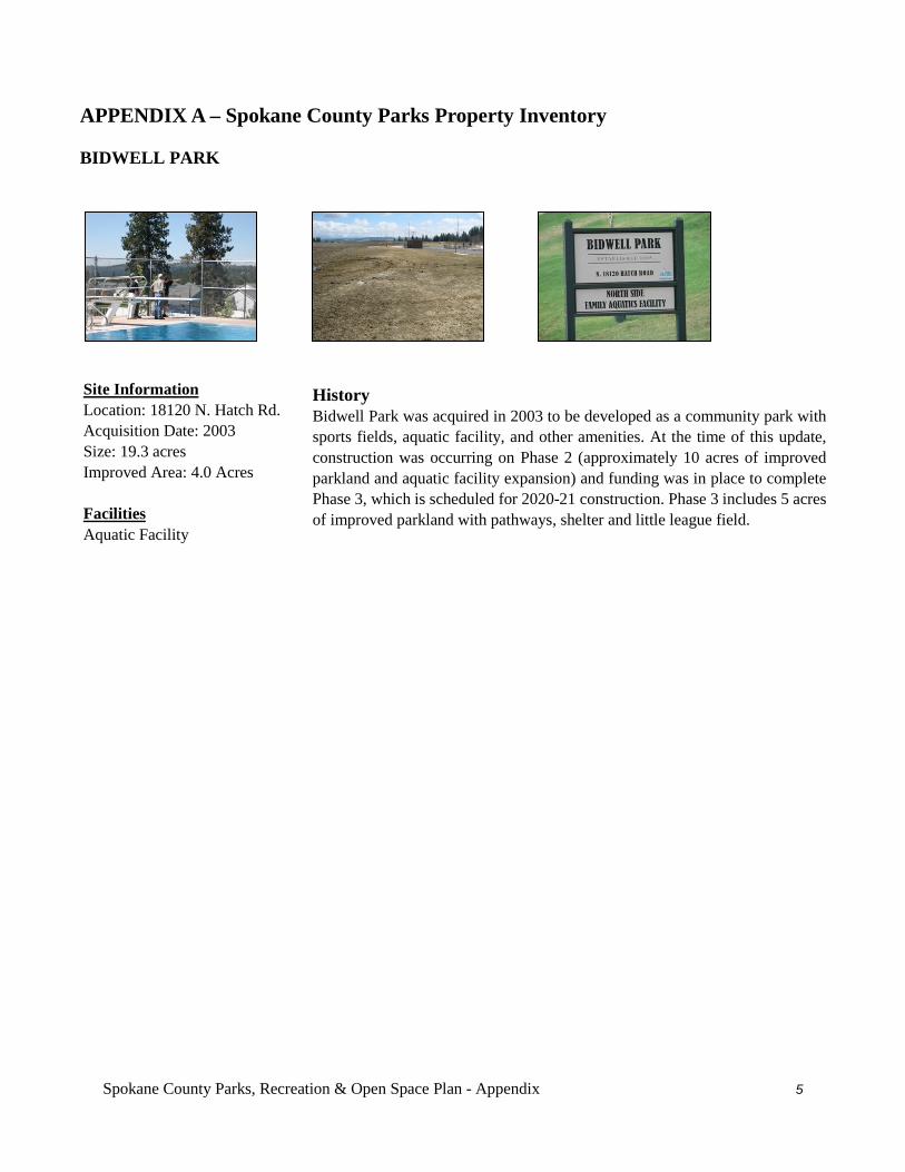
Spokane County Parks, Recreation & Open Space Plan - Appendix 5
APPENDIX A – Spokane County Parks Property Inventory BIDWELL PARK
History Bidwell Park was acquired in 2003 to be developed as a community park with sports fields, aquatic facility, and other amenities. At the time of this update, construction was occurring on Phase 2 (approximately 10 acres of improved parkland and aquatic facility expansion) and funding was in place to complete Phase 3, which is scheduled for 2020-21 construction. Phase 3 includes 5 acres of improved parkland with pathways, shelter and little league field.
Site Information Location: 18120 N. Hatch Rd. Acquisition Date: 2003 Size: 19.3 acres Improved Area: 4.0 Acres Facilities Aquatic Facility
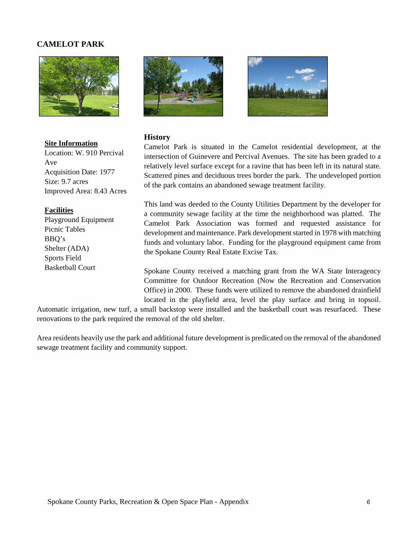
Spokane County Parks, Recreation & Open Space Plan - Appendix 6
CAMELOT PARK
History Camelot Park is situated in the Camelot residential development, at the intersection of Guinevere and Percival Avenues. The site has been graded to a relatively level surface except for a ravine that has been left in its natural state. Scattered pines and deciduous trees border the park. The undeveloped portion of the park contains an abandoned sewage treatment facility. This land was deeded to the County Utilities Department by the developer for a community sewage facility at the time the neighborhood was platted. The Camelot Park Association was formed and requested assistance for development and maintenance. Park development started in 1978 with matching funds and voluntary labor. Funding for the playground equipment came from the Spokane County Real Estate Excise Tax. Spokane County received a matching grant from the WA State Interagency Committee for Outdoor Recreation (Now the Recreation and Conservation Office) in 2000. These funds were utilized to remove the abandoned drainfield located in the playfield area, level the play surface and bring in topsoil.
Automatic irrigation, new turf, a small backstop were installed and the basketball court was resurfaced. These renovations to the park required the removal of the old shelter. Area residents heavily use the park and additional future development is predicated on the removal of the abandoned sewage treatment facility and community support.
Site Information Location: W. 910 Percival Ave Acquisition Date: 1977 Size: 9.7 acres Improved Area: 8.43 Acres Facilities Playground Equipment Picnic Tables BBQ’s Shelter (ADA) Sports Field Basketball Court
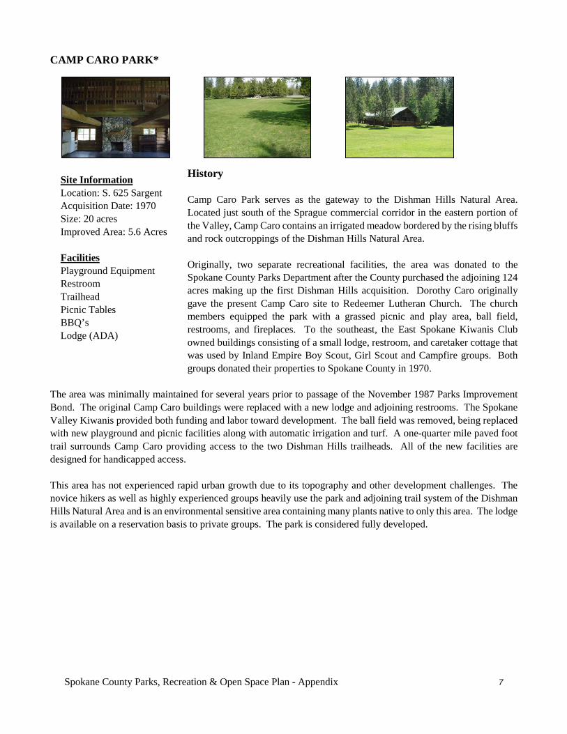
Spokane County Parks, Recreation & Open Space Plan - Appendix 7
CAMP CARO PARK*
History Camp Caro Park serves as the gateway to the Dishman Hills Natural Area. Located just south of the Sprague commercial corridor in the eastern portion of the Valley, Camp Caro contains an irrigated meadow bordered by the rising bluffs and rock outcroppings of the Dishman Hills Natural Area. Originally, two separate recreational facilities, the area was donated to the Spokane County Parks Department after the County purchased the adjoining 124 acres making up the first Dishman Hills acquisition. Dorothy Caro originally gave the present Camp Caro site to Redeemer Lutheran Church. The church members equipped the park with a grassed picnic and play area, ball field, restrooms, and fireplaces. To the southeast, the East Spokane Kiwanis Club owned buildings consisting of a small lodge, restroom, and caretaker cottage that was used by Inland Empire Boy Scout, Girl Scout and Campfire groups. Both groups donated their properties to Spokane County in 1970.
The area was minimally maintained for several years prior to passage of the November 1987 Parks Improvement Bond. The original Camp Caro buildings were replaced with a new lodge and adjoining restrooms. The Spokane Valley Kiwanis provided both funding and labor toward development. The ball field was removed, being replaced with new playground and picnic facilities along with automatic irrigation and turf. A one-quarter mile paved foot trail surrounds Camp Caro providing access to the two Dishman Hills trailheads. All of the new facilities are designed for handicapped access. This area has not experienced rapid urban growth due to its topography and other development challenges. The novice hikers as well as highly experienced groups heavily use the park and adjoining trail system of the Dishman Hills Natural Area and is an environmental sensitive area containing many plants native to only this area. The lodge is available on a reservation basis to private groups. The park is considered fully developed.
Site Information Location: S. 625 Sargent Acquisition Date: 1970 Size: 20 acres Improved Area: 5.6 Acres Facilities Playground Equipment Restroom Trailhead Picnic Tables BBQ’s Lodge (ADA)
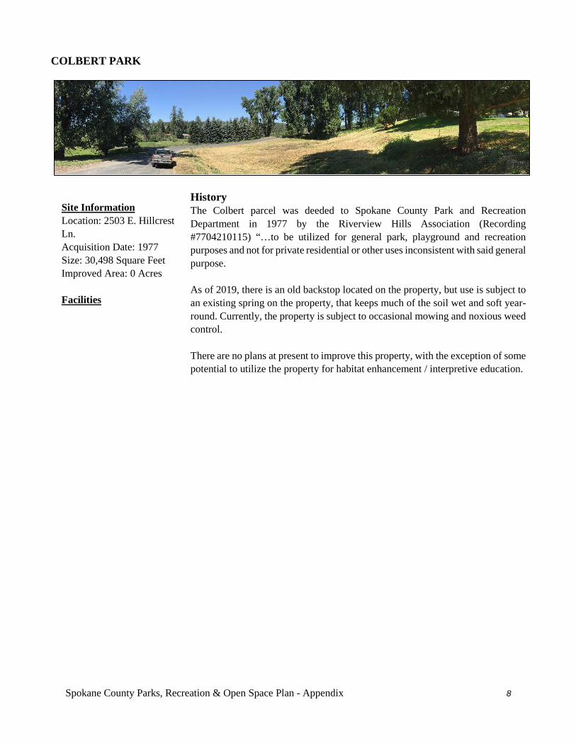
Spokane County Parks, Recreation & Open Space Plan - Appendix 8
COLBERT PARK
History The Colbert parcel was deeded to Spokane County Park and Recreation Department in 1977 by the Riverview Hills Association (Recording #7704210115) “…to be utilized for general park, playground and recreation purposes and not for private residential or other uses inconsistent with said general purpose. As of 2019, there is an old backstop located on the property, but use is subject to an existing spring on the property, that keeps much of the soil wet and soft year-round. Currently, the property is subject to occasional mowing and noxious weed control. There are no plans at present to improve this property, with the exception of some potential to utilize the property for habitat enhancement / interpretive education.
Site Information Location: 2503 E. Hillcrest Ln. Acquisition Date: 1977 Size: 30,498 Square Feet Improved Area: 0 Acres Facilities
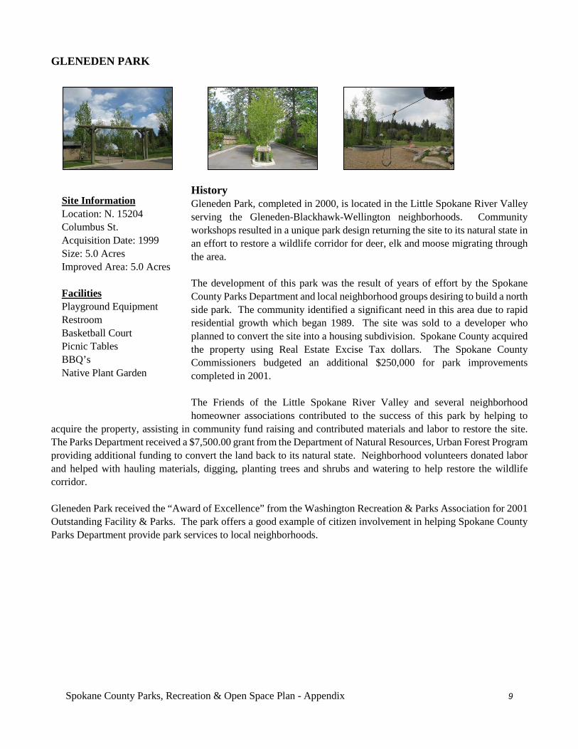
Spokane County Parks, Recreation & Open Space Plan - Appendix 9
GLENEDEN PARK
History Gleneden Park, completed in 2000, is located in the Little Spokane River Valley serving the Gleneden-Blackhawk-Wellington neighborhoods. Community workshops resulted in a unique park design returning the site to its natural state in an effort to restore a wildlife corridor for deer, elk and moose migrating through the area. The development of this park was the result of years of effort by the Spokane County Parks Department and local neighborhood groups desiring to build a north side park. The community identified a significant need in this area due to rapid residential growth which began 1989. The site was sold to a developer who planned to convert the site into a housing subdivision. Spokane County acquired the property using Real Estate Excise Tax dollars. The Spokane County Commissioners budgeted an additional $250,000 for park improvements completed in 2001. The Friends of the Little Spokane River Valley and several neighborhood homeowner associations contributed to the success of this park by helping to
acquire the property, assisting in community fund raising and contributed materials and labor to restore the site. The Parks Department received a $7,500.00 grant from the Department of Natural Resources, Urban Forest Program providing additional funding to convert the land back to its natural state. Neighborhood volunteers donated labor and helped with hauling materials, digging, planting trees and shrubs and watering to help restore the wildlife corridor. Gleneden Park received the “Award of Excellence” from the Washington Recreation & Parks Association for 2001 Outstanding Facility & Parks. The park offers a good example of citizen involvement in helping Spokane County Parks Department provide park services to local neighborhoods.
Site Information Location: N. 15204 Columbus St. Acquisition Date: 1999 Size: 5.0 Acres Improved Area: 5.0 Acres Facilities Playground Equipment Restroom Basketball Court Picnic Tables BBQ’s Native Plant Garden
Spokane County Parks, Recreation & Open Space Plan - Appendix 10
HALF MOON FUTURE PARK
History Half Moon Park was acquired in 2001, which included a $30,000.00 donation in land values from the sellers, Half Moon Ranch Corp. and represented by Mike Hume, partner. The property is a farm field with hillside meadows within a growing area and will make for an ideal park in the future, as needed.
Site Information Location: Burke Rd Acquisition Date: 2001 Size: 25.39 Acres Improved Area: 0.0 Acres Facilities Undeveloped
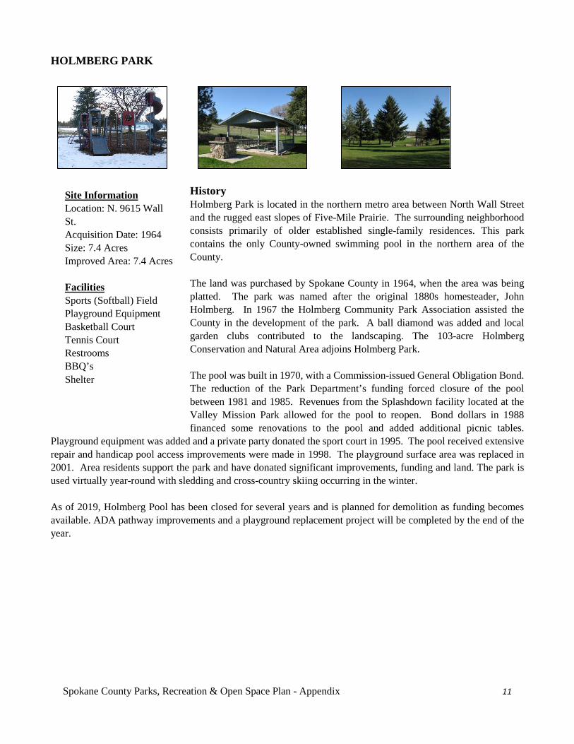
Spokane County Parks, Recreation & Open Space Plan - Appendix 11
HOLMBERG PARK
History Holmberg Park is located in the northern metro area between North Wall Street and the rugged east slopes of Five-Mile Prairie. The surrounding neighborhood consists primarily of older established single-family residences. This park contains the only County-owned swimming pool in the northern area of the County. The land was purchased by Spokane County in 1964, when the area was being platted. The park was named after the original 1880s homesteader, John Holmberg. In 1967 the Holmberg Community Park Association assisted the County in the development of the park. A ball diamond was added and local garden clubs contributed to the landscaping. The 103-acre Holmberg Conservation and Natural Area adjoins Holmberg Park. The pool was built in 1970, with a Commission-issued General Obligation Bond. The reduction of the Park Department’s funding forced closure of the pool between 1981 and 1985. Revenues from the Splashdown facility located at the Valley Mission Park allowed for the pool to reopen. Bond dollars in 1988 financed some renovations to the pool and added additional picnic tables.
Playground equipment was added and a private party donated the sport court in 1995. The pool received extensive repair and handicap pool access improvements were made in 1998. The playground surface area was replaced in 2001. Area residents support the park and have donated significant improvements, funding and land. The park is used virtually year-round with sledding and cross-country skiing occurring in the winter. As of 2019, Holmberg Pool has been closed for several years and is planned for demolition as funding becomes available. ADA pathway improvements and a playground replacement project will be completed by the end of the year.
Site Information Location: N. 9615 Wall St. Acquisition Date: 1964 Size: 7.4 Acres Improved Area: 7.4 Acres Facilities Sports (Softball) Field Playground Equipment Basketball Court Tennis Court Restrooms BBQ’s Shelter
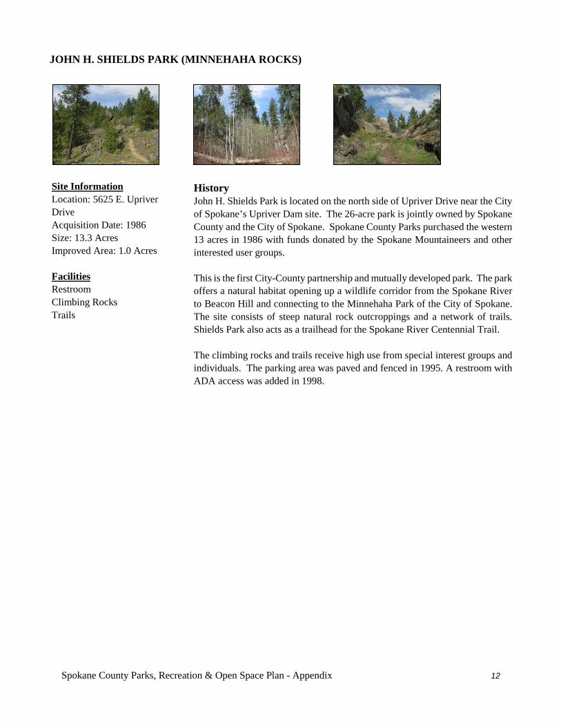
Spokane County Parks, Recreation & Open Space Plan - Appendix 12
JOHN H. SHIELDS PARK (MINNEHAHA ROCKS)
History John H. Shields Park is located on the north side of Upriver Drive near the City of Spokane’s Upriver Dam site. The 26-acre park is jointly owned by Spokane County and the City of Spokane. Spokane County Parks purchased the western 13 acres in 1986 with funds donated by the Spokane Mountaineers and other interested user groups. This is the first City-County partnership and mutually developed park. The park offers a natural habitat opening up a wildlife corridor from the Spokane River to Beacon Hill and connecting to the Minnehaha Park of the City of Spokane. The site consists of steep natural rock outcroppings and a network of trails. Shields Park also acts as a trailhead for the Spokane River Centennial Trail. The climbing rocks and trails receive high use from special interest groups and individuals. The parking area was paved and fenced in 1995. A restroom with ADA access was added in 1998.
Site Information Location: 5625 E. Upriver Drive Acquisition Date: 1986 Size: 13.3 Acres Improved Area: 1.0 Acres Facilities Restroom Climbing Rocks Trails
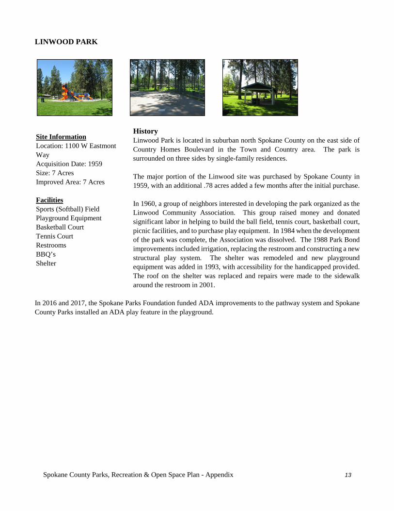
Spokane County Parks, Recreation & Open Space Plan - Appendix 13
LINWOOD PARK
History Linwood Park is located in suburban north Spokane County on the east side of Country Homes Boulevard in the Town and Country area. The park is surrounded on three sides by single-family residences. The major portion of the Linwood site was purchased by Spokane County in 1959, with an additional .78 acres added a few months after the initial purchase. In 1960, a group of neighbors interested in developing the park organized as the Linwood Community Association. This group raised money and donated significant labor in helping to build the ball field, tennis court, basketball court, picnic facilities, and to purchase play equipment. In 1984 when the development of the park was complete, the Association was dissolved. The 1988 Park Bond improvements included irrigation, replacing the restroom and constructing a new structural play system. The shelter was remodeled and new playground equipment was added in 1993, with accessibility for the handicapped provided. The roof on the shelter was replaced and repairs were made to the sidewalk around the restroom in 2001.
In 2016 and 2017, the Spokane Parks Foundation funded ADA improvements to the pathway system and Spokane County Parks installed an ADA play feature in the playground.
Site Information Location: 1100 W Eastmont Way Acquisition Date: 1959 Size: 7 Acres Improved Area: 7 Acres Facilities Sports (Softball) Field Playground Equipment Basketball Court Tennis Court Restrooms BBQ’s Shelter
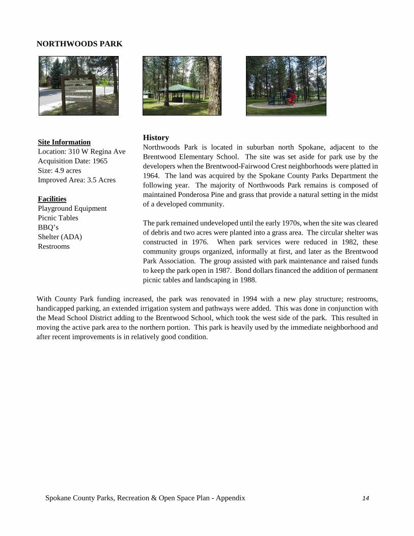
Spokane County Parks, Recreation & Open Space Plan - Appendix 14
NORTHWOODS PARK
History Northwoods Park is located in suburban north Spokane, adjacent to the Brentwood Elementary School. The site was set aside for park use by the developers when the Brentwood-Fairwood Crest neighborhoods were platted in 1964. The land was acquired by the Spokane County Parks Department the following year. The majority of Northwoods Park remains is composed of maintained Ponderosa Pine and grass that provide a natural setting in the midst of a developed community. The park remained undeveloped until the early 1970s, when the site was cleared of debris and two acres were planted into a grass area. The circular shelter was constructed in 1976. When park services were reduced in 1982, these community groups organized, informally at first, and later as the Brentwood Park Association. The group assisted with park maintenance and raised funds to keep the park open in 1987. Bond dollars financed the addition of permanent picnic tables and landscaping in 1988.
With County Park funding increased, the park was renovated in 1994 with a new play structure; restrooms, handicapped parking, an extended irrigation system and pathways were added. This was done in conjunction with the Mead School District adding to the Brentwood School, which took the west side of the park. This resulted in moving the active park area to the northern portion. This park is heavily used by the immediate neighborhood and after recent improvements is in relatively good condition.
Site Information Location: 310 W Regina Ave Acquisition Date: 1965 Size: 4.9 acres Improved Area: 3.5 Acres Facilities Playground Equipment Picnic Tables BBQ’s Shelter (ADA) Restrooms
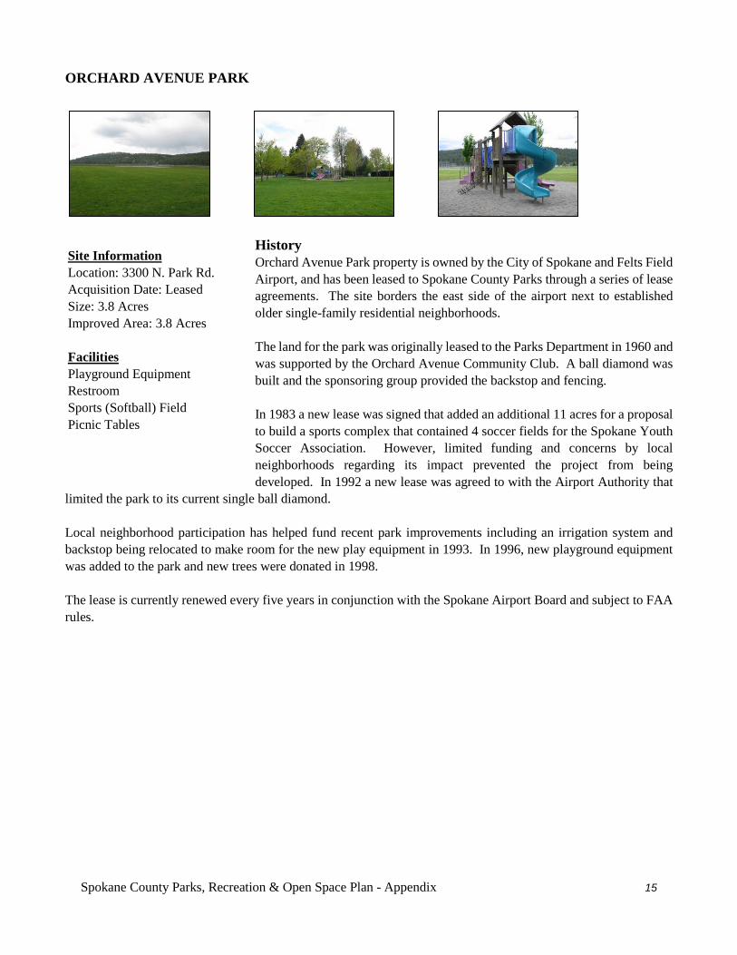
Spokane County Parks, Recreation & Open Space Plan - Appendix 15
ORCHARD AVENUE PARK
History Orchard Avenue Park property is owned by the City of Spokane and Felts Field Airport, and has been leased to Spokane County Parks through a series of lease agreements. The site borders the east side of the airport next to established older single-family residential neighborhoods. The land for the park was originally leased to the Parks Department in 1960 and was supported by the Orchard Avenue Community Club. A ball diamond was built and the sponsoring group provided the backstop and fencing. In 1983 a new lease was signed that added an additional 11 acres for a proposal to build a sports complex that contained 4 soccer fields for the Spokane Youth Soccer Association. However, limited funding and concerns by local neighborhoods regarding its impact prevented the project from being developed. In 1992 a new lease was agreed to with the Airport Authority that
limited the park to its current single ball diamond. Local neighborhood participation has helped fund recent park improvements including an irrigation system and backstop being relocated to make room for the new play equipment in 1993. In 1996, new playground equipment was added to the park and new trees were donated in 1998. The lease is currently renewed every five years in conjunction with the Spokane Airport Board and subject to FAA rules.
Site Information Location: 3300 N. Park Rd. Acquisition Date: Leased Size: 3.8 Acres Improved Area: 3.8 Acres Facilities Playground Equipment Restroom Sports (Softball) Field Picnic Tables
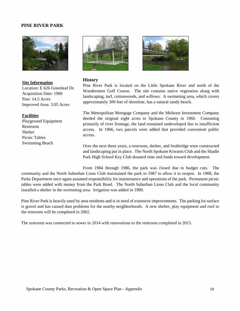
Spokane County Parks, Recreation & Open Space Plan - Appendix 16
PINE RIVER PARK
History Pine River Park is located on the Little Spokane River and north of the Wandermere Golf Course. The site contains native vegetation along with landscaping, turf, cottonwoods, and willows. A swimming area, which covers approximately 300 feet of shoreline, has a natural sandy beach. The Metropolitan Mortgage Company and the Midwest Investment Company deeded the original eight acres to Spokane County in 1960. Consisting primarily of river frontage, the land remained undeveloped due to insufficient access. In 1966, two parcels were added that provided convenient public access. Over the next three years, a restroom, shelter, and footbridge were constructed and landscaping put in place. The North Spokane Kiwanis Club and the Shadle Park High School Key Club donated time and funds toward development. From 1984 through 1986, the park was closed due to budget cuts. The
community and the North Suburban Lions Club maintained the park in 1987 to allow it to reopen. In 1988, the Parks Department once again assumed responsibility for maintenance and operations of the park. Permanent picnic tables were added with money from the Park Bond. The North Suburban Lions Club and the local community installed a shelter in the swimming area. Irrigation was added in 1989. Pine River Park is heavily used by area residents and is in need of extensive improvements. The parking lot surface is gravel and has caused dust problems for the nearby neighborhoods. A new shelter, play equipment and roof to the restroom will be completed in 2002. The restroom was connected to sewer in 2014 with renovations to the restroom completed in 2015.
Site Information Location: E 626 Greenleaf Dr. Acquisition Date: 1960 Size: 14.5 Acres Improved Area: 3.05 Acres Facilities Playground Equipment Restroom Shelter Picnic Tables Swimming Beach
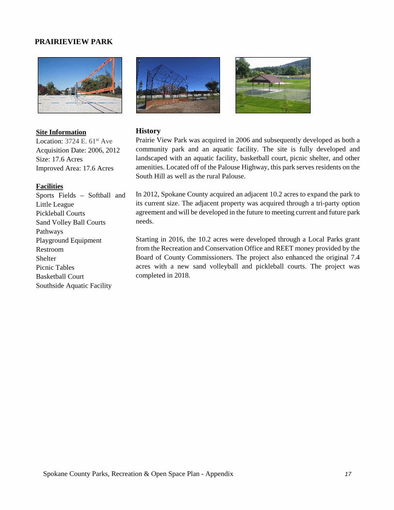
Spokane County Parks, Recreation & Open Space Plan - Appendix 17
PRAIRIEVIEW PARK
History Prairie View Park was acquired in 2006 and subsequently developed as both a community park and an aquatic facility. The site is fully developed and landscaped with an aquatic facility, basketball court, picnic shelter, and other amenities. Located off of the Palouse Highway, this park serves residents on the South Hill as well as the rural Palouse. In 2012, Spokane County acquired an adjacent 10.2 acres to expand the park to its current size. The adjacent property was acquired through a tri-party option agreement and will be developed in the future to meeting current and future park needs. Starting in 2016, the 10.2 acres were developed through a Local Parks grant from the Recreation and Conservation Office and REET money provided by the Board of County Commissioners. The project also enhanced the original 7.4 acres with a new sand volleyball and pickleball courts. The project was completed in 2018.
Site Information Location: 3724 E. 61st Ave Acquisition Date: 2006, 2012 Size: 17.6 Acres Improved Area: 17.6 Acres Facilities Sports Fields – Softball and Little League Pickleball Courts Sand Volley Ball Courts Pathways Playground Equipment Restroom Shelter Picnic Tables Basketball Court Southside Aquatic Facility
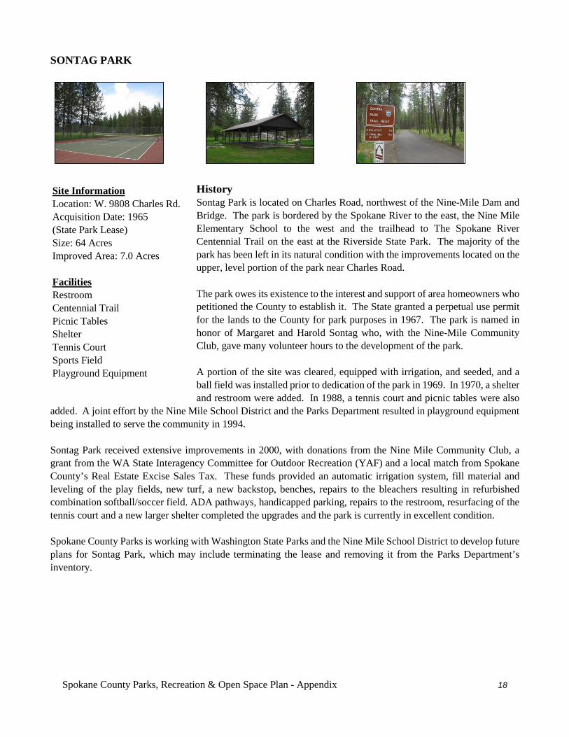
Spokane County Parks, Recreation & Open Space Plan - Appendix 18
SONTAG PARK
History Sontag Park is located on Charles Road, northwest of the Nine-Mile Dam and Bridge. The park is bordered by the Spokane River to the east, the Nine Mile Elementary School to the west and the trailhead to The Spokane River Centennial Trail on the east at the Riverside State Park. The majority of the park has been left in its natural condition with the improvements located on the upper, level portion of the park near Charles Road. The park owes its existence to the interest and support of area homeowners who petitioned the County to establish it. The State granted a perpetual use permit for the lands to the County for park purposes in 1967. The park is named in honor of Margaret and Harold Sontag who, with the Nine-Mile Community Club, gave many volunteer hours to the development of the park. A portion of the site was cleared, equipped with irrigation, and seeded, and a ball field was installed prior to dedication of the park in 1969. In 1970, a shelter and restroom were added. In 1988, a tennis court and picnic tables were also
added. A joint effort by the Nine Mile School District and the Parks Department resulted in playground equipment being installed to serve the community in 1994. Sontag Park received extensive improvements in 2000, with donations from the Nine Mile Community Club, a grant from the WA State Interagency Committee for Outdoor Recreation (YAF) and a local match from Spokane County’s Real Estate Excise Sales Tax. These funds provided an automatic irrigation system, fill material and leveling of the play fields, new turf, a new backstop, benches, repairs to the bleachers resulting in refurbished combination softball/soccer field. ADA pathways, handicapped parking, repairs to the restroom, resurfacing of the tennis court and a new larger shelter completed the upgrades and the park is currently in excellent condition. Spokane County Parks is working with Washington State Parks and the Nine Mile School District to develop future plans for Sontag Park, which may include terminating the lease and removing it from the Parks Department’s inventory.
Site Information Location: W. 9808 Charles Rd. Acquisition Date: 1965 (State Park Lease) Size: 64 Acres Improved Area: 7.0 Acres Facilities Restroom Centennial Trail Picnic Tables Shelter Tennis Court Sports Field Playground Equipment
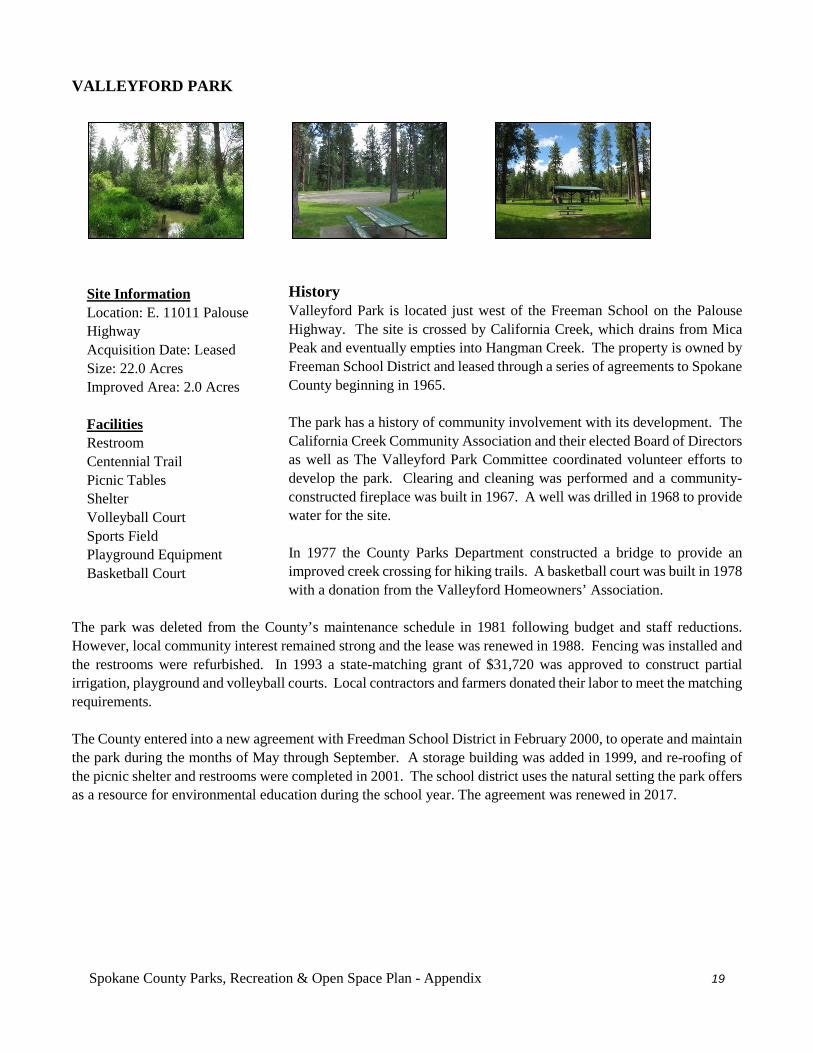
Spokane County Parks, Recreation & Open Space Plan - Appendix 19
VALLEYFORD PARK
History Valleyford Park is located just west of the Freeman School on the Palouse Highway. The site is crossed by California Creek, which drains from Mica Peak and eventually empties into Hangman Creek. The property is owned by Freeman School District and leased through a series of agreements to Spokane County beginning in 1965. The park has a history of community involvement with its development. The California Creek Community Association and their elected Board of Directors as well as The Valleyford Park Committee coordinated volunteer efforts to develop the park. Clearing and cleaning was performed and a community-constructed fireplace was built in 1967. A well was drilled in 1968 to provide water for the site. In 1977 the County Parks Department constructed a bridge to provide an improved creek crossing for hiking trails. A basketball court was built in 1978 with a donation from the Valleyford Homeowners’ Association.
The park was deleted from the County’s maintenance schedule in 1981 following budget and staff reductions. However, local community interest remained strong and the lease was renewed in 1988. Fencing was installed and the restrooms were refurbished. In 1993 a state-matching grant of $31,720 was approved to construct partial irrigation, playground and volleyball courts. Local contractors and farmers donated their labor to meet the matching requirements. The County entered into a new agreement with Freedman School District in February 2000, to operate and maintain the park during the months of May through September. A storage building was added in 1999, and re-roofing of the picnic shelter and restrooms were completed in 2001. The school district uses the natural setting the park offers as a resource for environmental education during the school year. The agreement was renewed in 2017.
Site Information Location: E. 11011 Palouse Highway Acquisition Date: Leased Size: 22.0 Acres Improved Area: 2.0 Acres Facilities Restroom Centennial Trail Picnic Tables Shelter Volleyball Court Sports Field Playground Equipment Basketball Court
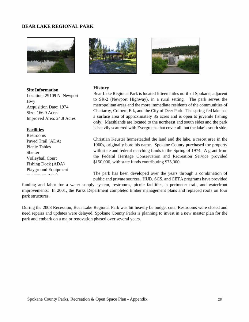
Spokane County Parks, Recreation & Open Space Plan - Appendix 20
BEAR LAKE REGIONAL PARK
History Bear Lake Regional Park is located fifteen miles north of Spokane, adjacent to SR-2 (Newport Highway), in a rural setting. The park serves the metropolitan areas and the more immediate residents of the communities of Chattaroy, Colbert, Elk, and the City of Deer Park. The spring-fed lake has a surface area of approximately 35 acres and is open to juvenile fishing only. Marshlands are located to the northeast and south sides and the park is heavily scattered with Evergreens that cover all, but the lake’s south side. Christian Keuster homesteaded the land and the lake, a resort area in the 1960s, originally bore his name. Spokane County purchased the property with state and federal matching funds in the Spring of 1974. A grant from the Federal Heritage Conservation and Recreation Service provided $150,000, with state funds contributing $75,000. The park has been developed over the years through a combination of public and private sources. HUD, SCS, and CETA programs have provided
funding and labor for a water supply system, restrooms, picnic facilities, a perimeter trail, and waterfront improvements. In 2001, the Parks Department completed timber management plans and replaced roofs on four park structures. During the 2008 Recession, Bear Lake Regional Park was hit heavily be budget cuts. Restrooms were closed and need repairs and updates were delayed. Spokane County Parks is planning to invest in a new master plan for the park and embark on a major renovation phased over several years.
Site Information Location: 29109 N. Newport Hwy Acquisition Date: 1974 Size: 166.0 Acres Improved Area: 24.8 Acres Facilities Restrooms Paved Trail (ADA) Picnic Tables Shelter Volleyball Court Fishing Dock (ADA) Playground Equipment Swimming Beach
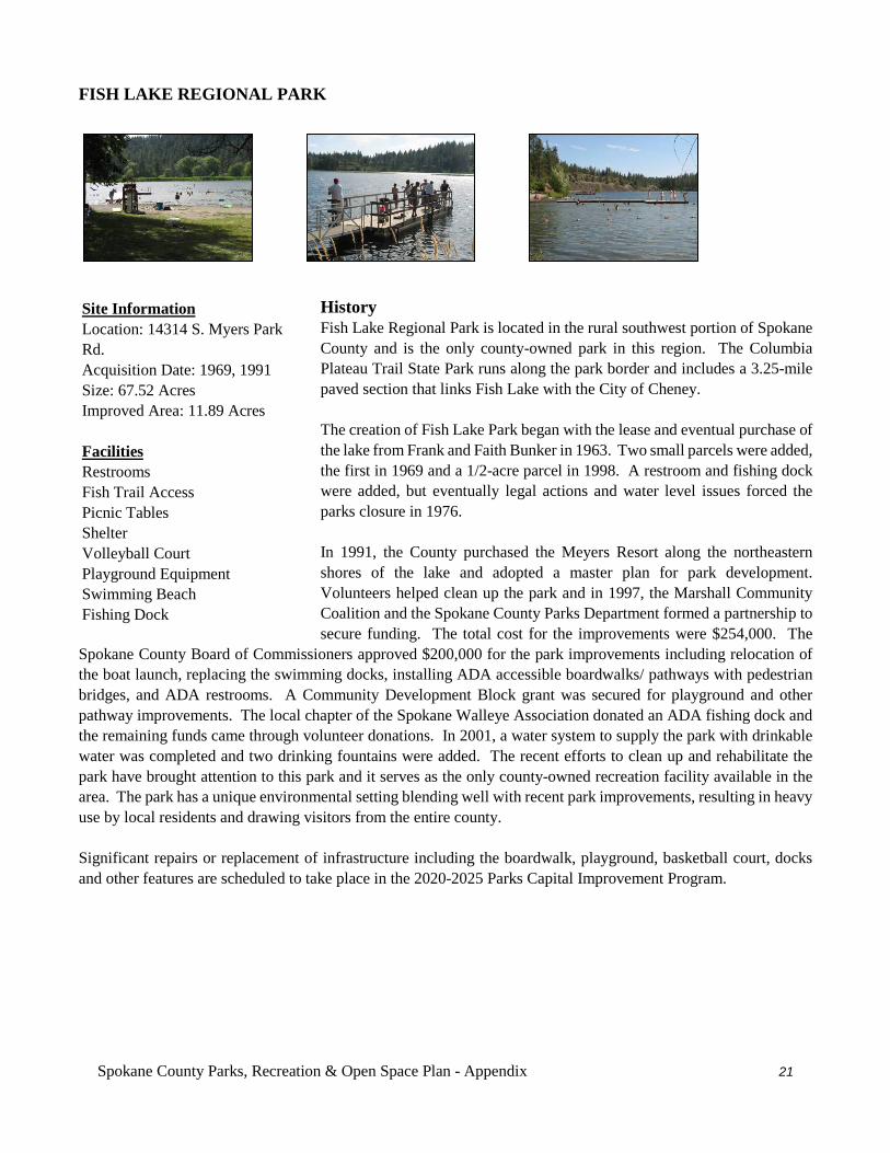
Spokane County Parks, Recreation & Open Space Plan - Appendix 21
FISH LAKE REGIONAL PARK
History Fish Lake Regional Park is located in the rural southwest portion of Spokane County and is the only county-owned park in this region. The Columbia Plateau Trail State Park runs along the park border and includes a 3.25-mile paved section that links Fish Lake with the City of Cheney. The creation of Fish Lake Park began with the lease and eventual purchase of the lake from Frank and Faith Bunker in 1963. Two small parcels were added, the first in 1969 and a 1/2-acre parcel in 1998. A restroom and fishing dock were added, but eventually legal actions and water level issues forced the parks closure in 1976. In 1991, the County purchased the Meyers Resort along the northeastern shores of the lake and adopted a master plan for park development. Volunteers helped clean up the park and in 1997, the Marshall Community Coalition and the Spokane County Parks Department formed a partnership to secure funding. The total cost for the improvements were $254,000. The
Spokane County Board of Commissioners approved $200,000 for the park improvements including relocation of the boat launch, replacing the swimming docks, installing ADA accessible boardwalks/ pathways with pedestrian bridges, and ADA restrooms. A Community Development Block grant was secured for playground and other pathway improvements. The local chapter of the Spokane Walleye Association donated an ADA fishing dock and the remaining funds came through volunteer donations. In 2001, a water system to supply the park with drinkable water was completed and two drinking fountains were added. The recent efforts to clean up and rehabilitate the park have brought attention to this park and it serves as the only county-owned recreation facility available in the area. The park has a unique environmental setting blending well with recent park improvements, resulting in heavy use by local residents and drawing visitors from the entire county. Significant repairs or replacement of infrastructure including the boardwalk, playground, basketball court, docks and other features are scheduled to take place in the 2020-2025 Parks Capital Improvement Program.
Site Information Location: 14314 S. Myers Park Rd. Acquisition Date: 1969, 1991 Size: 67.52 Acres Improved Area: 11.89 Acres Facilities Restrooms Fish Trail Access Picnic Tables Shelter Volleyball Court Playground Equipment Swimming Beach Fishing Dock
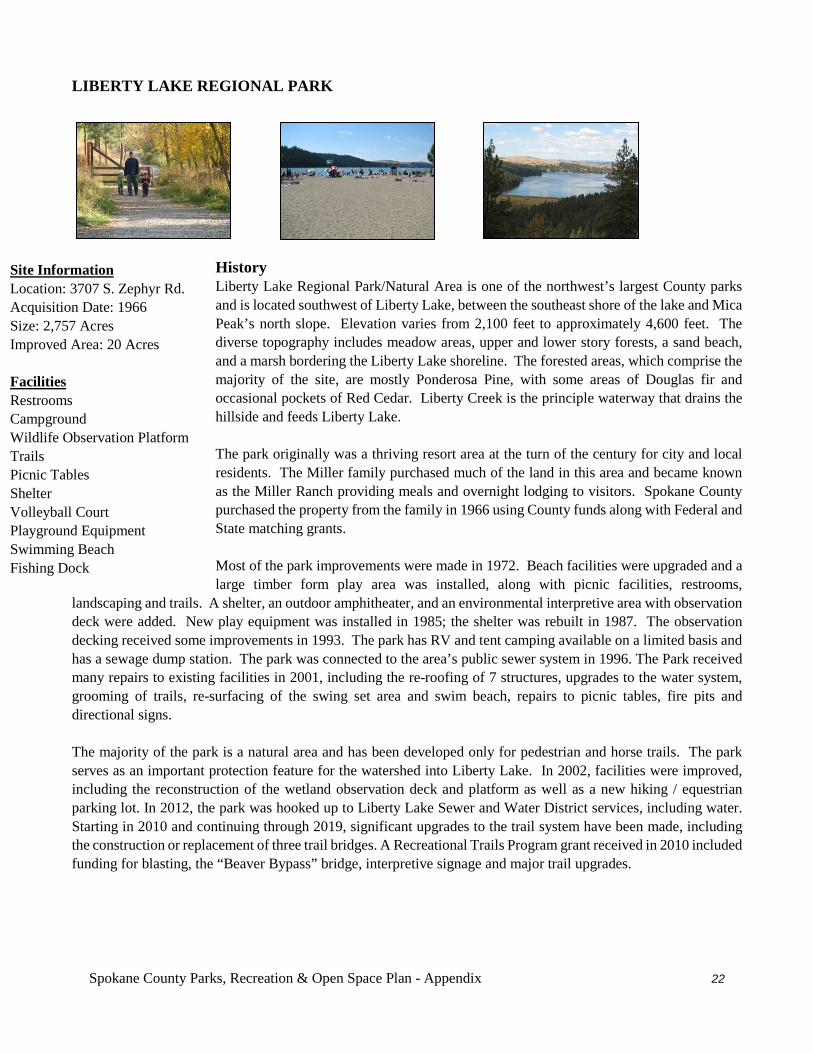
Spokane County Parks, Recreation & Open Space Plan - Appendix 22
LIBERTY LAKE REGIONAL PARK
History Liberty Lake Regional Park/Natural Area is one of the northwest’s largest County parks and is located southwest of Liberty Lake, between the southeast shore of the lake and Mica Peak’s north slope. Elevation varies from 2,100 feet to approximately 4,600 feet. The diverse topography includes meadow areas, upper and lower story forests, a sand beach, and a marsh bordering the Liberty Lake shoreline. The forested areas, which comprise the majority of the site, are mostly Ponderosa Pine, with some areas of Douglas fir and occasional pockets of Red Cedar. Liberty Creek is the principle waterway that drains the hillside and feeds Liberty Lake. The park originally was a thriving resort area at the turn of the century for city and local residents. The Miller family purchased much of the land in this area and became known as the Miller Ranch providing meals and overnight lodging to visitors. Spokane County purchased the property from the family in 1966 using County funds along with Federal and State matching grants. Most of the park improvements were made in 1972. Beach facilities were upgraded and a large timber form play area was installed, along with picnic facilities, restrooms,
landscaping and trails. A shelter, an outdoor amphitheater, and an environmental interpretive area with observation deck were added. New play equipment was installed in 1985; the shelter was rebuilt in 1987. The observation decking received some improvements in 1993. The park has RV and tent camping available on a limited basis and has a sewage dump station. The park was connected to the area’s public sewer system in 1996. The Park received many repairs to existing facilities in 2001, including the re-roofing of 7 structures, upgrades to the water system, grooming of trails, re-surfacing of the swing set area and swim beach, repairs to picnic tables, fire pits and directional signs. The majority of the park is a natural area and has been developed only for pedestrian and horse trails. The park serves as an important protection feature for the watershed into Liberty Lake. In 2002, facilities were improved, including the reconstruction of the wetland observation deck and platform as well as a new hiking / equestrian parking lot. In 2012, the park was hooked up to Liberty Lake Sewer and Water District services, including water. Starting in 2010 and continuing through 2019, significant upgrades to the trail system have been made, including the construction or replacement of three trail bridges. A Recreational Trails Program grant received in 2010 included funding for blasting, the “Beaver Bypass” bridge, interpretive signage and major trail upgrades.
Site Information Location: 3707 S. Zephyr Rd. Acquisition Date: 1966 Size: 2,757 Acres Improved Area: 20 Acres Facilities Restrooms Campground Wildlife Observation Platform Trails Picnic Tables Shelter Volleyball Court Playground Equipment Swimming Beach Fishing Dock
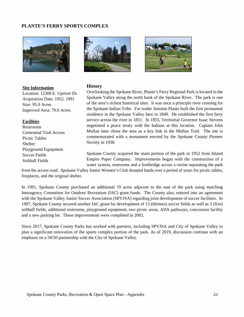
Spokane County Parks, Recreation & Open Space Plan - Appendix 23
PLANTE’S FERRY SPORTS COMPLEX
History Overlooking the Spokane River, Plante’s Ferry Regional Park is located in the Spokane Valley along the north bank of the Spokane River. The park is one of the area’s richest historical sites. It was once a principle river crossing for the Spokane Indian Tribe. Fur trader Antoine Plante built the first permanent residence in the Spokane Valley here in 1849. He established the first ferry service across the river in 1851. In 1855, Territorial Governor Isaac Stevens negotiated a peace treaty with the Indians at this location. Captain John Mullan later chose the area as a key link in the Mullan Trail. The site is commemorated with a monument erected by the Spokane County Pioneer Society in 1938. Spokane County acquired the main portion of the park in 1952 from Inland Empire Paper Company. Improvements began with the construction of a water system, restrooms and a footbridge across a ravine separating the park
from the access road. Spokane Valley Junior Women’s Club donated funds over a period of years for picnic tables, fireplaces, and the original shelter. In 1991, Spokane County purchased an additional 70 acres adjacent to the east of the park using matching Interagency Committee for Outdoor Recreation (IAC) grant funds. The County also, entered into an agreement with the Spokane Valley Junior Soccer Association (SPVJSA) regarding joint development of soccer facilities. In 1997, Spokane County secured another IAC grant for development of 13 (thirteen) soccer fields as well as 5 (five) softball fields, additional restrooms, playground equipment, two picnic areas, ADA pathways, concession facility and a new parking lot. These improvements were completed in 2002. Since 2017, Spokane County Parks has worked with partners, including SPVJSA and City of Spokane Valley to plan a significant renovation of the sports complex portion of the park. As of 2019, discussion continue with an emphasis on a 50/50 partnership with the City of Spokane Valley.
Site Information Location: 12308 E. Upriver Dr. Acquisition Date: 1952, 1991 Size: 95.0 Acres Improved Area: 79.0 Acres Facilities Restrooms Centennial Trail Access Picnic Tables Shelter Playground Equipment Soccer Fields Softball Fields

Spokane County Parks, Recreation & Open Space Plan - Appendix 24
GATEWAY REGIONAL PARK
History Overlooking the Spokane River near the State border with Idaho, Gateway Regional Park is located on the Spokane River and bordered by Interstate 90 to the south. In 2004, Spokane County Parks and Recreation acquired the 30.98 acre park and entered into a leased with the Washington State Department of Transportation (WSDOT) for an adjacent 19 acres, bring the current park size up to 50 acres. This acreage includes over 2,000 feet of shoreline for a new regional park that was acquired with funding assistance from the Recreation and Conservation Office (RCO). Since its acquisition, Spokane County Parks has developed a fenced, three acre off-leash dog park and provided some irrigation and landscaping. Much of property remains and is managed in a natural condition to preserve critical riparian habitat. A 2008 Washington Wildlife and Recreation Program Grant helped fund the reroute of the Centennial Trail through Gateway Park. In addition, in 2013, the Spokane County
Conservation District developed an improved water access point just upriver from the park. In 2018, Washington Department of Fish and Wildlife began using the former rest stop to create a boat inspection station as part of their efforts to prevent the spread of zebra and quagga mussels.
Site Information Location: 26715 E Appleway Ave Acquisition Date: 2004 Size: 49.98 Acres; 30.98 Owned; 19 Acres Leased Improved Area: 5.0 Acres Facilities Restrooms River Access Picnic Tables Fenced Dog Park
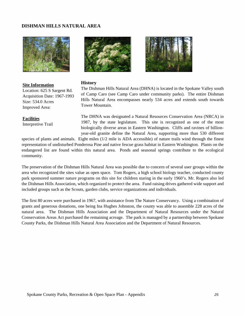
Spokane County Parks, Recreation & Open Space Plan - Appendix 25
DISHMAN HILLS NATURAL AREA
History The Dishman Hills Natural Area (DHNA) is located in the Spokane Valley south of Camp Caro (see Camp Caro under community parks). The entire Dishman Hills Natural Area encompasses nearly 534 acres and extends south towards Tower Mountain. The DHNA was designated a Natural Resources Conservation Area (NRCA) in 1987, by the state legislature. This site is recognized as one of the most biologically diverse areas in Eastern Washington. Cliffs and ravines of billion-year-old granite define the Natural Area, supporting more than 530 different
species of plants and animals. Eight miles (1/2 mile is ADA accessible) of nature trails wind through the finest representation of undisturbed Ponderosa Pine and native fescue grass habitat in Eastern Washington. Plants on the endangered list are found within this natural area. Ponds and seasonal springs contribute to the ecological community. The preservation of the Dishman Hills Natural Area was possible due to concern of several user groups within the area who recognized the sites value as open space. Tom Rogers, a high school biology teacher, conducted county park sponsored summer nature programs on this site for children staring in the early 1960’s. Mr. Rogers also led the Dishman Hills Association, which organized to protect the area. Fund raising drives gathered wide support and included groups such as the Scouts, garden clubs, service organizations and individuals. The first 80 acres were purchased in 1967, with assistance from The Nature Conservancy. Using a combination of grants and generous donations, one being Ina Hughes Johnston, the county was able to assemble 228 acres of the natural area. The Dishman Hills Association and the Department of Natural Resources under the Natural Conservation Areas Act purchased the remaining acreage. The park is managed by a partnership between Spokane County Parks, the Dishman Hills Natural Area Association and the Department of Natural Resources.
Site Information Location: 625 S Sargent Rd. Acquisition Date: 1967-1993 Size: 534.0 Acres Improved Area: Facilities Interpretive Trail
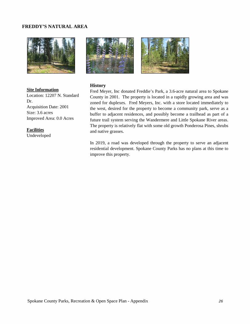
Spokane County Parks, Recreation & Open Space Plan - Appendix 26
FREDDY’S NATURAL AREA
History Fred Meyer, Inc donated Freddie’s Park, a 3.6-acre natural area to Spokane County in 2001. The property is located in a rapidly growing area and was zoned for duplexes. Fred Meyers, Inc. with a store located immediately to the west, desired for the property to become a community park, serve as a buffer to adjacent residences, and possibly become a trailhead as part of a future trail system serving the Wandermere and Little Spokane River areas. The property is relatively flat with some old growth Ponderosa Pines, shrubs and native grasses. In 2019, a road was developed through the property to serve an adjacent residential development. Spokane County Parks has no plans at this time to improve this property.
Site Information Location: 12207 N. Standard Dr. Acquisition Date: 2001 Size: 3.6 acres Improved Area: 0.0 Acres Facilities Undeveloped
Spokane County Parks, Recreation & Open Space Plan - Appendix 27
HAGGIN NATURAL AREA
History Trails The Haggin Natural Area property lies within the Little Spokane River Valley located in north suburban Spokane County. This area has experienced strong steady residential growth over the past two decades, thereby reducing the availability of large parcels for public ownership and protection of habitat. Morey and Margaret Haggin gifted this 10 acre parcel to Spokane County in 1990, with the desire that the property be retained and preserved in its natural state, to the extent possible, for the benefit of the public. The grantors have placed conditions specifying trees may be cut
only for public safety purposes, no cattle grazing, hunting or fishing may be allowed, the property shall not be subdivided; and Spokane County at its sole expense may remove all buildings from the property. The property is subject to a life estate and therefore, is not open to public use without specific permission from the parties residing on the premises. The Little Spokane River corridor is unique in Spokane County and clearly unique in the State of Washington as presenting a rare freshwater marsh and running water environment sustained by subterranean waters. This area contains an impressively diverse wildlife community abounding with aquatic mammals, resident and migratory birds and supports a broad, insect and river-margin animal population. The river valley also has valuable historic and prehistoric features. The Little Spokane River empties into the Spokane River at Nine Mile making it a water and trail route used by the native Indians.
Site Information Location: 15418 N. Little Spokane Dr. Acquisition Date: 1990 (Donated) Size: 9.07 Acres Improved Area: Facilities
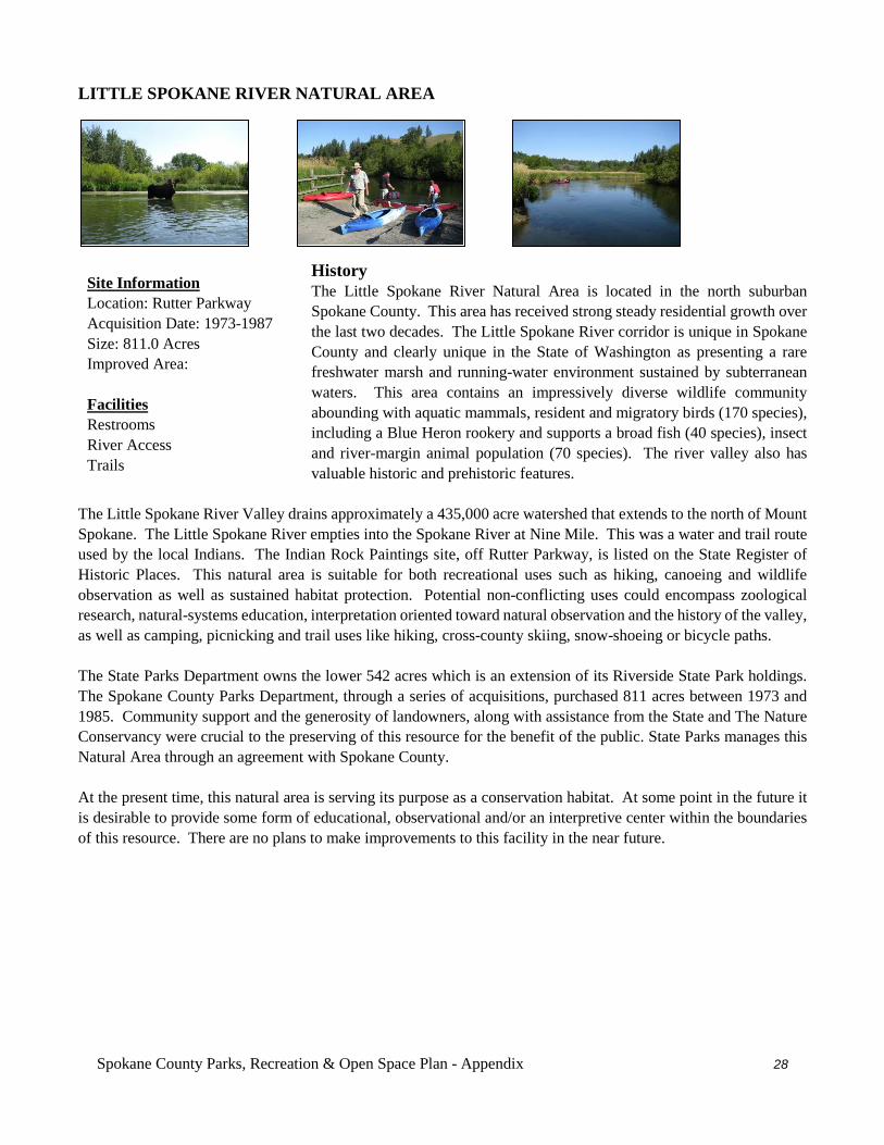
Spokane County Parks, Recreation & Open Space Plan - Appendix 28
LITTLE SPOKANE RIVER NATURAL AREA
History The Little Spokane River Natural Area is located in the north suburban Spokane County. This area has received strong steady residential growth over the last two decades. The Little Spokane River corridor is unique in Spokane County and clearly unique in the State of Washington as presenting a rare freshwater marsh and running-water environment sustained by subterranean waters. This area contains an impressively diverse wildlife community abounding with aquatic mammals, resident and migratory birds (170 species), including a Blue Heron rookery and supports a broad fish (40 species), insect and river-margin animal population (70 species). The river valley also has valuable historic and prehistoric features.
The Little Spokane River Valley drains approximately a 435,000 acre watershed that extends to the north of Mount Spokane. The Little Spokane River empties into the Spokane River at Nine Mile. This was a water and trail route used by the local Indians. The Indian Rock Paintings site, off Rutter Parkway, is listed on the State Register of Historic Places. This natural area is suitable for both recreational uses such as hiking, canoeing and wildlife observation as well as sustained habitat protection. Potential non-conflicting uses could encompass zoological research, natural-systems education, interpretation oriented toward natural observation and the history of the valley, as well as camping, picnicking and trail uses like hiking, cross-county skiing, snow-shoeing or bicycle paths. The State Parks Department owns the lower 542 acres which is an extension of its Riverside State Park holdings. The Spokane County Parks Department, through a series of acquisitions, purchased 811 acres between 1973 and 1985. Community support and the generosity of landowners, along with assistance from the State and The Nature Conservancy were crucial to the preserving of this resource for the benefit of the public. State Parks manages this Natural Area through an agreement with Spokane County. At the present time, this natural area is serving its purpose as a conservation habitat. At some point in the future it is desirable to provide some form of educational, observational and/or an interpretive center within the boundaries of this resource. There are no plans to make improvements to this facility in the near future.
Site Information Location: Rutter Parkway Acquisition Date: 1973-1987 Size: 811.0 Acres Improved Area: Facilities Restrooms River Access Trails
Spokane County Parks, Recreation & Open Space Plan - Appendix 29
MORROW PARK NATURAL AREA
History Morrow Park natural Area is located in the southern portion of the Spokane Valley at the end of Morrow Park Road. Charles W. and Florence B. Morrow donated the land in 1961, as a natural area with hiking and sledding in Park mind. The area north of the park has recently experienced significant residential growth. The park site is heavily forested with steep slopes and serves as a wildlife sanctuary within a fast urbanizing area. There are no plans in the near future to make improvements to this park.
Site Information Location: Morrow Rd. Acquisition Date: 1961 (Donated) Size: 40.0 Acres Improved Area: Facilities Undeveloped
Spokane County Parks, Recreation & Open Space Plan - Appendix 30
NEWMAN LAKE NATURAL AREA
History The Newman Lake Natural Area property is located in the east area of the county, just south of Newman Lake off of Harvard Road. Paul and Dorothy Noble gifted the property to the Parks Department. The property is restricted to remaining in its natural state with development limited to nature trails and restrooms. Currently, the Parks Department has no plans for this property, but it could be developed in the future as a natural area.
Site Information Location: Harvard Rd. Acquisition Date: 1986 Size: 48.9 Acres Improved Area: Facilities Undeveloped
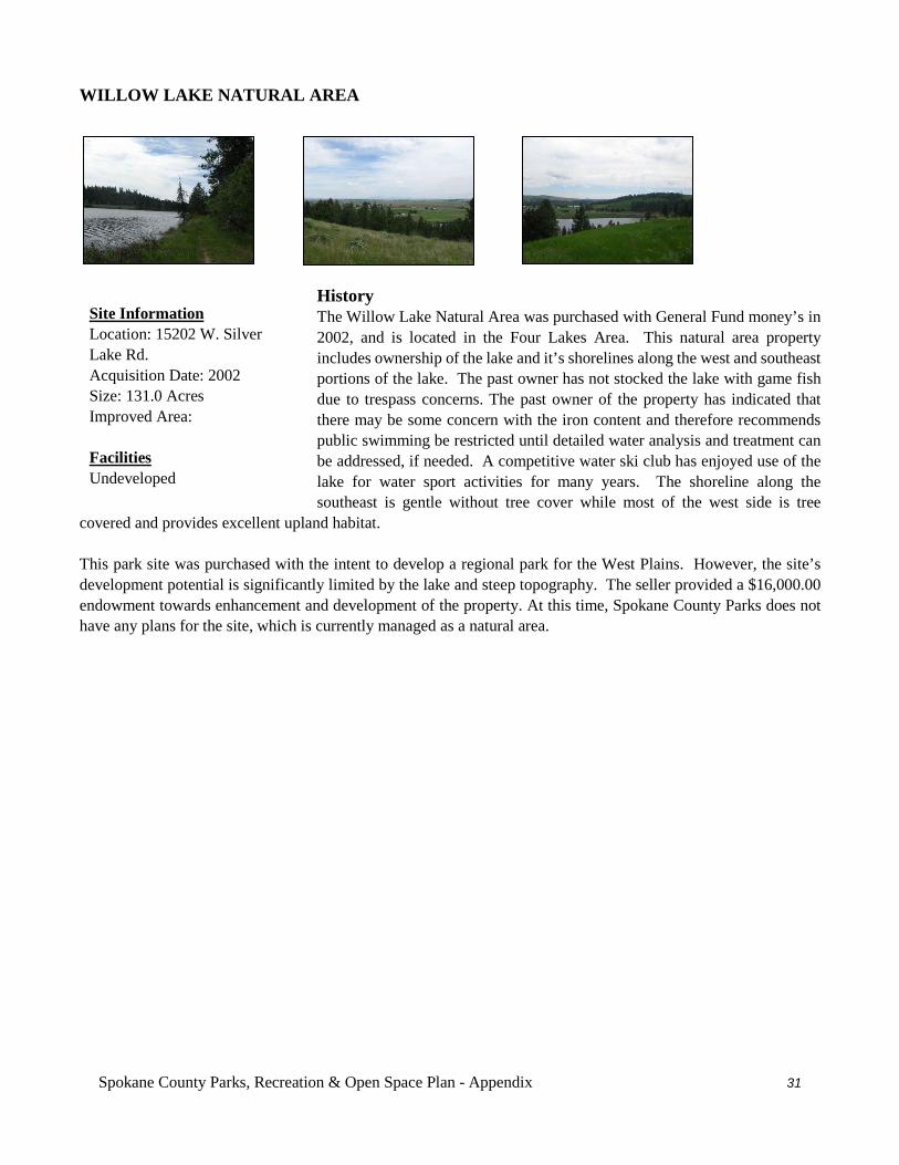
Spokane County Parks, Recreation & Open Space Plan - Appendix 31
WILLOW LAKE NATURAL AREA
History The Willow Lake Natural Area was purchased with General Fund money’s in 2002, and is located in the Four Lakes Area. This natural area property includes ownership of the lake and it’s shorelines along the west and southeast portions of the lake. The past owner has not stocked the lake with game fish due to trespass concerns. The past owner of the property has indicated that there may be some concern with the iron content and therefore recommends public swimming be restricted until detailed water analysis and treatment can be addressed, if needed. A competitive water ski club has enjoyed use of the lake for water sport activities for many years. The shoreline along the southeast is gentle without tree cover while most of the west side is tree
covered and provides excellent upland habitat. This park site was purchased with the intent to develop a regional park for the West Plains. However, the site’s development potential is significantly limited by the lake and steep topography. The seller provided a $16,000.00 endowment towards enhancement and development of the property. At this time, Spokane County Parks does not have any plans for the site, which is currently managed as a natural area.
Site Information Location: 15202 W. Silver Lake Rd. Acquisition Date: 2002 Size: 131.0 Acres Improved Area: Facilities Undeveloped
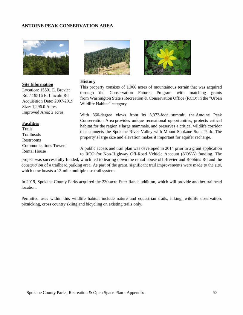
Spokane County Parks, Recreation & Open Space Plan - Appendix 32
ANTOINE PEAK CONSERVATION AREA
History This property consists of 1,066 acres of mountainous terrain that was acquired through the Conservation Futures Program with matching grants from Washington State's Recreation & Conservation Office (RCO) in the "Urban Wildlife Habitat" category. With 360-degree views from its 3,373-foot summit, the Antoine Peak Conservation Area provides unique recreational opportunities, protects critical habitat for the region’s large mammals, and preserves a critical wildlife corridor that connects the Spokane River Valley with Mount Spokane State Park. The property’s large size and elevation makes it important for aquifer recharge. A public access and trail plan was developed in 2014 prior to a grant application to RCO for Non-Highway Off-Road Vehicle Account (NOVA) funding. The
project was successfully funded, which led to tearing down the rental house off Brevier and Robbins Rd and the construction of a trailhead parking area. As part of the grant, significant trail improvements were made to the site, which now boasts a 12-mile multiple use trail system. In 2019, Spokane County Parks acquired the 230-acre Etter Ranch addition, which will provide another trailhead location. Permitted uses within this wildlife habitat include nature and equestrian trails, hiking, wildlife observation, picnicking, cross country skiing and bicycling on existing trails only.
Site Information Location: 15501 E. Brevier Rd. / 19516 E. Lincoln Rd. Acquisition Date: 2007-2019 Size: 1,296.0 Acres Improved Area: 2 acres Facilities Trails Trailheads Restrooms Communications Towers Rental House
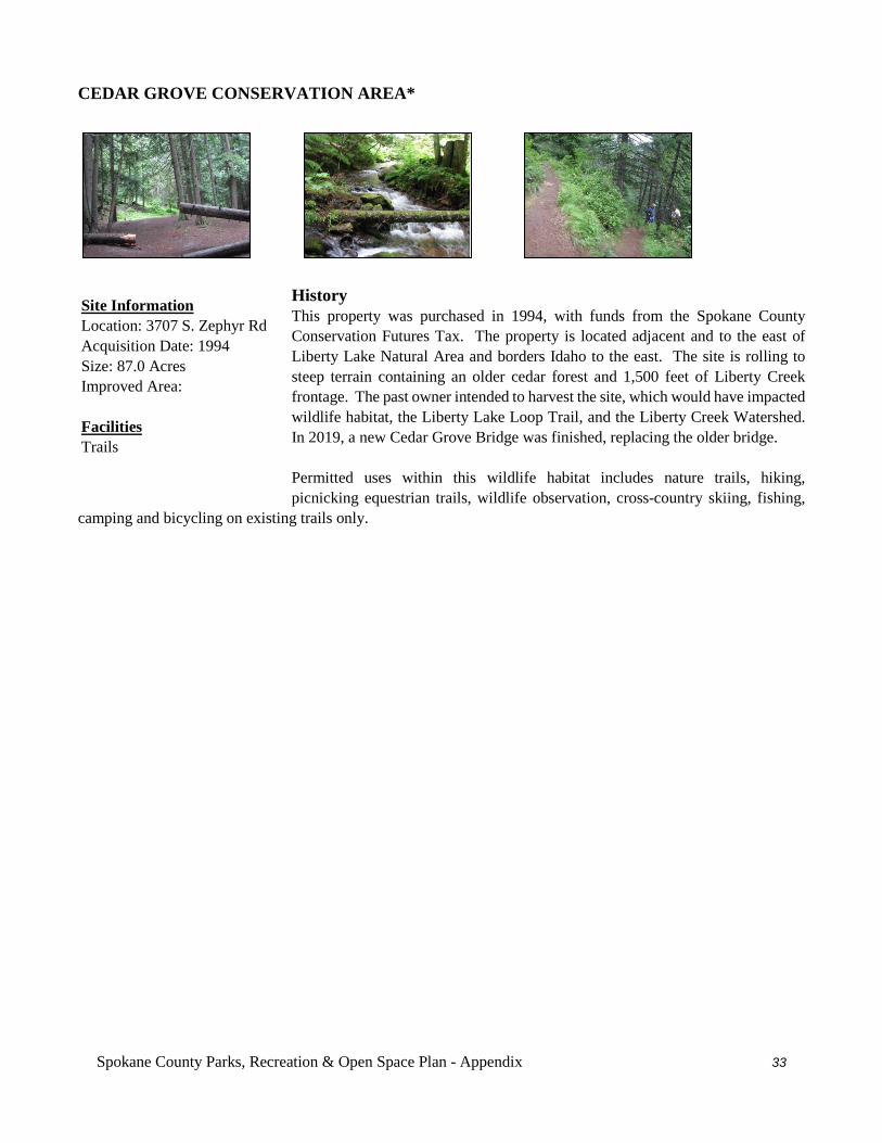
Spokane County Parks, Recreation & Open Space Plan - Appendix 33
CEDAR GROVE CONSERVATION AREA*
History This property was purchased in 1994, with funds from the Spokane County Conservation Futures Tax. The property is located adjacent and to the east of Liberty Lake Natural Area and borders Idaho to the east. The site is rolling to steep terrain containing an older cedar forest and 1,500 feet of Liberty Creek frontage. The past owner intended to harvest the site, which would have impacted wildlife habitat, the Liberty Lake Loop Trail, and the Liberty Creek Watershed. In 2019, a new Cedar Grove Bridge was finished, replacing the older bridge. Permitted uses within this wildlife habitat includes nature trails, hiking, picnicking equestrian trails, wildlife observation, cross-country skiing, fishing,
camping and bicycling on existing trails only.
Site Information Location: 3707 S. Zephyr Rd Acquisition Date: 1994 Size: 87.0 Acres Improved Area: Facilities Trails
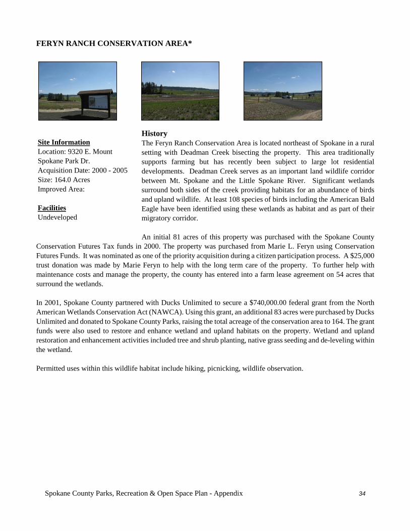
Spokane County Parks, Recreation & Open Space Plan - Appendix 34
FERYN RANCH CONSERVATION AREA*
History The Feryn Ranch Conservation Area is located northeast of Spokane in a rural setting with Deadman Creek bisecting the property. This area traditionally supports farming but has recently been subject to large lot residential developments. Deadman Creek serves as an important land wildlife corridor between Mt. Spokane and the Little Spokane River. Significant wetlands surround both sides of the creek providing habitats for an abundance of birds and upland wildlife. At least 108 species of birds including the American Bald Eagle have been identified using these wetlands as habitat and as part of their migratory corridor. An initial 81 acres of this property was purchased with the Spokane County
Conservation Futures Tax funds in 2000. The property was purchased from Marie L. Feryn using Conservation Futures Funds. It was nominated as one of the priority acquisition during a citizen participation process. A $25,000 trust donation was made by Marie Feryn to help with the long term care of the property. To further help with maintenance costs and manage the property, the county has entered into a farm lease agreement on 54 acres that surround the wetlands. In 2001, Spokane County partnered with Ducks Unlimited to secure a $740,000.00 federal grant from the North American Wetlands Conservation Act (NAWCA). Using this grant, an additional 83 acres were purchased by Ducks Unlimited and donated to Spokane County Parks, raising the total acreage of the conservation area to 164. The grant funds were also used to restore and enhance wetland and upland habitats on the property. Wetland and upland restoration and enhancement activities included tree and shrub planting, native grass seeding and de-leveling within the wetland. Permitted uses within this wildlife habitat include hiking, picnicking, wildlife observation.
Site Information Location: 9320 E. Mount Spokane Park Dr. Acquisition Date: 2000 - 2005 Size: 164.0 Acres Improved Area: Facilities Undeveloped
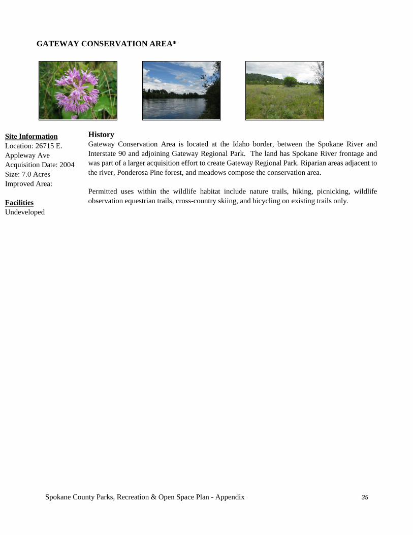
Spokane County Parks, Recreation & Open Space Plan - Appendix 35
GATEWAY CONSERVATION AREA*
History Gateway Conservation Area is located at the Idaho border, between the Spokane River and Interstate 90 and adjoining Gateway Regional Park. The land has Spokane River frontage and was part of a larger acquisition effort to create Gateway Regional Park. Riparian areas adjacent to the river, Ponderosa Pine forest, and meadows compose the conservation area. Permitted uses within the wildlife habitat include nature trails, hiking, picnicking, wildlife observation equestrian trails, cross-country skiing, and bicycling on existing trails only.
Site Information Location: 26715 E. Appleway Ave Acquisition Date: 2004 Size: 7.0 Acres Improved Area: Facilities Undeveloped
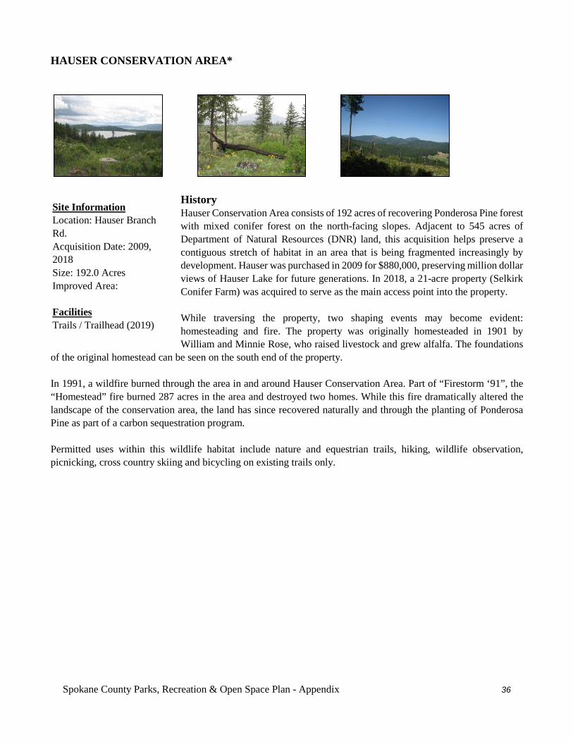
Spokane County Parks, Recreation & Open Space Plan - Appendix 36
HAUSER CONSERVATION AREA*
History Hauser Conservation Area consists of 192 acres of recovering Ponderosa Pine forest with mixed conifer forest on the north-facing slopes. Adjacent to 545 acres of Department of Natural Resources (DNR) land, this acquisition helps preserve a contiguous stretch of habitat in an area that is being fragmented increasingly by development. Hauser was purchased in 2009 for $880,000, preserving million dollar views of Hauser Lake for future generations. In 2018, a 21-acre property (Selkirk Conifer Farm) was acquired to serve as the main access point into the property. While traversing the property, two shaping events may become evident: homesteading and fire. The property was originally homesteaded in 1901 by William and Minnie Rose, who raised livestock and grew alfalfa. The foundations
of the original homestead can be seen on the south end of the property. In 1991, a wildfire burned through the area in and around Hauser Conservation Area. Part of “Firestorm ‘91”, the “Homestead” fire burned 287 acres in the area and destroyed two homes. While this fire dramatically altered the landscape of the conservation area, the land has since recovered naturally and through the planting of Ponderosa Pine as part of a carbon sequestration program. Permitted uses within this wildlife habitat include nature and equestrian trails, hiking, wildlife observation, picnicking, cross country skiing and bicycling on existing trails only.
Site Information Location: Hauser Branch Rd. Acquisition Date: 2009, 2018 Size: 192.0 Acres Improved Area: Facilities Trails / Trailhead (2019)
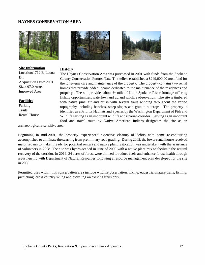
Spokane County Parks, Recreation & Open Space Plan - Appendix 37
HAYNES CONSERVATION AREA
History The Haynes Conservation Area was purchased in 2001 with funds from the Spokane County Conservation Futures Tax. The sellers established a $249,000.00 trust fund for the long-term care and maintenance of the property. The property contains two rental homes that provide added income dedicated to the maintenance of the residences and property. The site provides about ½ mile of Little Spokane River frontage offering fishing opportunities, waterfowl and upland wildlife observation. The site is timbered with native pine, fir and brush with several trails winding throughout the varied topography including benches, steep slopes and granite outcrops. The property is identified as a Priority Habitats and Species by the Washington Department of Fish and Wildlife serving as an important wildlife and riparian corridor. Serving as an important food and travel route by Native American Indians designates the site as an
archaeologically sensitive area. Beginning in mid-2001, the property experienced extensive cleanup of debris with some re-contouring accomplished to eliminate the scarring from preliminary road grading. During 2002, the lower rental house received major repairs to make it ready for potential renters and native plant restoration was undertaken with the assistance of volunteers in 2008. The site was hydro-seeded in June of 2009 with a native plant mix to facilitate the natural recovery of the corridor. In 2019, 24 acres of forest were thinned to reduce fuels and enhance forest health through a partnership with Department of Natural Resources following a resource management plan developed for the site in 2008. Permitted uses within this conservation area include wildlife observation, hiking, equestrian/nature trails, fishing, picnicking, cross country skiing and bicycling on existing trails only.
Site Information Location:1712 E. Leona Dr. Acquisition Date: 2001 Size: 97.0 Acres Improved Area: Facilities Parking Trails Rental House
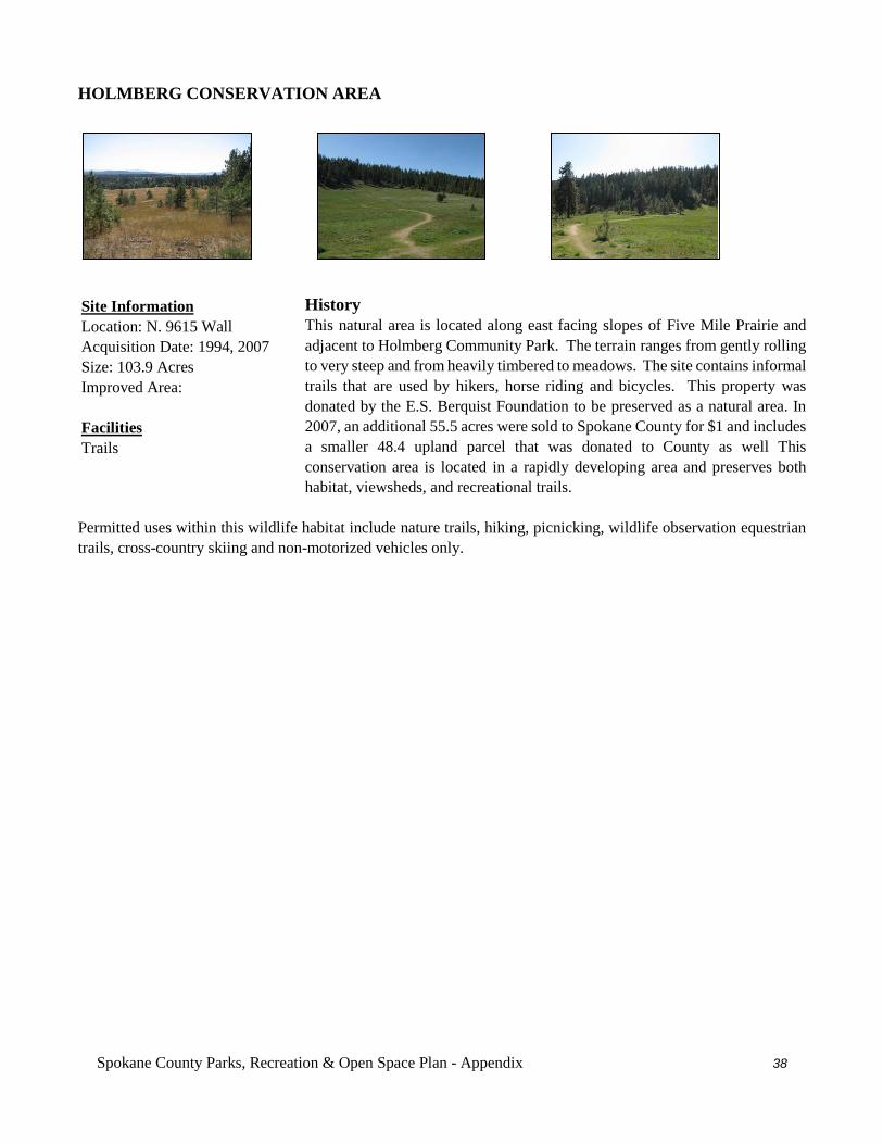
Spokane County Parks, Recreation & Open Space Plan - Appendix 38
HOLMBERG CONSERVATION AREA
History This natural area is located along east facing slopes of Five Mile Prairie and adjacent to Holmberg Community Park. The terrain ranges from gently rolling to very steep and from heavily timbered to meadows. The site contains informal trails that are used by hikers, horse riding and bicycles. This property was donated by the E.S. Berquist Foundation to be preserved as a natural area. In 2007, an additional 55.5 acres were sold to Spokane County for $1 and includes a smaller 48.4 upland parcel that was donated to County as well This conservation area is located in a rapidly developing area and preserves both habitat, viewsheds, and recreational trails.
Permitted uses within this wildlife habitat include nature trails, hiking, picnicking, wildlife observation equestrian trails, cross-country skiing and non-motorized vehicles only.
Site Information Location: N. 9615 Wall Acquisition Date: 1994, 2007 Size: 103.9 Acres Improved Area: Facilities Trails
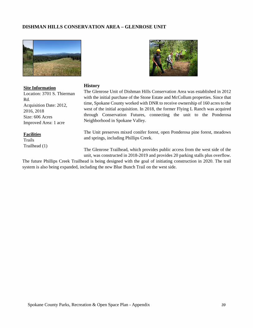
Spokane County Parks, Recreation & Open Space Plan - Appendix 39
DISHMAN HILLS CONSERVATION AREA – GLENROSE UNIT
History The Glenrose Unit of Dishman Hills Conservation Area was established in 2012 with the initial purchase of the Stone Estate and McCollum properties. Since that time, Spokane County worked with DNR to receive ownership of 160 acres to the west of the initial acquisition. In 2018, the former Flying L Ranch was acquired through Conservation Futures, connecting the unit to the Ponderosa Neighborhood in Spokane Valley. The Unit preserves mixed conifer forest, open Ponderosa pine forest, meadows and springs, including Phillips Creek. The Glenrose Trailhead, which provides public access from the west side of the unit, was constructed in 2018-2019 and provides 20 parking stalls plus overflow.
The future Phillips Creek Trailhead is being designed with the goal of initiating construction in 2020. The trail system is also being expanded, including the new Blue Bunch Trail on the west side.
Site Information Location: 3701 S. Thierman Rd. Acquisition Date: 2012, 2016, 2018 Size: 606 Acres Improved Area: 1 acre Facilities Trails Trailhead (1)
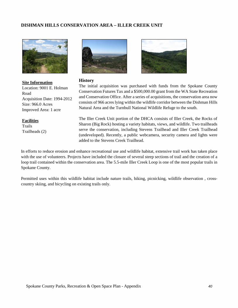
Spokane County Parks, Recreation & Open Space Plan - Appendix 40
DISHMAN HILLS CONSERVATION AREA – ILLER CREEK UNIT
History The initial acquisition was purchased with funds from the Spokane County Conservation Futures Tax and a $500,000.00 grant from the WA State Recreation and Conservation Office. After a series of acquisitions, the conservation area now consists of 966 acres lying within the wildlife corridor between the Dishman Hills Natural Area and the Turnbull National Wildlife Refuge to the south. The Iller Creek Unit portion of the DHCA consists of Iller Creek, the Rocks of Sharon (Big Rock) hosting a variety habitats, views, and wildlife. Two trailheads serve the conservation, including Stevens Trailhead and Iller Creek Trailhead (undeveloped). Recently, a public webcamera, security camera and lights were added to the Stevens Creek Trailhead.
In efforts to reduce erosion and enhance recreational use and wildlife habitat, extensive trail work has taken place with the use of volunteers. Projects have included the closure of several steep sections of trail and the creation of a loop trail contained within the conservation area. The 5.5-mile Iller Creek Loop is one of the most popular trails in Spokane County. Permitted uses within this wildlife habitat include nature trails, hiking, picnicking, wildlife observation , cross-country skiing, and bicycling on existing trails only.
Site Information Location: 9001 E. Holman Road Acquisition Date: 1994-2012 Size: 966.0 Acres Improved Area: 1 acre Facilities Trails Trailheads (2)
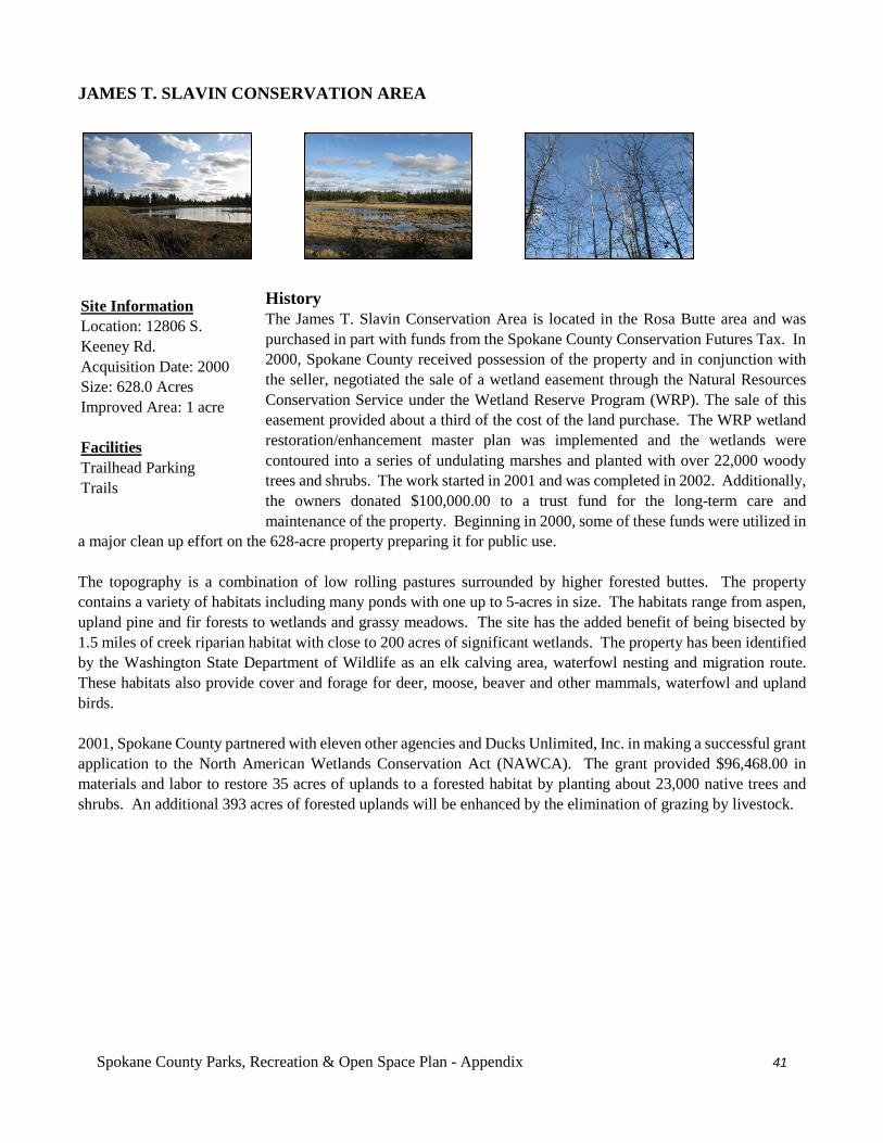
Spokane County Parks, Recreation & Open Space Plan - Appendix 41
JAMES T. SLAVIN CONSERVATION AREA
History The James T. Slavin Conservation Area is located in the Rosa Butte area and was purchased in part with funds from the Spokane County Conservation Futures Tax. In 2000, Spokane County received possession of the property and in conjunction with the seller, negotiated the sale of a wetland easement through the Natural Resources Conservation Service under the Wetland Reserve Program (WRP). The sale of this easement provided about a third of the cost of the land purchase. The WRP wetland restoration/enhancement master plan was implemented and the wetlands were contoured into a series of undulating marshes and planted with over 22,000 woody trees and shrubs. The work started in 2001 and was completed in 2002. Additionally, the owners donated $100,000.00 to a trust fund for the long-term care and maintenance of the property. Beginning in 2000, some of these funds were utilized in
a major clean up effort on the 628-acre property preparing it for public use. The topography is a combination of low rolling pastures surrounded by higher forested buttes. The property contains a variety of habitats including many ponds with one up to 5-acres in size. The habitats range from aspen, upland pine and fir forests to wetlands and grassy meadows. The site has the added benefit of being bisected by 1.5 miles of creek riparian habitat with close to 200 acres of significant wetlands. The property has been identified by the Washington State Department of Wildlife as an elk calving area, waterfowl nesting and migration route. These habitats also provide cover and forage for deer, moose, beaver and other mammals, waterfowl and upland birds. 2001, Spokane County partnered with eleven other agencies and Ducks Unlimited, Inc. in making a successful grant application to the North American Wetlands Conservation Act (NAWCA). The grant provided $96,468.00 in materials and labor to restore 35 acres of uplands to a forested habitat by planting about 23,000 native trees and shrubs. An additional 393 acres of forested uplands will be enhanced by the elimination of grazing by livestock.
Site Information Location: 12806 S. Keeney Rd. Acquisition Date: 2000 Size: 628.0 Acres Improved Area: 1 acre Facilities Trailhead Parking Trails
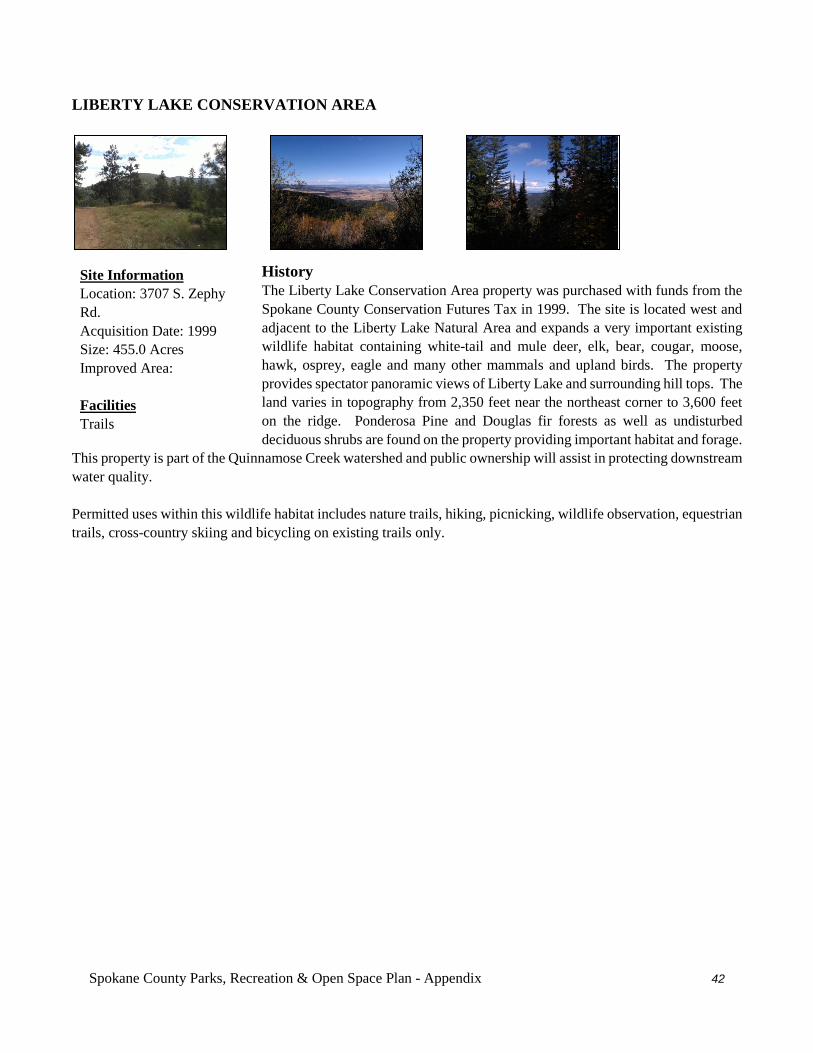
Spokane County Parks, Recreation & Open Space Plan - Appendix 42
LIBERTY LAKE CONSERVATION AREA
History The Liberty Lake Conservation Area property was purchased with funds from the Spokane County Conservation Futures Tax in 1999. The site is located west and adjacent to the Liberty Lake Natural Area and expands a very important existing wildlife habitat containing white-tail and mule deer, elk, bear, cougar, moose, hawk, osprey, eagle and many other mammals and upland birds. The property provides spectator panoramic views of Liberty Lake and surrounding hill tops. The land varies in topography from 2,350 feet near the northeast corner to 3,600 feet on the ridge. Ponderosa Pine and Douglas fir forests as well as undisturbed deciduous shrubs are found on the property providing important habitat and forage.
This property is part of the Quinnamose Creek watershed and public ownership will assist in protecting downstream water quality. Permitted uses within this wildlife habitat includes nature trails, hiking, picnicking, wildlife observation, equestrian trails, cross-country skiing and bicycling on existing trails only.
Site Information Location: 3707 S. Zephy Rd. Acquisition Date: 1999 Size: 455.0 Acres Improved Area: Facilities Trails
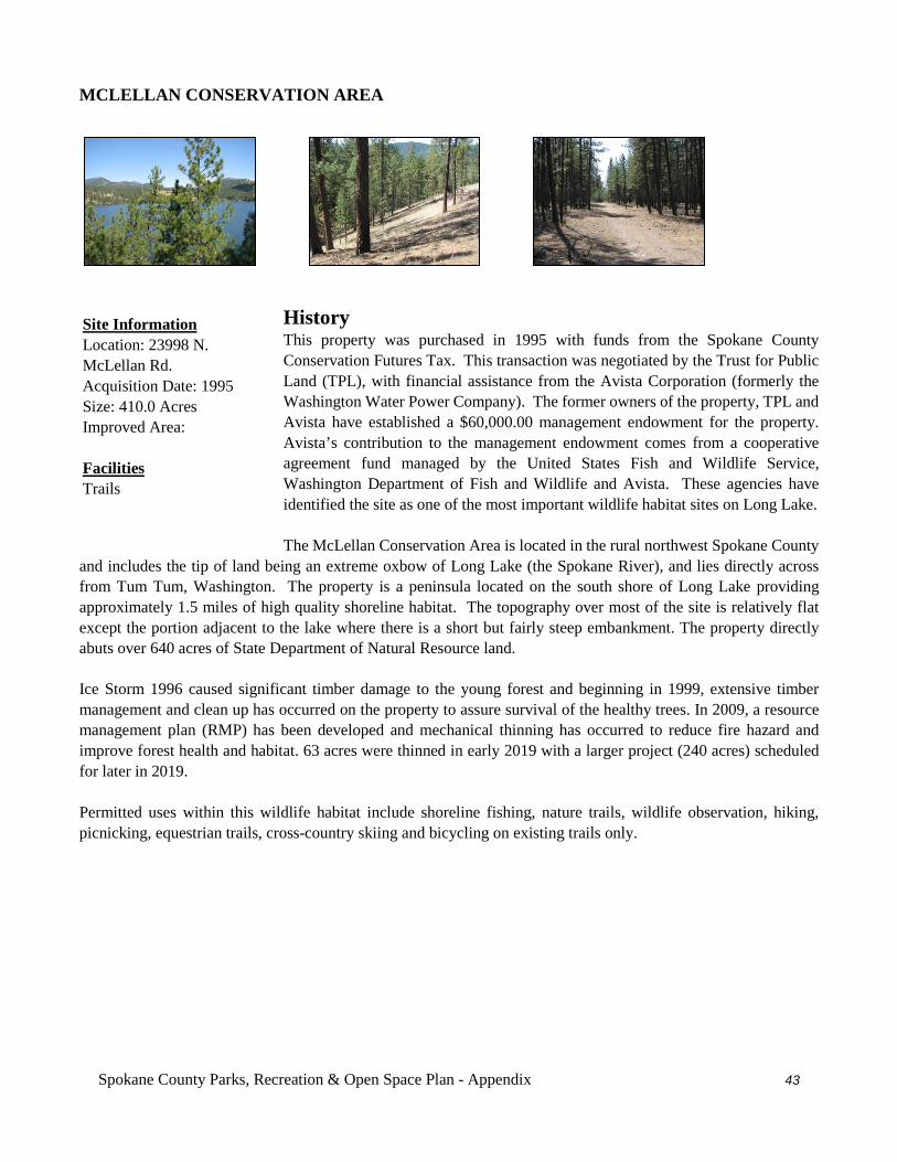
Spokane County Parks, Recreation & Open Space Plan - Appendix 43
MCLELLAN CONSERVATION AREA
History This property was purchased in 1995 with funds from the Spokane County Conservation Futures Tax. This transaction was negotiated by the Trust for Public Land (TPL), with financial assistance from the Avista Corporation (formerly the Washington Water Power Company). The former owners of the property, TPL and Avista have established a $60,000.00 management endowment for the property. Avista’s contribution to the management endowment comes from a cooperative agreement fund managed by the United States Fish and Wildlife Service, Washington Department of Fish and Wildlife and Avista. These agencies have identified the site as one of the most important wildlife habitat sites on Long Lake. The McLellan Conservation Area is located in the rural northwest Spokane County
and includes the tip of land being an extreme oxbow of Long Lake (the Spokane River), and lies directly across from Tum Tum, Washington. The property is a peninsula located on the south shore of Long Lake providing approximately 1.5 miles of high quality shoreline habitat. The topography over most of the site is relatively flat except the portion adjacent to the lake where there is a short but fairly steep embankment. The property directly abuts over 640 acres of State Department of Natural Resource land. Ice Storm 1996 caused significant timber damage to the young forest and beginning in 1999, extensive timber management and clean up has occurred on the property to assure survival of the healthy trees. In 2009, a resource management plan (RMP) has been developed and mechanical thinning has occurred to reduce fire hazard and improve forest health and habitat. 63 acres were thinned in early 2019 with a larger project (240 acres) scheduled for later in 2019. Permitted uses within this wildlife habitat include shoreline fishing, nature trails, wildlife observation, hiking, picnicking, equestrian trails, cross-country skiing and bicycling on existing trails only.
Site Information Location: 23998 N. McLellan Rd. Acquisition Date: 1995 Size: 410.0 Acres Improved Area: Facilities Trails
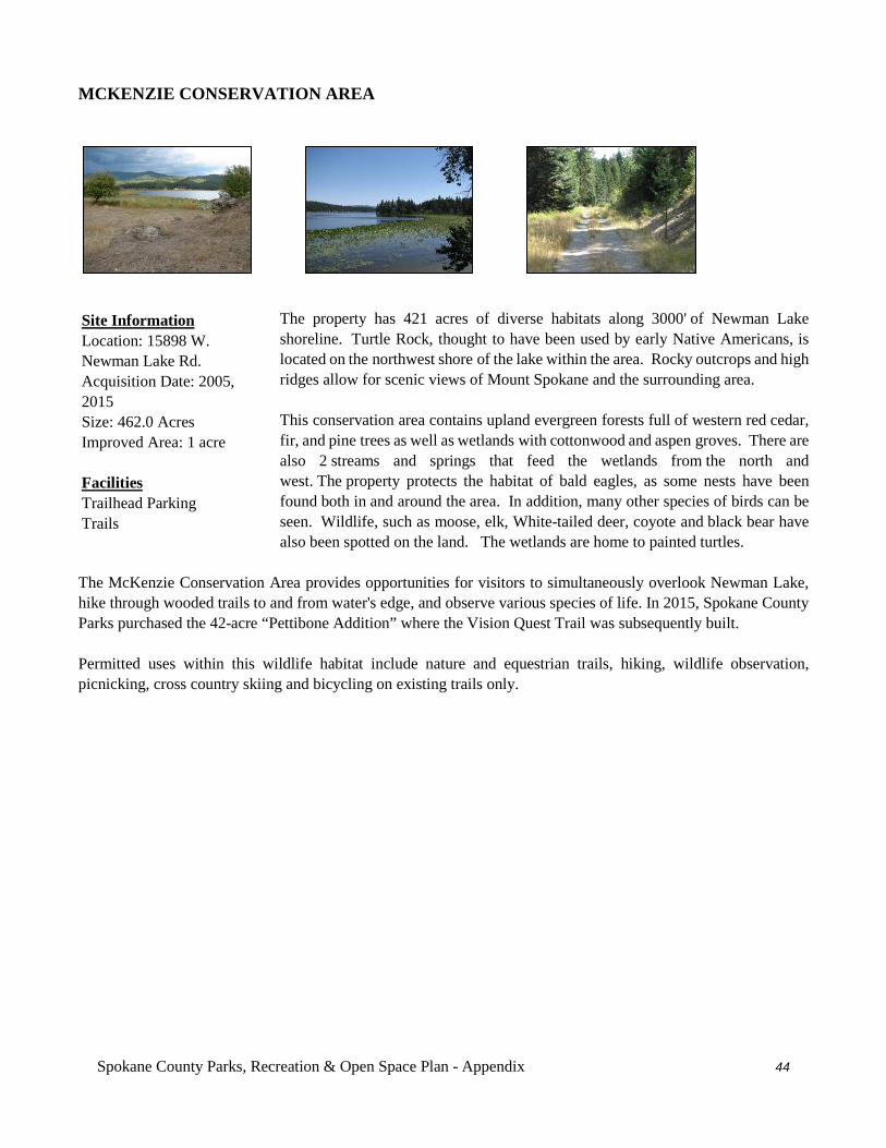
Spokane County Parks, Recreation & Open Space Plan - Appendix 44
MCKENZIE CONSERVATION AREA
The property has 421 acres of diverse habitats along 3000' of Newman Lake shoreline. Turtle Rock, thought to have been used by early Native Americans, is located on the northwest shore of the lake within the area. Rocky outcrops and high ridges allow for scenic views of Mount Spokane and the surrounding area. This conservation area contains upland evergreen forests full of western red cedar, fir, and pine trees as well as wetlands with cottonwood and aspen groves. There are also 2 streams and springs that feed the wetlands from the north and west. The property protects the habitat of bald eagles, as some nests have been found both in and around the area. In addition, many other species of birds can be seen. Wildlife, such as moose, elk, White-tailed deer, coyote and black bear have also been spotted on the land. The wetlands are home to painted turtles.
The McKenzie Conservation Area provides opportunities for visitors to simultaneously overlook Newman Lake, hike through wooded trails to and from water's edge, and observe various species of life. In 2015, Spokane County Parks purchased the 42-acre “Pettibone Addition” where the Vision Quest Trail was subsequently built. Permitted uses within this wildlife habitat include nature and equestrian trails, hiking, wildlife observation, picnicking, cross country skiing and bicycling on existing trails only.
Site Information Location: 15898 W. Newman Lake Rd. Acquisition Date: 2005, 2015 Size: 462.0 Acres Improved Area: 1 acre Facilities Trailhead Parking Trails
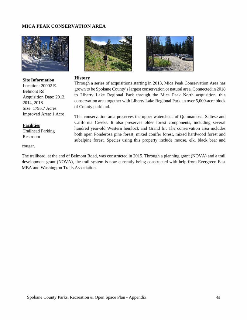
Spokane County Parks, Recreation & Open Space Plan - Appendix 45
MICA PEAK CONSERVATION AREA
History Through a series of acquisitions starting in 2013, Mica Peak Conservation Area has grown to be Spokane County’s largest conservation or natural area. Connected in 2018 to Liberty Lake Regional Park through the Mica Peak North acquisition, this conservation area together with Liberty Lake Regional Park an over 5,000-acre block of County parkland.
This conservation area preserves the upper watersheds of Quinnamose, Saltese and California Creeks. It also preserves older forest components, including several hundred year-old Western hemlock and Grand fir. The conservation area includes both open Ponderosa pine forest, mixed conifer forest, mixed hardwood forest and subalpine forest. Species using this property include moose, elk, black bear and
cougar.
The trailhead, at the end of Belmont Road, was constructed in 2015. Through a planning grant (NOVA) and a trail development grant (NOVA), the trail system is now currently being constructed with help from Evergreen East MBA and Washington Trails Association.
Site Information Location: 20002 E. Belmont Rd Acquisition Date: 2013, 2014, 2018 Size: 1795.7 Acres Improved Area: 1 Acre Facilities Trailhead Parking Restroom
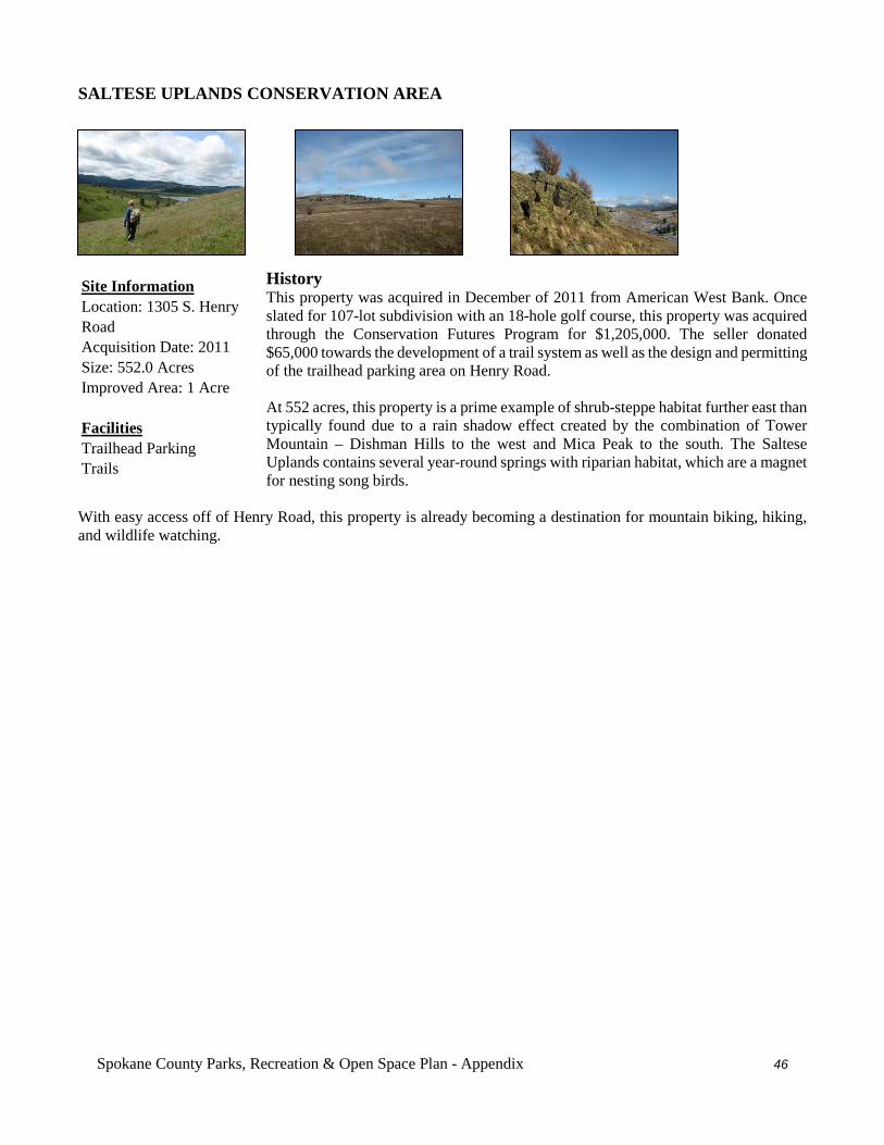
Spokane County Parks, Recreation & Open Space Plan - Appendix 46
SALTESE UPLANDS CONSERVATION AREA
History This property was acquired in December of 2011 from American West Bank. Once slated for 107-lot subdivision with an 18-hole golf course, this property was acquired through the Conservation Futures Program for $1,205,000. The seller donated $65,000 towards the development of a trail system as well as the design and permitting of the trailhead parking area on Henry Road. At 552 acres, this property is a prime example of shrub-steppe habitat further east than typically found due to a rain shadow effect created by the combination of Tower Mountain – Dishman Hills to the west and Mica Peak to the south. The Saltese Uplands contains several year-round springs with riparian habitat, which are a magnet for nesting song birds.
With easy access off of Henry Road, this property is already becoming a destination for mountain biking, hiking, and wildlife watching.
Site Information Location: 1305 S. Henry Road Acquisition Date: 2011 Size: 552.0 Acres Improved Area: 1 Acre Facilities Trailhead Parking Trails
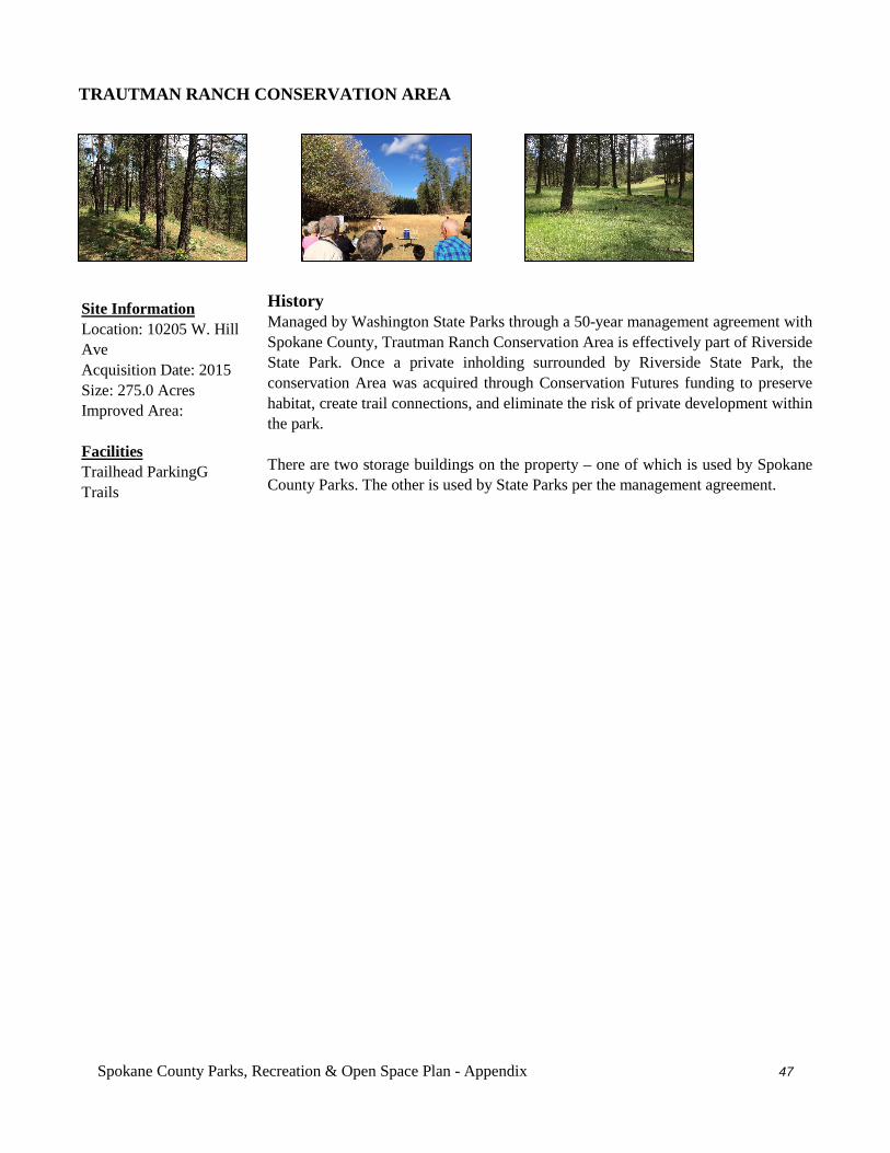
Spokane County Parks, Recreation & Open Space Plan - Appendix 47
TRAUTMAN RANCH CONSERVATION AREA
History Managed by Washington State Parks through a 50-year management agreement with Spokane County, Trautman Ranch Conservation Area is effectively part of Riverside State Park. Once a private inholding surrounded by Riverside State Park, the conservation Area was acquired through Conservation Futures funding to preserve habitat, create trail connections, and eliminate the risk of private development within the park. There are two storage buildings on the property – one of which is used by Spokane County Parks. The other is used by State Parks per the management agreement.
Site Information Location: 10205 W. Hill Ave Acquisition Date: 2015 Size: 275.0 Acres Improved Area: Facilities Trailhead ParkingG Trails
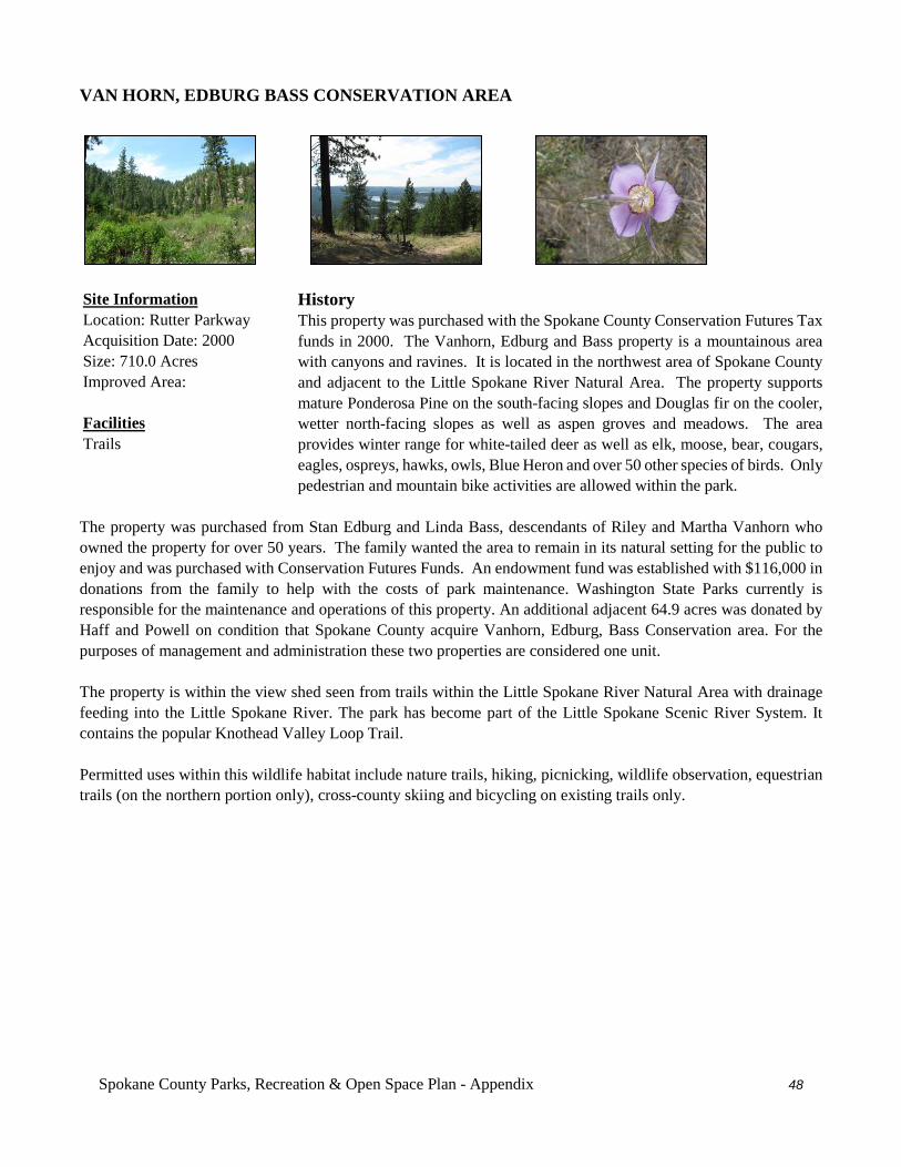
Spokane County Parks, Recreation & Open Space Plan - Appendix 48
VAN HORN, EDBURG BASS CONSERVATION AREA
History This property was purchased with the Spokane County Conservation Futures Tax funds in 2000. The Vanhorn, Edburg and Bass property is a mountainous area with canyons and ravines. It is located in the northwest area of Spokane County and adjacent to the Little Spokane River Natural Area. The property supports mature Ponderosa Pine on the south-facing slopes and Douglas fir on the cooler, wetter north-facing slopes as well as aspen groves and meadows. The area provides winter range for white-tailed deer as well as elk, moose, bear, cougars, eagles, ospreys, hawks, owls, Blue Heron and over 50 other species of birds. Only pedestrian and mountain bike activities are allowed within the park.
The property was purchased from Stan Edburg and Linda Bass, descendants of Riley and Martha Vanhorn who owned the property for over 50 years. The family wanted the area to remain in its natural setting for the public to enjoy and was purchased with Conservation Futures Funds. An endowment fund was established with $116,000 in donations from the family to help with the costs of park maintenance. Washington State Parks currently is responsible for the maintenance and operations of this property. An additional adjacent 64.9 acres was donated by Haff and Powell on condition that Spokane County acquire Vanhorn, Edburg, Bass Conservation area. For the purposes of management and administration these two properties are considered one unit. The property is within the view shed seen from trails within the Little Spokane River Natural Area with drainage feeding into the Little Spokane River. The park has become part of the Little Spokane Scenic River System. It contains the popular Knothead Valley Loop Trail. Permitted uses within this wildlife habitat include nature trails, hiking, picnicking, wildlife observation, equestrian trails (on the northern portion only), cross-county skiing and bicycling on existing trails only.
Site Information Location: Rutter Parkway Acquisition Date: 2000 Size: 710.0 Acres Improved Area: Facilities Trails
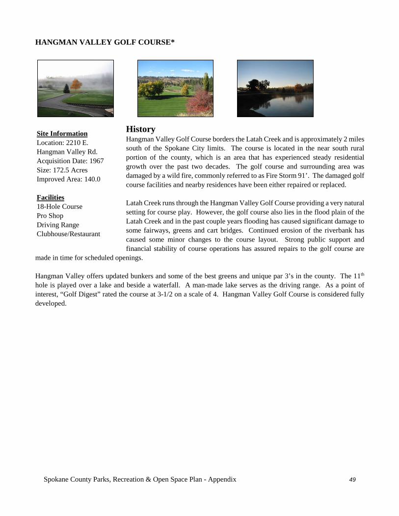
Spokane County Parks, Recreation & Open Space Plan - Appendix 49
HANGMAN VALLEY GOLF COURSE*
History Hangman Valley Golf Course borders the Latah Creek and is approximately 2 miles south of the Spokane City limits. The course is located in the near south rural portion of the county, which is an area that has experienced steady residential growth over the past two decades. The golf course and surrounding area was damaged by a wild fire, commonly referred to as Fire Storm 91’. The damaged golf course facilities and nearby residences have been either repaired or replaced. Latah Creek runs through the Hangman Valley Golf Course providing a very natural setting for course play. However, the golf course also lies in the flood plain of the Latah Creek and in the past couple years flooding has caused significant damage to some fairways, greens and cart bridges. Continued erosion of the riverbank has caused some minor changes to the course layout. Strong public support and financial stability of course operations has assured repairs to the golf course are
made in time for scheduled openings. Hangman Valley offers updated bunkers and some of the best greens and unique par 3’s in the county. The 11th hole is played over a lake and beside a waterfall. A man-made lake serves as the driving range. As a point of interest, “Golf Digest” rated the course at 3-1/2 on a scale of 4. Hangman Valley Golf Course is considered fully developed.
Site Information Location: 2210 E. Hangman Valley Rd. Acquisition Date: 1967 Size: 172.5 Acres Improved Area: 140.0 Facilities 18-Hole Course Pro Shop Driving Range Clubhouse/Restaurant
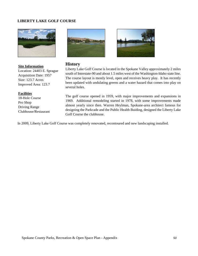
Spokane County Parks, Recreation & Open Space Plan - Appendix 50
LIBERTY LAKE GOLF COURSE
History Liberty Lake Golf Course is located in the Spokane Valley approximately 2 miles south of Interstate-90 and about 1.5 miles west of the Washington-Idaho state line. The course layout is mostly level, open and receives heavy play. It has recently been updated with undulating greens and a water hazard that comes into play on several holes. The golf course opened in 1959, with major improvements and expansions in 1969. Additional remodeling started in 1978, with some improvements made almost yearly since then. Warren Heylman, Spokane-area architect famous for designing the Parkcade and the Public Health Buiding, designed the Liberty Lake Golf Course the clubhouse.
In 2009, Liberty Lake Golf Course was completely renovated, recontoured and new landscaping installed.
Site Information Location: 24403 E. Sprague Acquisition Date: 1957 Size: 123.7 Acres Improved Area: 123.7 Facilities 18-Hole Course Pro Shop Driving Range Clubhouse/Restaurant
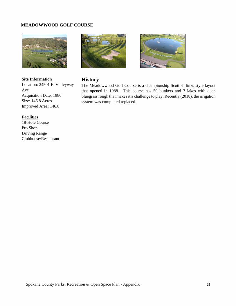
Spokane County Parks, Recreation & Open Space Plan - Appendix 51
MEADOWWOOD GOLF COURSE
History The Meadowwood Golf Course is a championship Scottish links style layout that opened in 1988. This course has 50 bunkers and 7 lakes with deep bluegrass rough that makes it a challenge to play. Recently (2018), the irrigation system was completed replaced.
Site Information Location: 24501 E. Valleyway Ave Acquisition Date: 1986 Size: 146.8 Acres Improved Area: 146.8 Facilities 18-Hole Course Pro Shop Driving Range Clubhouse/Restaurant
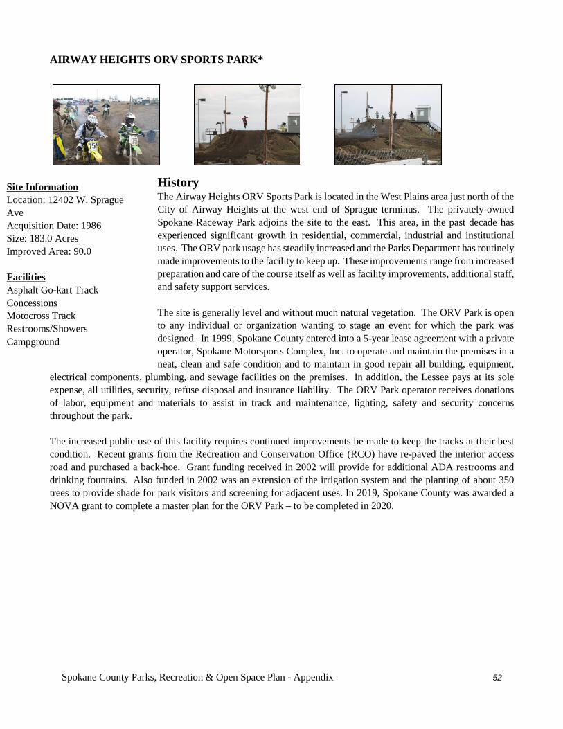
Spokane County Parks, Recreation & Open Space Plan - Appendix 52
AIRWAY HEIGHTS ORV SPORTS PARK*
History The Airway Heights ORV Sports Park is located in the West Plains area just north of the City of Airway Heights at the west end of Sprague terminus. The privately-owned Spokane Raceway Park adjoins the site to the east. This area, in the past decade has experienced significant growth in residential, commercial, industrial and institutional uses. The ORV park usage has steadily increased and the Parks Department has routinely made improvements to the facility to keep up. These improvements range from increased preparation and care of the course itself as well as facility improvements, additional staff, and safety support services. The site is generally level and without much natural vegetation. The ORV Park is open to any individual or organization wanting to stage an event for which the park was designed. In 1999, Spokane County entered into a 5-year lease agreement with a private operator, Spokane Motorsports Complex, Inc. to operate and maintain the premises in a neat, clean and safe condition and to maintain in good repair all building, equipment,
electrical components, plumbing, and sewage facilities on the premises. In addition, the Lessee pays at its sole expense, all utilities, security, refuse disposal and insurance liability. The ORV Park operator receives donations of labor, equipment and materials to assist in track and maintenance, lighting, safety and security concerns throughout the park. The increased public use of this facility requires continued improvements be made to keep the tracks at their best condition. Recent grants from the Recreation and Conservation Office (RCO) have re-paved the interior access road and purchased a back-hoe. Grant funding received in 2002 will provide for additional ADA restrooms and drinking fountains. Also funded in 2002 was an extension of the irrigation system and the planting of about 350 trees to provide shade for park visitors and screening for adjacent uses. In 2019, Spokane County was awarded a NOVA grant to complete a master plan for the ORV Park – to be completed in 2020.
Site Information Location: 12402 W. Sprague Ave Acquisition Date: 1986 Size: 183.0 Acres Improved Area: 90.0 Facilities Asphalt Go-kart Track Concessions Motocross Track Restrooms/Showers Campground
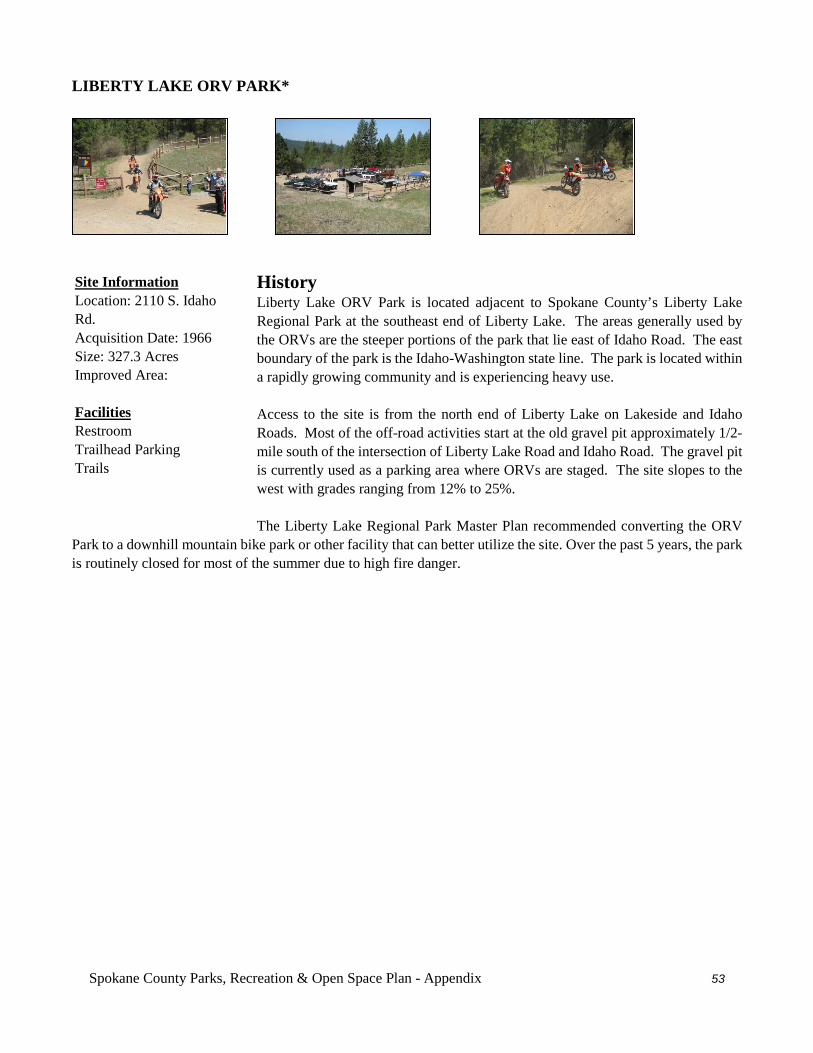
Spokane County Parks, Recreation & Open Space Plan - Appendix 53
LIBERTY LAKE ORV PARK*
History Liberty Lake ORV Park is located adjacent to Spokane County’s Liberty Lake Regional Park at the southeast end of Liberty Lake. The areas generally used by the ORVs are the steeper portions of the park that lie east of Idaho Road. The east boundary of the park is the Idaho-Washington state line. The park is located within a rapidly growing community and is experiencing heavy use. Access to the site is from the north end of Liberty Lake on Lakeside and Idaho Roads. Most of the off-road activities start at the old gravel pit approximately 1/2-mile south of the intersection of Liberty Lake Road and Idaho Road. The gravel pit is currently used as a parking area where ORVs are staged. The site slopes to the west with grades ranging from 12% to 25%. The Liberty Lake Regional Park Master Plan recommended converting the ORV
Park to a downhill mountain bike park or other facility that can better utilize the site. Over the past 5 years, the park is routinely closed for most of the summer due to high fire danger.
Site Information Location: 2110 S. Idaho Rd. Acquisition Date: 1966 Size: 327.3 Acres Improved Area: Facilities Restroom Trailhead Parking Trails
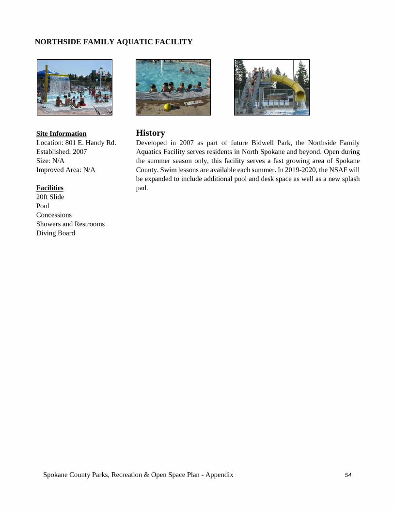
Spokane County Parks, Recreation & Open Space Plan - Appendix 54
NORTHSIDE FAMILY AQUATIC FACILITY
History Developed in 2007 as part of future Bidwell Park, the Northside Family Aquatics Facility serves residents in North Spokane and beyond. Open during the summer season only, this facility serves a fast growing area of Spokane County. Swim lessons are available each summer. In 2019-2020, the NSAF will be expanded to include additional pool and desk space as well as a new splash pad.
Site Information Location: 801 E. Handy Rd. Established: 2007 Size: N/A Improved Area: N/A Facilities 20ft Slide Pool Concessions Showers and Restrooms Diving Board
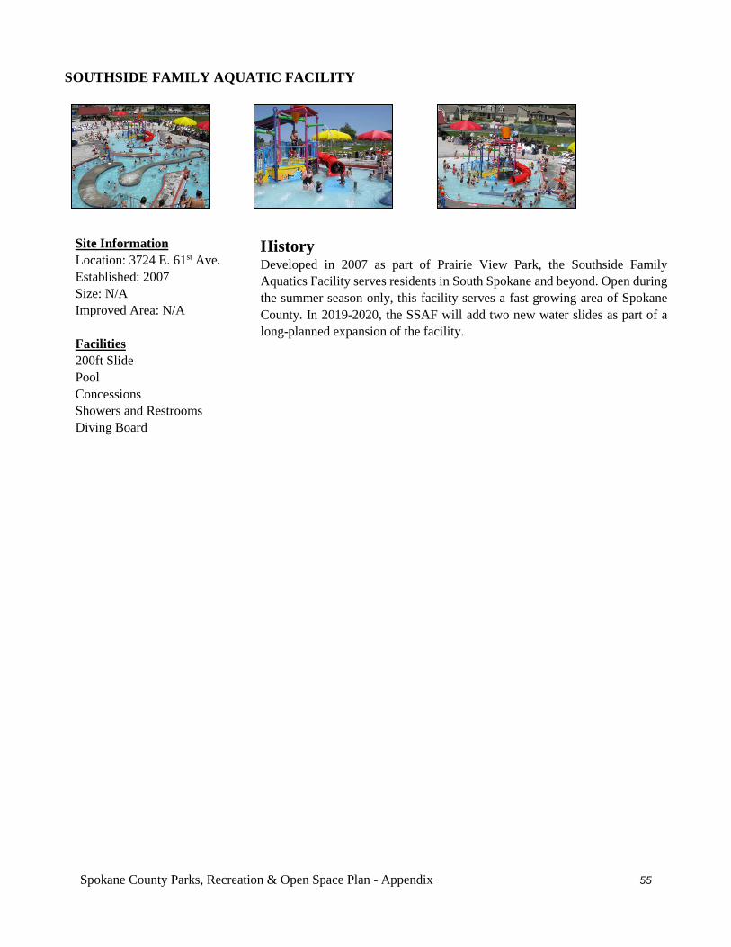
Spokane County Parks, Recreation & Open Space Plan - Appendix 55
SOUTHSIDE FAMILY AQUATIC FACILITY
History Developed in 2007 as part of Prairie View Park, the Southside Family Aquatics Facility serves residents in South Spokane and beyond. Open during the summer season only, this facility serves a fast growing area of Spokane County. In 2019-2020, the SSAF will add two new water slides as part of a long-planned expansion of the facility.
Site Information Location: 3724 E. 61st Ave. Established: 2007 Size: N/A Improved Area: N/A Facilities 200ft Slide Pool Concessions Showers and Restrooms Diving Board
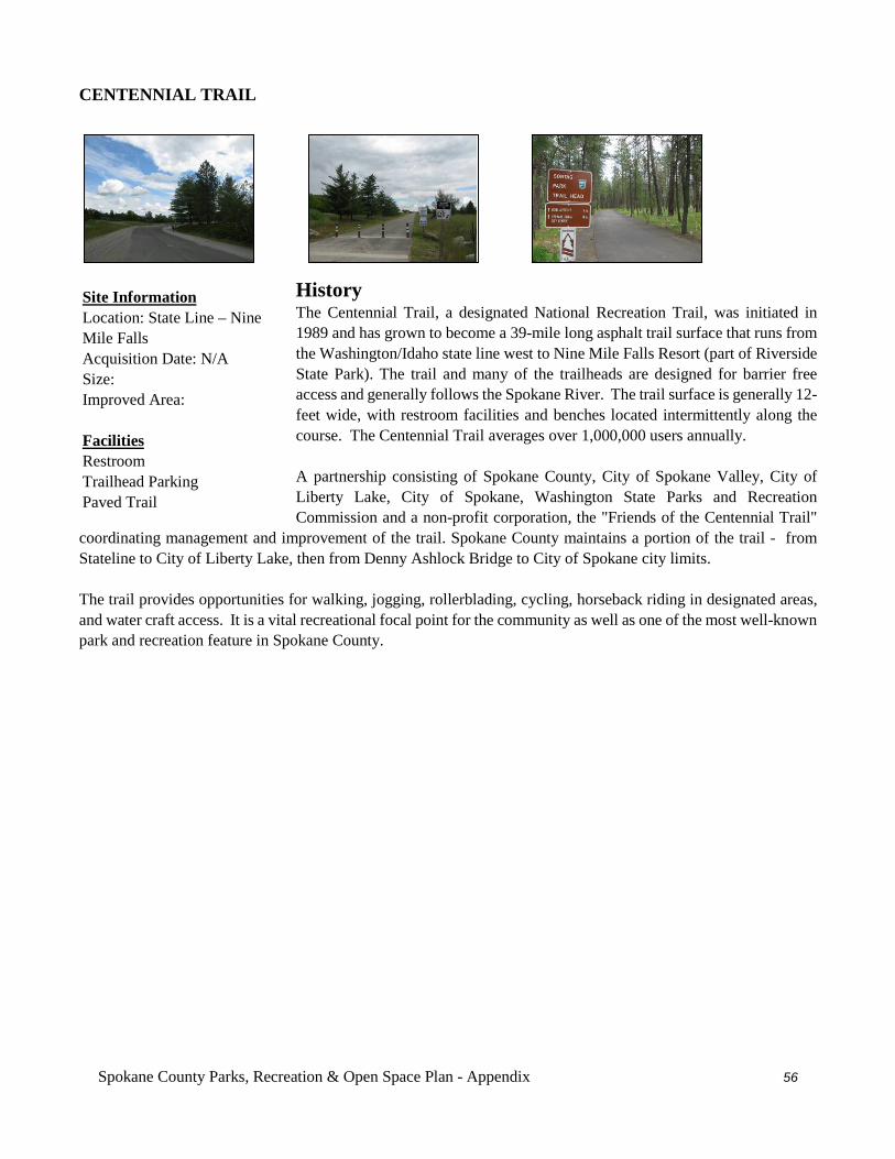
Spokane County Parks, Recreation & Open Space Plan - Appendix 56
CENTENNIAL TRAIL
History The Centennial Trail, a designated National Recreation Trail, was initiated in 1989 and has grown to become a 39-mile long asphalt trail surface that runs from the Washington/Idaho state line west to Nine Mile Falls Resort (part of Riverside State Park). The trail and many of the trailheads are designed for barrier free access and generally follows the Spokane River. The trail surface is generally 12-feet wide, with restroom facilities and benches located intermittently along the course. The Centennial Trail averages over 1,000,000 users annually. A partnership consisting of Spokane County, City of Spokane Valley, City of Liberty Lake, City of Spokane, Washington State Parks and Recreation Commission and a non-profit corporation, the "Friends of the Centennial Trail"
coordinating management and improvement of the trail. Spokane County maintains a portion of the trail - from Stateline to City of Liberty Lake, then from Denny Ashlock Bridge to City of Spokane city limits. The trail provides opportunities for walking, jogging, rollerblading, cycling, horseback riding in designated areas, and water craft access. It is a vital recreational focal point for the community as well as one of the most well-known park and recreation feature in Spokane County.
Site Information Location: State Line – Nine Mile Falls Acquisition Date: N/A Size: Improved Area: Facilities Restroom Trailhead Parking Paved Trail
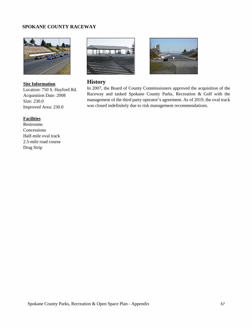
Spokane County Parks, Recreation & Open Space Plan - Appendix 57
SPOKANE COUNTY RACEWAY
History In 2007, the Board of County Commissioners approved the acquisition of the Raceway and tasked Spokane County Parks, Recreation & Golf with the management of the third party operator’s agreement. As of 2019, the oval track was closed indefinitely due to risk management recommendations.
Site Information Location: 750 S. Hayford Rd. Acquisition Date: 2008 Size: 230.0 Improved Area: 230.0 Facilities Restrooms Concessions Half-mile oval track 2.5-mile road course Drag Strip
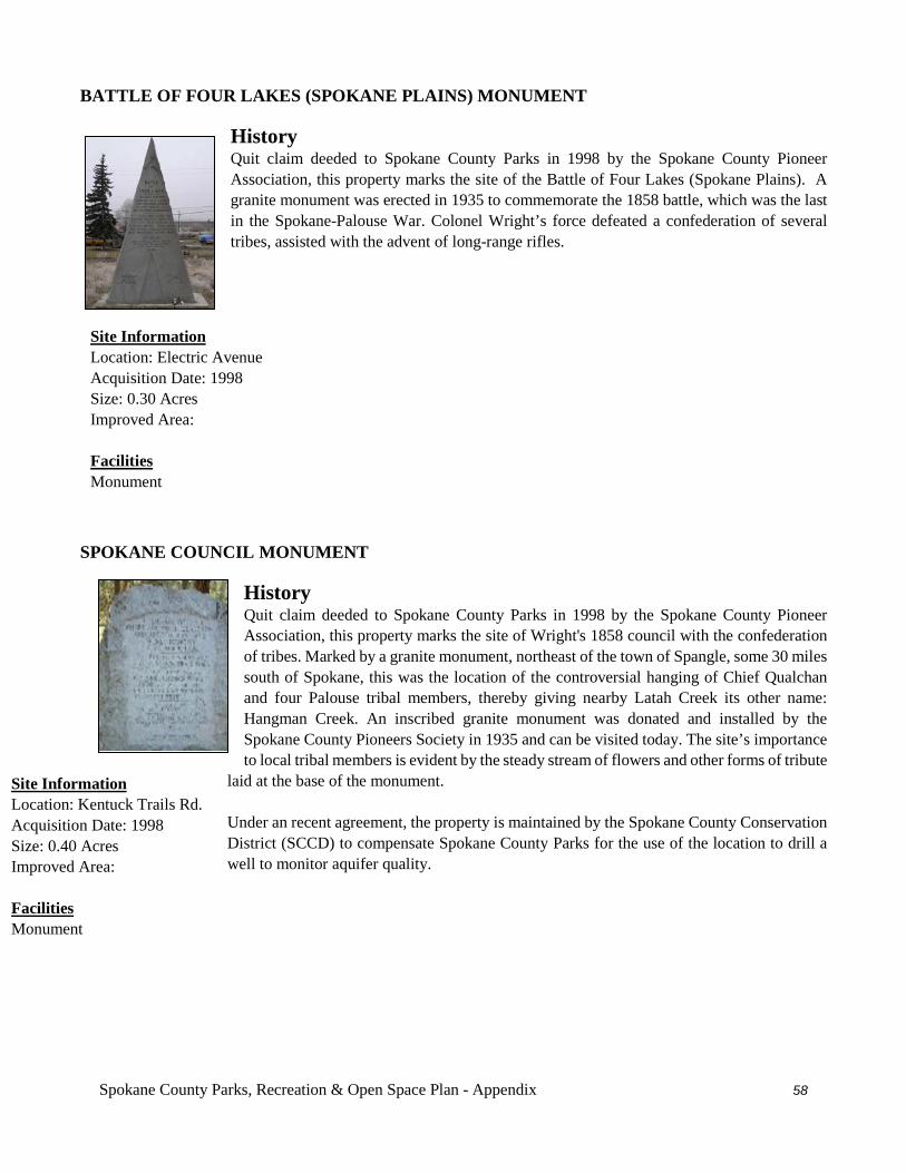
Spokane County Parks, Recreation & Open Space Plan - Appendix 58
BATTLE OF FOUR LAKES (SPOKANE PLAINS) MONUMENT
History Quit claim deeded to Spokane County Parks in 1998 by the Spokane County Pioneer Association, this property marks the site of the Battle of Four Lakes (Spokane Plains). A granite monument was erected in 1935 to commemorate the 1858 battle, which was the last in the Spokane-Palouse War. Colonel Wright’s force defeated a confederation of several tribes, assisted with the advent of long-range rifles.
SPOKANE COUNCIL MONUMENT History Quit claim deeded to Spokane County Parks in 1998 by the Spokane County Pioneer Association, this property marks the site of Wright's 1858 council with the confederation of tribes. Marked by a granite monument, northeast of the town of Spangle, some 30 miles south of Spokane, this was the location of the controversial hanging of Chief Qualchan and four Palouse tribal members, thereby giving nearby Latah Creek its other name: Hangman Creek. An inscribed granite monument was donated and installed by the Spokane County Pioneers Society in 1935 and can be visited today. The site’s importance to local tribal members is evident by the steady stream of flowers and other forms of tribute
laid at the base of the monument. Under an recent agreement, the property is maintained by the Spokane County Conservation District (SCCD) to compensate Spokane County Parks for the use of the location to drill a well to monitor aquifer quality.
Site Information Location: Kentuck Trails Rd. Acquisition Date: 1998 Size: 0.40 Acres Improved Area: Facilities Monument
Site Information Location: Electric Avenue Acquisition Date: 1998 Size: 0.30 Acres Improved Area: Facilities Monument
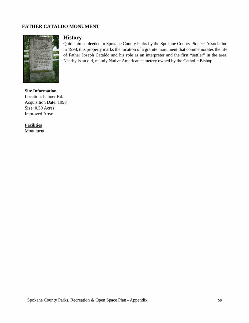
Spokane County Parks, Recreation & Open Space Plan - Appendix 59
FATHER CATALDO MONUMENT History Quit claimed deeded to Spokane County Parks by the Spokane County Pioneer Association in 1998, this property marks the location of a granite monument that commemorates the life of Father Joseph Cataldo and his role as an interpreter and the first “settler” in the area. Nearby is an old, mainly Native American cemetery owned by the Catholic Bishop.
Site Information Location: Palmer Rd. Acquisition Date: 1998 Size: 0.30 Acres Improved Area: Facilities Monument
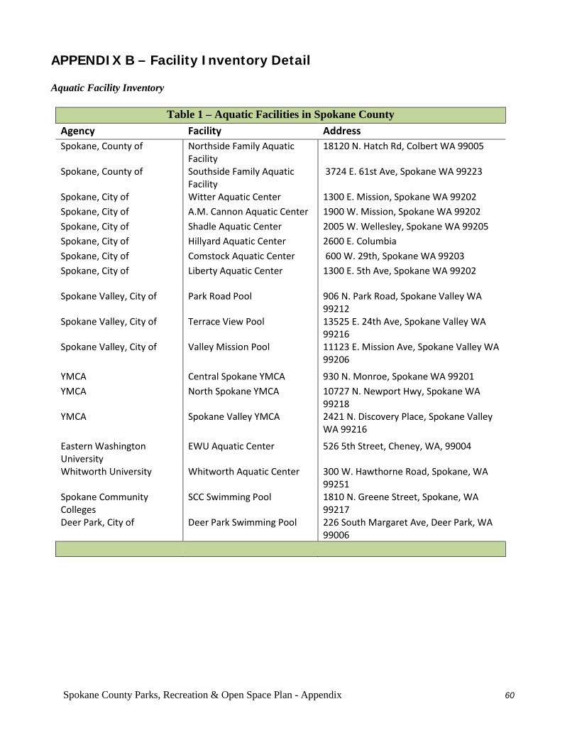
Spokane County Parks, Recreation & Open Space Plan - Appendix 60
APPENDIX B – Facility Inventory Detail Aquatic Facility Inventory
Table 1 – Aquatic Facilities in Spokane County
Agency Facility Address Spokane, County of Northside Family Aquatic
Facility 18120 N. Hatch Rd, Colbert WA 99005
Spokane, County of
Southside Family Aquatic Facility
3724 E. 61st Ave, Spokane WA 99223
Spokane, City of Witter Aquatic Center 1300 E. Mission, Spokane WA 99202 Spokane, City of A.M. Cannon Aquatic Center 1900 W. Mission, Spokane WA 99202 Spokane, City of Shadle Aquatic Center 2005 W. Wellesley, Spokane WA 99205 Spokane, City of Hillyard Aquatic Center 2600 E. Columbia Spokane, City of Comstock Aquatic Center 600 W. 29th, Spokane WA 99203 Spokane, City of
Liberty Aquatic Center 1300 E. 5th Ave, Spokane WA 99202
Spokane Valley, City of Park Road Pool 906 N. Park Road, Spokane Valley WA 99212
Spokane Valley, City of Terrace View Pool 13525 E. 24th Ave, Spokane Valley WA 99216
Spokane Valley, City of Valley Mission Pool 11123 E. Mission Ave, Spokane Valley WA 99206
YMCA Central Spokane YMCA 930 N. Monroe, Spokane WA 99201 YMCA North Spokane YMCA 10727 N. Newport Hwy, Spokane WA
99218 YMCA Spokane Valley YMCA 2421 N. Discovery Place, Spokane Valley
WA 99216
Eastern Washington University
EWU Aquatic Center 526 5th Street, Cheney, WA, 99004
Whitworth University Whitworth Aquatic Center 300 W. Hawthorne Road, Spokane, WA 99251
Spokane Community Colleges
SCC Swimming Pool 1810 N. Greene Street, Spokane, WA 99217
Deer Park, City of Deer Park Swimming Pool 226 South Margaret Ave, Deer Park, WA 99006
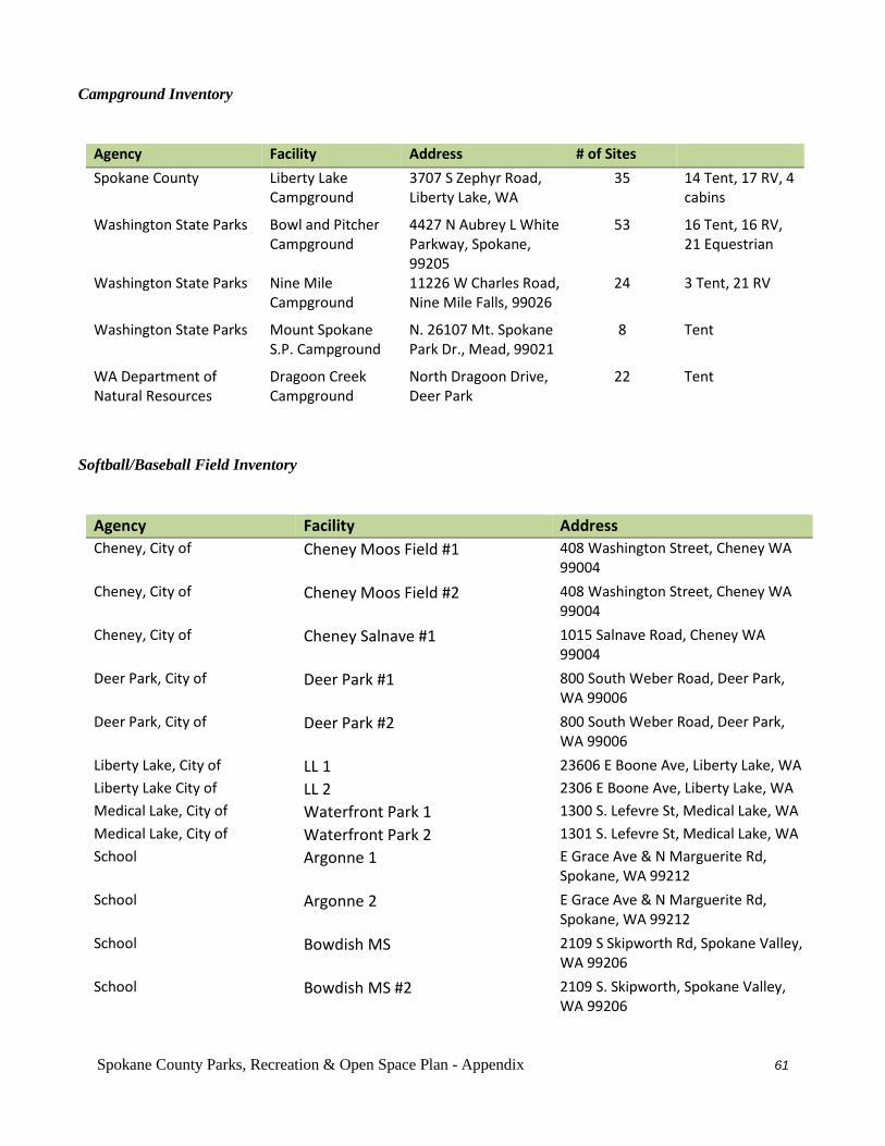
Spokane County Parks, Recreation & Open Space Plan - Appendix 61
Campground Inventory
Agency Facility Address # of Sites Spokane County Liberty Lake
Campground 3707 S Zephyr Road, Liberty Lake, WA
35 14 Tent, 17 RV, 4 cabins
Washington State Parks Bowl and Pitcher Campground
4427 N Aubrey L White Parkway, Spokane, 99205
53 16 Tent, 16 RV, 21 Equestrian
Washington State Parks Nine Mile Campground
11226 W Charles Road, Nine Mile Falls, 99026
24 3 Tent, 21 RV
Washington State Parks Mount Spokane S.P. Campground
N. 26107 Mt. Spokane Park Dr., Mead, 99021
8 Tent
WA Department of Natural Resources
Dragoon Creek Campground
North Dragoon Drive, Deer Park
22 Tent
Softball/Baseball Field Inventory
Agency Facility Address Cheney, City of Cheney Moos Field #1 408 Washington Street, Cheney WA
99004 Cheney, City of Cheney Moos Field #2 408 Washington Street, Cheney WA
99004 Cheney, City of Cheney Salnave #1 1015 Salnave Road, Cheney WA
99004 Deer Park, City of Deer Park #1 800 South Weber Road, Deer Park,
WA 99006 Deer Park, City of Deer Park #2 800 South Weber Road, Deer Park,
WA 99006 Liberty Lake, City of LL 1 23606 E Boone Ave, Liberty Lake, WA Liberty Lake City of LL 2 2306 E Boone Ave, Liberty Lake, WA Medical Lake, City of Waterfront Park 1 1300 S. Lefevre St, Medical Lake, WA Medical Lake, City of Waterfront Park 2 1301 S. Lefevre St, Medical Lake, WA School Argonne 1 E Grace Ave & N Marguerite Rd,
Spokane, WA 99212
School Argonne 2 E Grace Ave & N Marguerite Rd, Spokane, WA 99212
School Bowdish MS 2109 S Skipworth Rd, Spokane Valley, WA 99206
School Bowdish MS #2 2109 S. Skipworth, Spokane Valley, WA 99206
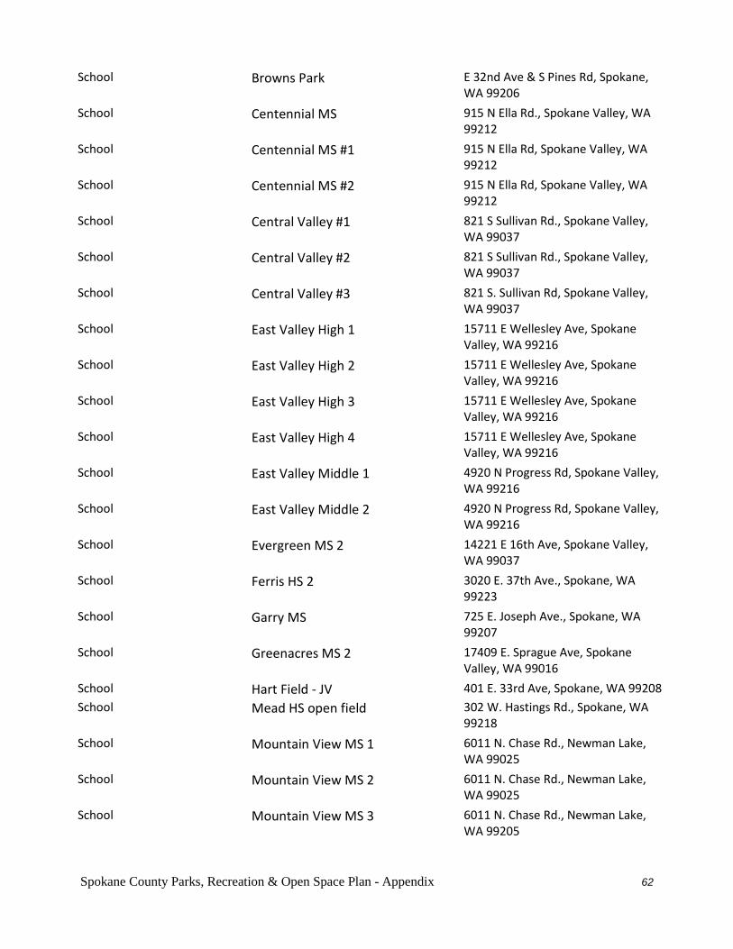
Spokane County Parks, Recreation & Open Space Plan - Appendix 62
School Browns Park E 32nd Ave & S Pines Rd, Spokane, WA 99206
School Centennial MS 915 N Ella Rd., Spokane Valley, WA 99212
School Centennial MS #1 915 N Ella Rd, Spokane Valley, WA 99212
School Centennial MS #2 915 N Ella Rd, Spokane Valley, WA 99212
School Central Valley #1 821 S Sullivan Rd., Spokane Valley, WA 99037
School Central Valley #2 821 S Sullivan Rd., Spokane Valley, WA 99037
School Central Valley #3 821 S. Sullivan Rd, Spokane Valley, WA 99037
School East Valley High 1 15711 E Wellesley Ave, Spokane Valley, WA 99216
School East Valley High 2 15711 E Wellesley Ave, Spokane Valley, WA 99216
School East Valley High 3 15711 E Wellesley Ave, Spokane Valley, WA 99216
School East Valley High 4 15711 E Wellesley Ave, Spokane Valley, WA 99216
School East Valley Middle 1 4920 N Progress Rd, Spokane Valley, WA 99216
School East Valley Middle 2 4920 N Progress Rd, Spokane Valley, WA 99216
School Evergreen MS 2 14221 E 16th Ave, Spokane Valley, WA 99037
School Ferris HS 2 3020 E. 37th Ave., Spokane, WA 99223
School Garry MS 725 E. Joseph Ave., Spokane, WA 99207
School Greenacres MS 2 17409 E. Sprague Ave, Spokane Valley, WA 99016
School Hart Field - JV 401 E. 33rd Ave, Spokane, WA 99208
School Mead HS open field 302 W. Hastings Rd., Spokane, WA 99218
School Mountain View MS 1 6011 N. Chase Rd., Newman Lake, WA 99025
School Mountain View MS 2 6011 N. Chase Rd., Newman Lake, WA 99025
School Mountain View MS 3 6011 N. Chase Rd., Newman Lake, WA 99205
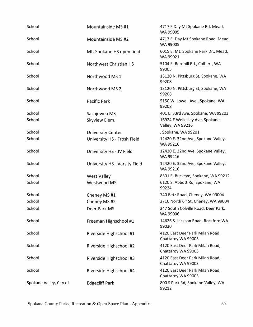
Spokane County Parks, Recreation & Open Space Plan - Appendix 63
School Mountainside MS #1 4717 E Day Mt Spokane Rd, Mead, WA 99005
School Mountainside MS #2 4717 E. Day Mt Spokane Road, Mead, WA 99005
School Mt. Spokane HS open field 6015 E. Mt. Spokane Park Dr., Mead, WA 99021
School Northwest Christian HS 5104 E. Bernhill Rd., Colbert, WA 99005
School Northwood MS 1 13120 N. Pittsburg St, Spokane, WA 99208
School Northwood MS 2 13120 N. Pittsburg St, Spokane, WA 99208
School Pacific Park 5150 W. Lowell Ave., Spokane, WA 99208
School Sacajewea MS 401 E. 33rd Ave, Spokane, WA 99203
School Skyview Elem. 16924 E Wellesley Ave, Spokane Valley, WA 99216
School University Center , Spokane, WA 99201
School University HS - Frosh Field 12420 E. 32nd Ave, Spokane Valley, WA 99216
School University HS - JV Field 12420 E. 32nd Ave, Spokane Valley, WA 99216
School University HS - Varsity Field 12420 E. 32nd Ave, Spokane Valley, WA 99216
School West Valley 8301 E. Buckeye, Spokane, WA 99212
School Westwood MS 6120 S. Abbott Rd, Spokane, WA 99224
School Cheney MS #1 740 Betz Road, Cheney, WA 99004 School Cheney MS #2 2716 North 6th St, Cheney, WA 99004 School Deer Park MS 347 South Colville Road, Deer Park,
WA 99006 School Freeman Highschool #1 14626 S. Jackson Road, Rockford WA
99030 School Riverside Highschool #1 4120 East Deer Park Milan Road,
Chattaroy WA 99003 School Riverside Highschool #2 4120 East Deer Park Milan Road,
Chattaroy WA 99003 School Riverside Highschool #3 4120 East Deer Park Milan Road,
Chattaroy WA 99003 School Riverside Highschool #4 4120 East Deer Park Milan Road,
Chattaroy WA 99003 Spokane Valley, City of Edgecliff Park 800 S Park Rd, Spokane Valley, WA
99212
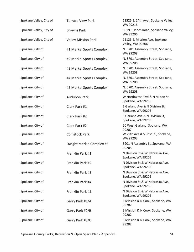
Spokane County Parks, Recreation & Open Space Plan - Appendix 64
Spokane Valley, City of Terrace View Park 13525 E. 24th Ave., Spokane Valley, WA 99216
Spokane Valley, City of Browns Park 3019 S. Pines Road, Spokane Valley, WA 99206
Spokane Valley, City of Valley Mission Park 11123 E. Mission Ave, Spokane Valley, WA 99206
Spokane, City of #1 Merkel Sports Complex N. 5701 Assembly Street, Spokane, WA 99208
Spokane, City of #2 Merkel Sports Complex N. 5701 Assembly Street, Spokane, WA 99208
Spokane, City of #3 Merkel Sports Complex N. 5701 Assembly Street, Spokane, WA 99208
Spokane, City of #4 Merkel Sports Complex N. 5701 Assembly Street, Spokane, WA 99208
Spokane, City of #5 Merkel Sports Complex N. 5701 Assembly Street, Spokane, WA 99208
Spokane, City of Audubon Park W Northwest Blvd & N Milton St, Spokane, WA 99205
Spokane, City of Clark Park #1 E Garland Ave & N Division St, Spokane, WA 99205
Spokane, City of Clark Park #2 E Garland Ave & N Division St, Spokane, WA 99205
Spokane, City of Clark Park #2 50 West Garland, Spokane, WA 99207
Spokane, City of Comstock Park W 29th Ave & S Post St., Spokane, WA 99203
Spokane, City of Dwight Merkle Complex #5 5901 N Assembly St, Spokane, WA 99205
Spokane, City of Franklin Park #1 N Division St & W Nebraska Ave, Spokane, WA 99205
Spokane, City of Franklin Park #2 N Division St & W Nebraska Ave, Spokane, WA 99205
Spokane, City of Franklin Park #3 N Division St & W Nebraska Ave, Spokane, WA 99205
Spokane, City of Franklin Park #4 N Division St & W Nebraska Ave, Spokane, WA 99205
Spokane, City of Franklin Park #5 N Division St & W Nebraska Ave, Spokane, WA 99205
Spokane, City of Garry Park #1/A E Mission & N Cook, Spokane, WA 99202
Spokane, City of Garry Park #2/B E Mission & N Cook, Spokane, WA 99202
Spokane, City of Garry Park #3/C E Mission & N Cook, Spokane, WA 99202

Spokane County Parks, Recreation & Open Space Plan - Appendix 65
Spokane, City of Grant Park E 11th Ave & S Arthur St, Spokane, WA 99202
Spokane, City of Harmon Park E Decatur Ave & N Market St, Spokane, WA 99208
Spokane, City of Liberty Park 1700 E 4th Ave, Spokane, WA 99202
Spokane, City of Merkel 6000 N. Assembly, Spokane, WA 99208
Spokane, City of Mission Park E Mission Ave & N Perry St, Spokane, WA 99202
Spokane, City of South Complex #1 E 46th Ave & S Regal St, Spokane, WA 99223
Spokane, City of South Complex #2 E 46th Ave & S Regal St, Spokane, WA 99223
Spokane, City of South Complex #3 E 46th Ave & S Regal St, Spokane, WA 99223
Spokane, City of South Complex #4 E 46th & S. Regal Street, Spokane, WA 99223
Spokane, City of South Complex 5 E. 46th & S. Regal, Spokane, WA 99223
Spokane, City of Thornton Murphy Park #1 3100 E 27th Ave, Spokane, WA 99223
Spokane, City of Thornton Murphy Park #2 3100 E 27th Ave, Spokane, WA 99223
Spokane, County of Holmberg Park 9615 N. Wall St, Spokane, WA 99208
Spokane, County of Linwood Park 1100 W. Eastmont Way, Spokane, WA 99208
Spokane, County of Orchard Ave. Park E Bridgeport Ave & Park Rd, Spokane, WA 99212
Spokane, County of Plantes Ferry #1 12308 E. Upriver Dr, Spokane, WA 99216
Spokane, County of Plantes Ferry #2 12308 E. Upriver Dr, Spokane, WA 99216
Spokane, County of Plantes Ferry #3 12308 E. Upriver Dr., Spokane, WA 99216
Spokane, County of Plantes Ferry #4 12308 E. Upriver Dr., Spokane, WA 99216
Spokane, County of Plantes Ferry #5 12308 E. Upriver Dr, Spokane, WA 99216
Spokane, County of Prairie View Park 3724 E 61st Ave, Spokane WA
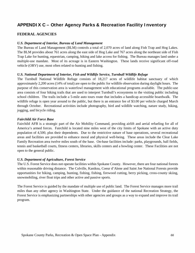
Spokane County Parks, Recreation & Open Space Plan - Appendix 66
APPENDIX C – Other Agency Parks & Recreation Facility Inventory FEDERAL AGENCIES U.S. Department of Interior, Bureau of Land Management The Bureau of Land Management (BLM) controls a total of 2,070 acres of land along Fish Trap and Hog Lakes. The BLM provides about 761 acres along the east side of Hog Lake and 767 acres along the northeast side of Fish Trap Lake for hunting, equestrian, camping, hiking and lake access for fishing. The Bureau manages land under a multiple-use mandate. Most of its acreage is in Eastern Washington. These lands receive significant off-road vehicle (ORV) use, most often related to hunting and fishing. U.S. National Department of Interior, Fish and Wildlife Service, Turnbull Wildlife Refuge The Turnbull National Wildlife Refuge consists of 18,217 acres of wildlife habitat sanctuary of which approximately 2,200 acres (14% of total) are open to the public for wildlife observation during daylight hours. The purpose of this conservation area is waterfowl management with educational programs available. The public-use area consists of four hiking trails that are used to interpret Turnbull’s ecosystems to the visiting public including school children. The trails include a 5-mile auto tours route that includes a handicap accessible boardwalk. The wildlife refuge is open year around to the public, but there is an entrance fee of $3.00 per vehicle charged March through October. Recreational activities include photography, bird and wildlife watching, nature study, hiking, jogging, and bicycle riding. Fairchild Air Force Base Fairchild AFB is a strategic part of the Air Mobility Command, providing airlift and aerial refueling for all of America’s armed forces. Fairchild is located nine miles west of the city limits of Spokane with an active duty population of 4,500, plus their dependents. Due to the restrictive nature of base operations, several recreational areas and facilities are provided to enhance moral and physical well-being. These areas include the Clear Lake Family Recreation area twelve miles south of the base. On-base facilities include: parks, playgrounds, ball fields, tennis and basketball courts, fitness centers, libraries, skills centers and a bowling center. These Facilities are not open to the general public. U.S. Department of Agriculture, Forest Service The U.S. Forest Service does not operate facilities within Spokane County. However, there are four national forests within reasonable driving distance. The Colville, Kaniksu, Coeur d’Alene and Saint Joe National Forests provide opportunities for hiking, camping, hunting, fishing, fishing, firewood cutting, berry picking, cross-county skiing, snowmobiling, river float trips and other active and passive sports. The Forest Service is guided by the mandate of multiple use of public land. The Forest Service manages more trail miles than any other agency in Washington State. Under the guidance of the national Recreation Strategy, the Forest Service is emphasizing partnerships with other agencies and groups as a way to expand and improve its trail program.
Spokane County Parks, Recreation & Open Space Plan - Appendix 67
WASHINGTON STATE AGENCIES
Department of Fish and Wildlife The Department of Fish and Wildlife is responsible for management of the state’s fish and wildlife species and their habitats, including regulation of hunting and fishing of classified “game” species. This agency is the permitting authority for in-stream work that could affect fish and fish habitat, and protection and recovery of threatened and endangered species. In Spokane County, WDFW owns 216 acres and operates the Spokane Fish Hatchery, which offers visitor interpretive signs and tours upon arrangement with Senior Environment Corps volunteers. Hatchery rainbow trout are stocked throughout Eastern Washington, including about 20 waterways in Spokane County. WDFW also manages ten fishing lake access sites with boat launches in Spokane County (Amber, Badger, Clear, Eloika, Hog Canyon, Liberty, West Medical, Newman, Silver, and Williams lakes). Department of Natural Resources The Department of Natural Resources manages 19,690 acres of trust lands in Spokane County. These lands consist of grazing, agriculture and timberlands that generate continuing revenue for trust beneficiaries while maintaining healthy ecosystems and resources. Timber from DNR forest lands have provide money for higher education and public school construction in the past, but has been on a steady declined in recent years as protection of natural habitats has become the focus. DNR operates two campgrounds within Spokane County. Dragoon Creek has 22 camp units on 20 acres, and Long Lake Camp and Picnic Area has 7 camp units on 78 acres. In addition, they participate in the operation of the Dishman Hills Natural Area found in the heart of the Spokane Valley, which was designated a Natural Resources Conservation Area in 1987 by the state legislature. This facility is recognized as one of the most biologically diverse areas of Washington State. Cliffs and ravines consisting of billion-year old granite define the Natural Area, supporting more than 530 different species of plants and animals. Washington State Parks The Washington State Parks Department owns two major parks in Spokane County: Mount Spokane and Riverside. Total, Washington State Parks owns 20,515 acres and manages an additional 2,000 acres of Avista land along Lake Spokane (formerly Long Lake). Mount Spokane State Park consists of 13,854 acres of land in Spokane County. It includes the highest elevation point in the county, Mount Spokane. The park offers horseback riding and hiking trails, 12 camping sites, 85 picnic sites, nature study, berry picking and metal detecting as summer activities. During the winter season, the park offers snowmobiling, cross-country skiing, and downhill skiing with concession facilities available. Riverside State Park consists of nearly 10,000 acres of land with 196,650 feet of freshwater shoreline (not including Avista property managed by State Parks). The Spokane House trading post was built in 1810 by the Northwest Fur Trading Company and is located within the park. There are 101 picnic sites, 3 kitchens, interpretive center at Spokane House, 3 comfort stations, 14 vault toilets, 101 vehicle and tent sites, 31 trailer/RV spaces, 36.7 miles of foot and horse trail, and a 218-foot pedestrian suspension bridge. The park operates a boat launch near Spokane House constructed by the Washington Water Power Company (Now Avista). There is also within the park a 600-acre motorcycle and ORV area and in the Fort George Wright portion of the park there are equestrian facilities. Activities include boating, camping, fishing, hiking, horseback riding, interpretation, motorcycle and ATV riding, picnicking, snowmobiling, and cross-country skiing. Included in Riverside State Park’s inventory is 542 acres of state-owned property, which along with Spokane County Parks Department property form the 1,300-acre Little Spokane Natural Area. This presents a rare freshwater marsh and running water environment where hiking and bird watching are the main activities.
Spokane County Parks, Recreation & Open Space Plan - Appendix 68
The Columbia Plateau Trail State Park is a 130 mile abandoned railroad corridor that begins near Ice Harbor Dam, on the Snake River just east of Pasco, and continues east and north to Fish Lake and ends in Cheney. The Spokane County section of the trail consists of 572 acres and includes a 3.25-mile asphalt paved section of the trail from Cheney-Spangle Road to Fish Lake. The trail is being developed in phases and when completed is expected to have trail markers, interpretive displays, parking areas, camp sites and restrooms. Other state park-owned lands include Riverside State Park’s management of the 663-acre “Fisk Property” located near the Little Spokane River and the 1-acre Spokane Plains Battlefield State Park-Heritage Area located across from Fairchild Air Force Base, and the Spokane River Centennial Trail consisting of 386 acres. Department of Transportation The Washington State Department of Transportation (WSDOT) owns significant state road right-of-way for SR-2, SR-27, SR-195, SR206, SR-290, SR-291, SR-395, SR-902 and SR-904. Portions of these right-of-ways have been made available for bicycle, hiking, and equestrian trail systems or trailheads, particularly where the highways crosses significant river corridors, estuaries, natural areas, scenic vistas, historic districts and other features of interest. Most significantly is the development of the Children of the Sun Trail, which will parallel the North-South Freeway, which is currently under construction. This trail will begin at I-90 in East Spokane and terminate north of Spokane. The Centennial Trail The Centennial Trail was initiated in 1989 during the Washington State Centennial. The trail is administered by the Washington State Parks and Recreation Commission and is maintained through the provisions of a cooperative agreement among the Commission, Spokane County, City of Liberty Lake, City of Spokane and City of Spokane Valley. Additionally, the Friends of the Centennial Trail, a non-profit organization, assists and encourages the development and maintenance of the trail. The coordinating council consisting of representatives from the above members is responsible for implementation of the cooperative agreement. The Centennial Trail consists of 37 miles of paved paths along the Spokane River and runs from the Idaho state line to Nine Mile Falls. The trail east of Riverside State Park to the Idaho border occupies 525 acres (386 acres of this is state-owned). The current trail system has its roots in EXPO 74 when a movement began to return the river to the people. In 1979, Spokane County Parks proposed a bicycle/pedestrian pathway along the river. The Spokane Valley Chamber of Commerce explored this recreational opportunity and proposed in 1986 a 10-mile trail to be built in conjunction with the Washington Centennial in 1989. The trail is designated for use by people of all ages and physical capabilities and is accessible to wheelchairs. It offers a wide range of beauty and scenic views. The western section travels through towering pine trees and offers a number of short climbs and descents through canyon type terrain. The central section of the trail travels through the downtown and Riverfront Park, and offers an urban open space environment. Going east of the town, the terrain is relatively flat and ends at the Idaho state border. The trail spotlights a natural ecosystem and supports a variety of uses such as walking, jogging, rollerblading, cycling, horseback riding and canoeing. It is a vital recreational focal point for the community where thousands of people can simultaneously experience nature without disturbing the natural surroundings.
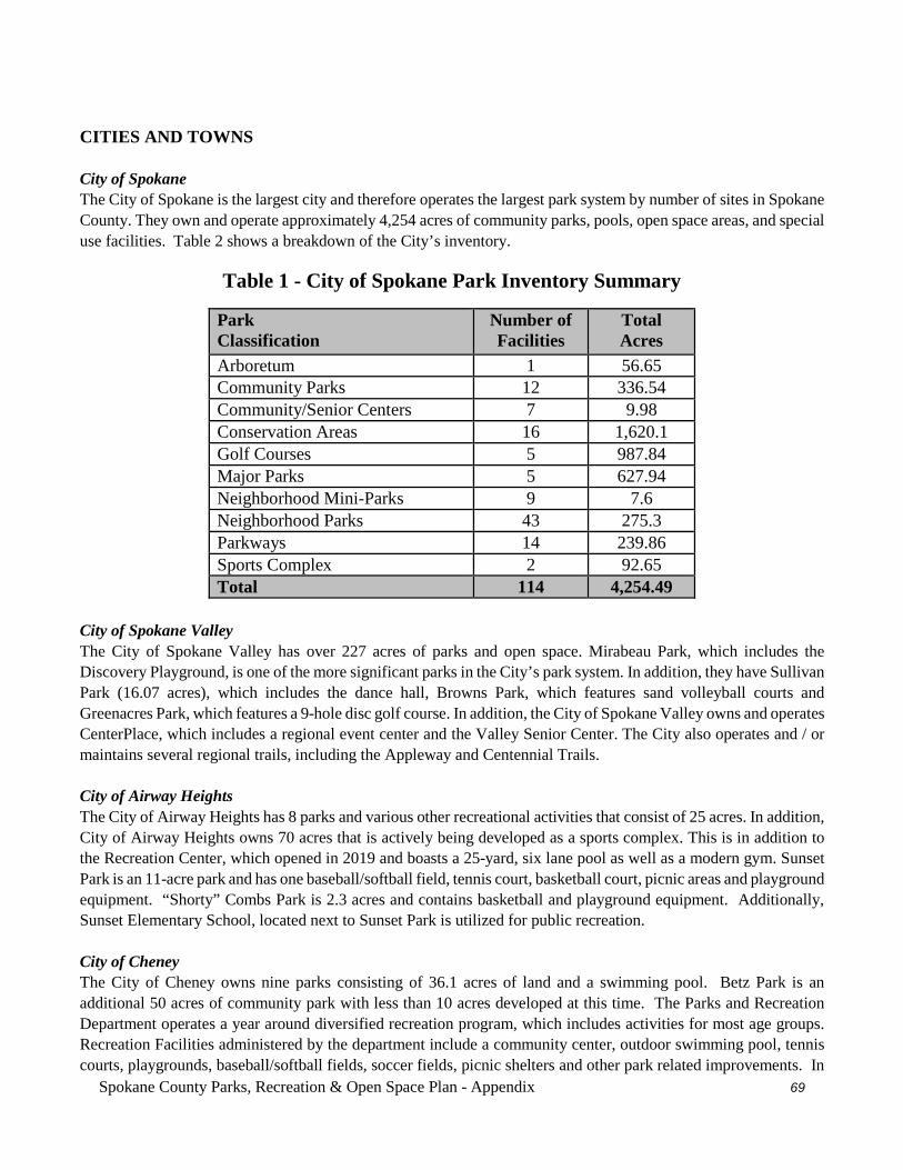
Spokane County Parks, Recreation & Open Space Plan - Appendix 69
CITIES AND TOWNS
City of Spokane The City of Spokane is the largest city and therefore operates the largest park system by number of sites in Spokane County. They own and operate approximately 4,254 acres of community parks, pools, open space areas, and special use facilities. Table 2 shows a breakdown of the City’s inventory.
Table 1 - City of Spokane Park Inventory Summary
Park Classification
Number of Facilities
Total Acres
Arboretum 1 56.65 Community Parks 12 336.54 Community/Senior Centers 7 9.98 Conservation Areas 16 1,620.1 Golf Courses 5 987.84 Major Parks 5 627.94 Neighborhood Mini-Parks 9 7.6 Neighborhood Parks 43 275.3 Parkways 14 239.86 Sports Complex 2 92.65 Total 114 4,254.49
City of Spokane Valley The City of Spokane Valley has over 227 acres of parks and open space. Mirabeau Park, which includes the Discovery Playground, is one of the more significant parks in the City’s park system. In addition, they have Sullivan Park (16.07 acres), which includes the dance hall, Browns Park, which features sand volleyball courts and Greenacres Park, which features a 9-hole disc golf course. In addition, the City of Spokane Valley owns and operates CenterPlace, which includes a regional event center and the Valley Senior Center. The City also operates and / or maintains several regional trails, including the Appleway and Centennial Trails. City of Airway Heights The City of Airway Heights has 8 parks and various other recreational activities that consist of 25 acres. In addition, City of Airway Heights owns 70 acres that is actively being developed as a sports complex. This is in addition to the Recreation Center, which opened in 2019 and boasts a 25-yard, six lane pool as well as a modern gym. Sunset Park is an 11-acre park and has one baseball/softball field, tennis court, basketball court, picnic areas and playground equipment. “Shorty” Combs Park is 2.3 acres and contains basketball and playground equipment. Additionally, Sunset Elementary School, located next to Sunset Park is utilized for public recreation. City of Cheney The City of Cheney owns nine parks consisting of 36.1 acres of land and a swimming pool. Betz Park is an additional 50 acres of community park with less than 10 acres developed at this time. The Parks and Recreation Department operates a year around diversified recreation program, which includes activities for most age groups. Recreation Facilities administered by the department include a community center, outdoor swimming pool, tennis courts, playgrounds, baseball/softball fields, soccer fields, picnic shelters and other park related improvements. In
Spokane County Parks, Recreation & Open Space Plan - Appendix 70
addition, Eastern Washington University provides recreational services for its students and faculty that compliments Cheney’s recreational opportunities. City of Deer Park The City of Deer Park has eight parks in their system consisting of 22 acres of parks and one swimming pool. The six city parks provide playground equipment, picnicking, basketball, and tennis, and some hiking trails. There is also a 400-acre open space area owned by the Deer Park Airport that is currently open to hiking, horseback riding, and other passive recreational activities. In addition to these amenities, the City of Deer Park also operates an 18-hole golf course. City of Fairfield The City of Fairfield has three public parks encompassing 8.1 acres of land and one private park open to public use on about 1 acre. Recreational opportunities include playground equipment area, BBQ and picnicking provisions, a pavilion, tennis, and basketball facilities. City of Latah The Town of Latah has two public parks consisting of about 1.8 acres of land. Recreational opportunities include picnic area, swings, a combination tennis/basketball court, gazebo, and a skateboard ramp. City of Liberty Lake The City of Liberty Lake, which incorporated in 2003 operates several parks consisting of 32.7 acres. Pavillion Park, Rocky Hill Park and Orchard Park are three larger parks operated by the city. The remaining three parks are neighborhood pocket parks, consisting of less than an acre and providing a playground and other amenities. Recently, the city took over management of the Harvard Road Trailhead and the Centennial Trail that’s adjacent to their city limits. City of Medical Lake The City of Medical Lake manages eight existing parks and natural areas consisting of approximately 64 acres. This park system includes Waterfront Park, a 45-acre regional park along the shores of Medical Lake that attracts 120,000 people a year mostly from Spokane County. Recreational Facilities includes a trail system, picnic shelters and BBQ areas, playground equipment, softball fields and open spaces. The Medical Lake Community Center, in conjunction with the Medical Lake Parks and Recreation Department, offers adult/youth sports programs throughout the year. There are 4 total miles of paved trail system incorporating public streets surrounding Medical Lake and running through northern areas of the city. Town of Millwood The Town of Millwood has one 6-acre park called Millwood Park. Recreation opportunities include a lighted tennis court, basketball, softball field, wading pool, horseshoe pits, picnic and play area and restrooms. In 2019, Millwood completed their section of the Millwood Trail, which includes about a mile of paved pathway, lighting and landscaping. Town of Rockford The Town of Rockford has one city-park and one ball field totaling about 13 acres of land. In addition it leases approximately two acres as a second ball field. Recreational amenities include playground equipment areas, picnic/sheltered area, tennis and basketball Facilities and restrooms.
Spokane County Parks, Recreation & Open Space Plan - Appendix 71
Town of Spangle The Town of Spangle has one public park approximately 0.2 acres of land. Additionally, there is an old baseball field that the city mows, but does not maintain on approximately 0.34 acres of land. The park provides picnic and playground equipment areas. Town of Waverly The Town of Waverly has one public park on approximately .65 acres of land. There is also an 8-acre riparian conservation area along Latah Creek that provides hiking opportunities. SCHOOL DISTRICTS There are 18 school districts operating within Spokane County, however, Newport, St. John, Rosalia, and Tekoa school districts do not have school sites within Spokane County boundaries. These school sites provide a variety of recreation facilities, including tennis courts, soccer, softball, baseball and football fields, tracks, basketball courts, gyms, and children’s playground equipment. School facilities are frequently used by residents no differently than parks. County Parks and several of the school districts have agreements to share facilities which has greatly increased the recreational opportunities of both agencies. The information below indicates the school district, type of school, the student population as of 2002, and the recreational Facilities available. Central Valley #356 Student pop. 13,468. Two high schools with a third under construction, with sports fields, two tracks, gym and outside tennis and basketball courts. Five junior high schools with sports fields, gyms and outside basketball courts. Fourteen elementary schools with sports fields, gyms, playground equipment areas and outside basketball courts. Cheney #360 Student pop. 4,696. One high school with two gyms, and three sports fields. One middle school with one gym, three sports fields, and outside basketball and tennis courts. Five elementary schools with five gyms, five sports fields, five playground equipment areas and three outside basketball courts. Deer Park #414 Student pop.2,518. One high school with sports field, track, and gym. One Jr. high school with sports field. gym, and tennis courts. Two elementary schools with sports fields, gyms, outside basketball courts and playground equipment areas. District #81 Student pop. 30,773. Six high schools with six sports fields, five tracks, eleven gyms, six outside basketball facilities, 31 tennis courts, and some high schools having indoor swimming pools. Six middle schools with six sports fields, six gyms, six outside basketball and ten tennis courts. Thirty-five elementary schools with 35 sports fields, 35 gyms, 35 playground equipment areas and outside basketball. East Valley #361 Student pop. 4,262. One combined high school/middle school with gym, sports field, track, outside basketball and tennis courts. Five elementary schools with two gyms, two sports fields, outside basketball courts and playground equipment areas. Freeman #358
Spokane County Parks, Recreation & Open Space Plan - Appendix 72
Student pop. 898. One high school with gym, sports field, track, outside basketball and tennis courts. Combined high school, middle school and elementary school. One elementary school with gym, sports field and playground equipment area. Great Northern #312 Student pop. 43. One elementary school with sports field and playground equipment area. Liberty #362 Student pop. 467. One high school with gym, sports field, track, and tennis courts. One elementary school with gym, outside basketball and playground equipment area and shared sports field with the high school. Mead #354 Student pop. 10,105. Two high schools with four gyms, two sports fields, two tracks, and outside tennis courts. Two junior high schools with sports fields, tracks, gyms and outside tennis and basketball courts. Seven elementary schools with gyms, sports fields, playground equipment area and outside basketball courts. Medical Lake #326 Student pop. 1887. One high school with two gyms, sports field, track, outside basketball and tennis courts. One middle school with gym, sports field, outside basketball court, and track. Three elementary schools with gyms, sports fields, outside basketball courts and playground equipment area. NOTE: One of these elementary schools is located on Fairchild Air Force Base and is therefore limited to base personnel and their families and provides the same recreation Facilities. Nine Mile Falls #325/179 Student pop. 1,444. One high school site with gym, three sports fields, track, and outside basketball and tennis courts. One middle school with four sports fields, track, gym, outdoor basketball, and tennis. Two elementary schools with gyms, sports fields, playground equipment area, and tennis courts. Orchard Prairie #123 Student pop. 85. One elementary school with sports field and playground equipment area. Reardan / Edwall #9 Student pop. 571. One combined high school/Jr. high school and elementary school site with two gyms, a sports field, outside basketball/tennis courts and playground equipment area. Riverside #416 Student pop. 1,483. One combined high school/middle school site share one sports field, gym, outside basketball and tennis courts and a rope course. Two elementary schools with gyms, sports fields and playground equipment. West Valley #363 Student pop. 3,781. One high school with two gyms, two softball fields, two baseball fields, two sports fields, one track, and outside basketball and tennis courts. One alternative high school with one gym, and two softball fields. One middle school with two gyms, two softball fields and one baseball field and two sports fields. Five elementary schools with five gyms, sports fields, and playground equipment areas and four outside basketball courts.
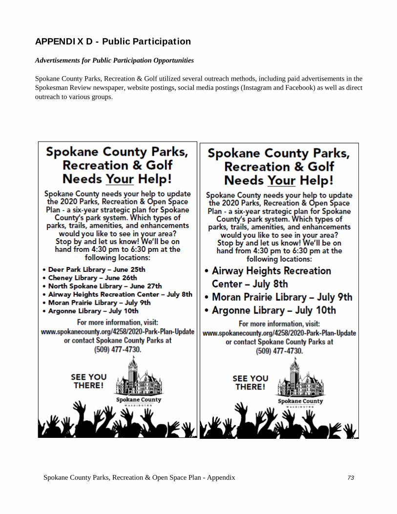
Spokane County Parks, Recreation & Open Space Plan - Appendix 73
APPENDIX D - Public Participation Advertisements for Public Participation Opportunities Spokane County Parks, Recreation & Golf utilized several outreach methods, including paid advertisements in the Spokesman Review newspaper, website postings, social media postings (Instagram and Facebook) as well as direct outreach to various groups.
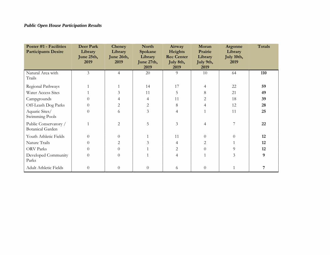
Public Open House Participation Results
Poster #1 - Facilities Participants Desire
Deer Park Library
June 25th, 2019
Cheney Library
June 26th, 2019
North Spokane Library
June 27th, 2019
Airway Heights
Rec Center July 8th,
2019
Moran Prairie Library July 9th,
2019
Argonne Library
July 10th, 2019
Totals
Natural Area with Trails
3 4 20 9 10 64 110
Regional Pathways 1 1 14 17 4 22 59 Water Access Sites 1 3 11 5 8 21 49 Campgrounds 0 4 4 11 2 18 39 Off-Leash Dog Parks 0 2 2 8 4 12 28 Aquatic Sites/ Swimming Pools
0 6 3 4 1 11 25
Public Conservatory / Botanical Garden
1 2 5 3 4 7 22
Youth Athletic Fields 0 0 1 11 0 0 12 Nature Trails 0 2 3 4 2 1 12 ORV Parks 0 0 1 2 0 9 12 Developed Community Parks
0 0 1 4 1 3 9
Adult Athletic Fields 0 0 0 6 0 1 7
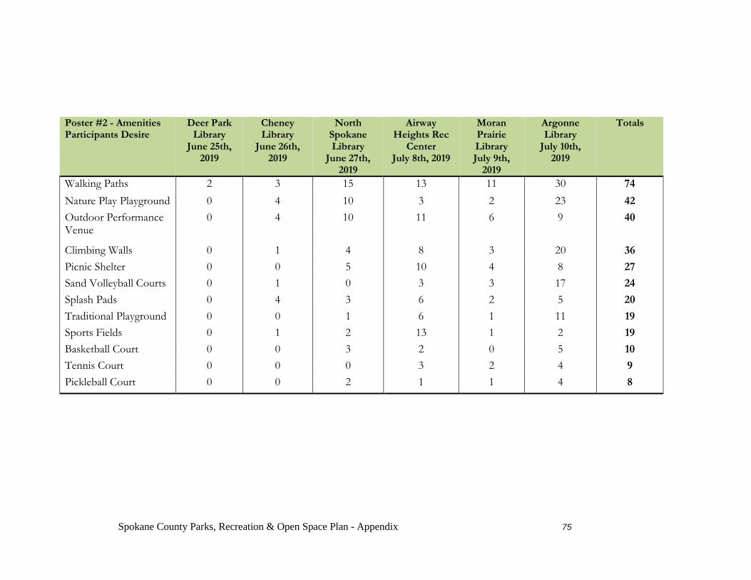
Spokane County Parks, Recreation & Open Space Plan - Appendix 75
Poster #2 - Amenities Participants Desire
Deer Park Library
June 25th, 2019
Cheney Library
June 26th, 2019
North Spokane Library
June 27th, 2019
Airway Heights Rec
Center July 8th, 2019
Moran Prairie Library July 9th,
2019
Argonne Library
July 10th, 2019
Totals
Walking Paths 2 3 15 13 11 30 74 Nature Play Playground 0 4 10 3 2 23 42 Outdoor Performance Venue
0 4 10 11 6 9 40
Climbing Walls 0 1 4 8 3 20 36 Picnic Shelter 0 0 5 10 4 8 27 Sand Volleyball Courts 0 1 0 3 3 17 24 Splash Pads 0 4 3 6 2 5 20 Traditional Playground 0 0 1 6 1 11 19 Sports Fields 0 1 2 13 1 2 19 Basketball Court 0 0 3 2 0 5 10 Tennis Court 0 0 0 3 2 4 9 Pickleball Court 0 0 2 1 1 4 8
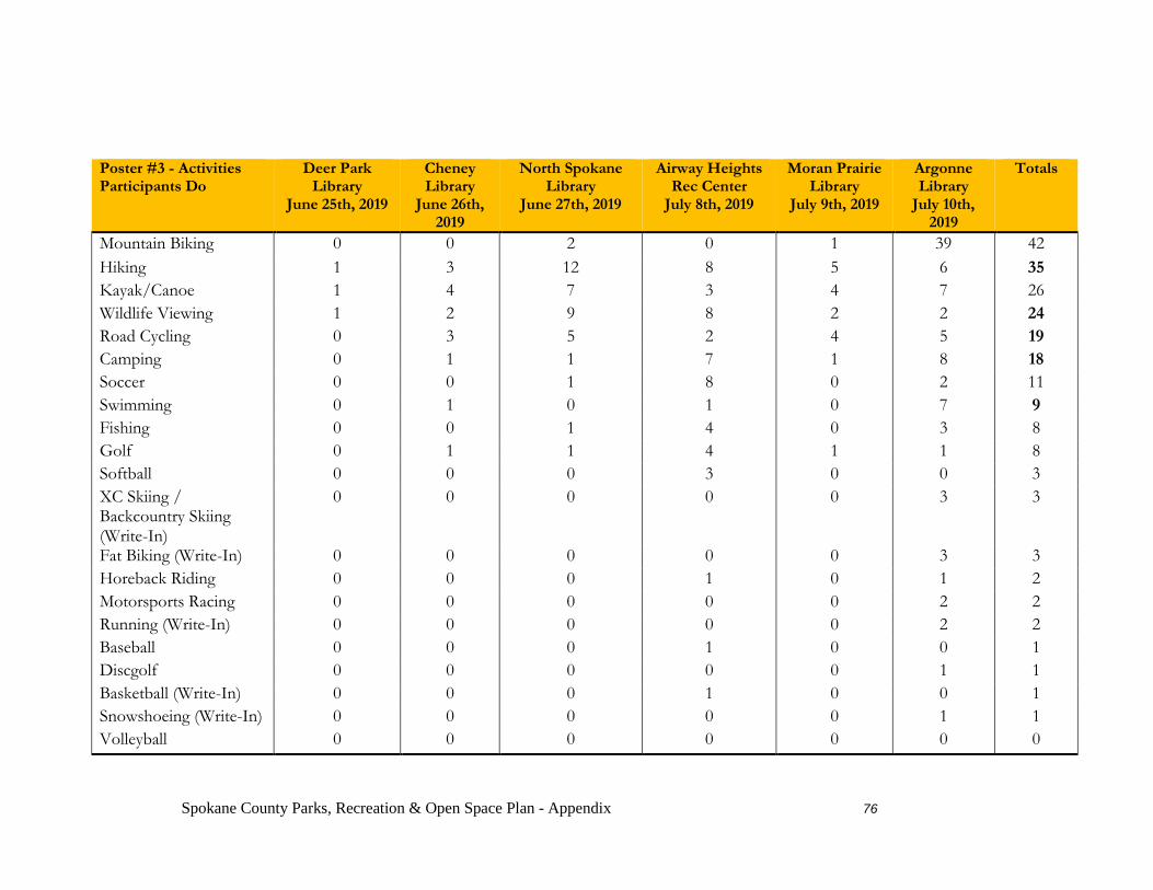
Spokane County Parks, Recreation & Open Space Plan - Appendix 76
Poster #3 - Activities Participants Do
Deer Park Library
June 25th, 2019
Cheney Library
June 26th, 2019
North Spokane Library
June 27th, 2019
Airway Heights Rec Center
July 8th, 2019
Moran Prairie Library
July 9th, 2019
Argonne Library
July 10th, 2019
Totals
Mountain Biking 0 0 2 0 1 39 42 Hiking 1 3 12 8 5 6 35 Kayak/Canoe 1 4 7 3 4 7 26 Wildlife Viewing 1 2 9 8 2 2 24 Road Cycling 0 3 5 2 4 5 19 Camping 0 1 1 7 1 8 18 Soccer 0 0 1 8 0 2 11 Swimming 0 1 0 1 0 7 9 Fishing 0 0 1 4 0 3 8 Golf 0 1 1 4 1 1 8 Softball 0 0 0 3 0 0 3 XC Skiing / Backcountry Skiing (Write-In)
0 0 0 0 0 3 3
Fat Biking (Write-In) 0 0 0 0 0 3 3 Horeback Riding 0 0 0 1 0 1 2 Motorsports Racing 0 0 0 0 0 2 2 Running (Write-In) 0 0 0 0 0 2 2 Baseball 0 0 0 1 0 0 1 Discgolf 0 0 0 0 0 1 1 Basketball (Write-In) 0 0 0 1 0 0 1 Snowshoeing (Write-In) 0 0 0 0 0 1 1 Volleyball 0 0 0 0 0 0 0
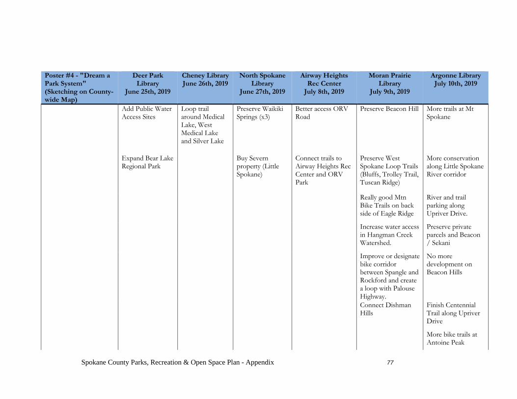
Spokane County Parks, Recreation & Open Space Plan - Appendix 77
Poster #4 - "Dream a Park System" (Sketching on County-wide Map)
Deer Park Library
June 25th, 2019
Cheney Library June 26th, 2019
North Spokane Library
June 27th, 2019
Airway Heights Rec Center
July 8th, 2019
Moran Prairie Library
July 9th, 2019
Argonne Library July 10th, 2019
Add Public Water Access Sites
Loop trail around Medical Lake, West Medical Lake and Silver Lake
Preserve Waikiki Springs (x3)
Better access ORV Road
Preserve Beacon Hill More trails at Mt Spokane
Expand Bear Lake Regional Park
Buy Severn property (Little Spokane)
Connect trails to Airway Heights Rec Center and ORV Park
Preserve West Spokane Loop Trails (Bluffs, Trolley Trail, Tuscan Ridge)
More conservation along Little Spokane River corridor
Really good Mtn Bike Trails on back side of Eagle Ridge
River and trail parking along Upriver Drive.
Increase water access in Hangman Creek Watershed.
Preserve private parcels and Beacon / Sekani
Improve or designate bike corridor between Spangle and Rockford and create a loop with Palouse Highway.
No more development on Beacon Hills
Connect Dishman Hills
Finish Centennial Trail along Upriver Drive
More bike trails at Antoine Peak
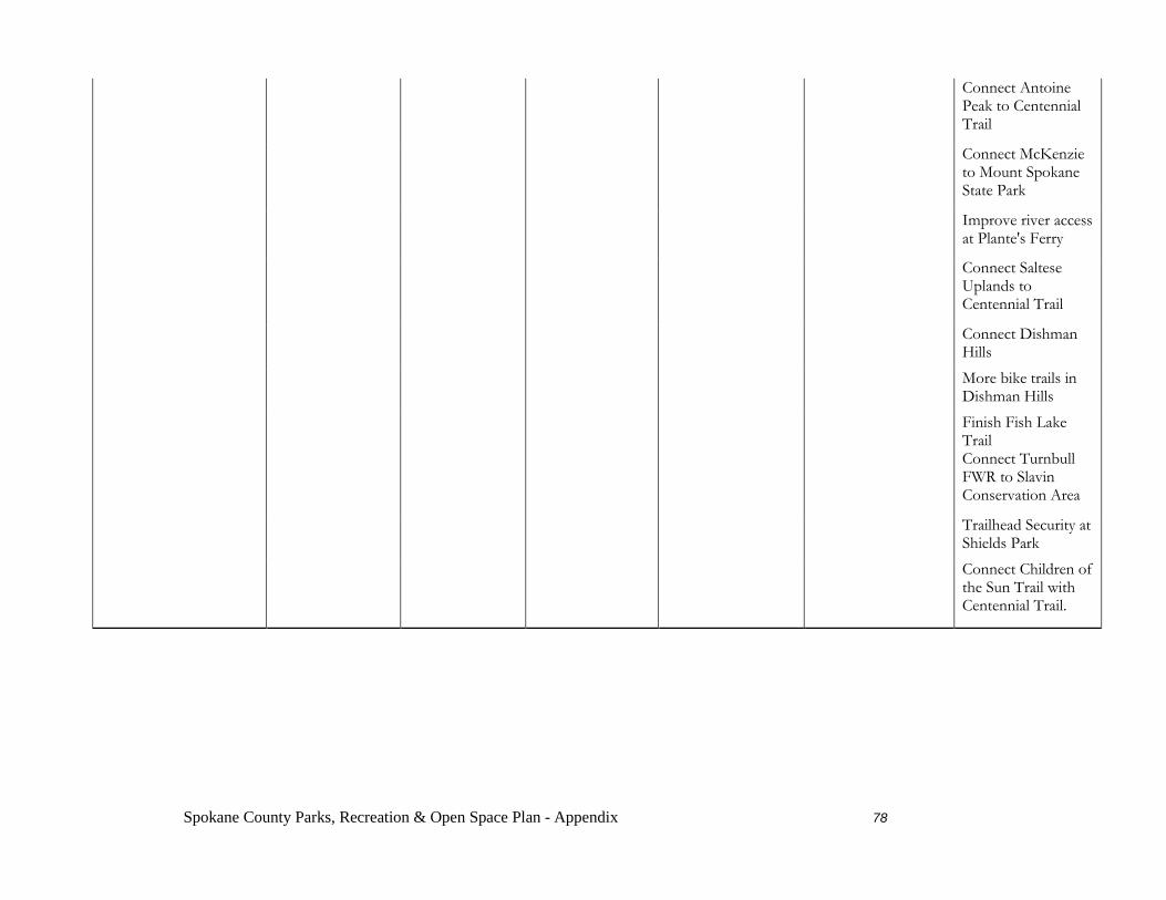
Spokane County Parks, Recreation & Open Space Plan - Appendix 78
Connect Antoine Peak to Centennial Trail
Connect McKenzie to Mount Spokane State Park
Improve river access at Plante's Ferry
Connect Saltese Uplands to Centennial Trail
Connect Dishman Hills
More bike trails in Dishman Hills
Finish Fish Lake Trail
Connect Turnbull FWR to Slavin Conservation Area
Trailhead Security at Shields Park
Connect Children of the Sun Trail with Centennial Trail.
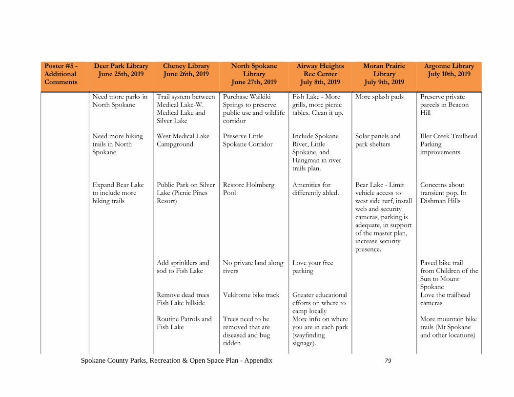
Spokane County Parks, Recreation & Open Space Plan - Appendix 79
Poster #5 - Additional Comments
Deer Park Library June 25th, 2019
Cheney Library June 26th, 2019
North Spokane Library
June 27th, 2019
Airway Heights Rec Center
July 8th, 2019
Moran Prairie Library
July 9th, 2019
Argonne Library July 10th, 2019
Need more parks in North Spokane
Trail system between Medical Lake-W. Medical Lake and Silver Lake
Purchase Waikiki Springs to preserve public use and wildlife corridor
Fish Lake - More grills, more picnic tables. Clean it up.
More splash pads Preserve private parcels in Beacon Hill
Need more hiking trails in North Spokane
West Medical Lake Campground
Preserve Little Spokane Corridor
Include Spokane River, Little Spokane, and Hangman in river trails plan.
Solar panels and park shelters
Iller Creek Trailhead Parking improvements
Expand Bear Lake to include more hiking trails
Public Park on Silver Lake (Picnic Pines Resort)
Restore Holmberg Pool
Amenities for differently abled.
Bear Lake - Limit vehicle access to west side turf, install web and security cameras, parking is adequate, in support of the master plan, increase security presence.
Concerns about transient pop. In Dishman Hills
Add sprinklers and sod to Fish Lake
No private land along rivers
Love your free parking
Paved bike trail from Children of the Sun to Mount Spokane
Remove dead trees Fish Lake hillside
Veldrome bike track Greater educational efforts on where to camp locally
Love the trailhead cameras
Routine Patrols and Fish Lake
Trees need to be removed that are diseased and bug ridden
More info on where you are in each park (wayfinding signage).
More mountain bike trails (Mt Spokane and other locations)
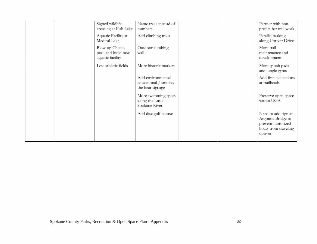
Spokane County Parks, Recreation & Open Space Plan - Appendix 80
Signed wildlife crossing at Fish Lake
Name trails instead of numbers
Partner with non-profits for trail work
Aquatic Facility at Medical Lake
Add climbing trees Parallel parking along Upriver Drive
Blow-up Cheney pool and build new aquatic facility
Outdoor climbing wall
More trail maintenance and development
Less athletic fields More historic markers More splash pads and jungle gyms
Add environmental educational / smokey the bear signage
Add first aid stations at trailheads
More swimming spots along the Little Spokane River
Preserve open space within UGA
Add disc golf course Need to add sign at Argonne Bridge to prevent motorized boats from traveling upriver.

2020 Online Survey Results Q1: Enter your zipcode.
Analysis Region Zipcodes Total
Population Registered
Voters Survey
Respondents
Percentage of
Registered Voters Who Took The
Survey South Spokane
99204 77,726 46,607 140 0.30%
99203
99223
99202
99258
North Spokane
99208 160,099 87,839 138 0.16%
99218
99205
99207
99201
99260
99026
99251
Spokane Valley
99212 103,814 62,975 115 0.18%
99206
99037
99016
99216
Liberty Lake
99019 9,502 6,635 16 0.24%
Foothills 99025 28,756 17,276 19 0.11% 99027
99217
North Spokane County
99021 48,270 24,390 32 0.13%
99006
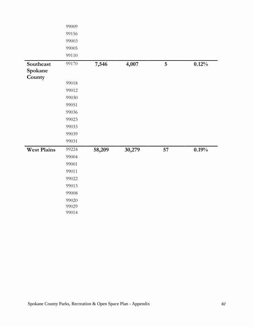
Spokane County Parks, Recreation & Open Space Plan - Appendix 82
99009
99156
99003
99005
99110
Southeast Spokane County
99170 7,546 4,007 5 0.12%
99018
99012
99030
99051
99036
99023
99033
99039
99031
West Plains 99224 58,209 30,279 57 0.19% 99004
99001
99011
99022
99013
99008
99020
99029
99014
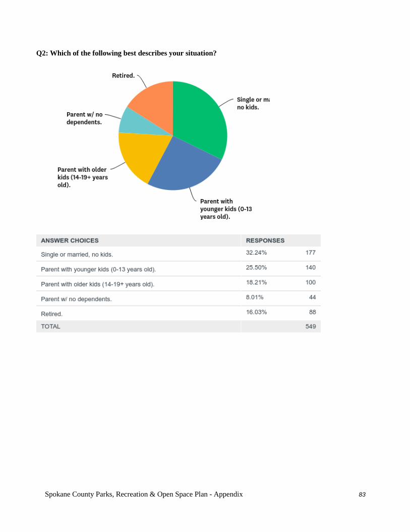
Spokane County Parks, Recreation & Open Space Plan - Appendix 83
Q2: Which of the following best describes your situation?
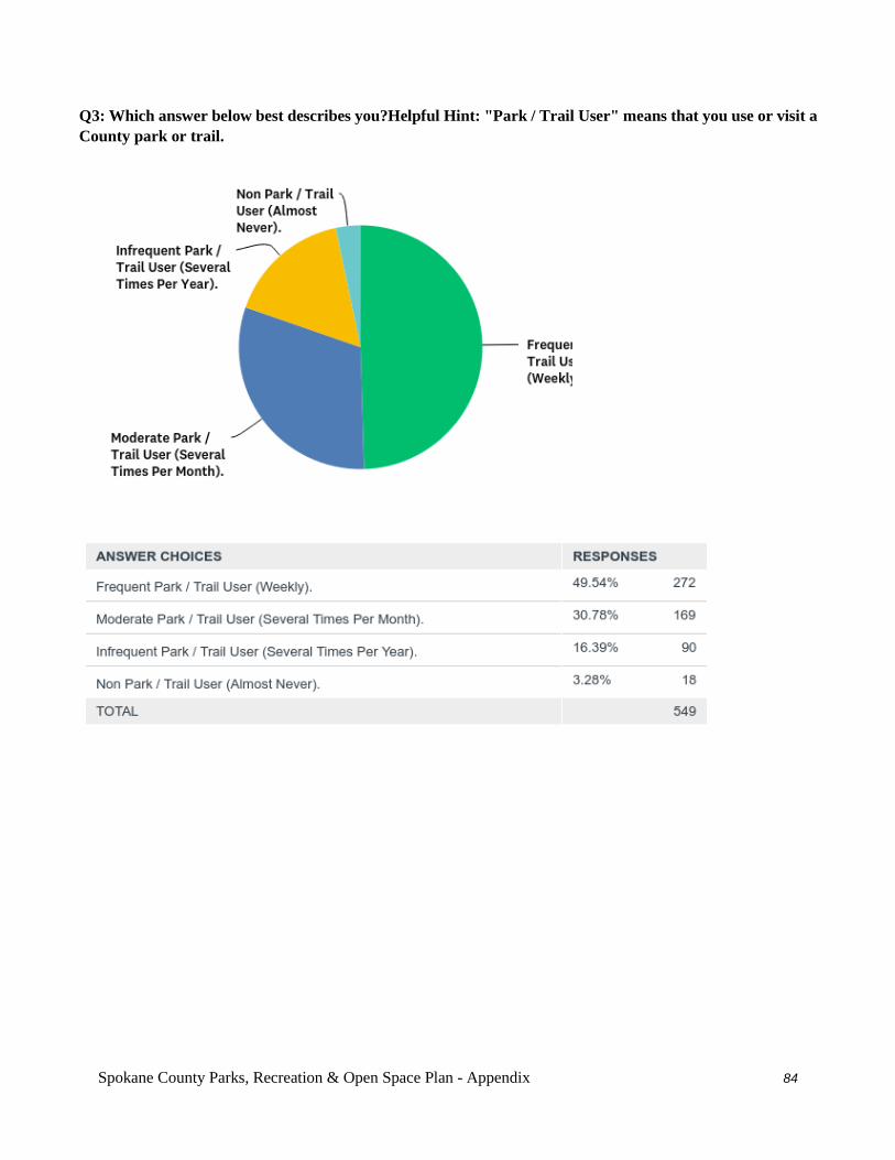
Spokane County Parks, Recreation & Open Space Plan - Appendix 84
Q3: Which answer below best describes you?Helpful Hint: "Park / Trail User" means that you use or visit a County park or trail.
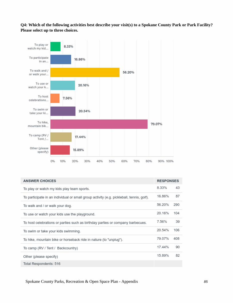
Spokane County Parks, Recreation & Open Space Plan - Appendix 85
Q4: Which of the following activities best describe your visit(s) to a Spokane County Park or Park Facility? Please select up to three choices.

Spokane County Parks, Recreation & Open Space Plan - Appendix 86
Q5: Why are you a non-park user? Pick the answer that best describes your situation.
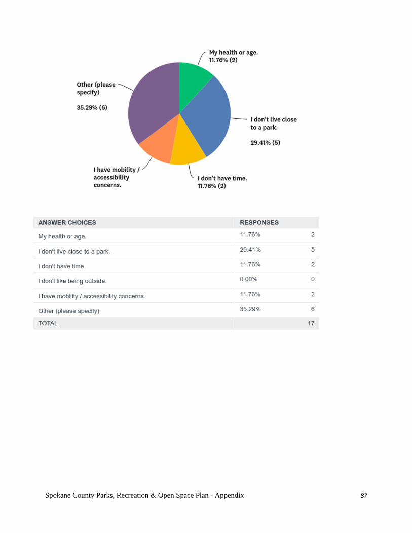
Spokane County Parks, Recreation & Open Space Plan - Appendix 87
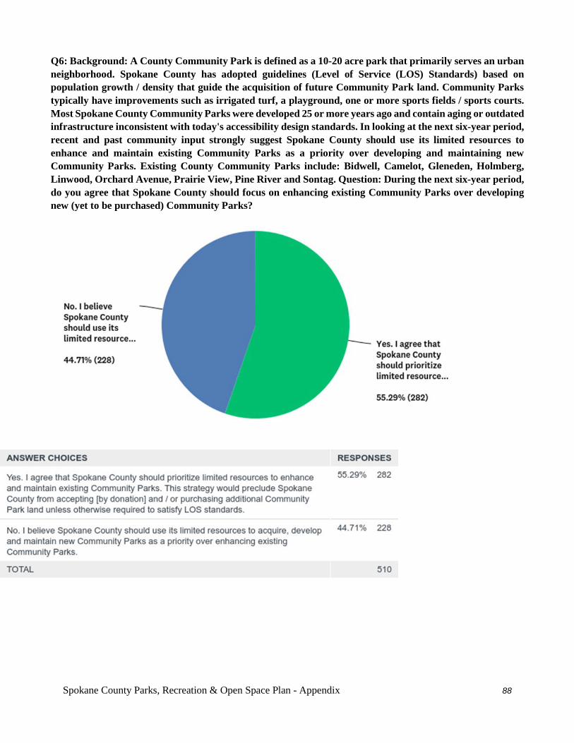
Spokane County Parks, Recreation & Open Space Plan - Appendix 88
Q6: Background: A County Community Park is defined as a 10-20 acre park that primarily serves an urban neighborhood. Spokane County has adopted guidelines (Level of Service (LOS) Standards) based on population growth / density that guide the acquisition of future Community Park land. Community Parks typically have improvements such as irrigated turf, a playground, one or more sports fields / sports courts. Most Spokane County Community Parks were developed 25 or more years ago and contain aging or outdated infrastructure inconsistent with today's accessibility design standards. In looking at the next six-year period, recent and past community input strongly suggest Spokane County should use its limited resources to enhance and maintain existing Community Parks as a priority over developing and maintaining new Community Parks. Existing County Community Parks include: Bidwell, Camelot, Gleneden, Holmberg, Linwood, Orchard Avenue, Prairie View, Pine River and Sontag. Question: During the next six-year period, do you agree that Spokane County should focus on enhancing existing Community Parks over developing new (yet to be purchased) Community Parks?
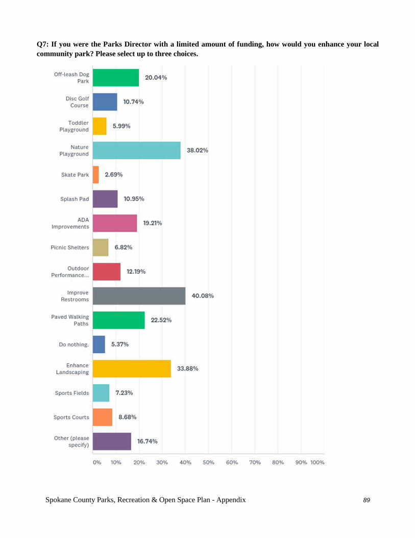
Spokane County Parks, Recreation & Open Space Plan - Appendix 89
Q7: If you were the Parks Director with a limited amount of funding, how would you enhance your local community park? Please select up to three choices.
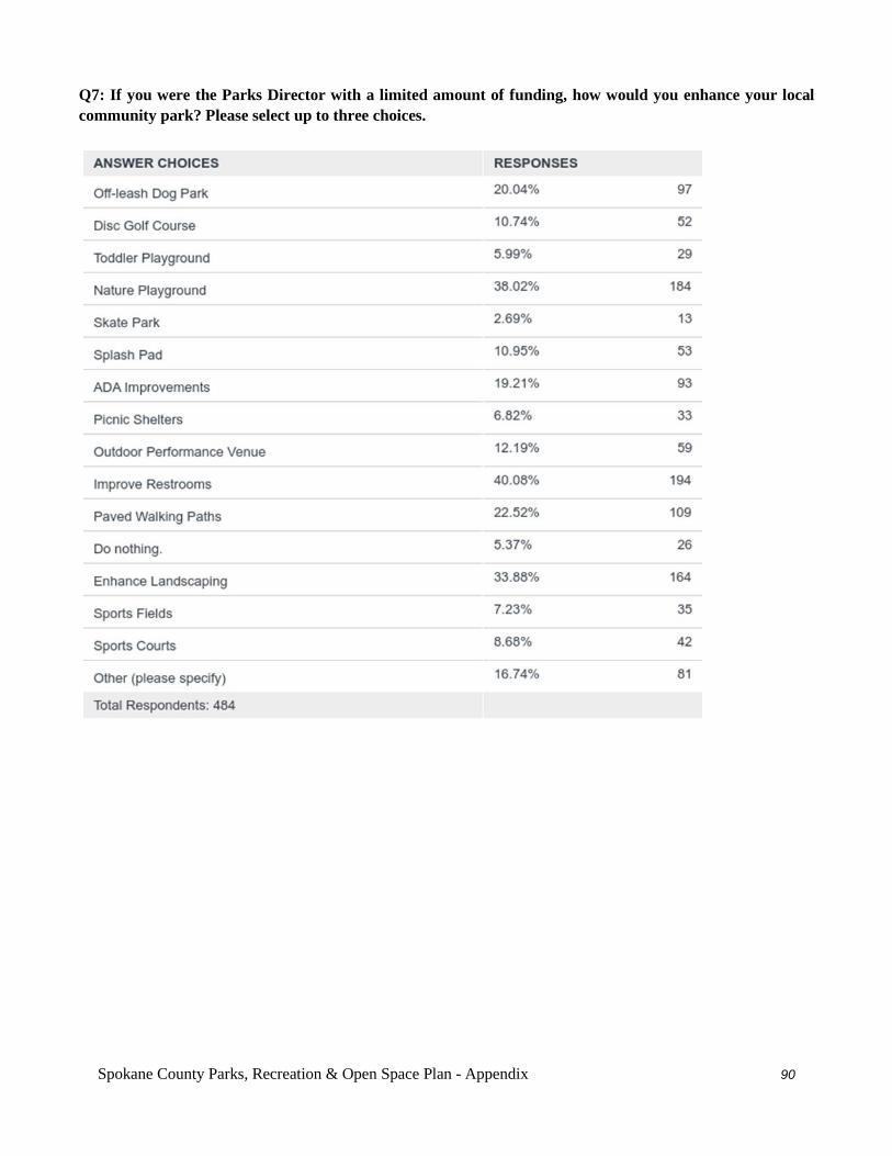
Spokane County Parks, Recreation & Open Space Plan - Appendix 90
Q7: If you were the Parks Director with a limited amount of funding, how would you enhance your local community park? Please select up to three choices.
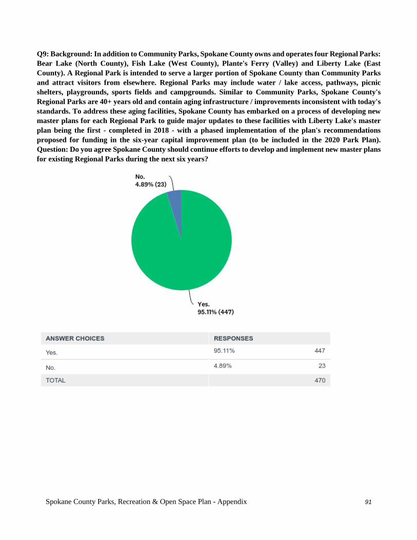
Spokane County Parks, Recreation & Open Space Plan - Appendix 91
Q9: Background: In addition to Community Parks, Spokane County owns and operates four Regional Parks: Bear Lake (North County), Fish Lake (West County), Plante's Ferry (Valley) and Liberty Lake (East County). A Regional Park is intended to serve a larger portion of Spokane County than Community Parks and attract visitors from elsewhere. Regional Parks may include water / lake access, pathways, picnic shelters, playgrounds, sports fields and campgrounds. Similar to Community Parks, Spokane County's Regional Parks are 40+ years old and contain aging infrastructure / improvements inconsistent with today's standards. To address these aging facilities, Spokane County has embarked on a process of developing new master plans for each Regional Park to guide major updates to these facilities with Liberty Lake's master plan being the first - completed in 2018 - with a phased implementation of the plan's recommendations proposed for funding in the six-year capital improvement plan (to be included in the 2020 Park Plan). Question: Do you agree Spokane County should continue efforts to develop and implement new master plans for existing Regional Parks during the next six years?
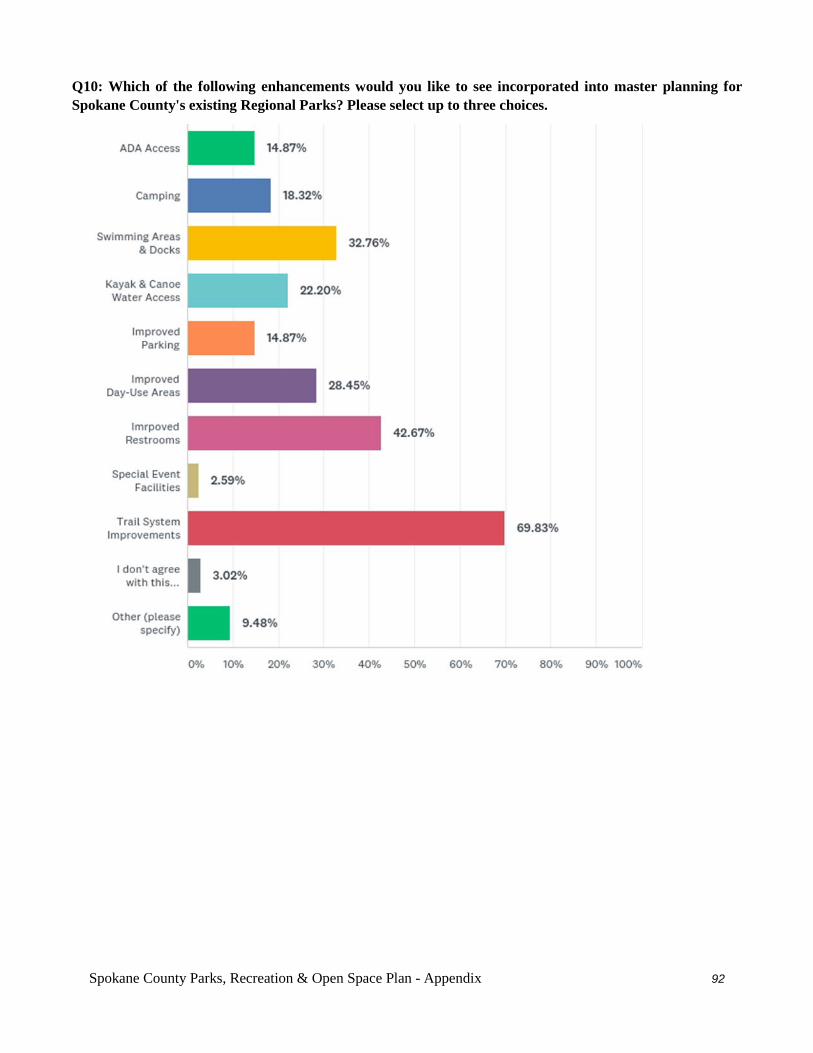
Spokane County Parks, Recreation & Open Space Plan - Appendix 92
Q10: Which of the following enhancements would you like to see incorporated into master planning for Spokane County's existing Regional Parks? Please select up to three choices.
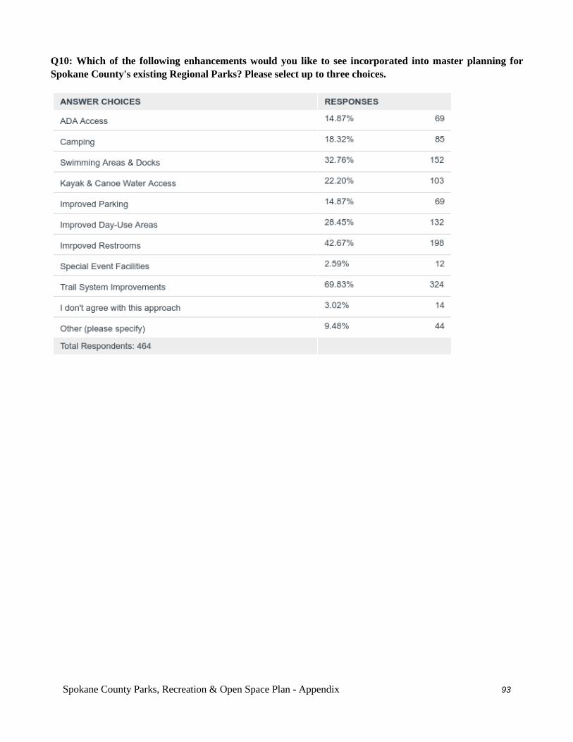
Spokane County Parks, Recreation & Open Space Plan - Appendix 93
Q10: Which of the following enhancements would you like to see incorporated into master planning for Spokane County's existing Regional Parks? Please select up to three choices.
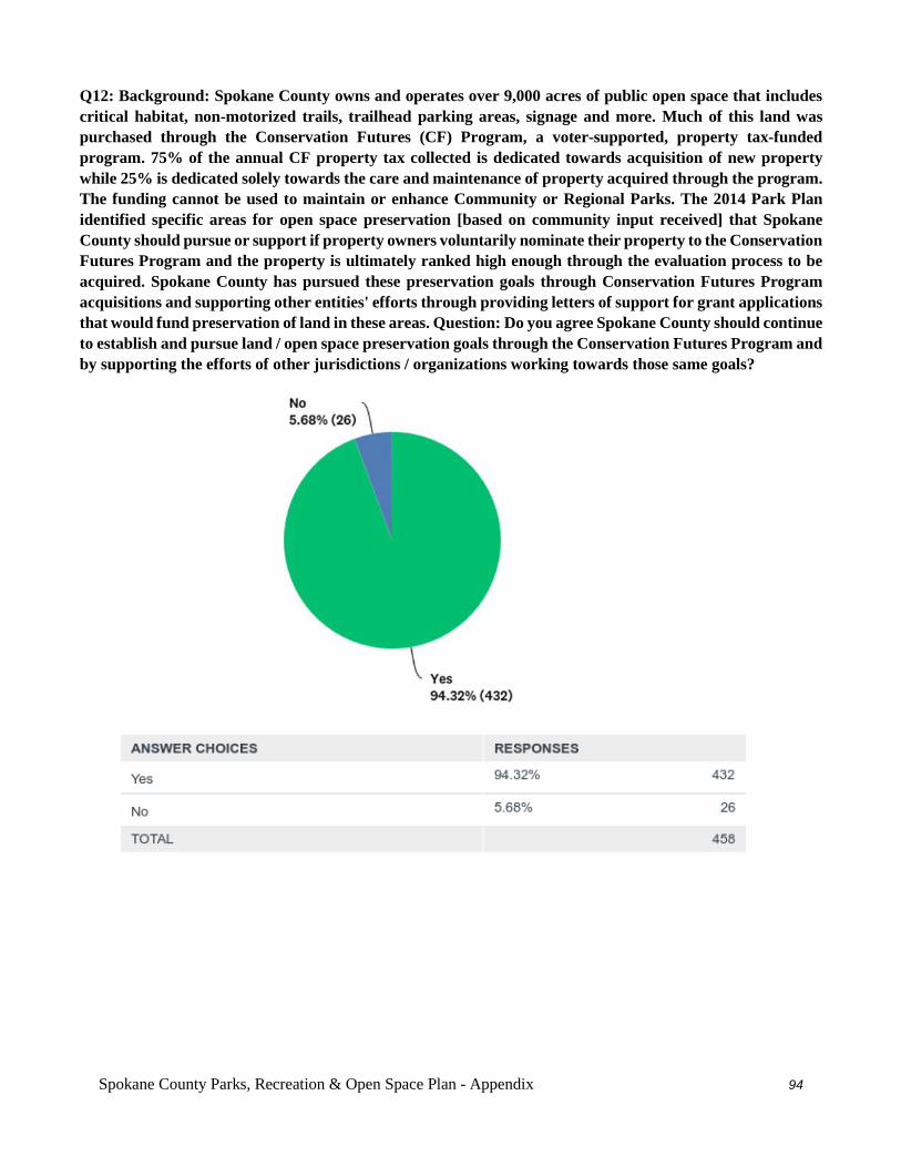
Spokane County Parks, Recreation & Open Space Plan - Appendix 94
Q12: Background: Spokane County owns and operates over 9,000 acres of public open space that includes critical habitat, non-motorized trails, trailhead parking areas, signage and more. Much of this land was purchased through the Conservation Futures (CF) Program, a voter-supported, property tax-funded program. 75% of the annual CF property tax collected is dedicated towards acquisition of new property while 25% is dedicated solely towards the care and maintenance of property acquired through the program. The funding cannot be used to maintain or enhance Community or Regional Parks. The 2014 Park Plan identified specific areas for open space preservation [based on community input received] that Spokane County should pursue or support if property owners voluntarily nominate their property to the Conservation Futures Program and the property is ultimately ranked high enough through the evaluation process to be acquired. Spokane County has pursued these preservation goals through Conservation Futures Program acquisitions and supporting other entities' efforts through providing letters of support for grant applications that would fund preservation of land in these areas. Question: Do you agree Spokane County should continue to establish and pursue land / open space preservation goals through the Conservation Futures Program and by supporting the efforts of other jurisdictions / organizations working towards those same goals?
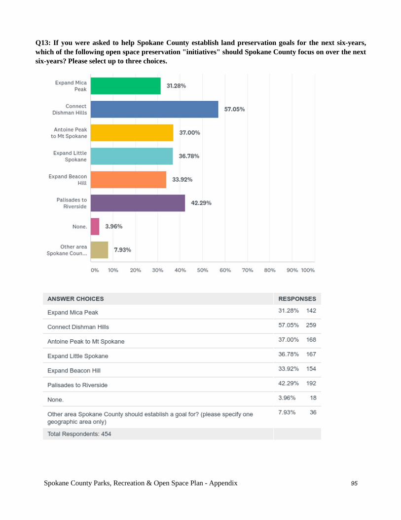
Spokane County Parks, Recreation & Open Space Plan - Appendix 95
Q13: If you were asked to help Spokane County establish land preservation goals for the next six-years, which of the following open space preservation "initiatives" should Spokane County focus on over the next six-years? Please select up to three choices.
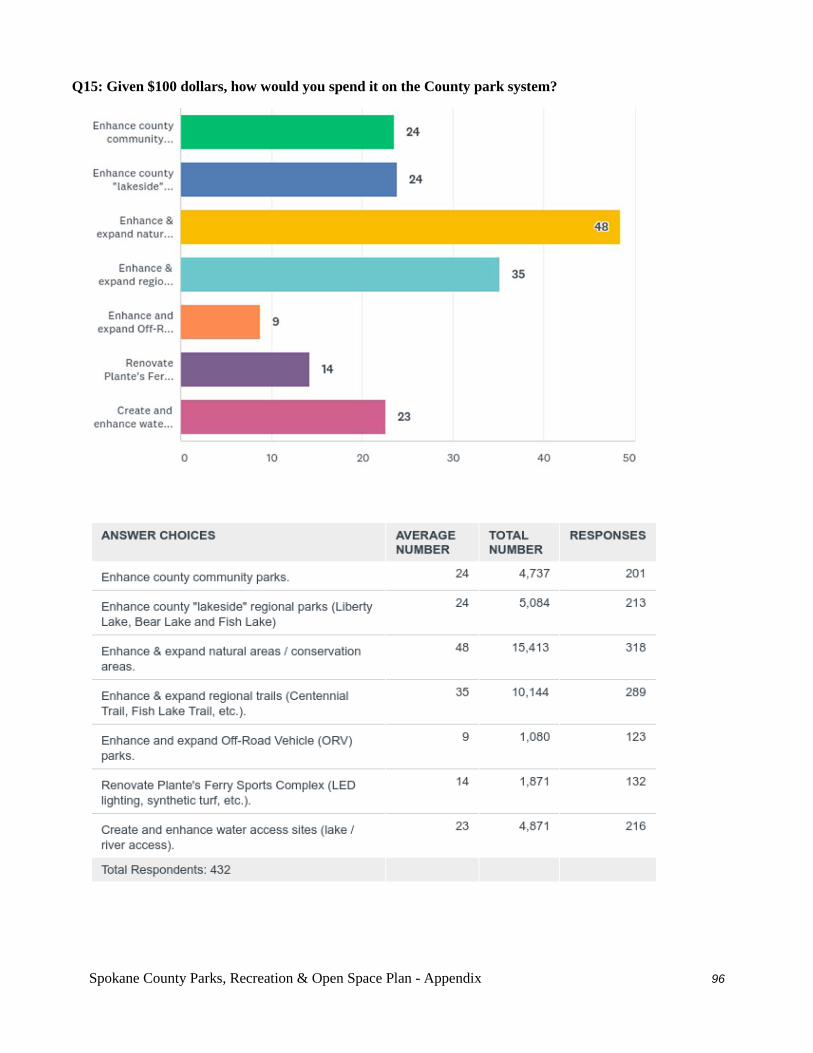
Spokane County Parks, Recreation & Open Space Plan - Appendix 96
Q15: Given $100 dollars, how would you spend it on the County park system?
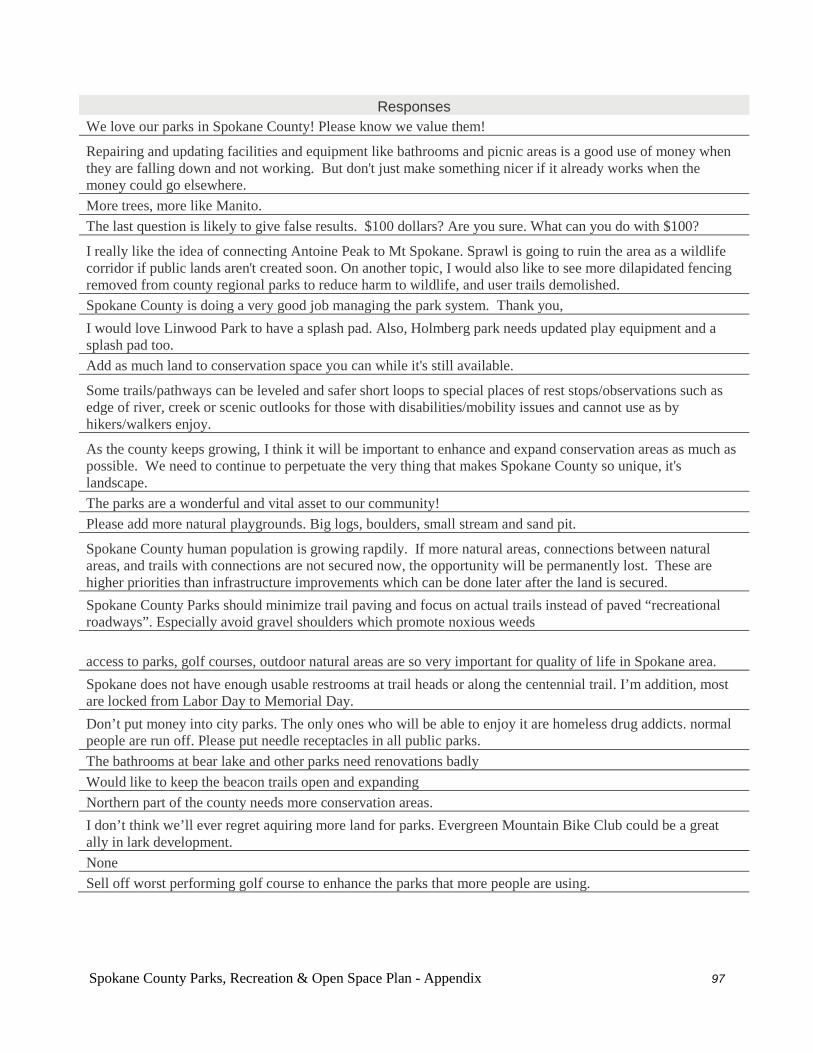
Spokane County Parks, Recreation & Open Space Plan - Appendix 97
Responses
We love our parks in Spokane County! Please know we value them!
Repairing and updating facilities and equipment like bathrooms and picnic areas is a good use of money when they are falling down and not working. But don't just make something nicer if it already works when the money could go elsewhere. More trees, more like Manito. The last question is likely to give false results. $100 dollars? Are you sure. What can you do with $100?
I really like the idea of connecting Antoine Peak to Mt Spokane. Sprawl is going to ruin the area as a wildlife corridor if public lands aren't created soon. On another topic, I would also like to see more dilapidated fencing removed from county regional parks to reduce harm to wildlife, and user trails demolished. Spokane County is doing a very good job managing the park system. Thank you, I would love Linwood Park to have a splash pad. Also, Holmberg park needs updated play equipment and a splash pad too. Add as much land to conservation space you can while it's still available.
Some trails/pathways can be leveled and safer short loops to special places of rest stops/observations such as edge of river, creek or scenic outlooks for those with disabilities/mobility issues and cannot use as by hikers/walkers enjoy.
As the county keeps growing, I think it will be important to enhance and expand conservation areas as much as possible. We need to continue to perpetuate the very thing that makes Spokane County so unique, it's landscape. The parks are a wonderful and vital asset to our community! Please add more natural playgrounds. Big logs, boulders, small stream and sand pit.
Spokane County human population is growing rapdily. If more natural areas, connections between natural areas, and trails with connections are not secured now, the opportunity will be permanently lost. These are higher priorities than infrastructure improvements which can be done later after the land is secured. Spokane County Parks should minimize trail paving and focus on actual trails instead of paved “recreational roadways”. Especially avoid gravel shoulders which promote noxious weeds
access to parks, golf courses, outdoor natural areas are so very important for quality of life in Spokane area. Spokane does not have enough usable restrooms at trail heads or along the centennial trail. I’m addition, most are locked from Labor Day to Memorial Day. Don’t put money into city parks. The only ones who will be able to enjoy it are homeless drug addicts. normal people are run off. Please put needle receptacles in all public parks. The bathrooms at bear lake and other parks need renovations badly Would like to keep the beacon trails open and expanding Northern part of the county needs more conservation areas. I don’t think we’ll ever regret aquiring more land for parks. Evergreen Mountain Bike Club could be a great ally in lark development. None Sell off worst performing golf course to enhance the parks that more people are using.
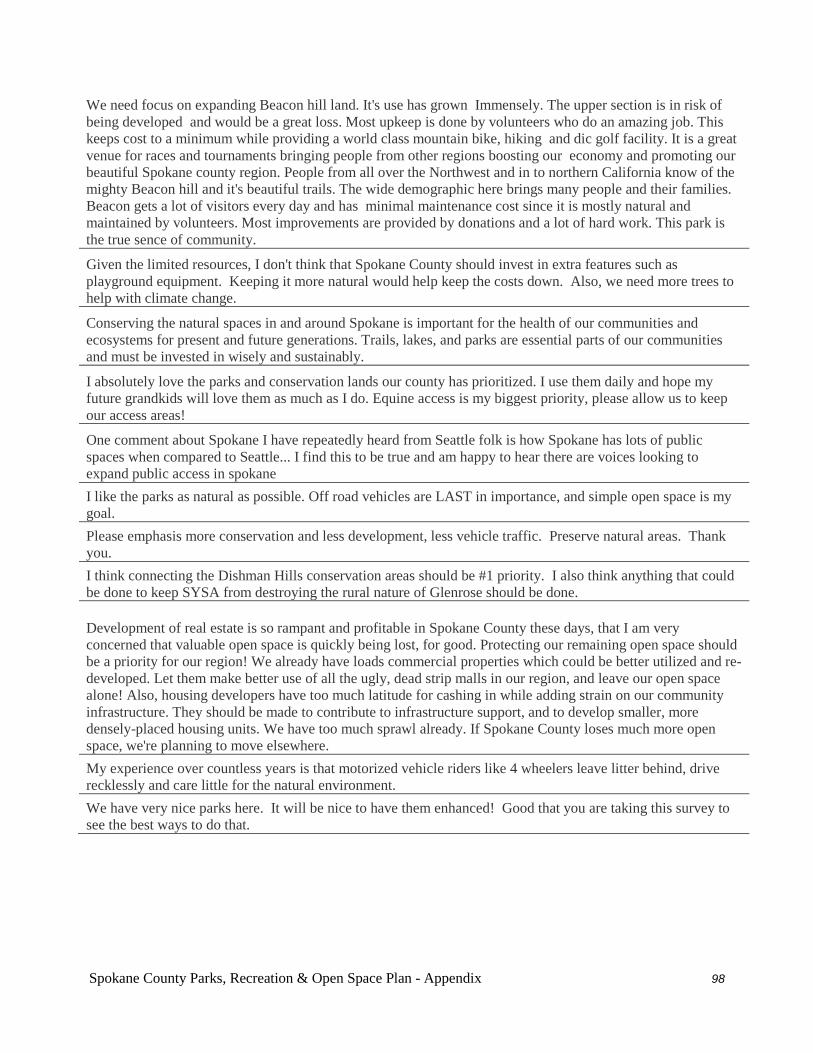
Spokane County Parks, Recreation & Open Space Plan - Appendix 98
We need focus on expanding Beacon hill land. It's use has grown Immensely. The upper section is in risk of being developed and would be a great loss. Most upkeep is done by volunteers who do an amazing job. This keeps cost to a minimum while providing a world class mountain bike, hiking and dic golf facility. It is a great venue for races and tournaments bringing people from other regions boosting our economy and promoting our beautiful Spokane county region. People from all over the Northwest and in to northern California know of the mighty Beacon hill and it's beautiful trails. The wide demographic here brings many people and their families. Beacon gets a lot of visitors every day and has minimal maintenance cost since it is mostly natural and maintained by volunteers. Most improvements are provided by donations and a lot of hard work. This park is the true sence of community.
Given the limited resources, I don't think that Spokane County should invest in extra features such as playground equipment. Keeping it more natural would help keep the costs down. Also, we need more trees to help with climate change.
Conserving the natural spaces in and around Spokane is important for the health of our communities and ecosystems for present and future generations. Trails, lakes, and parks are essential parts of our communities and must be invested in wisely and sustainably.
I absolutely love the parks and conservation lands our county has prioritized. I use them daily and hope my future grandkids will love them as much as I do. Equine access is my biggest priority, please allow us to keep our access areas!
One comment about Spokane I have repeatedly heard from Seattle folk is how Spokane has lots of public spaces when compared to Seattle... I find this to be true and am happy to hear there are voices looking to expand public access in spokane I like the parks as natural as possible. Off road vehicles are LAST in importance, and simple open space is my goal. Please emphasis more conservation and less development, less vehicle traffic. Preserve natural areas. Thank you. I think connecting the Dishman Hills conservation areas should be #1 priority. I also think anything that could be done to keep SYSA from destroying the rural nature of Glenrose should be done.
Development of real estate is so rampant and profitable in Spokane County these days, that I am very concerned that valuable open space is quickly being lost, for good. Protecting our remaining open space should be a priority for our region! We already have loads commercial properties which could be better utilized and re-developed. Let them make better use of all the ugly, dead strip malls in our region, and leave our open space alone! Also, housing developers have too much latitude for cashing in while adding strain on our community infrastructure. They should be made to contribute to infrastructure support, and to develop smaller, more densely-placed housing units. We have too much sprawl already. If Spokane County loses much more open space, we're planning to move elsewhere. My experience over countless years is that motorized vehicle riders like 4 wheelers leave litter behind, drive recklessly and care little for the natural environment. We have very nice parks here. It will be nice to have them enhanced! Good that you are taking this survey to see the best ways to do that.
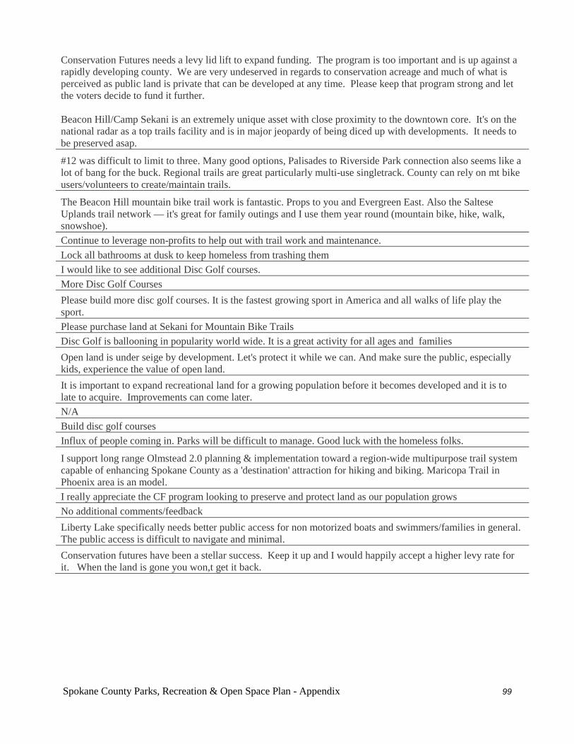
Spokane County Parks, Recreation & Open Space Plan - Appendix 99
Conservation Futures needs a levy lid lift to expand funding. The program is too important and is up against a rapidly developing county. We are very undeserved in regards to conservation acreage and much of what is perceived as public land is private that can be developed at any time. Please keep that program strong and let the voters decide to fund it further. Beacon Hill/Camp Sekani is an extremely unique asset with close proximity to the downtown core. It's on the national radar as a top trails facility and is in major jeopardy of being diced up with developments. It needs to be preserved asap.
#12 was difficult to limit to three. Many good options, Palisades to Riverside Park connection also seems like a lot of bang for the buck. Regional trails are great particularly multi-use singletrack. County can rely on mt bike users/volunteers to create/maintain trails.
The Beacon Hill mountain bike trail work is fantastic. Props to you and Evergreen East. Also the Saltese Uplands trail network — it's great for family outings and I use them year round (mountain bike, hike, walk, snowshoe). Continue to leverage non-profits to help out with trail work and maintenance. Lock all bathrooms at dusk to keep homeless from trashing them I would like to see additional Disc Golf courses. More Disc Golf Courses Please build more disc golf courses. It is the fastest growing sport in America and all walks of life play the sport. Please purchase land at Sekani for Mountain Bike Trails Disc Golf is ballooning in popularity world wide. It is a great activity for all ages and families Open land is under seige by development. Let's protect it while we can. And make sure the public, especially kids, experience the value of open land. It is important to expand recreational land for a growing population before it becomes developed and it is to late to acquire. Improvements can come later. N/A Build disc golf courses Influx of people coming in. Parks will be difficult to manage. Good luck with the homeless folks.
I support long range Olmstead 2.0 planning & implementation toward a region-wide multipurpose trail system capable of enhancing Spokane County as a 'destination' attraction for hiking and biking. Maricopa Trail in Phoenix area is an model. I really appreciate the CF program looking to preserve and protect land as our population grows No additional comments/feedback Liberty Lake specifically needs better public access for non motorized boats and swimmers/families in general. The public access is difficult to navigate and minimal. Conservation futures have been a stellar success. Keep it up and I would happily accept a higher levy rate for it. When the land is gone you won,t get it back.
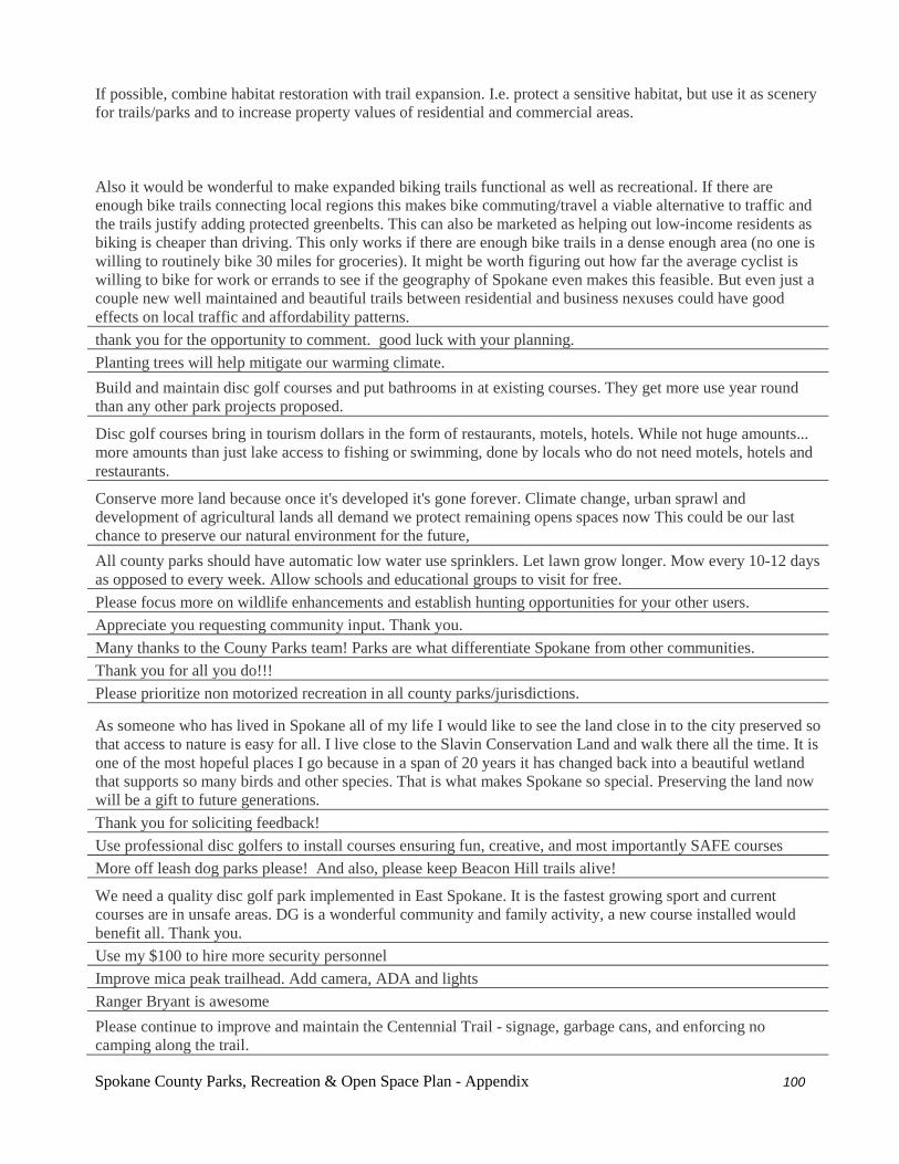
Spokane County Parks, Recreation & Open Space Plan - Appendix 100
If possible, combine habitat restoration with trail expansion. I.e. protect a sensitive habitat, but use it as scenery for trails/parks and to increase property values of residential and commercial areas. Also it would be wonderful to make expanded biking trails functional as well as recreational. If there are enough bike trails connecting local regions this makes bike commuting/travel a viable alternative to traffic and the trails justify adding protected greenbelts. This can also be marketed as helping out low-income residents as biking is cheaper than driving. This only works if there are enough bike trails in a dense enough area (no one is willing to routinely bike 30 miles for groceries). It might be worth figuring out how far the average cyclist is willing to bike for work or errands to see if the geography of Spokane even makes this feasible. But even just a couple new well maintained and beautiful trails between residential and business nexuses could have good effects on local traffic and affordability patterns. thank you for the opportunity to comment. good luck with your planning. Planting trees will help mitigate our warming climate. Build and maintain disc golf courses and put bathrooms in at existing courses. They get more use year round than any other park projects proposed.
Disc golf courses bring in tourism dollars in the form of restaurants, motels, hotels. While not huge amounts... more amounts than just lake access to fishing or swimming, done by locals who do not need motels, hotels and restaurants.
Conserve more land because once it's developed it's gone forever. Climate change, urban sprawl and development of agricultural lands all demand we protect remaining opens spaces now This could be our last chance to preserve our natural environment for the future, All county parks should have automatic low water use sprinklers. Let lawn grow longer. Mow every 10-12 days as opposed to every week. Allow schools and educational groups to visit for free. Please focus more on wildlife enhancements and establish hunting opportunities for your other users. Appreciate you requesting community input. Thank you. Many thanks to the Couny Parks team! Parks are what differentiate Spokane from other communities. Thank you for all you do!!! Please prioritize non motorized recreation in all county parks/jurisdictions.
As someone who has lived in Spokane all of my life I would like to see the land close in to the city preserved so that access to nature is easy for all. I live close to the Slavin Conservation Land and walk there all the time. It is one of the most hopeful places I go because in a span of 20 years it has changed back into a beautiful wetland that supports so many birds and other species. That is what makes Spokane so special. Preserving the land now will be a gift to future generations. Thank you for soliciting feedback! Use professional disc golfers to install courses ensuring fun, creative, and most importantly SAFE courses More off leash dog parks please! And also, please keep Beacon Hill trails alive!
We need a quality disc golf park implemented in East Spokane. It is the fastest growing sport and current courses are in unsafe areas. DG is a wonderful community and family activity, a new course installed would benefit all. Thank you. Use my $100 to hire more security personnel Improve mica peak trailhead. Add camera, ADA and lights Ranger Bryant is awesome Please continue to improve and maintain the Centennial Trail - signage, garbage cans, and enforcing no camping along the trail.
Spokane County Parks, Recreation & Open Space Plan - Appendix 101
Please continue to support the Spokane Futures program! So few cities have this - it’s a gift that we have designated outdoor use space so close into the city before the city grows too big to make this space! Mead/wandermere area needs a park with a splash pad Good luck! Regional parks need to be staffed and maintained by the County. Lets get the restrooms working again, empty the garbage and provide a staff presence to increase safety.
Love that Bidwell park will be enhanced. Larger pool area would be wonderful. Bear Lake is dilapidated. Please renew the bathrooms. At least the set near the open field. The others would be nice too but having nothing but portapotties is unacceptable especially with toddlers. The trails are quickly worsening as well. It used to be a lot more people friendly. Pickleball is a he fastest growing sport in our country. Putting in dedicated courts could bring revenue into the city. Please consider.
If anything from this survey, i would like beacon hill/camp sekani to be the primary focus. That area is utilized by a large number of residents and is established outside the current bounds of public land. I believe that without preservation of that land, parks usage will dwindle. Make Beacon Public
County Parks needs more general fund monies to support improvements and operations at Community Parks. Make Beacon Public! More trails will bring more recreationalists to Spokane and make our city more desirable.
Bear lake is close and easy to access; however it feels rundown and aloof with illegal activity (theft, drug deals) so much so that we think twice about going there even with it’s close proximity. Take it back to the days of clean bathrooms with changing areas, showers to wash off the swimmers itch, more security patrols so I feel safe leaving my car there to use the lake. It could be a real asset to the county but it feels too run down and not taken care of.
Mountain biking and hiking are amazing activities for the community and youth to get involved in. This should be a huge focus, as it helps with stabilizing emotional health and could help keep people off drugs and off the streets. Make Beacon Public I don't want to lose beacon
I feel like we should grab as much land as we can. We'll be happy we did in 30 years! Keep up the good work!
Areas like Sekani- Beacon, Dishman-Iller- Glenrose, and Antione are vital to the community and once lost can never be replaced. The loss or reduction of these areas would require folks to go further from town to ride mountain bike or hike. Preserving Beacon Hill trails should be the number one priority. Beacon is simply amazing and we need to keep this public! Would support better water access on lakes and rivers. Also need to support security to keep trailheads safe and clean. So many homeless camper and people living out of cars at trailheads. Trailheads requiring permits are so much cleaner and safer! Would support bike trail development along river and extension of trails from peoples park to TJ MEENACH... so much to work with. Spokane could be amazing for bikers and hikers! Need to get homeless out of prime recreation and family areas. Thank you for considering expanding public ownership of Beacon Hill and making improvements to mountain bike trails.
Spokane County Parks, Recreation & Open Space Plan - Appendix 102
Please place a high priority on obtaining and preserving public access at Camp Sekani. Parks should also place a high value on enhancing natural ecosystems you are stewards of.
Would love to see more in the region of Sontag park/Nine Mile area- a PUBLIC playground that can be used when school is in session. A natural, nature based playground would fit in well. A playground within riverside campground would be another alternative!
Thank you for caring! Im in helena Mt right now and they have a free community supported mountain bike shuttle that brings hundreds of riders to town eqch weekend bringing $$$$ into the community. Our decision to put more swings or led lights in at a park pales in comparison to the economic impact building more and better network of trails will have. Google it. City after city have found this. Oakridge OR is another example I bike ride or hike in these parks several times a week and love them for their open space, wildness/nature, wildlife habitat, great bike trails, and disc golf. Keep up the good work! It’s why I love living in Spokane!! keep funding Conservation futures and natural areas in Spokane County. Thanks for soliciting public input.
Please give Bear Lake some attention. The trail is no longer suitable for ADA use and the park needs real restrooms again. The dock also needs some TLC. The area that used to be a playing field would make a nice off leash dog area since the park is very popular with dog owners and there is no dog park on the north side. I think you have done a pretty good job. Would like to continue to see improved access to natural areas. But yet still have improvements and maintenance in the more traditional Parks.
Please research issued with multi-use and plan accordingly. I love to bike and hike but these 2 activities in the same area create conflict. There are enough resources available to allow for at least some limited "no bicycle" trails. Preserve, preserve, preserve our beautiful region! I feel like conservation should be the number one goal as our cities grow and expand and ruin nature. Spokane has some real treasures with its big old parks on the South Hill. Please preserve the nature there. And we have enough ball fields, thanks. Keep up the great work, and keep nurturing your relationships with local conservation groups through the development of the Olmsted 2.0 vision. With our rapidly growing county population this is the time to work collaboratively for the protection of vital habitat and recreation lands. Great survey, BTW
Spokane is poised to be a city with an extensive park system that rivals other cities. The manicured parks (Manito) are just as important as less-regulated wild spaces (The South Hill Bluff). Most integral to these parks is the presence of healthy, large, old trees that allow adults and children to feel like they are in a lush forest but only a block or a few miles from home. We live in an age where people are realizing the need to re-wild ourselves, and not everyone has the means to drive, camp, and boat in remote places. Spokane needs to save and create an abundance of public open spaces with mixed use that allows for relaxation, appreciation of flowers and trees, sports, and dogs (off leash areas). As I meet more retirees moving from larger cities to Spokane, they specifically sought a home that was close to a premier park (Manito, Cannon Hill). If we want to see more economic, racial, and age diversity in Spokane, we need to invest in more parks and the beautification of them throughout the city. We will continue to draw people from other cities and why not encourage them to live distributed throughout the city. We love our parks!
Spokane County Parks, Recreation & Open Space Plan - Appendix 103
More multi-use dirt trials and conservation areas!!!
I think public natural land preservation is a great priority. These lands benefit the natural ecosystem and where providing new parks has a negative impact on the ecosystem. We have a plentiful amount of existing parks, many with great paved trails and seem well maintained. I prefer to access dirt trails in a more natural environment than taking away natural vegetation for additional paved trails. The Centennial trail, Manito, Mirabeau and other parks provide great access for those with disabilities.
Though limited to three choices on the survey, many of the conservation areas are vert important. Beacon, Antoine, Palisades, Dishman, Little Spokane, Mica peak. We really need to preserve, protect, connect, and expand these areas before they are chewed up by development. There won't be a second chance to get back our natural spaces. Plus, they serve as vital wildlife habitat and movement corridors. Thank you! Also, the "limited funds" available sounds discouraging. It should not be a choice between maintenance and conservation. We really need to invest in our parks, not only in achieving and maintaining a standard of quality, but ensuring park space grows with our growing population and developments. We spend crazy amounts of money on many things. Parks should not be at the bottom of the list! Please fund them appropriately. I just hiked in the hills behind Holmberg Park today and stood at the fence by the pool and thought how sad it looked drained and empty on this hot sunny day. It should be fill with kids frolicking and enjoying swimming in the summer sunshine! Thank you. That last question was stupid. Nothing of impact could be done for our parks with $100. That stupid round-about they're looking at putting in on Trent is supposed to cost $25 million. $100, seriously? Increase winter recreation programs and services at parks and conservation areas. Establish a higher elevation trailhead (3500'+) at Mica Peak to allow for robust winter recreation activities. Thank you for asking for our opinion! We love the ideas of expanding walking trails and swimming areas. Thanks for doing what you do! I always think acquiring more parks should be the priority. It will never be cheaper or easier to get property than it is now. Keep in mind population growth. The Spokane area is getting positive nation-wide attention as a great place to live, and demand/use of recreational venues will grow too. You already know that, though. Thanks for the work you do upgrade/maintain what we have The question about renovating or acquiring community parks wasn't fair. How could that be an either/or? I chose acquire more, but use some money to enhance/renovate existing parks. Spokane County Parks is doing a great job expanding and managing their conservation areas. Continue your great work of adding new trails and signage. Create more public volunteer days
More parks in the city need to have some kind of off-leash dog facility or dog run. Corbin Park for example has huge, open green spaces that are underutilized for other activities and would serve the community better by allowing a small chunk for dogs to run off leash Spokane needs better planning and more open spaces and conservation. Stop ruining all the green space! your conservation futures program needs a qualified trail/native plant expert if you're going to make trails.
Natural areas are significant low impact recreation areas that are used by outdoor enthusiasts, like hikers, mountain bikers, birders and runners. I would put time and money into trail systems that would enhance the visitors experience and separate foot traffic from bike traffic and horse traffic. Keep trails specific to one sport. I think as spokane continues to grow, the acquisition, protection and connection of open spaces should be the #1 priority, though I do feel that all the parks goals are worthy ones.
Spokane County Parks, Recreation & Open Space Plan - Appendix 104
If this survey applies to our local free pools, please increase afternoon hours. This is important for children who do not nap in the afternoon and who may be home alone while parents work. I like to see the Conservation Futures Board move faster in acquisitions.
Many of the parks in the area have become a place for homeless and drug users to hang out. Real attention and resources need to be focused on getting these people away from places where children play. The tax payers hold the burden for the maintenance and development of these parks, but are increasingly nervous about using them, or allowing their children to use them. Those who do not pay the bills should not be creating an unsafe environment for those that do. Thank you for all that you do. The parks and natural green space are a valued feature of the Spokane area. Easy access to outdoor recreation is one of my favorite reasons to live in Spokane.
please begin paying attention to the West Plains region, as significant growth is projected for that area in the coming years, and it's important that natural areas and resources be preserved, as well as greenspace and parks
I am a huge auto racing fan, but purchasing Spokane speedway with tax payer funds was money wasted. It adds little to the well-being of the community and has a low profit value. Sell it and reduce the cost your golf courses. Bring back the park leader program like we had in the 1970's Allow hunting as part of your management of larger lands.
I believe creating more open spaces within the city limits for quick backyard excursions would make Spokane better. Colorado Springs is an excellent example of a city with many parks/open spaces built into the housing developments.
Some of the County properties are big enough to allow hunting, especially bow-hunting. There are several where bird hunting with shotguns could be allowed as well. This is a huge user group who is not allowed to use the property but yet funds much of wildlife management and likely some of the funding for these grants the county is receiving to purchase these properties. One of the main reasons people use these parks is to see wildlife, managed by the money from hunting dollars. These properties also create safe havens for wildlife which end up becoming a nuisance such as moose, turkeys, bears, cougars, deer, and elk. Hunting these populations keeps them in check, weary of humans, and dispersed into healthy and safe population densities.
The choice between expansion and improvement is a false choice. Balance between expansion and enhancement needs to be found in order to meet the needs of an expanding population and the pressure it will bring on existing park facilities (higher visitation = higher maintenance requirements) with expanded / new facilities to meet the growing needs. A stable funding source is needed - consider a municipal parks district. Recognizing that it is a costly improvement, sports parks need lighting for night time play to extend usage time and safety wherever possible. Love my parks good luck. Spokane is growing and needs like the above need to invest to stay ahead of growth. We need more spots for camping in our region. It is so limited and people have to make reservations 1 year or 6 months in advance otherwise there is nowhere to camp Keep the golf courses nice, great features that really sets Spokane apart from other areas. We are blessed to have so many nice public park areas in Spokane County. Let's keep them nice for future generations by investing in renovations. Thanks for asking my opinions. Thanks

Remember the native flora and fauna need space too. Not just humans.
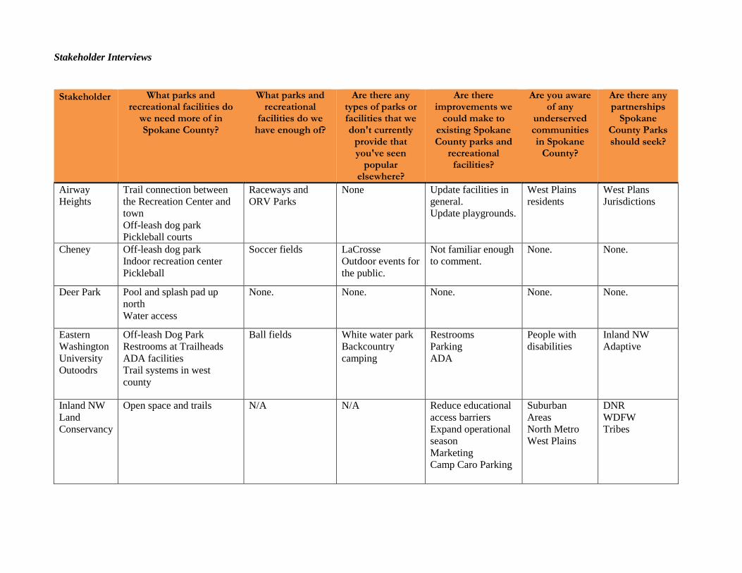
Stakeholder Interviews Stakeholder What parks and
recreational facilities do we need more of in Spokane County?
What parks and recreational
facilities do we have enough of?
Are there any types of parks or facilities that we don't currently
provide that you've seen
popular elsewhere?
Are there improvements we
could make to existing Spokane County parks and
recreational facilities?
Are you aware of any
underserved communities in Spokane
County?
Are there any partnerships
Spokane County Parks should seek?
Airway Heights
Trail connection between the Recreation Center and town Off-leash dog park Pickleball courts
Raceways and ORV Parks
None Update facilities in general. Update playgrounds.
West Plains residents
West Plans Jurisdictions
Cheney Off-leash dog park Indoor recreation center Pickleball
Soccer fields LaCrosse Outdoor events for the public.
Not familiar enough to comment.
None. None.
Deer Park Pool and splash pad up north Water access
None. None. None. None. None.
Eastern Washington University Outoodrs
Off-leash Dog Park Restrooms at Trailheads ADA facilities Trail systems in west county
Ball fields White water park Backcountry camping
Restrooms Parking ADA
People with disabilities
Inland NW Adaptive
Inland NW Land Conservancy
Open space and trails N/A N/A Reduce educational access barriers Expand operational season Marketing Camp Caro Parking
Suburban Areas North Metro West Plains
DNR WDFW Tribes
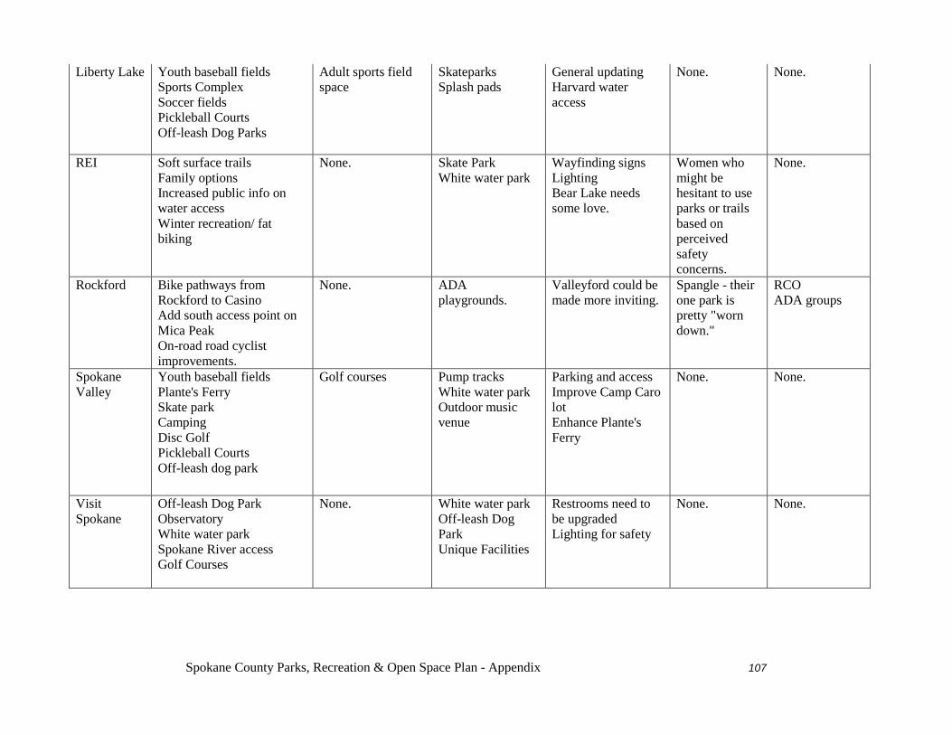
Spokane County Parks, Recreation & Open Space Plan - Appendix 107
Liberty Lake Youth baseball fields Sports Complex Soccer fields Pickleball Courts Off-leash Dog Parks
Adult sports field space
Skateparks Splash pads
General updating Harvard water access
None. None.
REI Soft surface trails Family options Increased public info on water access Winter recreation/ fat biking
None. Skate Park White water park
Wayfinding signs Lighting Bear Lake needs some love.
Women who might be hesitant to use parks or trails based on perceived safety concerns.
None.
Rockford Bike pathways from Rockford to Casino Add south access point on Mica Peak On-road road cyclist improvements.
None. ADA playgrounds.
Valleyford could be made more inviting.
Spangle - their one park is pretty "worn down."
RCO ADA groups
Spokane Valley
Youth baseball fields Plante's Ferry Skate park Camping Disc Golf Pickleball Courts Off-leash dog park
Golf courses Pump tracks White water park Outdoor music venue
Parking and access Improve Camp Caro lot Enhance Plante's Ferry
None. None.
Visit Spokane
Off-leash Dog Park Observatory White water park Spokane River access Golf Courses
None. White water park Off-leash Dog Park Unique Facilities
Restrooms need to be upgraded Lighting for safety
None. None.
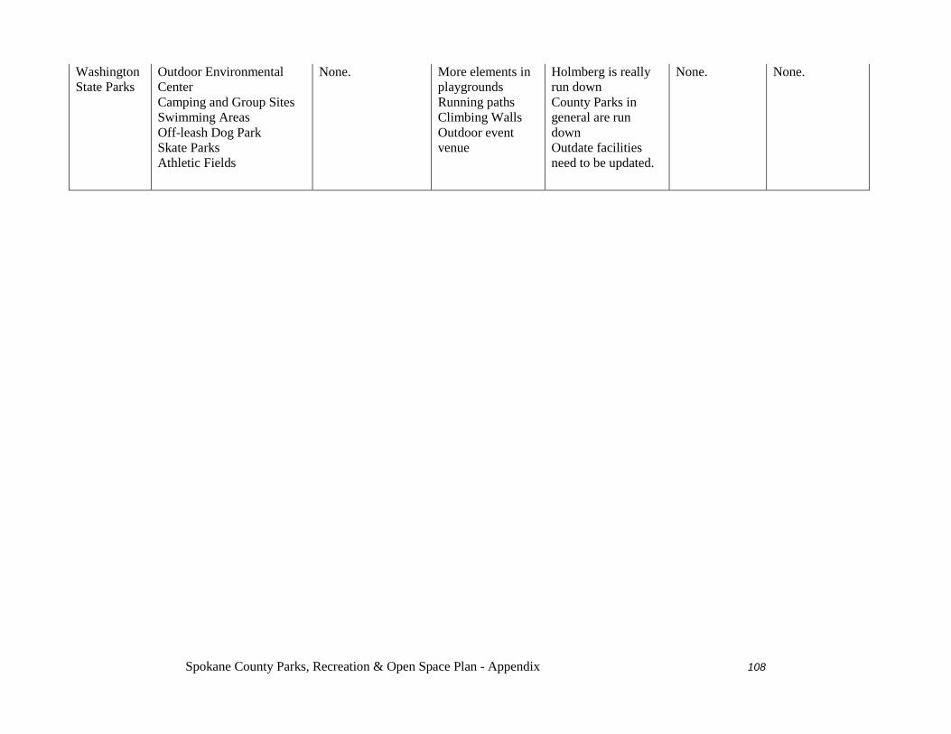
Spokane County Parks, Recreation & Open Space Plan - Appendix 108
Washington State Parks
Outdoor Environmental Center Camping and Group Sites Swimming Areas Off-leash Dog Park Skate Parks Athletic Fields
None. More elements in playgrounds Running paths Climbing Walls Outdoor event venue
Holmberg is really run down County Parks in general are run down Outdate facilities need to be updated.
None. None.
2015 Community Priorities Survey
March 25, 2015
Community Priorities Survey &
Open House Results Report
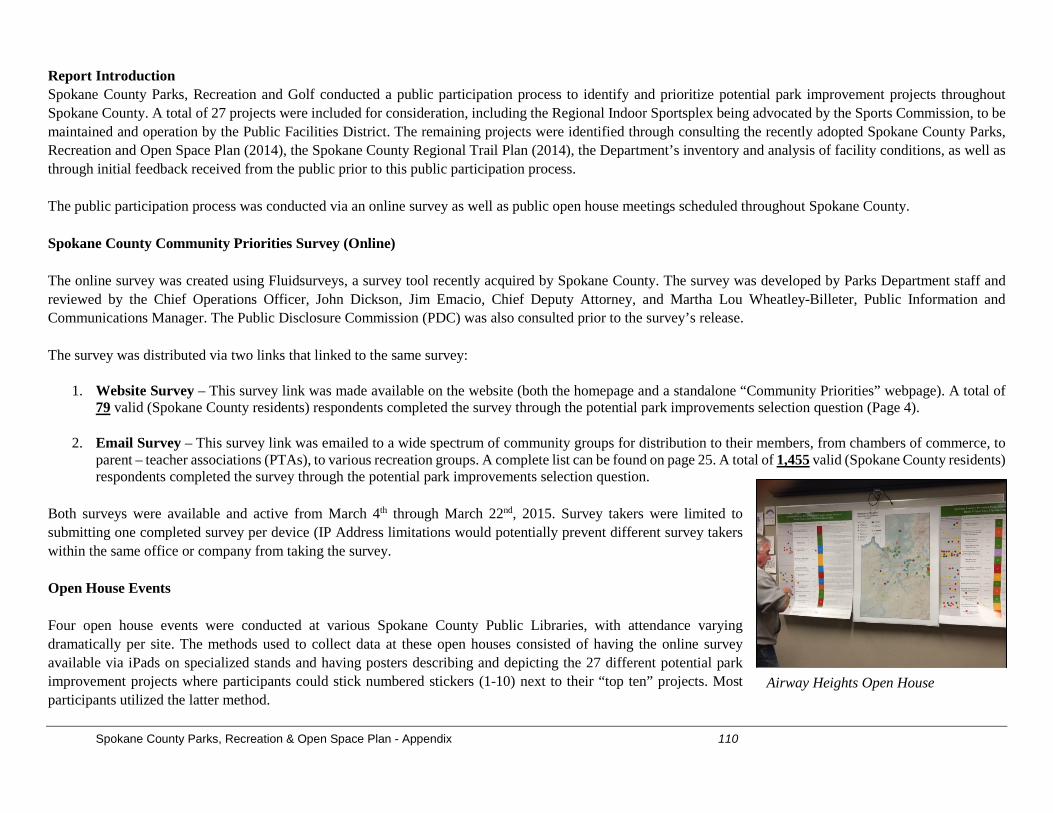
Spokane County Parks, Recreation & Open Space Plan - Appendix 110
Report Introduction Spokane County Parks, Recreation and Golf conducted a public participation process to identify and prioritize potential park improvement projects throughout Spokane County. A total of 27 projects were included for consideration, including the Regional Indoor Sportsplex being advocated by the Sports Commission, to be maintained and operation by the Public Facilities District. The remaining projects were identified through consulting the recently adopted Spokane County Parks, Recreation and Open Space Plan (2014), the Spokane County Regional Trail Plan (2014), the Department’s inventory and analysis of facility conditions, as well as through initial feedback received from the public prior to this public participation process. The public participation process was conducted via an online survey as well as public open house meetings scheduled throughout Spokane County. Spokane County Community Priorities Survey (Online) The online survey was created using Fluidsurveys, a survey tool recently acquired by Spokane County. The survey was developed by Parks Department staff and reviewed by the Chief Operations Officer, John Dickson, Jim Emacio, Chief Deputy Attorney, and Martha Lou Wheatley-Billeter, Public Information and Communications Manager. The Public Disclosure Commission (PDC) was also consulted prior to the survey’s release. The survey was distributed via two links that linked to the same survey:
1. Website Survey – This survey link was made available on the website (both the homepage and a standalone “Community Priorities” webpage). A total of 79 valid (Spokane County residents) respondents completed the survey through the potential park improvements selection question (Page 4).
2. Email Survey – This survey link was emailed to a wide spectrum of community groups for distribution to their members, from chambers of commerce, to parent – teacher associations (PTAs), to various recreation groups. A complete list can be found on page 25. A total of 1,455 valid (Spokane County residents) respondents completed the survey through the potential park improvements selection question.
Both surveys were available and active from March 4th through March 22nd, 2015. Survey takers were limited to submitting one completed survey per device (IP Address limitations would potentially prevent different survey takers within the same office or company from taking the survey. Open House Events Four open house events were conducted at various Spokane County Public Libraries, with attendance varying dramatically per site. The methods used to collect data at these open houses consisted of having the online survey available via iPads on specialized stands and having posters describing and depicting the 27 different potential park improvement projects where participants could stick numbered stickers (1-10) next to their “top ten” projects. Most participants utilized the latter method.
Airway Heights Open House
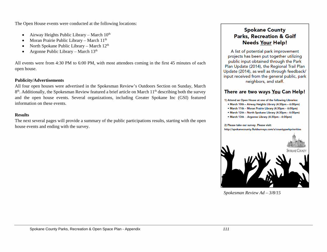
Spokane County Parks, Recreation & Open Space Plan - Appendix 111
The Open House events were conducted at the following locations:
• Airway Heights Public Library – March 10th • Moran Prairie Public Library – March 11th • North Spokane Public Library – March 12th • Argonne Public Library – March 13th
All events were from 4:30 PM to 6:00 PM, with most attendees coming in the first 45 minutes of each open house. Publicity/Advertisements All four open houses were advertised in the Spokesman Review’s Outdoors Section on Sunday, March 8th. Additionally, the Spokesman Review featured a brief article on March 11th describing both the survey and the open house events. Several organizations, including Greater Spokane Inc (GSI) featured information on these events. Results The next several pages will provide a summary of the public participations results, starting with the open house events and ending with the survey.
Spokesman Review Ad – 3/8/15
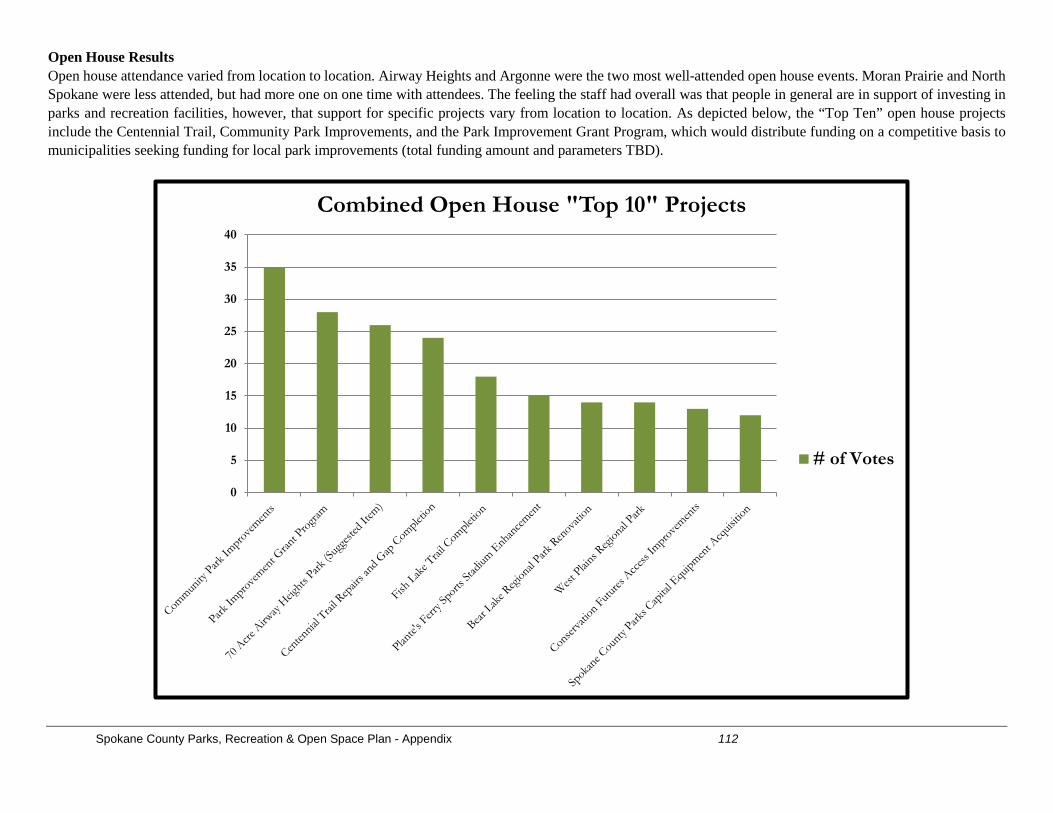
Spokane County Parks, Recreation & Open Space Plan - Appendix 112
Open House Results Open house attendance varied from location to location. Airway Heights and Argonne were the two most well-attended open house events. Moran Prairie and North Spokane were less attended, but had more one on one time with attendees. The feeling the staff had overall was that people in general are in support of investing in parks and recreation facilities, however, that support for specific projects vary from location to location. As depicted below, the “Top Ten” open house projects include the Centennial Trail, Community Park Improvements, and the Park Improvement Grant Program, which would distribute funding on a competitive basis to municipalities seeking funding for local park improvements (total funding amount and parameters TBD).
0
5
10
15
20
25
30
35
40
Combined Open House "Top 10" Projects
# of Votes
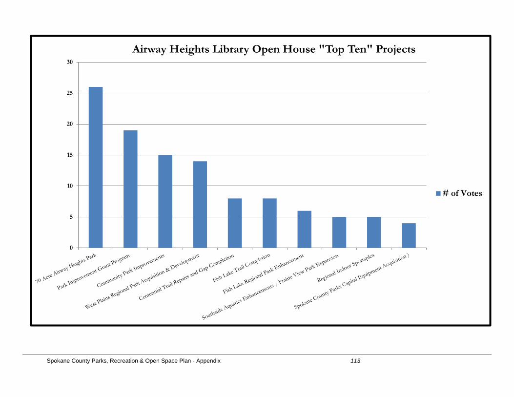
Spokane County Parks, Recreation & Open Space Plan - Appendix 113
0
5
10
15
20
25
30
Airway Heights Library Open House "Top Ten" Projects
# of Votes
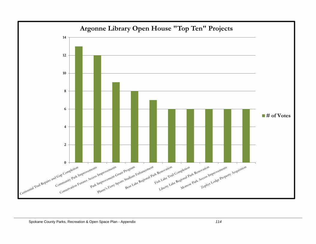
Spokane County Parks, Recreation & Open Space Plan - Appendix 114
0
2
4
6
8
10
12
14
Argonne Library Open House "Top Ten" Projects
# of Votes
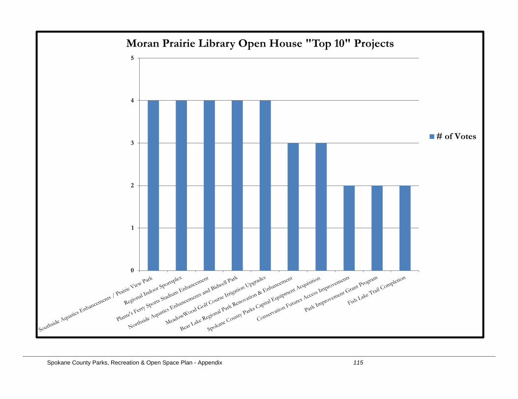
Spokane County Parks, Recreation & Open Space Plan - Appendix 115
0
1
2
3
4
5
Moran Prairie Library Open House "Top 10" Projects
# of Votes
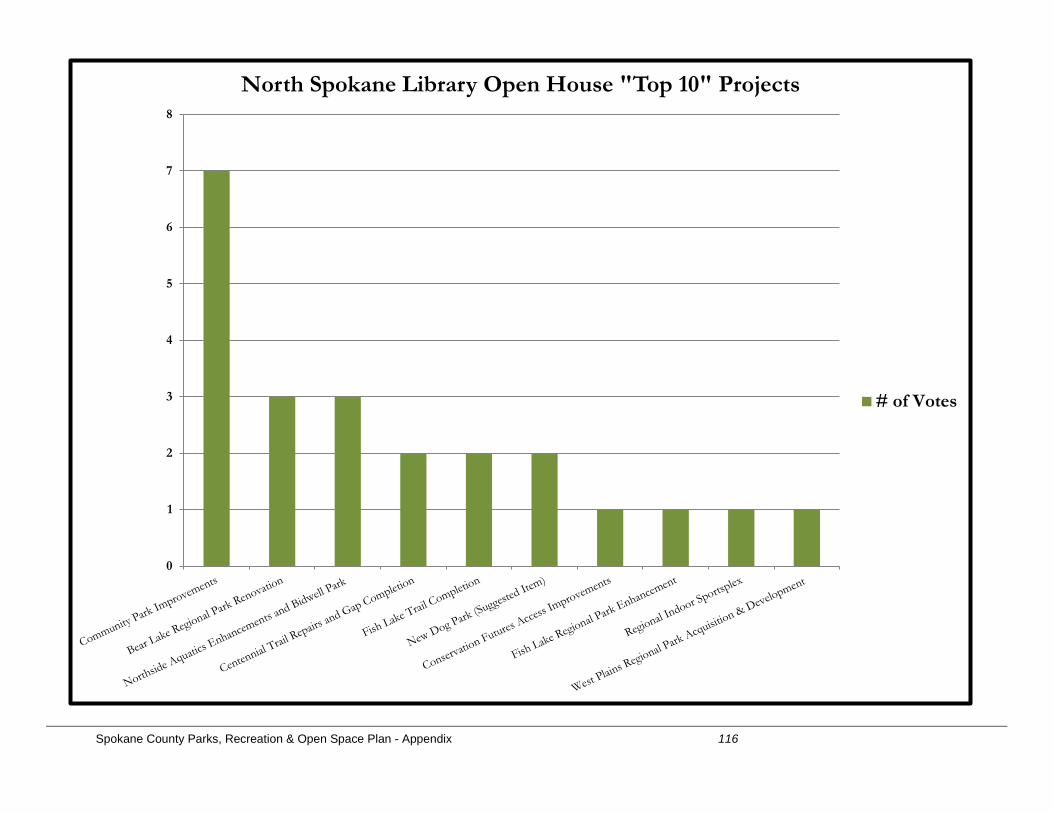
Spokane County Parks, Recreation & Open Space Plan - Appendix 116
0
1
2
3
4
5
6
7
8
North Spokane Library Open House "Top 10" Projects
# of Votes
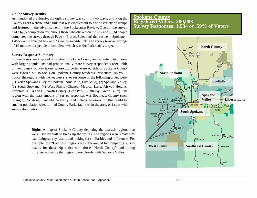
Spokane County Parks, Recreation & Open Space Plan - Appendix 117
Online Survey Results As mentioned previously, the online survey was split in two ways: a link on the County Parks website and a link that was emailed out to a wide variety of groups and featured in the advertisement in the Spokesman Review. Overall, the survey had a 62% completion rate among those who clicked on the link and 1,534 people completed the survey through Page 4 (Project Selection) that reside in Spokane –1,455 via the emailed link and 79 via the website link. The survey took an average of 10 minutes for people to complete, which was the Park staff’s target. Survey Response Summary Survey takers were spread throughout Spokane County and as anticipated, areas with larger populations had proportionally more survey respondents (See: table on next page). Survey takers whose zip codes were outside of Spokane County were filtered out to focus on Spokane County residents’ responses. As you’ll notice, the regions with the heaviest survey response, in the following order, were: (1) North Spokane (City of Spokane, Nine Mile, Five Mile), (2) Spokane Valley, (3) South Spokane, (4) West Plains (Cheney, Medical Lake, Airway Heights, Fairchild AFB) and (5) North County (Deer Park, Chattaroy, Green Bluff). The region with the least amount of survey responses was Southeast County (incl. Spangle, Rockford, Fairfield, Waverly, and Latah). Reasons for this could be smaller population size, limited County Parks facilities in the area, or issues with survey distribution.
North County
North Spokane
West Plains
Foothills
Southeast County
South Spokane
Liberty Lake Spokane Valley
Right: A map of Spokane County depicting the analysis regions that were used by staff to break up the results. The regions were created by examining survey results and looking for similarities and differences. For example, the “Foothills” regions was determined by comparing survey results for those zip codes with those “North County” and noting differences that tie that region more closely with Spokane Valley.
Spokane County Registered Voters: 280,008 Survey Responses: 1,534 or .59% of Voters
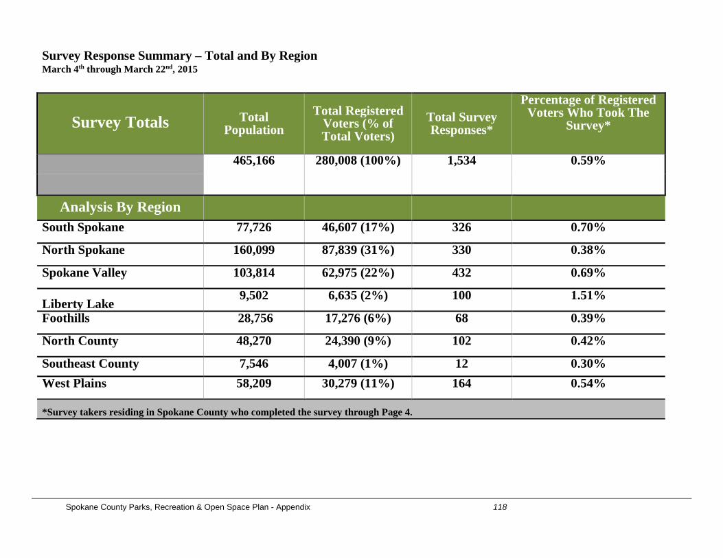
Spokane County Parks, Recreation & Open Space Plan - Appendix 118
Survey Response Summary – Total and By Region March 4th through March 22nd, 2015
Survey Totals Total Population
Total Registered Voters (% of Total Voters)
Total Survey Responses*
Percentage of Registered Voters Who Took The
Survey*
465,166 280,008 (100%) 1,534 0.59%
Analysis By Region
South Spokane 77,726 46,607 (17%) 326 0.70%
North Spokane 160,099 87,839 (31%) 330 0.38%
Spokane Valley 103,814 62,975 (22%) 432 0.69%
Liberty Lake 9,502 6,635 (2%) 100 1.51%
Foothills 28,756 17,276 (6%) 68 0.39%
North County 48,270 24,390 (9%) 102 0.42%
Southeast County 7,546 4,007 (1%) 12 0.30% West Plains 58,209 30,279 (11%) 164 0.54%
*Survey takers residing in Spokane County who completed the survey through Page 4.
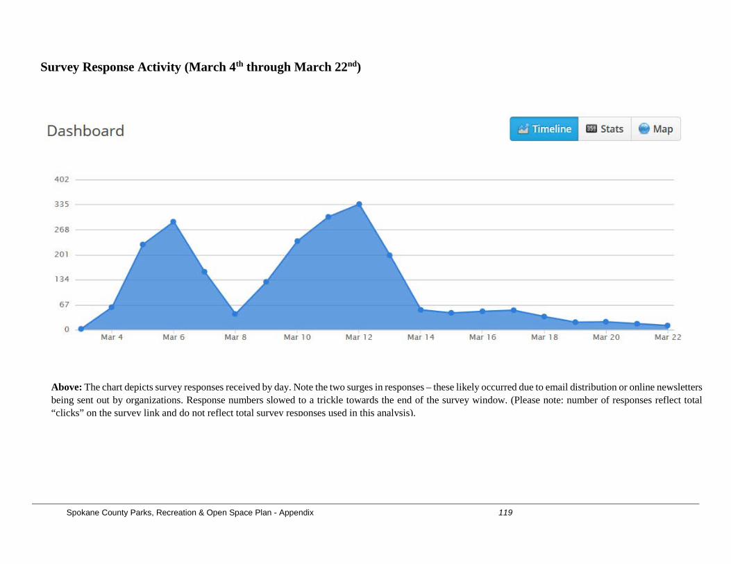
Spokane County Parks, Recreation & Open Space Plan - Appendix 119
Above: The chart depicts survey responses received by day. Note the two surges in responses – these likely occurred due to email distribution or online newsletters being sent out by organizations. Response numbers slowed to a trickle towards the end of the survey window. (Please note: number of responses reflect total “clicks” on the survey link and do not reflect total survey responses used in this analysis).
Survey Response Activity (March 4th through March 22nd)
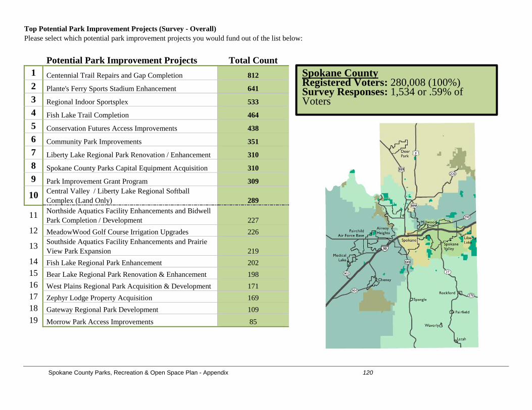
Spokane County Parks, Recreation & Open Space Plan - Appendix 120
Top Potential Park Improvement Projects (Survey - Overall) Please select which potential park improvement projects you would fund out of the list below:
Potential Park Improvement Projects Total Count 1 Centennial Trail Repairs and Gap Completion 812 2 Plante's Ferry Sports Stadium Enhancement 641 3 Regional Indoor Sportsplex 533 4 Fish Lake Trail Completion 464 5 Conservation Futures Access Improvements 438 6 Community Park Improvements 351 7 Liberty Lake Regional Park Renovation / Enhancement 310 8 Spokane County Parks Capital Equipment Acquisition 310 9 Park Improvement Grant Program 309
10 Central Valley / Liberty Lake Regional Softball Complex (Land Only) 289
11 Northside Aquatics Facility Enhancements and Bidwell Park Completion / Development 227
12 MeadowWood Golf Course Irrigation Upgrades 226
13 Southside Aquatics Facility Enhancements and Prairie View Park Expansion 219
14 Fish Lake Regional Park Enhancement 202 15 Bear Lake Regional Park Renovation & Enhancement 198 16 West Plains Regional Park Acquisition & Development 171 17 Zephyr Lodge Property Acquisition 169 18 Gateway Regional Park Development 109 19 Morrow Park Access Improvements 85
Spokane County Registered Voters: 280,008 (100%) Survey Responses: 1,534 or .59% of Voters
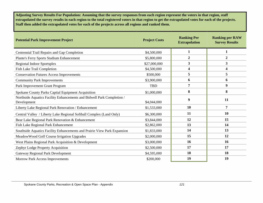
Spokane County Parks, Recreation & Open Space Plan - Appendix 121
Adjusting Survey Results For Population: Assuming that the survey responses from each region represent the voters in that region, staff extrapolated the survey results in each region to the total registered voters in that region to get the extrapolated votes for each of the projects. Staff then added the extrapolated votes for each of the projects across all regions and ranked them.
Potential Park Improvement Project Project Costs Ranking Per Extrapolation
Ranking per RAW Survey Results
Centennial Trail Repairs and Gap Completion $4,500,000 1 1
Plante's Ferry Sports Stadium Enhancement $5,800,000 2 2 Regional Indoor Sportsplex $27,000,000 3 3 Fish Lake Trail Completion $4,500,000 4 4 Conservation Futures Access Improvements $500,000 5 5 Community Park Improvements $3,900,000 6 6 Park Improvement Grant Program TBD 7 9
Spokane County Parks Capital Equipment Acquisition $1,000,000 8 8 Northside Aquatics Facility Enhancements and Bidwell Park Completion / Development $4,044,000 9 11
Liberty Lake Regional Park Renovation / Enhancement $1,533,000 10 7
Central Valley / Liberty Lake Regional Softball Complex (Land Only) $6,300,000 11 10
Bear Lake Regional Park Renovation & Enhancement $3,844,000 12 15 Fish Lake Regional Park Enhancement $2,862,000 13 14 Southside Aquatics Facility Enhancements and Prairie View Park Expansion $1,833,000 14 13 MeadowWood Golf Course Irrigation Upgrades $2,000,000 15 12 West Plains Regional Park Acquisition & Development $3,000,000 16 16 Zephyr Lodge Property Acquisition $2,500,000 17 17 Gateway Regional Park Development $4,595,000 18 18 Morrow Park Access Improvements $200,000 19 19
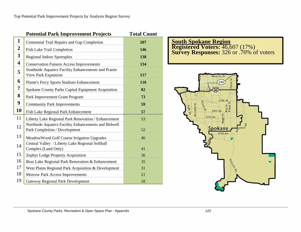
Spokane County Parks, Recreation & Open Space Plan - Appendix 122
Top Potential Park Improvement Projects by Analysis Region Survey
Potential Park Improvement Projects Total Count 1 Centennial Trail Repairs and Gap Completion 207 2 Fish Lake Trail Completion 146 3 Regional Indoor Sportsplex 138 4 Conservation Futures Access Improvements 134
5 Southside Aquatics Facility Enhancements and Prairie View Park Expansion 117
6 Plante's Ferry Sports Stadium Enhancement 110 7 Spokane County Parks Capital Equipment Acquisition 82 8 Park Improvement Grant Program 73 9 Community Park Improvements 59 10 Fish Lake Regional Park Enhancement 57 11 Liberty Lake Regional Park Renovation / Enhancement 53
12 Northside Aquatics Facility Enhancements and Bidwell Park Completion / Development 52
13 MeadowWood Golf Course Irrigation Upgrades 46
14 Central Valley / Liberty Lake Regional Softball Complex (Land Only) 41
15 Zephyr Lodge Property Acquisition 36 16 Bear Lake Regional Park Renovation & Enhancement 35 17 West Plains Regional Park Acquisition & Development 31 18 Morrow Park Access Improvements 21 19 Gateway Regional Park Development 18
South Spokane Region Registered Voters: 46,607 (17%) Survey Responses: 326 or .70% of voters
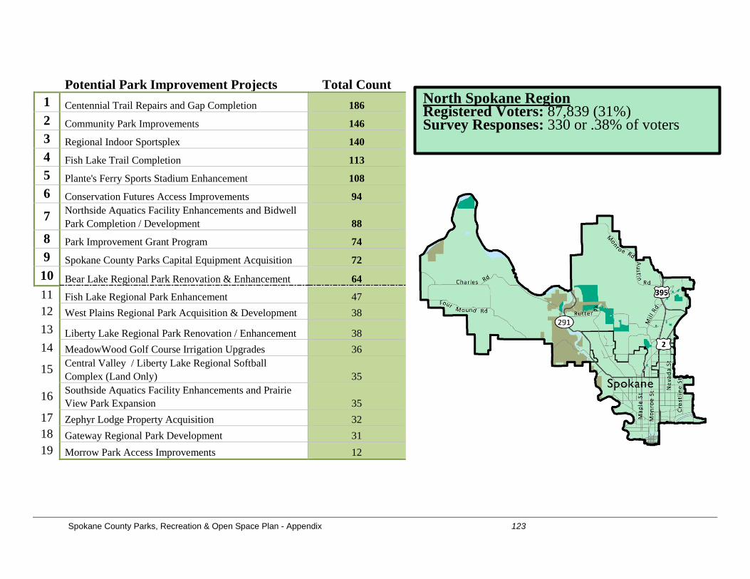
Spokane County Parks, Recreation & Open Space Plan - Appendix 123
Potential Park Improvement Projects Total Count 1 Centennial Trail Repairs and Gap Completion 186 2 Community Park Improvements 146 3 Regional Indoor Sportsplex 140 4 Fish Lake Trail Completion 113 5 Plante's Ferry Sports Stadium Enhancement 108 6 Conservation Futures Access Improvements 94
7 Northside Aquatics Facility Enhancements and Bidwell Park Completion / Development 88
8 Park Improvement Grant Program 74 9 Spokane County Parks Capital Equipment Acquisition 72 10 Bear Lake Regional Park Renovation & Enhancement 64 11 Fish Lake Regional Park Enhancement 47 12 West Plains Regional Park Acquisition & Development 38 13 Liberty Lake Regional Park Renovation / Enhancement 38 14 MeadowWood Golf Course Irrigation Upgrades 36
15 Central Valley / Liberty Lake Regional Softball Complex (Land Only) 35
16 Southside Aquatics Facility Enhancements and Prairie View Park Expansion 35
17 Zephyr Lodge Property Acquisition 32 18 Gateway Regional Park Development 31 19 Morrow Park Access Improvements 12
North Spokane Region Registered Voters: 87,839 (31%) Survey Responses: 330 or .38% of voters
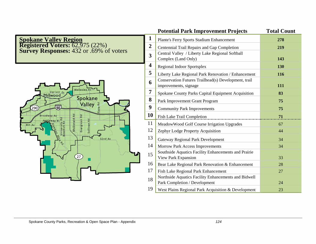
Spokane County Parks, Recreation & Open Space Plan - Appendix 124
Potential Park Improvement Projects Total Count 1 Plante's Ferry Sports Stadium Enhancement 278 2 Centennial Trail Repairs and Gap Completion 219
3 Central Valley / Liberty Lake Regional Softball Complex (Land Only) 143
4 Regional Indoor Sportsplex 130 5 Liberty Lake Regional Park Renovation / Enhancement 116
6 Conservation Futures Trailhead(s) Development, trail improvements, signage 111
7 Spokane County Parks Capital Equipment Acquisition 83 8 Park Improvement Grant Program 75 9 Community Park Improvements 75 10 Fish Lake Trail Completion 71 11 MeadowWood Golf Course Irrigation Upgrades 67 12 Zephyr Lodge Property Acquisition 44 13 Gateway Regional Park Development 34 14 Morrow Park Access Improvements 34
15 Southside Aquatics Facility Enhancements and Prairie View Park Expansion 33
16 Bear Lake Regional Park Renovation & Enhancement 28 17 Fish Lake Regional Park Enhancement 27
18 Northside Aquatics Facility Enhancements and Bidwell Park Completion / Development 24
19 West Plains Regional Park Acquisition & Development 23
Spokane Valley Region Registered Voters: 62,975 (22%) Survey Responses: 432 or .69% of voters
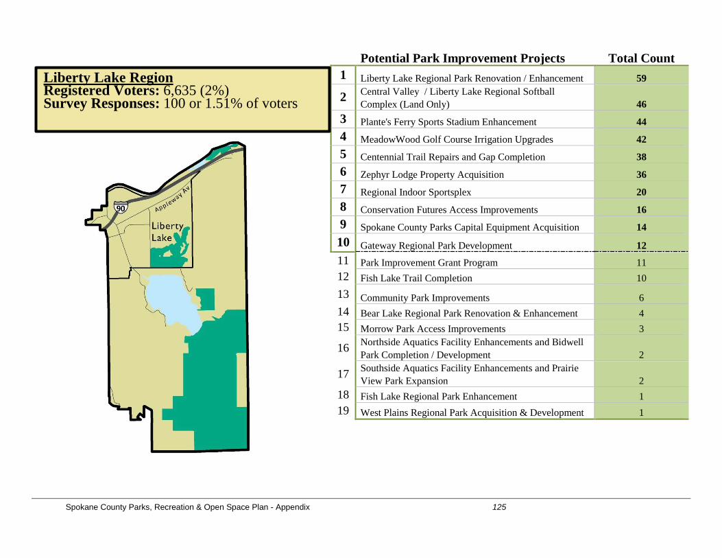
Spokane County Parks, Recreation & Open Space Plan - Appendix 125
Potential Park Improvement Projects Total Count 1 Liberty Lake Regional Park Renovation / Enhancement 59
2 Central Valley / Liberty Lake Regional Softball Complex (Land Only) 46
3 Plante's Ferry Sports Stadium Enhancement 44 4 MeadowWood Golf Course Irrigation Upgrades 42 5 Centennial Trail Repairs and Gap Completion 38 6 Zephyr Lodge Property Acquisition 36 7 Regional Indoor Sportsplex 20 8 Conservation Futures Access Improvements 16 9 Spokane County Parks Capital Equipment Acquisition 14 10 Gateway Regional Park Development 12 11 Park Improvement Grant Program 11 12 Fish Lake Trail Completion 10 13 Community Park Improvements 6 14 Bear Lake Regional Park Renovation & Enhancement 4 15 Morrow Park Access Improvements 3
16 Northside Aquatics Facility Enhancements and Bidwell Park Completion / Development 2
17 Southside Aquatics Facility Enhancements and Prairie View Park Expansion 2
18 Fish Lake Regional Park Enhancement 1 19 West Plains Regional Park Acquisition & Development 1
Liberty Lake Region Registered Voters: 6,635 (2%) Survey Responses: 100 or 1.51% of voters
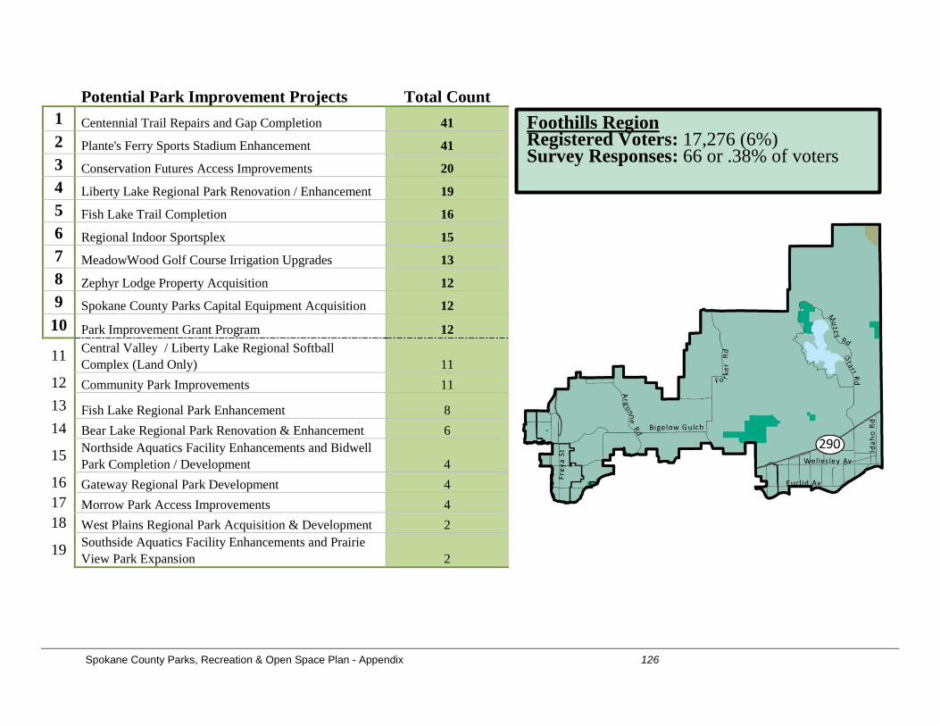
Spokane County Parks, Recreation & Open Space Plan - Appendix 126
Potential Park Improvement Projects Total Count 1 Centennial Trail Repairs and Gap Completion 41 2 Plante's Ferry Sports Stadium Enhancement 41 3 Conservation Futures Access Improvements 20 4 Liberty Lake Regional Park Renovation / Enhancement 19 5 Fish Lake Trail Completion 16 6 Regional Indoor Sportsplex 15 7 MeadowWood Golf Course Irrigation Upgrades 13 8 Zephyr Lodge Property Acquisition 12 9 Spokane County Parks Capital Equipment Acquisition 12 10 Park Improvement Grant Program 12
11 Central Valley / Liberty Lake Regional Softball Complex (Land Only) 11
12 Community Park Improvements 11 13 Fish Lake Regional Park Enhancement 8 14 Bear Lake Regional Park Renovation & Enhancement 6
15 Northside Aquatics Facility Enhancements and Bidwell Park Completion / Development 4
16 Gateway Regional Park Development 4 17 Morrow Park Access Improvements 4 18 West Plains Regional Park Acquisition & Development 2
19 Southside Aquatics Facility Enhancements and Prairie View Park Expansion 2
Foothills Region Registered Voters: 17,276 (6%) Survey Responses: 66 or .38% of voters
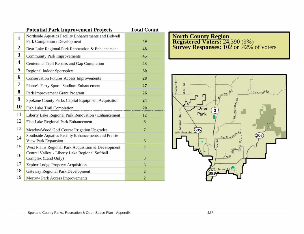
Spokane County Parks, Recreation & Open Space Plan - Appendix 127
Potential Park Improvement Projects Total Count 1 Northside Aquatics Facility Enhancements and Bidwell
Park Completion / Development 49 2 Bear Lake Regional Park Renovation & Enhancement 48 3 Community Park Improvements 45 4 Centennial Trail Repairs and Gap Completion 43 5 Regional Indoor Sportsplex 30 6 Conservation Futures Access Improvements 28 7 Plante's Ferry Sports Stadium Enhancement 27 8 Park Improvement Grant Program 26 9 Spokane County Parks Capital Equipment Acquisition 24 10 Fish Lake Trail Completion 20 11 Liberty Lake Regional Park Renovation / Enhancement 12 12 Fish Lake Regional Park Enhancement 8 13 MeadowWood Golf Course Irrigation Upgrades 7
14 Southside Aquatics Facility Enhancements and Prairie View Park Expansion 6
15 West Plains Regional Park Acquisition & Development 4
16 Central Valley / Liberty Lake Regional Softball Complex (Land Only) 3
17 Zephyr Lodge Property Acquisition 3 18 Gateway Regional Park Development 2 19 Morrow Park Access Improvements 2
North County Region Registered Voters: 24,390 (9%) Survey Responses: 102 or .42% of voters
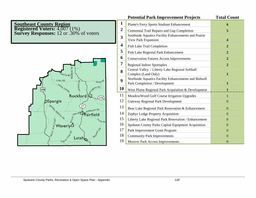
Spokane County Parks, Recreation & Open Space Plan - Appendix 128
Potential Park Improvement Projects Total Count 1 Plante's Ferry Sports Stadium Enhancement 6 2 Centennial Trail Repairs and Gap Completion 5
3 Southside Aquatics Facility Enhancements and Prairie View Park Expansion 4
4 Fish Lake Trail Completion 2 5 Fish Lake Regional Park Enhancement 2 6 Conservation Futures Access Improvements 2 7 Regional Indoor Sportsplex 2
8 Central Valley / Liberty Lake Regional Softball Complex (Land Only) 1
9 Northside Aquatics Facility Enhancements and Bidwell Park Completion / Development 1
10 West Plains Regional Park Acquisition & Development 1 11 MeadowWood Golf Course Irrigation Upgrades 1 12 Gateway Regional Park Development 0 13 Bear Lake Regional Park Renovation & Enhancement 0 14 Zephyr Lodge Property Acquisition 0 15 Liberty Lake Regional Park Renovation / Enhancement 0 16 Spokane County Parks Capital Equipment Acquisition 0 17 Park Improvement Grant Program 0 18 Community Park Improvements 0 19 Morrow Park Access Improvements 0
Southeast County Region Registered Voters: 4,007 (1%) Survey Responses: 12 or .30% of voters
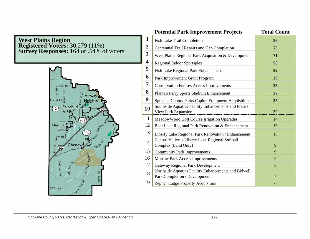
Spokane County Parks, Recreation & Open Space Plan - Appendix 129
Potential Park Improvement Projects Total Count 1 Fish Lake Trail Completion 86 2 Centennial Trail Repairs and Gap Completion 73 3 West Plains Regional Park Acquisition & Development 71 4 Regional Indoor Sportsplex 58 5 Fish Lake Regional Park Enhancement 52 6 Park Improvement Grant Program 38 7 Conservation Futures Access Improvements 33 8 Plante's Ferry Sports Stadium Enhancement 27 9 Spokane County Parks Capital Equipment Acquisition 23
10 Southside Aquatics Facility Enhancements and Prairie View Park Expansion 20
11 MeadowWood Golf Course Irrigation Upgrades 14 12 Bear Lake Regional Park Renovation & Enhancement 13 13 Liberty Lake Regional Park Renovation / Enhancement 13
14 Central Valley / Liberty Lake Regional Softball Complex (Land Only) 9
15 Community Park Improvements 9 16 Morrow Park Access Improvements 9 17 Gateway Regional Park Development 8
18 Northside Aquatics Facility Enhancements and Bidwell Park Completion / Development 7
19 Zephyr Lodge Property Acquisition 6
West Plains Region Registered Voters: 30,279 (11%) Survey Responses: 164 or .54% of voters
Spokane County Parks, Recreation & Open Space Plan - Appendix 130
Project Prioritization (Survey - Overall) This was an optional survey question added by staff. Staff received feedback that respondents were challenged on mobile devices with moving the “puzzle pieces” involved in answering this question. Due to both of these aspects, 20% of the survey respondents in the emailed link version skipped this question entirely and 28% of the respondents skipped it in the website link version. Therefore, staff has eliminated data from this question in the analysis as it is not representative of the overall results. Additional Suggested Projects (Overall Results) The survey included a question on whether the survey taker had any suggested additional projects that they would like to see funded and completed. A good portion of the responses included facilities that are not within Spokane County jurisdiction (E.g. Sports Complex on 70 acres near the Raceway owned by Airway Heights). A major focus of many of the suggested projects centered on:
1. Trails and trail-related improvements: a. Various trail connections (e.g. Fish Lake and Centennial Trails) b. Dream Trail Connection (26 comments related to this item) c. Beacon Hill (Trail improvements / land acquisition) d. High Drive Bluffs (10 comments - trail improvements / land acquisition) e. Bike lanes / trail expansion (Various) f. Conservation Futures related improvements (e.g. signage and trail improvements, trailhead development, and some land acquisitions suggestions –
Bear Lake, Tuscan Ridge, and general land acquisition support comments)
2. Sports, Athletics Field, Aquatics Improvements a. More turf soccer fields b. Airway Heights 70-acre Sports Complex (26 comments) c. New Aquatic Center in Liberty Lake Area d. Improved softball fields at Plante’s and other existing County facilities e. More sports facilities in Spokane Valley (softball, baseball, soccer, etc.) f. New Sand Volleyball Courts (focused on municipal parks) g. Update basketball courts (resurface with non-slip surface, 10’ heights, etc.)
3. Miscellaneous General Park Improvements
a. More dog parks (Camp Caro, Holmberg Park, etc.) b. Year-round restroom facilities c. Spokane River Water Trail access and promotion d. A new County golf course (various suggestions) e. General improvements to developed park including lighting, landscaping, drinking water, etc. f. Add disc golf course (up north or Liberty Lake)
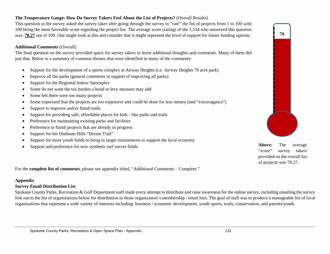
Spokane County Parks, Recreation & Open Space Plan - Appendix 131
The Temperature Gauge: How Do Survey Takers Feel About the List of Projects? (Overall Results) This question in the survey asked the survey taker after going through the survey to “rate” the list of projects from 1 to 100 with 100 being the most favorable score regarding the project list. The average score (rating) of the 1,534 who answered this question was: 78.27 out of 100. One might look at this and consider that it might represent the level of support for future funding options. Additional Comments (Overall) The final question on the survey provided space for survey takers to leave additional thoughts and comments. Many of them did just that. Below is a summary of common themes that were identified in many of the comments:
• Support for the development of a sports complex at Airway Heights (i.e. Airway Heights 70 acre park) • Improve all the parks (general comments in support of improving all parks) • Support for the Regional Indoor Sportsplex • Some do not want the tax burden a bond or levy measure may add • Some felt there were too many projects • Some expressed that the projects are too expensive and could be done for less money (and “extravagance”) • Support to improve and/or finish trails • Support for providing safe, affordable places for kids - like parks and trails • Preference for maintaining existing parks and facilities • Preference to finish projects that are already in progress • Support for the Dishman Hills “Dream Trail” • Support for more youth fields to bring in larger tournaments to support the local economy • Support and preference for new synthetic turf soccer fields
For the complete list of comments, please see appendix titled, “Additional Comments – Complete.” Appendix Survey Email Distribution List Spokane County Parks, Recreation & Golf Department staff made every attempt to distribute and raise awareness for the online survey, including emailing the survey link out to the list of organizations below for distribution to those organization’s membership / email lists. The goal of staff was to produce a manageable list of local organizations that represent a wide variety of interests including: business / economic development, youth sports, trails, conservation, and parents/youth.
Above: The average “score” survey takers provided on the overall list of projects was 78.27.
78
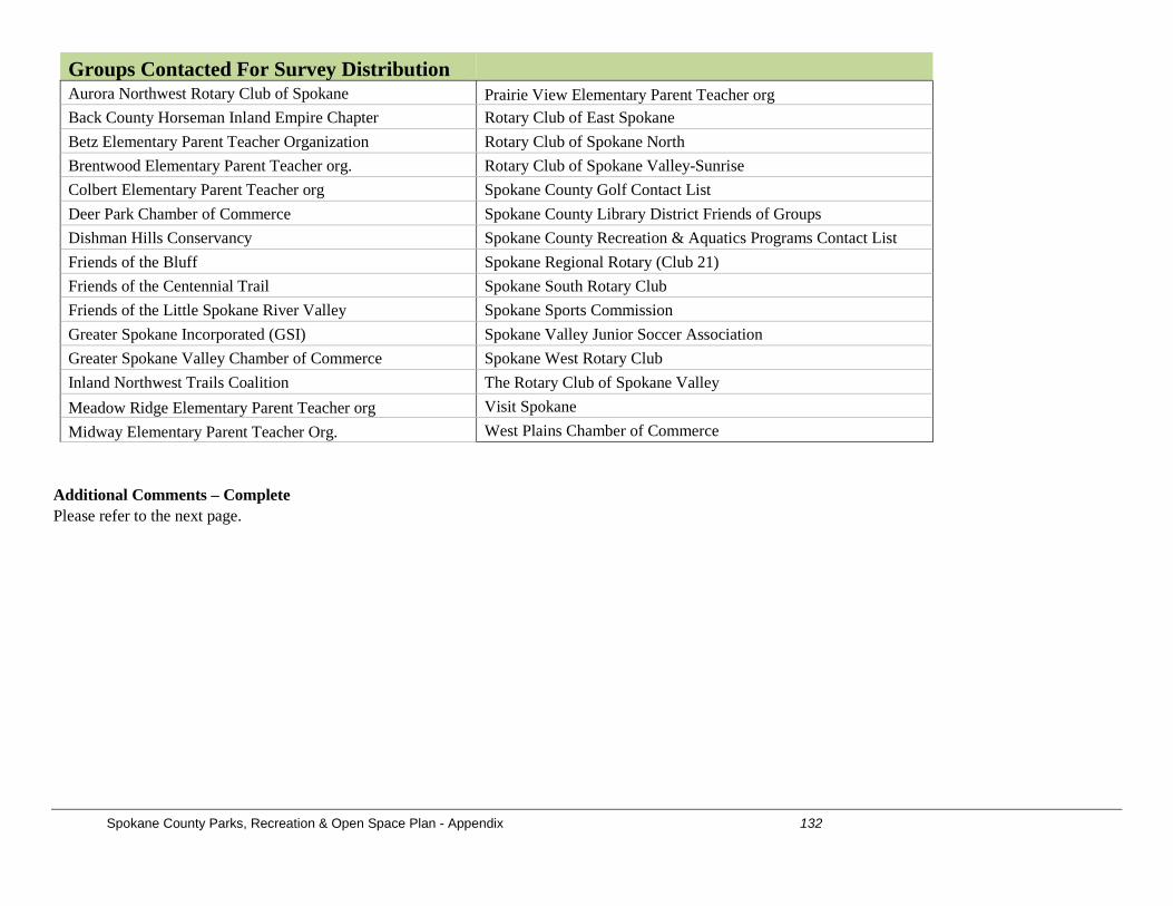
Spokane County Parks, Recreation & Open Space Plan - Appendix 132
Groups Contacted For Survey Distribution Aurora Northwest Rotary Club of Spokane Prairie View Elementary Parent Teacher org Back County Horseman Inland Empire Chapter Rotary Club of East Spokane Betz Elementary Parent Teacher Organization Rotary Club of Spokane North Brentwood Elementary Parent Teacher org. Rotary Club of Spokane Valley-Sunrise Colbert Elementary Parent Teacher org Spokane County Golf Contact List Deer Park Chamber of Commerce Spokane County Library District Friends of Groups Dishman Hills Conservancy Spokane County Recreation & Aquatics Programs Contact List Friends of the Bluff Spokane Regional Rotary (Club 21) Friends of the Centennial Trail Spokane South Rotary Club Friends of the Little Spokane River Valley Spokane Sports Commission Greater Spokane Incorporated (GSI) Spokane Valley Junior Soccer Association Greater Spokane Valley Chamber of Commerce Spokane West Rotary Club Inland Northwest Trails Coalition The Rotary Club of Spokane Valley Meadow Ridge Elementary Parent Teacher org Visit Spokane Midway Elementary Parent Teacher Org. West Plains Chamber of Commerce
Additional Comments – Complete Please refer to the next page.