Embed Size (px)
DESCRIPTION
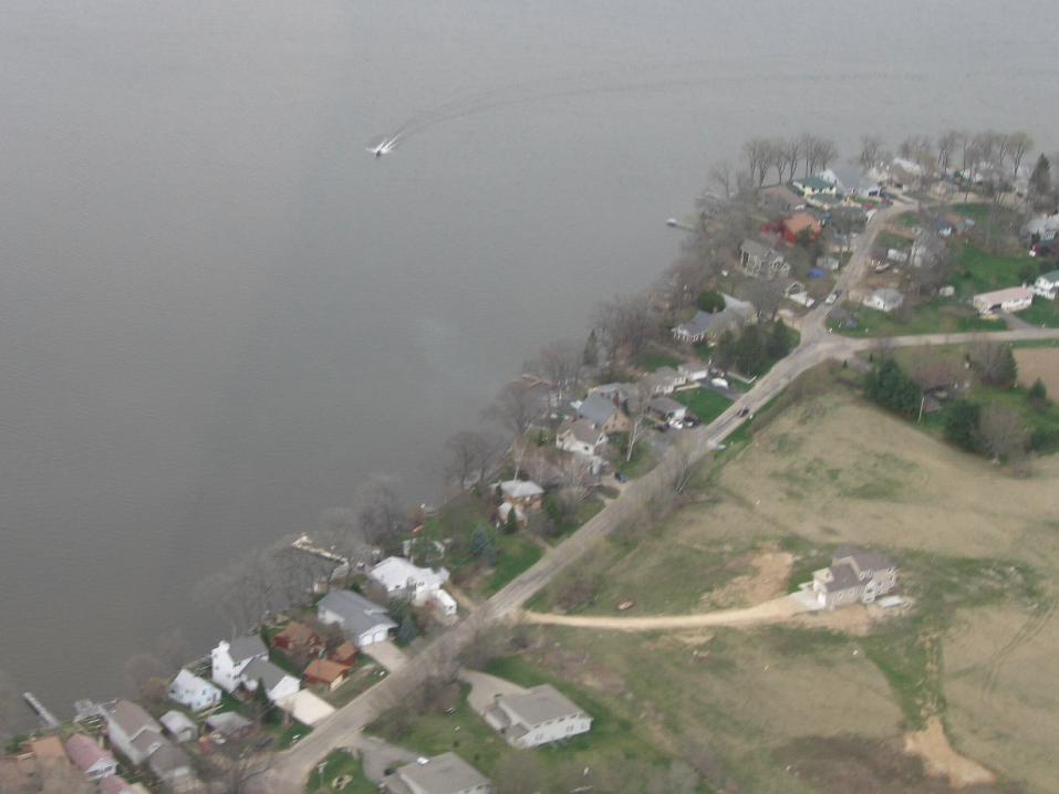
A project of the Dane County Department of Planning and Development, and the Dane County Regional Planning Commission. Dane County Water Body Classification Study Phase I. Lake Classification:. Lake Classification. Seepage/Spring lakes. Drainage Lakes. Shallow. Deep. Shallow. Deep. - PowerPoint PPT Presentation
Citation preview

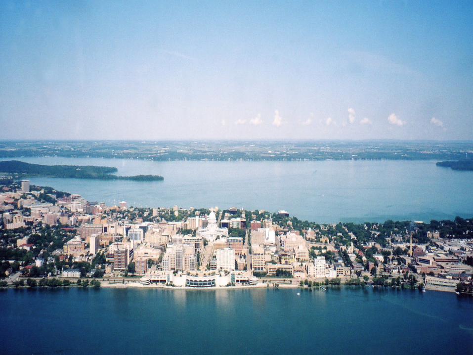
Dane CountyWater Body Classification Study
Phase I
A project of the Dane County Department of Planning and Development,
and the Dane County Regional Planning Commission


Water Body Classification Matrix
Current Level of Development
Natural Sensitivity toDevelopment Low Level Medium level High Level
High Sensitivity Protection Protection Protection and Restoration
Medium Sensitivity Protection Protection and Restoration Restoration and Enhancement
Low Sensitivity Protection and Restoration Restoration and Enhancement Restoration and Enhancement
Lake Classification:


Lake Classification
Seepage/Spring lakes Drainage Lakes
Shallow Deep Shallow Deep
Most Sensitive Least SensitiveDecreasing Sensitivity

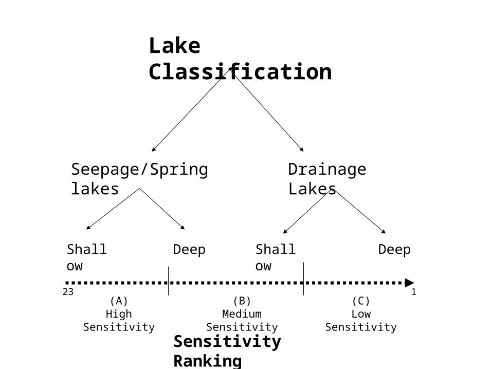
Lake Classification
Seepage/Spring lakes Drainage Lakes
Shallow Deep Shallow Deep
(A)High Sensitivity
(C)Low Sensitivity
(B)Medium Sensitivity
23 1
Sensitivity Ranking
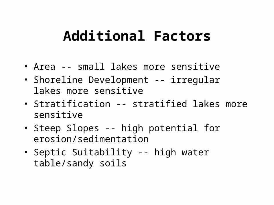
Additional Factors
• Area -- small lakes more sensitive
• Shoreline Development -- irregular lakes more sensitive
• Stratification -- stratified lakes more sensitive
• Steep Slopes -- high potential for erosion/sedimentation
• Septic Suitability -- high water table/sandy soils

LAKE CLASSIFICATIONSensitivity Rating Factors
Criterion SignificanceCriterionClasses
Units ofMeasure Points Comments
Lake Surface Area(size)
Smaller lakes are generallymore vulnerable to waterquality problems
1 - 1010 - 100100 - 500500+
Acres 1234
Very small lakes/pondsSmall lakesMedium lakesLarge lakes
ShorelineDevelopment Factor
(shape)
Lakes with irregularshorelines are morevulnerable to a higher densityof development
3.0+2.0 - 3.01.5 - 2.01.0 - 1.5
Unitless 1234
Very irregular shoreline
Close to circular shoreline
Stratification Factor(nutrient sensitivity)
Lakes that strongly stratify aremore sensitive to outsidesources of phosphorus
30.0+13.5 - 30.011.5 - 13.50 - 11.5
Unitless 1234
Strongly stratifiedStratifiedWeaklyNot stratified
Soil Erodability(steep slopes)
Lakes with steep slopedshorelines are morevulnerable to erosion andsurface water degradation
75 - 100%50 - 75%25 - 50%0 - 25%
Percent ofshoreline
within 300’
1234
Percent of shoreline withD slope (12% slope orgreater)
Septic Suitability(severe soils)
Lakes having shorelines withhigh groundwater or soilsposing severe limitation forseptic systems are morevulnerable to ground andsurface water contamination
1 - 1.51.5 - 2.52.5 - 3.53.5 - 4.0
Ave. soilfactor within
300’ ofshoreline
1234
Very severe limitationsSevereModerateSlight or sewered

Water Body Classification Matrix
Current Level of Development
Natural Sensitivity toDevelopment Low Level Medium level High Level
High Sensitivity Protection Protection Protection and Restoration
Medium Sensitivity Protection Protection and Restoration Restoration and Enhancement
Low Sensitivity Protection and Restoration Restoration and Enhancement Restoration and Enhancement
Lake Classification:

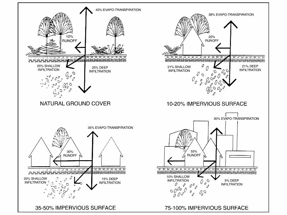
Impervious Cover Calculations:
– 300-foot buffer
– Determined acres of each land use present within buffer
– Assigned each land use an impervious cover percentage
– Calculated the average percent impervious cover for each named lake/pond

0
5
10
15
20
25
0% 10% 20% 30% 40% 50%
Impervious Cover
Sen
siti
vity
Ran
kin
g
(C)High
DevelopmentLevels
(B)Medium
(C)Low
(A)High
(B)Medium
Development Levels
I
I
I II
II
II
III
IIIIII
(A)Low
DevelopmentLevels

Water Body Classification Matrix
Current Level of Development
Natural Sensitivity toDevelopment Low Level Medium level High Level
High Sensitivity Protection Protection Protection and Restoration
Medium Sensitivity Protection Protection and Restoration Restoration and Enhancement
Low Sensitivity Protection and Restoration Restoration and Enhancement Restoration and Enhancement
Lake Classification:


G ood
F air
P oor
Str
eam
Qua
lity
Watershed Impervious C over
10% 25% 40% 60% 100%
Urban Drainage
Degraded or Non-S upporting
Stream Classification


Impervious Cover Calculations
– Determine area of each land use in a subwatershed
– Assign an impervious cover percentage to each land use
– Calculate the average impervious cover percentage for each subwatershed


Management Implications
• Lake or Stream• Protection, Restoration, or Enhancement
– based on classification• Regulatory, Incentive, or Educational
– Updating the County Shoreland Zoning Ordinance– Environmental Corridors, Rural Protection Areas– PDRs, TDRs, DNR grants, CRP, WRP, etc.
• Urban or Rural Design– Maximizing infiltration and natural vegetation– Minimizing impervious cover– Cost-sharing, BMPs, conservation plans– Conservation easements, etc.

Management Programs/Strategies
• Shoreland Vegetation (e.g., Buffer Size and Quality)
• Wetlands Restoration
• Shoreland Development
• Floodplain Management
• Land Disturbance/Construction Site Erosion Control
• Stormwater Management and Urban BMPs
• Rural Runoff and Agricultural BMPs
• Comprehensive Land Use Planning

Potential Management Tools by Classification(examples)
Program Area
ClassificationEducation & Technical
Assistance ProgramsPublic Investment, Incentives
& Acquisition ProgramsPlan Approval & Regulatory
Programs
Class I (Protection)
- Farm conservation plans- Agricultural runoff practices
design- Agricultural performance
standards- Agricultural buffers- Nutrient and pesticide
management- Safe handling / use of
chemicals- Workshops and field
demonstrations- Landowner and citizen
education
- Parks & Open Space Plan andCounty Conservation Fund
- State Stewardship Fund- Lake / River Planning and
Protection Grants- Cost-share programs- Conservation Reserve (CRP) and
other easement programs- Streambank buffer programs- Wetland / habitat restoration- Purchase of Development Rights
(PDRs) and Transfer ofDevelopment Rights (TDRs)
- Shoreland / wetland zoning- Floodplain zoning- Conservancy zoning- Site plan approval- Erosion control and stormwater
management (focus on newdevelopment)
- Open space corridors- Comprehensive planning
Class II (Protection &Restoration)
- Agricultural buffers- Stormwater practices design- Regional stormwater facility
planning- Wetland / habitat restoration
assistance- Watershed group support- Adult conservation volunteers- Workshops and field
demonstrations- Landowner and citizen
education
- Streambank buffer programs- Wetland / habitat restoration- Lake / River Planning and
Protection Grants- Cost-share programs- PDR / TDR programs- Wastewater treatment facilities- Regional stormwater facilities
planning- Water quality monitoring- Public land stewardship- Floodplain hazard mitigation
- Shoreland / wetland zoning- Floodplain zoning- Sewer services planning- Environmental corridor
mapping- Erosion control- Stormwater management (both
new and redevelopment;quality and quantity)
- High capacity well withdrawalsand permiting
- Comprehensive planning
Class III (Restoration &Enhancement)
- Neighborhood / watershedgroup support
- Volunteer clean-up programssuch as “Take a Stake in theLakes”
- Nonpoint runoff education- Citizen monitoring- Pollution prevention- Invasive and exotic species
control- Landowner and citizen
education
- Streambank buffer programs- Wetland / habitat restoration- Lake / River Planning and
Protection Grants- Cost-share programs- Regional stormwater facilities- Recreational access / trails- Floodplain hazard mitigation- Weed harvesting, dredging, lake
level management (YaharaLakes)
- Nutrient / pollution control andremoval
- Shoreland redevelopment- Erosion control- Stormwater management (focus
on redevelopment / retrofit)- Lake use regulations- Boater safety / enforcement

Phase I: - Provide the scientific basis/rationale
- Develop management strategies/alternatives
Phase II: - Develop a water body
management program;
- Including policies, programs and guidelines based on:
Classification
Public input
Water Body Classification: