Embed Size (px)
Citation preview


APPENDIX B
COASTAL ZONE MANAGEMENT


BUREAU OF STATISTICS AND PLANS (Bureau of Planning)
Felix P. Ca macho Governor of Guam
Michael W. Cruz, M.D. Lieutenant Governor
MI'. Allan Ota US EPA, Region 9
Goverrullcnt of Guam
P.O. Box 2950 Hagiltiia, Guam 96932 Tel: (671) 472·420113 Fax: (67 1) 477- 1812
JAN 1 1 2008
Dredging and Sed iment Management Team (WTR-8) 75 Hawthorne Street San Francisco, Californ ia 94 105-390 I
Dear Mr. Ota:
Alberto "Tony" Lamorena V Director
The 8 meau of Statistics and Plans recogn izes that the ex isting ocean disposal s ite for dredged material expired in 1997, and a new disposal si te must be identified and designated in conformance with the Marine Protection Research and Sanctuaries Act (MPRSA). Under the Act, the U.S. Environmental . Protection Agency (USEPA) and the U.S. Corps of Engineers (USCOE) share a number of. ' respons ibili ties with regard to the ocean disposal of dredged material. T he principal authority and respons ib ility for designating ocean sites for the disposal of dredged material is vested with the Regional Administrators of EPA regions in which the sites are located. Accordingly, ocean dumping cannot occu r unless a permit is issued by the USCOE under the MPRSA, using EPA's environmental criteria and subj ect to EPA's concurrence.
There is a need to identify a new ocean disposal site offshore of Apra Harbor, Guam, as a means to dispose of suitab le (non-toxic) dredge material for which other beneficial re-uses are exhausted. We request that the following be addressed in the EIS fo r the site designation of an ocean dredge material disposal s ite off Apra Harbor, Guam:
We understand that the material to be disposed of at this offshore site wi ll be cons idered "c lean" or "suitable," but it is not clear exactly what standards are used to determine if the material is suitable or not. The EIS must clearly define the test criteria that must be applied before approvi ng the material for disposal.
Th~. EIS shou ld identify th e .party/p::trtie.s !"es l~1f) n s ib ! e. for ronQI.l("ting the t~sts, and the. ·~geJlcy
responsible for mak ing the fi nal determination that the material is clean before it is moved to the ocean disposal site. We do not support a testing program implemented so lely by the dredging contractor, and prefer that a government agency carry out or at least oversee the testing and make the final determination that the material is clean. Furthermore, we are also concerned that the Guam Environmental Protection Agency (GEPA), wh ich is the agency li kely to be tasked with such a responsibi lity, may not have the capacity to carry out this responsibility effectively. The demands on local natural resource agencies will increase sign ificantly as the military build-up is undertaken, and the capacity of these agencies to effectively carry out existing and new responsibilities will be in question .
T he EIS should add ress the need for monitoring of disposal operations in order to ensure that the material is d isposed of properly.
Page 1 ESP/GeMP coml>1G11 /s
011 O cean Dis posal S iie
Guam Coastal Management Program •• Land Usc Planning •• Socio-Economic Plannins •• Plannillg inf0n11alion .+ l3usincss and Economic Stati stics Program

We prefer beneficial re-use of dredge material over ocean disposal and suggest that the EIS include an exhaustive search of existing and future public and private sector projects that may benefit from the dredge material. The comments provided by the Guam EPA include several options for beneficial re-use. Please note that a Memorandum of Understanding (MOU) was signed on April 12,2001 between the Department of the Navy and the Government of Guam for the beneficial use of dredge material from the Navy construction dredging project in Inner Apra Harbor for proposed PAG construction projects.
The EIS should provide an examination of different disposal methods, such as the thin layer disposal method.
The EIS should include a comprehensive analysis of the impacts of dredge material disposal on the benthic ccosystem at each alternative site. Deep-water sampling and photography should be used in this analysis. Plume modeling should also be utilized in the analysis in order to properly assess the extent of down-current impacts.
The EIS should also address impacts to pelagic fisheries and marine mammals.
We are looking forward to receiving for our review a copy of the required Environmental Impact Statement (EIS) and the rulemaking paperwork associated with this ocean disposal site designation process, as well as justifications and alternatives to ocean disposal of the dredged material. Proper disposal of dredged materials and how they are secured must be included in the EIS, ensuring that toxic materials harl11 aquatic and wildlife.
cc: GEPA DoAg DPR DLM Office of the Governor J parks/B.Mi Ilhouser R9guam_ ODMDS _ [email protected]
Sincerely,
ALBERTO A. LAMORENA V Director
Page 2 BSP/GCMP comments
on Ocean Disposal Site

~'E.Dsr..q1:
/ ft \, UNITED STATES ENVIRONMENTAL PROTECTION AGENCY ~ ~ ~ REGION IX .. ~~ -;l 75 Hawthorne Street
'""R'" San Francisco, CA 94105
Mr. Alberto A. Lamorena V Director Guam Bureau of Statistics and Plans P.O. Box 2950 Hagatfia, Guam 96923
July 24, 2009
SUBJECT: FEDERAL CONSISTENCY DETERMINATION FOR THE DESIGNATION OF AN OCEAN DREDGED MATERIAL DISPOSAL SlTE OFFSHORE OF GUAM
Dear Mr. Lamorena:
In accordance with the Federal Coastal Zone Management Act, we request your review and concurrence on the United States Environmental Protection Agency (US EPA), Region IX, Guam Coastal Management Program consistency assessment that is attached to this letter and provided as Appendix B of the June 2009 draft Environmental Impact Statement (EIS, which has been sent separately; electronic file on CD is enclosed.
As detailed in the draft EIS, the proposed federal action is to designate an ocean dredged material disposal site (ODMDS) at one of two alternative sites, which are located approximately 8.9 and 13.7 nautical miles (nm) northwest and north, respectively, of the Apra Harbor entrance channel (refer to Figure ES-2 of the draft EIS). Although both ODMDS sites would be outside of the Guam coastal zone boundary (3 nm from shore), USEP A is submitting this consistency determination because vessels would be transporting the dredged material through the coastal zone to whichever site is selected.
Formal designation of an ODMDS does not constitute approval of dredged material for ocean disposal. The designation does provide an additional dredged material management option for each dredging project. Ocean disposal is allowed only when USEP A and the US Army Corps of Engineers (USACE) determine on a case by case basis that the dredged material: 1) is environmentally suitable according to testing criteria (40 CFR Parts 225 and 227) as determined from physical, chemical and biological testing; 2) does not have a viable beneficial reuse; and 3) there are no practical land placement options available. USACE may issue disposal permits for use of the ODMDS ifUSEPA concurs with the decision. The designation is anticipated in 2010 and would be effective for 50 years, but could be interrupted at USEP A discretion. The maximum capacity per year would be 1,000,000 cubic yards. The ODMDS would be managed in accordance with a Site Management and Monitoring Plan, the draft of which is included as Appendix C of the draft EIS.

As part of the National Environmental Policy Act (NEPA) process, the USEPA, assessed reasonably foreseeable direct and indirect effects on Guam's resources within the defined coastal zone relative to relevant management program enforceable policies, The enclosed Guam Coastal Management Program Assessment form references relevant sections of the EIS to support this consistency determination. The USEPA has determined that there are no direct or indirect (cumulative or secondary) adverse impacts on coastal uses or resources, and the proposed action and its alternatives are consistent to the maximum extent practicable with the enforceable policies of Guam's Coastal lone Management (ClM) Program.
We appreciate your continued support. If you have any questions on this matter, please contact me at your convenience.
Sincerely,
~8 Allan Qta , Oceanographer Water Division (WTR-.8)
Enclosures (2): CD - electronic file of Draft Environmental Impact Statement, Designation of an Ocean Dredged Material Disposal Site Offshore of Guam; printed copy mailed separately
Guam Coastal Management Program Assessment Form
2

Guam CZMA Coastal Consistency Determination Page 1 of 9
GUAM COASTAL MANAGEMENT PROGRAM ASSESSMENT
DEVELOPMENT POLICIES (DP):
DP1. Shore Area Development
Intent: To insure environmental and aesthetic compatibility of shore area land uses.
Policy: Only those uses shall be located within the Seashore Reserve which: - enhance, are compatible with or do not generally detract from the
surrounding coastal area’s aesthetic and environmental quality and beach accessibility; or
- can demonstrate dependence on such a location and the lack of feasible alternative sites.
Discussion: The two proposed alternative ODMDS’s are outside of the coastal zone of Guam, located approximately 11 to 14 nautical miles (nm) northwest and north, respectively, of Guam, in water depths ranging from 6,560 to 9,055 feet. Dredged material disposal operations at these locations offshore of Guam are not expected to result in adverse impacts to the coastal zone of Guam, including any shore areas. The proposed ocean dredged material disposal site (ODMDS) would not be located within the Seashore Reserve or other shore area. There would be no surface markers delineating the site. It would not be visible from the shoreline. Compliance monitoring would be implemented in accordance with a site management and monitoring plan described in the Draft Environmental Impact Statement (EIS), Appendix C, to ensure compliance of dredged material disposal operations with site use requirements, including proper disposal at the ODMDS and no leaking of dredged material through the coastal zone in transit to the ODMDS. As such, the site designation alternatives and associated ocean dredged material disposal operations are not expected to have significant adverse environmental impacts on shore area land uses.

Guam CZMA Coastal Consistency Determination Page 2 of 9
DP2. Urban Development
Intent: To cluster high impact uses such that coherent community design, function, infrastructure support and environmental compatibility are assured.
Policy: Commercial, multi-family, industrial and resort-hotel zone uses and uses requiring high levels of support facilities shall be concentrated within urban districts as outlined on the Land Use Districting Map.
Discussion: The proposed ODMDS alternatives are located in submerged lands approximately 11 to 14 nm offshore and Urban Development policies are not applicable. As such, the site designation alternatives do not involve construction of any structure or changes to existing land uses.
DP3. Rural Development
Intent: To provide a development pattern compatible with environmental and infrastructure support suitability and which can permit traditional lifestyle patterns to continue to the extent practicable.
Policy: Rural districts shall be designated in which only low density residential and agricultural uses will be acceptable. Minimum lot size for these uses should be one-half acre until adequate infrastructure including functional sewering is provided.
Discussion: The proposed ODMDS alternatives are located in submerged lands approximately 11 to 14 nm offshore and Rural Development policies are not applicable. As such, the site designation alternatives and associated ocean dredged material disposal operations are not expected to affect existing land and water uses or change development patterns in rural areas.
DP4. Major Facility Siting
Intent: To include the national interest in analyzing the siting proposals for major utilities, fuel and transport facilities.
Policy: In evaluating the consistency of proposed major facilities with the goals, policies, and standards of the Comprehensive Development and Coastal Management Plans, the Territory shall recognize the national interest in the siting of such facilities including those associated with electric power production and transmission, petroleum refining and transmission, port

Guam CZMA Coastal Consistency Determination Page 3 of 9
and air installations, solid waste disposal, sewage treatment, and major reservoir sites.
Discussion: The proposed ODMDS alternatives are located in submerged lands approximately 11 to 14 nm offshore and would not qualify as a major facility siting. As such, the site designation alternatives support the national interest for the maintenance and future development of infrastructure associated with the Navy and PAG port facilities.
DP5. Hazardous Areas
Intent: Development in hazardous areas will be governed by the degree of hazard and the land use regulations.
Policy: Identified hazardous lands, including flood plains, erosion-prone areas, air installations, crash and sound zones and major fault lines shall be developed only to the extent that such development does not pose unreasonable risks to the health, safety or welfare of the people of Guam, and complies with the land use regulations.
Discussion: The alternative ODMDS sites are not located on fault lines, based on best available information. Even if they were located on a fault line, the deposition of approximately 3.9 inches or less per year (EIS Chapter 2.5.2) would not trigger movement of the fault line. The use of the ODMDS would not increase the anticipated risk to the health, safety or welfare of the people of Guam. The Mariana Islands are subject to typhoons that bring heavy rains and storm surge. Dredging and transport to the ODMDS would not occur under these conditions; therefore, no increased risk to human health would result from the ODMDS site. Flood plains, air installations crash and sound zones, and land use regulations are not relevant to the ODMDS designation.
DP6. Housing
Intent: To promote efficient community design placed where the resources can support it.
Policy: The government shall encourage efficient design of residential areas, restrict such development in areas highly susceptible to natural and manmade hazards, and recognize the limitations of the island’s resources to support historical patterns of residential development.
Discussion: The proposed ODMDS alternatives are located in submerged lands approximately 11 to 14 nm offshore and housing policies are not applicable. As such, the site designation

Guam CZMA Coastal Consistency Determination Page 4 of 9
alternatives and associated ocean dredged material disposal operations are not expected to have significant adverse impacts on residential development.
DP7. Transportation
Intent: To provide transportation systems while protecting potentially impacted resources.
Policy: The Territory shall develop an efficient and safe transportation system, while limiting adverse environmental impacts on primary aquifers, beaches, estuaries and other coastal resources.
Discussion: Transport of dredged material to the ODMDS would be within existing shipping lanes. A notice to mariners would be issued to alert other traffic to the dredged material transport operations. The US Coast Guard maintains jurisdiction over the shipping lanes and the barge traffic would adhere to the same laws and regulations of other ships. There would be increased use of the shipping lane that would vary with the specific dredging projects and associated dredged material production rates. The traffic impacts of each project would be addressed in their respective National Environmental Policy Act (NEPA) documents. Compliance monitoring would be implemented in accordance with a site management and monitoring plan (EIS Appendix C) to ensure compliance of dredged material disposal operations with site use and permit requirements, including real time remote monitoring of transport to and disposal at the ODMDS. As such, the site designation alternatives and associated ocean dredged material disposal operations are not expected to cause significant adverse environmental impacts on primary aquifers, beaches, estuaries and other coastal resources.
DP8. Erosion and Siltation
Intent: To control development where erosion and siltation damage is likely to occur.
Policy: Development shall be limited in areas of 15% or greater slope by requiring strict compliance with erosion, sedimentation, and land use districting guidelines, as well as other related land use standards for such areas.
Discussion: The ODMDS sites were specifically selected to avoid seamounts and slopes. As described in EIS Chapter 4.1.4, neither ODMDS is not expected to have any measurable effect on regional or site specific bathymetry. The dredged materials would be deposited on relatively flat areas. As such, the site designation alternatives and associated ocean dredged material disposal operations are not expected to cause significant adverse environmental impacts related to erosion and siltation.

Guam CZMA Coastal Consistency Determination Page 5 of 9
RESOURCES POLICIES (RP):
RP1. Air Quality
Intent: To control activities to insure good air quality.
Policy: All activities and uses shall comply with all local air pollution regulations and all appropriate Federal air quality standards in order to ensure the maintenance of Guam’s relatively high air quality.
Discussion: The additional vessel traffic associated with dredged material disposal operations are expected to generate transient and localized air impacts, but these are considered insignificant relative to the overall marine transportation-related emissions in and around the island. The air impact associated with the increase in traffic is described in the EIS chapter 4.1.1.2. Assumptions include an estimated 333 round trips per year and one trip per day. The conservative approach results in the NOx and SOx levels exceeding the Guam standards at the emissions point and meeting the standards through dilution and mixing within approximately1,300 feet of the emission. There are no sensitive receptors (residences, schools, medical facilities within 1,300 ft of the transport route. As such, the site designation alternatives and associated ocean dredged material disposal operations are not expected to have significant adverse environmental impacts on Guam’s air quality.
RP2. Water Quality
Intent: To control activities that may degrade Guam’s drinking, recreational, and ecologically sensitive waters.
Policy: Safe drinking water shall be assured and aquatic recreation sites shall be protected through the regulation of uses and discharges that pose a pollution threat to Guam’s waters, particularly in estuaries, reef and aquifer areas.
Discussion: EIS Chapter 4.1.3 describes the potential water quality impacts of dredged material disposal at the site. While there would be short-term localized impacts resulting in turbidity and decreased light transmittance, no significant impact was identified at either of the ODMDS sites. There would be no impacts on drinking water, estuaries, or reefs, which are located no closer than 11 nautical miles away. Pre-disposal testing ensures that only clean (nontoxic) sediments are transported and disposed at ODMDS’s. Compliance monitoring will be implemented in accordance with a site management and monitoring plan to ensure compliance of dredged material disposal operations with site use

Guam CZMA Coastal Consistency Determination Page 6 of 9
requirements, including proper disposal at the ODMDS and no leaking of dredged material through the coastal zone in transit to the ODMDS. As such, the site designation alternatives and associated ocean dredged material disposal operations are not expected to pose significant pollution threats to Guam’s waters, including estuaries, reef and aquifer areas.
RP3. Fragile Areas
Intent: To protect significant cultural areas, and natural marine and terrestrial wildlife and plant habitats.
Policy: Development in the following types of fragile areas shall be regulated to protect their unique character: - historical and archaeological sites - wildlife habitats - pristine marine and terrestrial communities - limestone forests - mangrove stands and other wetlands
Discussion: The proposed alternative ODMDS sites could be considered pristine marine communities. The other fragile areas listed are not relevant to the ODMDS designation of use. The biological impacts of ODMDS use is described in the EIS Chapter 4.2. There would be short-term and localized impact to planktonic communities during the first few hours after disposal prior to natural dilution of the discharge. The planktonic communities would recover quickly because of natural high turn-over rates resulting in rapidly reinstated local populations.
Benthic infaunal and epifaunal species are expected to experience high levels of mortality within 0.5nm radius of the ODMDS center within the boundary (approximately 3 nm diameter) of the ODMDS. The benthic community is not unique and is homogeneous within the vicinity. Recovery is rapid and the temporary loss due to burial is considered less than significant.
The pelagic fishery is consists of highly mobile species that would likely avoid plumes from dredged material disposal. The Guam bottom fishery occurs at depths much shallower than the two alternative ODMDS sites. Any impacts to fish communities outside the disposal area would be short-term and insignificant.
Noise may be the most dominant and continuous source of anthropogenic impact in the ocean. Ship traffic would be the primary source of noise in the vicinity of the ODMDS sites and the shipping lanes. The noise may result in alteration of migratory routes. Generally, marine mammals avoid the noise. The addition of one to two more ship trips within the shipping lane is not expected to significantly increase the noise impact. The turbidity at the ODMDS would reduce the accessibility of marine mammal prey, but

Guam CZMA Coastal Consistency Determination Page 7 of 9
these populations are patchy in the vicinity. The impacts would be short-term and localized.
Threatened and endangered species include mammals and seabirds. The potential impacts to marine mammals is described above. Seabirds often follow ships. The disposal may reduce water clarity and reduce the ability of seabirds to find prey at the disposal site. Seabirds may also be attracted to the buoyant fragments in the surface plume that may have the appearance of prey. Due to the temporary and localized nature of dredged material disposal operations, the impacts on threatened and endangered species would be less than significant.
As such, the site designation alternatives and associated ocean dredged material disposal operations are not expected to create unreasonable risks to natural marine and terrestrial wildlife and plant habitats.
RP4. Living Marine Resources
Intent: To protect marine resources in Guam’s waters.
Policy: All living resources within the territorial waters of Guam, particularly corals and fish, shall be protected from over harvesting and, in the case of marine mammals, from any taking whatsoever.
Discussion:See response to RP3.
RP5. Visual Quality
Intent: To protect the quality of Guam’s natural scenic beauty.
Policy: Preservation and enhancement of, and respect for the island’s scenic resources shall be encouraged through increased enforcement of and compliance with sign, litter, zoning, subdivision, building and related land-use laws. Visually objectionable uses shall be located to the maximum extent practicable so as not to degrade significant views from scenic overlooks, highways and trails.
Discussion: The proposed alternative ODMDS sites are outside of the coastal zone of Guam, located approximately 11 to 14 nm north or northwest of Guam There would be no surface markers delineating the site. It would not be visible from the shoreline. As such, the site designation alternatives and associated ocean dredged material disposal operations are not expected to have significant adverse impacts on the scenic beauty of Guam, including significant views from scenic overlooks, highways and trails.

Guam CZMA Coastal Consistency Determination Page 8 of 9
RP6. Recreational Areas
Intent: To encourage environmentally compatible recreational development.
Policy: The Government of Guam shall encourage development of varied types of recreational facilities located and maintained so as to be compatible with the surrounding environment and land uses, adequately serve community centers and urban areas and protect beaches and such passive recreational areas as wildlife and marine conservation areas, scenic overlooks, parks and historical sites.
Discussion: Because of the restriction on long-line fishing, there is no commercial bottom fishing in the waters near the alternative ODMDS sites. The nearest fish aggregating device is 5 nm of the north ODMDS alternative. Most commercial fishing and recreational fishing occurs within 6 nm of shore. The shipping lanes traverse suitable fishing areas and the tugs boats and scows with dredged material may encounter a fishing vessel but a notice to mariners would be issued and the tug travels slowly. Minimal impact from transiting barges is anticipated on fishing vessels. Other recreational activities would be much closer to the shoreline and coral reef. As such, the site designation alternatives and associated ocean dredged material disposal operations are not expected to have significant adverse impacts on environmentally compatible recreational development of land or shore areas.

Guam CZMA Coastal Consistency Determination Page 9 of 9
RP7. Public Access
Intent: To ensure the right of public access.
Policy: The public’s right of unrestricted access shall be ensured to all non-federally owned beach areas and all Territorial recreation areas, parks, scenic overlooks, designated conservation areas and their public lands; and agreements shall be encouraged with the owners of private and federal property for the provision of releasable access to and use of resources of public nature located on such land.
Discussion: There would be no impact on public access to the ODMDS except during dredged material disposal operations. The alternative ODMDS sites are 11 to 14 nm from all territorial recreational areas, parks, and public lands. As such, the site designation alternatives and associated ocean dredged material disposal operations are not expected to have significant adverse impacts on public access of land or shore areas.
RP8. Agricultural Lands
Intent: To stop urban types of development on agricultural land.
Policy: Critical agricultural land shall be preserved and maintained for agricultural use.
Discussion: The proposed ODMDS alternatives are located in submerged lands approximately 11 to 14 nm offshore and agricultural policies are not applicable. There are no mariculture operations to be impacted by the ODMDS designation and use. As such, the site designation alternatives and associated ocean dredged material disposal operations are not expected to have significant adverse impacts related to urban development of agricultural land or shore areas.

Felix P. Camacho Governor of Guam
Michael W. Cruz, M.D. Lieutenant Governor
Mr. Allan Ota
BUREAU OF STATISTICS AND PLANS (Bureau of Planning)
Government of Guam
P.O. Box 2950 Hagatiia, Guam 96932 Tel: (671) 472-420113 Fax: (671) 477-1812
o 7
Oceanographer, US EPA, Region IX Dredging and Sediment Management Team (WTR-8) 75 Hawthorne Street San Francisco, California 94105-3901
Dear Mr. Ota:
Alberto "Tony" Lamorena V Director
The Bureau of Statistics and Plans has completed the review of the Federal Consistency Determination for the Designation of an Ocean Dredged Material Disposal Site (ODMDS) Offshore of Guam and the corresponding Draft Environmental Impact Statement dated, July 2009.
Suggested alternatives for the ODMDS include the Marianas Trench, Off-Island upland placement, reactivation of the interim ODMDS, the North and the Northwest ODMDS. The selected Preferred Alternative is the Northwest ODMDS. As indicated in the DEIS, the North and the Northwest ODMDS meet the USEPA live general site selection criteria (40 CFR 228.5) and Specific Site Selection Criteria (40 CFR 228.6). However. the Northwest ODMDS alternative was chosen based on flatter bathymetry and proximity to Apra Harbor.
On our letter dated, January 11, 2009, we have indicated that the Bureau supports the identification and designation of a new disposal site in conformance with the Marine Protection Research and Sanctuaries Act (MPRSA), in which responsibilities are shared by the US Environmental Protection (USEPA) and the U.S. Corps of Engineers (USCOE). The DEiS has indicated tbat a USCOE permit is to be issued, using EPA's environmental criteria defined in the USEPA's Ocean Dumping Regulations at 40 CFR Part 227. and subject to EPA's concurrence under the MPRSA. The permitting regulations promulgated by the USACE, under the r-,,1PRSA, appear at 33 CFR Parts 320 to 330 and 335 to 338. The Guam ODMDS Site Management and Monitoring Plan has indicated that the Guam ODMDS would be restricted to the disposal of suitable dredged material only. It is permanently designatcd to receive an annual maximum quantity of dredged material of 1,000,000 cy (764,555 m3). The US EPA will encourage advanced planning and coordination by users of the Guam ODMDS to ensure the annual maximum quantity of dredged material is not exceeded, with consideration of potential variances in proposed volume determination for each project and unforeseen circumstances such as emergency dredging necds to maintain safe and navigable waterways. Decisions about the suitability of dredged material for ocean disposal are guided by criteria in the MPRSA and EPA's Ocean Dumping Regulations; guidance on specific aspccts of these regulations is provided in Ecological Evaluation of Proposed Discharge of Dredged material into Ocean Waters; USEP A/USACE 1991).
Guam Coastal Management Program •• Land Use Planning •• Socio-Economic Planning •• PJanning Infonnation •• l3usiness and Economic Statistics Program
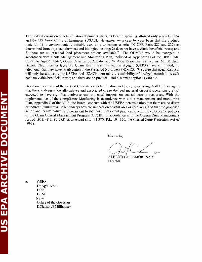
The Federal consistency determination document states, "Ocean disposal is allowed only when USEPA and the US Army Corps of Engineers (USACE) determine on a case by case basis that the dredged material: 1) is environmentally suitable according to testing criteria (40 CFR Parts 225 and 227) as determined from physical, chemical and biological testing; 2) does not have a viable beneficial reuse; and 3) there are no practical land placement options available." The ODMDS would be managed in accordance with a Site Management and Monitoring Plan, included as Appendix C of the DEIS. Mr. Cclestino Aguon, Chief, Guam Division of Aquatic and Wildlife Resources, as well as, Mr. Michael Gawel, Chief Planner from the Guam Environment Protection Agency (GEPA) have confirmed, by telephone, that they have no objection to the Preferrcd Northwest ODMDS. We agree that ocean disposal will only be allowed aftcr USEPA and USACE determine the suitability of dredged materials tested; have no viable beneficial reuse; and there are no practical land placement options available.
Based on our review of the Federal Consistency Determination and the corresponding Draft EIS, we agree that the site designation alternatives and associated ocean dredged material disposal operations are not expected to have significant adverse environmental impacts on coastal uses or resources. With the implementation of the Compliance Monitoring in accordance with a site management and monitoring Plan, Appendix C of the DEIS, the Bureau concurs with the USEP A determination that there are no direct or indirect (cumulative or secondary) adverse impacts on coastal uses or resources, and that the proposed action and its alternatives are consistent to the maximum extent practicable with the enforceable policies of the Guam Coastal Management Program (GCMP), in accordance with the Coastal Zone Management Act of 1972, (P.L. 92.583) as amended (P.L. 94·370, P.L. 104·150, the Coastal Zone Protection Act of 1996).
cc: GEPA DoAg/DA\VR DPR DLM
Navy Officc of the Governor KChastonlBMillhouser
Sincerely.
LAMORENA V Director


APPENDIX C
SITE MANAGEMENT AND MONITORING PLAN

Architect-Engineering Services for Environmental Engineering Services at Various Navy and Marine Corps Activities, Pacific Basin and Indian Ocean Areas Contract No. N62742-06-D-1870 Amendment 10 and 23
Guam ODMDS Site Management and Monitoring Plan
FINAL
Prepared For:
Department of the Navy Naval Facilities Engineering Command Pacific 258 Makalapa Drive, Suite 100 Pearl Harbor, Hawaii 96860-3134
March 2010

Guam ODMDS Site Management and Monitoring Plan
FINAL
Prepared For:
Department of the Navy Naval Facilities Engineering Command Pacific
258 Makalapa Drive, Suite 100 Pearl Harbor, Hawaii 96860-3134
Prepared By:
Weston Solutions, Inc. 2433 Impala Drive
Carlsbad, California 92010
March 2010

Guam ODMDS Site Management and Monitoring Plan FINAL March 2010
TABLE OF CONTENTS
1.0 INTRODUCTION ........................................................................................................................... 1 1.1 Objectives ........................................................................................................................... 1
2.0 SITE MANAGEMENT PLAN........................................................................................................ 2 2.1 Baseline Assessment of Conditions .................................................................................... 2
2.1.1 Disposal Site Characterization................................................................................ 2 2.1.2 Disposal Site History .............................................................................................. 6
2.2 Special Management Conditions or Practices..................................................................... 6 2.3 Quantity and Type of Material to be Disposed................................................................... 8
2.3.1 Reference Material Database .................................................................................. 9 2.4 Anticipated Site Use ......................................................................................................... 10 2.5 Site Management Plan Review and Revision ................................................................... 10
3.0 SITE MONITORING PLAN......................................................................................................... 10 3.1 Objective I......................................................................................................................... 13
3.1.1 Sediment Profile Imaging ..................................................................................... 14 3.2 Objective II ....................................................................................................................... 15
3.2.1 Sediment Sampling ............................................................................................... 15 3.3 Objective III ...................................................................................................................... 15
3.3.1 Solid Phase Toxicity Testing ................................................................................ 15 3.3.2 Bioaccumulation Potential Testing ....................................................................... 15 3.3.3 Benthic Community Analysis ............................................................................... 16
3.4 Reference Site ................................................................................................................... 16 3.4.1 Sediment Chemistry.............................................................................................. 16 3.4.2 Solid Phase Toxicity Testing ................................................................................ 16 3.4.3 Bioaccumulation Potential Testing ....................................................................... 16
4.0 MANAGEMENT ACTIONS ........................................................................................................ 16 5.0 ROLES, RESPONSIBILITIES and FUNDING ............................................................................ 17
5.1 Site Management and Monitoring Roles and Responsibilities ......................................... 17 5.2 Funding ............................................................................................................................. 17
6.0 REFERENCES .............................................................................................................................. 20
Weston Solutions, Inc. i

Guam ODMDS Site Management and Monitoring Plan FINAL March 2010
LIST OF TABLES
Table 1. Location and Dimensions of Surface Disposal Zone and Overall Disposal Site for the Guam ODMDS ........................................................................................................................................................ 7 Table 2. Designation of Site Management and Monitoring Responsibilities ............................................ 19
LIST OF FIGURES
Figure 1. Schedule for Confirmatory and Periodic Site Monitoring at the Guam ODMDS...................... 12
Weston Solutions, Inc. ii

Guam ODMDS Site Management and Monitoring Plan FINAL March 2010
ACRONYMS AND ABBREVIATIONS
CDF confined disposal facility CFR Code of Federal Regulations cm centimeter cy cubic yard DAMOS Disposal Area Monitoring System DEIS Draft Environmental Impact Statement EIS Environmental Impact Statement ft feet GPS Global Positioning System in inches km kilometer m meter m3 cubic meter MISTICS Marianas Islands Sea Turtle and Cetecean Survey MPRSA Marine Protection, Research, and Sanctuaries Act of 1972 nm nautical mile ODMDS ocean dredged disposal sites PAH polycyclic aromatic compounds PCB polychlorinated phenyls PSDDA Puget Sound Dredged Disposal Analysis SF-DODS San Francisco Deep Ocean Disposal Site SMMP site management and monitoring plan SP solid phase SPI Sediment Profile Imaging STFATE Short-term fate TKN total Kjeldahl nitrogen TON total organic nitrogen TOC total organic carbon TRPH total recoverable petroleum hydrocarbons USACE United States Army Corp of Engineers USEPA United States Environmental Protection Agency WRDA 92 Water Resources Development Act of 1992
Weston Solutions, Inc. iii

Guam ODMDS Site Management and Monitoring Plan FINAL March 2010
1.0 INTRODUCTION The disposal of dredged material in ocean waters, including the territorial sea is regulated under the Marine Protection, Research, and Sanctuaries Act of 1972 (MPRSA), 33 U.S.C. § 1401, ff. The transportation of dredged material for disposal into ocean waters is permitted by the US Army Corps of Engineers (USACE) (or, in the case of federal projects, authorized for disposal under MPRSA §103(e)) only after environmental criteria established by US Environmental Protection Agency (USEPA) are applied. The Water Resources Development Act of 1992 (WRDA 92; Public Law 102-580) made a number of changes to the MPRSA. As amended by Section 506 of WRDA 92, Section 102 (c) of the MPRSA provides that, in the case of ocean dredged material disposal sites (ODMDS), no site shall receive a final designation unless a management plan has been developed. Both USEPA and the USACE issued a joint guidance document in February, 1996 for the development of ODMDS management plans (USEPA/USACE, 1996).
MPRSA Section 102(c)(3), as amended by WRDA 92, sets forth a number of requirements regarding the content and development of site management plans, including:
(A) a baseline assessment of conditions at the site;
(B) a program for monitoring the site;
(C) special management conditions or practices to be implemented at each site that are necessary for protection of the environment;
(D) consideration of the quantity of the material to be disposed of at the site, and the presence, nature, and bioavailability of the contaminants in the material;
(E) consideration of the anticipated use of the site over the long term, including the anticipated closure date for the site, if applicable, and any need for management of the site after the closure of the site; and
(F) a schedule for review and revision of the plan (which shall not be reviewed and revised less frequently than 10 years after adoption of the plan, and every 10 years thereafter).
Multiple ODMDSs receiving similar material may be combined into a single management plan provided that all MPRSA Section 102 (c)(3) requirements are met for each individual site (USEPA/USACE, 1996). Currently, only one ODMDS is being designated offshore of Guam, therefore this provision does not apply.
The requirements of this site management and monitoring plan (SMMP), and the compliance and enforcement provisions of the MPRSA regulations themselves, apply to all projects using the Guam ODMDS, including projects which have received an "ocean dumping permit" issued by the USACE under Section 103 of the MPRSA, and Federal projects conducted by/or for the USACE. Throughout this SMMP, the term "permittee" is used to generically to apply to all these projects, even though the USACE does not issue a "permit" per se for its own dredging projects.
1.1 Objectives The three main objectives for management of the Guam ODMDS are not different than any other open-water disposal site:
Weston Solutions, Inc. 1

Guam ODMDS Site Management and Monitoring Plan FINAL March 2010
• Protection of the marine environment • Beneficial use of dredged material whenever practical • Documentation of disposal activities at the ODMDS
USEPA Region IX and USACE Honolulu District personnel will achieve these objectives by jointly administering the following activities:
• Regulation and administration of ocean disposal permits • Development and maintenance of a site monitoring program • Project-specific compliance tracking of disposal operations • Evaluation of permit compliance and monitoring results • Maintenance of an active database for dredged material testing and site monitoring results to
ensure compliance with annual disposal volume targets and to facilitate future revisions to the SMMP
• Active planning and coordination with the users of the Guam ODMDS to properly manage proposed dredged material disposal in accordance with the site use conditions and mitigate potential disposal of dredged material outside of the site use conditions.
2.0 SITE MANAGEMENT PLAN This management plan has been developed jointly by the USEPA Region IX and the USACE Honolulu District. An interim ODMDS, located approximately three miles offshore of Apra Harbor, was designated, but that site expired (along with all other “interim” disposal sites in the U.S. and Pacific Territories) on January 1, 1997. This interim ODMDS did not have a SMMP. By law, starting in 1997, ocean disposal may only occur at sites that have gone through a formal designation process to ensure that significant adverse impacts to the marine environment, and human uses of the ocean, would not occur. In addition, as stated previously, a site management and monitoring plan must be developed for newly designated ODMDSs. The following sections present the Site Management and Monitoring Plans for the Guam ODMDS.
2.1 Baseline Assessment of Conditions A comprehensive description of physical, chemical, and biological characteristics of the sediments and water column can be found in the Environmental Impact Statement for the Designation of an Ocean Dredged Material Disposal Site, West of the Territory of Guam (USEPA 2009) to which this document has been appended; a brief summary of the site conditions at the Guam ODMDS is presented in the following section.
2.1.1 Disposal Site Characterization The Guam ODMDS is located approximately 11.1 nm (20.6 km) offshore of Guam, northwest of the entrance to Apra Harbor. It is located in 8,790 ft (2,680 m) of water. The regional bathymetry of the target disposal area, located southeast of a conical seamount, is characterized by a gentle slope descending towards the southeast. The target disposal area (located on the ocean surface) is centered at 13° 35.500’N and 144° 28.733’E with a 1,640 ft (500 m) radius. The disposal site boundary (located on the seafloor) is also centered at 13° 35.500’N and 144° 28.733’E with a 2.98 mi (4.80 km) radius.
2.1.1.1 Physical Oceanography
Sea surface temperature (measured at 50 ft [15 m]) in the Guam ODMDS study region averaged 83.7°F (28.7°C), which is consistent with historical data. Temperatures within the upper water column were fairly uniform, averaging 82.8°F (28.2°C) from the surface down to the top of the thermocline. The top of the thermocline was located between approximately 410 and 490 ft (125 and 150 m), with an average
Weston Solutions, Inc. 2

Guam ODMDS Site Management and Monitoring Plan FINAL March 2010
temperature of 81.0°F (27.2°C). The thermocline was approximately 790 ft (240 m) thick, extending to depths of approximately 1,250 ft (380 m). Below the thermocline, temperatures gradually decreased from an average of 50.9°F (10.5°C) to an average of 35.2°F (1.8°C) near the ocean floor.
Salinity in the surface waters (measured at 50 ft [15 m]) averaged 34.5 parts per thousand (ppth). At the base of the surface water and just above the thermocline, salinity increased rapidly to a maximum average value of 35.1 ppth at approximately 560 ft (170 m) depth. Salinity then decreased to a minimum average value of 34.3 ppth near the base of the thermocline. Below the thermocline, the salinity remained relatively constant, with an average concentration of 34.6 ppth near the seafloor.
Transmissivity was slightly lower in surface waters of the Guam ODMDS than in the middle and lower water column. At the surface, the average transmissivity value was 85.2%, while in the mid-water column transmissivity values were higher at 85.7%.
Turbidity was relatively constant through the water column; however, slight changes in the turbidity measurements did have a discernable trend. Turbidity in the surface waters averaged 43.9 NTU. Minimum turbidity values were measured just below the thermocline, averaging approximately 42.2 NTU. Turbidity increased slightly through the remainder of the water column, with an average value of 44.9 NTU near the seafloor.
Dissolved oxygen concentrations in the surface waters averaged 5.98 mg/L. Dissolved oxygen concentrations slowly increased through the surface layer to an average 6.16 mg/L at 260 ft (80 m) depth. Concentrations then decreased to 2.21 mg/L at approximately 1,800 ft (550 m) depth. From 1,800 ft (550 m) to the bottom of the water column, dissolved oxygen concentrations slowly increased to 3.76 mg/L.
2.1.1.2 Water Quality
Conventional and chemical analyses were performed on seawater samples from four discrete depths to determine current baseline conditions at the Guam ODMDS. Analyses included nitrogen (ammonia, nitrate, and nitrite), dissolved orthophosphate, TOC, dissolved trace metals and organic pollutants (PAHs, chlorinated pesticides/PCBs).
Overall, nutrients tended to increase in concentration with increasing water depth, whereas TOC tended to decrease in concentration with increasing water depth. Ammonia ranged from non-detectable levels at the surface to 0.04 mg/L in the mid-water column sample; ammonia was not detected in the near bottom sample. Dissolved orthophosphate concentrations ranged from non-detectable levels at the surface to 0.06 mg/L in the near bottom sample. Nitrate concentrations ranged from non-detectable levels in the surface sample to 0.51 mg/L in the near bottom sample. TOC concentrations ranged from 0.4 mg/L in the surface sample to an estimated value of 0.1 mg/L in the near bottom sample.
In the dissolved form, all trace metals were detected with the exception of aluminum, beryllium, iron, mercury and tin. Throughout the water column, dissolved metals concentrations were consistent with other deep ocean reference samples and were one to three orders of magnitude below their respective Criterion Continuous Concentration (CCC) and Criterion Maximum Concentration (CMC) values. Very few PAH or chlorinated pesticides, including PCBs (both Aroclors and individual congeners), were detected in any of the water samples.
2.1.1.3 Sediment Quality
Physical, conventional, chemical and radiological sediment characteristics were examined to determine current baseline conditions at the Guam ODMDS. Measurements included grain size, TOC, nitrogen (ammonia, Total Kjeldahl Nitrogen (TKN), Total Organic Nitrogen (TON), sulfides, solids, trace metals,
Weston Solutions, Inc. 3

Guam ODMDS Site Management and Monitoring Plan FINAL March 2010
Acid volatile sulfides Simultaneously Extracted Metals (AVS-SEM), persistent organic pollutants (PAHs, chlorinated pesticides/PCBs, organotins, dioxins/furans) and gross alpha/beta.
Sediment samples were primarily sand and silt with some clay and no gravel fraction detected. The dominant sand fraction had an average of 52.1%, with the lesser silt fraction average of 39.5%, and the minor clay fraction average of 8.47%. Conventional parameters were detected in low concentrations. Percent solid content averaged 52.5% while TOC averaged 0.28%, and TON averaged 89.0 mg/dry kg. Ammonia-N averaged 0.24 mg/dry kg, approximately 2 orders of magnitude lower than biologically toxic concentrations (30 ppm) and were supported by toxicity test results conducted on project sediments. TKN averaged 170 mg/wet kg while total sulfides averaged 0.53 mg/dry kg.
All 23 metals measured were detected at concentrations characteristic of available oceanic crustal abundance values measured in the central Pacific Ocean. Cadmium, zinc, mercury, arsenic, chromium, lead and silver concentrations were below ER-L levels. Copper and nickel concentrations exceeded ER-L values but were below ER-M concentrations. AVS and SEM were also detected in low concentrations. AVS averaged 0.039 µmol/dry g while the combined SEM averaged 0.154 µmol/dry g, and the calculated ∑SEM:AVS ratio averaged 3.93. While this implies the potential for toxicity due to metal bioavailability, studies suggests that a ∑SEM:AVS ratio greater than 40 is required for certainty of metal toxicity predictions.
PAHs, chlorinated pesticides/PCBs, and organotins analyzed were not detected. Dioxins and furans as well as alpha and beta particle activity were detected in low concentrations. The sum of all detectable dioxins averaged 18.3 pg/g while the sum of all detectable furans averaged 2.20 pg/g. Gross alpha averaged 11.5 pCi/g while gross beta averaged 3.31 pCi/g.
2.1.1.4 Planktonic Community
As suggested in the guidance document for designation surveys for ODMDS (Pequegnat et al., 1990), plankton surveys were not conducted during the Site Characterization Study in April 2008 (Weston Solutions, Inc. and TEC 2008). However, information obtained through literature reviews and a generic oceanographic understanding provided sufficient background for the description of planktonic communities. Typically, plankton are concentrated in the neritic zone (shallower, coastal waters) where nutrients and light are abundant. Planktonic communities in the pelagic region (open ocean) tend to have patchy distributions and are dependent on resource availability (Nybakken 2001). In tropical waters, there is a significant amount of sunlight available throughout the year due to little change in the position of the sun in the equatorial region. This tends to result in large density and thermal gradients in the water column, thereby limiting mixing between the surface waters and deep nutrient rich waters. Therefore, in tropical seas, primary production is relatively constant because the light conditions are optimal for phytoplankton to photosynthesize but production rates tend to be lower in tropical seas due to the limited upwelling of nutrients (Nybakken 2001).
Zooplankton typically found in shallow, coastal tropical waters include Cladocera, Ostracods, Copedpods, Mysids, Cumaceans, Cirripede nauplii, Cyprids and Amphipods. Pelagic species consist primarily of Copepods and Ostracods, but similar to phytoplankton communities, distributions of zooplankton tend to be patchy and sparse in oceanoic waters. Zooplankton tend to have diurnal migrations throughout the photic zone (Wickstead 1965).
2.1.1.5 Benthic Community
Invertebrate communities consist of organisms living in, on, or above the bottom of the ocean. These organisms are often characterized by body size and where they live in relation to the seafloor. For the
Weston Solutions, Inc. 4

Guam ODMDS Site Management and Monitoring Plan FINAL March 2010
study region, the focus is on those invertebrates that live in the sediments (infauna and meiofauna), as these organisms are less able to move from an area if disturbed.
Benthic macroinfauna are small invertebrates that live within sediments and can be retained on a 0.5mm sieve. These organisms are important marine ecological community members because they burrow within and oxygenate sediments, may filter large volumes of water, contribute organic materials to the overall marine system, and serve as food for bottom-feeding fish and other invertebrates. In summary, a total of 30 different species were collected in the Guam ODMDS. Polychaetes dominated the benthic populations while crustaceans and molluscs were in low abundance. Echinoderms were absent at all of the stations.
Benthic meiofauna are described as small organisms that live within the sediment and can be retained on a 63μm sieve, but pass through a 0.5-mm sieve. Nematodes and harpactacoid copepods make up the majority of meiofauna; therefore, the presence of only these two taxa were accounted for in the samples collected. Meiofaunal organisms were absent throughout the Guam ODMDS. In addition to the absence of nematodes and harpactacoid copepods in the majority of the samples, it must be noted that when the samples were analyzed there were no other meiofaunal organisms present. Similar to the macroinfauna samples, there were large quantities of foraminifera (both living specimens and empty shells) present in all of the samples.
2.1.1.6 Fish Community
The demersal fish community in the deep offshore environment are those that reside directly in the action area, as these species live on or near the bottom of the Guam ODMDS. Species assemblages were assessed using three gear types: beam trawl, traps, and photography. Fish captured by images in photographs and video were generally unable to be identified to an advanced taxonomic level due to the quality of the camera equipment. These typically fell into two morphological types that were referred to as Ophidiiform (e.g., cuskeels that are relatively short and “tadpole” shaped, often with a bulbous head) and Anguilliform (e.g., true eels that are long and slender).
Specimens collected include fish species from the genus Bassogigas, Bathypterois, Cyclothone, Eptatretus, and Tauredophidiumi. Commonly called a cuskeel (although not a true eel), Bassogigas gillii, has been collected from all major oceans but is considered uncommon. The abyssal spiderfish, Bathypterois longipes, is named for the elongated extensions of the pelvic and caudal fin which form a tripod on which the fish rests on the seafloor. Cyclothone pallida is found in all major oceans and is one of the most abundant of all types of fishes. The largest of the “slime eels,” the giant hagfish (Eptatretus carlhubbsi) is known for its ability to produce copious amounts of slime when agitated. The uncommon species of cuskeel, Tauredophidium hextii, is quite unique in that it has three long spines on the operculum and does not have eyes.
2.1.1.7 Marine Birds
Birds that live in association with marine habitats fall into three main groups: shorebirds (such as plovers, sandpipers, etc.), water birds (such as ducks, cormorants, and loons) and seabirds (such as albatrosses, petrels, puffins, penguins, frigate birds and boobies). Seabirds are those species that obtain most of their food from the ocean and are found over water for more than half of the year.
A diversity of 27 seabird species has been recorded in Guam’s marine habitats, most of which are visitors. During the last century, most resident pelagic seabirds have decreased (Brown Noddies and White Terns) or have been lost entirely (Brown Boobies and possibly Wedge-tailed Shearwaters). Extensive predation by non-native Brown Tree Snakes (Boiga irregularis) since the 1950s is one of the major causes of these avifauna population declines. In response, nesting by Brown Noddies and White Terns, both common
Weston Solutions, Inc. 5

Guam ODMDS Site Management and Monitoring Plan FINAL March 2010
residents of Guam, is now largely constrained to offshore locations that are free of snakes, including Cocos Island, smaller islets and rocks.
The Environmental Impact Statement for the Designation of an Ocean Dredged Material Disposal Site Offshore of Guam (USEPA 2010) provided a comprehensive list of birds associated with the different marine habitats as well as detailed descriptions of 11 key seabird species including the Short-tailed Shearwater (Puffinus tenuirostris), Brown Noddy (Anous stolidus), Black Noddy (Anous minutus), White Tern (Gygis alba), Wedge-tailed Shearwater (Puffinus pacificus), Brown Booby (Sula leucogaster), Red-footed Booby (Sula sula), Great Crested Tern (Thalasseus bergii), Streaked Shearwater (Calonectris leucomelas), Black-naped Tern (Sterna sumatrana) and Matsudaira’s Storm-Petrel (Oceanodroma matsudaira).
2.1.1.8 Marine Mammals and Sea Turtles
The Marianas Islands Sea Turtle and Cetecean Survey (MISTCS), document in Marine Mammal and Sea Turtle Survey and Density Estimates for Guam and the Commonwealth of the Northern Mariana Islands Final Report (SRS-Parsons JV et al., 2007) was conducted in 2007 to determine marine mammals and sea turtle densities in the Mariana Islands region. This survey covered an area much larger than the area in the immediate vicinity of the Guam ODMDS, however, due to the highly migratory nature of marine mammals and sea turtles, species identified during this survey may likely be observed near the Guam ODMDS.
During the MISTCS there were a total of 149 individuals sighted of 13 different species. One Hawksbill Turtle was sighted, and the other 148 sightings were of 12 cetacean species. The Sperm Whale was the species that had the highest frequency of sightings followed by the Bryde’s and Sei Whales which had the 2nd and 3rd highest sighting frequency. The survey found that the most frequently sighted delphinids were the pantropical spotted dolphin followed by the false killer whale and striped dolphin. Groups that were sighted ranged from 1 to 115 individuals in size and varied depending upon the species. The range of bottom depth for the sightings was highly variable from 470 to 32,400 ft (144 to 9,874 m) and was largely species dependent (SRS-Parsons JV et al., 2007).
Although only one species of sea turtle was identified during the MISTCS, five species have distributions that extend in to Guam including the green, hawksbill, leatherback, loggerhead and olive ridley. However, only the green sea turtle is considered common to the area and the hawksbill is considered extremely rare (DON 2005). The leatherback, loggerhead and olive ridley sea turtles are considered infrequent visitors to the region.
2.1.2 Disposal Site History The Guam ODMDS is expected to be designated as a permanent disposal site in June of 2010; this site has never previously been used for the disposal of dredged materials.
2.2 Special Management Conditions or Practices In addition to any project-specific site-use conditions, the following generic conditions on the use of the Guam ODMDS include the following (as explained in Section 1.0 [Introduction], references to “permit” and “permittee” are generic references to all projects or project sponsors):
A) Mandatory conditions. All permits or federal project authorizations authorizing use of the Guam ODMDS shall include the following conditions, unless approval for an alternative permit condition is sought and granted pursuant to paragraph (C) of this section:
Weston Solutions, Inc. 6

Guam ODMDS Site Management and Monitoring Plan FINAL March 2010
1) Transportation of dredged material to the Guam ODMDS shall only be allowed when weather and sea state conditions will not interfere with safe transportation and will not create risk of spillage, leak or other loss of dredged material in transit to the Guam ODMDS .
2) Dredged material shall not be leaked or spilled from disposal vessels during transit to the Guam ODMDS.
3) When dredged material is discharged within the Guam ODMDS, no portion of the vessel from which the materials are to be released (e.g., hopper dredge or towed barge) can be further than 1,640 ft (500 m) from the center of the surface disposal zone designated in the permit. The center of the Guam ODMDS (Table 1) is also the center of the surface disposal zone for disposal:
Table 1. Location and Dimensions of Surface Disposal Zone and Overall Disposal Site for the Guam ODMDS
ODMDS
Diameter of Surface Disposal
Zone
Diameter of Disposal Site
Latitude (NAD 83)
Longitude (NAD 83)
Guam 3,280 ft (1,000 m)
2.98 mi (4,795 m) 13º 35.500’ N 144º 28.733’ E
4) No more than one disposal vessel may be present within the permissible dumping target area referred to in paragraph (3) of this section at any time.
5) Disposal vessels shall use an appropriate primary navigation/tracking system capable of indicating and recording the position of the vessel carrying dredged material (for example, a hopper dredged vessel or towed barge) with a minimum accuracy and precision of 100 ft (30.5 m) during all disposal operations. The primary system must also indicate the opening and closing of the doors of the vessel carrying the dredged material. If the primary navigation/tracking system fails, all disposal operations must cease until the navigational capabilities are restored. If the primary system fails during transit to the ODMDS, a back-up navigation/tracking system, with all of the capabilities listed in this condition, may be used to complete the trip.
6) The permittee shall maintain daily records of the amount of material dredged and loaded into barges for disposal, the times that disposal vessel depart for, arrive at and return from the Guam ODMDS, the exact locations and times of disposal, and the volumes of material disposed at the Guam ODMDS during each vessel trip. The permittee shall further record wind and sea state observations at intervals to be established in the permit.
7) For each disposal vessel trip, the permittee shall maintain a computer printout from a Global Positioning System (GPS) or other acceptable navigation system showing transit routes and disposal coordinates, including the time and position of the disposal vessel when dumping was commenced and completed.
8) An authorized and responsible representative of the prime contractor or permittee (not a subcontractor) shall inspect each disposal vessel prior to its departure for the Guam ODMDS. The authorized representative shall certify (along with the disposal vessel captain) whether the specifications on the approved Scow Certification Checklist have been met. The authorized representative shall promptly inform the permittee whether there are any inaccuracies or discrepancies concerning this information, and shall provide a summary for the calendar month in
Weston Solutions, Inc. 7

Guam ODMDS Site Management and Monitoring Plan FINAL March 2010
a report to USEPA and USACE by the 15th day of the following month. Space for a representative from USEPA or the USACE will be available on any disposal vessel should a federal regulator desire to observe disposal operations on any specific trip.
9) The permittee shall report any variances from mandatory or special conditions during disposal operations to the District Engineer and the Regional Administrator within 24 hours. In addition, the permittee shall prepare and submit reports, including a cover letter summarizing problems and corrective action(s) taken, certified accurate by the designated authorized representative, on a frequency that shall be specified in permits, to the District Engineer and the Regional Administrator setting forth the information required by Mandatory Conditions in paragraphs (7) and (8) of this section.
10) At the completion of short-term dredging projects, at least annually for ongoing projects, and at any other time or interval requested by the District Engineer or Regional Administrator, permittees shall prepare and submit to the District Engineer and Regional Administrator a report that includes complete records of all dredging, transport and disposal activities, such as navigation logs, disposal coordinates, scow certification checklists, and other information required by permit conditions. Electronic data submittals may be required to conform to a format specified by the agencies. Permittees shall include a report indicating whether any dredged material was dredged outside the areas authorized for dredging or was dredged deeper than authorized for dredging by their permits.
B) Project-specific conditions. Permits or federal project authorizations authorizing use of the Guam ODMDS may include additional conditions, if USEPA or the USACE determines these conditions are necessary to facilitate safe use of the Guam ODMDS, the prevention of potential harm to the environment or accurate monitoring of site use. These can include any conditions that USEPA or the USACE determine to be necessary or appropriate to facilitate compliance with the requirements of the MPRSA, such as timing of operations or methods of transportation and disposal.
C) Alternative permit/project conditions. Alternatives to the permit conditions specified in this section in a permit or federal project authorization may be authorized if the permittee demonstrates to the District Engineer and the Regional Administrator that the alternative conditions are sufficient to accomplish the specific intended purpose of the permit condition in issue and further demonstrates that the waiver will not increase the risk of harm to the environment, the health or safety of persons, nor will impede monitoring of compliance with the MPRSA, regulations promulgated under the MPRSA, or any permit issued under the MPRSA.
2.3 Quantity and Type of Material to be Disposed The Guam ODMDS would be restricted to the disposal of suitable dredged material, only. The Guam ODMDS is permanently designated to receive an annual maximum quantity of dredged material of 1,000,000 cy (764,555 m3). This quantity is based on a conservative (i.e., maximum volume of material to be dredged in a given year) estimate of dredged material for upcoming construction and maintenance dredging projects, calculations for determining the economic feasibility zone (Zone of Siting Feasibility Study [Weston Solutions and Belt Collins, Hawaii, 2006]), and the expected operating capacity for a dredge plant in Apra Harbor (one 3,000 cy [2,294 m3] disposal event per day over the course of a year). The USEPA Region IX and USACE Honolulu District will encourage advanced planning and coordination by users of the Guam ODMDS to ensure the annual maximum quantity of dredged material is not exceeded, with consideration of potential variances in proposed dredged material volume determinations for each project and unforeseen circumstances such as emergency dredging needs to maintain safe and navigable waterways.
Weston Solutions, Inc. 8

Guam ODMDS Site Management and Monitoring Plan FINAL March 2010
Management decisions about the suitability of dredged material for ocean disposal are guided by criteria in the MPRSA and EPA’s Ocean Dumping Regulations; guidance on specific aspects of these regulations is provided in Ecological Evaluation of Proposed Discharge of Dredged Material into Ocean Waters (the “Green Book”; USEPA/USACE 1991). USEPA Region IX in coordination with USACE Honolulu District may develop additional regional guidance in the future for sediment testing which should be used in addition to the 1991 Green Book. The USACE Honolulu District has the authority to evaluate the suitability of projects for ocean disposal and issue the required permits.
Regulatory decisions about dredged material proposed for ocean disposal will be based on the following:
1. Compliance with applicable criteria defined in the USEPA’s Ocean Dumping Regulations at 40 Code of Federal Regualtion (CFR) Part 227.
2. Requirements imposed on the permittee under the USACE Permitting Regulations at 33 CFR CFR Parts 320-330 and 335-338.
3. The potential for significant adverse environmental impacts at the Guam ODMDS from disposal of the proposed dredged material.
Potential environmental impacts from dredged material disposal are considered significant when such impacts pose an unacceptable risk to the marine environment or human health. Determinations will be based on appropriate methods to evaluate differences between the proposed dredged material and reference site sediments for chemicals of concern, acute toxicity of the proposed dredged material, the magnitude of bioaccumulation, and potential ecological impacts. The main concerns are that disposal of sediments may cause: 1). significant mortality or bioaccumulation of contaminants within the disposal site or adjacent to the site boundaries; and, 2). adverse ecological changes to either the ODMDS or the surrounding ocean floor. Changes in the benthic community are expected because different sediment-grain size and periodic disturbance will promote colonization of the site by different benthic species that may be on the surrounding bottom outside the site.
Management actions, involving the permit process or disposal site(s), are designed to reduce or mitigate any adverse environmental impact (see Section 3, Site Monitoring Plan). Management options for the permitting process include, but are not limited to: 1) full or partial approval of the dredged material proposed for ocean disposal; 2) prohibition of sediments proposed for ocean disposal; or, 3). special management restrictions for ocean disposal of the suitable material (e.g., limits on disposal quantities, specification of frequency, timing, equipment, or disposal at designated areas within either ODMDS). Management actions for the disposal site following unfavorable monitoring results may include, but are not limited to: additional confirmatory monitoring to delineate the extent of the problem, capping to isolate the sediments from potential biological receptors, and/or closure of the site.
2.3.1 Reference Material Database In April 2008, sediment collected from the designated reference site for the Guam ODMDS was collected for chemistry analyses, toxicity and bioaccumulation testing. Results from these tests are presented in the Field Report: Baseline Studies Conducted for the Designation of an Ocean Dredged Material Disposal Site, Apra Harbor, Guam (Weston Solutions, Inc. and TEC 2008), which is referenced in the Environmental Impact Statement for the Designation of an Ocean Dredged Material Disposal Site, West of the Territory of Guam (USEPA 2009). Results from these tests formed the basis for a reference material database. Permittees may compare results from project-specific toxicity and bioaccumulation tests to the reference material database or collect additional reference material. If additional reference material is collected and similarly evaluated, the reference material database may be subsequently amended with the new results, pending verification of test acceptability and approval by the regulatory agencies.
Weston Solutions, Inc. 9

Guam ODMDS Site Management and Monitoring Plan FINAL March 2010
2.4 Anticipated Site Use The Guam ODMDS is a permanent disposal site located in deep water (8,790 ft [2,680 m]) where accumulation of material will never become a navigation hazard; therefore, no closure is planned for this site at this time.
2.5 Site Management Plan Review and Revision The SMMP for the Guam ODMDS has been developed subsequent to over 10 years of management and monitoring conducted at a similar deep ocean disposal site, specifically the San Francisco Deep Ocean Disposal Site (SF-DODS) located in approximately 8,200 to 9,840 ft (2,500 to 3,000 m) of water about 50 nm (90 km) west of the Golden Gate, San Francisco, California. Although it is noted that each ODMDS is unique, data obtained from regular management and monitoring from these sites may be reviewed to determine potential impacts to the marine environment at the Guam ODMDS. However, there is always the possibility for unanticipated problems or events, in which case modifications to the management or monitoring plan will be decided jointly by USEPA Region IX and USACE Honolulu District personnel.
Absent any unforeseen or unanticipated problems with the management or monitoring of dredged material disposal at the Guam ODMDS, this plan will be reviewed (and revised if necessary) at regular intervals not exceeding 10 years from the final designation date, or as necessary if additional confirmatory or compliance monitoring results suggest a revised approach to site management and monitoring is warranted.
3.0 SITE MONITORING PLAN Site monitoring is a requirement for using the Guam ODMDS; disposal operations will be prohibited if resources for implementing the SMMP are not available. The primary purpose of the environmental monitoring plan is to confirm the conclusions of the Environmental Impact Statement (EIS) in regard to predicted site conditions following disposal. Simply stated, these conclusions are that: a) only acceptable dredged material is disposed at the site; b) no significant quantities of disposed dredged material are outside the designated site boundary and c) although physical impacts are expected, no significant toxicity and/or bioaccumulation is occurring inside the site.
Dredged material that is suitable for ocean disposal under the 1991 Green Book guidelines may cause impacts deemed acceptable within the disposal site. These include burial of any onsite benthic communities and potentially some chronic, sub-lethal biological effects to any onsite fauna from associated chemicals of concern in the disposed sediments. Rapid recolonization will occur within and outside of the site, as demonstrated by the monitoring studies at SF-DODS (Germano and Associates, Inc., 2008). However, recovery of the benthic community within the designated footprint of the Guam ODMDS may only occur for short durations during active use of the site, because continued disposal operations will rebury any recolonizing fauna. Full recolonization of the site with no long-term associated environmental impact would be expected should the Guam ODMDS ever be closed in the future and disposal at the site discontinued, or if site use is interrupted for a period of several years.
Two types of monitoring will be carried out at the Guam ODMDS: compliance monitoring as part of ongoing disposal projects, and periodic site monitoring. Compliance monitoring will only be conducted in the event that the disposal site management requirements (see Section 2.2) are not being met. Specifically, compliance monitoring may be initiated if an inappropriate volume of sediment is disposed (e.g., annual limits are exceeded), disposal of unsuitable material occurs, and/or if disposal occurs outside the designated boundaries of the site as determined from completed post-cruise scow log sheets, inspection reports, records of transport and disposal activities, etc., for each issued permit. If any of these reports show serious discrepancies (e.g., known permit violations for disposal scow conditions, awareness
Weston Solutions, Inc. 10

Guam ODMDS Site Management and Monitoring Plan FINAL March 2010
of misplaced dredged material as a result of permittee disposal reports), then the resulting management actions may include fines or additional monitoring activities carried out by the permittee at the disposal site as specified by either USACE Honolulu District or USEPA Region IX. These additional monitoring activities may include one or more of the monitoring elements described for periodic site monitoring below.
The periodic site monitoring consists of sampling tasks that will provide a comprehensive assessment of current conditions at the Guam ODMDS to be compared against baseline conditions. Baseline conditions at the Guam ODMDS are documented in USEPA Region IX's EIS for the Guam ODMDS designation action. This document will be used, along with reference data, to evaluate future changes to each site. A tiered approach will not be used to perform the periodic site monitoring due to the prohibitive costs associated with mobilizing and sampling at the remote, deep-ocean disposal site off of Guam. An ocean disposal database for the Guam ODMDS will be developed and maintained by USACE Honolulu District and USEPA Region IX; all acceptable sediment testing results for project-specific dredged material characterization studies as well as from routine compliance monitoring activities will be entered into this database.
The first monitoring survey at the designated disposal site will be a confirmatory monitory survey, conducted after the first major dredged material disposal event. Subsequently, periodic site monitoring will occur before the tenth year after designation of the Guam disposal site and approximately every 10 years thereafter, assuming the disposal site continues to be actively used (i.e., disposal of greater than 1,000,000 cy [764,556 m3] cumulatively during the remaining portion of the first 10 year period and each subsequent 10 year period. A volume of 1,000,000 cy [764,556 m3] was selected as the threshold for triggering periodic site monitoring to be able to compare modeling conducted for the environmental impact statement for site designation with site conditions and to verify disposal activities continue within site use guidelines). Figure 1 illustrates the schedule for confirmatory and periodic site monitoring at the Guam ODMDS during the first 20 years following site designation. For each subsequent 10 year period, refer to the 11 to 20 year period of the flow chart.
As part of the site monitoring program described in this section, USEPA Region IX and USACE Honolulu District will determine if there are any significant impacts to the following areas, based on monitoring physical, chemical, and biological parameters:
1. Inside the ODMDS boundary; and 2. Over an area adjacent to the ODMDS boundary if monitoring shows that significant
accumulations of dredged material (> 5.9 in [15 cm]) are outside the site boundary or that adverse biological effects are occurring inside the site. [NOTE: This is an extremely conservative trigger level that will have little or no adverse effects on the benthic infauna; details to follow in Section 3.1 below]
Weston Solutions, Inc. 11

Guam ODMDS Site Management and Monitoring Plan FINAL March 2010
Figure 1. Schedule for Confirmatory and Periodic Site Monitoring at the Guam ODMDS
Weston Solutions, Inc. 12
Y~ Event
YRS
RS
AdditIOnal Disposal ActiVity b1 MeY/lO-year period)
Refer to the 11 to 20-year period for each subsequent IO-year period.

Guam ODMDS Site Management and Monitoring Plan FINAL March 2010
The monitoring plan includes the following objectives: (1) to assess the vertical and horizontal extents of dredged material disposal and confirmation of predicted depositional thicknesses as stated in the Draft Environmental Impact Statement (DEIS), (2) to evaluate the sediment physical and chemical characteristics within the Guam ODMDS boundary to determine the potential for contaminants to impact benthic communities, and (3) to quantify the potential impacts dredged material disposal may have on the benthic communities, as necessary according to the schedule of events illustrated in Figure 1. This program facilitates monitoring of both short-term (dredged material is largely confined within site boundaries as modeling studies predict; see Chapter 4 of DEIS) and long-term (recolonization and toxicity testing) conditions, enabling both USEPA Region IX and the USACE Honolulu District to make management decisions in a timely manner should potential unacceptable impacts be discovered. The physical, biological, and chemical monitoring also will help these agencies verify whether disposal operations are being carried out in compliance with permit requirements and environmental regulations.
Long-term dredged material monitoring programs on the east-coast (the Disposal Area Monitoring System, or DAMOS program , run by the USACE New England District since 1979) and west coast ( the Puget Sound Dredged Disposal Analysis, PSDDA program, run by the USACE Seattle District since 1986; SF-DODS monitoring, run by the USACE San Francisco District since 1996 and periodic monitoring conducted by USEPA Region IX; and LA-2/LA-3 disposal site monitoring run by the USACE Los Angeles District) have demonstrated that monitoring resources are better allocated toward measuring impacts that are not transient, i.e. persist on time scales that are greater than those occurring in the range of hours to days. As such, the planned sampling efforts for the Guam ODMDS focused on the seafloor and will provide a complete impact assessment. These studies have shown that water column effects are transient and impacts to most components of the biological environment (plankton, epifauna, fish, birds, mammals, threatened or endangered species) and socioeconomic environment (commercial/recreational fisheries, shipping, military usage, oil and natural gas development) are rated as a Class III impact (adverse but insignificant or no anticipated impacts; no mitigation measures are necessary; see Chapter 4 of EIS).
As described above, sampling activities associated with all monitoring objectives should be completed during the same cruise due to the prohibitive costs associated with mobilizing and performing deep-ocean sampling. Although sufficient sediment should be collected to complete all biological testing associated with Objective III; these tests are only necessary during periodic site monitoring activities if results from Objectives I and II suggest biological testing is necessary, as determined through consultation with USEPA Region IX and USACE Honolulu District.
3.1 Objective I The monitoring for physical/biological processes is focused on the potential transport of dredged material outside of the designated site boundaries following disposal and the recolonization of dredged material by benthic infauna. Short-term fate (STFATE), a model developed by the USACE, was run for predictions of transport and fate of dredged material disposed at Guam ODMDS (Weston Solutions, Inc. and Belt Collins 2007; Chapter 4, Guam ODMDS DEIS for summary of results), and no substantial accumulations were expected outside the site boundary; the physical portion of the module focuses on mapping and tracking the dredged material deposit on the seafloor to verify the predictions of the numerical model. If material is found outside the site in accumulations thicker than expected, biological monitoring will be performed to document that infaunal recolonization is proceeding as expected.
Objective I monitoring activities focus on the statement (null hypothesis): • The accumulation of dredged material deposits is greater than 5.9 in (15 cm) outside the
Guam ODMDS boundary. Rejection of the null hypothesis indicates the accumulation of dredged material deposits is less than 5.9 in (15 cm) outside the Guam ODMDS boundary, suggesting there are no potential impacts outside the boundary.
Weston Solutions, Inc. 13

Guam ODMDS Site Management and Monitoring Plan FINAL March 2010
Objective I monitoring activities should be completed primarily using a sediment profile imaging (SPI) digital camera. Supplemental Objective I monitoring activities may also include high-resolution multibeam bathymetric surveys to map bathymetric features and dredged material deposits within and surrounding the Guam ODMDS boundary. It should be noted, though, due to the extreme water depths and the accuracy (resolution) of available multibeam data collection systems (i.e. the multibeam system mounted on the survey vessel of opportunity), dredged material deposits may not be resolved.
The SMMP is designed to ensure that significant deposits of dredged material do not consistently occur or extend beyond the site boundaries. A substantial deposit is defined as 5.9 in (15 cm) or more since the last monitoring event (thicker deposits are expected to occur and are acceptable within the site boundaries). Physical mapping of the dredged material footprint on the seafloor will be conducted at periodic intervals in order to confirm that management guidelines for disposal operations are operating within expected criteria and the predictions from the numerical models are correct.
The 5.9 in (15 cm) deposit thickness of dredged material outside the site boundary has been selected as a trigger level to proceed to Objective 2 for a number of reasons:
1. The maximum deposit thickness that can be detected by the sediment profile imaging equipment is 7.9 in (20 cm) but the camera settings are usually adjusted so that actual prism penetration is somewhat less than that (4.7 – 7.5 in [12-19 cm]) in order to capture details at the sediment-water interface.
2. Impacts to infauna from deposition of dredged material can range from negligible to total mortality, depending on the type of material and rate of deposition (a 19.7 in [50 cm] layer deposited at the rate of 0.4 in (1 cm) per week over the course of a year would have little detectable impact as compared with a 19.7 in [50 cm] layer that occurred at a location in one depositional event). Estimates of deposit thicknesses through which native infauna can reestablish themselves range from 2 in (5 cm) to 33.5 in (85 cm) (Kranz, 1974; Nichols et al., 1978; Maurer et al., 1980, 1986).
3. Repeated monitoring other open-water dredged material sites off all coasts of the USA (e.g., Rhoads and Germano, 1986; Germano et al., 1994; Newell et al., 1998; Germano and Associates, Inc., 2008) have shown that even in dredged material deposits exceeding a meter or more (where one can safely assume that all resident infauna were smothered and killed), benthic recolonization and community succession will occur with full ecosystem recovery over time, so any impact to the benthic community from deposition of dredged material that has passed testing criteria as acceptable for open-water disposal will be temporary. Using 5.9 in (15 cm) as the trigger level is an extremely conservative value; while this will most likely have little, if any, adverse effects on the benthic infauna, it will be a good verification check for the disposal model’s predicted footprint of dredged material on the seafloor.
3.1.1 Sediment Profile Imaging A series of radial transects through the Guam ODMDS site and continuing out 500 meters beyond the edge of the detectable dredged material layer will be sampled with SPI technology. SPI stations will be placed at 655 – 1640 ft (200 - 500 m) intervals along the transects or at appropriate spacing so that any area outside the site boundary with dredged material has at least 3-5 stations located on the dredged material. The SPI system must be equipped with a digital camera to allow on-board evaluation of results
Weston Solutions, Inc. 14

Guam ODMDS Site Management and Monitoring Plan FINAL March 2010
(necessary for assessing the adequacy of station locations for mapping the dredged material and for Objective 2 activities; see below).
3.2 Objective II Sufficient sediment volumes of material will be collected for Objectives II and III analyses during the monitoring event for Objective I.
Objective II sampling activities focus the statements (null hypotheses): • The sediment chemical concentrations within the Guam ODMDS boundary are elevated above
those measured in the sediment prior to disposal. Rejection of the null hypothesis indicates that sediment chemistry concentrations within the Guam ODMDS are not elevated above those measured in the sediment prior to disposal.
• The sediment grain size distribution within the Guam ODMDS boundary is different than the baseline grain size distribution and the grain size distribution of material prior to disposal.. Rejection of the null hypothesis indicates grain size characteristics within the Guam ODMDS boundary are not different than those of the site prior to any disposal activities.
3.2.1 Sediment Sampling A minimum of three sediment samples within the site boundary would need to be collected and analyzed for physical and chemical parameters. Sufficient sediment volume should be collected to perform all Objective II physical and chemical analyses, as well as all Objective III analyses.
3.3 Objective III Objective III analyses include solid phase toxicity testing and bioaccumulation testing.
Objective III sampling activities focus on the following statements (null hypotheses): • Toxicity (reduced survivorship) of sediment from within the site boundary is elevated relative to
toxicity of baseline conditions t. Rejection of the null hypothesis indicates sediment toxicity within the Guam ODMDS boundary is less or non-existent compared to baseline conditions, suggesting dredged material disposal is not impacting benthic communities within the Guam ODMDS boundary.
• Tissues from organisms exposed to sediment collected within the site boundary show increased uptake (bioaccumulation) of contaminants relative to tissues from organisms exposed to baseline conditions sediment. Rejection of the null hypothesis indicates bioaccumulation of contaminants within the Guam ODMDS boundary is less or non-existent compared to bioaccumulation of contaminants within sediment collected during baseline condition surveys, suggesting dredged material disposal is not impacting benthic communities within the Guam ODMDS boundary.
3.3.1 Solid Phase Toxicity Testing Solid Phase (SP) toxicity tests should be conducted on sediment collected from within the Guam ODMDS and a reference location. SP tests are performed to estimate the potential impact of ocean disposal of dredged material on benthic organisms that attempt to recolonize the area. Sediment samples should be used in 10-day SP tests using two species: one amphipod (Ampelisca abdita or Eohaustorius estuarius) and one polychaete worm (Neanthes arenaceodentata).
3.3.2 Bioaccumulation Potential Testing Bioaccumulation potential tests should be conducted with sediment collected from within the Guam ODMDS and a reference location. Bioaccumulation potential tests are performed to determine the availability of sediment contaminants taken up by test organisms. Tissue analysis (including pre-
Weston Solutions, Inc. 15

Guam ODMDS Site Management and Monitoring Plan FINAL March 2010
exposure samples) should be conducted for the same parameters required on sediment when conducting dredge material evaluations as wells as percent lipids.
3.3.3 Benthic Community Analysis Benthic community analyses (macroinfauna and meiofauna organisms) should be conducted with sediment from within the Guam ODMDS and compared to benthic community analyses in the area prior to disposal. Benthic community analyses are performed to estimate the population diversity and organism abundance of macroinfauna and meiofauna organisms in the sediment.
3.4 Reference Site Due to location of the Guam ODMDS in extreme water depths, the costs and effort to plan, mobilize and conduct monitoring activities offshore of Guam is relatively high. As such, during disposal site monitoring activities, sediment should also be collected from the Guam ODMDS reference site. Sediment from the reference site will be analyzed for physical and chemical parameters and used in SP toxicity tests and bioaccumulation tests for the comparisons described above and to further develop the reference material database. Permittees may compare results from project-specific toxicity and bioaccumulation tests to the reference material database.
3.4.1 Sediment Chemistry At a minimum, sediment collected from the reference site should be analyzed for physical and chemical parameters similar to those required for conducting dredged material evaluations. These include grain size, specific gravity, Atterberg limits, total solids, total organic carbon (TOC), total sulfides, dissolved sulfides, total ammonia, total recoverable petroleum hydrocarbons (TRPH), trace metals, polycyclic aromatic hydrocarbons (PAHs), chlorinated pesticides (including Aroclor polychlorinated biphenyls (PCBs) and individual PCB congeners) and organotins. For comparison to site characterization studies, additional analyses may be conducted including total organic nitrogen (TON), total Kjeldahl nitrogen (TKN), dioxins/furans and gross alpha/beta radioactive content.
3.4.2 Solid Phase Toxicity Testing SP toxicity tests should be conducted on sediment collected from the reference site. SP tests are performed to estimate the potential impact of ocean disposal of dredged material on benthic organisms that attempt to recolonize the area. Reference material should be similarly tested in 10-day SP tests using two species: one amphipod (Ampelisca abdita or Eohaustorius estuarius) and one polychaete worm (Neanthes arenaceodentata).
3.4.3 Bioaccumulation Potential Testing Bioaccumulation potential tests should be conducted with sediment collected from the reference site. Bioaccumulation potential tests are performed to determine the availability of sediment contaminants taken up by test organisms. Tissue analysis (including pre-exposure samples) should be conducted for the same parameters required on sediment when conducting dredge material evaluations as wells as percent lipids.
4.0 MANAGEMENT ACTIONS The results of any monitoring events that demonstrate disposed material outside the site boundary in excess of 5.9 in [15 cm] or a cumulative impact to the benthic community will trigger a review of management implications or a management action. The review of management implications (triggered by either disposed material outside the site boundary in excess of 5.9 in [15 cm] or bulk sediment chemistry values greater than baseline concentration ranges could mean one or more of the following problems exist:
Weston Solutions, Inc. 16

Guam ODMDS Site Management and Monitoring Plan FINAL March 2010
• Control of disposal operations is not occurring as planned • Numerical modeling predictions are inaccurate (site boundary may be too small) • Inadequate characterization of dredged material during the permitting process (material is either
more heterogeneous than anticipated or sampling density for characterizing a specified volume is too low)
Depending on which path leads to review of management implications or a management action, further investigations would identify which of the above problems is most likely the cause of the false positive trigger and allow correction once EPA Region IX and USACE Honolulu District personnel concur on the proper remedy and adjustment to the management plan. However, each agency is free to operate solely under its own authority as outlined in Table 2.
If, however, it is determined that the potential for risk to human health or the marine environment exists because of bioavailable contaminants being placed at the site, the potential management actions include any or all of the following actions:
• Review and revise the sediment characterization process as part of permit activity • Suspend or modify any further use of the site while the cause of the problem is being identified • Identify additional monitoring tasks that must be performed to better identify or delineate the
source of the problem • Permanently terminate use of the site if this is the only means for eliminating the adverse
environmental impacts
In general, any management action would be initiated only after consensus has been reached between EPA Region IX and USACE Honolulu District. USEPA and the USACE still retain their respective authority over the disposal site and dredging site, and may exercise their independent authority (i.e., enforcement) if appropriate and necessary for environmental protection in either area. Any changes to the SMMP will be published by USEPA.
5.0 ROLES, RESPONSIBILITIES AND FUNDING
5.1 Site Management and Monitoring Roles and Responsibilities While USEPA and the USACE work in coordination on all ODMDSs in waters of the U.S., they also have separate authorities over these sites. The roles and responsibilities for managing the Guam ODMDS are outlined in Table 2.
5.2 Funding Funding for site characterization studies for the designation of the Guam ODMDS as well as this SMMP was provided by U.S. Navy. Funding for future site monitoring will be provided by the users of the Guam ODMDS. Confirmatory site monitoring, conducted after the first major dredged material disposal event, will be funded by the user or users (prorated by volume). Periodic site monitoring, conducted every 10 years, will be funded by the user or users (prorated by volume). Compliance monitoring, as required because the disposal site requirements were not met, will be the sole responsibility of the user in violation of the disposal site requirements.
It is recognized that funding site monitoring activities will likely be costly and extensive pre-monitoring planning is required due to the logistical and technical difficulties inherent in working in a deep-ocean
Weston Solutions, Inc. 17

Guam ODMDS Site Management and Monitoring Plan FINAL March 2010
environment offshore of Guam. Site monitoring will require specialized marine vessels and oceanographic equipment capable of operating and collecting samples in extreme environmental conditions. Due to high mobilization and daily leases costs associated with such vessels and equipment, every effort should be made by the site users to coordinate and plan monitoring efforts. Coordination with the USEPA and USACE regarding monitoring activities is also recommended to reduce potential costs, for example, USEPA’s research vessel may be available as a monitoring platform (though the user would likely be responsible for a fuel surcharge to mobilize the vessel to and from Hawaii or the West Coast).
Further, it is recognized that federal funding sources may expire. Therefore, it is recommended that disposal activities and potential monitoring activities be coordinated with the USEPA Region IX and USACE Honolulu District in order to satisfy regulatory monitoring requirements without the need for excessive or supplemental monitoring events.
Weston Solutions, Inc. 18

Guam ODMDS Site Management and Monitoring Plan FINAL March 2010
Table 2. Designation of Site Management and Monitoring Responsibilities
Site Management Task Responsible Agency ODMDS Site Designation USEPA Region IX
Disposal Project Evaluation & Permit Issuance USACE Honolulu District1 with USEPA Region IX concurrence
Project-specific Compliance Tracking of Disposal Operations
USACE Honolulu District and USEPA Region IX
Enforcement Actions for Permit Violations at Dredging Site USACE Honolulu District (lead agency)
Enforcement Actions for Permit Violations for Disposal Operations (primary) and Dredging Site
(secondary) USEPA Region IX
Disposal Site Monitoring USACE Honolulu District with periodic assistance (including vessel support) from USEPA Region IX
Disposal Site Data Maintenance – Pre-disposal and Confirmatory Testing
USACE Honolulu District and USEPA Region IX
1 Issued by either the Planning/Operations or Regulatory Branch of the USACE Honolulu District, as appropriate
Weston Solutions, Inc. 19

Guam ODMDS Site Management and Monitoring Plan FINAL March 2010
6.0 REFERENCES
DON/Department of the Navy. 2005. Marine Resource Assessment for the Marianas Operating Area. Pacific Division, Naval Facilities Engineering Command, Pearl Harbor, Hawaii. Contract # N62470-02-D-9997, CTO 0027. Prepared by Geo-Marine, Inc., Plano, Texas.
Germano, J. D., D.C. Rhoads and J.D. Lunz. 1994. An integrated, tiered approach to monitoring and management of dredged material disposal sites in the New England regions. DAMOS Contribution #87. Report to US Army Corps of Engineers, New England Division, Waltham, MA.
Germano and Associates, Inc. 2008. Review/Synthesis of Historical Environmental Monitoring Data Collected at the San Francisco Deep Ocean Disposal Site (SF-DODS) in Support of EPA Regulatory Decision to Revise the Site’s Management and Monitoring Plan. Prepared for USEPA Region IX, San Francisco, CA.
Kranz, P. 1974. The Anastrophic Burial of Bivalves and Its Paleontological Significance. Journal of Geology 82:237-265.
Maurer, D., R.T. Keck, J.C. Tinsman, and W.A. Leathem. 1980. Vertical migration and mortality of benthos in dredged material – Part I: Mollusca. Marine Environmental Research 4: 299-319.
Maurer, D., R.T. Keck, J.C. Tinsman, W.A. Leathem, C. Wethe, C. Lord, and T.M. Church, 1986. Vertical migration and mortality of marine benthos in dredged material: a synthesis. Internationale Revue der gesamten Hydrobiologie, 71: 49-63.
Newell, R.C., L.J. Seiderer, and D.R. Hitchcock, 1998. The impact of dredging works in coastal waters: a review of the sensitivity to disturbance and subsequent recovery of biological resources on the seabed. Oceanography and Marine Biology Annual Review, 36: 127-178.
Nichols, J.A., G.T. Rowe, C.H.H. Clifford, and R.A. Young. 1978. In Situ Experiments on the Burial of Marine Invertebrates. Journal of Sedimentary Petrology 48(2): 419-425.
Nybakken, James W. Marine Biology: An Ecological Approach, 5th Addition. San Fransisco: Benjamin Cummings, 2001.
Pequagnat, W.E., B.J. Gallaway, and T.D. Wright. 1990. Revised Procedural Guide for Designation Surveys of Ocean Dredged Material Disposal Sites. Technical Report D-90-8. USACE Waterways Experiment Station, Vicksburg, MS. April.
Rhoads, D.C., and J.D. Germano. 1986. Interpreting long-term changes in benthic community structure: a new protocol. Hydrobiologia 142: 291-308.
SRS Parsons JV, Geo-Marine, Inc. and Bio-waves, Inc. 2007. Marine Mammal and Sea Turtle Survey and Density Estimates for Guam and the Commonwealth of the Northern Mariana Islands. Prepared for Naval Facilities Engineering Command, Pacific.
USEPA. 2010. Final Environmental Impact Statement – Designation of an Ocean Dredged Material Disposal Site Offshore of Guam. March.
Weston Solutions, Inc. 20

Guam ODMDS Site Management and Monitoring Plan FINAL March 2010
USEPA/USACE, 1991. Evaluation of Dredged Material Proposed for Ocean Disposal Testing Manual. EPA-503/8-91/001. Office of Water (WH-556F). Available at: http://www.epa.gov/OWOW/oceans/gbook/
USEPA/USACE, 1996. Guidance Document for Development of Site Management Plans for Ocean Dredged Material Disposal Sites. Office of Water (4504F). Available at: http://www.epa.gov/owow/oceans/ndt/siteplan.html
USEPA/USACE/United States Environmental Protection Agency and United States Army Corps of Engineers. 1998. Evaluation of Dredged Material Proposed for Discharge in Waters of the U.S. Testing Manual (Inland Testing Manual). EPA 823-B-98-004. EPA Office of Water, Washington, DC. February.
Weston Solutions, Inc. and Belt Collins Hawaii, Ltd. 2007. Dredged Material Sampling and Tier III Analysis Evaluation for Apra Harbor Projects (P-436, P-502, P-518), Apra Harbor, Guam. Final Report. Prepared for the Department of the Navy, Naval Facilities Engineering Command Pacific. Contract No. N62742-05-D-1873, Task Order No. 0008.
Weston Solutions, Inc. and TEC 2008. Field Report: Baseline Studies Conducted for the Designation of an Ocean Dredged Material Disposal Site, Apra Harbor, Guam. Prepared for the Department of the Navy, Naval Facilities Engineering Command Pacific. Contract No. N62742-06-D-1870, Task Order Nos. 10 and 13.
Wickstead, J.H. 1965. An Introduction to the Study of Tropical Plankton. London: Hutchinson & CO.
Weston Solutions, Inc. 21