Embed Size (px)
Citation preview
Floodplain Mapping using HEC-RAS and ArcView GIS
Eric TateFrancisco OliveraDavid Maidment
http://www.ce.utexas.edu/stu/tateec
Motivation and Objectives
HEC-RAS Hydraulic Model
Stream Cross-Section Mapping
GIS Data Models
3-D Terrain Modeling
Floodplain Mapping
Outline
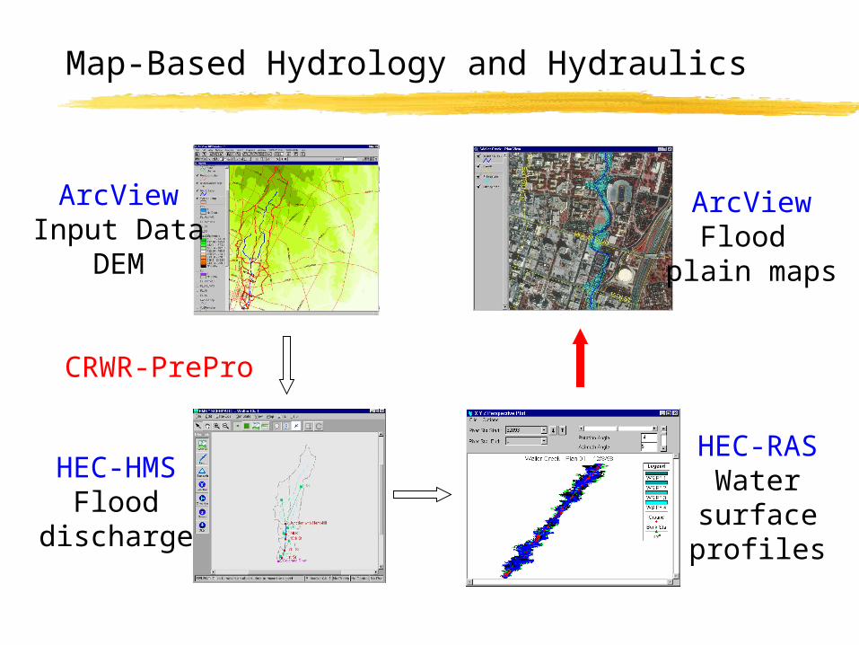
Map-Based Hydrology and Hydraulics
ArcViewInput Data
DEM
HEC-HMSFlood
discharge
HEC-RASWatersurfaceprofiles
ArcViewFlood
plain maps
CRWR-PrePro
Computer automation results in time and resource savings versus manual floodplain plotting
Flood insurance rate determination
Economic impact analysis and flood early warning systems
Design of drainage control structures, including storm drains, culverts, and bridges
Motivation: Why map floodplains in GIS?
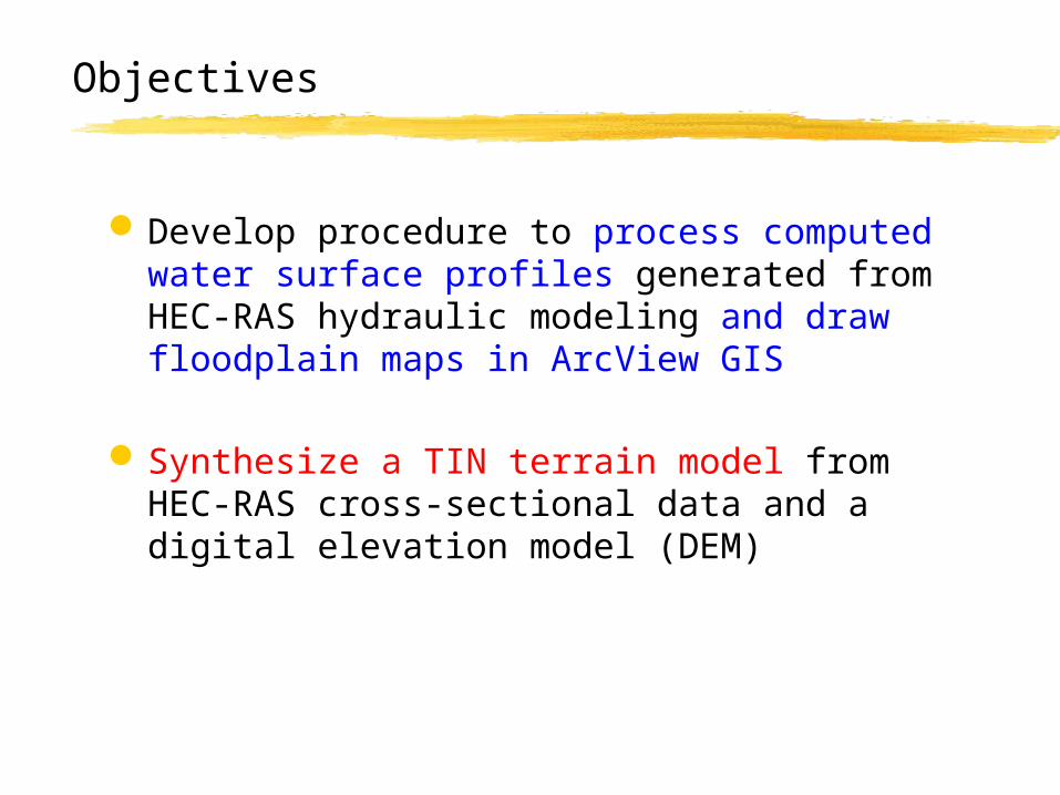
Develop procedure to process computed water surface profiles generated from HEC-RAS hydraulic modeling and draw floodplain maps in ArcView GIS
Synthesize a TIN terrain model from HEC-RAS cross-sectional data and a digital elevation model (DEM)
Objectives
Motivation
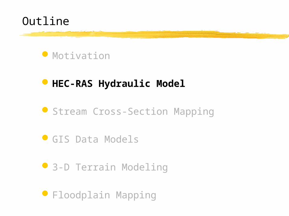
HEC-RAS Hydraulic Model
Stream Cross-Section Mapping
GIS Data Models
3-D Terrain Modeling
Floodplain Mapping
Outline
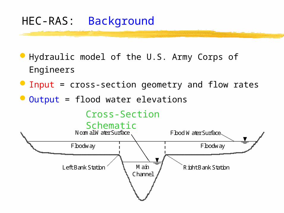
HEC-RAS: Background
Hydraulic model of the U.S. Army Corps of Engineers
Input = cross-section geometry and flow rates
Output = flood water elevations
Floodway Floodway
Left Bank Station
Flood Water Surface
Right Bank Station
Normal Water Surface
Main Channel
Cross-Section Schematic
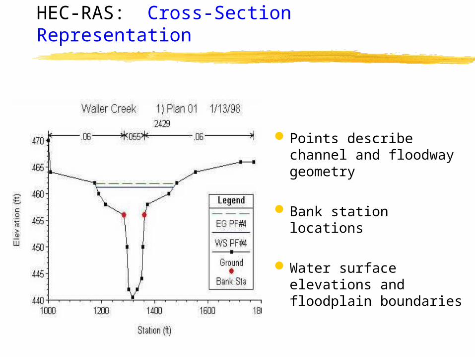
Points describe channel and floodway geometry
Bank station locations
Water surface elevations and floodplain boundaries
HEC-RAS: Cross-Section Representation
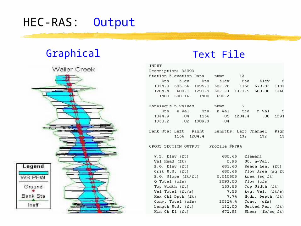
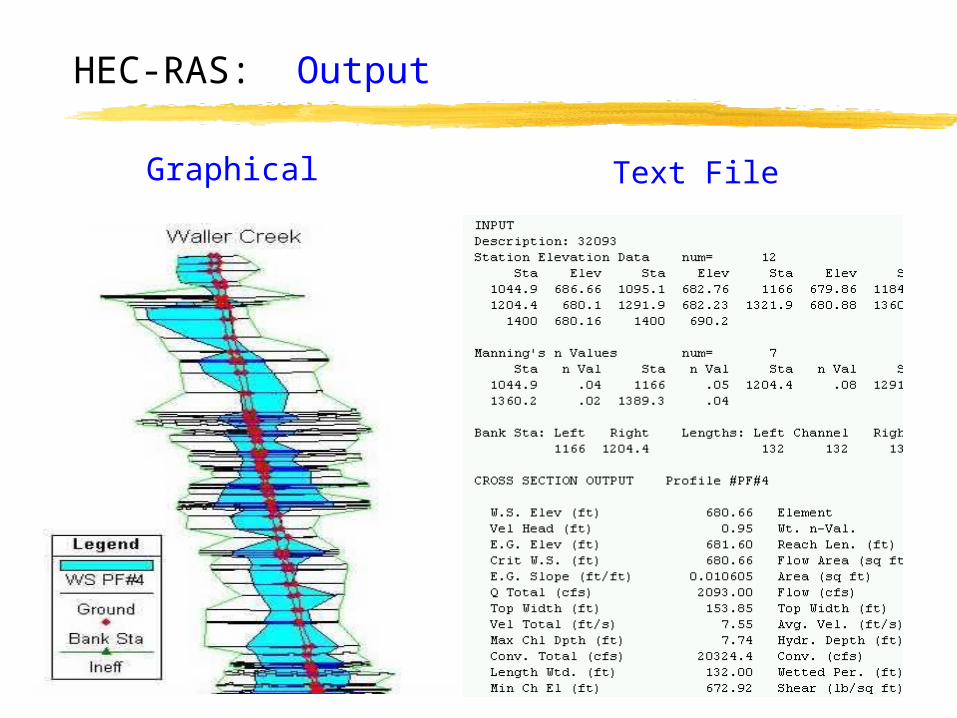
HEC-RAS: Output
Text FileGraphical
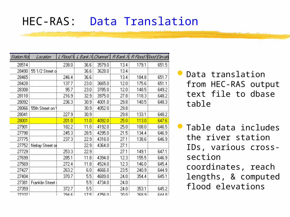
Data translation from HEC-RAS output text file to dbase table
Table data includes the river station IDs, various cross-section coordinates, reach lengths, & computed flood elevations
HEC-RAS: Data Translation
Motivation
HEC-RAS Hydraulic Model
Stream Cross-Section Mapping
GIS Data Models
3-D Terrain Modeling
Floodplain Mapping
Outline
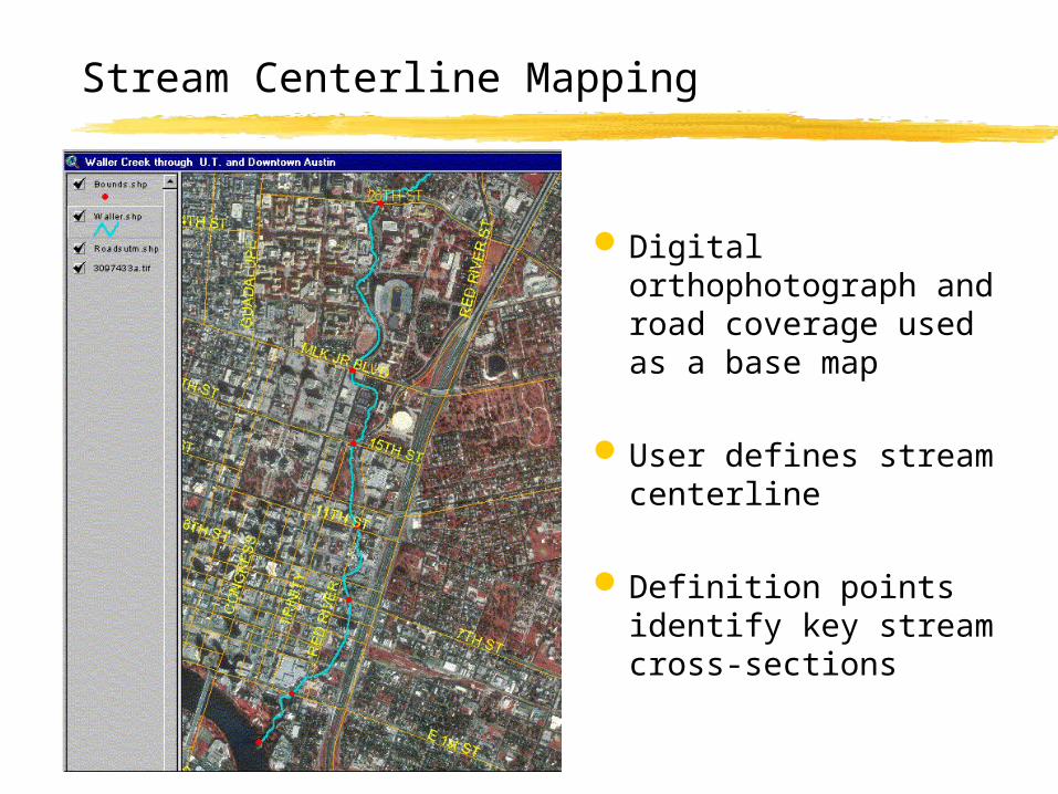
Digital orthophotograph and road coverage used as a base map
User defines stream centerline
Definition points identify key stream cross-sections
Stream Centerline Mapping
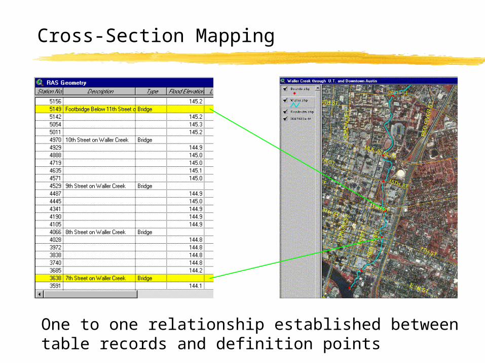
Cross-Section Mapping
One to one relationship established between table records and definition points
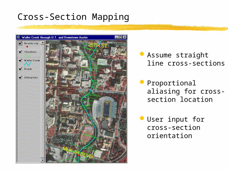
Assume straight line cross-sections
Proportional aliasing for cross-section location
User input for cross-section orientation
Cross-Section Mapping
Motivation
HEC-RAS Hydraulic Model
Stream Cross-Section Mapping
GIS Data Models
3-D Terrain Modeling
Floodplain Mapping
Outline
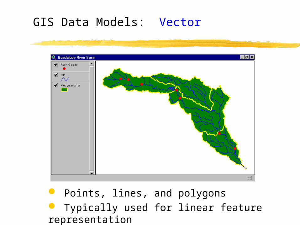
Points, lines, and polygons Typically used for linear feature representation
GIS Data Models: Vector
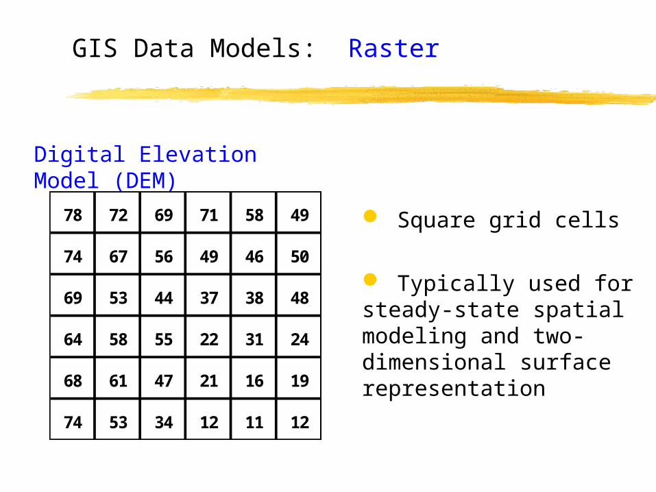
Square grid cells
Typically used for steady-state spatial modeling and two-dimensional surface representation
78 72 69 71 58 49
74 67 56 49 46 50
69 53 44 37 38 48
64 58 55 22 31 24
68 61 47 21 16 19
74 53 34 12 11 12
Digital Elevation Model (DEM)
GIS Data Models: Raster
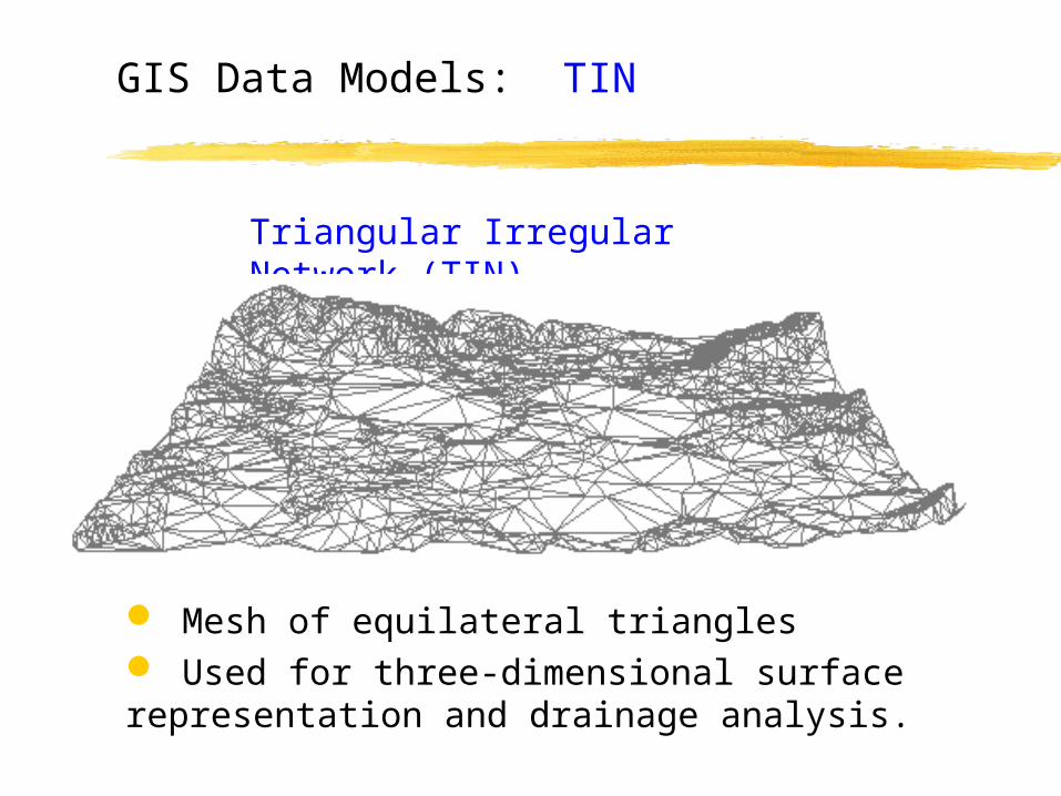
Mesh of equilateral triangles Used for three-dimensional surface representation and drainage analysis.
Triangular Irregular Network (TIN)
GIS Data Models: TIN
Motivation
HEC-RAS Hydraulic Model
Stream Cross-Section Mapping
GIS Data Models
3-D Terrain Modeling
Floodplain Mapping
Outline
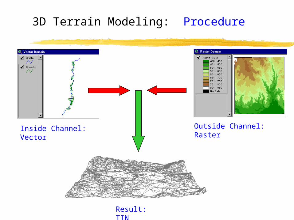
3D Terrain Modeling: Procedure
Inside Channel: Vector Outside Channel: Raster
Result: TIN
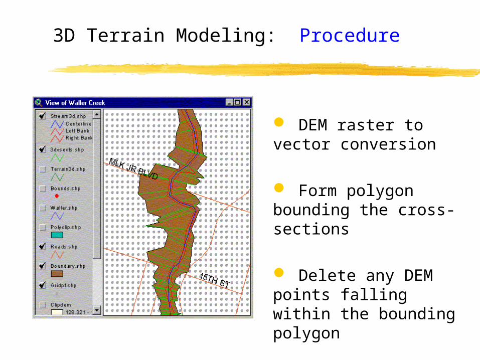
DEM raster to vector conversion
Form polygon bounding the cross-sections
Delete any DEM points falling within the bounding polygon
3D Terrain Modeling: Procedure
3D Terrain Modeling
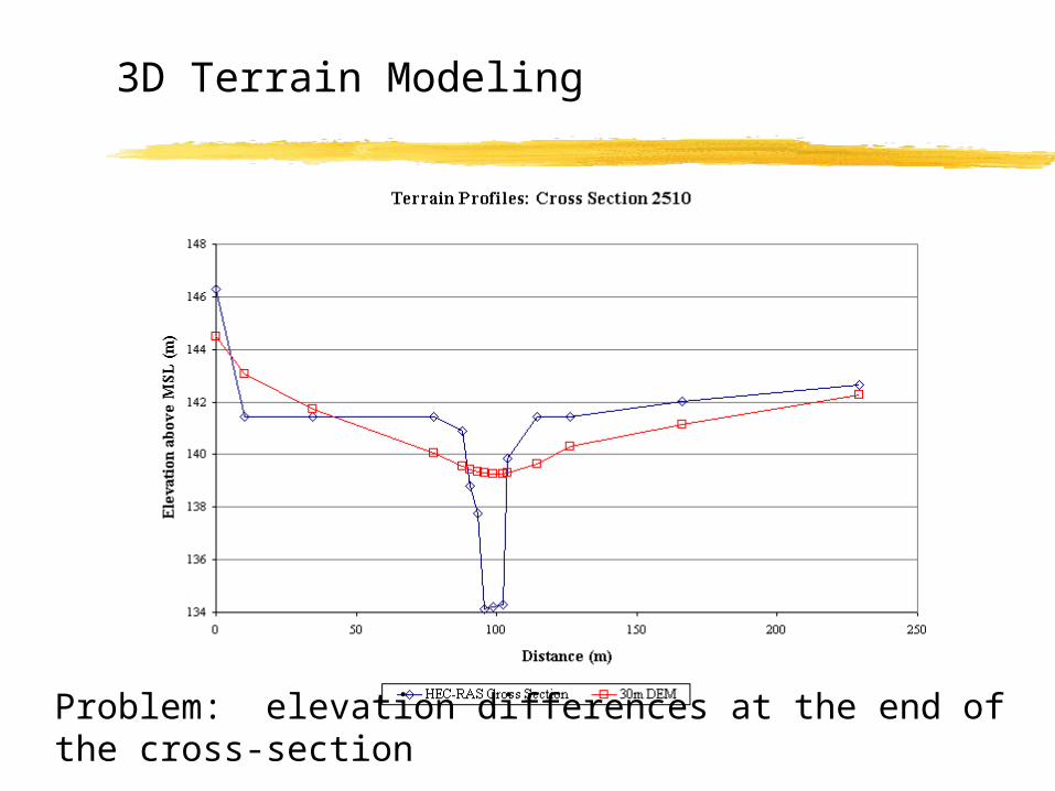
Problem: elevation differences at the end of the cross-section
3D Terrain Modeling
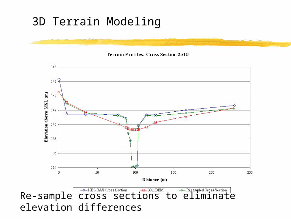
Re-sample cross sections to eliminate elevation differences
3D Terrain Modeling
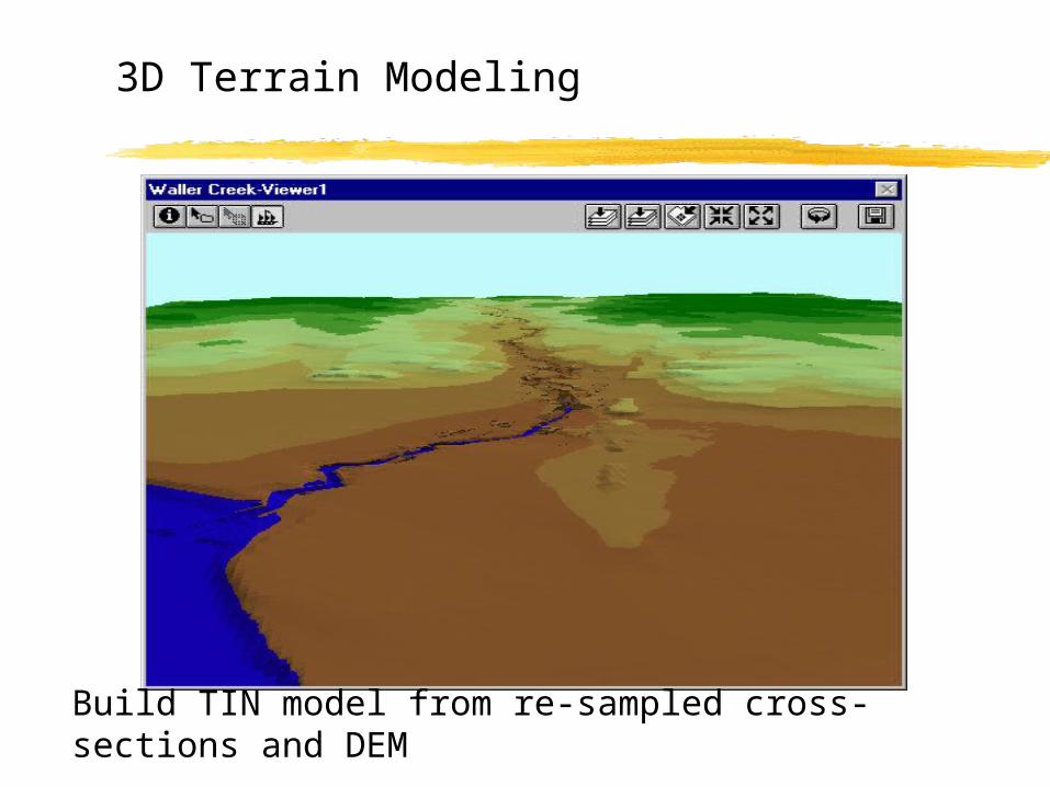
Build TIN model from re-sampled cross-sections and DEM
Motivation
HEC-RAS Hydraulic Model
Stream Cross-Section Mapping
GIS Data Models
3-D Terrain Modeling
Floodplain Mapping
Outline
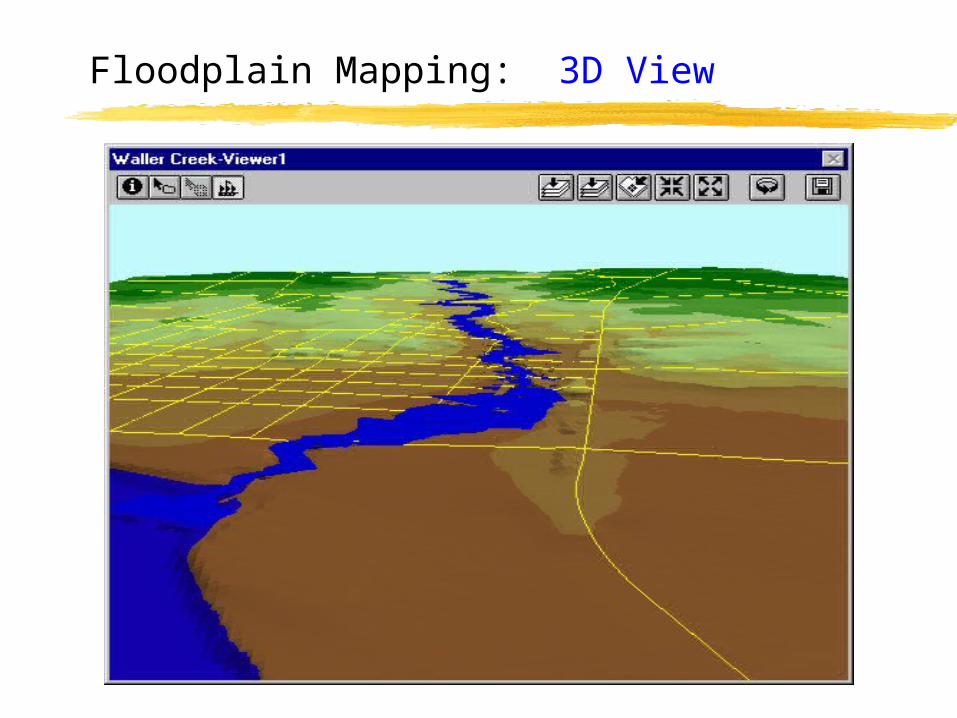
Floodplain Mapping: 3D View
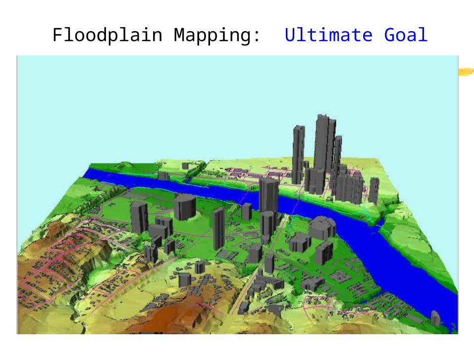
Floodplain Mapping: Ultimate Goal
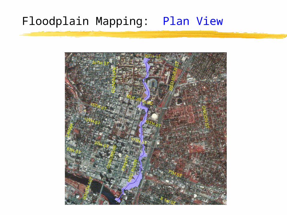
Floodplain Mapping: Plan View
HEC-RAS: Output
Text FileGraphical
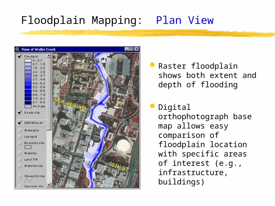
Floodplain Mapping: Plan View
Raster floodplain shows both extent and depth of flooding
Digital orthophotograph base map allows easy comparison of floodplain location with specific areas of interest (e.g., infrastructure, buildings)
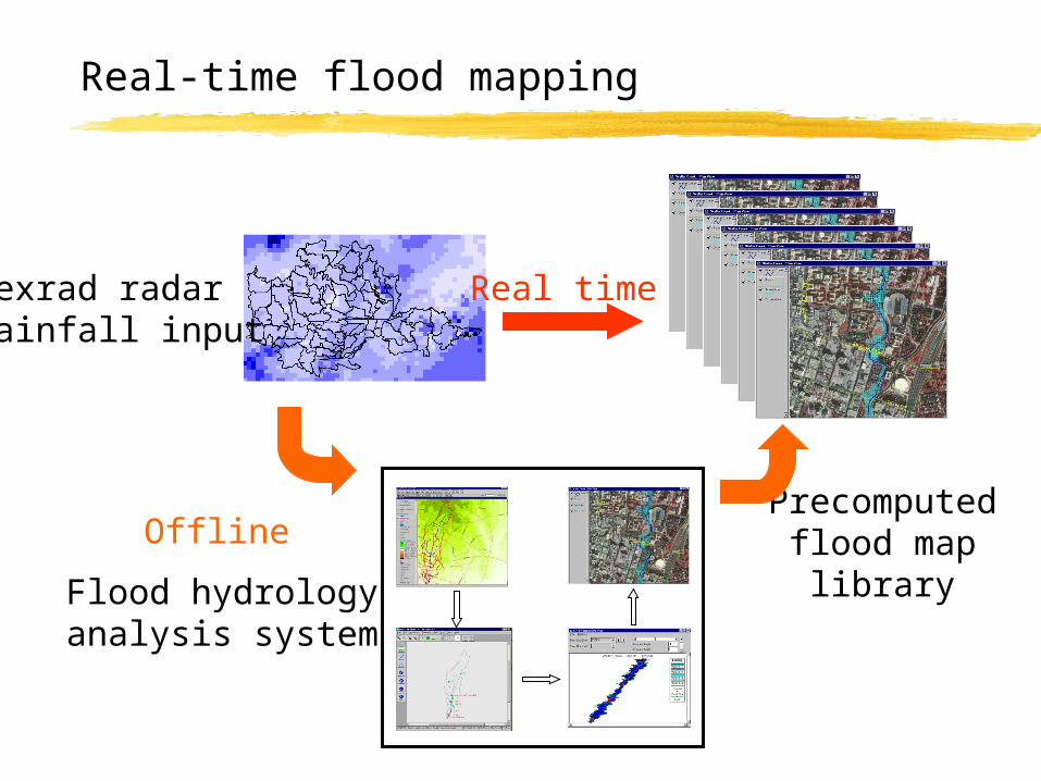
Real-time flood mapping
Flood hydrologyanalysis system
Nexrad radarrainfall input
Precomputedflood map
library
Real time
Offline
Questions?
Comments?
Also thanks to Seann Reed and Brian Adams