Embed Size (px)
DESCRIPTION
Â
Citation preview
Monday : #ThePrimaryFactor
how to assess the potential for strong ground motion and fault rupturing that might impact the siting of new buildings or facilities. A team of geologist,
Engineers have to study the area and made experimental boreholes to work out the rate of Hazardous of ground settling, earth quick and strong wind impact on
dwelling before start to depict it. This is called primary factor The below picture also a part of land which were called in ancient time as Death valley. Now a days
we have latest equipment which can assess the risk and we ae able to calculate the required precautionary measure to protect our dwelling from Hazards. So I
decided to plan my place near a running ravine without any fear of failours.
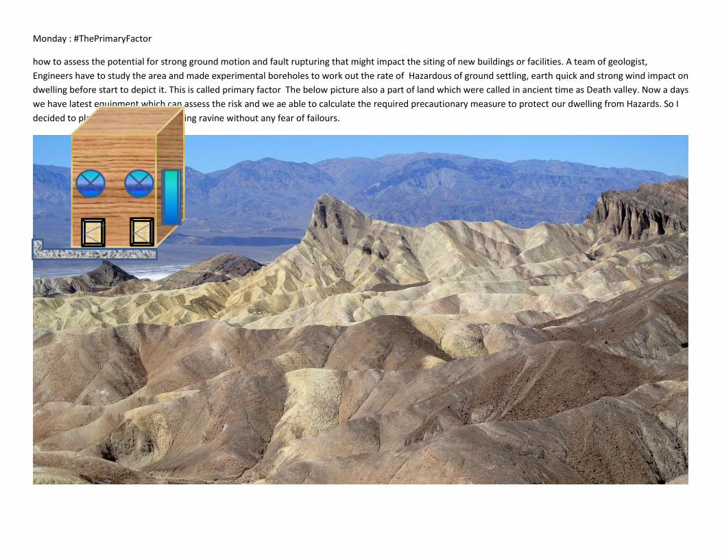
Tuesday: #TheSimplestWay
The Nazca Lines, mysterious geoglyphs that span a rugged Peruvian desert, remain an engima. No one has proof as to who built
them and what their function was. Since their discovery, they have inspired fantastic explanations from ancient believes, a landing
strip for returning aliens, a celestial calendar created by the ancient Nazca civilization -- putting the creation of the lines between
200 BC and 600 AD, used for rituals probably related to astronomy, to confirm the ayllus or clans who made up the population and
to determine through ritual their economic functions held up by reciprocity and redistribution, or a map of underground water
supplies.
I thinks they
discovered the
water creaks and
collection place so
that they can
extract for them
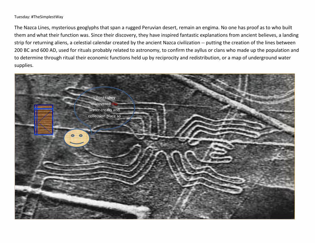
Wednesday: #TheEggHas
History of the Lascaux Discovery
In September 1940, Marcel Ravidat found a cavity on Lascaux Hill. On the 12th September 1940, He came back to the place with Gerorges
Agniel, Simon Coencas and Jacques Marsal. The 4 young boys decided to explore the hill, they made the cavity larger so as to slip into the
cave. Just with a lamp, they were the first ones to discover the painting caves. They did found some great and unique treasures… The Lascaux
cave, the finest of all prehistoric painted caves made by the Cro Magnons. Lascaux II So as to unable anybody to discover the
prehistoric masterpieces, The Lascaux cave was entirely and meticulously reproduced - same paintings, same techniques, same pigments. It
is now known as Lascaux II The Prehistoric Masterpieces of the Vézère Valley in Dordogne Périgord are exhibited in Lascaux II and in the Thot.
The guided tours (Lascaux II) or free tours (The Thot) enable to be keen on fabulous art of the prehistoric men.- See more at:
http://www.lascaux-dordogne.com/en/lascaux-cave#sthash.YP6iF1bw.dpuf
My Place
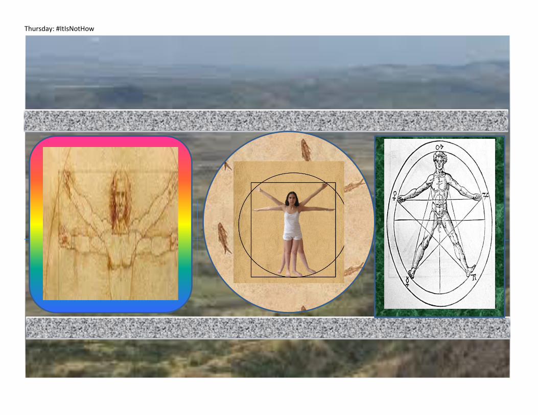
Thursday: #ItIsNotHow
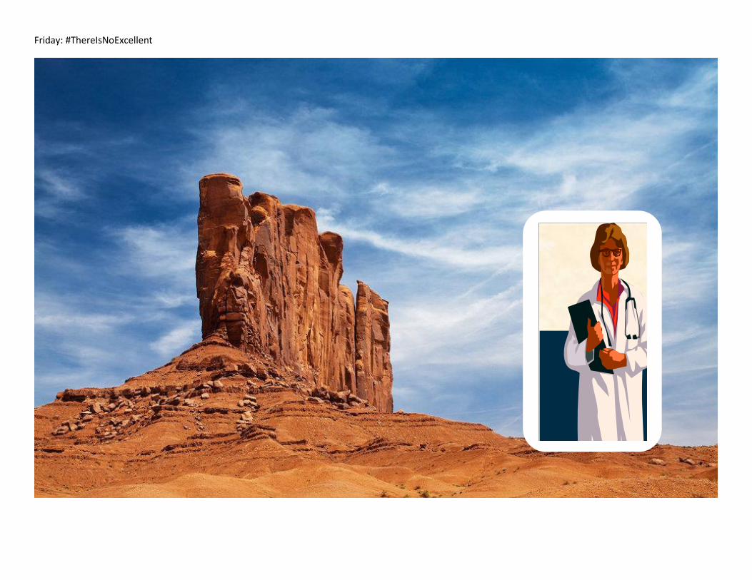
Friday: #ThereIsNoExcellent


![2PART - nust.na Yearbook Part 2... · Ft ement s 2019 [ ii ] NOTE The Yearbook for the Faculty of Management Sciences is valid for 2019 only. Curricula and syllabi may be amended](https://img.pdfslide.net/doc/110x75/5e0ac0a92864aa4cb35f5f49/2part-nustna-yearbook-part-2-ft-ement-s-2019-ii-note-the-yearbook-for.jpg)