Embed Size (px)
Citation preview
Introduction to AP Human
Geography
Introductory Questions
1) Why do students study geography? (3
examples)
2) How does geography affect your life? (3
examples)
3) How would your life be different if you
lived in Japan? (3 examples)
Intro. Cont..
I. In this course, we will examine why different areas have developed differently in terms of culture, economics, politics, and urban development.
II. Geography is a means to understand why certain areas are similar to and different from each other. Human geography in particular, helps us to focus on “how the world is and how it might be.”
III. Geography is a means to understand why certain areas are similar to and different from each other. Human geography in particular, helps us to focus on “how the world is and how it might be.”
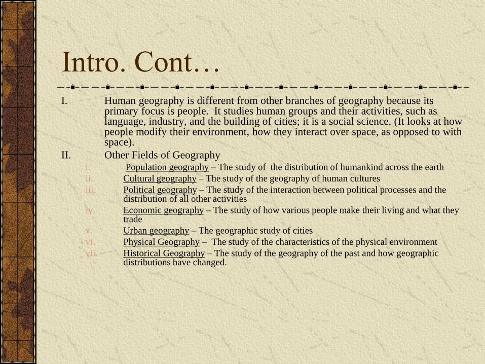
Intro. Cont… I. Human geography is different from other branches of geography because its
primary focus is people. It studies human groups and their activities, such as language, industry, and the building of cities; it is a social science. (It looks at how people modify their environment, how they interact over space, as opposed to with space).
II. Other Fields of Geography i. Population geography – The study of the distribution of humankind across the earth
ii. Cultural geography – The study of the geography of human cultures
iii. Political geography – The study of the interaction between political processes and the distribution of all other activities
iv. Economic geography – The study of how various people make their living and what they trade
v. Urban geography – The geographic study of cities
vi. Physical Geography – The study of the characteristics of the physical environment
vii. Historical Geography – The study of the geography of the past and how geographic distributions have changed.
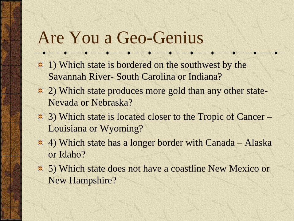
Are You a Geo-Genius
1) Which state is bordered on the southwest by the
Savannah River- South Carolina or Indiana?
2) Which state produces more gold than any other state-
Nevada or Nebraska?
3) Which state is located closer to the Tropic of Cancer –
Louisiana or Wyoming?
4) Which state has a longer border with Canada – Alaska
or Idaho?
5) Which state does not have a coastline New Mexico or
New Hampshire?
Chapter 1
Introduction to Geography
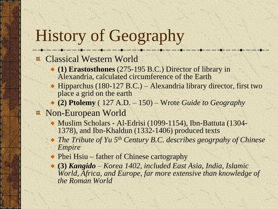
History of Geography
Classical Western World (1) Erastosthones (275-195 B.C.) Director of library in Alexandria, calculated circumference of the Earth
Hipparchus (180-127 B.C.) – Alexandria library director, first two place a grid on the earth
(2) Ptolemy ( 127 A.D. – 150) – Wrote Guide to Geography
Non-European World Muslim Scholars - Al-Edrisi (1099-1154), Ibn-Battuta (1304-1378), and Ibn-Khaldun (1332-1406) produced texts
The Tribute of Yu 5th Century B.C. describes geogrpahy of Chinese Empire
Phei Hsiu – father of Chinese cartography
(3) Kangido – Korea 1402, included East Asia, India, Islamic World, Africa, and Europe, far more extensive than knowledge of the Roman World
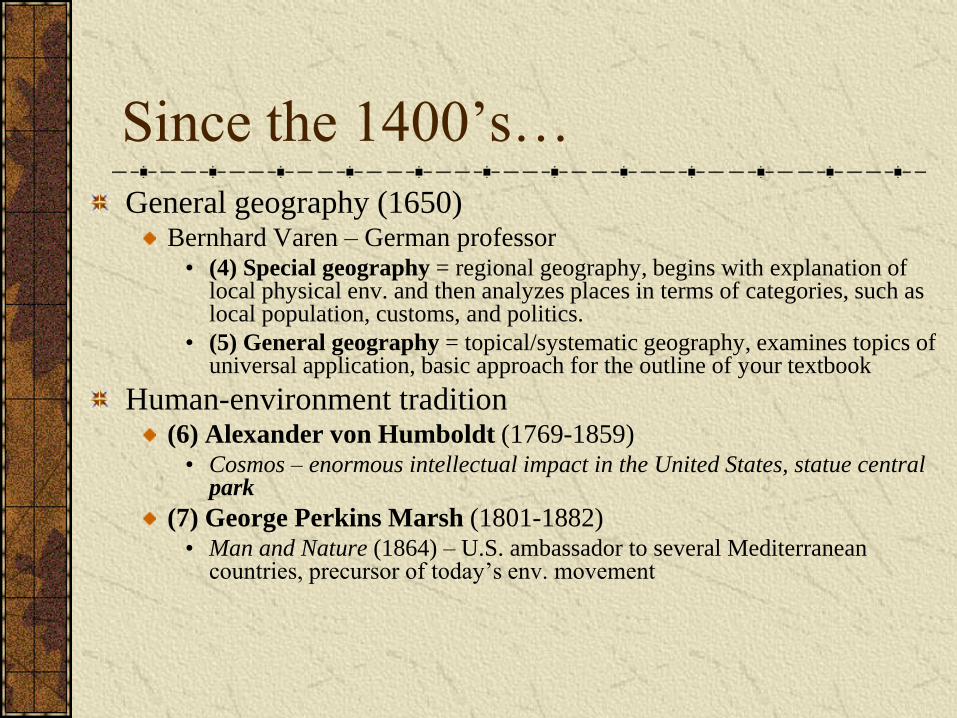
Since the 1400’s…
General geography (1650) Bernhard Varen – German professor
• (4) Special geography = regional geography, begins with explanation of local physical env. and then analyzes places in terms of categories, such as local population, customs, and politics.
• (5) General geography = topical/systematic geography, examines topics of universal application, basic approach for the outline of your textbook
Human-environment tradition (6) Alexander von Humboldt (1769-1859)
• Cosmos – enormous intellectual impact in the United States, statue central park
(7) George Perkins Marsh (1801-1882) • Man and Nature (1864) – U.S. ambassador to several Mediterranean
countries, precursor of today’s env. movement
“The information that any citizen
needs in order to make an
informed decision on an
important question of the day is
largely geographic.”
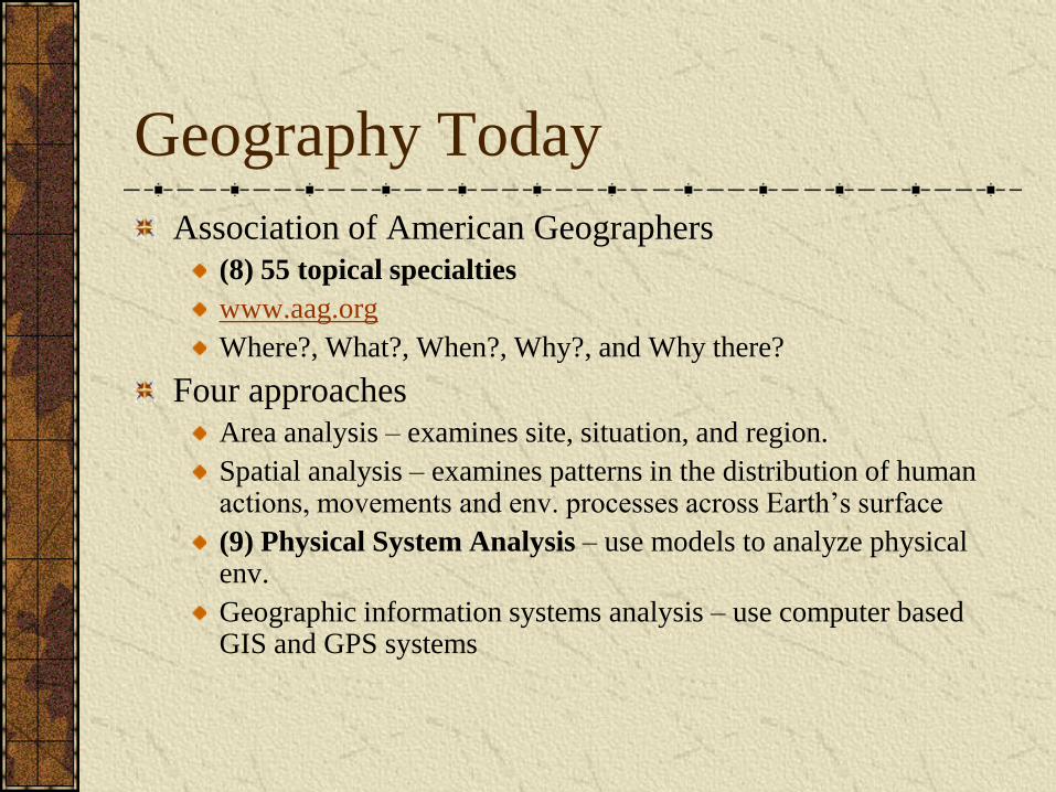
Geography Today
Association of American Geographers
(8) 55 topical specialties
www.aag.org
Where?, What?, When?, Why?, and Why there?
Four approaches
Area analysis – examines site, situation, and region.
Spatial analysis – examines patterns in the distribution of human actions, movements and env. processes across Earth’s surface
(9) Physical System Analysis – use models to analyze physical env.
Geographic information systems analysis – use computer based GIS and GPS systems
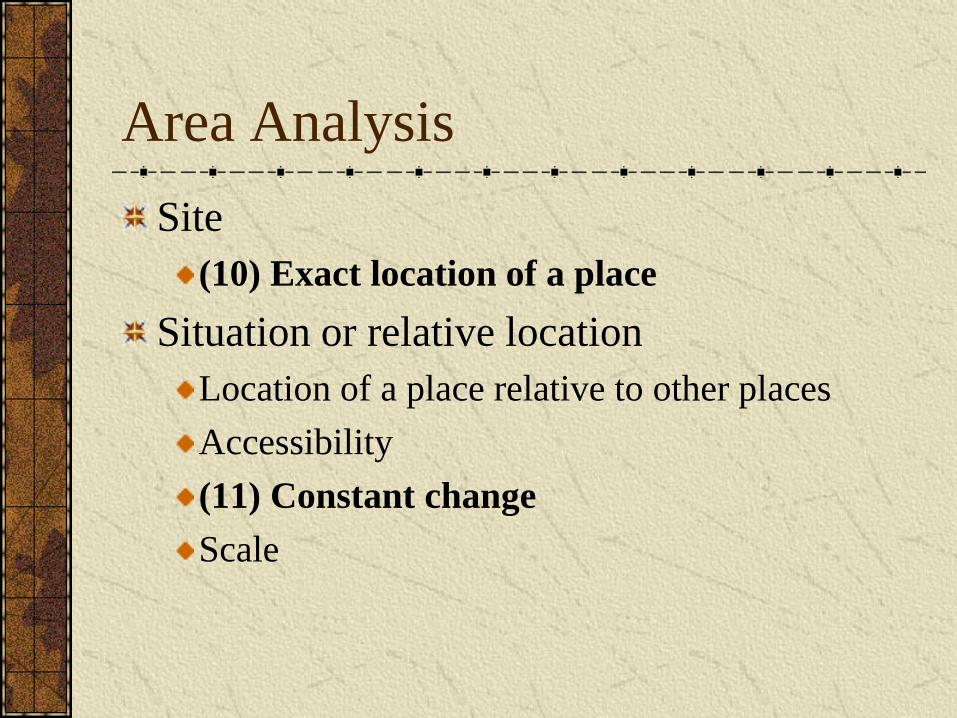
Area Analysis
Site
(10) Exact location of a place
Situation or relative location
Location of a place relative to other places
Accessibility
(11) Constant change
Scale
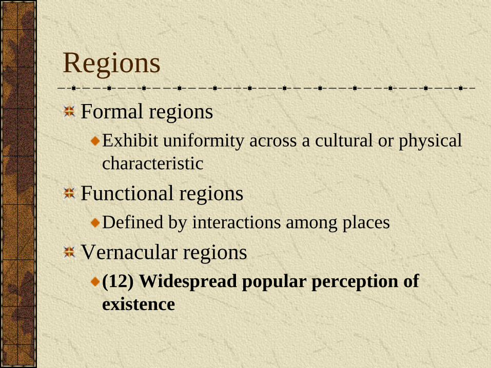
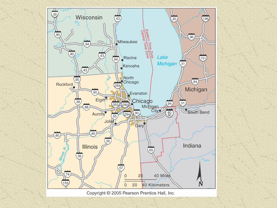
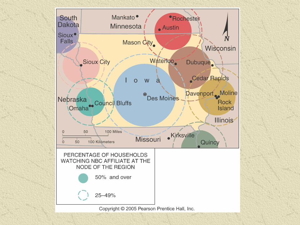
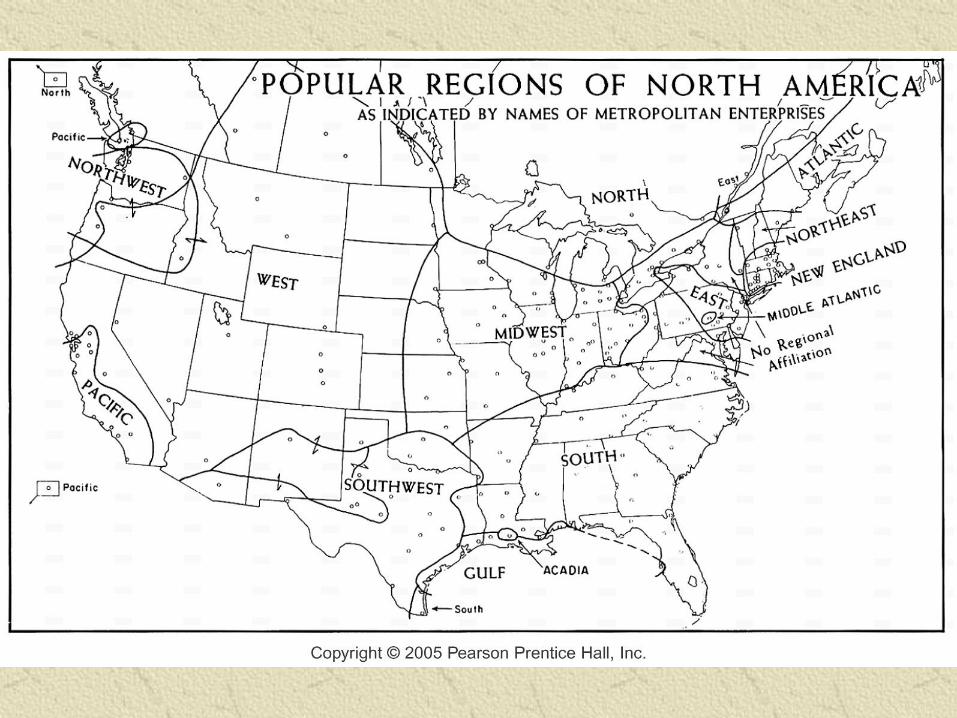
Regions
Formal regions
Exhibit uniformity across a cultural or physical
characteristic
Functional regions
Defined by interactions among places
Vernacular regions
(12) Widespread popular perception of
existence
Spatial Analysis
Distribution – the distribution of a phenomenon
means its position, placement or arrangement
throughout space
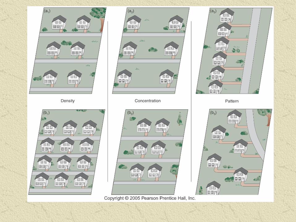
Three properties of distribution
(13) Density – describes the frequency of occurrence of
a phenomenon in relation to a geographic area (fig. 1-
11)
Concentration – refers to the distribution of a
phenomenon within a given area
(14) Pattern – geometrical arrangement of objects in
an area
Movement
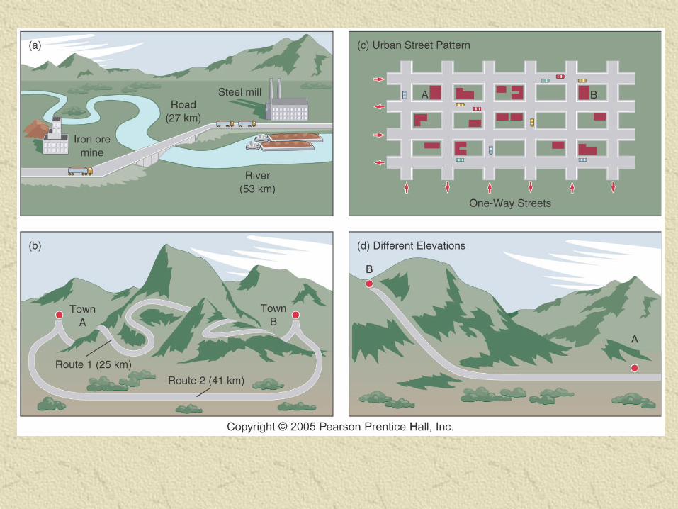
Distance – Interaction of people and places across distance
Measurements (several ways to measure)
• (15) Absolute – measured in terms of miles or kilometers
• Time – i.e. something is 20 minutes away
• Cost – monetary amount required to overcome a distance (explains importance of water to growth of cities)
(16) Friction of distance – effort to overcome distance when we transport items
Distance decay
As distance increases, importance of a particular phenomena decreases
• Ex. Newspaper circulation
Three Types of Diffusion
(17) Relocation diffusion – i.e. a nomadic tribe relocating
Contiguous diffusion – occurs from one place directly to another place
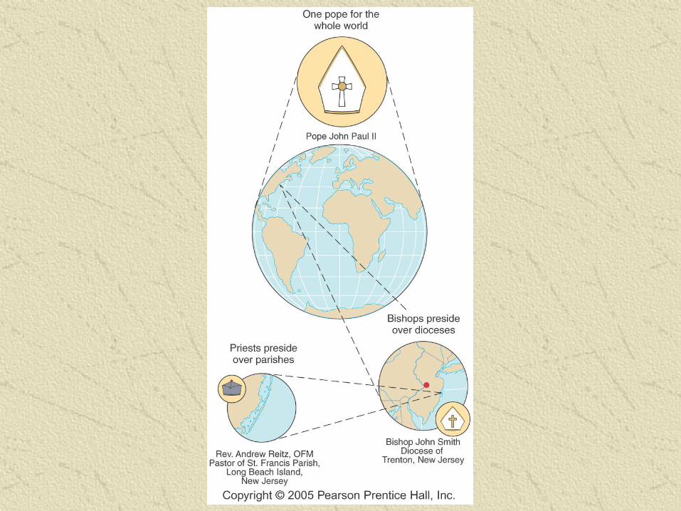
(18) Hierarchical diffusion – upward or downward in an organization (Roman Catholic Church)
Barriers to diffusion
Cultural barriers
• Oceans, deserts, distance, time
• Political boundaries, cultural differences
4 Physical Systems
Atmosphere (air) –surrounding Earth to an altitude of less than 300 miles (lower atm. pure air is 78% N and 21% O)
(19) Lithosphere (Earth’s solid rocks) – consists of Earth’s crust and a portion of upper mantle directly below the crust, extending down 45 miles
Hydrosphere (water) – surface water, vapor in the atmosphere, ice in glaciers, and groundwater in soil and rock
(20) Biosphere - living organisms on Earth
Human-Environmental
Interaction
(21) Reciprocal interaction – env. affects human life and cultures and humans alter the env.
Culture
Everything about the way people live: language, food, religion, social ceremonies
(22) Natural landscapes
Without evidence of human activity
Cultural landscapes
Reveals how humans modify local environment
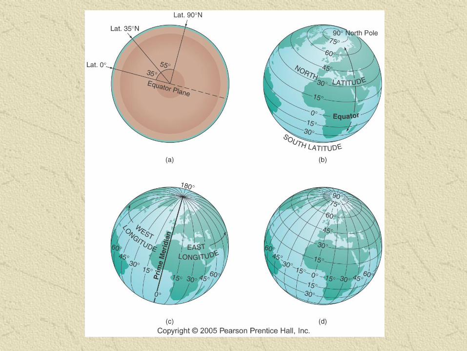
The Geographic Grid
Longitude
Measures distance east to west around the globe beginning at the Prime Meridian
Prime Meridian – 0 Degree
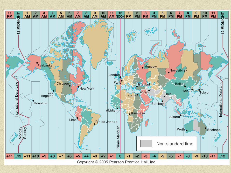
International Date Line – see figure 1-19
0-180 degrees East or West
(23) Greenwich Mean Time
Latitude
Location on the Earth’s surface between the equator and either the north or south pole
(24) Parallels – lines connecting all points at the same latitude
0-90 degrees North or South
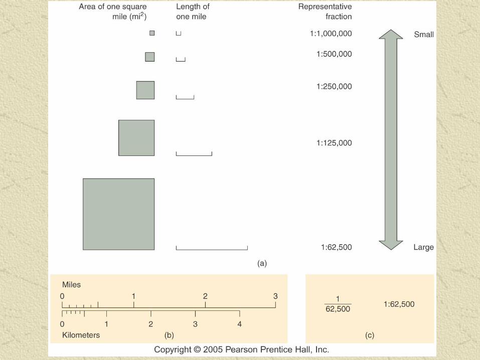
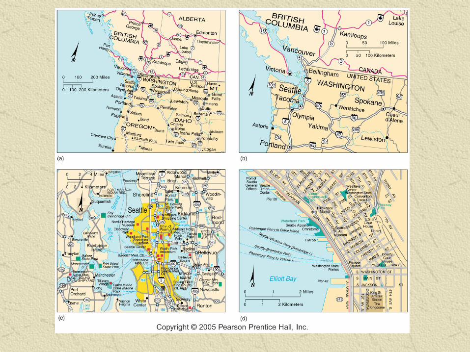
Map Making
Cartography
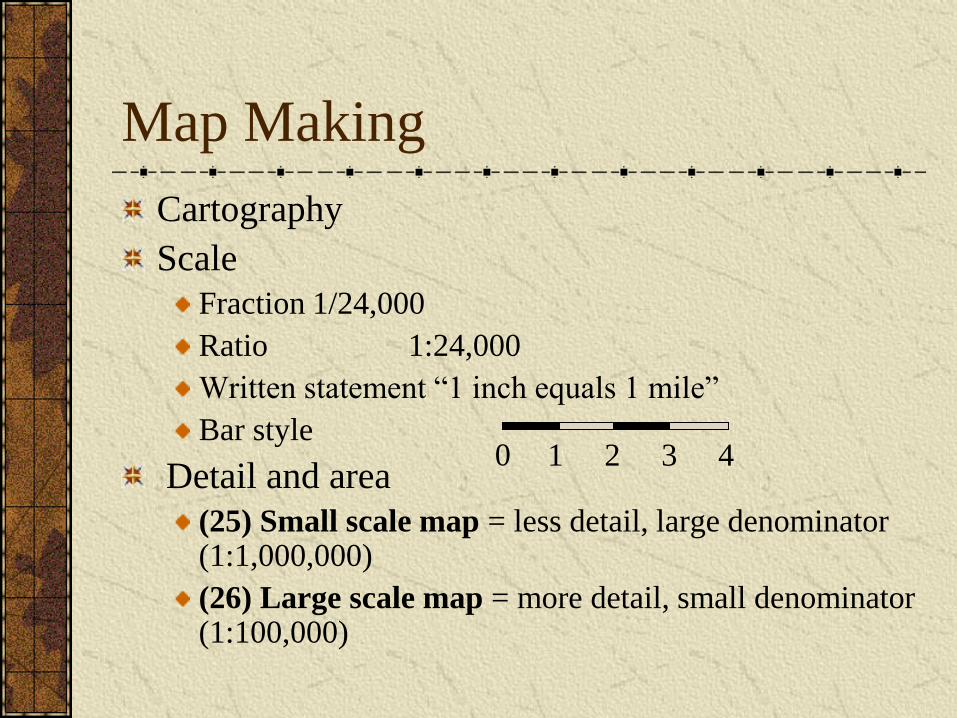
Scale
Fraction 1/24,000
Ratio 1:24,000
Written statement “1 inch equals 1 mile”
Bar style
Detail and area
(25) Small scale map = less detail, large denominator (1:1,000,000)
(26) Large scale map = more detail, small denominator (1:100,000)
0 1 2 4 3
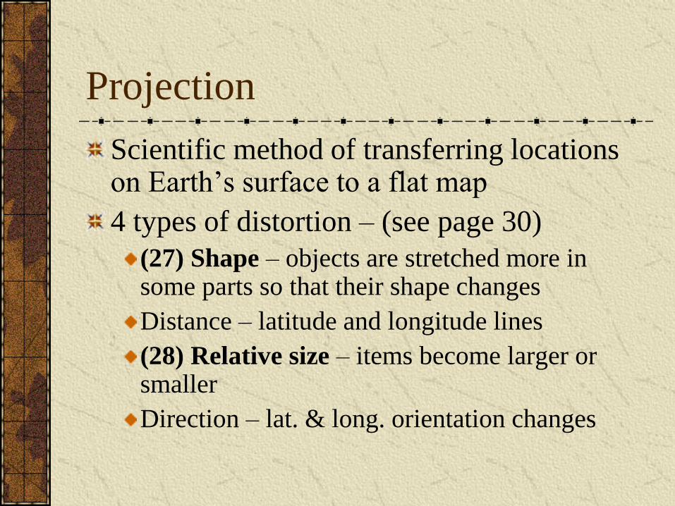
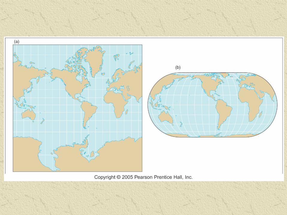
Projection
Scientific method of transferring locations on Earth’s surface to a flat map
4 types of distortion – (see page 30)
(27) Shape – objects are stretched more in some parts so that their shape changes
Distance – latitude and longitude lines
(28) Relative size – items become larger or smaller
Direction – lat. & long. orientation changes
Geographic Information
Technology
Automated cartography
Manual techniques - expensive
(29) Computer Assisted Drawing (CAD)
• Sophisticated, specialized digital cartography
systems
• Easier, cheaper editing
• Also used for product design, i.e. Cannondale
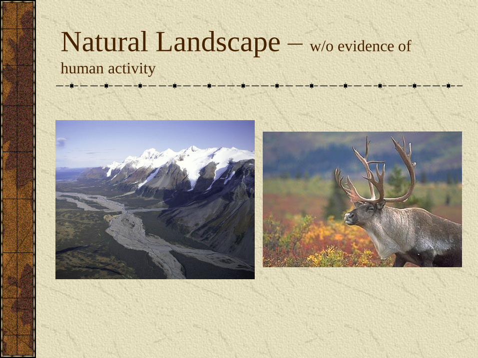
Natural Landscape – w/o evidence of
human activity
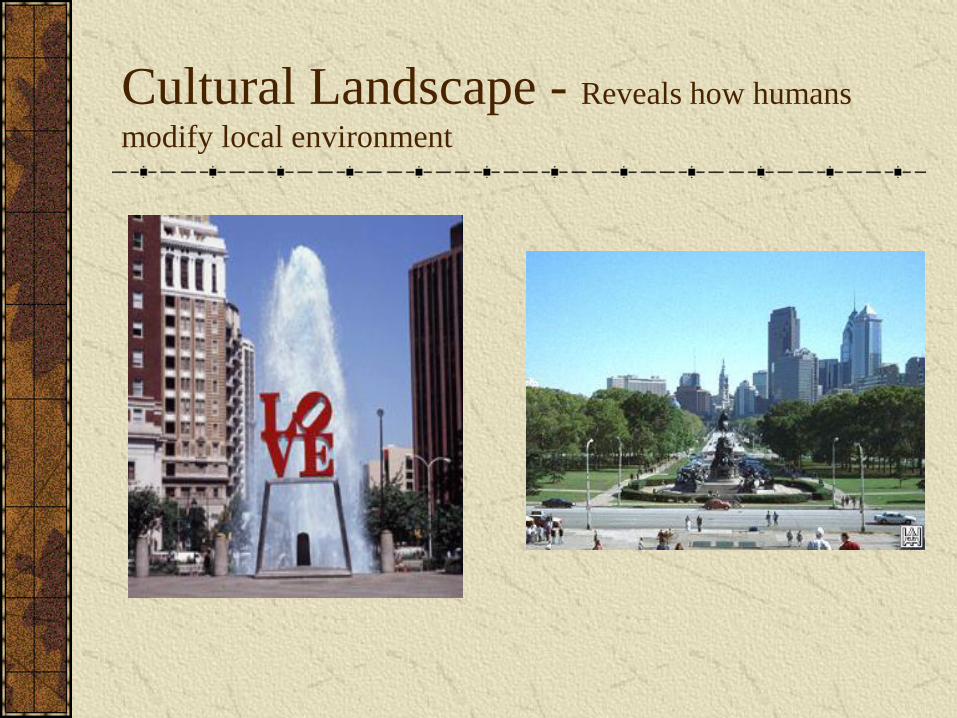
Cultural Landscape - Reveals how humans
modify local environment
Questions:
1) When does an area become a cultural
landscape and stop becoming a natural
landscape?
2) Are all landscapes cultural landscapes?
3) How much of land in the U.S. should be
preserved?
Accessibility – can be as valuable as
mineral deposits or fertile soil
Accessibility Survey
1. How accessible is NYC? Philadelphia? Tanzania?
2. How accessible are your teachers?
3. How accessible are you, can your friends easily
contact you?
4. How might your answers have been different
50 years ago?
5. What are the positives and negatives of increased
accessibility?
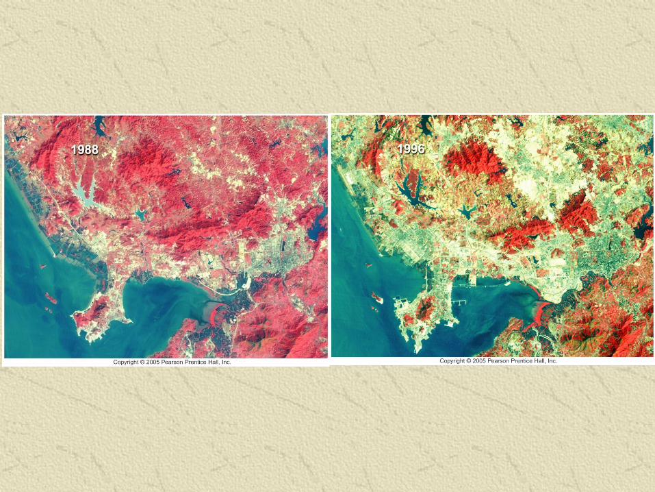
Remote Sensing
Acquisition of data about Earth’s
surface from a satellite orbiting the
planet or from high-flying aircraft
Satellites
(30) Landsat – see page 35
First launch 1972; most recent launch 1999
Sensors measure radiation of colors of visible light
Pixel size at first (resolution): 59 x 59 meters
IKONOS resolution now: 1.5 x 1.5 meters
Weather satellites
Very large pixels – cover several kilometers on a side
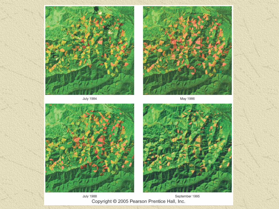
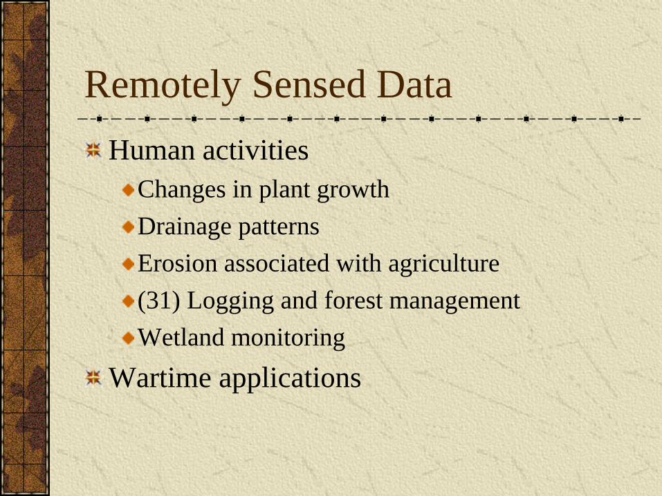
Remotely Sensed Data
Human activities
Changes in plant growth
Drainage patterns
Erosion associated with agriculture
(31) Logging and forest management
Wetland monitoring
Wartime applications
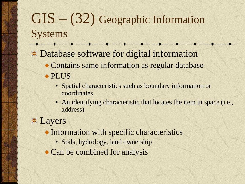
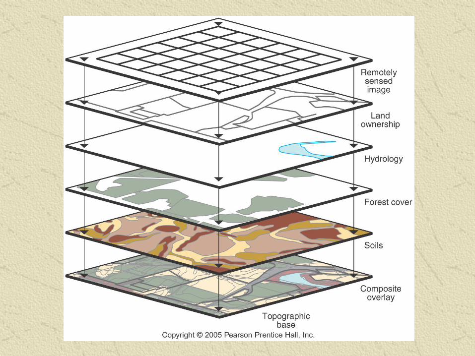
GIS – (32) Geographic Information
Systems
Database software for digital information
Contains same information as regular database
PLUS
• Spatial characteristics such as boundary information or coordinates
• An identifying characteristic that locates the item in space (i.e., address)
Layers
Information with specific characteristics
• Soils, hydrology, land ownership
Can be combined for analysis
Digital Geographic Information
(33) Raster
Grid cells of data
• Remote sensing images
• Pixels
(34) Vector
Point, line, polygon data
X and Y coordinates
Different uses and spatial accuracies
Digital Data
Conversion of paper to digital formats
Digital database creation
Remote sensing images
Digitizing
• Tracing lines
Available types of data
(35) Topographic maps
• DRG and DLG
US Fish and Wildlife Service National Wetlands Inventory
Census Bureau TIGER files
GIS Spatial Analysis
Calculating densities and distribution of
population
“Counting” lakes
Monitoring environmental changes with
satellite images
Analyzing changes in (36) food production
and land use
End of Chapter 1
Chapter 1 Vocab.
Space-time compression – the reduction in the time it takes for something to reach another place
Hearth – the place where an innovation originates
Expansion diffusion – spread of features from one place to another
Contagious diffusion – rapid widespread diffusion throughout a population, for example a disease
Stimulus diffusion – spread of an underlying principle, like the use of Windows
Uneven Development – Increasing economic gap between regions in the core and periphery as a result of globalization
Chapter 1 Vocab. Cont..
Transnational Corporation – multinational corp. operates factories and sells products in many factories
Polder – piece of land created from draining water
Cultural Ecology – geographic study of human-environment relationships
Environmental Determinism – Human environment causes social development
Possibilism – People have the ability to adjust to their environment
MDCS and LDCs
Culture – body of customary beliefs, material traits and social forms that constitute a distinct group
Chapter 1 Vocab. Cont..
Regions
Formal
Functional
Regional