Embed Size (px)
Citation preview
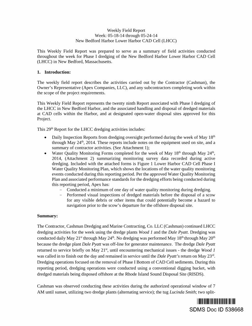
Weekly Field Report Week: 05-18-14 through 05-24-14
New Bedford Harbor Lower Harbor CAD Cell (LHCC)
This Weekly Field Report was prepared to serve as a summary of field activities conducted throughout the week for Phase I dredging of the New Bedford Harbor Lower Harbor CAD Cell (LHCC) in New Bedford, Massachusetts. 1. Introduction:
The weekly field report describes the activities carried out by the Contractor (Cashman), the Owner’s Representative (Apex Companies, LLC), and any subcontractors completing work within the scope of the project requirements. This Weekly Field Report represents the twenty ninth Report associated with Phase I dredging of the LHCC in New Bedford Harbor, and the associated handling and disposal of dredged materials at CAD cells within the Harbor, and at designated open-water disposal sites approved for this Project. This 29th Report for the LHCC dredging activities includes:
• Daily Inspection Reports from dredging oversight performed during the week of May 18th through May 24th, 2014. These reports include notes on the equipment used on site, and a summary of contractor activities. (See Attachment 1);
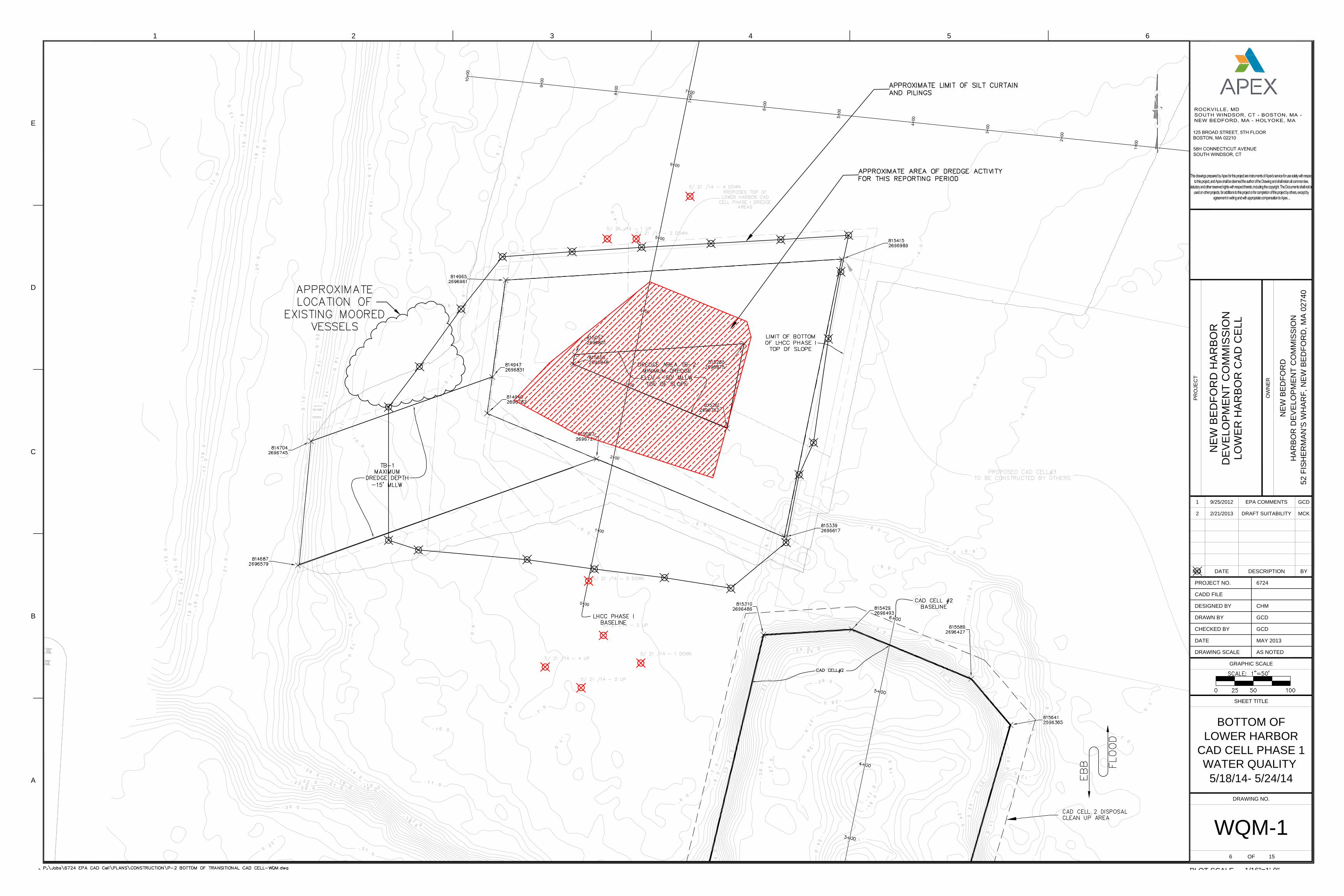
• Water Quality Monitoring Forms completed for the week of May 18th through May 24th, 2014, (Attachment 2) summarizing monitoring survey data recorded during active dredging. Included with the attached forms is Figure 1 Lower Harbor CAD Cell Phase I Water Quality Monitoring Plan, which shows the locations of the water quality monitoring events conducted during this reporting period. Per the approved Water Quality Monitoring Plan and associated performance standards for the dredging efforts being conducted during this reporting period, Apex has:
- Conducted a minimum of one day of water quality monitoring during dredging. - Performed visual inspections of dredged materials before the disposal of a scow
for any visible debris or other items that could potentially become a hazard to navigation prior to the scow’s departure for the offshore disposal site.
Summary:
The Contractor, Cashman Dredging and Marine Contracting, Co. LLC (Cashman) continued LHCC dredging activities for the week using the dredge plants Wood 1 and the Dale Pyatt. Dredging was conducted daily May 21st through May 24th. No dredging was performed May 18th through May 20th because the dredge plant Dale Pyatt was off-line for generator maintenance. The dredge Dale Pyatt returned to service briefly on May 21st, until encountering mechanical issues - the dredge Wood 1 was called in to finish out the day and remained in service until the Dale Pyatt’s return on May 23rd. Dredging operations focused on the removal of Phase I Bottom of CAD Cell sediments. During this reporting period, dredging operations were conducted using a conventional digging bucket, with dredged materials being disposed offshore at the Rhode Island Sound Disposal Site (RISDS). Cashman was observed conducting these activities during the authorized operational window of 7 AM until sunset, utilizing two dredge plants (alternating service); the tug Lucinda Smith; two split-
Weekly Monitoring Report Week of May 18 – May 24 Lower Harbor CAD Cell
hull scows - Mighty Quinn, and the M.E.R.C Shevlin, with capacities of 3800, and 4800 cubic yards, respectively; along with two small utility boats. With time of year restrictions currently in place (January 15th through June 15th) all dredging activities were conducted within a silt curtain perimeter surrounding the LHCC footprint. 2. Operational Notes: Dredging: Dredging of LHCC Phase I Bottom of CAD sediments continued during the week. Apex conducted one day of regular dredge turbidity monitoring. Monitoring was performed May 21st while dredging was being performed to ensure that these activities did not result in any exceedance of project-specific water quality standards. Offshore Disposal: Offshore disposal for LHCC Phase I Bottom of CAD sediments is scheduled and permitted for the Rhode Island Sound Disposal Site. Three offshore disposal events were recorded during the week as follows – scow Mighty Quinn (May 23rd), and the scow M.E.R.C Shevlin (May 22nd and 24th).
Table 1 – Cumulative Dredging Progress
Period of Activity Volume (cy) Approximate Top of CAD Volume Dredged to Date 24,890 Approximate Bottom of CAD Volume Dredged this Reporting Period* 4,785 Approximate Bottom of CAD Volume Dredged to Date* 80,005
* Dredge volume quantities are estimated based on observed scow draft marks and an assumed density of the materials dredged. Scows may contain varying amounts of water along with the dredge materials, thereby influencing the scow draft marks and projected volumes. Given the uncertainty in the density of a composite mix of sediments being dredged, all volumes are confirmed and adjusted as necessary using bathymetric survey data. 3. Monitoring Summary
There were no water quality exceedances observed during this reporting period related to dredging operations. Turbidity monitoring was performed, however since there were no exceedances, no water quality samples were collected for chemical analysis. Prepared by: Apex Companies, LLC
John B. McAllister, P.E. Donald Boyé Senior Project Engineer Senior Project Manager

Weekly Monitoring Report Week of May 18 – May 24 Lower Harbor CAD Cell
Attachment 1 Daily Inspection Reports
City of New Bedford Harbor Development CommissionNew Bedford Harbor USEPA Lower Harbor CAD Cell
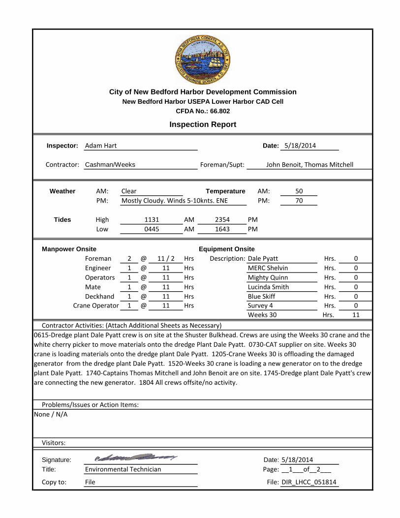
Inspector: Adam Hart Date: 5/18/2014
Contractor: Cashman/Weeks Foreman/Supt:
Weather AM: Temperature AM: 50PM: PM: 70
Tides High AM 2354 PMLow AM 1643 PM
Manpower Onsite Equipment OnsiteForeman 2 @ 11 / 2 Hrs Description: Dale Pyatt Hrs. 0Engineer 1 @ 11 Hrs MERC Shelvin Hrs. 0Operators 1 @ 11 Hrs Mighty Quinn Hrs. 0Mate 1 @ 11 Hrs Lucinda Smith Hrs. 0Deckhand 1 @ 11 Hrs Blue Skiff Hrs. 0
Crane Operator 1 @ 11 Hrs Survey 4 Hrs. 0Weeks 30 Hrs. 11
Contractor Activities: (Attach Additional Sheets as Necessary)
Problems/Issues or Action Items:
Visitors:
Signature: Date: 5/18/2014Title: Environmental Technician Page:
Copy to: File File: DIR_LHCC_051814
__1___of__2___
CFDA No.: 66.802
Inspection Report
11310445
Clear
0615-Dredge plant Dale Pyatt crew is on site at the Shuster Bulkhead. Crews are using the Weeks 30 crane and the white cherry picker to move materials onto the dredge Plant Dale Pyatt. 0730-CAT supplier on site. Weeks 30 crane is loading materials onto the dredge plant Dale Pyatt. 1205-Crane Weeks 30 is offloading the damaged generator from the dredge plant Dale Pyatt. 1520-Weeks 30 crane is loading a new generator on to the dredge plant Dale Pyatt. 1740-Captains Thomas Mitchell and John Benoit are on site. 1745-Dredge plant Dale Pyatt's crew are connecting the new generator. 1804 All crews offsite/no activity.
None / N/A
John Benoit, Thomas Mitchell
Mostly Cloudy. Winds 5-10knts. ENE
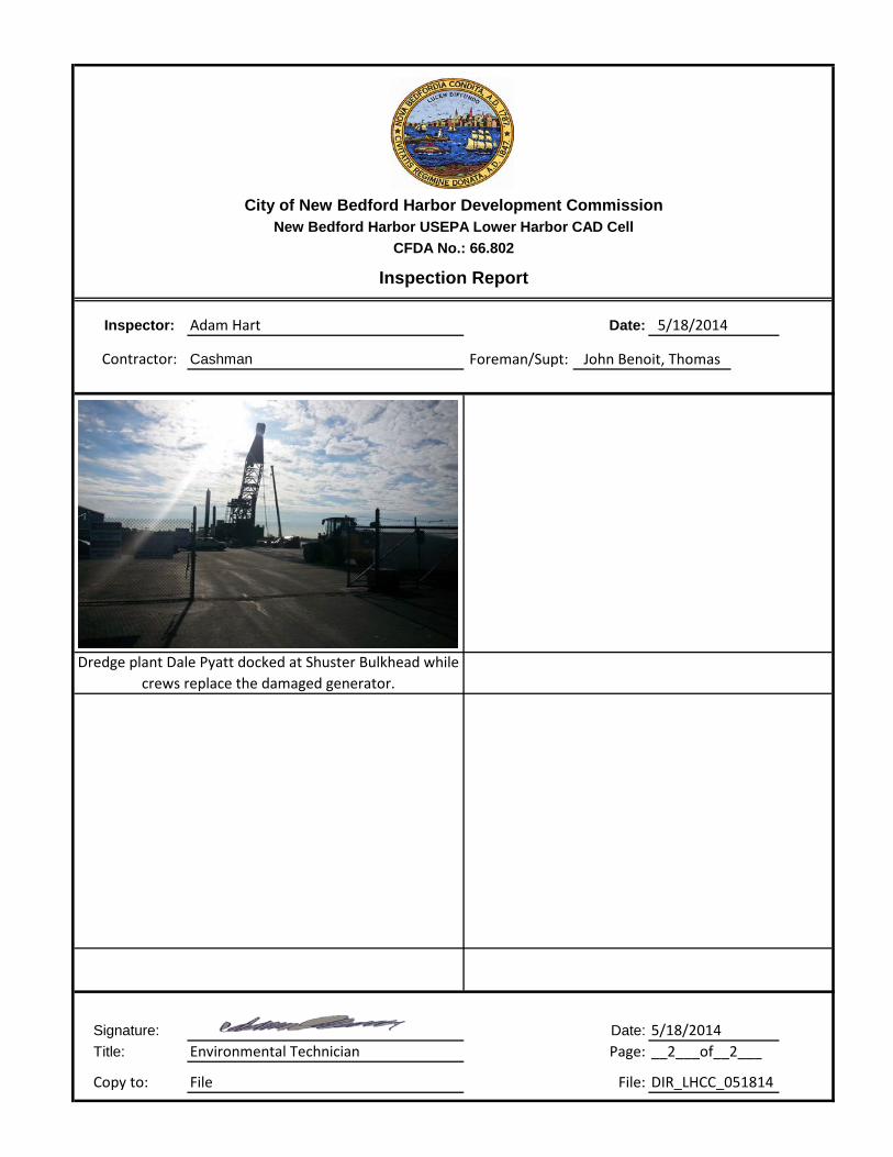
City of New Bedford Harbor Development CommissionNew Bedford Harbor USEPA Lower Harbor CAD Cell
Inspector: Adam Hart Date: 5/18/2014
Contractor: Cashman Foreman/Supt:
Signature: Date: 5/18/2014Title: Environmental Technician Page:
Copy to: File File: DIR_LHCC_051814
__2___of__2___
Dredge plant Dale Pyatt docked at Shuster Bulkhead while crews replace the damaged generator.
CFDA No.: 66.802
Inspection Report
John Benoit, Thomas
City of New Bedford Harbor Development CommissionNew Bedford Harbor USEPA Lower Harbor CAD Cell
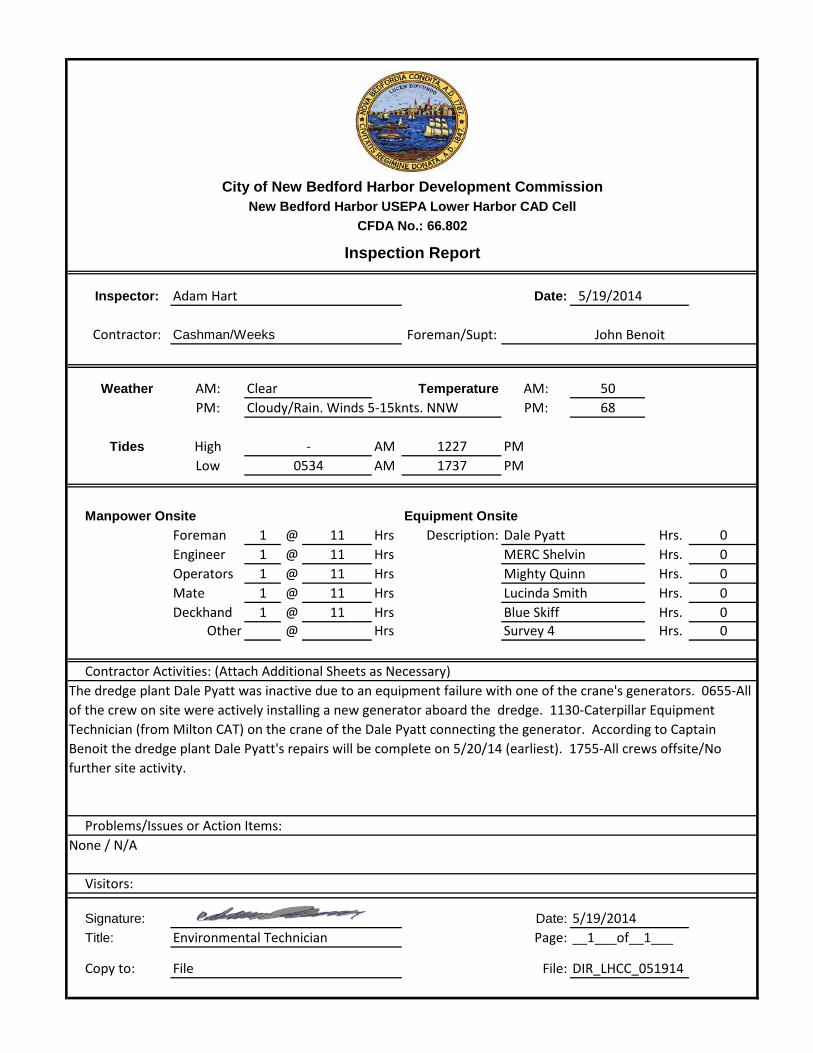
Inspector: Adam Hart Date: 5/19/2014
Contractor: Cashman/Weeks Foreman/Supt:
Weather AM: Temperature AM: 50PM: PM: 68
Tides High AM 1227 PMLow AM 1737 PM
Manpower Onsite Equipment OnsiteForeman 1 @ 11 Hrs Description: Dale Pyatt Hrs. 0Engineer 1 @ 11 Hrs MERC Shelvin Hrs. 0Operators 1 @ 11 Hrs Mighty Quinn Hrs. 0Mate 1 @ 11 Hrs Lucinda Smith Hrs. 0Deckhand 1 @ 11 Hrs Blue Skiff Hrs. 0
Other @ Hrs Survey 4 Hrs. 0
Contractor Activities: (Attach Additional Sheets as Necessary)
Problems/Issues or Action Items:
Visitors:
Signature: Date: 5/19/2014Title: Environmental Technician Page:
Copy to: File File: DIR_LHCC_051914
__1___of__1___
CFDA No.: 66.802
Inspection Report
-0534
Clear
The dredge plant Dale Pyatt was inactive due to an equipment failure with one of the crane's generators. 0655-All of the crew on site were actively installing a new generator aboard the dredge. 1130-Caterpillar Equipment Technician (from Milton CAT) on the crane of the Dale Pyatt connecting the generator. According to Captain Benoit the dredge plant Dale Pyatt's repairs will be complete on 5/20/14 (earliest). 1755-All crews offsite/No further site activity.
None / N/A
John Benoit
Cloudy/Rain. Winds 5-15knts. NNW
City of New Bedford Harbor Development CommissionNew Bedford Harbor USEPA Lower Harbor CAD Cell
Inspector: Adam Hart Date: 5/20/2014
Contractor: Cashman/Weeks Foreman/Supt:
Weather AM: Temperature AM: 46PM: PM: 70
Tides High AM 1326 PMLow AM 1843 PM
Manpower Onsite Equipment OnsiteForeman 1 @ 11 Hrs Description: Dale Pyatt Hrs. 0Engineer 1 @ 11 Hrs MERC Shelvin Hrs. 0Operators 1 @ 10 Hrs Mighty Quinn Hrs. 0Mate 1 @ 11 Hrs Lucinda Smith Hrs. 1Deckhand 1 @ 11 Hrs Blue Skiff Hrs. 0
Other @ Hrs Survey 4 Hrs. 0Weeks 30 Hrs. 1
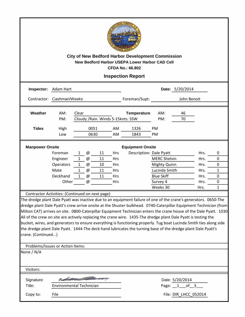
Contractor Activities: (Continued on next page)
Problems/Issues or Action Items:
Visitors:
Signature: Date: 5/20/2014Title: Environmental Technician Page:
Copy to: File File: DIR_LHCC_052014
__1___of__3___
CFDA No.: 66.802
Inspection Report
00510630
Clear
The dredge plant Dale Pyatt was inactive due to an equipment failure of one of the crane's generators. 0650-The dredge plant Dale Pyatt's crew arrive onsite at the Shuster bulkhead. 0740-Caterpillar Equipment Technician (from Milton CAT) arrives on site. 0800-Caterpillar Equipment Technician enters the crane house of the Dale Pyatt. 1030-All of the crew on site are actively replacing the crane wire. 1435-The dredge plant Dale Pyatt is testing the bucket, wires, and generators to ensure everything is functioning properly. Tug boat Lucinda Smith ties along side the dredge plant Dale Pyatt. 1444-The deck hand lubricates the turning base of the dredge plant Dale Pyatt's crane. (Continued...)
None / N/A
John Benoit
Cloudy /Rain. Winds 5-15knts. SSW
City of New Bedford Harbor Development CommissionNew Bedford Harbor USEPA Lower Harbor CAD Cell
Inspector: Adam Hart Date: 5/20/2014
Contractor: Cashman/Weeks Foreman/Supt:
Weather AM: Temperature AM: 46PM: PM: 70
Tides High AM 1326 PMLow AM 1843 PM
Contractor Activities: (Continued from Page 1)
Problems/Issues or Action Items:
Visitors:
Signature: Date: 5/20/2014Title: Environmental Technician Page:
Copy to: File File: DIR_LHCC_052014
0630
None / N/A
__2___of__3___
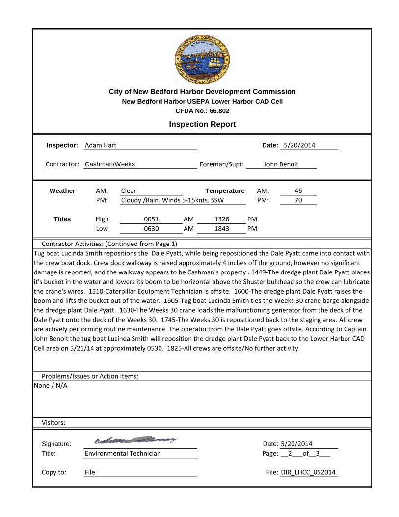
Tug boat Lucinda Smith repositions the Dale Pyatt, while being repositioned the Dale Pyatt came into contact with the crew boat dock. Crew dock walkway is raised approximately 4 inches off the ground, however no significant damage is reported, and the walkway appears to be Cashman's property . 1449-The dredge plant Dale Pyatt places it's bucket in the water and lowers its boom to be horizontal above the Shuster bulkhead so the crew can lubricate the crane's wires. 1510-Caterpillar Equipment Technician is offsite. 1600-The dredge plant Dale Pyatt raises the boom and lifts the bucket out of the water. 1605-Tug boat Lucinda Smith ties the Weeks 30 crane barge alongside the dredge plant Dale Pyatt. 1630-The Weeks 30 crane loads the malfunctioning generator from the deck of the Dale Pyatt onto the deck of the Weeks 30. 1745-The Weeks 30 is repositioned back to the staging area. All crew are actively performing routine maintenance. The operator from the Dale Pyatt goes offsite. According to Captain John Benoit the tug boat Lucinda Smith will reposition the dredge plant Dale Pyatt back to the Lower Harbor CAD Cell area on 5/21/14 at approximately 0530. 1825-All crews are offsite/No further activity.
CFDA No.: 66.802
Inspection Report
John Benoit
Clear
0051
Cloudy /Rain. Winds 5-15knts. SSW
City of New Bedford Harbor Development CommissionNew Bedford Harbor USEPA Lower Harbor CAD Cell
Inspector: Adam Hart Date: 5/20/2014
Contractor: Cashman/Weeks Foreman/Supt:
Signature: Date: 5/20/2014Title: Environmental Technician Page:
Copy to: File File: DIR_LHCC_052014
CFDA No.: 66.802
Inspection Report
John Benoit
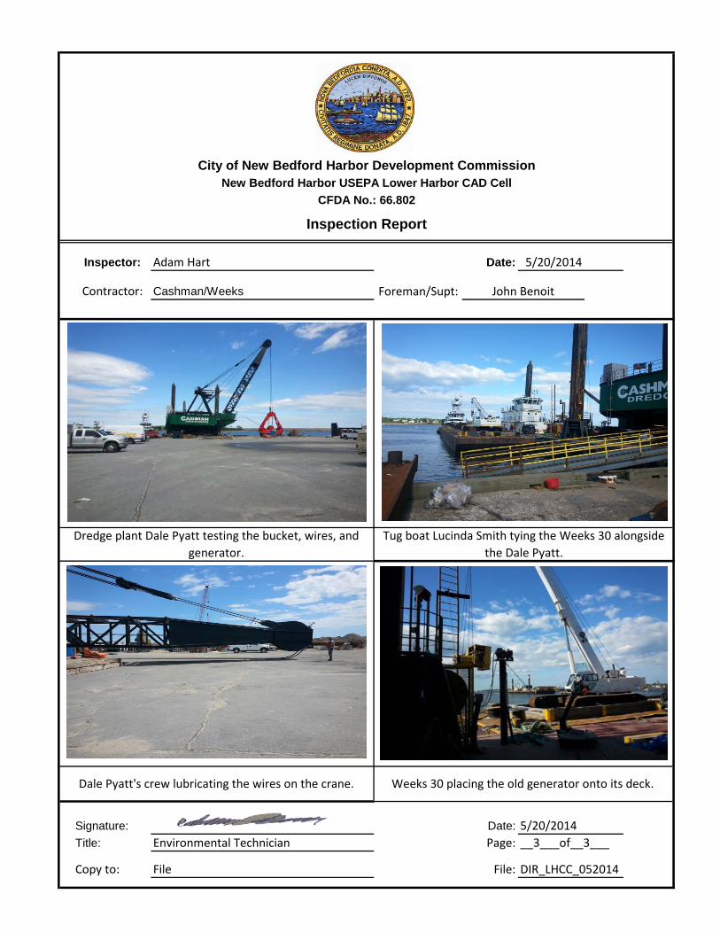
Dale Pyatt's crew lubricating the wires on the crane. Weeks 30 placing the old generator onto its deck.
__3___of__3___
Dredge plant Dale Pyatt testing the bucket, wires, and generator.
Tug boat Lucinda Smith tying the Weeks 30 alongside the Dale Pyatt.

City of New Bedford Harbor Development CommissionNew Bedford Harbor USEPA Lower Harbor CAD Cell
Inspector: Adam Hart Date: 5/21/2014
Contractor: Cashman/Weeks Foreman/Supt:
Weather AM: Temperature AM: 41PM: PM: 70
Tides High AM 1424 PMLow AM 2021 PM
Manpower Onsite Equipment OnsiteForeman 1 @ 11 Hrs Description: Dale Pyatt Hrs. 4Engineer 1 @ 11 Hrs MERC Shevlin Hrs. 11Operators 1 @ 11 Hrs Mighty Quinn Hrs. 4Mate @ Hrs Lucinda Smith Hrs. 6Deckhand 1 @ 11 Hrs Blue Skiff Hrs. 2
Other @ Hrs Wood 1 Hrs. 4
Contractor Activities: (Continued on next page)
Problems/Issues or Action Items:
Visitors:
Signature: Date: 5/21/2014Title: Environmental Technician Page:
Copy to: File File: DIR_LHCC_052114
__1___of__2___
CFDA No.: 66.802
Inspection Report
01500741
Clear
0615-Tug Lucinda Smith and dredge plant Dale Pyatt head north through bridge. 0700-Lucinda Smith has the Dale Pyatt and the scow MERC Shevlin secured inside the silt curtain. 0711-Lucinda Smith heads south. Silt curtain closed and dredging begins at 0737 at coordinates 2696946, 815156. 0900-Dredging into the MERC Shevlin. Lucinda Smith tied off at staging area. 0915-Dredge repositions to 2696048, 815169 and dredging resumes at 0920. 0930-Boom on Dale Pyatt way up, closer wire jumped back, boom wires are completely slack - crew investigating. Apex WQ monitoring boat arrives on site. 0937-Slack pulled out of boom wires - Dale Pyatt reportedly in need of repairs. 0953-Lucinda Smith maneuvers into position to relocate scow MERC Shevlin out of the silt curtained area.
None / N/A
John Benoit
Ptly. Cloudy. Winds 5-15knts. SSE
City of New Bedford Harbor Development CommissionNew Bedford Harbor USEPA Lower Harbor CAD Cell
Inspector: Adam Hart Date: 5/21/2014
Contractor: Cashman/Weeks Foreman/Supt:
Weather AM: Temperature AM: 41PM: PM: 70
Tides High AM 1424 PMLow AM 2021 PM
Contractor Activities: (Continued from Page 1)
Problems/Issues or Action Items:
Visitors:
Signature: Date: 5/21/2014Title: Environmental Technician Page:
Copy to: File File: DIR_LHCC_052114
0741
None / N/A
__2___of__2___
1010-MERC Shevlin brought out of silt curtained area. 1029-Lucinda Smith and MERC Shevlin maneuvering close to location of EPA pipeline - local fishing vessel complicates maneuver by blocking path of tug. 1047-Scow MERC Shevlin tied off to scow Mighty Quinn at staging area. 1055-Lucinda Smith ties off to Dale Pyatt and has her secured at staging area by 1125 - boom is lowered on deck and repairs begin. 1330-Crane barge SEI-30 ties off to Dale Pyatt - boom lowered down on the barge 196. 1503-Lucinda Smith ties off to the dredge Wood 1 and begins transiting to the LHCC; heading north through bridge at 1525. 1545-Wood 1 set in position inside silt curtain. Lucinda Smith retrieves scow MERC Shevlin from staging areas and has it alongside Wood 1 at 1600. 1625-Silt curtain closed. 1627-Wood 1 begins dredging at 2696846, 815032. 1730-Dredging continues. 1735-Dredging stops for the day with plans on resuming in morning with same gear set-up. 1810-Crew departs Wood 1, crew still working on repairs aboard Dale Pyatt. No further activity at LHCC.
CFDA No.: 66.802
Inspection Report
John Benoit
Clear
0150
Ptly. Cloudy. Winds 5-15knts. SSE
City of New Bedford Harbor Development CommissionNew Bedford Harbor USEPA Lower Harbor CAD Cell
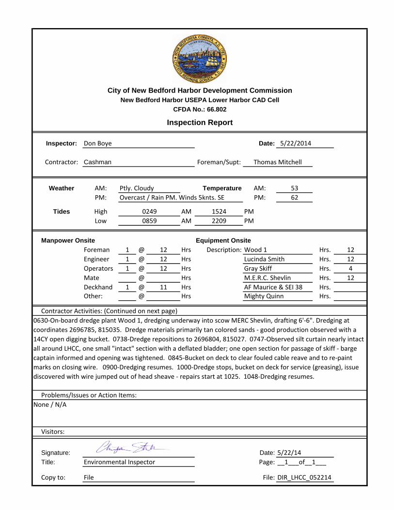
Inspector: Don Boye Date: 5/22/2014
Contractor: Cashman Foreman/Supt:
Weather AM: Temperature AM: 53
PM: PM: 62
Tides High AM 1524 PMLow AM 2209 PM
Manpower Onsite Equipment OnsiteForeman 1 @ 12 Hrs Description: Wood 1 Hrs. 12Engineer 1 @ 12 Hrs Lucinda Smith Hrs. 12Operators 1 @ 12 Hrs Gray Skiff Hrs. 4Mate @ Hrs M.E.R.C. Shevlin Hrs. 12Deckhand 1 @ 11 Hrs AF Maurice & SEI 38 Hrs. Other: @ Hrs Mighty Quinn Hrs.
Contractor Activities: (Continued on next page)
Problems/Issues or Action Items:
Visitors:
Signature: Date: 5/22/14Title: Environmental Inspector Page:
Copy to: File File: DIR_LHCC_052214
__1___of__1___
CFDA No.: 66.802
Inspection Report
02490859
Ptly. Cloudy
Thomas Mitchell
0630-On-board dredge plant Wood 1, dredging underway into scow MERC Shevlin, drafting 6'-6". Dredging at coordinates 2696785, 815035. Dredge materials primarily tan colored sands - good production observed with a 14CY open digging bucket. 0738-Dredge repositions to 2696804, 815027. 0747-Observed silt curtain nearly intact all around LHCC, one small "intact" section with a deflated bladder; one open section for passage of skiff - barge captain informed and opening was tightened. 0845-Bucket on deck to clear fouled cable reave and to re-paint marks on closing wire. 0900-Dredging resumes. 1000-Dredge stops, bucket on deck for service (greasing), issue discovered with wire jumped out of head sheave - repairs start at 1025. 1048-Dredging resumes.
None / N/A
Overcast / Rain PM. Winds 5knts. SE
City of New Bedford Harbor Development CommissionNew Bedford Harbor USEPA Lower Harbor CAD Cell
Inspector: Don Boye Date: 5/22/2014
Contractor: Cashman Foreman/Supt:
Weather AM: Temperature AM: 53PM: PM: 62
Tides High AM 1524 PMLow AM 2209 PM
Contractor Activities: (Continued from Page 1)
Problems/Issues or Action Items:
Visitors:
Signature: Date: 5/22/14Title: Environmental Inspector Page:
Copy to: File File: DIR_LHCC_052214
0859
None / N/A
__2___of__2___
1130-Dredging continues - scow drafting 8' aft and 10' forward. 1200-Dredge stops to reposition to 2696730, 815097. 1225-Dredge stops briefly to repaint marks on closing wire. Observed a small blue skiff with a whale logo circling and taking photographs of dredge. 1238-Dredge repositions to 2696789, 815025 and resumes. 1303-Dredge stops - checking dredge planes, digging slope of cell at an elevation of -27'. Dredge then shifts to 2696797, 815053 to dig in an area further down slope at -37'. 1334-Dredge stops, scow drafting 12' fwd and 9'aft. 1408-Dredge resumes and at 1500 scow drafting 11' fwd and 9-1/2' aft. 1600-Dredge conducts a wash-down of scow now drafting 11'-3" fwd and 10'-2" aft, crew receives direction to keep digging until scow on even keel. 1638-Scow drafting 11' -3" fwd/aft. 1734-Dredge stops for refueling. 1740-Silt curtain opened for passage of gray skiff. 1800-Dredging ends for the day and crew departs. No further activity.
CFDA No.: 66.802
Inspection Report
Thomas Mitchell
Ptly. Cloudy
0249
Overcast / Rain PM. Winds 5knts. SE

City of New Bedford Harbor Development CommissionNew Bedford Harbor USEPA Lower Harbor CAD Cell
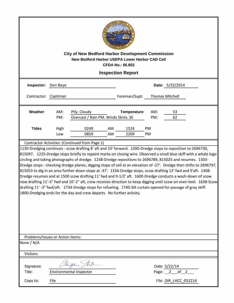
Inspector: Christopher Stillman Date: 5/23/2014
Contractor: Cashman Foreman/Supt:
Weather AM: Temperature AM: 54
PM: PM: 68
Tides High AM 1626 PMLow AM 2314 PM
Manpower Onsite Equipment OnsiteForeman 1 @ 11 Hrs Description: Wood 1 Hrs. 11Engineer @ Hrs Lucinda Smith Hrs. 12Operators 1 @ 11 Hrs Gray Skiff Hrs. 5Mate @ Hrs M.E.R.C. Shevlin Hrs. 0Deckhand 1 @ 11 Hrs AF Maurice & SEI 38 Hrs. Other: @ Hrs Mighty Quinn Hrs. 12
Contractor Activities: (Continued on next page)
Visitors:
Signature: Date: 5/23/14Title: Environmental Inspector Page:
Copy to: File File: DIR_LHCC_052314
__1___of__2___
CFDA No.: 66.802
Inspection Report
03501001
Cloudy, SE 5-10kts
Thomas Mitchell
Partly Cloudy Winds 8-10 knts. SE
0630-Crew headed to the dredge plant Wood 1, split scow Mighty Quinn drafts at 5.5 bow and stern. Three crew: Dredge Captain- Thomas Mitchell, deckhand- Raymond, and Crane Operator- Rick. 0710- Dredge plant takes its first bucket of the day. 0735-Dredge stopped for curtain repairs. 0800-Mitchell and Raymond attempting repairs on east side of the curtain. 0900-Repairs complete, dredge resumes loading the split scow Mighty Quinn. 0920-Dredge stops for a preparation to move towards the southeast. 0926-Dredging resumed at a depth of 12' in cut 1. 0945-Dredge depth 14.25' Fine to medium SAND, some Silt. 0958-Gate open too wide, repairs close it up, dredging resumed. 1105-Location: Dredge bucket position 814966, 2696718 in cut 1 at a depth of 15.77'. 1126-Dredge plant stops dredging to shift to a new position: 814927, 2696711 at cut 1 at a depth of 14.46' 1134-Dredge plant resumes dredging in cut 1 Fine to Medium SAND, some silt at a depth of 12.88'. 1213-Dredge Plant moves to new location at 814893, 2696656 at a depth of 14.68' Brown fine to medium SAND, some Silt. 1240-Dredging stopped.
City of New Bedford Harbor Development CommissionNew Bedford Harbor USEPA Lower Harbor CAD Cell
Inspector: Christopher Stillman Date: 5/23/2014
Contractor: Cashman Foreman/Supt:
Weather AM: Temperature AM: 54PM: PM: 68
Tides High AM 1626 PMLow AM 2314 PM
Contractor Activities: (Continued from Page 1)
Problems/Issues or Action Items:
Visitors:
Signature: Date: 5/23/14Title: Environmental Inspector Page:
Copy to: File File: DIR_LHCC_052314
1001
None / N/A
__2___of__2___
1310-Tug Lucinda Smith makes up to the split scow Mighty Quinn- the dredge plant Wood 1 crabs north into cut 3 while the Tug Lucinda Smith brings the Mighty Quinn alongside the Wood's port side. 1328-Dredging resumes at new cut 3 location: 814938, 2696807- Brown fine to medium SAND with some Silt at a dredge depth of 15.78'. 1400-Dredging stops for a shift to the west to begin dredging down the north entrance channel area of the CAD cell area of cut 3- skiff busy, delaying the move. 1437-Dredging resumes at location 814870, 2696788 in cut 3- stiff fine to medium SAND, with some silt at a dredge depth of 15.65'. 1438-The split scow Mighty Quinn is drafting at 8.5' on the stern and 9' on the bow. 1538- The split scow Mighty Quinn is drafting 9' Fore/Aft. 1540-Dredging stops while the dredge plant Wood 1 moves to the west to finish the entrance channel- new location: 814815, 2696771. 1605-Wood 1 calls for tug to remove Mighty Quinn from curtained area. 1645-Lucinda Smith moves Mighty Quinn to staging area. 1720-Mighty Quinn cleared for offshore disposal. 1725-Lucinda Smith moves Wood 1 to staging area, and at 1755 dredge crew departs. 1852-Lucinda Smith moves dredge plant Dale Pyatt into position at the LHCC. Mighty Quinn slated for offshore disposal tonight. No further activity.
CFDA No.: 66.802
Inspection Report
Thomas Mitchell
Cloudy, SE 5-10kts
0350
Partly Cloudy Winds 8-10 knts. SE
City of New Bedford Harbor Development CommissionNew Bedford Harbor USEPA Lower Harbor CAD Cell
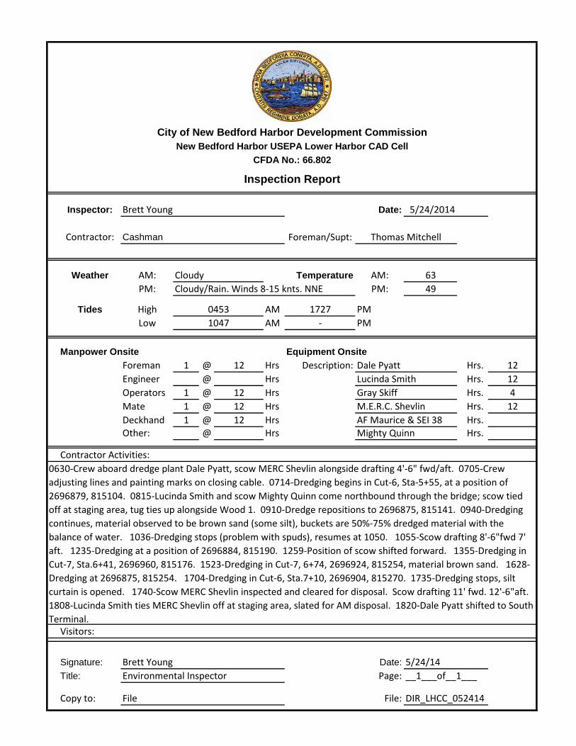
Inspector: Brett Young Date: 5/24/2014
Contractor: Cashman Foreman/Supt:
Weather AM: Temperature AM: 63
PM: PM: 49
Tides High AM 1727 PMLow AM - PM
Manpower Onsite Equipment OnsiteForeman 1 @ 12 Hrs Description: Dale Pyatt Hrs. 12Engineer @ Hrs Lucinda Smith Hrs. 12Operators 1 @ 12 Hrs Gray Skiff Hrs. 4Mate 1 @ 12 Hrs M.E.R.C. Shevlin Hrs. 12Deckhand 1 @ 12 Hrs AF Maurice & SEI 38 Hrs. Other: @ Hrs Mighty Quinn Hrs.
Contractor Activities:
Visitors:
Signature: Brett Young Date: 5/24/14Title: Environmental Inspector Page:
Copy to: File File: DIR_LHCC_052414
__1___of__1___
CFDA No.: 66.802
Inspection Report
04531047
Cloudy
Thomas Mitchell
Cloudy/Rain. Winds 8-15 knts. NNE
0630-Crew aboard dredge plant Dale Pyatt, scow MERC Shevlin alongside drafting 4'-6" fwd/aft. 0705-Crew adjusting lines and painting marks on closing cable. 0714-Dredging begins in Cut-6, Sta-5+55, at a position of 2696879, 815104. 0815-Lucinda Smith and scow Mighty Quinn come northbound through the bridge; scow tied off at staging area, tug ties up alongside Wood 1. 0910-Dredge repositions to 2696875, 815141. 0940-Dredging continues, material observed to be brown sand (some silt), buckets are 50%-75% dredged material with the balance of water. 1036-Dredging stops (problem with spuds), resumes at 1050. 1055-Scow drafting 8'-6"fwd 7' aft. 1235-Dredging at a position of 2696884, 815190. 1259-Position of scow shifted forward. 1355-Dredging in Cut-7, Sta.6+41, 2696960, 815176. 1523-Dredging in Cut-7, 6+74, 2696924, 815254, material brown sand. 1628-Dredging at 2696875, 815254. 1704-Dredging in Cut-6, Sta.7+10, 2696904, 815270. 1735-Dredging stops, silt curtain is opened. 1740-Scow MERC Shevlin inspected and cleared for disposal. Scow drafting 11' fwd. 12'-6"aft. 1808-Lucinda Smith ties MERC Shevlin off at staging area, slated for AM disposal. 1820-Dale Pyatt shifted to South Terminal.

Attachment 2 Water Quality Monitoring Forms
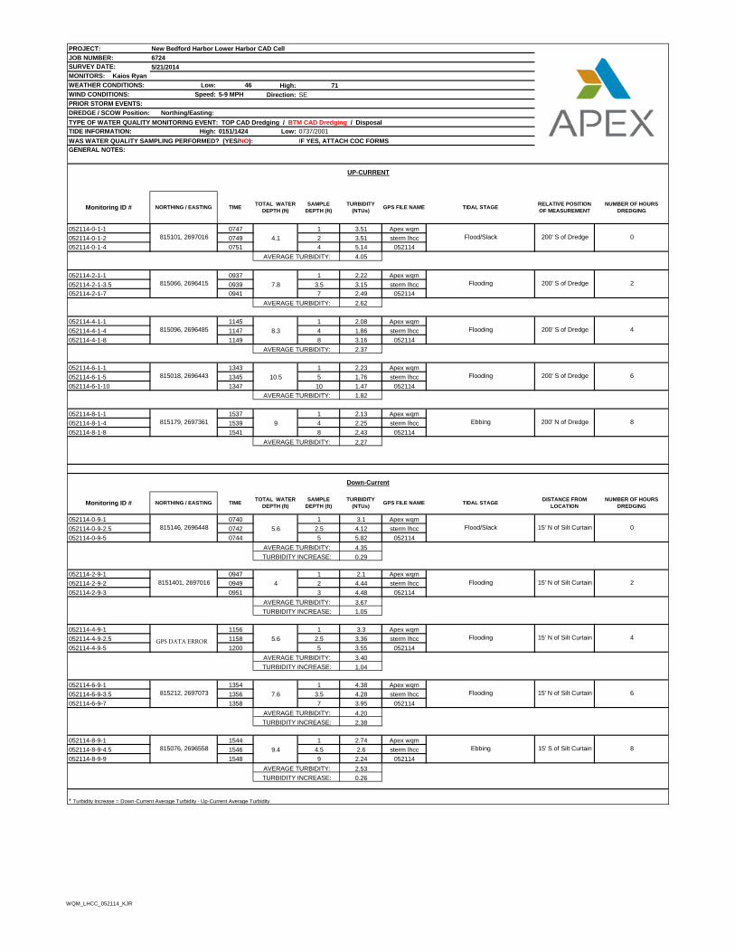
PROJECT: New Bedford Harbor Lower Harbor CAD Cell
JOB NUMBER: 6724
SURVEY DATE: 5/21/2014
MONITORS: Kaios Ryan
WEATHER CONDITIONS: Low: 46 High: 71
WIND CONDITIONS: Speed: 5-9 MPH Direction: SE
PRIOR STORM EVENTS:
DREDGE / SCOW Position: Northing/Easting:
TYPE OF WATER QUALITY MONITORING EVENT: TOP CAD Dredging / BTM CAD Dredging / Disposal
TIDE INFORMATION: High: 0151/1424 Low: 0737/2001
WAS WATER QUALITY SAMPLING PERFORMED? (YES/NO): IF YES, ATTACH COC FORMS
GENERAL NOTES:
0747 1 3.51 Apex wqm
0749 4.1 2 3.51 sterm lhcc
0751 4 5.14 052114
4.05
0937 1 2.22 Apex wqm
0939 7.8 3.5 3.15 sterm lhcc
0941 7 2.49 052114
2.62
1145 1 2.08 Apex wqm
1147 8.3 4 1.86 sterm lhcc
1149 8 3.16 052114
2.37
1343 1 2.23 Apex wqm
1345 10.5 5 1.76 sterm lhcc
1347 10 1.47 052114
1.82
1537 1 2.13 Apex wqm
1539 9 4 2.25 sterm lhcc
1541 8 2.43 052114
2.27
0740 1 3.1 Apex wqm
0742 5.6 2.5 4.12 sterm lhcc
0744 5 5.82 052114
4.35
0.29
0947 1 2.1 Apex wqm
0949 4 2 4.44 sterm lhcc
0951 3 4.48 052114
3.67
1.05
1156 1 3.3 Apex wqm
1158 5.6 2.5 3.36 sterm lhcc
1200 5 3.55 052114
3.40
1.04
1354 1 4.38 Apex wqm
1356 7.6 3.5 4.28 sterm lhcc
1358 7 3.95 052114
4.20
2.38
1544 1 2.74 Apex wqm
1546 9.4 4.5 2.6 sterm lhcc
1548 9 2.24 052114
2.53
0.26
* Turbidity Increase = Down-Current Average Turbidity - Up-Current Average Turbidity
TURBIDITY INCREASE:
AVERAGE TURBIDITY:
TURBIDITY INCREASE:
815076, 2696558 Ebbing 15' S of Silt Curtain
815212, 2697073 Flooding 15' N of Silt Curtain 6
8
AVERAGE TURBIDITY:
Flooding 15' N of Silt Curtain 4
AVERAGE TURBIDITY:
TURBIDITY INCREASE:
8151401, 2697016 Flooding 15' N of Silt Curtain 2
AVERAGE TURBIDITY:
TURBIDITY INCREASE:
815146, 2696448 Flood/Slack 15' N of Silt Curtain 0
AVERAGE TURBIDITY:
TURBIDITY INCREASE:
TURBIDITY
(NTUs)GPS FILE NAME TIDAL STAGE
DISTANCE FROM
LOCATION
NUMBER OF HOURS
DREDGING
AVERAGE TURBIDITY:
Down-Current
Monitoring ID # NORTHING / EASTING TIMETOTAL WATER
DEPTH (ft)
SAMPLE
DEPTH (ft)
AVERAGE TURBIDITY:
815179, 2697361 Ebbing 200' N of Dredge 8
815018, 2696443 Flooding 200' S of Dredge 6
AVERAGE TURBIDITY:
815096, 2696485 Flooding 200' S of Dredge 4
AVERAGE TURBIDITY:
AVERAGE TURBIDITY:
052114-2-1-1
815066, 2696415 Flooding 200' S of Dredge 2
815101, 2697016 Flood/Slack 200' S of Dredge 0
GPS FILE NAME TIDAL STAGERELATIVE POSITION
OF MEASUREMENT
NUMBER OF HOURS
DREDGING
UP-CURRENT
Monitoring ID # NORTHING / EASTING TIMETOTAL WATER
DEPTH (ft)
SAMPLE
DEPTH (ft)
TURBIDITY
(NTUs)
052114-0-1-1
052114-0-1-2
052114-0-1-4
052114-2-1-3.5
052114-2-1-7
052114-6-1-1
052114-6-1-5
052114-6-1-10
052114-8-1-1
052114-8-1-4
052114-8-1-8
052114-0-9-1
052114-0-9-2.5
052114-0-9-5
052114-2-9-1
052114-2-9-2
052114-2-9-3
052114-6-9-1
052114-4-9-5
052114-6-9-3.5
052114-6-9-7
052114-8-9-1
052114-8-9-4.5
052114-8-9-9
052114-4-1-1
052114-4-1-4
052114-4-1-8
052114-4-9-1
052114-4-9-2.5
WQM_LHCC_052114_KJR
GPS DATA ERROR

Figure 1 Lower Harbor CAD Cell Phase I – Water Quality Monitoring
A
B
C
D
E
PR
OJE
CT
OW
NE
R
DESCRIPTIONNO. DATE BY
CADD FILE
GRAPHIC SCALE
SHEET TITLE
CHECKED BY
DRAWING SCALE
DESIGNED BY
DRAWN BY
PROJECT NO.
DRAWING NO.
OF
DATE
PLOT SCALE
1 2 3 4 5 6
NE
W B
ED
FO
RD
H
AR
BO
R
DE
VE
LO
PM
EN
T C
OM
MIS
SIO
N
LO
WE
R H
AR
BO
R C
AD
C
ELL
NE
W B
ED
FO
RD
HA
RB
OR
D
EV
EL
OP
ME
NT
C
OM
MIS
SIO
N
52
F
IS
HE
RM
AN
'S
W
HA
RF
, N
EW
B
ED
FO
RD
, M
A 0
27
40
6724
CHM
GCD
GCD
AS NOTED
BOTTOM OF
LOWER HARBOR
CAD CELL PHASE 1
WATER QUALITY
5/18/14- 5/24/14
WQM-1
6 15
MAY 2013
1/16"=1'-0"
1 EPA COMMENTS GCD
2 2/21/2013 DRAFT SUITABILITY MCK
9/25/2012