Embed Size (px)
Citation preview
Towards a 3D National Hydrography Dataset
Presentation made to the US Geological Survey By David R. Maidment
Center for Research in Water ResourcesUniversity of Texas at Austin
4 December 2013
2
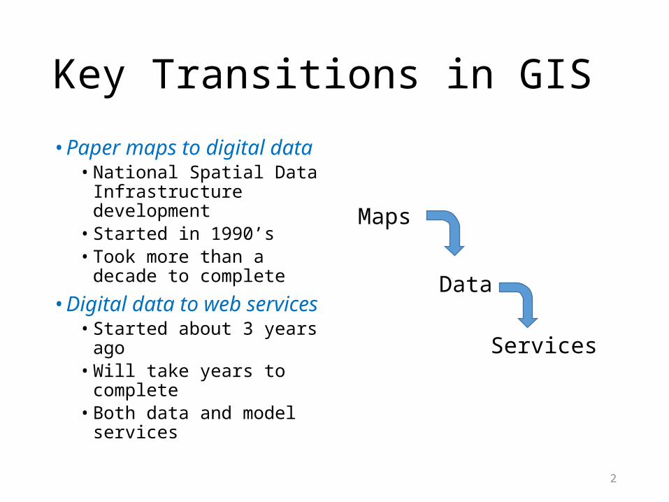
Key Transitions in GIS
• Paper maps to digital data• National Spatial Data
Infrastructure development• Started in 1990’s• Took more than a decade to
complete
• Digital data to web services• Started about 3 years ago• Will take years to complete• Both data and model
services
Maps
Data
Services
3
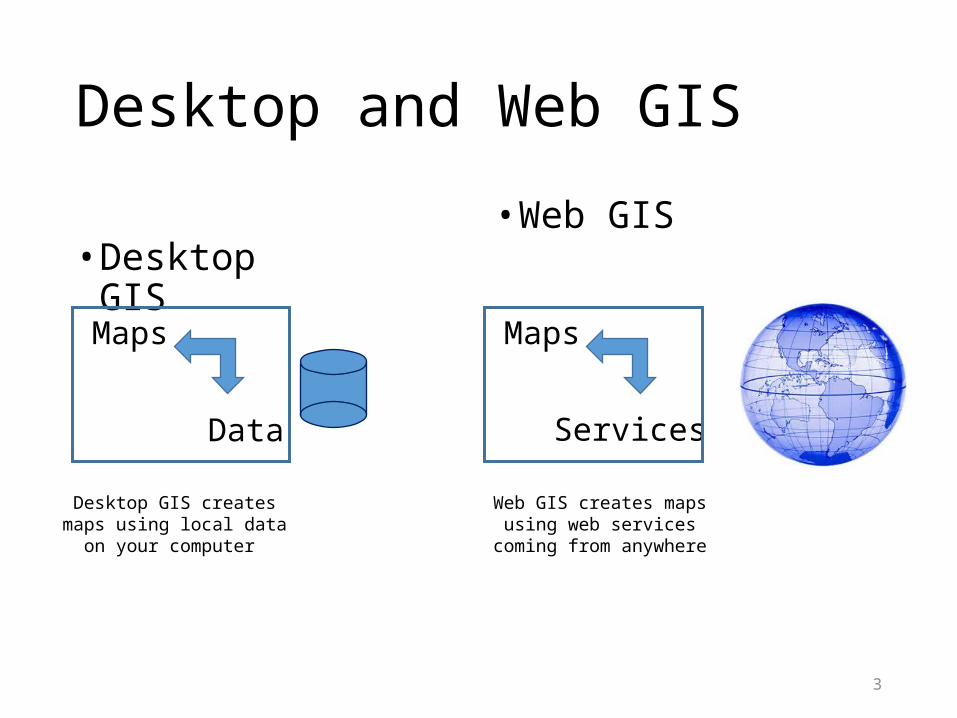
Desktop and Web GIS
• Desktop GIS• Web GIS
Maps
Data
Maps
Services
Desktop GIS creates maps using local data on your computer
Web GIS creates maps using web services coming from anywhere
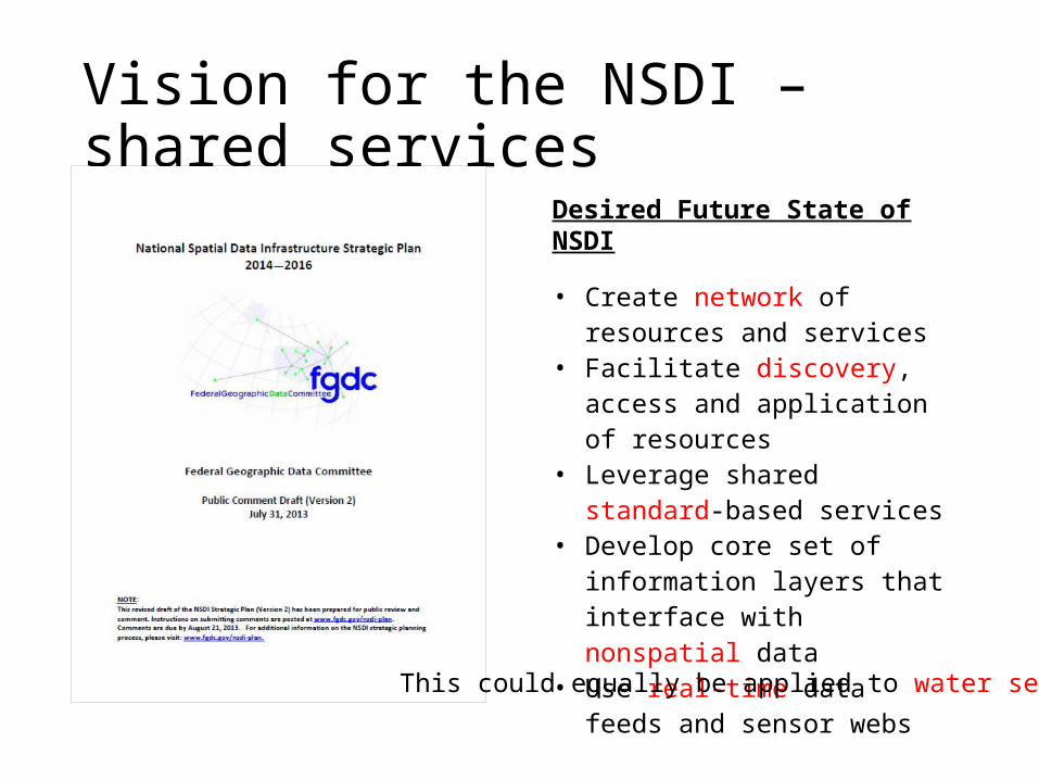
Vision for the NSDI – shared services
Desired Future State of NSDI
• Create network of resources and services
• Facilitate discovery, access and application of resources
• Leverage shared standard-based services
• Develop core set of information layers that interface with nonspatial data
• Use real-time data feeds and sensor webs
This could equally be applied to water services
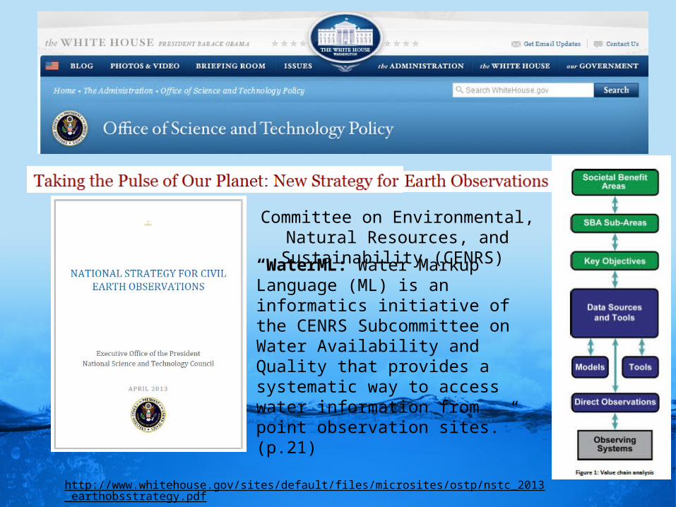
http://www.whitehouse.gov/sites/default/files/microsites/ostp/nstc_2013_earthobsstrategy.pdf
“WaterML: Water Markup Language (ML) is an informatics initiative of the CENRS Subcommittee on Water Availability and Quality that provides a systematic way to access water information from point observation sites.” (p.21)
Committee on Environmental, Natural Resources, and Sustainability (CENRS)
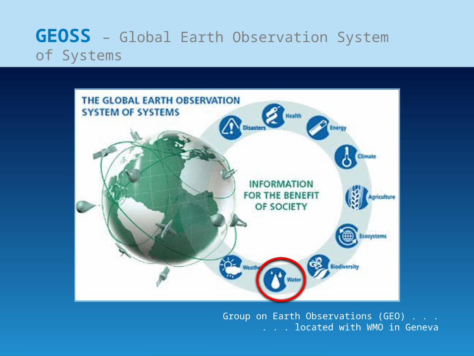
GEOSS – Global Earth Observation System of Systems
Group on Earth Observations (GEO) . . .. . . located with WMO in Geneva
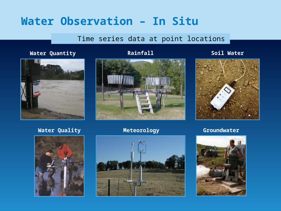
Water Observation – In Situ
Water Quantity Rainfall Soil Water
Water Quality Meteorology Groundwater
Time series data at point locations
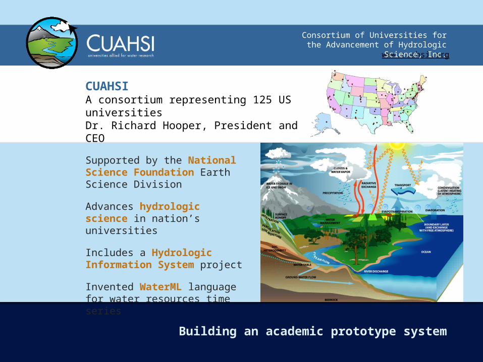
www.cuahsi.org
Consortium of Universities for the Advancement of Hydrologic Science, Inc.
CUAHSI A consortium representing 125 US universitiesDr. Richard Hooper, President and CEO
Building an academic prototype system
Supported by the National Science Foundation Earth Science Division
Advances hydrologic science in nation’s universities
Includes a Hydrologic Information System project
Invented WaterML language for water resources time series
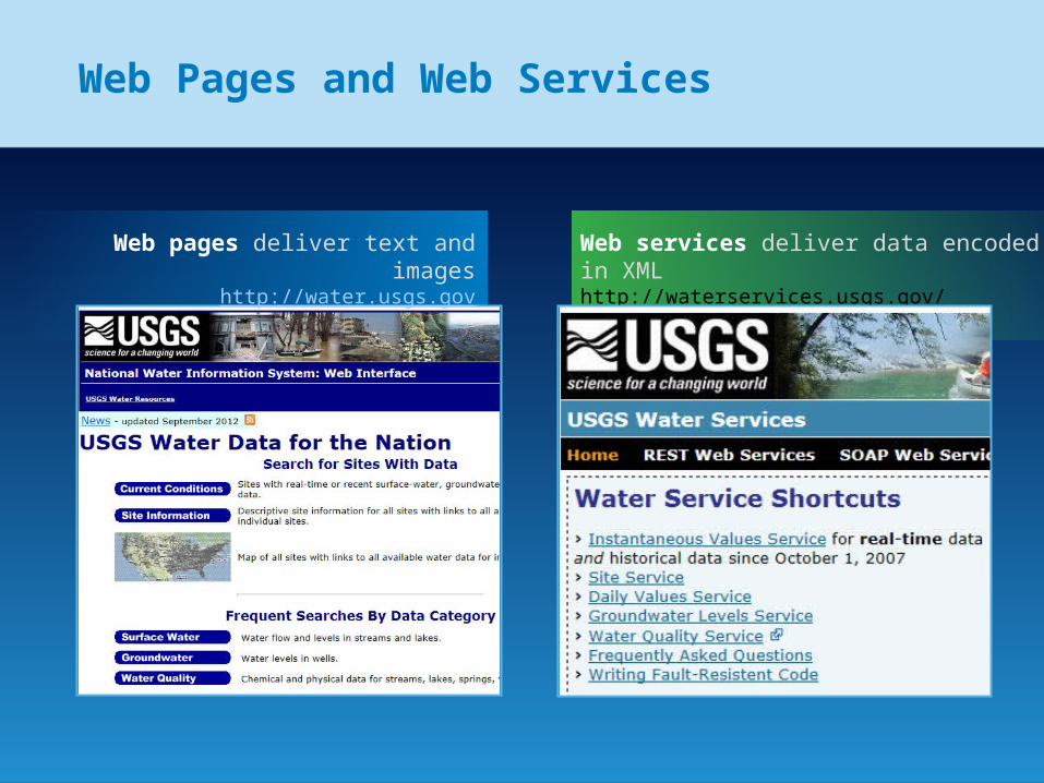
Web Pages and Web Services
Web pages deliver text and imageshttp://water.usgs.gov
Web services deliver data encoded in XMLhttp://waterservices.usgs.gov/
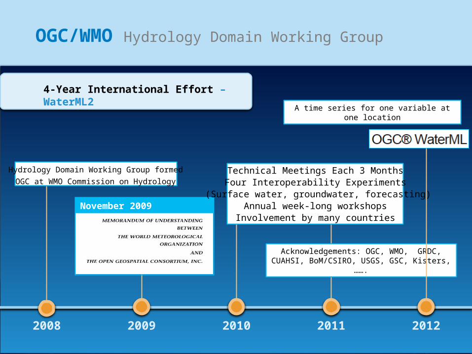
OGC/WMO Hydrology Domain Working Group
2008
4-Year International Effort – WaterML2
2009 2010 2011 2012
November 2009
Hydrology Domain Working Group formed
OGC at WMO Commission on HydrologyTechnical Meetings Each 3 MonthsFour Interoperability Experiments
(Surface water, groundwater, forecasting)Annual week-long workshops
Involvement by many countries
Acknowledgements: OGC, WMO, GRDC, CUAHSI, BoM/CSIRO, USGS, GSC, Kisters, …….
A time series for one variable at one location
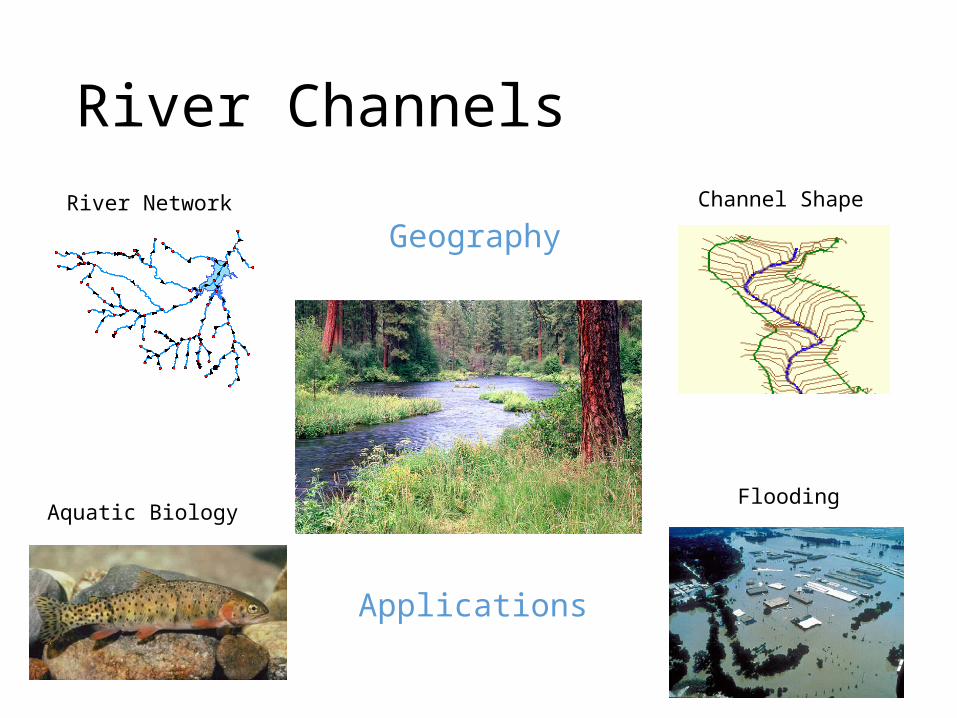
River Channels
Aquatic Biology
River Network Channel Shape
Flooding
Geography
Applications
RiverML: Standardizing the Communication of River Model Data
OCI-1148453 (2012-2017)OCI-1148090 (2012-2017)
Stephen R. JacksonDavid R. Maidment
David K. ArcturCenter for Research in Water Resources
University of Texas at Austin
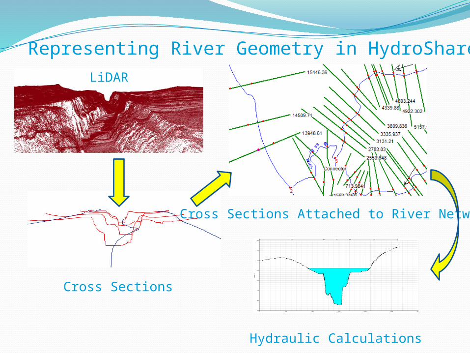
Representing River Geometry in HydroShare
Hydraulic Calculations
LiDAR
Cross Sections
Cross Sections Attached to River Network
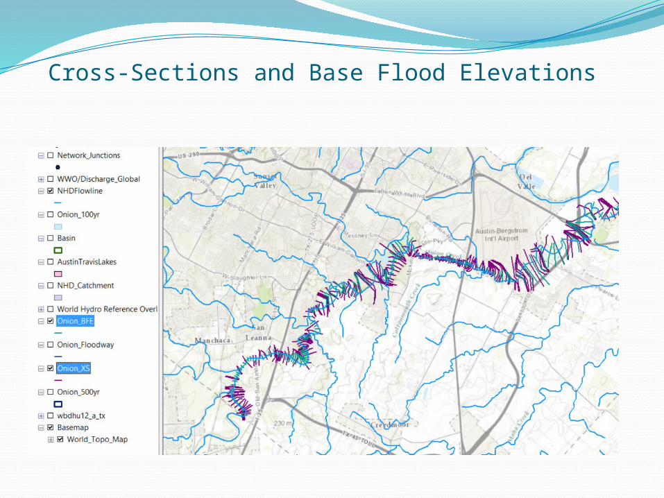
Cross-Sections and Base Flood Elevations
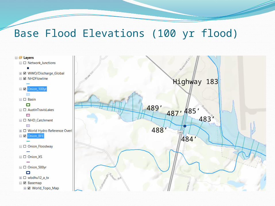
Base Flood Elevations (100 yr flood)
489’
488’
487’ 485’
484’
483’
Highway 183
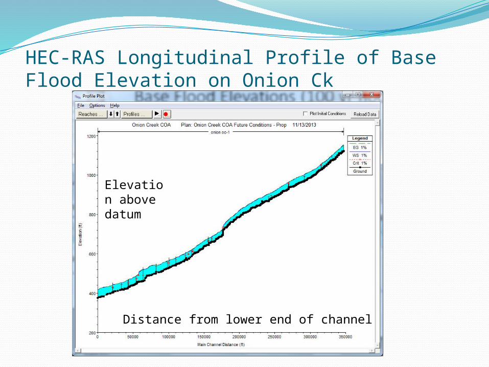
HEC-RAS Longitudinal Profile of Base Flood Elevation on Onion Ck
Distance from lower end of channel
Elevation above datum
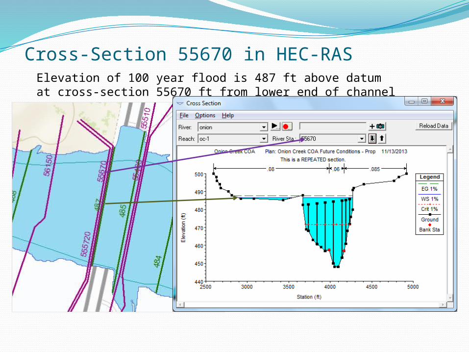
Cross-Section 55670 in HEC-RASElevation of 100 year flood is 487 ft above datum at cross-section 55670 ft from lower end of channel
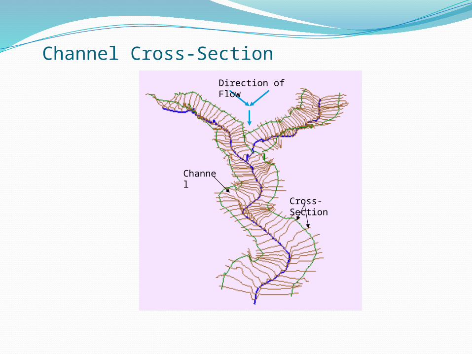
Channel Cross-SectionDirection of Flow
Cross-Section
Channel
From the NSF project proposal: “As an exemplar for advancing data access, we will establish a national repository within HydroShare for river channel cross section data: a new data type not presently supported by CUAHSI HIS. Since 2003, the United States has spent more than $2 billion on digital flood map modernization. A great deal of river channel cross-section, morphology and hydraulic modeling data has been developed to support this mapping and some of that could be repurposed to advance water science. This repository will include a mechanism for voluntary submission of information and it will provide access to this data in a standard way such that it is easy to run hydraulic models that use this data on either local or HPC environments.”
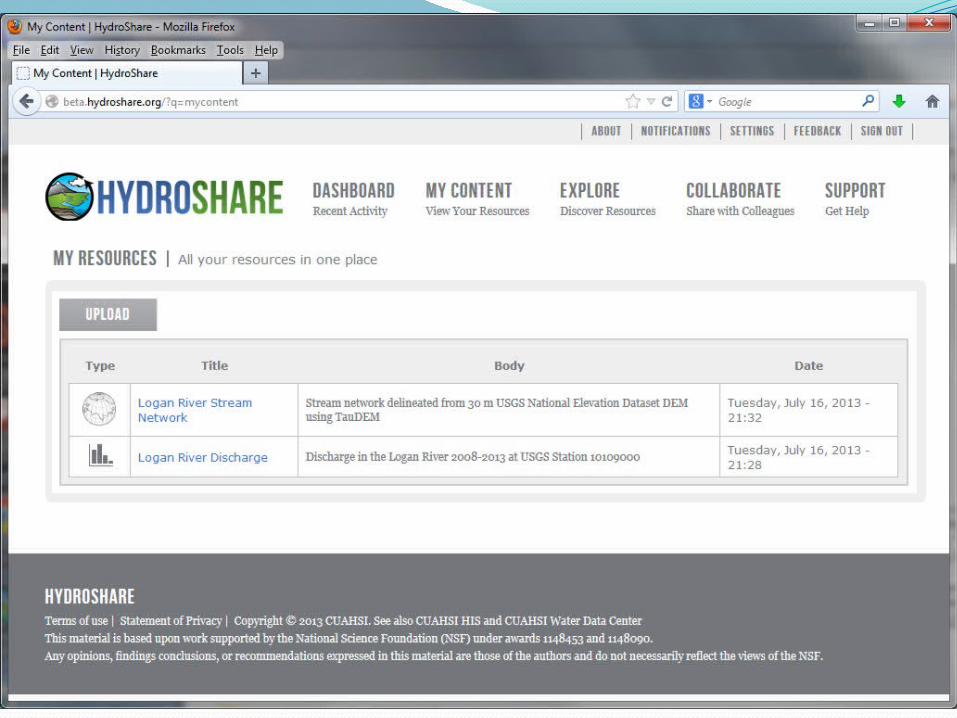
HydroShare: Channel Data
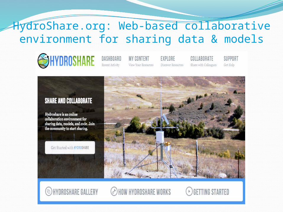
HydroShare.org: Web-based collaborativeenvironment for sharing data & models
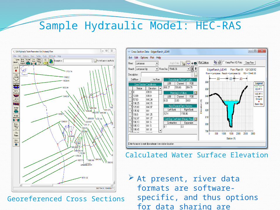
Sample Hydraulic Model: HEC-RAS
Calculated Water Surface Elevation
Georeferenced Cross Sections
At present, river data formats are software-specific, and thus options for data sharing are limited.
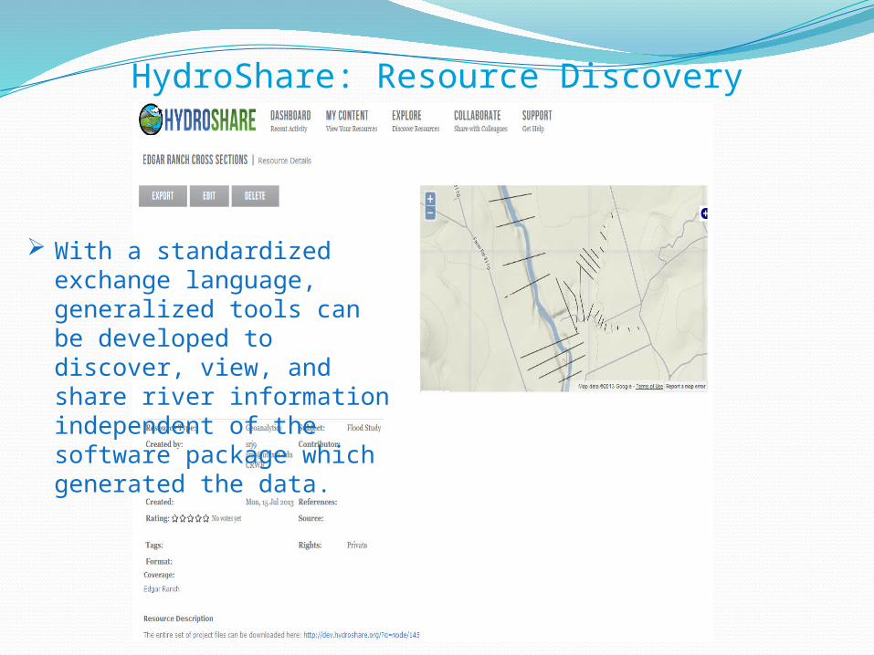
HydroShare: Resource Discovery
With a standardized exchange language, generalized tools can be developed to discover, view, and share river information independent of the software package which generated the data.
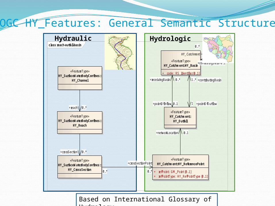
OGC HY_Features: General Semantic Structure
class reach-outfall-basin
«FeatureType»HY_Catchment::HY_ReferencePoint
+ refPoint: GM_Point [0..1]+ refPointType: HY_RefPointType [0..1]
«FeatureType»HY_Catchment::
HY_Outfall
HY_Catchment
«FeatureType»HY_Catchment::HY_Basin
+ code: RS_Identifier [0..1]
«FeatureType»HY_SurfaceWaterBodyConfines::
HY_Reach
«FeatureType»HY_SurfaceWaterBodyConfines::
HY_CrossSection
«FeatureType»HY_SurfaceWaterBodyConfines::
HY_Channel
+reach 0..*
0..*
+crossSectionPoint
0..*
+crossSection 0..*
+contributingBasin1..*
+pointOfOutflow1
0..*
+containingBasin 0..1
+pointOfInflow 0..1
+receivingBasin 0..*
+networkLocation 0..1
Hydraulic Hydrologic
Based on International Glossary of Hydrology
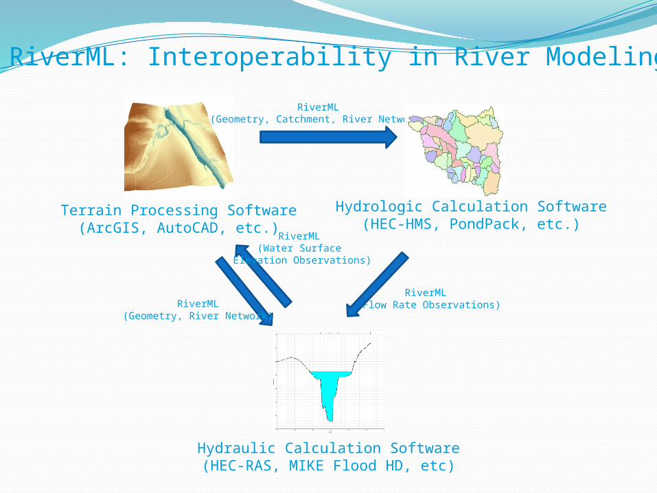
Hydrologic Calculation Software(HEC-HMS, PondPack, etc.)
Terrain Processing Software(ArcGIS, AutoCAD, etc.)
Hydraulic Calculation Software(HEC-RAS, MIKE Flood HD, etc)
RiverML: Interoperability in River Modeling
RiverML (Flow Rate Observations)
RiverML(Geometry, Catchment, River Network)
RiverML (Water Surface
Elevation Observations)
RiverML(Geometry, River Network)
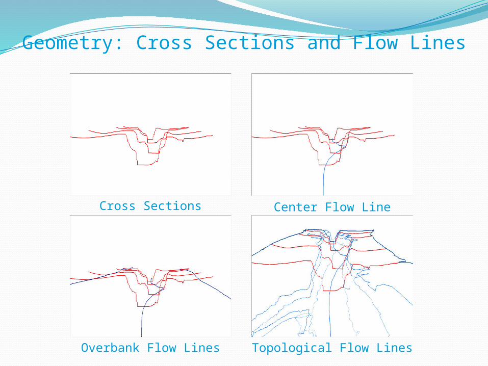
Geometry: Cross Sections and Flow Lines
Cross Sections Center Flow Line
Overbank Flow Lines Topological Flow Lines
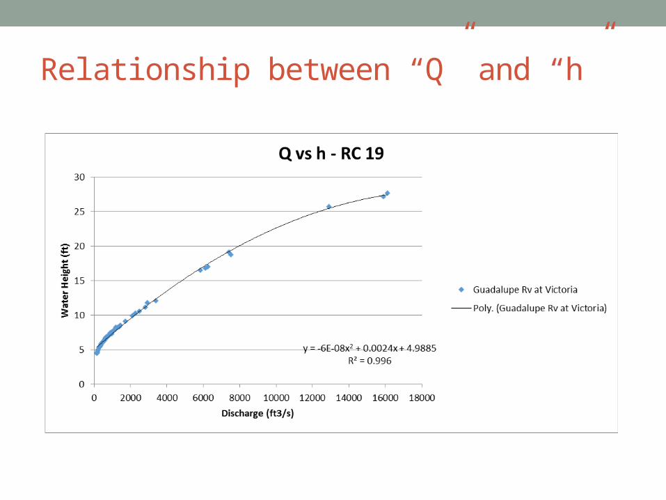
Relationship between “Q” and “h”

Relationship between “Q” and “h”
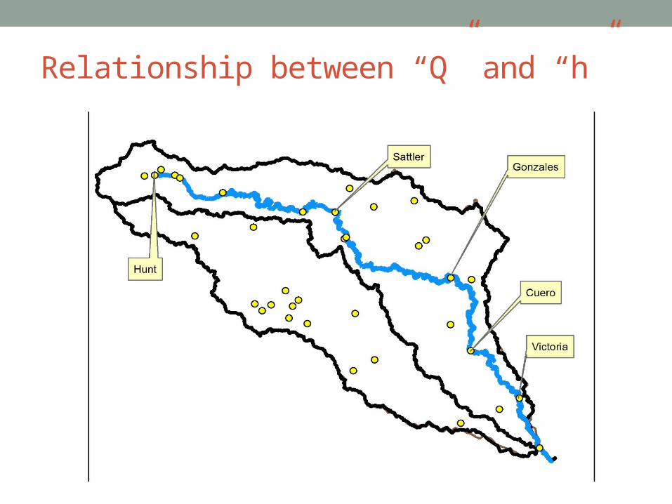
Relationship between “Q” and “h”
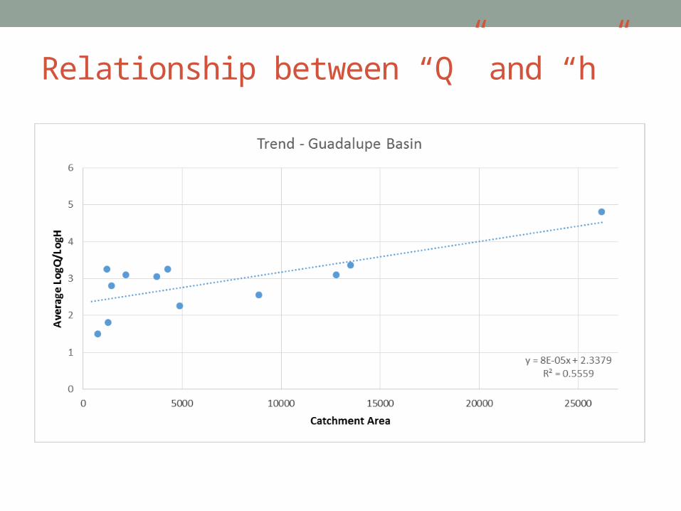
Relationship between “Q” and “h”
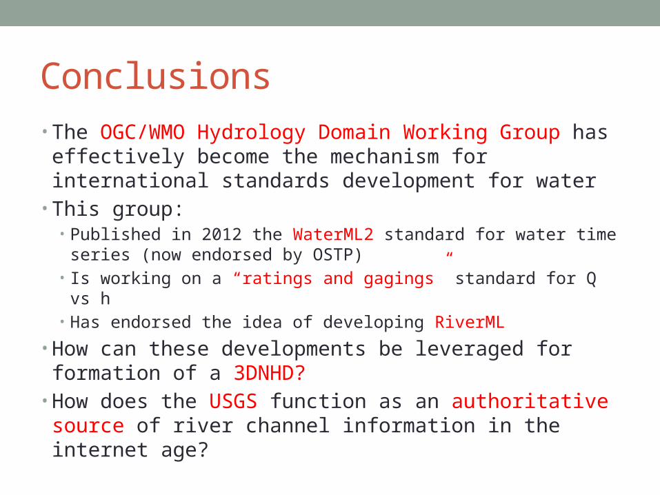
Conclusions• The OGC/WMO Hydrology Domain Working Group has
effectively become the mechanism for international standards development for water
• This group: • Published in 2012 the WaterML2 standard for water time series
(now endorsed by OSTP)• Is working on a “ratings and gagings” standard for Q vs h• Has endorsed the idea of developing RiverML
• How can these developments be leveraged for formation of a 3DNHD?
• How does the USGS function as an authoritative source of river channel information in the internet age?