Embed Size (px)
Citation preview
Opportunities for the Hydrographic Sector using Satellite Observation Services
Han Wensink (Ocean Space Consult, HERMESS)
Presented by: Radboud Koop (NSO)
1 April 2016
Content
• Introduction
• Satellite EO Value Adding Sector & Markets Perspectives
• Copernicus & NL Satellite Data Portal
• Examples
• Conclusions
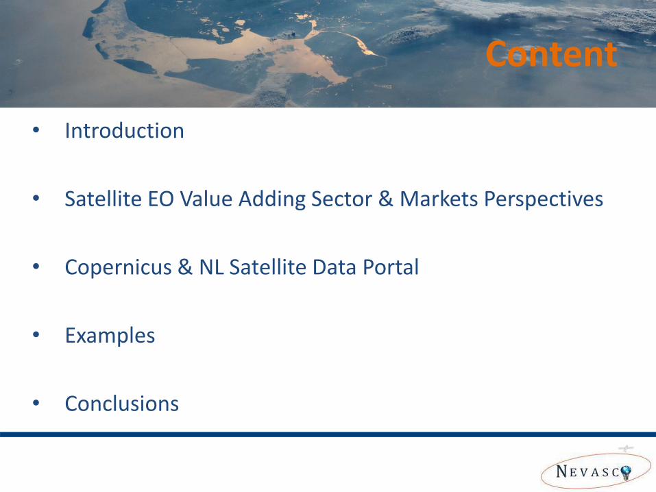
Satellite
Observations
Data Analysis and Added
Value Processing
In-Situ
Measurements
Downstream
Products
Satellite Data Providers Data Integrators Downstream Service
Providers
Satellite (EO) downstream: What part of chain is
covered by this sector
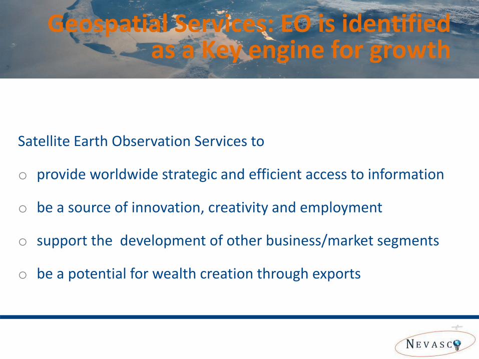
Satellite Earth Observation Services to
o provide worldwide strategic and efficient access to information
o be a source of innovation, creativity and employment
o support the development of other business/market segments
o be a potential for wealth creation through exports
Geospatial Services: EO is identified as a Key engine for growth
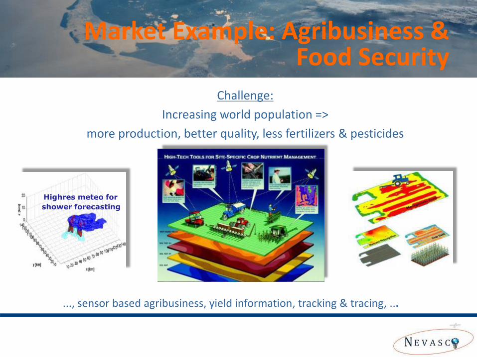
Challenge:
Increasing world population =>
more production, better quality, less fertilizers & pesticides
Highres meteo for
shower forecasting
..., sensor based agribusiness, yield information, tracking & tracing, ...
Market Example: Agribusiness & Food Security
10
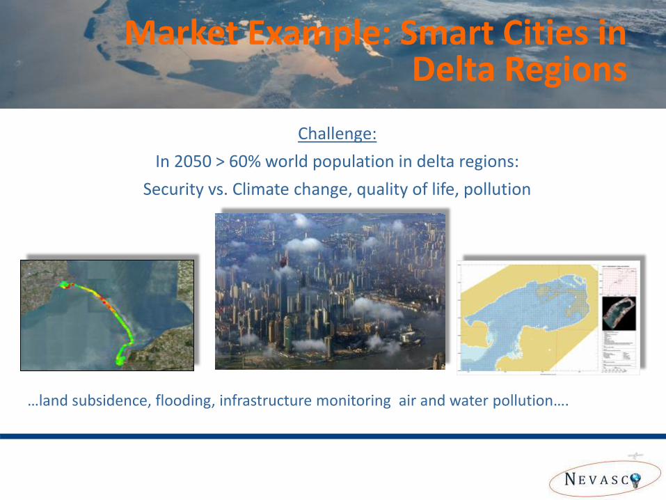
Challenge:
In 2050 > 60% world population in delta regions:
Security vs. Climate change, quality of life, pollution
…land subsidence, flooding, infrastructure monitoring air and water pollution….
Market Example: Smart Cities in Delta Regions
11
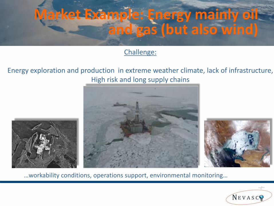
Challenge:
Energy exploration and production in extreme weather climate, lack of infrastructure, High risk and long supply chains
…workability conditions, operations support, environmental monitoring…
Market Example: Energy mainly oil and gas (but also wind)
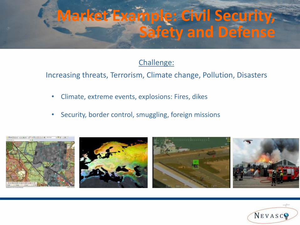
• Climate, extreme events, explosions: Fires, dikes
• Security, border control, smuggling, foreign missions
Market Example: Civil Security, Safety and Defense
Challenge:
Increasing threats, Terrorism, Climate change, Pollution, Disasters
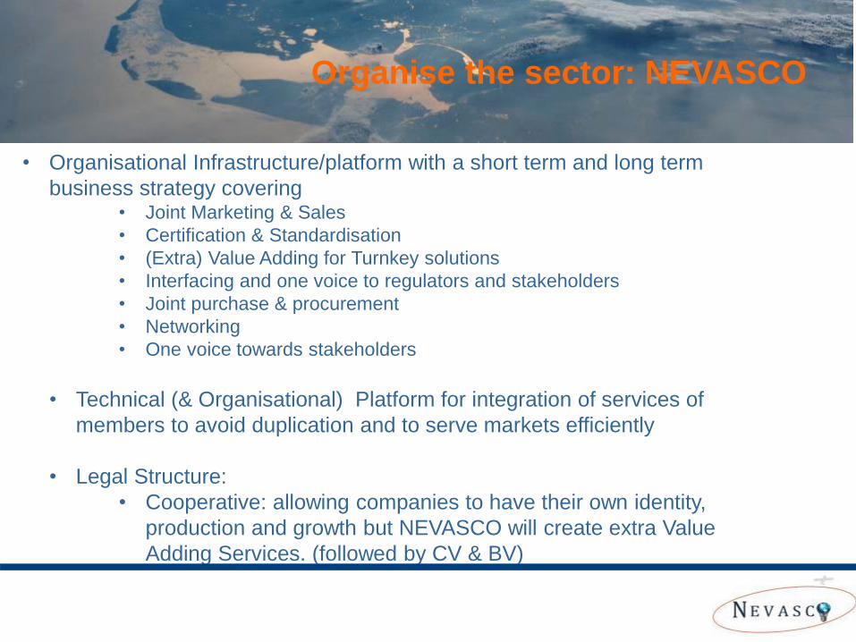
• Organisational Infrastructure/platform with a short term and long term
business strategy covering • Joint Marketing & Sales
• Certification & Standardisation
• (Extra) Value Adding for Turnkey solutions
• Interfacing and one voice to regulators and stakeholders
• Joint purchase & procurement
• Networking
• One voice towards stakeholders
• Technical (& Organisational) Platform for integration of services of
members to avoid duplication and to serve markets efficiently
• Legal Structure:
• Cooperative: allowing companies to have their own identity,
production and growth but NEVASCO will create extra Value
Adding Services. (followed by CV & BV)
Organise the sector: NEVASCO
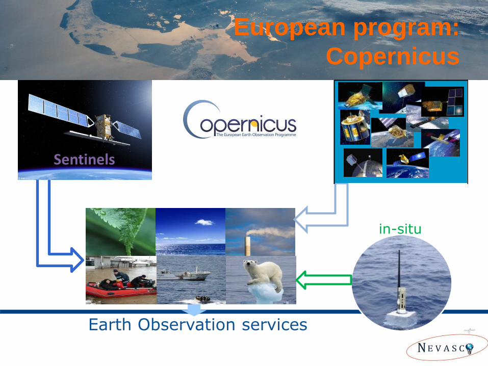
European program:
Copernicus
Earth Observation services
Sentinels Contributing
missions
in-situ
GMES USERS
Coordinated Data
Access System
GMES ServicesGMES Services
Contributing missions
In situ
observations
Sentinel 1/2/3/4/5 & Jason-CS seriesSentinel 1/2/3/4/5 & Jason-CS series
GMES Space
Component
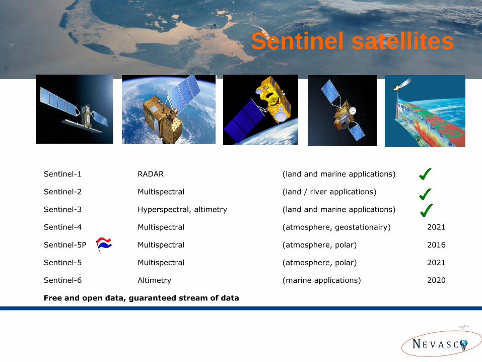
Sentinel satellites
Sentinel-1 RADAR (land and marine applications) Sentinel-2 Multispectral (land / river applications) Sentinel-3 Hyperspectral, altimetry (land and marine applications) Sentinel-4 Multispectral (atmosphere, geostationairy) 2021 Sentinel-5P Multispectral (atmosphere, polar) 2016 Sentinel-5 Multispectral (atmosphere, polar) 2021 Sentinel-6 Altimetry (marine applications) 2020 Free and open data, guaranteed stream of data
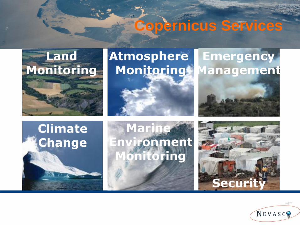
Copernicus Services
Land Monitoring
Atmosphere Monitoring
Marine Environment Monitoring
Emergency Management
Security
Climate Change
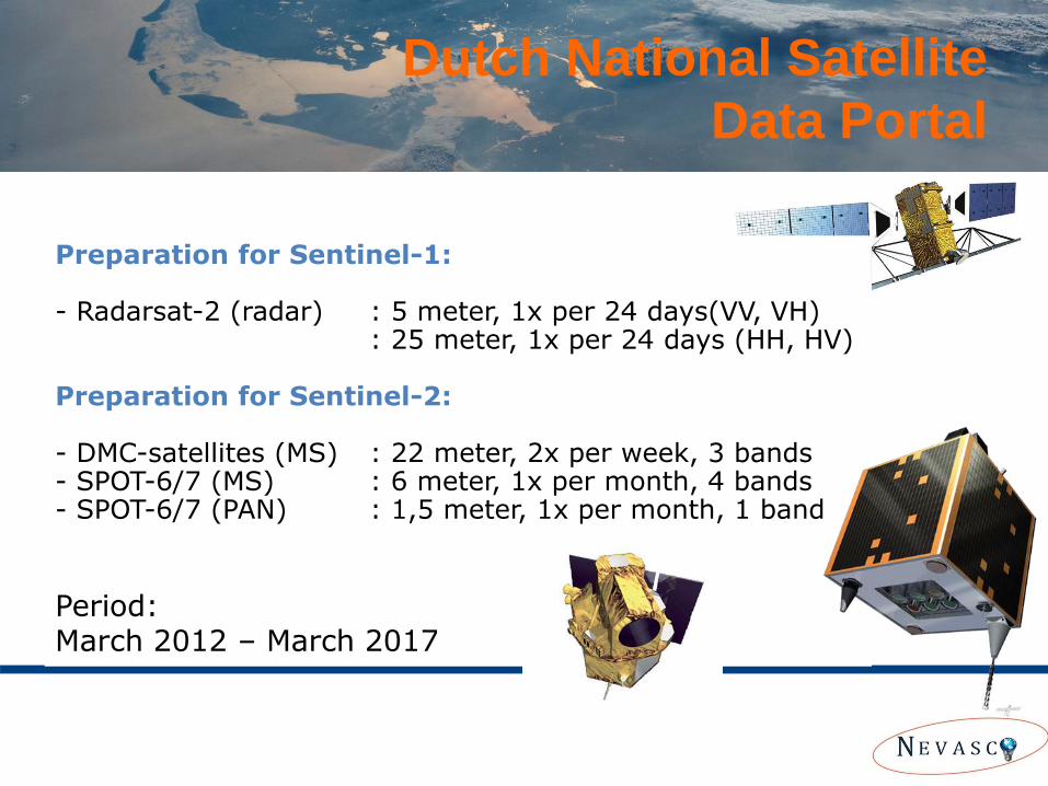
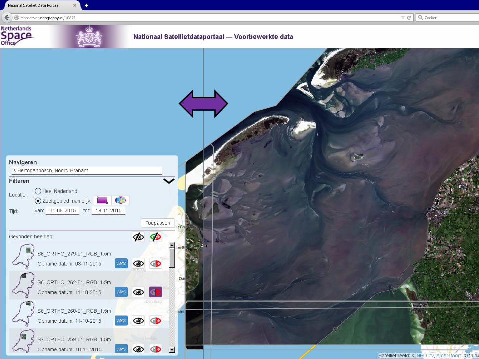
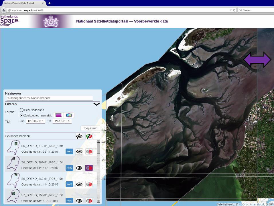
Dutch National Satellite
Data Portal
Preparation for Sentinel-1:
- Radarsat-2 (radar) : 5 meter, 1x per 24 days(VV, VH) : 25 meter, 1x per 24 days (HH, HV)
Preparation for Sentinel-2: - DMC-satellites (MS) : 22 meter, 2x per week, 3 bands - SPOT-6/7 (MS) : 6 meter, 1x per month, 4 bands - SPOT-6/7 (PAN) : 1,5 meter, 1x per month, 1 band
Period: March 2012 – March 2017
Netherlands Space Office 21
Netherlands Space Office 22
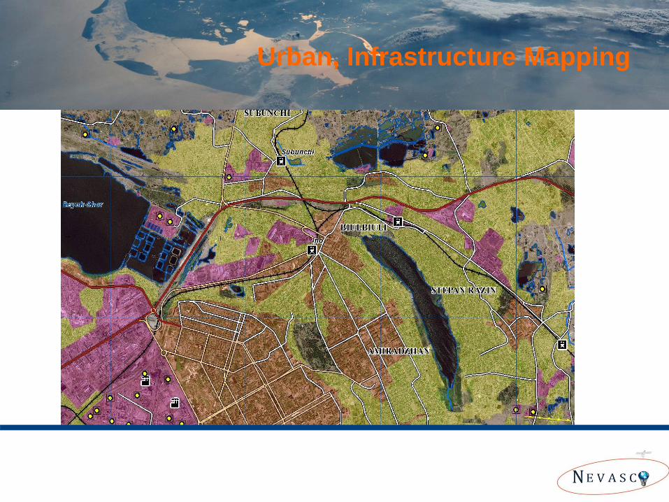
Urban, Infrastructure Mapping
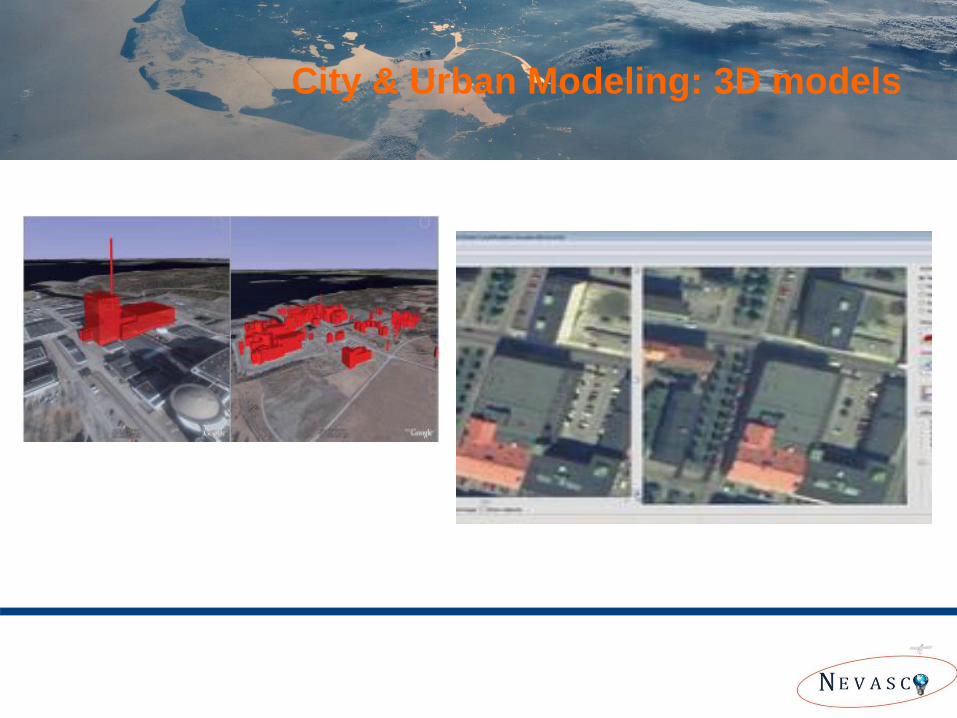
City & Urban Modeling: 3D models
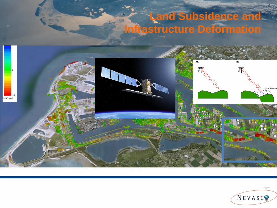
Land Subsidence and
Infrastructure Deformation
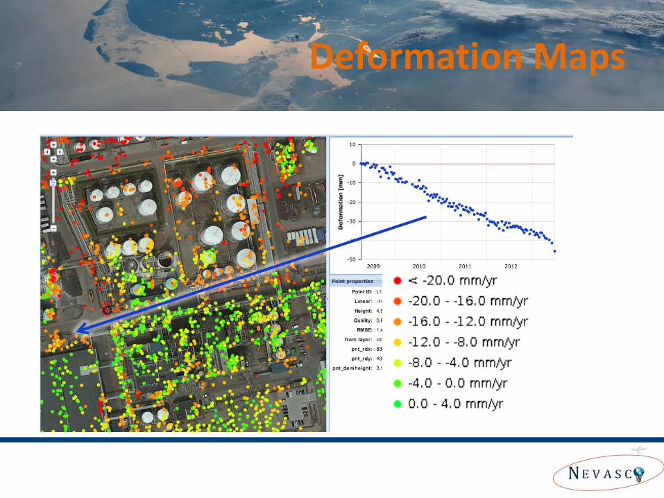
Deformation Maps
27
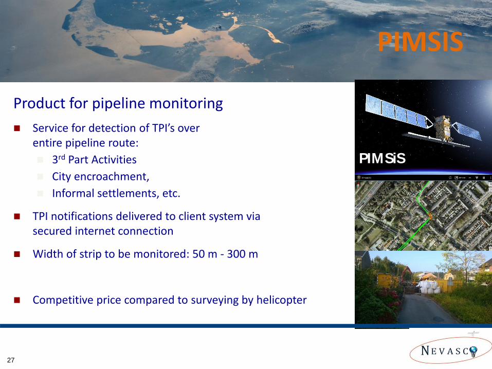
Service for detection of TPI’s over entire pipeline route:
3rd Part Activities
City encroachment,
Informal settlements, etc.
TPI notifications delivered to client system via secured internet connection
Width of strip to be monitored: 50 m - 300 m
Competitive price compared to surveying by helicopter
Product for pipeline monitoring
PIMSIS
PIMSiS
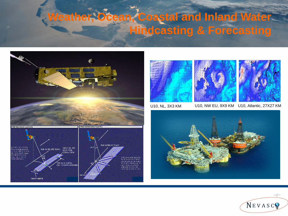
Weather, wind, wave, current and water level data from model hindcasts and satellite observations + forecasts
U10, NL, 3X3 KM U10, Atlantic, 27X27 KM U10, NW EU, 9X9 KM
Weather, Ocean, Coastal and Inland Water
Hindcasting & Forecasting
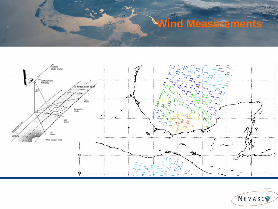
Wind Measurements
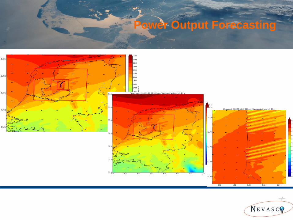
Power Output Forecasting
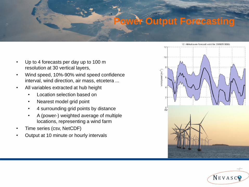
• Up to 4 forecasts per day up to 100 m
resolution at 30 vertical layers,
• Wind speed, 10%-90% wind speed confidence
interval, wind direction, air mass, etcetera ...
• All variables extracted at hub height
• Location selection based on
• Nearest model grid point
• 4 surrounding grid points by distance
• A (power-) weighted average of multiple
locations, representing a wind farm
• Time series (csv, NetCDF)
• Output at 10 minute or hourly intervals
Power Output Forecasting
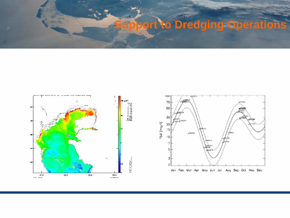
Support to Dredging Operations
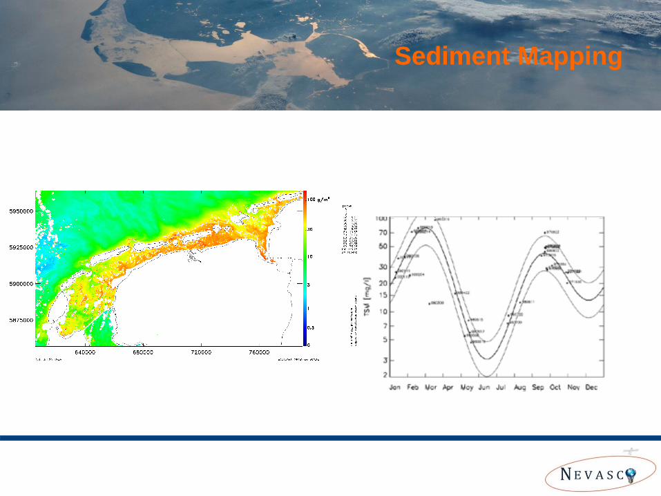
Sediment Mapping
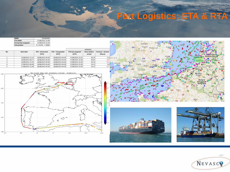
MSC OLIVER IMO 9703306
MMSI 356289000
ETA APMT 17/08/2015 15:00
Arrived last waypoint 17/08/2015 22:56
End position 51.1553N, 1.7868E
No. Start date ETA - Intertransis
(UTC)
ETA - Transponder
(UTC)
ETA last waypoint
(UTC)
Hours before
arrival
Forecast - Arrived
(Hours)
1 15/08/2015 12:14 18/08/2015 04:30 18/08/2015 04:30 17/08/2015 23:25 58.70 0.5
2 16/08/2015 06:17 18/08/2015 04:30 18/08/2015 04:30 17/08/2015 22:30 40.65 -0.4
3 16/08/2015 12:47 18/08/2015 04:30 18/08/2015 04:30 17/08/2015 22:30 34.16 -0.4
4 17/08/2015 06:49 18/08/2015 04:30 18/08/2015 04:30 17/08/2015 23:30 16.12 0.6
5 17/08/2015 12:49 18/08/2015 04:30 18/08/2015 04:30 17/08/2015 22:50 10.12 -0.1
HERMESS
Port Logistics: ETA & RTA
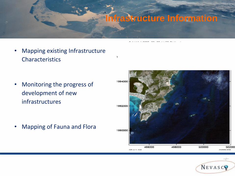
• Mapping existing Infrastructure
Characteristics
• Monitoring the progress of
development of new
infrastructures
• Mapping of Fauna and Flora
Infrastructure Information
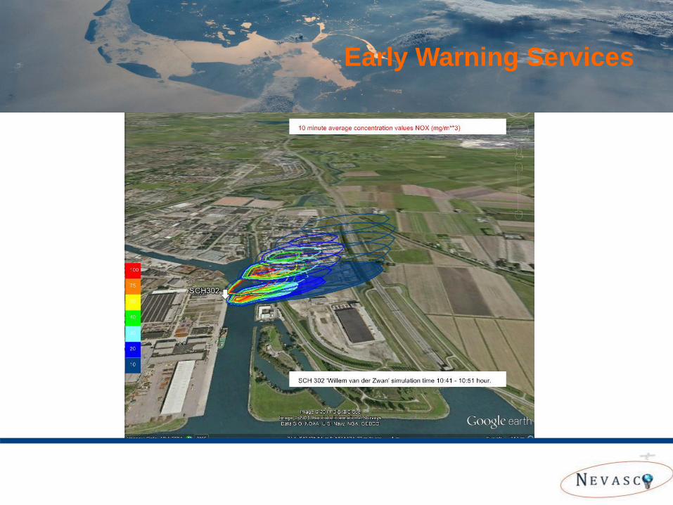
Chemiepack Early Warning Services
Our Weather Forecasting Services
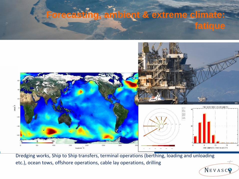
Examples of supported operations:
Dredging works, Ship to Ship transfers, terminal operations (berthing, loading and unloading
etc.), ocean tows, offshore operations, cable lay operations, drilling
Forecasting, ambient & extreme climate:
fatique
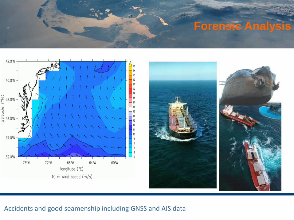
Accidents and good seamenship including GNSS and AIS data
Forensic Analysis
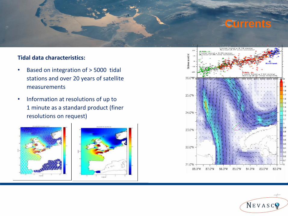
Tidal data characteristics:
• Based on integration of > 5000 tidal
stations and over 20 years of satellite
measurements
• Information at resolutions of up to
1 minute as a standard product (finer
resolutions on request)
Currents
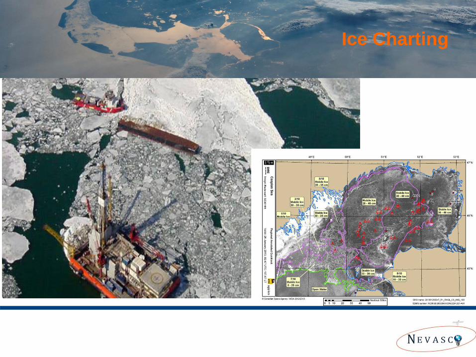
Keeping the Islands Accessible Ice Charting
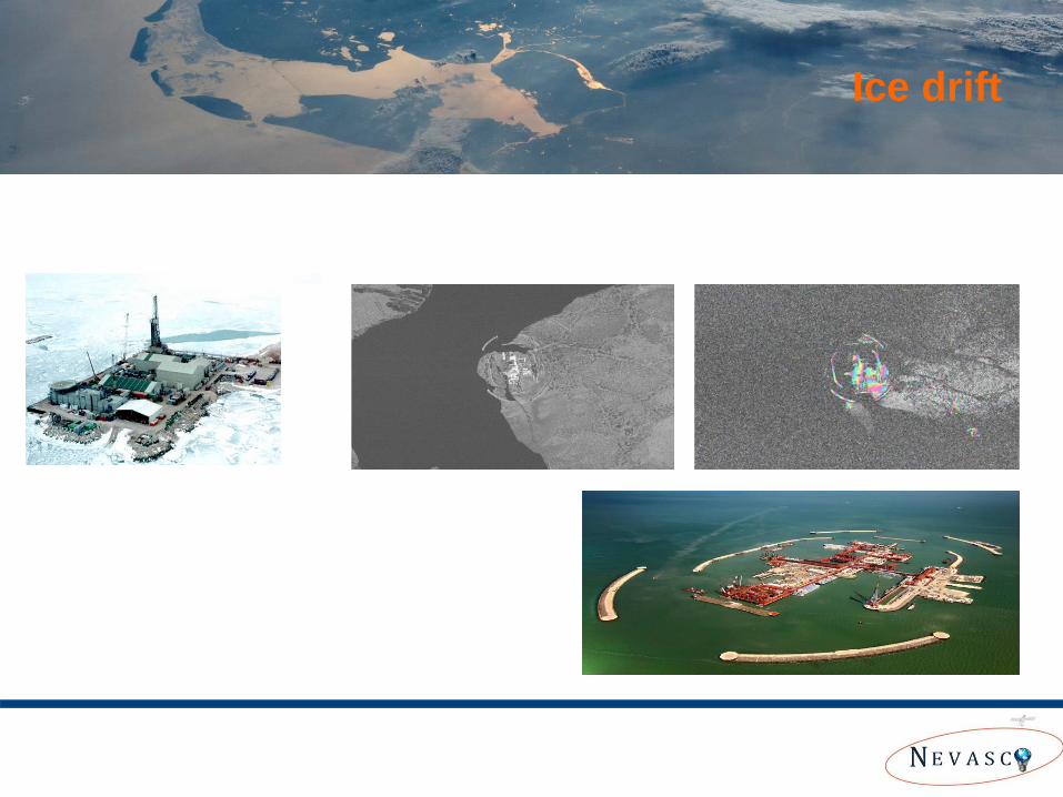
Risk Assessment Ice drift
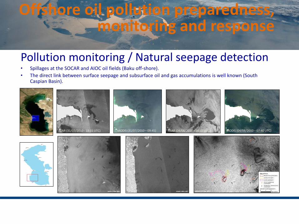
Offshore oil pollution preparedness, monitoring and response
ASAR (31/07/2010 - 18:31 UTC) ASAR (04/08/2010 – 06:47 UTC) MODIS (31/07/2010 – 09:45) MODIS (04/08/2010 – 07:40 UTC)
Pollution monitoring / Natural seepage detection • Spillages at the SOCAR and AIOC oil fields (Baku off-shore).
• The direct link between surface seepage and subsurface oil and gas accumulations is well known (South Caspian Basin).
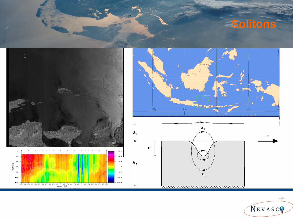
Solitons Solitons
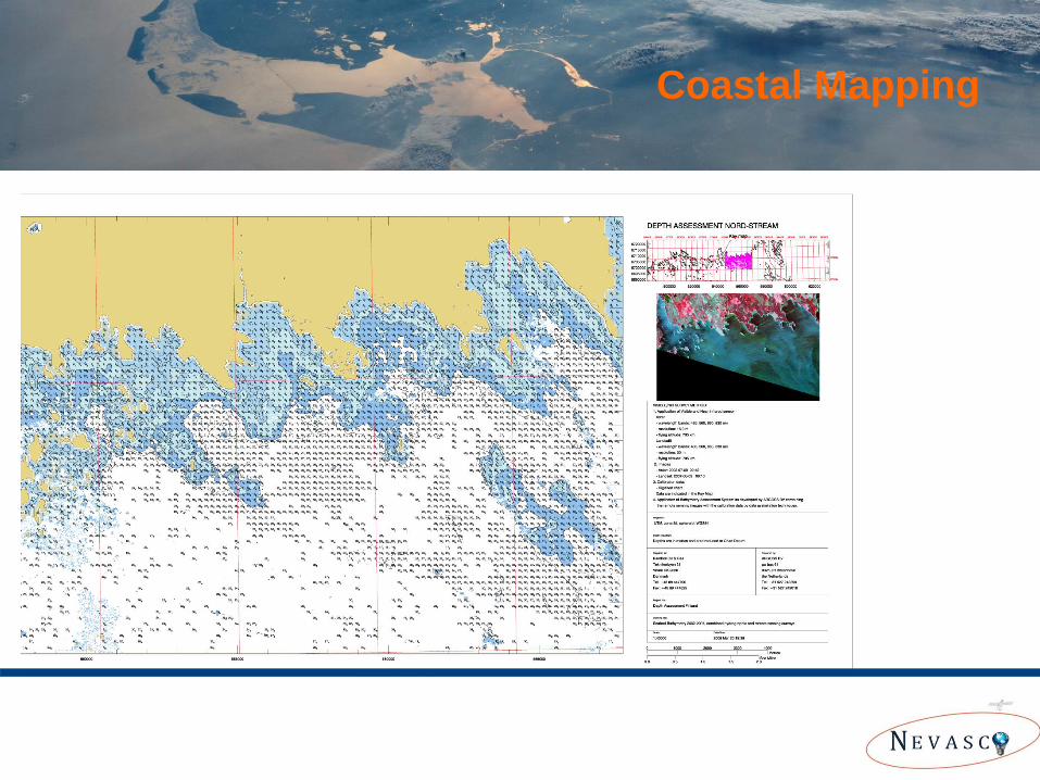
Bathymetry retrieved from Aster 9 Jul 2002 and Landsat 9 Aug 2007 scene
Coastal Mapping
Summary (1)
• The global Geo-information sector and the Earth Observation Sector is one of the high potential markets not just for Strategic Technology but also for Strategic Information and Economic Growth.
• Examples of applications of satellite data for the Hydrographic community have
been demonstrated. Many more applications will come available the next years.
Summary (2)
• Huge public (and private) investments in Satellite Observation Infrastructure (>4B Euro) will provide continuous access to global data for the next decades, offering new opportunities for the Hydrographic Sector.
• The Dutch Value Adding sector has taken its responsibility to organize itself through NEVASCO and has therefore become an interesting strategic partner for the Hydrographic Sector to support global activities and business.
For more information:
Secretaris NEVASCO
Maurits Voogt ([email protected])
Web: www.nevasco-group.nl
Netherlands Space Office
NEVASCO