Embed Size (px)
Citation preview
Archaeology 2020, 8(1): 1-12
DOI: 10.5923/j.archaeology.20200801.01
A Catalogue and Inventory of Cultural Heritage Sites,
Artefacts and Features in Kisumu City and Its Environs
in Lake Victoria Basin, Kenya
Fredrick Odede*, Fredrick Owino, Patrick Hayombe, Stephen Agong
JOOUST, Kenya
Abstract Most of the cultural heritage sites, artifact and features are under constant threat from human activities and
natural processes. Oral traditions of these sites are under threat. This threat is occasioned by the lack of appreciation of oral
traditions as authentic transmitter of history. KLIP is keen at conducting documentation of the existing oral traditions related
to these sites both in print and audio for future generations. The most serious problem faced is the grabbing of cultural
heritage sites for human activities. Extensive conditional survey and documentation should be undertaken to assess their
condition and facilitate their conservation, preservation and restoration for sustainable use by the local communities living
around them. Even though some of these sites are gazzetted and managed or protected by the National Museums of Kenya,
there is very little community involvement in their management and use. This work highlights the state of knowledge, and the
condition of some of these cultural heritage sites as well as areas for future research.
Keywords Catalogue, Inventory, Cultural heritage, Sites, Artifacts, Features, Conservation, Preservation, Kisumu city,
Environs, Lake Victoria Basin
1. Introduction
Kisumu and its environs have very rich cultural heritage
ranging from paleontological archaeological and historical to
cultural sites. This work presents information regarding
some sites in Kisumu and its environs. A few sites are
gazzetted (under the protection of the National Museums of
Kenya). However, the majority of sites in this region have
been identified but not mapped or well documented.
Archaeological and paleontological research has mainly
been undertaken in the region. Preliminary survey of this
region has revealed numerous sites in Kisumu, Bondo, Homa
Bay, Migori and Siaya Counties that are yet to be located and
mapped.
Under enormous threat from urbanism and westernization,
as well as general heritage deterioration through cultural and
natural processes and rapidly declining economic growth in
traditional areas such as fishing and agriculture, Kisumu City
nonetheless boasts of diverse cultural heritage resources that
are uniquely and spatially distributed on the landscape laced
with scenic landforms that traverse the city and its environs.
As one moves across the city into the Lake Victoria shores, a
myriad of cultural and natural features and artefacts dot this
* Corresponding author:
[email protected] (Fredrick Odede)
Received: Oct. 16, 2020; Accepted: Nov. 6, 2020; Published: Nov. 15, 2020
Published online at http://journal.sapub.org/archaeology
unique lacustrine region of western Kenya. Unfortunately,
the majority of these sites, artefacts and features are under
serious threat (Figure 1) from both cultural and natural
processes. The most serious problem is the grabbing of
gazzetted sites. An urgent conditional survey and
documentation should be undertaken to assess their
condition and facilitate their conservation, preservation and
restoration for sustainable use by the local communities
living around them. Even though some of these sites are
gazzetted and managed or protected by the National
Museums of Kenya, there is very little community
involvement in their management and use.
Figure 1. Change of Use Due to Human Activities
2 Fredrick Odede et al.: A Catalogue and Inventory of Cultural Heritage Sites, Artefacts
and Features in Kisumu City and Its Environs in Lake Victoria Basin, Kenya
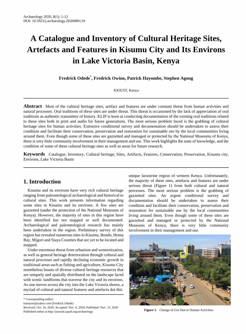
Some of the varied cultural sites and resources are shown in Figure 2 below.
Figure 2. Cultural Heritage Sites in Kisumu and its Environs in Kenya
2. Study Objective
To document and produce a catalogue of the various forms
of cultural heritage sites, artifacts and features in Kisumu and
its environs, Kenya.
3. Methodology
This work aimed at mapping the locations and spatial
distribution of cultural, historical and archeological sites,
artifactual remains and features in Kisumu and its environs.
Mapping is the key to accurate recording of surviving
features and artifacts (Renfrew and Bahn, 1991). Foot survey
was used to identify sites because it is the most effective
means of locating sites and producing the most complete
records (Hester, 1976). Topographical maps also led to the
identification and mapping of sites and features. GIS was
also used to locate the positions of the sites. Conditional
survey was employed to assist in the assessment of the
preservation state of the sites and associated artifacts. Both
oral interviews and focus group discussions were used to get
information about the sites. Actual observation across the
sites also assisted in the assessment of the site content,
quality of preservation and associated challenges. Spatial
analysis and thematic analysis were used to analyze various
forms of data collected.
4. Research Findings and Discussions
Knudson, (1978) defined a site as any area of the
landscape, which has evidence of pas human activities or
occupation. The notion of a site as a spatial concentration of
artifacts (by-product modification of natural environment) as
well as myths and legends were adopted in this study.
Proponents of this approach include Heizer and Graham
(1967), and Fagan (1981). An alternative approach considers
sites as places where artifacts, features, structures, organic
and environmental remains are found together, was brought
forward by Renfrew and Bahn (1991). In the new approach, a
site is studied in relation to geomorphological forms and the
immediate environment (Zvelebel and Macklin, 1992).
Features are those aspects of cultural heritage sites that are
too large, bulky, or difficult to be presented from their
original context to the laboratory for in-house analysis and
are therefore simply recorded, photographed or drawn
(Knudson, 1978). Artifacts on the other hand, are humanly
made or modified portable objects (Fagan, 1981) such as
pottery, stone tools, bones, iron implements, sculptures,
Archaeology 2020, 8(1): 1-12 3
ethnographic remains and many others.
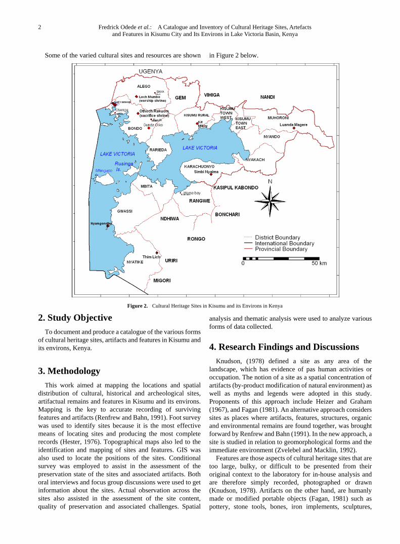
A. Cultural Spaces in Kisumu City
They include Aguch Kisumu, Oile Park, Jubilee Markets,
Social Halls, Kisumu Museum. Places such as Aguch
Kisumu, Oile Park, Jubilee Markets, Social Halls and
Kisumu Museum represent varied values to urban users
ranging from livelihood spots like market places to green
urban spaces which reduce and control environmental
pollution as well as provide recreational functions for
unemployed urban dwellers, and social gatherings such as
table-banking women’s groups. Initial mapping reveals the
value of everyday social and recreational spaces which
reveal values associated with cultural heritage and nourish
the lives of residents and visitors, including Aguch Kisumo
and the cultural infrastructure of the city – found in the
cinema, disco, hotels, markets, clubs and restaurants.
Figure 3. Jubilee Market in Kisumu city
B. Historical, Archaeological and paleontological
heritage in Kisumu and its Environs
Historical, archaeological and cultural sites-Thimlich
Ohinga, Seme-Kaila, Muguruk, Kit-Mikayi, Abindu, Luanda
Magere. Historical, archaeological and cultural sites include
Thimlich Ohinga, Seme-Kaila, Muguruk, Kit-Mikayi,
Abindu, Luanda Magere – bear testimony to the rich and
varied histories of the area. The values attributed to such
sites are not uniform, with differences between elder and
youth populations in terms of how they see their roles – or
not – as custodians of the past. Beyond the sacred, natural
heritage and conservation sites are also important, such as
landing beaches and forests, like Dunga, Musoma, Lwangi,
Impala Park, Got Ramogi, Riat Hill and Abindu.
Abindu Sacred site
The site is on a hilly ragged terrain which extends from
Kajulu to Ojola and is part of an extension of Nandi
Escarpment, 12 kilometres North–West of Kisumu City.
It offers a picnic site and a beautiful scenic landscape of
the Lake Victoria shores with its wetlands and beaches.
The site has numerous wild animals such as birds, unique
insects, reptiles and mammals. Archaeological remains,
unique sacred symbols, artistic design and engravings (rock
arts) and the presence of religious and symbolic inscriptions
attract various religious pilgrimages to the site. It offers
unique cultural identity and rituals, as well as traditional
herbal medicines and super-natural healing powers.
Community narratives have many elements. Witchdoctors
go to the site to communicate with ancestral spirits and cast
spells from those possessed with evil spirits. Sorcerers also
visit the site to exorcise the evil spirits from those who are
possessed. Customary marriages are consummated through
traditional weddings that are performed at the site by both
Independent African Christian Churches and Traditional
Medicine men. Wizards frequent the site draw their power
from the supernatural forces at the site as well as to practice
their witchcraft. Narratives from community informants
indicate that the site traces its cultural significance from
1970s, when the community received a visitor who had
strange, and unique behavior. The stranger had several
identities and would transform from a human being to either,
a wild cat, leopard or hyena (KTN, December, 15th 2012).
Kit Mikayi site
The name means ‘first wife’s rocks’ in Dholuo language.
It is a large rock with three rocks on top that is fascinating,
unique and attractive to travellers along the Kisumu- Bondo
road, about 12 kilometres from Kisumu City. It is a historic
site relating to Luo traditions and narratives. At Kit-Mikayi,
beliefs and traditions associated with this large rock are
varied. Some believe that Mikayi went up the rocky hill
weeping when her husband took a second wife. In another
version, an elderly man, Ngeso, had a great love for the
natural stone and named the stone the first wife (Mikayi). In
yet another narrative, the rock formation reflects the Luo
culture of polygamy with the stones depicting the huts of the
first three wives. The site is seen as a source of blessings,
wealth, rain, marriage and love, spiritual cleansing and
meditation. During dry spells elders converge at the entrance
of the rock for meditation, where a wondrous snake
‘Nyangundi’ is said to have controlled access to the rock.
The rock sends visions to people as far as Alego, Usonga,
Asembo, Sakwa, Gem, Uyoma, and Yimbo on the need to
conduct sacrifices and avert calamities: drought, divorce,
separation cases to appease supernatural forces. Its holy
water is said to possess therapeutic and healing powers,
hence a popular pilgrimage site. Tourists visit the site as a
recreational facility to: climb the rocks, view sunsets and
enjoy traditional Luo songs and dances. This supports
community empowerment and sustained livelihoods for
women and youth. It is significant as ecological and cultural
conservation site.
Muguruk Middle Stone Age Site
The site is situated on the east bank of the Muguruk River
at a point of 250 meters upstream from the bridge where the
Kisian Pau Akuche road crosses the said River. The site lies
3km north of the shores of Winam Gulf of Lake Victoria.
Muguruk is a Middle Stone Age site which was discovered in
1936 by Rev. Archdeacon Owen. The site was gazzetted in
4 Fredrick Odede et al.: A Catalogue and Inventory of Cultural Heritage Sites, Artefacts
and Features in Kisumu City and Its Environs in Lake Victoria Basin, Kenya
1982 and is managed by the National Museums of Kenya.
The topography of Muguruk is controlled by Ombo
phonolite from which artifacts were made. The artifacts of
Ojolla industry (Sangoan – Lupemban) are overlain by
those of Pundo – Makwar industry (Middle Stone Age
Industry). The Ojolla industry consists of heavy – duty tools
component (choppers, picks trimmed slabs and cobbles)
finely made lanceolate points, large bifaces (handaxes) and a
light duty component made up of unifacially – retouched
flakes. The Pundo Makwar industry is made up of flaking
debris from radial core reduction and formal unifacial
scrappers made on these flakes.
A construction firm owned by Hayer and Bishan Sons
LTD has grabbed most of the site from its original size of
two acres and reduced its size to a mere 80m X 80m in areas.
The company should return the land to the National
Museums of Kenya and stop quarrying activities at the site.
Kapurtay Prehistoric Site
The site is situated to the north of Ainomotua River and
west of Two Trees hill in Nandi District, Rift Valley
Province. The site is 227 acres in area. The land where the
site is situated was grabbed by the former President’s (Arap
Moi) Aides during the distribution of ADC land in the area.
Mr. Ali Noor (The Director of ADC at the time) completely
refused to return the land to the Kisumu curator. The DC was
also unable to return the land since the allocation was done in
Nairobi under the presidential prerogative. The land was to
be used by the grabbers as farmland but it is too sterile and
full of fossils to produce anything. It should be returned to
the National Museums of Kenya before the site is completely
destroyed.
Songhor Middle Stone Age Site
M.L. Pickford discovered the site in 1975. It is situated on
the foothills of the Nandi escarpment, former Nyanza
province in Western Kenya. It lies about 2.5km, southwest of
Songhor Miocene site. Songhor consists of mainly fluvial
deposits that are overlain by a tuff (2.5m thick) containing
Middle Stone Age tools and fauna. Upon this tuff is grey clay
deposit with occasional Pleistocene non – diagnostic quartz
artifacts. Stone artifacts include cores, scrapers, and bifacial
points. Levallois points, flake fragments, hammer stones and
angular waste made from lava and quartz. The stone tool
assemblage is typically Middle Stone Age in the low
frequencies of retouched pieces, points both bifacial and
levallois. The makers of this industry used the disc – core
technique in flake production.
Sally Mc Brearty recovered few animal species such as
buffalo, waterbuck rhinoceros and wildebeest in early 1980s.
The animals are large but not extinct. The inhabitants were
hunters who preferred large animals for butchering.
Rusinga Island Site
Rusinga Island has a palaeontological site and Tom
Mboya mausoleum. These sites are situated in Mbita
Division in Suba within the former Nyanza Province. The
sites are gazzetted and protected by the National Museums of
Kenya. The BPS coordinates of the site include S00°24’22.6
and E0340°8’53.7 at an elevation of 1167 metres above sea
level. Rusinga Island has a Miocene site dating back to about
17 million years ago. The site became world famous in 1948
when Dr. Mary Leakey found the skull of Proconsul
Africanus. Of particular interest is the site commonly known
as the pot – hole in the area R 114. This site has yielded a
skeleton of proconsul Africanus and many other fossils of
animals that lived on the island 17 million years ago. It is
argued that these apes could have been the precursor of man.
Attempts to grab the land (site) by the locals were suppressed
by the Kisumu curator who managed to repossess the site.
Songhor Palaeontological Site
The site is situated in Nyando in Kisumu County. The site
was gazzetted in 1982. It is 78 acres in area. It is a Miocene
site dating back to about 19 million years ago. There were a
large variety of animals living there. The fossil hominoids
collected from this site range from small to bigger apes.
Eight species of hominoids have been identified. There is
enough evidence that the proconsul Africanus also lived at
this site. The new survey (2000) that was carried out by the
National Museums of Kenya altered the boundary of the site.
Complaints have been put forward that the survey should be
done again. One respondent said that ön one side, we have
lost our land while on the other hand; the locals have lost
their land to us. The locals want to be compensated for the
loss if another survey cannot be done”.
Fort – Ternan Palaeontological Site
The site is situated in Kericho County which is located
within the former Rift Valley Province. It is 21.56 acres in
area. It was gazzetted in 1982. The site is under the
protection and control of the National Museums of Kenya. It
lies on the Kavirondo Rift, a crack on the earth’s crust that
runs at right angles to the main Great Rift Valley. This side
crack was one of the visible features of the Rift Valley and
was formed about 10 million years ago. The site lies in the
shadow of a great volcano, a protrusion that remains of
Kenyapithecus Eickeri that lived at this site about 14 million
years ago in 1961. A variety of habitats including woodland
provided our ancestors with livelihood. The hominid jaw of
Kenyapithecus was smaller than that of the proconsul. Fort
Ternan jaw and teeth seem to be similar to Ramapithecus.
Fort Ternan is the only site where the beds associated with
“Rangwapithecus” material have been dated directly and the
only area in which well – dated and well – studied older
hominid species are found. Over the years, more than 10,000
fossil specimens of antelopes, giraffes, rhinos, plants and
crocodiles have been found.
Kanam – Kanjera Sites
Kanam is situated along the shores of Lake Victoria on
Homa Peninsular around Homa Mountain. The site was
gazzetted in August 1933. In 1932, Louis Leakey’s
expedition discovered a fossil human mandible together with
Pleistocene fauna and pebble tools in the early Pleistocene
fauna and pebble tools in the early Pleistocene Kanam beds
Archaeology 2020, 8(1): 1-12 5
at Kanam West. Initially, it was thought to be
australopithecine. Doubts were thrown against this specimen,
and Leakey suggested that the fossil was that of Homo
Sapiens but later Leakey supported Sir A. Keith’s view of
australopithecine. Today, they are seen to be Neanderthaloid.
Recently researchers found palaeontological bones dating
between 1 and 6 million years ago at the site.
Kanjera is 4kms, northeast of Homa hills along the shores
of Lake Victoria and was dated to 2.2million years ago.
Oldowan stone tools together with abundant animal fossils of
buffaloes, hippos, elephants, giraffes, lions, wild pigs and
many other smaller animals of savanna environment have
been recorded unlike other Oldowan sites where the
hominids lived in forested areas, the early hominids at
Kanjera lived in savanna environment. Several cranial and
post cranial fragments were found in-situ in association with
Acheulean handaxes. Louis Leaky also found femeral and
cranial fragments of five hominids from the exposures of
Middle Pleistocene lakebeds at the site. These were
classified as Homo Sapiens dated to about 5,000 years ago.
There is a lot of encroachment by the local farmers who still
do not recognize the cultural importance of these sites. Most
farming activities take place around and within the sites
consequently destroying the material remains. The locals
should be removed from these sites in order to avoid further
destruction of the site.
Chianda Miocene Site
This is a very rich palaeontological site in Chianda village,
Madiany Division, Bondo Sub County. Numerous well –
preserved fossils have been exposed through cultivation and
erosion. However, this site is one of the few important
prehistoric sites in Bondo Sub County. The site should be
gazette and protected by the National Museums of Kenya.
Ugunja Site
These site is situated along the water rapids in Nzoia River
(0 12N, 34 16/2 E), 2Km west of Ugunja town. This is a Late
Stone Age hunter gatherer site that has exposed human
skeletal remains due to sand harvesting and erosion. This
significant site will soon disappear if serious measures are
not enforced.
Wadh Lang’o Site
The site is situated in Lower Nyakach, Kisumu County;
Southwestern Kenya, along Sondu Miriu River at Sang’oro
village. The GPS coordinates of the site are S00021’20.2”
and E034048’43.5” at an altitude of 1145 meters above sea
level. It is sheltered to the east by Nyakach – Nyabondo
plateau and bordered by Sondu Miriu River to the west.
South of Wadh Lang’o and Sondu Miriu River drops through
a steep gorge and the site itself is situated alongside the
resultant rapids. The rapids were good areas for trapping fish
moving upstream hence their ecological importance.
Wadh Lang’o was discovered in 1999 by a team of
researchers from the National Museums of Kenya. The site
measures approximately 350m X 200m with its long axis
running north south roughly parallel to the river. Pottery,
worked stone, and faunal remains litter the surface. Test
excavations were carried out in February 2000 and May
2001, which documented along, rich Holocene cultural
sequence spanning from Late Stone Age to Later Iron Age
period. These excavations revealed well preserved deposit
with abundant charcoal, numerous bones, ceramics, beads,
iron implements, lithics, hammer – stones, grindstones,
hearth and a human burial. Wadh Lang’o is the only site in
Western Kenya with well – preserved stratigraphically
superimposed rich Holocene cultural sequence. Currently the
site is being destroyed by the construction of a hydro –
electric power plant at Wath Lang’o site.
Gogo Falls Site
The site is situated along Kuja River at Gogo Falls in
South Nyanza. Peter Robertshaw discovered it in 1983. The
earliest deposit contains Oltome pottery associated with
stone tools made mainly from quartz and volcanic rocks.
Other materials from this horizon include wild faunal and
shellfish remains. This level was mixed with obsidian lithics
of the ashy midden indicating serious site disturbance.
Domestic stock such as goats, cattle and sheep were
numerous in the thick ashy midden that was associated with
Elemteitan pottery. Stone tools of this period were made
from obsidian. Burial practices were provided by a skelton of
an infant individual found lying in a tightly contracted
position covered by a pile of rocks. It appears that hunting
continued alongside domestication.
Urewe pottery was found in the topsoil but was also mixed
with Pastoral Neolithic level. Urewe ware was found in
association with iron implements but evidence of iron
metallurgy was absent. Other materials recovered include
ornaments and grindstones. Later Iron Age material was
observed. Later research work documented other
occupations such as Middle Iron Age.
Information from Gogo Falls is problematic since the site
is severely disturbed. Mixing of occupation levels cannot
allow secure dating of the occupation sequence. Local
farmers are destroying the site through cultivation. Future
farming activities should be stopped.
Aora Pundo Site
The site was discovered by a team of researchers from the
National Museums of Kenya and Dr. Tom Plummer in the
year 2000. It lies 4kms southeast of Homa hills, close to the
flood plain of Awach River along the shores of Lake Victoria.
The site is about 800meters wide with the rich deposits of
about 3 meters in thickness. It has not been dated. Test
excavations revealed abundant fauna of both small and large
animals. Numerous Late Stone Age lithics such as backed
pieces, burins, scrapers, cores, flakes, points and notched
pieces were also recorded. The lithics were made from a
variety of raw material but chert was predominat. Other raw
materials include quartz, basalt, quartzite and gneiss. Human
bone remains were also found both on the surface and sub –
surface levels. Lungfish dominated fish bones. Shellfish
remains, six potshards and white beads were also recovered.
Pleriminary analysis suggests that the hominid teeth from
6 Fredrick Odede et al.: A Catalogue and Inventory of Cultural Heritage Sites, Artefacts
and Features in Kisumu City and Its Environs in Lake Victoria Basin, Kenya
this site belonged to Homo Sapiens.
Aora Pundo is probably the most extensive and richest
Late Stone Age site in the Eastern and Central Africa.
Previous researchers had identified Aora Pundo as a
palaeontological site but it turned out to be an archaeological
site.
Shell Midden Sites
Louis Leakey was the first archaeologist who identified
and test excavated shell midden sites at Kanam and Kanjera
in Rachuonyo District South Nyanza region during the early
period of 1930’s. Later researchers like Peter Robertshaw
discovered many shell midden mounds at Luanda and White
Rock Point in South Nyanza region. Seven new shell midden
sites were discovered at Usare (in Madiany division) and
Yimbo (in Usigu Division), in Northern Nyanza region by
Fredrick Odede (Western Archaelogist) and Dr. Paul Lane
(Director – BIEA) in the year 2000.
The shell midden mounds are prehistoric rubbish dumps
composed mainly of the shells. Mixed with the shells are
bone remains, broken pots, stone tools and other refuse. The
earliest occupation of these shell middens is associated with
Kansyore (Oltome) pottery. Stone tools from this level
include a variety of scrapers, and small backed pieces used as
points of arrows and burins made from locally available raw
material. Their inhabitants greatly exploited shell fish such
as bivalves, gastropods or oysters. They also depended on
fish from the lake. Fish species represented include lungfish,
catfish and tilapia. Animals hunted include hippos, buffaloes,
antelopes, crocodiles, bush pigs and elephants.
The Kansyore people were hunters, gatherers and
fishermen who practiced hunting and gathering economy.
There was no domestication. The dating of this period is
problematic since a wide range of dates has been presented
i.e. between 4,000 and 8,000 years ago.
Other occupations above the Late Stone Age hunter –
gatherers are Early Iron Age and Later Iron Age observed at
Kanam. Urewe ware made and used by early Bantus was
found immediately above the Kansyore level at the same site.
Roulette decorated pottery of Recent Iron Age period occurs
at the topsoil. This potter (L.I.A) is similar to modern Luo
vessel forms. The shell midden sites are threatened by
farming activities. The local community members should be
advised to refrain from destroying these sites.
Got Ramogi site
The region surrounding Got Ramogi and beyond is a
melting pot of rich and varied archaeological site depicting
the lives and migration patterns of the Nilotes, dating to
thousands of years back. One such site is exemplified in the
area of Ulowa, at the foot of Got Ramogi. In addition to
Ulowa, there are several naturally sheltered settlements
having shrines in the region of Got Ramogi and beyond, for
example, Gunda Pudha (Fig. 4 and 5) and Bur Gangu which
is famous for iron artefacts. These sites provide excellent
opportunities for archaeological tourism.
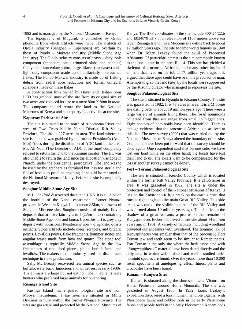
Figure 4. Gunda Pudha in the outskirts of Bondo Township
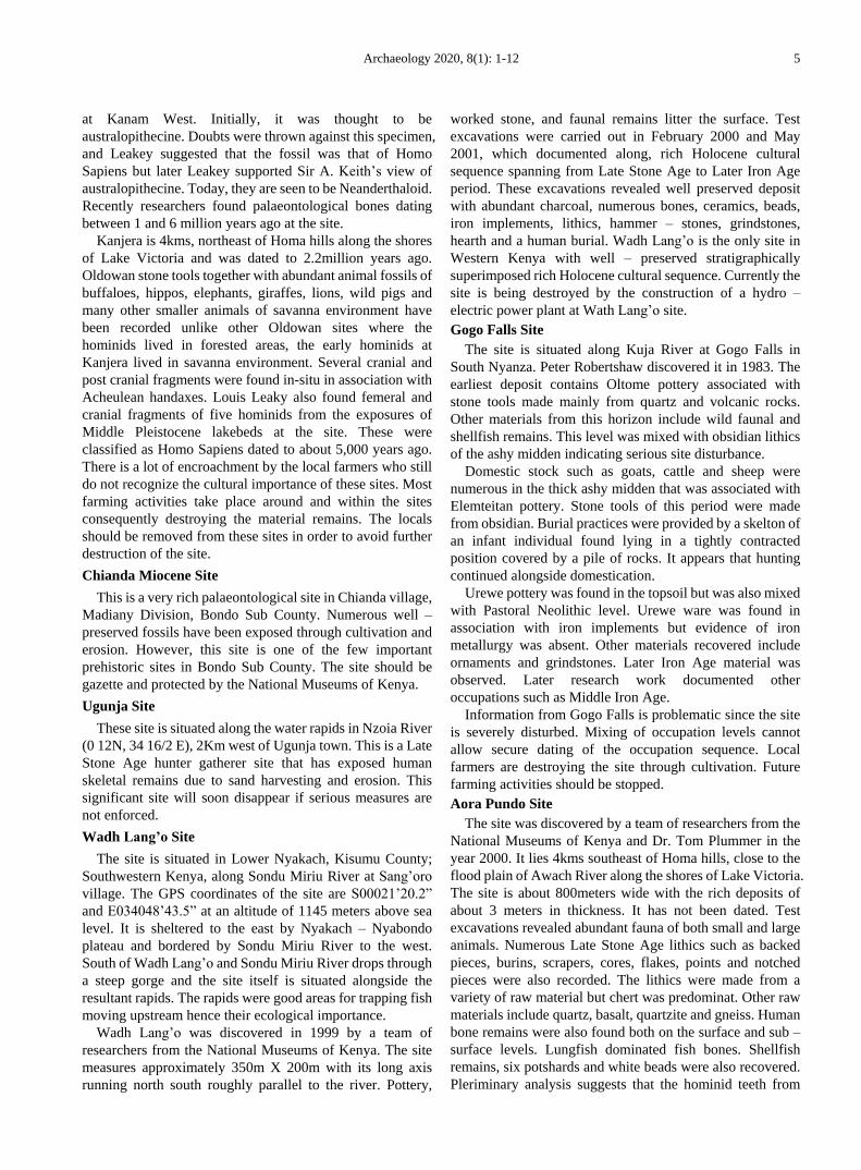
Figure 5. An Archeological Site in Ulowa
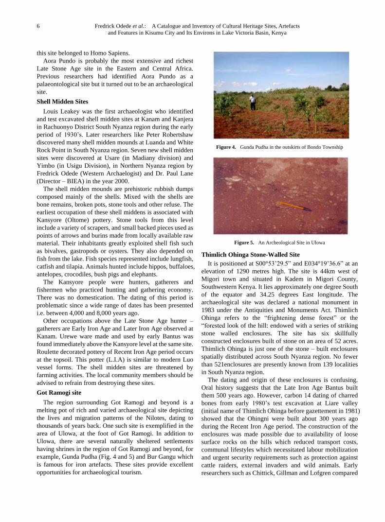
Thimlich Ohinga Stone-Walled Site
It is positioned at S00°53’29.5” and E034°19’36.6” at an
elevation of 1290 metres high. The site is 44km west of
Migori town and situated in Kadem in Migori County,
Southwestern Kenya. It lies approximately one degree South
of the equator and 34.25 degrees East longitude. The
archaeological site was declared a national monument in
1983 under the Antiquities and Monuments Act. Thimlich
Ohinga refers to the “frightening dense forest” or the
“forested look of the hill: endowed with a series of striking
stone walled enclosures. The site has six skillfully
constructed enclosures built of stone on an area of 52 acres.
Thimlich Ohinga is just one of the stone – built enclosures
spatially distributed across South Nyanza region. No fewer
than 521enclosures are presently known from 139 localities
in South Nyanza region.
The dating and origin of these enclosures is confusing.
Oral history suggests that the Late Iron Age Bantus built
them 500 years ago. However, carbon 14 dating of charred
bones from early 1980’s test excavation at Liare valley
(initial name of Thimlich Ohinga before gazettement in 1981)
showed that the Ohingni were built about 300 years ago
during the Recent Iron Age period. The construction of the
enclosures was made possible due to availability of loose
surface rocks on the hills which reduced transport costs,
communal lifestyles which necessitated labour mobilization
and urgent security requirements such as protection against
cattle raiders, external invaders and wild animals. Early
researchers such as Chittick, Gillman and Lofgren compared
Archaeology 2020, 8(1): 1-12 7
Thimlich Ohinga with the famous Great Zimbabwe ruins of
Southern Africa but without any serious archaeological
material evidence.
In terms of architectural characteristics, the enclosures
were built using intersecting, curved and zigzagging walls
made of loose stones of various shapes and sizes. The blocks
were used without any dressing or mortar. The walls are
rough and the course line is indiscernible. The walls range
from 1.0 to 4.2 metres in height and have a base of larger
blocks but no dug foundation. The walls are dotted with
buttres for general stability. Gates are similar in size at about
1.0 to 1.5 square meters. The gates have roof lintels and lock
holes. The base of the gates is twice as thick as the rest of the
wall of the structures. Long slabs are laid horizontally on
either side of each gate. There are also watchtowers for
viewing the surrounding landscape. Roof lintels of main gate
of each enclosure have a unique rock engraving quite distinct
from those of other structures. The enclosures have interior
partitions and external extensions. The interior has smaller
enclosures that were used as cattle kraals and house
depressions are located close to the wall of the enclosures.
An industrial area with remains of blacksmithing activities
is situated in the north east of Kochien’g main enclosure. A
bao game board is engraved on a stone slab found on the
northeastern section inside Kochien’g enclosure. Associated
archaeological material remains include hammer stones,
grindstones, pottery, charcoal, beads and faunal remains.
These are fortified prehistoric settlements (hill – forts) that
were used as defensive mechanism against external enemies,
cattle raiders and attack from wild animals.
Figure 6. Thimlich Ohinga Site in Migori
Seme-Kaila Stone-Walled site
This Historical settlement enclosure site is situated at
Kaila sub-location in Seme Sub-county of Kisumu County,
Kenya. The site consists of six stone-walled enclosures that
are situated on Got Kaila in Seme, 4 kms northwest of Holo
market in Kisumu County. The protective hill-forts were
used by early Luo ancestors as defensive mechanisms
against external human aggression and attack from wild
animals. The settlement arrangement within the enclosures
depicted Luo settlement cosmology lined along the walls of
the prehistoric settlement structures. The enclosures are
littered with archaeological artefacts such as pottery and
stone tools. A sacred tree used as a shrine exists in one of the
enclosures, where supernatural forces of the ancestral spirits
and the gods are said to live. Elderly men, led by medicine
men, lead in offering sacrifices to appease the gods and avert
calamities and misfortunes such as drought and famine
facing the local inhabitants. The enclosures are places of past
human habitation where people lived a communal form of
lifestyle for labour mobilization and security reasons. Initial
attempts have been made to form a Community-Based
Organisation where women and young people are part of the
governance committee. The cultural events are informative
learning grounds for most of the management members of
Seme-Kaila to engage in eco-ventures such as traditional
dressing, basketry, pot-making, traditional dances and songs,
drama, performing art, and sports.
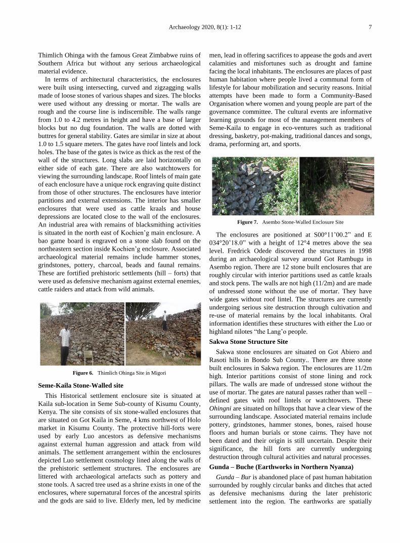
Figure 7. Asembo Stone-Walled Enclosure Site
The enclosures are positioned at S00°11’00.2” and E
034°20’18.0” with a height of 12°4 metres above the sea
level. Fredrick Odede discovered the structures in 1998
during an archaeological survey around Got Rambugu in
Asembo region. There are 12 stone built enclosures that are
roughly circular with interior partitions used as cattle kraals
and stock pens. The walls are not high (11/2m) and are made
of undressed stone without the use of mortar. They have
wide gates without roof lintel. The structures are currently
undergoing serious site destruction through cultivation and
re-use of material remains by the local inhabitants. Oral
information identifies these structures with either the Luo or
highland nilotes “the Lang’o people.
Sakwa Stone Structure Site
Sakwa stone enclosures are situated on Got Abiero and
Rasoti hills in Bondo Sub County.. There are three stone
built enclosures in Sakwa region. The enclosures are 11/2m
high. Interior partitions consist of stone lining and rock
pillars. The walls are made of undressed stone without the
use of mortar. The gates are natural passes rather than well –
defined gates with roof lintels or watchtowers. These
Ohingni are situated on hilltops that have a clear view of the
surrounding landscape. Associated material remains include
pottery, grindstones, hammer stones, bones, raised house
floors and human burials or stone cairns. They have not
been dated and their origin is still uncertain. Despite their
significance, the hill forts are currently undergoing
destruction through cultural activities and natural processes.
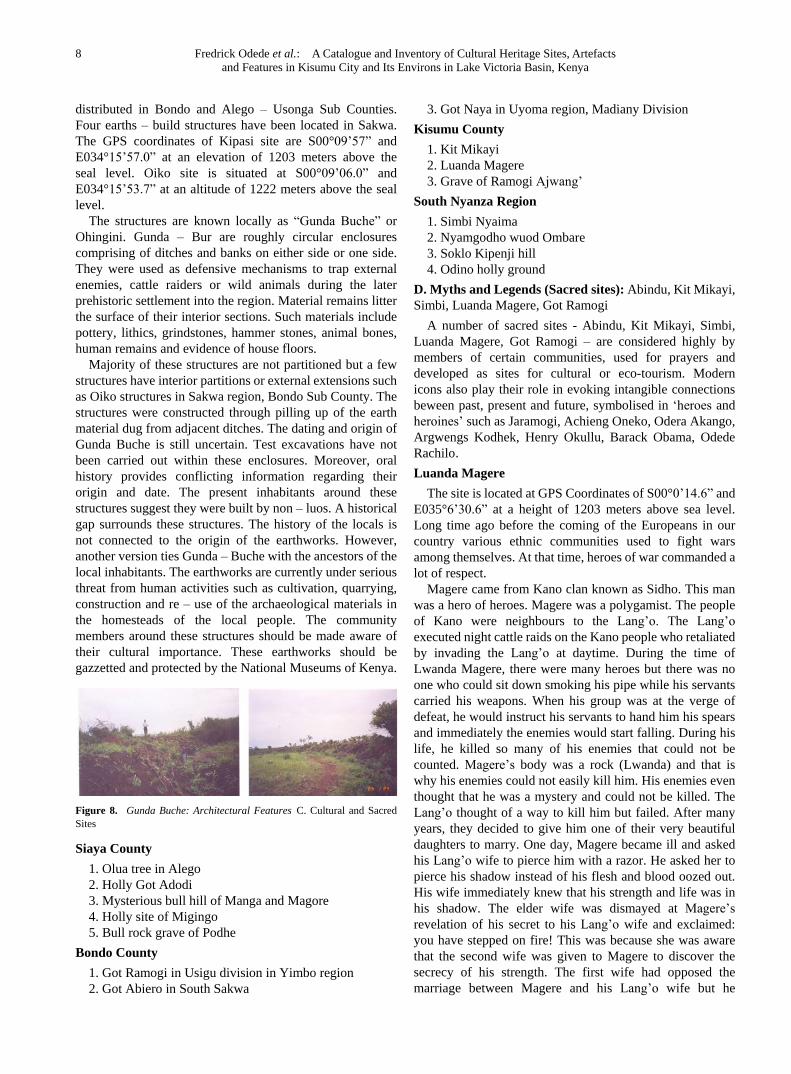
Gunda – Buche (Earthworks in Northern Nyanza)
Gunda – Bur is abandoned place of past human habitation
surrounded by roughly circular banks and ditches that acted
as defensive mechanisms during the later prehistoric
settlement into the region. The earthworks are spatially
8 Fredrick Odede et al.: A Catalogue and Inventory of Cultural Heritage Sites, Artefacts
and Features in Kisumu City and Its Environs in Lake Victoria Basin, Kenya
distributed in Bondo and Alego – Usonga Sub Counties.
Four earths – build structures have been located in Sakwa.
The GPS coordinates of Kipasi site are S00°09’57” and
E034°15’57.0” at an elevation of 1203 meters above the
seal level. Oiko site is situated at S00°09’06.0” and
E034°15’53.7” at an altitude of 1222 meters above the seal
level.
The structures are known locally as “Gunda Buche” or
Ohingini. Gunda – Bur are roughly circular enclosures
comprising of ditches and banks on either side or one side.
They were used as defensive mechanisms to trap external
enemies, cattle raiders or wild animals during the later
prehistoric settlement into the region. Material remains litter
the surface of their interior sections. Such materials include
pottery, lithics, grindstones, hammer stones, animal bones,
human remains and evidence of house floors.
Majority of these structures are not partitioned but a few
structures have interior partitions or external extensions such
as Oiko structures in Sakwa region, Bondo Sub County. The
structures were constructed through pilling up of the earth
material dug from adjacent ditches. The dating and origin of
Gunda Buche is still uncertain. Test excavations have not
been carried out within these enclosures. Moreover, oral
history provides conflicting information regarding their
origin and date. The present inhabitants around these
structures suggest they were built by non – luos. A historical
gap surrounds these structures. The history of the locals is
not connected to the origin of the earthworks. However,
another version ties Gunda – Buche with the ancestors of the
local inhabitants. The earthworks are currently under serious
threat from human activities such as cultivation, quarrying,
construction and re – use of the archaeological materials in
the homesteads of the local people. The community
members around these structures should be made aware of
their cultural importance. These earthworks should be
gazzetted and protected by the National Museums of Kenya.
Figure 8. Gunda Buche: Architectural Features C. Cultural and Sacred
Sites
Siaya County
1. Olua tree in Alego
2. Holly Got Adodi
3. Mysterious bull hill of Manga and Magore
4. Holly site of Migingo
5. Bull rock grave of Podhe
Bondo County
1. Got Ramogi in Usigu division in Yimbo region
2. Got Abiero in South Sakwa
3. Got Naya in Uyoma region, Madiany Division
Kisumu County
1. Kit Mikayi
2. Luanda Magere
3. Grave of Ramogi Ajwang’
South Nyanza Region
1. Simbi Nyaima
2. Nyamgodho wuod Ombare
3. Soklo Kipenji hill
4. Odino holly ground
D. Myths and Legends (Sacred sites): Abindu, Kit Mikayi,
Simbi, Luanda Magere, Got Ramogi
A number of sacred sites - Abindu, Kit Mikayi, Simbi,
Luanda Magere, Got Ramogi – are considered highly by
members of certain communities, used for prayers and
developed as sites for cultural or eco-tourism. Modern
icons also play their role in evoking intangible connections
beween past, present and future, symbolised in ‘heroes and
heroines’ such as Jaramogi, Achieng Oneko, Odera Akango,
Argwengs Kodhek, Henry Okullu, Barack Obama, Odede
Rachilo.
Luanda Magere
The site is located at GPS Coordinates of S00°0’14.6” and
E035°6’30.6” at a height of 1203 meters above sea level.
Long time ago before the coming of the Europeans in our
country various ethnic communities used to fight wars
among themselves. At that time, heroes of war commanded a
lot of respect.
Magere came from Kano clan known as Sidho. This man
was a hero of heroes. Magere was a polygamist. The people
of Kano were neighbours to the Lang’o. The Lang’o
executed night cattle raids on the Kano people who retaliated
by invading the Lang’o at daytime. During the time of
Lwanda Magere, there were many heroes but there was no
one who could sit down smoking his pipe while his servants
carried his weapons. When his group was at the verge of
defeat, he would instruct his servants to hand him his spears
and immediately the enemies would start falling. During his
life, he killed so many of his enemies that could not be
counted. Magere’s body was a rock (Lwanda) and that is
why his enemies could not easily kill him. His enemies even
thought that he was a mystery and could not be killed. The
Lang’o thought of a way to kill him but failed. After many
years, they decided to give him one of their very beautiful
daughters to marry. One day, Magere became ill and asked
his Lang’o wife to pierce him with a razor. He asked her to
pierce his shadow instead of his flesh and blood oozed out.
His wife immediately knew that his strength and life was in
his shadow. The elder wife was dismayed at Magere’s
revelation of his secret to his Lang’o wife and exclaimed:
you have stepped on fire! This was because she was aware
that the second wife was given to Magere to discover the
secrecy of his strength. The first wife had opposed the
marriage between Magere and his Lang’o wife but he
Archaeology 2020, 8(1): 1-12 9
dismissed the issue as sheer jealousy. The Lang’o wife
disappeared and went back to her people. His first wife
advised him not go to war anymore in the future but Magere
refused and insisted that he would rather die like a hero.
After receiving the information, the Lang’o organized a raid.
On that day, Magere killed so many people that he got tired
and could not run. At that moment, one person turned and
speared his shadow and he fell down only to disappear and
turn into a rock. Kano people went back very sad while the
Lang’o celebrated. However, many of them were still
doughtful since he had just turned into a rock. They thought
that he could change into something else or resurrect. A
foggy environment marked Magere’s death. The rock that
Magere turned into is still present. Today, the place is treated
as a sacred site. Whenever Kano people are going to war or
hunting, they sharpened their spears on this rock. Kano
people relied on Magere’s strength so much that a saying was
coined for it as follows: when one becomes notorious in
Kano he is asked whether he is Magere who was never
questioned.
Nyamgondho
Nyamgondho in Nyandiwa, just below Gwasi hills on the
shores of Lake Victoria is also a legendary area. It is said that
the poor man, Nyamgondho by sheer luch fished an old
woman from Lake Gwasi. The old lady requested to be taken
home and Nyamgondho complied since he was not married.
She asked him to build granaries and the following day the
whole home was full of livestock and wealth. He married
more wives and he became respected. One day he came
home late in the night drank and abused the old lady. The
following morning the lady was annoyed and left
Nyamgondho’s home. She started going towards the lake
and all the wealth followed her. Nyamgondho followed
behind and died on the shores of the Lake. Today, there is a
tree that represents him.
E. Traditional Practices and Beliefs
These are important including religious beliefs, dances
(traditional, Afro-music, European music and dances in
different localities in the city) and festivals, such as Dunga
Fish Night, Got Ramogi, Migwena and Suba. Festivals can
take an educational form, or be themed, for instance,
engaging Yawa dancers or cultural events initiated by the
Jaramogi Oginga Odinga University of Science and
Technology. Food is a critical contemporary manifestation
of cultural heritage, embodied in eating patterns, fishing
culture and food types (fish and ugali). Mapping intangible
cultural heritage reveals comedy, fashion, storytelling, arts
and crafts, clothing and traditional and contemporary dress.
Heritage is found in beach and fishing communities, but also
in colonial architecture and infrastructure – around the prison,
railway and port, housing and cemetary.
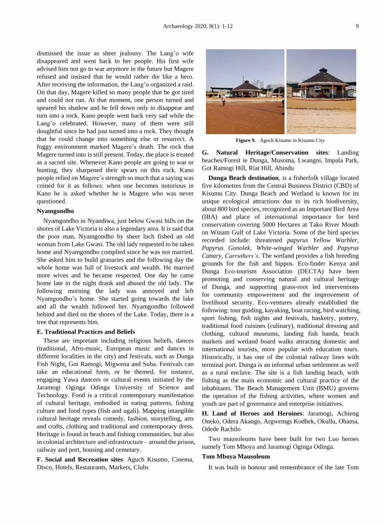
F. Social and Recreation sites: Aguch Kisumo, Cinema,
Disco, Hotels, Restaurants, Markets, Clubs
Figure 9. Aguch Kisumo in Kisumu City
G. Natural Heritage/Conservation sites: Landing
beaches/Forest ie Dunga, Musoma, Lwangni, Impala Park,
Got Ramogi Hill, Riat Hill, Abindu
Dunga Beach destination, is a fisherfolk village located
five kilometres from the Central Business District (CBD) of
Kisumu City. Dunga Beach and Wetland is known for its
unique ecological attractions due to its rich biodiversity,
about 800 bird species, recognized as an Important Bird Area
(IBA) and place of international importance for bird
conservation covering 5000 Hectares at Tako River Mouth
on Winam Gulf of Lake Victoria. Some of the bird species
recorded include: threatened papyrus Yellow Warbler,
Papyrus Gonolek, White-winged Warbler and Papyrus
Canary, Carruthers’s. The wetland provides a fish breeding
grounds for the fish and hippos. Eco-finder Kenya and
Dunga Eco-tourism Association (DECTA) have been
promoting and conserving natural and cultural heritage
of Dunga, and supporting grass-root led interventions
for community empowerment and the improvement of
livelihood security. Eco-ventures already established the
following: tour guiding, kayaking, boat racing, bird watching,
sport fishing, fish nights and festivals, basketry, pottery,
traditional food cuisines (culinary), traditional dressing and
clothing, cultural museums, landing fish banda, beach
markets and wetland board walks attracting domestic and
international tourists, more popular with education tours.
Historically, it has one of the colonial railway lines with
terminal port. Dunga is an informal urban settlement as well
as a rural enclave. The site is a fish landing beach, with
fishing as the main economic and cultural practice of the
inhabitants. The Beach Management Unit (BMU) governs
the operation of the fishing activities, where women and
youth are part of governance and enterprise initiatives.
H. Land of Heroes and Heroines: Jaramogi, Achieng
Oneko, Odera Akango, Argwemgs Kodhek, Okullu, Obama,
Odede Rachilo
Two mausoleums have been built for two Luo heroes
namely Tom Mboya and Jaramogi Oginga Odinga.
Tom Mboya Mausoleum
It was built in honour and remembrance of the late Tom
10 Fredrick Odede et al.: A Catalogue and Inventory of Cultural Heritage Sites, Artefacts
and Features in Kisumu City and Its Environs in Lake Victoria Basin, Kenya
Mboya. This is a burial place of Tom Mboya. It has
information on the family and Luo history. Tom Mboya’s
role as an international agent of Kenyan government is also
presented. The transfer of this mausoleum to the care and
protection of the National Museums of Kenya has led to its
proper management and conservation. The Mausoleum will
form an infrastructure of the greater museum to come on the
Rusinga Island.
Oginga Odinga Mausoleum
This was built at Jaramogi Oginga Odinga’s home in
Nyamira, Bondo Division in honour of the late veteran
politician. The site has all the information on Luo traditional
culture. Political, social and economic developments in
Kenya are well presented. Powerful political figures in
Kenyan history are also displayed. It also exhibits the
family’s involvement in Kenyan politics in post – colonial
era. Exhibition of traditional Luo cultural materials such as
clothing, weapons and ornaments constitute the greater
portion of this mausoleum. There is also a library. The late
Hon. Odinga is laid in a beautiful sheltered grave in front of
the main mausoleum. The mausoleum is not under the
National Museums of Kenya but it would be well managed if
it were put under its management. It could be the best place
for Luo Traditional Cultural in Western Kenya.
I. Events, and Festivals: Traditional events and festivals i.e.
Tero-Buru, Traditional dances, Annual festivals ie Dunga
Fish Night, Got Ramogi, Migwena, Suba
Figure 10. Traditional Luo Festivals
Educational Festivals: music, drama: primary and
secondary and universities.
Theme Festivals: Yawa dancers, Miss County Tourism,
Jooust Tourism and cultural week.
J. Food Culture: Feeding patterns, production, fishing
culture, fish and ugali, food typology i.e. breakfast, lunch;
culinary; delicacies; eating spaces
K. Music and Dances: Traditional, Afro-music, European
L. Talent Promotion Performances: Comedians, drama
and dance troupes, fashions, modelling, Narratives
M. Art and Craft: Pottery, basketry, fine art
N. Clothing and Dressing: Skins, beads, Traditional and
contemporary
O. Religious Practices and Beliefs: Traditional,
Afro-Christian, Muslim, Budha, Hindu
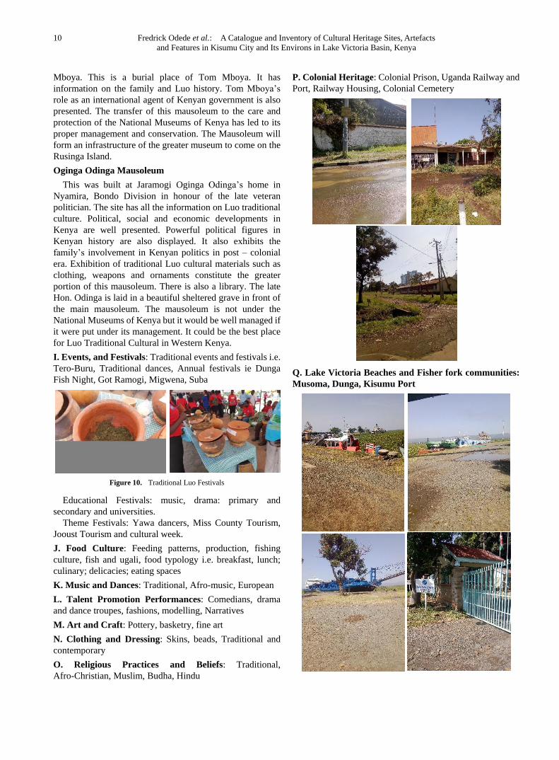
P. Colonial Heritage: Colonial Prison, Uganda Railway and
Port, Railway Housing, Colonial Cemetery
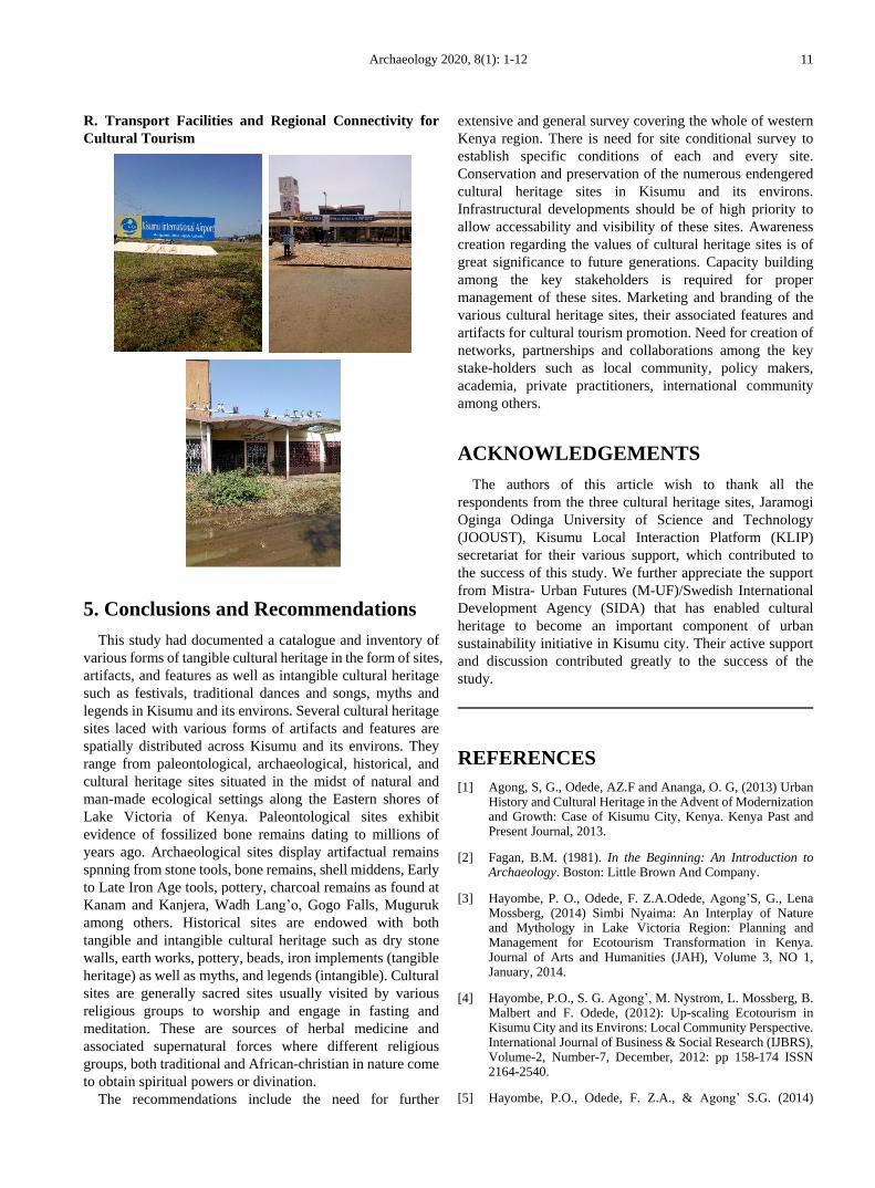
Q. Lake Victoria Beaches and Fisher fork communities:
Musoma, Dunga, Kisumu Port
Archaeology 2020, 8(1): 1-12 11
R. Transport Facilities and Regional Connectivity for
Cultural Tourism
5. Conclusions and Recommendations
This study had documented a catalogue and inventory of
various forms of tangible cultural heritage in the form of sites,
artifacts, and features as well as intangible cultural heritage
such as festivals, traditional dances and songs, myths and
legends in Kisumu and its environs. Several cultural heritage
sites laced with various forms of artifacts and features are
spatially distributed across Kisumu and its environs. They
range from paleontological, archaeological, historical, and
cultural heritage sites situated in the midst of natural and
man-made ecological settings along the Eastern shores of
Lake Victoria of Kenya. Paleontological sites exhibit
evidence of fossilized bone remains dating to millions of
years ago. Archaeological sites display artifactual remains
spnning from stone tools, bone remains, shell middens, Early
to Late Iron Age tools, pottery, charcoal remains as found at
Kanam and Kanjera, Wadh Lang’o, Gogo Falls, Muguruk
among others. Historical sites are endowed with both
tangible and intangible cultural heritage such as dry stone
walls, earth works, pottery, beads, iron implements (tangible
heritage) as well as myths, and legends (intangible). Cultural
sites are generally sacred sites usually visited by various
religious groups to worship and engage in fasting and
meditation. These are sources of herbal medicine and
associated supernatural forces where different religious
groups, both traditional and African-christian in nature come
to obtain spiritual powers or divination.
The recommendations include the need for further
extensive and general survey covering the whole of western
Kenya region. There is need for site conditional survey to
establish specific conditions of each and every site.
Conservation and preservation of the numerous endengered
cultural heritage sites in Kisumu and its environs.
Infrastructural developments should be of high priority to
allow accessability and visibility of these sites. Awareness
creation regarding the values of cultural heritage sites is of
great significance to future generations. Capacity building
among the key stakeholders is required for proper
management of these sites. Marketing and branding of the
various cultural heritage sites, their associated features and
artifacts for cultural tourism promotion. Need for creation of
networks, partnerships and collaborations among the key
stake-holders such as local community, policy makers,
academia, private practitioners, international community
among others.
ACKNOWLEDGEMENTS
The authors of this article wish to thank all the
respondents from the three cultural heritage sites, Jaramogi
Oginga Odinga University of Science and Technology
(JOOUST), Kisumu Local Interaction Platform (KLIP)
secretariat for their various support, which contributed to
the success of this study. We further appreciate the support
from Mistra- Urban Futures (M-UF)/Swedish International
Development Agency (SIDA) that has enabled cultural
heritage to become an important component of urban
sustainability initiative in Kisumu city. Their active support
and discussion contributed greatly to the success of the
study.
REFERENCES
[1] Agong, S, G., Odede, AZ.F and Ananga, O. G, (2013) Urban History and Cultural Heritage in the Advent of Modernization and Growth: Case of Kisumu City, Kenya. Kenya Past and Present Journal, 2013.
[2] Fagan, B.M. (1981). In the Beginning: An Introduction to Archaeology. Boston: Little Brown And Company.
[3] Hayombe, P. O., Odede, F. Z.A.Odede, Agong’S, G., Lena Mossberg, (2014) Simbi Nyaima: An Interplay of Nature and Mythology in Lake Victoria Region: Planning and Management for Ecotourism Transformation in Kenya. Journal of Arts and Humanities (JAH), Volume 3, NO 1, January, 2014.
[4] Hayombe, P.O., S. G. Agong’, M. Nystrom, L. Mossberg, B. Malbert and F. Odede, (2012): Up-scaling Ecotourism in Kisumu City and its Environs: Local Community Perspective. International Journal of Business & Social Research (IJBRS), Volume-2, Number-7, December, 2012: pp 158-174 ISSN 2164-2540.
[5] Hayombe, P.O., Odede, F. Z.A., & Agong’ S.G. (2014)
12 Fredrick Odede et al.: A Catalogue and Inventory of Cultural Heritage Sites, Artefacts
and Features in Kisumu City and Its Environs in Lake Victoria Basin, Kenya
Abindu Sacred Site: Socio-Cultural Capital for Ecotourism Promotion and Community Empowerment in Kisumu County, Kenya. International Journal of Humanities and Social Science, Vol. 4, No. 11:112-125, 2014.
[6] Hebert, J.J. (1976). Introduction to Archaeology. New York: Holt, Reinhart and Winstone.
[7] Heizer, R.F., and J.A. Graham, (1967). A Guide to Field Methods in Archaeology: Approaches to the Anthropology of the Dead. Mayfield: National press Palo Alto.
[8] Knudson, S.J. (1978). Culture in Retrospect: An Introduction to Archaeology. Chicago: Rand McNally College Publishing Company.
[9] Odede, A.Z.F, P. Lane, C. Ashley and P. Harvey. (2007) The transition to Farming in Eastern Africa: New Evidence from Wadh Lang’o and Usenge, Kenya. World Antiquity Journal Vol.81: 62-81, 2007.
[10] Odede, A.Z.F. (1999) Recent Archeological Investigation along the Sondu – Miriu River, Kenya. Azania 34:116 –122, 1999.
[11] Odede, A.Z.F. (2007) Secrets in Dry Stonewalls. Kenya Past and Present Journal. Volume 36:67-72, 2007.
[12] Odede, A.Z.F. (2008) Gunda Buche: The bank-and-Ditch fortified settlements of western Kenya. Azania, Vol XLIII: 36-49, 2008.
[13] Odede, F, Hayombe, P, Agong’ S. and Owino, F. (2020). Cultural Planning of Dunga, Abindu and Kit-Mikayi Cultural Heritage Sites, Kisumu City, Kenya. International Journal of Advanced and Multidisciplinary Social Science 2020, 6(1): 28-40, DOI: 10.5923/j.jamss.20200601.03.
[14] Odede, F, Hayombe, P, Agong’ S. and Owino, F. (2020). Upscaling Tourism Product Development for Enhancing Local Livelihoods at Dunga and Miyandhe Beach Destinations in Kisumu City, Kenya: A Co-Production
Approach. American Journal of Tourism Management 2020, 9(1): 24-33, DOI: 10.5923/j.jamss.20200601.03.
[15] Odede, F, Z.A. Odede, Hayombe, P. O., Agong’, S, G., Lena Mossberg, (2013) Sustainable Utilization of Cultural Heritage Sites for Posterity in Kisumu County, Kenya. International Journal of Humanities and Social Science, Vol. 3, NO. 20, 2013.
[16] Odede, F.Z.A., Hayombe, P.O & Agong’, S.G. (2015) Ecotourism for community empowerment and social inclusion: The Case of Abindu Sacred site in Kisumu County, Kenya. Journal of Economics and Sustainable Development, Vol. 6 (14): 7-15, 2015.
[17] Odede, Z.A. and Odhiambo, G. (2013) Got Ramogi Hill site in Northern Nyanza, Western Kenya: Its Historical and Archaeological significance. Kenya Past and Present Journal, 2013.
[18] Odede, Z.A. Hayombe, P, O., Stephen G. Agong’ and George O. Ananga, (2013) Sacred Habitats at Got Ramogi Cultural Landscape: Opportunities and Strategies for Ecotourism Promotion in Siaya County, Kenya. Journal of Arts and Humanities, Vol. 2, Issue 1, January, 2013.
[19] Odede,A.Z.F. (2009) The Historical settlements of western Kenya. Kenya Past and Present, Vol. 28, 2009.
[20] Odhiambo, E. A. and Odede, F, Z.A. Odede, (2012). Cultural Heritage and the Socialization Process: A Study of Got Ramogi Hill. International Journal of Business and Social Research, Vol.2: 87-96, 2012.
[21] Reinfrew, C and P. Bahn. (1991). Archaeology: Theories, Methods and Practice. London: Thames and Hudson.
[22] Zvelebel, M.S.W.G., and M.G. Macklin (1992). ‘Archaeological Landscapes, Lithic Scatters and Human Behavior’. In J. Rossignol and L. Wandsnider, (Eds), Space, Time and Archaeological Landscapes. Pp. 193-223. New York: Plenum Press.
Copyright © 2020 The Author(s). Published by Scientific & Academic Publishing
This work is licensed under the Creative Commons Attribution International License (CC BY). http://creativecommons.org/licenses/by/4.0/