Embed Size (px)
Citation preview

• Their History and Location •
Montana
IndiansMontana
Indians

Montana Indians
Their History and Location
Division of Educational Opportunity and Equity
February 2004
Montana Office of Public Instruction
Linda McCulloch, Superintendent
PO Box 202501Helena, Montana 59620-2501
www.opi.state.mt.us

TABLE OF CONTENTS
Page
Introduction .................................................................................................................................................... 1
Montana Indians Historical Overview ............................................................................................................. 2
Early Tribal Distribution (Map) ........................................................................................................................ 8
Montana Indian Reservations (Map) .............................................................................................................. 9
Montana Tribal Information .......................................................................................................................... 10
Blackfeet Reservation............................................................................................................................... 11
Crow Reservation ..................................................................................................................................... 21
Flathead Reservation ............................................................................................................................... 27
Fort Belknap Reservation ......................................................................................................................... 39
Fort Peck Reservation .............................................................................................................................. 47
The Ojibwa (Chippewa) Indians ............................................................................................................... 53
Little Shell Tribe of Chippewa ................................................................................................................... 54
Northern Cheyenne Reservation .............................................................................................................. 59
Rocky Boy’s Reservation.......................................................................................................................... 65
Montana’s Urban Indians.......................................................................................................................... 71
Chronologies ................................................................................................................................................ 77
Bibliographies............................................................................................................................................... 87
Miscellaneous .............................................................................................................................................. 97

INTRODUCTION
In this handbook we are attempting to give a brief look at Montana’s Indians. We have organized the material by reservation areas, even thoughin some cases, more than one tribal group lives on one reservation. There are also many Indians who are not tribal members or members of thereservation on which they reside. A section on Montana’s “Landless” Indians, now known as the Little Shell Tribe of Chippewa, is also included.
We are especially interested in providing information on the contemporary status of Montana’s Indian groups. Much has been written about theirhistory, but many people don’t know who they are and how they live today. For those readers who want more information, we have included achronology of important events and dates, a bibliography for children and adults, maps, and a miscellaneous section.
Please be advised this booklet is not meant to be all inclusive, but should be used merely as a guide. If there are any questions about this informationor content, please do not hesitate to contact us for clarification. You may also check with the local tribal authorities or Indian education committees.For additional information you may contact the Indian Education Specialist at the Office of Public Instruction, Helena, Montana 59620, (406) 444-3013.
We wish to thank the following individuals for their help with this publication:
Lea Whitford (text), David Nolt (photography)—Blackfeet ReservationSharon Peregoy (text), Nick Nolte (photography)—Crow ReservationJulie Cajune (text), Annie Warren (photography)—Flathead ReservationMinerva Allen (text), Louisa Kirby (photography)—Fort Belknap ReservationDr. Joseph McGeshick (text)—Fort Peck ReservationStan Strom (text)—Little Shell Tribe of ChippewaConrad Fisher (text)—Northern Cheyenne ReservationRussell Gopher (text), Garrett Cheen (photography)—Rocky Boy’s ReservationMurton McCluskey (text)—Urban IndiansDenise Juneau and Julie Cajune—Editing of Text
-1-

Montana Indians
Historical Overview
-2-

MONTANA INDIANS
Montana is the home of approximately 66,000+ people of Indianextraction. The majority of these people reside on one of the seven largeIndian reservations while many others live in the major cities of Missoula,Billings, Great Falls, Butte, Helena and Miles City. The Indian populationin our state has grown steadily and significantly as the U.S. CensusBureau improves procedures for identification of our Indian citizens.There are about 16,324 Indian students enrolled in public and privateschools in Montana with the largest single enrollment in Browning PublicSchools (1,857) and the second largest enrollment in the Billings PublicSchools (1,076).
Each of the seven Indian reservations in Montana is governed by agroup of elected officials called a Tribal Council. The exception to this ison the Crow Reservation where a true democracy or “town meeting” formof government is used to make decisions that affect their tribe. The TribalCouncil works in cooperation with the Bureau of Indian Affairs (BIA), andlocal, county and state governments to carry on tribal business.
In addition to having both public and private elementary and second-ary schools on or near each reservation, there are Head Start programsand tribal community colleges located there also. These tribal collegesallow a great number of reservation-based people the opportunity tosecure quality training or complete two-year degree programs withoutleaving their home area. As a result, educational training on reservationscan begin at age three in Head Start and continue two years after highschool graduation in the tribal college. Unfortunately, this is not alwaysthe case, since the dropout rate of Indian students is still 20-50 percentin many Indian communities. Most students drop out in junior high schoolor ninth or tenth grades. In terms of educational attainment, MontanaIndian people have done tremendously well considering the economicand social problems of some reservation communities. For example,many communities now employ school superintendents, principals, andmany teachers and paraprofessionals of Indian descent. Tribal Councilmembers now have college degrees and BIA and tribal employees are
very well trained. Some reservations employ Indian doctors, nurses,lawyers, engineers, social workers, and other highly skilled profession-als.
Economically, Indian tribes have made tremendous strides in orderto improve the financial conditions of each reservation. Major employerson all reservations are the local tribe, the Bureau of Indian Affairs andlocal school districts. Although these provide employment for a greatnumber of Indian people, the unemployment rate is still staggering–running anywhere from 50-80 percent. To deal with this, tribes havesought economic development through industry and several reserva-tions now operate industrial plants. The Blackfeet tribe operates a pencilfactory which makes several types of pens, pencils and markers, whilethe Assiniboine and Sioux tribes operate A & S Industries, whichproduces medical kits and camouflage netting. In addition to this, othertribes have used natural resources like water, timber, coal, oil and landto stimulate the economy of their reservations.
To obtain more information about the Montana Indian tribes, theirreservations, cultural ceremonies, powwows, schools, etc., please feelfree to write directly to the addresses in the directory section pages 99-100.
-3-

HISTORICAL OVERVIEW OF
MONTANA’S INDIANS
All of Montana’s Indian tribes migrated into this region, most of themwithin the last 300 years. Most of the Indian people came to what we knowas Montana in search of better hunting grounds or because they werepushed here by other groups. The boundaries of Indian tribes were notfixed. No one tribe owned land as we know it, but each claimed its use anda specific hunting territory. Stronger tribes often dominated their neigh-bors. With the acquisition of the horse, the Plains Indians (as they arecategorized by historians) became more mobile and more efficienthunters.
The Plains Indians moved around in fairly regular patterns, mostoften following the buffalo, which was the mainstay of their existence. Thebuffalo provided them with most of their meat, clothing, shelter andutensils. In the warm weather, they moved freely hunting the buffalo. Inthe winter, they selected well-protected areas for extended encampment.This pattern of life existed as long as there was abundant buffalo and thefreedom to move across the plains.
The coming of the white man threatened the Indian’s way of life. Themain reason for Indian-white conflict was the total disruption of theIndians’ use of the land, not the ownership of it. If we wonder why theIndian people fought so fiercely, perhaps we can understand it better if werecognize that they were trying to protect and maintain their culture.
The following overview of Montana’s Indians is taken fromMONTANA: A HISTORY OF TWO CENTURIES by Drs. Michael P.Malone and Richard B. Roeder, published by the University ofWashington Press, 1976, pages 11-16. See additional tribal histo-ries, pages 10-76.
The only Indians, apparently, who lived in Montana before 1600 werethose whom the white men found in the western mountains, the plateauIndians. The best known of these were the Flatheads, who, like many
other plateau peoples, belonged to the Salishan language group. TheFlatheads (the origin of whose name is disputed) were the eastern mostof all the Salishan tribes. Prior to the invasion of eastern Indians after1600, they lived in the Three Forks area and ranged as far eastward asthe Big Horn Mountains. Before 1700, the arrival first of Shoshonis fromthe south, and the Blackfeet from the northeast, forced them to retreatwestward into the mountains. Their homeland, by the time Lewis andClark found them in 1805, centered in the beautiful Bitterroot Valley.
The Flatheads combined in roughly equal parts, the cultures of theplains and the plateau peoples. They joined forces once or twice a yearwith their allies, the Nez Perce of Idaho, to hunt buffalo on the plains. Likethe other mountain tribes, they lived in constant fear of, and war with, theBlackfeet of northcentral Montana. The white men would find the Flatheads“peaceful,” friendly, and especially interested in Christianity. This friend-liness stemmed, most likely, not from any special meekness on their part,but from their need for allies, even white allies, against the better armedand more numerous Blackfeet.
Closely related to the Flatheads were the Pend d’Oreille or KalispellIndians, who were also of Salishan linguistic stock. The lower Pendd’Oreille lived mainly along the Clark Fork River and around Pendd’Oreille Lake in Idaho. The upper Pend d’Oreille were located generallyto the south of beautiful Flathead Lake and for a time even occupied theSun River Valley east of the Continental Divide. These Indians inter-mingled and allied with their Salishan cousins, the Flatheads and Spokans,but they absorbed less of the plains culture than did the Flatheads.Instead, like most plateau people, they depended mostly upon plants andfish for food. After the invasion of the eastern plains Indians, the Pendd’Oreilles joined the Flatheads in the westward retreat.
In the far northwest corner of Montana lived the Kootenai Indians.Their ancestry is uncertain, and their language is apparently unrelated tothat of any other tribe. Although they were not Salishan, the Kootenai had,by 1800, become friends of the Flatheads and Pend d’Oreilles, and todaythey occupy the same reservation. Like the Flatheads, they merged theways of the plains and the plateau. Until the Shoshonis and the Blackfeetdrove them out, the plains Kootenai traveled the prairies above and belowthe Canadian boundary. The Upper and Lower Kootenai lived, for the
-4-

most part, in the rugged Kootenai Valley of southeastern British Colum-bia, northwestern Montana, and the Idaho Panhandle. Later, manyKootenais moved southward to the Flathead Lake area. The first Britishand American explorers found these people isolated in their remotemountain valleys. They had only limited contact with the whites until laterin the 19th century.
Beyond the mountains lived the invaders from the east, the plainsIndians who had, by 1800, driven the Salish and the Kootenai from thebuffalo lands. The most fierce and powerful of these were the Blackfeet.The Blackfeet belonged to the Algonquian language group. They werevery numerous, probably totaling 15,000 people by 1780. Three separatetribes made up the Blackfeet Nation: the Blackfeet proper or Siksika, tothe far north; the Kainah or Bloods south of them; and the Piegans or PoorRobes on the far south. The earliest white explorers found them prior to1650 on the central plains of Canada, already migrating westward underpressure from eastern neighbors like the Crees. The Piegans led theBlackfeet advance, and they collided with the Shoshonis on the Cana-dian-Montana plains. After acquiring the horse, the Blackfeet drove theShoshonis south and west. By 1800, they had entered the RockyMountain foothills and pressed far southward into Montana.
At the time of Lewis and Clark early in the 19th century, the PieganBlackfeet controlled northcentral Montana east of the mountains. Theirwar parties had forced the Shoshonis clear out of the Three Forks areaof southwestern Montana, and that region remained a no-man’s landwhere Blackfeet competed with other tribes for valuable game. Only thePiegans were true Montana Blackfeet, for the Bloods and Siksikasremained largely to the north in Canada. Urged on perhaps by theCanadians, the Blackfeet became mortal enemies of the American furtraders, and they kept the invaders at bay until disease struck them downduring the late 1830s.
To the south and east of the Blackfeet, mainly in the YellowstoneValley of southcentral Montana, lived their enemies, the Crows ofAbsarokas—the “Bird People.” The Crows, of Siouan linguistic back-ground, were among the earliest Indians to enter Montana from the east.Along with their close relatives, the Hidatsa, they broke away from themain Sioux nation at an early date. Most likely they lived originally in the
-5-
upper Mississippi Valley area of Minnesota and Iowa. The domino effectof Indian migrations drove them onto the eastern edges of the plains.Eventually, Sioux and Cheyenne pressure forced them across the plainsand up the Yellowstone Valley.
The whites found them divided into River Crows and MountainCrows. The River Crows lived north of the Yellowstone River, especiallyin the Musselshell and Judith basins. The Mountain Crows hunted southof the Yellowstone, primarily in the Absaroka and Big Horn regions.Although they still maintained clan societies acquired in the East, whichmost of their plains neighbors had abandoned, all of the Crows hadbecome nomadic plainsmen by 1800. The American invaders found theCrow to be quite friendly and “peaceful.” They welcomed the whitesbecause, surrounded by hostile Blackfeet and Sioux, they badly needallies, especially allies with guns.
Two smaller Indian groups lived beyond the Blackfeet in northeasternMontana; the Atsina and the Assiniboine. The Atsinas spoke an Algonquianlanguage. They were close relatives of the Arapaho, who earlier movedsouthward into Wyoming and Colorado. Misunderstanding sign lan-guage, as they so often did, the French traders named them the “GrosVentre” meaning “big bellies.” This was doubly unfortunate, both becausethe Atsinas had ordinary stomachs and because the Hidatsas of theDakotas also became known as “Gros Ventre,” leading to much confu-sion. The Atsinas migrated out of the Minnesota region, up onto theCanadian plains in close proximity to the Blackfeet, and they eventuallysettled directly to the east of them between the Missouri and SaskatchewanRivers. They became close allies of the Piegans, so much as that thewhites often mistook them for Blackfeet.
The Assiniboine Indians lived on the Canadian-American plains, withtheir southernmost flank extending down into northeastern Montana.They were Siouan in linguistic ancestry and at one time belonged to theYanktonai branch of the Sioux Nation. The Assiniboines lived first,evidently, in the Mississippi headwaters area. Pressured by the Chippewa,Cree, and even the Sioux, with whom they became enemies after theirbreak from the Yanktonai, the Assiniboines migrated northward andwestward onto the plains. Like other tribes of the upper Missouri, theywould be hard hit by the smallpox epidemic of the late 1830s.

Sioux living with the Assiniboines on Montana’s Fort Peck Reservation.Although the center of Sioux power lay well to the east of Montana, thesenumerous Indians figured largely in the state’s frontier history, mostspectacularly with their defeat of Custer in Montana Territory during thecentennial year of 1876.
The Northern Cheyenne Indians intermingled with the Sioux andcame be their friend and allies. The Cheyennes belong to the Algonquianlanguage group. Like the Sioux, they were pushed from their traditionalhomeland in the Minnesota region. The Cheyenne paused for a timealong the lower Missouri River and practiced agriculture. Then mountainpressure from the east forced them to resume their westward march.They crossed the Dakota plains, and by the time of Lewis and Clark, theyhad reached the Black Hills. In the process, they adapted well to thenomadic ways of the plains Indians. Their warriors became outstandingcavalry: the Cheyenne Dog Soldiers were among the most respected ofIndian fighting men.
After reaching the Black Hills, the tribe divided, with the morenumerous Southern Cheyennes heading down toward Colorado andOklahoma and the Northern Cheyenne proceeding to the northwest. Bythe 1820s-1830s, the Northern Cheyenne lived among the Sioux in thearea where borders of Montana, Wyoming and South Dakota converge.These late-arriving Indians would, in future years, join the Sioux in thewars that led to Custer’s defeat, and they would eventually receive a smallreservation on the Tongue River in southeastern Montana.
The last of Montana Indian residents to enter the state were bandsof Chippewa, Cree, and Metis who began filtering across the Canadianand North Dakota borders later in the 19th century. Some of thesescattered bands and families were refugees from the unsuccessfulrebellion that Louis Riel led against the Canadian government in 1885.Others, like the band of Chief Little Shell, came in from North Dakota. TheMontana Crees and Chippewas are only splinters of much larger Indiangroups. Of Algonquian heritage, the numerous Crees came originallyfrom the frozen forests and plains of Canada. The Chippewa (Ojibwa)were Athabaskan-speaking people from both north and south of theGreat Lakes. A large proportion of these latecomers consisted of theMetis, or mixed bloods. Predominantly Cree, the Metis were actually a
-6-
The artificial boundary lines later drawn by white men meant nothing,of course, to migratory Indians. Their hunting lands had only vagueboundaries, and they freely invaded one another’s territory. So the placewe call “Montana” was often visited by neighboring tribes from all pointsof the compass.
From the west, plateau neighbors of the Flatheads and Pend d’Oreillesfrequently crossed over the Bitterroot passes and ventured onto theplains to hunt buffalo. These tribes, particularly the Spokans and NezPerces, had to exercise considerable caution on their journeys, for theIndians guarded their hunting lands jealously. The Nez Perces usuallyentered Montana over the Lolo Pass, dropping down into the BitterrootValley. Often with the Flathead friends, they would head through HellgateCanyon into Blackfeet country, or they would pass southeastward into thelands of the Crows. The Nez Perces would follow this latter route on theirfamous retreat of 1877.
Indians of the Shoshonean stock flanked Montana on the southwestand south. They included the Shoshonis themselves, the Bannocks, andthe Sheepeaters. The Shoshonean people were desert and mountaindwellers from the Great Basin country of Utah, Nevada, and southernIdaho; their easternmost lands extended into westcentral Wyoming. Asseen previously, their early mastery of the horse permitted the Shoshonisto conquer much of today’s Montana during the 18th century, but by 1800,the Blackfeet had driven them into the state’s southwestern corner. Lewisand Clark found them along the Idaho-Montana line near Lemhi Pass.Neither the Shoshonis nor the Bannocks became “legal” Montana resi-dents during the 19th century, but they entered its southwestern extremi-ties to hunt.
Eastward from present-day Montana, the great Sioux or DakotaNation held control of the vast plains area north of Nebraska’s PlatteRiver. Prior to the mid-17th century, the Sioux lived along the westernedges of the Great Lakes and in upper Mississippi woodlands. Invasionsby well-armed enemies, like the Chippewa, crowded them westwarduntil, by the late 19th century, they covered an area reaching fromwestern Minnesota across the northern plains into the easternmostfringes of Montana and Wyoming. The westernmost Sioux tribes of theYanktonai and Teton groups lapped into Montana, and today there are

group apart, a racial mixture of Cree, Assiniboine, Chippewa, and Frenchstock who spoke a language all their own.
These refugee Indians presented a problem to state and federalofficials, who did not know what to do with them. Known as “landlessIndians” they moved about from town to town and became familiar figuresat Havre, Chinook, and even Butte. Their settlement in Great Falls, “Hill57,” was a byword for Indian poverty. Finally, in 1916, the federalgovernment carved a tiny reservation for the Chippewa-Cree (and Metis)from the large Fort Assiniboine Military Reserve south of Havre. Thereservation is known as “Rocky Boy’s” named for the famous ChippewaChief Stone Child whose name was misinterpreted by the whites as“Rocky Boy.” Thus, the last of Montana’s seven Indian reservations tookshape only 60 years ago.
So these were the native peoples of what became Montana. Most ofthem, interestingly, were late arrivals. Some others, like the Cheyenne,Chippewa, and Cree would not even reside within Montana’s bordersuntil later in the 19th century. They formed a highly diversified group,combining plateau-mountain peoples from the west, Great Basin Indiansfrom the south, and hardy plainsmen from the north and east. Prior to1800, Montana was the eye of a cultural hurricane, where Indiansmigrating from all directions, bringing horses and guns with them, met tocreate new and unusual societies. These Indians would share a commonfate in the years following 1800, as American and Canadian governmentsdrove them from their lands, reduced them by war, disease, and alcohol,and shattered their native cultures. Their descendants live today onseven Montana reservations and in many Montana communities.
The Montana tribes and the headquarters of their reservationsare listed below.
Reservation & Date Name ofHeadquarters Established Tribes
Blackfeet 1851 BlackfeetBrowning, MT
Crow 1851 CrowCrow Agency, MT
Flathead 1855 ConfederatedRonan, MT Salish and
Kootenai
Fort Belknap 1888 Assiniboine andFort Belknap Agency Gros VentreHarlem, MT
Fort Peck 1888 AssiniboinePoplar, MT and Sioux
Northern Cheyenne 1884 NorthernLame Deer, MT Cheyenne
Rocky Boy’s 1916 Chippewa/CreeBox Elder, MT
NOTE: The Little Shell Band of Chippewa-Cree is, at present, seeking federal recognition.The tribe is headquartered in Montana, but does not have a reservation, as such.
-7-

EARLY TRIBAL DISTRIBUTION
(ABOUT 1850)
-8-

MONTANA INDIAN RESERVATIONS
-9-

Montana
Tribal Information
-10-

BLACKFEET RESERVATION
BLACKFEET
-11-

BLACKFEET RESERVATION
LOCATION
The Blackfeet Reservation is located in Northeastern Montana alongthe eastern slopes of the Rocky Mountains. It is bounded on the north bythe United States-Canadian boundary and extends 52 miles south toBirch Creek. The foothills of the Rockies form the western boundary andthe eastern boundary approximates an imaginary line, which starts nearthe junction of Cut Bank Creek and the Marias River and extendsnorthward. Within these boundaries, the land is mainly high, rollingprairies interspersed with rivers and creeks. The mountains found alongthe western border range in altitude between 4,400 to 9,600 feet.
Browning, the gateway to Glacier National Park, is an incorporatedtown on the reservation. It has been the headquarters of the BlackfeetIndian Agency since 1894 and is the principal shopping center on thereservation. Other communities located throughout the reservation in-clude East Glacier Park, Babb, St. Mary, Starr School, and Heart Butte.
POPULATION
Enrolled Members living onor near the Blackfeet Reservation 8,485
Enrolled Members living offthe Blackfeet Reservation 6,633
Total number of enrolledTribal members 15,118
THE CREATION
Chewing Black Bones, a respected Blackfeet elder, told Ella E. Clarkthe following creation myth in 1953. Clark later published the account inher book, “Indian Legends from the Northern Rockies.”
Old Man came from the south, making the mountains, the prairies,and the forests as he passed along, making the birds and the animalsalso. He traveled northward making things as he went, putting red paintin the ground here and there—arranging the world as we see it today.
He made the Milk River and crossed it; being tired, he went up on alittle hill and lay down to rest. As he lay on his back, stretched out on thegrass with his arms extended, he marked his figure with stones. You cansee those rocks today; they show the shape of his body, legs, arms andhair.
Going on north after he had rested, he stumbled over a knoll and felldown on his knees. He said aloud, “You are a bad thing to make mestumble so.” Then he raised up two large buttes there and named themthe Knees. They are called the Knees to this day. He went on farther north,and with some of the rocks he carried with him he built the Sweet GrassHills.
Old Man covered the plains with grass for the animals to feed on. Hemarked off a piece of ground and in it made all kinds of roots and berriesto grow: camas, carrots, turnips, bitterroot, serviceberries, bull-berries,cherries, plums, and rosebuds. He planted trees, and he put all kinds ofanimals on the ground.
When he created the bighorn sheep with its big head and horns, hemade it out on the prairie. But it did not travel easily on the prairie; it wasawkward and could not go fast. So Old Man took it by its horns, led it upinto the mountain, and turned it loose. There the bighorn skipped aboutamong the rocks and went up fearful places with ease. So Old Man saidto it, “This is the kind of place that suits you; this is what you are fitted for,the rocks, and the mountains.”
-12-

-13-
While he was in the mountains, he made the antelope out of dirt andturned it loose to see how it would do. It ran so fast that it fell over somerocks and hurt itself. Seeing that the mountains were not the place for it,Old Man took the antelope down to the prairie and turned it loose. Whenhe saw it running away fast and gracefully, he said, “This is what you aresuited to, the broad prairie.”
One day Old Man decided that he would make a woman and a child.So he formed them both of clay, the woman and the child, her son.
After he had molded the clay in human shape, he said to it, “You mustbe people.” And then he covered it up and went away. The next morninghe went to the place, took off the covering, looked at the images, and said“Arise and walk.” They did so. They walked down to the river with theirmaker, and then he told them that his name was Napi, Old Man.
This is how we cameto be people. It is he whomade us.
The first people werepoor and naked, and theydid not know how to doanything for themselves.Old Man showed themthe roots and berries andsaid “You can eat these.”Then he pointed to certain trees, “When the bark of these trees is youngand tender, it is good. Then you can peel it off and eat it.”
He told the people that the animals also should be their food. “Theseare your herds,” he said. “All these little animals that live on the ground— squirrels, rabbits, skunks, beavers, are good to eat. You need not fearto eat their flesh. All the birds that fly, these too, I have made for you, sothat you can eat of their flesh.”
Old Man took the first people over the prairies and through theforests, then the swamps to show them the different plants he hadcreated. He told them what herbs were good for sicknesses, saying often,
“The root of this herb or the leaf of this herb, if gathered in a certain monthof the year, is good for certain sickness.” In that way the people learnedthe power of all herbs. Then he showed them how to make weapons withwhich to kill the animals for their food. First, he went out and cut someserviceberry shoots, brought them in, and peeled the bark off them. Hetook one of the larger shoots, flattened it, tied a string to it, and thus madea bow. Then he caught one of the birds he had made, took feathers fromits wing, split them, and tied them to a shaft of wood.
At first he tied four feathers along the shaft, and with this bow sent thearrow toward its mark. But he found that it did not fly well. When he usedonly three feathers, it went straight to the mark. Then he went out andbegan to break sharp pieces off the stones. When he tied them at the endsof his arrows, he found that the black flint stones, and some white flint,made the best arrow points.
When the people had learned to make bow and arrows, Old Mantaught them how to shoot animals and birds. Because it is not healthfulto eat animals’ flesh raw, he showed the first people how to make fire. Hegathered soft, dry rotten driftwood and made a punk of it. Then he founda piece of hardwood and drilled a hole in it with an arrow point. He gavethe first man a pointed piece of hardwood and showed him how to roll itbetween his hands until sparks came out and the punk caught fire. Thenhe showed the people how to cook the meat of the animals they had killedand how to eat it.
He told them to get a certain kind of stone that was on the land, whilehe found a harder stone. With the hard stone he had them hollow out thesofter one and so make a kettle. Thus, they made their dishes.
Old Man told the first people how to get spirit power: “Go away byyourself and go to sleep. Something will come to you in your dream thatwill help you. It may be some animal. Whatever this animal tells you inyour sleep, you must do. Obey it. Be guided by it. If later you want help,if you are traveling alone and cry aloud for help, your prayer will beanswered. It may be by an eagle, perhaps by a buffalo, perhaps by a bear.Whatever animal hears your prayer you must listen to it.”
That was how the first people got along in the world, by the powergiven to them in their dreams.

-14-
After this, Old Man kept on traveling north. Many of the animals thathe had created followed him. They understood when he spoke to them,and they were his servants. When he got to the north point of thePorcupine Mountains, he made some more mud images of people, blewhis breath upon them, and they became people, men and women. Theyasked him, “What are we to eat?”
By way of answer, Old Man made many images of clay in the form ofbuffalo. Then he blew breath upon them and they stood up. When hemade signs to them, they started to run. Then he said to the people,“Those animals—buffalo—are your food.”
“But how can we kill them?” the people asked.
“I will show you,” he answered.
He took them to a cliff and told them to build rock piles: “Now hidebehind these piles of rocks,” he said. “I will lead the buffalo this way. Whenthey are opposite you, rise up.”
After telling them what to do, he started toward the herd of buffalo.When he called the animals, they started to run toward him, and theyfollowed him until they were inside the piles of rock. Then Old Mandropped back. As the people rose up, the buffalo ran in a straight line andjumped over the cliff.
“Go down and take the flesh of those animals,” said Old Man.
The people tried to tear the limbs apart, but they could not. Old Manwent to the edge of the cliff, broke off some pieces with sharp edges, andtold the people to cut the flesh with these rocks. They obeyed him. Whenthey had skinned the buffalo, they set up some poles and put the hideson them. Thus they made a shelter to sleep under.
After Old Man had taught the people all these things, he started offagain, traveling north until he came to where the Bow and Elbow Riversmeet. There he made some more people and taught them the samethings. From there he went farther north. When he had gone almost to theRed Deer River, he was so tired that he lay down on a hill. The form of hisbody can be seen there yet, on the top of the hill where he rested.
When he awoke from his sleep, he traveled farther north until hecame to a high hill. He climbed to the top of it and there he sat down torest. As he gazed over the country, he was greatly pleased by it. Lookingat the steep hill below him, he said to himself, “This is a fine place forsliding. I will have some fun.” And he began to slide down the hill. Themarks where he slid are to be seen yet, and the place is known to all theBlackfeet tribes as “Old Mans Sliding Ground.”
Old Man can never die. Long ago he left the Blackfeet and went awaytoward the west, disappearing in the mountains. Before he started, hesaid to the people, “I will always take care of you, and some day I willreturn.”
Even today some people think that he spoke the truth and that whenhe comes back he will bring with him the buffalo, which they believe thewhite men have hidden. Others remember that before he left them he saidthat when he returned he would find them a different people. They wouldbe living in a different world, he said, from that which he had created forthem and had taught them to live in.
LAND STATUS
Total acres within the Reservation’s Boundary 1,525,712 acres
Individually allotted lands 701,815.57 acres
Tribally owned lands 311,174.98 acres
Government lands 1,654.46 acres
Fee title or state lands 511,067.10 acres
Presently, the land is used for ranching, farming, oil and gas devel-opment, and harvesting timber. The principal crops are wheat, barley,and hay.

It is believed that traditional territorial lands of the Blackfoot Confed-eracy extended from the North Saskatchewan River south to YellowstonePark, their western boundary being the Rocky Mountains and extendingto the eastern boundary of Montana following the Missouri River.
HISTORICAL BACKGROUND
The present day Blackfeet are descended from tribes known as theBlackfeet (Siksika), Kainah or Bloods, and Piegans, all of Algonquinlinguistic stock. These three tribes shared a common culture, spoke thesame language, and held a common territory. Members of these tribeslived in the present Province of Saskatchewan until 1730, when theystarted to move southwestward where the buffalo and other game weremore abundant. Although there is some controversy over the origin oftheir name, “Blackfeet” is thought to refer to the characteristic black colorof their moccasins, possibly painted by the Indians themselves ordarkened by fire ashes.
Prior to the 1800s the Blackfeet had little opportunity to engage inconflicts with either the white man or other Indians. The location of theirterritory was such that the Blackfeet were relatively isolated and, thus,they encountered the white man later than most tribes. During the first halfof the 19th century, white settlers began entering the Blackfeet territorybringing with them items for trade.
The Blackfeet were indirectly introduced to a great variety of tradematerial through Cree and Assiniboine traders who traded furs andbuffalo hides to traders of the Hudson’s Bay Company in the northeast.Realizing the efficiency of the white man’s metal tools, utensils, andweapons, the Indians were eager to trade for wares that made life easier.
The horse and gun soon revolutionized the Blackfeet culture. Thewhite man’s guns offered a formidable new defense against their en-emies. Competition for the better hunting territories and the desire toacquire horses led to intertribal warfare. The Blackfeet quickly estab-lished their reputation as warriors and demanded the respect of otherIndian tribes and the white man alike.
Although they were not officially represented or even consulted, avast area was set-aside for the Blackfeet Tribes by the Fort LaramieTreaty of 1851. In 1855, the government made a treaty with the Blackfeetand several of their neighboring tribes, which provided for use of a largeportion of the original reservation as a common hunting territory.
In 1865 and 1868, treaties were negotiated for their lands south of theMissouri, but were not ratified by Congress. In 1873 and 1874, theBlackfeet southern boundary was moved 200 miles north by Presidentialorders and Congressional Acts. The land to the south was opened tosettlement. During the winters of 1883 and 1884, the Blackfeet experi-enced unsuccessful buffalo hunts. After the disappearance of the buffalo,the Blackfeet faced starvation and were forced to accept reservationliving and dependence upon rationing for survival.
In 1888, additional lands were ceded and separate boundariesestablished for the Blackfeet, Fort Belknap, and Fort Peck Reservations.In 1896 an agreement was once again made between the United Statesgovernment and the Blackfeet Tribe. This time the United States govern-ment was asking for the sale of the Rocky Mountains, which bordered thereservation to the west. It was believed that there were valuable mineralsthere. A commission was sent out to negotiate and heated disagree-ments ensued with tribal members over how much land and money thisagreement would involve. The end result was a cession of land that nowmakes up Glacier National Park and the Lewis and Clark National Forest.Today this agreement is still in dispute over how much land and moneywas agreed upon. The Blackfeet Tribe still holds some rights in GlacierNational Park and in the Lewis and Clark National Forest. As long as thepeople continue to appreciate what the Creator gave them, there willcontinue to be disagreement over stewardship of the land once occupiedby this great nation.
ORGANIZATIONAL STRUCTURE
The Blackfeet Indian Tribe was organized in 1935 under the IndianReorganization Act. It exists both as a political entity and a businesscorporation. All tribal members are shareholders in the corporation. TheBlackfeet Tribal Business Council is made up of nine members, selected
-15-

from four districts on the reservation: Browning, Seville, Heart Butte andOld Agency. The nine Blackfeet Tribal Business Council membersconduct both the political and business affairs of the tribe and corporation.The councilmen are elected by secret ballot of eligible tribal members andserve staggered four and two-year terms. The four council members thatwin by majority vote serve a four-year term, the other five councilmenserve a two-year term. The tribal council elects and appoints its ownofficers and hires its own staff. In the past, the Council has been grantedbroad political powers. Today Blackfeet Tribal Business Council over-sees 62 tribal programs and departments, being one of the majoremployers on the reservation.
The following is a list of Blackfeet Tribal Programs and Depart-ments :
• Blackfeet Tribal Business Council• Council Staff• Finance Department• Legal Department• Human Resources/Personnel Department• Self-Insurance Program• Enrollment Department• Tribal Security• Documents Department• Procurement Department• Land Department• Forestry Department• Forest Development Department• Margie Kennedy Center• Survey• Tribal Employment Rights Office-TERO• Low Income Housing Energy Assistance Program -LIHEAP• Agriculture Department• Veteran’s Program• Higher Education Program• Community Services/Hardship Program• Facility Management and Maintenance Department• Glenn Heavy Runner Memorial Swimming Pool• Blackfeet Youth Initiative Program - BYI• Blackfeet Utilities Commission-BUC
• Nurturing Center• Commodity Program• WIC Program• Health & Safety Program (AmeriCorps)• Medicine Bear Shelter• Heart Butte Senior Citizens Center• Oil & Gas Department• Southern Piegan Diabetes Program• Pikuni Family Healing Center• Indian Health Service Security• EMS Program• Tribal Health Program• Community Health Representatives Program• Chemical Dependency Program• Mineral Management Program• Water Resources Program• Fish & Wildlife Program• Transportation Program• Home Improvement Program-HIP• Johnson O’Malley Program-JOM• Law Enforcement• Juvenile Program• Tribal Credit• Tribal Court• Geographic Information Systems Program-GIS• Chief Mountain Hot Shots• Welfare Reform Program• Family Services Program• Indian Child Welfare Act Program-ICWA• Environment Program-EPA• JTPA/Welfare to Work Program• Eagle Shields Center• Personal Care Attendant Program-PCA• Planning and Economic Development• Blackfeet Transit• Head Start Program
The Bureau of Indian Affairs office is located in a new building on theedge of Browning, coming in from the east on Highway 89.
-16-

Bureau Operated Programs:
• Executive Direction (Superintendent)• Administrative Services• Natural Resources• Forestry• Real Estate Services (Realty)• Facility Management• Social Services• Roads Maintenance• Irrigation
HOUSING
The Blackfeet Indian Housing Authority was created in the 1960s inorder to address the need for affordable housing on the reservation.Currently the Blackfeet Housing Authority manages 1,395 units, with 32under construction. The units are either rentals or home ownerships.Home ownership programs have made it possible for families to havedecent, safe, and affordable housing. Due to the large unemploymentrate on the reservation and the continuous population growth, affordablehousing is an issue that the staff of the Blackfeet Housing continues tostrive for. Plans for an additional 200 rentals and homeownership housesare pending.
The Blackfeet Tribe and Blackfeet Housing are committed to providedecent, safe, sanitary, and affordable housing.
EDUCATION
In contrast to half a century ago, a great percentage of Blackfeettoday are fluent English speakers. Several of the modern schools on thereservation are administered by a locally elected school board, under theBoard of Public Education, and subject to compulsory school laws.
Elementary and high school students attend public schools locatedin Browning, Heart Butte, East Glacier, Babb and Croff Wren. In addition,
the Blackfeet Boarding Dormitories are operated to provide homes duringthe school year for elementary children from isolated districts. Heart Buttehas built a new high school with a gymnasium to serve the studentslocated on the southern portion of the reservation. Another option forelementary students is the Ni zi puh wah sin (Real Speak) schoolscreated in 1994. They offer K-8 education taught in the BlackfootLanguage. Approximately 60 students attend the school during thestandard academic year. The Piegan Institute operates the schools. ThePiegan Institute is a private non-profit organization. The Ni zi puh wah sinschools are located in Browning.
Students and community members have the opportunity to furthertheir education by attending the Blackfeet Community College. Thecollege is a fully accredited, two-year, higher education institution. TheNorthwest Association of Schools and Colleges accredits it.
EMPLOYMENT AND INCOME
Unemployment is a major problem on the Blackfeet Reservation.Currently the unemployment rate ranges between 60 and 80 percent.Much of the labor force depends on firefighting and other seasonal typejobs. In order to bring the high employment rate down, 3,000 new jobsmust be created.
In recent years all agencies on the Blackfeet Reservation have pulledtogether to address the unemployment issue. Most recently the BlackfeetTribe formed an economic development corporation to establish enter-prises that will create jobs and boost the economy. Currently SiyehDevelopment Corporation has started two enterprises which employs 20people and is in the process of constructing a wind farm that will not onlygenerate renewable power but will create many long term technical jobs.A 67-acre industrial park has been developed which houses a pencilfactory and Pikuni Industries, a corporation owned by the Blackfeet Tribe.Pikuni Industries builds modular homes and produces steel frames forconstruction. This industry provides full-time employment for 40 employ-ees.
-17-

Income for tribal members is derived from agriculture, livestockproduction, timber, light industry, tourism, and construction. The leadingjob providers on the reservation are Indian Health Service, School DistrictNo. 9, Blackfeet Tribe, and the Bureau of Indian Affairs. Local craftsmensupplement their income by selling crafts to the summer tourists.
CONTEMPORARY ISSUES
The future of the Blackfeet Tribe is looking positive. The warriors arethe young and old who feel it necessary to maintain our cultural integrityand identity.
According to Blackfeet Tribal Business Chairman Earl Old Person,the main issues facing the tribe today are “the high unemployment rateand water rights.” The Blackfeet Tribal Business Council is looking atways to create permanent employment opportunities rather than relyingon government programs for employment. The Siyeh DevelopmentCorporation and the industrial park were established to assist withcreating employment opportunities. The issue of water rights has a longhistory with the Blackfeet Tribe. Due to the location of the BlackfeetReservation they are in the unique situation of sitting at the crest of thecontinental divide which feeds three major bodies of water: Hudson Bay,Gulf of Mexico, and the Pacific Ocean. The headwaters supply many ofthe rivers and streams that flow through the state of Montana. The wateris of great value to wildlife, agriculture, and municipalities of the state. Thetribe must define water rights for all parties involved. This process willrequire a great deal of reason and thoughtful consideration. Chief OldPerson advises students “to be a part of the change” that takes place inlife. “There was a time we could sit on the side, it’s a must for our youngto do what they can. They are our future. Truly the warriors of this time willbe those who understand both the old ways and the new, keeping in mind,culture can strengthen.”
When Councilman Titus Upham was asked about major issuesfacing the tribe, he responded water rights, due to the recent drought andthe “disputed strip.” The recent drought we have been facing has causedthe age-old question of who has ownership of the water and how muchshould they be entitled to. Eventually, the Blackfeet Tribe will have todecide this or face the possibility of other governmental agencies doing
so for them. The other issue facing the Blackfeet people is the land inquestion along the Rocky Mountains, the Backbone of the World accord-ing to Blackfeet. In 1896 the United States sent out commissioners to theBlackfeet to negotiate once again for land. This time it would be for therocks or mountains that served as the eastern boundary for the Blackfeetfor centuries. The Agreement states the land was ceded to the UnitedStates with the Blackfeet Tribe entitled to three reserved rights: the rightto enter, the right to hunt and fish, and the right to gather timber. Fromthe beginning there has been the question raised by some members ofthe tribe whether this was a lease or an actual sale. The dispute is furthercomplicated when the northern portion became a national park (GlacierNational Park) and the southern part became a national forest (Lewis &Clark National Forest) changing the status of the land. Again questionswere raised, this time in regard to the boundary line between the “disputedstrip” and the reservation. The agreement reads from summit to summit,but this does not seem to be the case as one looks at a topographical map.These discrepancies, raised by members of the tribe in the past, have
surfaced again as we re-cently passed the 100-yearanniversary of this agree-ment.
As the new millenniumbegins, we must be readyfor the changes as Mr. OldPerson states, whether itis teaching our peopleabout academics or ourtribal traditions, which setus apart from others butcan enrich our lives. A ho-
listic approach can be accomplished by having a firm understanding ofthe Blackfeet language, traditions, and stories as well as having strongreading and writing skills. The warriors of today must work hard to makecertain they are prepared for the challenges of tomorrow.
-18-

RECREATION
The Blackfeet Tribe continues to address the development of touristtrade on the Blackfeet Reservation. The potential for outdoor recreationaldevelopments on the reservation has always been exceptional. Over 175miles of rivers and streams and eight major lakes offer some of Montana’sbest fishing. The possibilities are greatly enhanced by virtue of thereservation’s close proximity to Glacier National Park.
The town of Browning is the center of activity on the BlackfeetReservation. The major businesses are located in Browning: BlackfeetTribal Business Office, Bureau of Indian Affairs, Indian Health Service,Blackfeet Housing Authority, Browning Public Schools, and BlackfeetCommunity College along with the industrial park located adjacent toBrowning.
A principle attraction on the Blackfeet Reservation is the Museum ofthe Plains Indians operated under the direction of the Indian Arts andCrafts Board. Since opening in 1941, thousands of visitors have stoppedat the museum. The museum features Native American artists and theirwork throughout the year.
A camping facility called Chewing Blackbones is located on theeastern shore of Lower St. Mary’s Lake, which was opened in 1978. It issituated near the entrance to Glacier National Park on U.S. Highway 89near St. Mary’s and four miles south of Babb. Facilities include campinggrounds with hook-ups for RV motor homes and a general store. Visitorsare welcome to camp at any of the lakes located on the BlackfeetReservation; however, most are without facilities for RV trailers.
Things To Do:FishingHorseback Riding/Trail RidesGuided ToursRodeosHiking and CampingCross Country SkiingBoatingPow Wows
ANNUAL FESTIVITIES
Throughout the year there are many celebrations and other activitiestaking place on the Blackfeet Reservation. These are events that allowcommunities to come together and celebrate, visit, and enjoy. The largestof the celebrations takes place the second week of July, the NorthAmerican Indian Days Celebration. The Indian Days celebration includesa parade in Browning and other activities such as dancing, singing,drumming, special dance contests, feasts, stick games, give-a-ways, anda rodeo. This has always been a time for family and friends to get togetherand have some fun. Following is a list of annual events that take placeon the Blackfeet Reservation.
Community Sponsored Events
• Baker Massacre Memorial January 23• Blackfeet Community College Pow Wow June• Blackfeet Days May• Christmas Pow Wow December• Head Start Mini Pow Wow Fall• Heart Butte Indian Days August• Hell’s Half Acre Memorial Rodeo May• North American Indian Days July• Thanksgiving Pow Wow November• The Flood of 1964 Memorial June
School Sponsored Events
• Native American Heritage Week September• Eagle Claw Society Inductions September/
October• Homecoming parade/dance September/
October• Red Ribbon Week October• Prom Dance Spring• Graduation Commencement May/June
-19-

RESOURCES ABOUT THE BLACKFEET TRIBE
FOR STUDENTS/EDUCATORS
Books
The Blackfeet: An Annotated Bibliography / Johnson, Bryan,1965,Garland Pub.
Blackfeet and Buffalo: Memories of Life Among the Indians, Schultz,James Willard, 1859-1947, University of Oklahoma Press
Blackfeet Indian Stories, Grinnell, George Bird, 1849-1938, C. Scribner’sSons
Blackfoot Lodge Tales; The Story of a Prairie People, Grinnell, GeorgeBird, 1849-1938, University of Nebraska
The Blackfeet: Raiders of the Northwestern Plains, Ewers, John Canfield1967, University of Oklahoma Press
Crowfoot, Chief of the Blackfeet, Dempsey, Hugh Aylmer, 1924,University of Oklahoma Press
-20-
The Old North Trail; Life, Legends, and Religion of the Blackfeet Indians,McClintock, Walter, 1870, University of Nebraska Press
A Dictionary of Blackfoot, Frantz, Donald and Norma Jean Russell,1989, University of Toronto Press
Mythology of the Blackfoot Indians, Wissler, Clark and D.C. Duvall,1870-1947, University of Nebraska Press
The Sun Came Down, BullChild, Percy, 1985, Harper & Row Publishers
The Ways of My Grandmothers, Hungry Wolf, Beverly, 1980, Quill, NewYork, NY
Web sites
Blackfeet Nationhttp://www.blackfeetnation.com
Browning Public Schoolshttp://www.bps.k12.mt.us/
Bureau of Indian Affairshttp://www.doi.gov/bureau-indian-affairs.html

-21-
CROW RESERVATION
CROW

-22-
CROW RESERVATION
LOCATION
The Crow Indian Reservation encompasses a 4,989 square milearea or 3.8 million acres mainly in Big Horn County, in south centralMontana. The Crow Reservation is nearly the same size as the entirestate of Connecticut. The Crow Reservation is divided into six districts forcultural and Crow governmental purposes. They are: Reno, LodgeGrass, Pryor, St. Xavier, Wyola, and Black Lodge districts.
The Crow Reservation has three mountainous areas, the Big HornMountains and the Pryor Mountains to the south/southwest, and the WolfTeeth Mountains to the southeast. These mountain ranges meet theplains and valleys producing varied topography. In addition to the highmountains, the reservation includes gravely or stony slopes, broadhilltops with soils generally capable of supporting and maintaining excel-lent vegetative cover, level and productive irrigated valleys along the BigHorn and Little Big Horn Rivers and Pryor Creek, deep canyons, andextensive areas of rolling plateau.
The nearest service center is Hardin, Montana, immediately adjacentto the reservation’s northern boundary where restaurants, shops, andmotels are available. However, the biggest retail and business center forthe Crow Tribe is Billings located 90 miles north of Crow Agency,Montana.
POPULATION
Tribal Members living on or near the Crow Reservation 7,153
Tribal Members living off the Crow Reservation 3,180
Total number of enrolled Tribal members 10,333
LAND
Total acres within the Reservation’s boundary 2,464,914 acres
Individually allotted lands 1,166,406 acres
Tribally owned lands 404,172 acres
Fee title or state lands 709,167 acres
Government lands 1,135 acres
In 1973 over 31 percent of the land was owned by non-Indians. TheCrow Indians operate only a small portion of their irrigated or dry farmacreage and only about 30 percent of their grazing land. More authorityfor the leasing of land without supervision has been extended to the CrowTribe than to any other Indian tribe in Montana. Special legislationregarding Crow land in 1920, known as the Crow Act, and subsequentmodifications occurring in 1926, 1948, and 1949, allowed most Crowtribal members to contract independent leases for individually ownedland.
HISTORICAL BACKGROUND
The ancestors of the Crow Indians came from a “land of many lakes”probably in the headwaters of the Mississippi or further north in theWinnipeg Lake region. They eventually settled along the Missouri Riverin what are now the states of North and South Dakota. The people livedin semi-permanent villages of lodges covered with earth. They becameknown as the “people who lived in earthen lodges.”
Nearly 400 years ago, the people divided into two factions. Onegroup, the Hidatsa, remained along the Missouri. The other group, theAbsarokee, migrated westward and eventually claimed most of what isnow eastern Montana and northern Wyoming as homeland. At the timeof the breakup, this group, numbering about 500, was made up of several
-23-
families. Its population reached about 8,000 before the small pox epi-demic of the middle 1800s. At that time, the Absarokee or Crow Tribetraveled in two or three groups or bands.
In 1825, the Crow Tribe and the United States signed a treaty offriendship. In 1851, the Fort Laramie Treaty established the boundariesfor several tribes, including an area of 38,531,147 acres designated forthe Crow Indians. This was followed by the Fort Laramie Treaty of 1868,which reduced the Crow holdings to 8,000,409.20 acres.
An Act of Congress in 1882 resulted in a further reduction of the land.For compensation, the government committed to buy livestock and buildhouses for them. By this time, the tribe had been settled within theboundaries of the reservation for about ten years. In 1890, more land wasceded to the government for which they received $946,000. In 1905, thelast large land cession was made leaving about three million acres of landfor the tribe.
The Crow Indians have always felt the government failed to give themadequate compensation for the land it acquired. The estimated value wasfar more that the five cents per acre they received. In 1904, the Crow Tribefirst initiated legal proceedings for just compensation for lands taken. In1962, the Court of Indian Claims finally awarded a $10,242,984.70judgment to the Crow Indians.
Since 1905, further attempts have been made to reduce the CrowReservation. Sen. Dixon in 1910, Sen. Meyers in 1915, and Sen. Walshin 1919, all sponsored legislation in Congress to open the balance of theCrow Reservation for settlement by the public. All attempts failed. An Actof Congress passed on June 4, 1920, sponsored by the tribe itself, dividedthe remainder of the reservation into tracts which were allotted to everyenrolled member of the tribe. The titles to these lands are held in trust bythe federal government and allottees may not dispose of their landswithout the consent and approval of the government. The rough mountainareas were withheld from such allotment and remain in communal tribalownership.
ORGANIZATIONAL STRUCTURE
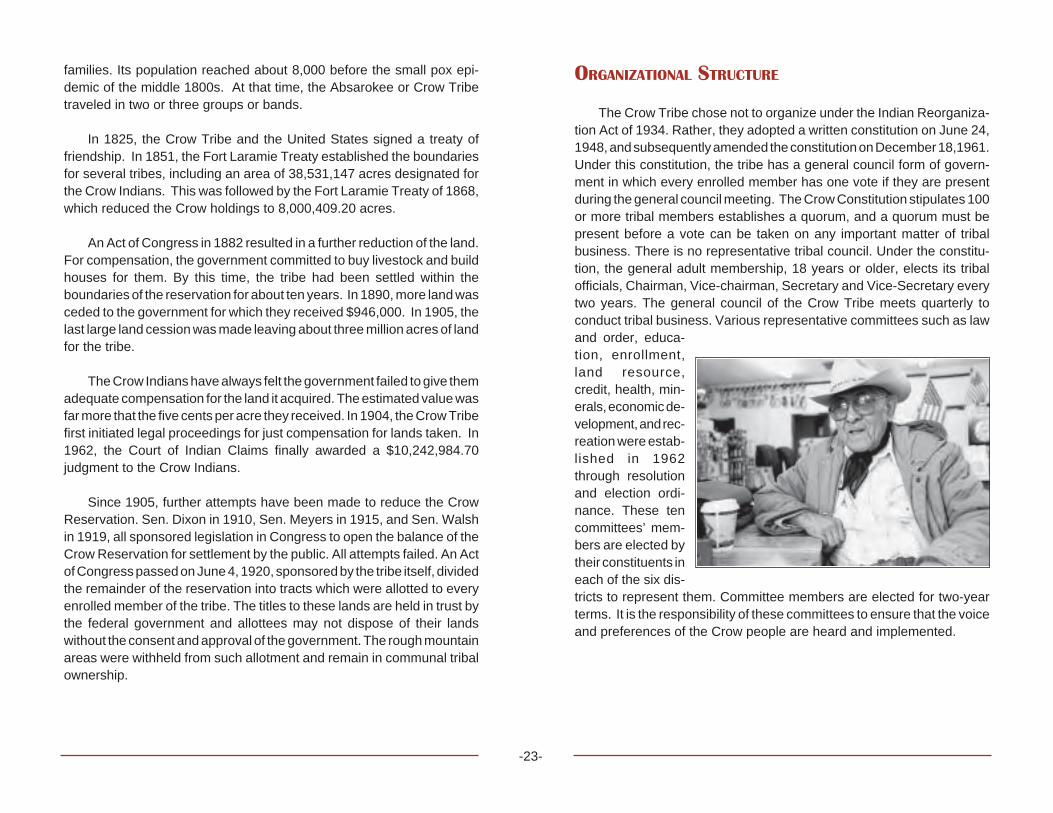
The Crow Tribe chose not to organize under the Indian Reorganiza-tion Act of 1934. Rather, they adopted a written constitution on June 24,1948, and subsequently amended the constitution on December 18,1961.Under this constitution, the tribe has a general council form of govern-ment in which every enrolled member has one vote if they are presentduring the general council meeting. The Crow Constitution stipulates 100or more tribal members establishes a quorum, and a quorum must bepresent before a vote can be taken on any important matter of tribalbusiness. There is no representative tribal council. Under the constitu-tion, the general adult membership, 18 years or older, elects its tribalofficials, Chairman, Vice-chairman, Secretary and Vice-Secretary everytwo years. The general council of the Crow Tribe meets quarterly toconduct tribal business. Various representative committees such as lawand order, educa-tion, enrollment,land resource,credit, health, min-erals, economic de-velopment, and rec-reation were estab-lished in 1962through resolutionand election ordi-nance. These tencommittees’ mem-bers are elected bytheir constituents ineach of the six dis-tricts to represent them. Committee members are elected for two-yearterms. It is the responsibility of these committees to ensure that the voiceand preferences of the Crow people are heard and implemented.

-24-
HOUSING
Housing conditions on the Crow Reservation are poor. Currently,there are 1,223 housing units across the reservation. Unfortunately, 75percent of these housing units are considered to be substandard. Since1971, approximately 250 HUD financed housing units have been con-structed on the Crow Reservation. Another 534 cluster homes were builtin 1987 in the towns of Crow Agency, Lodge Grass, Pryor, and Wyola.Overcrowding continues to be a serious problem on the reservation withtwo to three families living in one home. However, an estimated 2,500new homes are needed to meet the current needs for new and replace-ment construction.
MEDICAL FACILITIES
The Indian Health Service operates a new 50-bed hospital withcomplete inpatient care located one mile south of the Crow Agency. Inaddition, the outpatient facilities provide dental, vision, surgical, andspecial clinics once a month. Satellite outpatient services are available atthe Lodge Grass and Pryor Clinics. Also, a dialysis center and a 30-patient nursing home are adjacent to the hospital. The health carefacilities also serve members of the Northern Cheyenne Tribe located 30miles east of the Crow Reservation.
EDUCATION
Since 1900, the Crow Tribe of Indians preferred public education forits children. Around 1920, the Crow Tribe of Indians set aside land to “pay”for the privilege of having public schools on the reservation. Currently,there are four elementary (K-8) districts and three high school (9-12)districts on or adjacent to the Crow Reservation. These school facilitiesare situated at Crow Agency, Lodge Grass, Ft. Smith, Wyola, Pryor, andHardin. In addition, Crow students attend two private parochial schools,St. Xavier Mission at St. Xavier and St. Charles Mission at Pryor,Montana. The total on-reservation Indian student population is estimatedat 1,500 students.
In 1980, the Crow Tribe charted Little Big Horn College which islocated in Crow Agency, Montana. The college received candidacy foraccreditation in 1984. The college received full accreditation in 1990 byNorthwest Accreditation Commission for Schools and Colleges.
EMPLOYMENT AND INCOME
According to the Bureau of Indian Affairs Labor report for 1999, therewere 3,965 individuals in the potential labor force. Of these, 1,531 people(16 to 64 years of age) were employed, while 2,371, or 60 percent wereunemployed. Unemployment reaches its peak of an estimated 85 percentduring the winter months. The average annual unemployment rate on thereservation has held above 60 percent in recent years and has notdropped below 39 percent since 1976.
The economy of the Crow Reservation remains based almost entirelyupon government services to the people and agriculture, farming, andranching, although few tribal members are self-sustaining in theseactivities. The high winter unemployment is relieved to some extent in thespring and summer with farming, ranching, and construction work. Thecurtailment of the federal public service job programs in the 1980s hascontributed to a sustained rise in the annual unemployment rate. Over 75percent of the on-reservation Indian population has income below thecurrent federally established poverty levels.
Principal employers in the existing economy are the Bureau of IndianAffairs, Indian Health Service, Tribal Government, coal mining opera-tions, farming, ranching, and education related services. Income fromleasing of trust lands represents the major income resource for most on-reservation tribal members.
RECREATIONAL ATTRACTIONS
The building of the Yellowtail Dam, a 525-foot high, thin arch dam,resulted in the creation of a 70-mile long lake of spectacular scenic beautyin the Big Horn Canyon. The land and some of the surrounding area has

-25-
been designated a National Recreation Area. The Secretary of theInterior has approved a Memorandum of Agreement between the CrowTribe and the National Park Service to facilitate the development,administration, and public use of the Big Horn Canyon Recreation Area.Much of this national recreation area lies within the boundaries of thereservation.
The Big Horn River, which runs north and south through the reserva-tion, was opened to fishing by non-tribal members in 1981.
ANNUAL FESTIVITIES
Each year during the third week in August the Crow Fair Celebrationand Powwow is held. Indians from around the United States and Canadatravel to the Crow Reservation to set up as many as 500 teepees. Thefestivities include a parade, dances, Indian relay races, feasts, “give-aways,” and the Annual All-Indian Rodeo and Race Meet. The celebra-tion of this event has led to the national recognition of the CrowReservation as the “Tipi Capital of the World.”
POINTS OF INTEREST
Bighorn Canyon National Recreation Area and Yellowtail Dam, FortSmith, Montana, (406) 666-2412
The canyon features spectacular scenery, wildlife viewing, boating,fishing, and camping. There are two visitor centers - one at Fort Smithand one at Yellowtail Dam.
Little Bighorn Battlefield National Monument/Reno-Benteen Battle-field, Crow Agency, Montana, (406) 638-2621
These monuments commemorate the Indian victory over the Sev-enth Cavalry. The Little Bighorn Battlefield National Monumentfeatures museum exhibits, interpretive center, and ranger-led pro-grams.
Chief Plenty Coups State Park, Pryor, Montana, (406) 252-1289This is the home of the well-known Crow Chief, Plenty Coups. Thereis a display of Crow artifacts and scenic picnic area.
Little Big Horn College, Crow Agency, Montana, (406) 638-3100The college offers associate degrees in eight areas and integratesCrow Studies in all aspects of the plan of study to comply with itsmission of maintaining and preserving the Crow language andculture. In addition, the college operates the Institute for Micro-Business Development and Little Big Horn Tours for the CrowReservation. Group or individual tours and lectures are availableduring the summer, and on special arrangement all year long.

-26-

-27-
FLATHEAD RESERVATION
SALISH-KOOTENAI
-28-
FLATHEAD RESERVATION
LOCATION
The Flathead Indian Reservation is located in northwestern Montanaon the western slope of the Continental Divide. The exterior boundariesof the reservation include portions of four counties—Flathead, Lake,Missoula, and Sanders. The Flathead Reservation land base consists ofapproximately 1,243,000 acres. The eastern border of the reservation isat the top of the Mission Range of the Rocky Mountains. Flathead Lakeand the Cabinet Mountain Range are to the north; the Lower FlatheadRiver runs through the heart of the reservation; and to the west are theSalish Mountains and rolling prairie lands.
POPULATION
The three tribes of the Flathead Indian Reservation are the Salish,Pend d’Oreille, and Kootenai. Seliñ is the proper name for the Salish, whorefer to themselves as Sqéliö—the People. The Salish have often beenreferred to as “Flatheads,” but this name is a misnomer and, in actuality,there are no Flatheads. Qæispé is the proper name for the Pend d’Oreille.The aboriginal name of the Kootenai Tribe is Kutanaxa, a name thatmeans “licks the blood” in reference to a traditional hunting custom. Theterm Ktunaxa describes the Kootenai political sovereignty as a nation andall citizens who identify themselves as Kootenai. “Ksanka” refers to thename of the Ktunaxa band of the Flathead Reservation. Kasankatranslates, “Standing Arrow,” which is a traditional warring technique.The tribes today are known by the contemporary title of The Confeder-ated Salish and Kootenai Tribes. For the purposes of this document andfor reader understanding, the terms Salish, Pend d’Oreille, and Kootenaiwill be used.
After the reservation period, when lands were allotted and thensubsequently opened to homesteading in 1910, many non-Indians movedto the reservation. The influx of homesteaders and the continuing
movement of non-Indians onto the reservation have resulted in theConfederated Salish and Kootenai People being the minority populationon their own reservation. Presently there are many Indian people fromother tribes that live on the Flathead Reservation. Many are attendingSalish Kootenai College or Kicking Horse Job Corps. Some have inter-married with tribal members and live among the community with theirfamilies. Both Salish Kootenai College and local K-12 public schools haveidentified over 40 different tribal nations represented within the studentpopulations.
There are 6,961 enrolled members of the Confederated Salish andKootenai Tribes. Of this population, 4,244 live on the reservation.
LAND
The Hellgate Treaty of 1855 created the Flathead Reservation. Thetreaty defined the boundaries of the reservation. A formal survey by thegovernment actually diminished the reservation both on the northern andsouthern ends. The lands that remained as reserved by the treaty areapproximately 1,243,000 acres. This land base was soon to change,however, with the passing of the Allotment Act (Dawes Act) of 1887, andthe subsequent Homestead Act that opened the reservation to non-Indians in 1910. This resulted in the tribes becoming the minoritylandowners on their own reservation.
While much of the prime agricultural land remains in non-Indianhands, the tribes have been aggressively buying back land. At this timethey have become the majority landowners at roughly 56 percent.Following is a breakdown of the current status of reservation lands:
Area in Acres Status613,273.50 Tribal Trust 58,728.98 Tribal Fee 39,940.56 Individual Trust 4,248.89 Off-Reservation Tribal Fee 76,159.25 Water 22,466.46 Federal 40,742.57 State 346.42 Town sites466,480.67 Fee
-29-
Reservation lands are comprised of 451,000 acres of forested land,agricultural lands, prairie habitats, and numerous watersheds, pristinemountain lakes, and the lower half of Flathead Lake, which is the largestfreshwater lake west of the Mississippi River. Three hundred twenty-twothousand acres of forested lands are considered commercial forest. Thisforestland is managed as a whole to include reforestation, fire manage-ment, insect and disease control, timber, and economic opportunities forthe tribes. The Wildland Recreation Division of the tribe’s Natural Re-source Department maintains a variety of trails in the Mission Mountainsannually. Hiking and recreation on reservation lands by non-membersrequires a tribal recreation permit.
The Confederated Salish and Kootenai Tribes were the first tribalnation to designate a wilderness area. Much of the Mission Range fallsunder this category, and no development is allowed in this area. Both thenorthern and southern areas of the reservation have lands that aredesignated as “primitive.” The Jocko and Lozeau Primitive Areas areavailable only to tribal member use, and that use is restricted to certainactivities. It is the intent of the tribes that tribal members have access topristine lands for gathering plants, ceremonial use, and solitude.
The Confederated Salish and Kootenai Tribes believe in their role asstewards of the land and its resources as articulated in the followingstatement from the Salish Culture Committee:
The earth is our historian; it is made of our ancestor’s bones. Itprovides us with nourishment, medicine, and comfort. It is oursource of our independence; it is our Mother. We do not dominateHer, but harmonize with Her.
HISTORICAL BACKGROUND
Pre-reservation history provided by the Salish and Pend d’Oreille Culture Committee
Salish and Pend d’Oreille.
The Salish and Pend d’Oreille tell of having lived in what is nowMontana from the time when Coyote killed off the Naçisqéliö—the giants.The tribes’ oral histories tell that the Salish and Pend d’Oreille were
placed here in their aboriginal homelands. Their beginning and history inthis place is a story of genesis, not of migration. The late ClarenceWoodcock told this beginning:
Our story begins when the Creator put the animal people on thisearth. He sent Coyote ahead as this world was full of evils andnot yet fit for mankind. Coyote came with his brother Fox, to thisbig island, as the elders call this land, to free it of these evils. Theywere responsible for creating many geographical formations andproviding good and special skills and knowledge for man to use.Coyote, however left many faults such as greed, jealousy,hunger, envy and many other imperfections that we know oftoday.
Many of the Coyote stories contain what may be considered fairlyprecise descriptions of the geologic events of the last ice age. Anthropolo-gists and other non-Indians have long been skeptical of this, thinking thatthere was little evidence that Salish and Pend d’Oreille people had beenhere that long ago. But recently, archaeologists have found sites in theSouth Fork of the Flathead River dating back 12,000 to 14,000 years,about the time of the end of the last ice age.
From the beginning of time, the Salish and Pend d’Oreille peoplemade their living off the land through a complex pattern of seasonalhunting and gathering activities. The land provided all that the peopleneeded. Elders say that life was hard, but good. Spring would yield aplentiful bitterroot harvest, followed by sweet camas bulbs in June.
The bloom of the wild rose signaled the people that the buffalo calveshad been born and that it was time for the summer buffalo hunt.Throughout the rest of the summer, berries and fruits, including service-berries, huckleberries, and chokecherries would be gathered, dried andstored. The Salish and Pend d’Oreille regularly gathered hundreds ofdifferent plants for food and medicinal uses.
In the fall, hunting began in earnest. Men hunted for large game,which the women butchered, dried and stored for winter. As the huntersbrought home elk, deer, and moose, the women tanned hides for clothes,moccasins and other items such as a par fleche. A par fleche is a rawhide

-30-
container used for storing a variety of things like dried foods and clothing.Fishing was also important throughout the year. Both fishhooks and fishweirs were used to catch fish. Elders tell of days when the fish were soplentiful that you could almost cross the creeks walking on their backs.
The winter season involved trapping, ice fishing, and some hunting.Cold weather brought families inside and women made and repairedclothing while the men made and repaired tools and weapons. Coyotestories were brought out with the first snow. This was a sacred and happytime when ceremo-nial dances wouldbe held.
Salish andPend d’Oreille his-tory tells of thebreak-up of the onegreat Salish Tribethat existed longago. As the tribe’spopulation becametoo great to be sus-tained by hunting,fishing, and gathering foods in one central location, the people split up intomany smaller bands. Tribal elders say that tribes moved from theMontana area toward the west, breaking into smaller tribal groups thatcould be more easily supported by the seasonal supply of foods. Overtime, the tribes’ languages developed dialectical differences, though theyare still mutually intelligible. This story explains why all through historyand to the present day the Salish and Pend d’Oreille have kept close,friendly, and often intermarried relations with the tribes of easternWashington and northern Idaho. During the 19th century, these tribesoften banded together during their buffalo hunting expeditions to theplains.
The Salish have always considered the Bitterroot Valley their home-land, even though before the 17th or 18th century there were severalSalish bands based east of the Continental Divide, in such areas as theBig Hole Valley, the Butte area, the Helena area, and the Three Forks
vicinity. The Pend d’Oreille similarly occupied both sides of the moun-tains, with a major band situated by the Sun River near Great Falls. Salishlanguage place names are still remembered for numerous sites as fareast as the Sweetgrass Hills, the Milk River, and the Bear Paw Mountains.
To the north, relations with the Ktunaxa or Kootenai, whose languageis unrelated to Salish, were usually amicable, but not as close and familialas to the west. To the south, relations with the Shoshone people werevaried and shifted over time. At times these tribes raided each other. Atother times they traded, intermarried, and gambled together. A site in thefar southern end of the Bitterroot Valley was known as SleÛi, a kind ofneutral ground where the Salish and Shoshone would meet to playtraditional gambling games.
To the east, inter-tribal relations were less friendly. Both the Salishand Pend d’Oreille have always had conflicts and skirmishes with tribesof the plains, including the various Blackfeet bands; the Gros Ventre, theCrow, the Cree, the Assiniboine, the Cheyenne, and other Sioux tribes.Before the advent of guns, however, intertribal warfare tended to becharacterized by low mortality and was largely ceremonial in nature.Counting coup on the enemy was the most important aspect of warfare,which served to reaffirm longstanding boundaries between tribal territo-ries and to establish the honor and bravery of men in their willingness torisk their lives in defense of their people. Even with this history of conflict,the Salish and Pend d’Oreille sometimes had amicable relations witheastern tribes, including trade and even occasional marriage.
During the 17th century intertribal conflicts became more violent anddeadly. Perhaps for the first time since time immemorial, tribes foundthemselves in competition for resources. As tribes were being pushedwestward, food sources were being subjected to more intensive harvest-ing. Impacts of the movement of European trappers, traders, and settlerswere also felt through waves of smallpox, influenza, measles and othercontagious diseases. The greatest loss of life among Indian peopleoccurred through disease.
Horses and guns also made their way west. Tribes that gained firstaccess, like the Blackfeet, enjoyed a shifting balance of power beforeother tribal groups were able to secure similar armaments.

-31-
The combination of resource competition, loss of life from disease,and the introduction of deadlier weapons influenced Salish and Pendd’Oreille leaders to move their main camps to the west side of themountains. Horses would allow the people to continue to hunt buffalo,and the annual summer and winter hunts continued until the buffalopopulation was intentionally decimated in about 1883.
The Ksanka Band of KtunaxaHistoric information provided by the Kootenai Culture Committee
Ktunaxa history describes the evolution of The People from the timewhen the first sun rose in the sky and human beings were equal to theanimals. From the beginning of time the Sun and the Moon were brothersand they produced the powerful life force for all earthly creations. The Sunand Moon transformed all beings who chose to live on this earth intophysical forms and assigned them with a domain and complementarytools. The concept of interdependence that maintains the delicate bal-ance of the natural world is intrinsic to Ktunaxa culture.
The aboriginal territory of the Ktunaxa Nation encompasses threemajor ecosystems: the Columbia River Basin, the Rocky MountainRegion, and the Northern Plains. Although an official census was nevertaken, ethnographic studies estimate an historical population in excessof 10,000 Kootenai people.
With a massive homeland to protect and keen environmental skills,the Ktunaxa chose to live in distinct bands to maintain their unique lifecycles. The seven bands of the Ktunaxa Nation are distinguished by thelocation they inhabited throughout the winter months. The Ksanka or theFish Trap People reside in the Dayton, Elmo, Big Arm, and Nairadacommunities of Montana. The Wood Land People of St. Mary’s Band arein Cranbrook, British Columbia. The Two Lakes People of the ColumbiaLake Band are at Windmere, BC. The People of the Place Where theRock is Standing (the Lower Kootenai) reside in Creston, BC. TheMeadow People live in Bonners Ferry, Idaho and the Tobacco PlainsBand live in Grasmere, BC. The Not Shirt People (Upper Kootenai orShushwap) live in Ivermere, BC.
Prior to reservation settlement, the Ktunaxa lived a bicultural lifestyle, possessing cultural traits of both the Northern Plateau and Northern
Plains tribal groups. Ktunaxa subsistence was based on seasonalmigrations that followed plant and animal production cycles, and coinci-dentally served to prevent an environmental degradation of aboriginallands. Food preservation was an integral part of the Ktunaxa life cycle.Seasonal migrations for hunting and harvesting began in the early springwhen bitterroots ripened and fisheries were bountiful. In early summer,they traveled east of the Rockies to hunt buffalo, returning in mid-summerto process and store the meat. In summer, camas, huckleberries,serviceberries, chokecherries, and other plants were harvested. By fall,big game expeditions were organized and some of the hunters returnedto the plains for more buffalo. The people preserved and processed foodfor the winter cache.
The Ktunaxa life cycle also depended on a commerce sector, whichinvolved agriculture and aquaculture. The Ktunaxa cultivated a uniquespecies of tobacco for personal use and trade with other tribes. Theyspecialized in water, fisheries, bird hunting, trapping, and other aquacultural activities that were ongoing in Kootenai society.
The most prominent distinction of the Ktunaxa is the isolated lan-guage they speak. While scientists classify most indigenous languagesinto family groups to determine origin and migratory patterns, the Kootenailanguage has never been likened to any other language in the world. It isan anomaly that effectively contradicts any migration theory for Ktunaxa.Other distinctions of the Ktunaxa include their portable tulle-styledsummer lodges called Tanat. They also held the distinction of being avidcanoeists, trappers, and anglers. They excelled in engineering light craftto expedite navigation on some of the most treacherous waterways in theNorthwest. Their hunting and fishing techniques were superior even bymodern standards. They developed and utilized devices to augment theirtechnique. Traditional Kootenai fish weirs and bird traps were widelysought after for their utility.
Since time immemorial, the Ktunaxa have coexisted with MotherEarth’s creations in their natural habitat. Kootenai stewardship pre-scribes the utmost respect and protection for all elements of the naturalworld. As guardians, Ktunaxa people believe that life has little valuewithout a true appreciation for the environment and a genuine regard forall that is sacred.

The Confederation of the Salish, Pend d’Oreille, and Kootenai
The seasonal round patterned the existence of the tribes until theimpact of European colonization made its way west. After the Lewis andClark expedition, the fur trade exploded in the Northwest. With the furtrade came disease, alcohol, Christian teachings, guns, and goods thatwere said to “make life easier.” In retrospect, the fur trade took much morefrom tribes than it gave.
The westward movement of traders, homesteaders, and settlers,advanced the reservation period. In 1855, Isaac Stevens, TerritorialGovernor of Washington Territory, met with leaders of the Salish, Pendd’Oreille, and Kootenai Tribes at Council Groves near present dayMissoula, Montana. Tribal leaders were under the assumption discus-sions would be centered on their problems with their encroachingenemies, the Blackfeet. The resulting discussion, however, ended withtribal leaders reluctantly signing the Hellgate Treaty, ceding over 22million acres to the United States government. The prominent Salishleader at this time was Plenty Horses, or Victor. The treaty provided fora survey to be done of the Bitterroot Valley for Victor and his people inArticle XI. The survey was never done, however, and in 1871 PresidentGrant sent Rep. James Garfield to negotiate for the removal of the Salishto the Jocko Reservation (present day Flathead Reservation). Victor haddied during a summer buffalo hunt, and his son, Charlo—Small GrizzlyBear Claws—was chief. Charlo refused to sign the removal document,but when it was subsequently published, it showed his mark. Charloasserted that this was a forgery and refused to move. He remained in hisbeloved homeland until 1891, when he and his remnant band of Salishwere forcibly removed by military escort to the Jocko Reservation.
Confinement to the reservation made it difficult for the people toprovide for their families by hunting and gathering. Allocations forprovisions as outlined in the treaty were not fulfilled, and a series ofcorrupt Indian agents assigned to the reservation added to the hardshipof the people. The United States Congress passed the Dawes Act(Allotment Act) in 1887 in an effort to further assimilate Indian people.This legislation provided for the survey and allotment of individual landsto tribal members. In 1904 the Dawes Act reached the reservation withthe passing of the Flathead Allotment Act. Under this act, lots of 40, 80,and 160 acres were assigned to individual tribal members and families.
An underlying intention was to encourage the transition from a huntingand gathering economy to an agricultural one. There was a pervasiveattitude that Indian people must assimilate to white life ways. Triballeaders were active opponents of this legislation, traveling to Washing-ton, D.C. to give testimony of their opposition. Their efforts were futile andthe breaking up of the Flathead Reservation became a reality. Lands thatwere not allotted were deemed “surplus,” and in 1910 the reservation wasopened up to homesteading. The resulting land loss made the Confed-erated Salish and Kootenai Tribes the minority landowners on their ownreservation.
The next major impact on the tribes was the Indian ReorganizationAct, or Wheeler Howard Act, of 1934. This act ended the allotment eraand allowed tribes to adopt a constitution and charter of incorporation.Participation under this legislation was left up to the decision of each tribe.The Confederated Salish and Kootenai Tribes made the decision toincorporate under this act and in 1935 adopted a Tribal Constitution andCorporate Charter, becoming the first tribe in the nation to do so. Tribalgovernment became formalized under Article III of the Constitution,creating the Tribal Council, which at that time included Chief MartinCharlo and Chief Eneas Paul Koostahtah. Charlo and Koostahtah werethe last chiefs to serve as part of the Tribal Council.
From the inception of the reservation system, Indian people lostcontrol over their own destiny. The administrators and policies of theBureau of Indian Affairs controlled governance decisions for the tribes.The Indian Reorganization Act began the slow transition back to tribalcontrol over tribal affairs. Incorporation under this act allowed the tribesto again determine their own path. This journey was to be challenging, asevidenced in the government’s movement to terminate tribes during the1950s. Termination policy was initiated with various tribes, beginning withthe Menomonee of Wisconsin. Their final termination took place in 1961.Though the Salish, Pend d’Oreille, and Kootenai were targeted, theywere not terminated. Termination policy ended during the administrationof President Richard M. Nixon. Since then a number of tribes havesuccessfully sought reinstatement.
The Indian Self-Determination Act of 1976 bolstered the tribes’capacity to manage their own affairs. Tribes were given authority tomanage federal programs that had historically been under the direction
-32-

and control of the Bureau of Indian Affairs. Initially the tribes contractedprograms, but a more recent amendment to the Self-Determination Actallows the tribes to negotiate compacts with federal agencies on agovernment-to-government basis. Since 1994, the tribes have shiftedfrom contracting federal programs to compacting them.
Today the Confederated Salish and Kootenai Tribes are still facedwith many challenges. However, the historic and contemporary commit-ment to tribal sovereignty provides hope and confidence in a soundfuture. The vision and mission of the Confederated Salish and KootenaiTribes, the Sovereign People of the Flathead Reservation, are articulatedin a formal statement adopted by the Tribal Council in May of 1996:
Vision —The traditional principles and values that served ourpeople in the past are imbedded in the many ways that we serveand invest in our people and communities, in the ways we haveregained and restored our homelands and natural resources, inthe ways we have built a self-sufficient society and economy, inthe ways that we govern our Reservation and represent our-selves to the rest of the world and in the ways we continue topreserve our right to determine our own destiny.
Mission —Our mission is to adopt traditional principles andvalues into all facets of tribal operations and service. We willinvest in our people in a manner that ensures our ability tobecome a completely self-sufficient society and economy. Wewill strive to regain ownership and control of all lands within ourreservation boundaries. And we will provide sound environmen-tal stewardship to preserve, perpetuate, protect, and enhancenatural resources and ecosystems.
GOVERNMENT
The Secretary of the Interior, Hubert Work, authorized a survey in1926 to assess the economic status of Indians. This survey came to beknown as the Meriam Report. Findings of the survey “Shocked theadministration since it called for radical revisions in almost every phaseof Indian affairs” (Deloria and Lytle, American Indians, American Justice,
p12). Response and reform to the Meriam findings came under theInterior Department administration of John Collier. Under Collier’s admin-istration, the Indian Reorganization Act (IRA), or Wheeler Howard Act,was passed in 1934. This legislation provided for the cessation ofallotments and the opportunity for tribes to regain unallotted lands. TheIRA also enabled tribes to reorganize their governmental structures andadopt a Tribal Constitution and Bylaws. It was under this provision that theConfederated Salish and Kootenai Tribes adopted their Constitution andBylaws that were ratified by the United States in 1953.
Article III of the Constitution and bylaws of the Confederated Salishand Kootenai Tribes established the Tribal Council as the formal govern-ing body along with Chiefs Martin Charlo and Eneas Paul Koostahtah.
Initially, Tribal Council meetings were held quarterly. Presently,meetings are held every Tuesday and Thursday at the Tribal Complex inPablo, Montana. Quarterly meetings are still held with these meetingdays designated for the community to attend and address issues ofconcern. All council meetings are open to the public unless the council ismeeting in executive session. Visits can be formally arranged by callingthe Tribal Administrative Office at (406) 675-2700. Tribal Council mem-bers will visit classrooms upon request and as their schedules allow.
The Tribal Council is more than just a policy-making body. Unlikemost legislative bodies, they are expected to deal with everything fromfiscal management to assisting individuals in personal crisis. While thewelfare of tribal members is the single-most influencing factor of TribalCouncil decisions, other interests weigh heavily on the future of the tribes.At the forefront of tribal interests are future generations, preservation oftribal resources, tribal rights, environmental protection, fiscal manage-ment, legal issues, and community support. The Tribal Council dependson expert staff for accurate information to guide decisions on importantissues.
Tribal membership is an example of such an important issue. Atpresent, Tribal Ordinance 35A, as enacted by the Tribal Council in 1961,outlines the criteria for enrollment as a member of the ConfederatedSalish and Kootenai Tribes. Formal enrollment procedures require appli-cation requesting enrollment; proof of the child’s parental tribal member-
-33-

ship, and evidence the child possesses one quarter or more blood of theSalish and/or Kootenai Tribes, of the Flathead Indian Reservation, andproofs the child is not enrolled on another reservation.
The tribal organization employs over 1,000 people. Of this number,approximately 900 are tribal members. Following is a partial list ofdepartments and programs:
• Administration• Court• Salish and Kootenai Culture Committees• Human Resources• Education• Forestry• Natural Resources• Health & Human Services• Head Start• Kicking Horse Job Corps• Culture & Historic Preservation• People’s Center• Mission Valley Power• Housing Authority• Char-Koosta News• Law & Order• Personnel and Legal Department
EDUCATION
The first school on the Flathead Reservation was a boarding schoolstarted by the Sisters of Providence of Charity in St. Ignatius in 1864.Prior to the arrival of the nuns, Jesuit Priest Father Adrian Hoecken hadfounded a mission there in 1854. This was the second mission among theSalish—the first was St. Mary’s Mission in the Bitterroot Valley, estab-lished by Father DeSmet in 1841. Salish and Pend d’Oreille oral historyforetold of the coming of the “Blackrobes” by a prophet known as “ShiningShirt.” Four different delegations were sent to St. Louis to bring back thespiritual teachings of the Blackrobes to the Salish people. Father DeSmetresponded to the last delegation and established St. Mary’s Mission nearStevensville. The mission was later moved to St. Ignatius.
Ursuline nuns arrived in 1884, and opened a school to both boys andgirls. Later, in 1888, the Jesuit Priests had a trade school for boys. All ofthe schools were boarding schools. While many Indian children attendedthese local Catholic boarding schools, still others were sent away togovernment boarding schools throughout the country. The educationalexperience of the Salish, Pend d’Oreille, and Kootenai was similar to thatof other Indian children around the country. Often children did much of thework that kept the schools running. Native languages were forbidden, aswell as all other cultural traditions and customs. While some childrenattended the schools at the volition of their parents, many were forced togo due to a compulsory attendance law for Indian children, passed byCongress in 1893. Elders still relate stories of the Indian Agent comingto communities to “round up children.” Other parents sent their childrenbecause the reservation system had imposed such poverty upon thepeople that at least at the school the children would be fed. Villa Ursula,the school run by the Ursuline nuns, remained in operation until 1972, andby that time, it had changed over to a day school. When the schoolsclosed, lands that the tribes had allowed the church to use were to revertback to the tribe. The church, however, sold the lands and the tribes wereforced to accept a monetary settlement for them.
With the influx of settlers, small rural schools sprang up throughoutthe Mission Valley, oneas early as 1913 in St.Ignatius. Today thereare eight school districtson the Flathead Reser-vation, seven of thempublic schools and onea Bureau of Indian Af-fairs Contract School,Two Eagle RiverSchool, which was es-tablished in 1979. Two
Eagle River School (TERS) serves approximately 160 students in grades7-12. All students that attend TERS take Salish or Kootenai languageclasses and Flathead Reservation History. The core curriculum is aug-mented with cultural and historic content.
-34-

In 1977 Salish Kootenai College was established. The college islocated in Pablo, Montana across the highway from the Tribal Complex.The mission of the college is to provide quality postsecondary opportu-nities for Native Americans locally and throughout the United States.
Salish Kootenai College (SKC) offers 11 associate degree programs,and three baccalaureate degree programs. Financial aid and scholar-ships are available to assist students in attending. Cultural classes areoffered free to tribal members.
Beyond providing postsecondary opportunities, SKC offers manyother services to the local communities. Many cultural and educationalactivities scheduled throughout the school year are open to the public.The media center and library are available to all community members freeof charge. The college also operates a PBS television station thatbroadcasts local events and programs. SKC Press has published severalvolumes of oral literature, historical pieces, and native language dictio-naries.
ECONOMICS
Historically, the tribes have been the largest employers on thereservation. As tribal departments and programs have expanded andevolved, this has held true. K-12 school districts employ over 400 staffand Salish Kootenai College has a full-time staff and faculty of 178employees. SKC also houses the Tribal Business Assistance Center.This office provides workshops related to business management, creat-ing a business infrastructure and entrepreneurship. The Char-KoostaLoan Fund being developed by the center, will offer loans of $5,000 -$35,000 to tribal members for entrepreneurial or business ventures.
S & K Electronics, Inc. is a minority-owned company on the reserva-tion that specializes in assembly of electronic and electro-mechanicalcomponents for the United States government and commercial industry.The company was established in 1984 as an enterprise and wasincorporated under tribal and federal law in 1985 by the ConfederatedSalish and Kootenai Tribes, who are the sole shareholders of thecompany. However, S & K is separate from the tribal organization and
functions under its own board of directors. The company employsbetween 40 and 70 people depending on the amount and size of contractsit secures.
CONTEMPORARY ISSUES
• Native Language Restoration and Preservation• Stewardship of Natural Resources• Tribal Sovereignty• Repatriation and Cultural Resource Protection• Relationships with County and State Government• Responsible Economic Development• Improving the Education of Indian Children
RECREATION / TOURISM / POINTS OF INTEREST
Flathead Indian Museum, St. Ignatius, Montana, (406) 745-2951American Indian artifacts are displayed in a museum that adjoins atrading post that sells beadwork, art, and other items made by localIndian artists. It is owned and operated by a tribal member.
Four Winds Historic Village, St. Ignatius, Montana, (406) 745-4336Historic log buildings that make up the village date back to the 1800s.Moccasins, beadwork, and other crafts are sold as well as beadingsupplies, hides, etc. The village also houses a toy train museum.
St. Ignatius Mission, St. Ignatius, Montana, (406) 745-2768Established in 1854, the mission was constructed by Indian peopleunder the direction of Catholic missionaries. There are 58 originalmurals painted by Brother Joseph Carignano on its walls andceilings.
Ninepipe Museum, Ronan, Montana, (406) 544-3435This recently constructed museum has a good display of artifacts andphotographs of local families.
-35-
Ninepipe National Wildlife Refuge, Ronan, Montana, (406) 644-2211This is one of Montana’s designated Wildlife Viewing Sites. It is anexceptional wetland complex, prime for bird watching. The refugehas its namesake of the Ninepipe family. Brothers Louie, Andrew andAdolph, were well known for their talent and knowledge of traditionalsongs.
National Bison Range, Moiese, Montana, (406) 644-2211Approximately 500 readily visible bison roam nearly 20,000 acres ofnatural grassland. Visitors may also see elk, deer, antelope, andbighorn sheep.
Salish Kootenai College, Pablo, Montana, (406) 675-4800The college has an attractive 66-acre campus. Several unique metalsculptures mark the campus, as well as a number of beautiful artpieces that are housed in the D’Arcy McNickle Library. Campus toursare available by appointment.
Sqéliö Aqçsmaknik—The People’s Center, Pablo, Montana,(406) 675-0160
The People’s Center houses a permanent museum exhibit as well asa gallery for Native American artists. A gift shop offers books, audioand videotapes, as well as traditional and contemporary works oflocal Indian artists. A variety of events are scheduled for the publicthroughout the year. Each September the center hosts local schoolsduring Native American Week, providing a variety of cultural exhibi-tions and activities.
Kerr Dam, Polson, MontanaLocated just southwest of the town of Polson, the Kerr Dam Vista Siteoffers a spectacular overhead view of the dam and the LowerFlathead River. This area was considered sacred to the Salish, Pendd’Oreille, and Kootenai people. The tribes opposed the constructionof the dam due to the significance of the site. Construction wentahead and currently the dam is leased from the tribe for approxi-mately $13 million annually. A locally produced video, Place of theFalling Waters, provides an in-depth look at the history of the dam.
Kwataqnuk Resort, Polson, Montana, (406) 883-3636Kwataqnuk is a tribally owned resort on the shore of Flathead Lake.The resort hosts boat tours of the lake during summer months, as wellas boat rentals.
Flathead Lake, MontanaThere are a variety of state parks along the shores of the lake. FinleyPoint, Elmo, Yellow Bay, and Big Arm all offer camping, fishing,boating, and swimming.
Blue Bay Campground, Montana, (406) 675-2700Blue Bay is located on the east shore of the lake and is owned andoperated by the tribe. Campsite areas are available and offerelectrical hookups, bathrooms, and shower facilities.
Flathead Raft Company, Polson, Montana, 1-800-654-4359Owned and operated by a tribal member, the company offerswhitewater raft tours of the Lower Flathead River and canoe andkayak lessons.
CALENDAR OF EVENTS
January Jump DancesApril /May Bitterroot FeastMay River HonoringJune Vanderburg CampJuly Arlee Celebration (Pow Wow)July Standing Arrow Celebration (Pow Wow)September Native American Week—The People’s CenterSeptember Reservation Wide Teacher In-ServiceNovember Kicking Horse Job Corps Celebration Pow WowDecember St. Ignatius Community Center
Celebration Pow Wow
-36-

RESOURCES ABOUT THE CONFEDERATED SALISH
AND KOOTENAI TRIBES
Salish Culture Committee Publications:
• A Brief History of the Flathead Tribes• Eagle Feathers the Highest Honor• Buffalo of the Flathead• Common Names in the Salish Language• Stories From Our Elders• The Salish People and the Lewis & Clark Expedition
Salish Kootenai College Press Publications:
• The Politics of Allotment• Coming Back Slow—Agnes Vanderburg Interview• Over a Century of Moving to the Drum• Coyote Stories of the Montana Salish Indians• In the Name of the Salish & Kootenai Nation: The Hellgate Treaty
& The Origin of the Flathead Indian Reservation• Challenge to Survive: Volume I and II
-37-
Videos:
• The River Lives—SKC Media• Changing Visions—SKC Media• Place of the Falling Waters—Native Voices• Without Reservations: Notes on Racism in Montana—
Native Voices• The People Today—University of Washington, DeSmet Project• Seasons of the Salish—University of Washington, DeSmet Project

-38-

-39-
FORT BELKNAP RESERVATION
ASSINIBOINE - GROS VENTRE
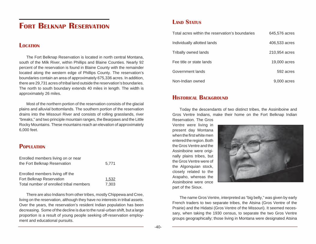
-40-
FORT BELKNAP RESERVATION
LOCATION
The Fort Belknap Reservation is located in north central Montana,south of the Milk River, within Phillips and Blaine Counties. Nearly 92percent of the reservation is found in Blaine County with the remainderlocated along the western edge of Phillips County. The reservation’sboundaries contain an area of approximately 675,336 acres. In addition,there are 29,731 acres of tribal land outside the reservation’s boundaries.The north to south boundary extends 40 miles in length. The width isapproximately 26 miles.
Most of the northern portion of the reservation consists of the glacialplains and alluvial bottomlands. The southern portion of the reservationdrains into the Missouri River and consists of rolling grasslands, river“breaks,” and two principle mountain ranges, the Bearpaws and the LittleRocky Mountains. These mountains reach an elevation of approximately6,000 feet.
POPULATION
Enrolled members living on or nearthe Fort Belknap Reservation 5,771
Enrolled members living off theFort Belknap Reservation 1,532Total number of enrolled tribal members 7,303
There are also Indians from other tribes, mostly Chippewa and Cree,living on the reservation, although they have no interests in tribal assets.Over the years, the reservation’s resident Indian population has beendecreasing. Some of the decline is due to the rural-urban shift, but a largeproportion is a result of young people seeking off-reservation employ-ment and educational pursuits.
LAND STATUS
Total acres within the reservation’s boundaries 645,576 acres
Individually allotted lands 406,533 acres
Tribally owned lands 210,954 acres
Fee title or state lands 19,000 acres
Government lands 592 acres
Non-Indian owned 9,000 acres
HISTORICAL BACKGROUND
Today the descendants of two distinct tribes, the Assiniboine andGros Ventre Indians, make their home on the Fort Belknap IndianReservation. The GrosVentre were living inpresent day Montanawhen the first white menentered the region. Boththe Gros Ventre and theAssiniboine were origi-nally plains tribes, butthe Gros Ventre were ofthe Algonquian stock,closely related to theArapaho, whereas theAssiniboine were oncepart of the Sioux.
The name Gros Ventre, interpreted as “big belly,” was given by earlyFrench traders to two separate tribes, the Atsina (Gros Ventre of thePrairie) and the Hidatsi (Gros Ventre of the Missouri). It seemed neces-sary, when taking the 1930 census, to separate the two Gros Ventregroups geographically; those living in Montana were designated Atsina

-41-
and those living in the Dakotas were called the Hidatsa. The Gros Ventreof the Prairie called themselves “The White Clay People” or “Ahaninin.”
The Assiniboine (from the Chippewa, meaning one who cooks by useof stone) tribe is a detachment from the Sioux tribe. They left their mothertribe shortly before 1640. This band of Assiniboine Indians followed theCree northward from the headwaters of the Mississippi between LakeSuperior and Hudson Bay. It is believed they settled first in the vicinity ofthe Lake of the Woods, then moved northwest to the region around LakeWinnipeg. They ranged in Canada and along the Milk River. Until 1838,they were estimated to be a large tribe from 1,000 to 1,200 lodges.Subsequently, small pox reduced them to less than 400 lodges.
Both the Gros Ventre and the Assiniboine Indians shared theBlackfeet Hunting Territory, which was set aside by the Fort LaramieTreaty of 1855. This treaty granted hunting grounds, with defined bound-aries, for the tribes of the Blackfeet, Blood, Crow, and Piegan as well. Theboundaries roughly extended from the Yellowstone River north to theUnited States-Canadian border and from the Rocky Mountains of west-ern Montana to the junction of the Yellowstone and Missouri Rivers. Thisarea was to be used in common by Indians receiving rations from FortBrowning, Milk River, and Fort Belknap for a period of 99 years. Theselands were reduced in size in 1873. Eventually three separate reserva-tions—the Blackfeet, the Fort Belknap, and the Fort Peck—were estab-lished by the Act of May 1, 1888.
One of the first trading posts was established near the present townof Dodson in 1868. A year later the new post, Fort Belknap, wasestablished on the south side of the Milk River, about one mile southwestfrom the present town site of Chinook. The fort, named for William W.Belknap, who was the Secretary of War at the time, was a substantial fortcombined with a trading post and it became the government agency forthe Gros Ventre and Assiniboine Indians living in the area.
In the early 1880s, the Fort Belknap Agency was moved fromChinook to the present site five miles east of Harlem on the northwestcorner of the reservation. In 1921, the United States government allotted539,065 acres to 1,171 Indians who were then enrolled on the FortBelknap Reservation. Thereafter, settlement of non-Indians took place
much more rapidly and did so partly in response to the availability of landfor cattle and sheep ranching.
In 1888, completion of the Great Northern Railroad helped theexpansion of the livestock industry. Malta became a major shipping yardfor cattle and sheep. It was about this same time that gold was discoveredin the Little Rocky Mountains, bringing people to Montana. Because of thevariety of people attracted to the area by the gold discovery, the towns ofLandusky and Zortman became famous as the “two toughest towns in theterritory.”
The discovery of gold brought with it another problem for the FortBelknap Indians. Mining claims appeared throughout the area of the LittleRocky Mountains apparently in disregard of the fact it was Indianreservation land. After the United States government appointed a com-mission to negotiate with the Fort Belknap Indians for surrender of theLittle Rockies, an agreement was signed in 1896 which ceded a portionof the Fort Belknap Reservation back to the United States.
In 1969, the Fort Belknap Community Council began proceedings torecover that portion of the Little Rocky Mountains ceded by the Act ofJune 10, 1896, and thus restore the reservation boundaries described inthe Act of May 1, 1888. As of the year 2003, this proceeding is still notsettled and is in the process of being recovered.
ORGANIZATIONAL STRUCTURE
The Fort Belknap Community was organized in 1935 under theIndian Reorganization Act and its constitution and bylaws were approvedon December 13 of that year. A corporate charter was ratified August 25,1937. In 1974, the Fort Belknap Community Council modified theconstitution to elect a membership of six councilmen to the tribal councilon a staggered basis every two years. The constitution states the FortBelknap Indian Community Council shall have two Gros Ventre and twoAssiniboine members, every two years. The people elect the TribalCouncil Officers at large for a term of four years.
-42-
NEW CONSTITUTION
The new constitution and bylaws of the Fort Belknap Communitywere ratified in 1994 by popular referendum. The duties and structureobjectives, territory, membership, powers of the community council,initiative referendum, land and adoption stand as the organization in 1935under the Indian Reorganization Act.
Section 1 Composition: The Community Council shall be com-posed of four (4) members all of whom shall be chosen every second yearby popular vote, a president and vice-president shall be chosen everyfour (4) years by popular vote, and a secretary-treasurer who shall beappointed in accordance with Section 4 of this Article. Every candidate forelected office shall pay a filing fee of $10.
Section 2 Creation of District Apportionment: This shall becreated by the Community Council two (2) Gros Ventre and two (2)Assiniboine voting districts on the reservation. The president and vice-president shall be a team of one (1) Gros Ventre and one (1) Assiniboine.
Section 3 Tenure: The Gros Ventre and Assiniboine candidates foreach district shall be elected for a two (2) year term, they succeedthemselves at will. The president and vice-president shall be elected fora four (4) year term and may succeed themselves at will.
Section 4 Officers: The officers of the Community Council shallconsist of a president and vice-president, and secretary-treasurer whoshall be appointed by the president. They shall be enrolled members ofthe Gros Ventre or Assiniboine Tribes. The secretary-treasurer of theCommunity Council, as a non-elected officer, shall not be entitled to voteon matters before the Community Council.
ARTICLE VII ELECTIONS
Section 1 Right to Vote: All tribally enrolled members of the FortBelknap Community, of either sex, eighteen (18) years of age or over,shall be entitled to one vote.
Section 2 Time of Elections: A primary election shall be held in eachdistrict. The two candidates for each office in each district receiving themost votes shall progress to a general election in which the candidatesreceiving the majority of the votes shall be elected and seated. Primaryelection for memberships on the Community Council shall be held on thefirst Tuesday in November of the second year and general elections shallbe held on the first Tuesday in December of the same year. Duly electedCouncil Members shall take office immediately upon certification ofelection results.
Section 3 Manner and Place of Elections: Elections by ballot andpolling places in each district. Absentee ballots, including those of non-residents shall be counted in their district. The council appointed three (3)election judges to serve at each polling place.
Section 4 Nomination: Candidates for election to membership onthe Community Council shall give public notice of such intention at leastthirty (30) days prior to the primary election date, and file with secretary-treasurer of the Council, their statement of residency in the district -endorsed by five (5) duly qualified electors from the same district, otherthan immediate relatives. President and vice-president shall give publicnotice of such intention same as the other candidates. A statement ofaffiliation of one (1) member of Gros Ventre and one (1) Assiniboine.
MEDICAL FACILITIES
The Fort Belknap Community Council created a Tribal Health Depart-ment in 1976 in response to P.L. 93-638. The Tribal Health Departmentis responsible for the administration of the following programs:
• Chemical Dependency Treatment Program• Community Health Representative Program• Family Planning Program• Health Education Program• Women, Infant and Child Nutrition Program• Tribal Health Diabetes Program

-43-
All the programs presently under the Tribal Health Departmentcontrol are contacted via P.L. 93-638. By gaining more experience andexpertise, the Fort Belknap Tribal Government is furthering self-suffi-ciency and self-determination by maximum participation in the contractprocess.
The majority of health care is provided by the New Fort BelknapHealth Center. There is a four-bed clinic located at Fort Belknap and asatellite health station located in Hays, a distance of approximately 35miles. The new clinic facility, EagleChild Health Center, located at Hayscan adequately serve 1,300 people.The new Health Center that was builtin Fort Belknap replaced the old hos-pital and serves the bulk of the healthcare for all people in the surroundingarea.
EDUCATION
Fort Belknap Indian children onthe reservation attend elementarypublic schools at Harlem, Lodge Pole,and Dodson. There is a public juniorhigh/high school and elementary mis-sion school at Hays, mainly attendedby those students living near thereservation’s southern border. Also,there are public high schools at Harlem and Dodson (grades 9-12). Someof the high school students elect to attend off-reservation federal board-ing schools.
The Fort Belknap Head Start Program has been in operation since1965 with a pilot program and since 1967 as a regular program at FortBelknap, Hays, and Lodge Pole, serving 1,900 children three to five yearsof age. As of 2000, there is a Child/Family Bilingual Program, teachingAssiniboine and Gros Ventre languages for two hours a day. A FosterGrandparents Program that hires elders to work with children in Head
Start has been in operation since 1975. This was the first FosterGrandparent Program in the state of Montana and on an Indian reserva-tion.
The Fort Belknap Community College offers a two-year degree in artsand sciences. It consists of a library, tribal archives, and public radiostation (KGVA). The enrollment is 254 students. The Board of Directorsconsists of seven (7) members.
Academic Programs:Degrees and Certificates
Degree: Associate of Arts General StudiesEmphasis Areas:
BusinessBusiness EntrepreneurshipCriminal JusticeElementary EducationHuman ServicesHuman Services—ChemicalDependency CounselingLiberal ArtsLiberal Arts—Native American StudiesMicrocomputer OperationPre-professional Biological SciencesPre-professional Medical
For information call Fort Belknap Community College, (406) 353-2607 or visit the Web site http://www.montana.edu/~wwwse/fbc/fbc.html.
The Fort Belknap Small Business Development Center is operatedwithin the Fort Belknap Community College. It offers individual consulta-tion with business advisors and business workshops and courses appro-priate for small business owners. Services are available for individualsinterested in starting a new business or expanding an existing business.Fort Belknap Community College offers a two-year degree in BusinessEntrepreneurship.
EMPLOYMENT AND INCOME
Today, as in the past, employment for the reservation’s residents isscarce. This scarcity forces many people to move away from thereservation to take up temporary or permanent employment elsewhere.
The Bureau of Indian Affairs and the tribe itself are the majoremployers on the reservation. Some of the Indians are successful inobtaining jobs in the nearby communities of Harlem, Havre, Chinook, andMalta. Some of the Indian people are supporting themselves by farming,ranching and other jobs in agriculture, while others derive some incomefrom these sources.
The Fort Belknap Indian Reservation has the highest rate of unem-ployment among the seven reservations in the state of Montana and isvirtually undeveloped in every aspect. Fort Belknap is heavily dependentupon federally subsidized programs to alleviate this problem. Seasonalmonies are received for fighting forest fires.
Unemployment fluctuates between a low of 40 percent and a high of75 percent depending upon the season of the year. As of January 1,1999, the unemployment level was over 70 percent (Employment Assis-tance Statistics, January 1, 1999, Fort Belknap Agency).
PUBLIC ASSISTANCE PROGRAMS
Fort Belknap Tribes on the reservation will be operating some of thepublic assistance programs that serve its low-income families. The tribalgovernment of the Assiniboine and Gros Ventre Indians will open atemporary assistance office to needy families (TANF) in the formerfederal hospital building. The TANF offices will be open October 1 withfour (4) case managers employed by the tribes. The program willadminister the federal cash assistance to more than 200 families on thereservation.
The Montana Department of Public Health and Human Services,which will move its Chinook office to Fort Belknap, will still carry out foodstamps and Medicaid functions.
CONTEMPORARY ISSUES
TRIBAL SOVEREIGNTY
Sovereignty has been a critical issue with Indian Nations. Since theindependence of the United States, policies affecting Tribal sovereigntyhave been a grave concern. From the Indian Removal Act of 1830, federalpolicy has impacted the tribal right of self-governance. As Indian peoplerepeatedly ceded lands in exchange for the United States’ guarantee oftheir sovereignty over the lands they reserved, they continued to findthemselves in a struggle to retain that guarantee.
The United States continued to assume authority over and to involveitself in tribal affairs. Federal policies have continued to chip away at tribalsovereignty. The Assiniboine and Gros Ventre of the Fort BelknapReservation hope that in the future the concept of Indian sovereignty willremain a determining issue in future policies. This can only be possibleif the Indian people protect the sovereignty cause from those who wouldseek to undermine it.
WATER RIGHTS CLAIMS AND THE WINTERS DOCTRINE
The Winters Doctrine gave tribes a special type of reserved WaterRights. In the court case dealing with Indian Rights, Henry Winters vs. theUnited States, the Supreme Court, in effect, held that rights to use ofwater for irrigation of Fort Belknap Indian Reservation lands have beenreserved. Moreover, the water rights reserved are not limited to thatnecessary for irrigation at the time reservation was established. TheInternational Boundary Treaty and agreement between the United Statesand Canada is an agreement to share the water supply of the Milk River.
The Madison limestone aquifer is considered the greatest economi-cal potential on the reservation. During the last ten years the Gros Ventreand Assiniboine Tribes of Fort Belknap Reservation have been workingon settling all existing water right claims.
The compact is entered into by and among the state of Montana, theGros Ventre and Assiniboine Tribes of the Fort Belknap Reservation, and
-44-

the United States of America for purpose of settling all existing water rightclaims. It will be ongoing, until settled, or back to the Winter Doctrine.
ZORTMAN/LANDUSKY MINING ISSUES
In the early 1980s the Bureau of Land Management (BLM) and theDepartment of State Lands (DSL) allowed Pegasus Gold to start a leachgold mine in the Little Rocky Mountains on BLM management and privatelands. Two mines were developed, one at Landusky and the other atZortman. Pegasus requested BLM/DSL to allow construction of Sullivanleach pad at the top of the watershed. The Environmental ProtectionAgency and Red Thunder, Inc. opposed the request. They told BLM/DSLthat the mined oxide ore and heavy metals would allow acid minedrainage to flow from the mine into ground and surface waters. In August1991 contaminated water and sediments were collected in Alder Gulchand cyanide contamination of ground water was verified.
The mines were shut down. The mines were designed and permittedonly for mining oxide ore and waste rock. This is because the moredangerous sulfide ores and waste rock generate acid mine drainage andheavy metals when exposed to water and weather.
Acid rock drainage appears at numerous locations in the mined area.The Canadian subsidiary went bankrupt and went back to Canada witha lot of controversies. Clean up is being done in Mission Canyon andAlder Gulch. Test wells done show how the groundwater will not becontaminated.
RECREATION
Along the Little Rockies, the reservation offers some scenic loca-tions. One of the best known sites is in Mission Canyon south of Hays.Visitors will find tribal campground sites throughout the reservation. Non-tribal members must purchase a permit for overnight or extendedcamping.
ANNUAL FESTIVITIES
During the 1920s, caravans of Indians from surrounding areastraveled to the Fort Belknap Indian Reservation to participate in the IndianFair. Today, a semblance of the fair and Pow Wow is held every year inlate July. The celebration, today called the “Fort Belknap Indian Days,”features Indian dancing, singing, feasts, and “give-aways.” The NewYear’s Pow Wow/Celebration is December 31 and has been held for 110years in Lodge Pole. During the summer there are two Sundances: thesecond week in June the Gros Ventre have their Sundance in the MissionCanyon; on the fourth of July, the Assiniboine have their Sundance atMouse Canyon Flats near Lodge Pole.
POINTS OF INTEREST
Fort Belknap Community CollegeFort Belknap Agency, Montana(406) 353-2607
Fort Belknap Tourism Office and Information CenterHarlem, Montana(406) 353-2205
The information center also houses the Fort Belknap Gift Shop,which features handcrafted Native American arts and crafts. Staff pro-vides tours of the Mission, Snake Butte, ancient tepee rings, and the tribalbuffalo pasture.
Tours are conducted and a public rest area and campground islocated at Fort Belknap Agency.
-45-

-46-

-47-
FORT PECK RESERVATION
SIOUX - ASSINIBOINE

-48-
FORT PECK RESERVATION
The Fort Peck Indian Reservation is home to a number of differentNakoda (Assiniboine), Dakota, and Lakota (Sioux) communities thatstretch along northeast Montana’s Hi-Line from the Big Porcupine Creekto the Big Muddy Creek. The reservation, Montana’s second largest interms of land area, consists of 2,093,318 acres of which just under halfis owned by individual tribal members or held in common by the Assiniboineand Sioux Tribes. Linguistically, the Nakoda, Dakota, and Lakota arerelated. Sometime in the late 16th century they resided in the regionbetween the Mississippi River and Lake Superior. As pressure fromeastern tribes increased, the Nakoda split from the other Dakota andLakota groups and moved north into Cree country.
Today, bands of Nakoda, Dakota, and Lakota reside in Frazer,Oswego, Wolf Point, Poplar, Brockton, Riverside, and Ft. Kipp. Thesecommunities lay along the Missouri River’s north bank, the reservation’ssouthern boundary. Wolf Point, with a population of 4,000, is the largesttown on the reservation and serves as the reservation’s commercialcenter. Poplar, the next largest community, has a population of 3,200.Poplar is also the center of tribal government. The Ft. Peck Tribes, theBIA, and the Indian Health Service are headquartered there, as well asa number of other federally funded programs. The nearest primary tradecenters are Billings, Great Falls (both approximately 300 miles from thereservation), and Williston, North Dakota, which lies some 75 miles eastof Poplar.
POPULATION
Enrolled Sioux members 6,962Enrolled Assiniboine members 4,209Total Ft. Peck tribal members 11,171
There are close to 1,000 members of other tribes living on Ft. PeckReservation One of the largest non-enrolled tribal groups is the Chippewa
from the Turtle Mountain Reservation in North Dakota. The next largestnon-enrolled group is the Assiniboine from Ft. Belknap followed byindividuals from the Three Affiliated Tribes (Mandan, Hidatsa, andArikiara) in North Dakota, and a number of Canadian Assiniboine.
LAND STATUS
Total reservation acreage 2,093,124Total tribal acreage 413,020Total individually allotted acreage 516,092Total fee simple or state acreage 1,164,012
The Ft. Peck Tribes have instituted an active policy of land acquisi-tion. Over the past 20 years the Tribes have acquired over 19,000 acres.Ft. Peck, like most reservations, experienced the allotment policy, whichresulted in the loss of just over half of tribal land holdings. Although theDawes Act was enacted in 1887, it wasn’t until the early 1900s when Ft.Peck was allotted. By 1922 the allotment process was near completionand lands not allotted were opened up for homesteading by non-Indians.Again, like most reservations, much of the better cropland passed intonon-Indian hands. During the Depression, many non-Indian farms failedand the government repurchased the lands. An Act of Congress returnedmuch of that land to the tribes in 1975.
HISTORICAL BACKGROUND
In the mid-1600s, the Nakoda separated into two groups. One groupmoved further west to the upper Red River territory, where they and theirever-present Cree allies began refining their buffalo hunting skills. Theother group moved north toward Lake Winnipeg and initiated a tradingrelationship with the Hudson Bay Company.
Soon after they established a foothold in the upper Red River region,the Nakoda and Cree found themselves engaged in a bitter dispute overhunting grounds with the Dakota bands who had also moved onto theNorthern Plains. By the time the United States was forging a new nation
-49-
east of the Appalachian Mountains, the Nakoda were engaged in a full-scale war against the various Dakota bands. Raids on each opposingvillage became commonplace as Plains warfare evolved. The boundarydifferences between the United States and Britain over present-dayMontana, North Dakota, and Canada also affected the Nakoda. By thetime these disputes were settled, the Nakoda divided into bands thateither moved west of Lake Manitoba or southwest toward the MissouriRiver. The bands that controlled the area north of the confluence of theYellowstone and Missouri Rivers, found themselves in alliance with theUnited States political forces. In September 1825 the Nakoda met withIndian agents at the Mandan Indian Villages.
A few years later, trader James Kipp of the American Fur Companybegan trading with the Nakoda at newly established Ft. Union. As thedemand for beaver pelts decreased, trade focused on buffalo hides andthe Nakoda, Dakota, and Lakota became increasingly dependent onAmerican trade items. Women welcomed metal pots, pans, skinningknives, manufactured blankets and cloth, and beads. Men were moreinterested in guns, ammunition and tools.Trade enticed the southernNakoda to move their lodges, some 1,200 strong, more permanently tothe vicinity of Ft. Union. Unfortunately, as more contact occurred, diseasedecimated lower Nakoda populations. Smallpox, carried upriver on asteamboat, reduced their numbers by two-thirds. Similarly, Dakota groupsfled their homes to escape the smallpox epidemic of 1837-38. Thousandsperished and bodies were dumped into rivers or left where they had died.
In 1851 the United States government formalized its relationship withNakoda, Dakota, and Lakota groups. Along with dozens of other Plainstribes, they met near Ft. Laramie and negotiated the first of many treatiesbetween tribal leaders and government officials. The treaty involvedacceptance of a set of tenuous boundaries. The Nakoda believed theirdesignated territory lay in the northeast region of Montana, near Ft.Union. The Lakotas and some bands of Dakotas accepted much ofpresent-day North and South Dakota.
During the first years of the Civil War, many eastern Dakota bandsfled from reservation life. As the Civil War waned, exiled Dakota andLakota groups battled American militiamen near the Killdeer Mountain,west of the Missouri River in Dakota Territory. This was one of the largest
assemblies of American forces fighting in a single battle against Plainstribes. Dakota and Lakota bands continued moving further west, andleaders such as Sitting Bull, Medicine Bear, Standing Buffalo, andWaanatan, found the country of the upper Missouri quite agreeable.Under the leadership of Red Stone, the Nakoda, Dakota and Lakota putold differences aside and began to participate in buffalo hunts and inter-marry with each other. Eventually, the bands of the southern Nakoda andtheir new Dakota and Lakota allies began inquiring about securing anagency of their own somewhere closer to the mouth of the Milk River. By1871 the government established the Fort Peck Agency near the old Ft.Peck trading post on the Missouri River. Some 5,000 Nakoda and Dakotamoved closer to this new agency. Sitting Bull, however, and most of hisHunk papas drifted back to Dakota Territory, nearer to his Lakotarelatives. After the Battle of the Little Bighorn in 1876, soldiers huntedDakota and Lakota refugees until they submitted or sought sanctuary withSitting Bull and other leaders in Canada. By 1880 bands of Lakotafollowing Sitting Bull, Gall, and Black Moon began to drift back into theUnited States, with most of those refugees surrendering at Ft. Buford.However, some of Sitting Bull and Gall’s people remained on Ft. Peck.
With the buffalo near extinction, the Nakoda, Dakota, and Lakotafaced total dependence on the United States government. In 1885, theymounted a hunt in which they shot the last few buffalo left in Montana. Thereservation period, marked by starvation and confinement, had begun.Tribal consolidation and land cessions became the fare of the day. Aftermuch suffering, the chiefs of the Blackfeet, Gros Ventre, Upper andLower Nakodas and Dakotas, along with a few refugee Lakota bands,signed an agreement in 1887. They surrendered about 17.5 million acresand accepted smaller reservations. The next year Congress ratified theagreement creating the Ft. Peck Reservation with its present boundaries.
At the turn of the century, the allotment process was in full swing, theGreat Northern Railway was completed and towns began to emerge onand near the reservation. By 1911 allotment was completed and hun-dreds of thousands of acres were left over. Conveniently, homesteadingby non-Indians seemed the answer. Most tribal allotments remained intrust for the next 25 years. When the Depression hit Ft. Peck, many non-Indian homesteads failed and the land reverted back to the government.
-50-
The building of the Ft. Peck Dam on the Missouri River provided somerelief, however, most Indians remained dependent upon what little thegovernment provided. Most Nakoda, Dakota, and Lakota families plantedgardens, worked on local farms, and hunted and trapped to supplementtheir livelihoods.
During World War II, Nakoda, Dakota, and Lakota men and womenjoined the armed forces. This was the first time many of them had left thereservation. Many served in European, African, and Asian campaigns.
Oil was discovered on the reservation in the early 1950s and over 50wells were producing enough crude oil each year that the Ft. Peck Tribesbecame the leading oil producing tribe on the Northern Plains.
Economically, the Ft. Peck Tribes relied heavily on agriculture, triballeases, and oil and gas production. However, in 1968, the A & S(Assiniboine and Sioux) Industries began, which refurbished M-1 rifles forthe United States government. They soon expanded this venture toinclude other government contracts. A & S Industries was followed byWest Electronics, which operated in the private sector. By 1990 A & SIndustries went out of business; however, West Electronics continued tooperate. In December 1998, a geographic zone within the boundaries ofFt. Peck was designated as an Enterprise Community. The intention wasto encourage federal agencies in assisting Ft. Peck in efforts of empow-erment toward social and economic growth.
HOUSING
Since 1962 the housing conditions of Ft. Peck have steadily im-proved through tribally sponsored programs. Extensive housing pro-grams, both low-rent and mutual help, have been undertaken by the Ft.Peck Housing Authority. The BIA Home Improvement has also helped tobring Indian homes up to standard. The Indian Health Service alsoprovides sewer and water facilities to Indian homes. The BIA’s roaddepartment has also built and paved new and existing roads and streetsin the surrounding communities. Ft. Peck has approximately 1,391housing units.
MEDICAL FACILITIES
Indian Health Service clinics can be found in Wolf Point—The ChiefRedstone Medical Clinic, and Poplar—The Verne E. Gibbs MedicalClinic. The clinics serve over 7,300 patients regularly. The clinics offeroutpatient services, dental care, X-rays, optometry care, pharmacy,mental health care, and field health and administration. Services pro-vided through P.L. 93-639 contracts include alcohol treatment, commu-nity health representatives, nutrition, sanitation, health education, house-keeping, environmental health, and tribal health administration. At thePoplar clinic, the Indian Health Service also operates a tribal dialysisprogram; however, this is totally funded by the Tribes. Inpatient servicesare provided by the Community Hospital in Poplar and the Trinity Hospitalin Wolf Point. Many patients also see specialists in Billings and Williston,North Dakota.
EMPLOYMENT AND INCOME
Unemployment on Ft. Peck reached catastrophic heights just afterWorld War II and into the 1950s and ’60s. A & S Industries provided somerelief through the 1970s and into the early ’80s. The oil boom that Ft. Peckinitially experienced in the 1950s and later in the early ’80s waned afteroil exploration dropped off soon after 1985. Ft. Peck has experiencedtides of prosperity and economic slump. Currently, the Ft. Peck Tribeshave been working with off-reservation communities in a water pipelineproject which will provide water for human and livestock consumptionover some 75,000 square miles, both on and off the reservation. TheEnterprise Community, which receives $250,000 annually to promoteeconomic development, is also a bright spot for Ft. Peck’s economicendeavors, while farming and ranching will continue to provide a soundfoundation for the future.

-51-
ANNUAL FESTIVITIES
Poplar Wild West Days —two-day rodeo - First weekend in July
Oil Discovery Celebration —three-day Pow Wow. Last weekend inAugust - Poplar
Badlands Celebration —three-day Pow Wow. Third weekend in June -Brockton
Ft. Kipp Celebration —three-day Pow Wow. Fourth of July weekend -Ft. Kipp
Iron Ring Celebration —three-day Pow Wow. Third weekend in July -Poplar
Red Bottom Celebration —three-day Pow Wow. Second weekend inJune - Frazer
Wadopana Celebration —three-day Pow Wow. First weekend in August- Wolf Point
Wolf Point Wild Horse Stampede —three-day rodeo (Montana’s old-est). Second weekend in July
POINTS OF INTEREST
Ft. Peck Assiniboine and Sioux Culture Center and Museum, Poplar,Montana, (406) 786-5155
Features permanent exhibits of local tribal culture. Arts and crafts arefor sale.
Ft. Peck Community College, Poplar, Montana, (406)768-5551Offers many Associate of Arts and Associate of Science degrees andcertificates and also limited Bachelor of Science degrees. It has alibrary and wellness center.
Tiotka Tibi, Poplar, Montana, (406) 768-3213Ft. Peck Community College bookstore and gift shop. Displays localartists’ work, including beadwork, hide paintings, sculpture, starquilts, etc., most of which are for sale.
Bell Enterprises—Indoor/Outdoor Indian Market, Wolf Point, Mon-tana, (406) 653-3216
Indian market and gift shop, featuring beadwork, Indian designwoodwork, star quilts, jewelry, etc.

-52-

-53-
The dotted line shows the territory ranged by the tribe during the later half of the 19th century. The solid triangles show present day full-bloodreservation or reserve communities, while the white triangles show present day Metis (mixed blood) communities.
THE OJIBWA (CHIPPEWA) INDIANS

-54-
LITTLE SHELL TRIBE OF CHIPPEWA
INDIANS OF MONTANA
LOCATION
The Little Shell Chippewa Tribe is without a reservation or land baseand members live in various parts of Montana. There are populationconcentrations in Great Falls, Havre, Lewistown, Helena, Butte, Chinook,Hays, Wolf Point, Hamilton, and Billings, as well as numerous other smallcommunities in the state. Because the tribe has been without a land basefor over 100 years, many members and their descendants live outside ofMontana. Many changes are expected during the next decade as federalrecognition is implemented.
POPULATION
The name of the tribe is: “The Little Shell Tribe of Chippewa Indiansof Montana,” and it is often shortened to “Little Shell.” The name “Métis”(pronounced may-tee) is often used, meaning “middle people” or “mixedblood.” The term Métis or more correctly Métifs, was first used during the18th and 19th centuries, but at that time it identified a specific Northwestsociety with its own culture and economic traditions, living in the areas ofthe Red River, the Saskatchewan River, Turtle Mountain, North Dakota,and the area of present day Winnipeg and Pembina, North Dakota. Afurther discussion regarding this group is found in the subsequent sectiontitled Ethnography and Historical Background.
The current population of enrolled tribal members in Montana isapproximately 3,850 and that number has not changed much in recentyears. The tribe maintains only a rented office with volunteer staff, butcontinues to struggle for federal recognition. The Métis number in thethousands in the United States and south central Canada, and there aremany unenrolled Little Shell people in Montana. Exact population num-bers are not available.
In the mid 1800s the tribe was numbered at several thousand in theRed River-Pembina region. At that time there was no formal enrollmentprocedure, no reservation and thus no documented population figure.After the 1892 renegotiation of the Treaty of 1863, (the infamous 10 centtreaty) many of the Métis, including the Band of Chippewa under LittleShell, were left without a land base or reservation, and many becamenomadic.
ETHNOGRAPHY AND HISTORICAL BACKGROUND
The lack of a reservation or land base has been a profound determi-nant of the fate and destiny of the Little Shell Tribe of Chippewa—adefining part of their history.
The origins of the Métis date back to the late 17th century when thefur trade became a significant commercial endeavor. Before the estab-lishment of the United States/Canada border in 1846, vast regions of thecentral and western parts of the continent in what are now known asManitoba, Saskatchewan, Alberta, North Dakota, Montana, Idaho andWashington were unsettled, and under the chartered use of the Hudson’sBay Company (Ruperts Land). Trapping and harvesting beaver pelts andother furs for return to Europe through eastern markets required thealliance and support of the native inhabitants of the areas west of theGreat Lakes. Working for Hudson’s Bay Company and the competingNorthwest Company, the trapping and trading was done largely byimmigrant Irish, Scotch, and French (voyageurs) who formed liaisonswith the northern tribes to trade for goods in exchange for the valuableanimal pelts. Marriage “a la façon du pays” (according to local custom)was a basic part of the social interaction and liaison between thevoyageurs and the local native inhabitants. Most of these unions involvedSaulteaux (Ojibwa) and Cree women, although there were also manyunions with the Chippewa, Blackfeet and Sarcee, the latter two livingfurther west.
Thus, thousands of Métis or “mixed blood” people came to occupy theareas nearest the trading posts along with thousands of Chippewa andCree. This population increased to many thousand and took root in theregion of the Red River in what is now southern Manitoba, and northern

-55-
Minnesota. In the early 19th century they called themselves “Métifs,”“Bois-Brûlés,” and “les gens libres” (the free people).
The early generations were of Indian mothers and immigrant Euro-pean fathers—parents who usually did not even share a commonlanguage. The resulting language, called “Mitchif” today by the Little Shelland Turtle Mountain people, was a unique blend of Chippewa nativelanguage, French, Cree, and a little English. By 1840 they had becomea distinct and independent group, unique in the world with cultural ties toboth French voyageurs and other Chippewa bands, but they also identi-fied with their full blood parents’ communities.
They industriously trapped, hunted buffalo, and conducted tradingbusiness with the Hudson’s Bay Company, transporting goods from thefar west to the trade centers at Fort Benton, Battleford, Red River,Batoche and Pembina. Their numbers grew and the settlements in-creased in size, containing both full-blooded Chippewa and Métis. Manylived in Northwest Company camps further west in Montana and southernAlberta. In 1867, New Brunswick, Quebec, Nova Scotia and Ontariomerged to form a British Dominion called Canada. In the late 1860s andearly 1870s when colonization of Canada continued westward fromQuebec, and the Hudson’s Bay Company began to relinquish control ofthese vast territories, the Red River settlements occupied by the Métiswere geographically annexed to Canada, although there was no politicalalignment to the newly formed dominion of Canada by the Métis people.The Métis and Chippewa people of the Red River settlements beganresisting the colonization of what they perceived as their home territoryand attempted to establish a sovereign nation in southern Canada to beknown as “Assiniboia.” Louis Riel, their chosen political leader andrepresentative to parliament for purposes of establishing the Metis-Indiannation, was only partly successful. Ultimately the movement for indepen-dence from Canada was denied, and over the next two decades, twomilitary rebellions by Riel and the Metis were put down, the last in 1885.Riel’s military leader, Gabriel Dumont left for Montana. The execution ofLouis Riel for treason marked the end of the Métis-Chippewa nation asthey had conceived of it, and white settlers poured into the region.
A reservation in the Turtle Mountain Area had been set aside for theChippewa and Métis who had taken up permanent residence in what isnow North Dakota. The two principal chiefs of the tribe to be known as the
Pembina Chippewa were Little Shell and Red Bear. Along with the UnitedStates government, these two chiefs were signators to the Treaty of 1863,which established a 10 million acre reservation. Many of the Chippewaand Métis engaged in agriculture and ranching on this reservation, whileothers continued to subsist on buffalo hunting and trading endeavors tothe west where they had migrated to insulate themselves from thewestward expansion of white settlements, which accelerated afterManitoba was annexed to the Dominion of Canada in 1869.
In a manner similar to what happened on many reservations, whitesettlers continued to migrate onto the Indian lands on both sides of the49th parallel, which had become the United States -Canadian border, andseeing no industry, they erected permanent buildings, businesses,fences and roads, until the federal government moved to renegotiate thetreaty. Chief Little Shell (son of the signator to the 1863 treaty) refusedto sign. The new agreement provided approximately a million dollars forthe 10 million acres of land ceded under the 1892 document, whichbecame known as the “Ten-Cent Treaty” in reference to the 10 cents peracre being offered. In the wake of Little Shell’s refusal to sign the Ten CentTreaty, and because many of the group were on a prolonged huntingexpedition in Montana, tribal members were removed from the reserva-tion list and federal recognition was lost. The resulting reservation wasthen less than 10 percent of its original size.
1892 was the beginning of a 120-year period of languishing as a tribewithout a homeland and with little economic opportunity. Some tookrefuge in Montana, some migrated west to Alberta, in their traditional two-wheel “Red River Carts.” Some allied with other tribes, and some joinedthe Turtle Mountain Chippewa to the south in what is now North Dakota.Many wandered and hunted as a means to avoid drifting into poverty, aswhite settlers took over their settlements, fields and crops. As the buffalodisappeared, their subsistence and their way of life crumbled. Withoutfederal recognition, they were without legal standing as citizens, withouta land on which to live, and unable to qualify as homesteaders. Therewere instances of Little Shell Chippewa being rounded up by the UnitedStates military and deported to Canada.
Facing starvation, many survived this era by salvaging buffalo bonesand skulls from the prairie and selling them at trading posts to be shippedeastward to fertilize rose gardens in the east. Many could not read or write

-56-
and had no access to education, taking jobs as servants and ranch handsfor the very settlers who occupied their former homeland. Some inte-grated with other Indians on other reservations (French surnames arecommon on Montana Reservations). And some lived in wanderingdestitution or in hovels on the perimeter of white communities. Many werepoverty stricken, and without health care, many died during the harshnorthern winters.
But efforts to reestablish their status as federally recognized Indianscontinued. After the third Chief Little Shell died in 1904, Joseph Dussomebecame a popular leader among the tribe, dedicating his life to efforts inlocating members, enrolling members, meeting with officials in Washing-ton, D.C., and organizing the splintered tribe. In 1927 he was organizingunder the name of the “Abandoned Band of Chippewa Indians.” In 1934he incorporated a group known as the “Landless Indians of Montana,”and in that same year, under the Indian Reorganization Act, Congressoffered land for a reservation for the Little Shell Tribe, but PresidentFranklin Roosevelt vetoed the action, based on the tribe’s lack of federalrecognition. Dussome continued in his efforts to restore hope for the tribe,even as the nation suffered through the Depression. Dussome has cometo exemplify hope to the people of the tribe and spirit—that same spirit thathas shown itself in the tribe’s relentless petitioning of the United Statesgovernment for recognition—and the hope that one day they will belandless no longer. This hope began to be realized in the year 2000, underprovisions of a 1978 program that established criteria under which a tribemay petition the federal government for acknowledgement. Preliminaryrecognition has been granted at the time of this writing.
GOVERNMENT/EDUCATION
The Little Shell Tribe is governed by an elected Tribal Council, whichhas maintained its integrity throughout the 20th century. The constitutionhas been revised, most recently in 1977, and the central office locationhas moved a few times but the government, social structure and culturehave been maintained. George Sinclair was elected president to succeedJoe Dussome, and served until 1976. Debbie Swanson of Havre wasformer Tribal Chairman during the 1980s when Gov. Stan Stephensgranted State Recognition to the tribe. It was then incorporated the LittleShell Tribe of Chippewa Indians of Montana.
Four council seats are up for election every other year, in a largelymail-in balloting process. The tribal council meets regularly in Great Falls,at least monthly, and quarterly meetings are held in other communities inMontana where enclaves of Little Shell people live, in efforts to keep tribalmembers involved and informed. The Council and office staff are unpaidexcept for donations from individuals and organizations.
As a group, which is not federally recognized, the Little Shell do notqualify for any educational or government support services such ashousing, medical facilities, or federally funded educational facilities,which are typically provided for recognized tribes by the United Statesgovernment. The Little Shell Chippewa have obtained such services onlythrough public services available in urban centers.
CONTEMPORARY ISSUES
The principal concern of the Tribal Government and most of itsmembers lies in the federal acknowledgement process.
The petition, as it existed in the late 1990s, represented manythousands of hours of work by the tribal government, volunteers, andconsultants. This historical document consisted of over 300 pages,according to former Tribal Councilman Robert VanGunten, Director ofAdult and Continuing Education at the Salish and Kootenai College inPablo, and there are 10 boxes of attachments to the historical document.The current petition consists of numerous and lengthy reports submittedby the tribe to provide the historical, anthropological and cultural evidenceneeded for the Interior Department’s Branch of Acknowledgment andResearch (BAR) to review the petition. When BAR responded with a listof deficiencies and omissions, the tribe responded with further research.The supporting evidence of “community,” an important criterion, wasstrengthened by the report of Franklin et. al., of the Department ofAnthropology of California State University, Long Beach, California, areport by Montana sociologist Milton Colvin of the College of Great Falls(1957), and a 1941 report by Stephen Gray, a leader of a factional groupknown as the “Montana Landless Indians.”

-57-
Council Chairman Tim Zimmerman praised tribal leaders such asVan Gunten, former Tribal Chairman John Gilbert, and others who haveworked tirelessly without compensation, to keep the petition alive whenthe announcement came in May 2000. The Native American Rights Fund,and particularly Robert Peregoy were also instrumental during the ’80sand ’90s as an advocate for the Little Shell Tribe.
Although the notice of preliminary recognition was issued in May of2000, additional information is to be provided during a 180-day waitingperiod. Zimmerman and the current council members continue to searchfor records and documents to complete and finalize the recognition bidbefore the end of the year.
Affecting a change in public perceptions of the citizens of Montanaabout who the Little Shell people are is among the goals of the tribe asrecognition is now imminent. Economic opportunities, training and healthcare will now be increasingly available to the tribe and it is important thatthe citizens of Montana continue to support the efforts of the Little ShellTribal Council and its members. Further information may be availablefrom the Tribal Offices at 105 Smelter Avenue Northeast, in Great Falls.
EVENTS OF INTEREST
Joseph Dussome Day —An annual gathering of the tribe for culturalrenaissance, social activities, election results, announcements andcommittee meetings, usually in September or October.
Back to Batoche Celebration —An annual gathering of the Little ShellTribe of Chippewa and sister Tribes of Metis in Canada, commemo-rating the Riel Rebellion, and including cultural activities, dancing, artand socializing, at Batoche, Saskatchewan.
RESOURCES - FOR MORE INFORMATION ON THIS TRIBE
The Great Falls Tribune, along with other area newspapers, has carriedliterally hundreds of stories, both current events and containingsignificant historical coverage during the period from 1930 to thepresent. The Tribune has often advocated federal recognition for theLittle Shell Chippewa people.
A Brief Historical Overview Of The Little Shell Tribe of Pembina Chippewa,by Deward E. Walker, Jr., July 1990—This historical digest may beobtained from the Little Shell Tribal Offices in Great Falls.
The Free People—Otipemisiwak, by Diane Paulette Payment—Thisvolume contains a detailed and articulate history of the Metifs andincludes cultural issues, early photographs, political action descrip-tions and other historical data-from a Canadian perspective. May beavailable on inter-library loan from Canadian affiliates.
Waiting For A Day That Never Comes, by Verne Dusenberry—Publishedin “Montana Magazine of Western History.” This article highlights theefforts of Joseph Dussome and features easy reading cultural andhistorical information. May be available through the Montana Histori-cal Society.
Buffalo Voices, compiled and published by Nicholas Churchin PetersonVrooman — Stories told by Metis and Little Shell Elders, part of TurtleIsland 1492-1992, North Dakota Quarterly Vol 59 No. 4, Fall 1991,Univ. of No. Dakota, Grand Forks. Vrooman also produced a record-ing (cassette tape) for Smithsonian/Folkways Recordings, entitledPlains/Chippewa/Metis Music from Turtle Mountain. The recordingincludes drumming, Chansons, and 1992 era Rock & Roll by TribalMusicians. It is distributed by Koch Int’l for the Smithsonian, and canbe ordered from music stores.
Strange Empire, by Joseph Kinsey Howard—The definitive but cumber-some history of the Métis, Canadian Métis, Little Shell Tribe, TurtleMountain and Pembina and related groups, reprinted in 1994 byMinnesota Historical Society Press with a new introduction byNicholas Vrooman.
Medicine Fiddle—by Michael Loukinen, produced by Northern MichiganUniversity, 1992. This film (videotape) features Metis and Chippewamusic dancing and spirituality, and contains interviews with musi-cians from several tribes and bands in the Western Great Lakes RedRiver area. Available through Up North Films , Northern MichiganUniversity, 331 Thomas, Fine Arts Bldg, Marquette MI 49855, tele-phone (906) 227-2041.

-58-

NORTHERN CHEYENNE RESERVATION
NORTHERN CHEYENNE
-59-
LodgeGrass
Reservation Agency
Colstrip

-60-
NORTHERN CHEYENNE RESERVATION
LOCATION
The Northern Cheyenne Reservation, situated in southeastern Mon-tana, lies within the counties of Big Horn and Rosebud. The CrowReservation borders it on the west. The reservation consists of openponderosa-pine plateau and valley country with an annual rainfall ofapproximately 16 inches. The topography ranges from about 4,800 feetto a low of a little less than 3,000 feet. The reservation headquarters andthe center for business activities and population are in Lame Deer. Thereservation itself is divided into five districts; Busby, Lame Deer, Ashland,Birney, and Muddy.
POPULATION
Total number of enrolled tribal members Approximately 7,374
Even though there are over 7,000 enrolled members, about 4,199members live on the reservation scattered through the five districtcommunities. There is also a relatively small population of non-Indiansand other tribal members living on the reservation.
LAND STATUS
Total acres within the reservation’s boundary 444,774.50 acres
Individually allotted lands 113,277.70 acres
Tribally owned lands 326,546.81 acres
Fee title or state lands 4,827.70 acres
Non-Indians own about 30 percent of the fee or state lands on theNorthern Cheyenne Reservation. The Tribal Council has selected a LandAcquisitions Committee whose primary policy is directed to the purchaseof land into Tribal ownership. The Committee thus assures that Indianland is retained in Indian ownership.
HISTORICAL BACKGROUND
The Cheyenne Indians are part of a linguistic group of the Algonquianlanguage stock. Originally, it is believed that the ancestors of theCheyenne lived south of the Hudson Bay and James Bay areas andslowly moved west into what is now northwestern Minnesota where theRed River forms a border between Minnesota and the Dakotas. Duringthe late 1600s, they settled among the Tribes of the upper Missouri Riverand began farming rather than subsisting as small game hunters andfishermen. During the early 1700s, they were still primarily farmersgrowing corn, but they also hunted buffalo. The Cheyenne acquired thehorse around 1750, and made the transition from a horticultural existenceto a horse culture within a matter of several generations. Hunting buffalobecame a way of life as they migrated as far south as New Mexico andTexas.
The Cheyenne participated in the treaty making in 1825 near what isnow Fort Pierre, South Dakota. A few years later, the larger part of thetribe (now the southern Cheyenne) moved southward and occupiedmuch of the Arkansas River in Colorado and Kansas. The remaindercontinued to inhabit the plains from the headwaters of the North Platte upon to the Yellowstone River in Montana. The division of the tribe wasrecognized by the Fort Laramie Treaty of 1851.
In the Battle of the Little Bighorn in 1876, the Northern Cheyennejoined the Sioux in what the Cheyenne call “where Long Hair was wipedaway forever.” Cheyenne oral history recalls a time when George A.Custer smoked a Cheyenne pipe and vowed never to fight the Cheyenneagain. The ashes from the pipe dropped on his boot and scattered on theground. These ashes were wiped away signaling Custer’s commitmentnever to fight the Cheyenne again. Although the Cheyenne won the battleit was the beginning of the end for them as they were exiled to Indian

-61-
Territory in Oklahoma to be colonized with the Southern Cheyenne. Asmall band escaped in a desperate effort led by Chief Dull Knife (MorningStar) and Chief Littlewolf. These two chiefs, in one of the most heroicepisodes of western history, bravely fought against overwhelming odds,leading a small band of men, women, and children back to their home-lands. The Northern Cheyenne call themselves “the Morning Star people.”The name is taken and used in respect of Chief Dull Knife who was alsoknown as Morning Star. Chief Littlewolf and Chief Dull Knife are buriedside by side in the Lame Deer cemetery.
By Executive Order of November 26, 1884, a tract of country east ofthe Crow Reservation was set apart as a reservation for the NorthernCheyenne. The reservation was expanded by another Executive Orderin 1900 to its present boundaries.
ORGANIZATIONAL STRUCTURE
The Northern Cheyenne Tribe was organized in 1936 under theIndian Reorganization Act. Today, the tribe is a federally charteredorganization with both governmental and corporate responsibilities. Thegoverning body is a tribal council headed by a President (elected at-large)to serve a term of four (4) years. Other members of the Council includethe vice-president (elected at-large) and ten (10) council representativesfrom the five (5) districts on the reservation and serve four (4) yearstaggered terms.
The Constitution and Bylaws of the Northern Cheyenne Tribe wereamended and approved by the Secretary of the Interior in July 1950.Tribal membership has gone through a number of stages. Today tribalmembership is based on descent and those that are able to providedocumentation and lineage to the 1935 census rolls are eligible forenrollment.
HOUSING
The availability of housing on the Northern Cheyenne Reservationhas improved in recent years because of federal housing programs
similar to other tribes in Montana. To date, the Northern Cheyenne HUDprogram has been transformed into the Native American Housing Self-Determination Act (NAHSDA). This Act allows the Northern Cheyenne tobecome more self-sufficient through block grants from HUD. There are525 mutual help homes and 299 low rent homes that have been built sincethe inception of federal programs on the reservation. Currently, the tribalhousing authority is looking into tax credit homes and home ownershiprather than continuing with mutual and low rent homes. Through NAHSDA,the Housing Authority on the Northern Cheyenne operates on an annualbudget of $3.1 million.
The Northern Cheyenne Tribe also houses a Senior Citizen’s Com-plex that was built in 1978 with a maximum capacity of 35 apartments.Currently, the complex has 29 occupants with the majority of them beingelders. The other units are for people with disabilities. Several units havebeen converted as public service offices.
MEDICAL FACILITIES
An Indian Health Service (IHS) clinic was recently built to replace theold clinic lost to fire. The new clinic opened in 1999 and is located in LameDeer, Montana. The clinic provides medical doctors, dentists, nurses,sanitation personnel, nutritionists, Well Child personnel, and others. Ithas been modified and expanded to include the mental and physicalneeds of the reservation and non-Indian communities. The nearestIndian Health Service hospital is at Crow Agency, 45 miles west of LameDeer, Montana. The nearest specialized facility, other than the Crowhospital is at Billings (110 miles from Lame Deer). Other medical facilitiesnot on the reservation include places such as Colstrip, Hardin, andForsyth.
EDUCATION
Elementary students are served by six schools: St. Labre IndianSchool and Ashland Public School, both in Ashland; Lame Deer PublicHigh and Elementary School, Lame Deer; Northern Cheyenne Tribal

-62-
School, Busby; Hardin Public School, Hardin; and Colstrip Public School,Colstrip, Montana. Both St. Labre Indian School and Ashland PublicSchool border the eastern part of the reservation approximately 20 milesfrom Lame Deer. The Northern Cheyenne Tribal School is located 16miles west of Lame Deer near the western border of the reservation in thecommunity of Busby. Hardin Public School is approximately 55 mileswest of Lame Deer. Colstrip Public School is located approximately 25miles north of Lame Deer. All schools that serve the Northern CheyenneReservation have buses that run on a daily basis to and from school.Increasingly, culture and language are being emphasized at most schoolsthat serve reservation students.
Chief Dull Knife College (CDKC) serves as the tribal communitycollege on the Northern Cheyenne Reservation. The college is namedafter one of two chiefs instrumental in returning the northern group backto Montana from Oklahoma. The college was originally chartered inSeptember 1975 by Tribal Ordinance as the Northern Cheyenne IndianAction Program Incorporated (IAP). Funding was granted by the IndianTechnical Assistance Center of the Bureau of Indian Affairs. Today,CDKC is an open-admission, community-based, comprehensive, triballycontrolled community college and land grant institution designed toprovide quality educational opportunities to reservation and surroundingcommunities. CDKC’s financial support includes Bureau of Indian Affairs’funds, grants foundations, and partnerships with other institutions.
EMPLOYMENT AND INCOME
Major employers on the reservation include St. Labre Indian School,the federal government, tribal government, PP & L (an electrical powerproducing plant formerly operated by Montana Power Company) ofColstrip, Western Energy Company, and the local and surrounding publicschools including CDKC. The branch of Forestry of the Bureau of IndianAffairs is another source of employment, particularly during the fireseason. Unemployment fluctuates and is usually anywhere from 60 to 75percent. On average, reservation income is at poverty level.
Tribal income or operating funds for the Northern Cheyenne tribalgovernment includes grazing fees, farm and pasture leases, and timberand stumpage fees. The tribe also operates under federal moniesthrough the Bureau of Indian Affairs. The funds are administered throughthe tribal council to provide many tribal services via tribal programsincluding tribal health, social services, TERO, Tribal Court, NaturalResources, and others.
NATURAL RESOURCES
The Northern Cheyenne Reservation has one of the largest coalreserves of any tribe in Indian Country. Under a unanimous decisionrendered by the U.S. Supreme Court in 1976, the Northern CheyenneTribe now owns all minerals underlying the reservation.
Approximately 30 percent of the reservation is covered with timber,mostly ponderosa pine that has commercial value.
Methane gas has been discovered recently on the reservation andthe question of whether or not to develop it has been controversial. Nodecision has been made yet by the tribal membership.
RECREATION
The Northern Cheyenne Reservation and its surrounding area offera variety of activities. There are a number of fishing and camping areas.Non-Indians can purchase permits that allow fishing in all ponds andstreams.
POINTS OF INTEREST on the Northern Cheyenne Reservationinclude:
• Headchief/Crazymule Monument
• Two Moons Monument at BusbyThis historic monument was built in 1936 in memory of Chief TwoMoons, a participant in the Battle of the Little Big Horn.

-63-
• Northern Cheyenne Chamber of Commerce in Lame Deer
• Buffalo PastureThe pasture is located next to Crazyhead Springs.
• Crazyhead Springs Camp AreaLocated between Lame Deer and Ashland on U.S. Highway 212,the area is used for swimming, fishing, and camping.
• Chief Dull Knife College, Lame Deer, Montana,(406) 477-6215
• St. Labre Indian School, Ashland, Montana, (406) 784-4500Established in 1884 by the Franciscan Order. The visitors’center, museum, and gallery are important showplaces of Chey-enne heritage and art.
ANNUAL FESTIVITIES
• 4th of July Pow Wow, Lame Deer, Montana• Ashland Labor Day Pow Wow• Memorial Day Pow Wow and Rodeo, Lame Deer, Montana
For more information about the Northern Cheyenne Reservation,contact: Northern Cheyenne Tribe, (406) 477-6285 or Chief Dull KnifeCollege, (406) 477-6215.

-64-

-65-
ROCKY BOY’S RESERVATION
CHIPPEWA - CREE

-66-
ROCKY BOY’S RESERVATION
LOCATION
The Rocky Boy’s Indian Reservation is located in north centralMontana, taking in portions of both Hill and Choteau counties.Thereservation lies 90 miles south of the United States-Canadian border nearthe boundary separating the provinces of Alberta and Saskatchewan.Thecity of Havre (pop. 12,000) is located 26 miles to the north. U.S. Highway87 between Havre and Great Falls intersects the reservation at Box Elder.Reservation roads total 216 miles with 62 providing well-paved, easyaccess to major points throughout the reservation. Airport facilities inHavre and Great Falls provide commercial airline services. Rail service,including Amtrak, is available in Havre on the main east/west line of theBurlington Northern Railroad; a south spur adjoins the reservation.
Mt. Baldy, Mt. Centennial and Haystack Mountain are the moreprominent landmarks found within the boundaries of the reservation. Allthree maintain significance in one way or another for the Chippewa Cree.East Fork and Bonneau Dams are also popular recreational areas.
There is no town site on the reservation. The community of Rocky Boyis truly rural in every sense of the word. Rocky Boy’s Agency is the hubof all reservation activity and serves as headquarters for the ChippewaCree Tribe. The Rocky Boy Reservation is the smallest reservation in thestate of Montana and the last to be established.
POPULATION
The reservation’s unusual name comes from the leader of a band ofChippewa Indians. Translated from the Chippewa language it meansStone Child, but the original translation was lost and the name Rocky Boyevolved. The reservation was established by Executive Order in April of1916, when Congress set aside 56,035 acres for the Chippewa and CreeBands of Chief Rocky Boy. In 1947 the reservation was expanded by
45,523 acres, bringing it to nearly its current size. None of the land hasbeen allotted, though some individual assignments have been made.
The ethnic origin of the residents of the Rocky Boy’s Reservation hasremained complex, with the reservation becoming home to a diversegroup of Cree, Chippewa, Metis, and Assiniboine peoples. The Creerepresent one of the largest Native American groups in North America.While primarily residing in Canada today, a group of Cree settled innorthern Montana after the Riel Rebellion in 1885. Led by Little Bear,these Cree eventually, after some three decades, became associatedwith a band of landless Chippewa under the leadership of Stone Child orRocky Boy.
The principal use of lands within the reservation is grazing anddryland farming. There is no substantial industry with the exception of afew small family-owned businesses. Although the reservation is isolatedfrom larger metropolitan areas, community residents are avid partici-pants in church; community and school related activities, such asbasketball games. This extreme isolation also accounts for the richcultural heritage continuing on the Rocky Boy’s Reservation.
LAND
Rocky Boy’s Reservation was established by Executive Order in1916. Along with the passage of the 1934 Indian Reorganization Act, theChippewa Cree Tribe had the opportunity to acquire the remaining landbase, which consisted of area farm operations that had been abandonedduring the depression era, thereby bringing the reservation land base tothe current 122,259 surface acres.
Rocky Boy’s Reservation is unallotted and is held in trust for the entiretribe. The reservation’s resource base consists of farm and range lands,minerals, timber stands, and the Bear Paw mountains which sustain wildgame, fish, waterfowl, and springs and creeks that converge to formseven major drainages.
The reservation has three distinct topographic zones including theBear Paw Mountains in the southeastern portion, central rolling foothills

-67-
and semi-arid plains in the north. The reservation is also split by HillCounty covering the northeast and Choteau County covering the south-west portion of the reservation. Reservation topography is dissected,showing glacial plains and volcanic outcroppings. Small perennial streamsarise in the Bear Paw Mountains, cutting steep sloped valleys. Elevationon the reservation ranges from 2,500 on the plains to 6,916 feet on topof Baldy Mountain. The average annual precipitation ranges from 10inches at the lower elevations to 20 plus inches at the higher elevations.Temperature extremes are commonly from 110 degrees to -35 degreesFahrenheit. Winters are long and cold and the roads are narrow andtreacherous, particularly in the winter months.
HISTORICAL BACKGROUND
Chippewa lived in bands on both sides of what now divides theiraboriginal homelands, the Canadian border and the Great Lakes region.The Cree territory extended from eastern Canada into the Saskatchewanand Alberta provinces. The Tribes began their migrations in the 1700sand 1800s and by the early 1890s had united in a search for a permanenthome - a place where children could be brought up in peace, where theirreligion would be uninterrupted and flourish.
Rocky Boy’s Indian Reservation was named after Ah-se-ne-win, orChief Stone Man; “Rocky Boy” evolved from the non-Indian misinterpre-tation. The reservation was established through the persistent efforts ofChief Rocky Boy (Chippewa) and Chief Little Bear (Cree). The two chiefsand their followers, numbering 450 at the time, had sought refuge insizable Montana towns, cities, and even other Montana Indian reserva-tions including the Blackfeet, Flathead, and Fort Belknap Reservations.
Three non-Indians were instrumental in assisting Chief Rocky Boyand Little Bear’s efforts: William Bole, editor of the Great Falls Tribune,Frank Linderman, and Charles Gibson, son of Montana Sen. ParisGibson. Gibson also applied much political pressure in both Montana andWashington, D.C., and gained supporters for the establishment of areservation on the Fort Assiniboine lands for Rocky Boy and Little Bear.
The first years on the reservation were difficult ones. There were fewjobs and many people had to go off the reservation to find work. Thosewho stayed tried to garden, hunt, pick rock, and collect bones, wool, tinand other metals.
The population of the Rocky Boy’s Reservation is about 5,000 with3,750 of the residents being enrolled members of the Chippewa CreeTribe. By the year 2045, the reservation population is expected to reach16,000 people. The birth rate for the community is three times that of thenational average and over 60 percent of the tribal membership is under25 years of age. The reservation resident population is comprised fromapproximately 450 families. There are 675 homes located in 11 low-income clustered housing sites and scattered housing sites throughoutthe 81,000 acres in the lower reservation elevations.
GOVERNMENT
The Chippewa Cree Tribe of the Rocky Boy’s Reservation wasorganized in accordance with the Indian Reorganization Act of June 18,1934 (34 Stat. P. 984) as amended by the Act of June 15, 1935 (74thCongress, Pub. No. 147). The governing document is the Constitutionand Bylaws of the Chippewa Cree Tribe of the Rocky Boy’s Reservation,Montana, which was signed in 1935 and amended in 1973; the Charterwas ratified in 1936. The Chippewa Cree governing body is the Tribal

-68-
Business Committee comprised of a Chairman, Vice Chairman, andseven members who are elected at large by the tribal membership andserve four year staggered terms.
The Tribe entered into a Bureau of Indian Affairs Self-GovernanceCompact Agreement with the U.S. Department of the Interior in October1993 and assumed all the functions, services, and activities that werepreviously a governmental function at the Rocky Boy’s BIA agency. Themission of the Chippewa Cree Tribe is to conduct all business in the bestinterest and understanding of the tribal members.
Tribal Business Committee members serve on 18 subcommitteesthat have direct oversight and decision-making authority for tribal depart-ments and programs. The subcommittees include: Administration, StoneChild College, Water Resources, Health Board, Gaming, Housing, SocialServices, Senior Citizens, Tribal Employment Rights Ordinance, Enroll-ment, Housing Improvement Program, Development Company, ImaseesLand and Cattle, Self-Governance, Public Works, Public Safety & Law &Order, Risk Management, and Natural Resources.
In accordance with Ordinance No. 1-77, applications for new enroll-ment are presented with supporting documents and the necessary proofof tribal enrollment. The tribal Enrollment Committee then reviewsapplicants fulfilling the requirement of one-fourth Chippewa-Cree blood.Enrollment meetings are held throughout the year to review and approveany and all applications.
EDUCATION
The first school on Rocky Boy’s reservation was a small log buildingbuilt by members of the local community in 1918. The school and teacherwere provided by funds from the Bureau of Indian Affairs (BIA). Childrenon the reservation were educated through the sixth grade. In 1926, theRocky Boy school system expanded with the addition of a two-story brickschool. Eventually the school system included four elementary schoolsacross the reservation: Haystack, Parker, Sangrey, and the Agencyschool. The Indian Affairs Administration controlled all of the schools.
In June 1960, a new school opened near the agency. The new schoolwas constructed under the jurisdiction of the Havre school board anddesigned for children in kindergarten through sixth grade. If they wishedto continue school beyond the 6th grade, the students were sent to Havre,Box Elder, BIA or parochial boarding schools far from the reservation inSouth Dakota, Oklahoma, Oregon, and Kansas. In February 1970, apetition signed by 163 Chippewa-Cree to the Hill County Superintendentrequested the creation of a new elementary school district for RockyBoy’s Reservation. In less than a month, a separate school district wasapproved for Rocky Boy’s Reservation. Rocky Boy Elementary Schoolbecame the second Indian-controlled school in the nation and the first inMontana.
Transporting school children from the many homes requires anextensive busing system. The total number of students in grades K-12,is 550. In addition, at least 200 attend off-reservation schools either innearby Havre or Box Elder. The Rocky Boy educational system is locatedin the Agency proper and includes Head Start, Kindergarten, Junior andSenior High School and Stone Child College. Box Elder School, whoseenrollment is nearly all Indian, is located 14 miles to the west of theAgency in the unincorporated town of Box Elder.
The Chippewa-Cree Business Committee chartered Stone ChildCollege (SCC) on May 17, 1984. Operating as a satellite site for Dull KnifeCommunity College and Salish-Kootenai College for many years there-after, SCC finally was on its own in 1989. Stone Child College coordi-nates and regulates all higher education on Rocky Boy’s Indian Reserva-tion. SCC is authorized to develop and operate programs grantingdegrees and certificates and/or enters into agreements with public orprivate agencies to offer postsecondary education on the Rocky BoyReservation. Degree programs are offered in the areas of: Associate ofArts, General Studies/Liberal Arts Option, Human Services Associate ofApplied Science, Secretarial Science, Computer Science, BusinessCertification of Completion, and Building Trades. Construction of a newcollege campus in the Bonneau Area is a possibility, considering potentialfunding.
The accomplishments of all reservation educational institutions arecritical in meeting a tremendous need for training to prepare our tribalmembers for employment to benefit the reservation and the membership.

ECONOMICS
Although substantial advances have been made in the area ofeducation, Rocky Boy’s Reservation continues to encounter economicdistressed conditions. Unemployment averages 70 percent during thewinter months when household expenses are the greatest. Virtually allavailable jobs are government related with most of the income generatedat Rocky Boy’s derived from federal government sources. This income isthen spent in Havre, with little evidence of the recirculation of reservationdollars. The reservation’s isolation and distance from major highwaysimpedes gain from the state’s tourism industry. The beauty of thereservation, while offering spiritual sustenance to the Chippewa Cree,goes unnoticed by the mainstream.
Major employers include the Chippewa-Cree Health Board, theChippewa-Cree Tribal Office, Rocky Boy Schools, Stone Child Collegeand Box Elder Schools. In 1998, there were a total of 31 small businesseswith active files at the Tribal Employment Rights Organization (TERO)office on Rocky Boy’s Reservation. The Chippewa-Cree Tribe operatesthe 4C’s Casino, Chippewa-Cree Meats and a propane delivery service.Through the passage of tribal Ordinance No.1-91, the Chippewa-CreeTribal Business Committee adopted the Enterprise Zone Act of 1991. Thepurpose of this act is to create employment and business growth on theRocky Boy’s Reserva-tion. Through this Act, thetribal government is ableto offer very flexible eco-nomic incentive pack-ages to new businessesand industries that wouldlike to locate on the RockyBoy’s Reservation.
The passage of theSelf-Governance Act byCongress in 1994 empowered the Rocky Boy’s Business Committee toplace funds where they are most needed and increased the financialability of the committee to deal with the increase in population. Rocky
Boy’s negotiates yearly for a financial lump sum from the government thatit is free to use as the business committee sees fit to meet the needs ofthe people.
Prior to the passage of the Self-Governance Act by Congress, theBureau of Indian Affairs and Indian Health Services controlled theavailability of service to Rocky Boy community members. The twoagencies employed a total of about 120 government employees with 85percent of all the money appropriated went to pay the salaries of thegovernment employees. Only 15 percent of the funds were available forroads, forestry projects, or health services, or other reservation needs.
Rocky Boy’s now employs about 210 people in Health Servicesinstead of the 60 the government used to employ and about 160 in otherareas of the reservation. This allows the reservation to decide what andhow many health services will be offered with the capacity to offertreatments such as acupuncture and traditional Indian medicine.
CONTEMPORARY ISSUES
In the summer of 1998, Rocky Boy community programs andorganizations met to discuss the current status of the tribe and the needsto be faced in the new millennium. Through a process of group discussionand data collection, the following issues were determined to be ofgreatest importance.
• Elders and Cultural Preservation• Cultural Preservation Office• Enforcement of codes and the Constitution• Memorandum of Understanding between departments• Self-sufficiency• Tribal sovereignty• Representation on county government and appropriate commit-
tees• Trust land• Code revision• Financial management relevant to fees, leases, and loans• Sacred site protection and the development of relevant tribal
ordinances
-69-

RECREATION
Many recreation areas are accessible on and near the reservation.Winter skiers are within a half-hour drive to the Bear Paw Ski Bowl on theRocky Boy’s Reservation. Camping is permitted on Beaver Creek, at thebase of the scenic Bear Paw Mountains. Beaver Creek Park, a 10,000-acre strip of the Bear Paw Mountains, is the largest county park in thenation. Camping, fishing, swimming, and canoeing are enjoyed springthrough fall. The Natural Resources Department has made considerablestrides in promoting tourism through the development of campsites.These campsites are scattered throughout the accessible areas begin-ning near Mt. Baldy and continuing through the Mt. Centennial area.
POINTS OF INTEREST
Major points of interest for outsiders include Chief Rocky Boy’sgravesite, Mt. Baldy, Chief Kennawash’s oratory hillside, the Bear PawSki Bowl, ceremonial grounds located three miles north of the Agency,Stone Child College, Rocky Boy Schools, and Box Elder School.
CALENDAR OF EVENTS
The more notable public events on Rocky Boy’s Indian Reservationare the Annual Chippewa-Cree Pow Wow held during the first weekendin August, community-wide Native American Week events held duringthe fourth week in September and the Christmas Pow Wow held duringthe Christmas season at the Stone Child College gym. The communityprides itself in its respect of traditional ceremonies and thus limits theinformation related to their occurrence.
CHIPPEWA-CREE TRIBAL RESOURCES
The Rocky Boy Internet Co-Op E-Mail Addresseshttp://www.cct.rockyboy.org/email.html
Rocky Boy Indian Reservation—Montana Online Highwayshttp://www.lewisclark.org/r/rocboyir.htm
HighWired.com: ROCKY BOY JR/SR HIGH SCHOOLhttp://highwired.com/School/0%2C2067%2C24171%2C00.html
Rocky Boy School District 87-J Informationhttp://www.nmp.umt.edu/netday/schools/rockyBoyDistrict.htm
Geochemical, Rocky Boy’s Indian Reservation, Montanahttp://snake1.cr.usgs.gov/demr/niemr/geochem/text/rockyboy.htm
H.R. 3658—Settlement of the water rights claims of Rocky Boy’sReservationhttp://commdocs.house.gov/committees/resources/hii51141.000/hii51141_0.htm
The Rocky Boy Areahttp://www.rbclinic.rockyboy.org/rbarea.html
2000 Rocky Boy’s Pow Wow—Havre Daily Newshttp://www.havredailynews.com/powwow/powwow.html
Stone Child Collegehttp://www.montana.edu/~wwwai/scc.html
Boys & Girls Club of the Bear Paws—Rocky Boy ReservationHistoryhttp://www.bearspaw.org/rbhist.html
Chippewa-Cree Health Center Home Pagehttp://www.rbclinic.rockyboy.org/
-70-

-71-
MONTANA’S URBAN INDIANS

-72-
MONTANA’S URBAN INDIANS
The following section addresses the subject of Montana’s UrbanIndians. It must be understood that this is as complex as any area dealingwith Montana’s Native people. The information stated is not all-inclusive,for the individual history and circumstances of Montana’s Urban Indianpeople are as diverse as the people themselves. However, some com-monalities do emerge, which include and transcend individual tribalaffiliation.
DEFINITION
The term Urban Indian is sometimes confusing and complex, evenamong Indian people themselves. Because of the divisions and disen-franchisement, Indian people in Montana have been split into manycommunities, social structures, cultural groups and economic strata. Thishas resulted in reservation and off-reservation Indians, enrolled and non-enrolled Indians, treaty and non-treaty Indians, Indian reservations andIndian country, trust and non-trust lands, etc. This condition has some-times caused strained relationships between the various groups and hasled to confusion for young people.
According to the 1980 Profile of Montana Native American and the1980 U.S. Census, the definition of Urban is: “The Census definition ofUrban means 2,500 or more inhabitants in incorporated places, andplaces closely surrounding these cities. The only city counted as ‘urban’in Montana would be Wolf Point, which had a 1980 population of 3,074.Hardin and Cut Bank are the only two urban areas immediately adjacentto a reservation under this definition. All other areas are defined as rural.”
In order to uncomplicate this phenomenon, this report will defer to theaforementioned definition of Urban.
HISTORICAL BACKGROUND
Transition from reservation to city life has often been a shock for thenation’s Native population. Consequently, Urban Indians are an almostforgotten segment of America’s Indian population.
Most of the urban Indian populations were created after World WarII, when the federal government embarked on a policy to terminatefederal recognition and services to reservations. This resulted in terribleeconomic conditions and high unemployment in these rural areas. ManyIndian people were forced to leave the reservation, because of thetremendously high level of unemployment, and little chance to provide fortheir families. During World War II 25,000 Indians served in the military,and another 100,000 left reservations to work on farms and in factories.
Native American’s service during World War II prompted the Bureauof Indian Affairs to decide that Indians were ready for assimilation. Later,during the ’40s and ’50s, the government followed their termination policywith the disastrous Relocation Program. This policy moved severalhundred thousand Indian people from the reservations to the cities,hoping to provide them with training that would ensure that they wouldseek a better life, and therefore abrogating the government’s responsibil-ity for their welfare. However, the policy did not work for all participants,and many returned to the reservations with little or no skills for off-reservation employment and more disillusioned about government pro-grams. However, large populations of Indian people left the reservationsto find employment in large cities such as Portland, Seattle, Los Angeles,Denver and Minneapolis.
Many Indian people who remained in the cities did not fare any betterthan those remaining on the reservations. They ended up with poorhealth, inadequate housing, unemployed, and surrounded by prejudiceor discrimination. Most of the support promised by the government failedto materialize, and in many cases Indian people were left to survive ontheir own. Contrary to government intentions, many urban Indiansmaintained their cultural identity and beliefs, but lacked strong commu-nity or tribal support. However, much of their ties to tribal identity andcultural practices were either isolated or fragmented.

-73-
Many of the people who migrated to the cities became assimilatedinto the mainstream culture, it is unsure just how many, or to what degreethe assimilation process affected the urban Native population. In theirarticle entitled Urban Indian Adjustment by Joseph Stauss and BruceChadwick, they state, “In addition, (Vogt (1957) in an article summarizingthe level of acculturation for groups of Indians in various sections of theUnited States, argues that the acceptance of white material culture isoften mistakenly equated with total acculturation. Just because Indiansmove to the city, live in modern houses, or watch colored television doesnot guarantee that they give up important aspects of their culture, suchas native religion, ties to the land, core values, kinship ties, or language.This caution is especially applicable to urban Indians who appear toaccept some material aspects of middle-class culture but who maymaintain significant portions of their traditional culture.”
Historically, many of Montana’s Urban Indians originated with theresult of two dramatic events. First, in 1885, Riel’s Rebellion in Canadaresulted in an influx of Canadian Cree and Metis. Secondly, the “10 CentTreaty” of 1892 displaced the Little Shell Chippewas of North Dakota.Many of these people settled on the outskirts of several Montanacommunities. The Hill 57 Indians of Great Falls were an example of the“pocket communities” of “Landless Indians” which developed in the urbanareas of Great Falls, Helena, Butte, and other Montana communities.
In more recent times, Indian people have left the reservations formany reasons; employment and educational opportunities, professionalaccess, inter-marriage, etc. They have left the reservations for a myriadof reasons, and many decided not to return.
LOCATION
Even though Indian people are concentrated in reservations andlarger cities, they are scattered all over the state of Montana, probably inevery city and town in the state. Most, however, are concentrated on theseven Indian reservations and cities such as Billings, Butte, Helena andMissoula, and the largest contingent located in Great Falls. While Indians
live in all 56 counties in the state, those with the largest Native Americanpopulations are Glacier, Big Horn, Lake, Roosevelt, Yellowstone, Blaine,Rosebud and Hill.
Smaller, off-reservation towns in Montana with significant Indianpopulations include, Lewistown, Cut Bank, Hardin, Havre, Choteau,Chinook, and Augusta.
Although a large percentage of Indian people living in the largerMontana communities, have ties to the Little Shell or Metis, off-reserva-tion Indians represent a considerable mixture of tribes from throughoutthe United States. The Population Division of the U.S. Census Bureaureported in 1990 that there are over 275 Indian tribes represented in thestate of Montana. An example of this diversity is illustrated by a 1995report by the Great Falls Public Schools who indicated they had 45different tribal groups represented in their school population.
LAND
Most off-reservation Indians do not have a land base, however, manylive in small clusters in the towns and cities of the state. The exceptionmight be that many Indians, with association to the Turtle MountainChippewas, were allotted lands throughout eastern Montana, from theNorth Dakota border to the edge of the Rocky Boy Reservation. This waspartly due to lack of eligible land for allotees, when allotments were madeduring the early 1900s. Much of the land was sold off for meager prices,or left abandoned because of the remoteness from the Turtle MountainReservation. Through the years, there have been attempts to secure aland base for off-reservation Indians. For example, in the 1930s 40 acresof land was secured for the Little Shell people on the outskirts of GreatFalls. There was such a public outcry for this gesture that the land wasmysteriously sold and the Little Shells had to seek enrollment in the RockyBoy Tribe.

-74-
POPULATION
In 1940, only 7 percent of the country’s Native Americans lived in urban areas.Most lived on reservations or federal trust lands. Today, over 63 percent of NativeAmericans live off the reservations, in small rural communities or large urban
areas
According to the 1999 Montana Commerce Census Estimate, theIndian population in Montana was 57,225, out of 808,346, the totalpopulation of the state of Montana. While Montana’s overall populationincreased only 1.6 percent from 1980 to 1990, the Indian populationincreased by 27.9 percent. Those counties with the largest urban popu-lations are: Big Horn, Blaine, Cascade, Hill, Missoula, Roosevelt andYellowstone.
ORGANIZATIONAL STRUCTURE
Native people have lost most of the federal services and tribalprivileges when they left the reservation, and there is no official govern-ment or organizational structure on a statewide basis for Urban Indians.There are local committees and organizations whose functions are toprovide a forum for economic, social, medical and cultural concerns.Among these are organizations such as: Montana United Indian Associa-tion, the Great Falls Indian Action Council, the Helena Indian Alliance,Montana Indian Peoples Action and Voice of Indian Communities forEducation.
Organizations such as the Montana United Indian Association wasestablished in 1971 to be an advocate for Montana’s off-reservationurban Indian people. Their objective was to provide urban Indians with aneven chance for education, employment, social and cultural opportuni-ties.
Most of the off-reservation and urban schools have Title IX (Now TitleVII) Indian Education Programs, which may be the center of culturalactivities, projects and programs for the Native populations. They may bethe lone organization available to promote and carry on Indian culture in
the schools, as well as the communities. The Indian Education Programat the Montana Office of Public Instruction provides a forum for bothreservation and off-reservation education.
HOUSING
There are no official housing programs specifically for Indian people;they are entitled to federally sponsored housing, as are non-Indians whoare economically qualified. There is, however, housing areas where largenumbers of Indian people reside, such as the Parkdale housing in GreatFalls.
MEDICAL FACILITIES
Although more than half of Montana’s Indians live off the reservation,a very small amount of the IHS budget goes to urban clinics. Some urbancommunities have Indian Health Service facilities that provide for minormedical care and referrals to regular hospitals and clinics.
The Billings Area Indian Health Service contracts five non-profitcorporations to provide a variety of levels of health care services toIndians living in the Billings, Butte, Great Falls, Helena and Missoulaurban areas. Among the services provided by the Urban Programs are;limited primary medical care, in addition to outreach referral, healtheducation, limited health care, and substance abuse counseling. Thetransportation component also transports patients to reservation-basedhealth programs that are in daily travel distance from the Urban Program.
EMPLOYMENT AND INCOME
One of the most difficult problems facing Indian people who leave thereservation is unemployment. The rate can vary from 20 percent to 50percent during the course of a year. Many of the families who move to thecities seeking employment may move to and from the reservationdepending on the availability of work.

-75-
Per capita income in reservation communities is disparate whencompared to most urban communities. For example, according to the1998 Department of Commerce, the average income in Glacier County,location of the Blackfeet Reservation, was $15,374, which was ranked49th in the state. However, the average income in Cascade County(Great Falls) was $23,721, which ranked 3rd in Montana. This is a 35percent differential in personal income. Given this disparage, the motiva-tion to relocate to an urban area can be quite compelling.
RECREATION ATTRACTIONS/ANNUAL FESTIVITIES/
POINTS OF INTEREST
Off-reservation and urban Indians have made a concerted effort topromote and provide for activities that would help them retain theircultural identity and pass the traditions along to their children. Someurban areas include Indian archeological sites, museums, pow wows,college and public school activities. Examples of these activities are asfollows:
• College Pow Wows
University Montana, MSU BozemanUniversity Great Falls, Carroll CollegeMontana State University—BillingsUniversity of Montana—MissoulaMontana State University—Northern
• Community Pow Wows
Great Falls, Helena, Butte, Hamilton, Missoula
• Metis Days - Lewistown• Metis Cabin and Displays - Choteau• Native American Art Show - Great Falls• Ulm Pishkin Buffalo Jump - Great Falls• Bear Paw Battle Field - Chinook• Montana Historical Museum - Helena• Wahkpa Chu’gen Bison Kill Archeological Site - Havre

-76-

Chronologies
-77-

GENERAL AMERICAN INDIAN
CHRONOLOGY
(October 12, 1492)Christopher Columbus landed in the Americas, discovering an alter-
native route to the home of Native American tribal peoples, instead of analternate route to the Asian Indies.
(1568)Native Americans became the recipients of the Anglo-Europeans’
formal education, with the establishment of a French Jesuit missionschool in Havana for the Indians of what is now Florida.
(March 24, 1617)The Anglican clergy were directed by King James I to raise funds for
the establishment of churches and schools for “Christianizing and civiliz-ing” the Indian children of the current state of Virginia.
(1625)First American deed executed between Indians and English colo-
nists. Some of the newly arrived immigrants requested 12,000 additionalacres of Pemaquid land from Samoset, who ceremoniously made hismark on a piece of paper, thereby contradicting his land concept andtransferring the land.
(1691)The College of William and Mary chartered for the secular and
religious education of certain young Indian males.
(17th Century)Dartmouth College and Harvard College (University) chartered for
the express purposes of educating Indian and English youths. The formerwere to be molded into the image of the newly arrived foreigners.
(1775)The Second Continental Congress organized three departments of
Indian affairs: Northern, Middle and Southern.
-78-
(1775)Dartmouth College appropriated funds ($500) by the Continental
Congress for the education of Indians.
(1778)Articles of Confederation became effective providing among other
things for Indian trade regulation and management of Indian affairs.The United States Constitution empowered Congress “to regulate
commerce with foreign nations and among the several states, and withthe Indian Tribes.” The states were also prohibited from dealing with anyIndians within their respective boundaries.
(August 7, 1786)Ordinance establishing, within the Department of War, an Indian
Department with Henry Knox, then Secretary of War, charged with theresponsibility for Indian affairs.
(1789)Northwest Ordinance, a statute continuing then existent Indian
policy.THE UTMOST GOOD FAITH shall always be observed towards the
Indians; their land and property shall never be taken from them withouttheir consent; and in their property, rights and liberty, they shall never beinvaded or disturbed unless in justified and lawful wars authorized byCongress; but laws founded in justice and humanity shall from time totime be made, for preventing wrongs being done to them, and forpreserving peace and friendship with them.
—An Ordinance for the Government of the Territory of the UnitedStates northwest of the river Ohio, 1789[Quoted from Vine Deloria, Jr., Of Utmost Good Faith]
(1789-1871)Treaty Policy Period of Federal-Indian Relations—Indian tribes were
treated as foreign nations with whom approximately 400 treaties werenegotiated of which 371 were ratified by the U.S. Senate.
Article VI of the U.S Constitution addressing itself and ALL treatiesstates that they “shall be the supreme law of the land; . . . anything in theConstitution or laws of any State to the contrary notwithstanding.”
-79-
(1790s)Beginning of annuity payments as agreed to in treaties. Payments
were for services, such as education and health, as well as for annuitiesin the form of money or goods for a specified period of time or inperpetuity.
(1794)Treaty with the Oneida, Stockbridge and Tuscarora nations, the first
treaty in which education for Indians was specifically mentioned.
(1819)An act passed marking the beginning of the period of federal support
for the education of Native Americans, which until 1873 provided for a“Civilization Fund” on an annual basis.
(1824)The Bureau of Indian Affairs, with personnel of three, established
with the War Department.
(May 28, 1830)The Indian Removal Act mandated the removal of the Indian tribes
west of the Mississippi, supposedly to save them from contamination bythe Anglo-Europeans and from extinction. In actuality, it facilitatedwestward expansion.
The Cherokee’s “Trail of Tears” was the result of this removal policy,in which approximately 4,000 died on their forced march west.
(1831)In the case of The Cherokee Nation vs. Georgia, Chief Justice John
Marshall, handed down the decision that tribes were “domestic depen-dent nations” subject to the U.S. Congress, but not to state law.
(1832)A Supreme Court decision in the case of Worcester vs. Georgia
reaffirming the sovereignty of the United States and the tribe, and that theremoval of the tribe by the state of Georgia was illegal.
(June 30, 1834)The Indian Trade and Intercourse Act as its names implies, regulated
trade and intercourse with Indian tribes, as well as provided for theorganizational operation of a Department of Indian Affairs.
(1849)The Bureau of Indian Affairs was transferred from the Department of
War to the Department of the Interior.
(1852)Successful Indian control of education exemplified by the “Five
Civilized Tribes,” specifically the Cherokees who operated 21 schoolsand two academies for their then 1,100 student body.
(December 24, 1864)Sand Creek Massacre of the Cheyenne and Arapaho.
(1868)Congressional committee report disclosed abysmally low socio-
economic and educational conditions of the Native American tribalpeoples.
(1868)Washita Massacre of the Cheyenne.
(1868)Ratification of the 14th Amendment extending citizenship in the
United States and respective states to those born in this country.Indians were not included in this action because of being born in a
tribe, which was considered to be a foreign nation.
(January 23, 1870)Baker Massacre of the Blackfeet.
(1871)Treaty Policy Period of Federal-Indian Relations ended.
(March 3, 1871)Appropriations Act ended the policy of making treaties with Indians
and inaugurated policy of domestic affairs relationships with Indians.
(1871-1887)Reservation Policy Period of Federal-Indian Relations Land areas
reserved by tribes within which boundaries they were expected to live.Created by treaties, Congressional Act and Executive Orders, 286 suchland areas remain ranging in size from the tiny Strawberry ValleyRancheria in California to the gigantic Navajo Reservation.

-80-
(June 25, 1876)The Battle of the Little Big Horn at which Native American resistance
to Anglo-European domination resulted in the defeat and death of GeorgeArmstrong Custer and 264 of the men under his command.
(September 9, 1878)The beginning of the six week march from Oklahoma back north of
the Northern Cheyennes led by Little Wolf and Morning Star. Of the 297men, women and children who began their walk back home, less thanone-third were young men.
(1879)General R.H. Pratt established at Carlisle, Pennsylvania the first
Indian boarding school located off a reservation. The Pratt philosophy ofremoval of student from family and tribe and imposition of rigid militarydiscipline characterized Indian education for the ensuing 50 years.
(November 16, 1884)Tongue River Indian Reservation for the Northern Cheyennes cre-
ated by Executive Order signed by President Chester A. Arthur.
(1885)Major Crimes Act in which Indian cases regarding major crimes are
to be tried in federal courts. The seven original major crimes were: arson,assault with intent to kill, burglary, larceny, manslaughter, murder andrape. There are currently 14 such crimes.
(February 8, 1887)Passage of the General Allotment Act, also known as The Dawes
Severalty Act for its sponsor Sen. Henry L. Dawes of Massachusetts. Thislegislation called for the compulsory individual allotment of land toIndians, and essentially broke up the cohesiveness of tribes.
This act did not apply on all reservations, among them the Apache,Navajo, Papago and Hopi. All reservations in Oklahoma, however, wereallotted, although it took the 1898 Curtis Act to mandate the allotment ofthe lands of the “Five Civilized Tribes.”
Within this specific Congressional Act alone, the Indian land basewas decreased from 140 million acres to approximately 50 million acres.
(November 2, 1921)Snyder Act authorized funds to be expended for Indians regardless
of Indian blood quantum, tribe or residence, so long as it is within theboundaries of the United States.
(1887-1934)The Allotment Policy Period of Federal-Indian Relations—The Dawes
Severalty Act was viewed by those that were pro-Indian as a muchneeded reform, but before allotment was finally halted, it was seen as onlyone other means of coercive assimilation and as a failure.
(October 18, 1888)Amendments to the General Allotment Act
(1889-1891)The Ghost Dance Religious Movement, which held forth promise to
the Indian that he would be released from the bonds of oppression, thatthe white man would be destroyed, and the old world of the Indian wouldbe restored in all its beauty.
(December 29, 1890)Massacre at Wounded Knee of the Miniconjou.
(February 28, 1891)Amendments to the General Allotment Act pertinent to the number of
acres of land to be allotted.
(March 3, 1893)Appropriation Act with Secretary of the Interior authorized to:
“. . . prevent the issuing of rations or the furnishing of subsistence eitherin money or in kind to the head of any Indian family for or on account ofany Indian child or children between the ages of eight and 21 years whoshall not have attended school during the preceding year in accordancewith such regulations.”
(1908)So-called “Winters Doctrine” in the case of Winters vs. United States
decided by the Supreme Court in which the right of Indian water use wasdefined.

(1924)The Indian Citizenship Act enacted into law, which extended Ameri-
can citizenship to those Indians who had not become citizens through theallotment process; however, in no way were property rights, tribal orotherwise, to be affected.
(1928)Lewis Meriam’s Report prepared by the Institute for Government
Research (now Brookings Institution), Washington, D.C., which sur-veyed Indian social and economic conditions. This report disclosedfederal paternalism and exceptionally poor quality medical and educa-tional services.
(1934)Enactment of the Indian Reorganization Act, which is also referred to
as the Wheeler-Howard Act. This Act provided for tribal self-government,land and resource conservation and development, and other reforms.
The IRA (as it is commonly referred to) did not apply within the statesof Oklahoma and Alaska. Special supplements to the IRA had to beenacted in 1936 to accommodate the Indians of Oklahoma and Alaska.
(April 16, 1934)Johnson-O’Malley Act became effective, which granted contracting
authority with the states to the Secretary of the Interior for Indianeducation, health, social welfare, and agricultural assistance.
(1934 to today)Reorganization Policy Period of Federal-Indian Relations.
(1936)Johnson-O’Malley Act amended to its current state. It expanded the
contracting authority of the Secretary of the Interior to include schools,colleges, universities, and other appropriate agencies.
(November 15, 1944)National Congress of American Indians organized in Denver, Colo-
rado, by Indian delegates representing 50 tribes.
-81-
(1946)Indian Claims Commission created to hear, investigate and rule on
compensation claims for injustices and wrongs committed by the federalgovernment against American Indians. Only monetary awards basedupon the market value of the land when it was taken made to those fewvictorious tribes.
(1950)Dillon S. Myer, formerly in charge of Japanese Concentration Camps
in the United States, appointed as Commissioner of Indian Affairs. Hewas responsible for reinstituting pre-Meriam Federal policies such asassimilation, as well as introducing policies of termination and relocation.
(September 23, 1950)Public Law 81-815, School Facilities Construction Act, authorized
federal assistance in public school construction in those schools at-tended by Indian students.
(September 30, 1950)Public Law 81-874, The federally Impacted Areas Act, authorized
funds for general operational expenses in those school districts which losttaxes because of the proximity of federal property.
(1952)Discontinuation of loans for Indian college students, formerly autho-
rized by the 1934 Indian Reorganization Act.
(1952)Governmental closure of all federal schools located in the four states
of Michigan, Wisconsin, Idaho and Washington.
(1953)Public Law 280 enacted, which transferred to individual states from
the federal government jurisdiction on reservations regarding law andorder.
(1953)House Concurrent Resolution 108 adopted, which called for the
withdrawal of federal services to Indians, thereby, terminating its trustresponsibilities to American Indians.

(1969)Publication of Our Brother’s Keeper: The Indian in White America
edited by Edgar S. Cahn, from which the following is an excerpt:The Indian Affairs Manual, which explains and sets forth the proce-
dures and rules that govern Indians, fills 33 volumes which stack somesix feet high. ... There are more than 2,000 regulations; 400 (389) treaties;5,000 statutes; 2,000 Federal court decisions; and 500 opinions of theAttorney General which state, interpret, apply, or clarify some aspect ofIndian.
(1969-1970)Occupation of Alcatraz Island in the middle of the San Francisco Bay
by the Indians of All Tribes.
(December 15, 1970)Sacred Blue Lake restored to the Taos Pueblos for religious pur-
poses, the 48,000 acres to remain forever in a natural state.
(July 8, 1970)President Richard M. Nixon’s special message on Indian affairs,
calling for Indian self-determination and a new House Concurrent Reso-lution repealing the termination policy contained in HCR 108.
(1971)Publication of An Even Chance, which disclosed the gross abuse and
misuse of federal funds specifically earmarked for Indian children.
(November 3-9, 1972)Trail of Broken Treaties occupation of the Washington, D.C., Bureau
of Indian Affairs building.
(1972)Indian Education Act (Title IV of Public Law 92-318, Educational
Amendments of 1972) enacted to serve the unique educational needs ofAmerican Indians.
(1972)Adoption of the new Montana State Constitution, Article X, Section
1(2), which recognizes the unique and distinct cultures of AmericanIndians, and is dedicated in its educational goals to preserving theircultural integrity.
-82-
(1954)Introduction of ten termination bills in Congress, six of which were
passed into law.
(September 18, 1958)Announcement by Secretary of the Interior Fred Seaton that Indian
tribes would be terminated only with their consent, which partially haltedthe termination policy.
(1961)Fund for the Republic Report issued, which was critical of the Bureau
of Indian Affairs, termination, and the inadequate federal services. Itcalled for Indian involvement and for Bureau of Indian Affairs educationalprogram reorganization.
(1961)“The Declaration of Indian Purpose” formulated at the Chicago,
Illinois, conference of more than 400 American Indians representing 67tribes.
(1965)Passage of the Elementary and Secondary Education Act, which
provided funds for the improvement of educational programs for thedisadvantaged child.
(1968)Indian Civil Rights Act assuring certain rights against infringement,
which are similar to those contained in the Bill of Rights.
(March 6, 1968)President Lyndon B. Johnson’s message on Indian affairs, “The
Forgotten American,” in which he advocated Indian tribal self-determina-tion and rejected the federal policy of termination.
(1969)The report “Indian Education: A National Tragedy—A National Chal-
lenge,” published by the Special Subcommittee on Indian Education ofthe Committee on Labor and Public Welfare, U.S. Senate (91st Con-gress, 1st Session).

-83-
(1973)Indian Studies Law of the state of Montana codified as Sections 75-
6129 through 75-6132 of the Revised Codes of Montana, 1947, whichrequires all public school teaching personnel employed on or in thevicinity of Indian reservations to have a background in American Indianstudies by July 1, 1979.
(February 7, 1973-May 8, 1973)The Wounded Knee Siege, an assertion of sovereignty based upon
the 1868 Fort Laramie Treaty.
(December 22, 1973)Menominee Restoration Act passed, which reversed termination for
the Menominee and restored them to federal recognition as a tribe.
(June 8-16, 1974)First International Treaty Conference meeting at the Standing Rock
Sioux Reservation in South Dakota.
(1975)Public Law 93-638, the Indian Self-Determination and Education
Assistance Act mandating maximum Indian community participation inquality educational programs as well as in other federal programs andservices.
(January 1977)Consultative Status in the United Nations granted to the International
Indian Treaty Council of the Western Hemisphere.
(August 5, 1977)Approval by Environmental Protection Agency of Class I air quality
standard on the Northern Cheyenne Reservation.
(September 20-23, 1977)“International NGO Conference on Discrimination Against Indig-
enous Populations-1977-In the Americas” held at the United Nations inGeneva, Switzerland.
Consultative Status in the United Nations is granted to the Interna-tional Indian Treaty Council of the Western Hemisphere.
Final report of the American Indian Policy Review Commissionrecommended Indian self-determination and opposed forced assimila-tion.
(1978)Bill to create Indian Community Colleges.Native American Indian Religious Freedom Act passed.The Longest Walk, a protest march organized by activists opposed
to government policy, is mustered for a march to Washington, D.C.Indian Claims Commission ends, unfinished cases go to the U.S.
Tenure of Court Claims.Indian Child Welfare Act was enacted to oversee the adoption and
custody procedures so that extended family, tribal members, or otherIndian families are given adoption preferences so that child, family andtribal rights are honored.
(1979)Washington vs. Washington State Commercial Fisheries, etc.; Su-
preme Court affirms district court orders implementing Boldt decision inU.S. Washington; 1955 treaties did reserve Indian rights to harvestspecific share of Puget Sound fishery resources.
(1980)President Ronald Reagan appointed James Watt as Secretary of the
Interior, an act described as “hiring the fox to guard the chickens.” DuringWatt’s two-year regime, public lands came under rapid development andpublic resources were sold at bargain prices.
Death of Jay Silver Heels who played Tonto in the Lone Rangerseries and movies.
The Passamaquoddy and Penobscot tribes of Maine receive asettlement of their land claims after a long and difficult legal battle.
According to the U.S. Census, the Native American population wasalmost 1.5 million.
President Reagan advocated a policy of cutting back on funds andprograms for Native Americans. Funds were cut almost in half.
(1985)The National Tribal Chairman’s Association rejected President
Reagan’s Commission, which they felt was another attempt at termina-tion.

-84-
(1988)Public Law 100-297, a bill to reauthorize the Indian Education Act. It
consolidated several Indian education programs. Name was changedfrom Title IV to Title V.
The Indian Gaming Act was passed by Congress. This opened upreservations to venture in the area of high stakes gambling. Manyreservations across the country took advantage of this opportunity.
The Bureau of Indian Affairs reorganization process, is still ongoing.
(1989)Department of Education Secretary commissioned the “Indian Na-
tions At Risk” study.Public Law 100-297 The Indian Education Amendment enacted.
(1990)Public Law 100-292 authorized the White House Conference on
Indian Education.Congress passed the Native American Graves Protection Act, which
gave protection to ancient burial grounds and archeological sites.The U.S. Census indicated that the population of the Native Ameri-
cans was almost two million.
(1991)“Indian Nations at Risk” is reported by the White House Conference
on Indian Education.
(1992)White House Conference on Indian Education.Many Native Americans throughout the United States express their
opposition to Columbus Day and protest the Columbus QuincentennialCelebration.
(1993)The National Trust placed the Sweet Grass Hills, a holy place for
Montana Indians, on its list of the Eleven Most Endangered HistoricPlaces list.

MONTANA INDIAN EDUCATION
CHRONOLOGY
The following chronology is a summary of some of the major eventsin Montana Indian education, from 1972 to 1999. Listed are major eventsand legislation that have made a significant impact on the education ofIndian people in our state. This document was prepared by the Office ofPublic Instruction and the Montana Advisory Council for Indian Educa-tion. In addition to historical information, we have listed events that havehappened more recently.
(June 1972)Montana Constitutional Convention adopts Article X, Section I,
Paragraph 2, of the new constitution indicating the “State of Montanarecognizes the distinct and unique cultural heritage of the AmericanIndian, and is committed in its educational goals to the preservation oftheir cultural heritage.”
(March 1973)House Bill 343 passed the Montana Legislature. This bill set up a
requirement that all teachers in Montana, who teach on or near an Indianreservation, have a background in Indian studies. The bill also encour-aged all schools in Montana to comply with the provisions of the law.
(February 1974)House Joint Resolution 60 passed the Montana Legislature. This
legislation instructed the Board of Public Education and the Board ofRegents to devise a Master Plan for enriching the background of all publicschool teachers in American Indian culture.
(March 1975)Senate Joint Resolution 17 passed the Montana Legislature. The
resolution encouraged public schools to include courses on Indianhistory, culture, and contemporary affairs in their curricula, and alsoencouraged teacher training institutions to provide programs specificallydesigned to prepare teachers to teach Indian children.
(March 1975)House Joint Resolution 57 passed the Montana Legislature. This
resolution designated the fourth Friday in September of every year as“Native American Day,” and invited the people of Montana to observe theday with appropriate ceremonies and activities.
(December 1975)The Indian Culture Master Plan - A plan for enriching the background
of public school personnel in American Indian culture, was adopted by theState Board of Education.
(April 1979)House Bill 219 passed the Montana Legislature. This bill amended
Montana statute to make the law requiring that certain teachers obtaininstruction in American Indian studies, permissive rather than mandatory.
(April 1984)The Board of Public Education adopts a Policy Statement on Ameri-
can Indian Education, which encourages programs and services to meetthe unique educational needs of American Indian youth and adults, andalso called for the establishment of a statewide Indian Education AdvisoryCouncil.
(June 1984)The Board of Public Education and the Office of Public Instruction
establish the Montana Advisory Council for Indian Education, to advisethe Board and the State Superintendent in educational matters involvingIndian students. The Council is to consist of delegates from all reserva-tions and major Indian educational organizations.
(March 1990)Superintendent of Public Instruction Nancy Keenan issues a Position
Paper—Commitment to American Indian Education in Montana. Thispaper reaffirms her support for Article X, Section 1, paragraph 2 of theMontana Constitution, and her commitment to work closely with Indianpeople in order to increase the educational attainment level of Indianstudents. She also states her opposition to using Public Law 81-874 forstate equalization.
-85-

(March 1990)Montana Forum for Indian Education is held in Helena. The one day
forum sponsored by the Board of Public Education and the Office ofPublic Instruction gave Indian tribes and Indian education organizationsan opportunity to provide testimony and recommendations aimed atimproving the state educational system for the benefit of Indian people.
(May 1990)“Opening the Montana Pipeline Conference: American Indian Higher
Education in the Nineties,” is held at Montana State University inBozeman. A major focus of the conference is to propose strategies andan educational action plan for the state of Montana.
(June 1990)Policy on minority achievement on submission to the State Board of
Regents.
(September 1990)Montana Indian Education Retreat is held at Fairmont Hot Springs to
allow participants to plan a legislative agenda, and draft a series ofrecommendations for state educational decision-makers.
(September 1990)State Board of Education holds meeting at Salish Kootenai College
in Pablo.
(September 1990)Policy on Minority Achievement: Montana University System, passed
by the Board of Regents.
(September 1990)Indian educators meet with the Legislative Committee on Indian
Affairs to discuss legislative agenda developed at the Retreat.
(January 1991)State Plan for Indian Education made available for public comment.
This plan will summarize all of the recommendations of the “Opening thePipeline Conference,” the Montana Forum for Indian Education, and theIndian Education Retreat. It will be reviewed yearly to determine ifprogress is being made in the education of Montana Indians.
(January 1991)The Montana Legislature approves a line item budget in the Office of
Public Instruction to fully fund an Indian Education Specialist on statefunds.
(1997)Governor Racicot signs Senate Bill 117, which renames the fourth
Friday of each September as American Indian Heritage Day.
(1999)House Bill 412 passes authorizing removal of the work “squaw” from
place name designations.The Montana Legislature passed and the governor signed into law
House Bill 528 (MCA 20-1-501) outlining the legislative intent of Article X,section 1(2) of the Montana Constitution and mandating instruction for allregarding the distinct and unique heritage of American Indians in aculturally responsive manner.
-86-

Bibliographies
-87-

BOOKS TO READ ABOUT
INDIAN EDUCATION
• Bergstrom, Amy, Cleary, Linda Miller and Peacock, Thomas D. TheSeventh Generation: Native Students Speak About Finding the GoodPath. .This book, written for today’s native middle and high school studentsis based on interviews of Native youth across North America.
• Cajete, Gregory. Look to the Mountain: An Ecology of IndigenousEducation.Offers a look at education from a Native perspective. Explains anindigenous form of education that could supplement or substitute forthe current linear system of education.
• Cleary, Linda Miller and Peacock, Thomas D. Collected Wisdom:American Indian Education.Offers an excellent background on teaching native students usingboth research and voices of teachers.
• Fedullo, Mick. Light of the Feather.Fedullo, a non-Native tells of his teaching experiences with varioustribal groups and the way those experiences caused him to drop hisown stereotypes for more realistic images of Native people.
• Huff, Delores J. To Live Heroically: Institutional Racism and Ameri-can Indian Education.Examines American Indian education during the last century, com-paring the tribal, mission, and Bureau of Indian Affairs (BIA) schools
and curriculums and the assumptions that each system made aboutthe role that Indians should assume in society. It analyzes therelationship between the rise of institutional racism and the fall ofpublic education in the United States using the history of AmericanIndian education as a model.
• Slapin, Beverly and Doris Seale, Eds. Through Indian Eyes: TheNative Experience in Books for Children.An invaluable resource for teachers at all levels. Includes essays,poems, reviews, and bibliographies of literature by and about Nativepeople.
• Susag, Dorothea M. Roots and Branches: A Resource of NativeAmerican Literature - Themes, Lessons, and Bibliographies.Offers teachers a great resource of Native American Literature to useat any level of teaching. Includes annotated bibliography and lessonplans.
• Swisher, Karen Gayton and Tippeconnic, John W. III. Next Steps:Research and Practice to Advance Indian Education.A series of essays written by Native researchers that addressesfacets of K-12 and postsecondary Native American education pro-grams, including their history, legal aspects, curriculum, access, andachievement.
-88-

RESOURCES AVAILABLE
The following are available to educators FREE OF CHARGE. Toobtain any of these resources, contact Indian Education Department,Office of Public Instruction, PO Box 202501, Helena, MT 59620-2501, orcall (406) 444-3013/444-3694. These are also available for downloadfrom the OPI Web site: www.opi.state.mt.us.
1. Idea Book for Creating Lessons and Units About AmericanIndians , Revised 2002, distributed by the Office of Public Instruction.Collection of information and suggestions which are intended to beof use to the teacher in planning an Indian unit or Native AmericanDay activities.
2. Directory of Indian Education Programs in Montana , revisedOctober 2003, published by Montana Advisory Council for IndianEducation and the Office of Public Instruction.This is currently notavailable on the Web site.
3. Evaluating American Indian Textbooks and Other Materials ,1993, Revised 2002, developed by Murton L. McCluskey, Ed.D.Information and suggestions designed to help teachers better reviewand evaluate textbooks and other materials for stereotypes, inaccu-racies, omissions, and bias about the American Indian.
4. A History and Foundation of American Indian Education Policy ,2001, by Stan Juneau, distributed by the Office of Public Instructiongives an overview to “spark interest ... to further research of what theirhistory is and says.”
5. Native American Literature Montana and Northcentral RegionalPublications , by Dorothea Susag.
6. Your Guide to Understanding and Enjoying Pow Wows , Revised2002, by Murton L. McCluskey, Ed.D.
7. Montana Indian Law-Related Education , downloadable only fromthe OPI Web site.
8. Essential Understandings About Montana Indians , downloadableonly from the OPI Web site.
-89-

MONTANA TRIBES
RESOURCE DIRECTORY
(Secondary and Adult Books)
BLACKFEET
Bennett, Ben, Death Too, for the Heavy Runner, Missoula, MT, MountainPress Publishing, 1982.
Bigby, Delmar, Constitution and By Laws of the Blackfeet Tribes, FortBelknap Agency, 1974.
Blackfeet Agency, The Blackfeet Indians (developed in 1928), 1986.Blackfeet Heritage Program, Sta-ai-tsi-nix-sin; Five Ghost Stories, Brown-
ing, MT, 1979.Browning Public Schools, The Blackfeet- Ni si Ka yi so. Kio sa to p: Five
View Points, Browning, MT, 1978.Browning Public Schools, Ethnology of the Blackfeet, Browning, MT,
1970.Bull Child, Percy, The Sun Came Down, Harper and Row, 1985.Calf Robe, Ben, Sisika a Blackfoot Legacy. Iveremere, BC: Good
Medicine Books,1979.Dempsey, Hugh, Crow Foot: Chief of the Blackfeet, University of Okla-
homa Press, Norman, 1989.Ewers, John C., Blackfeet Crafts. U.S. Department of Interior, 1945.Ewers, John C., Blackfeet Raiders on the Northwestern Plains, University
of Oklahoma Press, Norman, 1958.Ewers, John C., The Horse and the Blackfeet Indian Culture. Washing-
ton, D.C., Smithsonian Institute Press, 1955, 1969.Ewers, John C., The Story of the Blackfeet, Indian Life and Customs
Pamphlet No. 6, United States Indian Service, circa 1945.Farr, William, The Reservation Blackfeet, 1882-1945, Blackfeet Heritage
Program, 1980.Gilham, Dan, Sr., Handbook of Blackfeet Indian Tribal Law, Browning,
MT, Blackfeet Heritage Program,1979.Grinnell George Bird, Blackfeet Lodge Tales: The Story of a Prairie
People, Lincoln, University of Nebraska Press, 1962.
-90-
Grinnell, George Bird, The Punishment of the Stingy and Other IndianStories, Lincoln, University of Nebraska Press, 1982.
Grinnel George B., Pawnee, Blackfeet and Cheyenne, Charles Scribnerand Sons, 1985.
Ground, Mary, Grass Women Stories, Blackfeet Heritage Program,Browning, MT, 1978.
Harrod, Howard L., Mission Among the Blackfeet, Norman, University ofOklahoma Press, 1971.
Hungry Wolf, Adolph and Beverly, Blackfeet Craft Worker’s Book,Invermere, BC, Good Medicine Book,1977.
Hungry Wolf, Adolph, The Blood People, New York, Harper and Row,1977.
Kipp, N., Pre-Columbian History of Red Men, Blackfeet Heritage Pro-gram, Browning, MT, 1960.
Lancaster, Richard, Peigan, Doubleday and Company, 1985.Linderman, Frank (Illustrated by Winold Reiss), Blackfeet Indians,
Gramercy Books, NJ, 1995.McBride, Sister Genevieve, The Bird Tail, New York, Vantage Press,
1974.McClintock, Walter, Old North Trail, Lincoln, University of Nebraska,
1968.McFee, Malcom, Modern Blackfeet: Montanans on a Reservation, New
York, Holt, Rinehart Winston, 1972.Mountain Horse, Mike, My People the Bloods, Calgary, Glenbow Alberta
Institute, 1979.Pard, Bernadette, The Peigan: A Nation in Transition, Plains, 1987.Raczka, Paul, Winter Count - History of the Blackfeet People, 1986.Scriver, Bob, No More Buffalo, Kansas City, Lowell Press, 1982.Schultz, James Willard, Blackfeet and Buffalo, University of Oklahoma
Press, Norman, 1962Schultz, James Willard, Why Gone Those Times?, Norman, University of
Oklahoma Press, 1974.Stocken, Canon H.W., Among the Blackfeet and Sarcee, Calgary,
Glenbow Museum, 1976.Raczka, Paul, Winter Count: A History of the Blackfeet People, Freisen
Printers, 1979.Reyhner, Jon Allan, Stories of Our Blackfeet Grandmothers, Bilingual
Education Program, 1984.

-91-
Samek, Hana, The Blackfeet Confederacy 1980-1920, University of NewMexico Press, 1987.
Schultz, James Willard, Blackfeet and Buffalo, Norman, University ofOklahoma Press, 1962.
Schultz, James Willard, My Life As An Indian, Beaufort Books, 1968.Tolan, Sister Providencia, S.P., A Shining from the Mountains, Alberta,
Canada, Jasper Printing, 1980.Walton, Ewers, After the Buffalo Were Gone, Northwest Area Founda-
tion, 1985.West, Helen, Flood. Blackfeet Council, 1986.Wissler, Clark, et al, Mythology of Blackfeet Indians, AMS Press, NY,
1909, 1975.
CROW
American Indian Wildschut, William and John C. Ewers, Crow IndianBeadwork: A Descriptive and Historical Study, New York, Museum ofAmerican Indians, 1959.
Bigby, Delmar, Constitution and By-Laws of the Crow Tribal Council, FortBelknap Agency, 1974.
Chandler Institute, Crow Indian Art, Chandler Institute, 1984.Crummert, Michael, The Fifteenth Anniversary Crow Indian Sun Dance,
Falcon Press, Helena, MT, 1993.Debo, Angie, Of the Crow Nation, Arms Press, 1986.Fedullo, Mick, Light of the Feather, Wm. Morrow Co., NY, 1992.Fitzgerald, Michael O., Yellow Tail: Crow Medicine Man and Sun Dance
Chief, University of Oklahoma Press, Norman, 1991.Frey, Rodney, The World of the Crow Indians, University of Oklahoma
Press, 1987.Fox, Richard A., Anthology, History and Custer’s Last Battle, University
of Oklahoma Press, Norman,1993.Kammen, Robert, Fredrick Left Hand & Joe Marshall, Soldiers Falling Into
Camp, Affiliated Writers of America, Encampment, WY, 1992.Kaschubi, Dorthea, Structural Elements of the Language of Crow Indians
of Montana, University of Colorado Press, 1967.Linderman, Frank, Plenty Coups: Chief of the Crows, University of
Nebraska Press, Lincoln, 1930, 1957.
Lowie, Robert H., Myths and Traditions of the Crow Indians, New York,AMS Press, 1975.
Lowie, Robert H.,The Crow Indians, New York, Holt, Rinehart andWinston, 1935, 1956.
Lowie, Robert H., The Material Culture of the Crow Indians, New York,AMS Press, 1976.
Lowie, Robert H., The Sundance of the Crow Indians, New York, AMSPress, 1978.
Lowie, Robert H., The Tobacco Society of the Crow Indians, New York,AMS Press, 1975.
Lowie, Robert H., The Religion of the Crow Indians, Arms Press, 1976.Marquis, Thomas B., Interpreter, Wooden Legs, University of Nebraska
Press, 1931.Marquis, Thomas B., Custer Calvary and Crows, Fort Collins, Old Army
Press, 1975.Medicine Crow, Joseph, A Handbook of Crow Indian Laws and Treaties,
Daniel S. Press, Crow Agency, circa 1966.McGinnis, Dale K., and Floyd W. Sharrock, The Crow People, Phoenix,
Indian Tribal Series, 1972.Nabokov, Peter, Two Leggins: The Making of a Crow Warrior, New York,
Crowell, 1967.Pease, Eloise, et al, Grass, Tipis and Black Gold, Billings, MT, Artcraft,
1976.Powell, Fr. Peter, To Honor the Crow People, USA, 1988.Rebeth, Carolyn Reynolds, J.H. Sharp, Among the Crow Indians 1902-
1910, Upton and Sons.Sandoz, Mari, The Battle of the Little Big Horn, University of Nebraska
Press, Lincoln, 1966.Tushlca, Belva, Compiler, A Dictionary of Everyday Crow, Crow Agency,
Montana, 1979.Voget, Fred W., The Shoshone-Crow Dance, Norman, University of
Oklahoma Press, 1984.Wagner, Glendolin, Blankets and Moccasins, Lincoln, University of
Nebraska Press, 1987.White Bull, Joseph, The Warrior Who Killed Custer, University of Ne-
braska Press, 1968.Wildchut, William, Crow Indians Medicine Bundles, New York, Museum
of American Indians, Hay Foundation, 1975.

-92-
FLATHEAD
Adanson, Thelma, Folk Tales of the Coast Salish, New York, Krause,Reprint 1969.
Barry, Edward E., The Fort Belknap Indian Reservation: The First 100Years - 1855-1955, Published by Author, 1972.
Bigby, Delmar, Constitution and By-Laws of the Confederated Salish andKootenai Tribes of the Flathead Reservation, Fort Belknap Agency,1974.
Carriker, Robert C., The Kalispell People, Phoenix, Indian Tribal Series,1973.
Chief Charlot, Chief Charlot’s Speech of 1976, Montana Journal Review,No. 15, 1972.
Demarce, Raxanne, Editor, Blackfeet Heritage 1907-45, Browning, MT,Blackfeet Heritage Program, 1980.
Fahey, John, The Flathead Indians, Norman, University of OklahomaPress, 1974.
Fahey, John, The Kalispell Indians, University of Oklahoma Press, 1986.Flathead Culture Committee, A Brief History of the Flathead, St. Ignatius,
MT, 1993.Holbert, Harry, Memoirs of the American Anthropological Association,
Kraus Reprint Company, 1985.Hungry Wolf, Adolph, Charlo’s People: The Flathead Tribe, Good Medi-
cine Books, British Columbia, 1971.John, Olga Weydemeyer, Flathead and Kootenai, Arthur H. Clark Co.,
CA, 1969.McAlear, J.F., The Fabulous Flathead, Treasure State Publishing, Polson,
MT, 1962.McCurdy, Edward B., Frontier Days in the Flathead Country, Treasure
State Publishing, Polson, MT, 1976.McNickle, D’Arcy, Native American Tribalism: Indian Survivals and
Renewals, Oxford Press, London, 1973.Miller, Harriet, et al, Coyote Tales of the Montana Salish, Tipi Ship Inc.,
Rapid City, SD, 1974.Morgor, Robert A., Editor, Flathead, Kootenai, Pend D’Oreille Flannelboard
Stories, St. Ignatius, MT, 1976.Porter, Frank W., The Coast Salish Peoples, Chelsea House, NY, 1989.
Ronan, Peter, History of the Flathead Indians, Ross and Haines, Minne-apolis, MN, 1980.
Teit, James A., The Salishan Tribes of the Western Plateaus, AnnualReport of the Bureau of Ethnology, No. 45, 1927-28.
Terriault, Ron, prepared by, History of the Flathead Reservation, 1841-1934 Study Guide, Salish-Kootenai College, Pablo, MT.
FORT BELKNAP
Barry, Edward E., The Fort Belknap Indian Reservation, prepared andpublished by Author, 6/24/72-6/73.
Bigby, Delmar, Constitution and By-Laws of the Fort Belknap IndianCommunity, Fort Belknap Agency, 1974.
Flannery, Regina, The Gros Ventres of Montana, Washington, DC,Catholic University Press, 1953, 1975.
Fort Belknap Education Department, Assiniboine Memories: Legends ofthe Nakota People, 1983.
Fort Belknap Education Department, War Stories of the White ClayPeople, Fort Belknap, MT, 1982.
Fort Belknap Community Council, Recollections of Fort Belknap’s Past,Fort Belknap Education Department,1982.
Fowler, Loretta, Shared Symbols; Contested Meaning, Cornell Univer-sity Press, 1987.
Gone, Fred P., Seven Visions of Bull Lodge as Told By His DaughterGarter Snake, University of Nebraska Press, Lincoln, 1980.
Kroeber, Alfred L., Ethnology of the Gros Ventre, New York, AMS Press,1978.
Horse Capture, George P., Pow Wow, Buffalo Bill Historical Center, WY,1989.
Huberman, Robert G., Our Only Homeland: An Ecological Look at theLand of the Gros Ventre and Assiniboine, Hays/Lodge Pole PublicSchools, 1980.
Hungry Wolf, Adolph, Legends Told by the Old People, Good MedicineBook Co., Summertown, TN, 1972.
Rodnick, David, The Fort Belknap Assiniboine of Montana: A Study inCultural Change, Thesis, University of Pennsylvania, 1936.

-93-
FORT PECK
Adams, Alexander B., Sitting Bull: Epic of the Plains, Capricorn, 1973.Allen, Iris, White Sioux Major Walsh of the Mounted Police, Sidney, BC,
Gray’s Publishing Co. 1969.Benally, Harry Courage, Tribal Modernization of the Assiniboine Sioux
Tribes of the Fort Peck Indian Reservation, Western InterstateCommission for Higher Education Development Internship Program,1973.
Bigby, Delmar, Constitution and By-Laws of the Assiniboine and SiouxTribes of the Fort Peck Reservation, Fort Belknap Agency, 1974.
Black Bear, Ben and R.D. Theisz, Sons and Dances of the Lakota,Aberdeen, SD, Northern Plains Press, 1976.
Black Elk, Wallace, Black Elk: The Sacred ways of a Lokota, Harper &Row, NY, 1990.
Dakota Mission, Dakota Odowan (Dakota Hymns), New York, AmericanTract Society, 1941.
Demallie, Raymond, Sioux Indian Religion, University of Oklahoma,1987.
Ella Deloria Boas, and Franz, Dakota Grammar, Dakotah Press (Nodate).
Fort Peck Community College, Gathering, Poplar, MT, 1992.Fort Belknap Education Department, Assiniboine Memories: Legend of
the Nakota People, 1983.Fort Peck Reservation Area, Billings, MT, U.S. Department of the Interior,
1970.Hasserick, Royal B. Sioux: Life and Customs of a Warrior Society,
University of Oklahoma Press, 1964.Indians Commissioner’s Board, United States Government. Report on
the Conditions on the Fort Peck Indian Reservation or Report Uponthe Conditions on the Flathead Indian Reservation, U.S. Govern-ment, Washington, DC, 1915.
Institute for the Development of Indian Law, A Compilation of theTreaties, Agreements and Selected Proceedings of Treaties of theTribes and Bands of the Sioux Nation, Washington, DC, (no date).
Kennedy, Michael, The Assiniboines. University of Oklahoma Press,1985.
Long, James, Land of the Nakoda, Federal Writer’s Project, Poplar, MT.LaPointe, Frank, The Sioux Today, New York, Crowell-Collier, 1972.
Lowie, Robert H., The Assiniboine, AMS Press, 1975.Lowie, Robert, Hidatsa Texts, New York: AMS Press, 1986.Lyford, Carrie and R. Schnieder, Quill and Beadwork of the Western
Sioux, 1983.Miller, David Reed, Montana Assiniboine Identity: A Cultural Account of
Cultural Identity, 1987.Nelson, Bruce, Land of the Dacotahs, University of Minnesota Press,
1946.Nurge, Edith, The Modern Sioux, Lincoln, University of Nebraska Press,
1970.Ortiz, Roxanne, The Great Sioux Nation, Moon Books, Berkley, CA,
1977.Paige, Harry W., Songs of the Teton Sioux, Los Angeles, Westmore
Press, 1970.Robinson, Doane, History of the Dakota or Sioux Indians from Their
Earliest Traditions and First Contact with Whitemen to Settlement ofthe Last of Them Upon Reservations and the Consequent Abandon-ment of Old Tribal Life, Ross and Haines, 1974.
Standing Bear, Luther, Land of the Spotted Eagle, Lincoln, University ofNebraska Press, 1933, 1978.
Standing Bear, Luther, My Sioux People, University of Nebraska Press,1975.
Utley, Robert M., The Last Days of the Sioux Nation, New Haven, YaleUniversity Press, 1963.
Vestal, Stanley, Sitting Bull, Champion of the Sioux. Norman, Universityof Oklahoma Press, 1932, 1957.
Vestiges of a Proud Nation: The Ogden B. Read Northern Plains IndianCollection, Robert Huss Fleming Museum, 1986.
Wachaga, Language Arts, Students of Frazer High School, 1985.Writers Program Montana, Land of Nakoda: The Story of the Assiniboine
Indians, AMS Press, 1975.
NORTHERN CHEYENNE
Ashabranner, Brent, Morning Sun, Black Star, Dodd/Mead Co., NY,1982.
Berthrong, Donald J., The Cheyenne and Arapaho Ordeal, Norman,University of Oklahoma Press, 1976.

-94-
Berthrong, Donald J., The Southern Cheyenne, Norman, University ofOklahoma Press, 1963.
Bigby, Delmar, Constitution and By-Laws of the Northern CheyenneTribes on the Northern Cheyenne Reservation, Fort Belknap Agency,1974.
Cohoe, William, A Cheyenne Sketch Book, University of OklahomaPress, Norman, 1964.
Craman, St. Carlan, A Portrait of St. Labre Indian Mission Through 100Years, Ashland, MT, 1984.
Dorsey, George A. The Cheyenne, Rio Grande Press, 1971.Grinnell, George Bird, The Peace Chiefs of the Cheyenne, Norman,
University of Oklahoma Press, 1980.Grinnell, George Bird, By Cheyenne Campfires, Lincoln, University of
Nebraska Press, 1926, 1962, Bison Books, 1971.Grinnell, George Bird, The Cheyenne Indians, Lincoln, University of
Nebraska Press, 1923, 1972.Grinnell, George Bird, The Fighting Cheyenne, Norman, University of
Oklahoma Press, 1915.Hoebel, E. Adamson, The Cheyenne-Indians of the Great Plains, Holt,
Rineholt and Winston.Hoig, Stan, The Peace Chiefs of the Cheyenne, Norman, University of
Oklahoma Press, 1980.Llwellen, Karl N., et al, The Cheyenne Way, Norman, University of
Oklahoma Press, 1941.Marquis, Thomas B., The Cheyenne of Montana, Algonic, MI, Reference.Northern Cheyenne Bilingual Program, English-Cheyenne Student Dictio-
nary, Lame Deer, MT, 1976.Powell, Peter, Sweet Medicine, Norman, University of Oklahoma Press,
1969.Powell, Father Peter J., People of the Sacred Mountain: A History of the
Northern Cheyenne Chiefs and Warrior Societies - 1830-1879,Harper and Row, 1981.
Schlesier, Karl H., The Wolves of Heaven, University of Oklahoma Press,1987.
Seger, John H., Early Days Among the Cheyenne and Arapahoe Indians,University of Oklahoma Press, 1988.
Stands in Timber, John, et al, Cheyenne Memories, Lincoln, University ofNebraska Press, 1967.
Weist, Katherine, Belle High Walking, The Narrative of A NorthernCheyenne Woman, MCE 1982.
Weist, Tom, A History of the Cheyenne People, Billings, MT, M.C II, 1977.
ROCKY BOY’S & LITTLE SHELL
Bigby, Delmar, Constitution and By-Laws of the Chippewa and CreeIndians of the Rocky Boy Reservation, Fort Belknap Agency, 1974.
Bloomfield, Leonard, Compiler, Plains Cree Text, New York, AMS Press,circa 1975.
Bloomfield, Leonard, Sacred Stories of the Sweet Grass Cree, New York,AMS Press, 1976.
Danziger, Edmund J., Chippewas of Lake Superior, University of Okla-homa Press, 1979.
Dempsey, Hugh, Big Bear: The End of Freedom, University of NebraskaPress, Lincoln, 1984.
Denny, Walter, Bird Stories, Bilingual Program School Rocky Boy, 1975,1977.
Densmore, Francis, Chippewa Customs, Minneapolis, Ross and Haines,1970.
Densmore, Francis, Chippewa Music, Ross and Haines, 1973.Densmore, Francis, Dakota and Ojibwe People in Minnesota, Minnesota
Historical Society, 1985.Dion, Joseph F., My Tribe the Crees, Glenbow Museum, Calgary, 1979.Dusenberry, Verne, The Montana Cree: A Study in Religious Persis-
tence, Stockholm, 1962.Federal Writer’s Project, Cree Indian Religion and Ceremonialism, MSU
Collection, Bozeman, MT, 1941-1942.Federal Writer’s Project, Cree-Chippewa Mode of Life and Legends,
MSU Collection, Bozeman, MT, 1941-1942.Fine Day, My Cree People, Ivermere, BC, Good Medicine Books, 1973.Giraud, Marcel, The Metis in the Canadian West, 2 vols., University of
Nebraska Press, 1986.Gourneau, Patrick, History of the Turtle Mountain Band of the Chippewa
Indians, Belcourt, ND.Gray, Raymond, The Cree Indian History, Federal Writer’s Project,
Bozeman, MT, MSU Collection, 1941-1942.Harrison, Julia D., Metis, Calgary, Glenbow Museum, 1985.

-95-
Hilger, Sister M. Inez, Chippewa Child Life and Its Cultural Background,New York, AMS Press, 1979.
Howard, James H., The Plains Ojlwa or Bungi, Vermillion, University ofSouth Dakota, Vermillion, SD, 1965.
Howard, Joseph Kinsey, Strange Empire: The Story of Louis Riel,Houghton Mifflin, NY, 1952.
Kohl, Johann George, Kitchi-Gami: Life Among the Lake SuperiorChippewa, Minnesota Historical Society, 1985.
Landes, Ruth, Ojibwa Socioloy, New York, AMS Press, 1969.Laverdue, Patline, The Mitchif Dictionary: Turtle Mountain Chippewa
Cree from North Dakota, Pemmican Publishing, 1983.Mandelbaum, David G., The Plains Cree, NY, AMS Press, 1977.Murray, Robert J., History of the Education in the Turtle Mountain Indian
Reservation of ND, North Dakota, 1953.Nault, Fred, Montana Metis, Rocky Boy School, Rocky Boy, MT, 1977.Ojibwe Curriculum Committee, Land of the Ojibwe, Minnesota Historical
Society, 1973.Peterson, Jacqueline, Ed.D., The New People-Being and Becoming
Metis in North America, University of Nebraska Press, 1985.Rocky Boy School, Rocky Boy School Chippewa and Cree, Rocky Boy,
MT, 1977.Rogers, John, Red World and White, Norman, University of Oklahoma
Press, 1957, 1974.
Roufs, Timothy G., The Anishinabe of the Minnesota Chippewa Tribe,Phoenix, Indian Tribal Series, 1975.
Sealey, D. Bruce, et al, The Metis: Canada’s Forgotten People, D. Bruce& Sealey, A.S. Lussier, 1973.
Sevaried, Eric, Canoeing with the Cree, Minnesota Historical Society,1968.
Siggens, Maggie, Riel: A Life of Revolution, Haper/Collins, 1994.Small, Joe (Morning Star), A Happy Life, Rocky Boy School, Chippewa
Cree Research, 1975.Small, Joe (Morning Star), Everything has Changed, Rocky Boy School,
Chippewa Cree Research, 1977.Washington Institute for the Development of Indian Law,Treaties and
Agreements of the Chippewa Indians, Washington, D.C., (no date).Turtle Mountain Historical Museum, Turtle Mountain Reservation: St.
Anne’s Centennial: One Hundred Years of Faith. Belcourt, ND, circa1985.
Vizenor, Gerald, The Everlasting Sky, New York, Collier, 1972.Warner, John and Theda Bradshaw, A Cree Life: The Art of Allen Sapp,
Vancouver, JJ. Douglas, Ltd., 1977.Warren, William, History of the Ojibwa People, Minnesota Historical
Society, 1984.

-96-
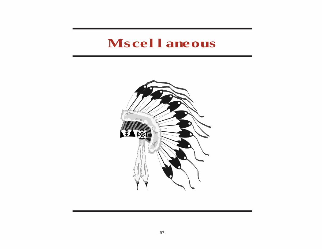
-97-
Miscellaneous

Indian PopulationsLiving on Montana Reservations
Reservation 1980 1990 2000
Blackfeet 5,525 7,025 8,507Crow 3,953 4,724 5,165Flathead 3,771 5,130 6,999Fort Belknap 1,870 2,338 2,790Fort Peck 4,273 5,782 6,391Northern Cheyenne 3,101 3,542 4,029Rocky Boy’s 1,549 1,882 1,542
Total PopulationsLiving on Montana Reservations
Reservation 1980 1990 2000
Blackfeet 6,660 8,549 10,100Crow 5,973 6,370 6,894Flathead 19,628 21,259 26,172Fort Belknap 2,060 2,508 2,959Fort Peck 9,921 10,595 10,321Northern Cheyenne 3,664 3,923 4,470Rocky Boy’s 1,650 1,954 1,605
Populations in Montanafor Select Ethnic Racesby Indian Reservation
in 2000
Black or Two or Indian African MoreReservation White American Indian Asian Other Races
Blackfeet 1,359 8 8,507 4 23 199Crow 1,551 1 5,165 7 33 137Flathead 17,814 24 6,999 76 173 1,086Fort Belknap 136 4 2,790 1 5 23Fort Peck 3,622 4 6,391 44 25 235N. Cheyenne 350 1 4,029 2 8 80Rocky Boy’s 42 1 1,542 2 2 16
Reservation Tot. 24,874 43 35,423 136 269 1,776Montana Total 819,416 2,713 56,075 4,522 6,331 15,375
Sources: U.S. Census Bureau (1990)U.S. Census Bureau (2000)
Profile of the Montana Native American (1994)
-98-

-99-
ASSINIBOINE & SIOUX TRIBES
Fort Peck TribesPO Box 1027Poplar, MT 59255(406) 768-5155(406) 768-5478 (fax)http://tlc.wtp.net/fortpeck.htm
BLACKFEET TRIBE
Blackfeet Tribal Business CouncilPO Box 850Browning, MT 59417(406) 338-7521(406) 338-7530 (fax)www.BlackfeetNation.comhttp://tlc.wtp.net/[email protected]
CHIPPEWA-CREE TRIBE
Chippewa Cree Business CommitteeRural Route 1 Box 544Box Elder, MT 59521(406) 395-4282(406) 395-4497 (fax)http://tlc.wtp.net/chippewa.htm
CONFEDERATED SALISH/KOOTENAI TRIBES
PO Box 278Pablo, MT 59855(406) 675-2700(406) 675-2806 (fax)http://tlc.wtp.net/[email protected]
CROW TRIBE
Crow Tribal CouncilPO Box 159Crow Agency, MT 59022(406) 638-3700(406) 638-7283 (fax)http://tlc.wtp.net/crow.htm
GROS VENTRE & ASSINIBOINE TRIBES
Fort Belknap Indian CommunityRR 1, Box 66Harlem, MT 59526(406) 353-2205(406) 353-2797 (fax)http:/tlc.wtp.net/[email protected]
TRIBAL COUNCILS OF MONTANA
-100-
LITTLE SHELL TRIBE
Little Shell TribeBox 1384Great Falls, MT 59403(406) 452-2892(406) 452-2982 (fax)http://tlc.wtp.net/little.htmwww.littleshelltribe.com
NORTHERN CHEYENNE TRIBE
Northern Cheyenne Tribal CouncilPO Box 128Lame Deer, MT 59043(406) 477-6284(406) 477-6210 (fax)http://tlc.wtp.net/[email protected]@ncheyenne.net

Montana Office of Public Instruction
Linda McCulloch, Superintendent
PO Box 202501Helena, Montana 59620-2501
www.opi.state.mt.us
FEBRUARY 2004