Embed Size (px)
Citation preview
Spatial Data Infrastructure – An Overview
Md. Ashraful Islam Dept. of Geology
University of Dhaka
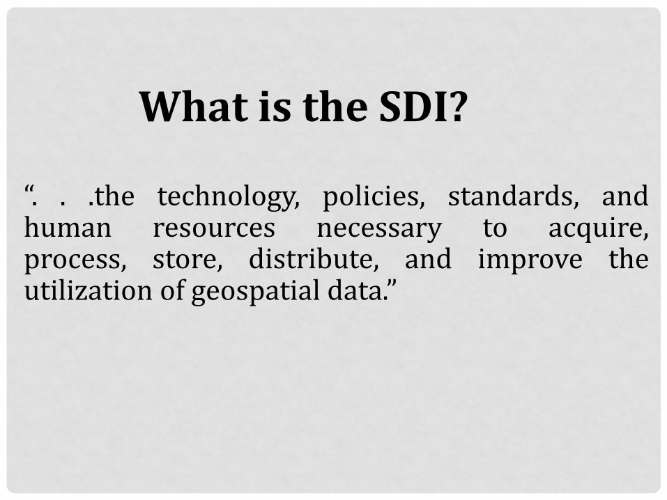
What is the SDI?
“. . .the technology, policies, standards, and human resources necessary to acquire, process, store, distribute, and improve the utilization of geospatial data.”
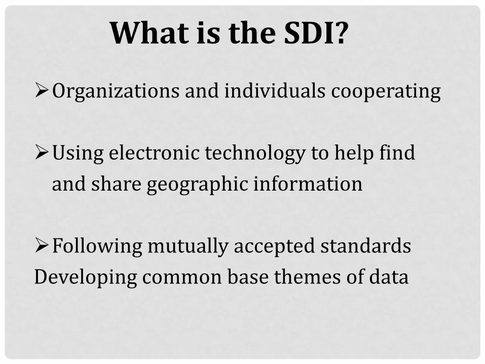
What is the SDI?
Organizations and individuals cooperating
Using electronic technology to help find
and share geographic information
Following mutually accepted standards
Developing common base themes of data
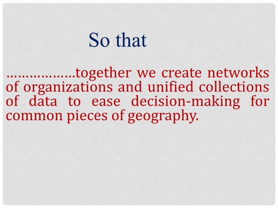
So that
………………together we create networks of organizations and unified collections of data to ease decision-making for common pieces of geography.

Why do we need to build SDI?
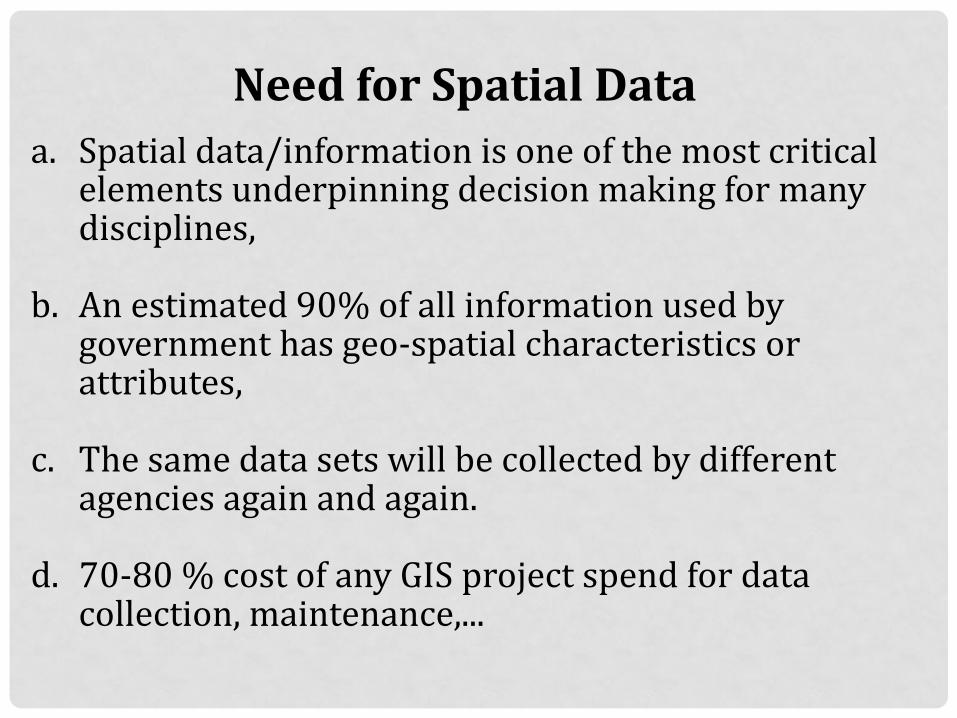
Need for Spatial Data a. Spatial data/information is one of the most critical
elements underpinning decision making for many disciplines,
b. An estimated 90% of all information used by government has geo-spatial characteristics or attributes,
c. The same data sets will be collected by different agencies again and again.
d. 70-80 % cost of any GIS project spend for data collection, maintenance,...
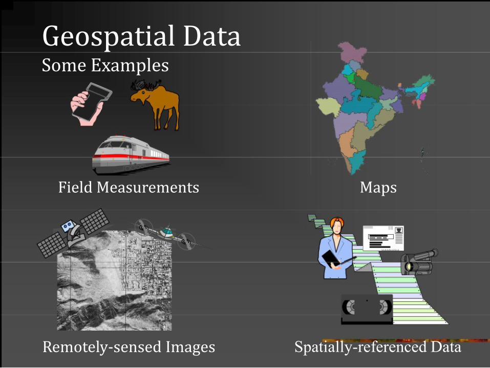
Geospatial Data Some Examples
Field Measurements
Maps
Remotely-sensed Images
Spatially-referenced Data
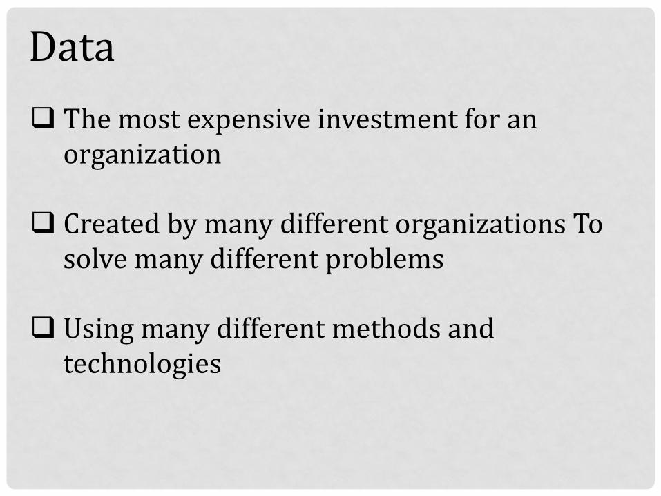
Data The most expensive investment for an
organization
Created by many different organizations To solve many different problems
Using many different methods and technologies
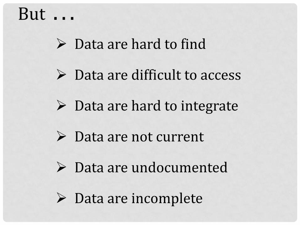
But . . .
Data are hard to find
Data are difficult to access
Data are hard to integrate
Data are not current
Data are undocumented
Data are incomplete
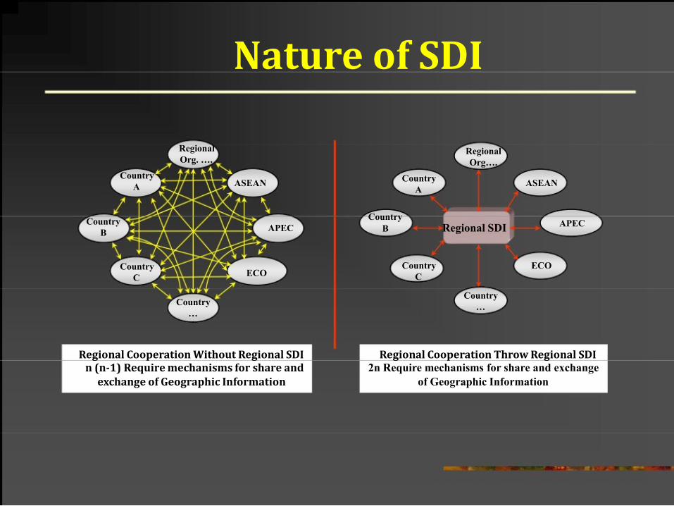
Nature of SDI
Regional
Org. ….
Country
A
Country
B
Country
C
Country
…
ASEAN
APEC
ECO
Regional
Org….
Country
A
Country
B Regional SDI
Country
C
Country
…
ASEAN
APEC
ECO
Regional Cooperation Without Regional SDI
Regional Cooperation Throw Regional SDI n (n-1) Require mechanisms for share and
2n Require mechanisms for share and exchange
exchange of Geographic Information
of Geographic Information
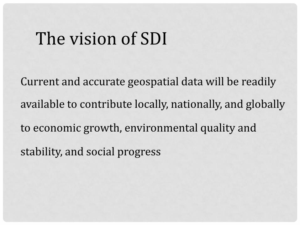
The vision of SDI
Current and accurate geospatial data will be readily available to contribute locally, nationally, and globally
to economic growth, environmental quality and
stability, and social progress
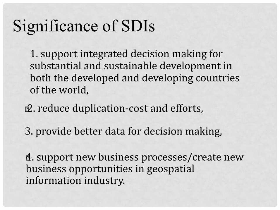
Significance of SDIs
1. support integrated decision making for substantial and sustainable development in both the developed and developing countries of the world,
„ 2. reduce duplication-cost and efforts, 3. provide better data for decision making, „4. support new business processes/create new business opportunities in geospatial information industry.
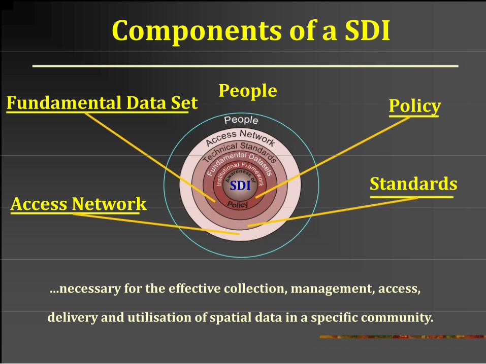
Components of a SDI
Fundamental Data Set
Access Network
People Policy
SDI Standards
...necessary for the effective collection, management, access,
delivery and utilisation of spatial data in a specific community.
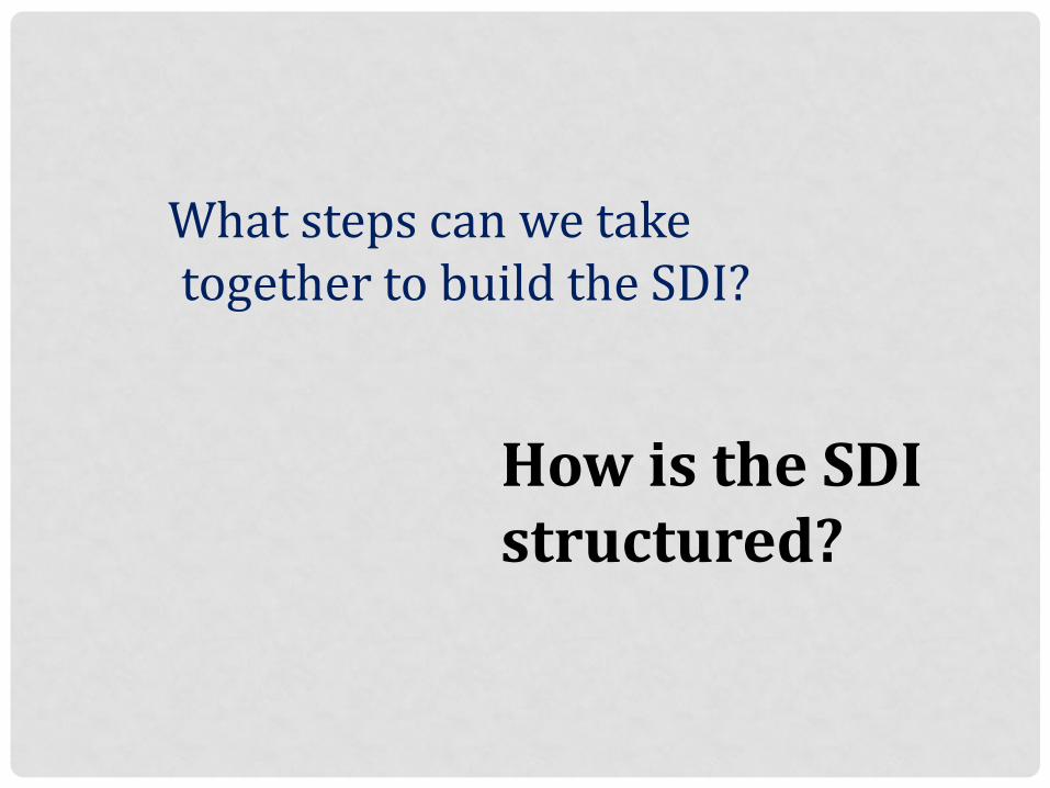
What steps can we take together to build the SDI?
How is the SDI structured?
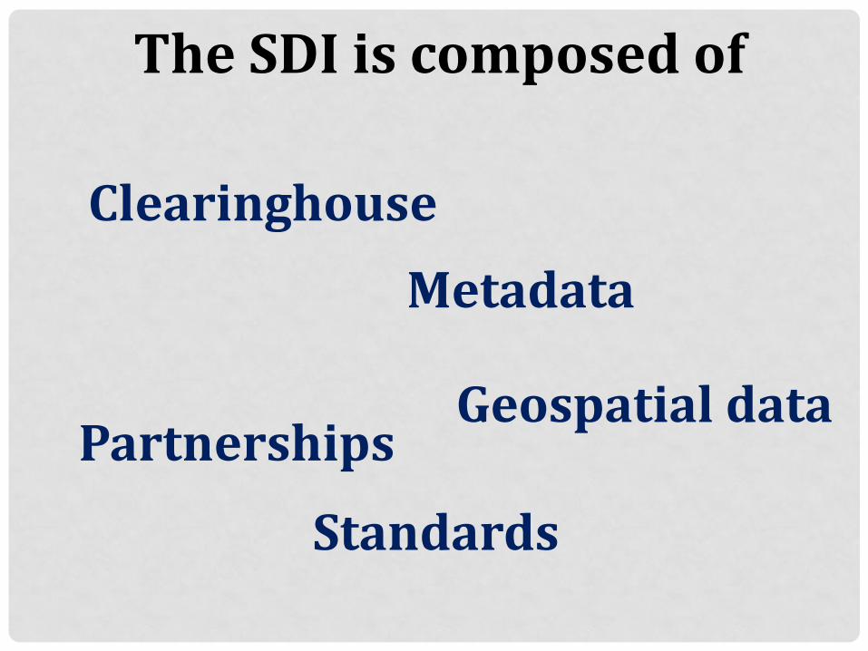
The SDI is composed of
Clearinghouse Metadata
Partnerships
Geospatial data
Standards
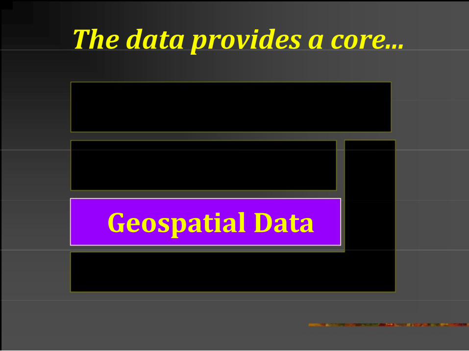
The data provides a core...
Geospatial Data
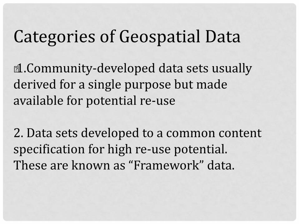
Categories of Geospatial Data „ 1.Community-developed data sets usually derived for a single purpose but made available for potential re-use 2. Data sets developed to a common content specification for high re-use potential. These are known as “Framework” data.
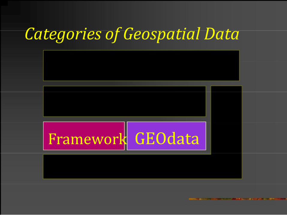
Categories of Geospatial Data
Framework GEOdata
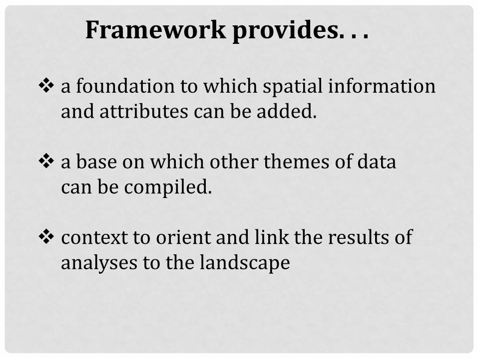
Framework provides. . .
a foundation to which spatial information
and attributes can be added.
a base on which other themes of data can be compiled.
context to orient and link the results of analyses to the landscape
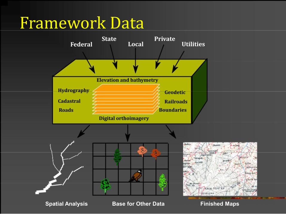
Framework Data Federal
Hydrography
Cadastral
Roads
State Private Local Utilities
Elevation and bathymetry
Geodetic
Railroads
Boundaries
Digital orthoimagery
Spatial Analysis
Base for Other Data
Finished Maps
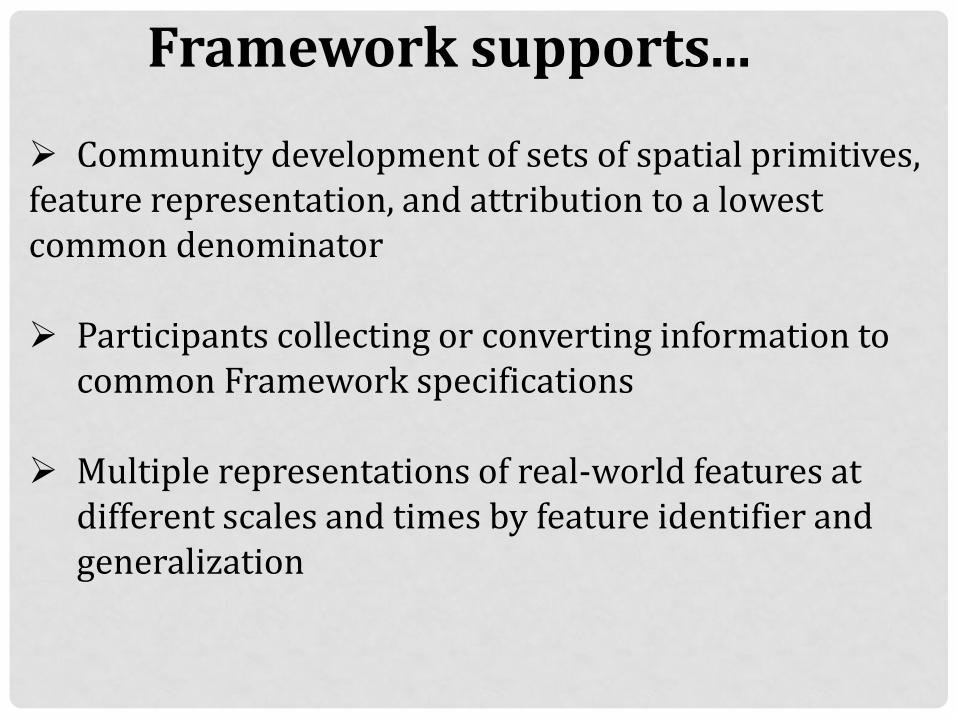
Framework supports...
Community development of sets of spatial primitives, feature representation, and attribution to a lowest common denominator Participants collecting or converting information to
common Framework specifications Multiple representations of real-world features at
different scales and times by feature identifier and generalization
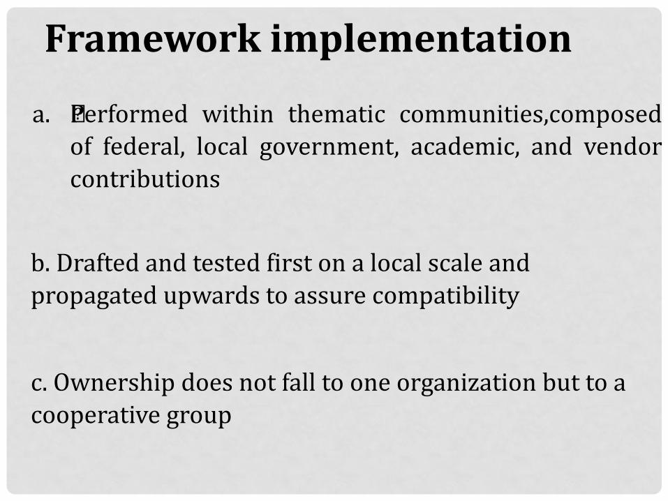
Framework implementation
a. „Performed within thematic communities,composed of federal, local government, academic, and vendor
contributions
b. Drafted and tested first on a local scale and propagated upwards to assure compatibility
c. Ownership does not fall to one organization but to a cooperative group
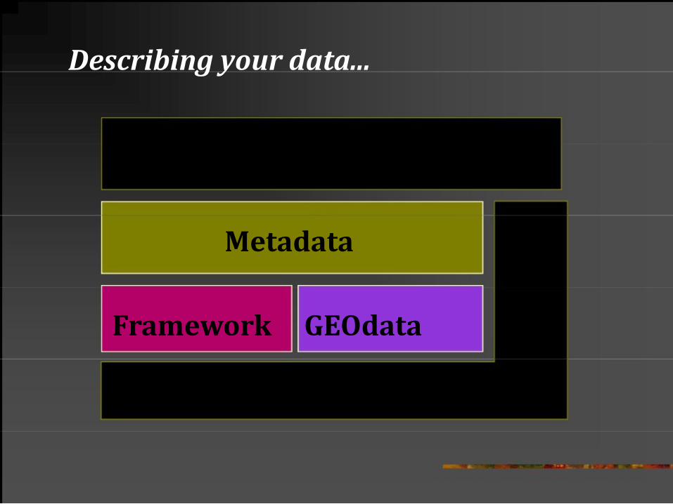
Describing your data...
Metadata
Framework GEOdata
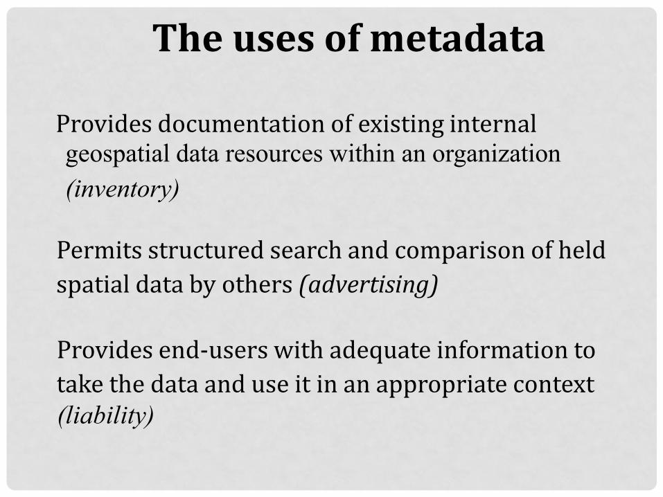
The uses of metadata
Provides documentation of existing internal geospatial data resources within an organization
(inventory)
Permits structured search and comparison of held
spatial data by others (advertising)
Provides end-users with adequate information to
take the data and use it in an appropriate context
(liability)
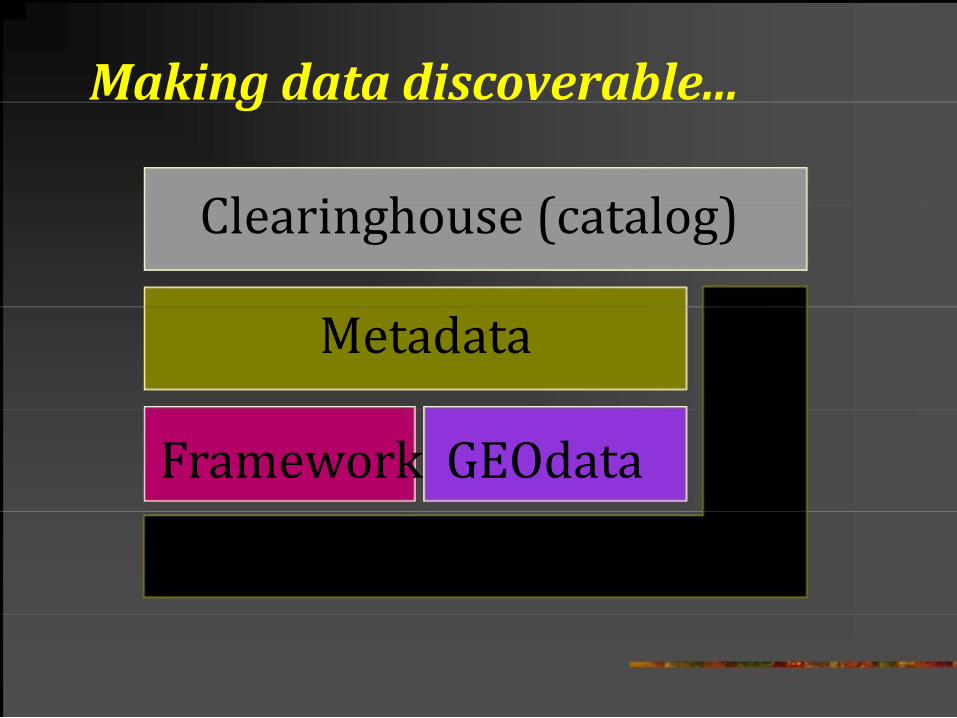
Making data discoverable...
Clearinghouse (catalog)
Metadata
Framework GEOdata
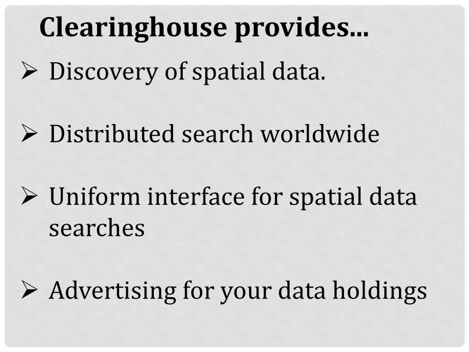
Clearinghouse provides... Discovery of spatial data. Distributed search worldwide
Uniform interface for spatial data
searches Advertising for your data holdings
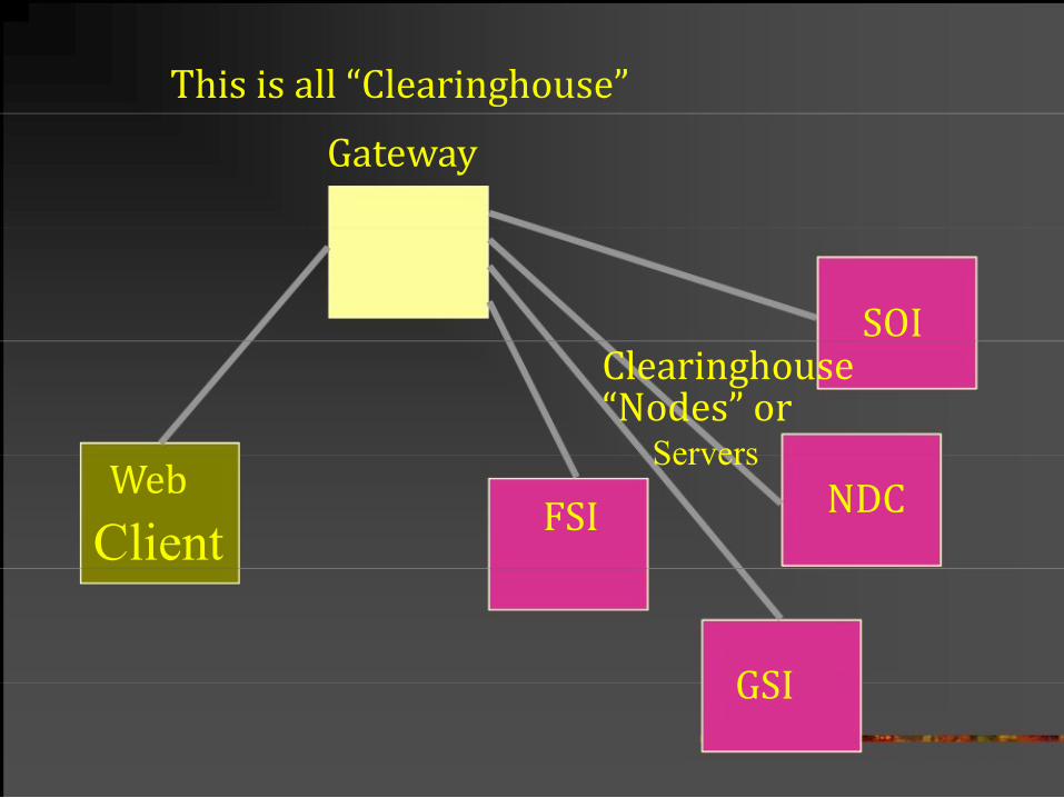
This is all “Clearinghouse”
Gateway
SOI Clearinghouse
“Nodes” or
Web
FSI Client
Servers
NDC
GSI
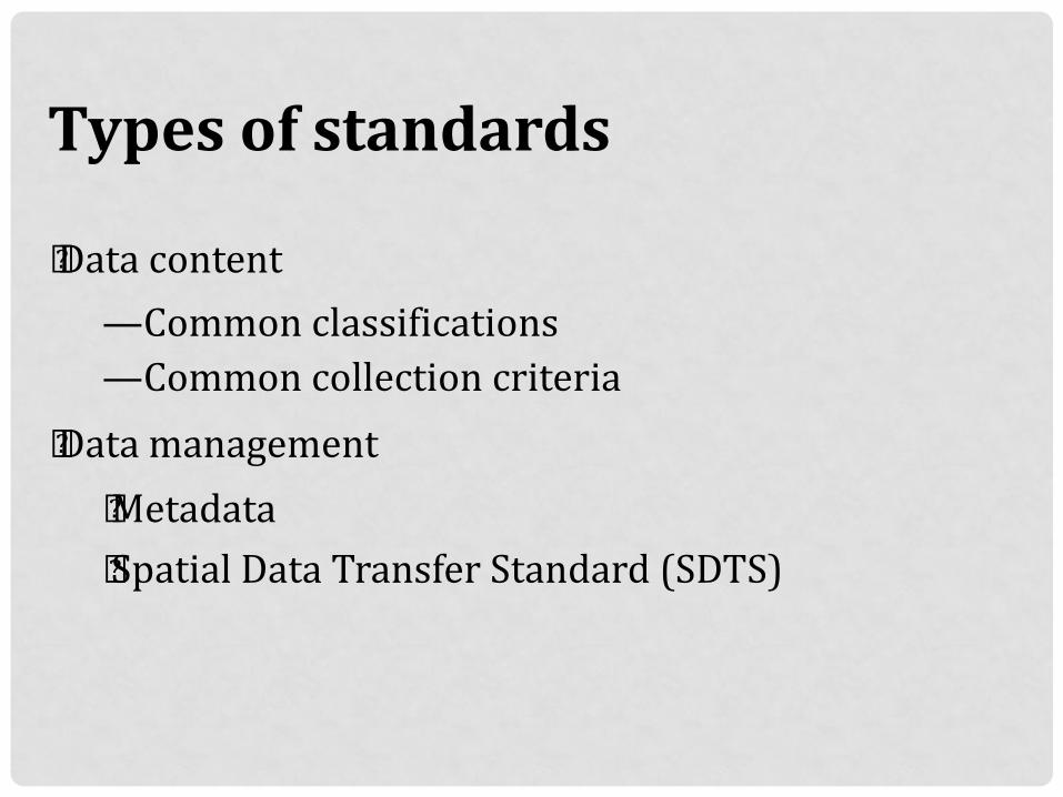
Types of standards „ Data content
—Common classifications —Common collection criteria
„ Data management
„ Metadata „ Spatial Data Transfer Standard (SDTS)

Partnerships hold it all together
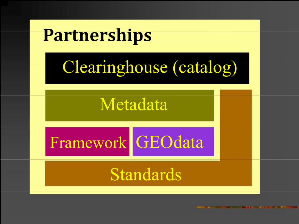
Partnerships
Clearinghouse (catalog)
Metadata
Framework GEOdata
Standards

Working with stakeholders to forge a common strategy to build a common infrastructure
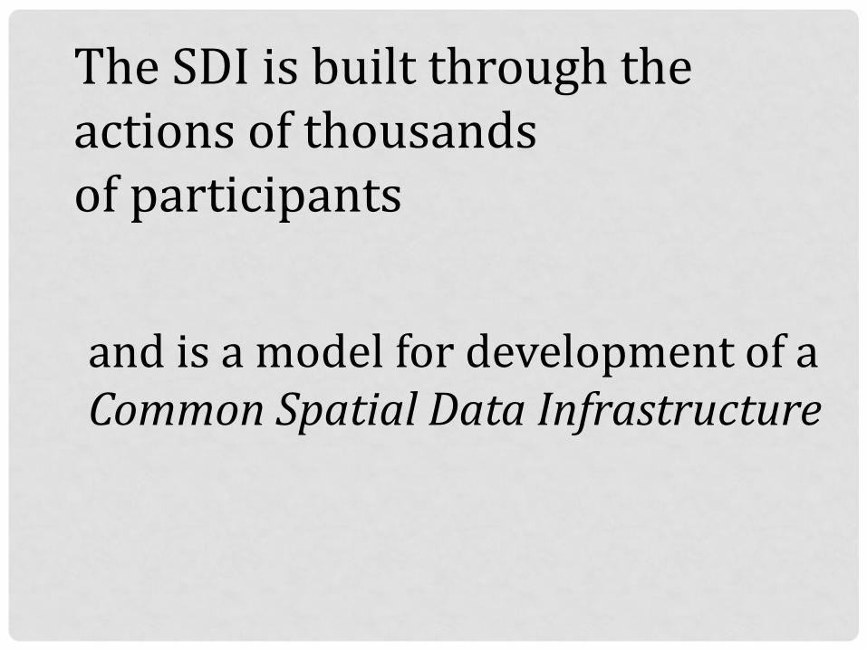
The SDI is built through the actions of thousands of participants
and is a model for development of a Common Spatial Data Infrastructure
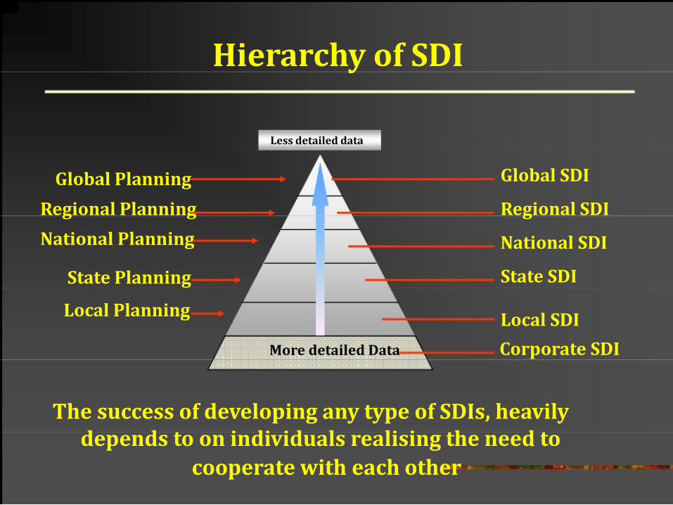
Hierarchy of SDI
Less detailed data
Global Planning
Regional Planning
National Planning
State Planning
Local Planning
Global SDI
Regional SDI
National SDI
State SDI
Local SDI
More detailed Data Corporate SDI
The success of developing any type of SDIs, heavily depends to on individuals realising the need to cooperate with each other
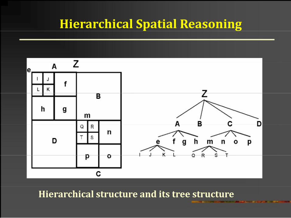
Hierarchical Spatial Reasoning
Hierarchical structure and its tree structure
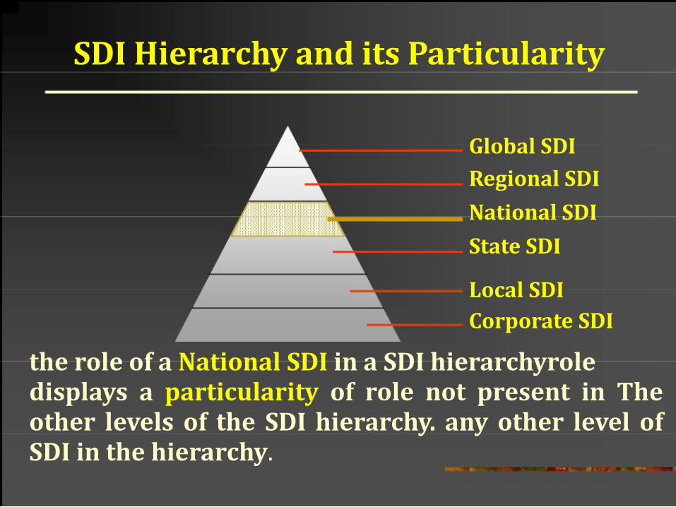
SDI Hierarchy and its Particularity
Global SDI Regional SDI
National SDI
State SDI
Local SDI Corporate SDI
the role of a National SDI in a SDI hierarchyrole displays a particularity of role not present in The other levels of the SDI hierarchy. any other level of SDI in the hierarchy.
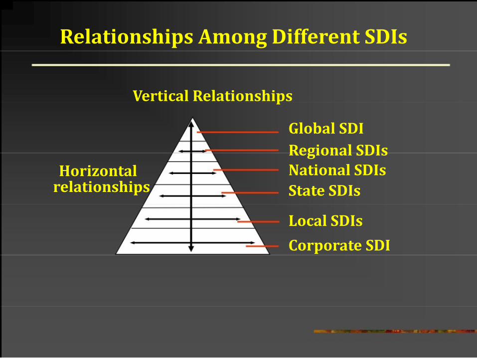
Relationships Among Different SDIs
Vertical Relationships
Global SDI Regional SDIs Horizontal
relationships
National SDIs
State SDIs
Local SDIs
Corporate SDI
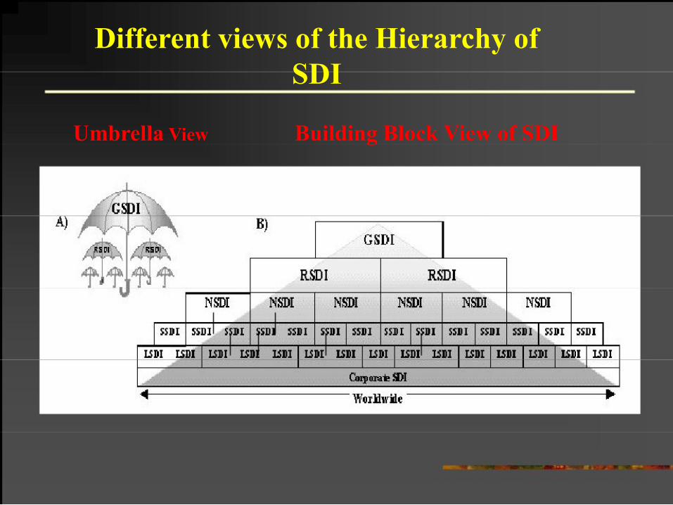
Different views of the Hierarchy of
SDI
Umbrella View
Building Block View of SDI
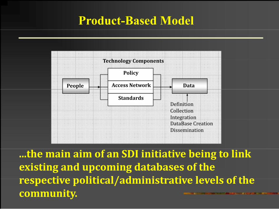
Product-Based Model
Technology Components
Policy
People
Access Network
Data
Standards Definition
Collection Integration DataBase Creation Dissemination
...the main aim of an SDI initiative being to link existing and upcoming databases of the respective political/administrative levels of the community.
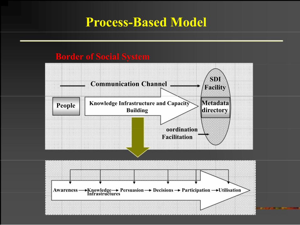
Process-Based Model
Border of Social System
People
SDI
Communication Channel Facility
Knowledge Infrastructure and Capacity Metadata Building directory
oordination
Facilitation
Awareness Knowledge Persuasion Decisions Participation Utilisation Infrastructures
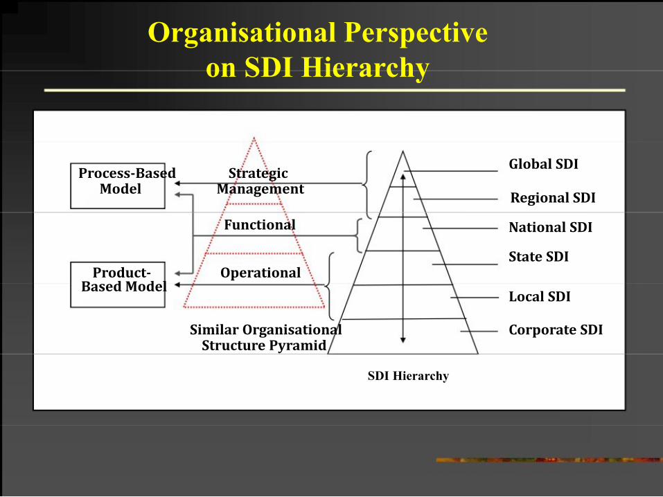
Organisational Perspective
on SDI Hierarchy
Process-Based Strategic Model Management
Functional
Product- Operational Based Model
Similar Organisational Structure Pyramid
Global SDI
Regional SDI
National SDI
State SDI
Local SDI
Corporate SDI
SDI Hierarchy
Overview of current NSDI initiatives --
Indian context
¾ Mapping Agencies in India
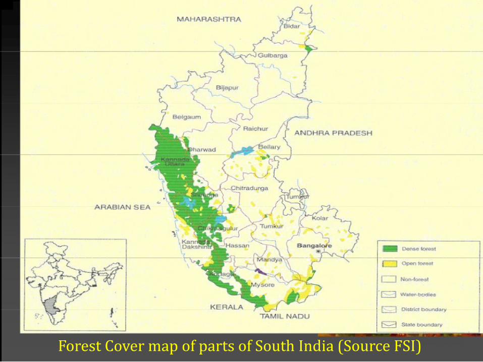
Forest Cover map of parts of South India (Source FSI)
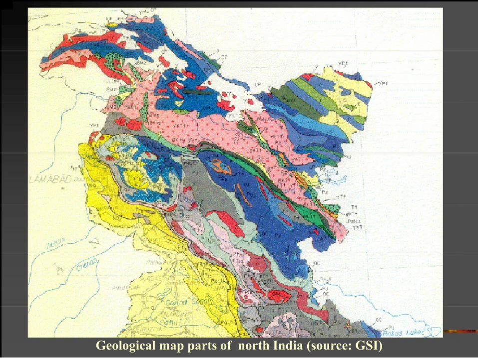
Geological map parts of north India (source: GSI)
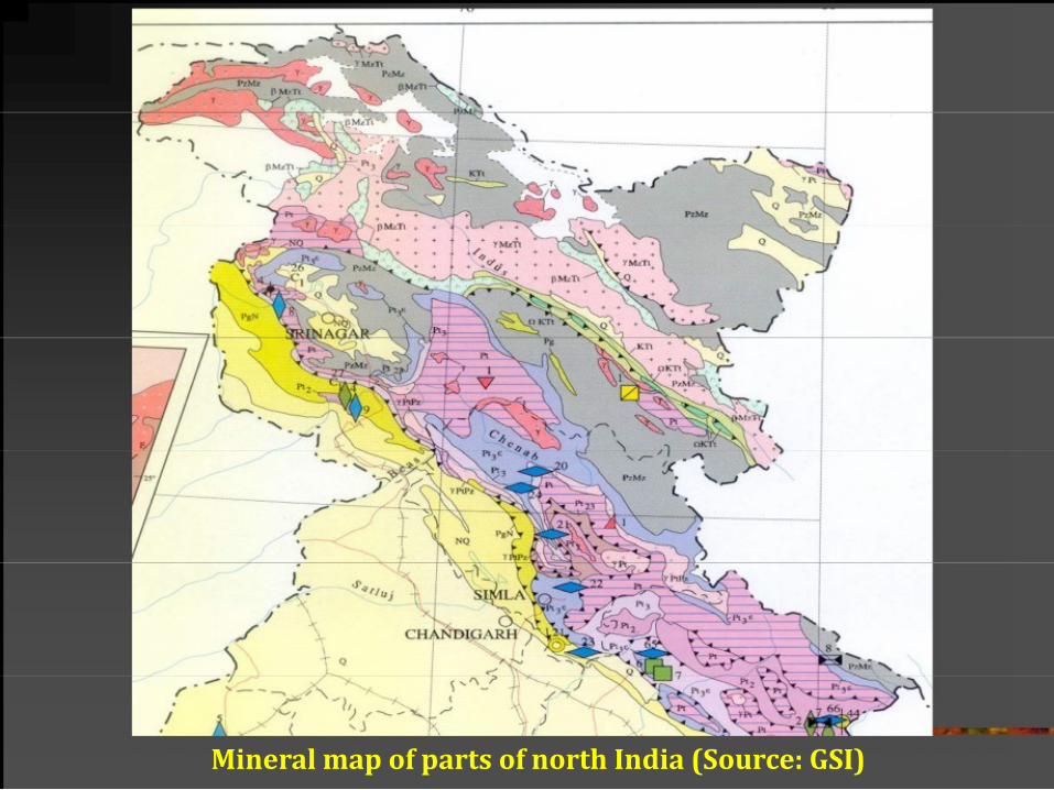
Mineral map of parts of north India (Source: GSI)
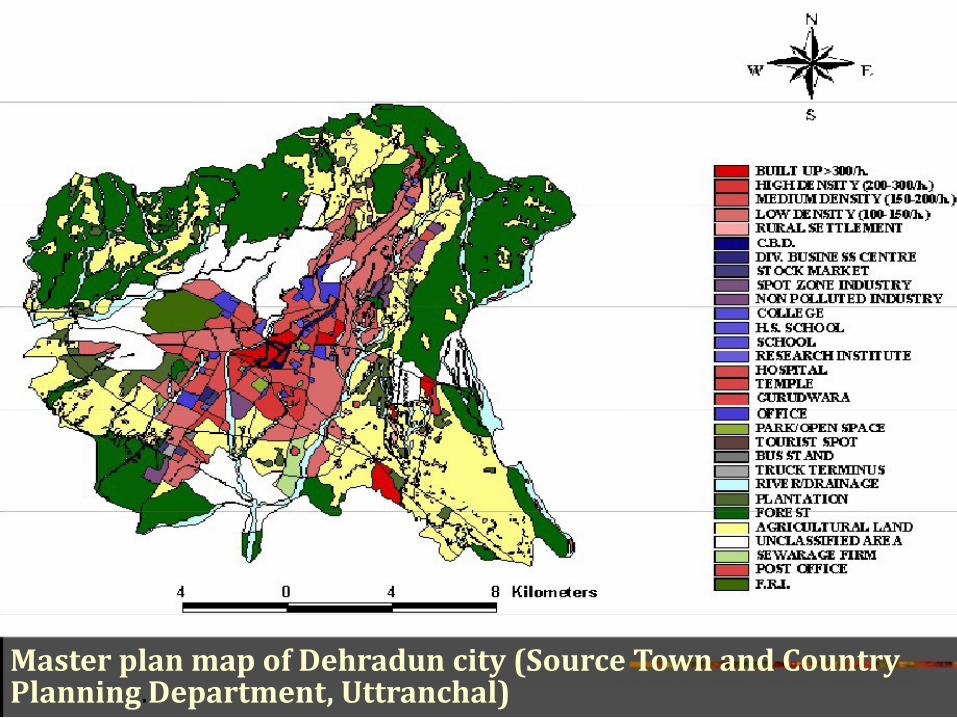
Master plan map of Dehradun city (Source Town and Country Planning.Department, Uttranchal)
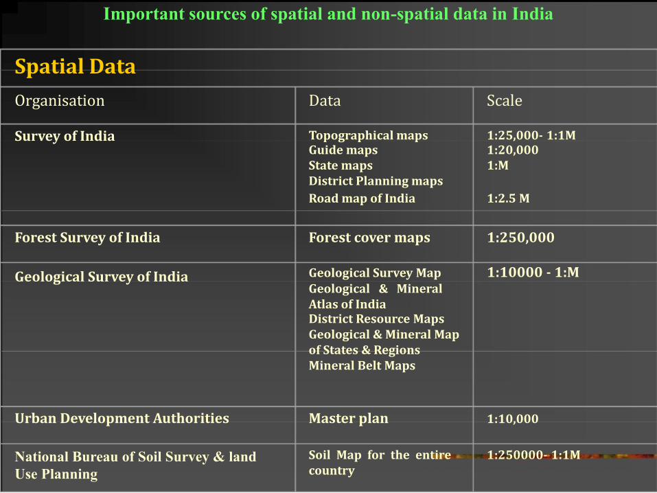
Important sources of spatial and non-spatial data in India
Spatial Data Organisation Survey of India
Forest Survey of India
Geological Survey of India
Urban Development Authorities
National Bureau of Soil Survey & land
Use Planning
Data Scale Topographical maps 1:25,000- 1:1M Guide maps 1:20,000 State maps 1:M District Planning maps Road map of India 1:2.5 M
Forest cover maps 1:250,000 Geological Survey Map 1:10000 - 1:M Geological & Mineral Atlas of India District Resource Maps Geological & Mineral Map of States & Regions Mineral Belt Maps
Master plan 1:10,000
Soil Map for the entire 1:250000- 1:1M country
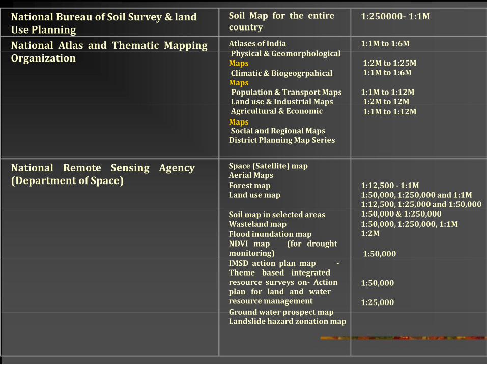
National Bureau of Soil Survey & land Use Planning National Atlas and Thematic Mapping Organization
National Remote Sensing Agency (Department of Space)
Soil Map for the entire country Atlases of India Physical & Geomorphological Maps
Climatic & Biogeogrpahical Maps
Population & Transport Maps Land use & Industrial Maps Agricultural & Economic Maps
Social and Regional Maps District Planning Map Series
Space (Satellite) map Aerial Maps Forest map Land use map
Soil map in selected areas Wasteland map Flood inundation map NDVI map (for drought monitoring) IMSD action plan map - Theme based integrated resource surveys on- Action plan for land and water resource management Ground water prospect map Landslide hazard zonation map
1:250000- 1:1M
1:1M to 1:6M 1:2M to 1:25M 1:1M to 1:6M
1:1M to 1:12M 1:2M to 12M 1:1M to 1:12M
1:12,500 - 1:1M 1:50,000, 1:250,000 and 1:1M 1:12,500, 1:25,000 and 1:50,000 1:50,000 & 1:250,000 1:50,000, 1:250,000, 1:1M 1:2M
1:50,000
1:50,000 1:25,000
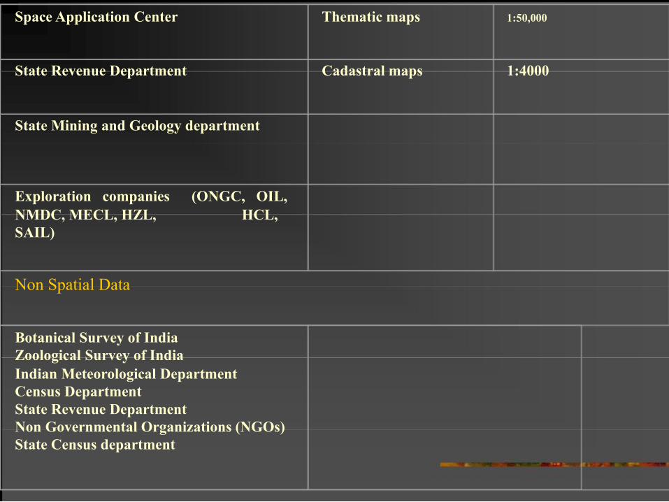
Space Application Center
State Revenue Department
State Mining and Geology department
Exploration companies (ONGC, OIL,
NMDC, MECL, HZL, HCL,
SAIL)
Non Spatial Data
Botanical Survey of India
Zoological Survey of India
Indian Meteorological Department
Census Department
State Revenue Department
Non Governmental Organizations (NGOs)
State Census department
Thematic maps 1:50,000
Cadastral maps 1:4000
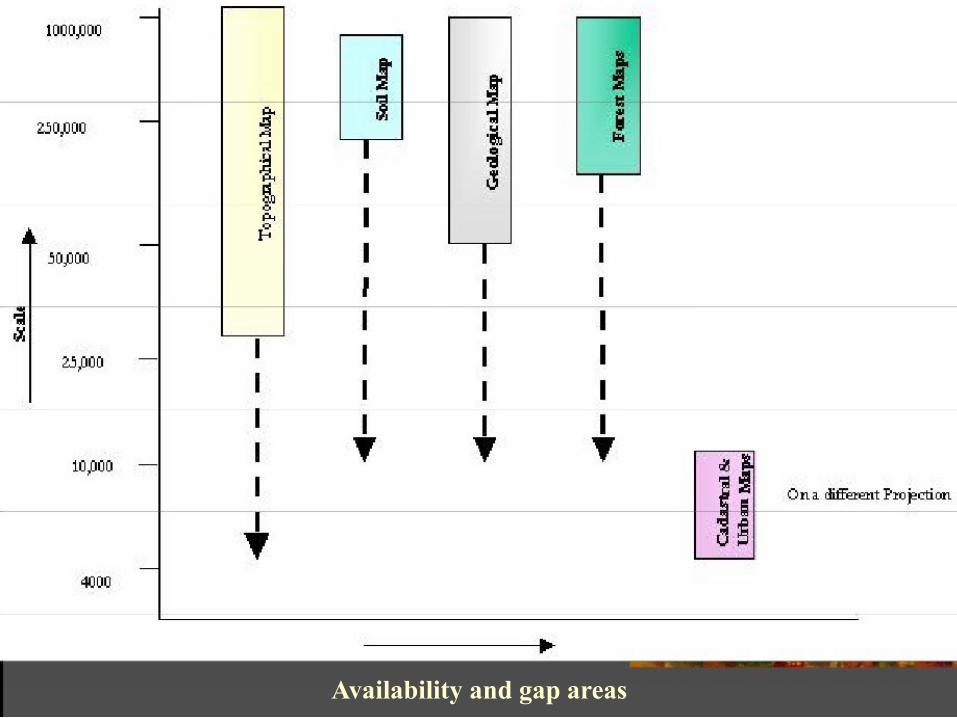
Availability and gap areas
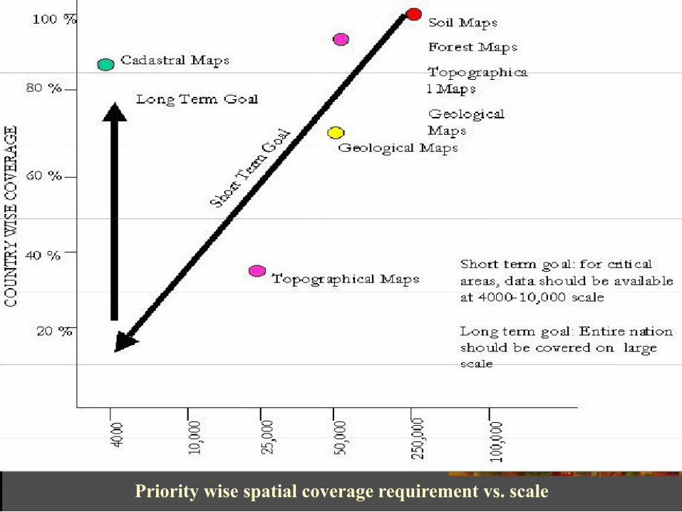
Priority wise spatial coverage requirement vs. scale
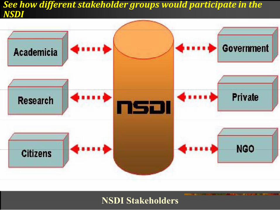
See how different stakeholder groups would participate in the NSDI
NSDI Stakeholders
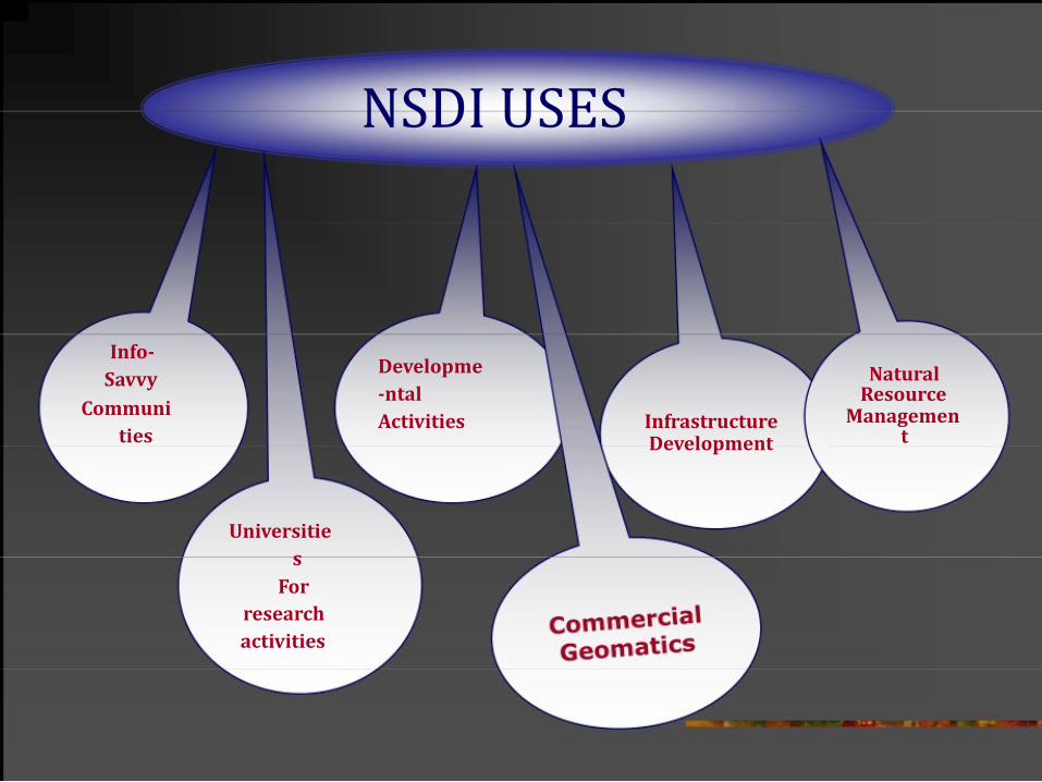
NSDI USES
Info-
Savvy
Communi
ties
Universitie
s
For
research
activities
Developme
-ntal
Activities Infrastructure
Development
Natural Resource
Managemen t
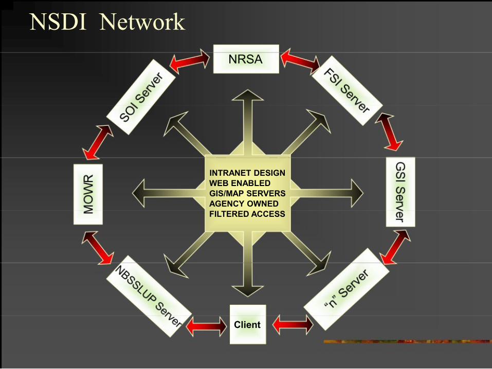
NSDI Network
NRSA
INTRANET DESIGN
WEB ENABLED
GIS/MAP SERVERS
AGENCY OWNED
FILTERED ACCESS
Client
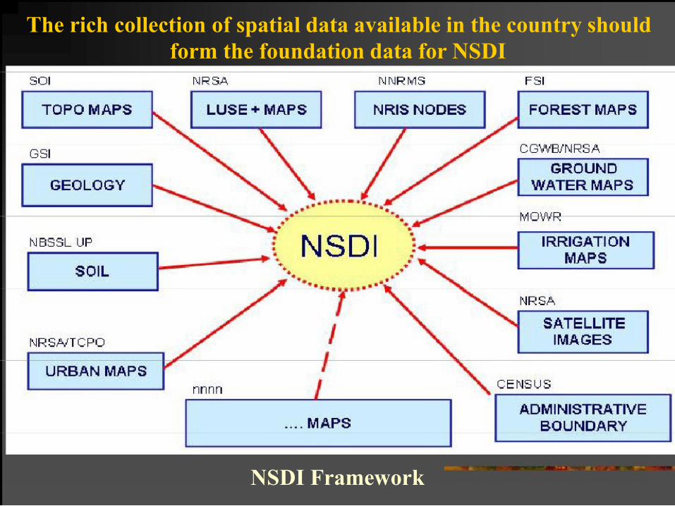
The rich collection of spatial data available in the country should
form the foundation data for NSDI
NSDI Framework

IMPORTANCE OF EDUCATION AND TRAINING IN NSDI
„ 1. Training to the existing professionals for the optimum
use of these new tools;
„ 2. Professional associations are concerned about the
changing technology and guidelines which would
tune the existing manpower
„ 3. Qualified professionals in this field would be in great
demand in future;

International Scenario - (UCGIS)
The University Consortium for Geographic Information
Science (UCGIS) is a non-profit organization of
universities and other research institutions dedicated to
advancing the understanding of geographic processes
and spatial relationships through improved theory,
methods, technology, and data.
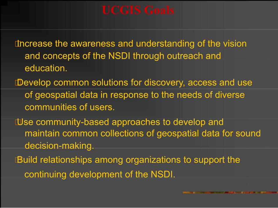
UCGIS Goals
„ Increase the awareness and understanding of the vision
and concepts of the NSDI through outreach and
education.
„ Develop common solutions for discovery, access and use
of geospatial data in response to the needs of diverse
communities of users.
„ Use community-based approaches to develop and
maintain common collections of geospatial data for sound
decision-making.
„ Build relationships among organizations to support the
continuing development of the NSDI.
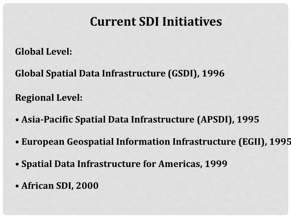
Current SDI Initiatives
Global Level: Global Spatial Data Infrastructure (GSDI), 1996
Regional Level: • Asia-Pacific Spatial Data Infrastructure (APSDI), 1995 • European Geospatial Information Infrastructure (EGII), 1995 • Spatial Data Infrastructure for Americas, 1999 • African SDI, 2000
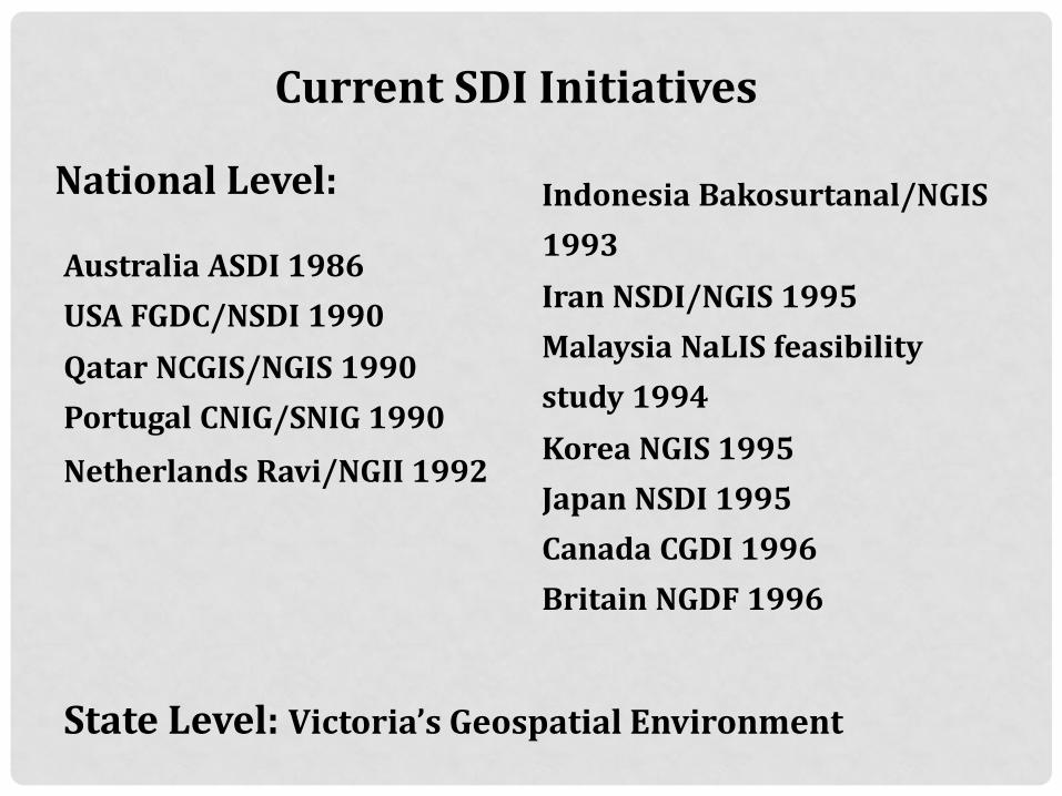
Current SDI Initiatives
National Level: Australia ASDI 1986
USA FGDC/NSDI 1990
Qatar NCGIS/NGIS 1990
Portugal CNIG/SNIG 1990
Netherlands Ravi/NGII 1992
Indonesia Bakosurtanal/NGIS
1993
Iran NSDI/NGIS 1995
Malaysia NaLIS feasibility
study 1994
Korea NGIS 1995
Japan NSDI 1995
Canada CGDI 1996
Britain NGDF 1996
State Level: Victoria’s Geospatial Environment
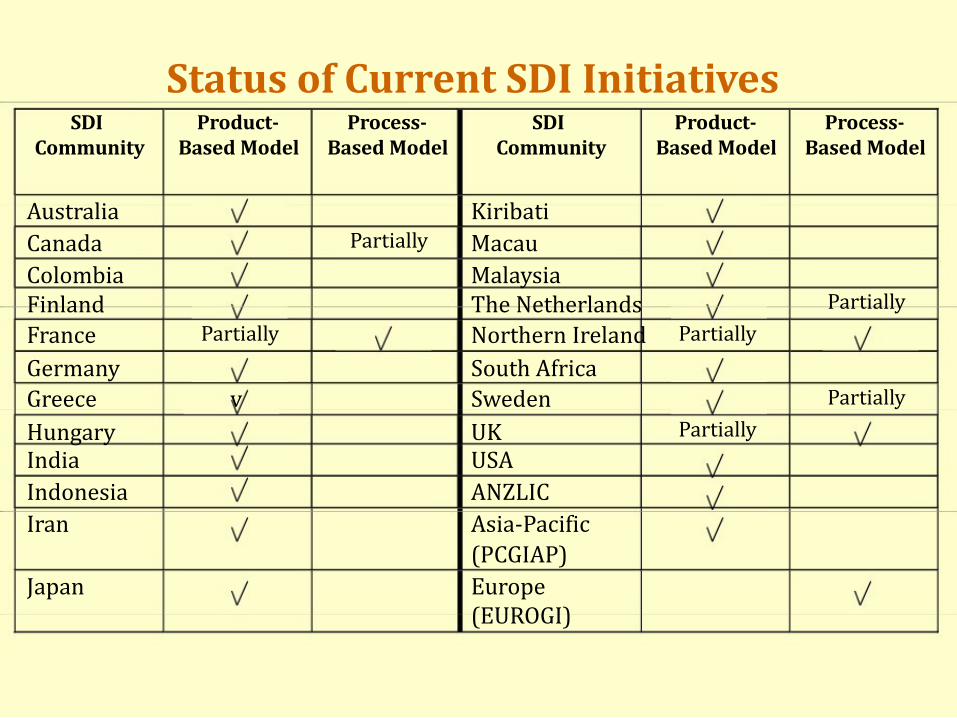
Status of Current SDI Initiatives SDI
Product-
Process-
SDI
Product-
Process- Community
Based Model
Based Model
Community
Based Model
Based Model
Australia
Kiribati Canada
Partially
Macau Colombia
Malaysia Finland
The Netherlands
Partially France
Partially
Northern Ireland
Partially Germany
South Africa Greece
v
Sweden
Partially Hungary
UK
Partially India
USA Indonesia
ANZLIC Iran
Asia-Pacific (PCGIAP) Japan
Europe (EUROGI)
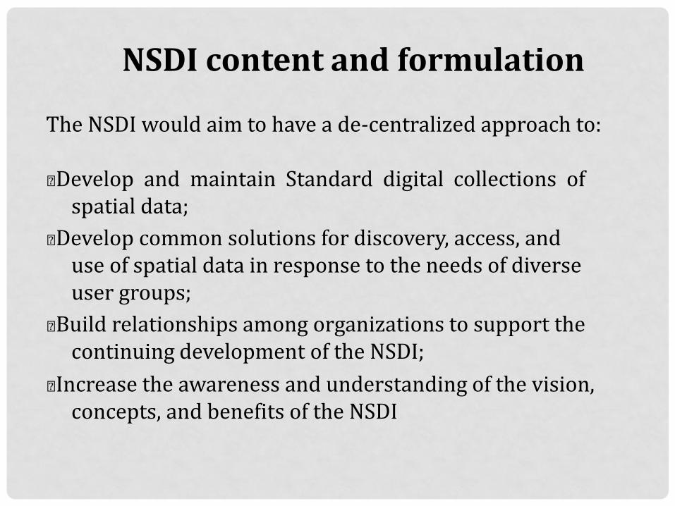
NSDI content and formulation
The NSDI would aim to have a de-centralized approach to:
„ Develop and maintain Standard digital collections of spatial data; „ Develop common solutions for discovery, access, and use of spatial data in response to the needs of diverse user groups; „ Build relationships among organizations to support the continuing development of the NSDI; „ Increase the awareness and understanding of the vision, concepts, and benefits of the NSDI


