Embed Size (px)
Citation preview

Geo 265 - GIS Practicuum
Introduction to ArcView
Chapter 2 of GIS Concepts and ArcView Methods
Review Chs. 1, 4, 10
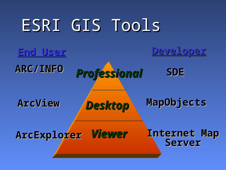
ARC/INFOARC/INFO
ArcViewArcView
ArcExplorerArcExplorer
ProfessionalProfessional
Desktop Desktop
ViewerViewer
SDESDE
MapObjects MapObjects
Internet MapInternet MapServerServer
DeveloperDeveloperEnd UserEnd User
ESRI GIS ToolsESRI GIS Tools
Geo 265, GIS Practicuum
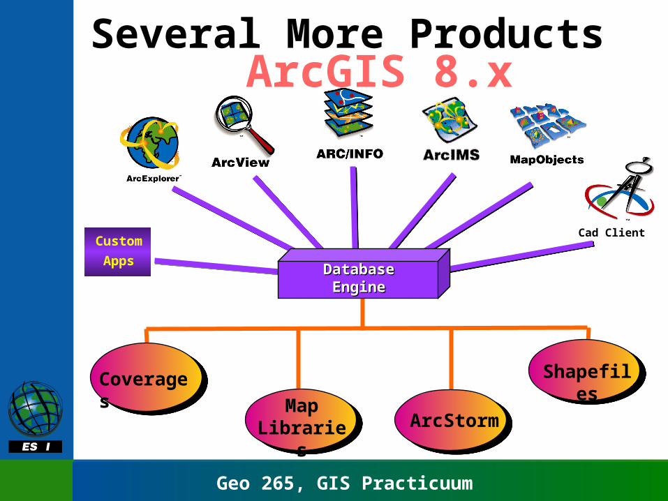
ArcGIS 8.xSeveral More Products
Database Database EngineEngine
Cad ClientCustom
Apps
Coverages
Map Libraries ArcStorm
Shapefiles
Geo 265, GIS Practicuum
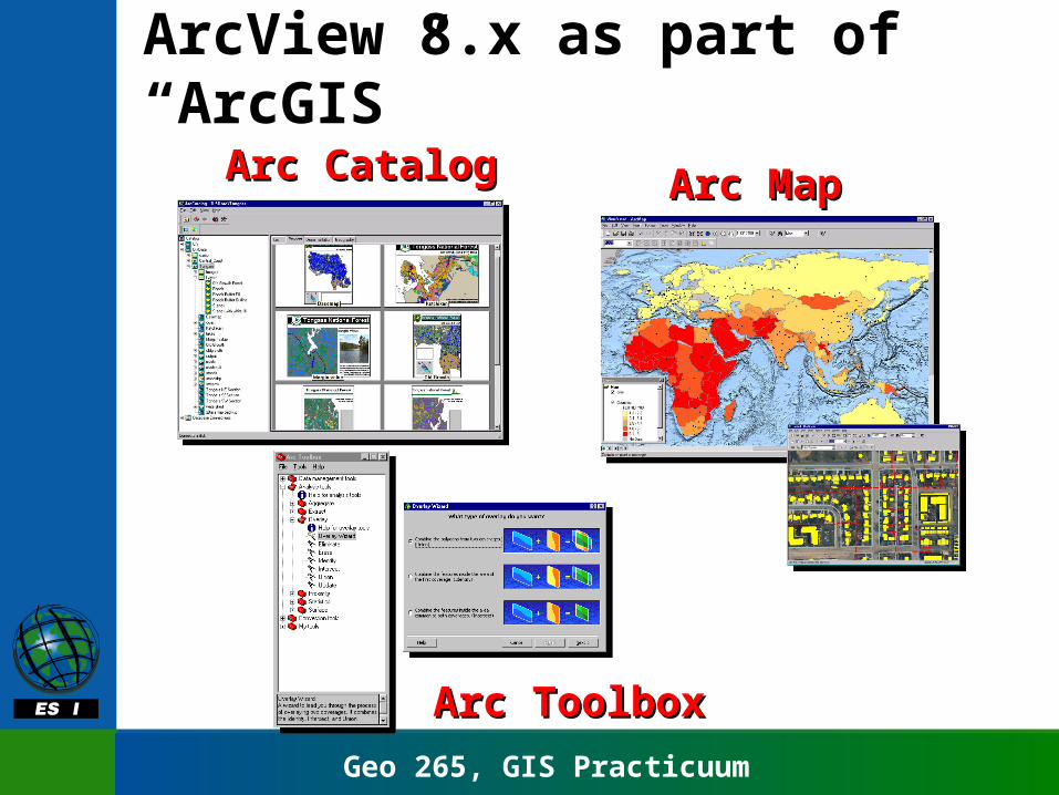
Arc MapArc MapArc CatalogArc Catalog
Arc ToolboxArc Toolbox
ArcView 8.x as part of “ArcGIS”
Geo 265, GIS Practicuum
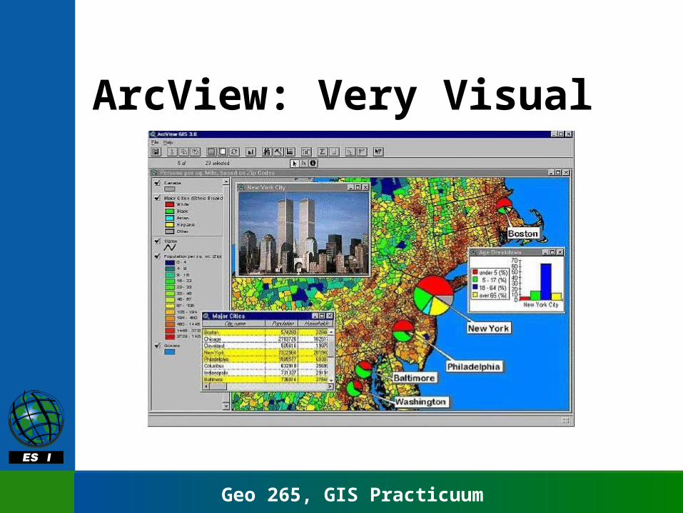
ArcView: Very Visual

Geo 265, GIS Practicuum
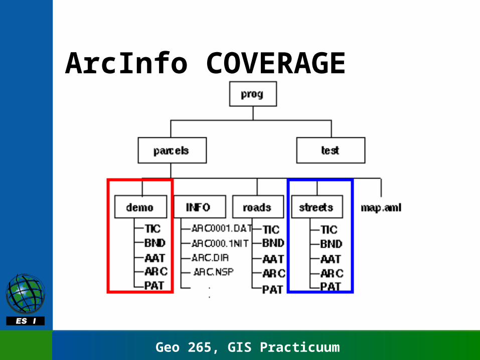
Data formats• ArcInfo Coverages
– info directory– multiple files
• ArcView Shapefile
• Many import formats
• Output to printer, file, image etc.
Geo 265, GIS Practicuum
ArcInfo COVERAGE
Geo 265, GIS Practicuum
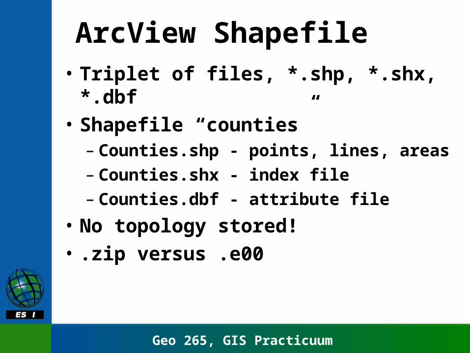
ArcView Shapefile• Triplet of files, *.shp, *.shx, *.dbf
• Shapefile “counties”– Counties.shp - points, lines, areas– Counties.shx - index file– Counties.dbf - attribute file
• No topology stored!
• .zip versus .e00
Geo 265, GIS Practicuum
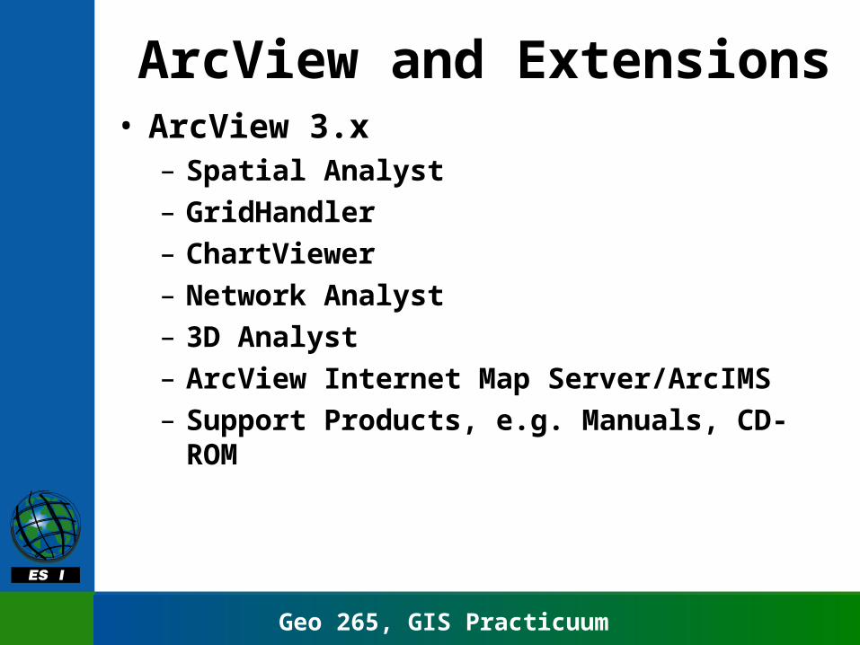
ArcView and Extensions• ArcView 3.x
– Spatial Analyst– GridHandler– ChartViewer– Network Analyst– 3D Analyst– ArcView Internet Map Server/ArcIMS– Support Products, e.g. Manuals, CD-ROM
Geo 265, GIS Practicuum
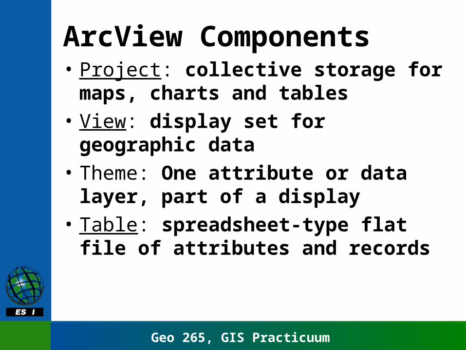
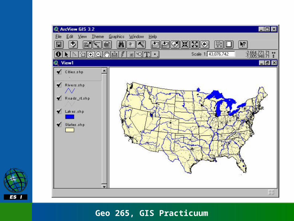
ArcView Components• Project: collective storage for maps,
charts and tables
• View: display set for geographic data
• Theme: One attribute or data layer, part of a display
• Table: spreadsheet-type flat file of attributes and records
Geo 265, GIS Practicuum
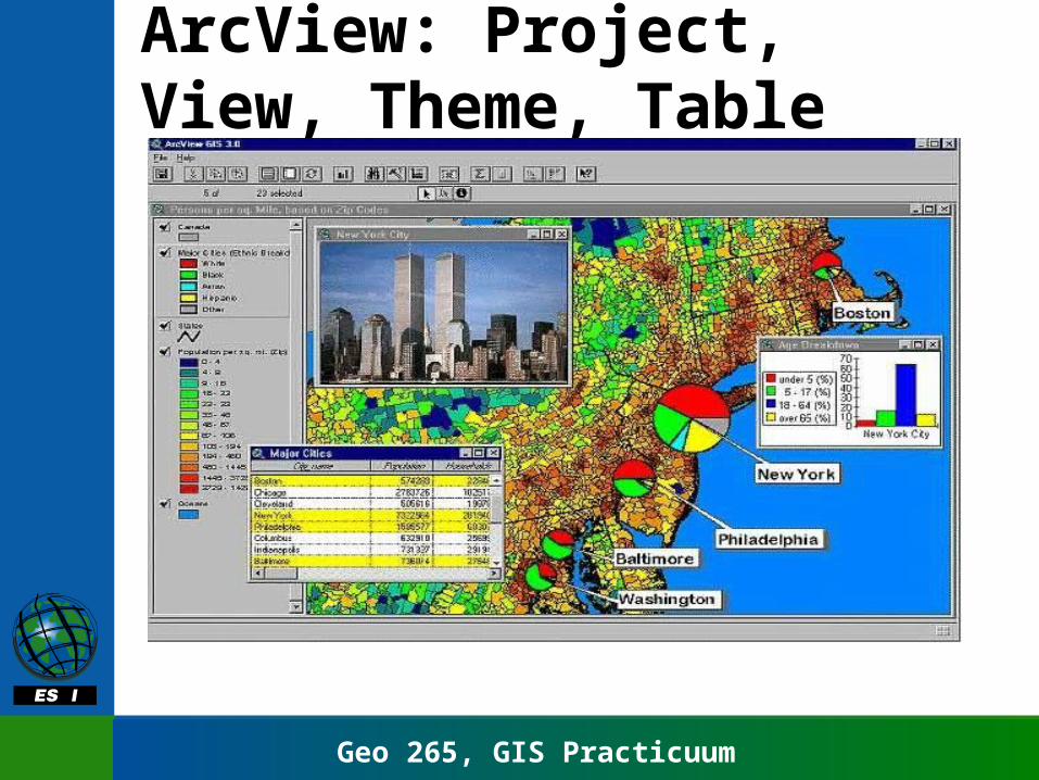
ArcView: Project, View, Theme, Table
Geo 265, GIS Practicuum
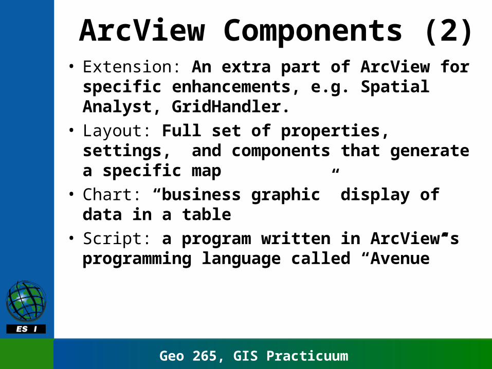
ArcView Components (2)• Extension: An extra part of ArcView for
specific enhancements, e.g. Spatial Analyst, GridHandler.
• Layout: Full set of properties, settings, and components that generate a specific map
• Chart: “business graphic” display of data in a table
• Script: a program written in ArcView’s programming language called “Avenue”
Geo 265, GIS Practicuum
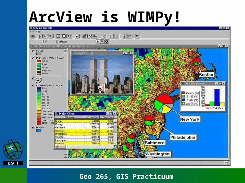
ArcView is WIMPy!
Geo 265, GIS Practicuum
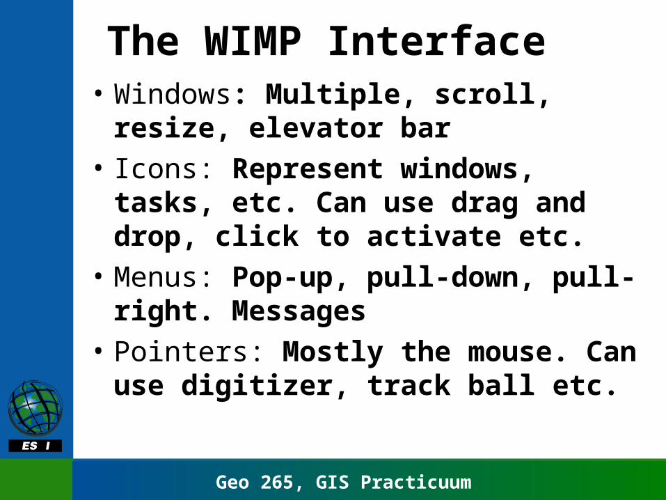
The WIMP Interface• Windows: Multiple, scroll, resize,
elevator bar
• Icons: Represent windows, tasks, etc. Can use drag and drop, click to activate etc.
• Menus: Pop-up, pull-down, pull-right. Messages
• Pointers: Mostly the mouse. Can use digitizer, track ball etc.
Geo 265, GIS Practicuum
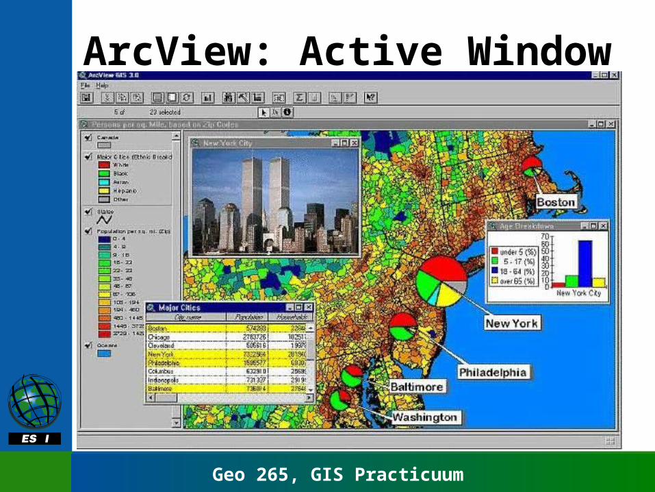
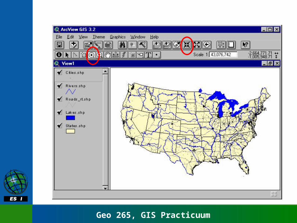
ArcView: Active Window

Geo 265, GIS Practicuum
Windows: The active window
• Projects, views, tables, charts, layout, and scripts all have their own windows
• Only one window is “active” at a time• To make a window active, click on it
or select it from the menus• The title bar will be highlighted in
color when the window is active
Geo 265, GIS Practicuum
Geo 265, GIS Practicuum
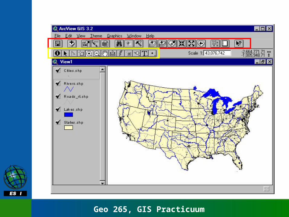
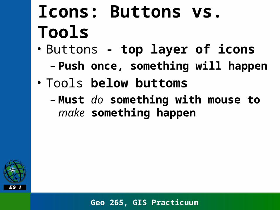
Icons: Buttons vs. Tools
• Buttons - top layer of icons– Push once, something will happen
• Tools below buttoms– Must do something with mouse to make
something happen
Geo 265, GIS Practicuum
Geo 265, GIS Practicuum
Geo 265, GIS Practicuum
Help
• Help menu on right of tool bar
• Help topics launches indexed user guide
• How to get help is a guide to help
• Toolbar icon of arrow with ? Gives context-sensitive help
Geo 265, GIS Practicuum
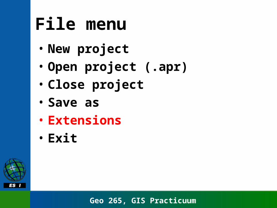
File menu• New project
• Open project (.apr)
• Close project
• Save as
• Extensions
• Exit
Geo 265, GIS Practicuum
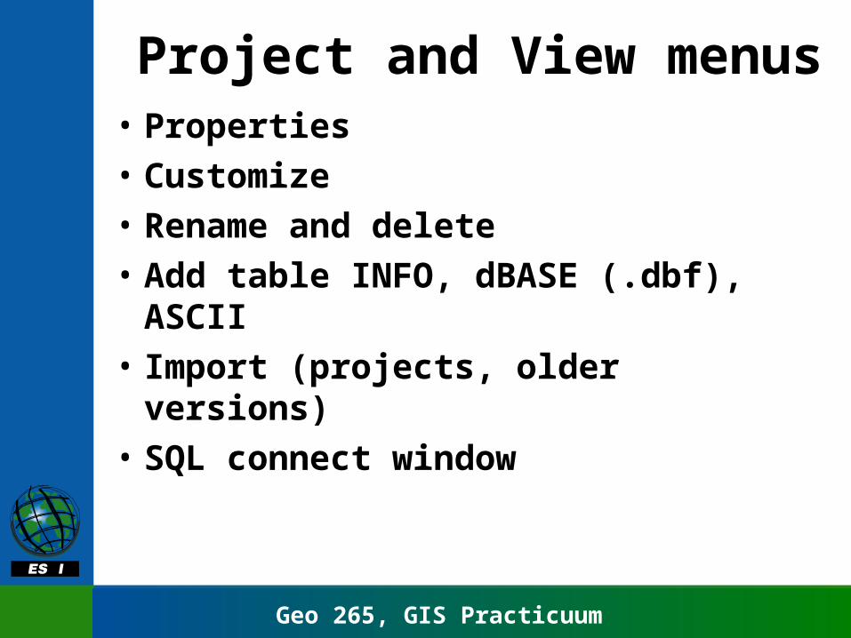
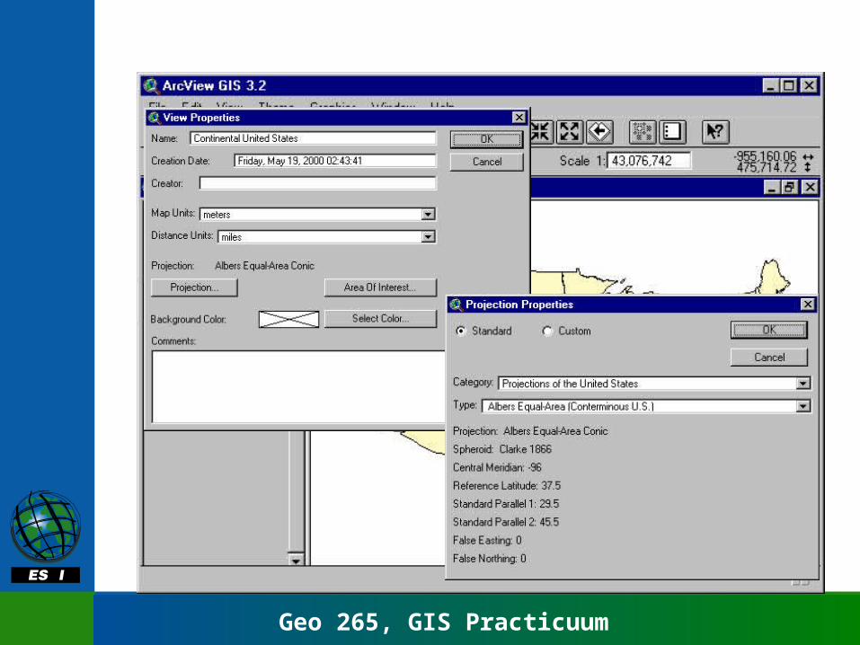
Project and View menus• Properties
• Customize
• Rename and delete
• Add table INFO, dBASE (.dbf), ASCII
• Import (projects, older versions)
• SQL connect window
Geo 265, GIS Practicuum

Geo 265, GIS Practicuum
Active Theme
Geo 265, GIS Practicuum
Geo 265, GIS Practicuum
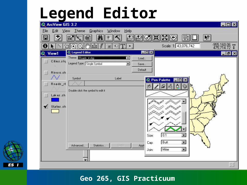
Legend Editor
Geo 265, GIS Practicuum
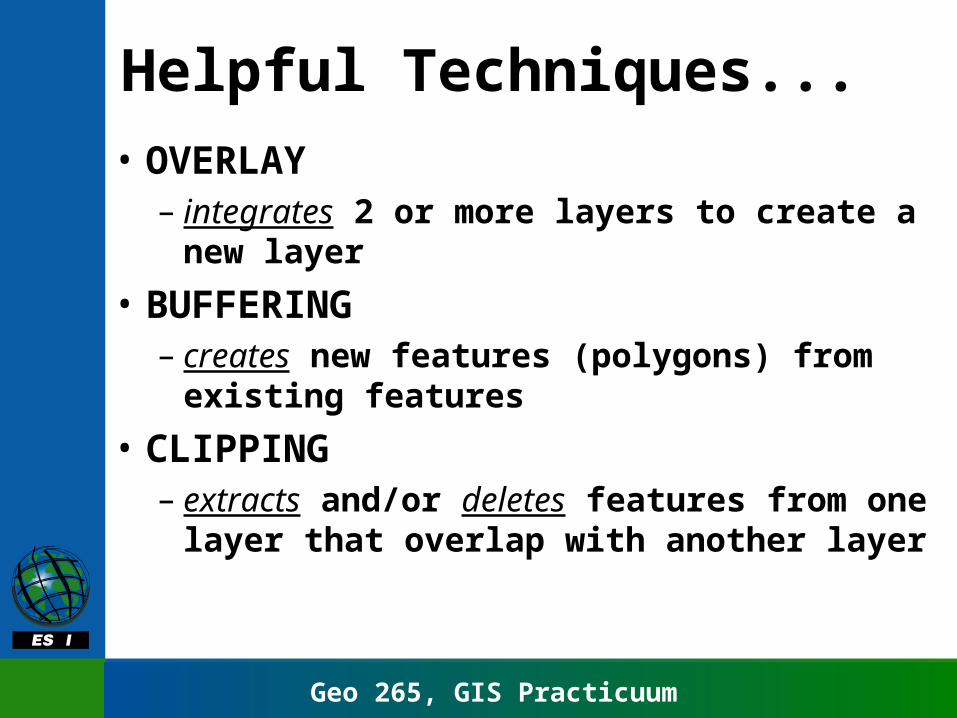
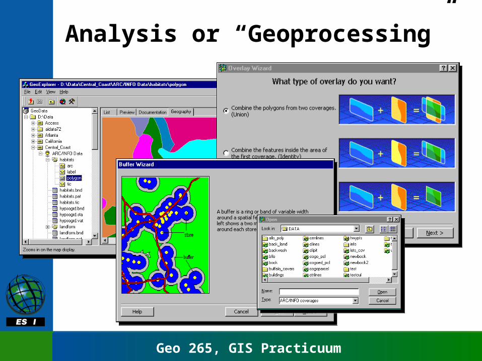
Helpful Techniques...
• OVERLAY– integrates 2 or more layers to create a
new layer
• BUFFERING– creates new features (polygons) from
existing features
• CLIPPING– extracts and/or deletes features from one
layer that overlap with another layer
Geo 265, GIS Practicuum
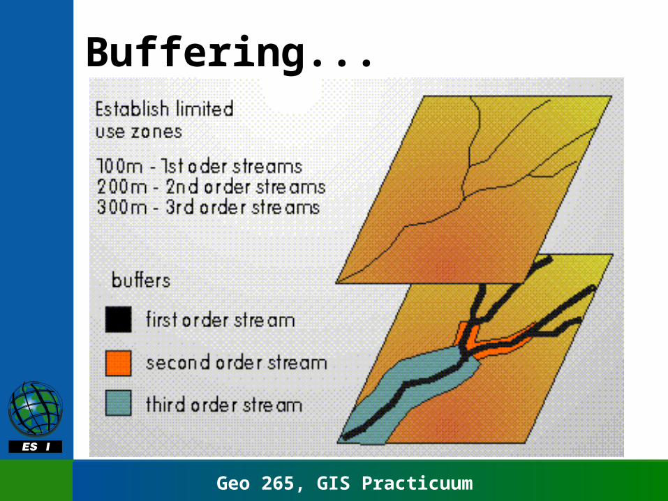
Buffering...
Geo 265, GIS Practicuum
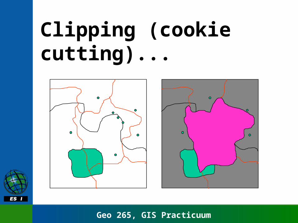
Clipping (cookie cutting)...
Geo 265, GIS Practicuum
Analysis or “Geoprocessing”

Geo 265, GIS Practicuum
Working with wizards Explanation & guidance
Not just new users
Helpful graphics
Smart defaults!
This is the Buffer wizard
One operation at a time

Geo 265, GIS Practicuum