Embed Size (px)
Citation preview

The Geology of Juba and the Surrounding Area,
Central Equatoria
Field Report
By
Samuel Macharyek Adak
10-CN-236
Department of Geology & Mining
College of Natural Resources and Environmental Studies
University of Juba
P. O. Box 82 Juba
August 2015
i
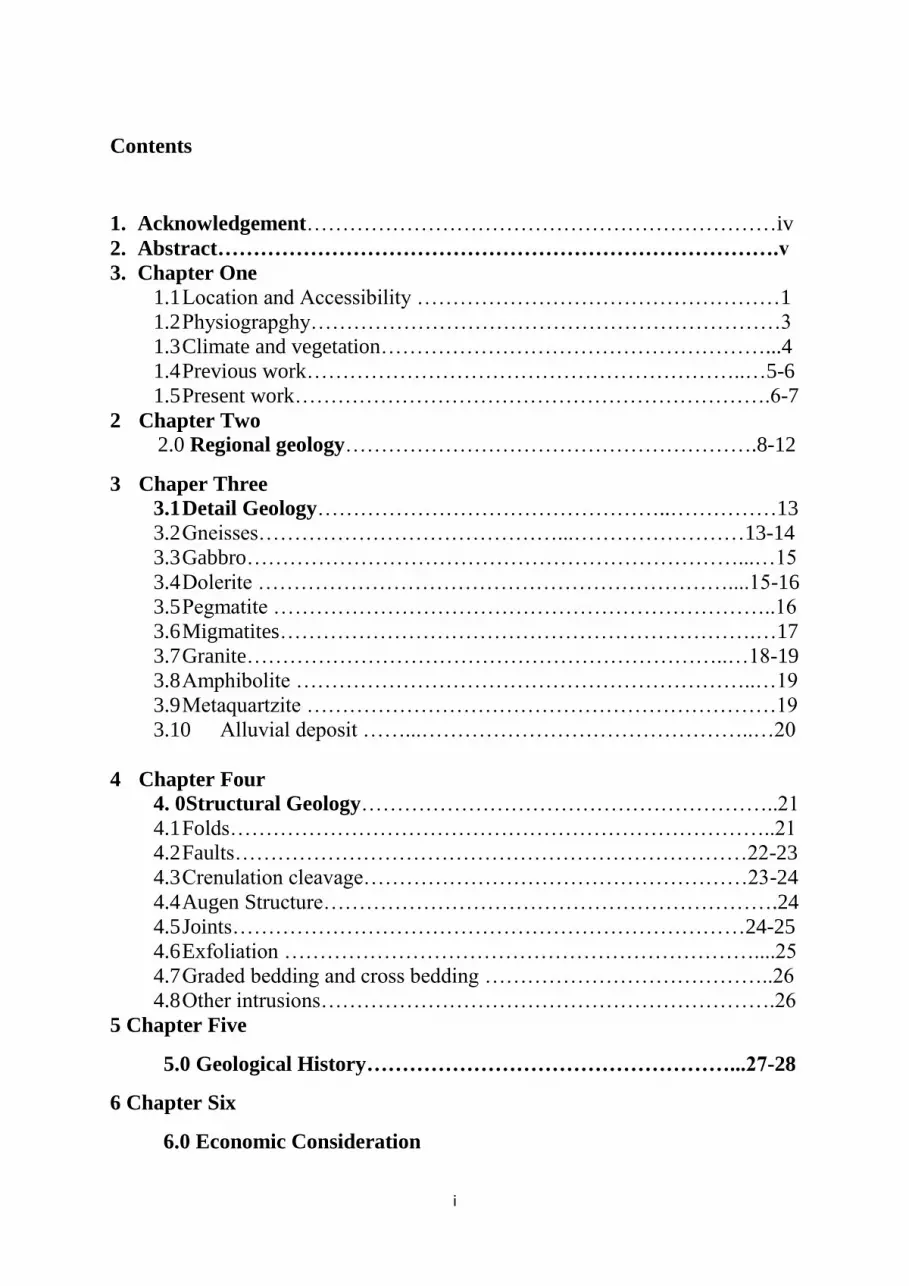
Contents
1. Acknowledgement…………………………………………………………iv
2. Abstract…………………………………………………………………….v
3. Chapter One
1.1 Location and Accessibility ……………………………………………1
1.2 Physiograpghy…………………………………………………………3
1.3 Climate and vegetation………………………………………………...4
1.4 Previous work……………………………………………………..…5-6
1.5 Present work………………………………………………………….6-7
2 Chapter Two
2.0 Regional geology………………………………………………….8-12
3 Chaper Three
3.1 Detail Geology…………………………………………..……………13
3.2 Gneisses……………………………………...……………………13-14
3.3 Gabbro……………………………………………………………...…15
3.4 Dolerite …………………………………………………………....15-16
3.5 Pegmatite ……………………………………………………………..16
3.6 Migmatites………………………………………………………….…17
3.7 Granite…………………………………………………………..…18-19
3.8 Amphibolite ………………………………………………………..…19
3.9 Metaquartzite …………………………………………………………19
3.10 Alluvial deposit ……...………………………………………..…20
4 Chapter Four
4. 0Structural Geology…………………………………………………..21
4.1 Folds…………………………………………………………………..21
4.2 Faults………………………………………………………………22-23
4.3 Crenulation cleavage………………………………………………23-24
4.4 Augen Structure……………………………………………………….24
4.5 Joints………………………………………………………………24-25
4.6 Exfoliation …………………………………………………………....25
4.7 Graded bedding and cross bedding …………………………………..26
4.8 Other intrusions……………………………………………………….26
5 Chapter Five
5.0 Geological History……………………………………………...27-28
6 Chapter Six
6.0 Economic Consideration

ii
6.1 Rocks………………………………………………………………..29
6.2 Clay…………………………………………………………………...30
6.3 Sand…………………………………………………………………..30
6.4 Gold……………………………………………………………….30-31
6.5 Conclusion………………………………………………………...31-32
Refrences…………………………………………………………………33

iii
List of illustrations
1. Figure 1; Map showing the study area……………………………………….2
2. Figure 2; Topography Features of Juba area………………………………...3
3. Figure 3; Average Annual temperature and Precipitation of Juba………...4-5
4. Figure 4; showing vegetation in the Area……………………………………5
5. Figure 5; showing map of the geology of South Sudan…………………….12
6. Figure 6; showing weathered banded gneiss on Jebel Kuruk………………14
7. Figure 7; shows boulder of gabbro found at the foot of Jebel Luri………...15
8. Figure 8; shows dykes in the area of study…………………………………16
9. Figure 9; pegmatitic feldfars vein near the foot of Rejaf East Mountian…..17
10. Figure 10; showing migmatite in Jebel Kuruk……………………………..17
11. Figure 11; showing Garnet spots in Jebel Kuruk Granite…………………..18
12. Figure 12; quartzite at the bank of KhorLadokeji………………………….20
13. Figure 13; chevron fold in mylonite zone in Khor Ladokeji……………….21
14. Figure 14; Macro and Micro folds found on Jebbel Kerek ………………..22
15. Figure 15; view of the fault in north Gumbo NE ministry of telecommunication
and postal services…………………………………………………………23 16. Figure 16; crenulation cleavage found around the dyke in North of Gumbo24
17. Figure 17; open Joints on rocks in area South of Radio Gumbo. ……….…25
18. Figure 18; Fig (18) Set of close joint found in Jebel Kuruk……………....25
19. Figure 19; Exfoliation (onion-skin weathering) In Khor Lado Keji………..25
20. Figure 20; Nature of Jebel Luri and Economic Activities around it………..29
21 Figure 21; showing gravel work in the study area………………………….30
iv
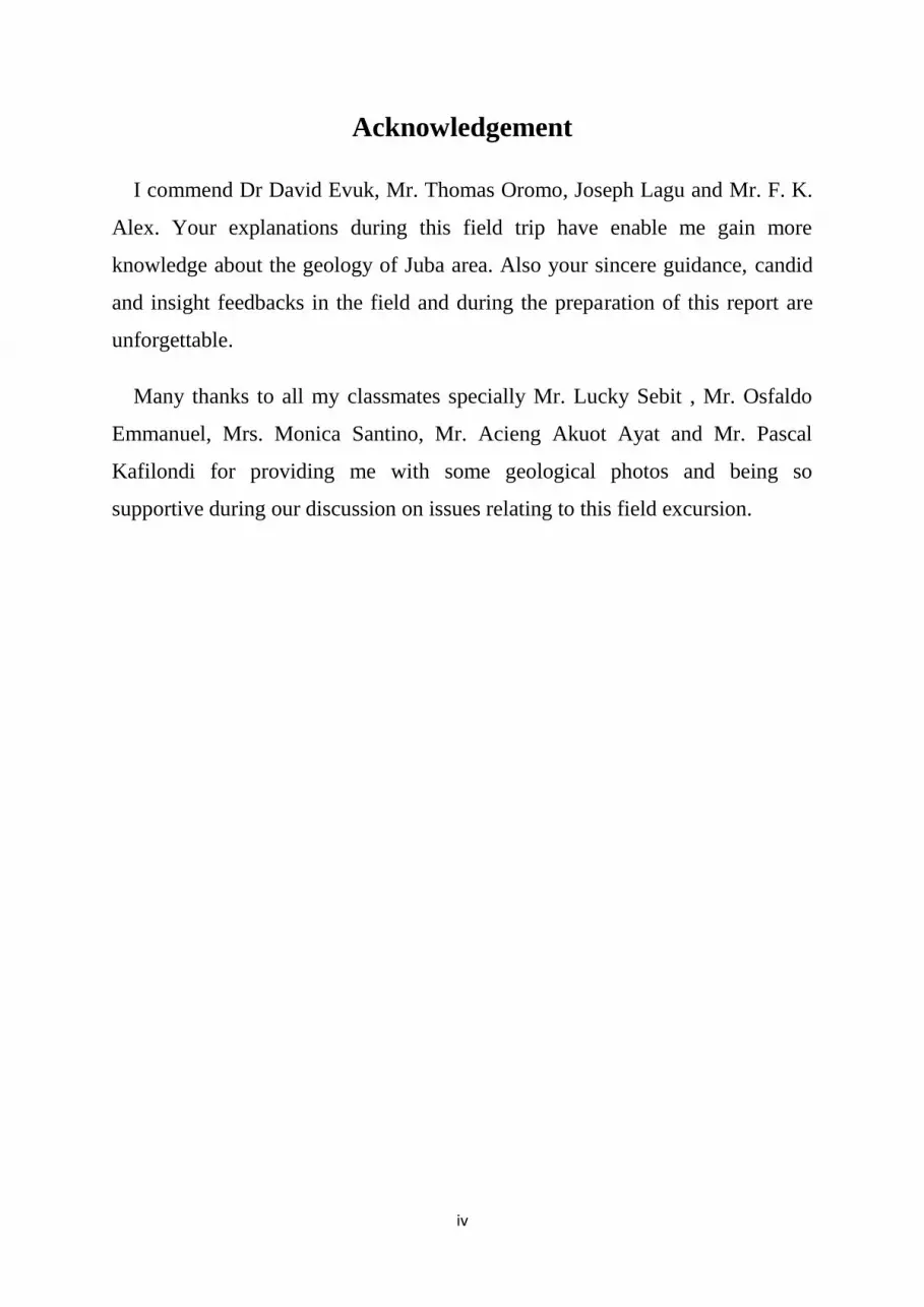
Acknowledgement
I commend Dr David Evuk, Mr. Thomas Oromo, Joseph Lagu and Mr. F. K.
Alex. Your explanations during this field trip have enable me gain more
knowledge about the geology of Juba area. Also your sincere guidance, candid
and insight feedbacks in the field and during the preparation of this report are
unforgettable.
Many thanks to all my classmates specially Mr. Lucky Sebit , Mr. Osfaldo
Emmanuel, Mrs. Monica Santino, Mr. Acieng Akuot Ayat and Mr. Pascal
Kafilondi for providing me with some geological photos and being so
supportive during our discussion on issues relating to this field excursion.

v
Abstract
The department of Geology and Mining university of Juba chose an area of
approximately 100 , extending from J Rejaf East Mountain, Gumbo and
Sherikat in the eastern bank of River Nile to Jebel Kuruk and Jebel Kunufi to
the southwest and West bank of River Nile where field excursion for geology
students was conducted. The objects of the trip were; as part and partial
fulfilment of the curriculum, and to train us (students) on the field investigation
to delineate rock types, structural orientation etc. in an area.
Juba area is generally underlain by metamorphic complex which formed the
Basement Complex intruded by numerous granitiods and doleritic dykes. The
Basement Complex is overlain uncomformably by alluvial and surficial deposits
that vary in thickness from one location to another.
This study reveals the following types of rocks; Gneisses which comprises of
banded gneiss, augen gneiss and biotite gneiss. They are abundant in the area
and dominate the country rock and occur as large exposures as well. Granites
occurs as large intrusions as seen in Jebel Kuruk and Jebel Kunufi. Both gneiss
and granites are cut by either doleritic or gabbroic dykes which trend EW.

1
Chapter One
1 Introduction
1.1 Location and Accessibility
The study area covers eastern and western part of Juba, the capital of the
government of South Sudan and Central Equatoria State as well. It lies on the
latitude , 45’, 34.2’’ and 52’, 06.6’’ N and longitude 21’,
12.8’’ and , 39’, 27’’ E . An area of approximately 100 , extending
from Jebel Rejaf East, Gumbo and Sherikat in the eastern bank of River Nile to
Jebel Kuruk and Jebel Kunufi to the southwest and West bank of River Nile
were covered.
Juba is accessible by Land, air, and by river transport. Due to improving roads
and bridges, the study area is easily reachable and the regional trade and social
networks are reshaping as well. There are both local roads connecting the city
with other state capitals, and International Highway like Juba-Kampala
Highway. The city has modernized airport and active river port.
Because of rapid urbanization and settlement in the area, some sites will not be
accessible for studies in some years to come. It is important that some specific
sites are preserved by the government in collaboration with University of Juba
as study areas.
During the study, a bus and land cruiser were use to access the sites but it also
involves walking from one location to another in the field. This is because of
the roughness of the terrain in some areas and the tall grass and unpassable
roots.

2
Figure (1)
Map showing the study area

3
1.2 Physiography
Juba has spectacular landscape rugged topography, high grounds and plains. The
mountains cover the east, west and Jebel Nyakenyi locally known as Jebel Lado to the
north. They represent areas of high relief that range from more than 600 plus to 1200 m
above sea level. The general ground has the average altitude, 468 meters above sea level
with gentle slope to the north. The mountain ranges, located west and east of Juba
provide a picturesque backdrop for the town with its sharp scenic peaks and wide
valleys.
The drainage pattern in the area is dendritic which is typical in mountainous areas. The
streams flow in different direction with respect to their origin and eventually drained to
River Nile they include streams such as Khor Rumula, Khor Ladokeji etc. The Nile
River creates a lush greenway that spans into Greater Juba and supports a diversity of
local flora and fauna, creating a rich ecological zone.
Numerous rocky outcrops are widely exposed throughout the area. They range from
small-sized to large mountains like Jebel Kuruk, Jebel Luri, Rejaf East. Dikes occur as
linear features trending generally East-West direction.
A B

4
Fig (2) Topography Features of Juba area (A) showing some mountains. (B) showing the main stream the River
Nile
1.3 Climate and Vegetation
The climate of Juba is tropical climate with average yearly high temperature of 34oC
and average yearly low temperature 21oC. Maximum temperature is experience during
the month of January to March and minimum temperature during April to July.
Rainy season starts from April-October. Average yearly total rainfall is 953.7 mm. The
dry season with small amount of rain start from November and intensifies from
December to March.
The type of vegetation is more biologically diverse and is not generally very dense.
Examples of common trees are Teak, shrubs, mango trees etc.
The rate of weathering is very high due to the combination of both high temperature
and rainfall, this condition facilitates hydrolysis, oxidation and reduction and physical
type of weathering such as the action of the plant’s roots.
(A)

5
(B)
Fig (3) Average Annual temperature and Precipitation of Juba. (A) Average min and max temperature. (B)
Average annual precipitation.
(A) (B)
Figure (4) showing vegetation in the Area (A) around Luri (B) western bank of the River Nile
1.4 Previous work
In general speaking, South Sudan is one of the areas in East Africa with little geology
data, Whiteman (1971) summarised brief descriptions of the igneous and metamorphic
rocks at selected localities. Much of geological investigations in the country were
generally done by correlation and extrapolation with the geology of the neighbouring
countries. For instance, in 1974, Professor Vail of the University of Khartoum
prepared –a geological map of Sudan using all available information, and extrapolating

6
data from adjacent countries. The project area had received little detailed study by the
students of the department of geology and mining, University of Juba.
However, limited systematic work was carried out in the central and parts of eastern
equatorial region. For example, Geologists from University of Khartoum studied the
gold occurrences in the Luri River basin and Kapoeta district. They also made
observations on the geology along the roads between Juba, Yei and Mundri ( Eyobo,
1973, Badri El Din).
Hunting Geology between 1976 and 1980 contracted by the regional government of
then Southern region conducted study aim at evaluating mineral resources that includes
metallic, radioactive and industrial minerals of the Juba area, and they produced a
1:250,000 scale geological map of the project area.
In 1986-1997, Legge published his findings on copper mineralization in Eastern
Equatoria, and the importance of Aswa shear lineament. He also described the geology
of the area as covered by basement of rocks invaded by Precambrian intrusion.
1.5 Present work
The study was conducted on Monday, August 31st
to September 3rd
2015 and it lasted
for 4 days. The object of the study is as follows:
1. It is part and partial fulfilment of the curriculum
2. To train us (students) on the field investigation to delineate rock types, structural
orientation etc. in an area.

7
Methods used during this study includes; observations, sample description of
geological features, and sampling. Also measurement of strike, dips, orientation of
structures were done plus snapshots were taken. An introduction to mapping was
conducted on the last day of the trip.
The tools used comprises of; geological hammer, goggles, clinometer and lens, GPS,
mathematical set, and notebook.
Accessibility to most sites of study is difficult because of the vegetation cover which
in some cases obscure detail of rock exposures which is the main constraint
encountered.

8
Chapter Two
2.0 Regional Geology
South Sudan is underlain by metamorphic and granitic rocks belonging to the northern
portion of the Tanganyika Craton bordered by gneissic rocks of heterogeneous Sudan
that were deformed during end-Precambrian Pan African orogenic event (Hunting
1980).
However, the Southern and North-western regions of the South Sudan are mainly
underlain by Archaean and Proterozoic rocks which are generally of medium to high
metamorphic grades.
The Basement Complex in these Regions can be discuss in four main contexts
identified in the adjacent neighbouring countries.
1) The Madi Sequence
The Madi rock Sequence was recognised by Berry and Whiteman in 1968 and by
HUNTING Geology in 1976. The Madi Sequence was originally described in northern
Uganda (Mathews, 1952, Hepworth and Macdonald, 1966), in the Abu Satta Hills and
to the northwest of Ragor along the boundary with the Central African Republic.
The Madi Sequence of northern Uganda continues into southern Sudan and is exposed
on the Juba - Yei road about 53 km southwest of Nimule. The Madi Sequence consists
of muscovite quartzites interbanded with muscovite schists,
quartz-feldspar-biotite-hornblende gneisses and amphibolites. The Madi Sequence
originated as a succession of arenaceous and argillaceous clastic sediments with minor
calcareous beds and probably with some volcanic rocks. Deposition age predates the
Miriam and Chuan deformations, but probably postdates Aruan (HUNTING, 1975).

9
(2) Karasuk Group (Miriam Group, Hepworth, 1967)
The term Karasuk Group was used in East Africa by Macdonald (1961), Almond
(1969) and applied to the Mozambique Belt of Eastern Africa (Holmes, 1951). The
Karasuk Group of the Precambrian basement rocks occupies a broad area covering the
eastern extremity of South Sudan and extends northwards as far north as Daga Post
(HUNTING. 1976). The rocks of the Karasuk Group are an assemblage of both
sedimentary and igneous origin, and include amphibolites, biotite-hornblende gneisses,
marbles, quartzites, chlorite and graphite schists, altered granites, ultrabasic rocks and
metagabbros. According to Almond (1969), most of the Karasuk rocks fall within the
amphibolite facies metamorphism, while the rest are of the greenschist facies regional
metamorphism.
(3) Gneiss Group
According to HUNTING Geology (1976), this group includes:
a -, massive weathered foliated granites and poorly banded gneisses,
b - biotite-hornblende gneisses with minor amphibolite and quartzite gneisses,
c - muscovite-biotite gneisses.
The gneissic rocks cover much of South Sudan of the Basement Complex. On the
basis of field observations (HUNTING, 1976), all the rocks of the Boya Hills area in the
Yambio region and areas northwest of Yambio, the Lafit mountains, areas west of
Mundri, near Wau, along areas west of Raga, southwest and southeast of Juba, and west
of Nyamlell, are included in this group.

10
(4) Strongly banded rocks, gneisses, migmatites and locally metasedimentary
rocks
This unit occurs in three areas to the east, north and west of the Imatong Mountains
and occupies broad zones within the Raga region west of longitude 26° 30' E
(HUNTING, 1976). The migmatitic rocks occur between Maridi and Mundri and
southeast of Tambura. Rocks of this group include quartz-feldspar-biotite garnet
gneisses, graphite-sill imanite gneisses and migmatites, in addition to quartzites, schists,
marbles, etc. of metasedimentary sequences.
In the study area, Precambrian basement includes the Nile gneisses occupying east
bank of the Nile which can be trace westward near Jebel Kuruk, the Madi
metasediments around Jebel Kuruk extending west beyond Jebel Kunufi in Luri area
metamorphosed to high and medium grade metamorphism and Kenyeti-metasediment.
According to Hunting 1980, the basement under when four tectono-thermal activities.
They include Watian 2.88 Ga, Aruan, Mirian and Chuan recognized in the neighbouring
Uganda.
The basement Complex during the Palaeozoic era was intruded by granitoids of post
tectonic era. They comprise of two granitic composition exposures at Jebel Kuruk and
Kunufi along with the nepheline syenite of Jebel Narkenyi (Lado) and Jebel Bilinyang.
During Tertiary the area was subjected to tensional tectonics that opened EW fractures
which were subsequently filled by doleritic dike cutting both the basement and the
major intrusions in the area.

11
In the region where there are Precambrian outcrop, lateritic soil develop and occurs at
irregular intervals. The laterite is composed of reddish brown, sandy soils and duricrust.
The duricrust forms broken blocky outcrops composed of yellow, reddish brown or
black, spongy and more massive hydrated iron oxides with scattered included detrital
silicate grains and larger angular rock fragments.
Umm Rwaba formation; this cover is found north of Juba and it is widely
distributed in South Sudan, and the Sudan, almost totally covering the Upper Nile
region and partly the Equatoria, Bahr el Ghazal, Darfur, Kordofan and Blue Nile
regions. It is characterize by low topography, smooth texture, variable thickness and
small number of drainage courses. Composition of Umm Rwaba is clay, sand and
gravels. (El Haga et tal, 2013-2014).
This formation contains very few fossils and therefore not much can be said about age.
It is considered of Quaternary to Tertiary age by Whiteman and as Quaternary by Vail.
Conditions of deposition for the Umm Rwaba are thought to have been fluviatile and
lacustrine, with sediments laid down in a series of land deltas similar to those existing in
the Sudd at the present day. The age of sediments of the formation are considered to
range from the Tertiary to Quaternary (vail 1978).
The Umm Rawaba formation may be divided into three units (Shafie, 1975):
Lower unit: some 99 m thick, it is characterised by individual grains of epidote.
Authigenic minerals are represented by the presence of many limonite grains;
Middle unit: some 149 m thick, it is characterised by abundant epidote, the increased
quantity of which forms the bottom of the cross-section;

12
Upper unit: some 157 m thick, the quantity of the epidote grains (in general) decreases
in this unit.
The Umm Rawaba Formation is also characterised by the presence of a considerable
amount of feldspars which may reach up to 40 % of the light fraction, and ilmenite
which reaches up to 77 % of the heavy fraction.
Much of the area overlain by the Umm Rawaba Formation has surface deposits
consisting of heavy clays, dark grey to chocolate in colour with kankar nodules. In the
Muglad and Umm Rawaba area (Quz), sands directly overlie the clays.
According to oil exploration data from central and southern Sudan, the maximum
drilled thickness of the Umm Rawaba Formation is higher than 15,000 feet (about 4,570
m). According to geophysical data the maximum recorded thickness is higher than
27,000 feet (about 8,225 m) in some places.
Other unconsolidated deposits lie as a thin blanket of varying thickness over the
Precambrian basement. Extensive alluvial deposits underlie the flood plain of the Nile
and many of its tributaries within the study area and toward the north of Juba.
Figure (5) showing map of the geology and mineral deposit of South Sudan

13
Chapter Three
3.0 Detail Geology
3.1 Introduction
Generally, the study area is underlain by metamorphic complex which formed
the Basement Complex intruded by numerous granitiods and doleritic dykes.
The Basement Complex is overlain uncomformably by alluvial and surficial
deposits that vary in thickness from one location to another. The detailed
description of the above rock categories will be discuss below.
3.2 Gneisses
Gneisses are abundant in the area of study, they dominate the country rock and
occurs as large exposures as well. Several types of gneiss that include banded
gneiss, biotite gneiss and augen gneiss are clearly exposed.
Banded Gneiss; are abundant in areas South of Gumbo, Rejaf East Mountain
and Jebel Kuruk in which banded gneiss occurs inform of large angular
fragments. They are high grade metamorphic rocks that occur as parent rock
that host many intrusions such as granitic plutons and dykes.
The banded gneiss has clear bands of dark and light colour minerals. They are
composed principally of quartz, feldspar mica and pyroxenes with subordinate
amphiboles. Its weathered surface is light brown and fresh surface is light grey.
Foliation and quartz vein are highly visible. Texture is medium to coarse
grained.

14
Fig (6) showing weathered banded gneiss on Jebel Kuruk.
Augen gneiss occurs in Rejaf East Mountain and an area North of Radio
Gumbo. In Rejaf East the augen forms very large exposure associated with
quartz-feldspathic. Some gneiss around Rejaf East Mountain is wholly
porphyroblastic. Weathered surface of this gneiss is greyish to brownish and
fresh surface is light grey.
Those Augen gneisses in area North of Radio Gumbo are coarser than those on
Rejaf East Mountain. This probably; means that the grade of metamorphism had
increase North-ward from Rejaf East Mountian. The main constituents of
Augen are the quartz, feldspar or amphiboles.
Biotite gneiss: occurs intermittently around Rejaf East Mountain and form the
main outcrop of Jebel Lemon, they looks grey on the fresh surface and dark on
weathered surface. It is composed of biotite, amphiboles, hornblende, quartz,
feldspar and it has a coarse-grained texture.

15
3.3 Gabbro
Occurs in form of dyke, generally oriented EW. Its main outcrop is a linear
feature found south of Gumbo, parallel to Juba-Nesitu highway. Also gabbro is
found incorporated with granite at Jebel Kunufi in southeast portion of the
outcrop adjacent to the quarry. It is produced as a result of assimilation of the
felsic magma by the country rock.
It is composed of few light minerals and composes dominantly of biotite,
minor pyroxenes, plagioclase and amphiboles. It has a coarse-grained texture.
Fig (7) shows boulder of gabbro found at the foot of Jebel Luri.
3.4 Dolerite
Dolerite are common inform of dikes that cut across gneiss in most areas, they
also cut granitic intrusion in areas around Jebel Luri, and Jebel Kuruk. They are
composed dominantly of mafic minerals and have fine-grained texture.

16
Most doleritic dikes races parallel to each other with orientation that is
generally EW direction. Doleritic and gabbroic intrusions occurs as linear dikes
that have gradational contact such as those found in an area along Khor Lado
keji and others have sharp contact in the same area and extend everywhere in
the area of study. In areas South of Gumbo, North of Radio Gumbo, the dikes
occurred as large intrusions with no visible contact with the parent rocks.
The general EW trending nature of the dikes across the area of study suggest
that there was extensional force oriented North-South that acted across the
region, resulting into formation of many fractures that were then filled with the
dykes.
A B
Fig (8) shows dykes in the area of study A. the dyke in area south of radio Gumbo. B. view
of the main doleritic dyke in area NE of Ministry of Postal services and Telecommunication.
3.5 Pegmatite:
There is occurrence of pegmatite around the gabbroic intrusion in area North
of Radio Gumbo, The pegmatite is composed of microcline (pinkish); it looks
the same with orthoclase. Also there is a pegmatitic feldspar composed of
feldspar and quartz and occur in form of lineament at approximately 20m away
from the foot of Rejaf East Mountain.

17
Fig (9) pegmatitic feldfars vein near the foot of Rejaf East Mountian.
3.6 Migmatites:
Migmatites found in the study area are granitic in composition. They occur
in association with granitic plutons such as those on Jebel Kuruk. The
migmatites have large crystals of feldspars, microcline or mica, this is
because of the slow cooling and low pressure. They have nebulitic texture.
Fig (10) showing migmatite in Jebel Kuruk

18
3.7 Granite
The granite invaded the gneiss in areas of Jebel Luri, Jebel Kuruk and an area
along Juba – Nesitu road south of Gumbo. Those granites at Jebel Luri and
Jebel Kuruk occur as large, linear intrusions composed of large boulders. The
granite in the study area can be discussed in two forms:
1. Garnetiferrous granite
2. Post-tectonic granite.
Garnetiferrous granite is confined to Jebel Kuruk, it bear garnet spots and
are granitic in composition, characterise by weak foliation and medium grained
texture. Since garnet is a high temperature metamorphic mineral, their
occurrence on Jebel Kuruk may be attributed to partial melting that resulted into
migmatites which are common on that mountain. Also existence of xenoliths
may suggest assimilation of the country rock that eventually led to formation of
garnet.
Figure (11) showing Garnet spots in Jebel Kuruk Granite
Post-tectonic granite is found in Jebel Luri, it has pinkish brown weathered
surface and its fresh surface is grey. The largest exposure is trending north-

19
-South. No observable foliation, there is even distribution of minerals. Its
texture is medium to coarse grain. Composition; light colour mineral dominated
by potash feldspar, and some quartz microcline, plagioclase and muscovite. And
dark colour minerals including; biotite, amphibole and hornblende. The dark
colour cannot be easily removed when scratched this is a characteristic of
amphibole.
According to (Hunting, 1980) the accessory minerals present include
sphene, apatite, zircon, opaque minerals, chlorite and secondary calcite.
3.8 Amphibole:
Amphibole is clearly seen as lenses with thickness of about 3-4 meters and
approximate length of about 1m on Jebel Kuruk in banded gneiss, it also occurs
as spots on granitic boulders called garnet ferrous granite. They are composed
of dominant hornblende and plagioclase plus small quartz.
However, the amphiboles found in other locations occur in form of trace
elements in the gneisses and in the doleritic and gabbroic dykes.
3.9 Metaquartzite;
Metaquatzite occurs inform of lens on eastern bank of Khor LadoKeji, it is
light brown to whitish in colour. It is highly fractured and is dominantly made
of quartz. Observing the fresh surface, a mosaic texture is seen, which is a
characteristic of quartzite. This distinguishes it from quartz vein which is
normally not crystallized.
The metaquartzite here is inter-bedded with dark colour rocks. It is probably
part of Madi-metasediment which is reported in literature that it is found on
both sides of Luri Hills. The mafic rock is meta-gabbro composed of pyroxenes
and plagioclases. Some parts of meta-gabbro are metamorphosed to
amphibolite.

20
Fig (12) quartzite at the bank of KhorLadokeji
3.10 Alluvial Sediments:
This is confined to areas along the streams such as Khor Ladokeji, river Nile
and many others. They occur as unconsolidated sediments on top of the streams
and as consolidated sand at the bottom of the streams. Their main constituents
are sands and some clay deposits.
During the deposition, they form several sedimentary structures like graded
bedding and cross bedding.

21
Chapter Four
4.0 Geological structures.
The rocks in the study area are mildly deformed, the geological structures in
the area consist of both ductile structures which include; folds, foliation. And
crenulation cleavage, and brittle structures which includes joints and faults.
Geological structure is a definable shape or fabric in a rock. The geological
structures are divided into primary structures which are structures formed
during or shortly after deposition (sedimentary) or formation (igneous) of rocks
while secondary structures formed after its host rocks are formed.
4.1 Folds
Jebel Kuruk is a host to many folds. The folds occur with tilting appearance,
micro-folds occurs at the base of the mountain, while, macro-folds occurs at the
top of the mountain.
In mylonitic zone in khor Ladokeji, chevron fold are seen. They have average
amplitude of 11 cm.

22
Fig (13) chevron fold in mylonite zone in Khor Ladokeji
A B
Fig (14) A Macro folds found on Jebbel Kerek (Photo by Lucky Sebit) B. Micro folds, also on
Jebel Kerek.
4.2 Faults
Faults occurs less commonly, the few that occurs are oriented E-W, implying
that there was regional extension that acted perpendicularly E-W. A normal
fault that has EW orientation and a displacement of 54 cm is found North of
Radio Gumbo at elevation 472 meters above sea level. The fault zone is
enriched with silica and characterised by presence of slicken sides.
At the foot of Rejaf East Mountain, There is what appears to be a fault zone
because of the followings:
- There are reddish materials from ferroginzation.
- Whitish material implying enrichment of silica because of high pressure
in the zone.
- Angular fragment from brecciation
- Striae

23
- Groove and steps
It appears that movement of the fault was dextral.
Fig (15) view of the fault in north Gumbo NE ministry of telecommunication
and postal services ( Orange arrow = fault direction, black arrow =displacement (54 cm) direction)
4.3 Crenulation and foliation
The country rocks in the study area are foliated. Some of the granitic intrusions
are also foliated. Crenulation occur in areas were pegmatization took place for
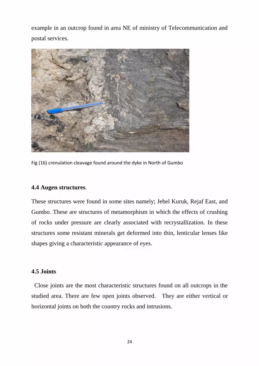
24
example in an outcrop found in area NE of ministry of Telecommunication and
postal services.
Fig (16) crenulation cleavage found around the dyke in North of Gumbo
4.4 Augen structures.
These structures were found in some sites namely; Jebel Kuruk, Rejaf East, and
Gumbo. These are structures of metamorphism in which the effects of crushing
of rocks under pressure are clearly associated with recrystallization. In these
structures some resistant minerals get deformed into thin, lenticular lenses like
shapes giving a characteristic appearance of eyes.
4.5 Joints
Close joints are the most characteristic structures found on all outcrops in the
studied area. There are few open joints observed. They are either vertical or
horizontal joints on both the country rocks and intrusions.

25
Fig (17) open Joints on rocks in area South of Radio Gumbo. Fig (18) Set of close joint found in Jebel
Kuruk
4.6 Exfoliation
A type of physical weathering that result due to unloading, it is vivid clear in
areas along Khor Lado keji and on dyke found NE of ministry of
Telecommunication and postal services. It is found on plutons that were uplifted
by tectonic activity in the area.
Fig (19) Exfoliation (onion-skin weathering) In Khor Lado Keji (Photo by Osfaldo
Emmanuel).

26
4.7 Graded bedding and cross bedding: are sedimentary structures found in
khor Lado keji. They are formed by the deposition of the alluvial sediments on
both sides of khor lado keji and Luri river basin.
4.8 Other Intrusions
Granitic intrusions on western bank of the Nile have a gradational contact with
parent gneiss. Areas of migmatization and pegamatization are characterised
by presence of large crystals of feldspar mica or microcline that shows perfect
cleavage.

27
Chapter Five
5.0 Geological History
The study area falls in a Precambrian shield underlain by metamorphic rocks
compose dominantly of gneisses and granitic rocks that are of medium to high
grade metamorphism. They were deformed during end-Precambrian Pan
African orogenic event.
During the Palaeozoic era, the basement Complex was intruded by granitoids
of post tectonic era. They comprise of two granitic composition exposures at
Jebel Kuruk and Kunufi along with the nepheline syenite of Jebel Narkenyi
(Lado) and Jebel Bilinyang.
During Tertiary the area was subjected to tensional tectonics that opened EW
fractures which were subsequently filled by doleritic dike cutting both the
basement and the major intrusions in the area.
According to Hunting 1980, the basement under when four tectono-thermal
activities. They include Watian 2.88 Ga, Aruan, Mirian and Chuan recognized
in the neighbouring Uganda. The area South and South West of Juba is
underlain by Archean and Proterozoic rocks. The basement complex here
include: - the Watian which is the oldest Archean tectno-thermal events
recognised in Uganda and dated at 2.88 billion years ago. It is recognised in
Imatong Mountain area and characterised by massive unfoliated Charnokites
rocks forming mass of the upland area, there are extensive fractures. They can
also be found South of Lainya as small inliers of Charnokitic rocks.
Aruan: - the younger Archean event recognised in North Uganda. They include
the Nile gneiss West of Imatong Mountain and east of the Juba-Nimule road.
Here the Nile gneisses are composed principally of gneisses of amphibolite

28
facies with subordinate metasediments and amphibolite. Foliation trends are
poorly defined but generally in Northerly direction.
Miran: - recognized in the banded gneisses between Yei and Lainya. This
trend can be traced to the east-northeast through the madi metasediments and
across the Aswa shear zone towards Juba.
Chuan: - in South Sudan and in Uganda is represented by a series of refoliation
zones similar in photo geological expression and age and to the Mozambiquan
but with more north-westerly trend. The best established is the Aswa zone,
trending from the upper reaches of the River Assua in Uganda, along the line of
the Nile from Nimule towards Juba and Continuing as far as Mvolo.
From Palaeozoic to present, South Sudan underwent uplift and erosion during
Palaeozoic period as there is no evidence of sedimentation during that period.
The basement rocks were intruded by post tectonic bodies such as Jebel Luri,
Jebel Kerek and so on.
The laterisation and tilting of the land took place during the Tertiary. The area
to the South was uplifted and eroded whereas to the north of Juba the Umm
Rwaba sediments accumulation in the Sudd Region. Evidence of tilting and
more extensive laterite cover can be seen in the high level remnants of laterite
found in the Koda watershed where it has been elevated to approximately 600
meters above the present level of Juba.
Cycles of physical and chemical weathering have been occurring. The
products of weathering include silici-clastic fragments, sands and other
unconsolidated materials. These unconsolidated materials are being deposited
into area north of Juba and into the River Nile. The area north of Juba marks the
periphery that lead to Umm Rwaba Formation toward northern part of the
country.

29
Chapter Six
6.0 Economic Potentials
6.1 Rocks
The study area is an important source of crashed-gravels as there are abundant
rocky outcrops and mountains that are fairly accessible by land. Although there
have been some quarry companies operating on large scale as well as local
people on small scale on Jebel Kerek and Jebel Luri, the rock in the area are still
unexhausted. The products (crashed-gravels) are locally used for construction of
roads, bridges, buildings etc.
Fig: (20) Nature of Jebel Luri and Economic Activities around it, it is composed of boulders of granitic
rocks. At the foreground of this photo, there are machines for a Quarry company operating on this
mountain.

30
Fig (21) showing gravel work in the study area. (photo from collection by Francis K Alex)
6.2. Clay
The clay deposit along the streams, such as Kabur Aboba, and River Nile is
very crucial in bricks lying. This generates a lot of income and the bricks are
used for construction. Currently, both small scale and large scale brick work
takes place along the streams in Juba.
6.3. Sand
Streams such as Luri River, khor Rumula are important source of sand as it
is deposited as alluvial sediments on their banks. Sand is an important mixture
in the concrete used in construction too.
6.4. Gold
There is occurrence of alluvial gold in the Luri river basin as it was studied by
geologists from university of Khartoum. This could be of economic importance
in the future when its source is identified and mined.

31
The area provide important field of study and research, the knowledge gained
here will hopefully be of economic value to the country.
6.5 Conclusion
This field excursion have enable me gain more understanding about basement
complex of Juba area, numerous intrusions and in general, the types of rock
present in the study area.
The basement complex of Juba is gneiss that range from medium to high grade
metamorphism, its chief constituents are mafic and felsic rocks, both banded
and unbanded gneiss occurs in the area, different types such as Augen gneiss,
grey gneiss etc. exist, the gneiss is invaded by several doleritic, gabbroic and
granitic intrusions, the invasion occurs as plutons, and others are inform of
doleritic, grabbroic dikes that have East-West trending.
Most commonly occurring types of rocks in the area are; gneiss, granites,
dolerite gabbro, etc. meanwhile ultra-mafic rocks, migmatites, metaquartzite
etc. less commonly occur in the area. Most of the surface in this area is covered
with sillici-clastic deposits, other unconsolidated materials and numerous rocky
outcrops.
There are some faults and many joints; this indicates that the intruding actions
of the plutons and/or effect of the tectonic forces occurred on parent rocks at
relatively shallow depths and moderate temperature, hence depicting the brittle
behaviour of the parent rocks.
Folding is less common, they are found in few areas, such as in Jebel Kuruk
and area along Khor Ladokeji.
Weathering is inevitable, due to tropical climate of the area; the effect of
weathering can be seen as in the change of surface colour (usually dark or

32
reddish brown) of most rocks, exfoliations and other types of physical
weathering such as action of trees’ roots are common.
The area is drained by river Nile and several other streams such as khor
ladokeji and many others that are connected to the River Nile. The banks of
River Nile and these streams are covered with clay or mud and others with
sands. They are important areas for brick lying. Also, the presence of large
plutonic mountains such as Jebel Kuruk, Jebel Luri etc provides a great source
for crashed-gravels useful in constructions.

33
References:
Ahmed Awadalla Yassin, Fathi Ali Khalil,Dr. Abdel Gadir El Shafie 1984 Explanatory
Note To The Geological Map At The Scale Of 1:2 000 000 Of The Democratic Republic
Of The Sudan 1981 Edition. Sd - 84, 02 1984
Albert H. Fay, Slate, A Glossary of the Mining and Mineral Industry, United States Bureau of
Mines, 1920.
Clemens, John (1998). "Observations on the origins and ascent mechanisms of granitic
magmas". Journal of the Geological Society of London 155 (Part 5): 843–51. Doi: 10.1144/
gsjgs.155.5.0843.
Essentials of Geology, 3rd Ed, Stephen Marshak.
Harvey Blatt and Robert J. Tracy (1997). Petrology (2nd Ed.). New York: Freeman. p. 66.
ISBN0-7167-2438-3.
Holmes, A., 1951, The sequence of Precambrian erogenic belts in south and Central Africa :
Rep. 18th Sess. int. geol. Congr., G.B., 1948, part 14, pp. 254-269.
Vail, J.R., 1974, Distribution of the Nubian Sandstone Formation in Sudan and vicinity :
Bull. Am. Assoc. Petrol. Geol., vol. 58, pp. 1025-1036.
Vail, J.R., in press, e. Tectonic trends and basement subdivisions, east of the Nile valley, in
Northern
Africa : Rep. 2nd Conf. afr. Geo!., Addis-Abeba, 1973.
Whiteman, A.J., 1971a, The geology of the Sudan Republic : Clarendon Press, London, 290
p.
Whiteman, A.J., 1971b, A reviev; of the Pleistocene and Recent history of Sudan Republic :
Bull. Assoc, senegal. Et. Quat. Ouest afr., vol. 29, pp. 29-101.
Whiteman, A.J., 1971c, Structural geology of Sudan, pp. 433-445 : In Tectonic of Africa,
UNESCO, Earth Sci., no. 6, Paris.