Embed Size (px)
Citation preview
53B01NW0003 53Be2Nweei7 WAPAMISK CREEK 010
HORSESHOE PROJECT
YEAREND REPOR1?
1981 EXPLORATION PROGRAM
NORCEN ENERGY RESOURCES LIMITED
MNIHG
i
Kor t hwe s t. e r r. On tar i oNTS 52/E2
i
l
Glen ."c'.viJ liair.su*T* V:^- * S Tl
L. J. S::.:;h, P, Gool
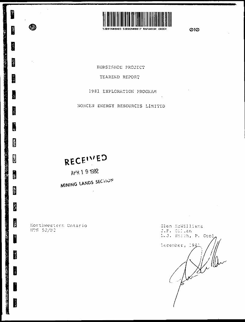
53B"iiNiwM3"53B*2NW**17 WAPAMISK CREEK 010C O F CONTENTS PAGE
g """ LIST OF ILLUSTRATIONS. . . . . . . . . . . . . . . . . . . . . . . . , . . . . . . . . . i. ACCOMPANYING MAPS. . .. . . . . . . . . . . .. . . . . . . . . . . . . . . . . . . . . . . i ii I EXECUTIVE SUMMARY AND RECOMMENDATIONS . . . . . . . . . . . .. . . .. l
S il INTRODUCTION . . .. . . . .. . . . . .. . . . . . . . . . . . . . . . . . . . . . . . . . . . 3
a. Location and Access .......... . ..,. . , . . . . . . . . . . . . . . . 3b. Land Status ........................................ 5c. General Geology ............... . . . . . . . . .. . .. .. . . . . . . 5d. Mineral Resources of the Area ...................... 5III HISTORY OF PREVIOUS WORK .. .. ... . .. . . . . . . . . . . . . . . . . . . . . 9
a. Rio Tinto Canadian Exploration Ltd. ................ 9b. Great Plains Development Co. of Canada Ltd. ........ 11c. Dome Exploration (Canada) Ltd. . . . . . . . . . . . . . . . . . . . . . 14IV GEOLOGY OF THE HORSESHOE BELT . .... . . . .... . . . . . . . . . . . . . 19
a. Mafic to Intermediate Volcanic Rocks . . . . . . . . . . . . . . . 20b. Felsic to Intermediate Volcanic Rocks . . . . . . . . . . . . . . 22c. Sedimentary Rocks . . . . . . . . . . . . . . . . . . . . . . . . . ....,.... 23d. Mafic Intrusive Rocks . . . . . . . . . . . . . . . . . . . . . . . . . . . . . . 23e. Quartz Feldspar Porphyry . . . . . . . . . . . . . . . . . . . . . . . . . . . 24f. Iron Formation . . . . . . . . . . . . . . . . .. . . ................. 25V GEOCHEMICAL SAMPLING . . . . . . . . . . . . . . . . . . . . . . . . . . . . . . .... 30VI OVERBURDEN DRILLING AND RELATED GEOCHEMICAL SAMPLING .. 33
a . Introduction . . . . . . . . . . . . . . . . . . . . . . . . . . . . . . . ... . . . . . 33b. Methods . . . . . . . . . . . . . . . . . . . . . . . . . . . . . . . . ............ 33c. Results . . . . . . . . . , . . . . . . . . . . . . . . . . . . . . . . . . . . . . . . . . . . 38d. Costs . . . . . . . . . . . . . . . . . . . . . . . . . . . . . . . . . . . ........... 38VII CONCLUSIONS A*ND RECOMMENDATIONS . . . . . . . . . . . . . . . . . . . . . . . 40
LIST OF APPENDICIES
i
l
APPENDIX I
APPENDIX II
APPENDIX III
APPENDIX IV
APPENDIX V
APPENDIX VI
APPENDIX VII
- SUMMARY OF DRILL LOGS BY PREVIOUS WORKERS
- ASSAY CERTIFICATES
- SCHEDULE OF CLAIMS
- SUMMARY OF TOTAL PROJECT EXPENDITURES
- ASSESSMENT CREDIT COMPUTATION
- PHOTOGRAPHS OF HORSESHOE LAKE AREA
- FIELD DATA SHEETS: OVERBURDEN SAMPLE DESCRIPTIONS
l
l
PLATE 5
PLATE 6
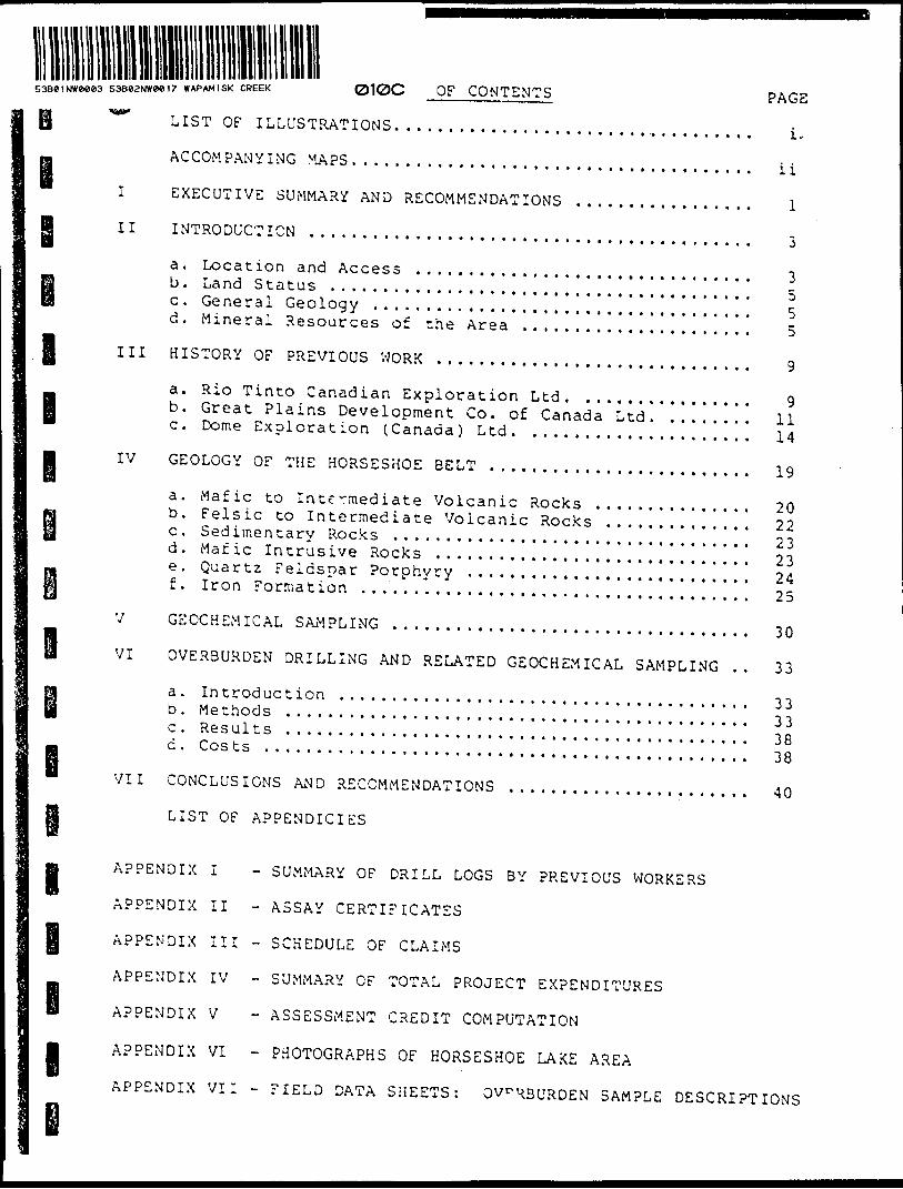
LIST OF ILLUSTRATIONS PAGE
Figure 1. Location map . . . . . . . . . . . . . . . . . . .. . . . . . . . . . . . . . . . 2Figure 2. Regional Geology and Mineral Deposits .......... 4Figure 3. Norcen Claims in the Horseshoe Project ......... 6Figure 4. Assessment Summary; Rio Tinto Exploration 1965 . 10Figure 5-6. Assessment Summary; Geophysics and Drilling byGreat Plains Development Company................ 12,13Figure 7-8. Assessment Summary; 1976 Drilling by Dome
Exploration Limited . . . . . . . . . . . . . . . . ............ 15,^.3
Figure 9. Sample Locat.ons Horseshoe Project . . . . . . . . . . . . . 31
" ' * . r.' ** ' -
Figure 11. Stacked Profiles; Line C, Geophysics andOverburden Sample Results . . .. . . . . .. . . . . . . . . . . . . 39
LIST OF TABLES
TABLE l ANALYTICAL RESULTS FROM GEOCHEMICAL SAMPLING.... 32
TABLE 2 ANALYTICAL RESULTS FROM OVERBURDEN SAMPLING..... 35
LIST OF PLATES
PLATE l MYLONITE NORTH OF CANOE LAKE.................... 21
PLATE 2 SULPHIDE FACIES IRON FORMATION.................. 26PLATE 3 BANDED OXIDE FACIES IRON FORMATION.............. 28
PLATE 4 BANDED OXIDE FACIES IRON FORMATION WITH RI? OFFCLASTS. . .. . . . . . . . . . . . . , . . . . . . . . . . , . . . . ........ . . 29
EXPLORATION CAMP SETTING AT HORSESHOE LAKE (APPENDIX V)
TOPOGRAPHY AROUND HORSESHOE LAKE (APPENDIX V)
MA?
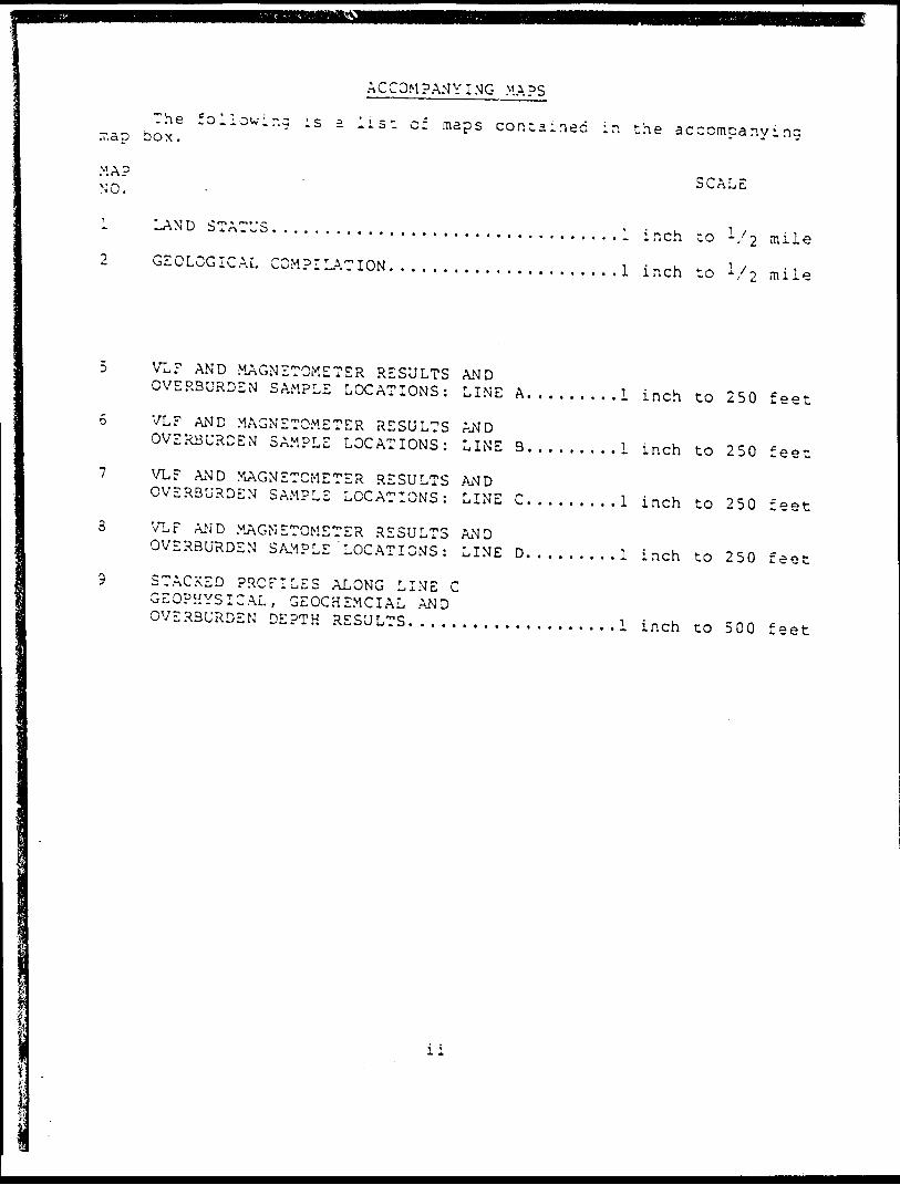
ACCOMPAMY I MG MAPS
The following is a list of maps contained ir. the accompanying box.
SCALE
1 LAND STATUS. ... . . . .. . . . . ... .... . . . . . . . . . . ...l inch to -/i m ile2 GEOLOGICAL COMPILATION. . .. . . . . . . . . . . . . . . . . . .l inch to 1/2 mile
5 VLF AND MAGNETOMETER RESULTS ANDOVERBURDEN SAMPLE LOCATIONS: LINE A.........l inch to 250 feet
5 VLF AND MAGNETOMETER RESULTS ANDOVERBURDEN SAMPLE LOCATIONS: LINE 3.........l inch to 250 feet
7 VL? AND MAGNETOMETER RESULTS ANDOVERBURDEN SAMPLE LOCATIONS: LINE C.........l inch to 250 feet
3 VLF AND MAGNETOMETER RESULTS ANDOVERBURDEN SAMPLE 'LOCATIONS: LINE D. . . . .....l inch to 250 feet
9 STACKED PROFILES ALONG LINE C GEOPHYSICAL, GEOCHEMCIAL AND OVERBURDEN DEPTH RESULTS. . . . . . . . . . . . . . . . . ...l inch co 500 feet
l l l l
l l
e i
-i-
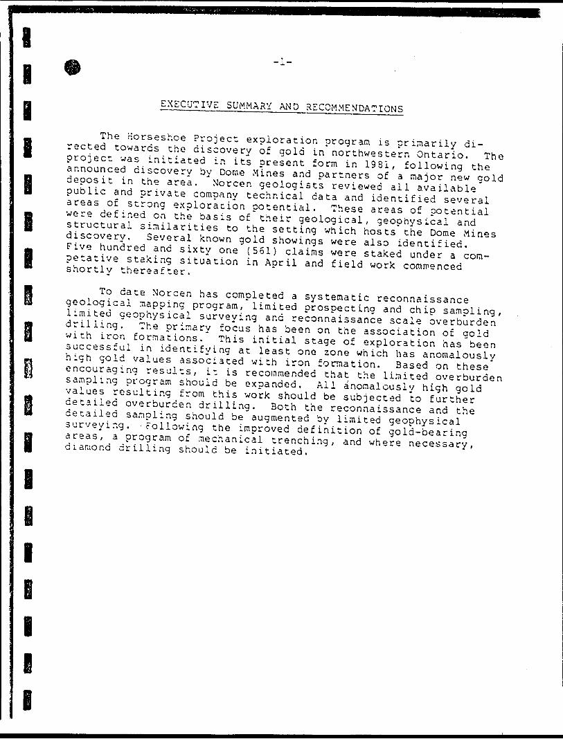
EXECUTIVE SUMMARY AND RECOMMENDATIONS
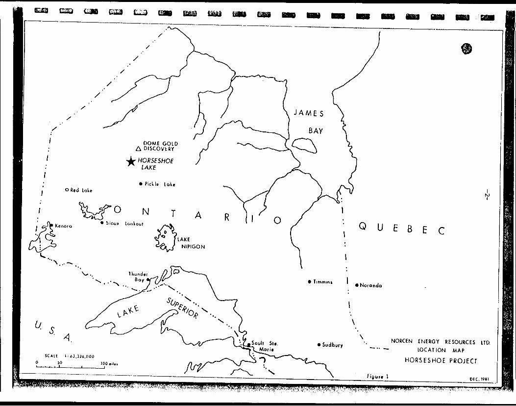
The Horseshoe Project exploration program is primarily di rected towards the discovery of gold in northwestern Ontario. The project was initiated in its present form in 1981, following the announced discovery by Dome Mines and partners of a major new gold deposit in the area. Norcen geologists reviewed all available public and private company technical data and identified several areas of strong exploracion potential. These areas of potential were defined on the basis of their geological, geophysical and structural similarities to the setting which hosts the Dome Mines discovery. Several known gold showings were also identified. Five hundred and sixty one (561) claims were staked under a com- petative staking situation in April and field work commenced shortly thereafter.
To date Norcen has completed a systematic reconnaissance geological mapping program, limited prospecting and chip sampling, limited geophysical surveying and reconnaissance scale overburden drilling. The primary focus has been on the association of gold with iron formations. This initial stage of exploration has been successful in identifying at least one zone which has anomalously high gold values associated with iron formation. Based on these encouraging results, it is recommended that the limited overburden sampling program should be expanded. All anomalously high gold values resulting from this work should be subjected to further detailed overburden drilling. Both the reconnaissance and the detailed sampling should be augmented by limited geophysical surveying. Following the improved definition of gold-bearing areas, a program of mechanical trenching, and where necessary, diamond drilling should be initiated.
i
i e
LJD (sai L-J
DOME OOID DISCOVERY
QUEBEC
• Noranda
Figure l
NORCEN ENERGY RESOURCES LTD. LOCATION MAP
HORStSHOE PROJECT
OIC. I'll^tt-'i 4-'-K^":V?'*V!;3;/^^ i^\^;^^^r^//.:':;'-'^--:'^/ ff r\V' '"'
e 3
a
a
II INTRODUCTION
An evaluation of the gold potential of Greenstone Belt of Northwestern Ontario was 1981. Interest in this area was aroused by by Dome Exploration of the discovery of athe Opapimiskan Lake area. The close proximity of this area, the similar geological setting and the presence of"gold occurrences' within the Horseshoe Belt prompted the staking of 561 claims.
Gold occurs in the Horseshoe Belt in the following settings:
the Horseshoe initiated in March the announcement made
major gold deposit in
volcanic rocks1. Gold within sheared mafic2. Gold within quartz veins3. Gold within quartz-feldspar porphyry4. Gold associated with massive pyrite", pyrrhotite
and arsenopyrite (sulphide facies iron formation)5. Gold within till overlying oxide and silicate facies
formation iron
Great Plains Development Company of Canada, a former wholly owned subsidiary of Norcen had investigated the massive sulphide potential of this belt during 1971 through 1973. Drilling and geophysical records from this exploration provided a data base for the initial evaluation. During their work*the presence of formation had been noted but not potential. There are no records
ironpresenceinvestigated for its gold
no records of any previous attempt to evaluate the gold potential in the iron formation of this belt. This represents the primary objective of the Horseshoe Project.
a. Location and Access
B i
Horseshoe Lake is located 105 air kilometres (65 miles) north-northwest of Pickle Lake Ontario, the closest supply centre,
kilometres (170 miles) north-northwest of Thunder Bay,' city.anathe
435 air nearest
The Horseshoe Lake claims are within the Patricia Mining Division with the recording office at Sioux Lookout. Horseshoe Lake is within the Kecheokagan Lake map sheet (NTS 53 3/2). Theclaims extend from 90 0 30' to 90 0 57' longitude and 52 0 15' latitude.
i 1 to 52'
The eastern margin of the Horseshoe Lake Claim Group is crossed by highway 308. This gravel road, which is only* maintained during the summer months, is a northern extention of highway 599 which ends at Pickle Lake. The Horseshoe Lake claims are located 130 road kilometres (31 miles) north of Pickle Lake. This road is presently completed as far as Upper Windigo Lake, located 30 kilometres (50 miles) to the northwest of Horseshoe Lake. When completed this road will connect with highway 105 at Red Lake .
a
Opopimiilton lot* Gold Deposit
Centrol Pofricio
Lolt St. Joitp.
Norcen Energy Resources Limifed
REGIONAL GEOLOGYand
MINERAL DEPOSITS
VOLCANIC BELTS
—— .— ROAD
HORSESHOE PROJECT AREA 90*
-5-
A private airstrip referred to as WiebenvilTe is located within the Norcen claims adjacent to highway 808. This unmanned, sand strip was designed to accommodate DC-3 aircraft transporting freight to communities to the north. Wheeled and float equipped aircraft are available for charter from Austin Airways or Bearskin Airways at Pickle Lake. Heli Voyageur currently maintains a heli copter base at Pickle Lake.
b. Land Status
Norcen Snr-cgy Resources Limited is the recorded holder of 100 percent interest in 561 claims in the Horseshoe Lake Project in Ontario. These claims are located on the following four claim maps :
Bugbee Lake - M. 3271
North of Wapamisk Ck-M. 2716
Kecheokagan Lake-M. 2713
Wapamisk Ck. - M, 2715
54 claims
28 claims
150 claims
329 claims
561 claims
The date of record for these claims is June 4, 1981. A complete listing of the claims is included with this report as Appendix III.
c. General Geology
The Horseshoe greenstone belt occurs at the southern margin of a large granitic batholith that is flanked by the North Caribou belt to the northeast and the Windigo belt to the west. These greenstone belts appear to have similar geological environments and histories of deformation. The discovery of a significant gold deposit by Dome at Opapimiskan Lake in the North Caribou belt has sparked exploration activity throughout this area.d Mineral Resources of the Area
The first mining activity in the area occured in 1926 with the discovery of gold associated with iron formation at Central Patricia, just north of Pickle Lake. The operations of Central Patricia Gold Mines Ltd. and Pickle Crow Gold Mines Ltd. had a cumulative production of 2,081,178 ounces of gold (Sage R. P. and Breaks F.W/1976) from 1934 to 1966. Active gold mining in the Pickle Lake area ceased with the closure of the Pickle Crow Mine in 1966. This deposit is currently being evaluated by Gallant Gold Mines Ltd.
-7-
e B i i i i
B
B
Done Exploration announced the discovery of gold within a banded iron formation at Opapimiskan Lake 51 kilometres (32 miles) north of Horseshoe Lake, {The Northern Miner March 5, 1981). Over l million tons of ore are drill indicated with an approximate grade of 0.2 ounces gold per ton. Active participants in this property include Dome Exploration (Canada) Ltd. as operator (353 interest), Canadian Nickel Co. (23.955), Esso Minerals (23.955), Lacana Mining Corporation (17.1C^).
The initial ooid discovery at Opapimiskan Lake was described by Thurston P.C., Sage R.P., and Siragusa G.M. (1979). Xeno- gamesis Gold Mines discovered gold mineralization in sheared iron formation south of Opapimiskan Lake in the summer of 1962. Kenpat Mines Limited was formed to represent joint venture partners; Kenlew Mines Limited, Moneta Porcupine Mines Limited, Kenogamesis Gold Mines Limited, Forbex Limited and Iso Mines Limited. Magne tometer and geological surveys, trenching and 20 diamond drill holes totalling 1171 metres were completed over the 72 claims. Two gold occurrences were located. Showing No. l is located 0.8 kilometres south of the mid-point of the south shore of Opapi miskan Lake. The Northwest occurrence lies 90 metres north of the north shore of Opapimiskan Lake.
The No. l showing is underlain by interbanded mafic metavol- canics and oxide and silicate facies iron formation. The iron formation occurs as a unit up to 72 metres wide which is folded into a synform and two antiforms offset by a north-northwest trending fault. The showing consists of a rusty quartzose shear zone .06 to .9 metres wide cutting across the strike of the iron formation over a length of 3 metres. Eight diamond drill holes totalling 397 metres were submitted for assessment work. The best mineralization reported was 0.8 metres of 0.03 ounces of gold per ton and 0.18 ounces of silver per ton in a buff and grey iron formation. The Northwest occurrence is located in a single north west striking band of iron formation. A quartz vein within the iron formation was traced for 210 metres. Assays from two tren ches of 0.23 ounces of gold per ton across 5.5 metres and 0.24 ounces of gold per ton across 6.1 metres were reported in the Northern Miner (December 6, 1962). Twelve drill holes totalling 773 metres tested this zone. The best assay reported was 0.39 ounces of gold per ton over 0.4 metres was described by Thurston, et al (1979 tite and pyrite-bearing shear zones in shear zones are described as sporadic, lowed to lapse.
The gold mineralization as associated with pyrrho tine iron formation. These The Kenoat claims were al-The Opapimiskan Lake gold showings were restaked in 1973. A
consortium headed by Dome Mines has carried out geophysical and geochemical programs and in excess of 130 diamond drill holes from 1974 to the present. To date over l million tons of ore grading approximately 0.20 ounces of gold per ton has been outlined.The information available on this occurrence is limited to the Ontario Geological Survey report by Thurston et al. (1979) summarized above and drill logs available in Ontario Government Assessment Files. Information from these files and throughB
li&M
l l I l e i i i
-3-
comnunication with Don Janes (Resident Geologist, Sioux Lookout) who has examined the property is summarized as follows:The gold - occurs within oxide and silicate facies iron formation with minor values in andesite.
- is controlled by faulting {shearing and brecciation) and folding of the iron formation.
- is associated with pyrrhotite and pyrite although barren sulphides are equally common.
- is locally associated with quartz and quartz carbonate veins. Barren quartz and quartz carbonate veins are also present. Gold also occurs in the absence of any quartz or carbonate veins.
- is associatd with weak conductors with an associated strong magnetic response.
- is associated with anomalous arsenic values.
- the l million tons reserve estimate is conservative.The host rocks are silicate and oxide facies iron formation which are interbanded with mafic volcanic flows. This assemblage oce -pies tight isoclinal folds which have been offset by steeply dipping faults. These rocks have been subjected to upper green schist and amohibolite facies metamorohism.
l
e i
I l l l l l l l
9
!
l
in
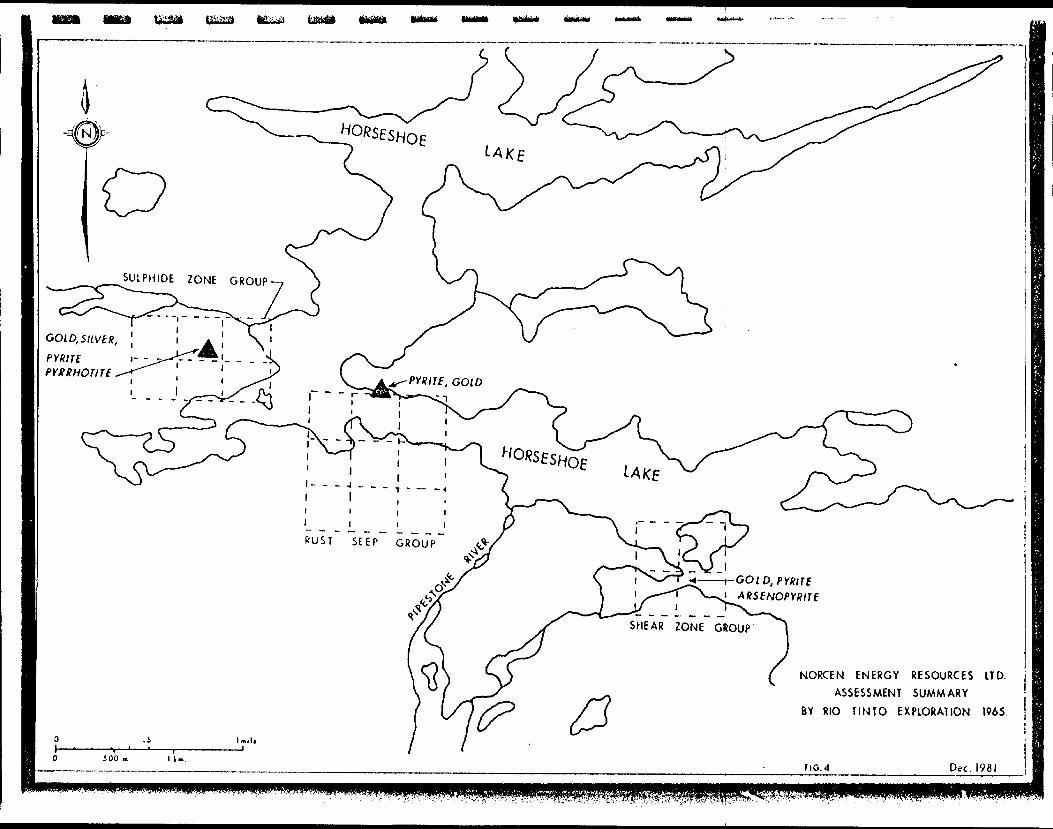
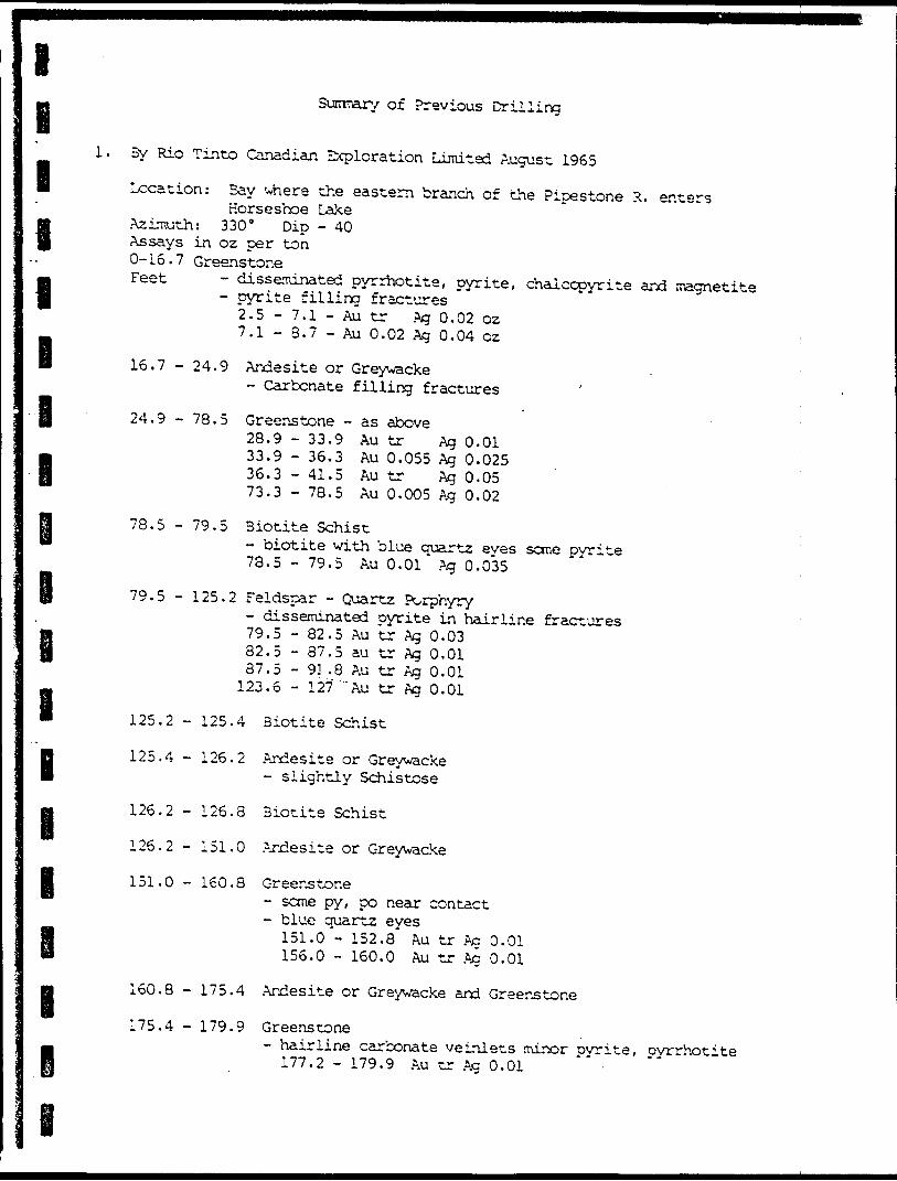
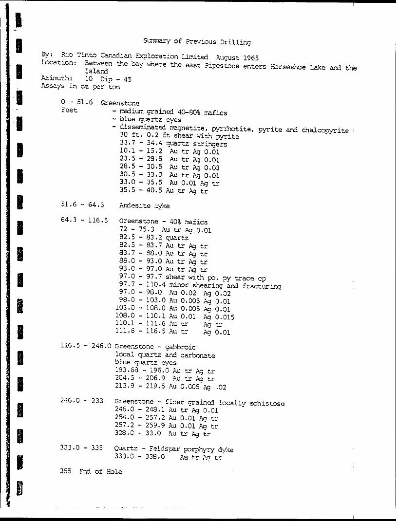
The first recorded exploration out by Rio Tinto in 1961 as part of canic belts of the Patricia Mining work involved prospecting in areas cative of volcanic terrain outlined maps. Three claim-groups totalling covering several mineralized zones of Horseshoe Lake. The results of the Ontario Government Assessment F the results of this work from priva
work on this belt was carried a regional study of the voi-
Division. This reconnaissance of magnetic high relief indi- on the government aeromagnetic 19 claims were staked in 1962
along the south shoreline area this work are not available in iles. Sage (1976) summarizes te Rio Tinto files as follows:, ^ S4.I.1UC1 1. i zesv ,..wuc KIO Tinto files as follows
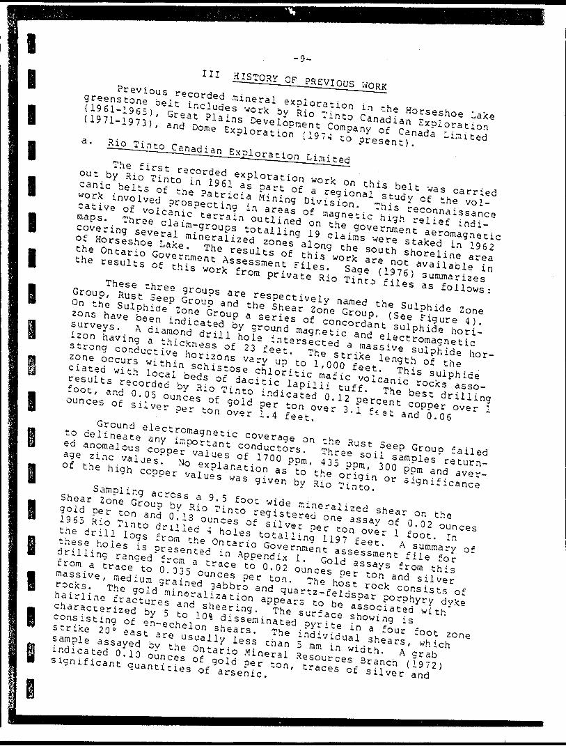
These three groups are respectively named the Sulphide Zone Group, Rust Seep Group and the Shear Zone Group. (See Figure 4 ). On the Sulphide Zone Group a series of concordant sulphide hori zons have been indicated by ground magnetic and electromagnetic surveys. A diamond drill hole intersected a massive sulphide hor izon having a thickness of 23 feet. The strike length of the strong conductive horizons vary up to 1,000 feet. This sulphide zone occurs within schistose chloritic mafic volcanic rocks asso ciated with local beds of dacitic lapilli tuff. The best drilling results recorded by Rio Tinto indicated 0.12 percent copper over l foot, and 0.05 ounces of gold per ton over 3.1 feet and 0.06 ounces of silver per ton over 1.4 feet.
Ground electromagnetic coverage on the Rust Seep Group failed to delineate any important conductors. Three soil samples return ed anomalous copper values of 1700 pom, 435 ppm, 300 pom and aver age zinc values. No explanation as to the origin or significance of the high copper values was given by Rio Tinto.
Sampling across a 9.5 foot wide mineralized shear on the Shear Zone Group by Rio Tinto registered one assay of 0.02 ounces gold per ton and 0.13 ounces of silver per ton over l foot. In 1965 Rio Tinto drilled 4 holes totalling 1197 feet. A summary of the drill logs from the Ontario Government assessment file for these holes is presented in Appendix l. Gold assays from this drilling ranged from a trace to 0,02 ounces per ton and silver from a trace to 0.035 ounces per ton. The host rock consists of massive, medium grained gabbro and quartz-feldspar porphyry dyke rocks. The gold mineralization appears to be associated with hairline fractures and shearing. The surface showing is characterized by 5 to 101 disseminated pyrite in a four foot zone consisting of en-echelon shears. The individual shears, which strike 20" east are usually less than 5 mm in width. A grab sample assayed by the Ontario Mineral Resources Branch (1972) indicated 0.10 ounces of gold per ton, traces of silver and significant quantities of arsenic.
SULPHIDE ZONE GROUP
NORCEN ENERGY RESOURCES ITD.ASSESSMENT SUMMARY
BY RIO TINTO EXPLORATION 1965,
Dec, 1981
l
l
l
l
I
I
l
l
l
l
l
-11-
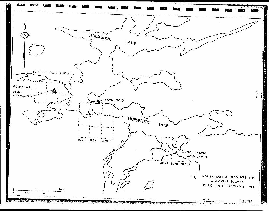
b. Great Plains Development Company of Canada Limited
Great Plains, a former wholly owned subsiduary of Norcen Energy Resources Limited, was actively involved in the exploration of the base metal potential of the Horseshoe Lake greenstone belt from 1971 to 1973. A total of 395 claims were recorded following a Questor airborne magnetic and Input survey flown in 1971 (see outline on Figure 5). Ground magnetic, and electromagnetic sur veys were carried out over 7 selected areas to investigate the the massive sulphide potential. The Input anomalies selected for follow-up work had the following characteristics: a) limited strike length, b) good conductivity and strength, and c) magnetic association. A total of 3410 feet of diamond drilling .in 25 holes tested these areas.
The eastern portion of the belt, referred to as the Rose Lake area, received the most attention. This area is covered with muskeg and overburden with few widely scattered outcrops. The overburden encountered in the drilling ranged from 14 to 125 feet thick with a mean depth of 44 feet. The overburden consists of sand with minor boulder and gravel horizons with local areas of boulder moraines. Diamond drilling was carried out on ail five grid areas (see Figure 5 and 6 ). Summary drill logs are included in Appendix 1. The rocks intersected include an assemblage of sedimentary and volcanic schists and gneisses. Granite, and quartz and carbonate veins were encountered in few of the holes. Pyrrhotite and pyrite were intersected in all of the drill holes and represent the source of the magnetic and electromagnetic anom alies. These sulphides are described as disseminations within- schists and gneisses, as fracture filling veins and stringers and a raw instances as massive beds. Minor amounts of magnetite and traces of chalcopyrite were mentioned. The sulphides appear to be associated with quartz and carbonate. Assays ranged from trace up to Q.54% copper, 0.09 'i nickel, Q.19% zinc, 0.16 ounces per ton silver and 0.01 ounces gold per ton. The majority of the assays indicated that the sulphides present were barren and the claims were allowed to lapse.
The Horseshoe Lake grid was located to the west of the south end of Horseshoe Lake. This area consists of moderate to good out crop exposure just south of a highly sheared volcanic/granite con tact. The metavolcanic assemblage consists of chlorite and chlorite-hornbiende schists and gneisses with talc chlorite schist, and calcareous chlorite schist. Porphyritic granodiorite is present within the volcanic assemblage adjacent to the northern contact. Sulphides present include disseminations and massive veins and stringers of pyrrhotite and pyrite. The sulphides ap pear to be fracture controlled. Seven diamond drill holes total ling 375 feet tested two conductors outlined on the grid. Assay results ranged from nil up to Q.08% copper, 0.12 ounces per ton silver and traces of nickel, zinc and gold. These claims were al lowed to lapse afte.- the completion of the drilling.
Two ground geophysical grids were located to the north of Kecheokagan Lake. Outcrop in the grid area is less than 5 percent
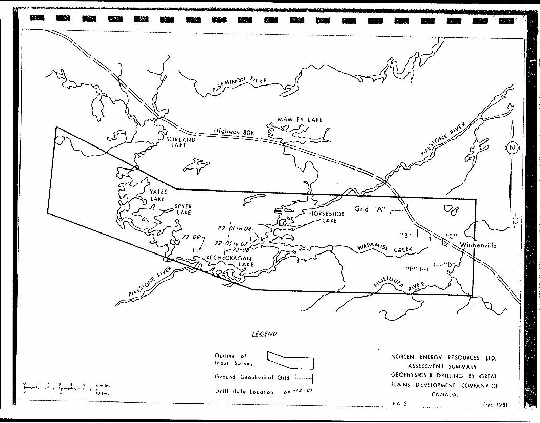
l f Gf NO
Oullio* o l
Inpul Survey
Ground Gtophyncol Grid
Drill Hoi* Locoiior. o-
NORCEN ENERGY RESOURCES LID.ASSESSMEN1 SUMMARY
GEOPHYSICS i DRIUING BY GREAT PLAINS OEVElOPMENT COMPANY OF
CANADA. FIG 5 Dec 1981
62/36-latt/ -/.02
laf o, f yr/.OB/.OJ
'\/1 r S. 29/08
'G5/5J- ,IJ,la,lFb
v^
Outline of Geophyticol Grid J . . ,Drill Mole location oDrill Hole/Deplh inmelro G4/ 31lithologyMetallic Minerals Au in oi./Ag in oj
NORCEN ENERGY RESOURCES UDASSESSMENT SUMMARY
GEOPHYSICS i DRIIUNG BY GREAT PLAINS DEVELOPMENT COMPANY OF
CANADA, f tc. 6 Dec 1981
l l l l l lB
l
due to aVolcanic
-14-
pervasive moss, muskeg and glacial overburden cover, rocks include massive to gneissic (hornblende-chloriterich) mafic volcanics and one agglomerate outcrop. Porphyritic granodiorite occurs in the southern portions of the grid and a hornblende-plagioclase gneiss along the contact between the vol canics and the granitic batholith. Disseminations and stringers of pyrite and pyrrhotite occur along fractures. Two diamond drill holes, one on each grid, tested the conductors. Assays ranged from trace up to Q.04% copper, Q.11% nickel and traces of zinc and gold. These claims were allowed to lapse.
c. Dome Exploration (Canada) Limited
Dome acquired two claim blocks referred to as the North and South claim blocks in 1974. The North Group of 12 claims covers the former Shear Zone Group in which Rio Tinto Canadian Explora tion drilled four holes in 1965 (Figure 7). The South Group of 4 claims was staked following the discovery of gold in bedrock ap*- proximately 1.6 kilometres south of Horseshoe Lake {Figure 8).
During 1976 Dome completed 6323 feet of diamond drilling in 15 drill holes, with hole depths ranging from 295 to 800 feet. Lithologies intersected in order of abundance include andesite, quartz-feldspar porphry, gabbro, subgreywacke, dacite, basalt, siltstone, quartz veins, quartz carbonate veins, quartz carbonate schist, quartzite and siliceous tuff. Drill holes which inter sected gold mineralization in excess of trace amounts include:
l
l
B l B
Drill Hole
3-2
S-3B
S-6
Sample 1 e ng t h
Depth (feet)
164. 5
149.0207.0215. 5253. 7339. 6
429. 3434. 0
55.
80.2
- 165. 5
- 169.0- 212.0- 216.5- 254. 7- 340.6
- 432. 5- 435.0
56. 0
- 36. 5
1
205111
3. 21
1
6.4
Lithology Gold(oz/ton)
V4 in Qtz. vein in gabbro 0.02
37. 6 - 90.5 7. 4
Quartz-Feldspar porphyryQuartz-Feldspar porphyryGreywackeSiltstone and GreywackeAndesite SchistoseChloriticSiltstoneSiltstone
Gabbro 1/4 in. qtz. veinlet Sulphides Gabbro, Schistose 15* pyrite and pyrrhotite, arsenopyrite 53 as above
0. 0. O, O,O,
01502010101
0.010.01
0.02
0.06
0,03
l
l
l
l l l
e i
i
Li tholocvMetallic Mine ra Is
- n
S3;
, la
56/205 ST ' 1 ""' SS/92 S9/9C 510/91 SI 1/91
2b,2a,5a.4a,3b,3d la 3b,5a,:b
5a, 3b, la la , 5o
la la
3b
S l 3/9 3 516/142
(py,po,cp)
(oy)
py (po, (pv j
. 36 . O l . 5 l . r'
l . 5 l . 5 T. 1.0 ra
. 3 m
m
m
2a,5a, 3f, 3d, 3b 5a,3b,2a 3b, 2a 5a , la
,~\V .
20 .-^,-i
0 .0.0.0 .
020102010101010207
or .5 o?. .o z *oz .o z .oz .or .zz .oz .
A uAu
.-^ uAuA uAuAuAuAu
3b3 b
-la, 3d,3b
(pv)py
(rv,DO)
All of
O indicates minor amount
^ O . O 3 o 2 . A u other o ssoyj i ndicate trace amounts
Au Si Ag.
NORCEN ENERGY RESOURCES LTD,ASSESSMENT SUMMARY
1976 DRILLING 3Y DOME EXPLOR ATION LIMITED NORTH CLAIM
BLOCK HORSESHOE LAKE1000 JOOO
100 JCO 300 400 500
7 Dec. 19B1
l l lE l l l l
l
9
l l
-15-
Frora the description in the drill Iocs, ation appears to be controlled by fracturing all fractures are mineralized. Visible gold is not mentioned in the drill logs. The gold appears to be associated with quartz veins and disseminated pyrite, pyrrhotite and in one instance ar- senooyrite. The one exceotion to the above is the 20 foot inter-
the gold mineraliz- and shearing. Not
section of porphyry.
0.015 ounces Six assays f
0.01 to 0.02 ounces" a 20 foot section a
of gold rom this
of gold per ton. the too of this
per ton in massive quartz-feldspar unit (sill or dyke?) ranged from
These assays were taken from unit and a 5 foot interval at the contact with subgreywacke. The quartz-feldspar porphyry is described as "quartz and feldspar phenocrysts (up to 10 mm.) in grey silicious matrix with 15S mafics. Generally massive." Drill intersections of quartz-feldspar porphyry in other drill holes contain only trace amounts of gold. A summary of Dome Explora tions drill logs are presented in Appendix 1.
The South Group consisting of 4 claims was staked by Dome Exploration (Canada) Limited in 1974, and are located approximate ly l mile (1.6 kilometres ) south of Horseshoe Lake. This area, which is predominantly muskeg covered, covers at the contact of the volcanic rocks and the granitic batholith to the south. The gold showing was described in Dome's assessment report as follows:Trenching in the vicinity of 13*3 0 S-Q-r50W has exposed a sequence of northwesterly trending andesitic and felsic dykes in gabbroic rock. The assemblage appears to be close to the metasedimentary rocks. Quartz veining'oc curs along and parallel to the contacts of the dykes, also some short and irregular veins extend into the dykes and gabbroic rocks. Sampling of the quartz veins has returned assays ranging from trace to 0.780 ounces of gold per ton. Sample widths of the quartz veins rai ge from 0.2 to 0.5 feet.
Geological mapping by Dome Exploration on the 4 claims indi cates only a few small scattered outcrops, representing only a fraction of l percent of the area, metavolcanic rocks are repre sented by fine grained andesite locally sheared with small irregu lar quartz veins. Mecasediments (impure quartzite, greywake or arkose) display tight drag folding and quartz-feldspar veining. Metagabbroic rocks are massive, medium to fine grained with minor irregular quartz veining.
Quartz-feldspar porphyry is exposed in the north of the claims and appears to be similar to the quartz feldspar porphyry exposed along Horseshoe Lake. Granitic rocks which occur in the southern part of the claims are medium grained granodiorite. These rocks are locally sheared and exhibit a gneissic texture.
l

l l l l l i i l l I i I
-17-
Two drill holes, inclined at 45 degrees, 298 and 302 feet in length were completed adjacent to the surface gold showing by Dome during 1976. Lithologies intersected include andesite, dacite and quartz-feldspar porphyry. Quartz veins which host the gold miner alization at the surface showing were poorly represented. Six quartz veins ranging from 1/2 inch to I inch in width were inter sected. No asssays were reported from the drilling.
The gold mineralization found at the showing is restricted to narrow (less than l foot) quartz veins cutting andesite and gab bro. Results of the drilling by Dome indicate a lack of contin uity of these veins outside the original showing. These claims were allowed to lapse.
l l
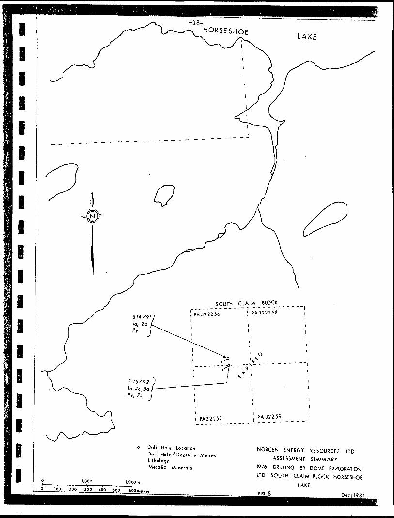
-18-HORSESHOE
LAKE
SOUTH CLAIM BLOCK
, PA 392256 1i i
', PA392258i i l i
i PA32257 PA32259
o Drill Hole LocationDrill Hoi*/Depth In MetresLithologyMelolie Mineral*
1.000 3.000 h.JOO ?00 JOO 400 }QQ
NORCEN ENERGY RESOURCES LTD.
ASSESSMENT SUMMARY
1976 DRILLING BY DOME EXPLORATION LTD SOUTH CLAIM BLOCK HORSESHOE
LAKE. HO. 8 n.
l
l l l l
-19-
IV GEOLOGY OF THE HORSESHOE GREENSTONE BELT
The Horseshoe Greenstone Belt is a trending assemblage of metavolcanic and bounded by granitic batholiths semblage is isoclinally folded vertical. Within the belt all to intensive shearing as noted a well developed schistosity, to an east-west trending shear is up to l kilometre in width, granitic intrusive rocks within
narrow, linear, me tasedimentar
east-west rocks
co the north and south. This as and all dips are vertical or near the rocks have undergone moderate by deformation of pillow lavas and The northern contact is abrupt due zone. This zone along the contact 3oth the volcanic rocks and the this zor.e display cataclastic tex tures. The southern contact is predominantly a gradational intru sive contact with a migmatite gneiss transition zor.e. All rocks within the belt have been subjected to upper greenshist to amphib olite facies metamorphism.
The belt is best exposed along the shore of Horseshoe Lake and in the burned off area west of the lake. In other areas the exposure varies from intermittent outcrops along topographic highs to small dispersed outcrops. To the east of Horseshoe Lake the belt is blanketted by muskeg and sandplain. Here a few outcrops poke up through the sand and muskeg. In this area of limited out crop, a geological interpretation relies on aeromagnetic inter pretation. An abrupt truncation of the magnetic trend indicates the belt has been faulted off to the east. The geological data are presented on the Geology Map which accompanies this report.The volcanic rocks are typical of the suite found within the God's Lake Subprovince of the Canadian Shield. The volcanics are dominantly rr.afic to intermediate in composition (andesite) with intercalated beds of felsic to intermediate flows and pyroclas tics. The lavas are presently represented by amphibolite and amphibole chlorite schists. The high degree of deformation and metamorphism that this belt has been subjected to has obliterated most primary structures. Unlike other belts within this Sub- province, no occurrences of ultramafics have been found. The poor exposure over large parts of the area and the absence of detailed mapping may account for this. Sills of gabbro have intruded the volcanic sedimentary pile. These rocks predominate the southern portion of the belt where they form east-west ridges. Quartz feldspar porphyry sills and dykes are locally present. Quartz and feldspar phenocrysts within a grey siliceous matrix possibly re present subvolcanic intrusives equivalent to the pyroclastic rocks .
Narrow bands of sedimentary rock occupy the central part of the belt.- These sediments in order of decreasing abundance in clude quartz greywacke, argillite, orthoquartzite, conglomerate and chert.
l
l
l
l
l
l
l
e
i
i
i
-20-
Iron formation of sulphide, oxide and silicate facies forms a distinctive horizon that can be traced on the Questor magnetic and electromagentic maps (included in the map section). Few outcrop- pings of the iron formation are present. Where observed the iron formation is represented by sulphide facies ir. the west and oxide facies in the east. The iron formation is of pri mary importance to gold exploration in this area.a. Mafic to Intermediate Volcanic Rocks
Volcanic rocks of mafic to intermediate composition are the dominant rock type of the Horseshoe Lake 3elt. These rocks of up per greenschist to amphibolite facies metamorphism vary from mas sive to schistose. In general, mafic to intermediate lavas ar^ moderate to intensely foliated and massive lavas are rare. Pil lowed lavas are present but highly deformed. Several pillow l^vas were mapped by Sage R.?, and Breaks F.W. (1976) along the shor^ of Horseshoe Lake on the Dome Mines claims. These outcrops are de's- cribed as follows:
Stretched pillow lavas are exposed at several locations along the shore of Horseshoe Lake. The pillows form crudely lenticular units varying in size from 0.15 to 0.30 metres to 0.6 X 1.5 metres and are separated by dark fine grained chloritic selvages which tend to weather low leaving the pillows standing in relief. Deformation orevented anv reliable too determination.Characteristic mineral assemblages of order of decreasing mineral abundance (Sag 1976) are as follows:
the mafic volcanics in R. P, and Breaks F.W.
a) hornblende * plagioclase carbonate
chlorite T quartz * epidote
b) chlorite -f- plagioclase -t- quartz jr biotite ^ magnetite actinolite
c) plagioclase ^ chlorite ^ epidote H- quartz j- magnetiteSome of the mafic volcanics- in texture, possibly representing thick flows. In other locations show definite intrusive contacts
lavas. An abundance of these coa in the southern portion of the be that they are gabbroic sills dyke pile. These rocks are described sives) .
are coarser grained and gabbroiccoarser grained central parts of these coarser grained mafic rocks and contain rafts of fine grained rser grained mafic rocks occurs lt. Intrusive contacts suggestwhich have intruded the volcanic separately (see Mafic Intru-
l l l l l l i lI
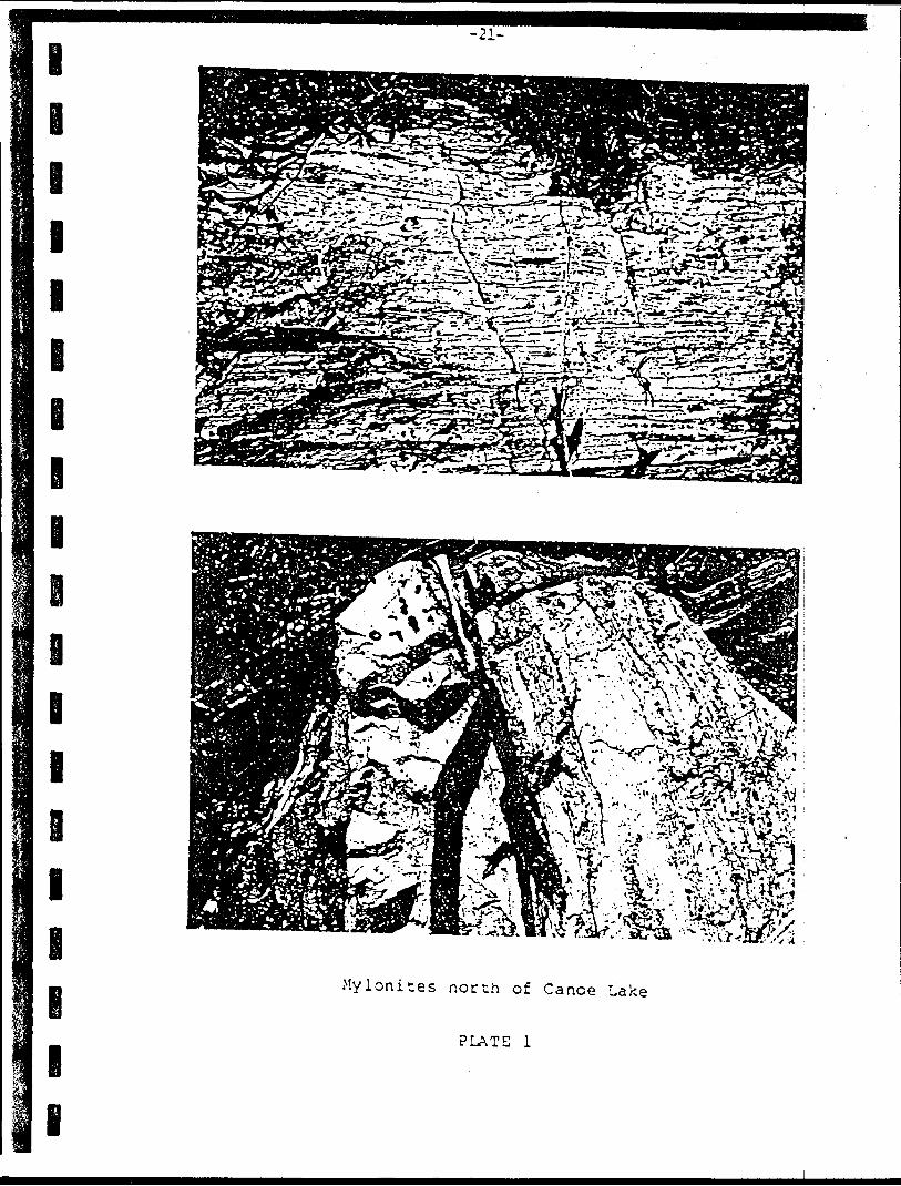
e e i i i i i i i
Mylonites north of Canoe take
PLATE l
l l l l l l l
e
i
-22-
Quartz and quartz-carbonate veins are localized in areas of intense shearing of the lavas. These areas are coorly represented in outcrop. They are more common in drill cores". Chlori'te- carbonate and chlorite-talc schists in drill intersections common ly contain a network of quartz and quartz-carbonate veins and ve inlets (see Appendix l, Summary Drill Logs by Previous Workers).
In one area referred to as the South Claim Block (see map 1) quartz veins containing visible gold cross cut amphibolitized" mafic volcanics. Previous assays from Dome Mines"ranged from traces to 0.780 ounces of gold per ton over widths from 0.2 to 0.6 feet (see section III, History of Previous Work-Dome Exploration, for details). Chip samples collected by Norcen across these veins contained from .003 to .051 ounces of gold per ton and from .006 to .227 ounces of silver per ton. The veins range from a few cen timetres to .3 metres in width. Diamond drilling by Dome Mines indicates that these veins cannot be traced at depth.
Quartz-feldspar porphyry and feldspar porphyry dykes and sills intrude the mafic volcanics at several locations. Where served in outcrop, the rocks,
ob-porphyries are concordant with the host
In drill cores they are described as porphyrv dykes. They appear to have undergone the same deformation" as the" host rocks.
Intercalations of oxide and silicate facies iron formation are present within the mafic volcanics. These horizons serve as distinctive marker horizons within the me tavolcanics , oarticularly in the area of limited exposure east of Horseshoe Lake".
b. Felsic to Intermediate Volcanics
Volcanic rocks of felsic to intermediate composition are represented as narrow beds of pyroclastic rocks within the mafic lavas. Where observed they occur as narrow lenses up 3 metres thick. The paucity of outcrop inhibits tracing of the beds along strike. Felsic flowi, were not observed nor are they mentioned in the diamond drill logs.
Felsic to intermediate pyroclastic rocks are recresented b tuff, lapilli " cations it isand the feldspar porphyry due to the absence of contacts and the intensity of shearing. The close similarity suggests that the crystal tuff is an extrusive equivalent of the feldspar porphvrv. No analytical work has been carried out to date on these" rocks , * The pyroclastic rocks all appear to be of dacitic composition.
tuff, crystal tuff and derived schists". In some lo difficult to distinguish between the crystal tuff
Characteristic mineral assemblage of these rocks by Sage R.?, and Breaks F.W. (1976) include:
described
a) plagioclase -t- quartz j- microcline j^ muscovite ^ epidote
b) plagioclase quartz * chlorite 4- carbonate -t- eoidote
lllllllei
i i i
-23-
Although the felsic and intermediate metavolcanics are poorly represented in outcrop, the abundance of siliceous sediments, orthoquartzi tes, arkose and subgreywackes in the sediments sug*- gests chat they may have been more widespread prior to the deposi tion of che sediments.c . Sedimentary Rocks
Narrow bands of sedimentary rocks occupy the central part of the belt. The thickness of the sediments is difficult to determine as they occur along the south shore of the south arm of Horseshoe Lake. The greatest exposed thickness of 100 metres was observed in a dried up pond .7 km east of Reg Lake. A projected maximum thickness based on outcrops along Horseshoe Lake would be . 5 kilometres.
The sediments in order of abundance include quartz greywacke, argillite, orthoquartzite conglomerate and chert. The sandstones occur as massive beds which grade upwards into argillites. These sandstones would appear to represent a quartz rich suite. The abundance of quartz suggests either a quartz rich source or a higher maturity than is commonly associated with greywacke suite commonly associated with volcanic belts. The quartz-feldspar porphyry which intrudes the volcanics may represent a source fot the quartz. This would indicate that the quartz-feldspar porphyry represents a relatively early event in the volcanic cycle.The argillites occur interbedded with the sandstone in units up to 10 metres thick. They contain varve like laminations which are represented by alternating light and darker grey bands. Preserved primary structures include cross laminations and graded bedding. Sequences of greywacke grading to argillite indicate tops to the north. At the east end of Horseshoe Lake magnetite within the argillite produces a pronounced magnetic high.In addition to the sediments which occupy the central portion of the belt, quartz-feldspar-bioti te paragneisses are reported in drill holes in the Rose Lake area. These paragneisses occur to the north of the volcanic pile adjacent to the granitic batholith. Whether these sediments are a separate unit or the same unit on the opposite limb of a fold has not been determined.d . Mafic Intrusive Rocks
Sills of gabbro intrude the are coarser grained and gabbroic coarser grained centres of thick coarser grained mafic rocks show contain rafts from the volcanic difficult to distinguish between grained lavas. Sage and Breaks pluton which has intruded the vo claims.
volcanic pile. Some of the lavas in texture, possibly representing flows. In other localities the definite intrusive contacts and pile. In the field it is often mafic intrusives and coarse (1976) encountered a large mafic lcanics south of the Norcen
-24-
l
i
l
l
l
l
The gabbro varies from a fine grained rock with amphibole phenocrysts to a medium to course grained rock with a crystalline texture. The visually estimated percentage of mafic minerals (amphiboles) ranges from 40 to 35 percent. Feldspars are commonly finer grained than the amphiboles and appear as a matrix. Quartz eyes with a blue tint help to distinguish the gabbro from coarse grained lavas. The gabbro contains i to 5 percent pyrite. On the east end of Reg Lake sulphide mineralization was noted by Sage and Breaks (1976). This small occurrence consists of hairline frac ture fillings of pyrite and pyrrhotite accompanied by some mala chite staining. Stripping of the moss from the area indicates it to be a local feature that does not warrant follow-up.
Sage and Breaks (1976) noted that apparently unmineralized gabbro specimens contain significant quantities of copper and nickel (26 to 1300 ppm Cu and 33 to 180 ppm Ni from 9 samples assayed). They concluded that the gabbroic intrusive is enriched in copper and nickel. This enrichment represents a good explora tion target for nickel-copper deposits similar to the Thierry Deposit at Pickle Lake.
Two small diabase dykes (3 and 5 metres wide) were encoun tered during field mapping along the shore of and l kilometre south of Wap I Lake. A large diabase dyke is geophysically inter preted on O.G.S. Map 2213 to be present in a northwest trending linear which extends through North Caribou Lake. It is probable that this dyke extends through the Norcen claims and the small dykes encountered represent offshoots from it. This dyke cannot be traced magnetically due to the masking effect of the iron form ation. A small diabase (?) dyke can be traced magnetically on the Questor aeromagnetic map to the south of the Norcen claims.e. Quartz Feldspar Porphyry
Dykes and possibly sills of quartz feldspar porphyry have intruded the volcanic pile. In sections where delineation of contacts has been possible, the porphyry bodies appear to be more or less lenticular in form, and parallel both the strike and dip of the enclosing formations. In some drill sections the quartz-feldspar porphyry transects the banded lavas. The typical porphyry observed in outcrop is a sheared light grey rock with phenocrysts up to 10 millimetres in diameter enclosed by a grey siliceous matrix which contains up to 10 percent mafic minerals. Locally they contain fine grained disseminations of pyrite and pyrrhotite. In drill core left at the drill site by Rio Tinto, the porphyry consists of euhedral albite (15S), quartz (5*), phenocrysts suspended in a light grey siliceous matrix. Thin quartz and quartz carbonate stringers intersect the porphyry. Dome Mines in a follow-up to the drilling by Rio Tinto in this area, intersected a 20 foot section of porphyry carrying 0.015 ounces of gold per ton. The presence of gold within the porphyry appears to be similar to occurrences described by Pye (1976) in his report of the gold deposits of the Pickle Lake area. In this report, Pye states:
l i l l l l l l l
i l l l l e
-25-
Frcm the ecomonic point of view, the quartz albite porphyries are of considerable importance, for near the Pickle Crow No. 3 shaft a large mass of this rock haswithin it a zone of shearing is localized a large tonnage g r ad e .
and fracturinc, alor.o whichor Quartz ore or commercial
i
In his recommendations to prospectors, Pye states that the brittle nature of the porphyry results in fracturing rather than shearing. The resultant fracture system provides a channel for migrating ore bearing fluids. Using this analogy, the porphyry as well as the iron formation should be considered as an exploration target.
f. Iron Formation
A nearly continuous horizon of sulphide, oxide and silicate facies iron formation can be geophysically traced through the belt. This represents an east-west distance of approximately 2? kilometres. In the west, the iron formation occurs as narrow b^ds of massive sulphide within the schistose chloritic mafic volcanic rocks associated with local intercalations of dacitic lapilli tuff. Several narrow beds of massive pyrite, pyrrhotite with some magnetite occur along the shore of Horseshoe Lake. In the east* the iron formation occurs as thick horizons of interbedded chert and magnetite beds within the mafic lavas. Exposures include chert beds on the south shore of Wap I Lake and a 20 metre horizon of oxide facies chert magnetite laminations north of Glove Lake.The iron formation is poorly exposed in outcrop. It is best outlined in the Questor Input and magnetic surveys. These surveys indicate that the iron formation underlies the east-west arm of Horseshoe Lake. During ground traverses, strong magnetic anomalies were encountered in areas of no outcrop. Where observed in the western portion of the belt, the iron formation has been sheared and weathers down in relief. Exposures are limited to the shore of Horseshoe Lake visible during mid to late summer during low water levels. In the east, strong magnetic anomalies associated with the iron formation prevent navigation by compass. Ground magnetometer readings in this area exceeded 140,00 gammas compared to a background of 57,000 gammas (see geophysical sections included in the map box).
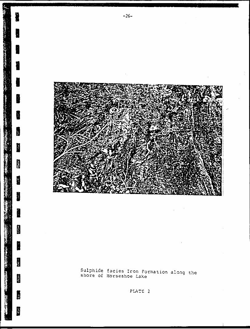
Sulphide facies iron formation occurring in the western por tion of the belt occurs as narrow continuous beds of pyrite, pyrr hotite and minor magnetite and arsenopyrite. A total of nineteen samples were collected from exposures of the iron formation along the shore of Horseshoe Lake. These samples included chip samples across the bed, grab samples of the massive sulphides and panned samples from the gossan. Assay results from this sampling were low. Values ranged from nil to .002 ounces of gold per ton, nil to 0.015 ounces of silver per ton, 34 ppm to 0.1 percent copper/ 9 oom to 0.07 percent zinc and nil to 0.4 oercent arsenic. A dia-
i e i i i i e
-26-
i
Sulphide facies Iron Formation along the shore of Horseshoe Lake
PLATE 2
-27-
l
l
l
l
mond drill hole by Rio Tinto is reported to have intersected 7 metres of massive sulphide. The best assays from this hole indicate 0,1 percent copper over .3 metres, 0.05 ounces of gold per ton over l metre, and 0.06 ounces of silver per ton over .5 metres. Drilling by Great Plains Development Company in this area intersected the iron formation with minor silver and copper values and nil gold. All indications from present and past work in this area indicate that the sulphides of this area contain minor values of base or precious metals.
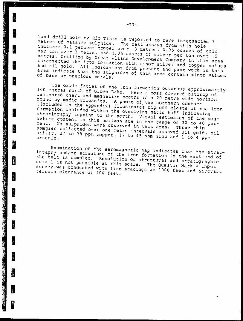
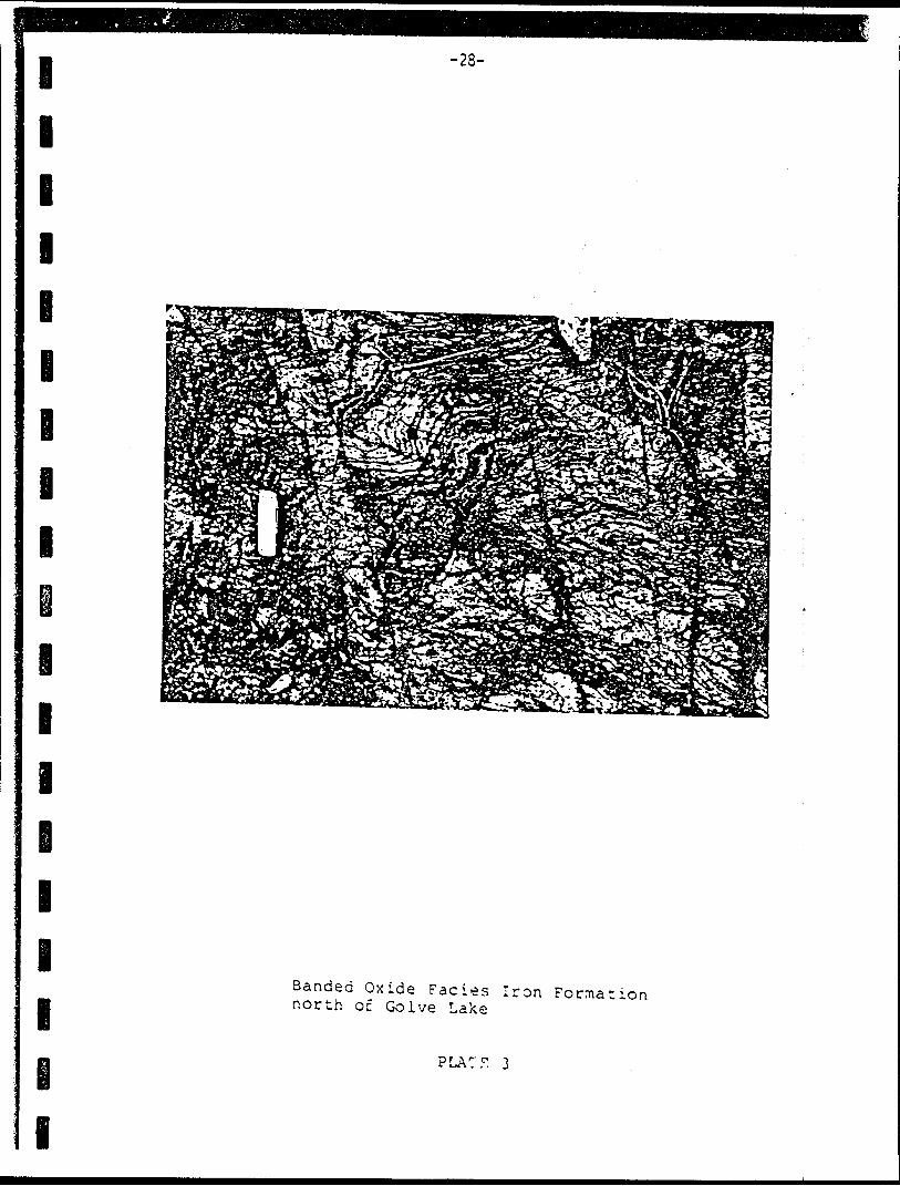
The oxide facies of the iron formation outcrops approximately 100 metres north of Glove Lake. Here a moss covered outcrop of laminated chert and magnetite occurs in a 20 metre wide horizon bound by mafic volcanics. A photo of the northern contact (included in the Appendix) illustrates ri? off clasts of the iron formation included within the overlying mafic tuff indicating stratigraphy topping to the north. Visual estimates of the mag netite content in this horizon are in the range of 30 to 40 per^ cent. No sulphides were observed in this area. Three chip samples collected over one metre intervals assayed nil gold, nil sillar, 27 to 38 ppm copper, 17 to 45 ppm zinc and l to 4 ppm arsenic .
Examination of the aeromagnetic map indicates that the strat igraphy and/or structure of the iron formation in the west end of the belt is complex. Resolution of structural and stratigraphic detail is not possible at this scale. The Questor Mark V Input survey was conducted with line spacings at 1000 feet and aircraft terrain clearance of 400 feet.
l
l
l
i
l l l lR l
-28-
i
l
l
l
l
l
l
lBanded Oxide Facies Iron Formation north of Golve Lake
PLA7F 3
I
B l E l l l l l l B l l l l l l l l
-29-
Rip off Clast of Iron Formation in Mafic Tuff north of Glove Lake
PLATE 4
V
-30-
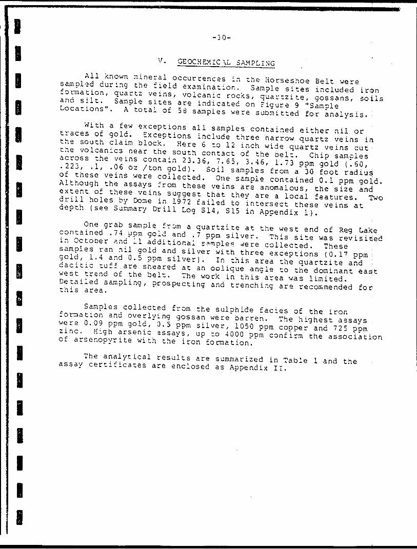
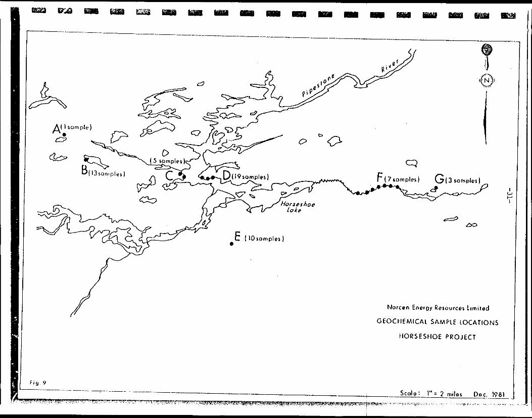
GEOCHEMICAL SAMPLING
All known mineral occurrences in the Horseshoe Belt were sampled during the field examination. Sample sites included iron formation, quartz veins, volcanic rocks, quartzite, gossans, soils and silt. Sample sites are indicated on Figure 9 "Sample Locations". A total of 58 samples were submitted for analysis.With a few exceptions all samples contained either nil or traces of gold. Exceptions include three narrow quartz veins i rt the south claim block. Here 6 to 12 inch wide quartz veins cut : the volcanics near the south contact of the belt. Chip samples across the veins contain 23.36, 7.65, 3.46, 1.73 pom gold (.60, .223, .1, .06 oz /ton gold). Soil samples from a 30 foot radius; of these veins were collected. One sample contained 0.1 ppm gold. Although the assays from these veins are anomalous, the size and extent of these veins suggest that they are a local drill holes by Dome in 1972 failed to intersect these veins at depth (see Summary Drill Log S14, S15 in Appendix 1).
features. "jwo
One grab sample from a quartzite at the west end of Reg Lakje contained .74 ppm gold and .7 ppm silver. This site was revisited in October and 11 additional sample? were collected. These samples ran nil gold and silver with three exceptions (O.I 7 ppm gold, 1.4 and 0.5 ppm silver). In this area the quartzite and - dacitic tuff are sheared at an oblique angle to the dominant east west trend of the belt. The work in this area was limited. Detailed sampling, prospecting and trenching are recommended for this area.
i
l
i
l
I
l
l
l
Samples collected from the sulphide facies of the iron formation and overlying gossan were barren. The highest assays were 0.09 ppm gold, 0,5 ppm silver, 1050 ppm copper and 725 ppm zinc. High arsenic assays, up to 4000 ppm confirm the association of arsenopyrite with the iron formation.
The analytical results are summarized in Table l and the assay certificates are enclosed as Appendix II.
r(7somples)
Norcen Energy Resources Limited
GEOCHEMICAL SAMPLE LOCATIONS
HORSESHOE PROJECT
Scale: ]" s 2 milos Doc. 1981S^
Table l-32-
Analvtical Results
Number501455155255355455555655755855956056156456750155016501750185019500150025010502050215022502350285029503050325034503650395040504150435045505050275035503750385042504450465047504350495003500450055006500750085009501150125013
LocationAB33BB3BBBBBB3CCCCCDDDDDDDDDDDDDDDDDDDEr^f^
P
f^
cr4^
EEr
EFFFp?^
tGGG
Rock 7 -pegossanquartz! tequartz! tequartz! tequartz! tequartz! tequartz! tequartzitequartz! tequartzitequartzitequartz! tequartz! tequartz! tesulphide IFsulphide IFsulphide IFsulphide IFsulphide IFgossangossanquartz! tesulphide IFgossangossangossangossansulphide IFsulphide IFsulphide IFgossangossanporphyrysulphide IFsulphide IFsulphide IFgossangossanqtz. veinqtz. veinqtz. veinqtz. veinmafic vol.mafic vol.soilsoilsoilsoilsiltsiltsiltsiltsiltsiltsiltoxide IFoxide IFoxide IF
Samole Tvpegraograbgrabgrabgrabgrabgrabgrabgrabgrabgrabgrabgrabgrabchipchipchipgrabgrabpannedpannedgrabpannedpannedpannedpannedpannedchipchipchippannedchipchipchipeh ipchippannedpannedeh ipchipeh ipeh ipgrabgrabsoilsoilsoilsoilpannedpannedpannedpannedpannedpannedpannedchipchipchip
Au(pom)ntrnilnilnilnilnilnilnilnilnilnilnil.17nilnilnilnilnil.09
tr.74trtrtrtrnil
- nilnilnil.03.03nilnil.03niltr.02
1.7323.367.653.46nil.01nil.10nilniltrnilnilnilnilnilnilnilnilnil
Ag(ppm )nilnilnilnilnilnilnilnilnil.5nilnilnilnilnilnilnilnil.2
.3
.7nilnil.2.3.2nilnil.006.2.12nil "nil.5.2.3.3.4
7. 8.70. 6.3. 2nilnilnilnil.2nilnilnilnilnilnilnilnilnil
Cu(ppm)23 ~-~--~-~-~~--- -- 385182
103107
4086
2101988998
1050345969
197128~~~~l-3
6218011247542
21922013
117200170
71396
220216
101449
383327
2n(opm)12-~~-~--~-~ -~~-~-,--~-~---
11017610213871
15495840
39224572530981515151515151515156515151515151515151531151314171315174525
As(?pm)
2~------~~-~--~-~-~-~-- --
380250040054
2000
--3
~--~-- 1622
8004000
4017
12
2020~-52121622
3248222
22a212421
l
lB l B
-33-
VI OVERBURDEN DRILLING AND RELATSD GEOCHEMICAL SAMPLING a. Introduction
The primary objeccives of the overburden drilling program were to verify the presence of gold within the Moreen claims and to investigate the relationship between anomalous gold values and iron formations. The program was successful in both objectives. Anomalous gold values were discovered in several samples and the gold appears to be associated with one of the two iron formations outlined.The first phase of the overburden drilling program was de signed as a reconnaisance program. The east end of the project area was selected a s the location for the first phase because of the almost total lack of outcrop and the geophysically interpreted complexity of the structure and stratigraphy. This complexity was considered to be of primary importance because of its similarity to the Opapimiskan area where Dome's gold discovery is located. Figure 10 is a composite of the airborne data in the immediate area around the overburden sampling lines. Four of the proposed ten lines were completed and each is plotted on the geophysical compilation. The two iron formations which stand out on the Ques- tor aeromagnetic map correlate closely with the two iron forma-r tions indicated on the detailed ground magnetometer survey along line C as shown in Figure 11.
b. Methods
The initial work war to have consisted of approximately 150 sample sites. These sample sites were selected along lines which crossed the apparent stratigraphy at right angles {or in areas where gold values had been reported). Samples were collected ac 400 foot intervals along each line.Roland Collins Overburden Drilling Ltd. of Timmins was con tracted to complete the sampling. A four man crew assisted by an all terrain vehicle was employed. The procedures used are sum marized as follows.
1. Lines were cut such that the ends of the lines were tied into recognizable topographic features. Normal compass; orientation in the field was found to be impossible due to the high magnetite content of the iron formations.2. A Phoenix VLF survey (using Guttler, Maine as the trans mitter) and a proton precession magnetometer survey were completed along each line. Cross-over locations and vejry high magnetometer readings were marked in the field.3. Overburden drill sampling was completed along each line : . The equipment consisted of an 30 pound Wacke r percussion drill which was adapted to accept "3" sized drill rods. These drill rods were modified by the contractor for this application. The open end of the leading drill rod was
I l l l l l l l l l l lH B l l B
-34-
covered by a wooden capping point which excluded material; from entering the sampling tube located inside the rod. The drill rods were pushed down to the bedrock surface by adding incremental two foot.lengths at the drill. The driller was able to distinguish between bedrock and boul ders by the nature of the vibrations encountered. In only very few cases was it necessary to abandon a hole and make a second attempt.
Once bedrock was reached rnatelv two feet at which
the rods were lifted up approxi- time the wooden point would dis
engage. The rods were then pushed back to the bedrock surface, collecting the basal till sample. The sample was then held in place by a mechanism in the sample tube and the drill rods were withdrawn by a manual jack. Each san]i- ple was between 1/2 and l pound depending on the coarse ness of the material.
4. The samples were dryed and described as to colour, coarse ness and any unusual characteristics prior to shipment fcj)r analysis. These descriptions are included as Appendix VI j[ .
5. The analyses were completed by Assayers Ontario ofToronto. Each sample was split into +30 mesh and -80 mefch fractions. Gold and silver assays were completed on both size fractions and arsenic assays completed on only the -80 mesh fraction. Gold analyses were obtained by the following procedures:
i. 15 grams of the sample was selected
~ - ii. 1.0 milligrams of silver was added to provide a collector bead
iii. flux was added
iv. the sample was fire assayed resulting in the formation of a bead consisting of silver and lead {from the flux)
v. the bead was disolved in hot aqua reg La
vi, the resulting fluid was subjected to normal atomic absorption analytical procedures
Silver analyses were obtained by normal wet chemical atomic
absorption procedures. The arsenic analyses were obtained by a modified Goodsice method which is a colourmetric method utilizing
a spectrophotometer. These three analytical procedures demon
strate very good reproducability. All samples were frequently checked against standards and normally one out of evey twenty sam
ples was repeated.Assay certificates for all analyses are enclosed with this
report as Appendix II. Table 2 is a summary of the analytical
results from the overburden sampling program.
-35-
Table 2 Analytical Results from Overburden Sampling
11yIB1
HoleNumber
AlA2A3A4A5A6A7 A8A9A10All
Depth(feet)
33757296 899777
107749767
B
BlB2B3B4B5B637B839BIOBilB12313B14B15
467174717181506460606747532927
DID2D3D4D5D6D7D8D9D10DU
2247
li151
132189
Proximity to Iron-Formation
overlying overlying overlying
overlying
overlying
overlying
overlying overlying overlying
Au ( ODD )- 12 - 80ao ao aoaoao ao ao aoaoao ao
aoaoaoaoao aoaoao aoaoaoaoaoaoao
aoao ao aoaoaoaoaoao690ao
ao ao aoaoao ao ao aoaoao ao
aoaoaoaoao aoaoaoaoaoaoaoaoaoao
aoao ao ao aoaoaoaoaoaoao
Ag(oom) As (com) +30* -30 -80
<.l <.l 7 <.l <.l 2 <.l <.l 1 1<.l <.l 1<,l <.l a<. 1 -C. 1 2 <.l <.l 6 <.'L <.'L 1ai ^1 2<.l < .l <l<.l < .'L 1
<.l <.l 1.6 .4 2
<.l <.l a<.l <.l <l
.2 . 2 a, ^1 <.l <l^1 <.l a.<.l <.l <l<.l <.l 2<.l ^1 2<.l <.l <l^1 <.l <l
.3 <.l 3
.2 ^1 <l<.l ^1 <l
<.l <.l <l.4 ^1 <l.4 .1 <l
<.l .4 <l.2 .4 a
^ 1 .2 2<.l < . 1 1^i <.l a^1 .6 <l<.l . 5 a^ i <. i <l
l l
l
l
l
i l
ll
-36-
Table 2 (continued)
HoleNumber
CIC2C3C4C5C6C7C8C9CIOCllC12C12AC13C14C15C16CI7CISC19C20C2iC22C23C24C25C26C27C28C29C30
Deoth(feet)
292232192321262328191530154516107
15655
11241254
1113198
Proximity to Iron Formation
ove riving overlying overlying overlying overlying overlying
overlying overlying overlying
overlying
Au{pob )+ 80
<10<10aoaoaoaoaoaoaoaoaoao
60ao
90aoaoaoaoaoaoaoaoaoaoaoao
30aoao
-30
40aoao*c:oaoaoao
3020
aoao
20aoaoao
80ao
noaoaoaoaoaoaoaoao
10ao
20aoao
Ag(ppm)+ 80
.6
. 6
.7
.1^1^1
.3<.l<.l<.l C.I
.3<.l
.2<.l<. 1^1
s am ol e.2
^1^1^1^1^1<.l<.l<. 1
.1
. 2
.3^1
-80
.6
.1
.3
.7^1<.l
.3^1<.l<. 15.12.2.612.3*:.l1.0^i
. 6<. 1^1<.l<. 1<.l^1<.l<.l<.l
.6
. 2<.l
As(ppm)-80
a.a.aaaa:aaaa
120106
314214
42
2 .<la<l
3211
<l<l<l<la
l l l l i
I
l
l
l e i i i
-38-
Results
Inclement weather forced the suspension of the sampling after 67 samples had been collected. The results from these samples in dicate that the technique works well. It also resulted in the discovery of anomalous gold values which had gone previously un^- detected by previous workers.The results from the two areas deserve further description. Sample D10 (on line D) which returned as assay value of 690 ppb gold was the highest assay from the sampling program. The anoma lous value {which was rechecked by the assayer) is isolated in that sample sites on either side returned background values and the -80 mesh fraction from the same sample was also background. Since the high value came from the coarse fraction it is probable that a nugget of gold from bedrock chips may be the source of the anomaly. Further detailed sampling is required to better define the significance of this sample.The most encouraging results encountered come from line C. A stacked profile of these results is presented as Figure 11. Ttie VLF and magnetometer results clearly define two iron formations (north and south). The arsenic, gold and silver results show a very close correlation between anomalous metal values and the north iron formation. The overburden depth profile shows an over burden trough on both sides of the iron formation. Further de tailed sampling along line C and along parallel lines along strike from line C are required to evaluate the significance of these results.
7 Costs
The total cost of the overburden sampling program was approx imately 332,000. The figure includes mobilization and demobilisa tion from Timmins, linecutting, magnetometer and VLF surveys and the sampling. The cost per sam-" e of 5480 would have been signif icantly less if the proposed pr-^ram of 150 samples had been com pleted. These costs are considered favourable given the success of the program and the very high costs of an alternate technique.
i
™ BB 10W
f.s.
VLF PROFILE ( Tx, Cuiiler, Moinej)
rOik fi,
looV.
toov.
"VJ" .JL
MAGNETOMETER ( x )000 0ommoi)
U IN
DJLJq
ARSENIC IN TILL(ppm)
D
SILVER IN TILL (ppm)
l GOLD IN TILL (ppb)
-D
-Q
75.00 70*00 65tOO 60*00 55*00 50*00 45*00 40*00 35*00 30*00 ^5*00 20*00 l7**00 10*00 ioO 0 soO 10*00 15*00 30*00 s*0 30*00 35*00 4c*00 S l ut lo A'•""""" DEPTH OF OVERBURDEN (feet) M r D '-"" kNorcco Energy R viourcvt lirniltd
fig.11 STACKED PROFILE ALONG LINE C HORSESHOE PROJECTD*c.l9oi
^^^^
il l
all
-40-
VII CONCLUSIONS AND RECOMMENDATIONS
The following conclusions are based on a detailed review of government assessment file data, private Norcen data obtainedduring the early 1970 's, personal communications with governmen and industry geologists familiar with the area, and the 1981 ex ploration work completed by Norcen as described in this report,
The stratigraphy and are
.j-ytciyuy ana structure of the Horseshoe greenstone belt are similar to the geological setting which hosts a recently defined major gold deposit approximately 51 kilo metres to the north.
I
I
2. There are several gold occurences within and near the Norcen claims.
3. Geological mapping has confirmed tne presence of sulphide, oxide and silicate phase of iron formation units. These iron formations are intercalated with a sequence of mafic to intermediate composition volcanic flow and pyroclastic rocks and related sedimentary rocks. The greenstone belt is bounded on both sides of felsic intrusive rocks.
4. The west end of the claims is underlain by steeply dip4- ping, relatively undeformed stratigraphy. The east end of the claims is underlain by complexly folded and faulted stratigraphy which has resulted in the repetition of the geophysically interpreted iron formations.
5. Exploration of the gold potential of the entire property must be directed to take into account the poor outcrop 1 ex posure. The overburden consists primarily of sand gravel. Clay-type overburden was not encountered.
!5. The overburden
cessful from a DO i n t.
drill sampling technique proved to be suc- logistical, technical and results stand
l I ii l
7. Four overburden sampling lines were completed with a tptal of 67 samples taken. Lines A and 3 tested the potential of a pair of Input conductors. Line C tested three other Input conductors and line D tested the most southerly 0f the conductors crossed by line C. The strongest conductor defined along line C is coincident with a narrow, strong magnetic anomaly which is interpreted to be an oxide facies iron formation. This iron formation is character ized by anomalously high gold, silver and arsenic values. No other sampling was completed along the strike of this clearly defined iron formation.
On the basis of these positive results the following explora- .ion is strongly recommended.
l l l l l l l i
l l
-41-
1. The reconnaissance scale overburden drill .sampling program as described in this report should be expanded to provide cross sections across all zones of coincident Input and aeromagnetic anomalies as defined in the Questor surveys.2. The iron formation as defined on Line C should be subject ed to further detailed exploration. This exploration should consist of the establishing of a grid with line spacing of 100 metres. Magnetometer and VLF surveys should be completed along all lines followed by overburden sampling at 100 metre intervals along each line. Areas.of anomalous metal values within this grid area should then be subjected to more detailed overburden sampling at 25 metre intervals. This detailed phase of work will result in the definition of targets requiring either mechanical stripping and trenching or diamond drilling.
3. All anomalous metal values defined in the reconnaissance scale work as outlined in item l above should be further explored in detailed as outlined in item 2 above.4. Consideration should be given to completing a high resolu tion, radar controlled electromagnetic and magnetometer survey over the project area. Scintrex Ltd. estimated that they could complete such a helicopter borne survey for approximately 5100,000.
The work completed to-date has demonstrated the gold poten-i- tial of the Horseshoe Project area. A commitment to a persistent and thorough exploration effort as demonstrated by Dome's ap proach, which led to the discovery of their Opapimiskan deposit^ is required to fully evaluate the gold potential of this prop- i erty.
l e i
l l" APPENDIX I
lSUMMARY OF DRILL LOGS BY PREVIOUS WORKERS
l
l
l
l
l
l
l
l
l
l
SULPHIDE ZONE GROUP
RUST SEEP GROUP
-*———i-GOL Dt PYRITE
l A RSENOPYRITE
NORCEN ENERGY RESOURCES LTD.ASSESSMENT SUMMARY
BY RIO TIN TO EXPLORATION 1965
S 00 m l k*.no. Dec. 1981
lSurrmary of Previous Drilling
l
i
I
e i
i i
i
i
1. By Rio Tinto Canadian Exploration Limited August 1965
Location: Bay where the eastern branch of the Pipestone R. entersHorseshoe Lake
Azimuth: 330* Dip - 40 Assays in oz per ton 0-16.7 GreenstoneFeet - disseminated pyrrhotite, pyrite, chalcopyrite and magnetite - pyrite filling fractures
2.5 - 7.1 - Au tr Ag 0.02 oz 7.1 - 8.7 - Au 0.02 Ag 0.04 oz
16.7 - 24.9 Andesite or Greywacke- Carbonate filling fractures
24.9 - 78.5 Greenstone - as above28.9 - 33.9 Au tr Ag 0.01 33.9 - 36.3 Au 0.055 Ag 0.025 36.3 - 41.5 Au tr Ag 0.05 73.3 - 78.5 Au 0.005 Ag 0.02
78.5 - 79.5 Biotite Schist- biotite with blue quartz eyes some pyrite 73.5-79.5 Au 0.01* Ag 0.035
79.5 - 125.2 Feldspar - Quartz Porphyry- disseminated pyrite in hairline fractures 79.5 - 82.5 Au tr Ag 0.03 32.5 - 87.5 au tr Ag 0.01 87.5 - 9! .8 Au tr Ag 0.01
123.6 - 127 "Au tr Ag 0.01
125.2 - 125.4 Biotite Schist
125.4 - 126.2 Andesite or Greywacke- slightly Schistose
126.2 - 126.8 Biotite Schist
126.2 - 151.0 Andesite or Greywacke
151.0 - 160.8 Greenstone- seme py, po near contact- blue quartz eyes
151.0 - 152.8 Au tr Ag 0.01 156.0 - 160.0 Au tr Ag 0.01
160.8 - 175.4 Andesite or Greywacke and Greenstone
175.4 - 179.9 Greenstone- hairline carbonate veinlets minor pvrite, pyrrhotite
177.2 - 179.9 Au tr Ac 0.01
179.9 - 187.0 Andesite or Greywacke
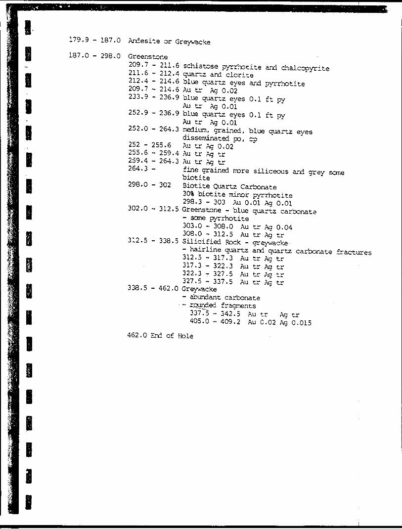
187.0
l
l
l
l
B
298.O Greenstone 209.7 - 211. 211.6 - 212. 212.4 - 214. 209.7 - 214. 233.9 - 236.
252.9 - 236,
252.0 - 264,
252 - 255.6 255.6 - 259 259.4 - 264 264.3 -
298.0 - 302
302.0 - 312
312.5 - 338
6 schistose pyrrhotite and chalcopyrite4 quartz and clorite6 blue quartz eyes and pyrrhotite6 Au tr Ag 0.029 blue quartz eyes 0.1 ft pyAu tr Ag 0.01
9 blue quartz eyes 0.1 ft pyAu tr Ag 0.01
3 medium, grained, blue quartz eyesdisseminated po, cpAu tr Ag 0.02*
.4 Au tr Ag tr ,3 Au tr Ag tr
fine grained more siliceous and grey sanebiotiteBiotite Quartz Carbonate30% biotite minor pyrrhotite298.3 - 303 Au 0.01 Ag 0.01
.5 Greenstone - blue quartz carbonate- some pyrrhotite 303.0 - 308.0 Au tr Ag 0.04 308.0 -312.5 Au tr Ag tr
.5 Silicified Rock - greywacke- hairline quartz and quartz carbonate fractures 312.5 - 317.3 Au tr Ag tr
Au tr Ag trAu tr Ag trAu tr Ag tr
317.3 - 322.3 322.3 - 327.5 327.5 - 337.5
338.5 - 462.0 Greywacke- abundant carbonate
- - rounded fragments 33775 - 342.5 Au tr Ac tr405.0 - 409.2 Au 0.02 Ag 0.015
462.0 End of Hole
B i B
l
l
l
l
l
l
l
l
Summary of Previous Drilling
By: Rio Tinto Canadian Exploration Limited August 1965Location: Between the bay where the east Pipestone enters Horseshoe Lake and theIslandAzimuth: 10 Dip - 45 Assays in oz per ton
O - 51.6 Feet
Greenstone- medium grained 40-801 mafics- blue quartz eyes- disserainated negnetite, pyrrhotite, pyrite and chalcopyrite30
33.10,23.28.30.33.35,
ft. 0.2 ft shear with pyrite3415.28.30333540
4 quartz stringersAu Au Au Au
tr tr trtr
Ag 0,01 Ag 0.01 Ag 0.03 Ag 0.01
Au 0.01 Ag trAu tr Ag tr
51.6 - 64.3 Andesite dyke
64.3 - 116.5 Greenstone - 40!! mafics72 -82.582.583.788.093.097.097.797.098.0
103.0108.0110.1111.6
75.3 Au tr Ag 0.01-83.2 quartz- 83.7 Au tr Ag tr-38.0 Au tr Ag tr- 93.0 Au tr Ag tr- 97.0 Au tr Ag tr-97.7 shear with po, py trace cp- 110.4 minor shearing and- 98.0 Au 0.02 Ag 0.02- 103.0 Au 0.005 Ag 0.01- 108.0 Au 0.005 Ag 0.01- 110.1 Au 0.01 Ag 0.015- 111.6 Au tr Aa tr- 116.5 Au tr Aa 0.01
fracturing
116.5 - 246.0 Greenstone - gabbroiclocal quartz and carbonate blue quartz eyes 193.68* - 196.6 Au tr Ag tr 204.5 - 206.9 Au tr Ag tr 213.9 - 219.5 Au O.OOS'Ag .02
246.0 - 233
333.0 - 335
Greenstone - finer grained locally schistose 246.0 - 248.1 Au tr Ag 0.01 254.0 - 257.2 Au 0.01 Ag tr 257.2 - 259.9 Au 0.01 Ag tr 328.0 - 33.0 Au tr Ag tr
Quartz - Feldspar porphyry dyke 333.0 - 338.0 " Au tr AI tr"
355 End of Hole
l
l
l
i i i i
B i B
Surrmary of Previous Drilling
3y Rio Tinto Canadian Exploration Limited August 1965
Location: The point adjacent to the bay -where the eastern branch of thePipestone River enters Horseshoe Lake Azirajtth: 330' dip -35 Assays in oz "per ton
O - 18.6 Greenstone - blue quartz eyesFeet - disseminatri py, po trace magnetite, cp
0-3.6 Au 0.005 Ag tr3.6 - 8.6 Au tr Ag tr8.6-13.6Autr Ag 0.01
13.6 - 18.6 Au tr Ag 0.02
18.6 - 26.6 Andesite dyke18.6 - 26.6 Au tr Ag 0.02
26.6 - 52.9 Greenstone - sheared 30 - 33, 50.8 - 52.9 26.6 - 30.0 Au tr Ag 0.02 30.0 - 33.0 Au 0.03 Ag 0.03 33.0 - 37.6 Au tr Ag 0.02 37.6 - 41.8 Au 0.005 Ag 0.02 41.8 - 46.0 Au tr Ag 0.02 46.0 - 50.8 *Au 0.07,tr, 0.01
Ag tr, tr, 0.23 50.8 - 52.9 *Au 0.10, tr, tr
*Ag 0.09, 0.02, 0.01
52.9 - 66.0 Quartz Feldspar Porphyry minor disseminated oyrite 52.9 - 57.9 *Au 0.05,*tr, tr*Ag 0.01, 0.01, tr
57.9 - 61.0 Au tr Ag 0.01 61.0 - 66.0 Au tr Ag tr
66.0 End of Hole
* initial assay, repeat assay, reject assay
l
Mi Mi BBB
x'-S^Wiebenville
l VD'J
Outline o f Input Survey
Ground Geopliyiicol Grid j-
Drill Hole locolion o-*" 7
NORCEN ENERGY RESOURCES 110.ASSESSA/ENT SUMMARY
GEOPHYSICS i DRILLING BY GREAT PLAINS DEVELOPMENT COMPANY Of
CANADA. MG 5 Der I9P!
'05/53- JJ.Ia.lFb
V^
Outline ol Geophyticol Drill Hole Location o Drill Hole /Depth m melrei LithologyMetallic Mineral)Au in OI./Ag in O l /CuVe
NORCEN ENERGY RESOURCES LTDASSESSMENT SUMMARY
GEOPHYSICS i DRILLING BY GREAT PLAINS DEVELOPMENT COMPANY OF
CANADA MG 6 Dec 1981
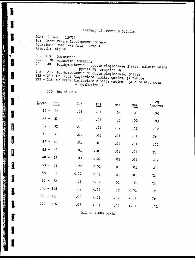
Sunrrary of. Previous DrillingDCK: 72-013y: Great Plains Development CompanyLocation: Horseshoe LakeAzimuth: O 0 Dip -45 s
0-53.4 ft
33.4 - 55.2 55.2 - 70.0
70.0 - 96.0
Greenstone - possibly quartzite- fine v^iite quartz stringers thoughout
Cherty Cuartz - light greyGreenstone - Chlorite schist, siliceous
- 3-10% sulphides fd, minor oy, cp Ni tr O Q.01% Au Mil - tr pz/ton Cu tr - D.08% Ag Nil - .29' oz/ton Greenstone - quartz chlorite bands
- chlorite content increases with depth- up to l (ft pyrrhotite co minor pyrite py Ni tr Au Nil - tr Cu Q.02-0.06% Ag 0.003 - 0.26 oz/ton Chlorite schist End of Hole
Summary of Previous Drilling
96.0-110 110
DCH: 72-033y: Great Plains Development CompanyLocation: Horseshoe LakeAzimuth: O 0 Dip -4 S 0
DCH: 72023y: Great Plains Development CompanyLocation:Azimuth O 0 Dip -45 s
Greenstone - interlaced with quartz stringers- Chlorite Schist
ni .OU Au. tr Cu tr - Q.02% Zn tr - .OU Greenstone - chloritic schist
- dark green Greenstone - local cuartz veins UD to l in. thick
Summary of Previous Drilling
O - 8 ft overburden8-22 Greenstone - quartz veins and stringers, schistose22 - 40 Greenstone - chlorite schist40 - 137 Greenstone - talc chlorite schist
- talc 5 - l ( 137 End of Hole
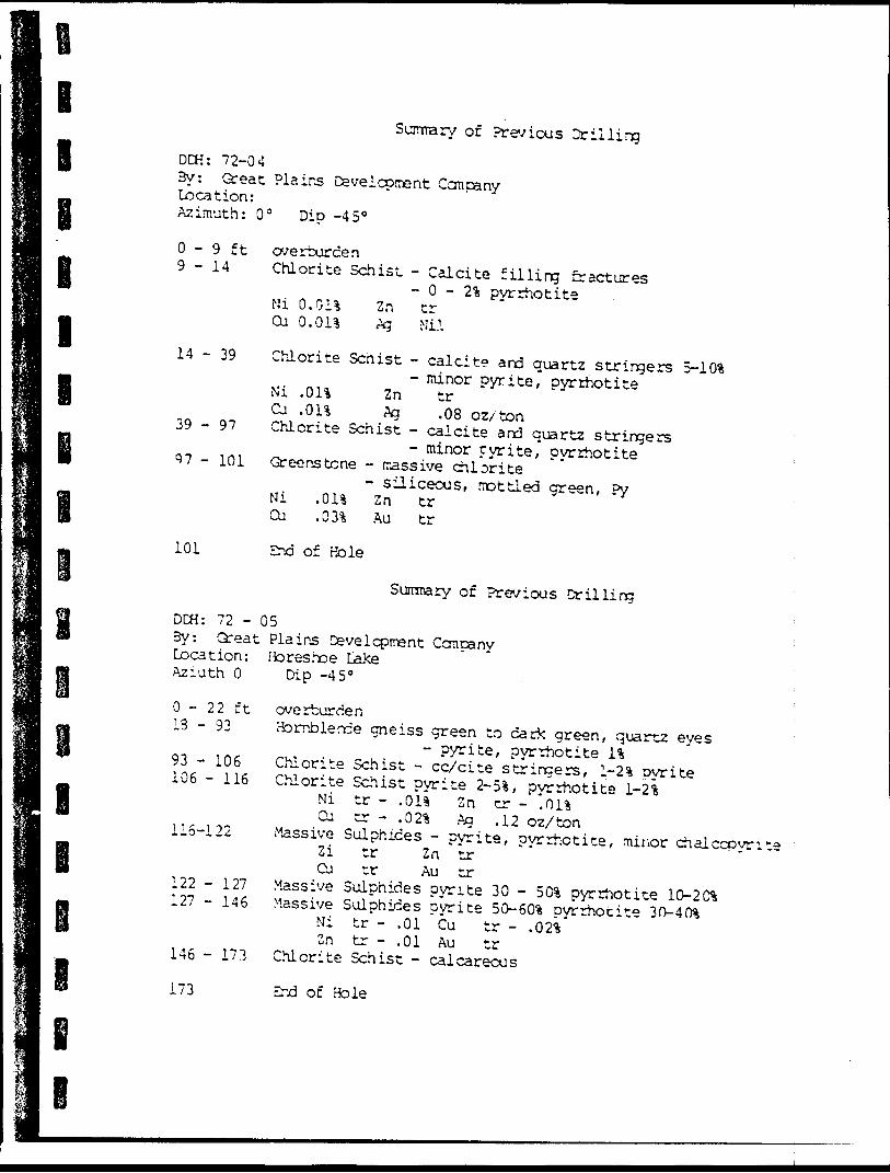
Summary of Previous DrillingDCH: 72-04By: Great Plains Development CcmpanyLocation:Azimuth: O 0 Dip -45 0
O - 9 ft overburden9-14 Chlorite Schist - Calcite filling fractures
- O - 2% pyrrhotiteNi 0.011 2n trCu 0,011 Ag Mi.l
Chlorite Scnist - calcite and quartz stringers 5-101- minor pyrite, pyrrhotite Ni .01% 2n tr Cu .013; Ag .08 oz/ton Chlorite Schist - calcite and quartz stringers
- minor pyrite, pyrrhotite Greenstone - rassive chlorite- siliceous, mottled green, ?y Ni .011 Zn tr
Cu .031 Au tr
End of Hole
Sumrary of Previous DrillingDCH: 72 - 053y: Great Plains Development CcnpanyLocation: Horeshoe LakeAziuth O Dip -45"
overburdenHornblende gneiss green to dark green, xquartz eyes
- pyrite, pyrrhotite 11Chlorite Schist - cc/cite stringers, 1-21 pyrite 106 - 116 Chlorite Schist pyrite 2-51, pyrrhotite 1-21 Ni tr - .011 Zn tr - '.Oil Cu tr - .021 Ag .12 oz/tonMassive Sulphides - pyrite, pyrrhotite, minor chalccpyrite 2i tr Zn tr Cu tr Au tr122 - 127 Massive Sulphides pyrite 30 - 501 pyrrhotite 10-201 127 - 146 Massive Sulphides pyrite 50-601 pyrrhotite 30-401 Ni tr - .01 Cu tr - .021 Zn tr - .01 Au tr
Chlorite Schist - calcareous
B l
l l l l l B
B
B B B B
O - 21 ft21282931
3965
- 28-29- 31- 39
6567
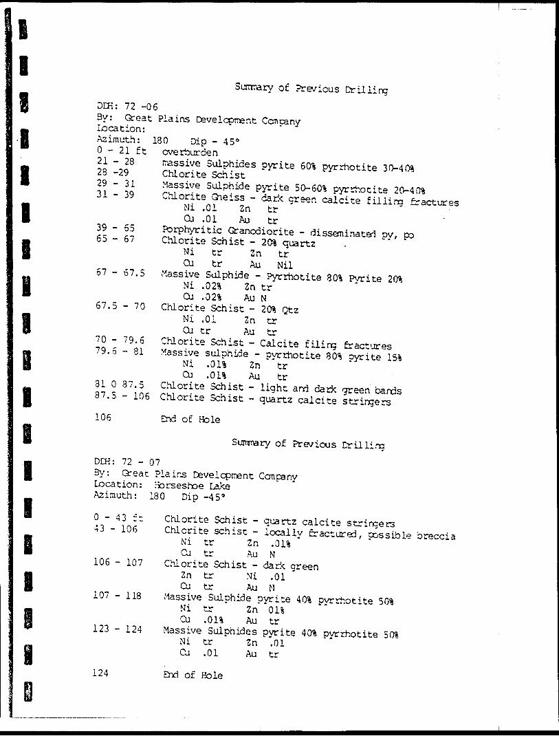
Surnrary of Previous DrillingDCK: 72 -063y: Great Plains Development Company Location:Azimuth: 180 Dip - 45 0
overburdenirassive Sulphides pyrite 603 pyrrhotite 30-403 Chlorite SchistMassive Sulphide pyrite 50-603 pyrrhotite 20-403 Chlorite Gneiss - dark green calcite filling fracturesMi .01 Zn tr
Cu .01 Au trPorphyritic Granodiorite - disseminated oy, po Chlorite Schist - 203 quartz
Ni tr Zn trCu tr Au Nil
Massive Sulphide - Pyrrhotite 803 Pyrite 203Ni .023 Zn trCu .023 Au N
Chlorite Schist - 203 QtzNi .01 Z n trCu tr Au tr
Chlorite Schist - Calcite filing fractures Massive sulphide - pyrrhotite 803 pyrite 153Ni .011 Zn trCu .013 Au tr
Chlorite Schist - light and dark green bands Chlorite Schist - quartz calcite stringers
57 - 67.5
67.5 - 70
7079.
3137,
79.6 - 81
87.D- 106
106 End of Bole
Surrmary of Previous DrillingDCH: 72 - 073y: Great Plains Development CompanyLocation: Horseshoe LakeAzimuth: 180 Dip -45"
0-43 ft 43 - 106
106 - 107
107 -118
123 - 124
Chlorite Schist - quartz calcite stringersChlorite schist - locally fractured, possible brecciaMi tr Zn .013Cu tr Au N
Chlorite Schist - dark greenZn tr Ni .01Cu tr Au N
Massive Sulphide pyrite 40% pyrrhotiteNi t ZnCu .013 Au tr
Massive Sulphides pyrite 40% pyrrhotite 50% Ni tr Zn .01 Cu .01 Au tr
124 End of Hole
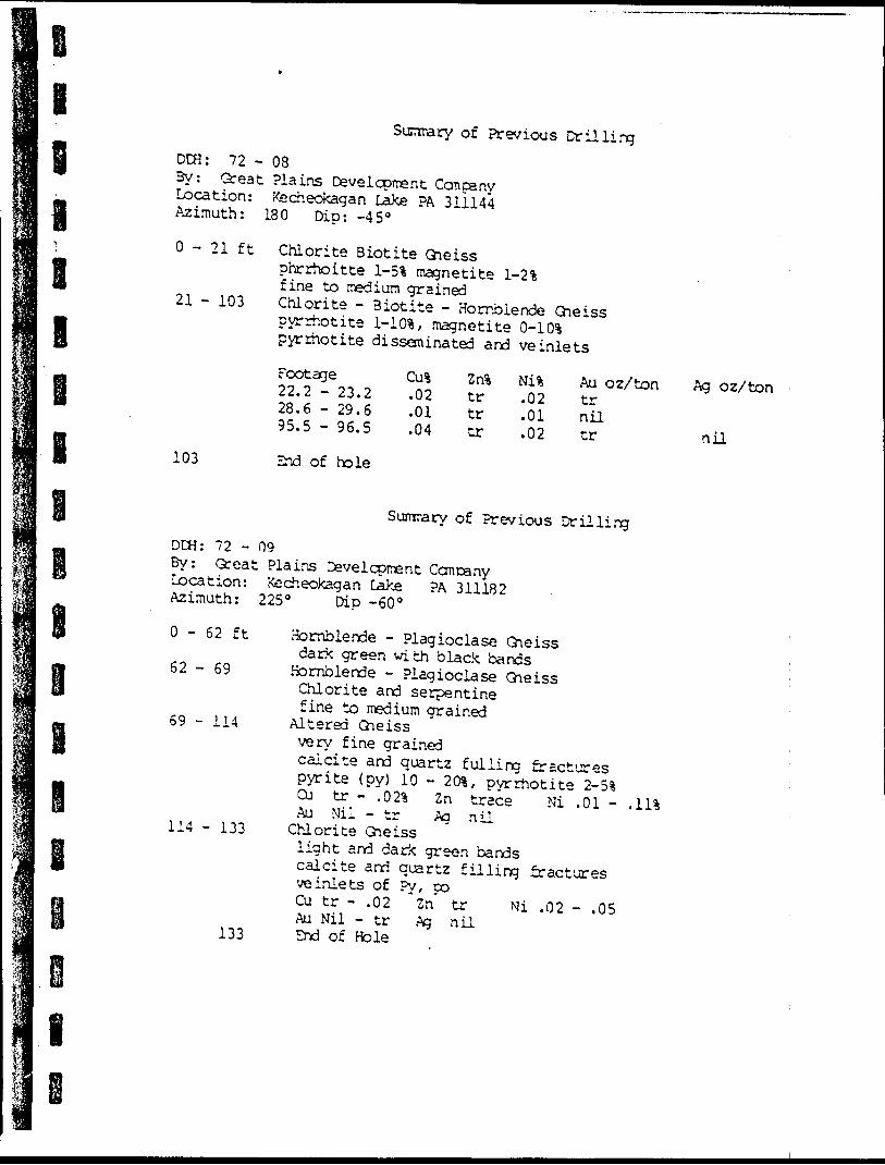
Surnrary of Previous DrillingDCfi: 72 - 083y: Great Plains Development CcmpanyLocation: Azimuth:
O - 21 ft
21 - 103
kecheokagan lake PA 311144 180 Dip: -45 0
Chlorite Biotite Gneissphrrhoitte l-5% magnetite 1-21fine to medium grainedChlorite - Biotite - Hornblende Gneisspyrrhotite 1-10S, magnetite Q-10%pyrrhotite disseminated and ve inletsFootage22.228.695.5
- 23.2-29.6- 96,5
Cu%.02.01.04
Znitrtrtr
Nisi Au oz/ton Ag oz/ton.02.01.02
trniltr nil
103 End of hole
Sumrary of Previous DrillingDDH: 72 - 09By: Great Plains Development Ccmcany Location: Kecheokagan Lake PA 311182 Azimuth: 225" Dip -60"
O - 62 ft Hornblende - Plagioclase Gneissdark green with black bands 62-69 Hornblende - Plagioclase GneissChlorite and serpentinefine to medium grained 69 - 114 Altered Gneissvery fine grainedcalcite and quartz fulling fracturespyrite (py) 10 - 20%, pyrrhotite Z-5%Cu tr - "02% 2n trace Ni .01 -Au Nil - tr Ag nU 114 - 133 Chlorite Gneisslight and dark green bandscalcite and quartz filling fracturesve inlets of Py, poCu tr - .02 *2n' tr Mi .02 - .05Au Nil - tr Ag nil
133 Zrd of Hole
l
i l
1;j;II 1
lim i11 lni| i
lii 1li1 Bliii
Sunmary of Previous Drilling
DCH: 71-A-l (1971) By: Great Plains Development Concany Location: Pose Lake .Area - Grid A Azimuth: Dip 90
0 - 67.5 Overourden 67.5 - 70 Muscovite Pegmatite 70 - 148 Porphyroblastic diorite Plagioclase O^eiss, calcite ve^ns us tn- rv, - ' ^^ 3*' 9raPhite 2* 215 - m S^00^8^ f 1 0rltS Pia9 ioc1^, gneiss 299 33S rS -? S*3100}356 bio"ie gneiss/U Pyrite 299 335 Chlorite Plagioclase Biotite gneiss - calcite stringers
- pyrrhotite U "
335 End of P^ole
^Pth-(ft) cu^ M Ni, 2 n, ( o2^n)
17 " 2 2 - 08 -01 .04 .01 .04
22 " ^ - 06 .01 .03 .02 .03
27 " 3 2 - 02 .01 .02 .01 .02
32 " 37 - 01 -01' .01 .01 TT
37 " 4 3 - 01 .01 .01 .01 . 02
43 " 48 -01 ^01 .01 .01 TT
48 - 5 3 - 03 <.01 .02 .01 .02
53 - 58 ' 02 <.01 .01 .01 .02
58 - 63 < 01 <.01 .01 .01 TT
53 " 6 8 -01 <.01 .01 .01 TT
308 - 3 i3 -02 <.01 .02 c.oi TT
313 - 3 18 -02 <.01 .02 ^.01 Tr
274 - 276 -O 3 <.01 .02 <.01 .02
All Au ^005 oz/ton
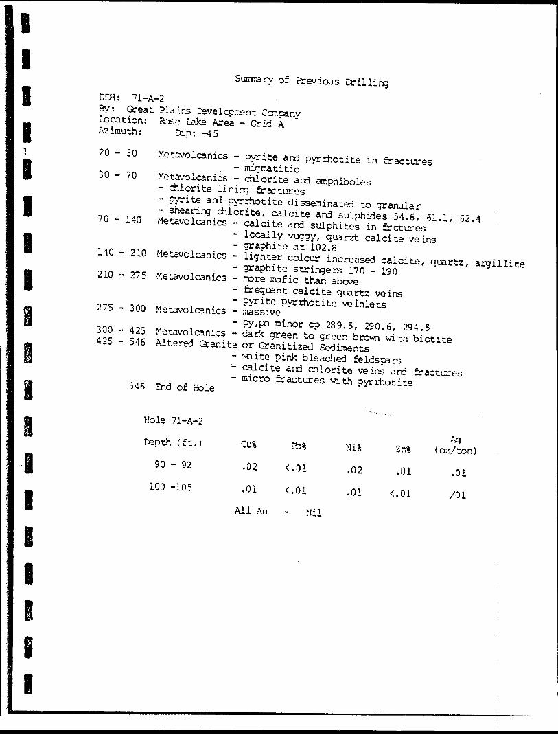
l l l ll I lB
Sunrary of Previous drillingDCH: 71-A-2By: Great Plains Development Conpany Location: Rose Lake Area - Grid A Azimuth: Dip: -45
20 - 30
30 - 70
70 - 140
140 - 210
210 -275
275 - 300
300 - 425425 - 546
546
Metavolcanics - pyrite and pyrrhotite in fractures- migmatitic Metavolcanics - chlorite and amphiboles- chlorite lining fractures- pyrite and pyrrhotite disseminated to granular- shearing chlorite, calcite and sulphides 54.6, 61.1, 62.4 Metavolcanics - calcite and sulphites in frctures- locally vuggy, quarzt calcite veins- graphite at 102.8 Metavolcanics - lighter colour increased calcite, quartz, argillite- graphite stringers 170 - 190 Metavolcanics - more mafic than above
- frequent calcite quartz veins- pyrite pyrrhotite ve inlets Metavolcanics - massive- py,po minor cp 289.5, 290.6, 294.5 Metavolcanics - dark green to green brown with biotite Altered Granite or Granitized Sediments- white pink bleached feldspars- calcite and chlorite veins and fractures- micro fractures with pyrrhotite End of Bole
Hole 71-A-2
Depth (ft.)
90 - 92
100 -105
Cirt
.02
.01
All Au
Nil
.02
.01
Zrfc
.01
Ag {oz/ton)
.01
/O l
Mil
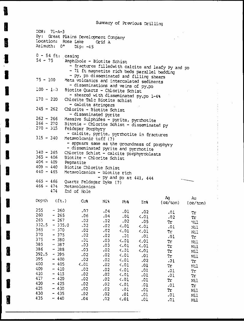
i i
l l I l l l l l l l lH
l
Sumary of Previous Drilling
DCH: 71-A-3By: Great Plains Development Company Location: Rose Lake Grid A Azimuth: O 0 Dip: -45
0-54 ft: casing54-75 Amphibole - Biotite Schist
- fractures fillecwith calcite and leafy Py and po- 71 ft magnetite rich beds parallel bedding- py, po disseminated and filling shears 75 - 100 Meta volcanics and intercalated sediments- disseminations and veins of py,po
100 - 1/0 Biotite Quartz - Chlorite Schist- sheared with disseminated py,po l-4% 170 - 220 Chlorite Talc Biotite schist- calcite stringers
245 - 262 Chlorite - Biotite Schist- disseminated pyrite
262 - 266 Massive Sulphides - pyrite, pyrrhotite 266 - 270 Bitotie - Chlorite Schist - disseminated py 270 -315 Feldspar Porphyry- calcite, pyrite, pyrrhotite in fractures 315 - 340 Metavolcanic tuff (?)- appears same as the groundmass of porphyry- disseminated pyrite and pyrrhotite
365 Chlorite Schist - calcite porphyroblasts 406 Biotite - Chlorite Schist 409 Pegmatite 440 Biotite Chlorite Schist 465 Metavolcanics - biotite rich
- py and po at 441, 444 ^Quartz Feldspar Dyke (?)MetavolcanicsEhd of Hole
340365406409440
465 - 466466 - 474
474
Depth ( ft.) Pb% Zr.% (oz/ton)Au
(oz/ton)
255260265332.5365370375385386392.5395400409410417420425430435
- 260- 265- 267- 335.0- 370- 375- 380- 387- 388- 395- 400- 405- 410- 415- 420- 425- 430- 435- 440
.07
.06
.02
.02
.02
.02
.01
.03
.03
.02
.02C01
.02
.02
.02
.02
.02
.02
.04
.04
.04
.02
.02
.02
.02
.03
.03
.02
.02
.02
.02
.02
.02
.02
.02
.02
.02
.02
.01
.01
.02colC01
.01 C. 01colC01C01C01colCOlCOlCOlCOl
.01
.01col
.02col
.05C01col
.01colCQ1col
.01
.02
.01
.01
.01
.01
.01.01.01.01
.01
.02Tr.01Tr.01TrTrIrTr.01Tr.01.01Tr.01Tr.01.01
TrTrNilNilNilTrNilNilNilNilTrMilTrTrNilTrNilNilNil
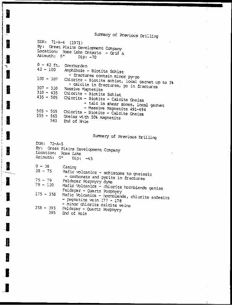
i
iB B
l I B
B B
Sunmary of Previous DrillingDDH: 71-A-4 (1971) By: Great Plains Development Company Location: Pose Lake Ontario - Grid A Azimuth: O 0 Dip: -70
0-42 ft. Overburden42 - 100 Anphibole - Biotite Schist
- fractures contain minor ?y-po 100 - 307 Chlorite - Biotite schist, local garnet up to 3%- calcite in fractures, no in fractures 307 - 310 Massive Magnetite 310 - 435 Chlorite - Biotite Schist 435 - 505 Chlorite - Biotite - Calcite Gneiss- talc in shear zones, local garnet- Massive Magnetite 491-494 505 - 555 Chlorite - Biotite - Calcite Gneiss 555 - 565 Gneiss with 50% magnetite 565 End of
Summary of Previous DrillingDDH: 72-A-5By: Great Plains Development CompanyLocation: Pose LakeAzimuth: O 0 Dip: -45
0-38 Casing38 - 75 Mafic volcanics - schistose to gneissic- carbonate and pyrite in fractures 75-79 Feldspar Porphyry dyke 79 - 120 Mafic Volcanics - chlorite hornblende genissFeldspar - Quartz Porphyry 175 - 358 Mafic Volcanics - hornblende, chlorite andesite- pegmatite vein 177 - 178
- minor chlorite calcite veins 358 - 395 Feldspar - Quartz Porphyry 395 End of Bole
B
B I
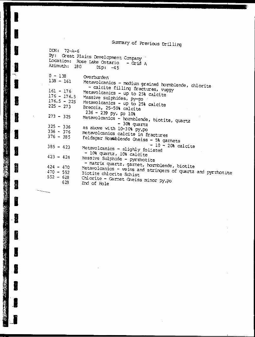
I l Il ll l l l
l i
of Previous DrillingDCH: 72-A-6By: Qreat Plains Dsvelcpmer.t Company Location: Pose Lake Ontario - Grid A Azimuth: 180 Dip: -45
0-138 138 - 161
161 -176 176 - 176.5 176.5 - 225 225 - 273
273 -325
325 - 336 336 - 376 376 - 385
385 - 423
423 - 424
424470552
470552628623
OverburdenMetavolcanics - medium grained hornblende, chlorite- calcite filling fractures, vuggy Metavolcanics - up to 251 calcite Massive sulphides, ?y-po Metavolcanics - up to 25% calcite Breccia, 25-50!i calcite
236 - 239 oy, po 10% Metavolcanics - hornblende, biotite, quartz- 3Cft quartzas above with 10-3C^ py,po metavolcanics calcite in fractures Feldspar Hotmblende Gneiss - 5i garnets
- 10 - 2Cft calcite Metavolcanics - slighly foliated- 1C& quartz, 10% calcite massive Sulphide - pyrrhotite- matrix quartz, garnet, hornblende, biotite Metavolcanics - veins and stringers of quartz and pyrrhotite Biotite chlorite Schist Chlorite - Garnet Gneiss minor ?y,po End of Bole
lll 1 I
Summary of Previous Drilling
DOi: 72-A-7By: Great Plains Development Ccmpany Location: Pose Lake Grid A Azimuth: 030 Dio -45
0-41 ft, 41 - 100
100 - 125
125 - 152
152 - 131
181 - 200
200 - 262
262 - 264.5
262 - 274
274 - 237.5
237.5 - 290 290
OverburdenAndesite - Chlorite Hornblende Gneissmedium - dark green, med. grained, hornblende- rnonor disseminated py,po Metavolcanics- siliceous, medium to dark green- up to 30% biotite, 11 disseminated py, co- massive pyrrhotite in fractures (5%'j Greenstone - banded at 40"- 201 quartz, 5-101 garnets Greenstone: Biotite - garnet Gneiss- calcite in fractures, 2% poBiotite - Hornblende - Feldspar Gneiss- pyrrhotite in fractures 201 Greenstone: Biotite - Garnet Gneiss- pyrite and pyrrhotite in fractures Porphyritic Granodiorite- banded, fine grained pyrite in fractures Feldspar - Quartz Gneiss- pyrite in fracturesBornblende - Feldspar - Quartz Gneiss- mionor garnet, Py in fractures
.5 - Chlorite - Muscovite - Talc Schist
.5 End of Hole *
301
l
l
l
lSummary of Previous Drilling
l-i le e i
DCH: 72-A-3By: Great Plains Development Ccmcany Location: Ftose Lake Grid A Azimuth: 180 Dip: -50
0-51 ft. 51 - 71.5
71.5 - 98.5
98.5 - 103
103 - 122112 - 174.5
174.5 - 324
324 - 350
Overburden Chlorite Schist- redium grey green/fine grained- 5 - ICft quartz, disseminated pyrite
Pegiratite- quartz, muscovite, garnet
Chlorite Schist- siliceous, da'rk grey green ,- 5 - 15% biotite
Granitoid Calcite chlorite Gneiss- calcite veins, 10 - 40% quartz, B-5% garnets Biotite Chlorite Gneiss- light grey green- fine bands at 45 0 to core axis Calcite - Chlorite - Biotite Schist- Calcite bands 4-10 cm
l
l
l
l
Suraiary of Previous Drilling
DCH: 72 - 3-1By: Great Plains Development Company Location: Rose Lake Grid B Azimuth OOO 0 Dip: -45
O - 115 115 - 140
140 - 145 145 - 149.5
149.5- 203
203 - 253
253260
290
315
326
340
260290
315
326
340
365
390 -418
418
Overburden Sedimentary Gneiss- Carbonaceous chlorite quartz gneiss- 135 - 136 massive pyrrhotite, 2Cft quartzChlorite - Biotite GneissMagnetite - Chlorite - Plagioclase Gneiss- magnetite 5%, spotted appearance Carbonaceous - biottie Gneiss 165 - 190 - pronounced banding
- massive and disseminated py-po Chlorite Quartz Gneiss- 2-31 magnetite20-40% quartzMagnetite Chlorite - Plageoclase GneissChlorite Quartz Gneissgrey green quartz 25%Chlorite Biotite Calcite Gneiss- fractured, po in fractures chlorite - Biotite - Quartz gneiss- disseminated magnetite, 3!* po Chlorite Quartz Gneiss- 5% garnet, 2% magnetite, l% pyrrhotite Chlorite Biotite Gneiss- 3% garnets- calcite filling fratures Carbonaceous chlorite Quartz Gneiss- 10% pyrrhoite379.5 - 380.5 massive pyrrhotiteChlorite Quartz Gneiss394 -415 shearedEnd of Hole
Summary of Previous Drilling
l
i
l
l
l
DCH: 72-B-2By: Great Plains Development Company Location: Hose Lake Grid 3 Azimuth 180 DID: -60
0-62 62 - 34
84-185
185 - 267
267 - 296
296 - 309.5 309.5 - 432
432-548
548 - 625
625 - 685
685
OverburdenSiliceous Chlorite Gneiss medium grey-green, fine grained lignite on shear planes, 51 py -t- po Garnetiferous Biotite Gneiss 30 - 35% garnets, shear planes at 45" Biotite - Chlorite Gneiss - {paragneiss) pyrite in shears and fractures Biotite - Chlorite Gneissmassive and disseminated pyrite and pyrrhotite S-8% Garnetiferous Biotite Gneiss Chlorite - Biotite Gneissmassive and disseminated py,poclays and limonite in fractures408"' bedded pyrite409 garnet rich bed428 quartz vein
Siliceous chloritic Gneiss460 - 464 massive pyrite and pyrrhoite475 - 500 fractured pyrite beds Talc chlorite Gneissbiotite bands 5-10 enlocally schistose
Siliceous - Biotite - Chlorite Gneisspyrite in fractures End of Bole
i
l
l
l
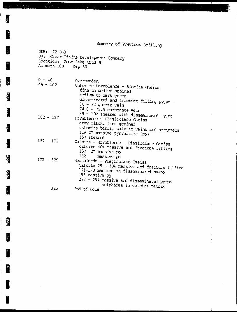
l
Summary of Previous DrillingDCH: 72-B-33y. Great Plains Development Company Location: Pose Lake Grid 3 Azimuth 180 DID 50
0-46 46 - 102
102 - 157
157 - 172
172 - 325
325
OverburdenChlorite Hornblende - Biotite Gneiss
fine to medium grainedmedium to dark greendisseminated and fracture filling py/po70 - 72 quartz vein74.8 - 75.5 carbonate vein89 - 102 sheared with disseminated -y,po Bomblende - Plagioclase Gneissgrey black, fine grainedchlorite bands, calcite veins and stringers119 2" massive pyrrhotite (po)157 sheared
Calcite - Hornblende - Plagioclase Gneisscalcite 401 massive and fracture filling157 2" massive po162 massive po
Hornblende - Plagioclase GneissCalcite 25 - 30% massive and fracture filling171-173 massive an disseminated py+po193 massive oy272 -284 massive and disseminated oy-t-po
sulphides in calcice matrix End of Hole
l
l
l
l
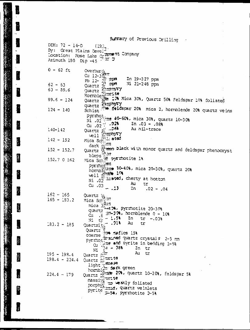
DCH: 72 - 14-D (19JL. By: Great Plains Cevel~ ' Location: Pose Lake ( Azimuth 180 Dip -45
0-62 ft
52 - 6353 - 39.6
39.6 - 124
124 - 140
140-142
142 - 152
152 - 152,7
Overburd,
of Previous Drillin
,t Company
Zn 19-327 ppn"i 2 1~ 248
quartz Schistpyrrhqt,Ni .(Cu .02"-' ^
Quartz R" ' "':. . t--.*—i
iMicadark
Quartz
;;;^*' r^4* ~o olac*
Mica 3(ft, Quartz 50% Feldspar 10% foliate^
20% mica 2/ hornblende 2Cft quartz veins
, mica 30%, quartz Id-30% 2n .03 - .08% Au nil-trace
quartz and feldspar Phenocryst
152.7 O 162 Mica SchF ?^rhotite pyrrhot3^* * -,^**^***, mica 20-3(ft, q'^rtz
162 -165 Quartz Ve.l f r i n i -x .. . - .^* *
cherti' a t C^ trZn .02 - .04
Mica
Cu .6 Ni tr
Quartzite
165 - 133.2
133.2 - 135
Cu .C Mi t
195 - 193.4 Quartz D?198.4 - 224.4 Quartz ^p;
Light ^
ite 20-3 O* hornblende O - l (ft
2n tr ~- Au tr
quartz crystals 2-5 rnn te in bedding 1-51
Zn tr Au tr
green224.4 - 179 Quartz 10-2 (ft, feldspar 51
quartz ve inlets pyrrhotite 2
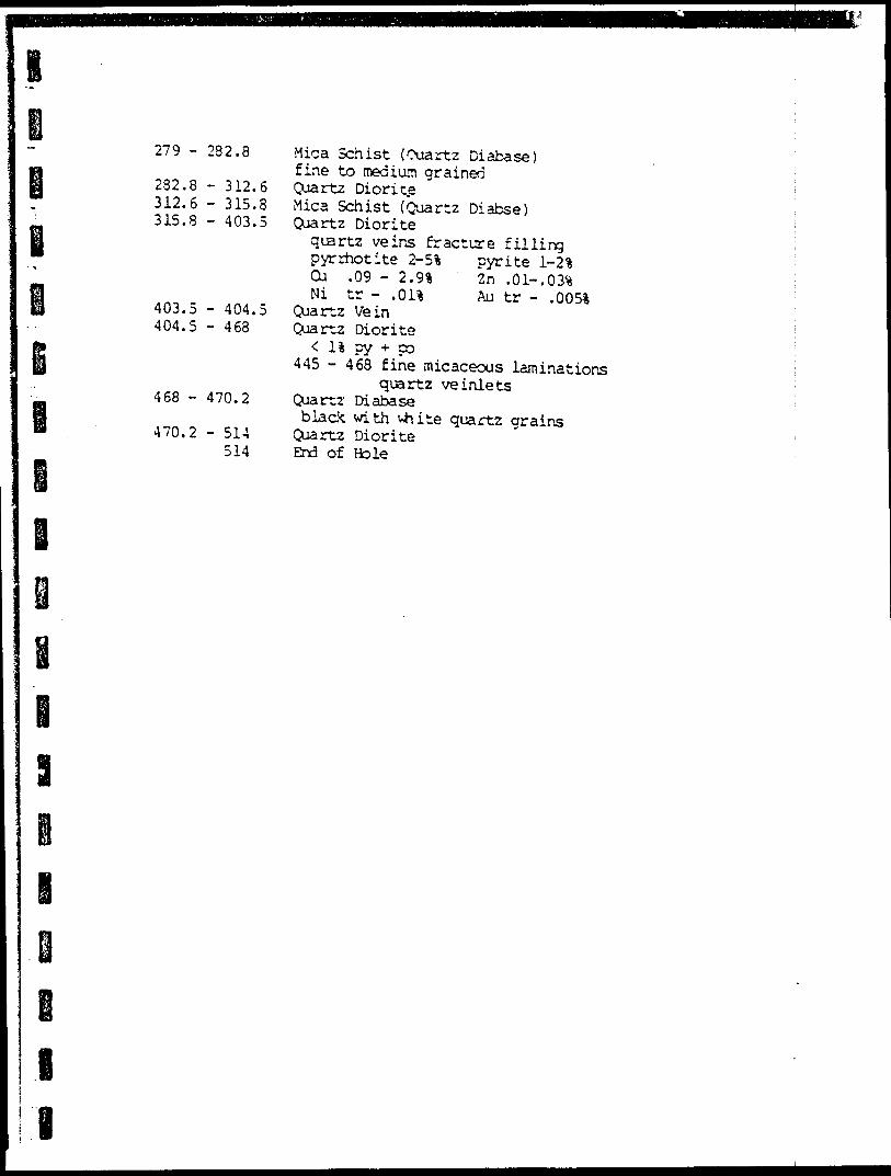
279 - 282.8
282.8 - 3L2.6312.6 - 315.8315.8 - 403.5
403.5 - 404. 404.5 - 468
468 - 470.2
470.2 - 514514
Mica Schist (Quartz Diabase) fine to medium grained Quartz Diorite Mica Schist (Quartz Diabse) Quartz Diorite
quartz veins fracture fillingpyrrhotite 2-51 pyrite 1-2*Cu .09 - 2.9*Ni tr - .01*
Quartz Vein Quartz Diorite
< l* py -t- po 445 -468 fine micaceous laminations
quartz ve inlets Quartz- Diabaseblack with vhite quartz grains
Quartz Diorite End of Hole
Zn .01-.03* Au tr - .005*
!
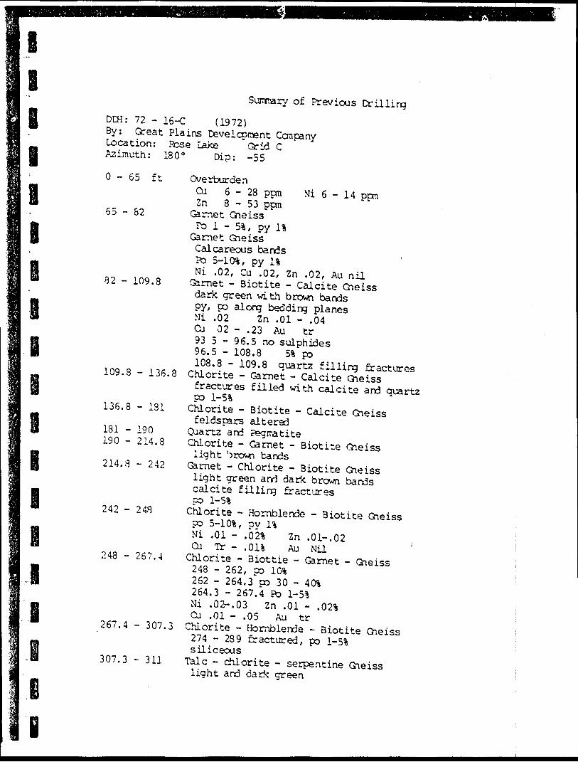
l l
Sunrary of Previous Drilling
DCH: 72 - 16-C (1972) By: Great Plains Development Ccmpany Location: Rose Lake Grid C Azimuth: 180" Dip: -55
I
0-65 ft
65 - 82
- 109.8
l
i
109.8 - 136.8
136.8 - 131
181 - 190 190 - 214.8
214.3 - 242
242 - 248
248 - 267.4
267.4 - 307.3
307.3 - 311
OverburdenCu 6-28 ppm Ni 6 - 14 ppmZn 8-53 ppm
Garnet Gneissro l - 51, py 11
Garnet GneissCalcareous bandsPo 5-101, py 11Ni .02, Cu .02, Zn .02, Au nil
Garnet - Biotite - Calcite Gneissdark green with brown bandspy, po along bedding planesNi .02 Zn .01 - .04Cu 02 - .23 Au tr93 5 - 96.5 no sulphides96.5 - 108.8 51 po108.8 - 109.8 quartz filling fractures
Chlorite - Garnet - Calcite Gneissfractures filled with calcite and quartzpo 1-51
Chlorite - Biotite - Calcite Gneissfeldspars altered
Cuartz and Pegmatite Chlorite - Garnet - Biotite Gneisslight '^rown bands
Garnet - Chlorite - Biotite Gneisslight green and dark brown bandscalcite filling fracturespo 1-51
Chlorite - Hornblende - Biotite Gneisspo 5-101, pv liNi .01 - .021 Zn .01-.02Cu Tr - .011 Au Nil
Chlorite - Biottie - Garnet - Gneiss248 - 262, po 101262 - 264.3 po 30 - 401264.3 - 267.4 Po 1-51Ni .02-.03 Zn .01 - .021Cu .01 - .05 Au tr
Chlorite - Hornblende - Biotite Gneiss274 -289 fractured, po 1-51siliceous
Talc - chlorite - serpentine Gneisslight and dark green
e
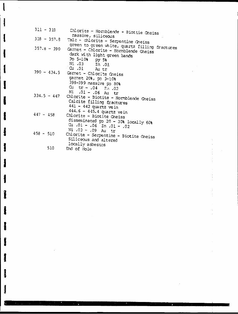
I I i
I i I
311 - 318
318 - 357.3
357.8 - 390
390 - 434.5
334.5 - 447
447 - 458
458 - 510
510
Chlorite - Hornblende - Biottie Gneiss massive, siliceous
Talc - chlorite - Serpentine Gneissgreen to green -4iite, quartz filling fractures
Garnet - Chlorite - Hornblende Gneissdark with light green bandsFD 5-10% py 5%Ni .03 Zn .01Cu .01 Au tr
Garnet - Chlorite Gneissgarnet 201, cc 3-101398-399 massive co 301Cu tr - .04 ?;i .02Ni .01 - .06 Au tr
Chlorite - Biotite - Hornblende GneissCalcite filling fractures441 - 442 quartz vein444.6 - 445.4 quartz vein
Chlorite - Biotite Gneissdisseminated po 20 - 301 locally 601Cu .01 - .06 ~Zn .01 - .02Ni .03 - .09 Au tr
Chlorite - Serpentine - Biotite GneissSiliceous and alteredlocally asbestos
End of Hole
I
l
l
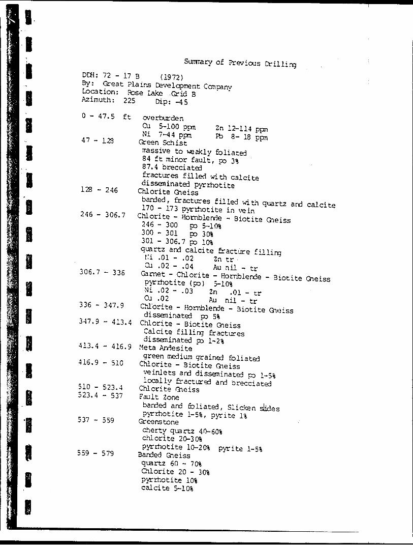
Summary of Previous DrillingDCH: 72 - 17 B (1972) 3y: Great Plains Development Company Location: Rose Lake Grid B Azimuth: 225 Dip: -45
O - 47.5 ft
47 - 128
Zn 12-114 ppm Fb 8- 18 ppm
128 - 246
246 - 306.7
306.7 - 336
336 - 347.9
347.9 - 413.4
413.4 - 416.9
416.9 - 510
510 - 523.4 523.4 - 537
537 - 559
559 - 579
overburdenCu 5-100 ppmNi 7-44 ppm
Green Schistmassive to ve akiy foliated84 ft minor fault, po 3%87.4 brecciatedfractures filled with calcitedisseminated pyrrhotite
Chlorite Gneissbanded, fractures filled with quartz and calcite170 -173 pyrrhotite in vein
Chlorite - Hornblende - Biotite Gneiss246 - 300 po 5-1 (*300 - 301 DO 3Cft301 - 306.7 po l (ftquartz and calcite fracture fillingt:i .01 - .02 2n tr
Cu .02 - .04 Au nil - tr Garnet - Chlorite - Hornblende - Biotite Gneisspyrrhotite (po) S-10%Ni .02 - .03 Zn .01 - trCu .02 Au nil - tr
Chlorite - Hornblende - Biotite Gnoissdisseminated po 5% Chlorite - Biotite GneissCalcite filling fracturesdisseminated po 1-^
Meta Andesitegreen medium grained foliated
Chlorite - Biotite Gneissve inlets and disseminated po 1-51locally fractured and brecciated Chlorite Gneiss
Fault Zonebanded and foliated, Slicken slidespyrrhotite i-5%, pyrite li
Greenstonecherty quartz 40-60!4chlorite 20-30%pyrrhotite lQ-20% pyrite 1^
Banded Gneissquartz 60 - 70%Chlorite 20 - 301pyrrhotite 1 0*calcite S-10%
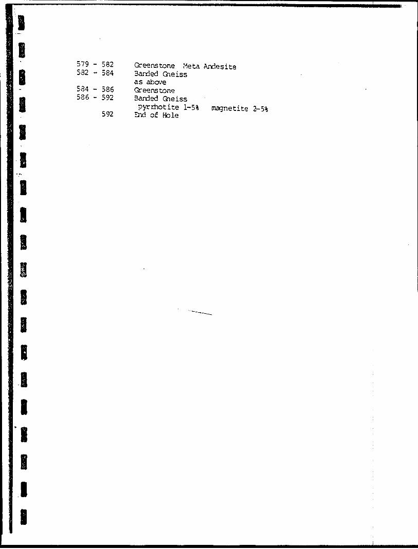
l
1 i11EiOB
579 - 582 582 - 584
584 - 586 586 - 592
592
Greenstone Meta Andesite Banded Gneiss as above Greenstone Banded Gneisspyrrhotite 1-51 magnetite 2-5i
End of Bole
e i B
i ie i i
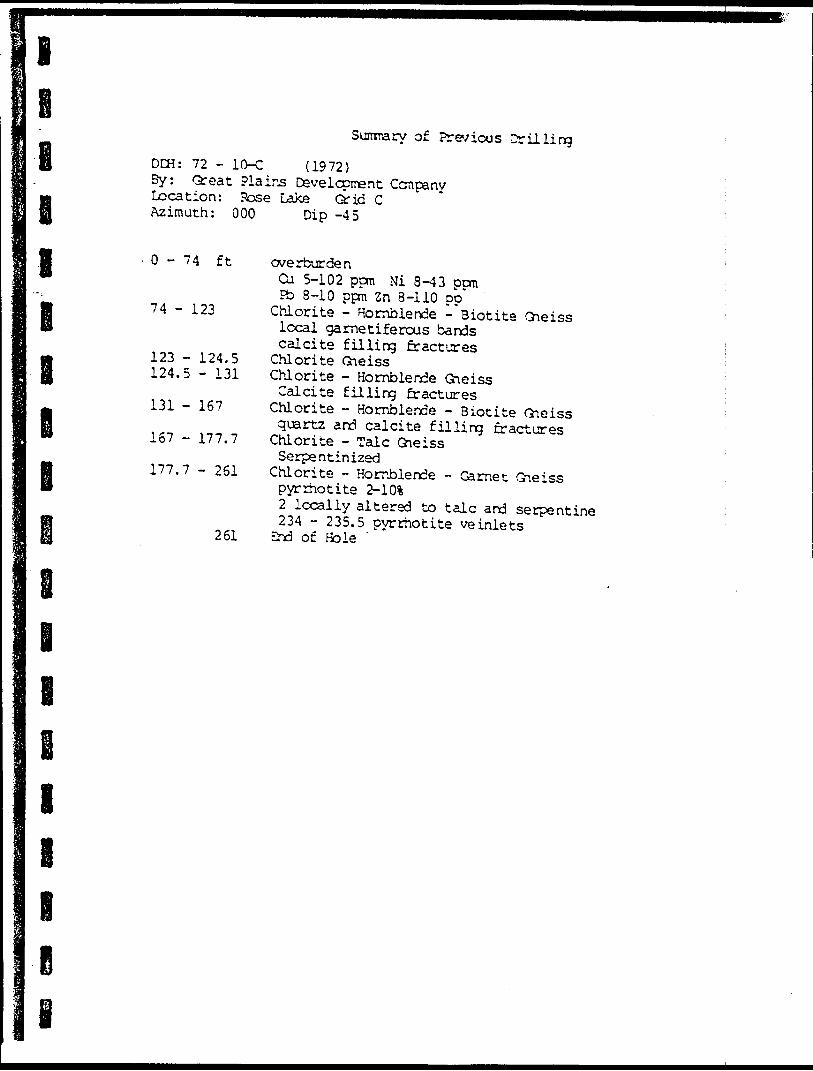
lSummary of Previous Drilling
DCH: 72 - 10-C (1972) By: Great Plains Development Company Location: Pose Lake Grid C Azimuth: 000 Dip -45
l 0-74 ft
74 - 123
123 - 124.5 124.5 - 131
131 - 167
167 - 177.7
177.7 - 261
261
overburdenCu 5-102 ppra Ni 8-43 pernPb 8-10 ppm 2n 8-110 pp"
Chlorite - Hornblende - Biotite Gneisslocal garnetiferous bandscalcite filling fractures
Chlorite Gneiss Chlorite - Hornblende GneissCalcite filling fractures
Chlorite - Hornblende - Biotite Gneissquartz and calcite filling fractures
Chlorite - Talc GneissSerpentinized
Chlorite - Hornblende - Garnet Gneisspyrrhotite 2-1012 locally altered to talc and serpentine234 - 235.5 pyrrhotite ve inlets
End of Hole
l
l
l
e
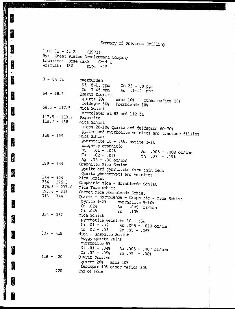
Summary of Previous DrillingDEH: 72.- 11 E ( 1972) By: Great Plains Development Company Location: Sose Lake Grid E Azimuth: 180 Dip: -45
O - 64 ft
64 - 68.5
68.5 - 117.5
117.5 - 118.7 118.7 - 158
158 - 199
199 - 244
244 - 254 254 - 275.5 275.5 - 293.6 293.6 - 316316 - 344
334 - 337
337 - 413
418 - 420
420
Zn 23 - 60 ppm Au . l-.2 ppm
mica hornblende
other mafics 10*
overburdenNi 8-13 ppmCu 7-45 ppm Quartz Dioritequartz 20*feldspar 50%
Mica Schistbrecciated at 83 and 112 ft
Pegmatite Mica Schistmicas 20-3 O1* quartz and feldspars eO-70%pyrite and pyrrhotite ve inlets and fracture filling Mica Schistpyrrhotite 10 - 154, pyrite 2-3 4slightly graphiticNi .01 - .021 Au .005 -Cu .02 - .03% Zn .07 -Ag .03 - .06 oz/ton
Graphitic Mica Schistpyrite and pyrrhotite form thin bedsquartz phenocrysts and ve inlets
Mica SchistGraphitic Mica - Hornblende Schist Mica Talc schist Garnet Mica Hornblende Schist Qjartz - Hornblende - Graphitic - Mica Schistpyrite 1-2% pyrrhotite 5-10%Cu .021 Au .005 oz/ton
.13%
.010 oz/ton
.008 oz/ton
.19*
Ni .04* ZnMica Schistpyrrhotite ve inlets 10 - Ni .01 - .02 Au .005 - Cu .02 - .03 Zn .05 - ,
Mica - Graphite Schist Vuggy quartz veins pyrrhotite 5*Ni .01 - .04* Au .005 - Cu .02 - .05* Zn .05 -
Quartz Diorite quartz 20* mica 10* feldspar 40* other mafics
End of Hole
.007 oz/ton
.08*
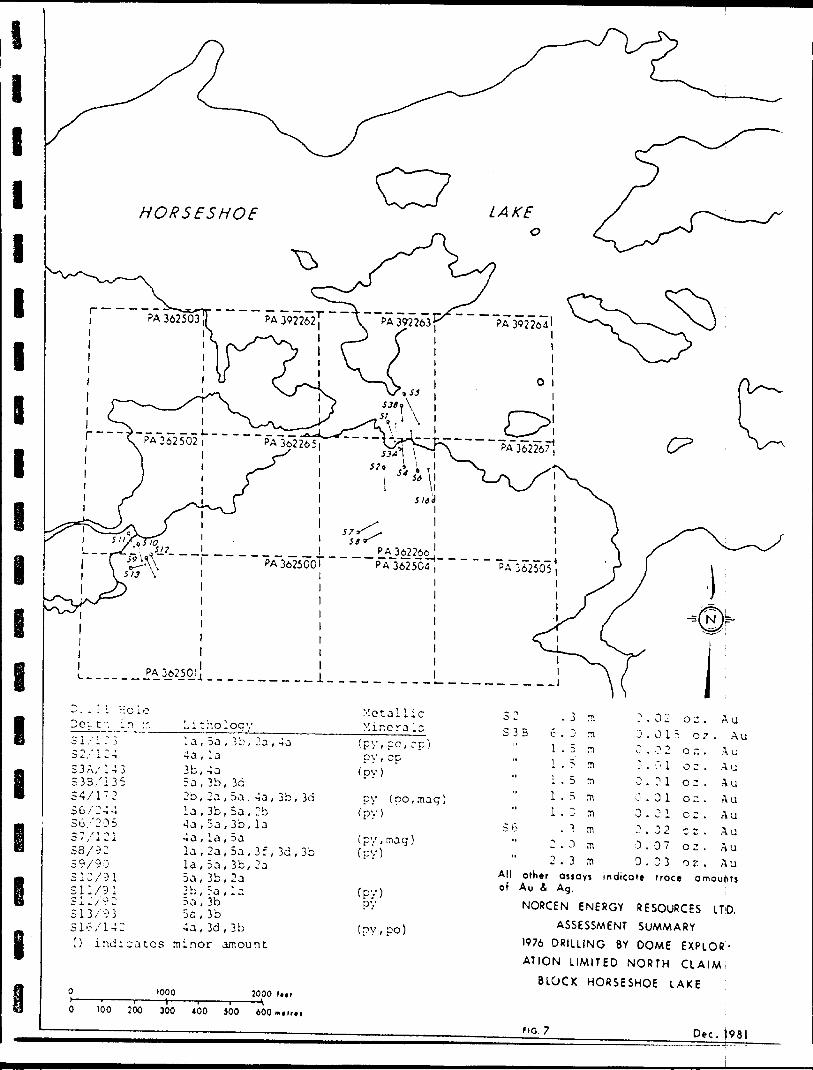
, 3b c , 3b
4a,3d,3bt) indicates minor amount
?\ a3 .0 .
"1
0.0 .0 .3.0.a.
00,~,
00o300
12Ti
11i
273
5ooo0
cco
O 7 .
z .z .z .n .^ ,z .I! .
o z .
. AuAuAuAuAuAuAuAuAu
100 500 300 400 500 600™. ir. i
2.0m2.3m
other ossoys i ndicate rroce amounts Au S- Ag.
NORCEN ENERGY RESOURCES IT'D.ASSESSMENT SUMMARY
1976 DRILLING BY DOME EXPLOR ATION LIMITED NORTH CLAIM!
BLOCK H ORSESHOE LAKE
Dec. )981i— — -.
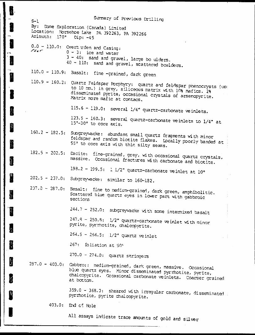
l8 I
l
e i
Sumarv of Previous Drilling S-l3y: Dome Exploration (Canada) Limited Location: Horsehoe Late ?A 392263, PA 392266 Azimuth: 170 0 Dip: -45
0.0 - 110.0: Overt.'rden and Casing: f f f 0 -3: ice and water3 - 40: sard and gravel, large bo aiders.40 - 110: sand and gravel, scattered boulders.
110.0 - 110.9: Basalt: fine -grained, dark green110.9 - 160.2: Quartz Feldspar Porphyry: quartz and feldspar phenocrysts {UD to 10 mm.) in grey, siliceous matrix with l OS mafics. 2% disseminated pyrite, occasional crystals of arsenopyrite. Matrix more mafic at contacs.
115.6 - 119.0: several 1/4" quartz-carbonate ve inlets.123.5 - 160.3: several quartz-carbonate ve inlets to 1/4" at 15"-30 0 to core axis.
160.2 - 132.5: Subgreyvacke : abundant small quartz fragments with minorfeldspar and random biotite flakes. Locally poorly banded at 55 9 to core axis with thin silty seams. ;182.5 - 202.5: Dacite: fine-grained, grey, with occasional quartz crystals, massive. Occasional fractures with carbonate and biotite.
198.2 - 199.5: 11/2" quartz-carbonate ve inlet at 10 0 202.5 - 237.0: Subgreyvecke : similar to 160-132.237.0 - 287.0: Basalt: fine to medium-grained, dark green, amphibolitic. Scattered blue quartz eyes in lcwsr part with gabbroic sections
244.7 - 252.0: si jgreywacke with some intermixed basalt247.B - 250.8: 1/2" qua rt z-carbonate veinlet with minor pyrite, pyrrhotite, chalcopyrite.
264.5 - 266.5: 1/2" quartz veinlet
267: foliation at SO'
270.0 - 274.0: quartz stringers
287.0 - 403.0: Cabbro:: medium-grained, dark green, massive. Occasional blue quartz eyes. Minor disseminated pyrrhotite, pyrite, chalcopyrite. Occasional carbonate ve inlets. Coarser grained at bottom.
359.0 - 368.0: sheared with irregular carbonate, disseminatedpyrrhotite, pyrite chalcopyrite.
403.0: End of Hole
All assays indicate trace amounts of gold and silver
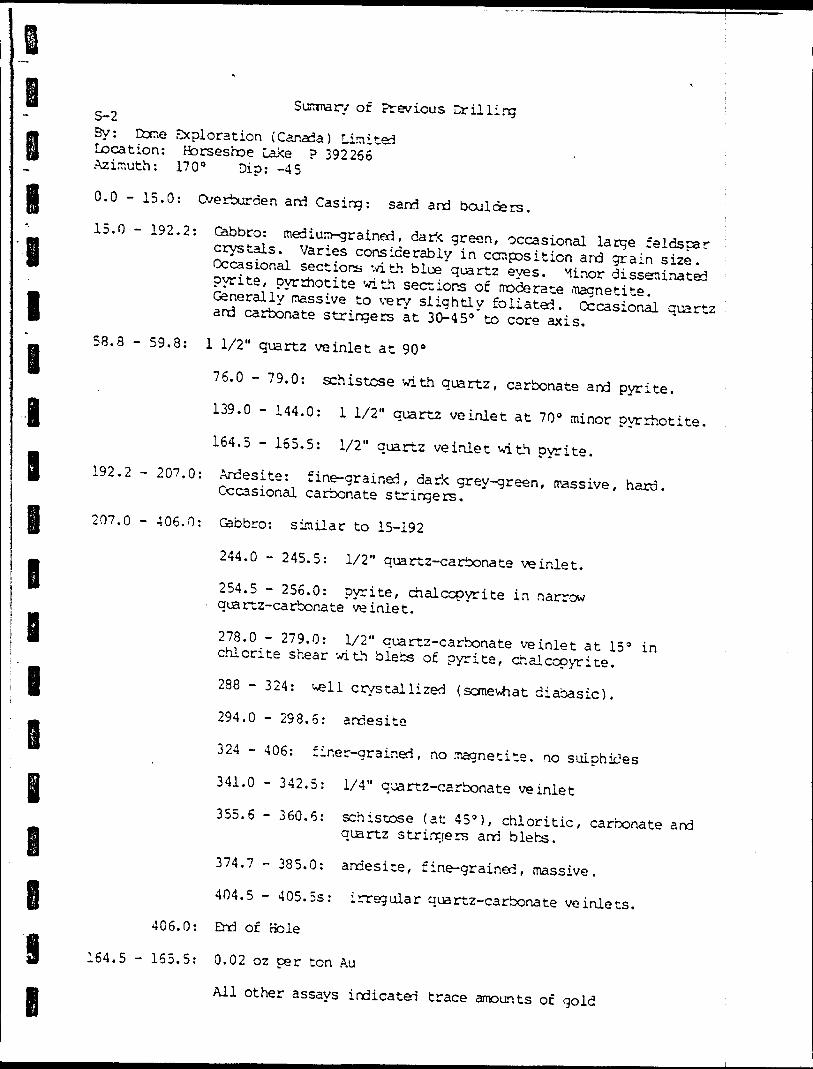
l
l
B
B B B
l B
Sizmarv of Previous Drilling ; S-2By: Cccr.e exploration (Canada) Lin i ted Location: Horseshoe Lake P 392266 Azimuth: 170" Dip: -45
0.0 - 15.0: Overburden and Casing: sand and boulders.15.0 - 192.2: Gabbro: medium-grained, dark green, occasional large feldspar crystals. Varies considerably in composition and grain size. Occasional sections with blue quartz eyes. Minor disseminated pyrite, pyrrhotite with, sections of moderate magnetite. Generally massive to very slightly foliated. Occasional quartz and carbonate stringers at 30-450 to core axis.58.8 - 59.8: l 1/2" quartz veinlet at 90 0
76.0 - 79.0: schistose with quartz, carbonate and pyrite. 139.0 - 144.0: l 1/2" quartz veinlet at 70 0 minor pyrrhotite. 164.5 - 165.5: 1/2" quartz veinlet with pyrite.
192.2 - 207.0: Andesite: fine-grained, dark grey-green, massive, hard. Occasional carbonate stringers.207.0 - 406.0: Gabbro: similar to 15-192
244.0 - 245.5: 1/2" quartz-carbonate veinlet.254.5 - 256.0: pyrite, chalcopyrite in narrow quartz-carbonate veinlet.
278.0 - 279.0: 1/2" quartz-carbonate veinlet at 15 0 in chlorite shear with blebs of pyrite, chalcopyrite.288 - 324: well crystallized {somewhat diabasic). 294.0 - 298.5: andesite
324 - 406: finer-grained, no magnetite, no sulphides 341.0 - 342.5: 1/4" quartz-carbonate veinlet355.6 - 360.6: schistose (at 45"), chloritic, carbonate and quartz stringers and blebs.
374.7 - 385.0: andesite, fine-grained, massive. 404.5 - 405.5s: irregular quartz-carbonate ve inlets.
406.0: End of Hole
164.5 - 165.5: 0.02 oz per ton Au
All other assays indicated trace amounts of gold
i
i
l
l
l
l
l
l
l
Surrrary of Previous Drilling 3-3 ABv: Dome Exploration (Canada) Limited Location: Iforseshoe Lake PA 392266, ?A 392263
Azimuth: 350 0 Di?:
0.0 - 113.0: Overburden and Casing: 0-3: ice and water . 8 - 10: humus 10 - 113: sand, gravel, boulders.
113.0 - 468.0: Subgreywacke: fine-to ned i untrained, grey to dark grey depending on amount of mafic material in matrix. predominantly small quartz grains with minor feldspars. Massive to faintly banded and locally sliqhtly foliated. Occasional small reck fragrents. Minor disseminated pyrite, pyrrhotite. Minor quartz-carbonate stringers. i
113 - 128: several narrow bands of light grey silty sediment. jBanding at 25" to core axis.
135.5 - 140.0: irregular quartz-carbonate blebs.
180.2 - 130.8: andesite dyke.
206 - 235: similar to 113-128, banding at 35'
249 - 251: fragments and bands of siltstone
266: narrow band of siltstone at 35 s
279.2 - 282.0: andesite dyke.
296: 3" andesite dyke
313.0 - 315.5: large quartz blebs.
328.0 - 332.0: andesite dyke.
345.2 - 346.2: 3/8" quartz ve inlet
346.8 - 347.8: l" shear with pyrite, chalcopyrite, arsenopyrite.
354.5 - 356.5: quartz-carbonate stringers minor pyrite, pyrrhotite, chalcopyrite, arsenopyrite.
354.7 - 356.1: andesite dyke
373.5 - 375.0: 1/4" quartz veinlet.394: narrow quartz-carbonate veinlet with disseminated pyrite
parallel to core
438.4: 31/2" andesite dyke at 35 0
439.5 - 468.0: occasional bands of light and dark green silty
sediment. Increase in nuirber with depth. Banding at 35".
441.0 - 449.7: andesite, some quartz-carbonate fracture filling
468.0: End of Hole
All assays indicate trace amounts of gold and silver.
l
e
B i
Simrarv of Previous Drilling S-33By: cone Exploration (Canada) Limited Location: Borseshoe Lake Azimuth: 170" Dip: -45
0.0 - 149: Overburden and Casing: 1 .5' of ice, bculders to 3', remainder sand and gravel. Note: no water but collar below average vater level
149.0 - 212.0: Ciiartz Feldspar Porphyry: feldspar and quartz phenocrysts (up to 10 mm.) in grey siliceous matrix with 151 mafics. Generally massive.
212.0 - 222.0: Subgreyvacke: medium-grained, grey, massive222.0 - 259,8: Siltstone: fine-grained, light grey-green finely banded with interbanded subcreyvacke . Banding at 400 to core axis.259.8 - 268.0: SubgreyvvQcke : medium grained , grey, massive 268.0 - 275.0: Andesite: fine to medium-grained, dark green275.0 - 429.0: Subgrey^acke: Cccasional carbonate and quartz ve inlets
316.4 - 319.0: andesite
339.6 - 340.6: andesite, schistose, chloritic.350.0 - 355.0: andesite
429.0 - 444.0: siltstone: similar to 222-259. Banding at 45". Occasional auartz-carbonate ve inlets.444.0: End of Hole
Assay Interval
149-154154-159159-164164-169207-212215.5-216.5253.7-254.7339.6-340.6429.3-432.3434-435
Au o z/ton
.02
.01
.02
.01
.02
.01
.01
.01
.01
.01
l All other assavs indicate trace amounts of gold
i
l l l I ll l l
l
I l
Summary of Previous Drilling
S-4By: Dome Exploration (Canada) limited
Location: Borseshoe Lake PA 392266
Azimuth: 350 0 Dip: -45
0.0 - 7.0: Overburden and Casing:
0-6: casing
6 - 7: broken rock, humus
7.0 - 7.3: Siliceous Tuff: f ine-qrained , grey-creen, banded, sericitic,
possibly boulders. Disseminated pyrite, pyrrhotite, arsenopyrite.
7.3 - 22.7: Dacite: fine-to-medium-grained , grey-green quartz eyes in upper
part. Conserable carbonate, scr;e chlorite. Miner disseminated
pyrite, pyrrhotite. Foliated at 453 to core axis. Strong shearing
at lower contact. A few quartz-carbonate ve inlets*.
7.3 - 22.7: Dacite: fine-to-medium-grained, grey-green quartz eyes in upper
part. Considerable carbonate, some chlorite. Minor disseminated
pyrite, pyrrhotite. Foliated at 45" to core axis. Strong shearing
at l ewe r contact. A few quartz-carbonate ve inlets.
22.7 - 44.3: Quartz Feldspar Porphyry: quartz and feldspar phenocrysts (up to
10 mm) in fine-grained, grey, siliceous matrix with ICft mafics.
Foliation at 450 moderate to strong at contacts with increased
chlorite. Minor disseminated pyrrhotite, pyrite.
44.3 - 221.6: CStbbro: medium - to coarse-grained, dark green, massive to
locally schistose, minor disseminated pyrite and magnetite.
Occasional carbonate stringers.
44.5 - 45.5: contact.
56 - 91: abundant blue quartz eyes
56.1 - 57.3: several quartz-carbonate strirqers, minor
pyrrhotite, pyrite, arsenopyrite.
60.2 - 62.2: 1/3" quartz stringer with pyrite.
63.5 - 65.6: irregular quartz ve inlet with pyrite.
115.5 - 120.5: several carbonate stringers
Finer grained near lower contact.
221.6 - 229.2: Dacite: medium-grained, grey, abundant small quartz eyes,
beccm.es porphyritic near lower contact
229.2 - 388.0: subgreywacke : fine-to-medium-grained, grey with predominantly
small quartz veins, some feldspars and l (ft mafics. Pock matrix
occasionally darker in colour - more mafic. Minor fine carbonate,
Locally fine-grained, silty. Massive to occasionally weakly
banded. Occasional quartz and carbonate stringers. A f
pattered angular rock
l
li li i l
l l
B l l
l l
248.7 - 249.7: l" quartz-carbonate ve inlet at 20" 258: barring at 35'
264.0 - 265.0: light green silty sediment with 1/4" quartz-carbonate ve inlet at 45 0
353: finely banded, green siltstone at 30"367 - 372: finely banded to fine-grained -nassive at 30"386.2 - 387.9: quartz-carbonate stringer
388.0 - 400.0: Cacite: fine-grained, dark grey-green, massive, dense, occasional small quartz eyes.400.0 - 409.0: Siltstone: fine-to-very-fine-grained, grey to light green,locally well banded at 40 0 minor disseminated pyrite, occasional quartz-carbonate ve inlets.
399.5 - 401.0: 1^ disseminated pyrrhotite, pyrite ; 407.^ - 4?a OS: 2" quartz-carbonate ve inlet at 25"
409.0 - 563.0: Subgreyvacke : similar to 229-388. Scattered small reck ! fragments
473.4 - 476.6: andesite: fine-grained, dark green, fresh, probably a dyte. Several quartz-carbonate ve inlets.487 - 495.7: more chloritic ground mass with numerous carbonate- blebs and stringers
495.7 - 533.0: quartzite: light grey, predominantly ouartz : grains. ;
500.0 - 505.0: darker grey, finer-grained, with nuirerous ; interbeds of light grey, siltstone, finely banded at 30-40 0 . A j few carbonate stringers.
563.0: End of Bole
All Assays indicate trace amounts of gold
l
I
l
l
e
i
Surrmarv of Previous Drilling S-53y: tone Exploration (Canada) Limited Location: Horeshoe Lake ?A 392263 Azimuth: 155 Dip: -55
0.0 - 179.0: Overburden and Casing: sand, gravel and boulders.179.0 - 181.7: Andesite: fine-grained, dark green, chloritic, carbonated, foliated at 40 0 to core axis. Minor disseminated pyrite, occasional carbonate stringers.
131.7 - 183.3S: Subgreywacke: medium-grained, grey, small (2 mm.) grains of quartz, feldspar, carbonate, mafics -generally massive.183.8 - 185.2: Andesite: similar to 179-181
185.2 - 192.5: Subgreyvacke: similar to 181-183 with seme interbanded light grey-green siltstone, finely banded at 40 0
192: 1/2" quartz ve inlet
192.5 - 269.0: Quartz Feldspar tSrphyry: feldspar and quartz phenocrysts (up to 10 mm) in grey, siliceous matrix with 151 mafics, locally showing foliation at 45 0 . a few quartz ve inlets . Minor pyrite in fractures
269.0 - 296.0: Subgreywacke: similar to 181-183 with some interbi,nded siltstone296.0 - 304.5: Siltstone: fine-grained, light grey-green finely banded at 45 s . Some interbanded greywacke
304.5 - 316.3: Cacite Tuff (?): fine-grained, dark green locally very faintly banded. Seme interbanded siltstone. Becomes more mafic at depth.
316.3 - 346.3: Quartz Feldspar Porphyry: similar to 192-269, slightly darker colour.
329 - 333: schistosity parallel to core with chlorite development.
334.5 - 338.4: andesite, considerable carbonate.346.3 - 416.6: Subgreyv-acke: similar to 131-133, becones coarser-grained with occasional small rock fragments. Occasional quartz veinlets.
349.0 - 355.2: andesite
416.3 - 448.0: Cacite Tuff: similar to 304-315
416.3 - 417.4: irregular quartz veining.439.8 - 442.7: subgreywacke :448: contact at 30"
l ll l l I l
e
i i
448.0 - 487.8: Subgraywacke: similar to 181-183. Cccassional small rock fragments.
487.3 - 503.0: Basalt: fine-grained, dark green, massive
503.0 - 660.0: Subgreyvacke : similar to 181-183, some rock fragments up to l"
521.8 - 523.2: andesite.
566: fine-grained, faintly banded at 20 0
638.0 - 639.5: finely banded (at 40 0 ) siltstone.
640 - 543: core ground
648 - 650: several narrow sections of andesite.
658.4 - 660.0: interbanded siltstone.
660.0 - 730.6: Andesite: fine-to medium-grained, dark grey-green, massive to slightly foliated, numerous carbonate fracture-fillings. ;
660.0 - 669.0: some interbanded subgrey*acke and siltstone. : Occasional irregular quartz and carbonate stringers and ve inlets.
701.6 - 702.9: siltstone.
703.6 - 715.3: Subgrey-acke: similar to 181-183
715.3 - 782,0: Quartz Feldspar Porphyry: similar to 192 - 269
779.2 - 781.0: basalt: fine-grained, dark green, chloritic
782.0 - 800.0: Subgraywacke: similar to 181 - 183
800.0: End of Hole
All assays indicate a trace of gold
l
l iB i
l B
B
B B
B B
Sunnary of Previous Drilling S-6By: Come Exploration (Canada) Limited Location: Horeshoe Lake PA 392263, PA 392266 Azimuth: 350 0 Dip: -45
0.0 - 9.0: Cverburden and casing: O - 2.5: ice 2.5 - 9: Srtnd, bculders, broken rock
9.0 - 127.9: Cfebbro: fine~to-neiiium-grained , dark greer., massive to slightly foliated, grain sizt; varies considerably. Minor disseminated pyrite, pyrrhotite and magnetite. Scattered quartz eyes, locallynumerous.
50.0 - 51.0: minor pyrrhotite, pyrite.55.0 - 57.7: foliatedauartz ve inlet with
minor disseminated arsenopyrite in 1/4" pyrite, pyrrhotite at 45 080.2 - 36.6: 15* pyrrhotite, pyrite, specks of chalcopyrite, 5* disseminated arsenopyrite in schistose section with numerous quartz eyes, minor quartz and carbonate.
86.6-37.6: 51 pyrite, pyrrhotite, minor arsenopyrite.87.6 - 89.1: similar to 80.2 - 86.6
39.1 - 90.5: similar to 30.6 - 87.fi
90.5 - 95.0: 5* pyt :.te, pyrrhotite, magnetite, several 1/4" quartz ve inlets with disseminate arsenopyrite in wall rock.101.1 - 102.3: similar to 86.6 - 87.6
.te and111.9 - 115.0: 2% pyrrhotite, pyrite, minor arsencc, chlccpyrite, several-irregular quartz and carbonate stringers.121.6 - 123.1: 6" band with quartz stringers, minor pyrrhotite, pyrite, arsenopyrite at 35 0
123.1 - 124.1: 3" band similar to above124.1 - 127.9: chloritic, schistose with blebs of pyrrhotite, magnetite, increase in nunber of quartz eyes.
127.9 - 260.1: Quartz Feldspar Porphyry: quartz and feldspar pher.ocrysts {up;to 10 mm.) in fine-grained, grey siliceous matrix with 10* mafics.: Massive to-slightly foliated. Upper contact at 20 0 .
i
i
r i
142.0 - 147.0: 1/4" quartz veinlet.
152.5 - 134.0: l" and 1/2" quartz veinlet.
160.4 - 151,4: 1/4" quartz veinlet
166.0 - 171.0: 1/2" quartz veinlet
211.5 - 216.5: several quartz stringers.
250: veak foliation at 40 0
260.1 - 278.1: Subgreyv-acke: predominantly sm.dl quartz grains (uo to 2 ram)
with possibly some feldspars in grey, siliceous matrix with
considerable carbonate. Occasional angular fragnents up to 10
mm. of siltstone. Very slight foliation at 40". ;
278.1 - 373.7: Quartz Feldspar Porpyry: similar to 127 - 260 :
300: foliation at 40"
327,5: narrow chloritic inclusion
357.6 - 363.7: subgraywacke
367.0 - 369.0: subgreywacke
373.7 - 378.3: Siltstone: fine-to-very-fine-grained, light grey, soft, banded
at 30 0 .
378.3 - 501.0: Subgreywacke: abundant small quartz fragments, minor feldspar ;
~- and mafics. 'Massive to very slight foliated. Moderate very fihe
carbonate. Occasional carbonate fracture fillings. Seme
interbanded siltstone in upper 8.
477.6 - 478.6: several quartz veinlets.
486.0 - 487.8: quartz feldspar porphyry with 1/4" and 1/2"
quartz veinlets. Schistose at 15 0
497.0 - 502.0: 20% irregular quartz and quartz-carbonate
veinlets at contact:
501.0 - 640.0: 0-iartz Feldspar Porphyry: similar to 127 - 260. A few quartz
veinlets and stringers. Occasional feldspars up to 5 cm.
640.0 - 650.1: Andesite: fine-grained, grey-green.
639.8 - 640.8: chloritic with 51 finely disseminated pyrite.
650.1 - 673.0: Subgreywacke: similar to 378-501 with considerable interbanded
siltstone. Banding varies frcm 35-55".
650.7 - 654.3: schistose with minor disseminated pyrite.
673.0: End of Hole
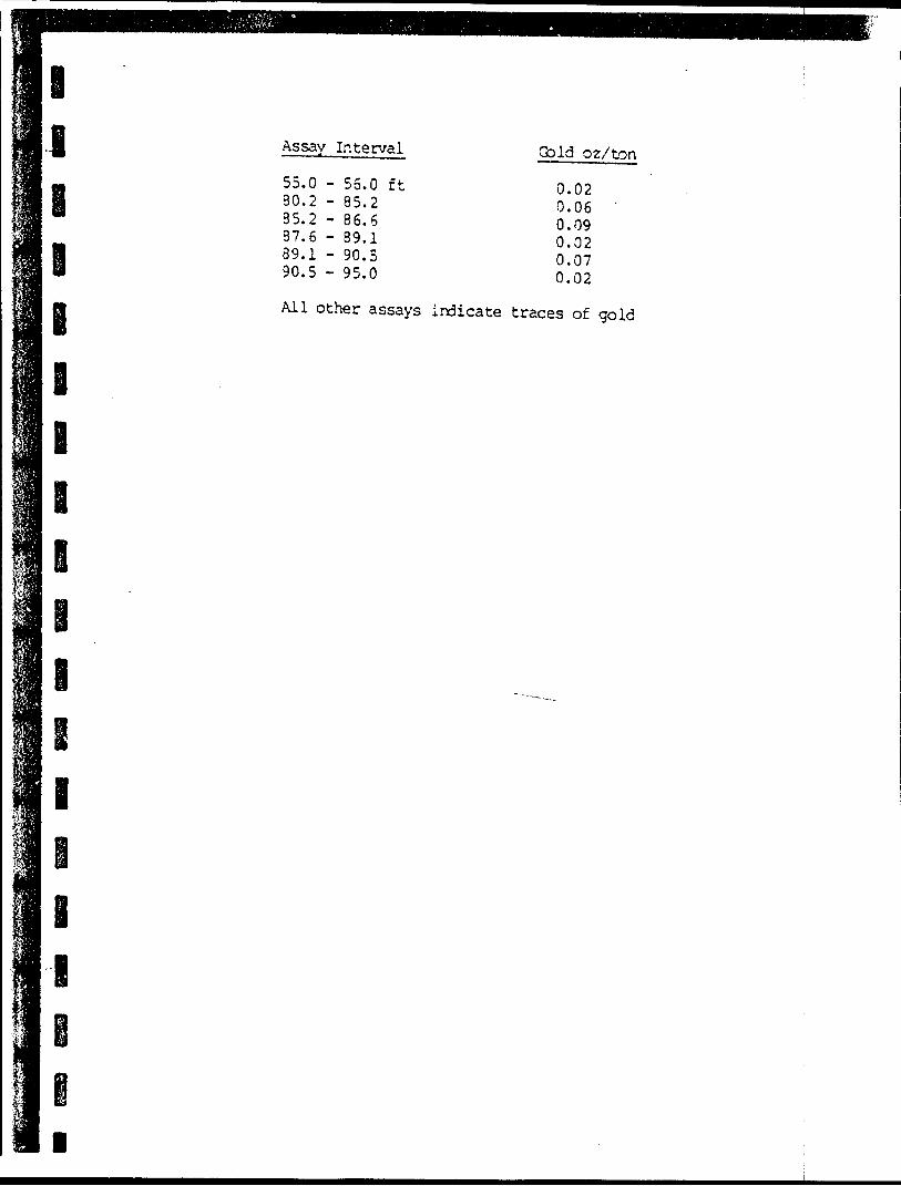
J
i l
e
i
Assay Interval (bid oz/ton
0.020.06 '0.090.020.070.02
All other assays indicate traces of gold
55.080.285.287.689.190.5
- 55.- 85.- 86.- 89.- 90.- 95.
0 ft26150
e i
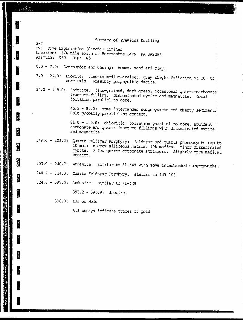
IIl l l
l
e i
Sumrary of Previous Drillirn S-7By: Cone Exploration (Canada) Limited Location: 1/4 mile south of Horeseshoe Lake ?A 392266 Azimuth: 060 Dip: -45 '
0.0 - 7.0: Overburden and Casing: humus, sand and clay. ;
7.0 - 24.0: Diorite: fine-to mediura-^rained , grey slight foliation at 20" to ; core axis. Fcssibly porphyritic dacite.
24.0 - 149.0: Andesite: fine-grained, dark green, occasional quartz-carbonate;fracture-filling. Disseminated pyrite and magnetite. Local ; foliation parallel to core.
45.5 - 81.0: some interbanded subgreyvacke and cherty sediment. Hole probably paralleling contact.
31.0 - 149.0: chloritic, foliation parallel to core, abundant carbonate and quartz fr act ore-filling s with disseminated pyrite and magnetite.
149.0 - 203.0: Quartz Feldspar Porphyry: feldspar and quartz phenocryst^ (up to 10 mm.) in grey siliceous matrix, 101 rrafics. Minor disseminated pyrite. A few quartz-carbonate stringers. Slightly more mafic la t contact.
203.0 - 240.7: Andesite: similar to 31-149 with sone interbanded subgreyvvacke .
240.7 - 324.0: Cuartz Feldspar Porphyry: similar to 149-203
324.0 - 398.0: Andesite: similar to 81-149
392.2 - 396.9: d:.orite.
398.0: End of Hole
All assays indicate traces of gold
i
i i i
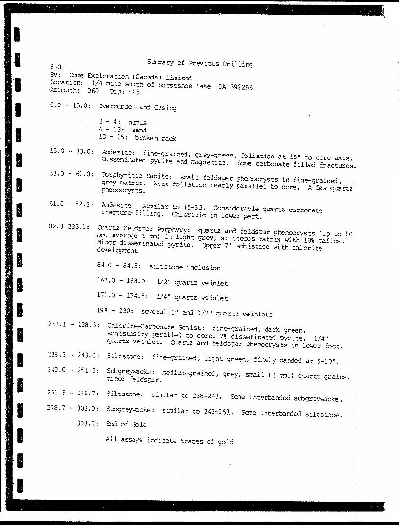
li l l l l
I
l
l i l
Sumrarv of Previous Drilling S-S3y: Dome Exploration (Canada) Limited Location: 1/4 nil e south of norseshce Lake PA 392266 Azimuth: 060 Dip: -45
0.0 - 15.0: Overburden and Casing
2 - 4 : humus 4-13: sand 13 - 15: broken rock
15.0 - 33.0: Andesite: fine-grained, grey-green, foliation at IS 3 to core axis. Disseminated pyrite and magnetite. Seme carbonate filled fractures.33.0 - 61.0: Porphyritic Cacite: small feldspar phenocrysts in fine-grained,grey matrix. Weak foliation nearly parallel to core. A few quartz phenocrys ts.
61.0 - 82.3: Andesite: similar to 15-33. Considerable quartz-carbonatefracture-:illing. Chloritic in lc^er part.32.3 233.1: Quartz Feldspar Porphyry: quartz and feldspar phenocrysts (up to 10 mn, average 5 mm) in light grey, siliceous matrix with l (ft rafics. Minor disseminated pyrite. Upper 7' schistose with chlorite development
34.0 - 34.5: siltstone inclusion
167.0 - 153.0: 1/2" quartz ve inlet
171.0 - 174.5: 1/4" quartz veinlet
198 - 230: several l" and 1/2" quartz ve inlets233.1 - 238.3: Chlcrite-Carbonate Schist: fine-grained, dark green,schistosity parallel to core. 7% disseminated pyrite. 1/4" quartz ve inlet. Quartz and feldspar phenocrysts in lc**er foot.238.3 - 243.0: Siltstone: fir.e-crair.ed, light green, finely banded at 5-10".243.0 - 251.5: Subgreyvacke: medium-drained, grey, small (2 zm. ) quartz grains, minor feldspar.
251.5 - 278.7: Siltstone: similar to 238-243. Seme interbanded subgreyvacke . 278.7 - 303.0: Subgreywacke: similar co 243-251. Seme interbanded siltstone.
303.0: End of Hole
All assays indicate traces of gold
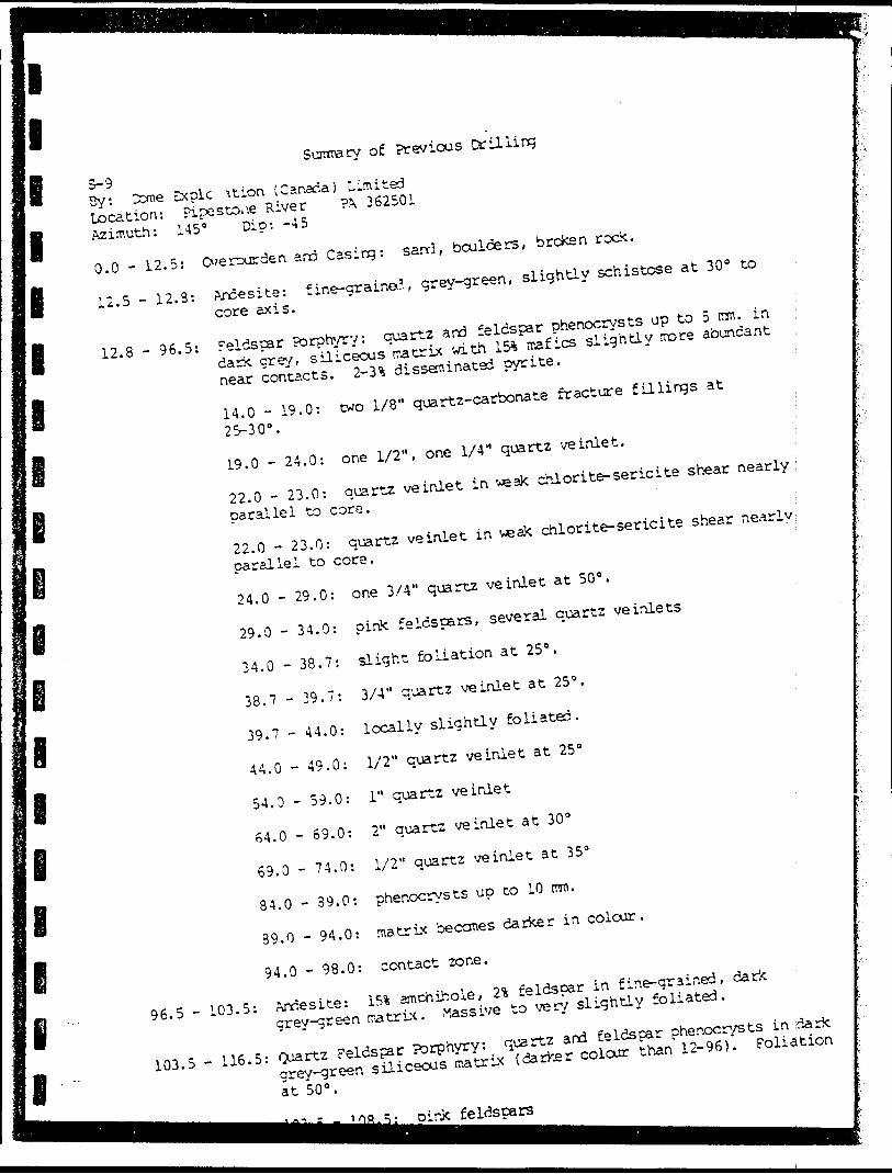
e
i e
ei i i
S-.93y: :cme Sxplc \tion (Canada) Limited
Surarery of Previous Drilling
Location: Pipestone River 362501
Azimuth: 145" Dio: -45
0.0 - 12.5: Overburden and Casing: sard, boulders, broken rock.
12.5 - 12.3: Andesite: fine-grained, grey-green, slightly schistose at 3Q 0 to
core axis.
12.8 - 96.5: Feldspar ?orphyry: quartz and feldspar phenocrysts up to 5 ran. in
dark grey, siliceous rcatrix with 15% rcafics slightly acre abundant
near contacts. 2-^ disseminated pyrite. \
14.0 - 19.0: two 1/8" quartz-carbonate fracture fillings at
2S-30 0 .
l
19.0 - 24.0: one 1/2", one 1/4" quartz ve inlet.
22.0 - 23.0: quartz ve inlet in !*eak chlorite-sericite shear nearly j
parallel to core.
'~.
22.0 - 23.0: quartz veinlet in weak chlorite-sericite shear nearly;
parallel to core.
:
24.0 - 29.0: one 3/4" quartz veinlet at 50 0 .
29.0 - 34.0: pirie feldspars, several quartz ve inlets
34.0 - 38.7: slight foliation at 25 a . :
38.7 - 39.7: 3/4" quartz veinlet at 25 s .
39.7 - 44.0: locally slightly foliated.
44.0 - 49.0: 1/2" quartz veinlet at 25 0
54.0-59.0: l" quartz veinlet
64.0 - 69.0: 2" quartz veinlet at 30"
69.0 - 74.0: 1/2" quartz veinlet at 353
84.0 - 39.0: phenocrysts up to 10 rcra.
89.0 - 94.0: matrix becomes darker in colour.
94.0 - 98.0: contact zone.
96.5 - 103.5: Andesite: i5% amchihole, 2* feldspar in fine-grained, dark
grev-green tratrix. Massive to very slightly foliated.
103.5 - 116.5: Quartz Feldspar PDrphyry: quartz and feldspar phenocrysts in dark
grey-^green siliceous roatrix (darker colour than 12-96). Foliation
at 50 0 .
feldspars
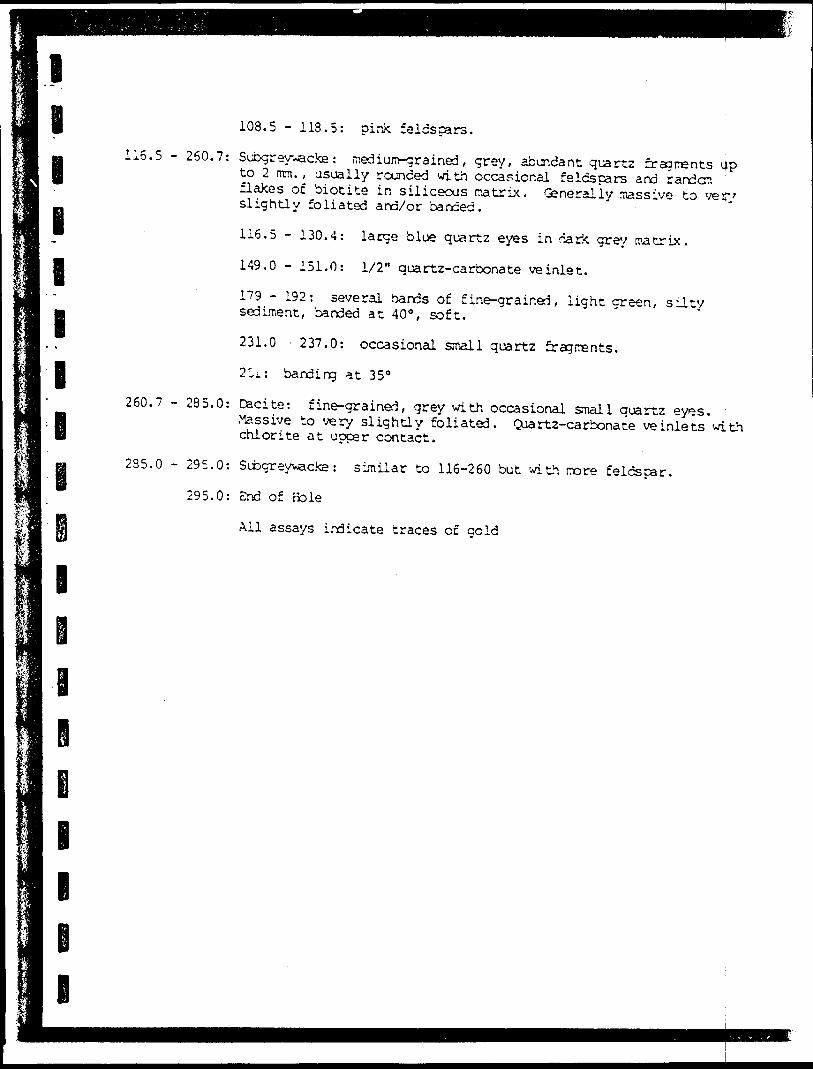
l l B l l l lB
108.5 - 113.5: pink feldspars.
116.5 - 260.7: Subgrey~acke: medium-drained, grey, abundant quartz fragments up to 2 mm., usually rounded with occasional feldspars and random flakes of biotite in siliceous r-atrix. Generally massive to ve r/ slightly foliated and/or banded.
116.5 - 130.4: large blue quartz eyes in nark grey matrix.
149.0 - 151.0: 1/2" quartz-carbonate veinlet.
179 - 192: several bands of fine-grained, light green, silty sediment, banded at 40 0 , soft,
231.0 237.0: occasional small quartz fragments.
2 r.j.: banding at 35"
260.7 - 285.0: Dacite: fine-grained, grey with occasional small quartz eyes.Massive to very slightly foliated. Quartz-carbonate ve inlets with chlorite at upper contact.
235.0 - 295,0: Subcreywacke : similar to 116-260 but with rore feldspar.
295.0: End of fcle
All assays indicate traces of gold
B
1
B B
BML
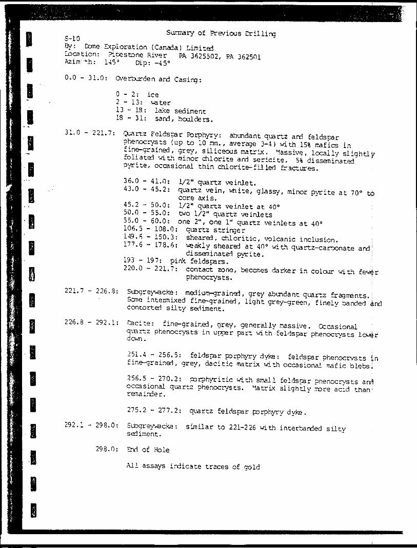
l
l
l
i
Surcmary of Previous DrillingS-10By: Done Exploration (Canada) Limitedlocation: Picestone River PA 3625502, PA 362501Azinr ".h: 145 3 Dip: -45"
0.0 - 31.0: Overburden and Casing:
0-2: ice 2 - 13: water 13-18: lake sediment 18 - 31: sand, boulders.
31.0 - 221.7: Quartz Feldspar Porphyry: abundant quartz and feldspar phenocrysts (up to 10 mm., average 3-4) with 15* irafics in fine-grained, grey, siliceous matrix. Passive, locally slightly foliated with minor chlorite and sericite. 5% disseminated pyrite, occasional thin chlorite- filled fractures.
to
221.7 - 226.3:
36.0 - 41.0: 1/2" quartz veinlet.43.0 - 45.2: quartz vein, white, glassy, minor pyrite at 70
core axis.45.2 - 50.0: 1/2" quartz veinlet at 40 0 50.0 - 55.0: two 1/2" quartz veinlets 55.0 - 60.0: one 2", one l" quartz veinlets at 40" 106.5 - 108.0: quartz stringer149.6 - 150.3: sheared, chloritic, volcanic inclusion. 177.6 - 178.6: weakly sheared at 40" with quartz-carbonate
disseminated pvrite. ; 193 -197: piak feldspars.220.0 - 221.7: contact zone, becor.es darker in colour with few^r
phenocrysts. ;Subgreywacke: medium-grained, grey abundant quartz fragments.; Seme intermixed fine-grained, light grey-green, finely banded 4ind contorted silty sediment.
226.8 - 292.1: Cacite: fine-grained, grey, generally massive . Occasional quartz phenocrysts in upper part with feldspar phenocrysts
292.1 - 298.0:
298.0:
251.4 - 256.5: feldspar porphyry dyke: feldspar phenocrysts in fine-grained, grey, dacitic matrix with occasional mafic blebs l256.5 - 270.2: porphyritic with small feldspar phenocrysts and occasional quartz phenocr/sts. Matrix slightly more acid than ; remainder.
275.2 - 277.2: quartz feldspar porphyry dyke.
Subgreywacke: similar to 221-226 with interbanced silty sediment.
End of Hole
All assays indicate traces of gold
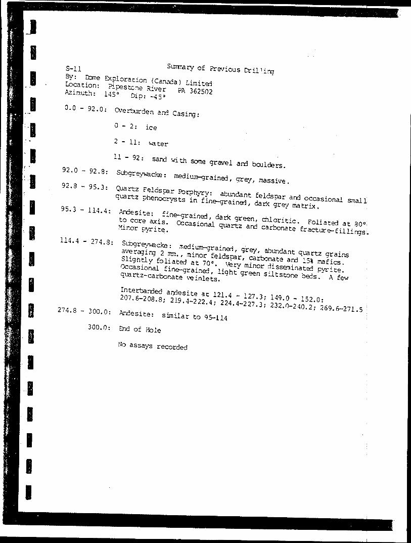
J
I
I l I l
l
lB8 l l l
Summary of PreviousS-ll
3y: Cone Exploration (Canafa) Limited Location: Pipestone River PA 362502 Azimuth: 145 a Dip: -45'
0.0 - 92.0: Overburden and Casing:
O - 2: ice
2 - 11: vater
11 - 92: sand with some gravel and boulders.
92.0 - 92,8: Subgraywacke: medium-grained, grey, massive.
92.3 - 95.3: Qoartz Feldspar Porphyry: abundant feldspar and occasional smallquartz phenocrysts in fine-grained, dark grey matrix.
95.3 - 114.4: Andesite: fine-grained, dark green, chloritic. Foliated at 30"to core axis. Occasional quartz and carbonate fracture-fillings,. Minor pyrite.
114.4 - 274.3: Subgreyvacke : medium-grained, grey, abundant quartz grainsaveraging 2 mm., minor feldspar, carbonate and 15* nafics. i Slightly foliated at 70 a . Very minor disseminated pyrite. Occasional fine-grained, light green siltstone beds. A few quartz-carbonate ve inlets.
Interbanded andesite at 121.4 - 127.3; 149.0 - 152.0: : 207.6-208.8; 219.4-222.4; 224.4-227.3; 232.0-240.2; 269.6-271.5 ;
274.8 - 300.0: Andesite: similar to 95-114 :
300.0: End of Bole
No assays recorded

l
l S-12Suntrary of Pre/ious Drilling
l
l
l
l
Sl l l
By: Dome Exploration (Canada) Limited Location: Pipestone River ?A 362501 Azimuth: 145 0 Dip: -45 0
0.0 - 10.0: Overburden and Casing: sand and broken rock.
10.0 - 146.3: Quartz Feldspar Porphyry: abundant quartz and feldsparphenocrysts (up to 10 mm.) with 151 mafics, massive to slightly foliated. A few quartz stringers. Very minor disseminated pyrite.
143 - 146: darker grey-green, chloritic, schistose.
146.3 - 162.0: Subgreyvecke: medium-grained, grey, foliated at 40 0 to core axis.
162.0 - 135.8: Quartz Feldspar Porphyry: similar to 10-146. Occasionalquartz-carbonate fracture filling. Very minor disseminated pyrite.
185.8 - 301.0: Subgraywacke : fine-to red i urn-grained, grey, varies considerably in texture, locally faintly banded and slight schistose. Minor inclusions of andesite. Occasional quartz and carbonate ve inlets.
302.0: End of Hole
All assays indicate traces of gold
l
l
l
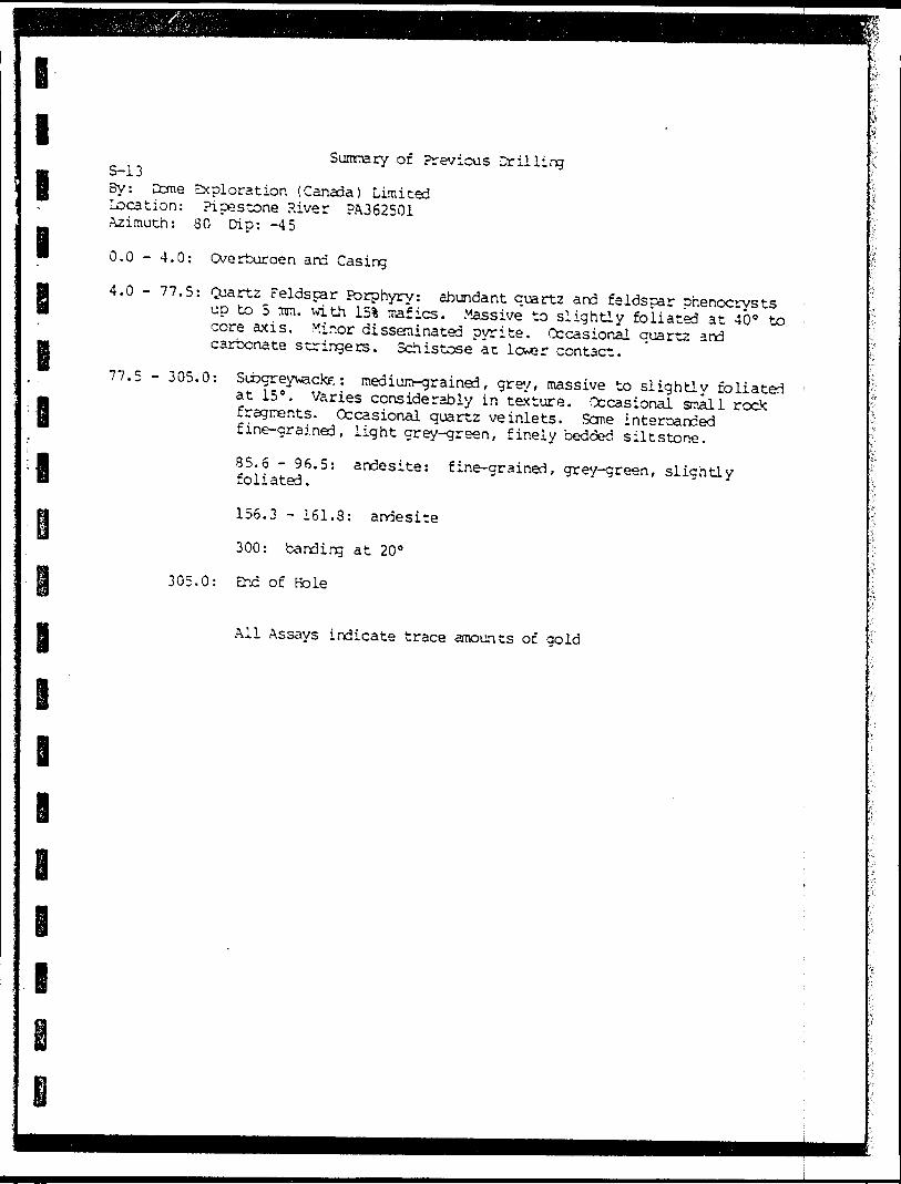
l l l l l l I
Summary of Previous Drilling S-133y: Cone Exploration (Canada) Limited Location: Pipestone River PA362501 Azimuth: 80 Dip: -45
0.0 - 4.0: Cverburaen ard Casing
4.0 - 77.5: Cuartz Feldspar Porphyry: abundant quartz and feldspar phenocrysts up to 5 mn. with 151 mafics. Massive to slightly foliated at 40" to core axis. Minor disseminated pyrite. Occasional quartz and carbonate stringers. Schistose at lower contact.
77.5 - 305.0: Subgreywacte : medium-grained, grey, massive to slightly foliated at 15". Varies considerably in texture. Occasional small rock fragments. Occasional quartz ve inlets. Seme interbanced fine-grained, light grey-green, finely bedded siltstone.
35.6 - 96.5: andesite: fine-grained, grey-green, slightlyfoliated.
156.3 - 161.8: andesite
300: banding at 20 0
305.0: End of Hole
B All Assays indicate trace amounts of gold
B i
B
l HORSESHOELAKE
i
i
I
l
I
l
I
S l l l
Drill Hole LocutionDrill Hole X Depth in Metre!LithologyMetolic Mineroli
1,000 J.OOO It,
100 700 300 400 500
NORCEN ENERGY RESOURCES LTD.
ASSESSMENT SUMMARY
1976 DRILLING BY DOME EXPLORATIONLTD SOUTH CLAIM BLOCK HORSESHOE
LAKE. ;MG. 8_____ DecL 1981
l i l
l
y of Previous Drilling S-14By: come Exploration (Canada) Limited 1976 Location: South Group, 1020'M -*- 450'E of post l PA 392556 Azimuth: 242" Dip: -45" '
O - IS ' Overburden and casing13.0 - 143.0 Andesite medium grained dark grey - greenfresh generally massive, minor disseminated pyrite, 143.0 161,0 Dacite - fine grained grey, slighty chlorite in upper part142.8 - 146.6 chloritic dacite146.6 - 148.2 3/4 inch quartz ve inlet148.2 - 150.2 chloritic dacite150.2 - 151.2 2 inch quartz veinlet visible gold, minor py,cp, galena151.2 - 152.2 chalcopyrite (cp), galena153.2 - 155.2 chloritic dacite
161.0 - 298.0 Andesite - fine grained dark grey green slightly foliated at 45 Cto core axis - some biotite
218.0 - 221.5 5% pyrite as blebs and disseminations 249 becomes slightly more siliceous 270 -275 5% disseminated pyrite 275 - 290 porphyritic with feldspars and occasionalphenocrysts 290.2 - 294.4 felsic volcanic locally banded at 45 0298: End of Hole
iKfo assays present in assessment file
i l ei i
l e i
i i
S-15By: DomeLocation:Azimuth:
0.0 - 7.0
7.0 - 268.
l
E
Summary of Previous Drilling
Exploration (Canada) LimitedSouth Group, l mile south of Horseshoe Lake PA 392257
242" Dip: -45
Overburden and Casing
4 Andesite: medium-grained, dark grey-green, generally fresh, massive (possibly intrusive), minor disseminated pyrrhotite, pyrite.
99:06" irregular green, felsic vein.
113.8 - 163.2: medium-grained, grey with biotite flakes and some carbonate - possibly lamprophyre. Becomes foliated at depth. (45" to core axis).
129.5 - 131.1: l" quartz ve inlet.131.1 - 133.5: 1/2" quartz ve inlet133.5 - 138.8: schistose, biotitic.138.8 - 140.0: l" quartz veinlet140.0 - 143,0: similar to 133 - 138
172.7 - 188.7: schistose, biotitic with unaltered section at 132.3-184.4
201 - 206: medium-grained, grey, quartz diorite (?) :
206 - 268: fine-grained, dark green, slightly more siliceous, i occasional feldspar crystals - -
222 s 247: pink feldspar crystals
268.4 - 289.4: Quartz Feldspar Porphyry: small quartz andfeldspar phenocrysts in grey, siliceous matrix with some mafic material. Occasional blebs anri stringers of pyrite. Sane included volcanic. Lover contact at 20".
289.4 - 302.0: Andesite: fine-grained, dark grey, minor disseminated pyrite.
302.0: End of Hole
Assays not provided in assessment file
i
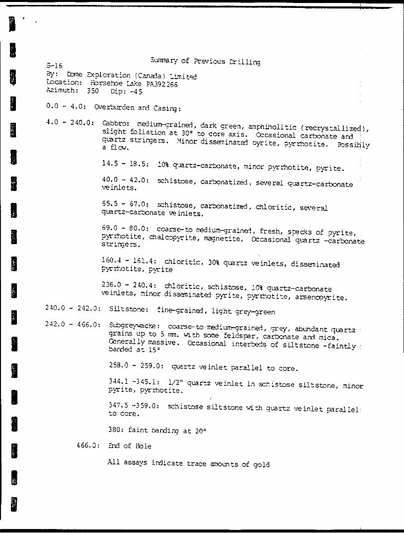
i
i g
i
i
Summary of Previous Drilling S-16By: Come Exploration (Canada) Limited : Location: Borsehoe Lake PA392266 Azimuth: 350 Dip: -45
0.0 - 4.0: Overburden and Casing: ;4.0 - 240.0: Gabbro: medium-grained, dark green, amphiholitic {recrystallizecj) , slight foliation at 30 0 to core axis. Occasional carbonate and \ quartz stringers. Minor disseminated oyrite, pyrrhotite. Possiijly a flow.
i14.5 - 18.5: 101 quartz-carbonate, minor pyrrhotite, pyrite.40.0 - 42.0: schistose, carbonatized , several quartz-carbonate ve inlets.
65.5 - 57.0: schistose, carbonatized, chloritic, several quartz-carbonate ve inlets.
69.0 - 80.0: coarse- to medium-grained, fresh, specks of pyrite, pyrrhotite, chalcopyrite, magnetite, Occasional quartz -carbonate stringers.
160.4 - 161.4: chloritic, 301 quartz ve inlets, disseminated pyrrhotite, pyrite
236.0 - 240.4: chloritic, schistose, lO5* quartz-carbonate veinlets, minor disseminated pyrite, pyrrhotite, arsenopyrite.240.0 - 242.0: Siltstone: fine-grained, light grey-green242.0 - 466.0: Subgreywacke : coars e- to medium-grained , grey, abundant quartz grains up to 5 mm. with some feldspar, carbonate and mica. Generally massive. Occasional interbeds of siltstone -faintly banded at 15 s
258.0 - 259.0: quartz ve inlet parallel to core.
344.1 -345.1: 1/2" quartz ve inlet in schistose siltstone, minor pyrite, pyrrhotite.
347.5 -359.0: schistose siltstone with quartz veinlet parallel to core.
380: faint banding at 20 0
466.0: End of Hole
All assays indicate trace amounts of gold
i
ei i i i i i
APPENDIX II
ASSAY CERTIFICATES
l
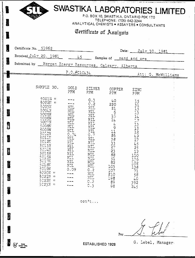
l
l l
SWASTIKA LABORATORIES LIMITEDP.O. B OX 10, SWASTIKA, ONTARIO POK 1TO
TELEPHONE: (705) 642-3244 ANALYTICAL CHEMISTS * ASSAYEBS * CONSULTANTS
(Uprttfiratp nf Analysis
Certificate No. 51962 Date: Julv 30. 1931Received Julv 20. 1931 45 Samples of sane ana ereSubmitted bv Moreen. Energy Resources. Calsarv. Alberta
?.O.^C1C434 AtwiG. McWilliams1l SAMPLE NO.m
B 5 00 IN * I 5002N *
i 5003N
B 5004N5005N5C06N
* ? OC7Nm 5 008N6* 50CQN
5010N
8 5 01 IN501 2N5013N
f 501uN50 1 5N5015N5017N
H 501eN* 5019N
5020N *
f 50 2 IN :;-"5022N :' :5C23N "
GOLDPPM
---
NILNILNILNILNILMILNIL0.74NILNILNILNILNILNILNILNIL0.09-~---.,-~--~-
S ILVERPPM
0.3 0.2NILNILNILNILNILNILNIL0.7MILNILNILNILNILNILNILNIL0.2NILNILO 0^ . f .n -j- ^ . j
COPPERPPM
40 220216
1014
;C-
9li3633332723S35132
1031072101933993
ZINC :PPM
15 ; 311513 -17 '13 :15124917452512
110176102133715340
392245
Per.
ESTABLISHED 1928G. Lebel, .Manager
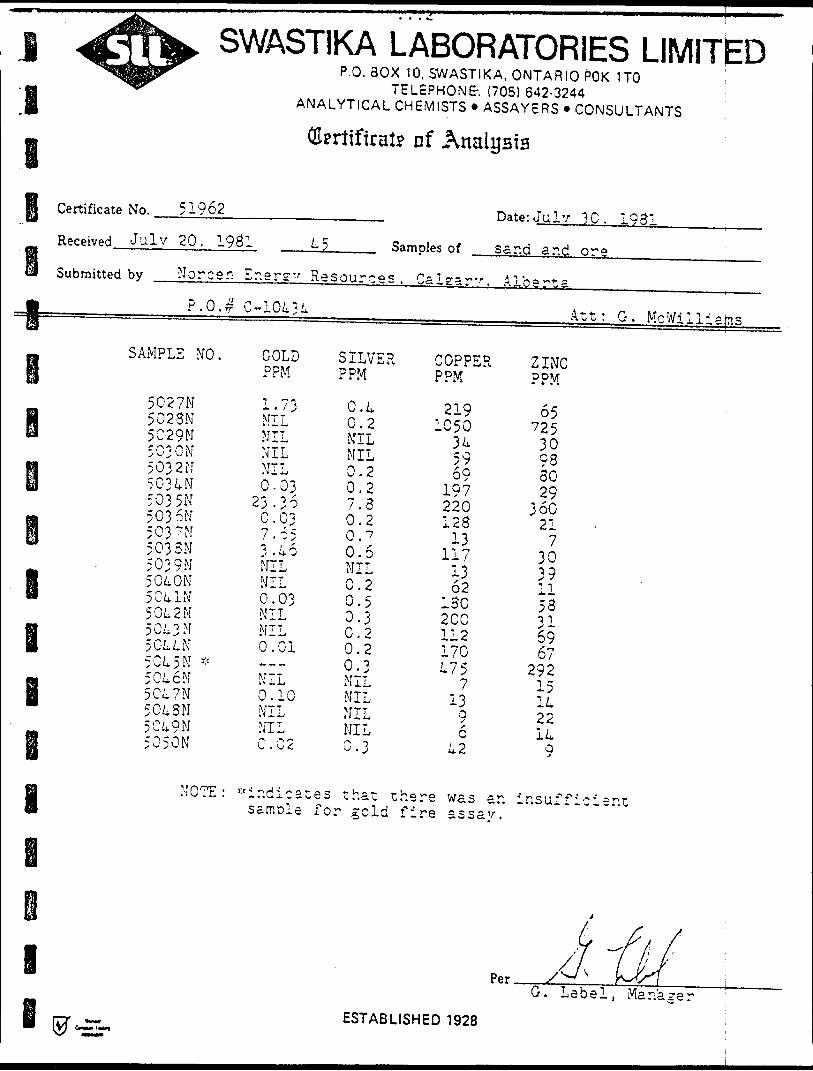
SWASTIKA LABORATORIES LIMITEDP.O. BOX 10, SWASTIKA, ONTARIO POK 1TO
TELEPHONE. (705) 642-3244 ANALYTICAL CHEMISTS * ASSAYERS * CONSULTANTS
Olpritfirai? nf Analysia
I
e
Certificate No. 51962
Received July 20, 1981
Submitted by Norcen E
P.0.# C
SAMPLE NO.
5027N5023N5C29N503 ON5032M5 03 4 M503 5N503 6N503 nr503 SN503 9N5 04 ON5 04 IN5 04 2 M5043 M5044N5C45N *5046N5C47N5C43N5049N5050N
4 5 Samples of
ne r s 'f
-10434
GOLDPPM
1.73APT 1
NILNILNIL0-03
23-360 . 037.65-i.46-NILNIL0.03NILMIL0.01-~-NIL0.10MILNIL0.02
Resources .
SILVERPPM
0.40.2NILMIL0.20.27.30.20.70.6NIL0.20.50.30.20.20.3NILMILNILNIL0.3
Calearv.
COPPERPPM
2191050
345969
197220123
13117
1362
130200112170475
713
96
42
Date: July 30. 1931
sand and ore
Alberta
Art: G. Mcwilliams
ZINCPPM
6572530933029
36021
730391153y~6967
29215142214
9
NOTE: -indicates that there was an samcle for geld fire assay.
insurricier.t
iESTABLISHED 1 928
G. Lebel, Manager
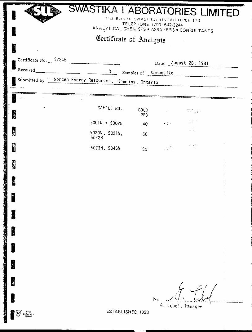
l
l
I
l
l
Certificate No.
Received
/AST1KA LABORATORIES LIMITEDV'U.BU'-' 1O, L:WA;, l l KA. OH I'ACKJ I'UK l TO
TELEPHONE. (705) 642-3244 ANALYTICAL CHEiVSTS * ASSAYERS * CONSULTANTS
t? of Analysis
Date: August 28, 1981
Samples of CompositeSubmitted by Norcen Energy Resources. Tiwnins. Ontario
1SAMPLE NO.
5001N * 5002N
5020N, 5021N, 5022N
5023N, 5045N
GOLD PP8
40
60
e i
i
e ie
r f X*
G. Lebel.ESTABLISHED 1923
1 ^1'^ OVVA;iP ^BM^H^MSIMW^^^ISWF
11H Certificate No. 52176
Received
B f Submitted by Morc9r, Er.erg"
DiirvM LMDUnMi unite:P.O. BOX 10, SWASTIKA, ONTARIO POK 1
TELEPHONE: (705) 642-3244
) LIMJ 1 C.UTO
ANALYTICAL CHEMISTS * ASSAYERS * CONSULTANTS ;
(Eprttfiralp of Analysis
Date: Aug. ?t
33 Samples of pn"i ps f r-nm pr:— -" ————— r . — t — * — t *j — - — — ~* — f— —
1 OR]
i
1 ^
S"'
SAMPLE NO. ARSENICf PPM
i 1 5 003 M 2*500k 2
B 5005 ^15006 25007 15003 2
fi 5009 1® 5010 35011 k
B 5012 2 5013 1501k 2
B 5015 3305016 2500
: 501- kOO: a 5013 5k; I 5019 20001
.
1
eiB ®^
SAMPLE NO.
5 027 M5023502950305032503k5035503650375038 503950kO50kl50k25Ck350kk50ko5 Ok 75 Ok 850k9^0 C 0
i
^/J
G. LebelESTABLISHED 1928
ARSENIC ;PPM ;
121622
800k 000
kO1617
22T,2
202
20kS222
52
/y
7 ^ yv// i/N^v 7
, Manager
lASSAYERS (ONTARIO) LIMITED33 CHAUNCEY AVENUE TORONTO. ONTARIO M82 222 - TELEPHONE (416) 239-3527
Certificate of Analysis
Certificate No. NO-O l
;. Received October 16, 1981 11 Samples ofSubmitted by Norcen Energy Resources Ltd.
Date: October 22, 1981
___Rock—————....—.—.————. Att'n; Mr. G. Mcwilliams
Sample
551
552
553555
556
558
559560
561
564
567
Au ppb
'.'10
•ao
170
Ag ppm
O. l 0.10.1
1.4O. l
0.5
O . l
Per
ASSAYERS/ONTARIO) LIMITED
ANANYTICAL CHEMISTS - ASSAYING - CONSULTING . ORE DRESSING - REPRESENTATION
ASSAYERS (ONTARIO) LIMITED32CKAU','CEYAVE' ' 'E. TORONTO. ON'TAnIO K'.cZ 2Z2 - TELEPHONE (416) 23S-3S27
CERTIFICATE OF ANALYSIS
Certificate No. Dare: Ocrcber 22, ISP1Received October 16, i :-l
Submitted by Kcrcer. Ir.ercy Resources
Au Ac i-rSC Sarr^Ies of: OverburcerXAu Ac ,As -EC
Mr . G . .McV.'i 11 i arr.s
Au -SO .u -SOSample f
C-ll
C-12
C-12 A
C-13
Ac -f S O
<0. l
0.2
< O . l
Ac -SOppm
D . l
2.2
0. 6
? . 3
As -80
120
106
< 0 .1C-1 8
I
ASSAYERS (ONTARIO) LIMITED33 CHAUNCEY AVENUE, TORONTO. ONTARIO M3Z 222 - TELEPHONE (416) 239-3527
CERTIFICATE OF ANALYSIS
Certificate No. NO-02
r^ Received October 16, -
Date: October 22, 1981
Sample of: Overburden
Submitted by Norcen Energy Resources Att'n: Mr. G. Mcwilliams
Sample -f+80 Mesh
% Fraction-80 Mesh
% Fraction
ii
C-ll
C-12
C-12A
C-13
C-14
C-15
C-16
C-18
75.5
66.8
79.9
88.1
83.7-
84.4
57.9
48.8
ASSAYERS /(GS7ARIO 2Tl*fITED
hn van Engelen
ANANYTICAL CHEMISTS - ASSAYING - CONSULTING - ORE DRESSING - REPRESENTATION
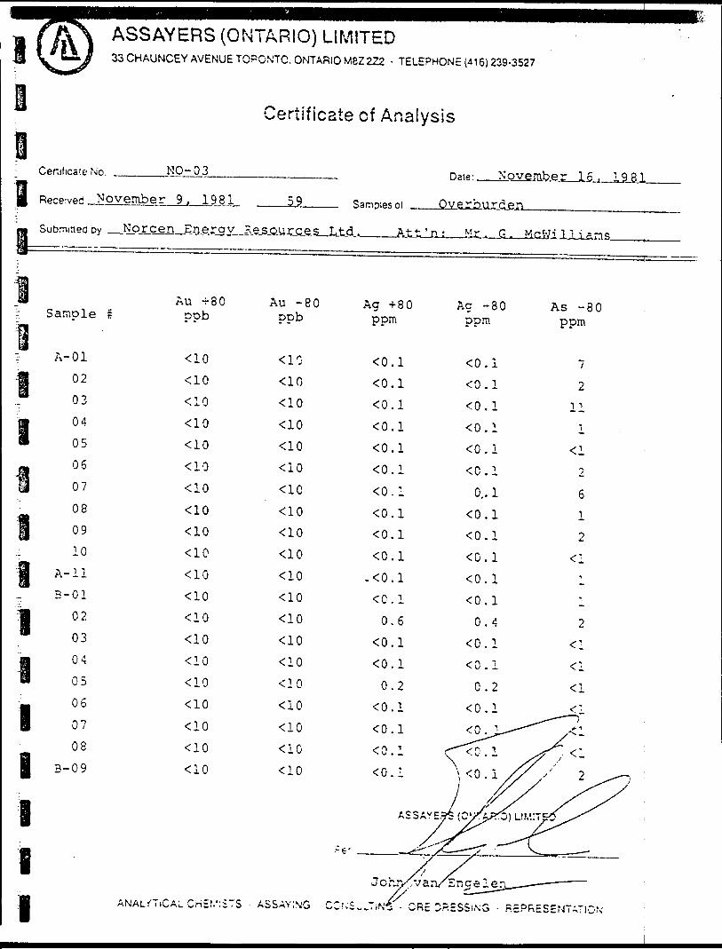
ASSAYERS (ONTARIO) LIMITED33 CHAUNCEY AVENUE TORONTO. ONTARIO M8Z 222 - TELEPHONE (416) 239-3527
Certificate of Analysis
Certificate No. NO-O 3 Date: November l 6, ,.198,1.3R, S
i) ———
f
l
iif-
aI•-iioP
1f;
1ii iI
prp-vpf! November 9, 1981 59
uDmineODy Norcen Erieray E.e.sjiu.rjLes-J
Au -i- 30 Au -80 Sample r ppb ppb
A-oi *ao <lo02 <10 <1003 <10 <1004 <10 *C1005 <10 <1006 <10 <1007 <10 <1C08 -^10 <1009 <10 < '1010 <10 <10
A-ii -ao <loB-01 <10 <10
02 ^0 <10 03 <10 -CIO04 <10 <1005 ^ ^ 0 ^1006 <10 <iO 07 "ClO <1008 <10 <iO
B-09 <10 <10
^ ——
Ag +80 ppm
0.10.10.1O.IO.IO.IO.I0.10.10.1
-O.I0.1
0.6 0.10.10.2
O.I0.1O.I O.!
Overburden
t ' n : Mr . G . McWi 1 ' i sms
Ac -80 As -80 ppm ppm
O.I 7O.I 20.1 110.1 1o.i -aO.I 2
0,. 1 60.1 1O.I 2O.I -ci0.1 10.1 10.4 2
0.1 < lo.i *a0.2 -ci
O.I ^ :
O.ly^/' 2^o
ASSAYS^ (O^^LIMiTe^X^
.-P- ^^"s(——^-s ' ^~~— — — —
ANALYTICAL CHE.'.':STS ASSAYING
Johnco.;s..7,N^
/ /'V v arv E ne elerx-— — - — ~ ' —ORE D?.5SSi,\o - REPRESENTATION ;
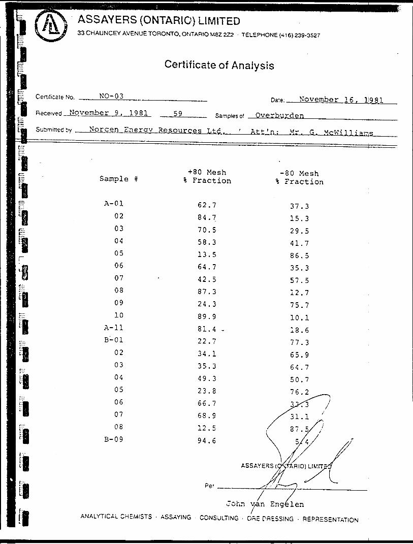
ASSAYERS (ONTARIO) LIMITED33 CHAUNCEY AVENUE TORONTO, ONTARIO M8Z 222 TELEPHONE (-i 16) 239-3527
Certificate of Analysis
lit— Certificate No. NO-O 3 Date: November 16, 1981Received November 9 , 19.81, 59 Samples of Overburden,Submitted t Norcen Energy Resources Ltd., Jitt'n; M.r. G. McKilliaas.
+ 80 Mesh Fraction
80 Mesh Fraction
rr
l
lr*"ii i i
A-01
02
03
04
05
060708
0910
A-11 B-01
02
03
04
05
060708
8-09
62,84,
70,
58.3
13.57
5
3
.3
64,42,87,
2489.981.4 -22.734.135.349.323.8
66.768.912.594.6
37.315.329.541.786.535.357.512.775.710.118.677.365.964.750.7
Per
John \jan Engelen ANALYTICAL CHEMISTS - ASSAYING - CONSULTING - ORE DRESSING - REPRESENTATION
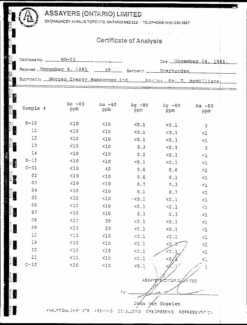
I~~ t f\\ ASSAYERS(OW ^ *i*LS^ 33 CHAUNCEY AVENUE TOP
?|
p CftnifiCSTP Mr, NO- 03
8 Received November 9, 1981
C™ Au +80
•^ Sample s pob
PI1*2 B - 10 <10
ri l l * 10L.. 12 <101 1-*.".*N ;: :;:
6 3-15 <10j C-Oi <10
S1" 0 2 < 1003 <10
bg 04 ^0
*1 05 ^0I.... 06 <10
g 07 *101 08 <10III 09 ^0
f 1 0h ;: :i:PI c.;; :::li li• |:'8 ANALYTICAL CrE' ' 5~S
FARIO) LIMITEDCXTC. ONTARIO MSZ 222 - TELEPHONE;-! 6; 239-3527
Certificate of Analysis ji
2ve- November 16, 19^1.59 Sarr.-ie?-' Overburden :
2 source s Ltd. At" 'i: Mr. G. McWill i'r.s j
Au -80 Ag -80 Ac -80 As -80 ppb . ppn ppm pprn
<10 <0.1 <0.1 2^0 <0.1 <0.1 <l•CIO <0. 1 <0 . 1 <l<10 0.3 O.I 3*ao 0.2 o.i ^i<10 <0 . 1 <0 . 1 *:i
40 0.6 0.6 <l'CIO 0.6 0.1 <l<10 0.7 0.3 < l<10 0.1 0.7 < l<10 - <0. 1 <C . 1 'Ci<10 <C.1 <0.1 <l*C10 0.3 0.3 <i
30 O.I O.I ^20 <0.1 <0.1 <l
<10 0.1 <0.1 Uoo * i:i ^y *"lo * :l \ ffi /?\
,^L^.-r'7- ,joan v/in r,ngelen/' t
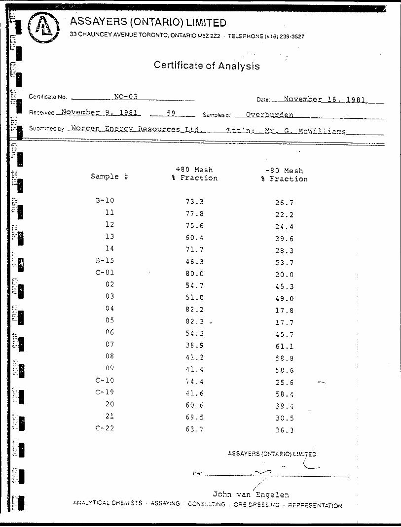
iLi
ASSAYERS (ONTARIO) LIMITED33 CHAUNCEY AVENUE TORONTO. ONTARIO M8Z 222 - TELEPHONE D15)239-3527
Ev
11 ":: Cenificate No.teB
m Received Novr.v
t; --a SuDrr,;ned Dy Ji
rPBIBf"l,t'"::
S""
' iv |
E-
^i
,-iC.'.'..IB
B!.-.
IBi
IB[ii
Certificate of Analysis
NO- 03
amber 9, 1981
arjsfin-SDfirsiL-
Sample r
3-10
11121314
B-15C-01
0203040506070809
C-10
C-19 2021
C-22
59 Samples c!
Resources Ltd. Tit
+80 Mesh\ Fraction
73.377.875.660.471.746.380.054.751.082.282.3 -54.338.941.241.4
'i 4 . 4
41.6 60.669.563.7
nxp- November 16, 1981
Overburden
t'n: M.r . G. McWiliiams
-80 Mesh% Fraction
26.722.224.439.628.353.720.0 i45.3 i49.0 ;17.8 :17.7 !45.7 161.1 i58.8 '58.625.6 — i58.4 ;39.4 ;
30.5 :36.3 ;
ASSAYERS (ONTARIO) LIMITED :., (
p..
JohnANALYTICAL. CHEMISTS ' ASSAYING - CONSULTING -
-^.-^/'
fvan Engeien
CnE DRESSING - REPRESENTATION
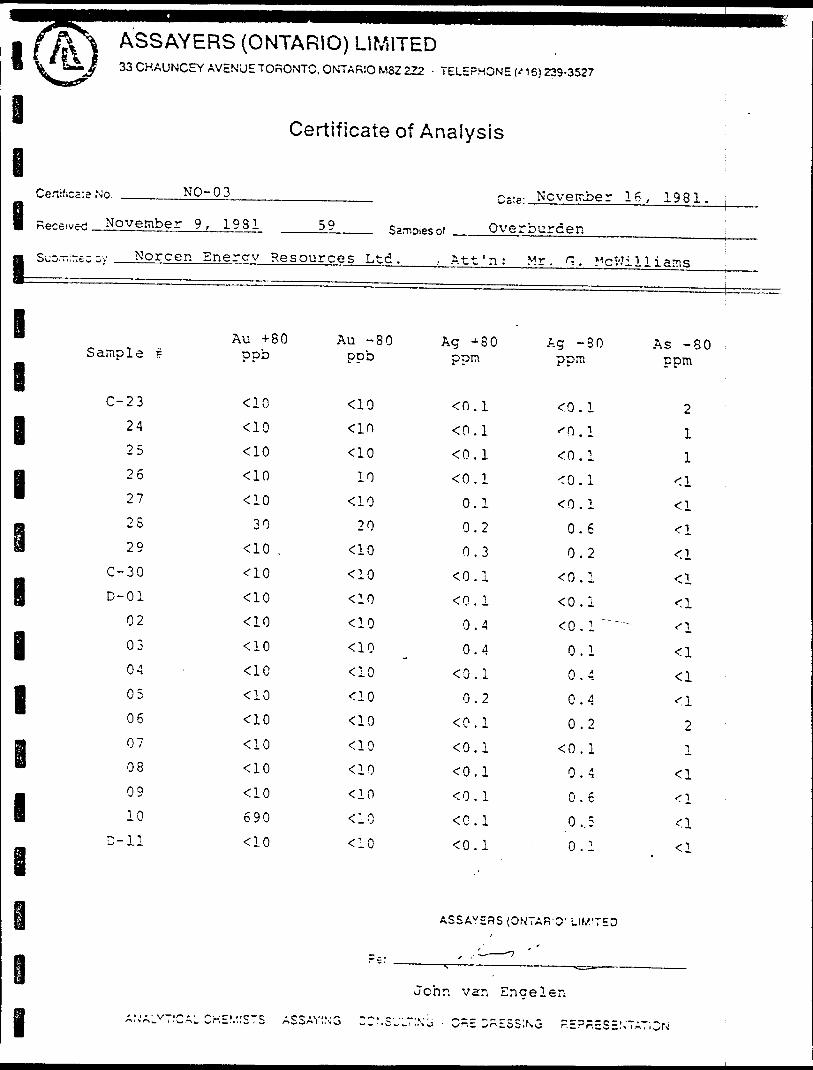
l ASSAYERS (ONTARIO) LIMITED33 CHAUNCEY AVENUE TORONTO, ONTARIO M82 222 - TELEPHONE ('15)223-3527
Certificate of Analysis
e1,I s9 ——
I
I
1
1-
i
1
I
1
1
|
M
w*ivwi November 9, 1981 59 s,™,*
,^~~-- sv Norcen Enercv Resources Ltd.
Au +80 Au -80Sample i ppb ppb
C-23 <10 <1024 <lo •ao25 <10 <1026 *ao 1027 <10 <1028 30 2029 -cio . •ao
C-30 -ao <10D-01 <10 <10
02 <10 <1003 <10 <1004 ' <1C <1005 <10 <10 06 <10 <1007 -ao <lo08 <10 <1009 ^0 <1010 690 ac
D-ll <10 <10
s of Overburden j
, Att'n:
Ag + 80ppn
0.10.1<0. 1
0.1
0.1
0.2
0.3
O.I
0.1
0.4
0.4
0. 1
0.2
0.10.1
0.1
O.I
0.1
ASSAYERS
Mr. G. McWil
Ag -80ppm
0.10.1
0. 1
0.1 0.1
0.6
0.2
0.1O.IO. l' """"""
0.1
0.4
0.4
0.2
O.I0.4
0.6
0,5
0.1
(ON7AR-0' LtM'TED
-7
liams -
As - 80 ippm
2 ;11
•^
•a*:i<^_
<l^1
<l
<l
2
1<l<^_
f. l
- < 1
John van Encelen
l \'ALV7!CAI CHEV.'STS ASSAVIN
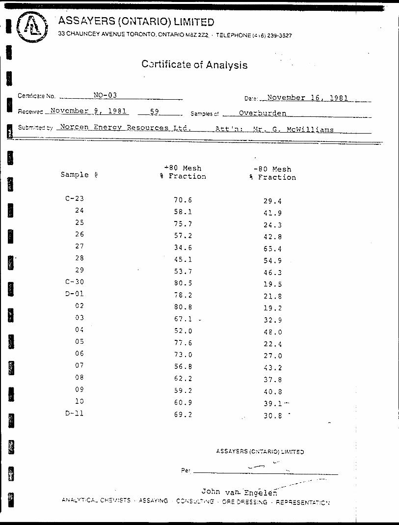
l
l
I
I
ASSAYERS (OMTARIO) LIMITED33 CHAUNCEY AVENUE TORONTO, ONTARIO MBZ 2Z2. - TELEPHONE 1-: 165 23S-3527
Cortificate of Analysis
Certificate No. NO-O 3 November 16, 1981Receives November 9, 1981 59 Samples c! Overburden
Submitted bv Norcen Energy Resources Ltd. ft11 ' n: Mr. G. McWi11 i ams
Samole r+80 MeshFraction
80 Mesh Fraction
I
l
l
C-23
24
25
26
27
28
29C-30 D-01
02
03
04
05
06
07
08
09
10 D-ll
70.6
58.1
75.757.2
34.6
45.153.780
78
80.8
67.1 -52.0
77.673.0
56.8
62.2
59.2
60.9
69.2
29.4
41.9
24.3 42.8
65.4
54.S
46.3 19.5
21.8 19.2
32.9
48.0
22.427.0
43.2
37.8
40.8
39.1-
30.S *
ASSAY5RS (CN'TARIO; LI
re.'
John van- Engele'nANALV T;CAL CHE'.'lSTS ' ASSAYING CCN'S'jLTiNC; - O?.E D RESSING - R
l
l
l
l
APPENDIX III
SCHEDULE OF CLAIMS
l i
l
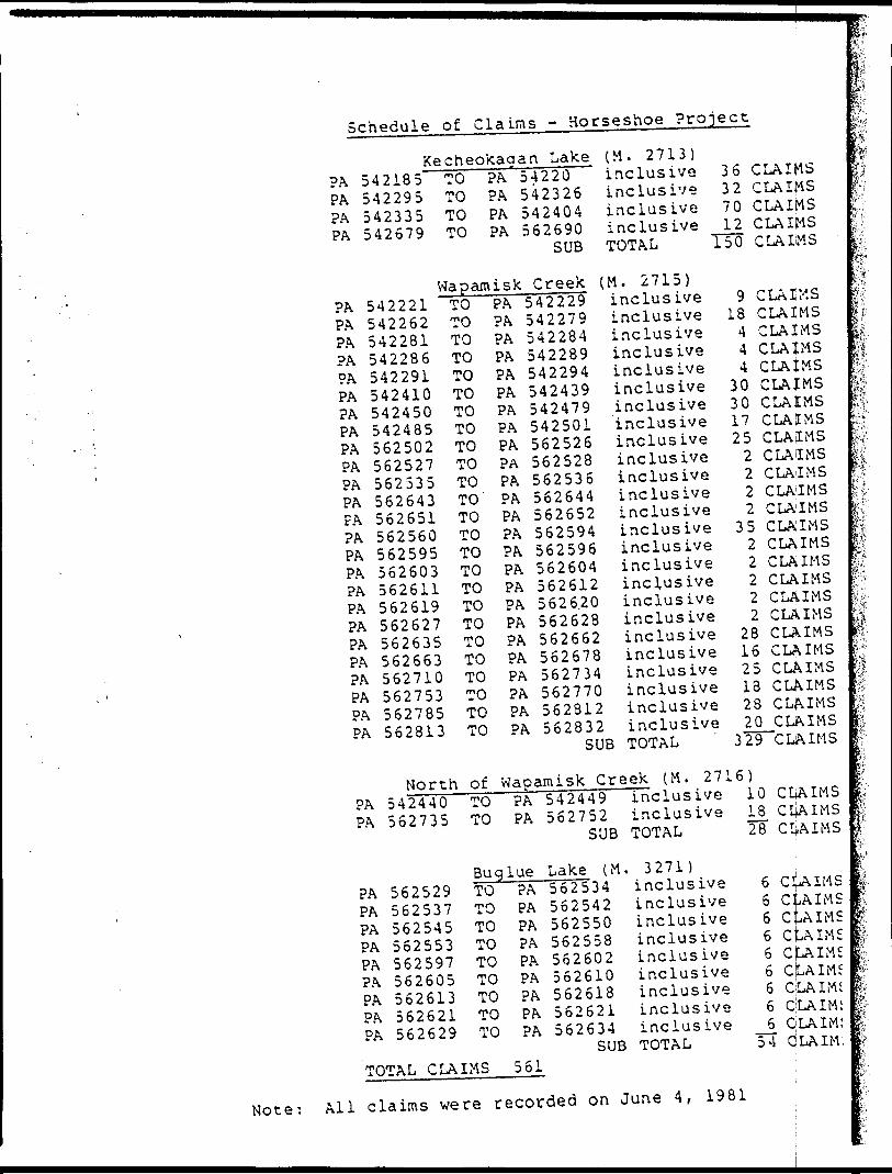
Schedule of Clams - Horseshoe Project
Kecheokaaan LakePAPA?APA
542185542295542335542679
TOTOTOTO
PAPAPAPA
WapamiskPAPAPAPAPAPAPAPAPAPAPAPAFAPAPAPAPAPAPAPAPAPAPAPAPA
542221542262542281542286542291542410542450542485562502562527562535562643562651562560562595562603562611562619562627562635562663562710562753562785562813
TOTOTOTOTOTOTOTOTOTOTOTOTOTOTOTOTOTOTOTOTOTOTOTOTO
North ofPAPA
PAPAPAPAPAPAPAPAPA
542440562735
562529562537562545562553562597562605562613562621562629
TOTO
BugTOTOTOTOTOTOTOTOTO
TOTAL CLAIMS
PAPAPAPAPAPAPAPAPAPAPAPAPAPAPAPAPAPAPAPAPAPAPAPAPA
54220542326542404562690
SUB
(M. 2713)inclusiveinclusiveinclusiveinclusiveTOTAL
36327012
TTO
CLAIMSCLAIMSCLAIMSCLAIMSC LA IW S
Creek (M. 2715)5422295422795422845422895422945424395424795425015625265625285625365626445626525625945625965626045626125626,20562628562662562678562734562770562812562832
SUB
inclusiveinclusiveinclusiveinclusiveinclusiveinclusiveinclusiveinclusiveinclusiveinclusiveinclusiveinclusiveinclusiveinclus iveinclusiveinclusiveinclusiveinclusiveinclusiveinclusiveinclusiveinclusiveinclusiveinclusiveinclusiveTOTAL
Wapamisk Creek (M. 27PAPA
luePAPAPAPAPAPAPAPAPA
561
542449562752
SUB
Lake (M562534562542562550562558562602562610562618562621562634
SUB
inclusiveinclusiveTOTAL
. 3271)inclusiveinclusiveinclusiveinclusiveinclus iveinclusiveinclusiveinclusiveinclusiveTOTAL
918444
303017252222
3522222
281625182820
329
16)101828
666666666
54
CLAIMSCLAIMSCLAIMSCLAIMSCLAtMSCLAIMSCLAIMSCLAIMSCLAIMSCLAIMSCLAIMSCLAIMSC LA1 IMSCLAIMSCLAIMSCLAIMSCLAIMSCLAIMSCLAIMSCLAIMSCLAIMSCLAIMSCLAIMSCLAIMSCLAIMSCLAIMS
CLAIMSCliAIMSCL: AIMS
C!c:c
AIMS..AIMS-AIMS
CtAIMSCJLAIMSCJLAIMSQLAIMiCLAIM!CLAIM:CjLAIM:
m
Note: All claims were recorded on June 4, 1981
l l l l
l APPENDIX IV
SUMMARY OF TOTAL PROJECT EXPENDITURES
l
l
l
l
l
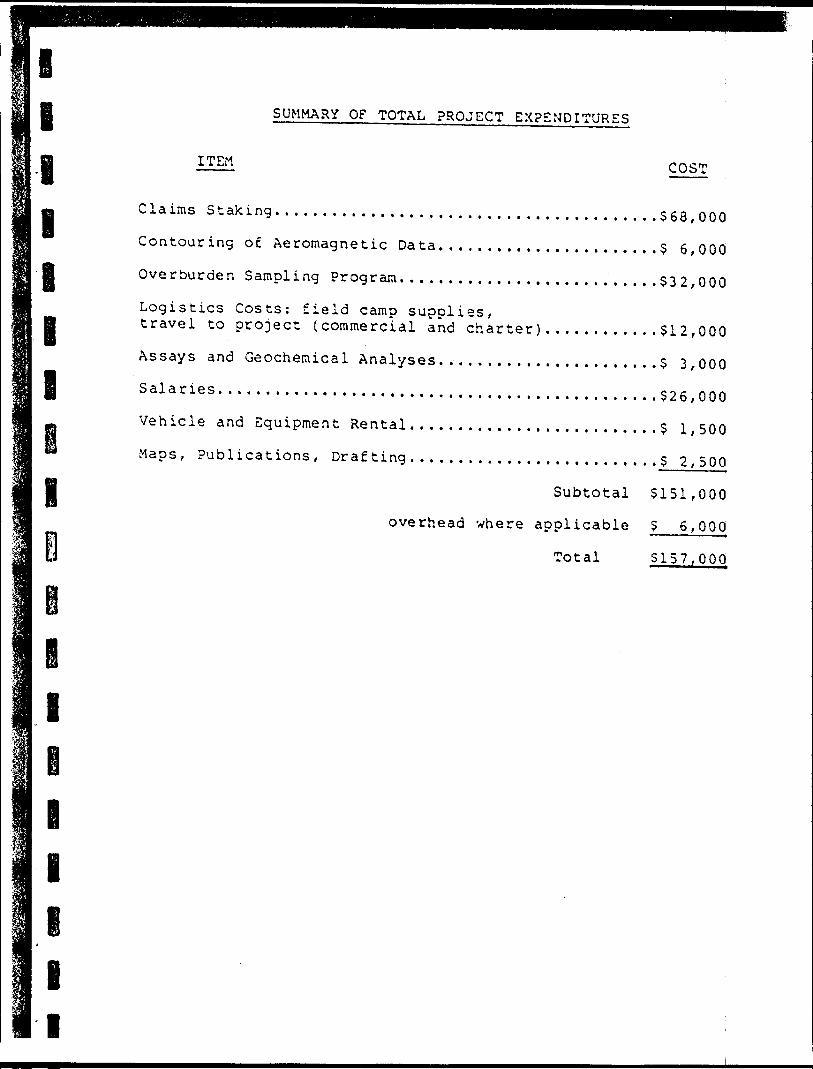
l l l i l l l
l
SUMMARY OF TOTAL PROJECT EXPENDITURES
ITEM COST
Claims Staking........................................568,000Contouring of Aeromagnetic Data......,..,.............5 6,000Overburden Sampling Program...........................532,000Logistics Costs: field camp supplies,travel to project {commercial and charter)............512,000Assays and Geochemical Analyses. ., . . . . . . .. . . . . . . . . . . . .5 3,000Salaries..............................................526,000Vehicle and Equipment Rental..........................5 1,500Maps, Publications, Drafting..........................52,500
Subtotal 5151,000
overhead where applicable 5 6,000
Total 5157,000
I
l
ll
i
l e
APPENDIX V
ASSESSMENT CREDIT COMPUTATION
l
l
i
I J
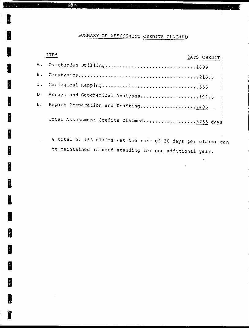
l l l l l
SUMMARY OF ASSESSMENT CREDITS CLAIMED
I TEM DAYS CREDIT
A. Overburden Drtiling...............................1399 ;
B. Geophysics.........................................210.5 i
C. Geological Mapping.,,..............................553 \
D. Assays and Geochemical Analyses....................197.6 :
E. Report Preparation and Drafting....................406 l
Total Assessment Credits Claimed. . . ..... ..........3266 days
iA total of 163 claims (at the rate of 20 days per claim) can
be maintained in good standing for one additional year.
l
i
i
l
l
I l l l
i
ASSESSMENT CREDIT COMPUTATION
A. Ove rbur de n Dr illi ng
1. mob and demob{4 men and equipment).........................? 3,5901.34
2. all terrain vehicle(32 days @ S160 per day)plus maintenance..............................? 5,445i.90
3. drilling costs: operating(27 days @ 5500 per day)......................513,500u00equipment left in holes.......................5 1,699*50
4. camp costs....................................? 1,649*795. miscellaneous expenses;
air freight phone orders etc. ................3 700^00
6. pro]ect supervision:l geologist (6 days @ 5200 per day)...........5 1,200*00(Oct. l to 4 and October 30 to 31)expenses from Thunder Bay to project..........5 700*00(2 return trips) ——-——,^-
Total costs. . .............528,485i53
l
l
Assessment Credits Claimed for Item A:{l day credit per 515 of expenditures)- 1899 days credit
B. Geophysics
1. linecutting:S days S 12 hours per day
2. VLF surveys: 120 hours; 7 days per 8 hours
3. Magnetometer surveys: 120 hours; 7 days per 8 hours
Assessment Credits Claimed for Item B:
- 7.5 days credit
- 105 days credit
- 105 days credit
.5 days credit
l
l l
l
C. Geological Mapping
1. 2 geologists: (June 17 to July 15)
2 men X 19 days Q B hours per day * 38 man days (8 hours) 2 men X 11 days @ 12 hours per day - 33 man days (8 hours)
2 additional geolog i s ts; (July 13 to July 15)
2 men X 3 days 3 12 hours per day * 9 man days (3 hours)
iTotal 8 hour man days ~ 7 9
Assessment Credits Claimed for Item C: {7 days credit for each man day of geological mapping)
D. Assavs and Geochemical Analyses
553 days credit
1. Swastika Laboratories: i Assay Certificates; 51962, 52176, 52246......? 1,072.J252. Assayers (Ontario) Limited ' Assay Certificates; NO-01, NO-02, NO-03. . . . . .S 1,891. }35
Total....................5 2,963.60
l
l
l
I
I
Assessment Credits Claimed for Item D: (l day credit for each 515 of expenditure)
Report Preparation and Drafting
1. l geologist
2. l geologist
3. l draftsman
Total man days
19 7.6, days cr^d i t
27 man days
13 man days
18 man days
58 man days '
Assessment Credits Claimed for Item E:(7 days credit for each man day worked) -406 days credj. t
l
l l l I
APPENDIX VI
PHOTOGRAPHS OF HORSESHOE LAKE AREA
i
i
l
l
l
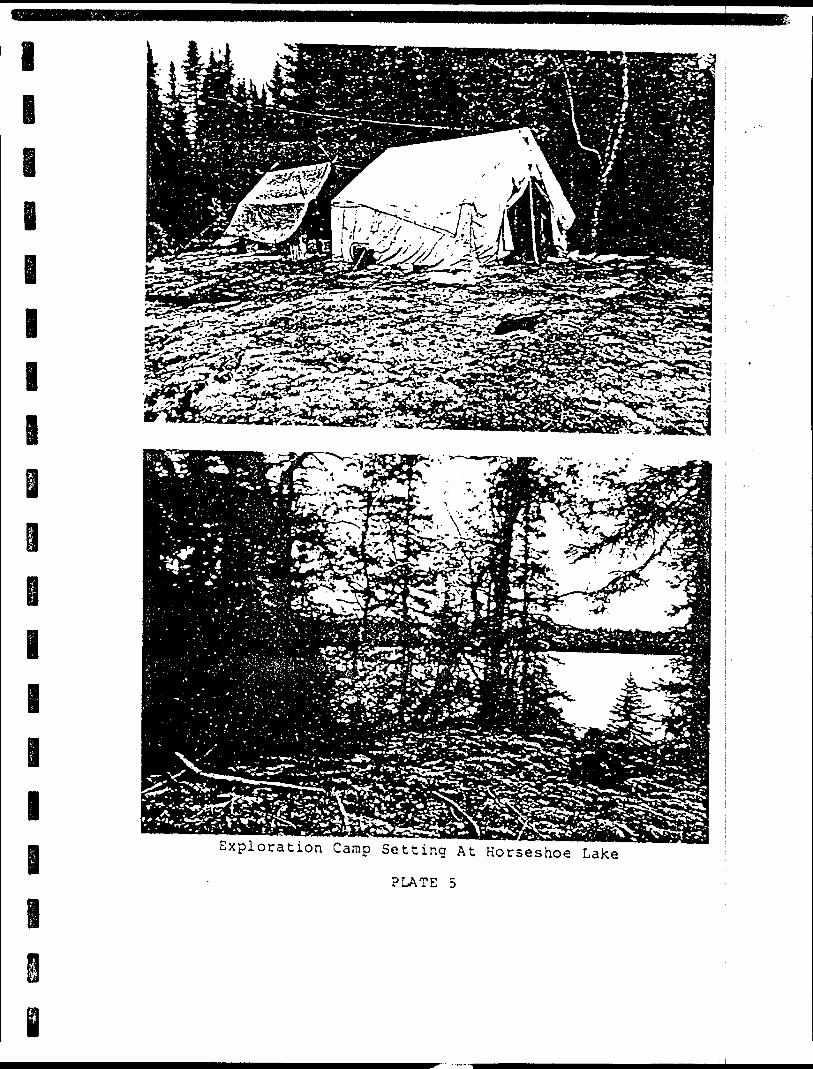
l
e
i i
i i
i a Exploration Camp Setting At Horseshoe Lake
PLATE 5
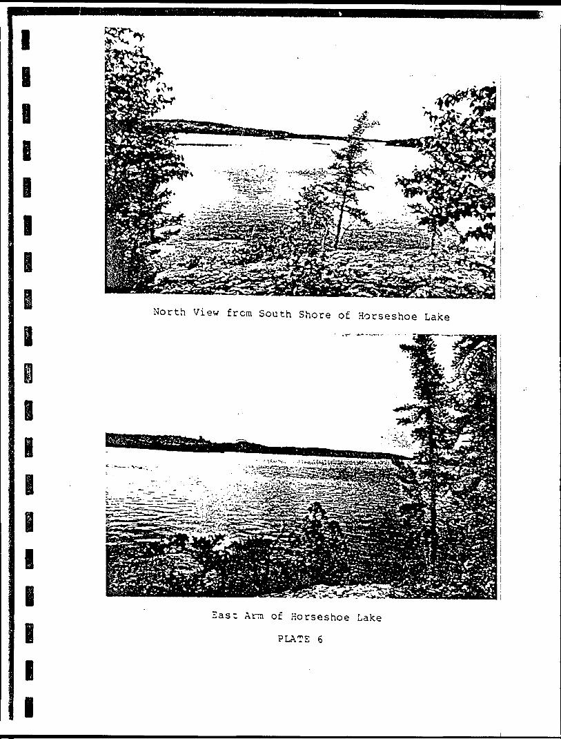
l
l l
North View from South Shore of Horseshoe Lake
East Ann of Horseshoe Lake
PLATE 6
l
l l
APPENDIX VII
FIELD DATA SHEETS:
OVERBURDEN SAMPLE DESCRIPTIONS
l
l
e
HOLE NUMBER f\ - J"
LOCATION ^j^ } fi
Material Encountered(organic, muskeg, sand, gravel, boulders etc)
Footage -o ' to - X- - organic
A'-/*'-
70'- 3o' - '-33'-
Sample Number
Coarse
yto
% Sand ——-4 Silt ____% Clay M---l Other ___
Coiour ,5 y Lua.a
Description {odour, sulphides, magnetite etc)
magnetite
DUPLICATE COPYPOOR QUALITY ORIGINAL
TO FOLLOW
-oo
*xL -Q
U)
^
d O
O
xo0
"v 1'
,-'j i .1
CV-
i
Kv' •i.
••-i-'
- ,
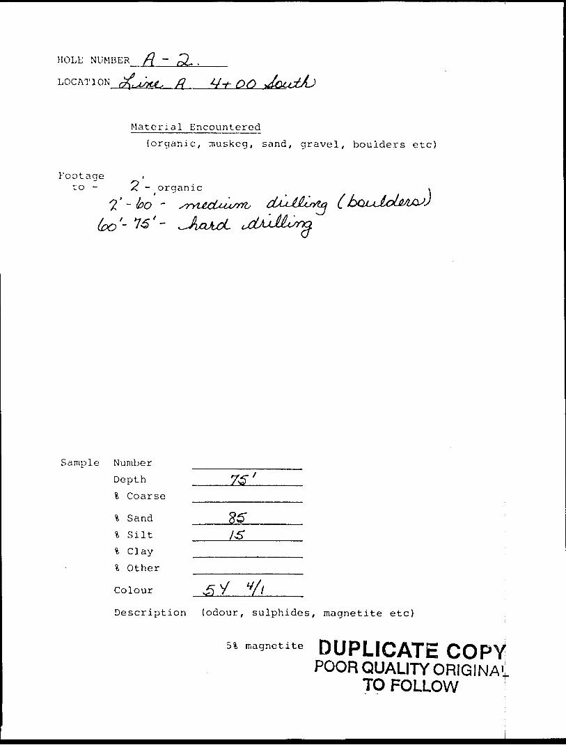
HOLE NUMBER
LOCATION ^u. X? *4t- on
Material Encountered
{organic, muskeg, sand, gravel, boulders etc)
Footage .to - /c - organic
l'- bo -
Sample Number
Depth
fc Coarse
% Sand l S ilt
% Clay
l Other
Colour Y 7
Description (odour, sulphides, magnetite etc)
51 magnetite DUPLICATE COPYPOOR QUALITY ORIGINAt
TO FOLLOW
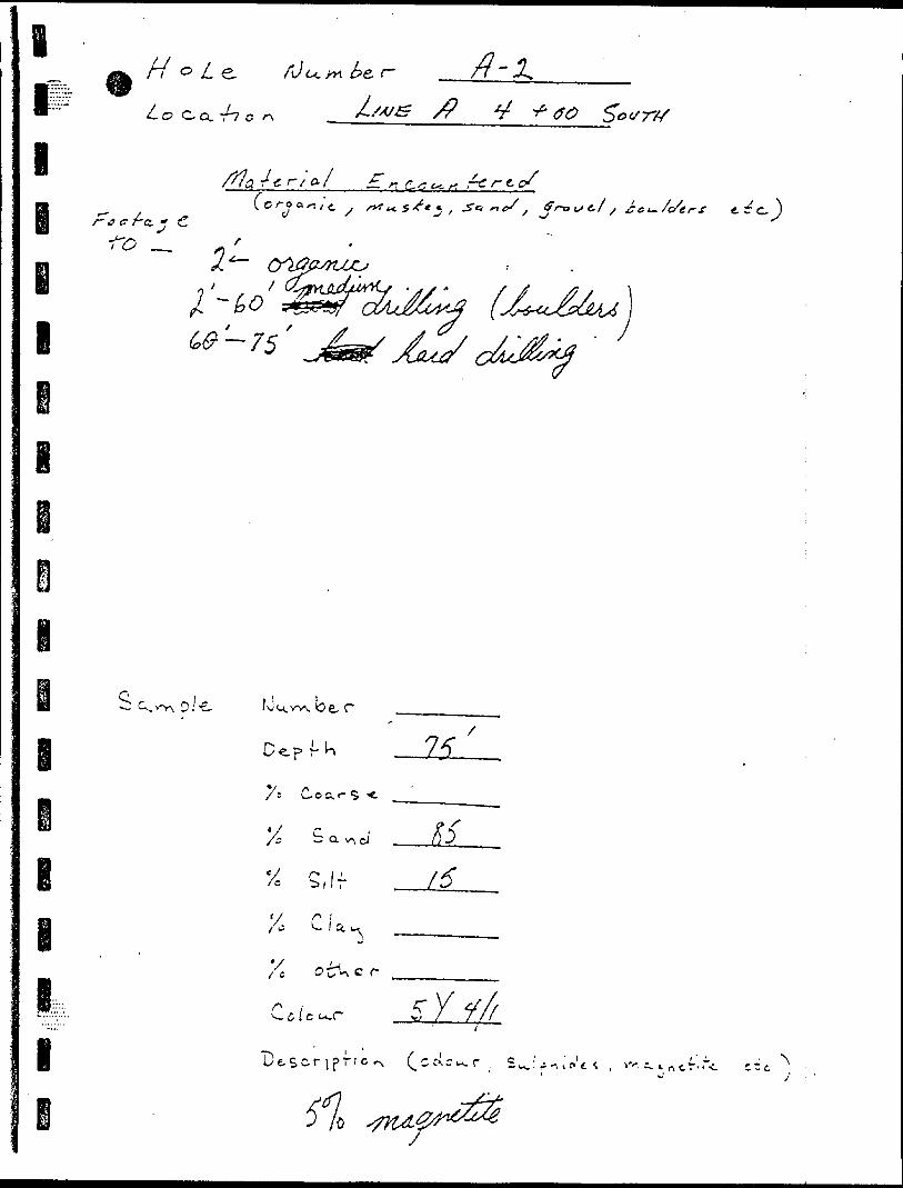
i i i
// fi)u.**Ur-
/-
/P
n c,,, ft r- 1. c/
, fn^/c/ffrf
o.-e. fvu.w-v.e r
*//C c r
s.if f6
C./ec.r5" K
C c^c^r t i ,"N
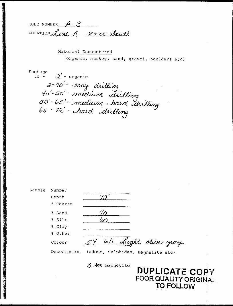
HOLE NUMBER /j ~ 3___
LOG AT I ON ^/W yf fr
Footageto -
Material Encountered(organic, muskeg, sand, gravel, boulders etc)
- o rganic
3 'O '~ xc'
Sample Number Depth t Coarse
\ S and % Silt % Clay % Other
Colour
73'
toO
Description (odour, sulphides, magnetite etc)
magnetite
DUPLICATE COFlYPOOR QUALITY ORIGINAL
TO FOLLOW
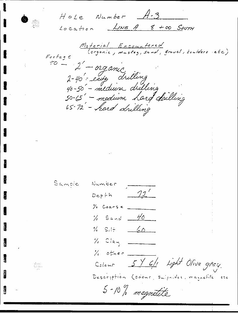
p T
-O
-f-
o 9 o f -i i/)
f
O
0
x.D-
(p
po o p T
(P r
O
l cr C' i
if: o,
o V V
o o
o 8 l"1
l-\ li.
o
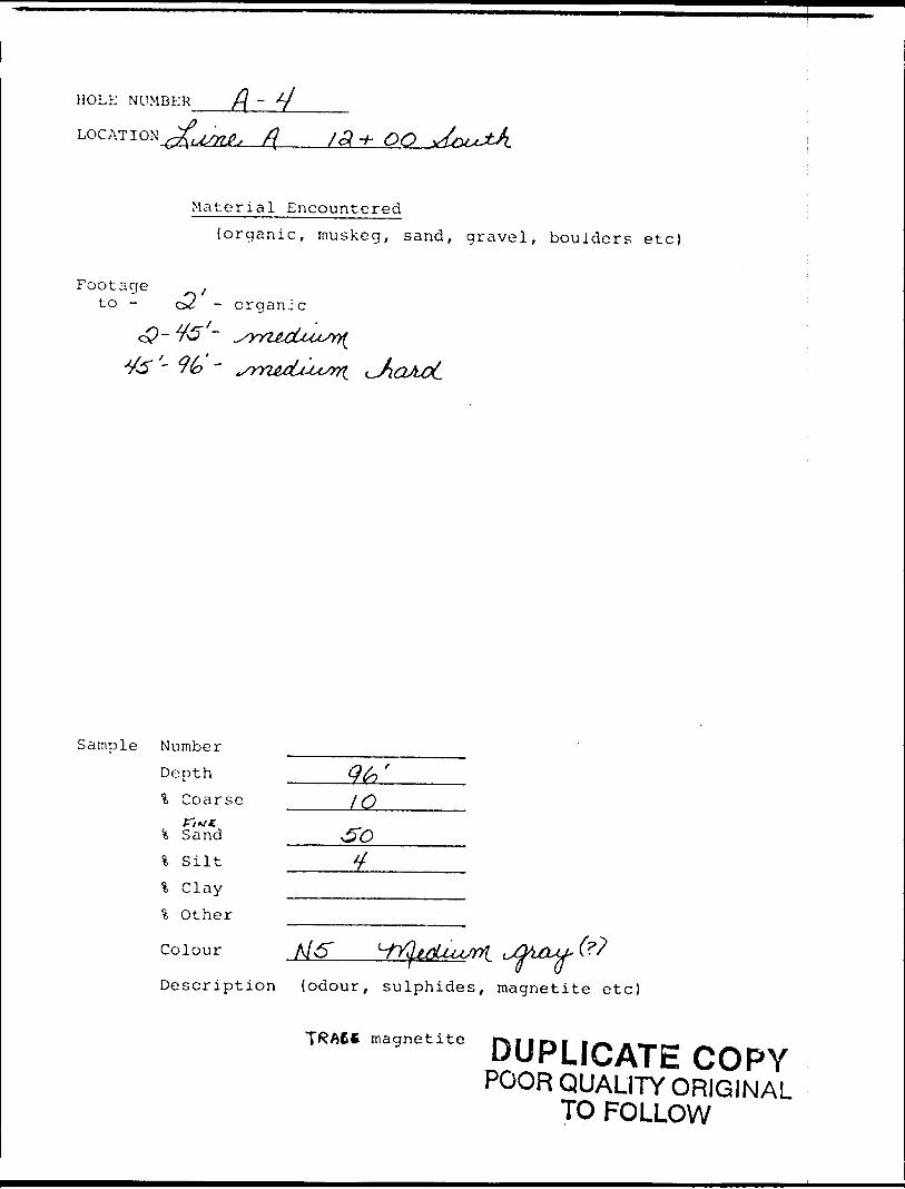
HOLE NUMBER f{ ~
LOG AT I QXu/nfs /f /a -/- 00
Material Encountered{organic, muskeg, sand, gravel, boulders etc)
Footagec2 -to - c - organic
Sample NumberDepth ____Q fa ' l Coarse / Q
* Sandl S ilt% Clay
l Other
Colour
Description (odour, sulphides, magnetite etc)
magnetiteDUPLICATE COPY
POOR QUALITY ORIGINAL TO FOLLOW
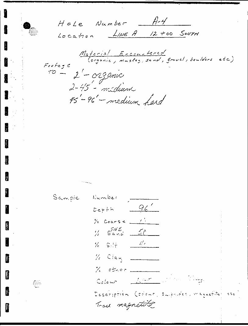
III
l J-r f
-..
0
.XO
l'1
t
P o"
X
T
' r
Oo P
(P
^
C7
s l'
•* l
-
\ A
f* V
H
V.I* V
(S
S" ^
O ft
P K
o X 0
O O sf.
' li o
O, O
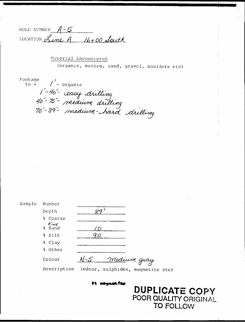
HOLi; NUMBER
LOG AT I ON c /^x ft /&+00
Material Encountered(organic, muskeg, sand, gravel, boulders etc)
Footage fto - l - organic
'-89-
Sample Number
Depth % Coarse
l Sand _____f Q\ s ilt __go% Clay —.—......-% Other
Colour A/'dT
Description (odour, sulphides, magnetite etc)
M
DUPLICATE COPYPOOR QUALITY ORIGINAL
TO FOLLOW
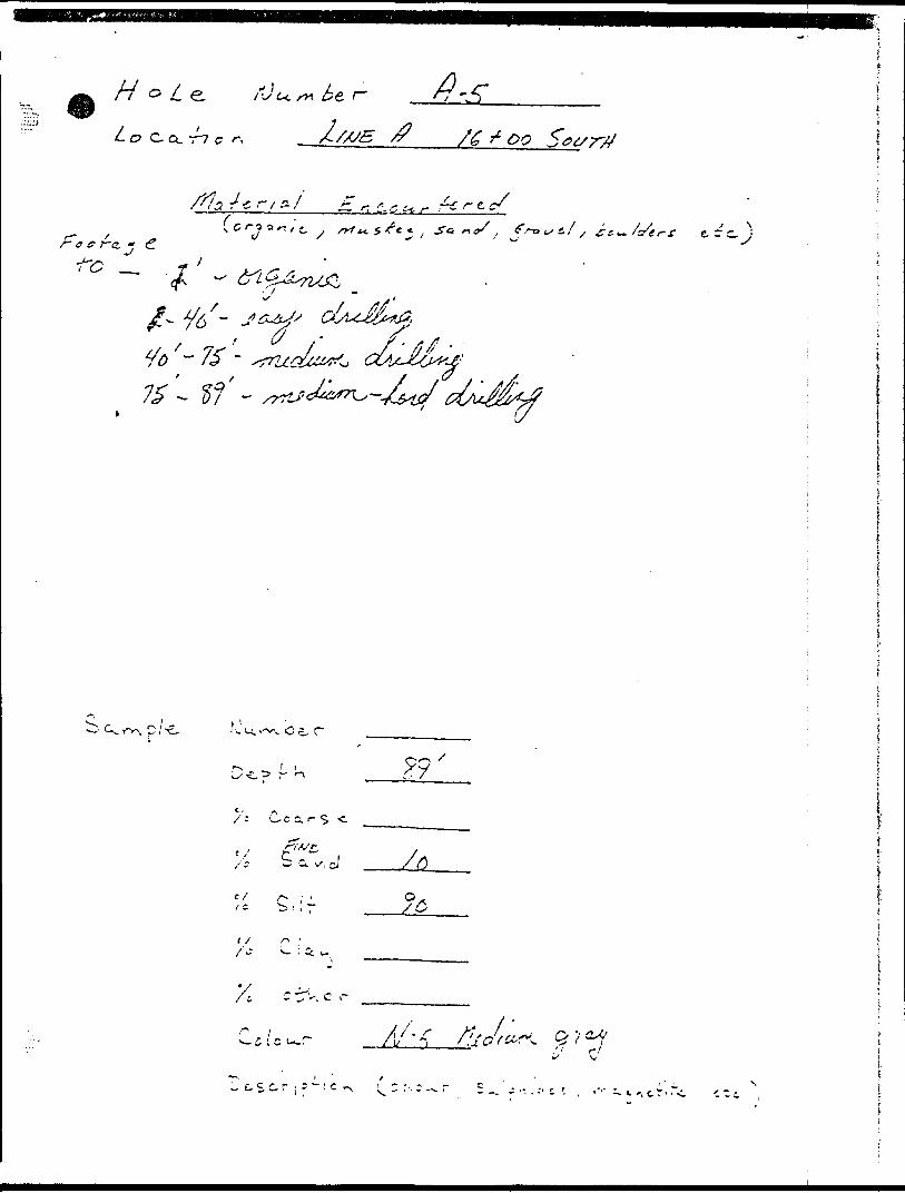
/V o Z
C? C Q. ~7 C /C t OO
i/(f
e. C C.
x
i ~ U. .-v\ O
/: U-c a. r- 5 -c.
^ '-i v', ci
t / r- '
c r
-i i C U.P A/'-,
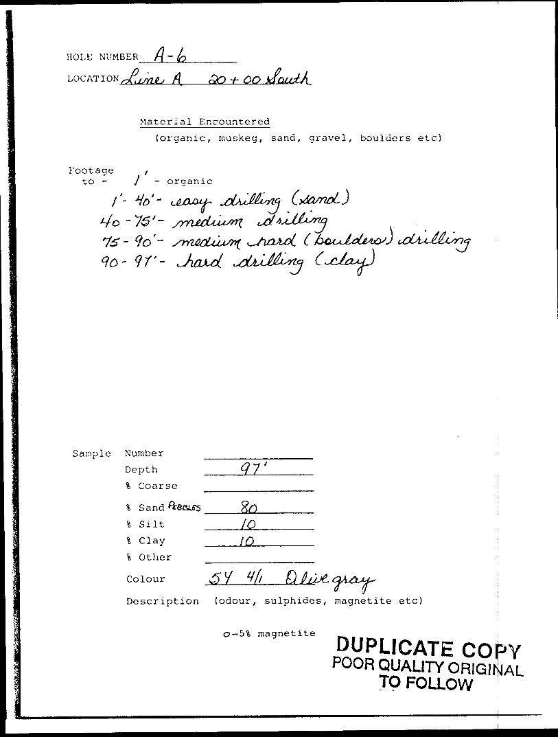
HOLE NUMBER A-LOG AT I ON jrtjfij fi 30 + 60
Material Encountered
(organic, muskeg, sand, gravel, boulders etc)
Footage ,to - j o rganic
"
o - 16'-~ 9o'- /meu^ iQJLc ct^jM& c^^nG - 9?'-
Sample Number
Depth
% Coarse
*fc Sand Createsfc Silt
l C lay
l Other
Colour 3 V y fi fi 0lJUt
Description (odour, sulphides, magnetite etc)
CJ-5% magnetite
DUPLICATE COPYPOOR QUALITY ORIGINAL
TP FOLLOW
^0n)
oo
o -r.-si
d
o o o-Nj
-i- •JcV III
L
r- 0-
C^
•^x\
--,\
.v
.. -^i Is0
V**-' ^
v ,
t f
^f\
Oc^
-^ y '
u..c
i 4 ~':
- '-: v\
^ ^ ^
-, t5
^
o, o
o i
, v,
"' M
y*
V^
^-
xo
vn
X
* V
* C
) u
-0
/") "N
-"s.
v", -X
*
x ^
^ -j ^J
Ci .
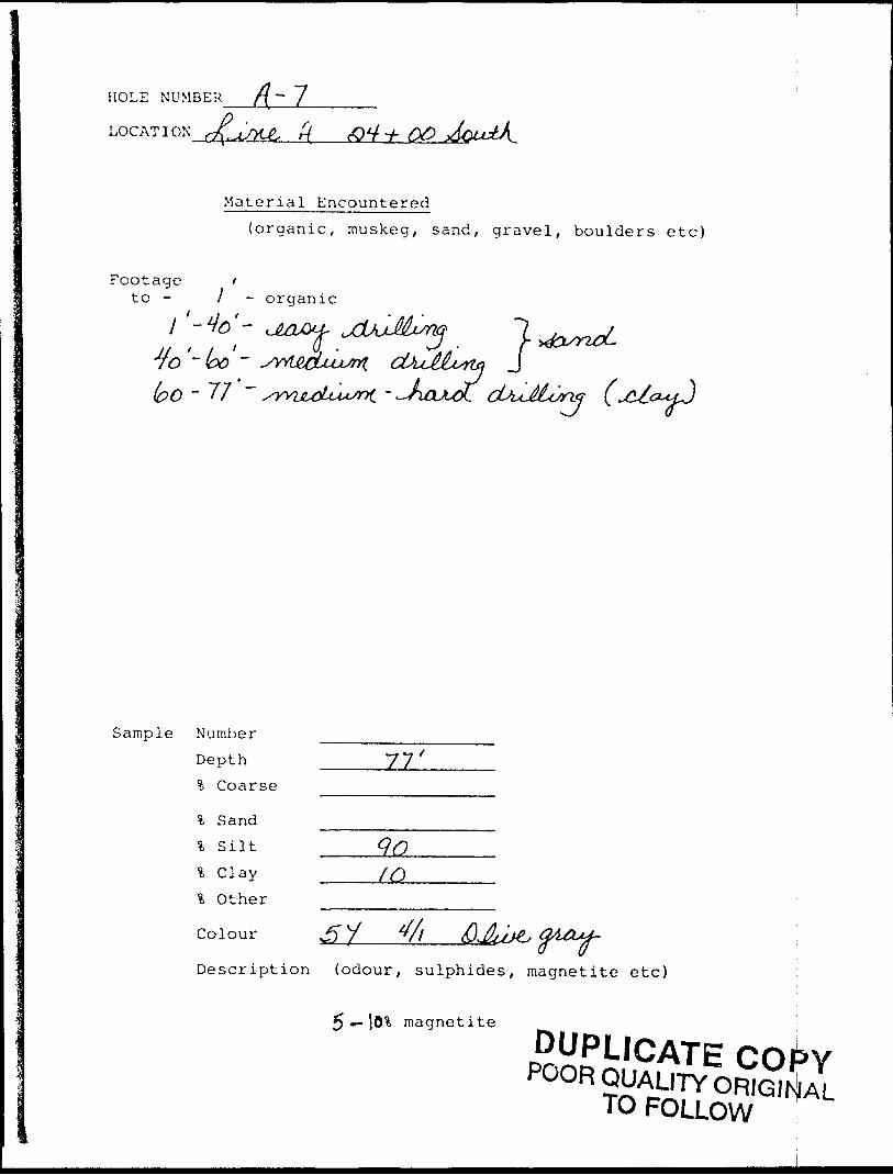
HOLE NUMBER /f-7LOG AT I ON rXtJLMA, cOV -/-
Material Encountered(organic, muskeg, sand, gravel, boulders etc)
Footage ito - l o rganic
-77 ~ /yvu&Ui*^ - ^OM) tsvrif!
Sample Number
Depth _____77 f % Coarse
l Sand
% Silt
% Other
Colour J5"
Description (odour, sulphides, magnetite etc)
5 — l5% magnetite
x*ts.
: ~ i l J "3 S
f\
-1 a ^
; -^
l l
l
-(?^l
H
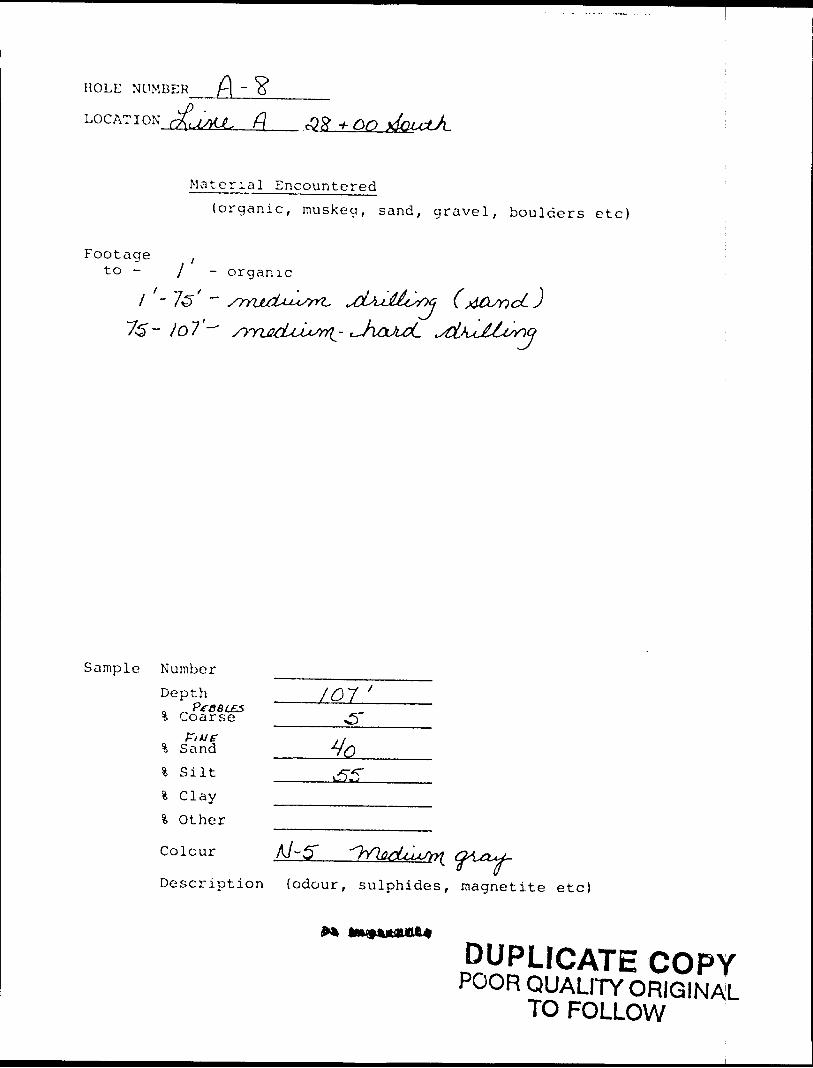
HOLE NUMBER ft-LOCATION cj(aMJL f\
Material Encountered(organic, muskeg, sand, gravel, boulders etc)
Footage ,to - j organic
f —7 f 'l - 15 ~ /rnjLcU**srn. 73 ~ Io7'-^ ^yyijud^u^-
Sample Number Depth % CoarseT
% Sand% silt\ C lay% Other
colour A/-5"Description (odour, sulphides, magnetite etc)
DUPLICATE COPYPOOR QUALITY ORIGINAL
TO FOLLOW
l.-} o in
p l"
t
O
\ p
o ,.,
t "J
-v"
x ™
X
*o
X
o\
..^
U P,
Ut
;- ,
K'.f
Xf*
1 ^
(l f
1- 8
0 1 oq
Ov O
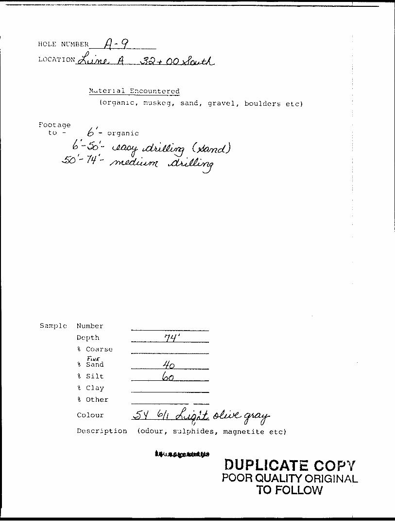
HOLE NUMBER
; f{
Material Encountered(organic, muskeg, sand, gravel, boulders etc)
"ootage ,to - fa - organic
*") - ULQ^u,
Sample Number
% Sand
* Silt% Clayl Other
\_s
Depth ______7V \ Coarse
Colour v^y bil
Description (odour, sulphides, magnetite etc)
DUPLICATE COPYPOOR QUALITY ORIGINAL
TO FOLLOW
loo
-8•f
lo
o-r.o o
v.V
"4M
\
G...
i J t-.0
1J
_r-x.n.
d o
L01
-U
O.v
L j o
r. o-I-tv-
. l.4) (/l
O
1-1
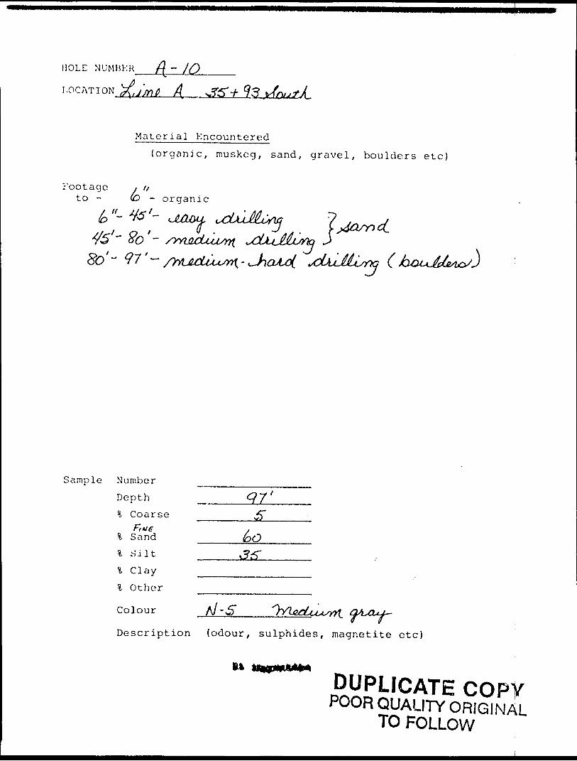
HOLE NUMBER f\ - j Q^^—
LOCATION .j'mt A v?5V93
Material Encountered
(organic, muskeg, sand, gravel, boulders etc)
Footage i /xto - (O - organic
r'-fo'-
Sample Number
Depth % Coarse
j Sand _____6OSilt
Clay .-——... Other
Colour
Description (odour, sulphides, magnetite etc)
i*
DUPLICATE COPYPOOR QUALITY ORIGINAL
TO FOLLOW
t i Vj
-i '5
r-^s 3^'j/
,
l
l
l
^^ "n ^ i
e e e
^ *?-*? 'f,*~f '/•I'g'f'f* "^ ^ ^/
•y lv^*fCW
o L^- "O "O ^7
H
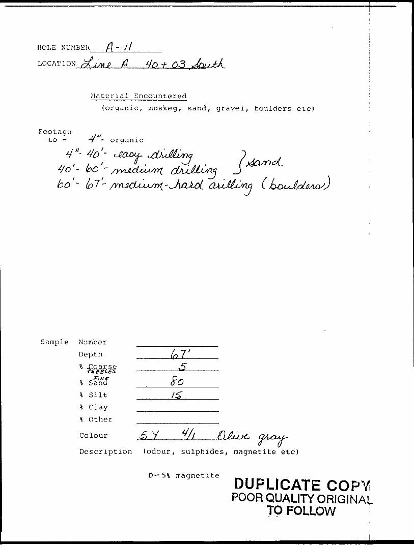
HOLE NUMBER f\ ~ 11—————
LOCATION ^6^ A 4o * O3
Material Encountered
(organic, muskeg, sand, gravel, boulders etc)
Footageto - -y - organic
4"- 4o'~ dia&i- o .
J
Sample Number Depth % J2oarse
___ So% Silt m———
fc Clay -.———.
l Other
Colour .5 V
Description (odour, sulphides, magnetite etc)
O— 5% magnetite ^DUPLICATE COPY
POOR QUALITY ORIGINAL TO FOLLOW
in p 1 -o r
l. r
O
Xt-, o f
o ? R
'l
N."
(H
(P •o
o l* -y T-
2 o~
o*
o ^
O O
K.
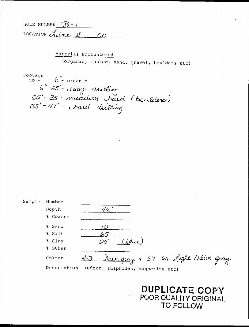
HOLE NUMBER
LOCATION rfi^UKJL, IB OO
Material Encountered(organic, muskeg, sand, gravel, boulders etc)
Footage ,,to - (D - organic
/ 'l
'- 36'
Sample Number Depth \ Coarse
Sand _____/Qsilt ^5"Clay Other
colour A/-3Description (odour, sulphides, magnetite etc)
DUPLICATE COPYPOOR QUALITY ORIGINAL
TO FOLLOW
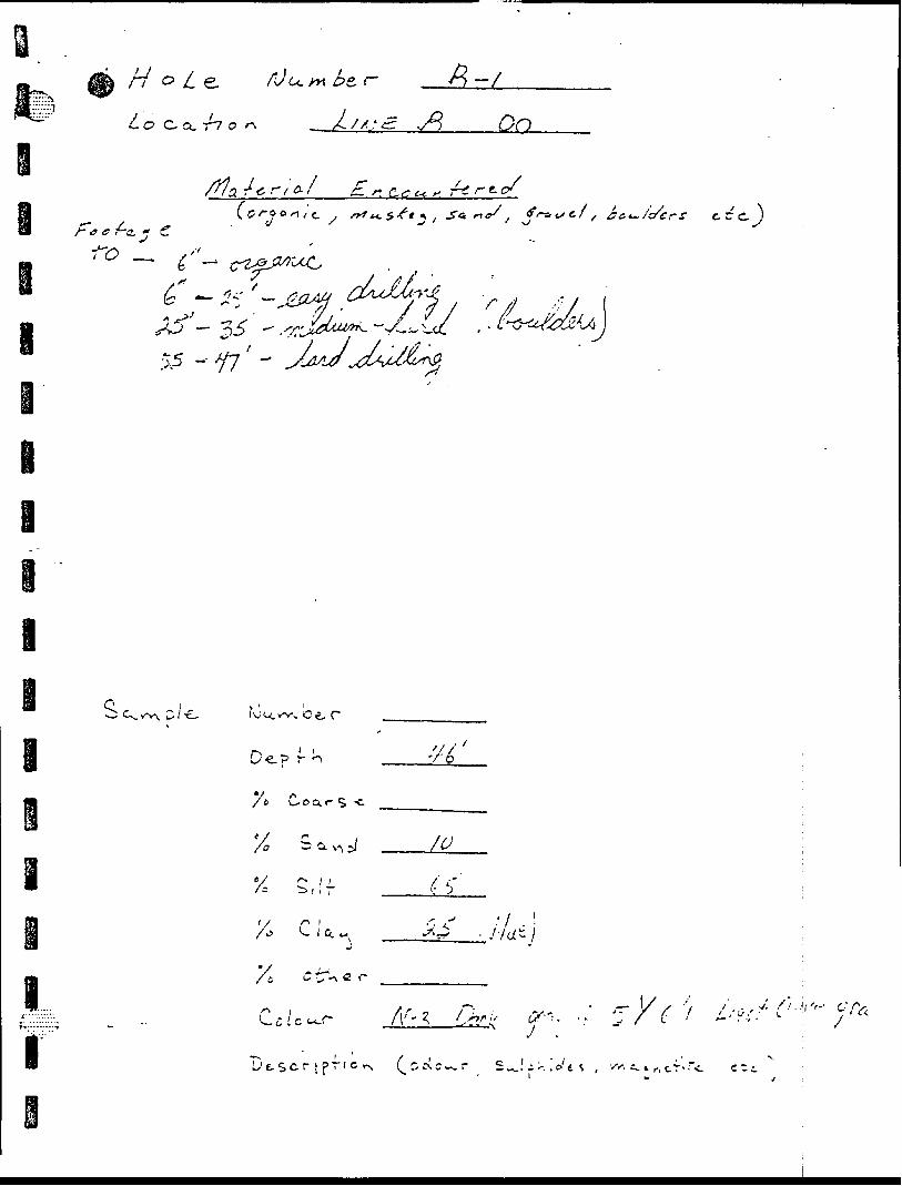
o i-:
l......14
l
V,Ti'5
Ci v^ -n fN i i i *
i
w*y / iff - s*- 5"^ - CV
" p.'"// VIE~1
"S 7 o
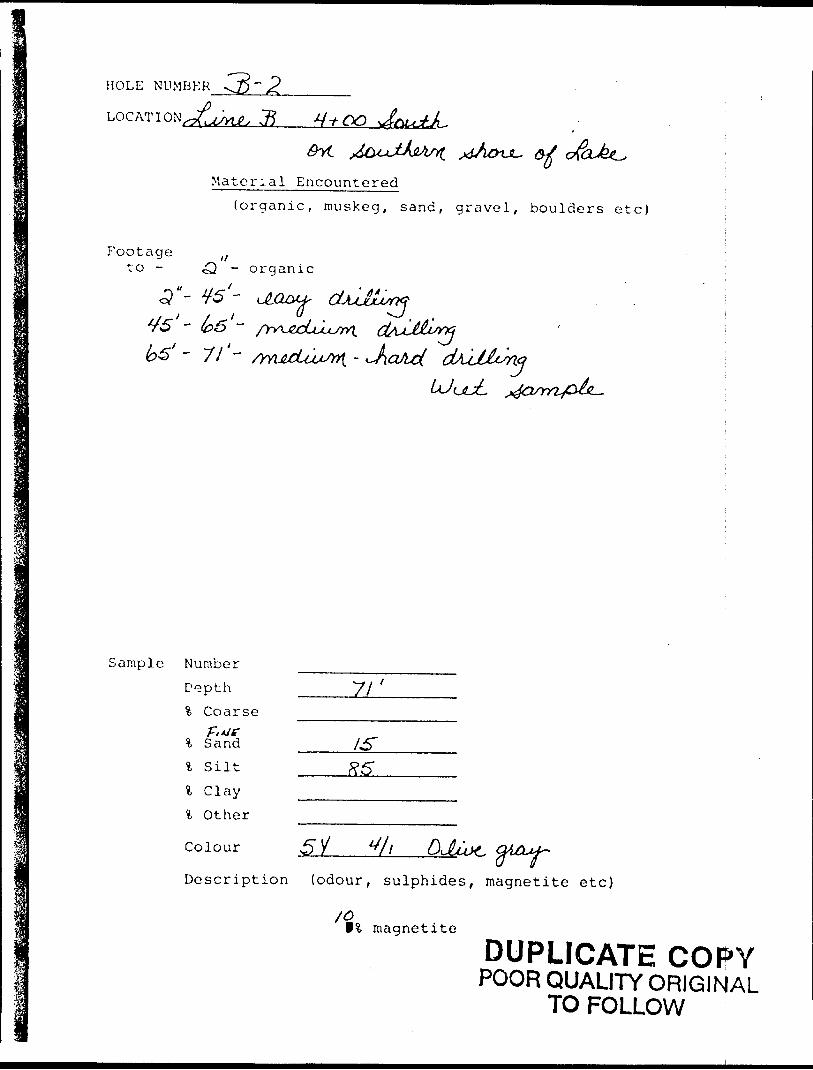
HOLE NUMBER " 2.
j?
Material Encountered(organic, muskeg, sand, gravel, boulders etc)
Footageto - - organic
' " 71 " a
Sample Number D^pth % Coarse
l Sandl S ilt
l C layl Other
Colour
71'
Description (odour, sulphides, magnetite etc)
f% magnetite
DUPLICATE COPYPOOR QUALITY ORIGINAL
TO FOLLOW
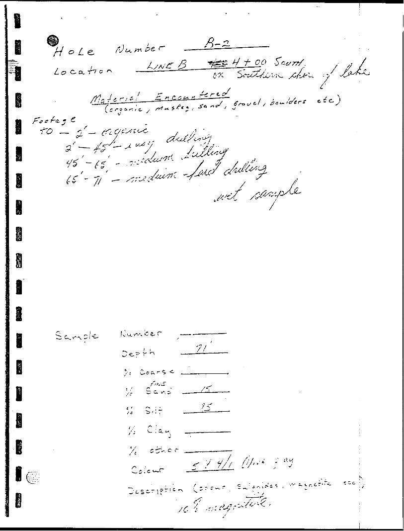
,/
-' 3 -*—v
-e ;
st , '
- X ,* J
l
l
l e i
'— OJ-, Cl}~l3ff-J
l
l
W O L^~~0^ Oy
stfu/^/y ^1 0 H i *- jith
i l"
i
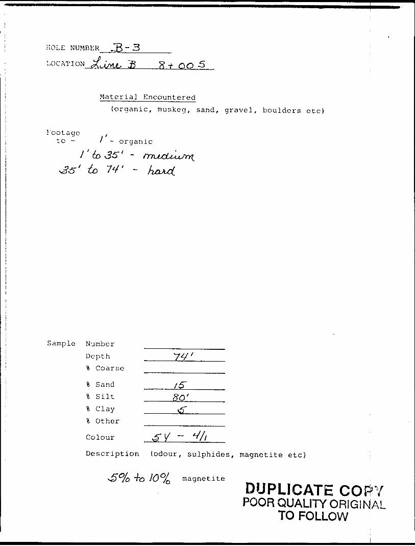
HOLE NUMBER B - 3
LOG AT I ON Jji(ju S R -t 00
Material Encountered
(organic, muskeg, sand, gravel, boulders etc)
Footage ,to - l - organic
* to 74' -
Sample Number
Depth
?. Coarse
Colour
\ Sand _____X5"4 Silt ____SO'4 Clay ______^4 Other
Description (odour, sulphides, magnetite etc)
magnetite
DUPLICATE COPYPOOR QUALITY ORIGINAL
TO FOLLOW
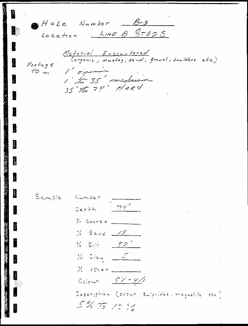
oNi O
LJ*
C o0)
^x^
dO
OM
v. 4\V)0
o
II vi
til
L
\ i\
s 'i1.1v^yf
. oi
- LJi-
. - 1-
ex-
C/)
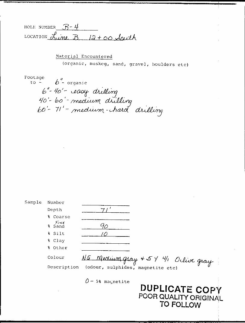
HOLE NUMBER .J*)"
LOCAT I ON ( .j/Ylf. ~P) 13
Material Encountered(organic, muskeg, sand, gravel, boulders etc)
Footage ,/to - O - organic
- / '- 7/ - c
Sample Number
Depth t. Coarse
* Sand .———l S ilt ——.————..-———
l C lay -—————^———.^....% Other --————————...-..
Description (odour, sulphides, magnetite etc)
— 5 % magnetite
DUPLICATE COPYPOOR QUALITY ORIGINAL
TO FOLLOW

BH o L s. fiJu.
Lo C CL -h c *\ --00 T
o e f's. ~
•TO -,
I
a 4 c r-; c. f,l :i~ j'o'er r e c'c. )
. o e, r
lBl l l
S.c~ C
l/'
.'/y/
C —5 /U'
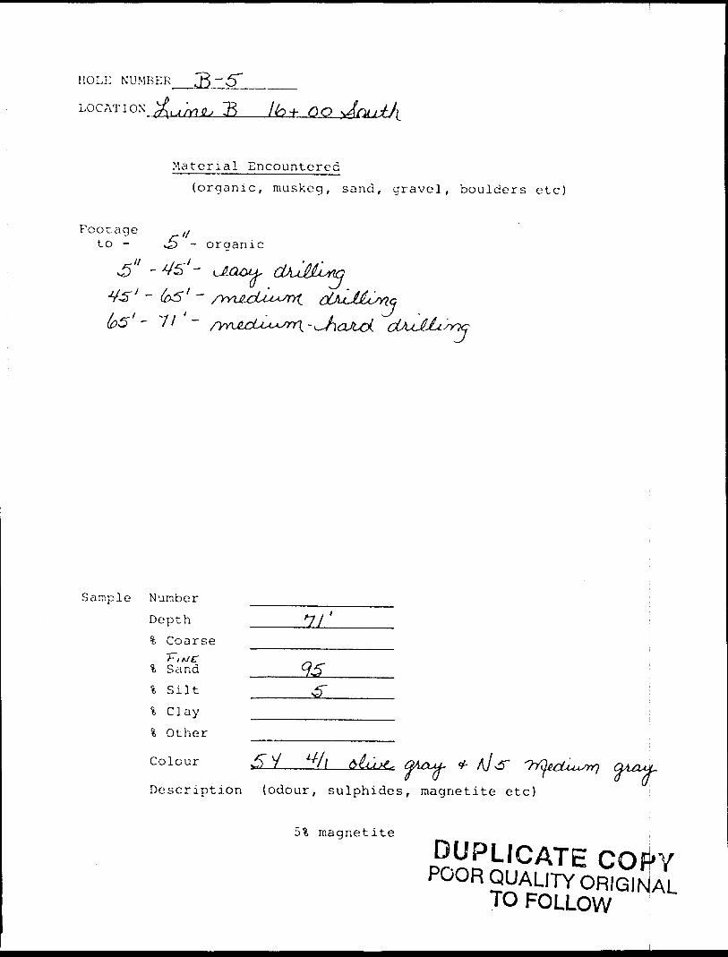
HOLi: NUMBER
LOG AT I ON u/r?^ & + 00
.Material Encountered(organic, muskeg, sand, gravel, boulders etc)
Footage l{to - J} - organic
^ri^ O{JU~ML
i
Sample NumberDepth _____7/ ' 3, Coarse
4 Sand4 Silt4 Clay\ O ther
Colour j5" J
Description (odour, sulphides, magnetite etc)
Sifc magnetite
DUPLICATE COfi'YPOOR QUALITY ORIGINAL
TO FOLLOW
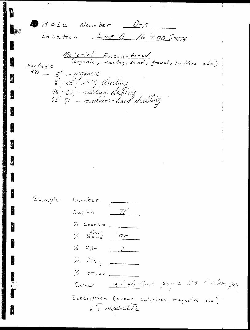
•M'-o'•"•t ^ ' v ?c -r ;-~
, ? C v ~- ' /-' ' -' f ,'t* i
l J. c -J "3 S
^~~i 3; 7
V, o c
j/
u -i c:
O "3 ^
i
i
i i
i
l
/s^v
Q Q
l l
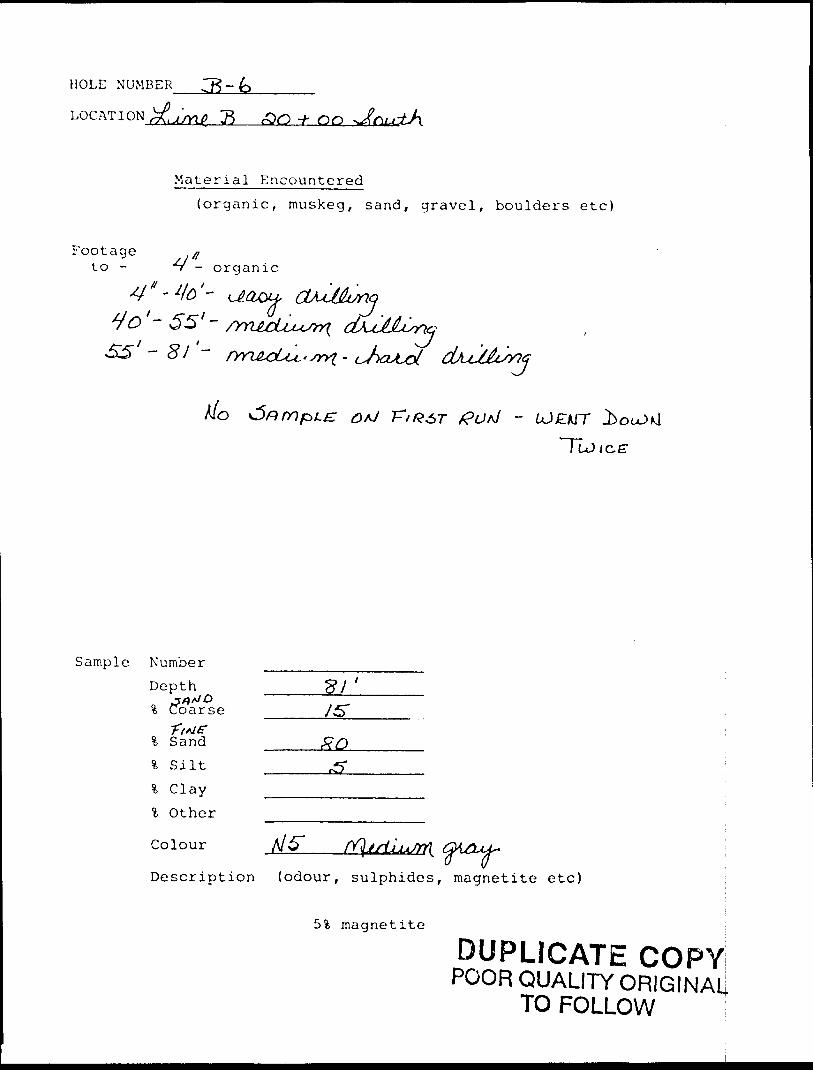
HOLE NUMBER
LOCATION JSM 7^ .OQ -V- 00
Material Encountered(organic, muskeg, sand, gravel, boulders etc)
Footage ato - 'v - organic
Sample Number Depth
-J/JA/O
% Coarse
.'~ 65'-
rtt
A/o *5nmpLz Q/J T^IRST ffod -
% Sand -———,% Silt —————^-————-% Clay ______________
l Other ——-.-.,.—.—-....—.
Colour V5" (Y\JsiljijJrt(
Description (odour, sulphides, magnetite etc)
51 magnetite i
DUPLICATE COPY!POOR QUALITY ORIGINAL!
TO FOLLOW
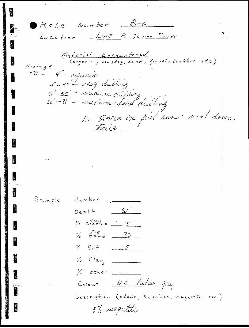
C'
p -t '
-t- O
'
o f. o f -1. .\ t
o o (l F
OO P t
O
P
-n J'7
"
,*
V
O -u t-
3~ i/st-
S-
•N M'
C- t-- d-
•v
u\
\ \
A ^
^ C
t- ^
R *
* - :
^ **
CI
,VO
(~
~V ^ e)
?,I
(\
o 0 i VA ^ nVj
- U p' l
C*
^v f4 F
\ o
5
O
-^
O
Op
rx 1
X 4......
j}
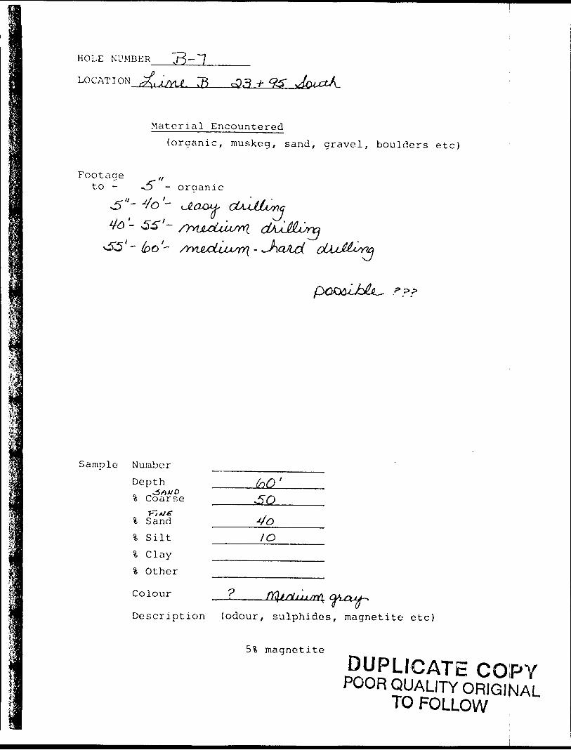
HOLE NUMBER
LOCATION
Material Encountered
(organic, muskeg, sand, gravel, boulders etc)
Footageto - - oraanic
4to - SS'- /^yiju^Uu^n. v55'- 60'- /YvwcUjusrr(-
Sample Number
Depth0 ^^5/OA/O% Coarse
!fc Sand
l Silt
% Clay
l Other
Colour
10
Description (odour, sulphides, magnetite etc)
5% magnetite
DUPLICATE COPYPOOR QUALITY ORIGINAL
TO FOLLOW
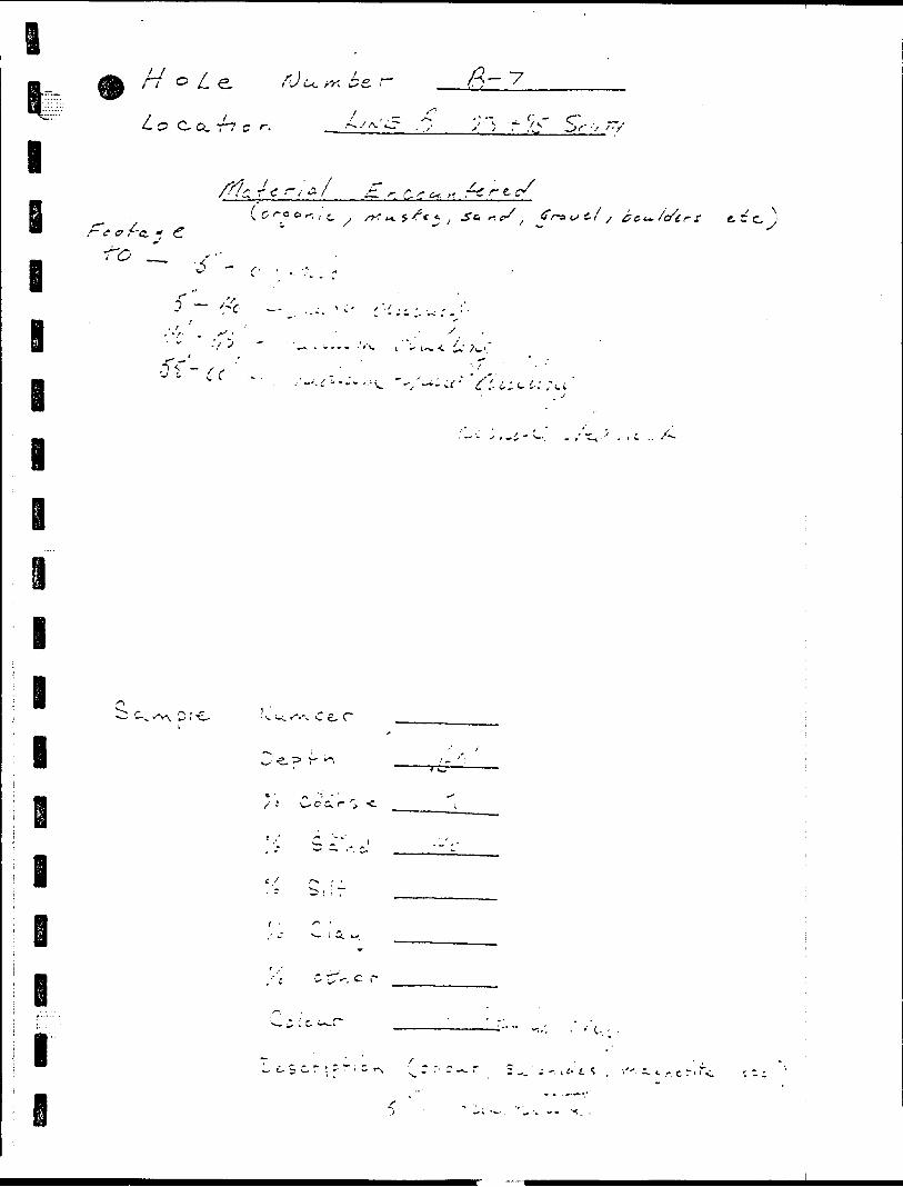
H o L rJi ~ --7
L O C-a. T7 C r.
l^ r ^ /r c*. -- r*, r e.
e i
- f 0 f-G. C
t
c , rt^sr**, *O
i
l I l
e- r
l
C -T-. c r
i
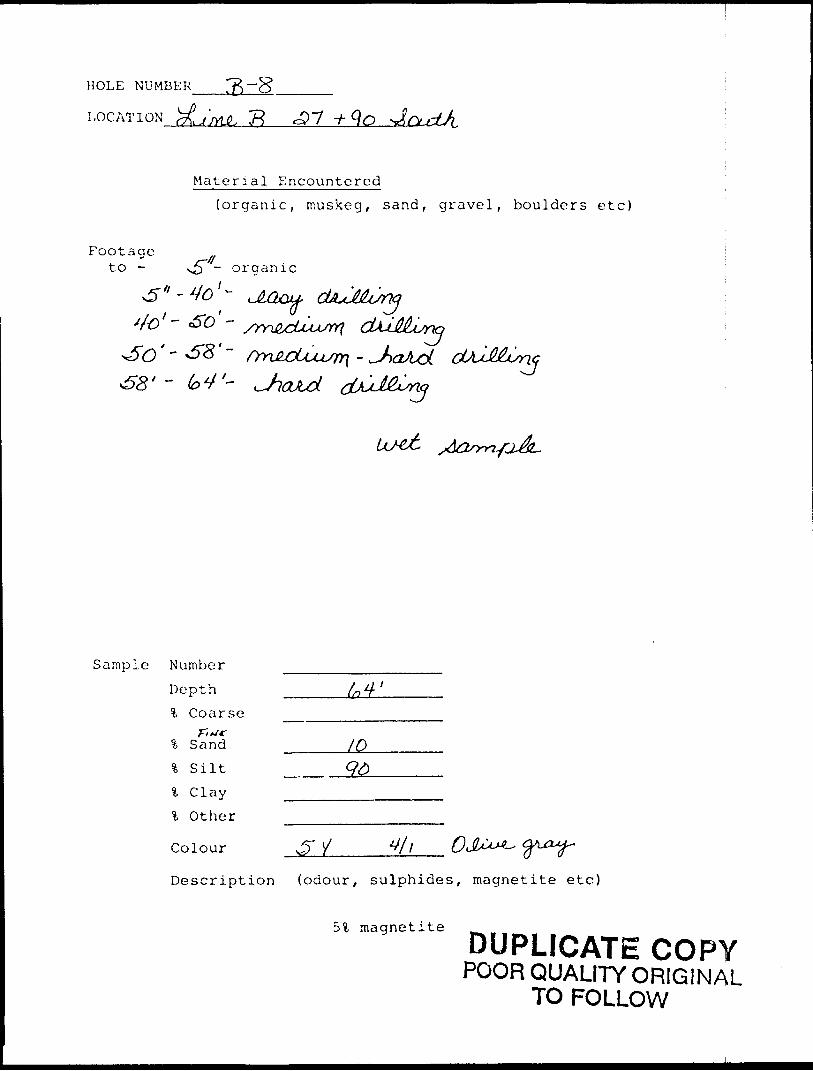
HOLE NUMBER
LOCATION ;^ 7?
Material Encountered
(organic, muskeg, sand, gravel, boulders etc)
Footageto - ~^ ~ orqanic
ic
Sample Number
Depth !fe Coarse
% Sand ______K)
\ S ilt ___^
l C lay ____
l Other
Colour
Description (odour, sulphides, magnetite etc)
SI magnetite
DUPLICATE COPYPOOR QUALITY ORIGINAL
TO FOLLOW
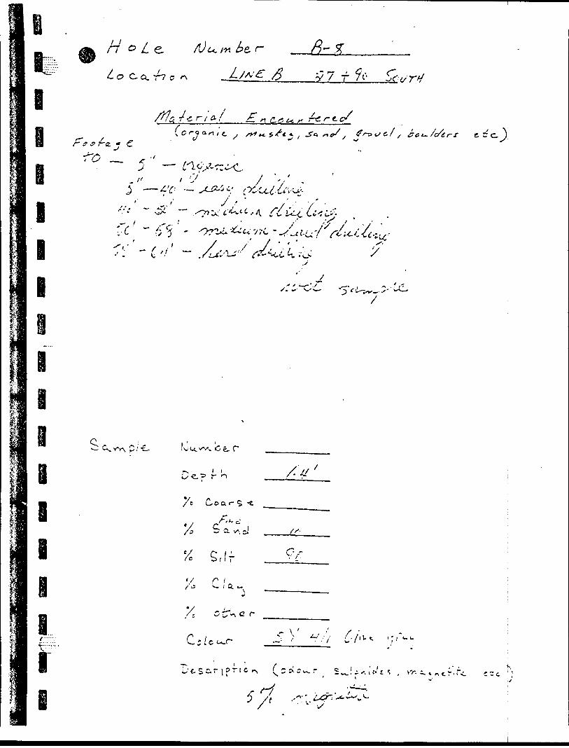
•1-
•I-
) •O
V
r- 0
X
o
\ X
X
^
X
p*rt
t*
-li
s p
^
^
,n
V
^-
'''r
0
O
Y?
(0
0
^
fs
--,.
fT ?
i-
-T
P
J-
? ^
r
o -
n ^
e.
T
")
**
^
O 9- t -i
}-'. ---'
-t •-s
...
~--
. /~
\
(^-.
>x
X -^x X
d "'
(x
-^
P .
t f j
V
0,
o o i w K V*
P*
00
Ci
'K P
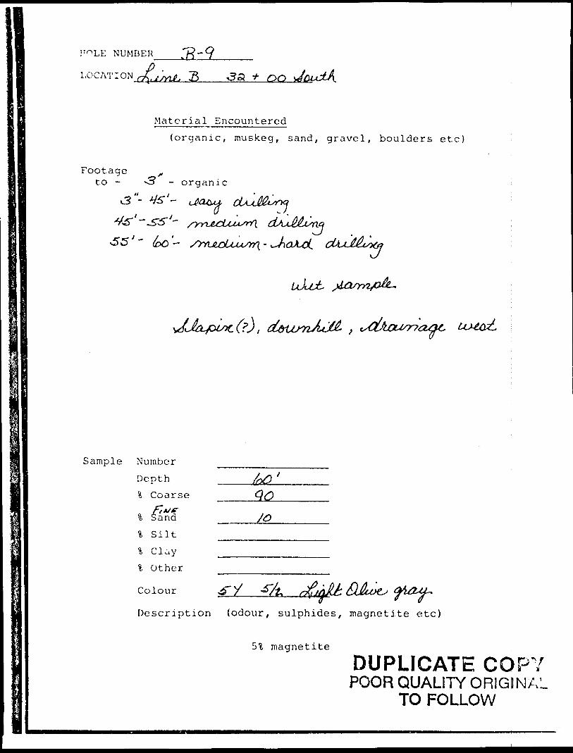
!"~*LE NUMBER .7?"9—————
LOG AT ION^G;^ g ,?a * OQ
Footageto -
Material Encountered(organic, muskeg, sand, gravel, boulders etc)
organic
J
Sample Number
Depth l Coarse
3; Sand
l S ilt
t Other
Colour QJluXL;
Description {odour, sulphides, magnetite etc)
magnetite
DUPLICATE COPYPOOR QUALITY O RIGINAL
TO FOLLOW
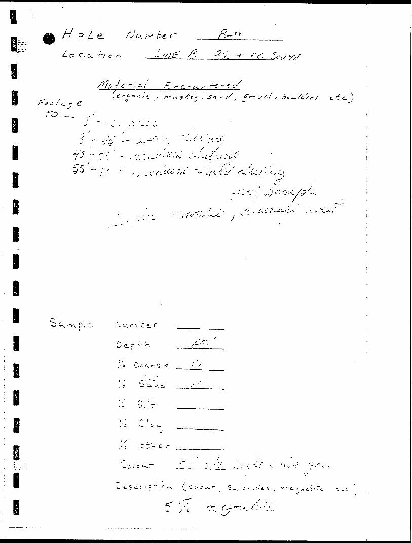
1 t -3 ..,*N/'3.-: c i J -o 3
i
--^/-^f ' .
o o --r: ;
l ^ S 3
^.o* "r,
' ,'^/ -*' ?-
.3 X
/X ^ ^.y -A. 7:
. r (J
B l l l l l le i
e o
-370
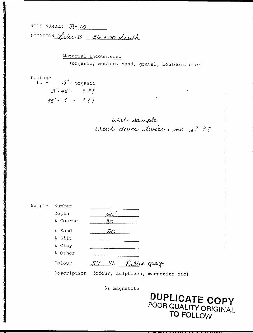
HOLE NUMBER ^ - /Q______
LOCATION ^u^ft 3k tan
Footage to -
Material Encountered(organic, muskeg, sand, gravel, boulders etc)
- organic
Sample Number Depth l Coarse
l Sand l S ilt % Clay *i Other
Colour
Description (odour, sulphides, magnetite etc)
magnetite
DUPLICATE COPYPOOR QUALITY ORIGINAL
TO FOLLOW
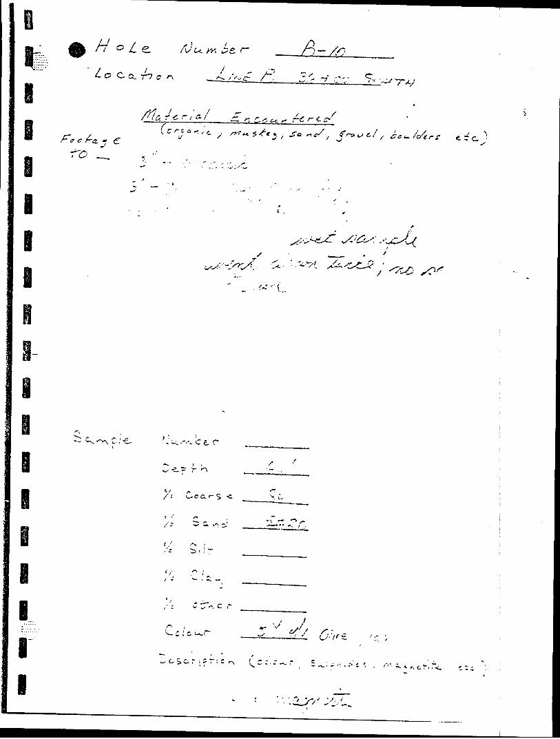
o o o
(j
o 11
, ,
l '
o o pS S, v 'J(
s \)
\
K
O ^ ;,- (o
'l,
T
n
•K
O
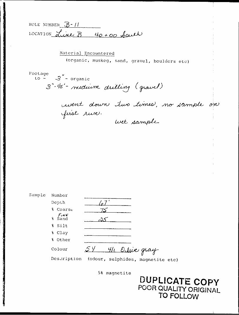
HOLE NUMBER
LOCATI ON d umU R 140 * 00
Material Encountered(organic, muskeg, sand, gravel, boulders etc)
Footage ,,to - *3 - organic
Sample Number
Depth ?. Coarse
t, Sand
l S iltl Clayl Other
Colour v5 y V//
Desjription (odour, sulphides, magnetite etc)
magnetite
DUPLICATE COPYPOOR QUALITY ORIGINAL
TO FOLLOW
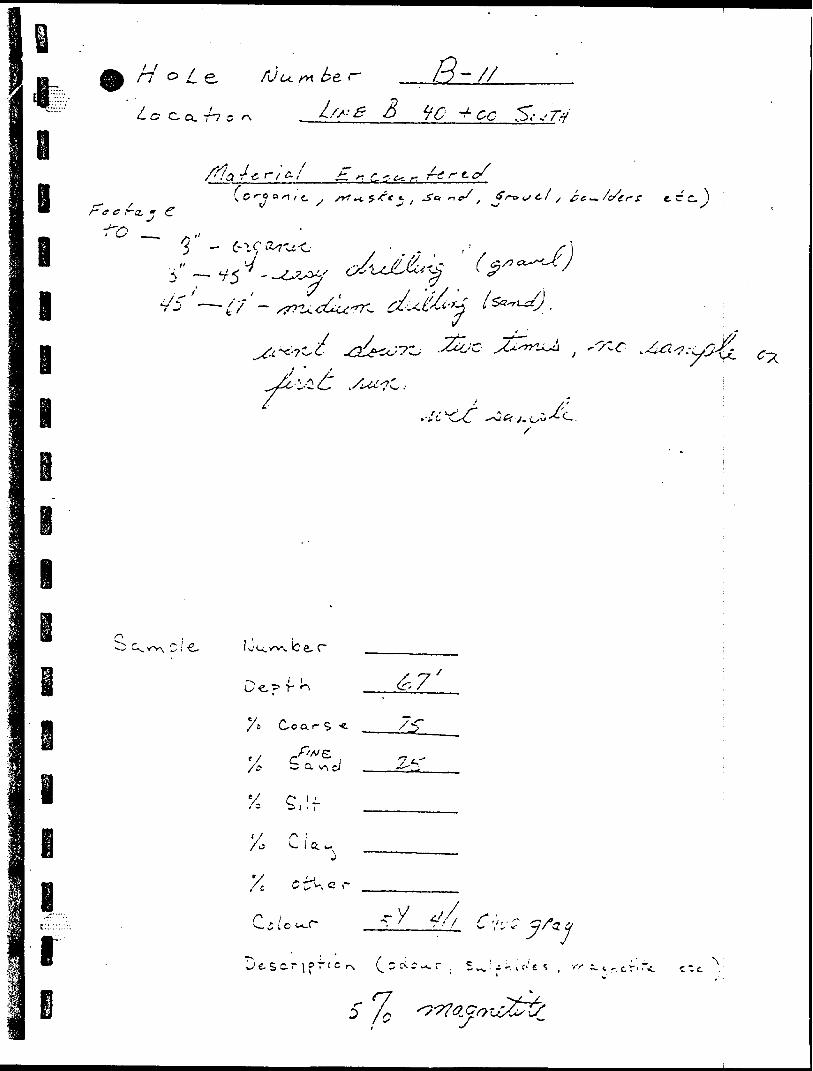
p' C ") ^ o 140! -J "35
r l
rC v. n ~ */
* S-
J
•9-;
-3 3 "a' -?
-j
i l l
. oo
/X -
g7 o LJ
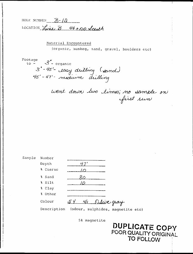
HOLE NUMBER ^B'/cS -
LOG AT I ON xyy^ g
Material Encountered
(organic, :nuskeg, sand, gravel, boulders etc)
Footage
3 - - oov c *w4to - O - organic
- 4s" 1-
- 4T -
-*tux)
Sample Number
Depth
% Coarse
l Sand
'k Silt
l Clay
l Other
Colour
Description (odour, sulphides, magnetite etc)
51 magnetite
DUPLICATE COPYPOOR QUALITY ORIGINAL
TO FOLLOW
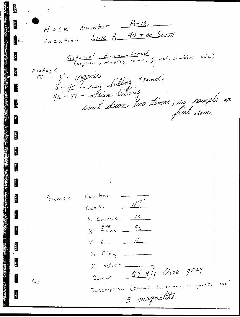
Wife
*
IP r -,
^ ^ w 5
^ o
x ^s
*"^
~C
o
O
"-
F a-
' -
~-
^ f-i
y p
-'•(
" I
-. R
* x
0 '
't1
l
/^ 0 0 f -i -t
tvS
,
^ "~~
^
(f) }
Rv^ p-
0
O (* -y -t-c- i
.^
o p o
0
•^ 4 feo
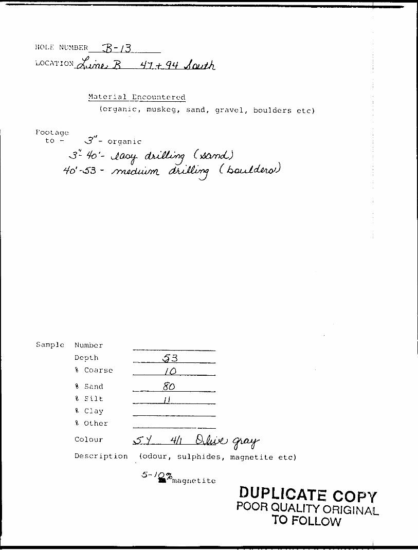
HOLE NUMBER
LOC AT : o
Material Encountered(organic, muskeg, sand, gravel, boulders etc)
Footageto - vjy - organic
v5- 4b'- J.O&U- ^o' -OT3 - /rnAcUu/rn.
(dbrxL)C k&uJLcLM&J
Sample Number
Depth \ Coarse
% Sand l S ilt l C lay l Other
Colour
/Q
V
Description (odour, sulphides, magnetite etc)
'magnetite
DUPLICATE COPYPOOR QUALITY ORIGINAL
TO FOLLOW
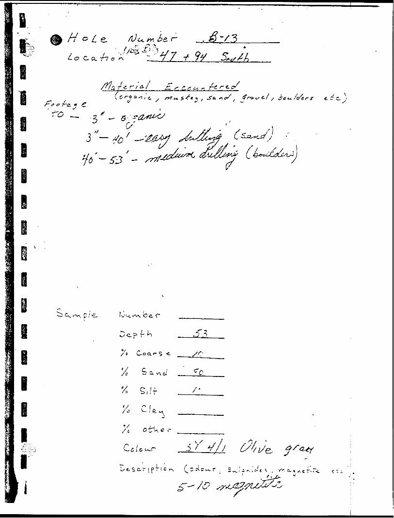
G/^5
A-
7
"3 C* ~^* "^ j
li
(f~**if — - \" ~
-JM/ -,^~,^ •^ _ r
c/f
lp i -o a o
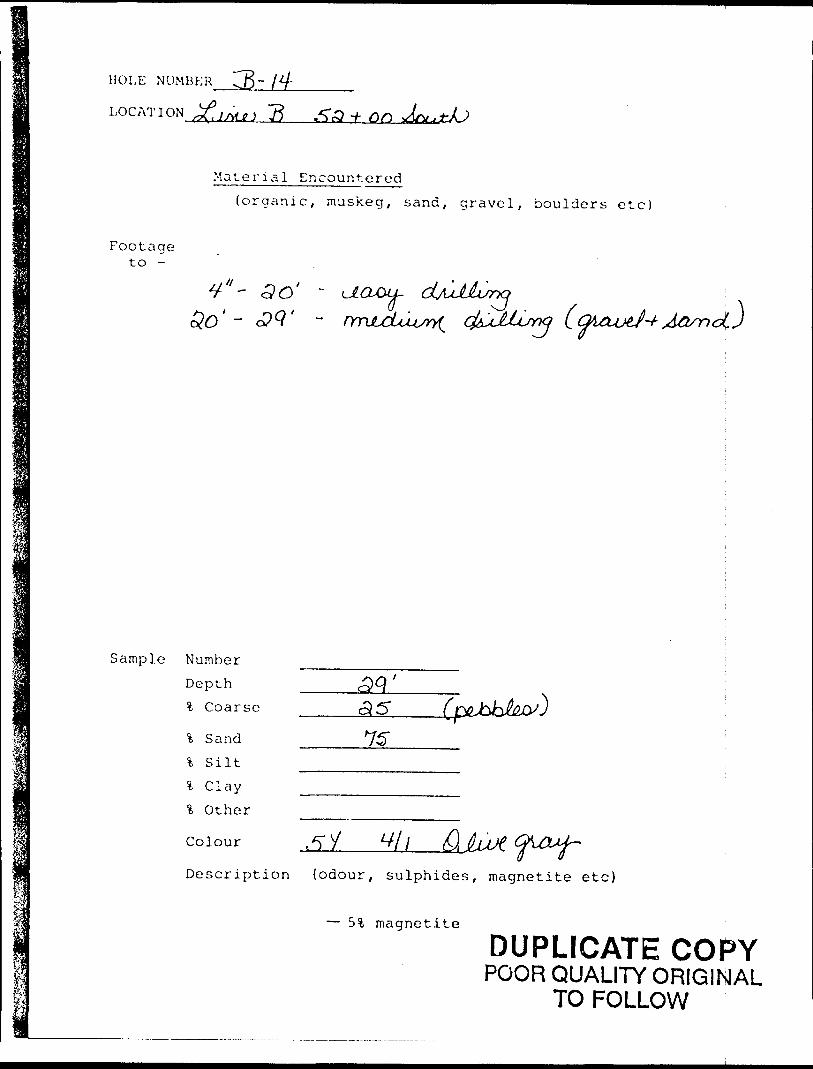
HOLE NUMBER CB~
LOG AT I ON -i- On
Material Encountered(organic, muskeg, sand, gravel, boulders etc)
Footage to -
Sample Number
Depth
% Coarse
\ Sand
% Silt
\ C lay
\ Other
Colour ^ 11Description {odour, sulphides, magnetite etc)
— 5% magnetite
DUPLICATE COPYPOOR QUALITY ORIGINAL
TO FOLLOW
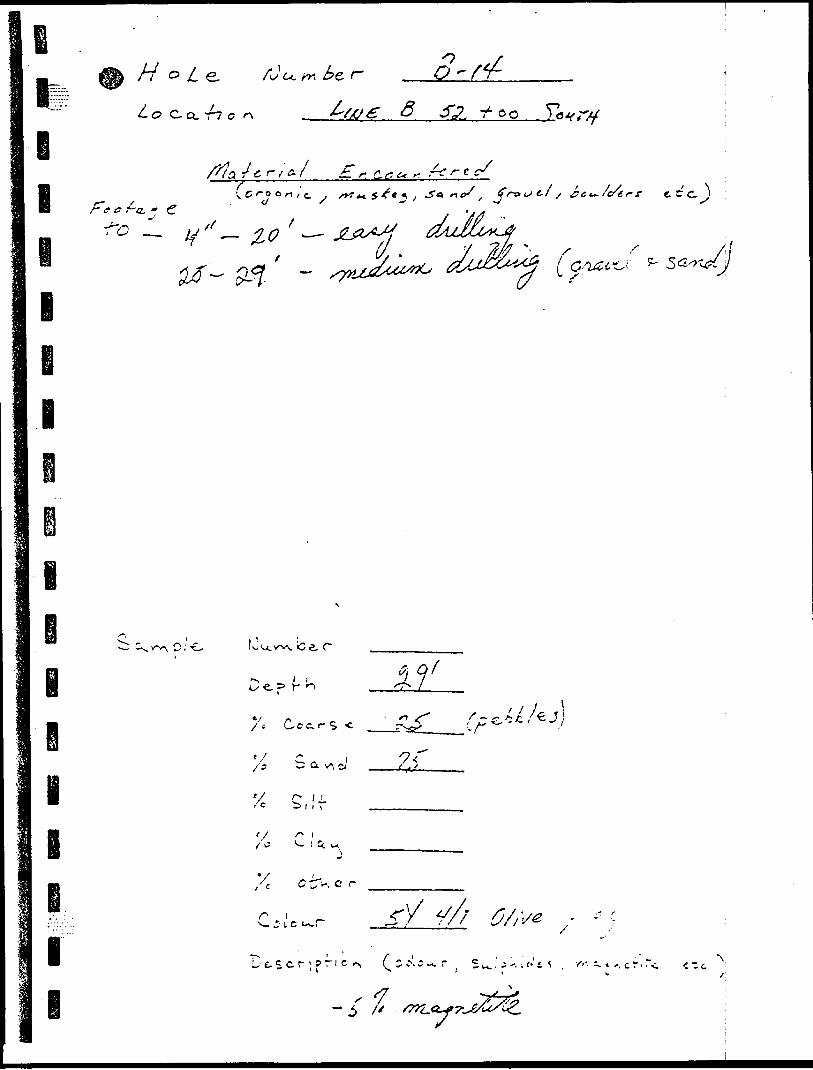
H v L rJu 3-C- CL T7 C
lr. C.* c*. *
f~Q.; C
l
rff
t C C.
yL*o ^M^
l i
l
f O u. v-i^v. le e,
l lr- o
r-, c r
^— z L c
t S c. r ; ? i c
"L— * ', c r' - <
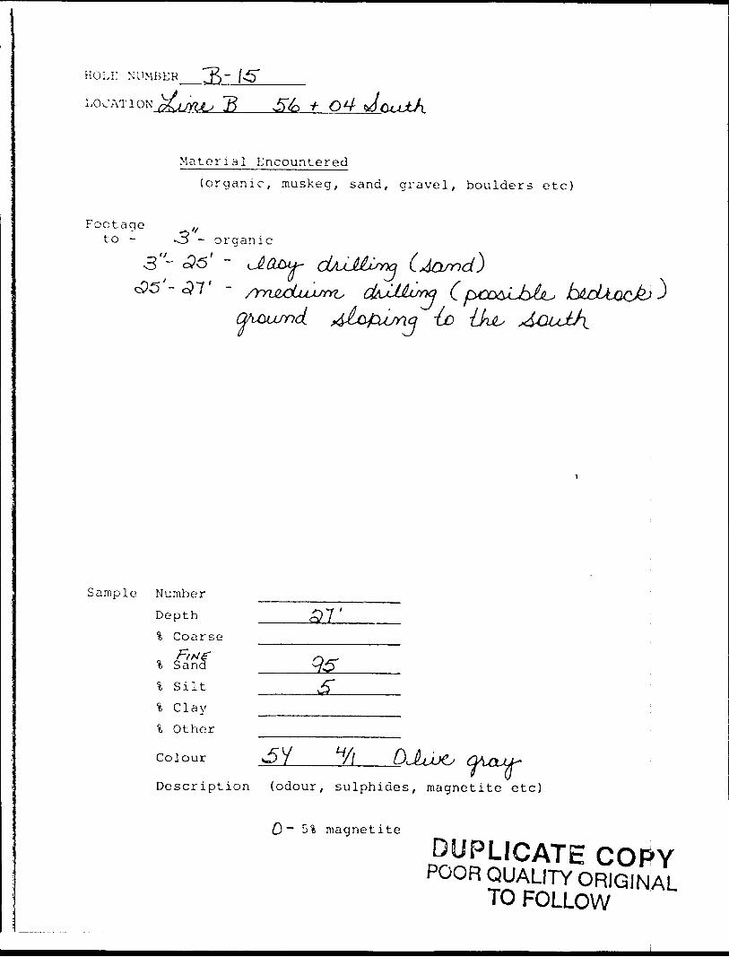
HOLE NUMBER
LOC AT I QXUKJU ~B
Material Encountered(organic, muskeg, sand, gravel, boulders etc)
Footage lfto - O - organic3"-
Sample Number
l Coarse
* S ilt% Clay% Other
Colour
-Loo
Description (odour, sulphides, magnetite etc)
O "~ 5% magnetite
DUPLICATE COPYPOOR QUALITY ORIGINAL
TO FOLLOW
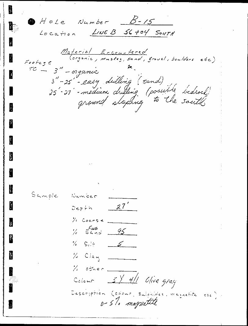
Q)0ft
ISi-codO oo .
c/;
o II \lviCj t J
L.0S
)to
Oc/)
c (J
-f,o
O
LO
f o
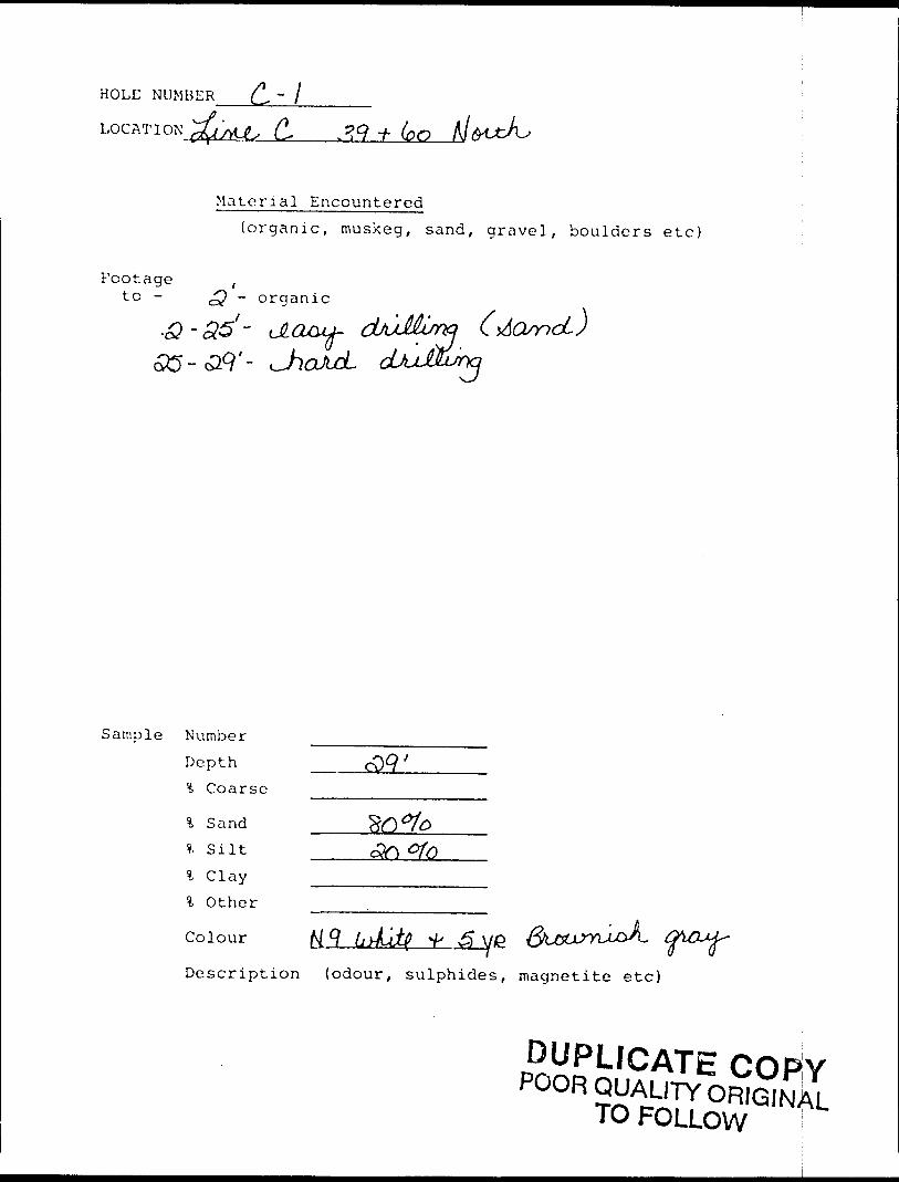
HOLE NUMBER
LOG AT I ON.^vU^ (L 33 * (oO
Material Encountered(organic, muskeg, sand, gravel, boulders etc)
Footage ,to - o? ~ organic
JLQMhv-^*— /i
Sample Number
Depth ?. Coarse
l Sand * Silt
l C lay l Other
Colour N9
Description (odour, sulphides, magnetite etc)
DUPLICATE COPYPOOR QUALITY ORIGINAL
TO FOLLOW l
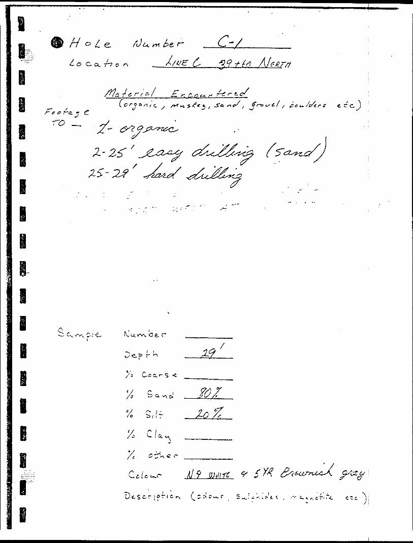
fir/o/eL O C. (X T"7 O
A)u C X
i
g-l-tf't c./ F? Q i
.
~~
Z-/
^^ f ^n ' s e. c c, l
( tf^^C/ s
l
l
NJU.WN. be r
' U r n
S, if to
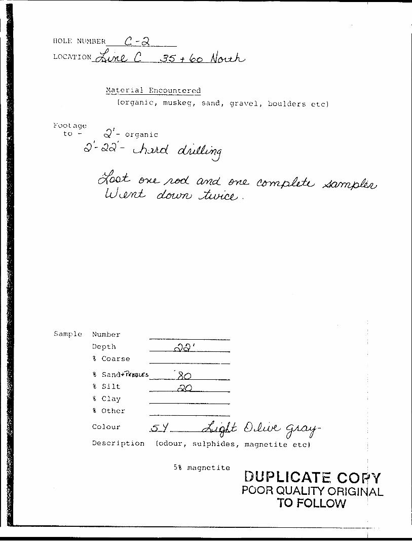
ROLL: NUMBER C. - LOCATION C, 35 f (oO
Material Encountered(organic, muskeg, sand, gravel, boulders etc)
footage to - ~ organic
nG
and.
Sample Number
Depth % Coarse
% Silt
\ C lay\ Other
Colour
Description (odour, sulphides, magnetite etc)
5% magnetiteDUPLICATE COPYPOOR QUALITY ORIGINAL
TO FOLLOW !
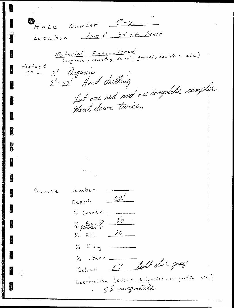
•Si5
l
i
-f *
•xV 7^/7
mwtnf/y j ~L
e
i
i
l
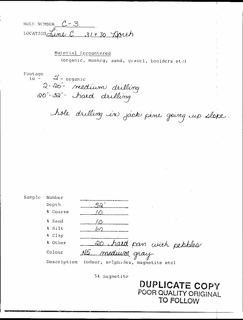
HOLE NUMBER C-~ 3
LOCAT ! o'i JMJL' C.
Material Encountered(organic, muskeg, sand, gravel, boulders etc)
Footage ,to - 'S. ~ organic
d?O'-v55'~^^s
&UYL3
Sample Number
Depth% Coarse ____ l Q
% Sand
l Silt ____fcQ
% Clay ,,—————.l Other
Colour , , -— . -.~~-_^— "~" v /)"' ^
Description (odour, sulphides, magnetite etc)
51 magnetite
DUPLICATE COPYPOOR QUALITY ORIGINAL
TO FOLLOW
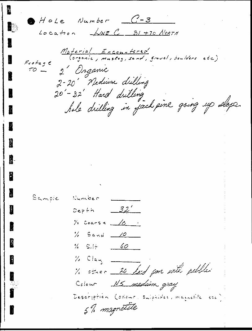
lI l l
Ho L
g i
r7-3-T- 7 C-
/g r ; O. 7 ^T./t g. /g * * r
xe, c.
m
*/ /o
X, •A
a v,
C S
C*?* e
. i. ^ r, c
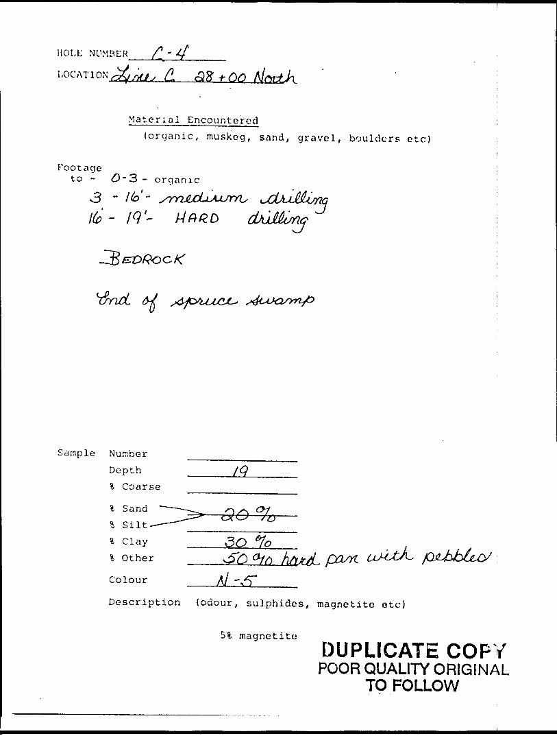
HOLE NUMBER
LOG AT I ON t JMJ; (L olZ -h
Mate r la l E ncou n t e red(organic, muskeg, sand, gravel, boulders etc)
P'ootageto - O ~3- organic3 - Ho-
Sample NumberDepth ______/Q % Coarse
f O
partA/ -
Description {odour, sulphides, magnetite etc)
51 magnetite
DUPLICATE COPYPOOR QUALITY ORIGINAL
TO FOLLOW
V. S.M
VI
fOc
d) ^
o o
-i- o
Ci-
C/)
o IIVI
OC J l
t}
-l-d
O
N
\^cr
5i VS
x
^A*r
C^ o
o
X
^
L j
v\o0
HOLE NUMBER d. ~ S
LOCATION C, hQtPj ~03 -f QO
Material Encountered(organic, muskeg, sand, gravel, boulders etc)
~t o/ -
Footageto - o/ - organic
Sample Number Depth
% Sand ——...—M% Silt ____5ol Clay _____ *)l Other
Colour y R
Description (odour, sulphides, magnetite etc)
j magnetite
DUPLICATE COPYPOOR QUALITY ORIGINAL]
TO FOLLOW
(p
?0
C-
' -F?
t *
±
SL rf" r t r
lpn l h-v y
ft
^-M
u
•t-
-Y*
0I-
l- (\
- 5?
o o
p r-
-^
(*o
* k 0\ x V
c. P 5 ^j-
o l ^
^\
c* rK O
HOLE NUMBER C," h ———~—.
LOG AT I ON;^ C. BC -f OO
Footage to -
Material Encountered(organic, muskeg, sand, gravel, boulders etc)
- organic
Sample Number Depth % Coarse
% Sand % Silt % Clay % Other
Colour
If)
Description (odour, sulphides, magnetite etc)
51 magnetite ;DUPLICATE COPY
POOR QUALITY ORIGINAL TO FOLLOW i
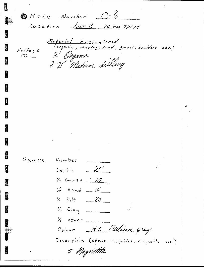
c* to P in i. .V 5 ;* f f y f "J",
ri-
o oo U
- J- n
o ——
p
r •o
\" (p
p 5
0
o P
O J"
\.
OKo O P o
o
Xi o
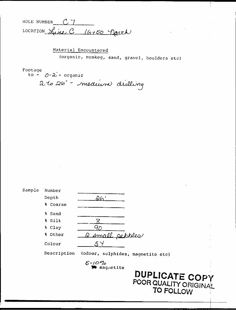
HOLE NUMBER (\,
LOG AT I ON
Material Encountered(organic, muskeg, sand, gravel, boulders etc)
Footageto - 0 -oU - organic
Sample Number Depth % Coarse
l Sand l Silt * ClayOther o?
Colour ^ 7
Description (odour, sulphides, magnetite etc)
magnetite
DUPLICATE COPYPOOR QUALITY ORIGINAL
TO FOLLOW
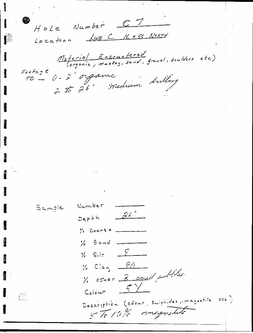
(P r
e; c* \o P -i
x
r"O-I
- o -
?
O
Xo r
o 'A n -)
;s o
-^ K^ t s
^ ^.
N ,x V
O
-tP 5
O o P l
R
-"K
O"
C"
r* fi
^r-
o O
o h- o*
h
o 'K
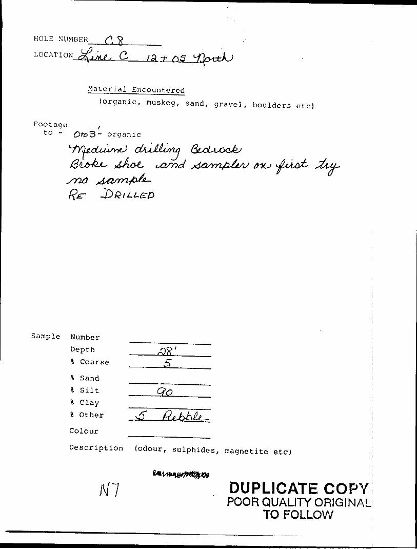
HOLE NUMBER
LOCATION C,__iSL±,
Footage to ~
Material Encountered(organic, muskeg, sand, gravel, boulders etc)
~ organic
tnu
Sample Number Depth % Coarse
% Sand l Silt l Clay
Colour
Qo
Description (odour, sulphides, magnetite etc)
DUPLICATE COPYPOOR QUALITY ORIGINAL
TO FOLLOW
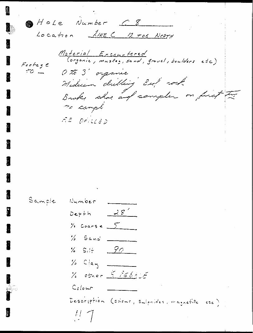
l-j
v ;-C'?/ c J3V
06
f
w/
^ 0/
7.e/
Ji i i ie ^/G^^O
p e j.'
'\SZs**^'"'S
l l l
ff -t
7
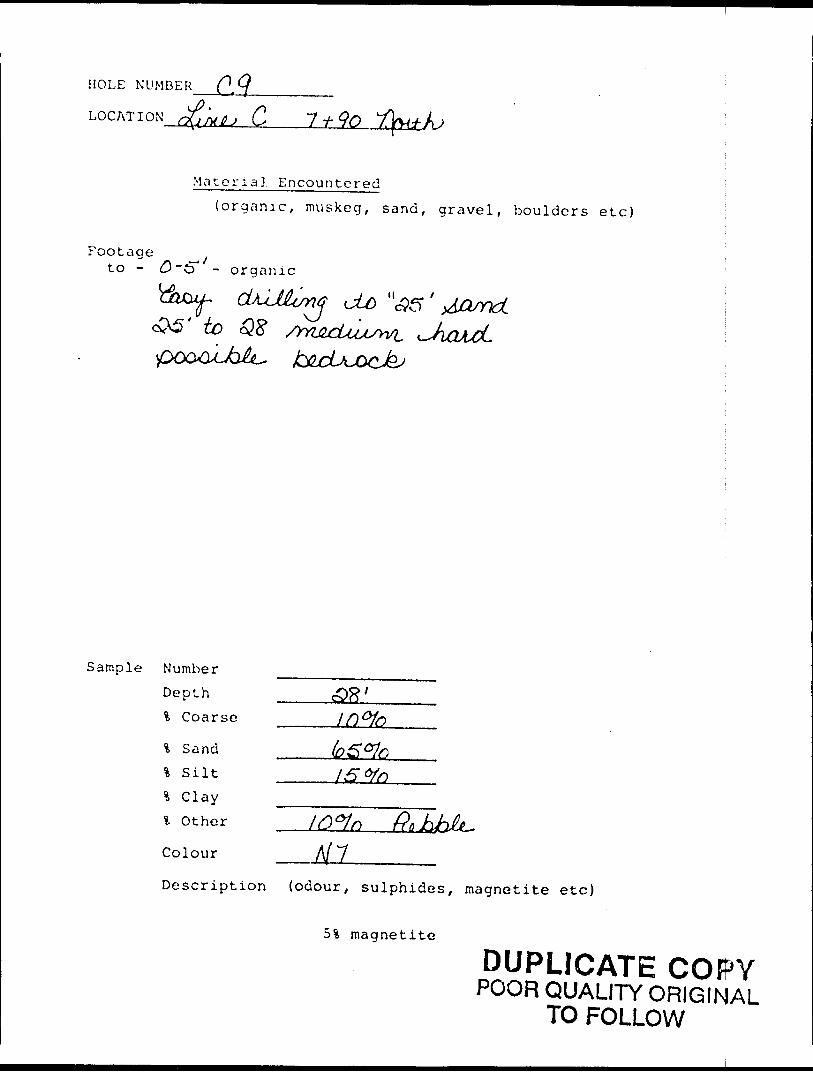
HOLE NUMBER Q^
LOCATION (^(jMJtj C 90
Footageto -
M a t or i a 3. E n co u n t e r e d(organic, muskeg, sand, gravel, boulders etc)
- organic
' io 08
Sample Number Depth % Coarse
% Sand % Silt 4 Clay l Other
Colour MlDescription (odour, sulphides, magnetite etc)
5% magnetite
DUPLICATE COPYPOOR QUALITY ORIGINAL
TO FOLLOW
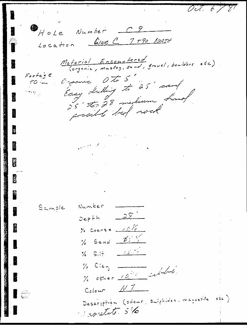
l l,.t...
f l l
6
H G Le.
Lo C O. T7 C
' ' JT-Q.* c
r 9-7
l
l
l
B l l
-. b e, r
x,
V r -* c rC ty -^ ^ *
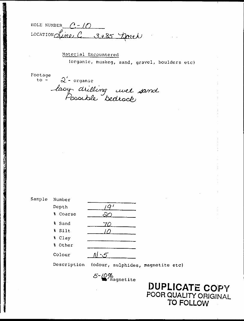
HOLE NUMBER
Material Encountered(organic, muskeg, sand, gravel, boulders etc)
Footage to - - organic
Po
Sample Number Depth % Coarse
\ Sand l Silt % Clay \ Other
Colour
-70
1O
Description (odour, sulphides, magnetite etc)
magnetite
DUPLICATE COPYPOOR QUALITY ORIGINAL
TO FOLLOW
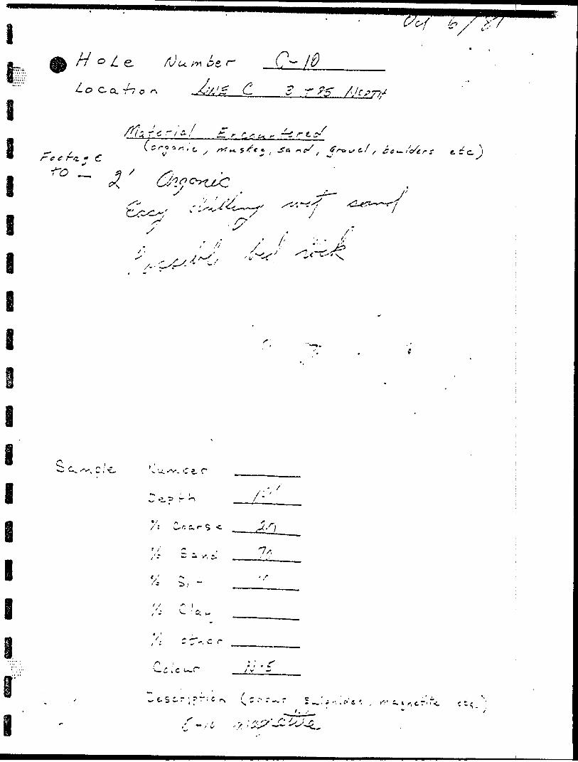
r W"
f^N
^
i-; ,vv
o 'J J -l
R..
AM , V
. (i
o l '\
IV Min
i- v.
T A
C •\l 3-
rfN
-
O o 0 ;j ^1
0
•K O V.--
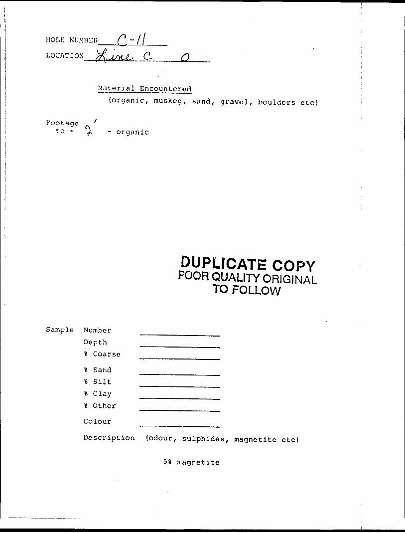
HOLE NUMBER C. "ll
LOCATION C.
Material Encountered{organic, muskeg, sand, gravel, boulders etc)
Footage 'to - y. - organic
DUPLICATE COPYPOOR QUALITY ORIGINAL
TO FOLLOW
Sample Number Depth l Coarse
% Sand% SiltS. Clayl Other
Colour
Description (odour, sulphides, magnetite e tc)
51 magnetite
•o
r M
..
\ ,.x
"^
"\
-^
(.
f
l \
o ^
r,
fn
T
'x-
t^
'l V
'IT
T
p
n '~
*
- '^
t 5
^ T
0 n
'-
Y.',
y "'
^^ 0 f -ii
"c
1
F ;
\
in f •i-
rr l*.
I-
S
o1
V* ^ V
r^
K
s. V k
O O
OP
rx 0*
f* •K O
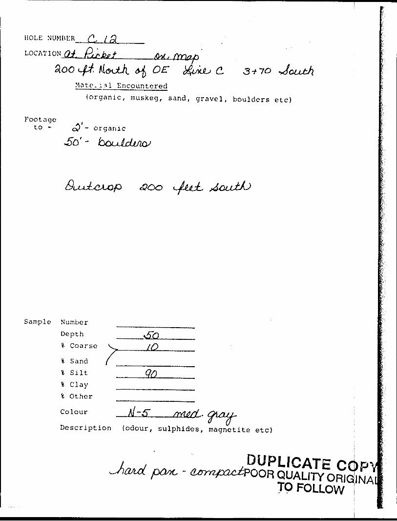
HOLE NUMBER
LOCATION^.
OE: yuu C 3+70Ma to. i3l Encountored
(organic, muskeg, sand, gravel, boulders etc)
Footageto - (
c? ~ organic
JLt&JL
Sample Number
Depth?. Coarse V _____[Q
\ S and f —-——--——.\ s ilt ___QQ\ C lay --.———^.. i Other
colour A-5* frtwrj^ OMUL-Description {odour, sulphides, magnetite etc)
DUPLICATEQR QUALITY
TO FOLLOW
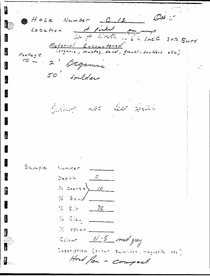
O } r
o x
r
-. -
X'
X-
iO -I- CN
" uC V
l- p
rv
o O P o
0
0 i * ItV
* 1? 1
-*
\ . J.'
A 1li ^
*^K
•i ^
*^~
^ yv
^ \ ;
J
k
C
(f "
V
^
s ^^ c*\
"l\ l' x ? l
k ^*
.
K
li f-'K
5* o C
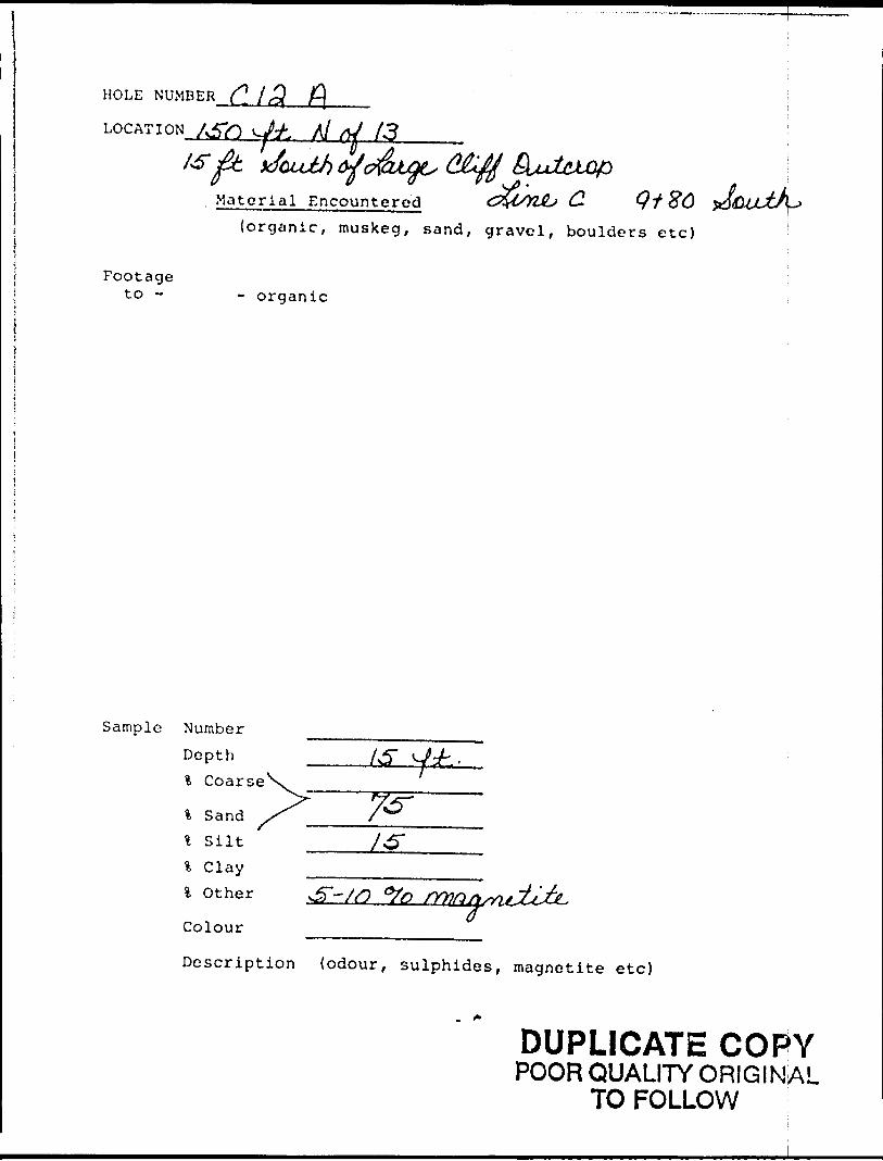
HOLE NUMBER (]. 13( f\
LOG AT I ON. A5?l .Vj^fc. Al / A3
Material Encountered Q1 86(organic, muskeg, sand, gravel, boulders etc)
Footageto - - organic
Sample Number Depth l Coarse
% Sand4 Siltl Clayl Other
Colour
Description (odour, sulphides, magnetite etc)
DUPLICATE COPYPOOR QUALITY ORIGINAL
TO FOLLOW
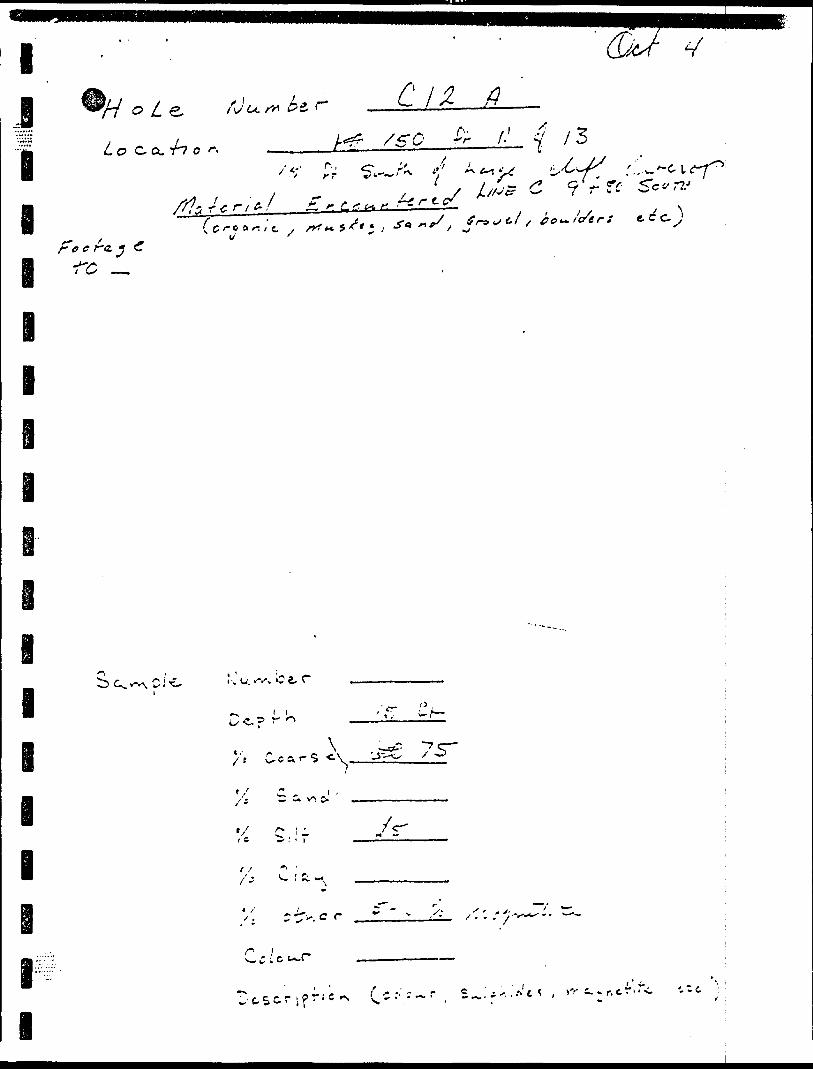
o4
V': *
J"* -^
-* *^
^r
o
td) o
(f*ci:
v o
:*N
O
y
?'
- -l
c-iJc/)
J)
oH-j.o cl t
01
Cn) ..OiJ
n-
td oOU
)
I-
V*
X"
f*CO
Co
. u OO
f *
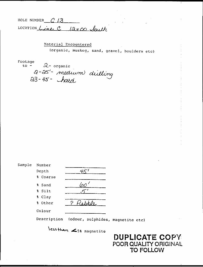
HOLE NUMBER C /S
LOG AT I ON L ^'jXJL* (L
Material Encountered(organic, muskeg, sand, gravel, boulders etc)
Footageto - ,p^- organic
Sample Number Depth % Coarse
fc Sand l Silt % Clay *i Other
Colour
Description (odour, sulphides, magnetite etc)
% magnetite
DUPLICATE COPYPOOR QUALITY ORIGINAL
TO FOLLOW
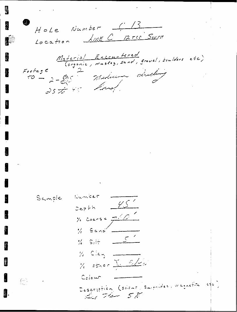
3 ' j-.-J C")
o I 5 -^
7.
i J
' '; c
x *
/
-i t t
l
l
e i i
;'-3^ /-'J/'/-"? V7
l
l
e i
V/ O
H
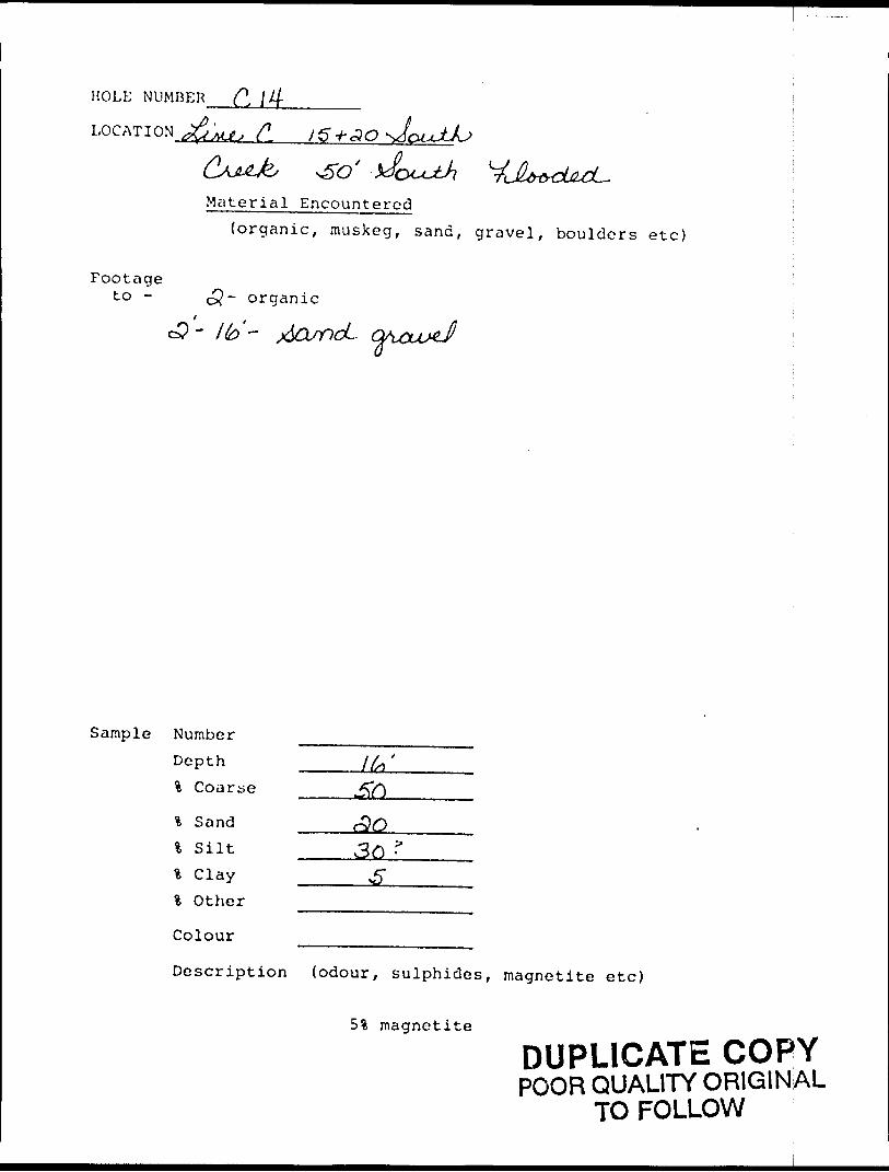
HOLE NUMBER (l \ 4
LOCATION
Material Encountered(organic, muskeg, sand, gravel, boulders etc)
Footageto - cQ- organic
c3- -
Sample Number Depth % Coarse
% Sand \ S ilt % Clay \ Other
Colour
Description {odour, sulphides, magnetite etc)
51 magnetite
DUPLICATE COPYPOOR QUALITY ORIGINAL
TO FOLLOW
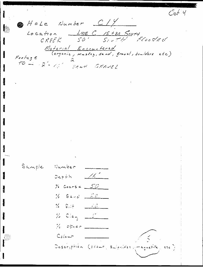
(p o
ov ^ I(x
O o
10 :;. Ci -l
Srv
Ml -t { 3- \
A
oc\
K,
\
.\
V
Cv •O
o li o\
O)
^r-..
-C.
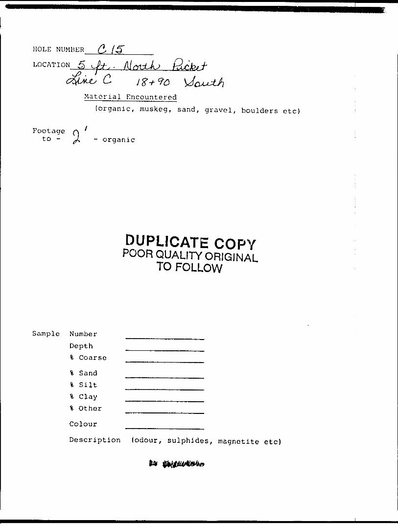
HOLE NUMBER
LOG AT I ON *
c.Material Encountered
(organic, muskeg, sand, gravel, boulders etc)
Footage to - - orqanic
DUPLICATE COPYPOOR QUALITY ORIGINAL
TO FOLLOW
Sample Number Depth % Coarse
% Sand \ S ilt \ Clay t Other
Colour
Description (odour, sulphides, magnetite etc)
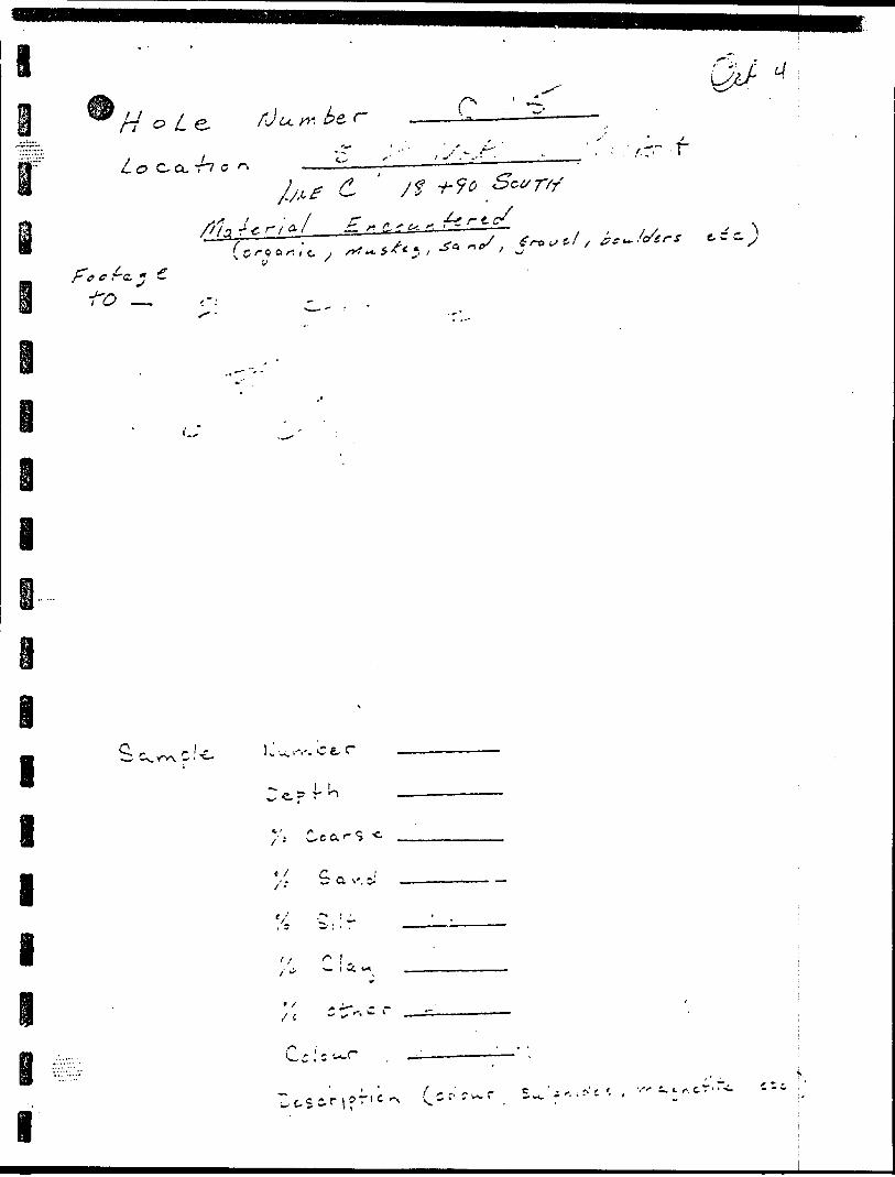
(P -o
. vi
- ( r
'.
-r'
r
-v-
-^
..x
-.v.
^ }
r t,
u :!
p o
, -x
i'';
tp
o (~
(*
1
- ~
0
'
p
3~
(to
r0
t, y-
p-
:,r
J
^ o
r* t-
1 V
io
-
n
f~^ o F -1
1 i
,
n* .
o O P o
hM
^ g
V
h** f\
C.
- o
-1-
V.. -C.
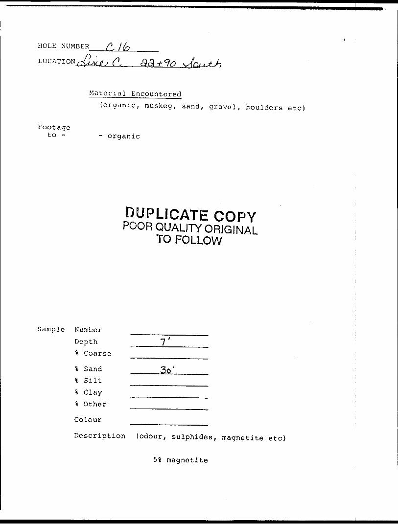
HOLE NUMBER
LOCATION (9oU*fc?
Footage to -
Material Encountered{organic, muskeg, sand, gravel, boulders etc)
- organic
DUPLICATE COPYPOOR QUALITY ORIGINAL
TO FOLLOW
Sample Number Depth l Coarse
\ Sand % Silt % Clay \ Other
Colour
7'
3o'
Description (odour, sulphides, magnetite etc)
51 magnetite
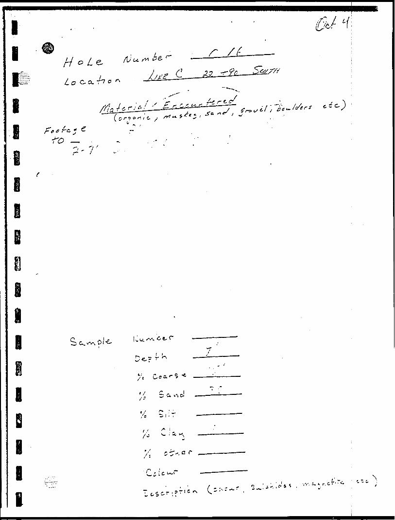
^0;'J
J O
s- t : ^ v' i ^* / '
^ ' 5
l l
l
— o j-i ll I l
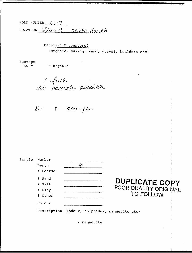
HOLE NUMBER
LOCATION C,
Footageto -
Material Encountered(organic, muskeg, sand, gravel, boulders etc)
- organic
//LO
Sample Number
Depth % Coarse
l Sand l Silt
\ Clay l Other
Colour
DUPLICATE CO^YPOOR QUALITY ORIGINAL
TO FOLLOW
Description (odour, sulphides, magnetite etc)
51 magnetite
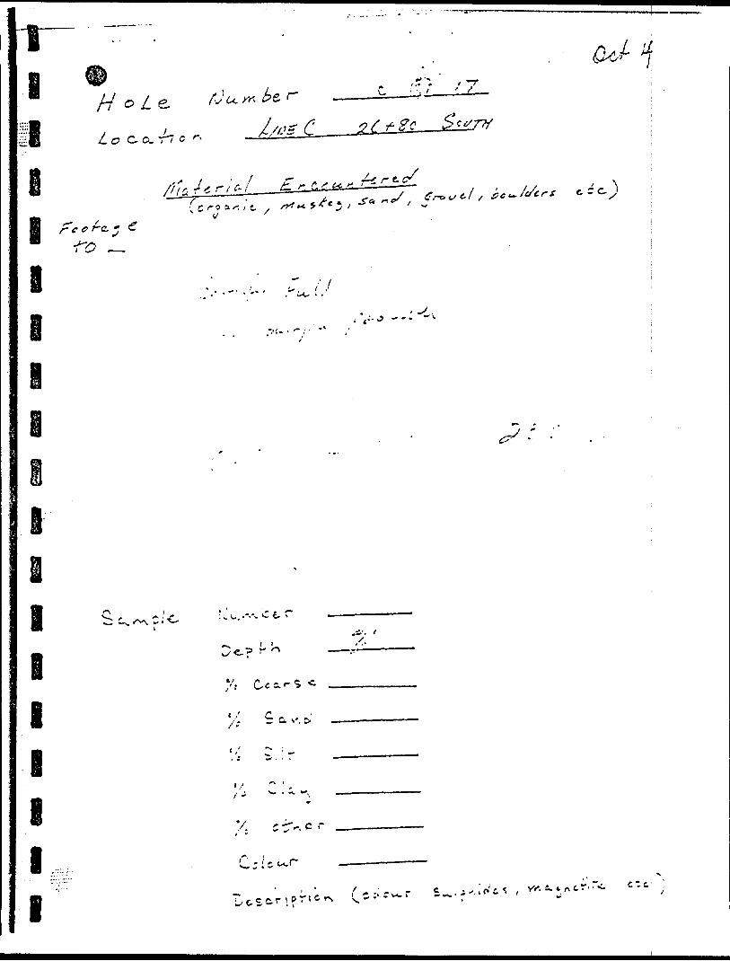
x
fp r l -o
V
0
.N*
v-
'-
"*
r \
i" c'
O
-{-
o *r~
/-
j v?
in
**
,-
r•-"
E,
"v .!
-r p
" -
** *
1 ^
iA
;". ?
'' v-
*
^ •) -i
i1 ** ^
* -fc
•t- o li o
l 4 4 x
^ V* ^y Vi"
\
3 t ft r fc
Q O
P o
0
l'* ^
(* *K
O
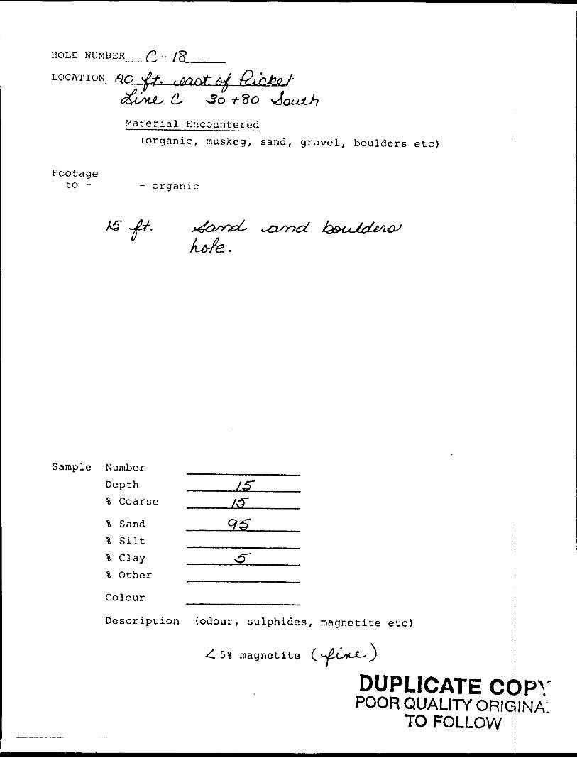
HOLE NUMBER ^ - /S* LOCATION
s 0*0 t- So
Material Encountered(organic, muskeg, sand, gravel, boulders etc)
Footageto - - organic
Jfr.0 Ue.
Sample Number Depth l Coarse
* Sand % Silt l Clay l Other
Colour
Description (odour, sulphides, magnetite etc)
^ 51 magnetite
DUPLICATE COPYPOOR QUALITY ORIG INA
TO FOLLOW
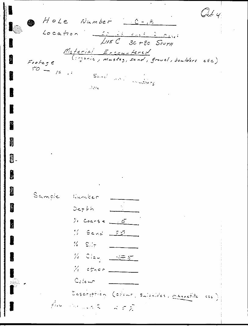
'•l0 in
li
o
(r* r > - o
r.
C
f"
r 0
f
* tO
(f
, 0
T-
^
-7 \V
,Y
:.-
P
* r
o-t
5 1
O
i .
tf^
1 t •li "l^
A
f)
II
f
v ..
y
fN.
O O0
ir.
Ir.
^o V t i V
t\
Oj
O o
o
o o.
O
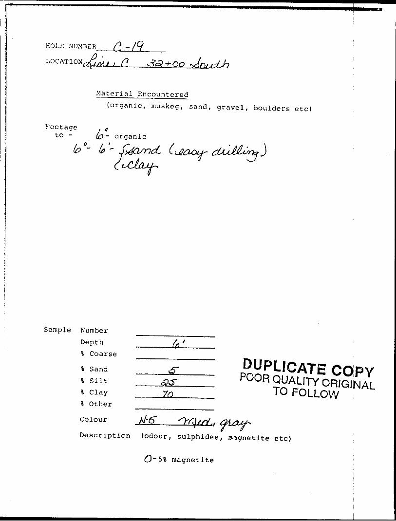
HOLE NUMBER (\ -
j C*. 3(3+00
Material Encountered(organic, muskeg, sand, gravel, boulders etc)
Footage to - - organic
"" b ~
Sample Number Depth *fc Coarse
% Sand% Silti Clay% Other
Colour
DUPLICATE COPYPOOR QUALITY ORIGINAL
TO FOLLOW
Description (odour, sulphides, nsgnetite etc)
magnetite
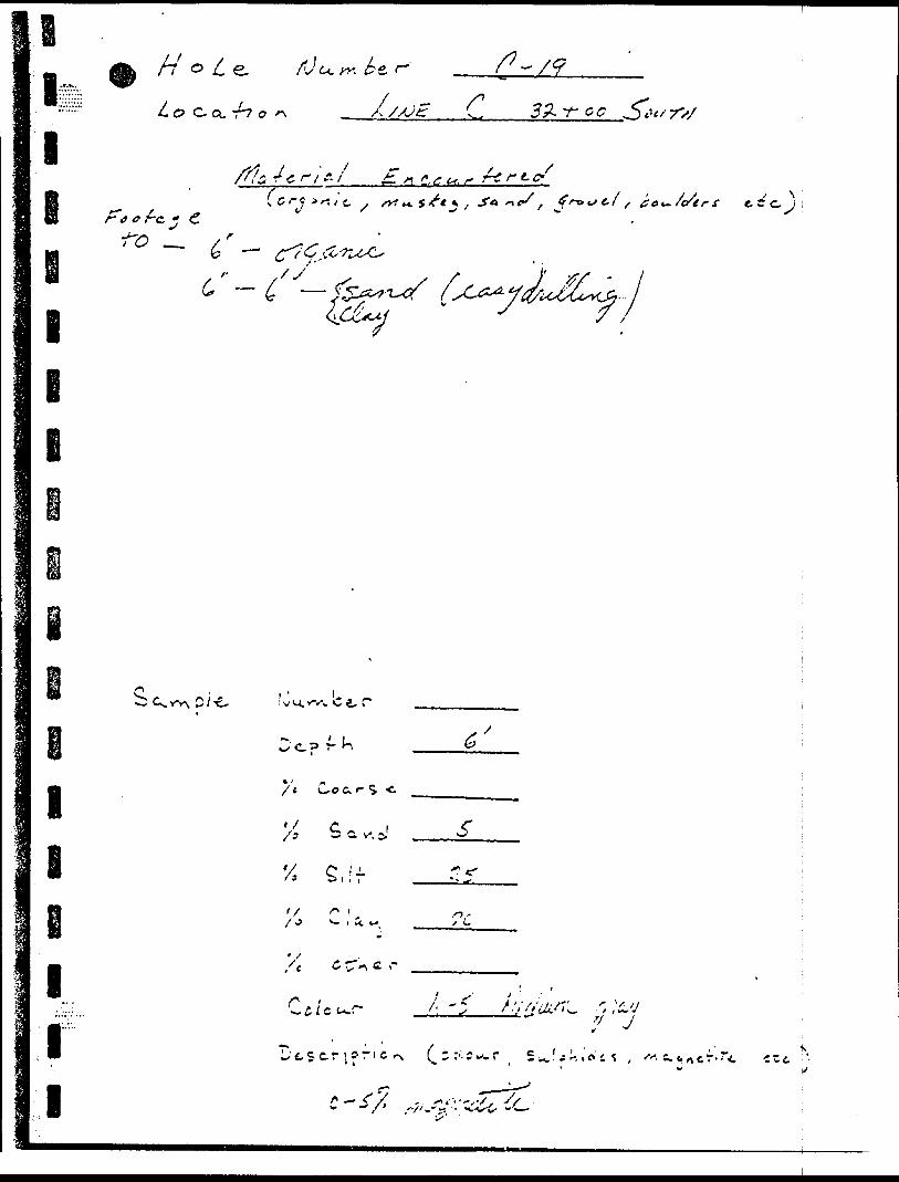
i l
/r
Co. r7 o/i
32- -r e c S tt f rv
c fc. *
I
e i
7 C r* K*{* * f , fo^/e/tr-f frCrc. j
C.
lE
ll l
i v u. icv. c 4. r
c. r
/'e Co c. *- S -c
V: S av^
'X C ?-/5 S" | . i
f/
C ^ e. ,-,'e
-, K
? J
". c. c.
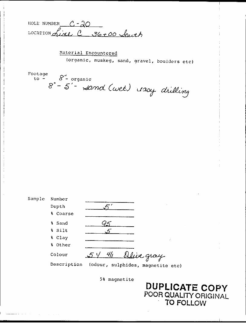
HOLE NUMBER
LOCATION J^^ d
Material Encountered(organic, muskeg, sand, gravel, boulders etc)
Footage ,,to - o - organic
5**- 5"- xJQsnvL(u^) ijaou-
Sample Number Depth % Coarse
% Sand l S ilt l Clay * Other
Colour ^ S/
Description (odour, sulphides, magnetite etc)
5i magnetite
DUPLICATE COPYPOOR QUALITY ORIGINAL
TO FOLLOW
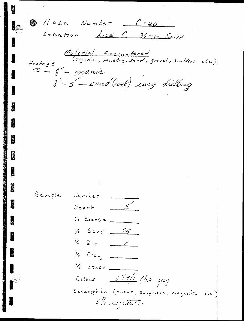
o"lio
o l
V.V
o
~xC o
l.s?-s4Vix
oca
^\
S
o oo
•xjV)
Ci.
(J)
u
-i.t*
0
o l) x"
r.'oc J l.1-l
"A
N
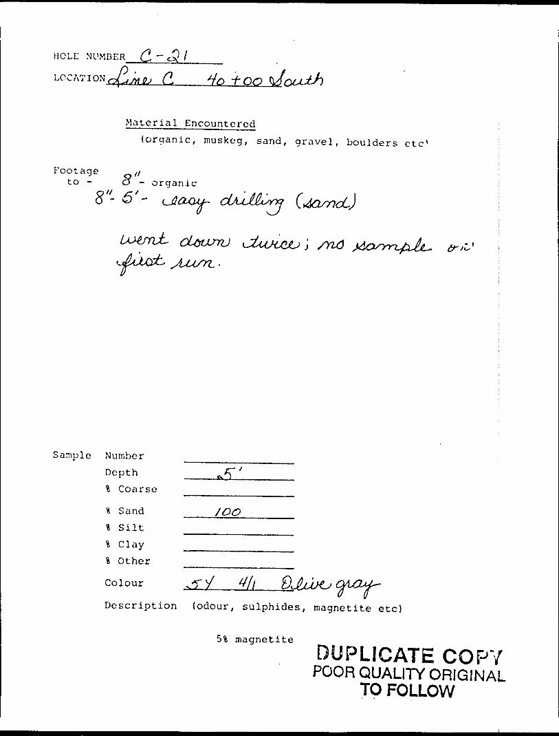
HOLE NUMBER ~ cj?
LOCATION c ^JrttU d +/0 J- CO
Material Encountered{organic, muskeg, sand, gravel, boulders etc 1
Footage ,/to - O - o rganic
O ^-S
\ /Yl6
Sample Number Depth % Coarse
% Sand JOO'i Silt ^—————-.l Clay ———————% Other
yDescription {odour, sulphides, magnetite etc)
5% magnetite
DUPLICATE COPYPOOR QUALITY ORIGINAL
TO FOLLOW
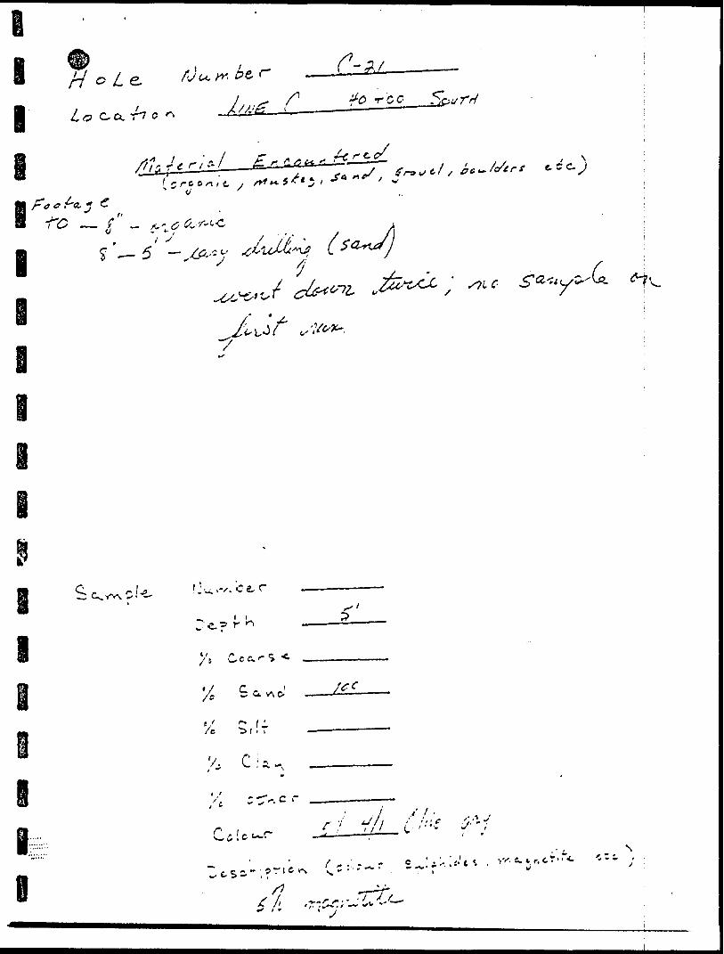
'j} '/r /
V, -j-; D
'5 'X
/^"
i J- c?^ P r^*v
^ ^'Y^ -5^ -^ ^/y7 0 H
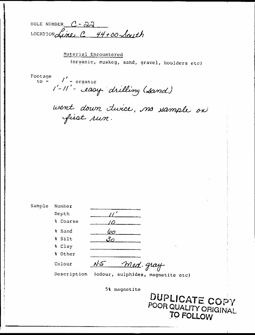
HOLE NUMBER (2, -
CL
Material Encountered(organic, muskeg, sand, gravel, boulders etc)
Footage tto - l - organic
cUrusn c
Sample Number
Depth _____l/ ' % Coarse
\ Sand ^.-^^j,% Silt ———\ Clay -——% Other
Colour
Description (odour, sulphides, magnetite e tc)
5i magnetite
DUPLICATE COPYPOOR QUALITY ORIGINAL
TO FOLLOW
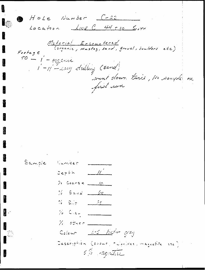
i l -i - -- r -*- ^ j ~ - -.; ; N, ^ ; : . c ' - O S -3t i
/V'~ ^ .-^O'J-.
- ' '^. . *v,' i
J "? C* '-
l
I
l
y
r- 7
7 —
^ '*J V'"si
c L~
7 o /
i
Il \
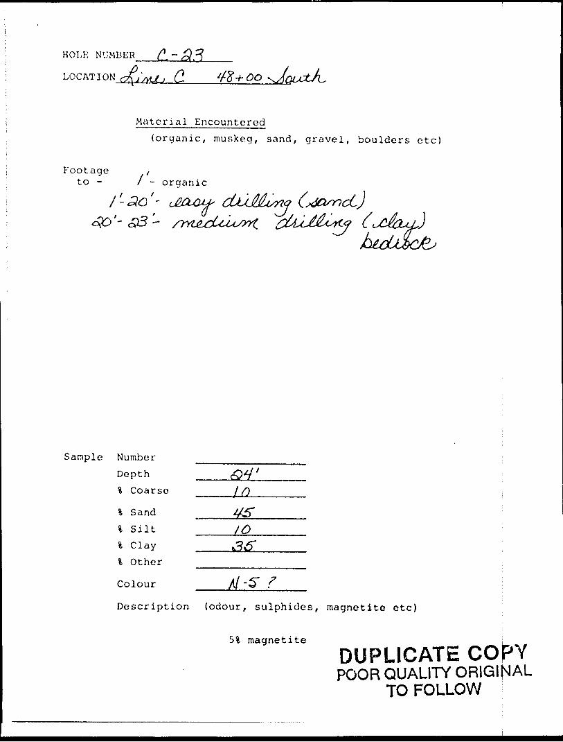
HOLE NUMBER
LOG AT I ON C. 48+00
W
Material Encountered(organic, muskeg, sand, gravel, boulders etc)
Footage {to - l - o rganic
' dJUMvrtrtc
Sample Number Depth % Coarse
\ Sand l S ilt l Clay l Other
Colour A/-S"
Description (odour, sulphides, magnetite etc)
5% magnetiteDUPLICATE COJPYPOOR QUALITY ORIGINAL
TO FOLLOW
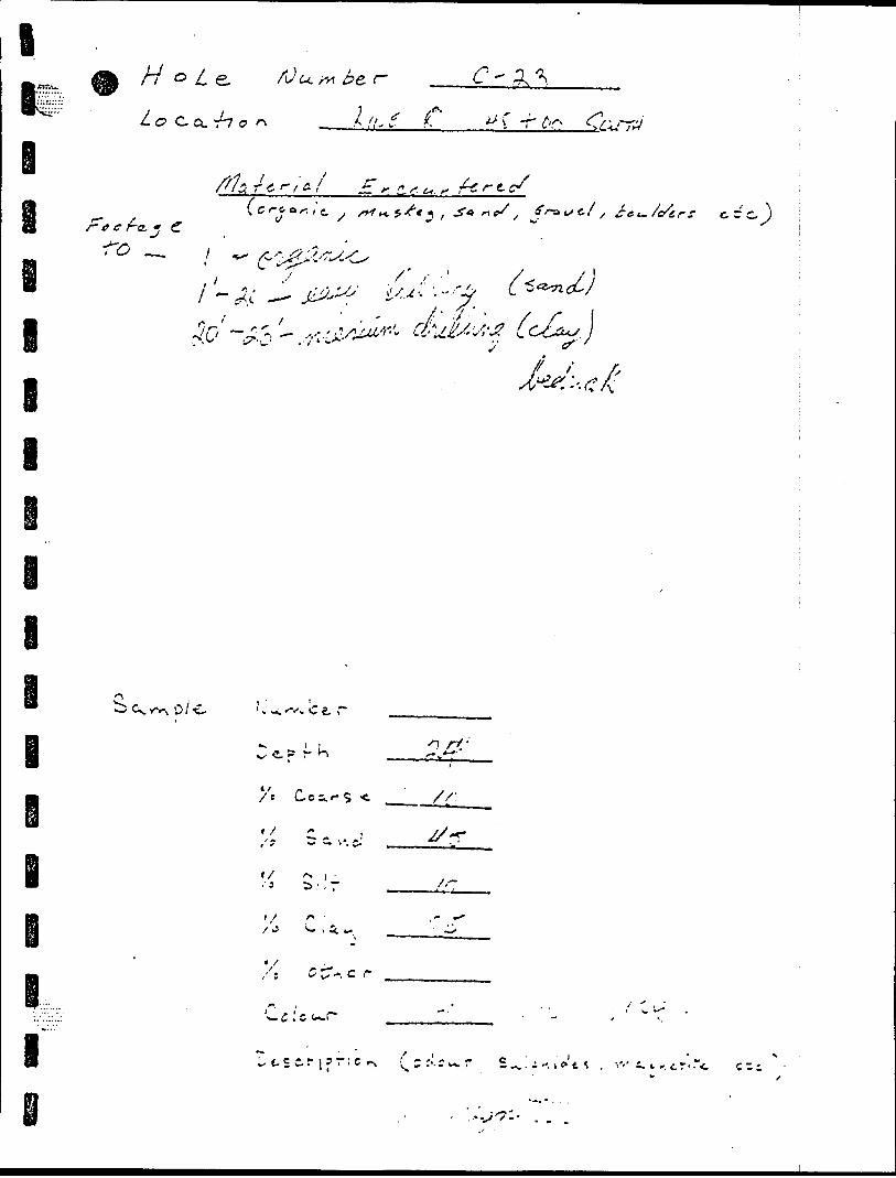
r in
O •M
M
o-
(O p VM
o o J'
C ;
f
* t 11 -\
1l
t'- .
'X
- *
l \ x^ lv
r- •l rt
li
l*
lio
o
Os
f
V
rx (A
o o o A O V
(X
Q O p Q 3 ft
0 o* 1
'K o
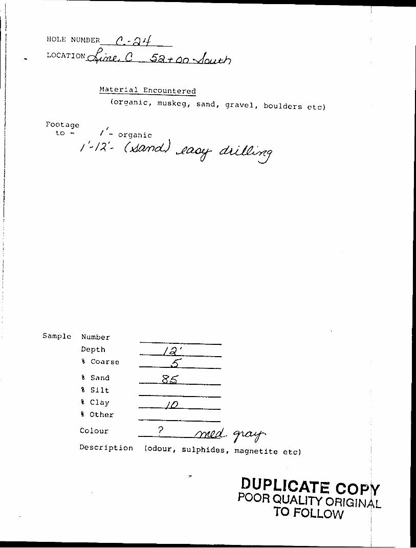
HOLE NUMBER ^ - ,Q
LOCATION ' . Q,
Material Encountered(organic, muskeg, sand, gravel, boulders etc)
Footage ,to - X - organic
Sample Number Depth % Coarse
fc Sand l Silt l Clay 4 Other
Colour
Description (odour, sulphides, magnetite etc)
DUPLICATEPOOR QUALITY ORIGINAL
TO FOLLOW
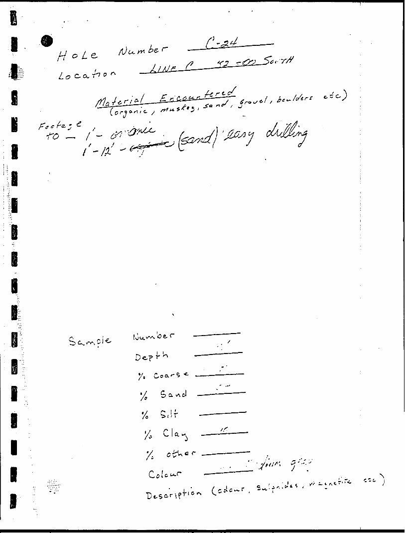
V///'/". ;
Mu^C
j-ac^ Wnrvj
l
l
l
l
-x o
i
ifi l fi
7^-(l
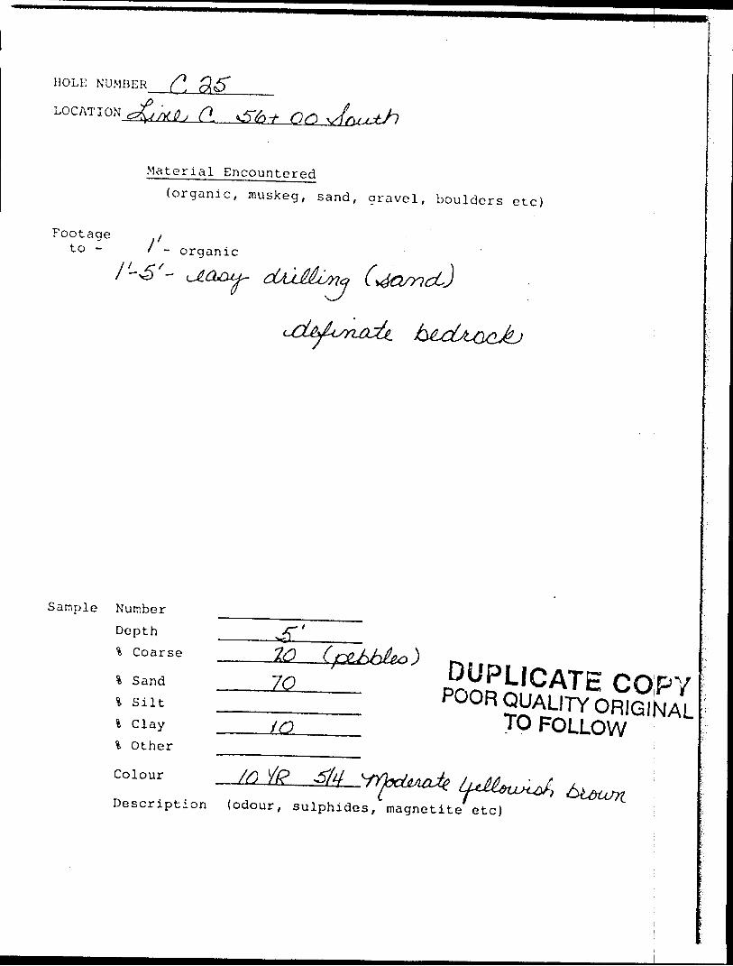
HOLE NUMBER
LOC AT I W
Material Encountered(organic, muskeg, sand, gravel, boulders etc)
Footageto - i 1-
organic
Sample Number Depth % Coarse
fc Sand % Silt l C lay % Other
Colour
iO
DUPLICATE COPYPOOR QUALITY ORIGINAL
TO FOLLOW
i RDescription (odour, sulphides, magnetite etc)
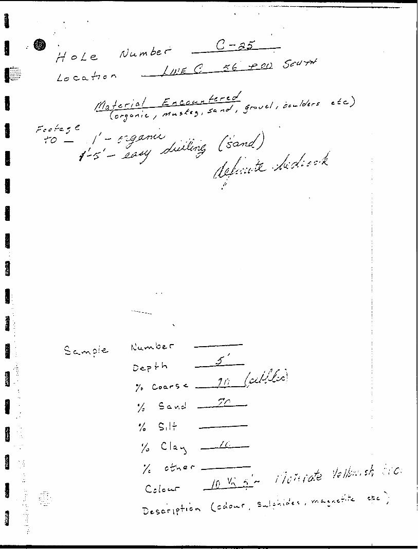
-. V ''A
-fi'S 7.
e
— o/-C^99.
l 0 H
I
l
I
i
ei i
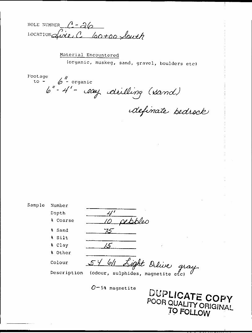
HOLE NUMBER /l ~
LOG AT I ON
Material Encountered(organic, muskeg, sand, gravel, boulders etc)
Footageto - fo ~ o rganic
i(U2&LL
Sample Number Dipth l Coarse
% Sand % Silt l Clay l Other
Colour
^ /yDescription (odour, sulphides, magnetite etc) u
magnetite p^
TP FOLLOW
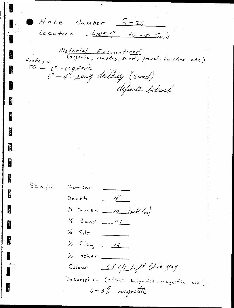
e •
tIt, , l !f~l G L e. /v6c /i-* DC,
Lo C-CL -/7 p ^
l
•^ ^r-^
-/i g. ^ ^ /^ /~ g.. c/
c .
lf -
l
l lr n
\: c : /'
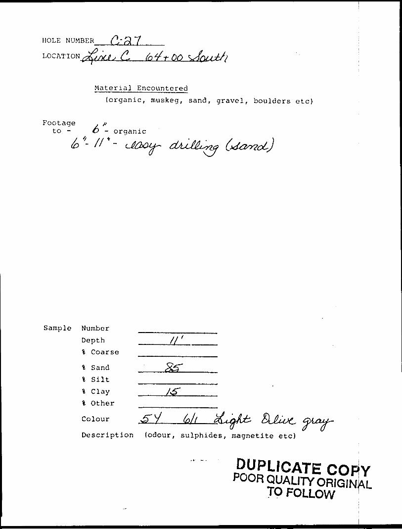
HOLE NUMBER
LOG AT I ON rtJ; . fo f OO
Material Encountered
(organic, muskeg, sand, gravel, boulders etc)
Footage . pto - O - organic
*-//*- ,,^J
Sample NumberDepth _____/f ' l Coarse
\ Sand% Silt
% Clay\ Other
Colour
Description (odour, sulphides, magnetite etc)
DUPLICATE COFivPOOR QUALITY ORIGIN^
TO FOLLOW T
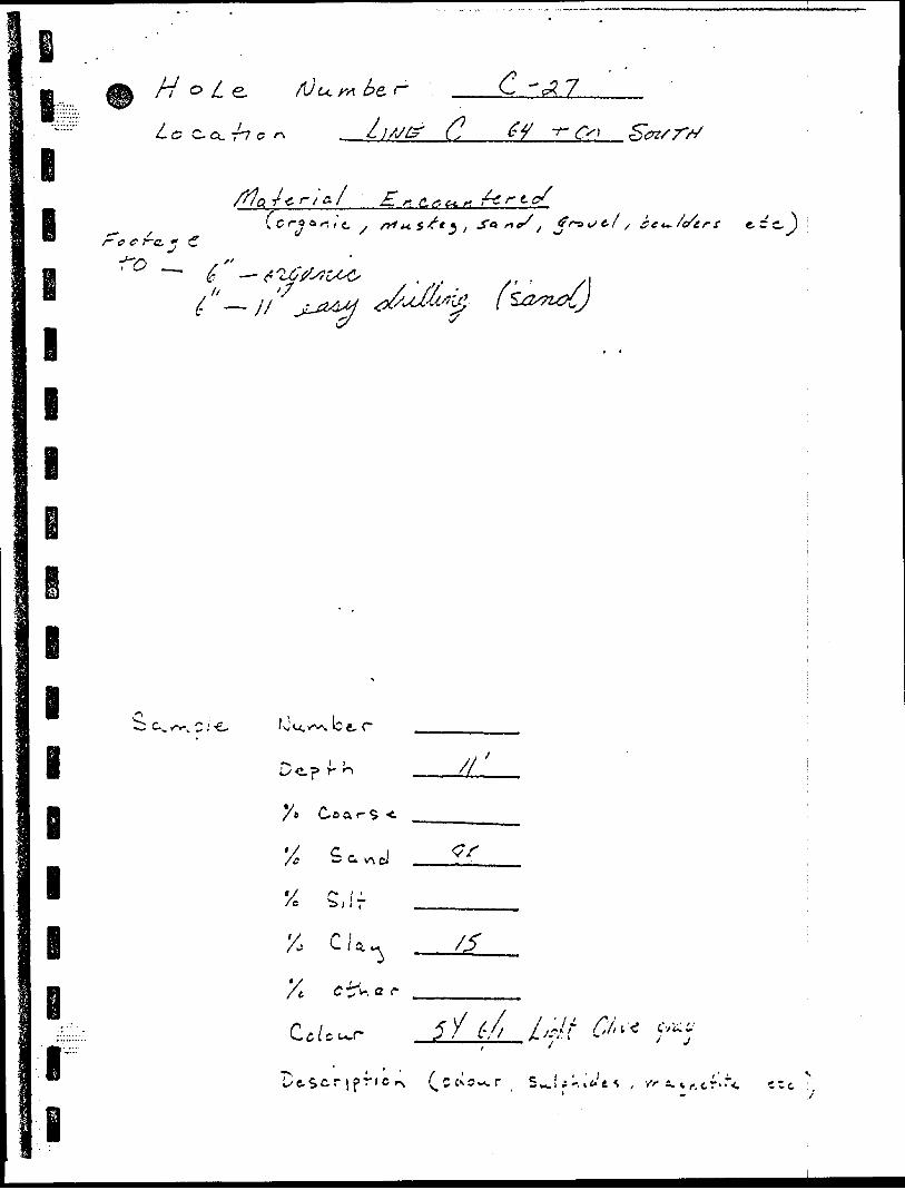
(p
5*
P -o -1-
o -
o c. oO
P
-1-
(0
N* O
o P
O -M y
c..
o 7-
o f in
VA
"^^ 3^ x.
\ VA•C
jA
v "\
f vh"
ft f ^ rv •f
-
l\
tt
O
O.V? o o A O
X ^
. r
1o o
P r\
ZJ"-
C5o v s
O. l
'K
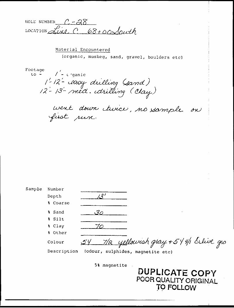
HOLD NUMBER
C.
Material Encountered(organic, muskeg, sand, gravel, boulders etc)
Footage to -
, 7 - c -ganic
x-/*-
O
Sample Number
Depth % Coarse
% Sandl S iltl Clayl Other
Colour 7/Si
Description (odour, sulphides, magnetite etc)
5% magnetite
DUPLICATE COPYPOOR QUALITY ORIGINAL
TO FOLLOW
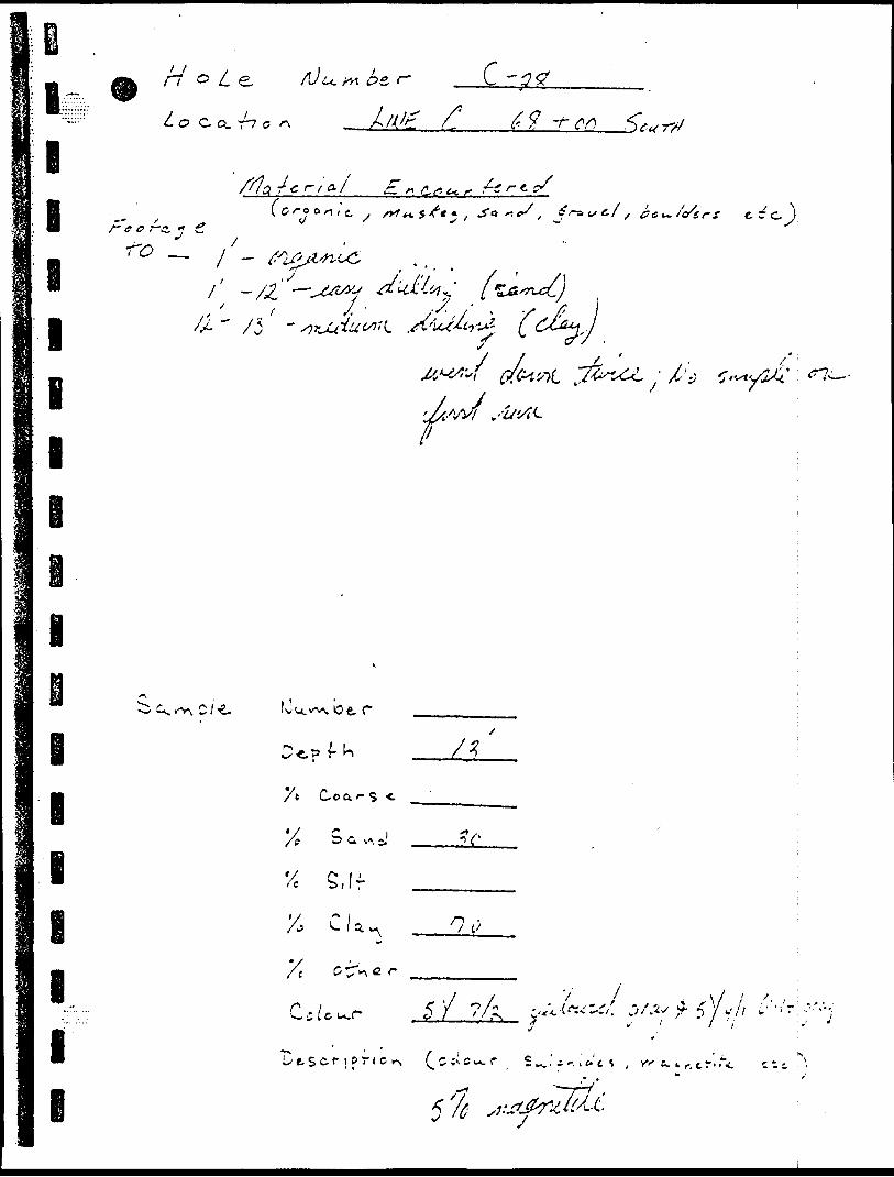
E i
e i i i
' ' /t t i^f t^-
L O C Q. r~7 C
C -
69 -r
/g r-/'^ E * C.r. t*.*i~ /o'er f
i
I
l
I
l
o e, r
7* Co o.-- s -t
'/s S a v^ J
'7 C* li'e b j i r
Xi C U ^
Y t C^a r
5
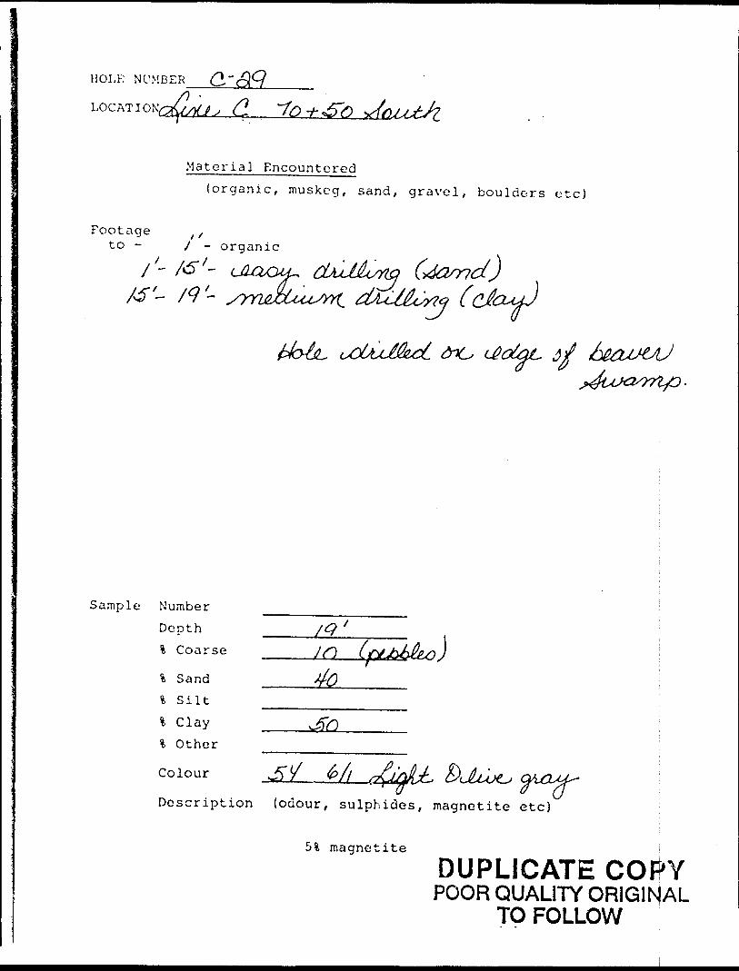
HOLE NUMBER
Material Encountered{organic, muskeg, sand, gravel, boulders etc)
Footage ,/to - / - organic
/- 7*5"'-'- W-
d^L, L
Sample Number Depth \ Coarse
% Sand _____40
\ S ilt ,———— % Clay ,-—— l Other
Colour b/lDescription (odour, sulphides, magnetite etc)
51 magnetite
DUPLICATE COPYPOOR QUALITY ORIGINAL
TO FOLLOW
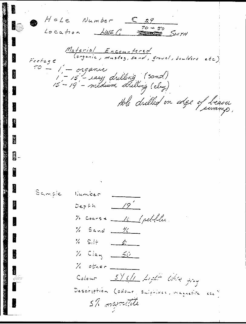
//oj/le AJuM^&r- C z?7 o -t- fro
o. r-? o f\ ^ X^g x? ///•/ylre, r t e. f .n c,e e*, r. fc r t s/
•^•- ^ * , / ^ f * j S s \d ^ i C y /^** 5^'^ , ^"*5 '-'^ x ^j^* *s **f s tre*~ /crtrs t ec)
- ^ .— 7 —x '-
l l
.'y'
X
i
lv u. v^-v c e, r
Co a
S, If
.c r
I
l
w WJ
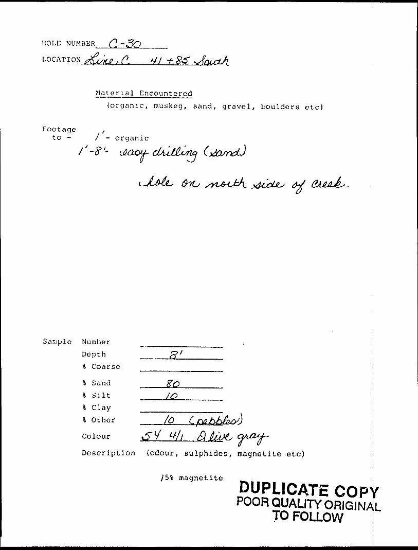
HOLE NUMBER (~\ ~3O-———
LOG AT I ON J M^ ft V / -f-
Material Encountered(organic, muskeg, sand, gravel, boulders etc)
Footage fto - J - o rganic
d^JJLuno(l ^J
&YU
Sample Number Depth % Coarse
* Sandl S ilt ____JO
\ C lay ________l Other
Colour
Description (odour, sulphides, magnetite etc)
ySI, magnetite
DUPLICATE COPVPOOR QUALITY ORIGINAL
TO FOLLOW i
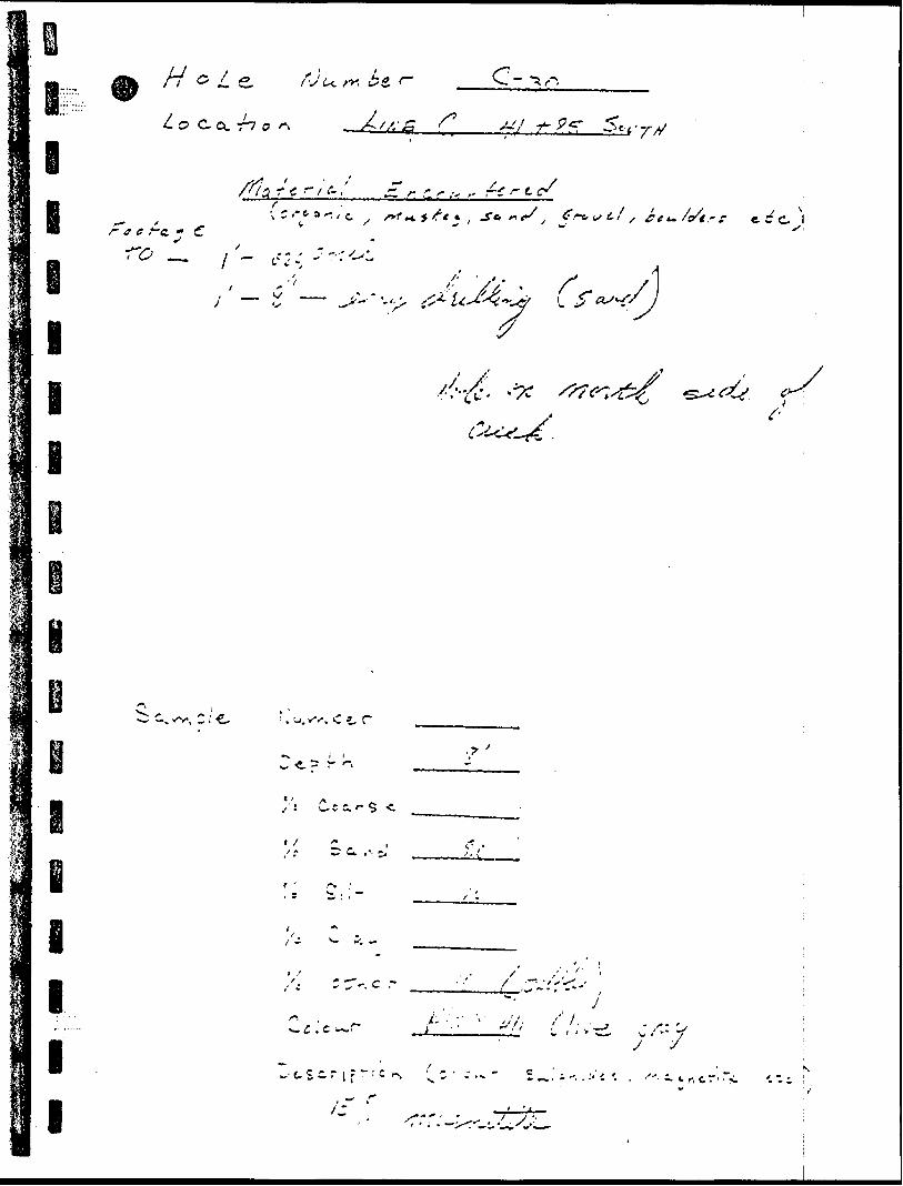
*f' l f
"1-' X
l l i i
"n - :
' ~j f -i S ~ Z,
O (Ui "O
•S q xv v^/y *3 ~J o
l l
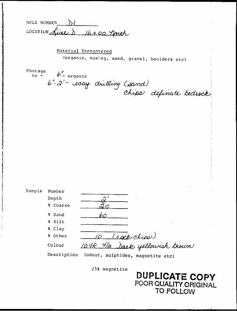
MOLE NUMBER ^-f
LOCATION f 00
Material Encountered(organic, mus/eg, sand, gravel, boulders etc)
Footage to - - organic
i&tu btcUecjkJ,
Sample Number Depth % Coarse
% Sand % Silt l Clay * Other
Colour
/o/fi jbl*asn-J
Description (odour, sulphides, magnetite etc)
magnetite
DUPLICATE COPYPOOR QUALITY ORIGINAL
TO FOLLOW
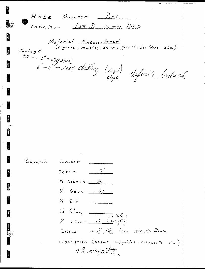
\
Q)G
Cod O
i -^x\
NlV
•vuvN
OV oO.5
*V
M
V 3'
i Jc/)
s'"-^
• l l'
w*
"S.'•7
O^V
\
Ox^
V ,-
•^ j"x
X7\;.•- .**.X'•C*
v
i.i \*V)
v J
v '-
c l
J
r'
M -
L '
-1-
.V
, v l
!-C
vi
^ --
U
j V
; -).
^
^'
C/)
^ ^ V)
0 Jj
A-
M
w,
0
Js. "^
^
-v'' X
' Cj
,.1
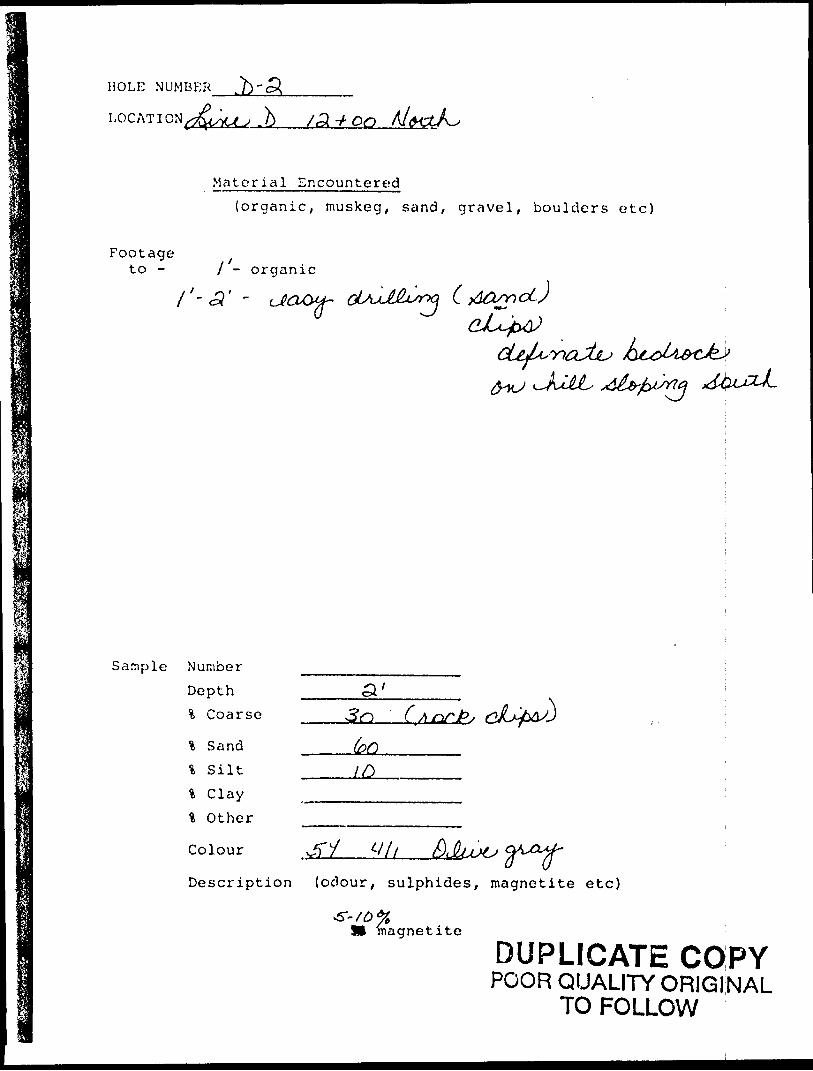
HOLE NUMBER
LOG AT I ON ( j^UU .b /3t -f-
Material Encountered(organic, muskeg, sand, gravel, boulders etc)
Footageto - l ~ organic
l' -
Sample Number
Depth % Coarse
l Sand
% Silt
l C lay % Other
Colour
3rt (
Description (odour, sulphides, magnetite e tc)
magnetite
DUPLICATE COPYPOOR QUALITY ORIGINAL
TO FOLLOW
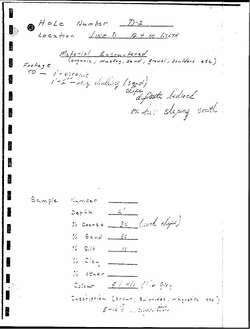
-J .^ •s y i -5 ..^ ' i s o i - r ;"- 3
•^ "5 '
;/
-,. i"-~ 7' V
V.- --i - .
8 l' 4
l
l
l
I
I
I
7
f p~2o S J
l
, — ' vi-r
e -J
,V/
-3 7 o//i
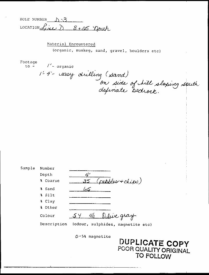
HOLE NUMBER j^ -,3_____
^Q .7^ 8 t
Material Encountered(organic, muskeg, sand, gravel, boulders etc)
Footageto - l - organic
1-4'- na
Sample Number Depth % Coarse
\ Sand —..——^5"\ S ilt -—————\ C lay -——————l Other
Colour
Description (odour, sulphides, magnetite etc)
C'5% magnetite
DUPLICATE COPYPOOR QUALITY ORIGINAL
TO FOLLOW
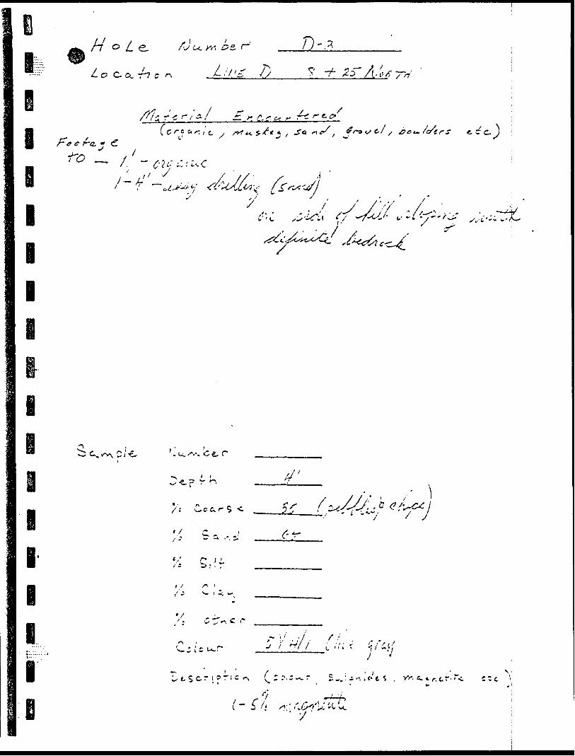
/H .( : /' ,' ! ~-
J. ' I C
. r71
i o—i :/ ^ i
l l
l
\~-*rt at-^9 (7 ' y- ~* f J 9 a/-* 00' * fjf Z
'; /'
•03 n
l
l
l
i
l
a i-i. "O o
7 o U
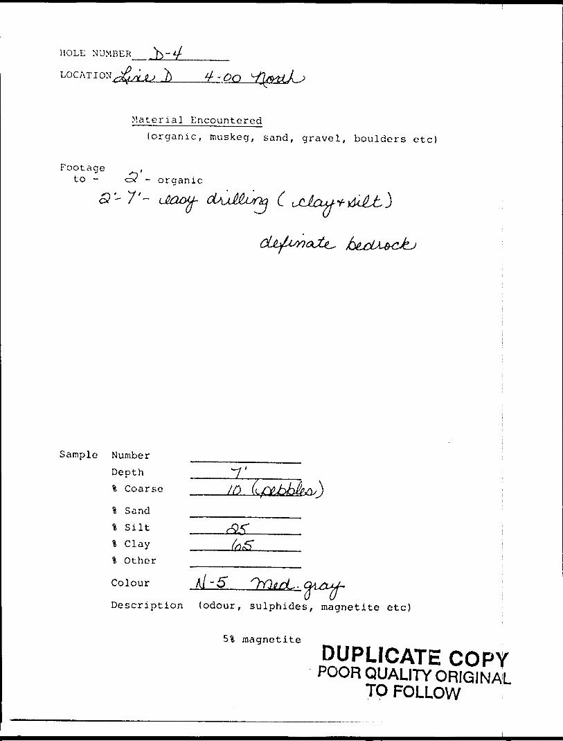
MOLE NUMBER
LOCATION
Material Encountered(organic, muskeg, sand, gravel, boulders etc)
Footage ,to - c? - organic
. . * * f
\J
Sample Number
Depth % Coarse
\ Sand
% Silt * Clay % Other
Colour A/ -6*
Description (odour, sulphides, magnetite etc)
5% magnetite
DUPLICATE COPYPOOR QUALITY ORIGINAL
TO FOLLOW
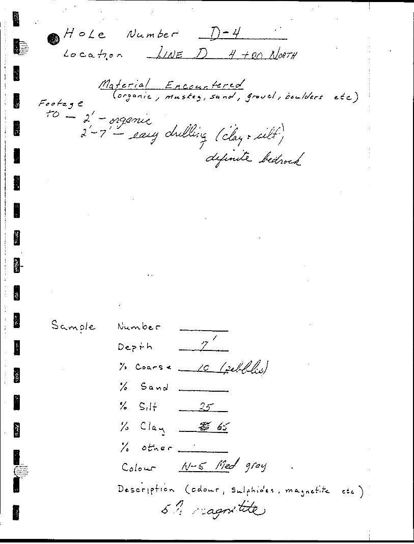
o -
o in 5 pc* ft f-
O
o
O
tO ^
?
if
^
'O
O
-v rC* 1
-L ^
rJ
ti ~TN
I ^
-o-
N.
0 P
P
NJ
t
p ^ Vi It F :
ft h (* O
0
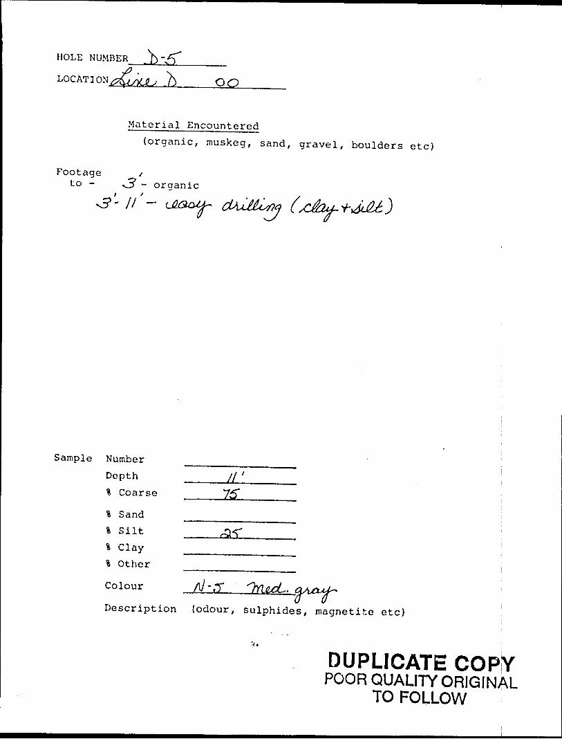
HOLE NUMBER Jfo -/T,——————
LOG AT I OUjfa/tJU .^ QQ
Material Encountered(organic, muskeg, sand, gravel, boulders etc)
Footage /-to - *3 - organic
Sample NumberDepth _____y/ ' % Coarse 75*
% Sand% Silt% Clay4 Other
Colour
Description (odour, sulphides, magnetite etc)
DUPLICATE COPYPOOR QUALITY ORIGINAL
TO FOLLOW
J
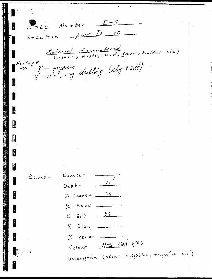
lB-5
i
l
el i
'/o
X,
/c
, If
o. r
U-
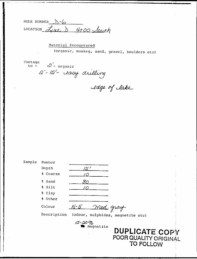
HOLE NUMBER^
LOCATION s&KJ?; . b ^00
Material Encountered(organic, muskeg, sand, gravel, boulders etc)
Footage /to - z3 - organic
o?'- /5 X- Uaou-(J
Sample Number
DepthCoarse _____/Q
Sand4 Silt _____/Ql Clay -——^——^.i Other
colourDescription {odour/ sulphides, magnetite etc)
magnetite
DUPLICATE COPYPOOR QUALITY ORIGINAL
TO FOLLOW
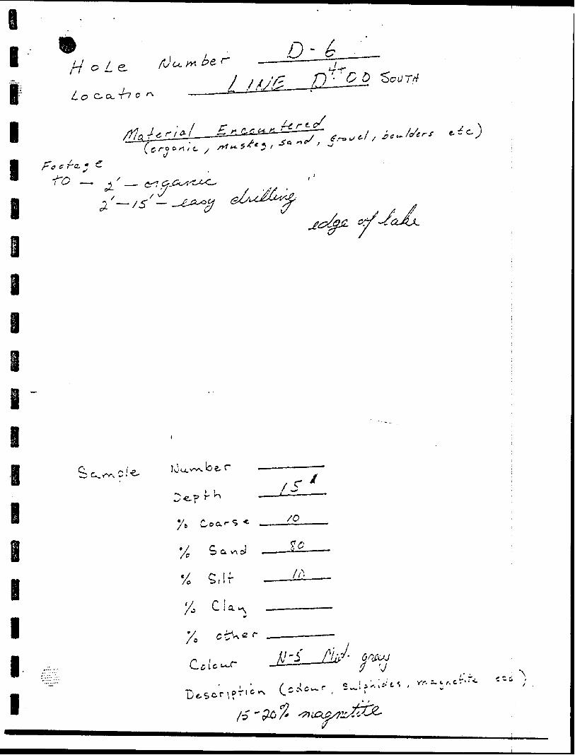
A
y.
l
l
l
l
e
i
9-0
— d.
o t-:. ~o-o ^7
^jo fJ
B l l
l
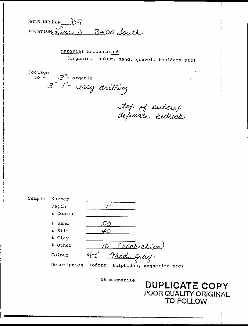
HOLE NUMBER
LOG AT I ON^CO h 8 -/-
Material Encountered(organic, muskeg, sand, gravel, boulders etc)
Footage ,,to - -3 - organic
3"-1 -————*--- —— fl WV- f *~~\~*[^S*
"*~^
Sample Number
Depth \ Coarse
i Sand l Silt % Clay ______________ * other /O (AjtirJpj f*JJ2j~v) J
Colour
Description (odour, sulphides, magnetite etc)
51 magnetiteDUPLICATE COPY
POOR QUALITY ORIGINAL TO FOLLOW
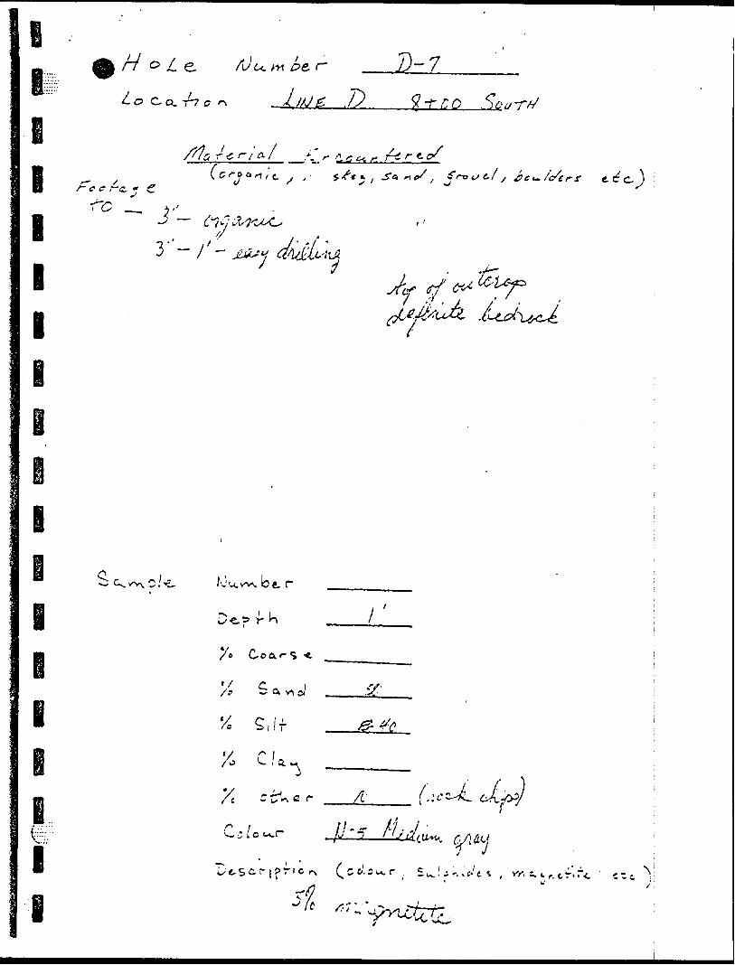
'5
L, r j
o i J.d l J -y S?
f!'5 7,
g
l
x? -3
C? .7
ff
l l -V- e ' i'
OJ.
J. Vi,/
-3 7 o
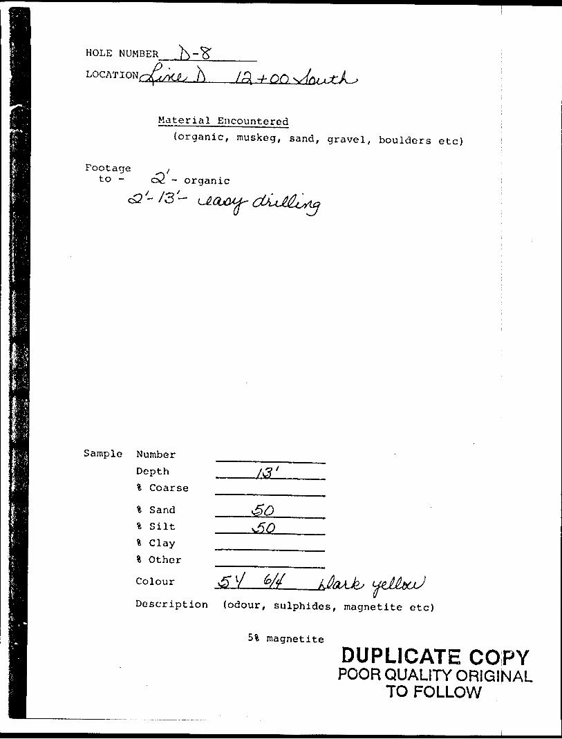
HOLE NUMBER
icL/ -h -A
Material Encountered{organic, muskeg, sand, gravel, boulders etc)
Footage yto - o2 - organic
Sample Number
% Coarse
% Sand % Silt fc Clay l Other
Colour
Description (odour, sulphides, magnetite etc)
51 magnetite
DUPLICATE COPYPOOR QUALITY ORIGINAL
TO FOLLOW
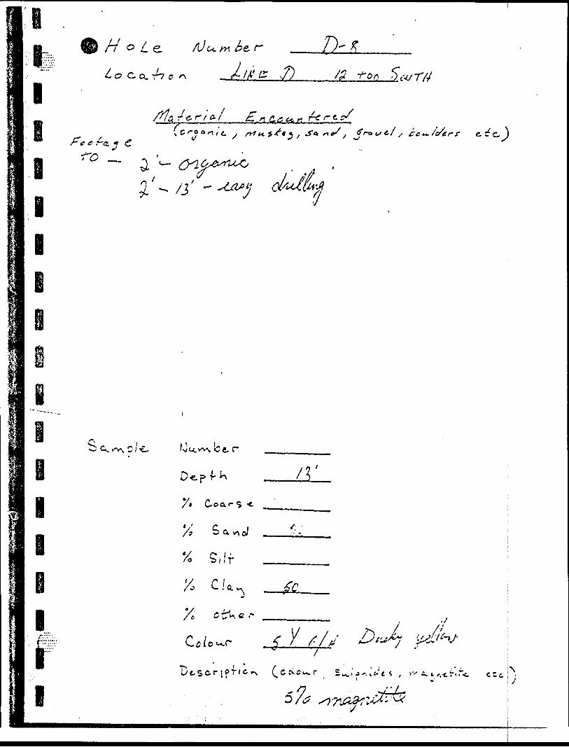
l
HWeL o c,a,r7 c
f'c c r-e- (f
i I
rt, f i o-l( c /-o a/-! /'e.
.f)
C.a**r r* r 11ne/ ,
w r y/
/ Cc^/s/eerf
l
l
I
S a
Xo S, f f
X, C!a
y* C-oar S * ^
C tV c r
y- ^70 A? y
• r.-c!"'"C Ctc
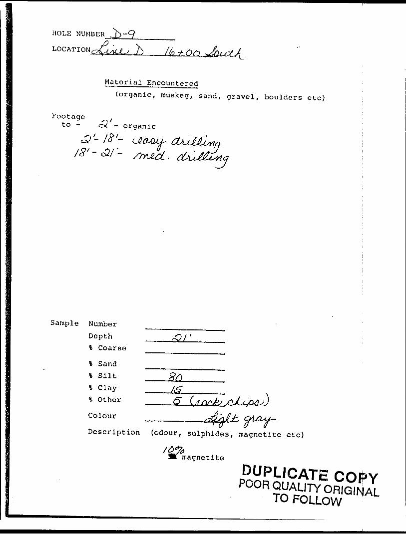
HOLE NUMBER
LOCATION .h
Material Encountered(organic, muskeg, sand, gravel, boulders etc)
Footageto - ex - organic
Sample Number Depth \ Coarse
% Sand % Silt l Clay \ Other
Colour
Description (odour, sulphides, magnetite etc)
magnetite
DUPLICATE COf*YPOOR QUALITY ORIGINAL
TO FOLLOW
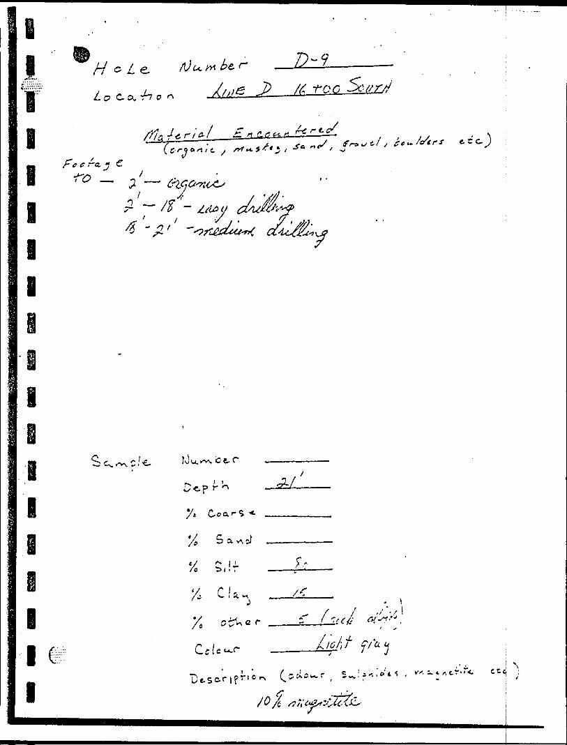
o-ooQ-vi
K
^
•0ft)
O
C od Oo -^
C'
vL-i-
U)
C
Cf
^-*
.vi
"j -^ ^
i. io-4Ot. o-T
' 0
o.iJC
/)
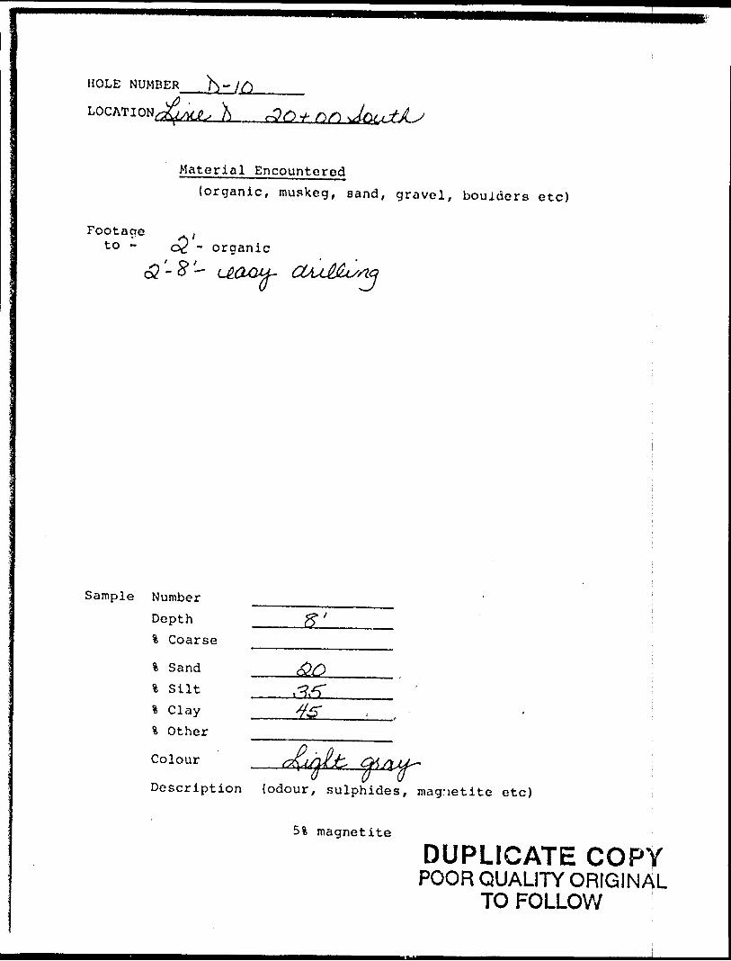
HOLE NUMBER .h" J fi
X
Material Encountered(organic, muskeg, sand, gravel, boulders etc)
Footage ,to - QC - organic
c? '- S*'— ( D OuQJUL, CtAsL@JUSrtQ ^ U
Sample Number Depth % Coarse
% Sand % Silt
% Other ^^
Colour __
Description (odour, sulphides, magnetite etc)
5% magnetite
DUPLICATE COPYPOOR QUALITY ORIGINAL
TO FOLLOW
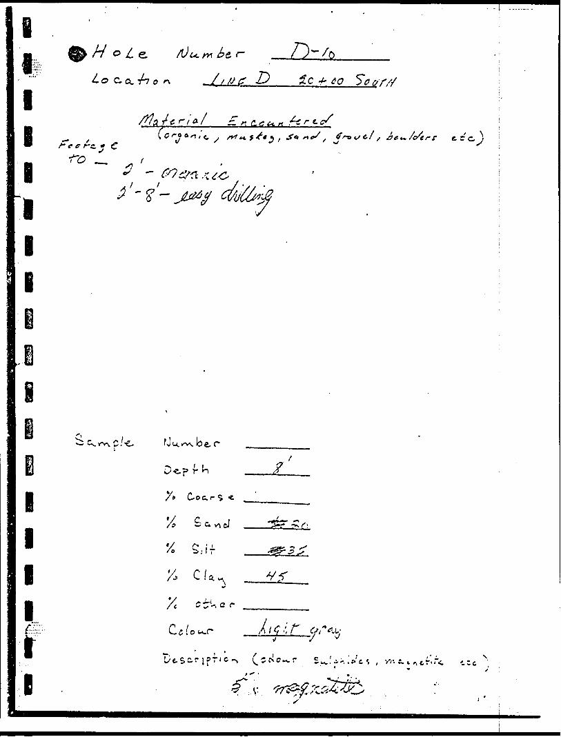
^,-fj'5
1
l II
i t
"3'-t
OQ -rO j
l ll l l li i
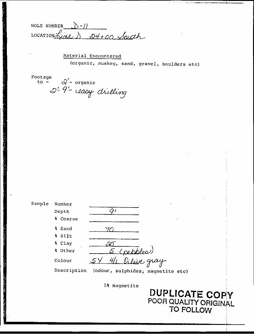
HOLE NUMBER
LOG AT I OH^yyt^ }] ^ 4 j- fin
Material Encountered(organic, muskeg, sand, gravel, boulders etc)
Footage ;to - cy - organic
**~s
Sample Number Depth % Coarse
\ Sand % Silt % Clay % Other
3 yDescription (odour, sulphides, magnetite etc)
5% magnetite
DUPLICATE COPYPOOR QUALITY ORIGINAL
TO FOLLOW !
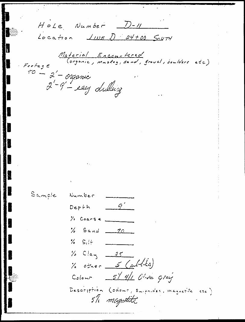
-
lg5 L e
o Co. -h o
T)-//7)
^T/, fL^K.,* r-irt-c/
e a if|, t
'
L
—C/
mm
I
1 S^o/e
1
li
1
1
1•t;;;;'::v -
11
k
KJU.W*. b t rf
Dc.p r- J-* x
/* Coa.i- S *- ^
X S a vs -J 7(0
^ C 'i' 8 -" ' i .., ,... .. ,,.,..,.
v r i * -5 r'A* L .' a ^ . . . .y. r• y "^ x A C tT1 c r ^ (. ^l
r i ,. *y 4//C-a(cu.r p/ T//
•*N ' X JL'tS^^'l^^"'^^ l C' c*. c in^. r 1 s rf -s'/5/1 tnfaj'M^
i-/c/e r t
. r.r,c cct (. x
BSBaiNweaes 53B02Nw0ei7 WAPAMISK CREEK.' '~ 900
t*-, ; .: i-.,.iri i il .v.ci Fxprruliturcs) .y/- ^/r 82-50Tlio Mining Act
ClaTnTHoidt rfj)~7*i'VT**r'tj*iiTl*V.^."i**'~ *-—~—-' —- -- - ---..j — .—. *- —r^—.. ,.. ,.... ,
s: o. c,
Mole: -- Only ^-'ys en-l is ralr t il,itril "FKf :'njitijif!s" ict-tion ir.ay lie in 1l-e "!rxp''rirl. P"v? Cr." i
~ D o rmt L'tc sh'Hled an'*s brjlow. i TOAr ;hip or Area
. -,..---..,..^............. ...T-::^-
. ... ....™... .... ..*f)d Addrnt of Author (o) Geo-f scimlol report)
-iv^ f7 ni UO-**. " rt- S ^ Oi-^
.- 0 )1 ( fiom fit to) Totil Mile* of lui* Cut
^ledits Requested per Each Claim in Columns at right Mining Claims Traversed (List in numeiical sequence)
For lini survey:Enter 40 dayj. (This includes line cutting)
For each additional survey: -,using the same grid:
Enter 20 days ((or each)
Complete teverse tide and enter totalls) here
Special provisions Electromagneticcredik do not applyto Airborne Surveys.
Mining Clrim J^' '*''d Vreti^' l"''' Number'\" J O. i it C-!
Expenditures (exclude; powet stripping)Type of Work PertCKir^d *
Performed 6n Cialm(t) -*^
Calculation of Expenditure Days Credits
Totnl Expenditure*
S 4- 15
TotalDays Credits
^
Instructions ^^"^ ^^ — v Total Days Credits may be apportioned^fthe claim hoJo*er'i , choice. Enter number of days credltvi^er claim telec*40 S * in columns at fight. s?^^? jrf' dr
ReebrdloSHoldcc&r A^rUMSignature)
CertHication Verifying rVpon of Work
Total number of mining claims covered by thte (apon ol work.
l hereby certify that l/hav* a personal and intimate knowledge of t h* fact* Mt forth in the Report ol Work annexed ! or witnessed tame during and/or after its completion and the annexed repon H true.i^9V*'''5*''wd th^*Of
Name and fostal Aoaress of Penon Certifying
1362 ( 81/91
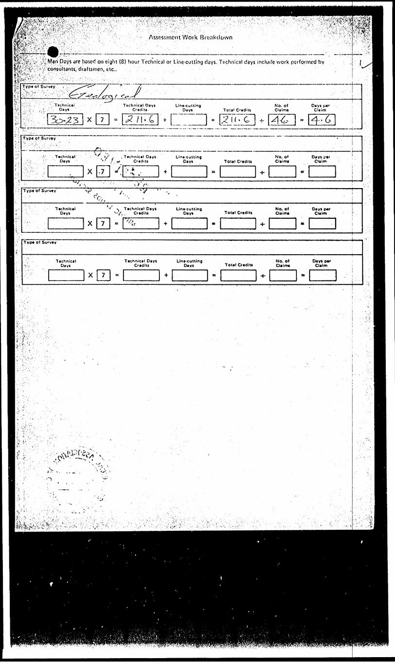
^^Jv^!W?^!p!.^VT" ' l.™.."'". .'vlr. ' V™ -' . '..TV •*; -l''^.'.^^ ;A";JvV'i;''. i - .-','- 't:',^ 'Vf?tiffyiKte
. .Assessment Work 'Breakdown' ' "
eSvSf^Vi ' :?*Ww Psys -afe based on eight (8) hour Technical or Line-cutting days. Technical days include work performed by vl&iy'&X ••''A-'1 ' ' coniiultants, draftsmen, t lc..l^;\U--:v::"v:;. ..-; : - . ,-'-
U""
,S,'c
-^S':
'i i;
Typ* o) Survey , ., .^^' \/ * /j i
;:^:; -:^ ''••.'".•.•'".' "''-- :' 'crr^-^vs/fAc^ r- f-'^f ' :'..^: , .Technical Technical Day! Line-cutting No. of Dayi pef :L V . . '. Dayt C'ediu Dayi Toisl Credits Claimt Claim
- ' r~~* ^ l ~^l li/" 1 1 .-T ^ \ A S Jl /"^ 3bv23 x 7 ^ j^/1* 4 +I -I^M'C H- |^}^. - ^--6r '' " r ' " ! '
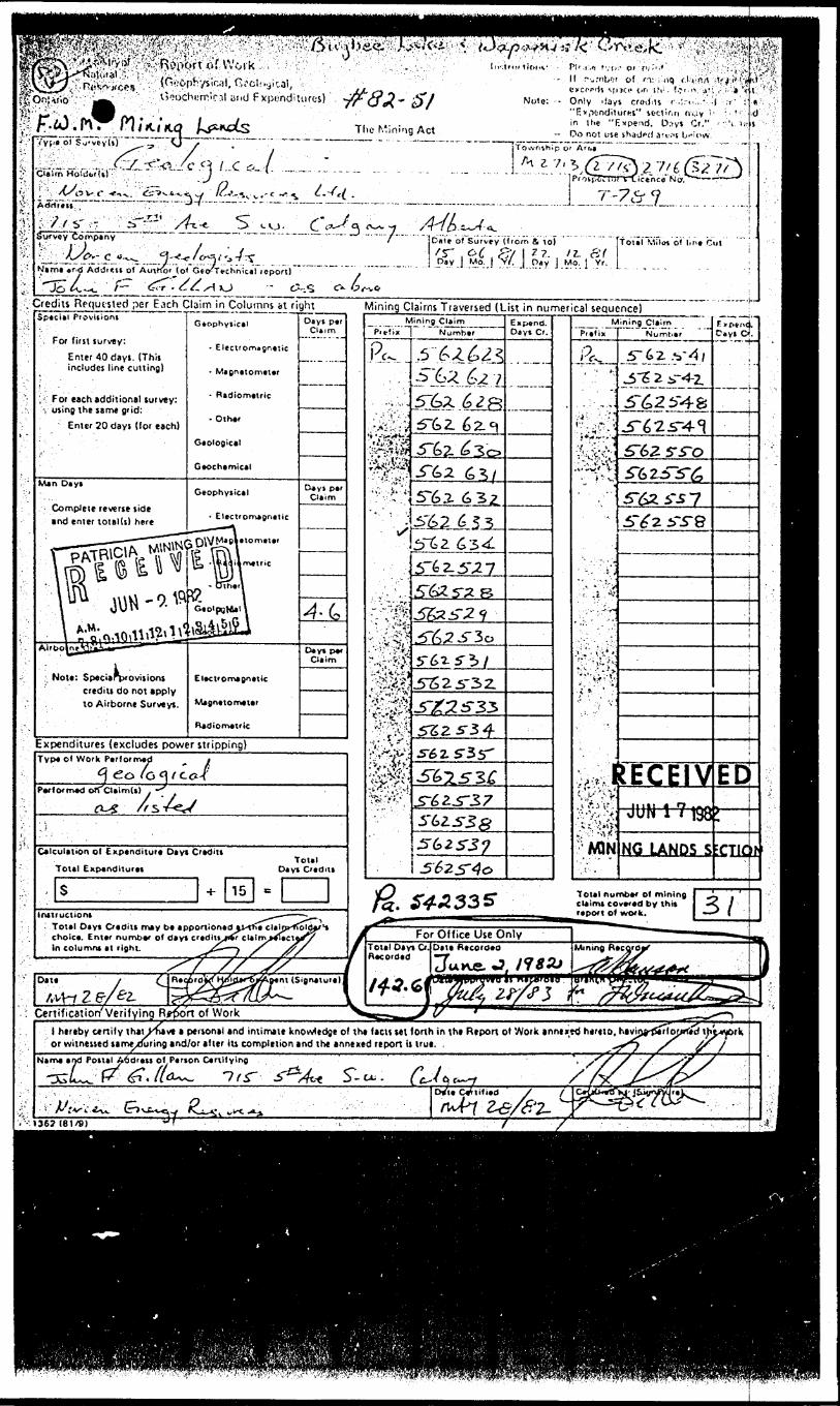
tiTOClnirricnl urid F x pencji Ui res) -y
VVf'*.Dl STlic Mining Act
Claim Hotdt.V(i) :
Adrlrelt.
Note: - Only i!ays erodes '' - '.rc'.i .••.'•t :C :""ExponditurKi" tt-cl'trm rr.uy i' ' "in Uie "Expend. D.tyt Or." ••"'i *^
- Do not use ihadpd a^t:is b-iow. |To^vnihip O' A ri.a !
Proip!'ci7s.
*'
Name *^d Addxn of AuiMor (o* G*yT*chnical loport)
O
Dflie of Survey Urom St t o)
-P*.y J M0.-.! .X(( J 9*y j M9-1
Toial MJIat of line Cut
-.Credits Requested per Each Claim in Columns st right
G#ophylice1
Mining Claims Traversed (List in numerical sequence)
- Electromagnetic
- Magnetometer
- Radiometric
- Other
Geological
Geochemica
Enter 40 days. (This includes line cutting)
, For each additional survey: •i using the same grid:
Enter 20 days (for each)
Geophyiical
- ElectromagneticComplete reverse side and enter totel(s) here
Expenditures (excludes power stripping)Type ol Work Perfor
CtO (G ^ t
Calculation ol Expenditure Dayi Credit*
Total Expenditure*
Imtructioni', Total Dayt Credit* may be apportioned
choice. Enter number of day* in columnt at'ight.
A'_____For Office Utef T otal Oayt O.I D* t e Recorde
.— f Recorded I—T
ell t Jt X x*eTWWW9"l^ffDS.: CenificaUon Verifying Ryport of Work
l hereby certify thaO^htvt a personal and intimate knowledge of the facts ut forth in the Report ol Work annexed h*reto, havirjrfSirtoprte'c) ty\ or witnessed tame/rfuring and/or after lu completion and the annexed report is Iru*. . __ __________
Name arid PoitalA6drett olIPerton Certifying
P 6?. f(a~- ior
36? 161/S)
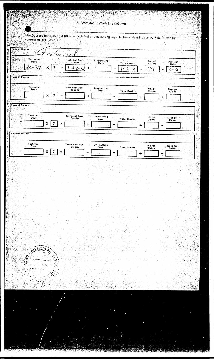
i'^&i ••'/'.'ivvi'/-.-.- '- '' : - '. , . "' '- ;- :.v, ; ' /: ; /-^^YVv^ '' ' '''' ' ' - -
•e bas-jd on eight (8) hour.Technical or Linc-cuttiny days. Technical days include work performed byIp-'.-i^!'- 5''!''' --^consultants, draftsmen, etc.. " •'••'•''. -,
Type of Survey -:-., ; . ' y^-~: .'.'- :': f " -',
jit'''"V ' ' ^ . '' -' - ' ^ffa'::! 1'-: :-'^: Technics! "echnieel D*yt ; ; '\ Line-cutting
Otdiu . . ., - . D*yi Toul CmdltiNo. o 1 Cliitnt
Days per Ci*!m
X 4-2-c t.L I't:X"''-
l;V;*,T.V
Typt ot Survey -
; ":v - Technlc*! , Technical Diyt Lint-cutting No. o* Di y l per : l'.*. V O*yi OediU Dtyt Tote) Credit! Claims Claim !W!- : :' x 7 * ' :* ' . H- * :
\ ^
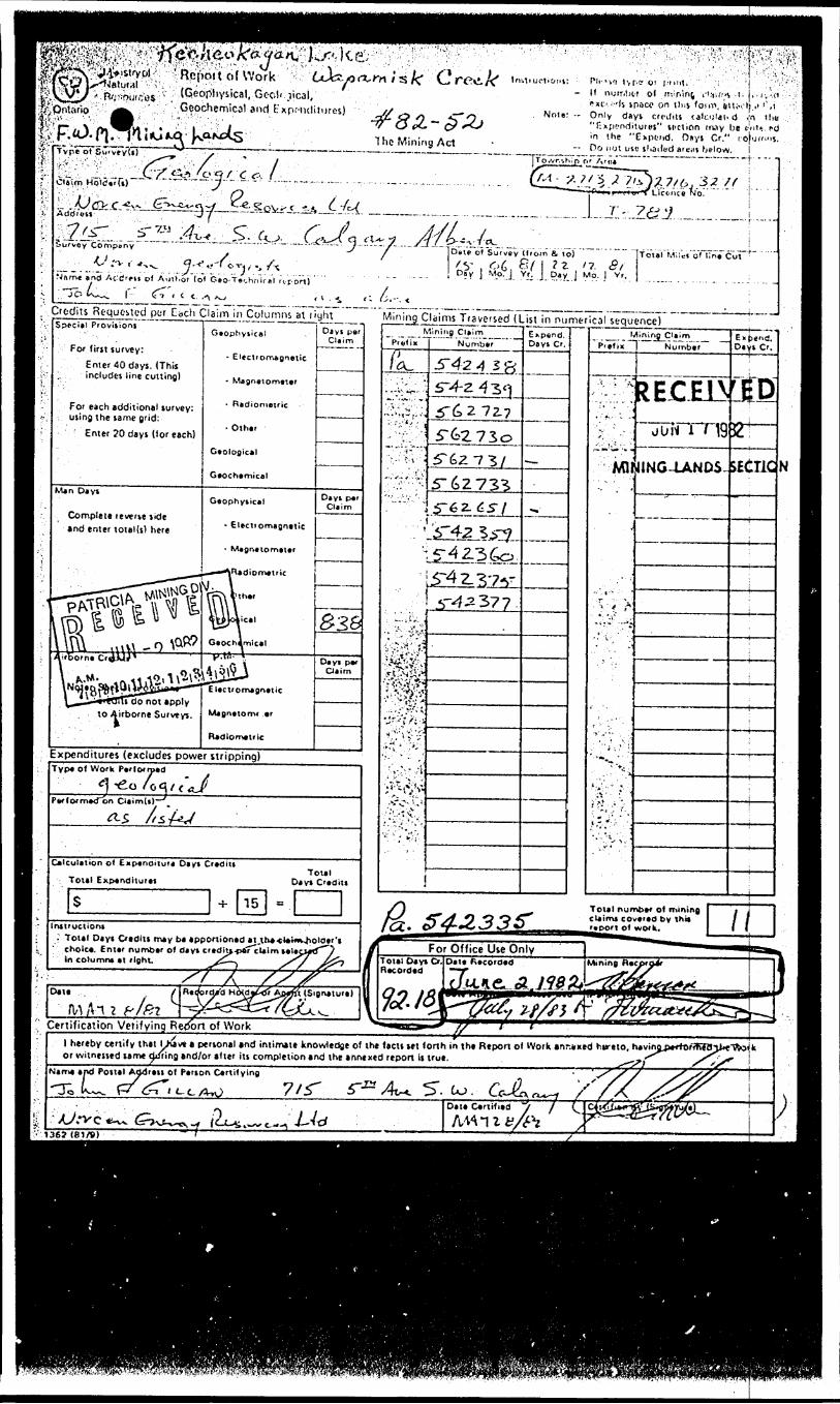
3!t;ji^^ ^: " : '•[f'-^Rpppi'tofWork' ^ Cc^xxo-^/s/C Cree./
.,.'0niario : :- ' A ' ' ,.' .".GOOChemical and FxpflKlilures)"''s-' - -. i;'- ' v ' - ' :-'*- ''''-'' ' ' ' ' '
rType pt Sti'veyd
CUifn HolSVrfk)"
y'o -q r c o.-*— -— - -- - — -
The Mining Act
ot'C/iri: [*li-'ifi tvt-t? O! j'lniti ' ' ;; ;j \ ''^
Nats', - - Only days crcJ.lt caicuio d i|n tliu
in the "Expend. Dsys Cr." r-o|u(""S. -- Do not uic sl.atled areiis below. i
JTo.vr.ihin c.
CTr"'J'ui'f Li'cc-nce Nor " " ' i
—......... . ....^.,.,....7'-i.6Namt a nd Ac-'cJrrti of Author lol G *o-T*r.hnirel ri.port)
/ v 0 6 e/-1 ?z '?. 5/-l D?v l M.oT.J. Y.r; j P.'.v J MO- j Vr 'Total" M'llef'of l7ne~Cai ^
-"-- ^fcdiis Reque-slcd pur Each Ciaim in ^ojuirrmsjatjlyh^ Mining Claims traversecTlllsTirrmirnerTcal^quenceT ~'•', Special Provision, Geophysical" . oly.p.," , . .. . ™?l!3.C^™^~. .. liT^cT ~ 7". Minin^Cl.imi ! . . Cltim P tglix N umber _ Days C r. pi e ) i x "] Number____
- ElectromagneticEnter 40days. (This includes line cutting)
For each additional survey: using the same grid:
' E nter 20 days (tor each)
MINING-LANDS
Complete reverte tide and enter total(s) here Eleciiomagnetic
Expenditures (excludes power stripping)Typ* of Work Pcrlornxd
C*lcu!*tion of Exptnoilur* Diyi Cicdiu
Total Expandiiui*!
Total numb*r of irtcov*i*d by thit
r.po't of work.Irutructions. Total Dayt Otdlu may ba apponionad •t,
' cholca. Entar numbar of diyi crtditj^TcUim tala In column* at rloht.
For Office Use OnlyTotal Day* Cr.|Date Recorded Recorded
Certification Verifying Report of Workl hereby cenify that Lhav* t personal and intimate knowledge of the factt ut forth in the Repon of Work anr.vxed htreto, havirv or witnessed tame riming and/or after iu completion and the annexed report it true. .^-
Mama and Pottal Addreis of Person CertifyingL. fr^r.Lc^o 7/r 5". co.-M-d
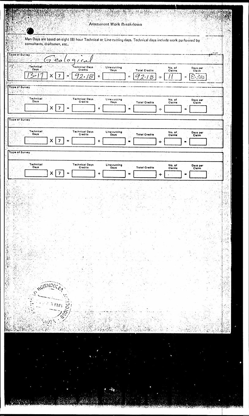
^?^^^;'V; sh'i^^-..^-'tv ;' : ix • ^•?.':: f":''': : '"'''';''- X /. : . ' .^^^m^m^^:rm'-::'' ^i^*^-^;l^t^ ; "- v :--
^^^^^^^^^ l ; ' - ' ; y W^^^^jjS^"AVsi.'SMnont Work RrfsakVlown 0 /\' 's v' A'.'' : : •'•'•''•'.' -'.' ' ••"- ' ' --'. : ' ' . . - - . ' .' Vl '.'''•'.'•'"'"Ov^'.'V
-; :. -, -. . , . '':, '' . ' ,, '. . : " .' ' - 1 ''. .'.;'. - ' ' - "•' 1
^;;5;;^ ;: ,;- ;Man Deys arc based on eight (8) hour Techn cal or Linc-cuuiny days. Technical (.Uys include work peifoirned by ' f||'^-S'?;'^;Cdnsulianis, draftsmen, etc.. . ••'• i ' i . '- '. ' - ,, . " -,, - .. * iS'-p-,;- V ^Y:''': ''! V^'-' V"'; '''' . ::' f' '- '' ' "' •'' 11 ' " '.' ' " " ' ' "; ' ; "; . .'^.^r~...:.'.TYPeo* Survey . - ;'.., :V;...' .^--. ,. -;, ; 7 . ' . ., - " jj - •'•-- . - ' - - ;-. "' ' "' ' ' v^ ::':--.J ,.^,, .^ , :- ' .'-,- '"':;; ,. v ~.-jj - --•"-•••- - ^ . . - ..,.... ,. . ,.. ,,. ™. .,. ,.-,.,,.,,, .™., ...^ , ;
.4'|.-:i •- '..;',-;:' ; 'Technical' ' '. '' 'T ;: • ••'. ' ' :- Technical Dayi '-. .Line-cutting No. o* Day* par : :. * ^ ': ! •L'v'Vr'r'-iv ' y '' D*V* --' r ;-v .:.. '.'. :'': ' "' :'-'-'!'. ' :. : Credit* -. . :, 'Dayf . Total Cuditf . Claims Claim - '. .'- ' j
fe::;;M73x; /'/ x l 7 ; ;-: c??.-~- : - '" - 1
IB * ^ I^^'/S '* | K \ ! 3 '|#v2B|.,'; .-' ' ' ' , i
•j1,'''.*-?1 ';"-'-' ' : '. ' ' , ' ' ' . !;- Typ*pt Surv*v ;;. ^.'''.'^'••'v'v .' '.- ' •.•..".'.' - -
, .- ': -. Tachnical - .Technical.,'--'-v..- .;- ". ;. Dayi . - . C'ad
: ;-': 4;'". -, . x 7 .
1'. ''- ' ' ' . ' - . - - ' . '' .-.' ,- '. '. i/•- - -' . ' ' .- , ' -. - ' ' ,. - ; •••^•••.-1Dayt Line-lotting No, of Dayi per tt Dayi Total Creditt Claimi Claim
i = . -5- ' a . '' '' - '
. TVP* of Survey .. . .- : 'i 'V : ' - - ' . ' . . •. 1 . . '-''-.
- ' -. Technical Technical Dayi Line-cutting No. of Day* per ' - i -l:' Dayi Creditt Day* Tottl Creditt Dalmt Cl*!m; ' ; ' '••; ' : " : '''l ————— ———— l 1 ——— l l ————— V" ' ;- '' '"'""'? ir:-- Y : X 7 B.;
+ a ^- B
M
Pisi •'"^'
'i
TVP* o* Survey , . .
Technical Technical Dtyt Line-cutting No. of Day* per '.•'' Day* Crediti Dayi Total Credit! Clalmj Claim
X 7 = H- e H- , . *' ' . ::'J
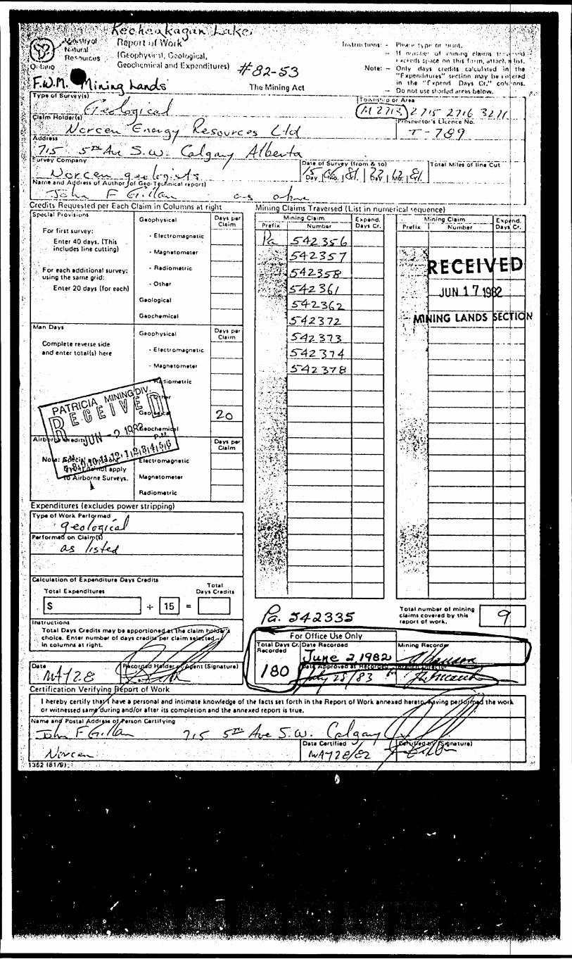
rTT-.*j'p*IfpilittM^'' 1 *' ' '' ' ' - : -'- rl''^'f tvP' 1 f lT 'Hint, H n'jiv'.lK'' of nitn'Og claims t? i 1 '.-
(H Sluice on t his f o* in, 4*1 Inch j Note: — Only d ays t red its ca'tuhtvd i n
"Fxpco(Ji*urei" sect inn nviy bv * o in the "f^ppnfl O^yi Or*" colt.
,. il, boologioal, GoochyniK-al anil Expenditures)' "'
The Mining Act - Do not uiO th,icii;d itrrm below.Typ* pf .Surv^vUT
'"jQt'S'.r Z7'6 34'/f—^T——--.—--,.i. plajrtTHoldorTs)'''''
the
atiie a nd Addreu of Authorjol Geo-Tecftnical itport).. —^—.,- 1 l f^t j*^~ *fr, /\,. f * ^- * 4
^ ^ ^ ^^t Dale of Survey (from li to) " If oial Mi Jet of"iTne"Cm T ^^i^j?.?i.fei^J.^.,.,....'....i
Crcdiu Regufcvied per Each Claim inSpac.tal"piovljioni
For first survey:Enter 00 days. (This . includes line cutting)
For each additional survey: using the same grid:
Enter 20 days (for each)
Man Days
Complete reverse side and enter total(s) here
Gaophysical
- Electromagnetic
- Magnetometer
- Radiometric
- Other
Geological
Geochemical
- E'ectromagnetic
- Magnetometer
lect'Omagnetic
Magnetometer
Radiometric
Expenditures (excludes power stripping)
Dayi per CUim
Days per Claim
Mining Claims Traversed (List in numerical '-cgucnce)-—h —
Typ* ol Work Performed
Per formed on aim(
/s
Calculation of Expenditure Days Crediu Total Expenditure*
sInstruction*
Total D*y* Credits mty b* •pponion*jj-rfffit claim l -i cho l c*. Enttr number of d* y* cf*cHj*p*r cUim *
' in columns *t fight.
Mining ClaimPrefix Numbftf
3 72.
.lit3V 8
Expend. Day* Cr, Prefix
Mining ClaimK'umbef
UH-U-19241NG LANDS 5EOICN
Expand, Oiv* C'.
Total number ol mining claimi covered by this report of work.
Certification Verifyinq B^po'rt of Workl hereby certify thikl l or witnessed limr'dun
•
htvc t penonal end intimate knowledge of the factt lei forth in the Report ol Work annexed heretp*4yving pt ng and/or tfter iu completion and the annexed report is t'ue. / 7
the wot k
1362 1 61/9),
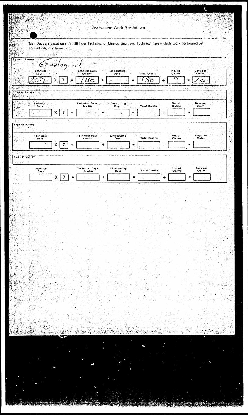
1li^^^^^^.'^^?^^m,' Assessment Work Breakdown
m^m Imt&vl^.^i' ',,; ; - Man Days arc based on ei'jht (8) hour Technical or Line-cutting days. Technical days include v^ork performed by If'l&^vf1 consultants, draftsmen, etc.. , ,,r^U&v'i 1 '." -' :f-V... . ''v •'•.';.:i ,', i. "- V . ".': ; ''". :- ''"'- '- ' ' -- ' ' ' . ' Iffife^.v'. . , ; .,;,.: .' ; .' ;-r-^'- " ' - ," ••- -: '•.' .' - .
SVEV.m.
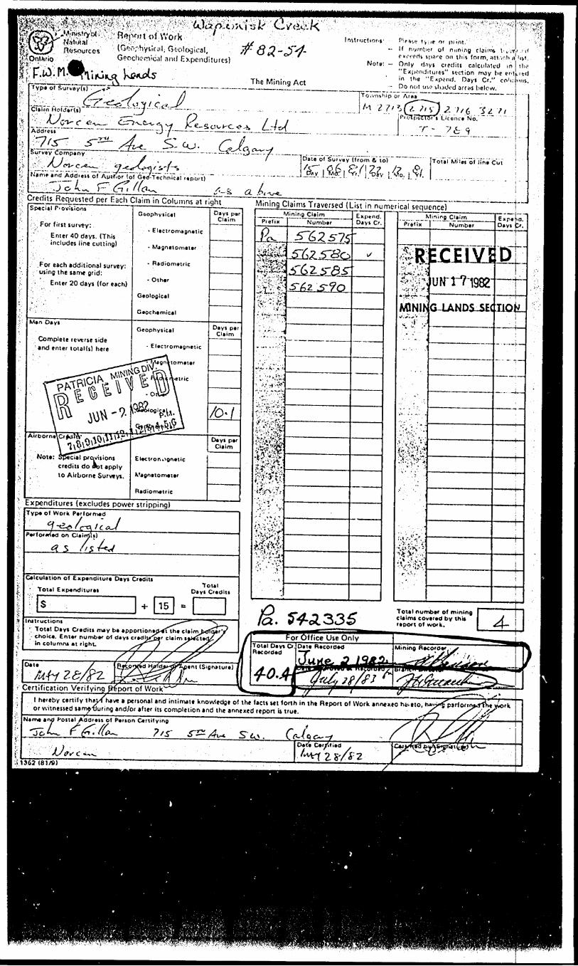
InstructtOf-s 1 W fW: t vi*e Of p/int. ' ,.— If r.v'Titx'r of nuning claims t- fc vr.
nn-'.'rrtt iparc on tl"S form, ;itt -,-.lt n[ !ivt. Note; — Only d.iys credits calculated in
"Expondituies" section may t ie e " in the "Expend. Days Cr." co'ulim
— Do not use iliatVd arf as below. |
lysiciil, GoologffrVical and Expenditures)
The Mining ActType of Survay(i) ",**
Liconrt No.
769
Dai'of Sufvi'vTfVom ft to)
Nam* and Addnn of AuifTor (of Geti-Tschnical rt'port)
ili Requested per Each Claim in Columns at rightSpecial P'Oviiioni
r For (iiit turvey:' Enter 40 days. IThis
includes line cutting)
.For each additional survey: using the tame grid:
. Enter 20 days (for each)
Man Dayi
Complete reverse side /and enter toial(s) here
Gbophytical
- Electromagnetic
- Magnetomatar
- Rsdiometric
- Oihar
Geological
Geochamical
Gcophytical
Note: Special provisionscredits do obt apply to Airborne Surveys. Vagnatomatar
Radiometric
^ Expenditures (excludes power stripping)
Dayi perClaim
Days pai Claim
Days par Claim
Mining Claims Traversed (List in numerical sequence)
Type of Work Perlormed
on CUirrJU)
Calculation of Expenditure Days Credits Total Expenditures
Total Days C'editi
Date 7
/frf/^/pz -.s/ / s ^
H Pi'efix
P^
~ ,*.',J ~ --i .*..,.;.,,
:3^Sv-v^.'':'^*
!i-'^p
mli
, t\-.- "- y
'.'' -' 'i*''
•••S
ining Claim Number
5^2^75
57^25^0^T6Z5"^S"5-^2 ^?0
Exp*nd. Days C'.
i/
M " P'lefTx ~
^;v.'-l!
MINlh*B i ;^
• ;; t-'v"-
ining Cilim
Number
EJCfWiUiTtTl982
G-LANDS-SEC
Dayi fcr.
D
nok.
-- -i—
Yj ^ Total number of mining f~^f ^^L.^ ^^ *^ ^ c laims coveied by thta ji iGl * V f~Gf*^^i~S'eS r eport of work. ^ \~
Certification Verifying ^port of Work1
Cent (Signature) .
y/^-~—————————.—————————————.——————————————————^*————————————————————————————————————————————————————————————————————————————H————M———"**5^^^Mnil^^ i f ———""~"——————————l hereby certify thai/f have a personal and intimate knowledge of the facts ut forth in tht Report of Work annexeo ho.etc, or witnessed lame.'fJuring and/or after its completion and the annexed report is true.
Postal Add'*it of Ptrton Cvrtifying
j^-7/ttfU'W*—"O*t*
.51362(81/8)
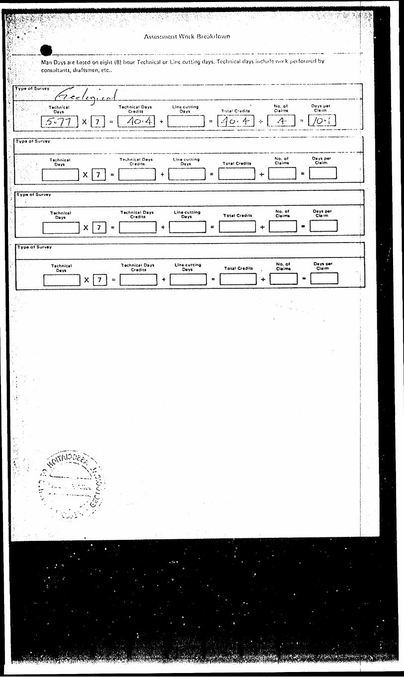
VVotk Bi'Ki
Man Diys aic bftsed on eiyhl 18) hour Technical or l.int culling days. Technical days include vvoik jwifonntd by
consulliiiu, draftsmen, etc..
TVP* o' Survey
Tuchn'cal Day*
hnicAl Dtyl CiodiU
Lino cutting Deyi Total C'Oditi
No. 0( Clai'ni
Dsyt ptrClaimx- -:- (I±H :: D^T
v,::
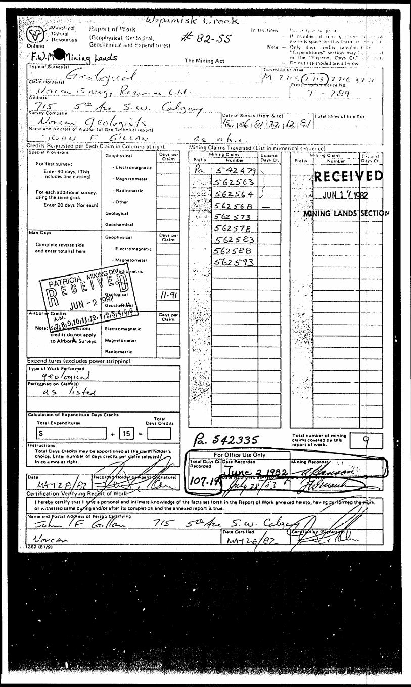
sic.il, GfT'li'ijical, Geochemiul ;ind Expend!t
The Mining Act•pt of Su'veyis)
CClaim Holiler(i)
Address
Purvey Company
--4-v , c 'l--^*YJ .
Note: — Only 'J.iys o'-clits u"n*()*:'uJiTuifrs" socliort rnrt^ ! . j •n the "C xpt-nd. Days C'." i: K
•- Do not use- shc-dtid o if:ts l ( 'i!ow. !o^ntliip or A't*B
~ 7 7, 6 ^ , (,;ice No.
s o(*', tv * { .v:-;
Dale o t Survey (i'rom Si l o)
(o!
total Miles ot lir.e Cui
^iL'l^yiii^L^^^J"10 !!!!!!'^!!^. 5 ^:1/'?!!!- Mining Claims Traversed (List in numerical sequence)SpCCij! P lOViSiOIK
For'firit survey:
Enler 40 days. (This includes line cutting)
For each additional survey: using the same grid:
Enter 20 days (tor each)
Man Dlyi
Complete reverse side and enter total(s) here
Geophysical
- Electromagnetic
- Magnelornftltr
- Ridiomtuic
- Other
Geological
Gtochernical
Geophysical
K^agnatorrtaiar
s ionscredits do not apply IO Airbor*V Surveys.
Expenditures (excludes power stripping)
Days p*r Claim
Days par Claim
TYP* O( Work P*r1orm4d
^ O ' C"^ / C c^J(Pttrtc^yitd On Cl*fl*n{*) /* .
-sAx
Calculation o1 Cup^nditut* Da y t Ctadits
Total Expenditure
s -*- 1 15 ] ETotal
Day* Credit)
Intiructions Total Day* Credit* may tie apportioned at ttiecirrrTTnTnoer't choice. Enter number ol days credlu per cUTm telected^x-^ in columns at right. ^"~"7T ST^ r/'-
Prefixlining Claim
Numbtr
^•73
5:4251^8
Expend. Davt Cf.
V---f—
O*tt
Z 8i
f ft?XA
gnature)
Certification Verifying R e pan of Worlf-
For Oflice Use OnlyToul Di vi O. 0*1* Rtcordtd
V 'prefm
! . ' 'S
.. ."...-'.A*,
'""'ii** :
J :f
./.t.'j-*-,-'. r -':" '.,4 .'-".t
v^if ••^^i
V
f ' - . ^ ,' .J t- ,'' ' ''*-
Total nu claim* co report ot
T™"^**5™
• ning Claim Numb*r
RE G Eh-JUMJLli
•flFRS'lSNDir
r ii, v:. n 1 2iv* c' J
^d4.1S^CTIC
..^^^ _ _
— 1 ——
rtiw of mining , varcd by thU ^ ' work.* ———— ———— ———
Mining n*cord*v - ; ! ^r^/tr ''i 1-~~tti3fr^(*e**~*.
S5SSM
(
1 ^•^^•^^•^•VP9^W^M^B^*'*VEJ2^^^^^^ ^^i^i^aWM
N
\ hereby certify that or witnessed same d
t 1 h/ve i persona! and inlimit y/fng and/or after its completi
mite knowledge ot the tacit *et (onh in the Report o( Work *nn*xed hereto, havinj p^-f67med thfri*ju"'kcompletion and the annexed tepon u tru*.
nj p^-f '
: 136? (81/9)
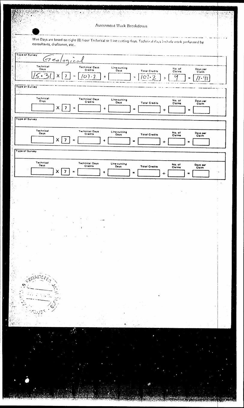
Work Brc;ikclown
Min Days arc based on ciijht (8) hour Technical or l inc euiting d,-,ys. Tcchiiirjl dr,'s i consuliaiits, draftsmen, etc.,
rie woik p.:-r(omuHl by
Typ* ol Survey
Technical Dayi
Technical Davi Lino-cutting Ci t d; II Dayl Total Credit*
N'o, of Clsimt
Cayi par Calm
IZZZI ^
\xV''
f i f.'' Avv -f • ••jist\*? ' "V
-U. rliuiva 'l!ic IViniiiy Act
Claim Holfitif
\'ote: - O..iy i..,; .- i'!-. . '-r:M' . .'M-,-v . . i.,.,, -r..,vin the "1: vpi no. D *ys C'."
•- Drj no! ir.'.' ^hvti i! ,iir. -. 'i.-ir.A
Tc -vr-^'^i) O' Af t.-a
f.Y' 'l-
T.-7B7
Survey Company"
*rd Arldrcsi o( Author (ol Geo Ttclmit./! ut fi
l A. K^ pi (3* /C C A AJ _ -, .X^oV.ipar Each Claim in Columns M ilyht
T6ai c cf Survey liiom a 10) Ttnai Wilei o' l.ne Cut
i-.':nii.g Claims Ti^ovuised (LSpacial P'QvViuns
For tust survey:
includes line cutting)
For each additional survey:using the tame grid:
Enter 20 days Kor each)
Man Days
Complete reverse side • nd enter toiai(i) here
Airborne CxOitt
Nota: Special provisions
to Airborne Surveys.
. E loctromajnatic
- Magnaiometar
- Radiomatric
- Other
Caological
Geochemical
G*ophy*ical
- E!*ct'Om*gnetic
- M*gaatom*t*(
- Radiorrietnc
- Othar
Geological
Gaochamlcal
Elactrornagnatic
KUgnatomatar
Radion^auic
T , t [ ,(,rClaim
— -- ——
Days par Claim
D*yt po Claim
Mining Owim
PioliA i N^rnt)0r
. j . —— _.-__J
ra. ^~42J36cp^ sAl^jjrP*. S ^TLP*- ^4245^
p* "ff^^
P*- J5-^273JPA J3-6Z733PA I-T62 d 5-
j
:
ii
ist in numfciical
Expenditures (excludes power stripping)
ft*f
m
c'"p*nc. Davi C'.
'^m
Ctai'n
REGEIvilD
s'sife IO
TVP* ol VVoik P*Ho'm*d
P*r(orm*c) on CUimd)
Calculation ol Enpanditur* Dayt Cxditi
Total Enpanditurat
Total numbaf 01 mining cUimi covarad by thit '•POM of wo'k.
Irulf uctioniTotal Days Credits may ba apportioned at th* ci
. Entar numbar ci days craditi par clai^- --. In column* at tight. S^ S S/
For Office Use Only
CenificJtion \jferifyinq RepppfoiWorkl hereby ctr-.ily thtt l hav^ptnonal *nd ir.i,m*te knoivledje o) the lacn *et t or/n in tht Report of Work inntxtd hereto or witnessed umt aunnp'anrj/or *(ter ill compinion and tht tnnexed upon it tmt.
Postal Aooretxol f*"on Cartilying
1367 1 61/9!
pl^i^^l;^r-:j^rtS I^"'''"7 ^ ' fUiport of Work
'l dplario :\.\0fiophy sic.il. Geological, Grocnfemical and Expenditures)
y '____;___;___i_r; Type of Surviyd) ~ " VJ
The Mining Act
finnt: — P!*,a'.e typ( or print. :— If nyinber of mining chirr.i i^r-tn.d
txctfdi soact on this form, jf j^ s Nt,Not*: — Only dayi credits calculated ;-n : r *
"Expendituret" lection iray bs i t i^i^din tht "Expend. Oayt Cr." kt'l\".-i.
— Do not use shaded attn b frlow.Township or Are,
M '- i' ?
d:-roAodftil
^ 7':
Nirni *nd AJCrm of Author (of Oto-T*:hni;tl r4port)
'/^J^KK P' (? / ^cA u
r^.Total M:IM of lin* Cut i
rt- f.'i a-*.Credits Requested per Each Claim in Columns at rightSp*ci*l Provnioni
, For firn survty:Enter 40 day*. (ThU includn lint cutting)
For ttch additional turvey: using the urn* grid:
Enttr 20 days (for ttch)
Man Day*
Complitt rtvtrtt tide and tnttr total it) htrt
Airborne Ci tom
Nott: Special proviiions crtdin do not apply to Airborne Surveys.
G*ophytic*l
4 ElvctrornaQntttc
- Mtgntiomttcr
- Radiomvtric
- Oth*r
ecological
Gtocrt*mical
Ctophyiical
- EI*ctrom*Bnatic
- Magn*tom*t*r
- Radiom*tric
- Oth*r
Geological
G*ocri*mical
El*cvomagn*tic
MaBneiomatvr
Radio m*uic
Dayi par Oaim
————— .
Day* p*r Oaim
35^
———
D*V1 P*r Claim
Expenditures (excludes power stripping)
Mining Claims Traversed (List in numerical sequence)
iPSfe ik*^
Type of Work Performed
l/*-^, /ffQrt/IV'-f'rt^^v. Z/neCv"^^Performed on OaimU) '
y. . ^, /5 "' jX S li ^4f-A C**- "rH'S fC*-
~i
*v-w
Calculation of Expenditure Day* Credit* Total Expenditure*
, S ' 4-1
Total Oayt Otditt
5 "Initructioni ;i Total Dayt C/tdltt may be apportions at th*cjji[m holoer'i J. choice. Enter number of oayi credit* p*rxcU"TmieT*:tep'^ '.' In column* at rljht, f fjT //s
Oat*s//
Mining Cliimrr.fi> Numbtr
5~62
5*62 5~fi
.5~6Z .5"*?
Expend. Da vi Cr, Prefix j
Mining ClaimNumber
tECETV
. ' -4 v
LANDS
Ei
ILQptna.
Cr.
. ,l ** S /01 ^C
Total numoer of mining claim* covered by in t* report of work.
Recor
Certification Verifvino Redort of Workl htrtoy ctrtifv t hat l ha" vi a personal arid intimatt knowltdg* of t h* facts t*t fortn in Ih* Rtpon of Work anntxed htrtto, having ptnornttcj th* w^rk ; or witneued i*m* d ur'ing and/or after its compUtion *nd tht *nn*xtd ftport is trut. - , ——s i
Nam* a na PoiUI Addreti of P*rton Certifying
l Date Certified by tSlana
XAssessment Work Breakdown
'.t:';; Man Days are based on eight (8) hour Technical or Line-cutting days. Technical days include work performed by : . consultants, draftsmen, etc.. ,
Tvpt o* Sufvty
? V L. r ~ e- A-ii Tn.hnlol Tschnical DlVJ D*',5 C/ediu
, 3-^ x 7 -l .27 ]————————————— . —— . — . —H
Line-cutting Day*
l- Total C'lditl
l 2.; lNo. 0* C:*!mf
-l ? l
Day! par Cljirn
3 j .'5
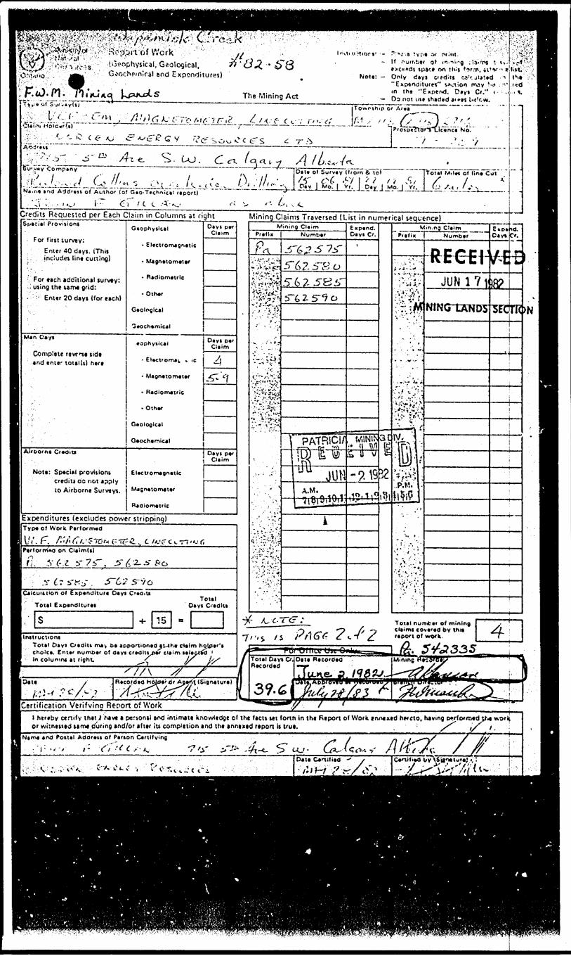
Geochemical end Expenditures)
-^L ... .The Mining Act
' " '"~ *r
Note:- Only dayi citcMt u'r.ji*!*d --ill^t ' •:'.''\
in tht "Expend. Diyi Cr." — Os n ot nit ihaded 3 1 cat l"i'rw. |
i; 'r^^ir;7i;Tf^-/.^ ' jj-o V^ t
i^
S
y
ezx.
i. C
u o c tr s ^
c-x /aa, 7
-i!:.l *~(i--^- f i --^ - -* ^ '-'I J- /',. . j*-*.,. Ut. lin- . ,sN*.r
Cred
* *nd Add'tti of Autho' (of G*o-Techn;c*l report)
i v - . i '^v i ' d i ! C t A'- KJits Requested per Each Claim in
Special Proviiioni
For fitjt lurvey:Enter 40 dayj. (This
. : includes lint cutting)
'For each additional survey: , using the tame grid:
••'•.•'' Enter 20 dayi (tor each)
Man Deyi
Complete revnt sidt and enter total (i) here
:Airborn* Credit!
Mott: Special proviiiom credit! do not apply (O Airborne Survayt.
'
Columns st fightQtophytlcel
- Electromagnetic
- Magnetometer
- Radiometric
- Other
Ceolnglcal
Geochemical
lOphylkal
' Magnetometer
- Radiometric
- Other
Geological
Geochemical
Electrorrwgnetlc
Mjgnetometer
Radiometric
i-^ V '"- t
.j — .
T - 5.
Towrthip O'
..(•1, //.-
^./^A
"t ' - '.: v,
l^M^a^Brs:
....j..-
i
Mining Claims Traversed (List in numerical sequence)Diyt per
Claim
Dayi per Claim
4
-•^ Vf
O* y IClii
perTl
[Expenditures (excludes power stripping)[Type o* Work PerformedIII* f~ /"/1 x~../-— -, — ^-o . . — - l\:( r" / 'i/ifi /.'cior-t (.-"ifrii ^ l~ IU l- C i. V7 "J f,borm*d on Claim(t)
y (-.-i y 7s", ^ ^2-A- Por — ~ ~""~~~ "~ " " " "~~l y C t i"{-:-r S~C'2 S^/og - - ** ** .'
ICaic uitiion of Expenditure Oayt Creoiti
Total Expenditure*
S -H
Total 0*yi G'edlti
15llnttiuctiont 1 Total Oayi daditi ma-v b* aoponioned^l-t 1 choice. Enter number of day* credltvper cla 1 In columru at right. t^
B
K.e cieim hotp*r*' imielectid '
-)-?
/f ' //\ /7 S h\*liU-:?*/-'' : R^^^VSi'wu'- ) j[-
Mining ClaimPrefix
P
-•A''"'i*r'^.••;"-'^''i
- — - IO--
'-•*-'.V. ^-*J.'
f /UC.
Number
j5"6^ 5 7jT5"6?.5"Scj5" 6 7-^8 i"5~6 2- 5"^ o
~T' PATR1CI/
-M ——— :
A.M.t?'"' ' '•-i
i
t C
' ' t*t / i
— .
P/16**? ?
Expend. Dayi Cr.
'
WIN1N ;* li Wi u \j
-?.1910,1,0
^'2
til152l*?l
Min.ng C'*imPr if SK Numbtr
* . , i *H . ' '^
:S;
ilW
C':''#^
. ", - . ^
iy, s : .
..P.M/ -
ii.iP
'f'.M
n P *** r* i ^ft E tt 1JUN 17 1
WNCTtSNDS
&KD4.XJ.C*V* C^e
* M M
•f **C ^j
8?
ii
Tot*l nurriber of mining J y { ciaimi covered by thit Si- ' report of work. Y"
*^ r y wiiiwv wit ^T^^^t^^i^a^B^^Total Oayt Cs Recorded
3 y. (o |Si Recorded
\ fluKi-ifel ^
-—As* 5"^? 33 5Minine ((ecoroev' 'N
S Jf \'^^rfmlrtl'J*r^ '"'^rf^ ^''^
ICertification Verifying Report of Work_______________^___^_____________________________l hereby otnify ihit i have t penon*! md intimate knowledge of tht fact! M I loan in tht Rtpoa of Work tni'xxtd ntrcto, having twrlotrotd V* work or wi:neiitd tem* during and/or •fttr !u completion and tht anntxtd rtpoa i* trot. __ ' __ /^ if l.
Adami of P*r*on C*rtlfying -j , f^^\^ jf /^S-?' x/ /lv -.A. 7 /yc V.;V ,1-v
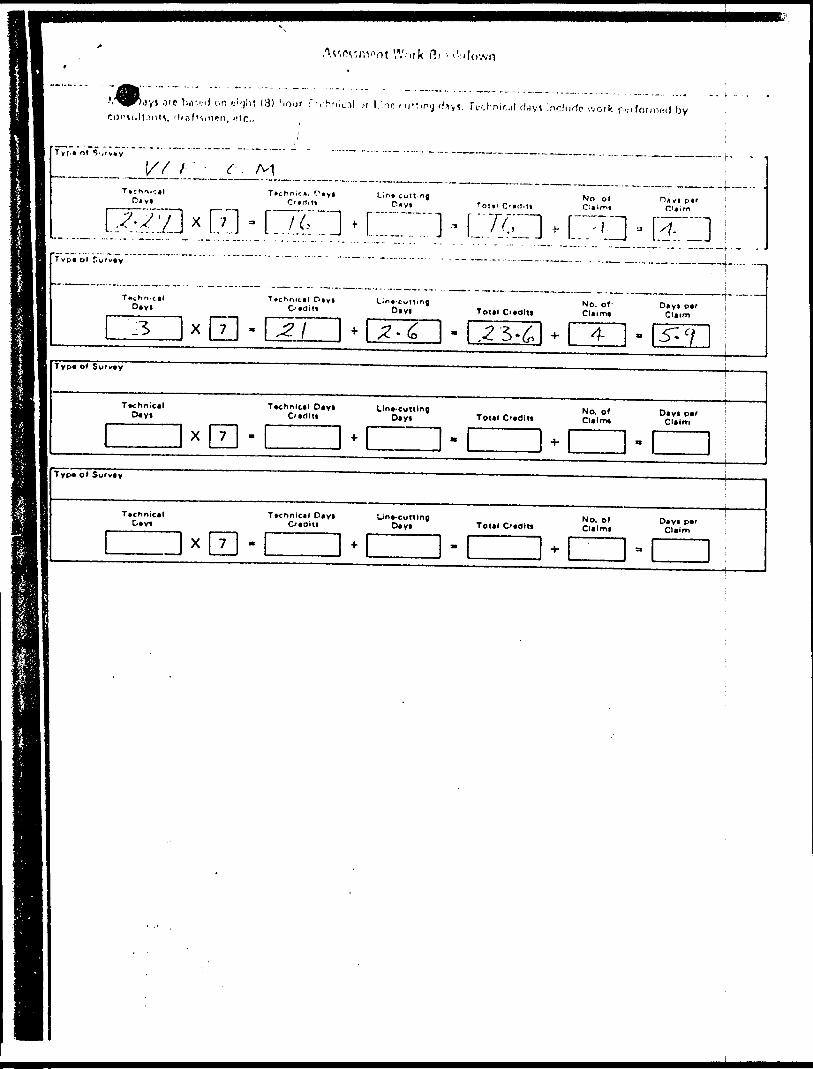
Ae,rv,nvnt Wnik Ri - '
J'O b iV.i.-iJ on ijiyllt (3) hour f-rhfncil jr l.'no U, -li.ift',, ii*n, He,,
f^vv JV.hnir..il cfayt incltlrto •.vork.f-.-ifoMmii) by
Tyr-n ot
l// c -J^\^ -T*chnir.*i ftyl
———f.—— .. .
of Hay! p*r
x 7 - L".7:a * L~j
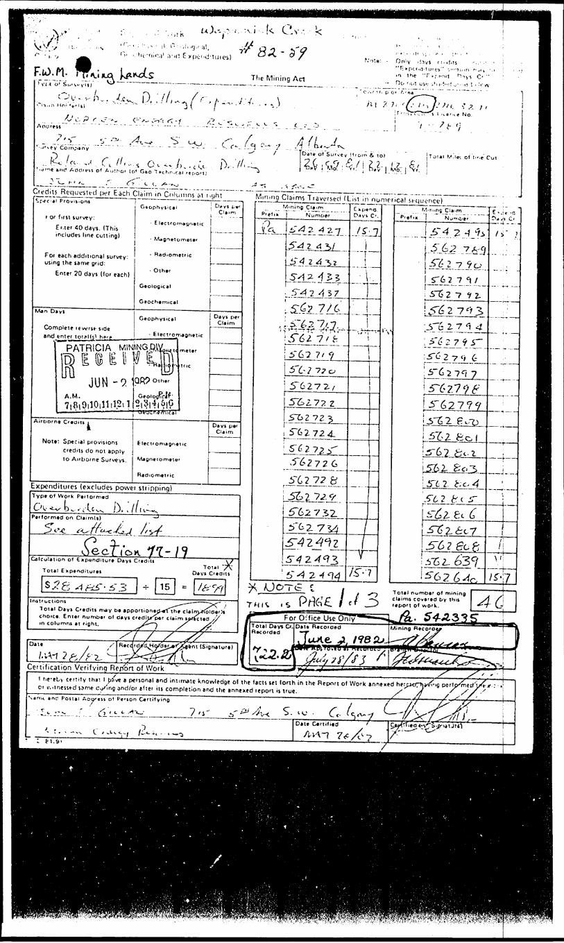
Cv, k
r" - *u--r,;r.i' ,v,(! E xpo"d'!ui ei!
Tlie Mining Act
., D. .'M-
Aou'eii
?-r
*ric? A ddrt-vs o* lo* Gto T f-c hn-ca
rn-^""^ Daie ot Suf w y
f.'o'.e: - Only ,!.iys ri.-ii.ls
'C.-.i '-f. p C" -'.i
Ai 7 7. '
i
6. to)
ys C- "
- "t-, s'7.i , lt r, v , NO.
[Totil M.li- o) !i'.r Col
Credits Requested I KT Eacti Claim in Columns st r.yhl^r-ff'* 1 PrOvifc'Oni
r or first survey:
Enter 40 days. (This includes line cutting)
For each additional survey: using the same grid:
Enter 20 days (tor each)
Man Di
Conr •nd
vs
iplete levfrK- tideenter toij*l(^ n?'p- __ -
PATRICIA, WINjfe E B E II
JUN-9.1
Airborne Credits i
Note Special provisions credits do not apply to Airborne Surveys.
- Radionietric
Geological
Geochemical
Geophysical
- ElecTforrjpnn
QP9 Other
Geolosftl^ **l*^l i ^1^*
C
C
E lectf on\agneuc
Ci.. n
— .-
——
Days per Claim
———
Da y j p*'Claim
Expenditures (excludes power stripping)Type ot Work Parlor m*d
P.,,
^nad on QeirnU)
C*-C. ^•Cx- M ^^-C -*^A-f4
/O T O C C/l'o *V *ft - 1 9
Colt ulation ot txpanditure Days Crtdi'ts V/ Total 7V Total Enptnditurts Da vi CorJits
S ^x S "1 ^ii - i 3 H- 15 = /^"/7Instructions ^^-— ——— ~-*f- ;
i
-\
M n i n g C J a ' n^
jk
' '
^ rUC
*T^2 ^^72J z 4^
SA 2 4 ^^J^dfL^-i-
5:^? 7/6.^-^77,J
!r6?7'Vfr'
5"6Z7Z^
51SZ72 z5~fc2 72 5^
5*^272^-^62726
5~627?fr5^17^.9-
5"6273Z5"tZ 734JT^Z^^Z
!f~~^-
n tr C 1
rHK -S Prt&'jE. /
Dnyi C'.
ff.j
i~" T i
-^
J
'.* * t
t
~~1
-- —
-!-
jf
41
J S
l\'
)
r.',, rung C'aim
3-4 2 ^ i
ST5 2 7 ^ ,
57s 2 7 e'r3'6 2-71
5't' 27^5
^-,
i-^4-~
^' 2 7 O 6
5"627^7S~627*nV* /* O ~7 Q -^ O X- f f
5752 feo
y
1r-62 fcc-i"Stt".5"6 2 fr t i
*
iljZ 8c 6'^^6c7j5"6 ? gc 85152- 6'36"62 ^^
Total number of mining Claim* covered t y thii repoM 0* work.
*v
P. ; " C *
/s." ;
j
i
/i
7TTi
Total Days C'tcMi may D* apportionajKtiht claim/rtolatrli choica. Enttr numoar of days crediXp*r claim iptKUdi/X m columns at right. ^ ~ J ^x^ v^
^.. 54A33y
Oil*r s
t (Sigrxturt)
Cettilication Verifying Report of WorkXV S' hf^tLy Cf rtity thai 1 Jifive B pcrjonal
Of v.'tnessfd jpmt c^r\g and/or ttief
r , ' ^, L ,- *-^-
,:.-^ C,^v, /2.,
end intimate knowledge ot the tacts tet lorth in the Report ot Work snnened herpK/pjittfi-ig pcMjXrietf'j/? t r .; us completion end the annexed repon is true. X* /f , ///,' \
VinB 7 o- ^^^ 5.^. 6- /V-7- ^"^V/^fL
t - - i -- •j-'Ti
Date C*rtitits '
- ,, M, ., . .———— , . ..., ... i.: ti.91
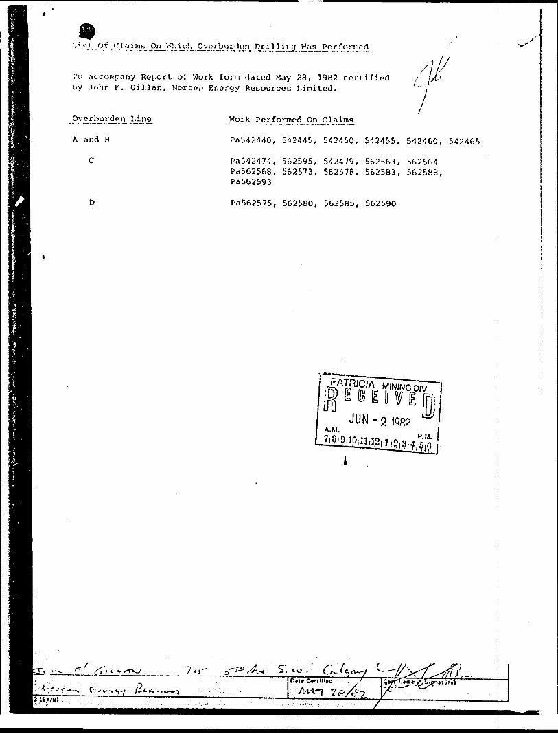
I,i vi. Of Claims On^Whi^h Overburden nriljjng Wa^Performod
To .v.-company Report of Work form dated May 28, 1982 certified by John F. Gillan, Norcon Energy Resources Limited.
A and B
C
PaS42440, 5424-15, 542450, 542455, 542460, 542465
Pa542474, 562595, 542479, 562563, 562564 Pa562568, 562573, 562578, 562583, 562588, Pa562593
Pa562575, 562580, 562585, 562590
A.M.
12 (i l/B)
~j ,- S", to-..''
7
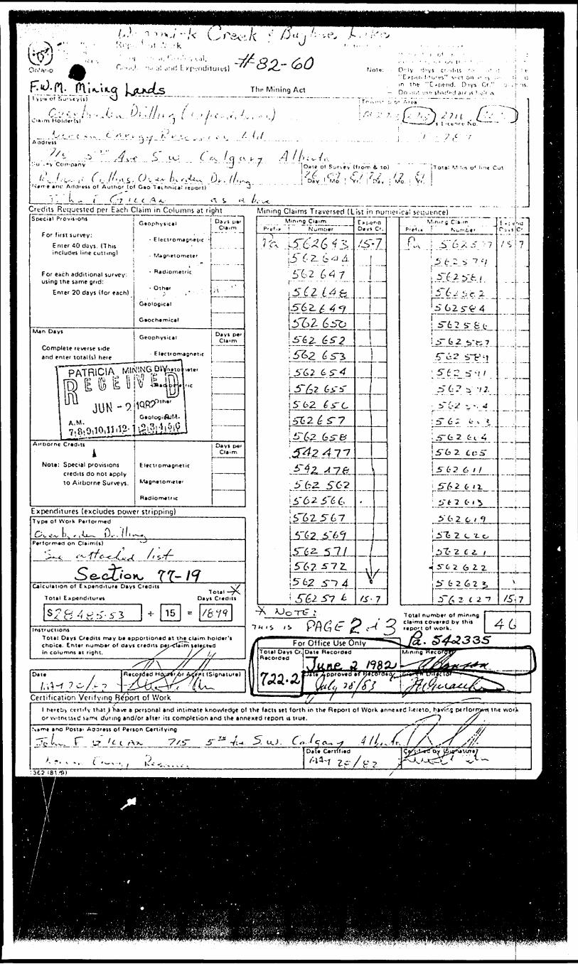
'-/-^ Crev-;.A " :
O.vvo
Tlin Mining Act
Not*: - O- lv '! ; 'VS c'.H|,K ' - i- - " E f f .'.r. !-' u-f i" ve! on i- ^ :: m the "C'C'i-ruJ. Oiyi Cr."
- On ,:V. i!S'; ifisc'".! ill f A l ....Ir ,v^::i.'^•....^'-".^..f.
S- W./ncv,, /?/^/, ...•~J ' J Daie ol S'jr^f y {1ionn f- l o) i T o^a: ^.* v* o* l^t Cut
.. _N*fye *nt' Afldrtii ot Author (o* Geo "technical ftpon)
^ "l , t, ^ (' (^-7 i l t .A ^ *T. S.Credits Requested per Each Claim in Columns at right Mining Claims Traversed (List in numerical sc-t;ji-ncelSpecial Provisions
For first survey:
Enter 40 doys. (This includes line cutJing)
For each additional survey: using the same grid:
Enter 20 days (lor each)
Geophysical
- Eletl'On
- Othars
Geological
Gaochamical
Djyl CU'rn
Man Days
Complete reverse side and enter total(s) here
Days p*'
lw l' * . - -\ ri rpIS IE li N? l
A. 'Dome Credits iNote: Special provisions
credits do not apply to Airborne Surveys.
Days pei Claim
Electrorrugnelic
Expenditures (excludes power stripping)Typ* of Work Parlor med
^ li ^ '/l O^~t\,,-L— iJ.-.Ml^—-Pe'torrnad on Ctaim(s) *~"
^^ ™/ *"* FT" fT
Calculation o1 Exptnd.iurt Days Credits
Total Expenditures
s -c"8 A K rT-5' J * 1 5
WTotal -^s.
Days Credits
* /679Instructions
Total Days Credits may be apportioned m the claim holder's choice. Enter number of day* credits pej-^Teim ^elep^d in columns ei ripht. /^ J S j^.
Mining C 1 i ' rri
T Number
15-62
6 5-
5" 62 562
^2L5"6?
i 5" 62 ^-74
E * [,ff'Days *
r-7W, r,, r g c:i.m
"Prf'l,. ! " Number
f\ i .S" 6 x 5 '7— - "i -- - --'St:2 ^ t -V
i ^2yf./
\?.tmi..;^"6zr^4-! 5-fc 2 s- S t
i 5~ 1 2 v*i 7
,fA2..^-V:i\?A?-5'\i.^6? i; -/Z
^±rc-y v -. -i: 5" 6 i t v i
L-5-fcZ fc t 4
5~62 CoS-
S-L-2 6 i f
^Sj&ljLii -..' iT t 7 C- . ^
i" 6 2 c * */
i .i"^ 2 c "i- o
^ iZ- -i c z. t^'5-G2 6 i Z
P~fc262*. .
j 5~^i 2 f 2 -7
: ' ; t '*cTi,) C-
/V 7
..j...
- -j- ——
. . j — .-.
...-
—
\
/Si7
O* it
Certification Verifvmq Be'fSon of Workhereby certify t hat \ 'have a personal and intimaie knowledge ol the facts let (orth in the Report ol Work anneieC Lueio. htvir.; pt ri orryrtit ne
jr v,!tnt!,stc! vomt during and/or alter its completion and the annexed report is true. ^^•""""7 /f ,
ana Postal Aoaress ol Person Certifying
. C
-- t — ,.., , 1^.-,...,.
Dtf*
ISl.'S)
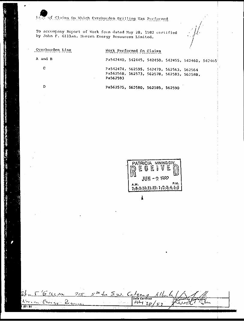
l,i.,.. Of C3;ii;ns On VJhich Overburden Drilling V.'as
To accompany Rt-port of Work form (3,'ited May 28, 1982 certified by John F. Gilliin, Nor con Ennryy Resources Limited.
A and B
C
D
Work^ J'or^ormed ,On..Cljaiins,
Pa542440, 5-12445, 542450, 542455, 542460, 542465
Pa542474, 562595, 542479, 562563, 562564 Pa562568, 562573, 562578, 562583, 562588, Pa562593
Pa562575, 562580, 562585, 562590
PATRICIA WIN5NGDIV.
) l 8 1 1 V l
A M ' PlMl
D.U
2
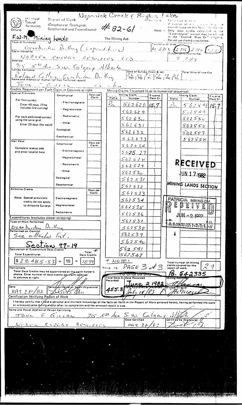
^ M..- /.:ryoi Rcp'ji- of Work ' '- t.Mk.iai
Rc-LOurcci ( Geophysical, Gt-ological,Geochtinical and Expenditures)
lyp* Ol Kurvfyls)
Craim"Hold*iTs)" ~i \ ,. T) r . - f-
Add'cis
l 1 r.uili'.i-f ol r, r ' , .- ., ,- rnC'-''d: M-;nfr on thri lorn. :
Note: — Only days CM-iins c.ikulv.- " i : * pericJituics" section m.'!^ l in (he "Expend. D .tys Cr." Do not usf- shaded i*'cai
.1 .rj :t,e i.i- i H'. ri d
(-'N.^ JS' , lll^f. [ C
C'^J c- ii? ^ v /? r
/-,' x'7/5
..Comptny
Name and A dd'e&i gf A utho' ( o* G oo Tt-chnical
a-.. .-- Dale ol Survey ( Irorn i to).?(- c-'j r/ l"? /2 ijr/Day j Mo. J V(. j Day J Mo. j Yr.
Total M.lt-i ol lin* Cut
Credits Requested pei^Fjich C^nijnJ^j^ijrnn^aj^right___ Mining Claims Traversed (List in numerical sequence)Special Prov*tions
For first survey:
Enter 40 days. (This includes line cutting)
For each additional survey: using the same grid:
Enter 20 days (for each)
Man Days
Complete reverse side and enter lotal(s) here
Airborne C'adiu
Nota: Special provisions credits do not apply to Airborne Survey}.
- Electromapntiic
- R*dtomttfic
- Olh0r
Geologicat
Geophyiical
- E lcetfomao^ft
- Olhftr
Gto'ogical
Gtoch*mic*1
tc
Elccvomj&nvttc
R*dtOrn#tr ic
Days Cm
porTT\
DaysClai
P*f
m
Days Clai
P*' m
Expenditures (excludes power stripping)Typ* of Work Ptrforrrxd
Performed on Oaim(s)
5-^-G. C^.-'i t ' O-c.^Ci,/ ' l ^7
^^*^ "^^ A^- ^. ^^ f * f9 ff 1 ^^^^* p^. C^/f t ^ n j i i "* i ^yCaK ulation ol Expenditure Days Credits
Total Expenditures
S^8^8^'-S"3 ^ 15
Instructions Total Dayi Credits may ba apportioned at t choice. Enter number ol flays credits p*j^cli in columns at right. ^^
cTotal ~*
lays Credits
18^
ss^r-T
tf
^/, /y #D*t* / RJcof^/d H\)p^fXi (i/' ^\ fM~t ift/ai ^*^fc
r A^^nt ISignaiu
/ll^ra)
Certification Verifying R^ort of Work ^*
Mining Ct*imP.elix
rkNumbtr
S~6 2 6lia..-r 6 z. 62 9^7 02 6 y,
62 (C^/
3"62 6 3 zSS
5~
5
62633
6 2 t .5^
^25 J 762 sV K
6 2 ^2 ^
5^2 T3oD~ 5 2 5- S/-5~62 532
5" 6 2 S J 3
5-6?jT3^S-i"
———
62y-?jsr(T i 5' 3 (,
"6 2 5- 3 7
J?" 6 2 r3 fr5~
5
**
3~
•^ ;oo7?Hii *S i
f^*"" — *wTotal Dayi Cr Rtco'ded
^^.S
•1I1MII ^
E2i-3 76 2 5-^o
^2 3-^ X
^7-5"4??i
^^3
E xp*nd.Dayi Cr,
X *T* /X"/c? * y
j
-pl
^j^LUHHdU—^l^^^^.^
1 Ul IILe uic wTT^*Data Recorded
7 ^
i**s^.
'fiJ*vt/!?} Y
Mining CI*) mPf#1in
.^,
RV
MINIM
PAIR/*'a.M.
i
Nurr.be'
'*"^t **ty c- 1 s- 4 -ji-625's'e
5-625-5-65'62 5~i-7
5" d2 ifSiS"
fetiviUN 1 7 too?
3 UNDS SEC
CIA MINING Dmm"JN - o JQR?
,iji^i-|2in|.i.
Days!— * *-f
C'.7~
D^~
no,v
7ri!li^.1!.
•li
Total nun^bt' of mining claims covtud by thti ^ C? r t POM of work. ."^- /*
M C** ^^535
l^SL-c*.w— w
^^c^/cctff^,^.^-^
j
IM
TI^ — ,iyU^**9 f "-S"
hereby cenily that 1 LKave t personal and inlimale knowledge ol the facts set forth in thf Report ol Work innened hcitio. having performed the w-ork or witnessed same di/ring and/or alter its complelion and the annexed report is true. ^"
Name and Postal Address of Peison Ce'tilying
/^r-,1 i- /^ ^ '- ^.IrT Y K t--'c. *? r i' s
S. cu. C (Cl a.., ;]-//^,. /^,//"Date Certified '
/-UT l f- /f-?. C52^S^?^71 1
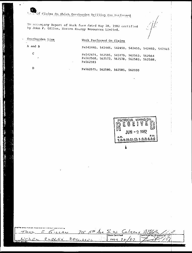
1.1 . ,~,.~Gf Claims On Which^ Overburden Drilling VJ.is Performed
To ,v.- t:omi,any Report of Work form dated May 2 8, 1982 certified by John F. Callan, Norcr-n Energy Resources Limited.
A and B
C
Pa542440, 542445, 542450, 542455, 542460, 542465
Pn542474, 562595, 542479, 562563, 562564 Pa562568, 562573, 562578, 562583, 562588, Pa562593
Pa562575, 562580, 562585, 562590
l rv l m* *ttu rwttet nww*c* t/i * *IBWM
'- t-.—^r^.c^ A-Olt* Ctrlilitd C*rl-:(nd by '
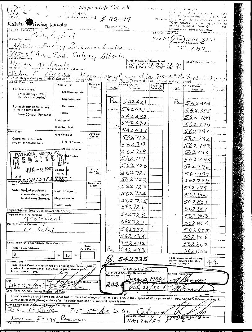
i al.O O ,.
I. . . . |. kOVr f. M Jill-. ' .
O'-ly ((''Vi -.'i-'J.ls r.ikii'iiTt -t "C - ni.-ii'!itu"'s" '.'i-iion may i' f) ci
o''J "l .A ^ i~ C Ur. C f. -S
;.eu. ^
ihor fot-.ri*o T k.-. f-' &U.C.
- 7
-.CuVvay ComjYnny
•Narn* ,-*n J /\---1' ^** of *Xulho* f ot-fieo Toe hn.f A l r
o n. . 7J -..-j.Ome ol Sur to) Tot(l Mi'ei o' lint Cut
SCredits Rrcji^i"'Cial J'roviJ't.
:Ach Claimed Columns a \ r iyhl F/.nitig Claims TiKve'M-d (l-isl id numerical sp(|iicnce)
For firjt furvty:Enter 4 0 dayi. IThij includei line cutting)
For etch additional turvey: using the strne Qrid:
Enter JO dayi (for each)
Man O* y t
Complete 'rv* f if ode and tnir' lotallt) here
Dayt i *i Claim
- Elacif omapns
- Othar
Gaological
Gtophytical
- E lecUO
D(yt pa'Claim
Expenditures (excludes power stripping)Typa o* W rk PaMo'm*/! * ;
• -C o ' c c-i i c a I .F*f*O'rn*d on
Calculation of Expenditure Dayi C'*rt'ti
Total ExptndtturtsTotal
D* v* C'*dat
Tot*1 D*yi Ovdilt m*y b* appoaiontd *Oh* claim eholc*. Enter nurnb*' o f d ty* crvdlit proclaim in column* AT right.
DatS S
Cefiificaiion Vtrifying RjK"3rt of Work
-. -5142.^27-
51^.7/6
^ a 7,2.4-
15-42
\'. n -n p C 'aim 1 Numiier
S&3L23J.-
^6,? 7 9 S
5" 6,2 WooZ 6'o
6c.
fiobTotal numb*' of rnining claims covar*d by thit
of work. 44-
l hereby certify that jXave a pervonsl and intimate knowledge of the (ecu tet forth in the Report of Work annexed h -eto, hn^ipirpiTformnlJh.5or witnessed same during and/or after ill completion and the annexed report is true.mnlJh.5 work
s f —Nimt •no'Poit*! A cf di ut o f^f*f)on C*rtityinB
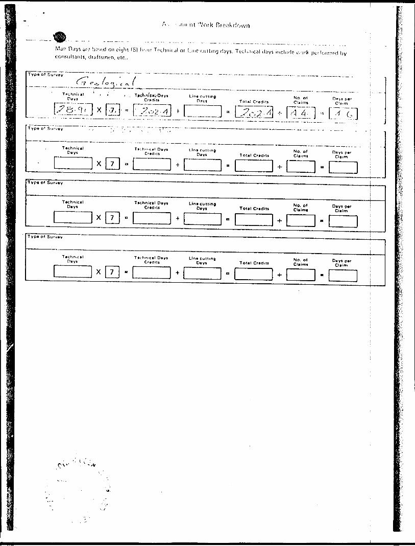
A, .nicol Work Rie.'jkdow
Man O.iys jio b,v,i,-d on eiylu (8) Iv-'ir Tc(jlmit..il or Line uiltinij days. Tot'niical days include ivj r k pt r formed Ijy consultants, draftsmen, etc..
Typa o) G urvoy , i ' t
( ~f **c- 'O ^ , c rx i
Technical . i * j TjMC'iniCnl'Oiiyf Line ruttinp No, of D/^yi JH Day! Crttrlitt Oflys To:*:C'*dilt CUirm C'fl'm~?.^L] x rio" f~^~3 * n~r~TVP* D' SLCv*y
f I4,*?
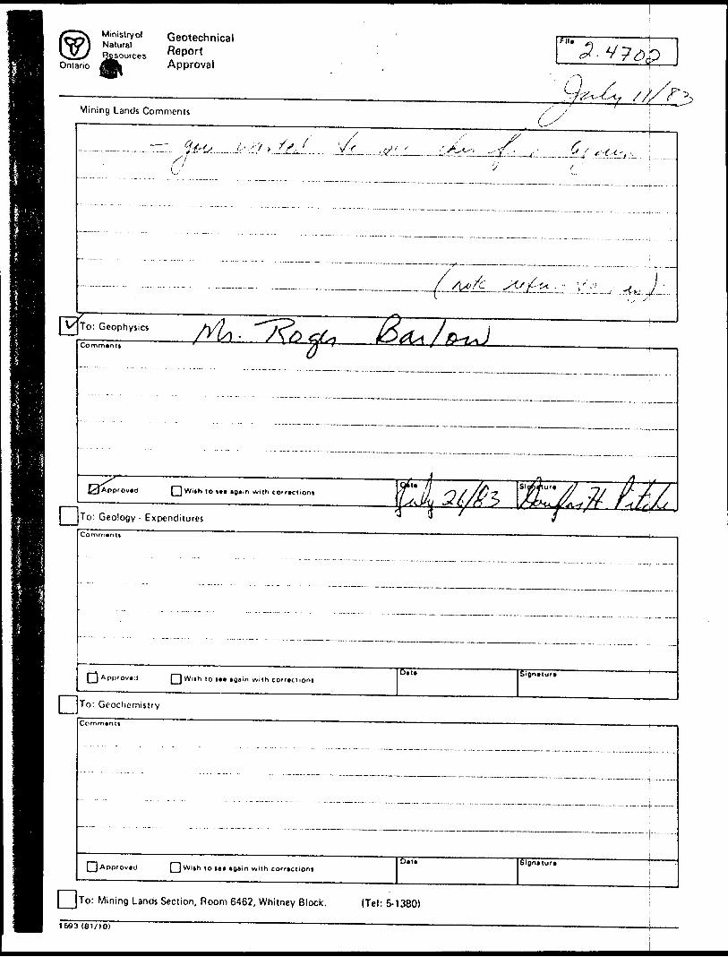
Ontario
GeotechnicalR-PortApproval
Flit
Mining Lands Comments
'/''
: C eophyiioComment i
^ ____ ,^Slg^Aur* ^7 ^T/ If-// f L /f 'Jil f T^ f^x^^t-^k^/r. r --LL^J^
*
Appfov.d lot., agiin with co'r.clioni
To: Geology - Expenditures
Oil7f^
Pj Approval rj W i|h t o i#t again w ilh c orrection*Oil* SignHuf*
To: Geochemistry
Commtnlt
[ ] Approved [ j Wi*h to te* *gain with corfactiontSignatuft
j JTo: Mining Lands Section, Room 6462, Whitney Block. (Tel: 5-1380)
1693 (61/10)
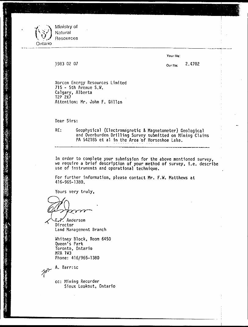
•/' \ Ministry oflV'"j Nalural V ^,J R esourcesOntario
1983 02 07
Your (ile:
Our file:
Norcen Energy Resources Limited715 - 5th Avenue S.W.Calgary, AlbertaT2P 2X7Attention: Mr. John F. Gillan
Dear Sirs:
RE: Geophysical (Electromagnetic i Magnetometer) Geologicaland Overburden Drilling Survey submitted on Mining Claims PA 542185 et al in the Area bf Horseshoe Lake.
In order to complete your submission for the above mentioned survey, we require a brief description of your method of survey, i.e. describe use of instruments and operational technique.
For further information, please contact Mr. F.W. Matthews at 416-965-1380.
Yours very truly,
Anderson Director Land Management Branch
Whitney Block, Room 6450Queen's ParkToronto, OntarioM7A 1W3Phone: 416/965-1380
A. Barr:sc
cc: Mining RecorderSioux Lookout, Ontario
-33-
VIGEOCHEMICAL SAMPLING
a *
The primary objectives of the overburden drilling program were to verify the presence of gold within the Norcen claims and to investigate the relationship between anomalous gold values and iron formations. The program was successful in both objectives. Anomalous gold values were discovered in several samples and the gold appears to be associated with one of the two iron formations outl i ned.The first phase of the overburden drilling program was de signed as a reconnaisance program. The east end of the project area was selected as the location for the first phase because of the almost total lack of outcrop and the geophysically interpreted complexity of the structure and stratigraphy. This complexity was considered to be of primary importance because of its similarity to the Opapimiskan area where Dome's gold discovery is located. Figure 10 is a composite of the airborne data in the immediate area around the overburden sampling lines. Four of the proposed ten lines were completed and each is plotted on the geophysical compilation. The two iron formations which stand out on the Qucs- tor aeromagnetic map correlate closely with the two iron forma tions indicated on the detailed ground magnetometer survey along line C as shown in Figure 11.
The initial work was to have consisted of approximately 150 sample sites. These sample sites were selected along lines which crossed the apparent stratigraphy at right angles (or in areas where gold values had been reported). Samples were collected at 400 foot intervals along each line.Roland Collins Overburden Drilling Ltd. of Timmins was con tracted to complete the sampling. A four man crew assisted by an all terrain vehicle was employed. The procedures used are sum marized as follows.
1. Lines were cut such that the ends of the lines were tied into recognizable topographic features. Normal compass orientation in the field was found to be impossible due to the high magnetite content of the iron formations.2. A Phoenix VLF survey (using Cuttler, Maine as the trans mitter) and a proton precession magnetometer survey were completed along each line. Cross-over locations and very high magnetometer readings were marked in the field.3. Overburden drill sampling was completed along each line. The equipment consisted of an 80 pound Wacker percussion drill which was adapted to accept "B" sized drill rods. These drill rods were modified by the contractor for this application. The open end of the leading drill rod was
y, -ft
l
-34-
covered by a wooden capping point which excluded material from entering the sampling tube located inside the rod. i The drill rods were pushed down to the bedrock surface by adding incremental two foot lengths at the drill. The l driller was able to distinguish between bedrock and boni-; ders by the nature of the vibrations encountered. In only very few cases was it necessary to abandon a hole and ma k p a second attempt. jOnce bedrock was reached the rods were lifted up approxi-; rnately two feet at which time the wooden point would dis-j engage. The rods were then pushed back to the bedrock j surface, collecting the basal till sample. The sample wab then held in place by a mechanism in the sample tube and ; the drill rods were withdrawn by a manual jack. Each cam|- ple was between 1/2 and l pound depending on the coarse- * ness of the material. j
4. The .samples were drycd and described as to colour, coarsef- ness and any unusual characteristics prior to shipment fo^r analysis. These descriptions are included as Appendix VIl| .5. The analyses were completed by Assaycrs Ontario of ; Toronto. Each sample was split into +80 mesh and -80 mesh fractions. Gold and silver assays were completed on both; size fractions and arsenic assays completed on only the -80 mesh fraction. Gold analyses were obtained by the following procedures;
i. 15 grains of the sample was selected
ii. 1.0 milligrams of silver was added to provide a collector
iii. flux was added
IV, the sample was fire assayed resulting in the formation of a bead consisting of silver and lead (from the flux)v. the bead was disolved in hot aqua regia
vi. the resulting fluid was subjected to normal atomic absorption analytical procedures
Silver analyses were obtained by normal wet chemical atomic absorption procedures. The arsenic analyses were obtained by a modified Goodside method which is a colourmetric method utilizing a spectrophotometer. These three analytical procedures demon strate very good reproducability. All samples were frequently checked against standards and normally one out of evey twenty sam ples was repeated.Assay certificates for all analyses are enclosed with this report as Appendix II. Table 2 is a summary of the analytical results from the overburden sampling program.
.Micruy Rcsoiirxci Limited
NORCEN TOWER. 715 - 5ih Avenue S,W. CALGARY, ALBERTA T2P2X7 Phone (103) 231-0111
March 25, 1982
Mr. F red MathcwsMinistry of Natural ResourcesMining Lands SectionRoom 6450Whitney BlockQueen's ParkToronto, OntarioM7A
Dear Mr. Ma thews,
l am enclosing the below listed forms and two copies p^f the technical report entitled "Horseshoe Project, Yea rend~Report, 1981 Explorat ion'P'rogram" by Glen Mcwilliams, J.F. Gillan and L. J. Smith plus maps to support my application for assessment credit, l am applying for 20 days credit for each of 163 claims in the Patricia Mining Division.
I have sent the appropriate Report of Work forms to the Mining Recorder at Souix Lookout.
The enclosed data includes:
- copy of letter to the Mining Recorder in Souix Lookout- copies of each of three green Report of Work foms enclosed
v;ith the above letter- one original plus one copy of the "Technical Data
Statement" form- two copies of the technical report as stated above- two copies each of seven maps v/h i eh accompany that report;- one original plus one copy of the supporting paid invoices
from various contractors supporting our claim for Expenditure Credits
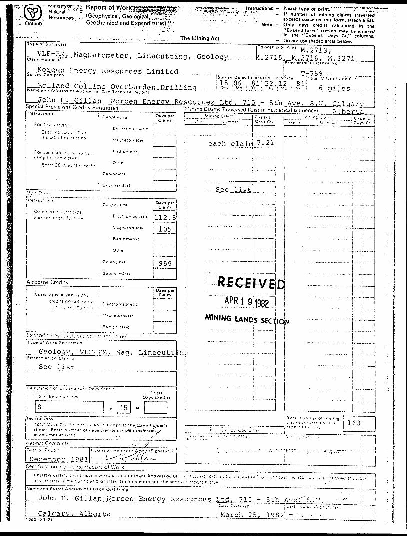
,, OntariC)
Ministry w^r:.-.: Kcport of WoriNatural "'.-s- . V'-,'-'3i\.Resources - . (Geophysical, Geological, ^,- ^.'r^;.
'' Geochemical and Expenditures)'.;*;"
i: - PIMI*- "
The Mining Act
of mining claims tr*y*rt*d on thii form, attach B lift.
Note - Only days C'*ditj calculated irt l h* "Expenditures" lection may be entered in the "Expend. Days Cr." columns.
- Do noi use shaded areas btJow.ypt o( Soiviyiij :7ownth:p O' A'H ,. ill lM . 2. l J . o ,..J^LF-EM, Magnetometer, Linecutting, Geology .... .......k. 2.715.J,...M. L 27.16.,....M. 3.2.71.Iftini HoUlertO
P 'mr*vciO''* L 't* r'f* ^O-
Norce.a. Eip.c.rgy Resources LimitedSurvey Co^i^nv
^_Holland.Collins. .Qverburden-DrillingNftrnft flnri Adcrt'i^ of A;ii^fir tof Goo Technical report)
.John F. Qillan Norcen Energy Resources Ltd. 715 - 5th Ave. S.V.\ Calaary
,...... ,.......... .. .!. .T7 789 ... .........'Su'v*v Ostei iimtcuTtir.^ 10 oM.ctl ^ota' V-.'n c' li no Cjtl 15 06 81' 22.12 81; , . .l D.isr Mo. ' V'. ' Dnv ' '.'a. ' v'. i D ml.
Special Provisions Ci edits Rpciuesieri j Claims Traversed (List in numeric* i senuencel
Pot f if b'. Mjrvt-v:
Ecu; 40 rts,,. ITf, ;
Init'nf. or l
Vin.ne C'aimi--..' v rv.^,^ t .
each c la in
'....S.ee..U.si.
|
C.ptr.a.D"vi C-.
7.21
———
-...—.
V.'.,r; C'i.-. j 6'P*-SF'-t'.. '.'. ~ ' .t- l "-,-vi C-
1 !...- .,.,. . .... -- . 11 . . ..............!..,.;........ . . .... . . i - —— , i
i~ . ^ . . . ....
........—.,....j. _
.....John.. F. Gi llan Norcen. .Enejrgy Re
CaJgary, Alberta________ March 25, 1982) —' .1363 ( 81,2!
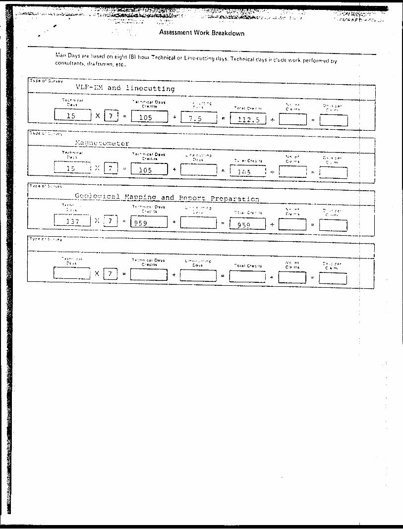
Assessment Work Breakdown
N'an D^ys S'fc h comultfinu, (Irn
ecl on eight (8) boni Technical or Lint-cuttin'j (!sys. Technical days include work perforrrt-d oy en, etc..
'ype D'
VLF'-EM and linecutting
GOOJ epical Maooina and F'ocort Preoaraticr.
List of Claims Covered by Report of Work Dated March 25, 1982
Dy John F. Gillan, Norcen Energy Resources Ltd.
F^-SM t ma nc[ Jj.ac^ne t oin^t em r ^Survej^s ^a nd ^L JJTG c u 11 i^ ' "" W ere"CQmpi'e ted" *on "c f a fm s "
542440, 542445, 542450, 542455, 542460,542465
564575, 564580, 564585, 564590
542474, 542479, 542563, 562564, 564568, '62595, 564573, 564578, 564583, 564588, 564593
- Lines A and P.
- Line D
- Line C
Geological Mapping Completed on Claims
542185
5'42295
542335
562679
5 6268?
562687
542263
5
C*
C
42422
42485
62502
562719
5
5
5
G2787
62789
62816
to
to
to
to
to
to
to
to
to
to
to
to
to
to
542220
542326
542404
562681
562685
562689
542279
542439
542495
562506
562734
562788
562812
562819
inclusive
inclusive
i
i
i
i
i
nclusive
nclusive
nclusive
nclusive
nclusive
inclusive
inclusive
i nclusive
inclusive
i
i
nclusive
nclusive
(36
(32
(70
{ 3
( 3
( 3
(17
{18
(10
( 5
(16
{ 2
(24
( 4
cla ims
cla
cla
cla
cla
cla
cla
cla
cla
cla
cla
cla
cla
cla
ims
)
)
ims)
ims )
ims)
ims
ims
ims
ims
ims
ims
ims
)
)
)
)
)
)
j
ims)
ims )
* * * * j-
-) f^ C^a. i.rc s ,.Cqv e^ red^ J; y .Hc-jjQ r of^ j|q r k J3a t o^d j-i^a r ;chu 2.5 l 9 82 ( con t ' c
By, John F. Gil la n^ ^ Norcen Energy ^
Geological Mapping Completed on Claims (co n t'd)
'^ 562826
562740
562749
562758
562767
562675
562663
562635
542440
562560
5G2595
562603
562611
562619
P^ 562527
to
to
to
to
to
to
to
to
to
to
to
to
to
to
to
562827
562743
562752
562761
562770
562678
562674
562662
542479
564594
562597
562605
562616
562634
562558
inclusive
inclusive
inclusive
inclusive
inclusive
inclusive
inclusive
inclusive
inclusive
inclusive
inclusive
inclusive
inclusive
inclusive
( 2
{ t t
( 4
( 4
( 4
( 4
(12
(28
(40
(35
( 3
( 3
( 6
{16
(32
cla'cla
cla
cla
cla
cla
cla
cla
cla
cla
cla
cla
cla
ins)
ins)
ims)
ins)
ims )
ims)
ims)
ins )
ins )
ims)
ims)
ims)
ims)
claims )
cla ins )
. . .3
-3-
Li.st
Po,
Assessn.e
542356,542372,542425,542433,542494,
562503,562530,562537,562549,562564,562619,562629,562640,562651,5 6. .6 58,562721,562728,562789,562796,562303,
564566,564574,564581,564588,
nt C rod i
542356,542373,542426,542439,542495
562504,562531,562538,562550,562603,562620,562630,562643,562652,562715,562722,562729,562790,562797,562804,
564567,564575,564582,564589,
P . J3 i.1,1^ n , 1 ,'o ree- n E n e rq y
t Applied to Cla
542358,542374,542427,542477,
562505,562532,562539,562556,562604,562621,562631,562644,562653,562716,562723,562730,562791,56279P,562805,
564568,564576,564583,564590,
542359,542375,542431,542478,
562506,562533,562540,562557,562605,562622,562632,562647,562654,562717,562724,562731,562792,562799,562S06,
564569,50-1577,56456'.,564591,
irns
542360,542377,542432,542479,
562527,562534,562541,562558,562611,562623,562633,5626.'.8,562655,562718,562725,562732,562793,562800,562S07,
564571,564578,564585,564592,
— i^5.'^yjLS.^5. A Vli.
542361,542378,542433,542492,
562528,562535,562542,562562,562612,562627,562634,562649,562656,562719,562726,562733,562794,562801,562803,
564572,56-1579,564586,564593,
542362,542421,542437,542493
562529562536562548562563562613562628562639562650562657562720562727562734562795562802562809
564573564550
i
tiiiiiiiiitiii
ii
564537,564594
M.nitryol-~
Onlarto
••'i 'W .*/. eV 1 'i*'*f'."'" ;"*'ilcal, Geological/.;^;.-;;;; - Geochemical ancft^pendlturei)"
The Mining Art
lyp* or print. .- If number o f m ining cltlrm t'ntvtntd
txceedj i pi c* on thit form, itttjch * tiltNoti: - Only d*yi crtditi calculated i In iht
"Exptnditur*i" tection miy b*'*nt*r*din th* "Expend. Diyi Cr." cjolumnt,
- Do not ut* ih*o*d artai b tlow. !Typt 01
^ GeocheiTij c?il (Assays and Analyses)
^JNorce:. Energy Resources Lirnited
.-Swastika Labs and As sayer s^ (Ontario) Ltd .D,V ; yo
jToAnih s or Ar#* jvj ^ 2713 l
lM. 2715,, M..2716 ,. H..327i_;P'eip*5ior'l i'L":*''tt"Kb. "" i
- John F. Glllan Norcen Energy Resources Ltd. 715 - 5th.Ave. S.W. CaProvision* Credit* Traversed ILisiO.ylp.r1 CHiTl
Ter l ifit Ijfvt-y
E".'.- -;0 ci,) (Tr.i*
r C 1 ' f ,;. 'i i.-j J:t ifil t.' Mivty: ut"-n '*- J - ' "-r fnt:
E i*r 20 d* vi I'o- ft:M
! D*yi tt'
Geoc' .ftr^ic
Airborr.e Dec*'1 1*i O*VS
Note: S
L
-V7,-7~"UT:S,- ——
.each ...cljaiir
See list.
C K p* r rj. Os,' C'.
.LJi.
. — ..-..—
M. r,,-- C'4'ir j
--
- -- --- - - -
C K VI f.'.
'i'"" ~
^
———————— .
1
T\re c^ \*;c**( rc r fc pr^o^
A c g a y s P. n d, A r; a 1 y c P c"•f^ On (••~, r ,"
|...... See list ...
to if.'.-w^ o* E*To:ai
Dny* C'tciui
T:,tr; Tt, s C' f !: r-.,s, t c spr c^O'Ci Cnttr nurrfjft' o* cljyi
MINING
....^
""•"1 l ........J t
TC!3' r.jmi.t- c' n-K'-ng jCH! ^ I C0.4-C-J C V i n.t IB 3
ri.) w''i:Ce o st
19811 •--/.i-^-^r^ ///^- JCertii"Ci:.o: -. V r! of \\oik*in'v ci-n i* y i MI* l fievt t. pcrioai. Bf.o .r.nrriiie knowifct;e c" i'.t- 0:11 ir; fdf;i. f - \ l it fi c so "i 01' ,,^"s t^ fc*tc I'l-iTO, Le-, f l.t-'\ut-d f ,t ,,\i-. v.'.:- -r:*-: !; "v :li-r nq (no/o- t)l*i Hi COTipiftion end the ar.nf A(G ''T-i'' ' '.- l '-t.
John F. Gillan Norcen .Energy K: sourcesi Calgary, Alberta (March 25, 1982 i
LEi^^.^S^.S5tJ2l^-vi(2E)i^22.S.S,cl.Jl^.'CSJl...2.5,_1,982
By John F. .Gil la n, ^Koj; cg.n E^ne^r c^y. -.Rjtso^r .L td .
A s s a v s ancl Analyses Completed on Claiins
O.
542193, 542360, 542487, 562730, 562651
542212, 542377, 542438, 562731,
542375, 562684, 542438, 562727,
542359, 562630, 542439, 562733, -
Assessment Credit Applied to Claims
542356,542372,542425,542438,542494,
562503.562530,562537,562549,562564,562619,562629,562640,562651,562658,562721,562728,562769,562796,562803,
564566,564574,564581,
. 564588,
542356,542373,542426,542439,542495
562504,562531,..62538,562550,562603,562620,562630,562643,562652,562715,562722,562729,562790,562797,562804,
564567,564575,564582,564589,
542358,542374,542427,542477,
562505,562532,562539,562556,562604,562621,562631,562644,562653,562716,562723,562730,562791,562798,562805,
564568,564576,564583,564590,
542359,542375,542431,542478,
562506,562533,562540,562557,562605,562622,562632,562647,562654,562717,562724,562731,562792,562799,562806,
564569,564577,564584,504591,
542360,542377,542432,542479,
562527,562534,562541,562558,562611,562623,562633,5C2648,562655,562718,562725,562732,562793,562800,562807,
564571,5 u 4 5 7 c ,504585,5C4592,
542361,542378,542433,542492,
562528,562535,562542,562562,562612,562627,562634,562649,562636,562719,562726,562733,562794,562801,562808,
564572,564579,564586,564593,
542362,542421,542437,542493,
562529,562536,562548,562563,562613,562628,562639,562650,562657,562720,562727,562734,562795,562802,562809
564573,564580,564587,564594
Ontario
Ministry of Natural Resources
GEOPHYSICAL - GEOLOGICAL - GEOCHEMICAL TECHNICAL DATA STATEMENT
File.
TO BE ATTACHED AS AN APPENDIX TO TECHNICAL REPORTFACTS SHOWN HERE NEED NOT BE REPEATED IN REPORT
TECHNICAL REPORT MUST CONTAIN INTERPRETATION, CONCLUSIONS ETC.
Type of Snrvey(s) Geophysical, Geological, Overburden Drilling GeochemicalTownship or Area Horseshoe Lake Area-Maps M. 2713,r, . .. ,. , , M.2715, M.2716, M.3271Claim Holdcr(s) ———-——-.————.————————.—-—-———————-—.^—
Norcen Energy Resources Ljml,j;e^______ -— Survey Company Roland Collins Overburden Dri 11 Ing
MINING CLAIMS TRAVERSED List numerically
Author of Report Mcwilliams, Gillan. Smith———-—. Address of Author 715 - 5th Ave. S.W. Calgary. Alta. Covering Dates of Survey June 15 to December 22, 1981
(bnrcutling to offior)
Total Miles of Line Cut approximately 5.5 miles——-—
SPECIAL PROVISIONSCREDITS REQUESTED
ENTER 40 days (includes line cutting) for first survey.ENTER 20 days for each additional survey using same grid.
Geophysical
-Electromagnetic.-M ?pnr(nrriPtrr. ,.
-Rruliomrtric, . ,,-Oir^r
GrnlogiciOOrochcmir?!..., .
DAYS per claim
patricia ...Mining ...Divisio^i(number) j
AIRBORNE CREDITS (Sptciil provhion ciediu do not .pply
Magnetometer. .Electromagnetic(enter diyj per clai
. March 25/82 SIGNATURE^
Res. Geo!..
Previous SurveysFile No. Type Date Claim Holder
.AP.B.1.9.1982..
TOTAL CLAIMS. 440
837 ( 5/79)
GEOPHYSICAL TECHNICAL DATA
GROUND SURVEYS- If morr than one survey, specify data for each type of survey
248 Mag S, VLFNumber of Stations _Station interval_____100 feetProfile tf-ale Dip angle: l inch to 10 degrees; Field strength; l inch to
.Number of Readings 248 Mag f, VLF
..Line s.-irin as plotted——-——sen
Contour interval not contoured - profile plotted
q•—*H w Z O
Instrument Geonics G-816 proton precession magnetometerAccuracy - Scale mutant l gamma accuracy plotted to nearest 500 gammaDiurnal correction mrthoH base station repetition
3 hoursBase Station check-in interval (hours). Base Station location and value first station of each line was used as base station for that line and was calibrated to the base station at camp with a value
oH u:6*".^•N ^
fiju.U u:
of 62535 gammas. Instrument. Phoenix VLF-2Coil configuration Coil separation
N/A
Accuracy 2 degrees dip angle and 21 field strengthMethod: CD Fixed transmitter D Shoot back
Guttler, Maine; Seattle, WashingtonD In line CD Parallel lijie
Parameters measured.(ipccify V L.F. nation)
Field strength and Dip Angle
fti!O
Instrument
Scale constant .
Corrections made.
Base station value and location .
Elevation accuracy.
Instrument ————————Method D Time DomainParameters — On time .
- Off time
— Delay time.— Integration time.
PI Frequency Domain _ Frequency_____ _ Range ———^———
Power.
Electrode array — Electrode spacing . Type of electrode
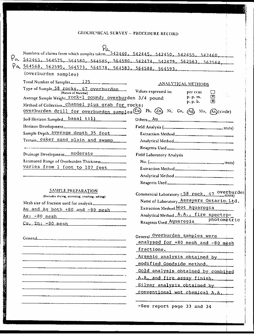
GEOCHEMICAL SURVEY - PROCEDURE RECORD
Numbers of claims from which samples t 542465, 564575, SfiJSRQ,
542440. 542445. 54245Q, 542455,56459Q, 54?474 562563.
564568, 562595, 564573. 564578. 564583. 564588. 564593, {overburden samples)
Total Number of Samples———125———.———————.Type of S:implf 58 rocks, 67 overburden
(Nature of Material)Avrragr Sample Wright,. rQck-1 pound ; overburden 3/4 pound Method of Coi|rcii"n channel plus grab for rocks ; overburden drill for overburden samples©) pb - (^ N l -
ANALYTICAL METHODS
Values expressed in: per cent 'CD
mp. p. m.P. P. b.Co. Mo, Hcircje)
basal tillSoil Horizon Sampled.Horizon Development.———-———————————Sample Hr-pth average depth 35 feet Trrrain. esker sand plain and swamp
Drainage Drvrinprn^ni moderate———————Estimated Range of Overburden Thickness——-—— varies from l foot to 107 feet
SAMPLE PREPARATION(Includes drying, tcreening, crushing, nhing)
Mesh size of fraction used for analysis ————.Au and Aq both +80 and -80 mesh As; -80 mesh_______________— Cu. Zn: -80 mesh_____________
Othprt AU
Field Analysis .tests)Extraction Method. Analytical Method.Reagents Used ——————
Field Laboratory AnalysisNo. -—-—————- .tests)Extraction Method. AnalyticaJ Method. Reagents Used^——
Commercial Laboratory ( 58 rock, 67___tpsts) Name of 1-r.t.nrainry Assayers Ontarioj Ltd. Extraction MnhnHMot Aquaregia-———Analytical M^thnH A.A. , fire spectro-D ,, . amiArertia photometric Reagents Used.
GcneraLGeneral Overburden samples were analysed for +80 mesh and -80 m^sh fractions.__________________t Arsenic analysis obtained by - modified Goodside method._____[ , r- Gold analysis obtained by combined A.A. and fire assay finish,___^ , Silver analysis obtained by j conventional wet chemical A.A. i
-See report page 33 and 34
DECLARATION
I, John F. Gillan of the city of Calgary in the Province of
Alberta, with a mailing address of 715 - 5th Ave, S.W., do hereby declare that:
1. I an employed as Exploration Supervisor - Base Motals, by
Norcen Energy Resources Ltd., with offices at 715 -5th
Ave. S.W., Calgary, Alberta.
2. I completed a bachelor's degree in economic geology at
the University of Western Ontario in 1970 and the M.Se
programme (incl.) in economic geology in 1972 at Memorial
University of Newfoundland.
3. I am a fellow of the Geological Association of Canada,
member of the Canadian Institute of Mining and Metallurgy
and applicant to The Association of Professional
Engineers, Geologists and Geophysicists of Alberta.
4. l have been involved in minerals exploration since 1964.
5. I did personally set forth the facts as outlined in this
report or made reference to contractor work where
appropriate, and did conduct, supervise, or review the
work contained herein.
G. I do not have, nor do I expect to have, any interest in
the properties held by Norcen Energy Rosou:
: MASLCMDated at Calgary Alberta
hn F. GiTlan Exploration Supervisor Base Metals '
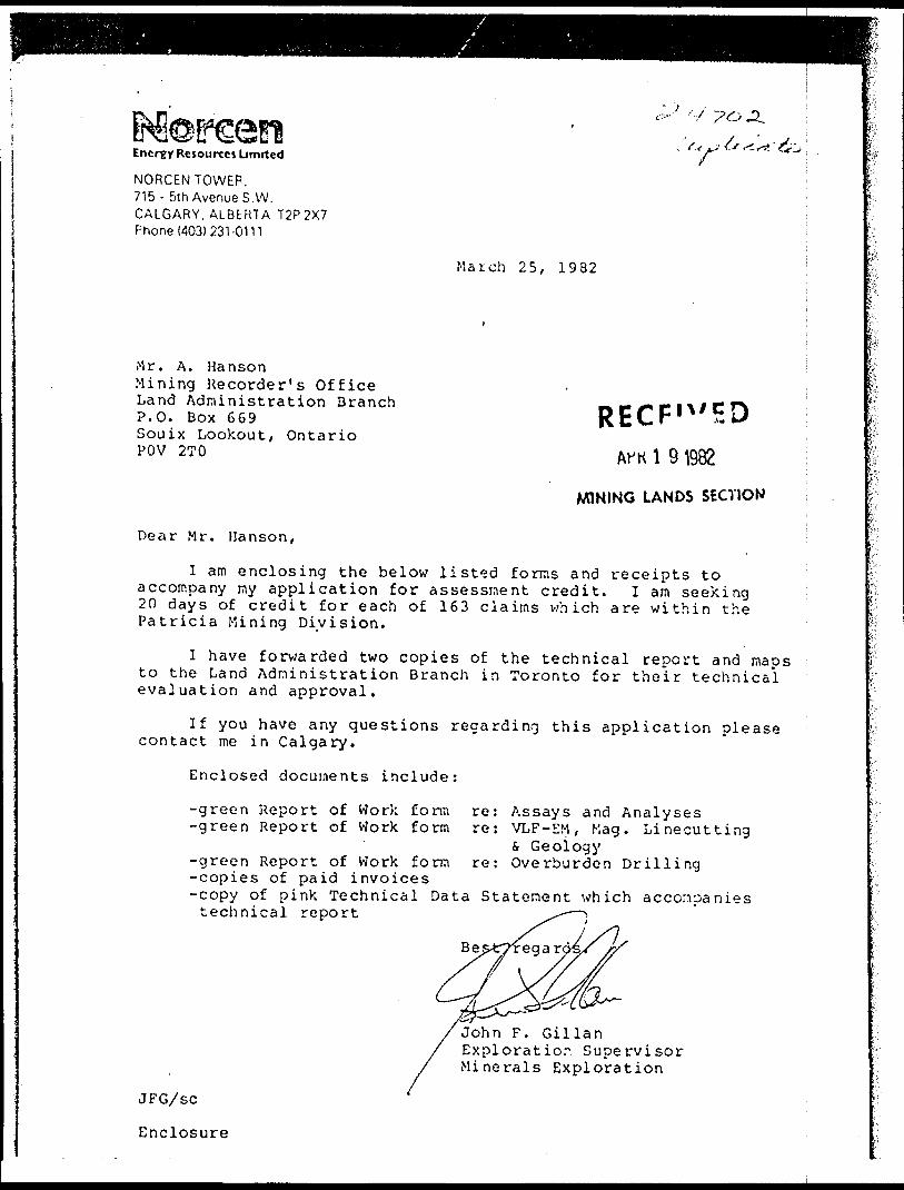
Energy Rcsourxct Limited
NORCEN TOWER, 715 - 5th Avenue S.W. CALGARY, ALBERTA T2P2X7 Phone 1403) 231-0111
^ ".y, Vv
March 25, 1982
Mr. A. HansonMining Recorder's OfficeLand Administration BranchP.O. Box 669Souix Lookout, OntarioPOV 2TO
RECF' W F.DA™ \ 9 1982
MINING LANDS SECTION
Dear Mr. Hanson,
I am enclosing the below listed forms and receipts to accompany my application for assessment credit. I am seeking 20 days of credit for each of 163 claims which are within the Patricia Mining Division.
I have forwarded two copies of the technical report and maps to the Land Administration Branch in Toronto for their technical evaluation and approval.
If you have any questions regarding this application please contact me in Calgary.
Enclosed documents include:
-green Report of Work form re: Assays and Analyses-green Report of Work form re: VLF-EM, Mag. Linecutting
s. Geology-green Report of Work form re: Overburden Drilling-copies of paid invoices-copy of pink Technical Data Statement which accompanies technical report
Be
JFG/sc
Enclosure
John F. Gillan Exploratior Supervisor Minerals Exploration
MinislfydNaturalResources
Ontario
Report of'(Geophysical, Geological, ~ ' ",\ Geochemical and Expenditures)
The Mining Act
.'i')**si... .-..-••.-^•.-•.•-...•,. i .. -- - . - - ,, -Instruction*: — Please type Of print. "
— gf number of mining claims traversedexceeds space on thii form, attach a|lin.
Note: — Only days credits calculated in j th*"Expenditures" section may be enteredin t he "Exptid. Days Cr." rolujnns.
- Do no-, use shaeed areas below, lTV PU O* SuFVVyvii
__ Overburden DrillingCalm r-Tol'K-'iif '"" --•••--•-•-- - --•••- —
_ Norcen Energy Resources LimitedSurvey Co- T-;-',-.f!s'
;Tc.'.'njH r ? r A 'ea \* fj "7 T "i
M. 2715, M. 2716, 1^3271
'Survey Daits c nocu*:."i': lo G'J.ce. Tc'.a \' . or, c* lino c"-:; 26 09 81 22. 12 81; DJV i Vn. ' V-. C..-," . '.'c . v..Roland Col l ins pverburden^prilling
*n^ Accrfti: ol f* uUir.- 10* Goo-T ftc^r.ifa! report) iJohn F. Gillan Norcen Energy Resources, 715 - 5th Ave. S.K. Calgary i
Special Provisions Credits Requested .'..runt; Claims Traversed (L st in numencii st;;jfr.''Cfei Alcertal nstruct ions
f Ci: ( .ri- Sur.';-y
t n'.-jr ^0 1:5. s i7hi
Claim
Geo 't p tco)
G r o .: h '; rn i c S '
~'-.7"~" "" *?., ^.^ r ~ j p-, -i r i
each claim i 1 - 6 ?
i i
Deyt pi' Claim
G r O; Tit rr^Cil
See attachedlist
Airl)Oinc Credits
Note: Srtcii! p-o,:i c. r. 4Days p*r
Claim
.v'u-:- P'MC
Of V. f. Prrfc-'iCC
Overburden Drillinq
See attached list' - -
Tolil
28,485.53 -5- 1 5
l-.su uc'.'OnsT; -,.; C i v-: C'; *: '- - : ^ :. r^' .'.''; c' r -r r; :^e c'.?, i rr, h o'd e''t c ho'C e. Cnte' n^n-1-*" o t d? v* c TH i'.i fK-- c(e ; "^ i t ' oC ltd in co'uT.':* 4; '.on:, ' ' /' ,.-'
APRHG LANDS Stv.TIOH
T "—I l
i i j__l
/.
)ecer.ber 1981
f t'v cf''*'S ti-iv. l MJ A r. pr.-ric:f ci tritirr.^te knowledgt c- ' * -;OP'tpiHiOn and the flr-r,; :; .;-
John F. Gillan Norcen Energy Resource^ Ltd. 715 -_StJ^^.ve. S -^
Calgary, Alberta__________________p-'.arch 25, 1982 j -.
.-SiiLims^Cove^red^ by ^Report of TWqrk Da ted J'l.a.r ch^2J5 t^1.9J^2
By John F. Gillan, Kgrcen ^Enerc^v^Resourrces^Ltd L
Overburden Drilling Completed On Claims
542440, 542445, 542450, 542455, 542460,542465
564575, 564580, 564585, 564590
542474, 542479, 542563, 562564, 564568,562595, 564573, 564578, 564583, 564588,564593
- Linos A and B
- Line D
- Line C
Assessment Credit Applied to Claims
p*
PC
542356,542372,542425,542438,542494,
562503,562530,562537,562549,562564,562619,562629,562640,562651,562658,562721,562728,562789,562796,562803,
564566,564574,564581,564588,
542356,542373,542426,542439,542495
562504,562531,562538,562550,562603,562620,562630,562643,562652,562715,562722,562729,562790,562797,562804,
564567,564575,564582,564589,
542358,542374,542427,542477,
562505,562532,562539,562556,562604,562621,562631,562644,562653,562716,562723,562730,562791,562798,562805,
564568,564576,564583,564590,
542359,542375,542431,542478,
562506,562533,562540,562557,562605,562622,562632,562647,562654,56271"/.562724,562731,562792,562799,562806,
564569,564577,564584,564591,
542360,542377,542432,542479,
562527,562534,562541,562558,562611,562623,562633,562648,562655,562718,562725,562732,562793,562800,562807,
564571,564578,564585,5645S2 ,
542361,542378,542433-,542492,
562528,562535,562542,562562,562612,562627,562634,562649,562656,562719,562726,562733,562794,562801,562808,
564572,564579,564586,564593,
542362,542421,542437,542493,
562529,562536,562543,562563,562613,562623,562639,562650,562657,562720,562727,562734,562793,562802,562809
564573,564580,564587,564594
1982 04 29 2.^702
Mining RecorderMinistry of Natural ResourcesP.O. Dox 669Sioux Lookout, OntarioPOV 2TO
Dear Sir:
Ve have received reports and maps for a Geophysical Electromagnetic and Magnetometer) i Geological and Overburden Drilling Programme on Mining Claims Pa 542185 et al in the Area of Horseshoe Lake.
This material will be examined and assessed and a stateaent of aasessnent work credits will be issued,
Yours very truly,
E.F. AndersonDirectorLand Management Branch
Whitney Block, ROOB 6450Queen's ParkToronto, OntarioM7A 1W3Phone: 416/965-1316
J. Skura/anc
cc: Horcen Energy Resources Limited Calgary, Alberta
^Moreen^•^ Energy Resources Umrted
NORCEN TOWER, 715 - 5th Avenue S.W. CALGARY,ALBERTA T2P2X7 Phone (403) 231-0111
July 5, 1983
Mr. E.F. Anderson,Director, Land Management Branch,Whitney Block, Room 6450,Queen's Park,TORONTO, Ontario M7A 1W3 File No. 2.4702
Dear Mr. Anderson:
Re: Your Letter of May 19, 1983 ________(copy attached )^^^^
I have provided two copies of the following maps as per your request in your letter of May 19, 1983:
1.
2.
3.
Original VLF - electromagnetic readings for the profile lines A - D inclusive.
Plots of the magnetic data in profile form for the profile lines A - D inclusive.
Coloured geological maps showing outcrop locations and a coloured legend.
I trust this will complete the information required for the subject assessment credits.
JFG:cl Enclosures
RECEIVEDJUL 8
MINING LANDS SECTION
J.F. GILLAN Exploration Supervisor Base Metals

Ministry ofNaturalResources
1983 05 19
Your lile:
Our hie 2.4702
Norcen Energy Resources 715 - 5th Avenue S.W. Calgary, Alberta T2P 2X7Attn: Mr. J.F. Gillan.
Dear Sirs:
RE: Geophysical (Electromagnetic S Magnetometer)Geological and Overburden Drilling Surveys submitted on Mining Claims PA 542185 et.al in the area of Horseshoe Lake.
Enclosed are the plans, in duplicate, for the above mentioned survey, ] regretfully inform you that I require additional information prior to assessing your geophysical and geological surveys. This was an oversight missed in my letter dated February 7, 1983. Please provide us with the following:
a) plots of the magnetic survey in profile form.b) original VLF readings plotted on the plans.c) outcrop designated by colour and by a letter
corresponding to the rock type as listed in the legend.
Again my apologies for having to write a second time on this matter. I assure you that upon receipt of the above information, assessment of the surveys will be done promptly and a statement of approved credits will be issued.
rs very truly,
Anderson 'ector
Land Management BranchWhitney Block, Room 6450Queen's ParkToronto, OntarioM7A 1W3Phone: 416/965-1380R. Pichette:scEnds:cc: Mining Recorder
RECEIVEDJUL 81983
MINING LANDS SECTION
1933 05 2.4702
Moreen Energy Resources 715 - 5th Avenue S.W. Calgary, Alberta T2B 2X7Attn: Mr. J.F. Gillan.
Dear Sirs:
RE: Geophysical {Electromagnetic"S Magnetometer)Geological and Overburden Drilling Surveys submitted on Mining Claims PA 542185 et al in the area of Horseshoe Lake. t
Enclosed are the plans, in duplicate, for the above mentioned survey. I regretfully inform you that I require additional information prior to assessing your geophysical and geological surveys. This was an oversight missed in my letter dated February 7, 1983. Please provide us with the following:
a) plots of the magnetic survey in profile form.b) original VLF readings plotted on the plans.c) outcrop designated by colour and by a letter
corresponding to the rock type as listed in the legend.
Again my apologies for having to write a second time on this matter. I assure you that upon receipt of the above information, assessment rf the surveys will be done promptly and a statement of approved credits will be issued.Yours very truly,
E.F. AndersonDirectorLand Management BranchWhitney Block, Room 6450Queen's ParkToronto, OntarioM7A 1W3Phone: 416/965-1380R. P1chette:sc Encls:cc: Mining Recorder
Sioux Lookout, Ontario
/
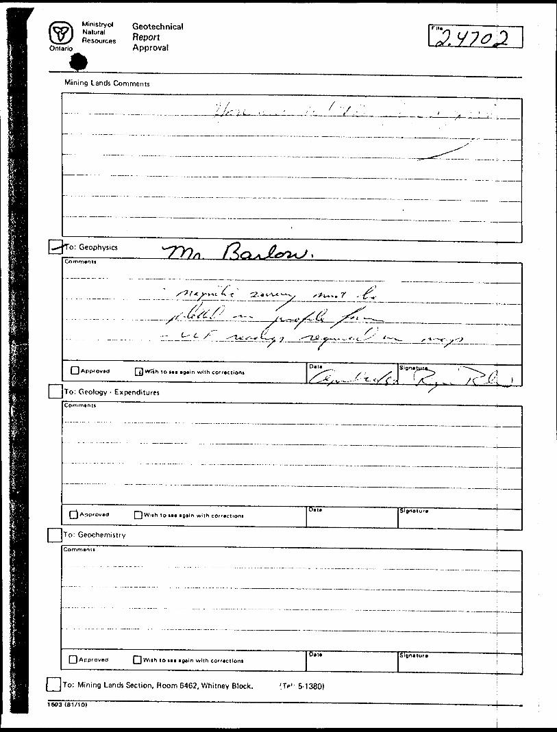
Ministryof Geotechnical
Ontario Approval 2/7^2
Mining Lands Comments
^^^^^.,^^^.^L^^.^.^.^
IIIIIIIIZZIZIIIIIZIIIZ7'
^*\To: Geophysics
Commanti
'V /'L- ^'•/^T- —5-1. ^-* tA-*^/ x^^v. r -t^r. -
7 -x y'"~ i'' * rf .......... ...,...-.-.-.-..—^?i^i-7^2—^——^x^:-^——.
Data SignalQApp'Ovad QJ With to taa again with co'ractioni s^~~, : X ^ /^ l --" -— /^" — - . . /C J^^ '
To: Geology - ExpendituresCommantt
Data Signatura ^ JApprovad [ [ Wiih to taa again with co"actiom
To: Geochemistry !Comn^anit
Bat*[ ] Approved [ [ Wrih to taa aoaln with co"actioni
Signature
{ j To: Mining Lands Section, Room 6462, Whitney Block. 'Jf'- 5-1380)
16O3 (81/10)
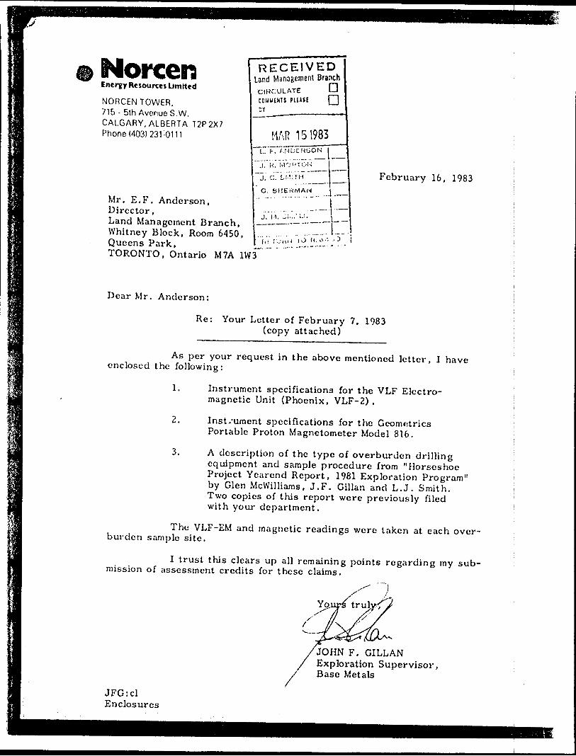
NorcenEnergy Resources Limited
NORCEN TOWER, 715- 5th Avenue S.W. CALGARY, ALBERTA T2P2X7 Phone (403) 231-0111
Mr. E.F. Anderson,Director,Land Management Branch,Whitney Block, Room 6450,Queens Park,TORONTO, Ontario M7A 1W3
RECEIVEDand Management BranchCIRCULATE LJ COMUWS PUHE Q
MAR 151983irTv A N D C H1J O N
'.irK~~MOf'TGN
J. C. 5,1-11 !"H
G. SHERMAN
J. M.
ri.:n'iJ (O f*, o.:
February 16, 1983
Dear Mr. Anderson:
Re: Your Letter of February 7, 1983 (copy attached)
As per your request in the above mentioned letter, I have enclosed the following:
1. Instrument specifications for the VLF Electro magnetic Unit (Phoenix, VLF-2) .
2. Inst/ument specifications for the Geometrics Portable Proton Magnetometer Model 816,
3. A description of the type of overburden drilling equipment and sample procedure from "Horseshoe Project Yearcnd Report, 1981 Exploration Program" by Glen Mcwilliams, J.F. Gillan and L.J, Smith. Two copies of this report were previously filed with your department.
The VLF-EM and magnetic readings were taken at each over burden sjimple site.
I trust this clears up all remaining points regarding rny sub mission of assessment credits for these claims.
fJOHN F. GILLAN Exploration Supervisor, Base Metals
JFG:cl Enclosures
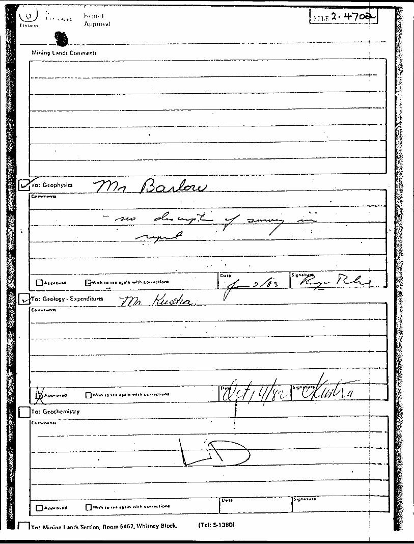
L*ndi Comment)
•S?s:
i^c"**- "7??^ /So
,ih lo in igtln wllh toi'.ctlon*Dan•-tt*JTorGroloBy.Exptndilo**
?L-
lo *e* •p*lt wlih
To: GtochcmiiUyt——7
l Ito: Min'ino L*nih Srciion. Room 64G2, Whiiney Block. (Tel: S-13BO)
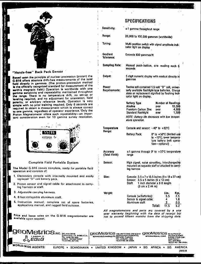
"Handi-fr**" Back Pack Sensor Baud upon the principle of nuclear precession (proton) the G-eiC offer* absolute drift-free measurements of the total field dlreciry In gamma*. (Th* proton precession method to |h* officially recognixed standard for measurement of the earth's magnetic field.) Operation Is worldwide with one Mmm* sensitivity and repeatability maintained throughout the rang*. There li no temperature drift no set-up or leveling required, and no adjustment for orientation, field polarity, w arbitrary reference levels. Operation is very •Jmple wilh no prior training required. Only 6 seconds are required to obtain a measurement which is always correct to one gamma, regardless of operator experience. 'Only the Proton Magnetometer offers such repeatability—an impor tant consideration even for 10 gamma survey resolution.
Complete Field Portable System
The Model G-816 comes complete, ready for portable field operation and consists of:
1. Electronics console with internally mounted and easily replaced "D" cell battery pack.
2. Proton sensor and signal cable for attachment to carry ing harness or staff.
3. Adjustable carrying harness.
4. 8 foot collapsible aluminum staff.
6. Instruction manual, complete set of spare batteries, applications manual, and rugged field suitcase.
Price and lease rates on the G-816 magnetometer are available upon request.
Sensitivity:
Range:
Tuning:
Gradient Tolerance:
SPECIFICATIONS±1 gamma throughout range
20.000 to 100,000 gammas (worldwide)
Multi-position switch with signal ampitude Indi cator Dght on display
Exceeds 800 gammas/ft
Sampling Rite: Manual push-button, one reading each 6 seconds ;
Output:
Power Requirements:
Temperature Range:
Accuracy (Total Reid):
Sensor.
Size:
Weight:
5 digit numeric display with readout directly Irj gammas i
Twelve self-contained 1.5 volt "D" cell, univer sally available flashlght-type batteries. Charg* state or replacement signified by flashing Indi cator light on display. j
Battery Type AlkalinePremium Carbon Zinc Standard flashlight
Number of Reading t over 10,00) over 4,00) over 1,50)
NOTE: Battery Me decreases with tow tempei'r ature operation.
Console and sensor. -40* to -f 85*C j
Battery Pack: O" to +50-C (imlted to -15*C; lower temperaj- ture battery belt opera tion—optional) l
±1 gamma through O" to -i-50"C temperature range '
High signal, noise cancelling, Interchangeably mounted on separate staff or attached to carry- Ing harness
Console: 3.5 x 7 x 10.5 inches (9 x 18 x 27 en)) Sensor. 3.5 x 5 Inches (9 x 13 cm) Staff: 1 Inch diameter x 8 ft length
(3 cm x 2.44 m)
Console (w/batteries): Sensor ft s ignal cable: Aluminum staff.
Lo*. 5.5 4 2
. 2.5M
Total: 11.5 5.2All magnetometers and pans arc covered by a one year warranty beginning with the dote of receipt bift not to exceed fifteen months from the shipping dotie.
'QeoMetrics,
WOftLD-WlDE AGENTS:
INC. 3*S J*VA DfllVtSUUWrVALE, CA I40MU.O A. Hi.'(40(1714 (616 CABLE: "Of IE LE K HO.
geoMetrlcs 43t LIMESTONE CRESCENT geoMettlcst* r———^.r,*,,™™™ a |KI |,INATIONAl.COM'. "55?",*
1EL-. m {
AUSTRALIA! TEl:M***4l TELE! NO l.tO-tttlt
EUROPE * SCANDINAVIA * UNITED KINGDOM * JAPAN * SO. AFRICA * SO. AMERICAJJM578
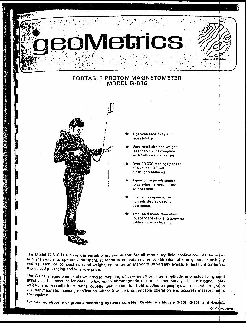
tries'i*trum*nt Dlylalon
PORTABLE PROTON MAGNETOMETER MODEL G-816
•k 1 gamma sensitivity and repeatability
ir Very small siza and weight: less than 12 Ibs complete with batteries and sensor
it Over 10.000 readings per set of alkaline "O" cell (flashlight) batteries
"k Provision to attach sensor to carrying harness for use without staff
it Pushbutton operation— numeric display directly in gammas
ir Total field measurements— independent of orientation—no calibration—no leveling
The Model G-816 is a complete portable magnetometer for all man-carry field applications. As an acjcu- rate yei simple to operate instrument, it features an outstanding combination of one gamma sensitivity and repeatability, compact size and weight, operation on standard universally available flashlight batteries, fuggedized packaging and very low price.
The G-816 magnetometer allows precise mapping of very small or large amplitude anomalies for ground geophysical surveys, or for detail follow-up to aeromagnetic reconnaissance surveys. It is a rugged, light weight, and versatile instrument, equally well suited for field studies in geophysics, research programs or other magnetic mapping application where low cost, dependable operation and accurate measurements 8fe required. !For marine, airborne or ground recording systems consider GeoMetrlcs Models G-801, G-803, and G-B2JBA.
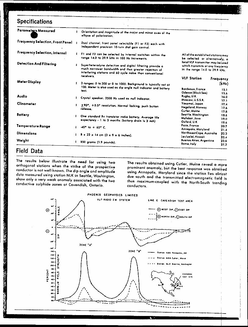
SpecificationsParameters Meoiured
Frequency Selection, Front Panel
Frequency Selection, Internal
Detection And Filtering
Meter Display
l Orientation ond magnitude of the major ond minor axes ol the ellipse ol polorliotlon.
! Dual channel, front panel selectable (F) or F7) eoch with Independent precision l O-turn dial gain control.
i FI ond fi con be selected by Internal (witches within the range 14.0 to 29.9 kH.i In 100 Hi Increments.
! Superheterodyne detection ond digital filtering provide o much narrower bandwidth ond thus greater rejection ol Interfering stations ond 60 cycle noise than conventional receivers.
! 2 ranges: O to 300 or O to 1000. Background Is typically set ol
Allot the established stations, may be selected, Df alternatively, a local VIF transmitter may belused which transmits at any frequency In the range 14.0 lo 79.9 kHi.
VLF Station Frequency
Audio
Clinometer
Battery
Temperature Range
Dimensions
Weight
100. Meter is also used os dip ongle null Indicator ond batterytest.
I Crystal speaker, 7500 Hi used os null Indicator.
I 490*. 40.5* resolution. Normal locking, push buttonrelease.
5 One (londord 9v transistor radio battery, Average lifeexpectancy - 1 to 3 months (battery drain Is 3 mA)
J -40* lo -*- 60* C.
: B x 72 x 14 cm (3 x 9 x 6 Inches).
! B 50 grams (1.9 pounds).
Bordeaux, FranceOdessa (Block Sea)Rugby, U.K.Moscow. U.S. S. R.Yosomol, JapanHegolond. NorwayCutler. MolneSeattle. WashingtonMolobar, JavaOxford. U.K.Paris, FranceAnnopoils, MarylandNorthwest Cope. AustraliaLouluolel, HawaiiBuenos Alres. ArgentinaRome. Italy
15.115.616.017.117.417.617. B18.6i!9.019.6&0.701,4P7.3|73.4j?3.637.2
Field DataThe results below illustrate the need lor using two orthogonal stations when the strike of the prospective conductor is not well-known. The dip ongle and amplitude doto moosured using station NIK in Seattle, Washington, show only o very weak anomaly associated with the two conductive sulphide zones at Cavendish, Ontario.
Tho results obtained using Cutler, Maine reveal o m|ore prominent onomoly, but the best response wos obloihed using Annapolis. Maryland since the station lies olrrjost due south ond the transmitted electromagnetic ficlcjl is thus maximum-coupled with the North-South trending conductors.
PHOENIX GEOPHYSICS LIMITED Vl.r-*ADIO I M S YSTEM UNt C CAVENDISH T CST
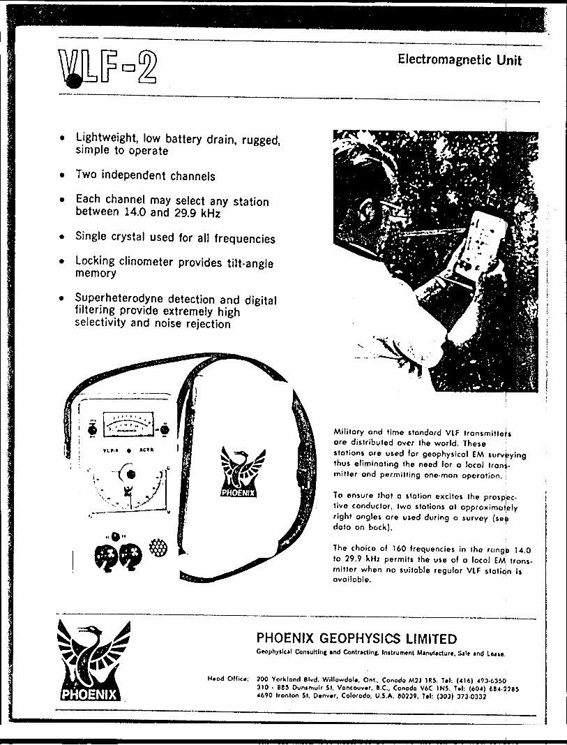
Electromagnetic Unit
Lightweight, low battery drain, rugged, simple to operate
Two independent channels
Each channel may select any station between 14.0 and 29.9 kHz
Single crystal used for all frequencies
Locking clinometer provides tilt-angle memory
Superheterodyne detection and digital filtering provide extremely high selectivity and noise rejection
Militory ond time stondord VLF tronsmittefs ore distributed over the world. These stotions ore used for geophysicol EM surveying thus eliminoting the need for o local troni- mitter ond permitting one-man operation. :
To ensure that o station excites the prospec tive conductor, two stations at approximately right angles are used during a survey (sejj data on bock).
The choice of 160 frequencies in the reingb 14.0 to 29.9 kHz permits the use o) a locol EM trans mitter when no suitable regulor VLF station is available.
Head Ollic*:
PHOENIX GEOPHYSICS LIMITEDGfophytlcil Contuttlfif and Contracting, Initrument Manufacture, Sale md L Mie.
700 Yorklond Blvd. WiltowdoU. On!., Conode MJJ IR}. T.I: (416) 493-6350 3)0 - 865 Dunimulr St. Voncouv.r. B.C., Conode V6C IN}. T*l: (604) 684-378} 4690 Ironton St. Denver, Colorodo, U.S.A. 80739, Tel: (303) 373-0337
VIKiNG HELICOPTERS JMITED FLIGHT REPORTBOX 5104, STN. F, OTTAWA, ONTARIO, CANADA, K2C 3H4 613-257-4660 "j^y /^r/
PILOT
S .
ENGINEER
FLT. NO.
1
1
3
4
5
6
7
8
9
10
11
12
13
14
JOURNEY FROM PREVIOUS LINE TO
1
fttkzi^ t-RKZLoc^L
LnC/j^LO C,f\l-
Lotfii^- PICKLE. Lfike
HELICOPTER REGISTRATION
4^y*6HELICOPTERTYPE 5bo 0
PASSENGERS
X
Z•^333
CLIENT NAME tt A DDRESS
AP o Zce,j tfiiztey fi&o ufl, CES
CTC ZONEf -HCLASS Q 4 Q 7
TYPE
TIME UP
/a -fo/l\fo10\zZtOittIT-ttf&'-fo
TIME DOWN
/ :^bl 3^It, if*n y*/8-/ f (7/7\*fo
DAILY TOTAL HOURS
BROUGHT FORWARD
TOTAL CONTRACT HOURS
CONTRACT No.
TOTAL A/F HOURS
AIR TIME:^5~r^^•*iz-.t f:?JD
f'&O
H-'^
•———— ----
FUEL GALS. REFUNDABLE
IF NO FLYING CHECK:
D NIL ASSIGNMENT
D WEATHER
D UNSERVICEABLE
REMARKS
6^5////!
CONDITIONS OF CARRIAGE
The Charter Tariff of Viking Helicopters Limited (the Carrier), which is available for examination (at any office of the Carrier upon request), is deem ed to form a part of this and all contracts for the carriage of the Charter and/ or his servants, agents and/or goods. In particular, the Charterer is advised that the liability of the Carrier for ioss or damage to the goods of the Char terer is limited to the sum of 1W per Ib., pursuant to Rule 13 of its said Charter Tariff.
APPROVAL AUTHORIZED COMPANY REPRESENTATIVE.
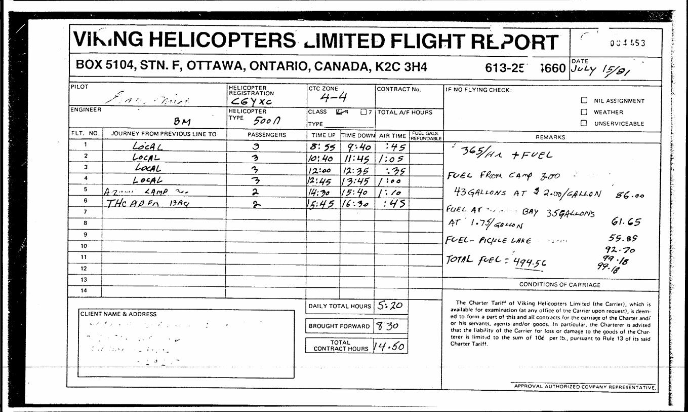
VIKiNG HELICOPTERS ..IMITED FLIGHT RLPORTBOX 51 04, STN. F, OTTAWA, ONTARIO, CANADA, K2C 3H4 61 3-25 1660
^ l
0 v 4 1.5 3
DATE ' iJoLy f^/0/
f - -^ , f? '.- , '" /'l r s '-ENGINEER
&HFLT. NO.
1
2
3
4
5
6
7
8
9
10
11
12
13
14
JOURNEY PROM PREVIOUS LINE TO
Ly'cALL*CAL.t*0tALLot*!"
4-2."""' ^•fl'V ""
77/c ftp ?n v*v
HELICOPTER REGISTRATION
^GVXc,HELICOPTERTYPE fron
PASSENGERS
O1**-^z^
CLIENT NAME b A DDRESS
- - -' ' -- - - ' '. -" . - - - -
- - " *^~
' - i' 'j . '" S - i. 1 i *
- J . ~
CTC ZONE^-4
CLASS IZ^n D 7TYPE
TIME UP
*'-f*
fc',4oI2.-.40
yz'-VfIff l Jo\S'*t5
CONTRACT No.
TOTAL A/F HOURS
TIME DOWNJ AIR TIME
V'loli w 2ii-iziw*15-tfof 6:1*
DAILY TOTAL HOURS
BROUGHT FORWARD
TOTAL CONTRACT HOURS
•fsI'.O?
'.^5f \fO
1 \ /o'VS
5--ZO
730
\t{.6o
FUEL GALS. REFUNDABLE
IF NO FLYING CHECK:
D NIL ASSIGNMENT
D WEATHER
D UNSERVICEABLE
REMARKS
^^^/-/A. i- p v e trc/e*- fftcr*. e? 4 -Y Z-&&
*t354LLCtf3 Pt T 3 3'CfD/t
f net. /K ^ , , - . Qny 3S^ 4r l -7 fj/ tfa t-**, rt
f^ec- ftq^-e isAte T"--,*
TOTAL f^t - ^9^^
CONDITIONS OF
The Charter Tariff of Viking Helicopters available for examination (at any office of th ed to form a part of this and all contracts fo or his servants, agents and/or goods. In par that the liabi'ity of the Carrier for loss or d terer is limit-.-d to the sum of 104 per !b.. Charter Tariff.
fJAACAj #6,00
-J^orf^GI-L555. 99 ?Z.-7o W -/x*-0
CARRIAGE
Limited (the Carrier), which is e Carrier upon request), is deem- ' t he carriage of the Charter and/ ticular, the Charterer is advised amage to the goods of the Char- pursuant to Rule 13 of its said
APPROVAL AUTHORIZED COMPANY REPRESENTATIVE.
:-L?
i'
;
:".-.-"
.
- j
;-"5;
ir:
L
f
L
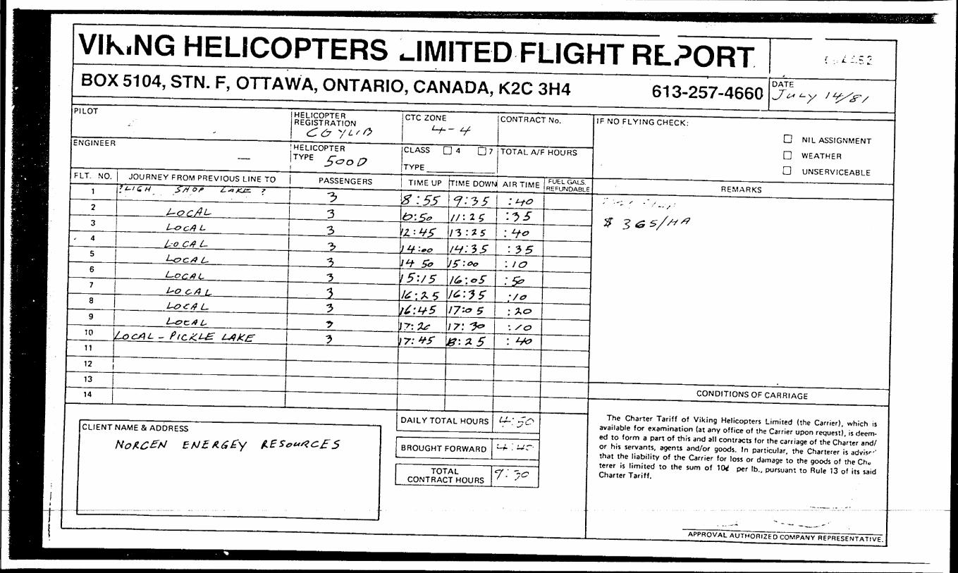
VIK.NG HELICOPTERS JMITED FLIGHT RLPORT' .
DATEBOX 5104, STN. F, OTTAWA, ONTARIO, CANADA, K2C 3H4 613-257-4660 J* *-y / t^r/PILOT
ENGINEER
FLT. NO.
1
2
3
4
5
6
7
8
9
10
11
HELICOPTER REGISTRATION
HELICOPTER TYPE Z&O 0
JOURNEY FROM PREVIOUS LINE TO PASSENGERSf*-/ C*. S* or ±~*js. *
J-~OCfll-
L-ocA L
L-o C4 L-
L~oc#L.
L,ocA L
L*O o A L,
Ux:/} L-
L-oc/l L.LocAL - PtcZ.i~g L4kf:
12
13
14
1•*i
-^
^•^
1)
•5
J
J
CLIENT NAME St ADDRESS
Not-C&tf ENZAGZy l*E Sem^c. f 5
CTC ZONE
CLASS D 4 D 7
TYPE
CONTRACT No.
TOTAL A/F HOURS
TIME UP (TIME DOWM AIR TIME
8:55t*: S*/Z : V f
i ^Y ~00
r* ^A 50
1 5: y 5I&* \ f** ^
lt;if5\?:2*1 7: *f
7: J 5l/: 15li: ISiH:?*5J *) " &G
J C& \ ^ *}
lt-:?SJ7'-0 517: ^8:1 5
DAILY TOTAL HOURS
BROUGHT FORWARD
TOTAL CONTRACT HOURS
:HO'-15
: H-o: 55
: to: 5?:/":*o-./o: J-&
tr-'y^
^ : wr-
*7 ~~c
FUEL GALS. REFUNDABLE
IF NO FLYING CHECK:
D NIL ASSIGNMENT
D WEATHER
D UNSERVICEABLE
REMARKS, . — - s s
CONDITIONS OF CARRIAGE
The Charter Tariff of Viking Helicopters Limited (the Carrier), which is available for examination (at any office of the Carrier upon request), is deem ed to form a part of this and all contracts for the carriage of the Charter and/ or his servants, agents and/or goods. In particular, the Charterer is advis'"' that the liability of the Carrier for loss or damage to the goods of the Cho terer is limited to the sum of 1W per Ib., pursuant to Rule 13 of its said Charter Tariff.
APPROVAL AUTHORIZED COMPANY REPRESENTATIVE.
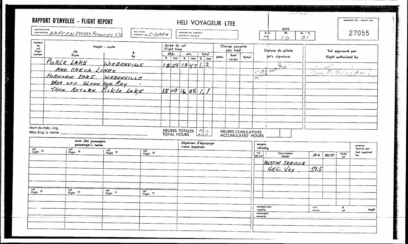
RAPPORT D'ENYOLEE - FLIGHT REPORT
)
HELI VOYAGEUR LTEEj.
DATEH.
f r.A. - y. "27055
m**n*ro dy *ol
flight number
traj.td*
from
P* M e tfikZ/)MD r^ecA / /,
^^vfy^sXrv^ fAtfF
,tX(J.P 0 r/? &L CNM . .TX/^V /f/r^-^ ^^ v
- route
ato
^^^^V^/^^V^T-
V/ifarduii-Lf*4/va /f/Jy 'f^/, '^^-^
dure* du rol flight time
de p.h i mn
/*
AT
-?Y
oO
arr. j totalh
(1
Ik
mn
fJ-7-f-f-i
O*
Nomdum6c.-ing. HEURES TOTALES Mpc-Eng.'s name TOTAI HOUPS
h/.
/,
nJ .
mn
Z
f
^
CKargo payant* pay load
pajJ. frot cargo
total
Siatur* du pilots
bf* jignature
j ^ 'o/HJ-^*rv '
i
'
iHEURES CUMULATIVES ' Arri IAAI 11 ATFD HOI IP*;
Vol approuv* par
flighf authorized by
' . ^--'
''/---i. A f' -Xt/ //;':'/ '' ; '- ^
nom d*t paisagwn pati*ng*r i nama
vel (light — *"' -
flight ~
vol j *ol flight - | flight ~
vol ^flight —
••' flight ~
\ \
——— ......- —— —— — -- -.-— - - —— — -— -- -- — -- - -— -- — -'-- — - - - -
*ol flight ~
depentei d'equipags crewj eip*nj*i
voi flight ~
.J.
1
———— r ———————— - ——— ~ ————————————————————— ^ ^ eiseni r*fuwkgno.
de vol| fcxjrnisseur
dealer
Aasr/tf Se^Vir.z4/^A Vov
ttmpir/urt:^..fh..
JP-4
,5V..fl
80/87
.
hu!U oil
*tl*tC*fowrni* p*r:
fu*t iwppli*d by.
|
:x/:. t, -phr*mjrcj(j:
Jr*m*fb....... . ......... .. . . -. - ................ —— -..-- — -- •-•- .—— -— -— •--•-•-— — —— - --
-
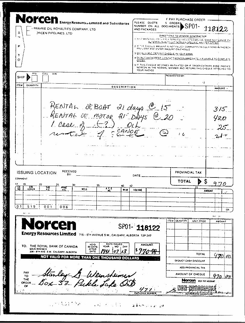
Norcen Energy Re sou rt t. umitcd and Subsidiaries[Z~'
Q
PRA|RIE O IL ROYALTIES COMPANY. LTD :iRCEN PIPELINES. LTD
PLEASE QUOTENUMBER ON ALL DOCUMENTSAND PACKAGES
f P AY PURCHASE ORDERS ORDER lw
kr
*1 -1J J.
ON? TO VENDOR CONTRACTORM "VICES AS i iKTiom low v*E NO ryANCu o*
-CV NQ1HN Sffcci'iC vt"i''f.O'i:i",
"f O'EOUE AWOUN' IS NOT ML i EL' COMPLETE C ALCUl A T IONS IJJ I ME BC'rviPf P ANP E stf n A MOUNT ON Cutout '3 UETAyM
l Pt'NL.^ l
NC DE^OSi 1 ifANK
II l)f.A(( L f T
5 " THIS CHEQUE Bf COME i- MUTILATEP on K OHDEH f MCE E os JKXiii INVOICINOnCtN IN THE NORMAL MANNE" AND HETUHN THIS C"EOl,'E ATTACHED TO VOUH- INVOICE ;COLL VIAr-] REQUESTED BY
ipUNITEM QUANTITY DESCRIPTION
jl/5".
ISSUING LOCATION R ECBEYVEDDATE.
COMMENT
17 19
PROVINCIAL TAX
TOTAL72 25 30 36 40 42'16
09
.01
li W*
5 1 9
508
Pooi
^
006
WELL *4i W/M VtXUMf AMOUNT -•" "1
C" j
NorcenEnergy Resources Umited 7 15 - STH AVENUE s w., CALGARY. ALBERTA T?P 2X7
TO: THE ROYAL BANK OF CANADAMAIN BRANCHXM-ITHAVE SW. CAIGAKY. ALBERTA
VOIDCO DAYSAFT EADATE
DATf ISSUED YCAfl . MO DAY
\o7\t3NOT VALID FOR MORE THAN ONE THOUSAND DOLLARS
QUANTITY UNIT PRICE
TOTAL
Df DUCT CASH DISCOUNT
ADD PROVINCIAL T A*
AMOUNT
^t-\ ±--— l*- -J-^-r ' L ^- *lf',r "^- --" -
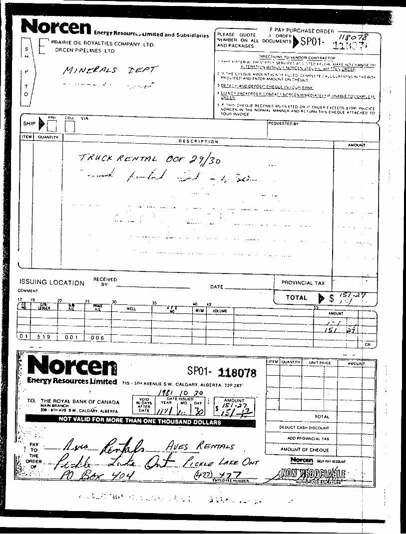
Norcen Energy Resource* Limited and SubsidiariesPRAIRIE OIL ROYALTIES COMPANY. LTD
ORCEN PIPELINES, LTD
PLEASE QUOTENUMBER ON ALL DOCUMENTSAND PACKAGES
F PAY PURCHASE ORDEn i ORDERI
DIRECTIONS 1Q VENOOR CONTRACTORi t H T i.'ATfB,A! O" yi-r*. v SfHvrCfS A'- l t^'ED f-.Caiv. Mt" f NO C-'ANflE O" a^rnatin-j wnnCVI NQ'jClS b''[Ci"C W'TTE'i OHL'^f-j ir i M( o- E OLIE AMOUNT i s N r.T fit^ED COWL f 'f C'.A.CULATiONJ 'N T., E BO' PBOnftn AND f NTtw AMOUNT ON3 pe T '; H AND DEPOSIT CMC our, m -PU" BANK4 C'ONO' PACtORPf " ..CONTACT NQ1CCN .IMMt plAT( [ VI' UNAllt~
5 :f THIS CHfOUt BtCOMES MuTilAieo OH P' OKDEfl ExCEEnS SKTOP INjvOlCt NOflCE'i IN TnE NOIlUAl MANStH AND RETURN 1MIS CHEQUE ATTACHED TO VOUfl INVOICE :
SHIPCOLI V IA
HEOUESTEDBV
ITCM QUANTITYDESCRIPTION
AMOUNT
ISSUING LOCATIONCOMMENT
DATE .PROVINCIAL TAX
15117/'CO
•K)
l,0 1
9en
UPM1
5 1 9
7!5Ut
. *A . .
00 1
?5WiU{*'t
006
30WEH
35A f. L
NO
40
W/U
4?
VOIUUE
i \s i ni. V v r J55
AMOUNT
S ~ i i
J5/ ^7
J•\
Cfl j
Norcen SP01- 116078^ Energy Resources Unfitted 715-5™ AVENUE s w.. CALGARY, ALBERTA
MSI / oTO: THE ROYAL BANK OF CANADAUAIN BRANCH ^
3M-*TNAVf S W. CAlOAfly. AiBtATA
W DAYSAFTEH DATI
DATE ISSUEDYIAB . MO//x/ L
DAY
loNOT VALID FOR MORE THAN ONE THOUSAND DOLLARS
ITEM QUANTITY UNIT PHlCE
TOTAL
DEDUCT CASH DISCOUNT
AMOUN
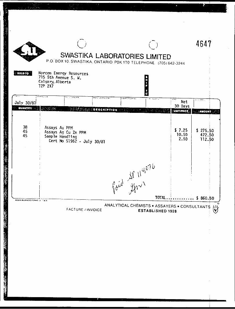
U (JSWASTIKA LABORATORIES LIMITED
P.O. BOX 10. SWASTIKA. ONTARIO POK 1TO TELEPHONE (705)642-3244
464?
Norcen Energy Resources 715 5th Avenue S. W. Calgary, Alberta T2P 2X7
July 30/81
384545
Assays Au PPM Assays Ag Cu Zn PPM Sample Handling
Cert No 51962 - July 30/81
(t**
Net 30 Days
7.2510.502.50
TOTAL.
S 275. 472. 112.
503030
860.^0
FACTURE /INVOICEANALYTICAL CHEMISTS * ASSAYERS * CONSULTANTS f—,
ESTABLISHED 1928 \5/
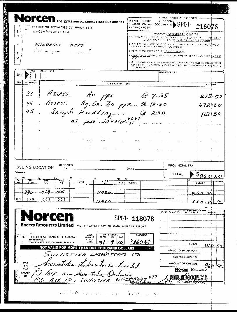
Norcen Energy Resource.. Limited and SubsidiariesPRAIRIE OIL ROYALTIES COMPANY, LTD JORCEN PIPELINES LTD
PLEASE QUOTENUMBER ON ALL DOCUMENTSAND PACKAGES
PAY PURCHASE ORDER ORDER i
118076
3 CE'*C^ ANH [.'i
MfOi f PtCOVEJ V^TilAUD O" " ORIiFB l "CtCOS SKXXijiNVOlCt IS THE '.O"M*i WAN'.fd A\D df TUHN TMIS CHEOUE AITAfHEO 'O
iNv'OiCE
SHIPPPO COLL VIA
DREQUESTED B*
ITEM QUANTITY DESCRIPTION
r. , .Q ^5,~ So
ISSUING LOCATION R ECBEvVED.COMMENT
17 19 ?? ?5 30
DATE.PROVINCIAL TAX
TOTAL35 *0 4? O SO
(tt *)
101
emu uw"
,J2/^.-5T&
^519
5UT" " *'C
-O/-?
^001 J
**iar ve. .
r&S
006 1
WELI A f tNO
^J2U.S^i
JJWQ
W/M VOlUME AMOUNT :—————— -- —— | —— H
3 6 o , ire*
^ ^ ^2 . LSd
,
en ^
Norcen SP01- 116076Energy Resources Umfted 7 is - MN AVENUE s w.. CALGARY. ALBERTA T2P ;x7
TO: THE ROYAL BANK OF CANADAMAIN BRANCH3M - (TM AVE S W . CALOAWY, ALBERTA
VOID BO DAYS
DATE ISSUED YEAH MO , DAY
\J0NOT VALID FOR MORE THAN ONE THOUSAND DOLLARS
PAY': TOTHE
TIM I QUANTITY AMJ3UNT ^
TOTAL
DCDUCT CASH DISCOUNT
ADD PROVINCIAL TAX
AMOUNT OF CHEQUE Ste-
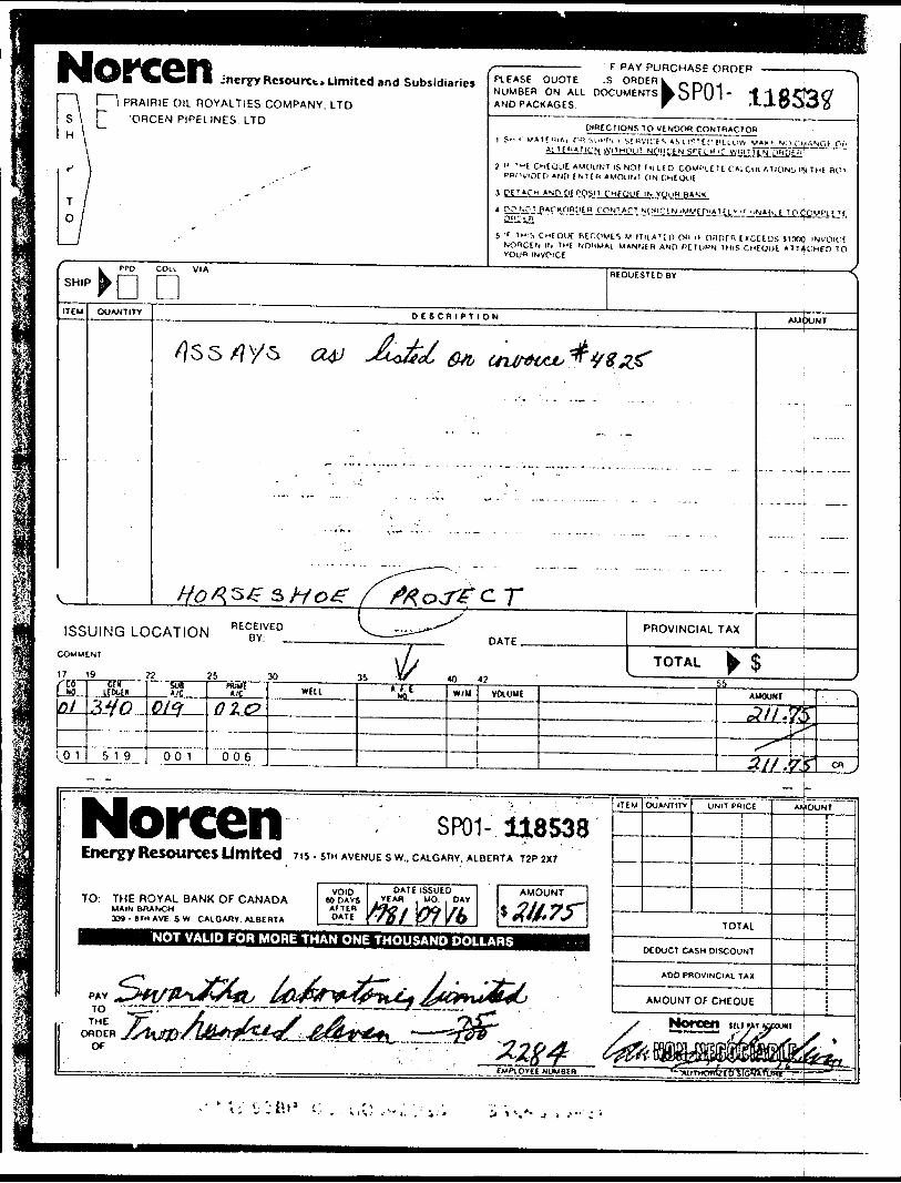
• I^^ET ^l^^l I jncryyRcsourxt* Limited and Subsidiariesl l PRAIRIE OIL ROYALTIES COMPANY. LTD [~ 'ORCEN PIPELINES. LTD
PLEASE QUOTENUMBER ON ALL DOCUMENTSAND PACKAGES
f PAY PURCHASE ORDER ,S ORDER!S
kY
DIRECTIONS TO VENDOR CONTRACTOR, ^ .. i- v iTfnuii rn si'k'Pi - S!Hvit fs A;, i i f: t r H E i o* MM^ NO CH.'.NC.J p(. AiUPATtON wilMl'Ul NOHCENSrLCH'C W'ilMEN OHUt^*'j li n-t CMtOUC AMOUNT IS NO! Ml LED COMI'lElE CALCULATIONS IN Tut BO-
PPCViOCti AND EN1EK AMOUM ON Cutout
3 f t T tf.H AND pt PQSIT CueouC IN VOuH BANK
4 POf.QT BArKORtltg. CONTACT NQ'ICtNlMMCPIATtLVf UN*|lLl "
5 ' ' I wis, CHEOUC BECOWtS MiJTILATCO On i( OflOfR [JCEEDS HOfXj INVOICE NORCEN IN THE NOMMAL M*N',( H AND PE!U"N THIS CHEOUE ATlAf.HeO TO VOU** INVOICE
SHIPPPO COLI VIA REQUESTED BY
ITEM QUANTITY DE SCRIf T ION AMOUNT
ISSUING LOCATIONCOMMENT
17 19 ?2 25 30 35 W 40 42,. ,.•9
&L
01
cor UKIK
5 1 9
sueA /C
01^
00 1
HOME A /C
o tc?
006
WELL w W/H VOLUMEtt
AUOUNt
^//,^L^
s^\
^
^~
ys
3. // .yjf
• - . ^
en j
Norcen SP01- 118538Energy RCSOUfXes Limited 7 15 - MH AVENUE s w., CALGARY. ALBERTA T2P 2X7
TO: THE ROYAL BANK OF CANADAMAIN BRANCHJ39 - 6TM A VE S W., CALGARY. ALBERTA
VOID(ODAYSAFTERDATE
DATE I SSUED VEAH , MO. . DAY
NOT VALID FOR MORE THAN ONE THOUSAND DOLLARS
ITEM UNIT PRICE
TOTAL
DEDUCT CASH DISCOUNT
ADD PROVINCIAL TAX
AMOUNT
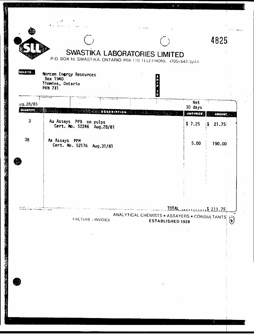
c O 4825SWASTIKA LABORATORIES LIMITED
P.O. BOX 1U. SWASTIKA. ONTARIO POK 1 TO IfLFI'MONL (705) 6
Norcen Entrgy Resources Box 1940
Timmins, Ontario P4N 7X1
.ug. 28/81OUANTITV
38
Au Assays PPB on pulps Cert. No. 52246 Aug.28/81
As Assays PPM Cert. No. 52176 Aug.31/81
Net 30 daysUNITMICI,
J 7.25 $ 21.75
5.00 190.00
TOTAL
FACIUMI /INVOICEANALYTICAL CHEMISTS * ASSAYERS * CONSULTANTS:
ESTABLISHED 1928 \
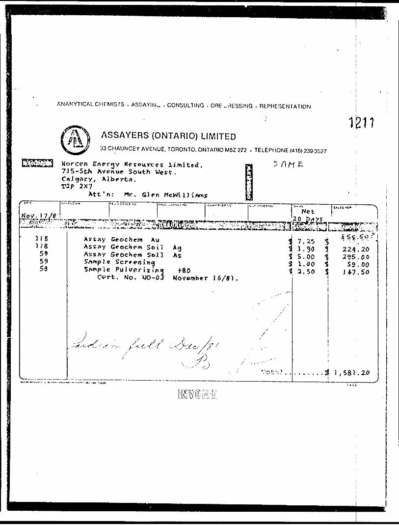
ANALYTICAL CHEMISTS . ASSAYIN^. . CONSULTING . ORE-MESSING . REPRESENTATION
ASSAYERS (ONTARIO) LIMITED33 CHAUNCEY AVENUE, TORONTO. ONTARIO M6Z 2Z2 . TELEPHONE (416) 239 3527
1J211
Norcen Energy Resources l imited, 715-5tK Avenue South West, Calgary, Alberta.
2X7Att'n: Mr. Glen
M E
'"p*"!' ViH'ib'v* . t ;. t 'U'.U NO
NoJC-.tZ/t.,,. -.^.,. .....,- r'"'' '^•'•iil'"*" ' iLiiii^t^. ^ ! V 't.'!l5t ''ji!X(i'A ' ^'
1181)8595959
^rtOV L'C1'.CI SO
ji^f]^!^^^;*
iCu"C-'OIB'.9
..' r.--^:- ''••''^
C, j ii O '*Ot** '.O 't -*VS
NetS*llS"l* ^\
20 p/rXS^ii^^^L^^A *AjSti*Kf'*si*±J L^.^fa*4ftE^:^.-^., '
1 r ^ — ^ ,-x ^Assay Ce ocher* Au ^( 7 . 25 S ' " . :" "Assay GeocJiem So LI AgAssay Geoc)\em Soil AsSample ScreeningSample PuJv/erizing f80
^ .1.30 1 224.20S 5.00 ^ 295.003 1.00 t 59.00t
CVrt. Mo. WO-03 Kovember 16/81.
y^,,.; x^//" c ^-6-^7
•*V-^
xx
"O f T, 1
2.50 S J 4-7. 50
-. . ... .3! 1 , 581 .20
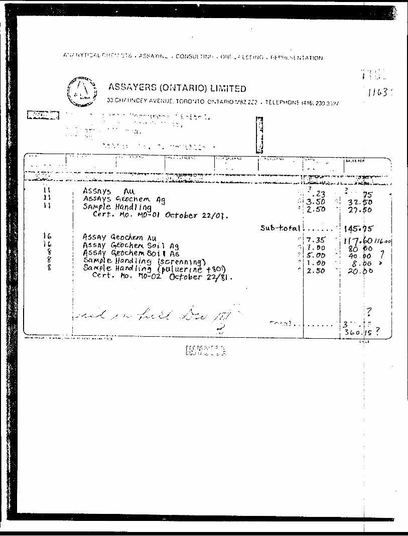
A';/ U'YTOU OHf.V 'jTS . A SSAVIN, . COfJSUl TIN'; . OMT . G . f-.FPHi-.Sf STATION
. i f-' j)\^ *~*"*J 3 3 CH
ASSAYERS (ONTARIO) LIMITEDUNCtY AVENUE. TORONTO ONTARIO V3Z2Z2 . TELtPHONt (416) 239 3 W
- .
'''..'•i j --~ . |"2^^ " ^ '
Vt11u
: - •• ; ' : -' "
t
1~~~'fcTi~*. , 'r'T7"'T7"IAssnys Au.AssAys Cyecchem. /}eSAM/'/S. tf4fld?Jog
Cerf:. no- f^O-Of
1 ~ ^
.-,. ,..su..:
*^^.^!Wf '^O.'^7'"' "
Octob&r Z2/
•,.-^-.,-:3
fo\ .
i! t A*sfly Gfochtn. Soi-1 flq
1g
V
/jssdy 6,roc^en\Qov&QW0] B- flood] //T^i (sSample fffl^ li' iTrg (i
Cert. t\o. no-02.
f ^.s' '
1 AsCx t ^f/'fl i**rj 7
••4
jr --"•- . ..-.. f. ~,o- t ' ^"^•••'••" ——— •^^iryv^*^'"'1"' """"'•rqjerr-'' ••• - .-o... ^ ...:.i .^. u^o^*i-i4i^i^. j i.-^^j-jc'^*, 1-^ — v j
•;! J.Z3 * 1753. 50 ; 3*2-^0
' 2..510 ": 27 '^01 ;
Sub -ho f*M .......' I45-.175--' 7.35" ' Ify.^/^-ooj '" -/ . 00 ^o 06' 5". 00 'i 4o i K) 7^ 1 . 0 '0 f ^ . ^6 *
^uluerfne fi0'1) -October 2'
y^ y' ^ -- ' .
•. ^.-' -'C'
-
^7 O" *
J "t"/
'.'
^
"•(-, :- -.1
2.50 'j PO.(j)C)i
i l
7; 9
' 2 - - -rt
Sfco./S ? j
.L L J U vi, L '.c. -,-
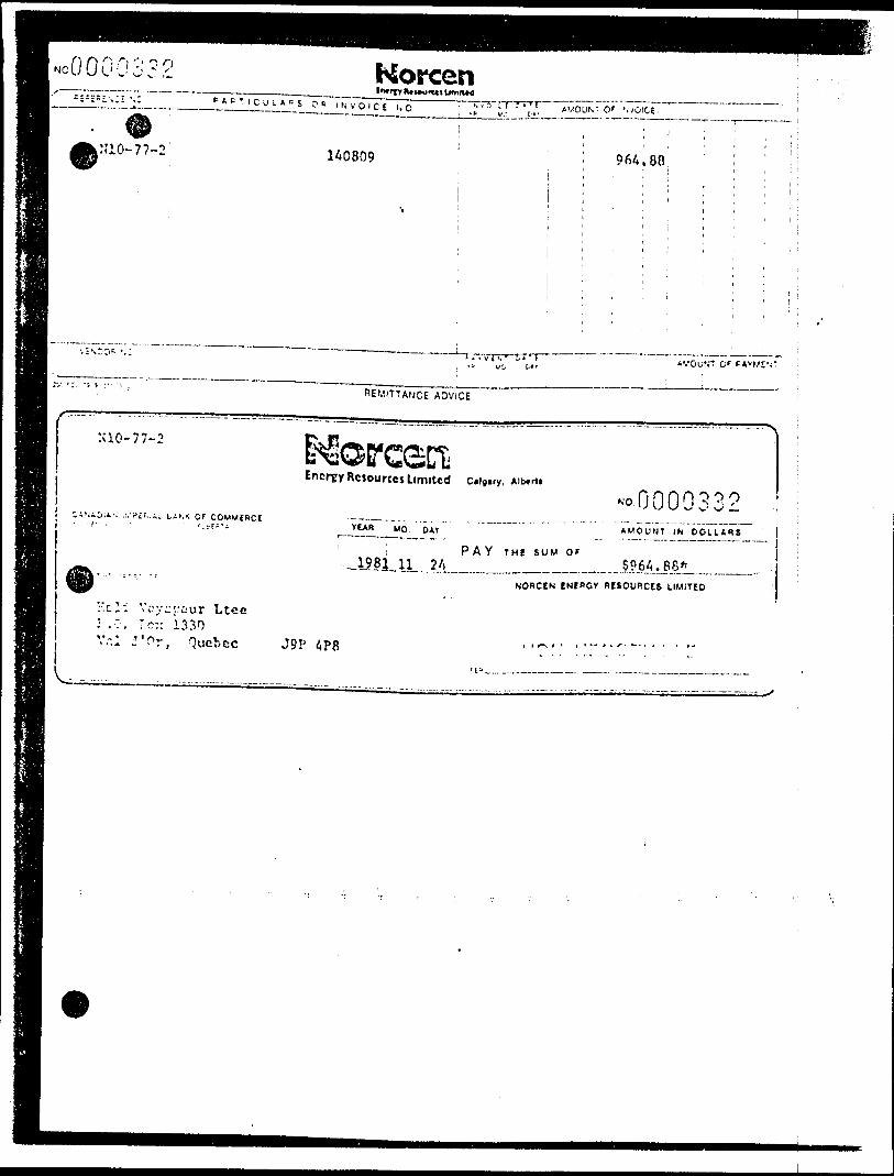
".r"ct' "r
N'10-77-2
:ao-77-2
Korcen-^-li!-tJll.L!ilE' cE u o "
1A0809 9 64 .80
A'.'OU'.'T O f
REMIT!ArjCE ADVICE
Energy RciourccsLimrtcd c .ig.ry, Aib*n.
OF COMMERCIt)AV AMOUNT Ifv DOLLARS
P A Y THl SUM Of
_______ — —NOflCEN ENCBGV WISOURCES LIMITED
yc::cur Ltcc : .7, r.c:: 1330
} Vr.l r Or, Quebec J9P APS t
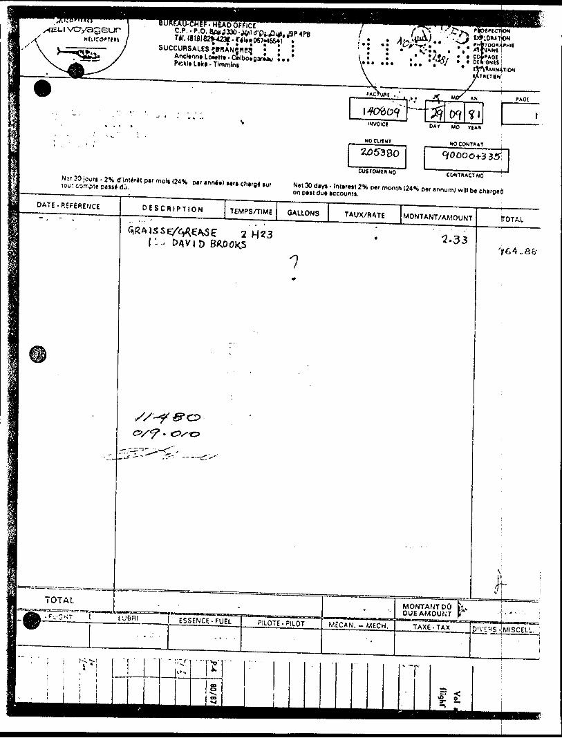
VO/sgeur C.P.-P.O. a#*J330-J4*ld'Pi.A^.J9p4P8 l . t J'^'V11, ,, ,- y SUCCUR?AUP*PHANff"irj * * * ' - * -*1
^PX P*,,L,k,.T,™,n, ^
•l" ' V•:^ :. * COf'AOl
tyft^MIN4TlC*J tSTHttllN
lAcVwi . ,' i J 1 M{X t* PAG!i****"---1 ' J - ' " -, PKVOlCI * * * *
, ^ " 'i . NOClltNT
255380
CUSTOMtHNO
fi *PAY MO VIA*
KOCONTHAT \
90000^-335:
COMTHACT NO 'Nit 3D jour* . 2\ d'lntMt par mol* I24S par annee) sera charge *ur Net 30 day* - Interett 2 11 per month (24S per annum) will be charge^) ir,,,- r r,-r*,* *,..i*,-, on pajt dge account*.
M DATE -REFERENCE
^BH
•^a^BjJ
ml
sSI - "'
m
m ~ OTAL
DESCRIPTION TEMPSAIME
GiRAlSSE/^^/VSE" 2 H 3 1 - - t?4VJD BROOKS
s/--?O/*?' t•?S"C3
.
• .C...OKT 1 lUBRI
. . : .ESSENCE- FUEL
,...
GALLONS
•7
PILOTE- PILOT
TAUX/RATE
-
MtCAN. - MECH.
MONTANT/AMOUNT
^•33
... -
MONTANTDO DUE AMOUNT
TOTAL
'f 64.8cr
^: ;
^ . ,-..,.-, ;
TAXE-TAX D'\f"(S JMISCELL ;j
PT
sou rorL
Viking Helicopters Limited' t - . P.5. Bw 5Ki, Station f , Ottawa, Ontario. K2i!lH4 , . ' '
-. LocJlioru Hig.'jwav 7, S mild tax ol Carleton Placa Ontario , i. 6nawalin(|6li)U6-n03 {6)3)257-4660 Tala* OSJ-3659
Norcen Energy Resources, '13 - 5th Ave. 3.W Calgary, Alberta. *T2P 2X7
4.S-B 9.Fuel
1665 l
J
INVOICIO*TI August 21
vou* osoi*)
To helicopter service -
C-CTXO July 13, U, 15/81 C-GYXO S365.00
5 5,908.71
4-T. Bay
4451,52,53
'"••eneo, "i ./.r er
ACCOUNTS,
0.0072534 NorcenIntrtT M* WU
P*BTICUL*WS OR INVOICE NO.
1 i1i
8-9 7951
s. i :i '.''i"* "*- 5" AMOUNT O f I NVOICE i
'
5, 908
';
.71r 1
:
i
.
REMITTANCE ADVICE
O' DAVMEN T |
____! ^
Energy Resources Ltmttcd
CANADIAN II/PERI/.. BAN* f)fYEAR l MO. l DAY i
NO H f'! 7 9 59:.i*U. w Sk' . t~. ~^J **S
AMOUNT IN DOLLARS
1981 i09 i22 ; P AY T HE S UM O F ' S 5,90R.
Tt *": ' •'.-:- : -
Vikir.n I'.clicopters Limited P'.C. R o:: 510/i, Station F Ottawa, Ontario 1C2C 3KA
NOHCEN ENERGY RESOURCES LIMITED
NON NEGOTIABLE
ASSAYERS (ONTARIO) LIMITED33 CHAUNCEY AVENUE TORONTO. ONTARIO M8Z 272 - T ELEPHONE (416) 239 3527
Mr. John Gillan,Norcen Energy Resources Limited,715-5th Avenue South West,Calgary, Alberta.T2P 2X7
Dear Mr, Gillan:
Toronto, Ontario January 1 9, 1 982
Please find enclosed receipted copies of your invoices #1163, and #1211 as requested.
I have also enclosed some^irnforrnation on glacial overburden exploration in which you^tjxpressed interest,
(
JvE:sm
an Engelen, Jyers (Ontario) Ltd,
ANALYTICAL CHEMISTS - ASSAYING - CONSULTING - ORE DRESSING - REPRESENTATION
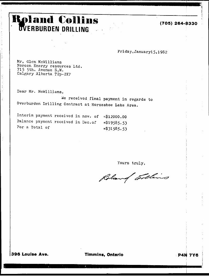
,land Collins ERBURDEN DRILLING
(70S) 264-8330
Friday,Januaryl5.1982
Mr, Glen Mcwilliams Norcen Energy resources Ltd. 715 5th. Avenue S,W, Calgary Alberta T2p-2X?
Dear Mr. McWilliairiS,We received final payment in regards to
Overburden Drilling Contract at Horseshoe Lake Area.
Interim payment received in nov. of =$12000.00Balance payment received in Dec.of =$19585.53For a Total of =$31585.53
Yours truly,
396 Louise Ave. Timmins, Ontario P4N 7Y6
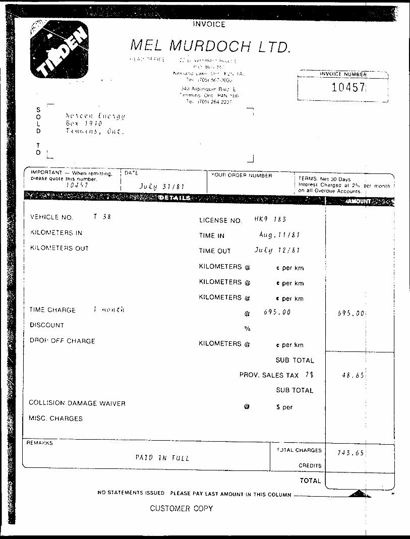
INVOICE
MEL MURDOCH LTD... k.i •.•'"•mf" : M int.: ;
'' '.'' B ,, i M 'iM.ri'j i.fl*". l'--: f-V?, t.
l fi 170s) ftt-r-303i.'
"ir-imini Ont P4N 'Bf. U'i (70M 264-2237
INVOICE NUMBEft
10457S0 .Ve t c c' li t ne ig i,/L S e x 1 9 iO D T{ (Miii 01 i , Out.
T0 ^
IMPORTANT — When remitting, HATE please quote this number.
lO-IV Juttj 31 1••^•^••^^••^^••••^^^••••MMiM^WMI^MMMMMHMHHMBMMH^^BMMiaMM^^M^^^^^^^^^HF^:^?;i*^v.v;,:?:^
VEHICLE NO. T 3S
KILOMETERS IN
; KILOMETERS OUT
TIME CHARGE ' " 'ontti
DISCOUNT
DROf' OFF CHARGE
COLLISION DAMAGE WAIVER
MISC. CHARGES
REMARKS
PA I P I WV
NO STATEMENTS ISSUED
JYOUR ORDER NUMBER TERMS Ne. 30 Days
Interesl Charged at 2'^ oef monih o ' on all Overdue AccountsAa*.S;-r'V;.:'..i-."ft.^. -- •:V-- ;:' ;: 'V;v.;H-t*'-: -r^;-' - -:- .••.'/""••K,^- ':- v4AiiouwTife^^i
LICENSE NO. H K9 n 5
TIME IN A u 9- H /H
TIMEOUT J ut-'J 11/11
KILOMETERS (3 e per km
KILOMETERS @ e per km
KILOMETERS @ c per km
@ 695.00
"/o
KILOMETERS @ e per km
SUB TOTAL
PROV. SALES TAX ?!
SUB TOTAL
0 S per
r JTAL CHARGES
PULLCREDITS
TOTAL
PLEASE PAY LAST AMOUNT IN THIS COLUMN - —
^ " r
-
695.00;
i
^S.65
i
743. 65
V ^X
^I^K) ^
CUSTOMER COPY
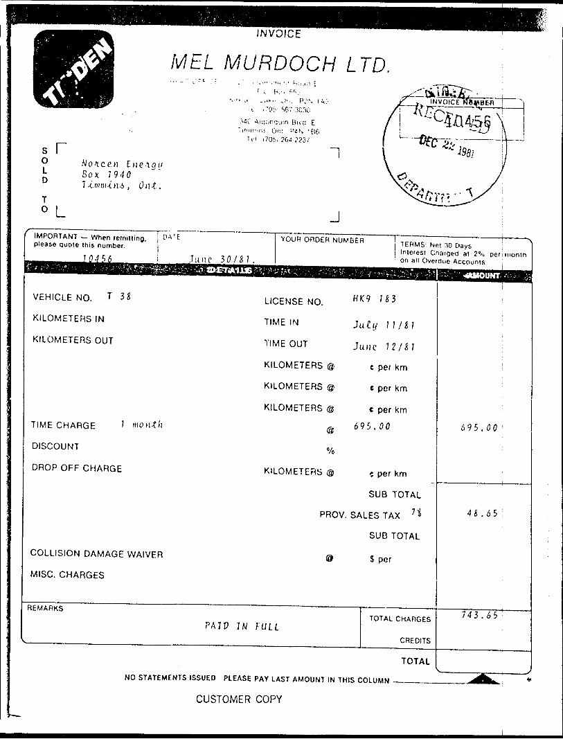
INVOICE
M EL MURDOCH LTD.
*Odira '••i- . 70:-J'.: f:'N t^;- J-~-tY ' NV 5673030 X AT-V""
340 Alcona. jin Bivcl E jiinm-irif,. On; P4 N 1 B6 7 j ____ ^
s r "It" i70h
0 Mo A. c en E ii c A g i/ J- Box J 940
T -c m m -i. M .6 , O ut ,T0 L
IMPORTANT — When remilling, please quote this number.
70456
VEHICLE NO. T 3*
KILOMETERS IN
KILOMETERS OUT
TIME CHARGE ' m on *
DISCOUNT
DROP OFF CHARGE
PA l E
June 5 0/&1.^^fev^raMEisMJaB,^/^'
J6J.2237 ( i^p
— ' \
DICE fiBWBEfl ^- ————— , j ————
"~ li '2Z l
;V5 , y^snr^X
J
YOUR ORDER NUMBER j T ERMS; N c , M Dgys ^l Interest Charged at 2"A. per month 1 on all Overdue Accounts
^?^'^\^;^^;i^^^:f^v-^^^^ r '^"^^^':"\*MOUNrv^
LICENSE NO. H K9 n 3
TIME IN July 11/61
TIMEOUT J u ,ie 72/4?
KILOMETERS @ e per km
KILOMETERS @ e per km
KILOMETERS @ t per km
:h 0 695.00
Vo
KILOMETERS ® -. per km
COLLISION DAMAGE WAIVER
MISC. CHARGES
REMARKS
V
NO RT/
SUB TOTAL
PROV. SALES TAX 1 ' *"
SUB TOTAL
0 S per
TOTAL CHARGESPAIP IN F ULL
TFMFNTS ISSUED PLEASE PAY
CREDITS
TOTAL
LAST AMOUNT IN THIS COLUMN
!
695.00
45.65
743.65 '
^ ———— -Jk^ " ———
CUSTOMER COPY
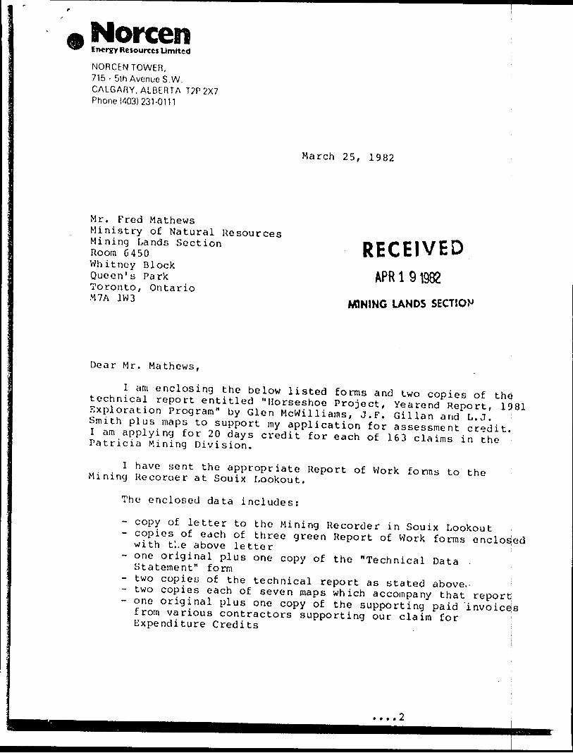
NorcenEnergy Resources Limited
NORCEN TOWER, 715 - 5th Avenue S.W, CALGARY,ALBERTA T2P2X7 Phone (403)231-0111
March 25, 1982
Mr. Fred MathewsMr. Fred MathewsMinistry of Natural ResourcesMining Lands SectionRoom 6450 Whitney Block Queen's Park Toronto, Ontario M7A 1W3
RECEIVEDAPR l 91983
MINING LANDS SECTION
Dear Mr. Mathews,
I am enclosing the below listed forms and two copies of the? technical report entitled "Horseshoe Project, Yearend Report, 1981 Exploration Program" by Glen Mcwilliams, J.F. Gillan and L.J. Smith plus maps to support my application for assessment credit. I am applying for 20 days credit for each of 163 claims in the Patricia Mining Division.
I have sent the appropriate Report of Work forms to the Mining Recorder at Souix Lookout.
The enclosed data includes:
- copy of letter to the Mining Recorder in Souix Lookout- copies of each of three green Report of Work forms enclosed with tl.e above letter- one original plus one copy of the "Technical Data Statement" form- two copies of the technical report as stated above,-- two copies each of seven maps which accompany that report- one original plus one copy of the supporting paid 'invoicejs from various contractors supporting our claim for ! Expenditure Credits i
-2-
Please contact me in Calgary if you have any questions regarding this assessment credit application.
Best
John F. Gillan Exploration Supervisor Minerals Exploration
JFG/sc
Enclosure
HULSE LAKE M.27I790"
Horseshoe
KECHEOKAGAN LAKE
DISTRICT
KENORA ( PATRICIA PORTION)
MINING DIVISION
-PATRICIA
/'Is f O CMS
Ministry of Natural ResourcesSurveys and Mapping Branch
M.27I3
n e o * a y a
Q
V
r-*—
WAPAMISK C R.DISTRICT OF
KENORA(PATRICIA PORTION)
PATRICIA MINING DIVISION
SCALE: l-INCHr^4O CHAINS
10'
ro
UJv*p l
00oea
ARE A OF
BUGBEE LAKEM- 33171
DISTRICT OFKENORA
PATRICIA PORTION
PATRICIA MINING DIVISION
SCALE: l-INCH :iz 40 CHAINS
FOR.
FORMAT) ON
5-3BM/VW-OOI7
53BB1NWB003 53B02NW0017 WAPAMISK CREEK
---t
---,-
--.-
az.7
i.i-
st r)
13U
-
~
-i - - -
CflN
-OX
Norc
enEn
etry
Res
ourc
es U
mtte
d
HORS
ESHO
E PR
OJE
Q
NO
RC
EN C
LAIM
SO
utlin
e or
Cla
ims
for
whi
ch
Ass
essm
ent
Cre
dit
is f
iled
^ '/2
m
ileLo
catio
n of
Ove
rbur
den
Sam
plin
g Li
nes
Map l
of
9D
ecem
ber J
981
9T
00
1
A6/
191
la,
IFb
,6c
'Po
( Py
I-A
8/1
07
lo
,7e,
7a,
6ePy
jTA
S/1
2
6 1 a
,5a
G.P
.D.
Dri
llin
g
Gri
d
A
G 6
/106
la,7
b,I
Fb
Py
, Po
Al,
2/1
02,1
66
0,6
0,
7cp y
,gp,
.005/.0
4/.08
nil/.O
l/
02
l——
A3.
4/14
4.17
2 6c
* l
o, I
Fa,
5
o m
ag
, P y
, Po
J/.02/0
7
Hor
sesh
o
B17
/180
6c
,la
Po
,Py
,ma
9
B 3/9
9
6c,lF
b
Py,P
o
Sasig
tnag
a
G.P
.D
Dri
llin
g
Gri
d
BB
2/2
09
3g
,IF b
P
o,P
y
B1/
J27
6a,
6c,lF
m
ag.
Po
C16/1
55
3c,6
c
Po,
Py
trY
-A0
9
GP
-D.
Dri
lling
G
rid
C
Ho
rse s
ho
eW
ap T
La
ke
lFb
3*G
.P.D
. D
rilli
ng
G9/
416c P
o,m
ag.
D1
4/1
57
5a,7
b,IF
b,6
c ,
3a ,
4bP
o,P
y.0
05
/-/1
2.9
G.P
.D.
Dri
llin
g
Gri
d D
P D.
D
rilli
ng
G
9/3
1
*4a,la
Pipe
ston
Dri
l l
Hol
eD
ecth
in
mL
ith
olo
gy
la,5
a,3
b,
2a,4
a4a
, la
3b
,4a
5a,
3b,3
d2b,2
a,5
a,4
a,3
b,3
dla
,3b,5
a,2
b4a,5
a,3
b,l
a4a,l
a,5
aIa
,2a,5
a,3
fr 3
d,3b
la,5
a,3
b,2
a5a,
3b,2
a3b,5
a,l
a5
a,3
b5a,
3b
4a,
3d,3
bm
inor
amou
nt
(py,p
o,c
p)
PY/c
p(P
Y)
SI/
123
S2/
124
S3A
/143
S3B
/135
S4/
172
S6/
244
S6/
205
S7/
121
S8/
92S
9/90
S10
/91
Sll
/91
S12/9
2S
13/9
3S
16/1
42
py
(po,
mag
) (P
Y)
(py,
mag
)Cp
y)
f) in
dic
ates
9T 0
0'901
45'
93*3
0'
l l
LEG
END
F
els
ic
Intr
usi
ves
(a)
mas
sive
(b)
foli
ate
d(c
) g
neis
sic
(d)
shea
red,
mylo
nit
e(e
) p
egm
atit
e
Mig
mat
ite
(a)
sedim
enta
ry x
en
oli
ths
(b)
volc
anic
x
en
oii
tbs
(c)
gneis
s an
d/o
r sc
his
t
Qu
artz
F
eldsp
ar
Porp
hyry
(a)
quart
z
and
feld
spar
ph
en
ocry
sts
(b)
feld
spar
ph
eno
cry
sts
Maf
ic
to
Ult
ram
afic
In
trusi
ves
fa)
gab
bro
(b
) d
iab
ase
Sed
imen
ts(a
) ar
ko
se(b
) gre
yw
acke
(c}
con
glo
mer
ate
(d)
shale
, arg
illi
te,
silt
stone
(e)
chert
(f)
schis
ts(g
) g
nei
ss
Fels
ic
to
Inte
rmed
iate
V
olc
anic
s(a
) m
a ss
ive
to
f oli
ate
d(b)
tuff, agglomerate
(c)
sericite sc
hists
Mafic
to Interm
ediate Volcanics
(a)
massive
(b)
pillowed
(c)
tuff, agglomerate
(d)
amphibolite
(e)
migmatized
Iron Formation
(a)
oxide
facies
(b)
sulphide facies
(c)
chert
to lean oxid
e facies
SYM
BO
LS
Are
a
o f
Be
dro
ck
Ou
tcro
p
Bed
ding
in
clin
ed
vert
ical
Fol
iatio
n in
clin
ed
*
vert
ical
^
dip
unkn
own
*-
Gla
cial
Str
iae
Dia
mon
d D
rill
Hol
e o
Hol
e N
o X
Dep
th
in
Met
res
Lith
olo
gy
Met
alic
M
iner
als
Au
(oz.J
XA
g(o
z)X
CuV
.
Pic
ket
L ine
s ( M
ag,
VLF
,ove
rbur
den
drilli
ng
G4
/31
la
Py,
Po
.1 /.08/.03
B Nor
cen
Ener
gy R
esou
rces
Um
rtcd
HORS
ESHO
E PR
OJEC
T
GEO
LOG
ICAL
CO
MPI
LATI
ON
1/2
l" =
1/2
mile
Map
2 o
f 9
Dec
embe
r, 19
81
535/0
^/^
-00/7
f-d
f-e .0
(.
J. t'
FI F2 *^ !K ' i* M
100 Vo 150V. lOOVo 150Vo FIELD 1 * S | i
1 '. ' ' STRENGTH Mag in * * * gammas Ho!e#
-10- .0 . +10: ,-10' 0 *10', ^NPr, 1F 60500 r , A
fil•C' :'
s
-f
-1
•J'
^
L\\^Lflj
i-3\
\-*
-2.
-z
-x
Z ''lir-3
V-2
-i
-a
r-3-3-3
-.J
-3(
1-?/
(~*i X' 7
\ '\ \-y
-y-f
U
/^ ' 2' i *~
i*,j^
A' 61(100
y'-3 6 7;
00 -
)00 \.
\-; oi./ 73500 \ 2 A
/'
i? 0V\\
ii
z \ *\ f^. ^ ;t v 7 7
^ \
t o
t o\\\ '
\
* \ t-1 1
U 17 ; T
i3 /' ^
s
to z
, P
\; 78000
! I 80500\'\ |\ i
u. x 79500 ;
/' . 1•2-1 78*
//' 76:
l 75C
)00 3 A
00 T
iOO
1 72.V 71 ii\W 7 li
\Z\ 711
/lJ 73
\A 7 7
/i 77 V
* 75
^
i\ 0 IU 76k
2- ;
y) iy 2-* 2.
o 2i \\ f .
i ^
' ^
y '
A 7 7\ l
J\ 78
Z 83
*v 87\
A \ 89.x
00
)00 4 A
)00
\iOO -.
iOO l
1)00 .- 5A
)00 '
\)00
)00
iOO 6A
,00 ^
\00 \\iOO \
3L/ 85)00 /7A
;(AW 73 a/ ^
i'
^ ; 69ii/"
2- 17
1
x'O ^y
*
7
0
0 69
77
)00
l)00
/)00 J 8 A
lioo !
)00 !
\ 1 1)K 67ooo ;
l 7a l 65600 f 9A
7; loY*t ^~{ in
-M a 1-3 71 -f ; PH-3 7K
-i z ' 0,L* 77,
!'z J *\x" '/\
S 'i
ff ^ . —f
\
r \ -'^,
/i ^"^ "1
f
)00 V
00 \
\iOO ;
-f 73500 X 10 A
-Y 69
\J 6 6
liOO j
1)00
\xJ^ X\. 66500
1 \
d S\ 68000 " 11 A1 *N -W *Nkto ^ ^^ "p "*
Depth of O.B
33' 0
1 S
2 S
3 S
75' 45
5 S
6S
75
72' 8 S
95
10 S
11 S
96' 125
135
145
15 S
89' 165
175
18 S
195
97' 205
21 S
22 S
23 S
77' 245
255
265
27 5
107' 285
295
30 S
31 S
74' 32 S
335
345
355
97' 365
375
385
395
67 l 405
"*"* ^ s s, * ^? i i i i*
NorcenEnergy Resources Limited
LEGEND
FI c^Moin. HORSESHOE PROJECT
F2 Seattle Washington VLF AND MAGNETOMETER RESULTSand
Line creation: North, South OVERBURDEN SAMPLE LOCATIONS
^\^^ F ield Strength /- " /-} 1 1 M F A^•"^ f S l/ l* 1 1 ^1 L* r^
^\ D ip Angle /^ '\ /y # o 100 250 sooft.iiiiiiiiiiniiniiiHi ^, "'" IX ' ,,,t,,M153B01NW8003 53B92NW80I7 WAPAMISK CREEK 220 -oof? *3
1 1
FI F 2 '-313O (
1 1E1 ^ ** f vO ,jj
fi -.O ^ O O X
lOO'/o lOOVo WO 0/. 150V. FIELD ** L ** ^ 1,1 ————————— ' ' STRENGTH
Mag in gammas
-10" O 0 +10- -10" 0 tio- DIP 66000 l,
v -i\
\\fe\ \
O
Z
o
o
1 it ti' 0
1fi
1 0 v V\
x
0?
o^ '
l\
.V\\
o
o
0f,//
— 1 \\")
f
\'L-Z
A1 i"i^j
j•im '
ii
t/ t'.i
^2
y - 2\ \ \ ..\ 4ts
/ 4/ '41 Lx i
s\
v^ ~*
w-r*''" ~1
s/^ r3x*
•s s,
"f
'l
-3
-V
'J
-?
1 1 . ———
*-^ ri
\'z f1
-A -f A
1. hK1'
i!/ -'
b :^
-f -^
r"' -'
\-r o
C "0 0
\.i \
j 1 ef~*. o" V
-f -f/'-3
. O .'0\
\* 0 \
3} -1 {
T7-/ 0
-1' ' t
f
\ \
-' *\\
! M o\\
3 t
13 \Z, \
Z/' 0\\\ ^
7 . / */ '
/O /Z
l -i ^
*
13
-s f 9.\ \
^ \."3 v ^ i
S 3\N
" x\ o/'
-1* S 1 1 \ -lV xx
-7- -^N
•^ -r\ \ \- "
-T- /oS
S
~fo ,/ - ; l s 7x 7 •x 7
-r - Y-vp ' 3
/O* ^N l-^' \.
1 \ i \
/^ ^j ^
V o\
-* \ o\\ 1
^ \ ^/y
————————— ' ANGLEr\ 1 ^ N^ k ^ \
67500 ;
65500
P 640
)/ 645
00
00
-Z 66000 lt
x/ 695•s.
•s
L N S\ 7 107
if. 1 73(s
00 -.
00
00
'v 76500
0 78500
0 79000
-f 78000
i\ 75500/*
li 74; 00y
o 75000\-\ 75000
7 1 1 9 72500
0 69500\\a \ 69000
l
ti 1 71000/
xZ/ 71500f
,-A 70.
Hole, Depth number of 0. B
IB 47' 0
2B
*: 3B
\\
*
4B
i
1*l\ s ,
l1. 6B\
*
*
:00 .-
7.Z 64500 f
\/ 67
J\
\3 \ 89
7B
iOO
,oo V
)00
\ t 8 1000
7/'*. 75.
~; 70
\; 67\
300
)00
)00 fl
l\ 6 7000
?/ 67 500
,/ 66500
ilo 66000V,\A 66000
J/ 69
\• ' ft Q
ff
9B
10B
000 \
-Z 75000
-37
* 75500
\^ 71 000
y-^^ 68500 jfl
/u 68500 ;
^- 63500
-j. 63000
sx
M X N. 64500 ^T x
;/ 82000y
-3 73000
-^ 64
-1 57s
x
/000 S
500.'
3\^ 51500.
\^ ^v/3 "-. 72000
i/Z J 1 15000
-Z"*' 1 25000\A 87500
1
it 74500
-10" 0 +10 0 -10" 0 +10 0
FI F 2 3 i
1. i
y 11 B7/'
12B
;f
S 1 3B
^* t 1 vi D
— -
f15B
1 S
3! -S 2 s0 D tt —l
3 S
71' 4 S
5 S
6 S
7 S
74' 8 S
9 S
10 S
11 S
71' 12 S
13 S
14 S
15 S
71' 16 S
17 S
18 S
19 S
8V 20 S
21 S
22 S
23 S
60' 24 S
25 S
26 S
27 S
64' 28 S
29 S
30 S
31 S
60' 32 S
33 S
34 S
355
60' 36 S
37 S
38 S
39 S
67' 40 S
41 S
42 S
43 S
47' 44 S
45 S
46 S
47 S
53' 48 S
49 S
50 S
51 S
29' 52 S^--^
53 S
54 S~~*~
55 S
27' .S6S
•W ^*i ""*
1 1 l^
NorcenEnergy Resources Limited
LEGEND
M Cutt,erM ai ne HORS ES HOE PROJ ECT
F2 settle wanton VLF AND MAGNETOMETER RESU LTS
Line orientation: North, South OVERBURDEN SAMPLE LOCATIONS
^^^ Field Strength ^ ' '/"l L INE B
--•'\.-'^ Dip Angle /"/•- /y1/ ? l cl0 2 50 5" 0 f t '
*~TL^L(I^"~ 1 " i 250'III H li III li lil li in in IIIIIMIII li nun MI li in yfijf^^ \/illlllllllllllllllllllillllllllllllllll T ""P* "f 9
December, 1981
53BeiNW00*3 53B02N*^017 WAPAMISK CREEK 230 S3B/0&A/W-0017
FIELD STRENGTH
FI
lOOVo 200V.
DIPANGLE
-20 -10s -10(
T\o
2-
U.xx•( /
\\i"i
V1111"s. 1X
NN\oo
o
o
0"er
o
ffz
to/s / /
< o\\\*\
o
r/sss o\s\ \
\oO
O
o
o-(0
J'\G
f
/
t/ii/!\
/
^J.--•""""~ 2
s *s"'
w-r /?-\ --'--Ay
r*o
1 I)ZA7'-f-r^\V\^4 )
//
t/l1
'l\
-3\\\-r \i \-* \\ /*
K -''1 j
i-r j \ /\ s\sIA\ iv\ ifi/ if'o
~*"JL.
\
VA1-fO
o\\
/'0
o
o
\t\\\3 \\\*-~ x F ^yi o
'f-f
3\
.3--N
43/
/
•' o
/*
/i
C-lf 29'
5700
6950
6300
x
-f;
-z
-2
s.;
! f
-r-7
9700
7600
6700
C-2+22 1 X
C-3J32'
•f 19'
-;
/9
6850 C-5f 23'
H ;
l -l
Z l
-;-3
-f
N5* -;/ 5
0
6350
6400
6500
6500
C-7
32 N
30 N
t
21N
18N
123'
O
-l
t1,
6400
6450
6450
6550
C-10-H9 1
15N
9N
C-9J28 1
6N
-2
U
^
-^C
-/r-
-rw
-r
-i
-;-y
-f
8000
7850
7900
7950
7500
7300
C-12-1-50'
^2
-/3
-;/
vr
-/r
7
V
-fO
-l*
\
-J
~3
\ y-3
-3
-J
-V
-3
-J
-5
-*0
-a/
-**
-/7
-/J
-^
-/c
-?
-r
zv
r \
-i
-x
'-^
b*
-/^
-;x
-7
\
—t
-3
-3
-3
~3
-3
-t
-3
-J
-3
-3
3 '
15'
12750
C-13J45'
L/r-/2-
-Z**
^^
-2 J
-i a
-/f
-/7
-/7
C-14|l6'
C-15J 10'
,
12S
13 Sx4
714S
C-16J 7'
-3
-i
-3
Z^,
/*
/3-
/*
;*
C-171
r.r l\
v
2M*
-i
kr
2f -f
/f
J.3.
23
-L————^
6300
6300
6300
6200
6150
6250
6600
t
/'295
C-18+
C-191
7050
10500
34S
i
15'
•^38 S
39 S
? /t
-/o
-2/
Mf -i A
44000
^
•^i
-*/
5'
C^e* i' ^ --
^d
45 S
l 24'
*;112'
N
\
X.
N
\
-H-3
^-f
-3-f
-3
-3
-3
-3
5900
-7-
-7-
-3
3N
f \
15'
C-261
-3
/f
/3
;f v
\
/r
-;
-;-;
C-27f 11
5700
5700
.z//
/r C-28-H3 1
J2-
;?/r C-29-h 19
i*
5700
F l
F 2
LEGEND
CutHer Maine
Seattle Washington
Line orientation: ( 0-725) North, South(0-40N) 300 east of north
Field Strength
Dip Angle
NorcenEnergy Resources Umtted
HORSESHOE PROJECTVLF AND MAGNETOMETER RESULTS
and OVERBURDEN SAMPLE LOCATIONS
LINE C100 250 500 Ft.
l 11 ' 250'
Mop 7 of 9 December, 1981
53B01N*ee03 53B02NW0017 WAPAMISK CREEK 6/0A/YW—00/7
FI100V. 150V.
F2100 Vo I—
200 CAJ,; J x
t
O" + 20*
iff
\
W
2.0
-f\
'0
i
f
i3
J*
\
Mag in gammas No
71500 ol
72500
75000
76000
89000 02 2'
x.
83500
91000
97000
20 D3 4'
105000
t
F l
F2
LEGEND
Cuttler Maine
Seattle Washington
Line orientation: North, South
Field Strength
Dip Angle
Z
\ '
}
3^^ .w
— — -
fir-/J-^,
fZ
-z
A1
3r^'
\ i\ iM-^
-i-'l
;o
'vr~"^~"~ 102JOO
*3 ' 1 20000
\ y \ 105000 04
/X 1^ 94000
-i 88500 1
V ^. 86000
(f . 80000 05
t \ J. 79500
7 1^ 77000
-2. 77(X)0
-Y 73: '00 06
-* 69)00
-3 681*00
-3 67000
^ 6 5500 07
* 63500 J
i \r X 65000
3 7 65500
xt ^. 65000 08
\ \/e, \ 63000 ;
1\^f ^. 6 2500 1
\ ^ 1 /V\ ^ ^.s' 6 1500 I
•T" — "" 1 l
'LJ. 6 1000 ['9
I f 60^00
-.5T 60000
3 59500
10 59500O10
\ ; 59^00 ^\ 1
9 ^-. 61000 t 7 \
\// \ 59500 ,r 7 L iT- y 59000 fell
1 i
/6N X
. a' * Ok.
u..3 5N
7' 4N
3N/3N*X
/IN
11' Oe^/ 0
y is
35
15* 45
-' J 5S
! .s1 n
1 Sfi 1 - BS
u
0 95
105
13' 12S
135
145
15S
2T 165
175
18S
(^ ' —— 19S
8' 205
215
225
235
9' H 245 ^
' L i **^ -^ ^ *.i i i i
NorcenEnergy Resources Limited
HORSESHOE PROJECTVLF AND MAGNETOMETER RESULTS
andOVERBURDEN SAMPLE LOCATIONS
/*
s -y^ L INE D-^ /* ff 0 1 00 2 SO
^ ^^/('i ' " ~ 2 50 '
Map 8 of 9
500 ft.
December, 1981
Deprh g * ofO.B.w ^r 16N
15N
14N
13N
12,1M
IN
ION
9N
8N
7N
\J l N
i
i
53B81NWMa3 S3B02NW8017 WAPAMISK CREEK 250 *J J D /0,*X /V 1/V ~""* C3^) f T "" O
53B
atN
WW
ft3
53B
02N
*M17
W
AP
AM
ISK
CR
EEK
DIP
AN
GLE
X'N
-/*
VLF
PR
OFI
LE
(Tx:
Gut
tler,
Mai
ne)
MA
GN
ETO
ME
TER
(xl
OO
O g
amm
as)
106
120
nAR
SEN
IC I
N T
ILL
(ppm
)
nN
s
SILV
ER I
N T
ILL
(ppm
)
GO
LD I
N T
ILL
(ppb)
75+0
0
feet
sou
th
70+0
065
*00
60
*00
55+0
050 +
0045
+00
40+
0035
+00
30+
0025
+00
20+0
015
+00
10+0
05+
000+
005+
0010
+00
15+
0020
+00
25+0
030
+00
35+0
0
DEPT
H O
F O
VER
BUR
DEN
(f
eet
DIP
A
NG
LE
201
FIE
LD
STR
ENG
TH
r 20
0".;
^ 10
0
-10
-20'
100
80 60 56
45 40 35 30 25 20 15 10 5
-80 m
esh
-2.0
-1.0
- .2
- .2
. +
80 m
esh
SIL
VE
R
- 1.
0
- 2.
0
-80 m
esh
-70 50 10 10
-
50
-10
0
" +8
0 m
esh
GO
LD -
-80
mes
h
- O
-10
-20
-30
-40
- 50
SA
MP
LE
NU
MB
ER
40
+0
0
ST
AT
ION
feet
nor
th )
Opa
pim
iska
n La
k*
Gol
d D
epos
it
LOC
ATI
ON
SKE
TCH
LIN
E L
OC
ATI
ON
B
—
—
J-
_
~-
—
-
A l1 A
5-1/2.
^2,'
Nor
cen
Ener
gy R
esou
rces
IJm
ited
HO
RSE
SHO
E PR
OJE
CT
STAC
KED
PROF
ILES
A
LON
G L
INE
CG
EO
PH
YS
ICA
L, G
EO
CH
EM
ICA
L A
ND
OV
ER
BU
RD
EN
D
EPTH
RES
ULTS
590
logo
1500
f..t
HO
RIZ
ON
TA
L S
CA
LE
Ma
p
9 of
9D
ec.
1981