Embed Size (px)
Citation preview
PP*!;:-
Ifc-'l'
It-
l
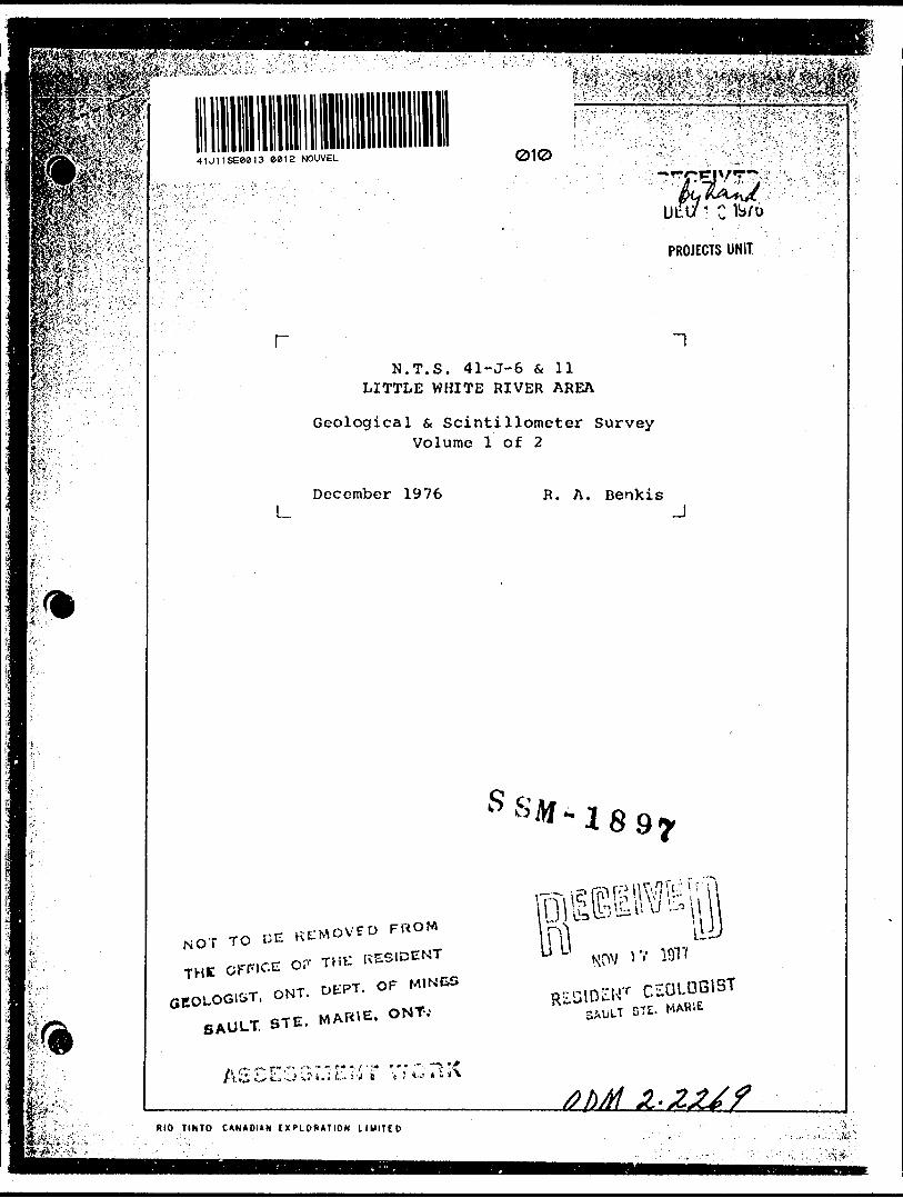
II41J11SE0I813 88)2 NOUVEL 010
PROJECTS UNIT.
rN.T.S. 41-J-6 6, 11
LITTLE WHITE RIVER AREA
Geological s Scintillometer Survey Volume l of 2
December 1976 R. A. BenkisJ
S R
NOT TO C E
TH, orr.CE O, T.*
RIO TlhtO C ANAOItN IXClOfUTION L IMITCD . - ; . ....- ,.'..:.:\Sk
• ; :--,, •:,.V-:^.?i..v
ijtfk-
41J11SEe813 C8I2 NOUVEL
XV:'f--^'"; LITTLE WHITE RIVER AREA ' ; j NOUVEL, VARLEY, MONTGOMERY AND KAMICHISITIT TOWNSHIPS
? ;/ ONTARIOl N.T.S. 41-J-6 5, 11
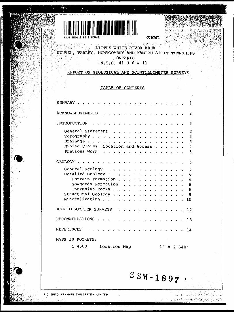
REPORT ON GEOLOGICAL AND SCINTILLOMETER SURVEYS
TABLE OF CONTENTS
SUMMARY . .- . . . . . . . . . . . . . . . . . . . l
ACKNOWLEDGEMENTS . . . . . . . . . . . . . . . . 2
INTRODUCTION . . . . . . . . . . . . . . . . . . 3
General Statement . . . . . . . . . . . . . . 3Topography . . . . . . . . . . . . . . . . . . 3Drainage . . . . . . . . . . . . . . . . . . . 3Mining Claims, Location and Access . . . . . . 4Previous Work . . . . . . .. . . . . . . . . . 5
GEOLOGY . . . . . . . . . . . . . . . . . . . . . 5
General Geology . . . . . . . . . . . . . . . 5Detailed Geology . . . . . . . . . . . . . . . 6
Lorrain Formation . . . . . . . . . . . . . 6Gowganda Formation . . . . . . . . . . . . 8Intrusive Rocks . . . . . . . . . . . . . . 8
Structural Geology . . . . . . . . . . . . . . 9Mineralization . . . . . . . . . . . . . . . . 10
SCINTILLOMETER SURVEYS . . . . . . . . . . . . . 12
RECOMMENDATIONS . . . . . . . . . . . . . . . . . 13
REFERENCES . . . . . . . . . . . . . . . . . . . 14
MAPS IN POCKETS:
L 4500 Location Map 2,640'
-1897
RIO TINTO CANADIAN EXPLORATION LIHITCD
K*':
•*. • TV'V''i ^ v ; "-' v- ' "J -vi *i - '^ ' - .'-"^.-"*i •i'- ' i* V* ' ' ' ' '" h ' ^'" •'•'"'' '•'!i ' '" ~"'": - ^- ' "•'" " " "y"'''
•- ," ' J •i,''*',- T',*.'"-''' " * ,-- •-.'.'"•-.'v'y; Tv' 1 " 1 :',-- :J- ' - " ; ".1 -:"- .r*--./;'.-. , : -'I.' '- /: V , ; : .; ; !-,v . . ? "' - --r : -V ••' - - . •••'s ^.v:;:-'':- - .' - ;;- .- ' - ' :
•'1 :; ; -H G '4498-1; '? t G 4498-2x v : G 4498-3i ! ;G 4498-4
G 4498-5G 4498-6G 4498-7G 4498-8G 2747-1G 2747-2G 2747-3
SC 4499-1SC 4491-2SC 4491-3SC 4491-4SC 4491-5SC 4491-6SC 4491-7SC 4491-8SC 2748-1SC 2748-2SC 2748-3
'•••; L -. \'.. ' :- :'. ..••',.
Geological Map (I)Geological Map (H)Geological Map (G)Geological Map (F)Geological Map (E)Geological Map (B)Geological Map (C)Geological Map (D)Geological Map (J)Geological Map (K)Geological Map (A)
Scintillometer SurveyScintillometer SurveyScintillometer SurveyScintillometer SurveyScintillometer SurveyScintillometer SurveyScintillometer SurveyScintillometer SurveyScintillometer' SurveyScintillometer SurveyScintillometer Survey
(^* f~*^otf-
-, . '. -
(D(H)(G)(F)(E)(B)(C)(D)(J)(K)(A)
18
1" s
1" =1" -1" *
l 11-."1" s
1" a
1" a
1 " —
1" a
1" ^
1" ".1" =
1" a
1" a
1" =
1" a
1" a
1" a
1" s.1" =
1" ~
97
/-^l^jt.y'V-'Ml^f
\~- - -} ~ '
200'200'200'200'200'200'200'200'200'200'200'
200'200'200'200'200'200'200'200'200'200'200'
•ft p
RIO TINTO CANADIAN CX PlOftATIOM LIMITED
N.T.S. 41-J-6 & 11
LITTLE WHITE RIVER AREA
NOUVEL. VARLEY, MONTGOMERY AND KAMICHISITIT TOWNSHIPS
ONTARIO
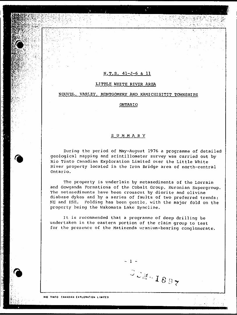
SUMMARY
During the period of May-August 1976 a programme of detailed geological mapping and scintillometer survey was carried out by Rio Tinto Canadian Exploration Limited over the Little White River property located in the Iron Bridge area of north-central Ontario.
The property is underlain by metasediments of the Lorrain and Gowganda Formations of the Cobalt Group, Huronian Supergroup. The metasediments have been crosscut by diorite and olivine diabase dykes and by a series of faults of two preferred trends: NE and ESE. Folding has been gentle, with the major fold on the property being the Wakomata Lake Syncline.
It is recommended that a programme of deep drilling be undertaken in the eastern portion of the claim group to test for the presence of the Matinenda uranium-bearing conglomerate.
'•- - i fiRIO TINTO C ANADIAN t X P LOKATION LIMITCD
s rst.jVWWJ.-.v*.';,- M^C;'Jv-^X,'v.;.
l ft?"'"'
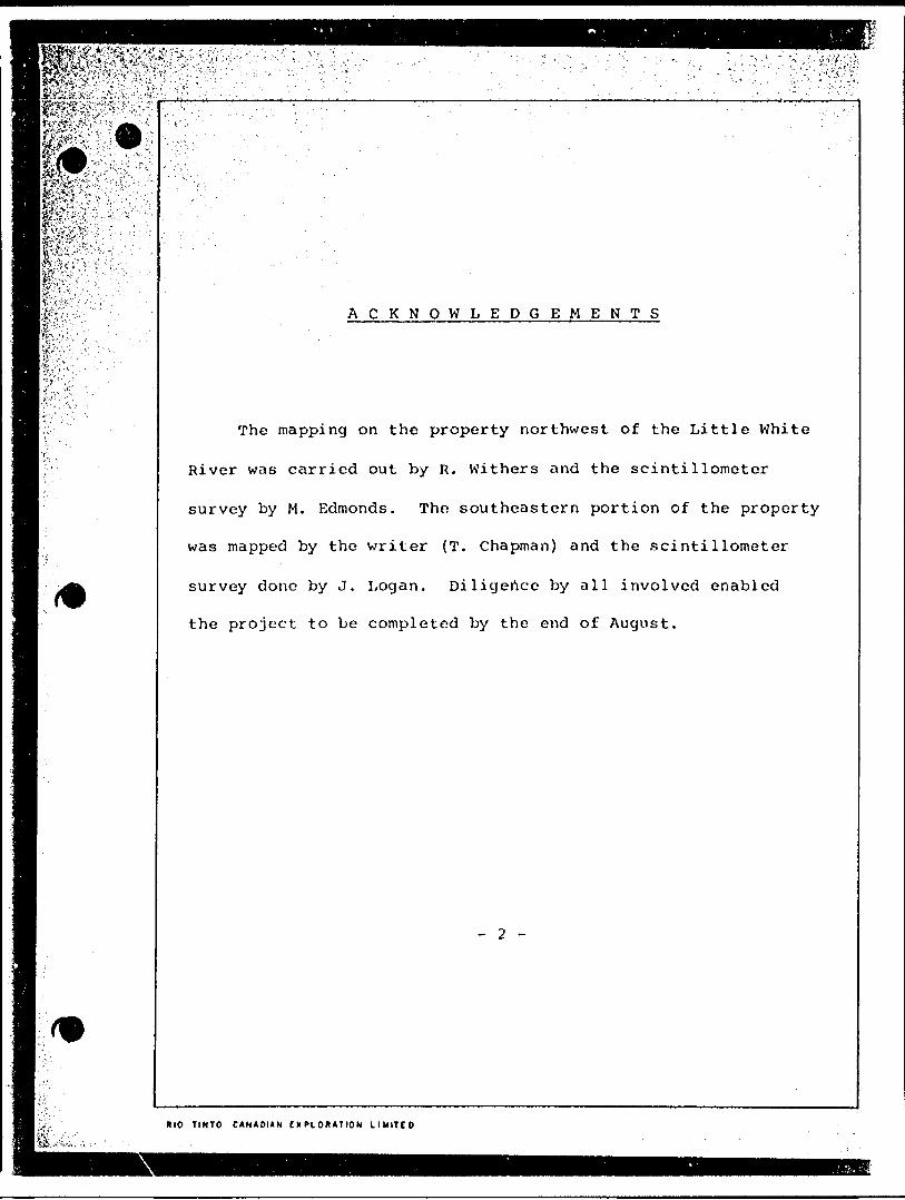
ACKNOWLE D G E M E N T S
The mapping on the property northwest of the Little White
River was carried out by R. Withers and the scintillometer
survey by M. Edmonds. Tho southeastern portion of the property
was mapped by the writer (T. Chapman) and the scintillometer
survey done by J. Logan. Diligence by all involved enabled
the project to be completed by the end of August.
— 2 —
RIO TINTO C ANADIAN EXPLORATION L IMITCO
P^^S^W'^-; ^^•••i&^&pr*^'PAGE —-
tiSifWiT-r+r
mSK^-- m&^-x-m?-S*JJv:^:.-Vit ' ;WfeifeK'/- - .. ,;m*i-f'-
mmi
LITTLE WHITE RIVER AREA
NOUVEL, VARLEY, MONTGOMERY AND KAMICHISITIT TOWNSHIPS
ONTARIO
INTRODUCTION
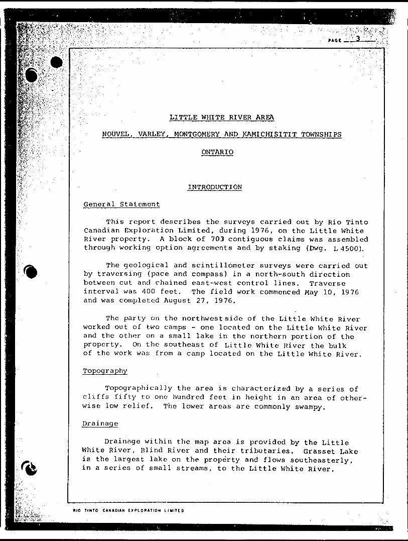
General Statement
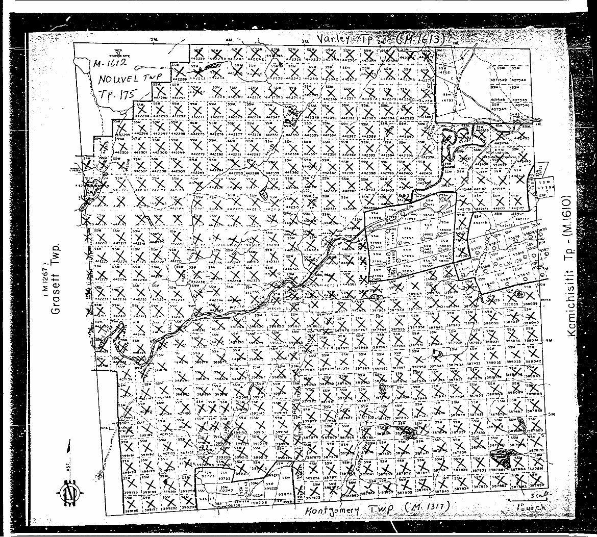
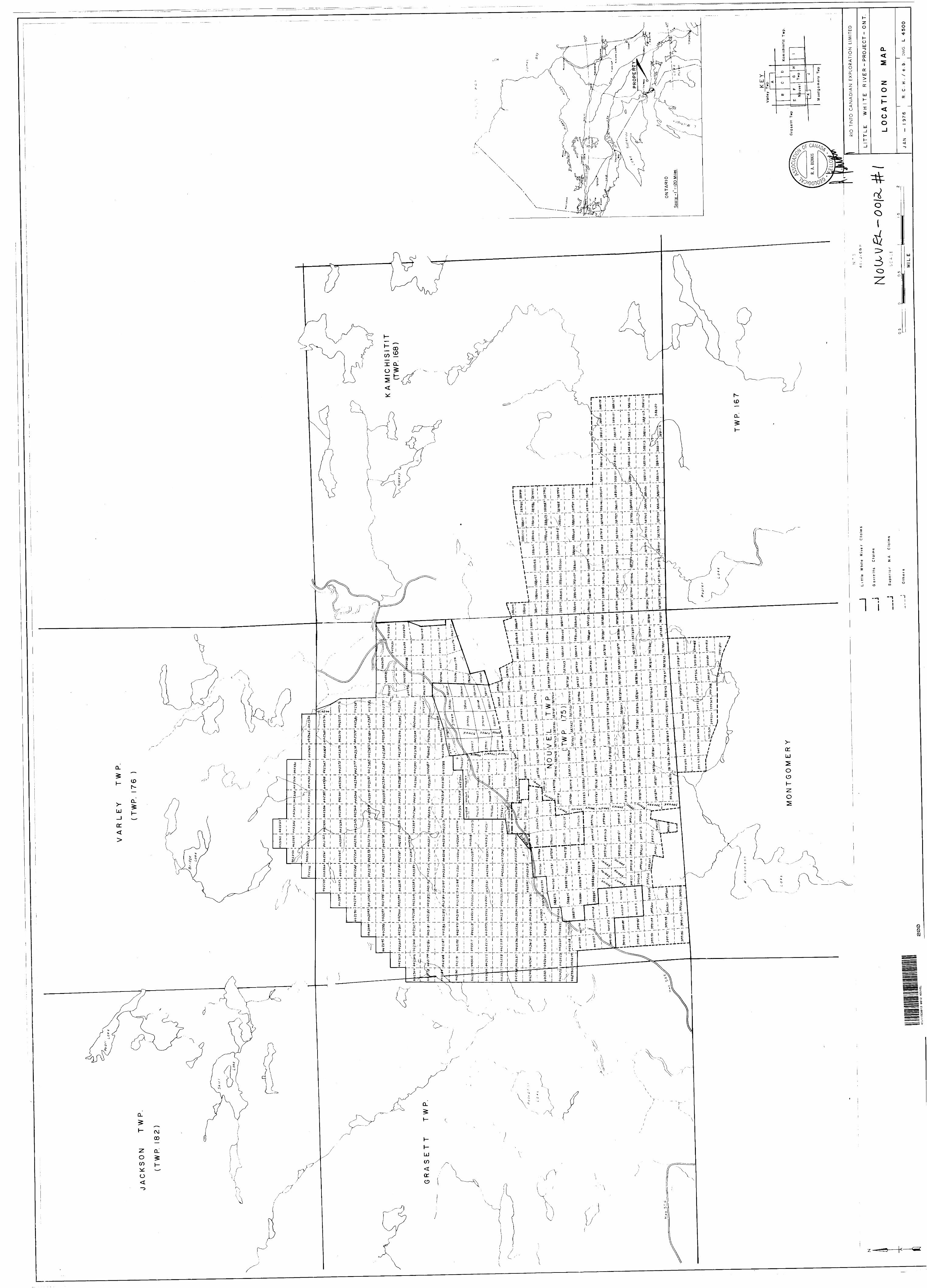
This report describes the surveys carried out by Rio Tinto Canadian Exploration Limited, during 1976, on the Little White River property. A block of 703 contiguous claims was assembled through working option agreements and by staking {Dwg. L-1500).
The geological and scintillometer surveys were carried out by traversing (pace and compass) in a north-south direction between cut and chained east-west control lines. Traverse interval was 400 feet. The field work commenced May 10, 1976 and was completed August 27, 1976.
The party on the northwest side of the Little White River worked out of two camps - one located on the Little White River and the other on a small lake in the northern portion of the property. On the southeast of Little White River the bulk of the work was from a camp located on the Little White River.
Topography
Topographically the area is characterized by a series of cliffs fifty to one hundred feet in height in an area of other wise low relief. The lower areas are commonly swampy.
Drainage
Drainage within the map area is provided by the Little White River, Blind River and their tributaries. Grasset Lake is the largest lake on the property and flows southeasterly, in a series of small streams, to the Little White River.
MIO TINTO CANADIAN EXPLORATION LIMITED
V'Oi&H fi*.
|r*'*?"V-.V,O\i-':' .v 'J' '-" - .' ' ,'- ' - - -.- ' . . - . -- ' - " —— — ——————Iwy/jis'-^^A'...^^.^.^/:-: 1 -'' - '\ - " . . '. - ' ' -'' -
BfeSPslk'Sf4-A;: "- : ^^.p^v;.V;;:;: - ' . -i:
i^t^Y "— '
fe.Y -- " .b'*;—-.'pfjV'v/ 'Y
IS-' ;k- ''\-'-: "''"-
ff."' . .r"-'" 1 ' ;b: .'-.'"r-' -
: -(^
^
;*
- ' . ; ' .-; '-: ' - ' ' . . '' ' " ' "- "' ' '
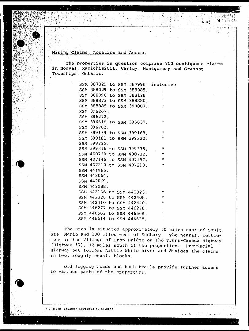
Mining Claims, Location and Access
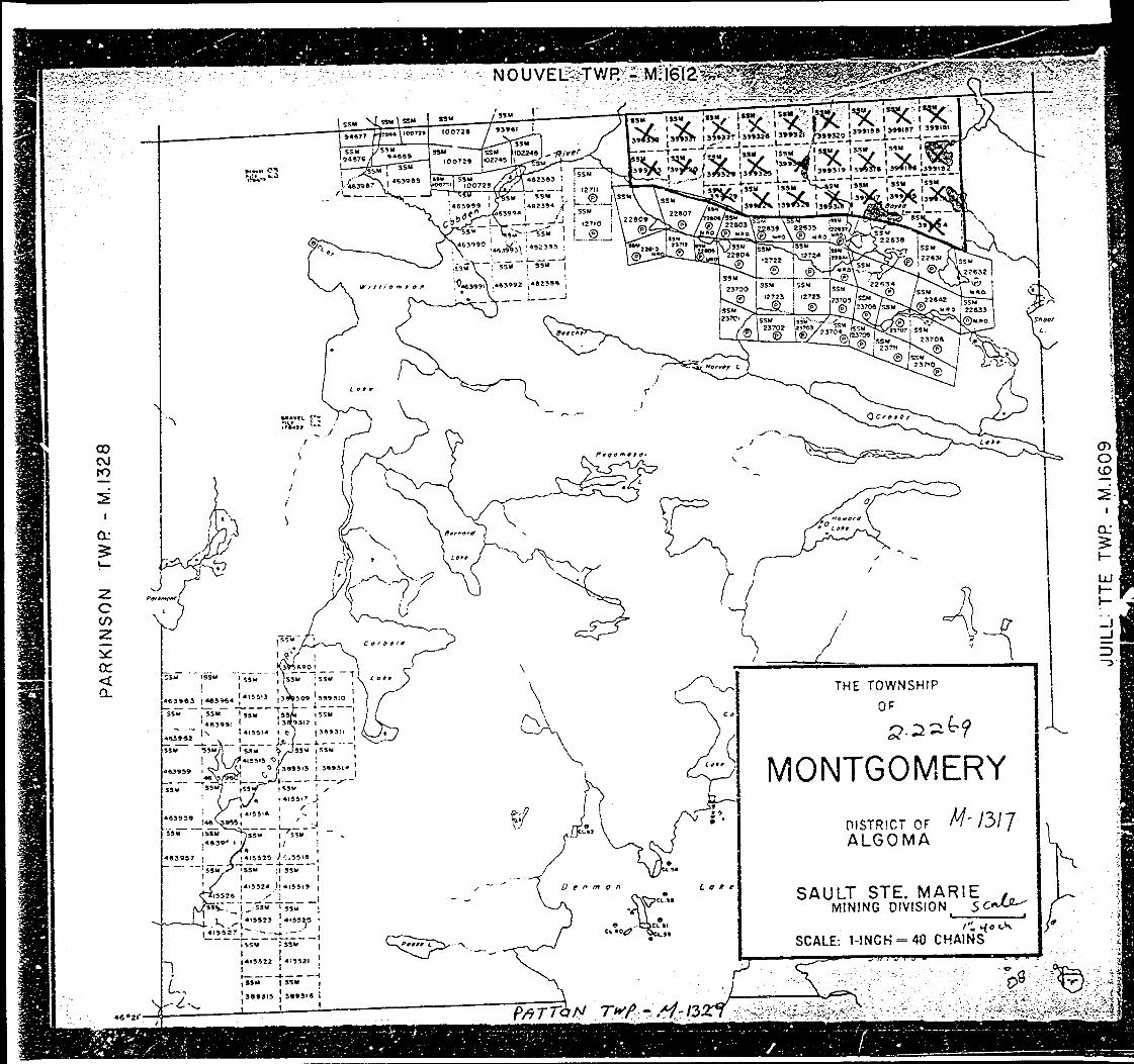
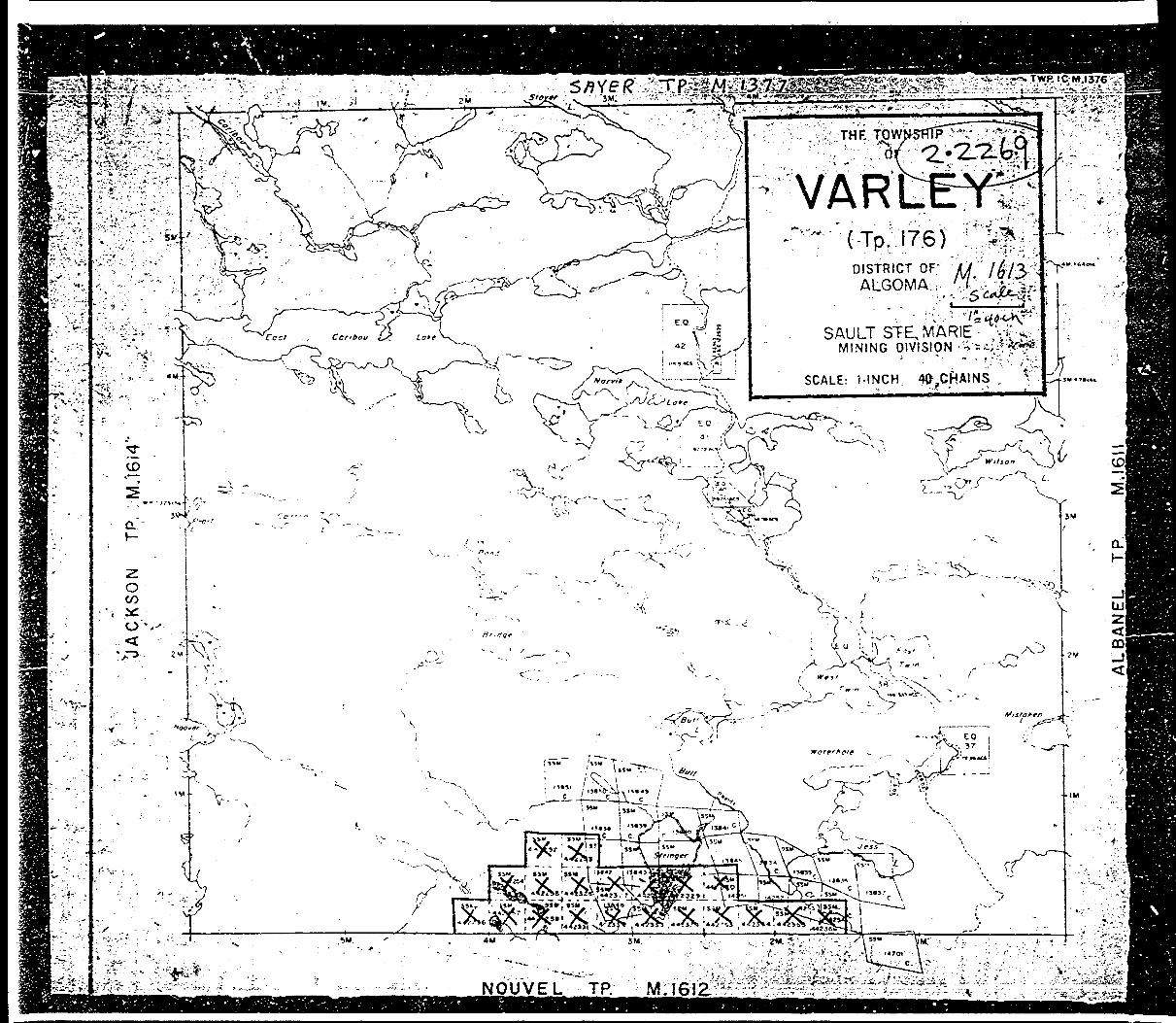
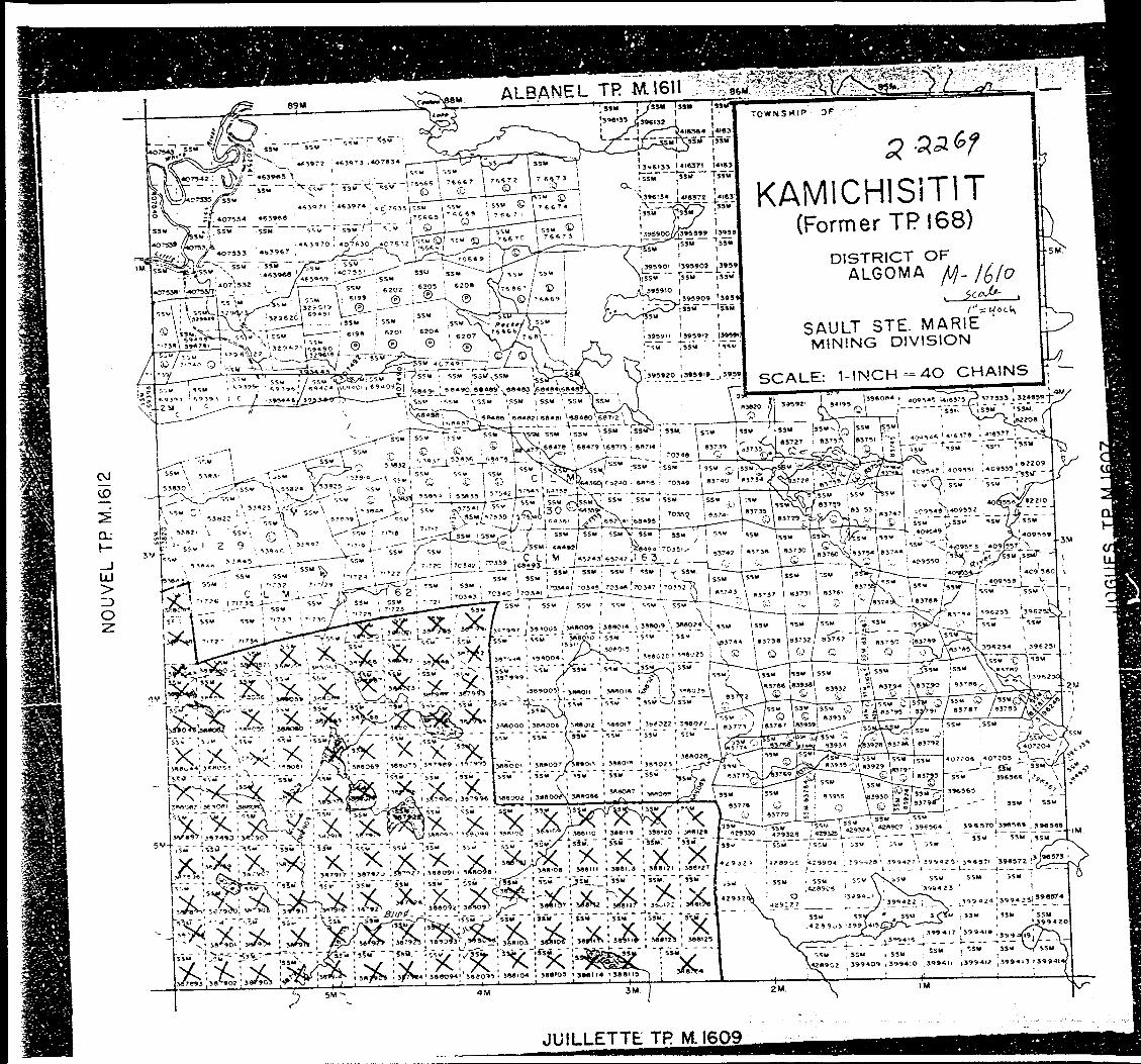
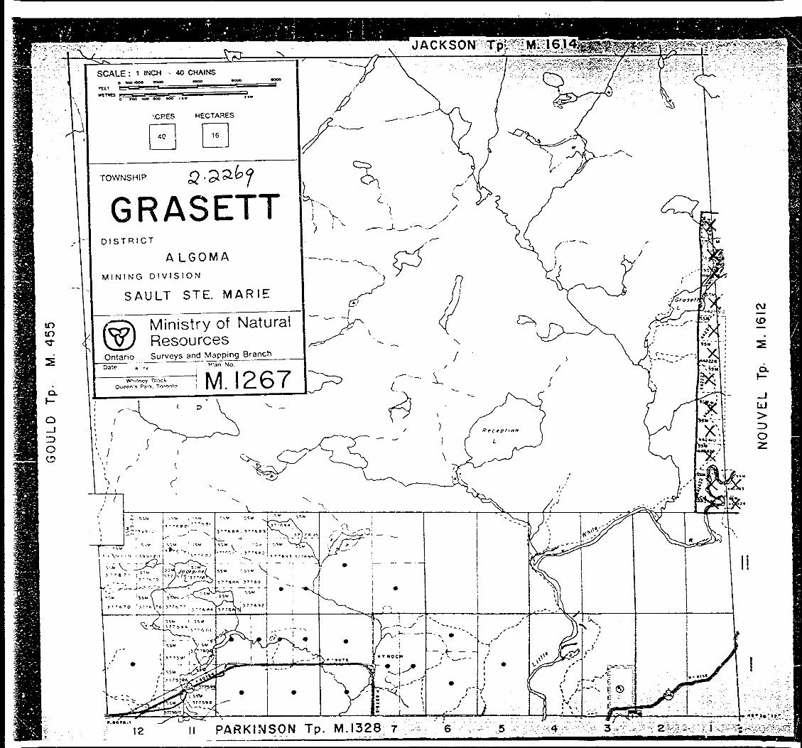
The properties in question comprise 703 contiguous claimsin Nouvel, Kamichisitit, Varley, Montgomery and GrassetTownships, Ontario.
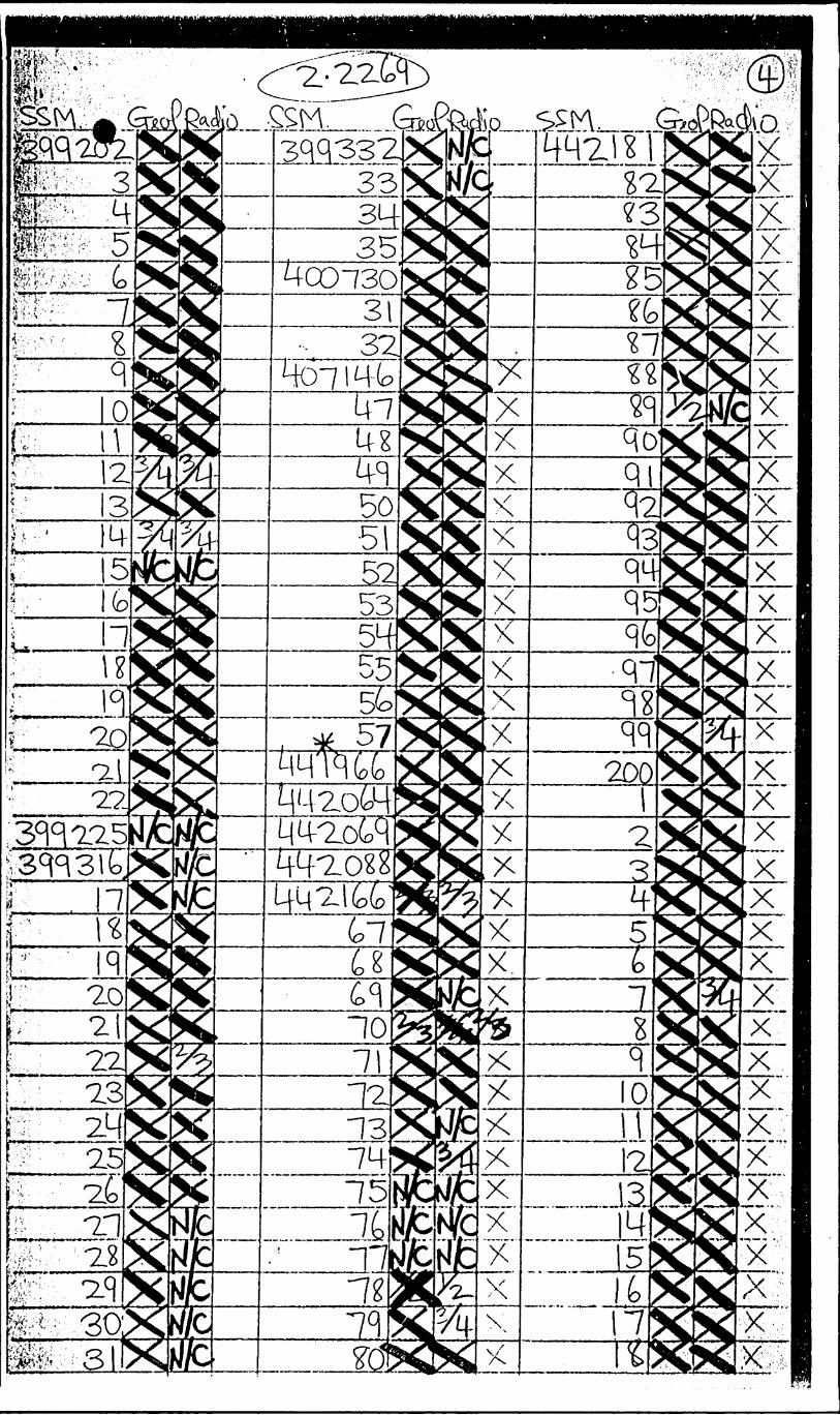
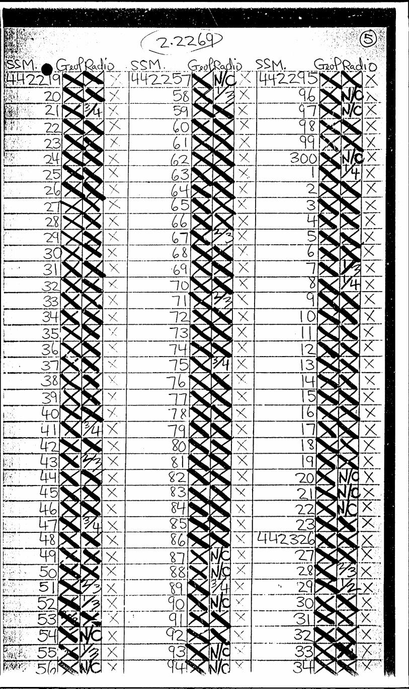
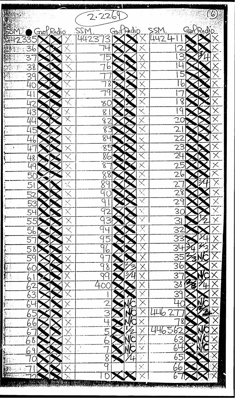
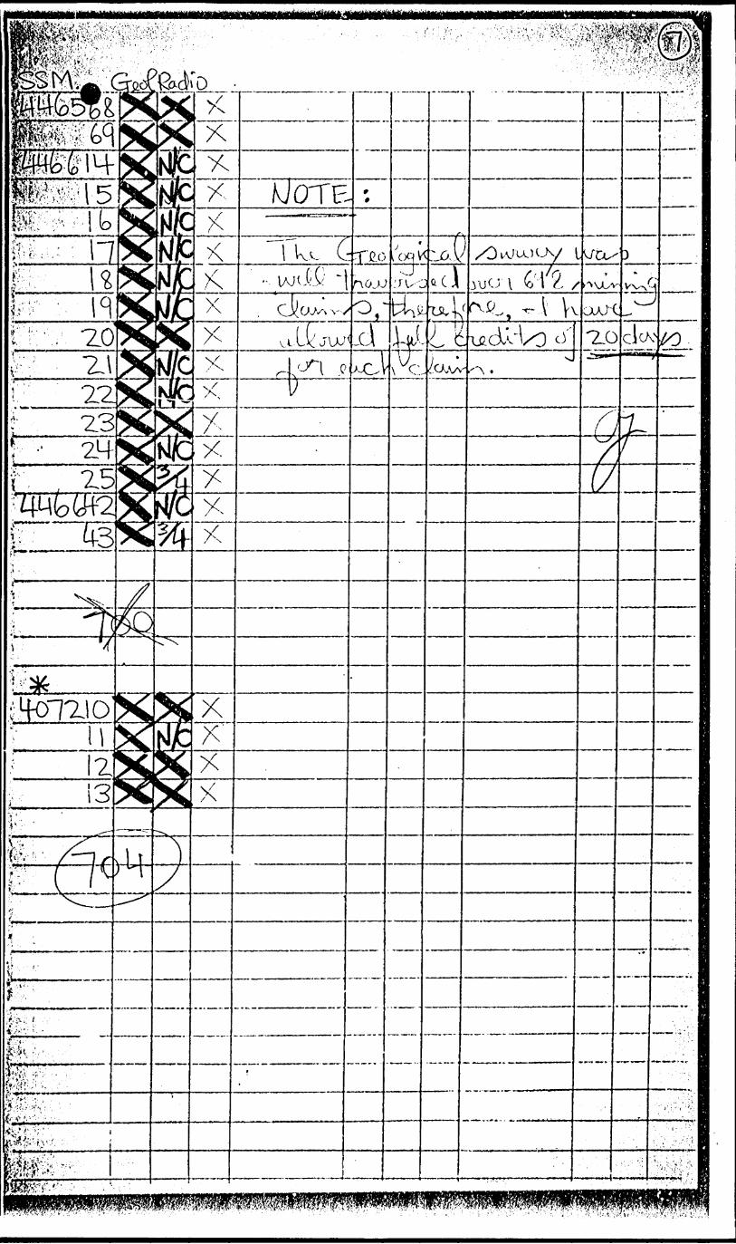
SSM 387829 to SSM 387996, inclusiveSSM 388029 to SSM 388085,SSM 388090 to SSM 388128, "SSM 388873 to SSM 388880,SSM 388885 to SSM 388887,SSM 396267,SSM 396272,SSM 396618 to SSM 396630,SSM 396762,SSM 399139 to SSM 399168,SSM 399181 to SSM 399222,SSM 399225,SSM 399316 to SSM 399335, . "SSM 400730 to SSM 400732,SSM 407146 to SSM 407157,SSM 407210 to SSM 407213,SSM 441966,SSM 442064,SSM 442069,SSM 442088,SSM 442166 to SSM 442323,SSM 442326 to SSM 442408,SSM 442410 to SSM 442440,SSM 446277 to SSM 446278,SSM 446562 to SSM 446569,SSM 446614 to SSM 446625,
The area is situated approximately 50 miles east of SaultSte. Marie and 100 miles west of Sudbury. The nearest settle ment is the Village of Iron bridge on the Trans-Canada Highway(Highway 17), 12 miles south of the properties. ProvincialHighway 546 follows Little White River and divides the claimsin two, roughly equal, blocks.
Old logging roads and bush trails provide further accessto various parts of the properties.
RIO T INTO C ANADIAN EXPLORATION L IUITCD
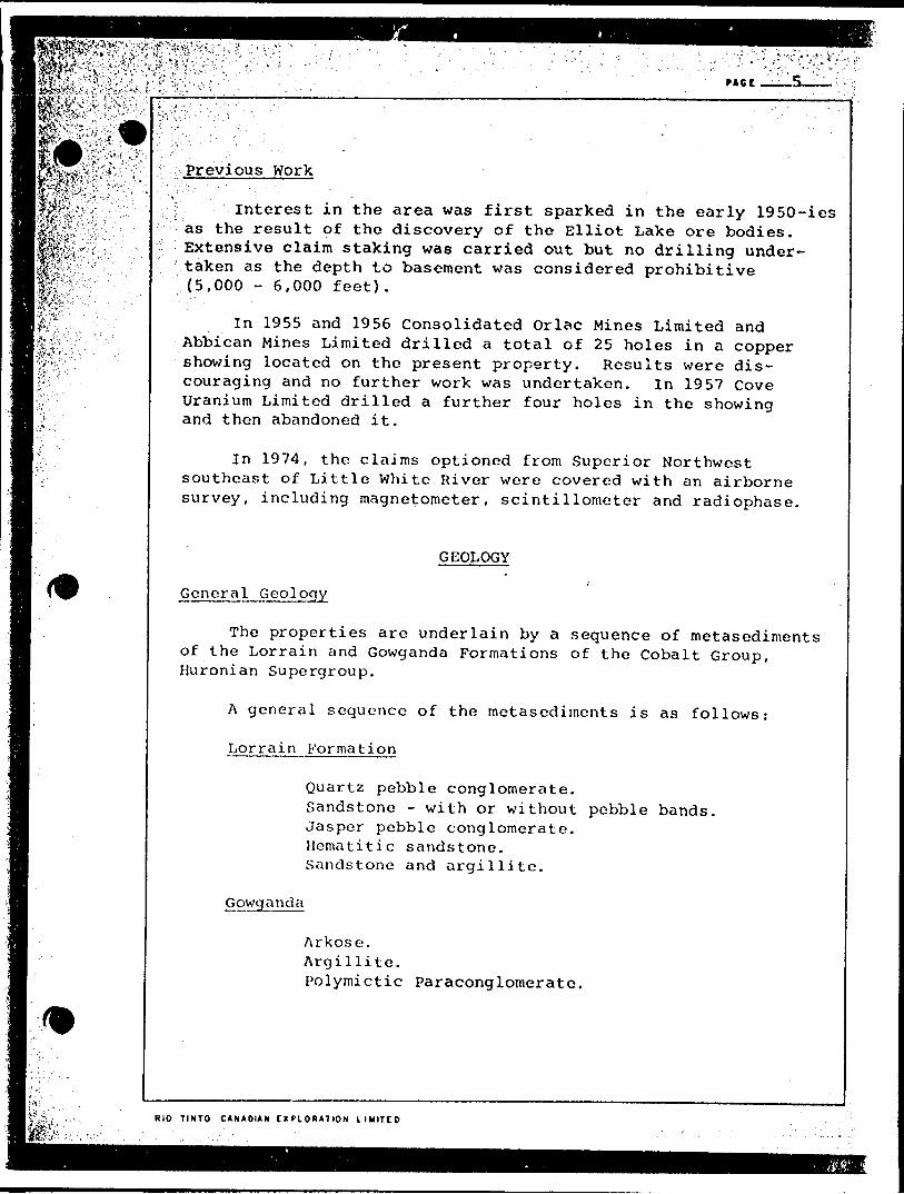
Previous Work
f Interest in the area was first sparked in the early 1950-ies as the result of the discovery of the Elliot Lake ore bodies. Extensive claim staking was carried out but no drilling under taken as the depth to basement was considered prohibitive (5,000 - 6,000 feet).
In 1955 and 1956 Consolidated Orlac Mines Limited and Abbican Mines Limited drilled a total of 25 holes in a copper showing located on the present property. Results were dis couraging and no further work was undertaken. In 1957 Cove Uranium Limited drilled a further four holes in the showing and then abandoned it.
In 1974, the claims optioned from Superior Northwest southeast of Little White River were covered with an airborne survey, including magnetometer, scintillometer and radiophase.
GEOLOGY
General Geology
The properties are underlain by a sequence of metasediments of the Lorrain and Gowganda Formations of the Cobalt Group, Huronian Supergroup.
A general sequence of the metasediments is as follows:
Lorrain Formation
Quartz pebble conglomerate.Sandstone - with or without pebble bands.Jasper pebble conglomerate.Hematitic sandstone.Sandstone and argillite.
Gowganda
Arkose.Argillite.Polymictic Paraconglomerate.
RIO TINTO CANADIAN C X PI O R A 7 ION LIUITCP
PAG f
mi:^feu^^.:',fife-fefe-W:[©ST-*-:
tWK'-~t-' ' "
m"
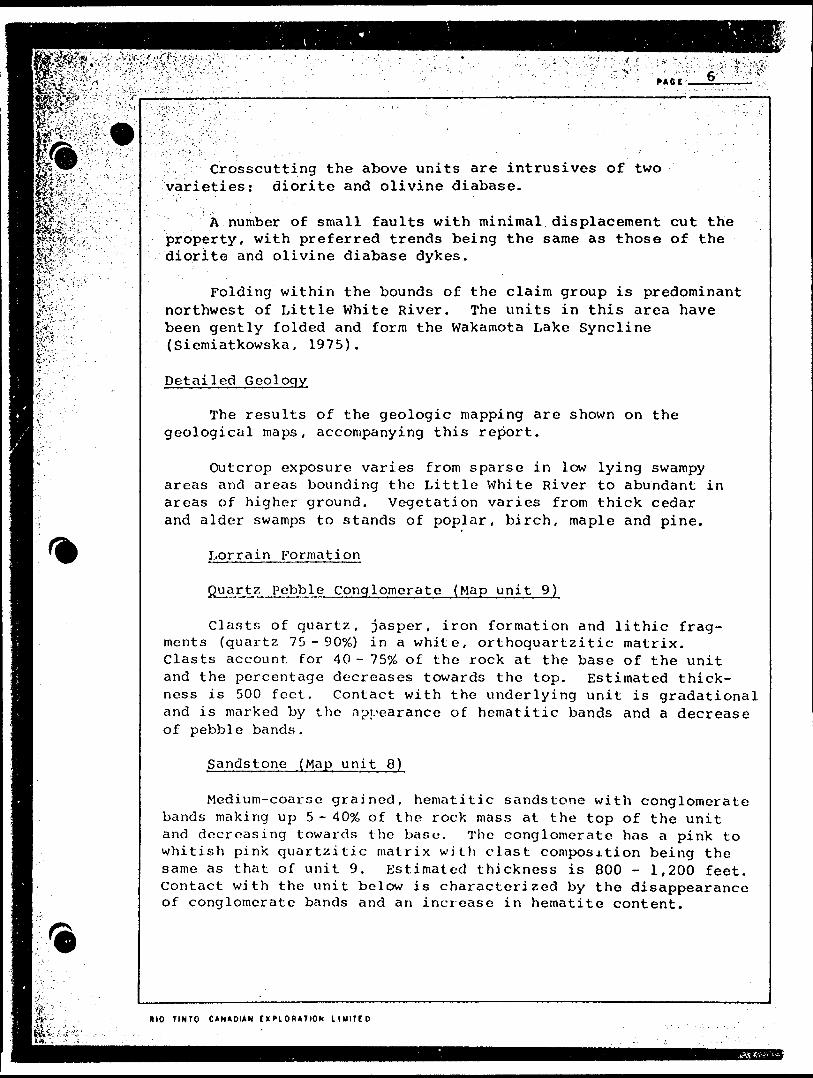
,, Crosscutting the above units are intrusives of two varieties: diorite and olivine diabase.
A number of small faults with minimal displacement cut the property, with preferred trends being the same as those of the diorite and olivine diabase dykes.
Folding within the bounds of the claim group is predominant northwest of Little White River. The units in this area have been gently folded and form the Wakamota Lake Syncline {Siemiatkowska, 1975).
D e t a i led Geolog y
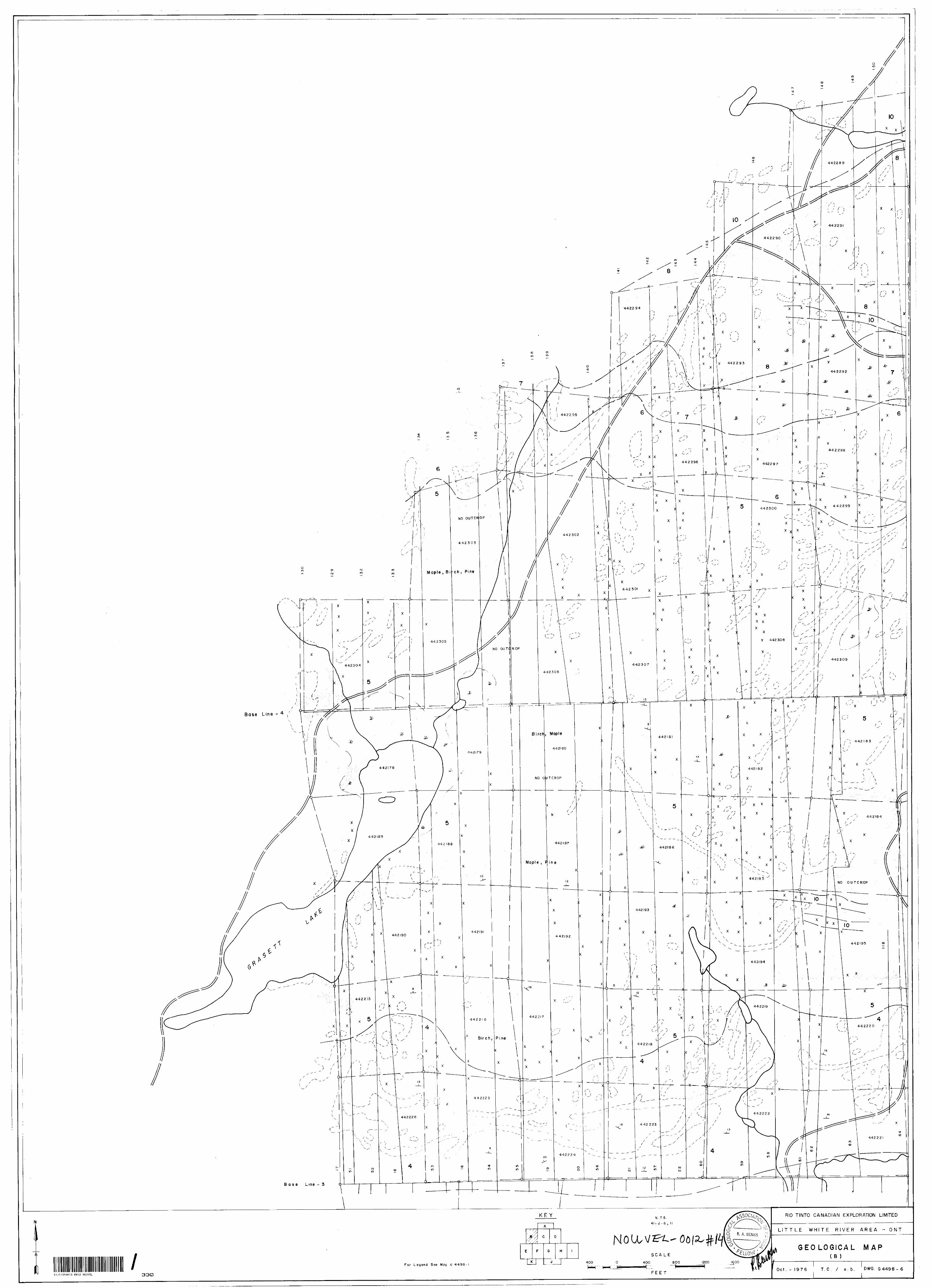
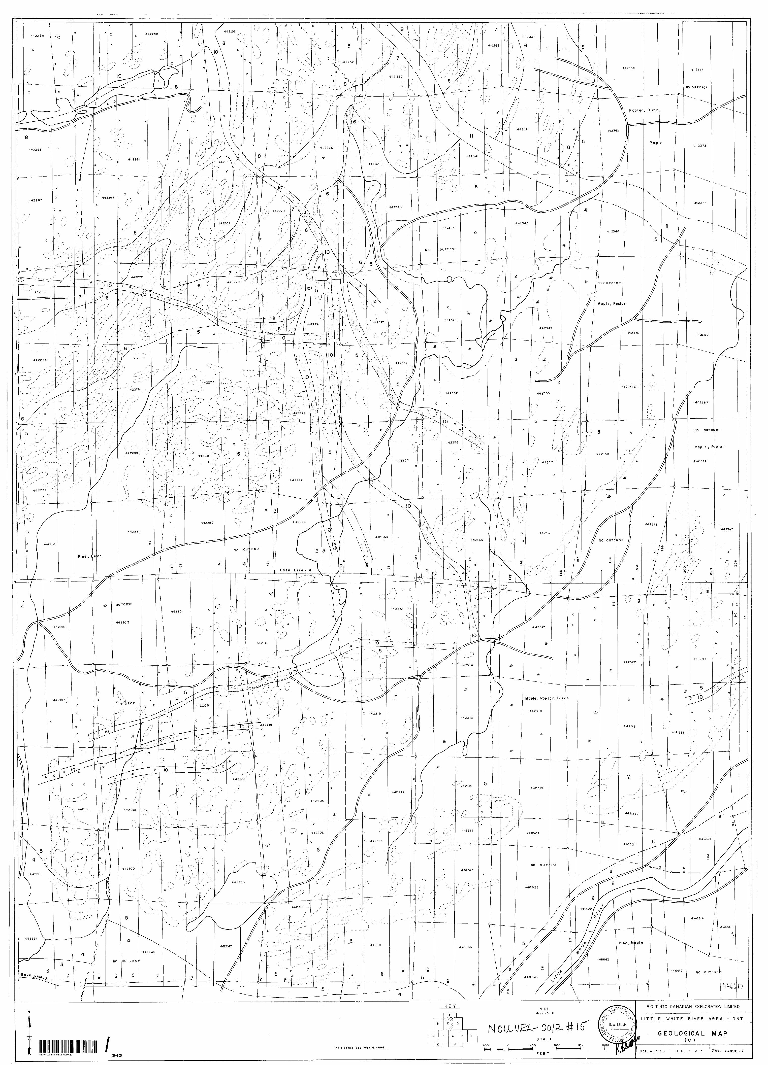
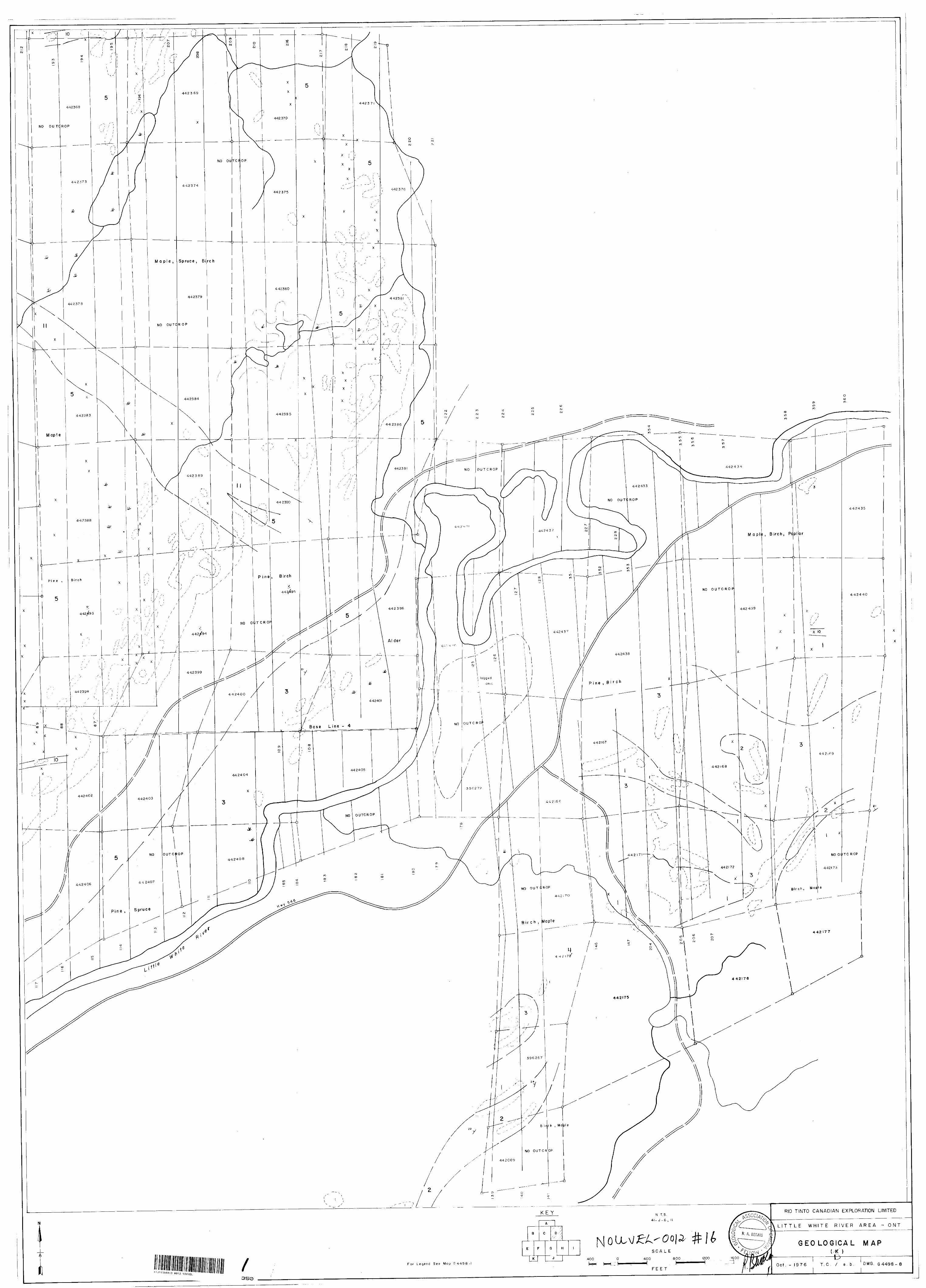
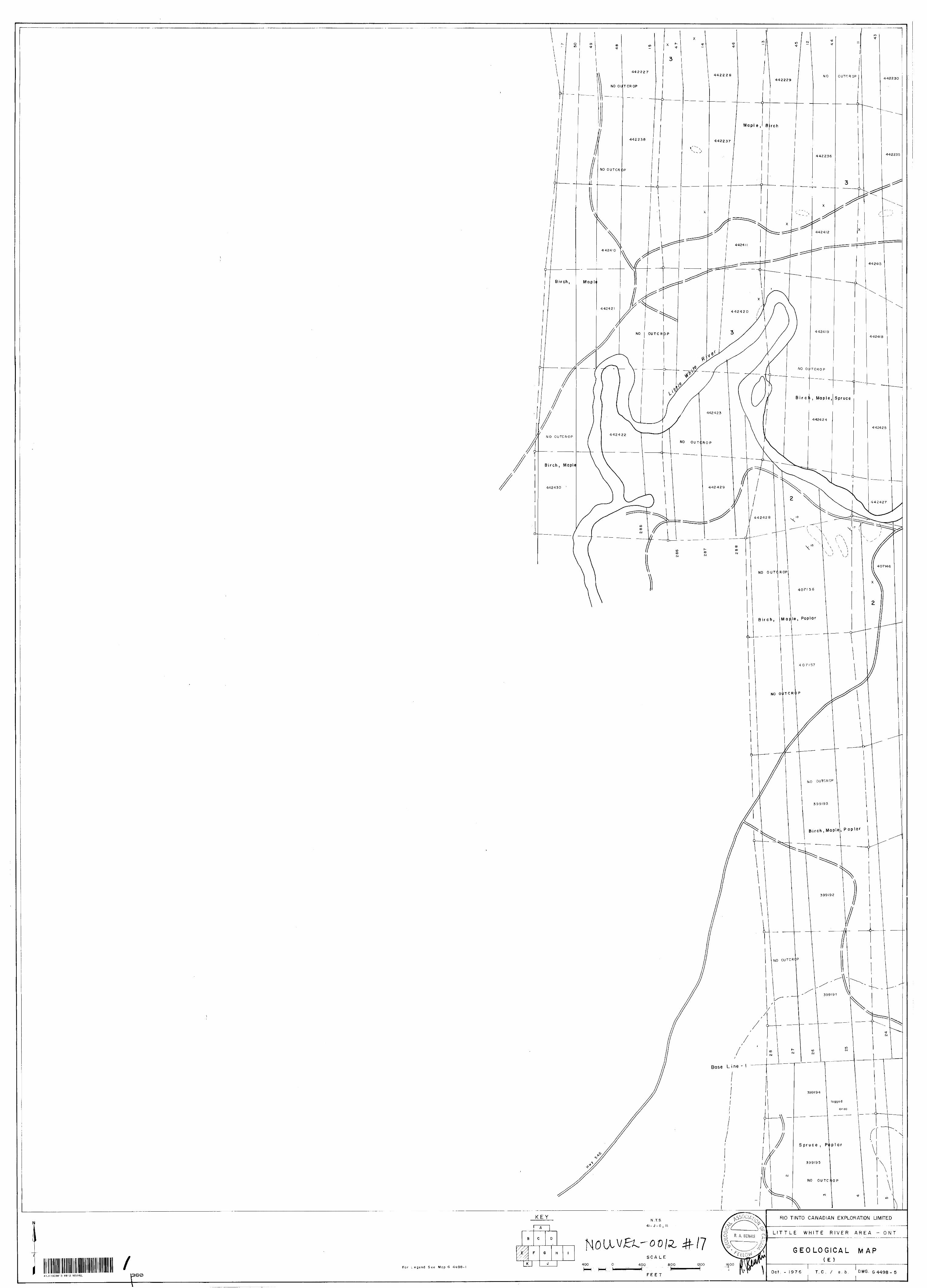
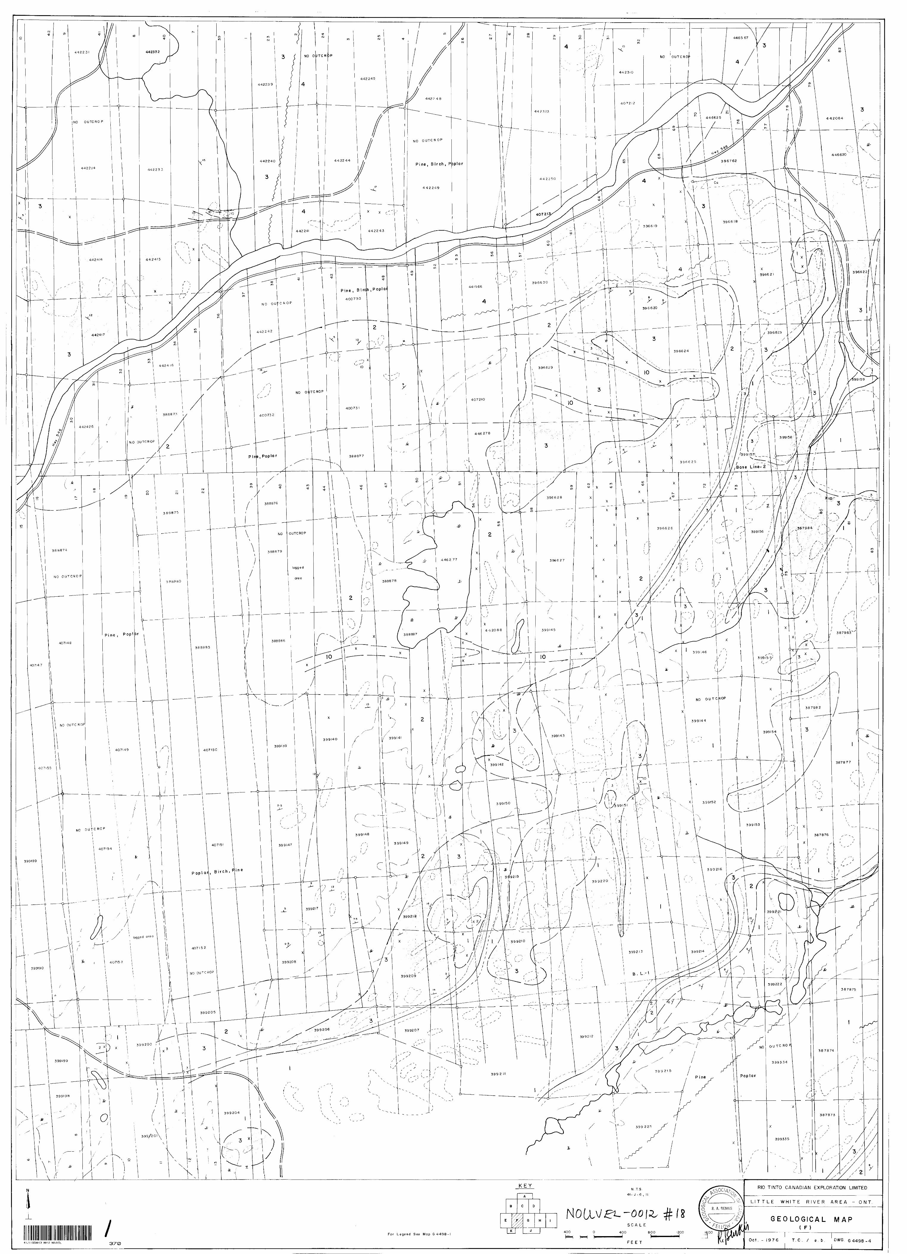
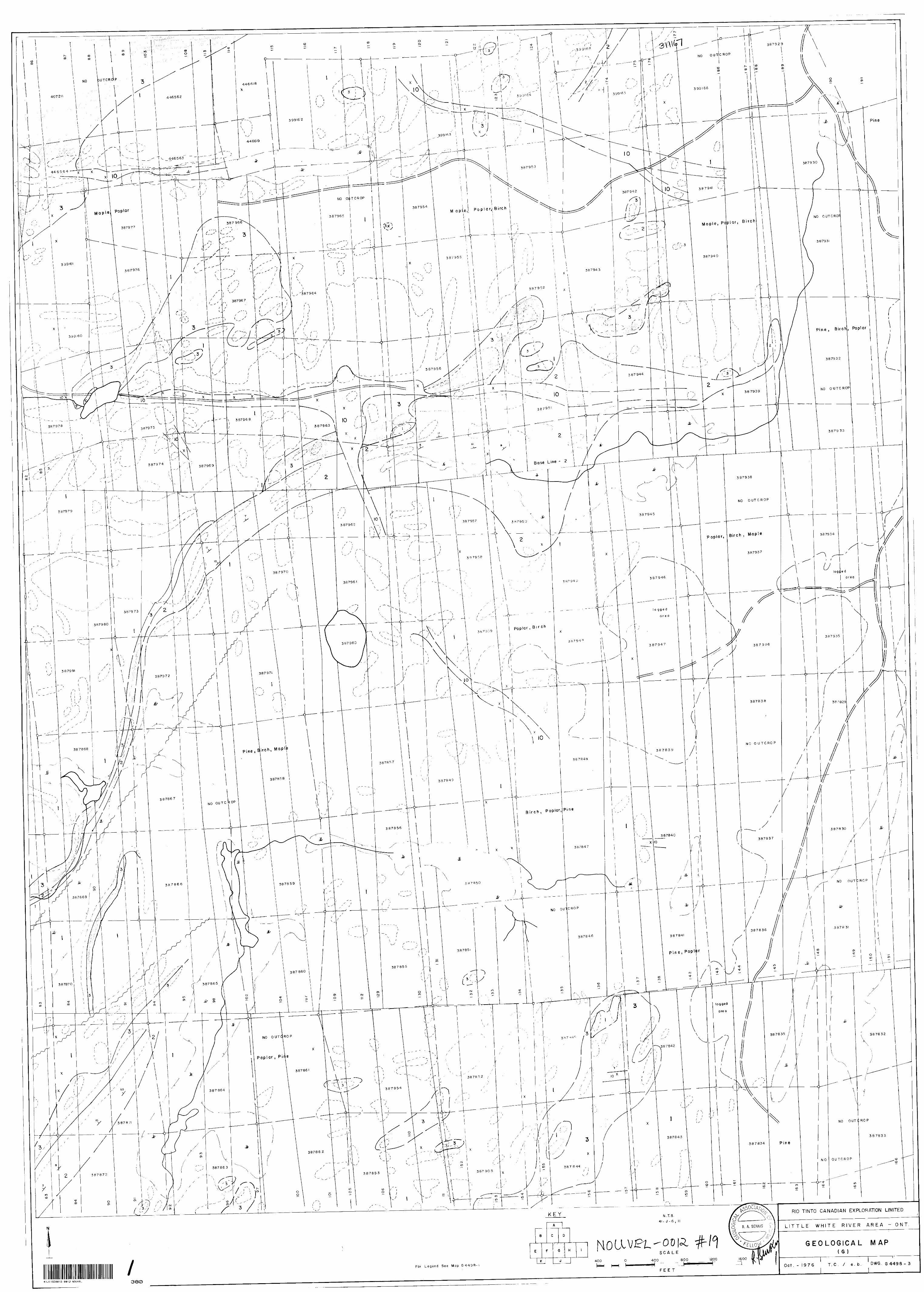
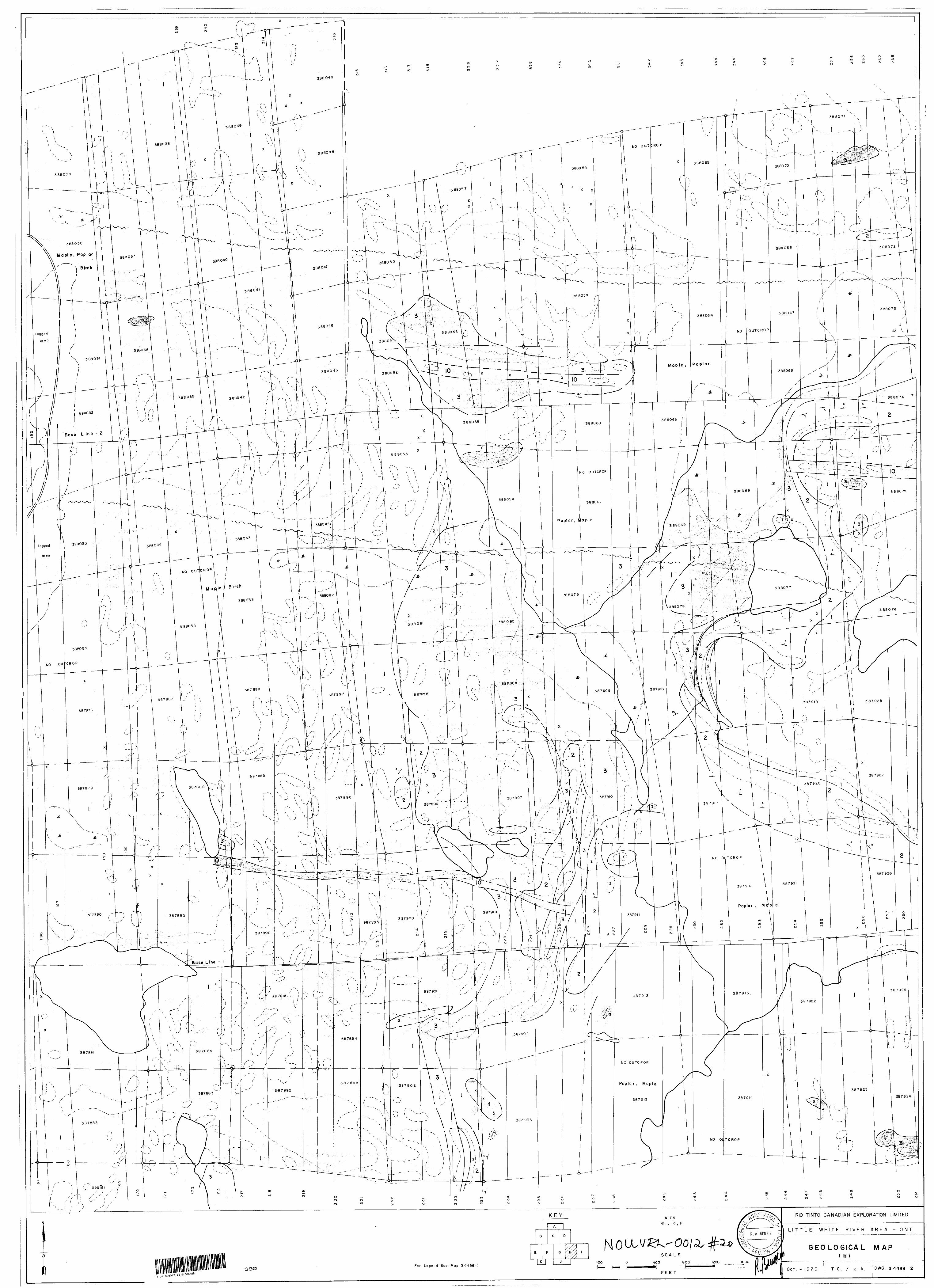
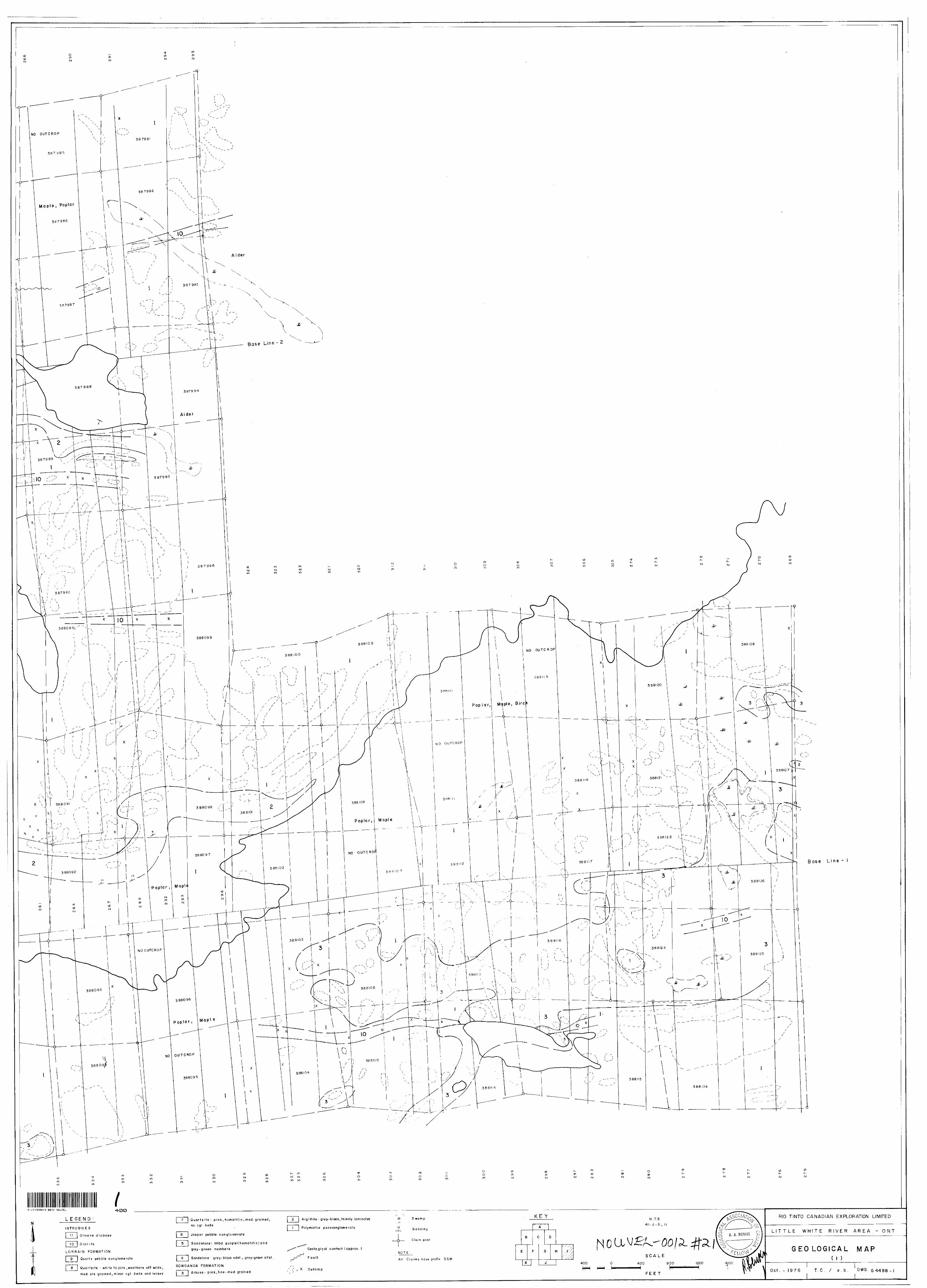
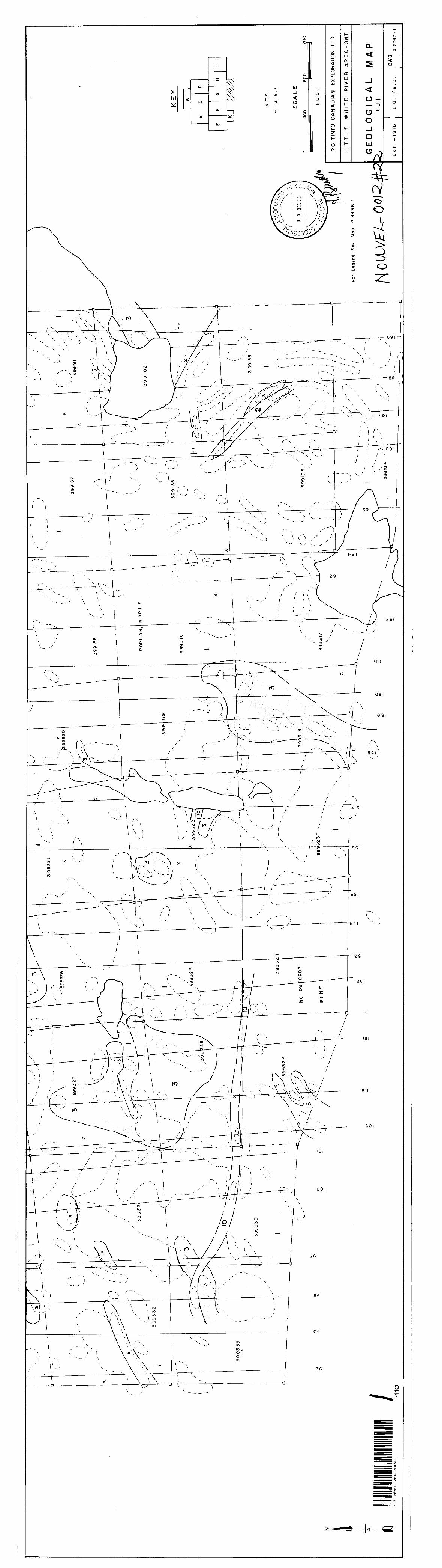
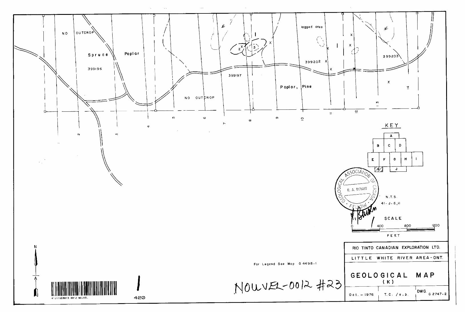
The results of the geologic mapping are shown on the geological maps, accompanying this report.
Outcrop exposure varies from sparse in low lying swampy areas and areas bounding the Little White River to abundant in areas of higher ground. Vegetation varies from thick cedar and alder swamps to stands of poplar, birch, maple and pine.
Lo r r ain Formati on
Quart?. Pebble Conglomerate (Map unit 9)
Clasts of quartz, jasper, iron formation and lithic frag ments (quartz 75 - 9(W) in a white, orthoquartzitic matrix. Clasts account for 40 - 7 5 0/, o f the rock at the base of the unit and the percentage decreases towards the top. Estimated thick ness is 500 feet. Contact with the underlying unit is gradational and is marked by the appearance of hematitic bands and a decrease of pebble bands.
Sandstone (Map unit 8)
Medium-coarse grained, hematitic sandstone with conglomerate bands making up 5 - 40% of the rock mass at the top of the unit and decreasing towards the base. The conglomerate has a pink to whitish pink quartzitic matrix wjth clast composition being the same as that of unit 9. Estimated thickness is 800 - 1,200 feet. Contact with the unit below is characterized by the disappearance of conglomerate bands and an increase in hematite content.
m: feu
RIO TINTO CANADIAN t X P LOftATION LIMITED
; ^ Sandstone (Map unit 7)
Pink to light red, fine grained, hematitic sandstone; cross- bedded. Estimated thickness is 100 - 250 feet. The contact with the underlying unit is indistinct and is marked by the dis appearance of hematitic staining and crossbedding.
Jasper Pebble Conglomerate (Map unit 6)
Clasts composed of quartz (40-8096). jasper (lQ-40%) and chert (S-30%); fine-medium grained, white quartzitic matrix; conglomerate bands make up 10 - 90% of rock in middle of unit and less than 10*26 at the top and bottom of the unit; estimated thickness is 150 - 400 feet. Contact with the unit below is distinct and is marked by a disappearance of clasts and the presence of purple colouring in the underlying unit.
Sandstone (Map unit 5)
Alternating purplish, hematitic, medium-coarse grained, cross laminated quartzitic sandstone and greyish-green, fine- medium grained, sericitic sandstone and siltstone; purplish sandstone contains small lenses and bands of coarser, granular and pebbly material (mainly quartz) - these lenses disappear towards the base of the unit; estimated thickness is 1,200 - 1,700 feet. Contact with the underlying unit is gradational and is characterized by the loss of the purplish colour of thicker beds, greater abundance of greyish-green beds and the appearance of grey sandstone.
Sandstone and Argillite (Map unit 4)
Grey, pink weathering, fine grained, arkosic sandstone with cross laminations at the top of the unit; alternating grey, fine grained sandstone and siltstone and grey-green laminated argillite at the base of the unit. Estimated thickness is 150 feet.
This unit is the lowermost unit of the Lorrain Formation (Card, 1965). The contact between the unit and the uppermost unit of the Gowganda Formation was not observed in the field.
RIO TINTO CANADIAN C X PLORATION LIMITED
1 . MG t 8
Gowganda Formation
Arkose (Map unit 3)
A massive, fine-medium grained, red weathering, pink, angular to subangular, moderately sorted feldspar and quartz grains in a silica cement with very little matrix.
Argillite (Map unit 2)
Very fine grained, grey-black, thinly laminated mudstone. May contain granitic dropstones (to 2 inches in diameter, average *5 inch) and lenses and thin bands of very fine grained pink arkose (unit 3). In most cases bedding planes were readily determined.
Polymictic Paraconglomerate (Map unit 1)
Boulders and cobbles of pink granite, gneiss, diabase and greenstone with pebbles of the same compositions plus quartz, chert and jasper. Clasts are unsorted and range to several feet across, with the majority being ^ to 5 inches in diameter. Shapes are subrounded to angular. The matrix consists of grey-black, fine-medium grained, poorly sorted, angular to subangular grains of quartz and feldspar in a groundmass of silica, chlorite and iron oxides. Feldspars in the matrix have been only slightly altered to sericite.
Contacts between the units of the Gowganda Formation are sharp and eire readily identifiable in the field. There appears to be no specific sequence of units of the Gowganda Formation on the property. Each of the described units may be found anywhere within the sequence. Total thickness of the Gowganda Formation in the area is in the order of 1,500 - 1,700 feet.
Intrusive Rocks
Diorite (Nippissing Type) (Map unit 10)
Grey-black to greenish-black pyroxene laths in a white (weathers greenish-white) plagioclase and dark green pyroxene groundmass; medium-coarse grained in larger dykes, fine grained in small dykes and along chilled margins; pyroxene is non-oriented.
RIO TINTO C ANADIAN EXPLORATION L IMITED
g?-y--5-^ir^-.tff: tf'ffitf^
Olivine Diabase (Map unit 11)
Greenish-black pyroxene laths in a white (weathers greenish- white) plagioclase and olivine groundmass; coarse grained; pyroxene non-oriented.
The contact relationships between the intrusive dykes and the host rocks are generally distinctive and sharp. The contacts are parallel to joints within the dykes and in the host rock. The host rocks have been relatively unaffected by the intrusives. Alteration is limited to the presence of a limonite stain due to greater abundance of hematite, a coarsening of grain size and occasionally, the presence of quartz veining and stockwork masses. Little mineralization is associated with the. dykes ; only minor pyrite was noted.
Width of the dykes ranges from 40 to 150 feet, with trends NNW-SSE and WNW-ESE being most common and dips to the south or southwest at a steep angle (75O - vertical).
A large diorite sill is present on the northwestern boundary of the claim block. The contact'relationship between the sill and unit 8 is sharp, with the sandstone (8) underlying the sill and dipping llo to the west. This large diorite mass may have served as the source for the diorite dykes in the immediate area.
Structural Geology
Faulti ng
Faults within the property may be grouped on the basis trends. Two groups exist: those striking NNE and those striking ESE. The only major fault, the Skirl Lake Fault, is found in the northwest corner of the property. Shear planes in the fault zone strike 145O and dip 30OSW.
The nature of the other faults in the claims group is difficult to determine, as the rock types on both sides of suspected faults are similar. On those faults which cut an argillite unit a determination of vertical displacement was possible and movement of 200 - 400 feet was indicated. It is believed that all postulated faults are steeply dipping.
RIO UNTO C ANADIAN EXPLORATION L IMITED
CASE
h Folding :
Folding is gentle and only a small number of paramitic- type S-folds were found. The main structured feature on the property is the Wakomata Lake Syncline. Tho axis of the syncline trends NW-SE and plunges 8O - 12O to the northwest. Dips on the northeastern limb are steeper (20O - 35O ) than those on the southwestern limb (10O - 16O ) and folding is most intense along the axis.
Mi nerali za ti on
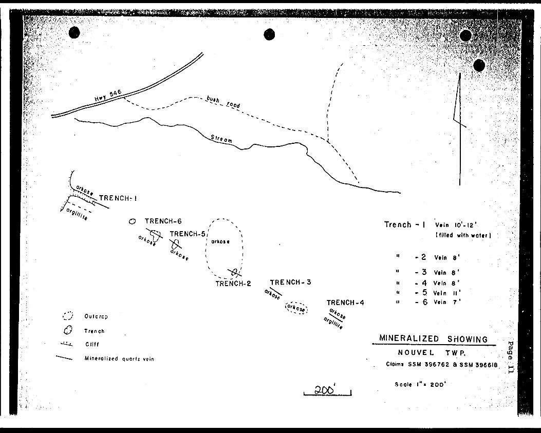
The copper showing, mentioned in the Previous Work section, is located south of Highway 546 on claims SSM 396762 and SSM 396618. A quartz-carbonate vein which carries chalcopyrite is found in an arkosic unit of the Gowganda formation. The vein varies in width from 5 to 14 feet and has been traced some 1,050 feet along its strike. Five trenches present on the showing (Dwg.on page 11) were sampled and assayed with following results:
TrenchNo.
# 2# 3# 4# 5# 6
Width of Vein
O 1 8' 8'
11 ' 7'
Cu
.64
.14
.24
.74 1.49
It was evident that in the past some ore had been removed from Trench # 1; however, today the showing has little economical potential.
RIO TINTO CANADIAN EXPLORATION LIMITtO
^ffi®^^;::
O TRENCH-6
TRENCH-5, \ ' orkoie '
TRENCH-2 TRENCH-3
TRENCH-4
Outcrcp
Trench
Cliff
Mineroliied quort: vein
xw;*oje \
Trench - l Vtin 10'-12' (filled with woter
n H n
- 2 V.ln 8'
- 3 Vtln 8'-4 Vein B '- 5 Vein II 1- 6 Vein 7 '
MINERALIZED SHOWING NOUVEL TWP.
Cloims S SM 396762 8 SSM 396618. (O
. ODD iScole l"* 200*
iSflS:'
Pfc I'fe^
lm-
PA G t
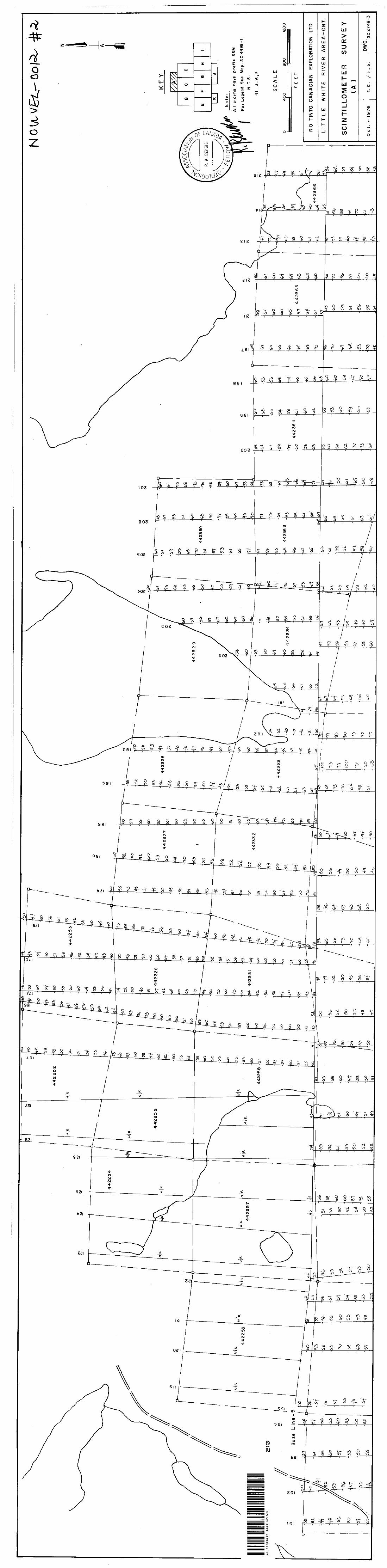
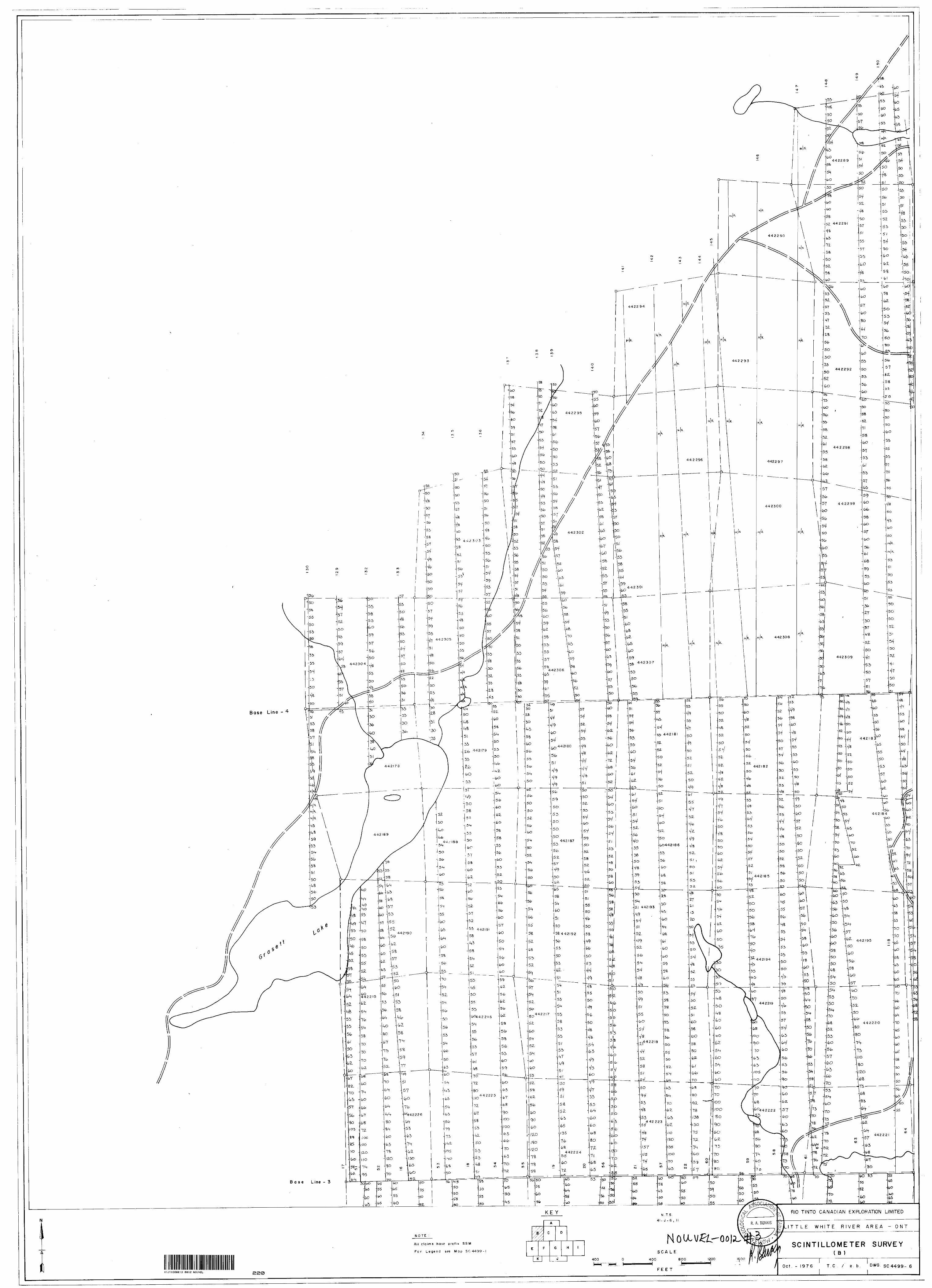
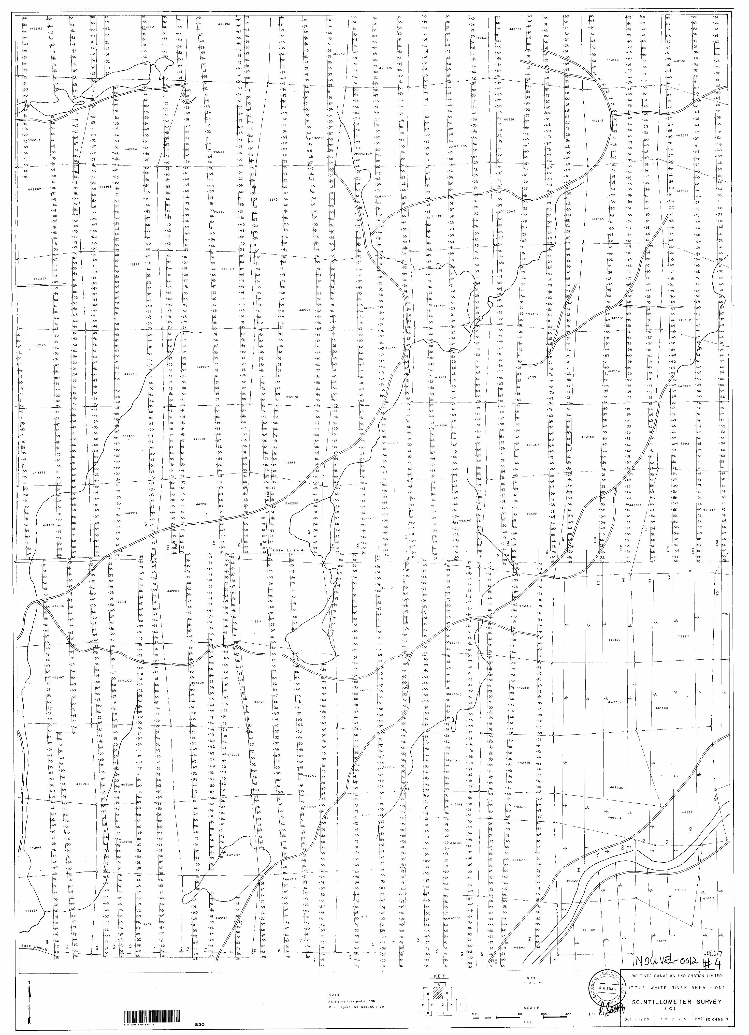
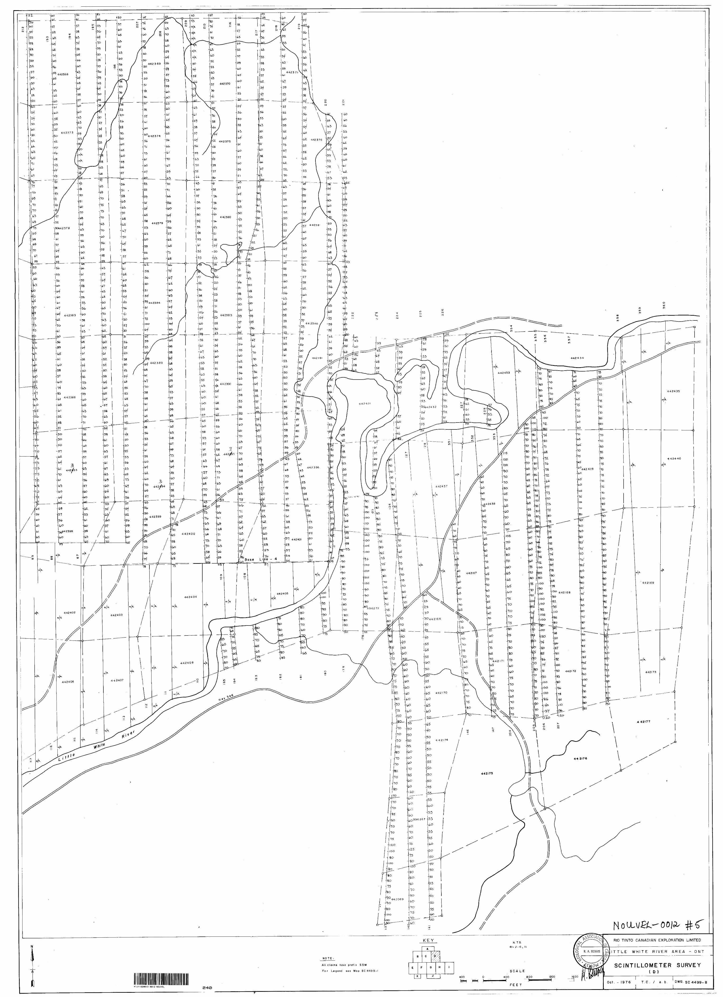
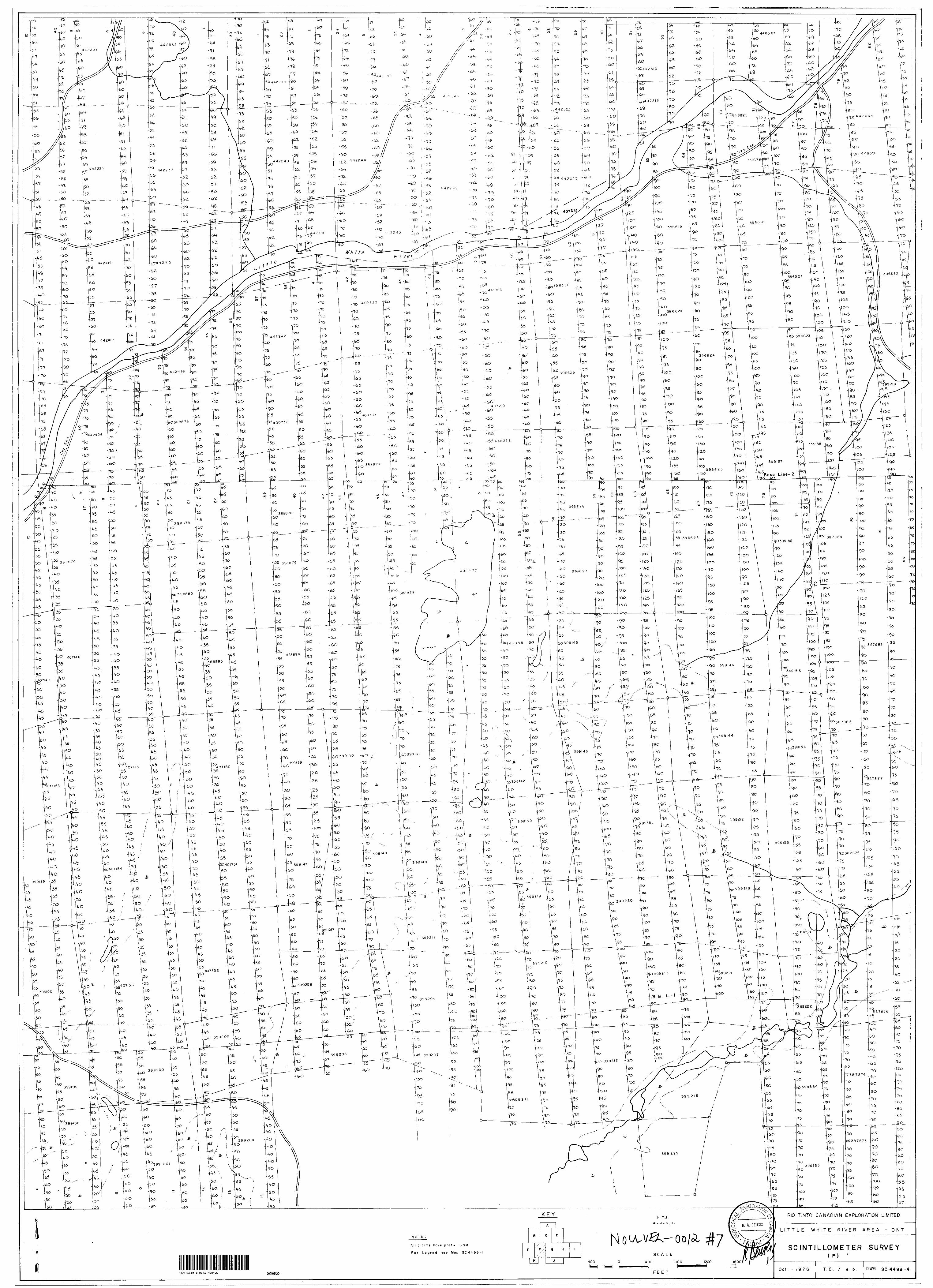
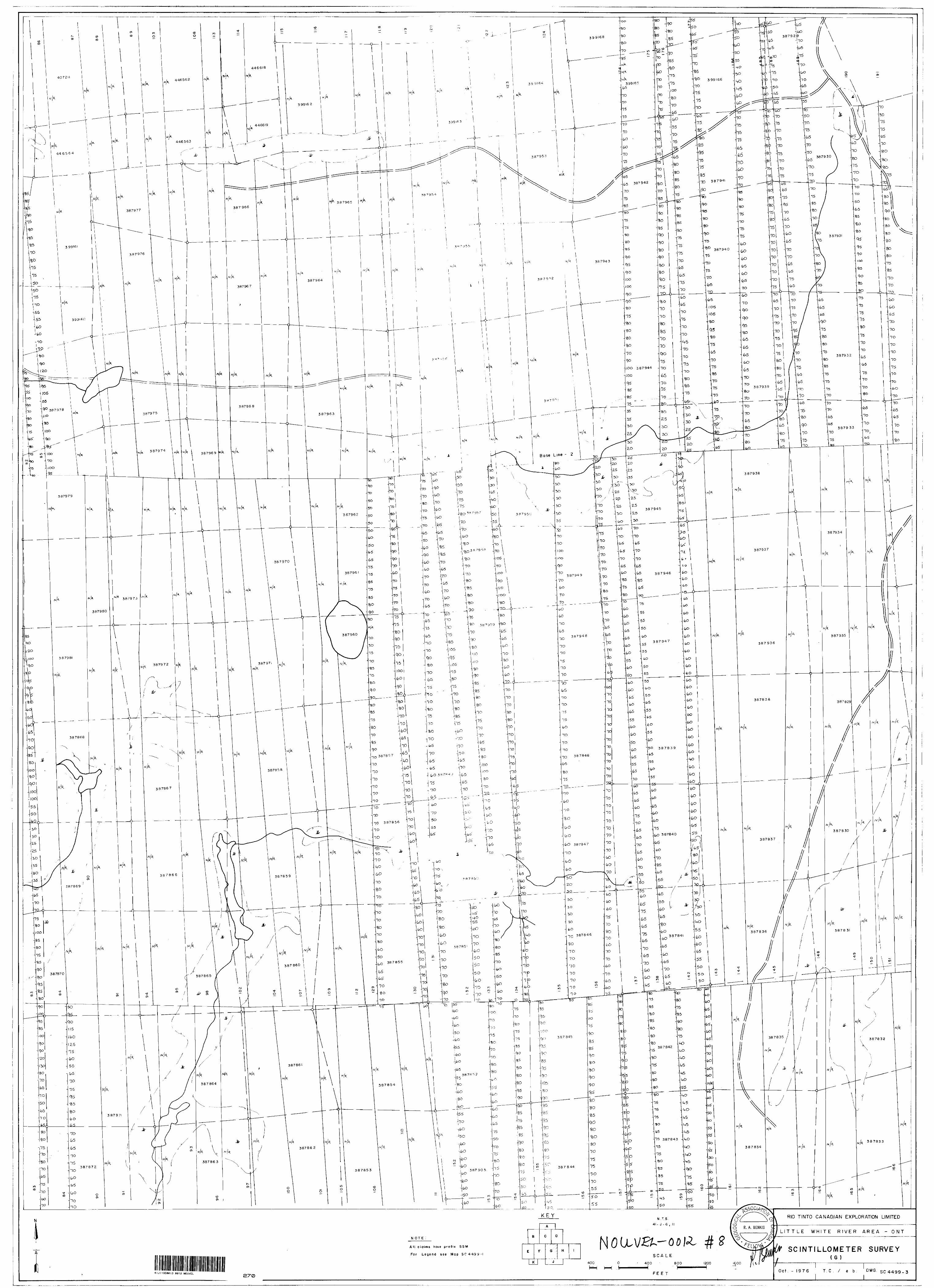
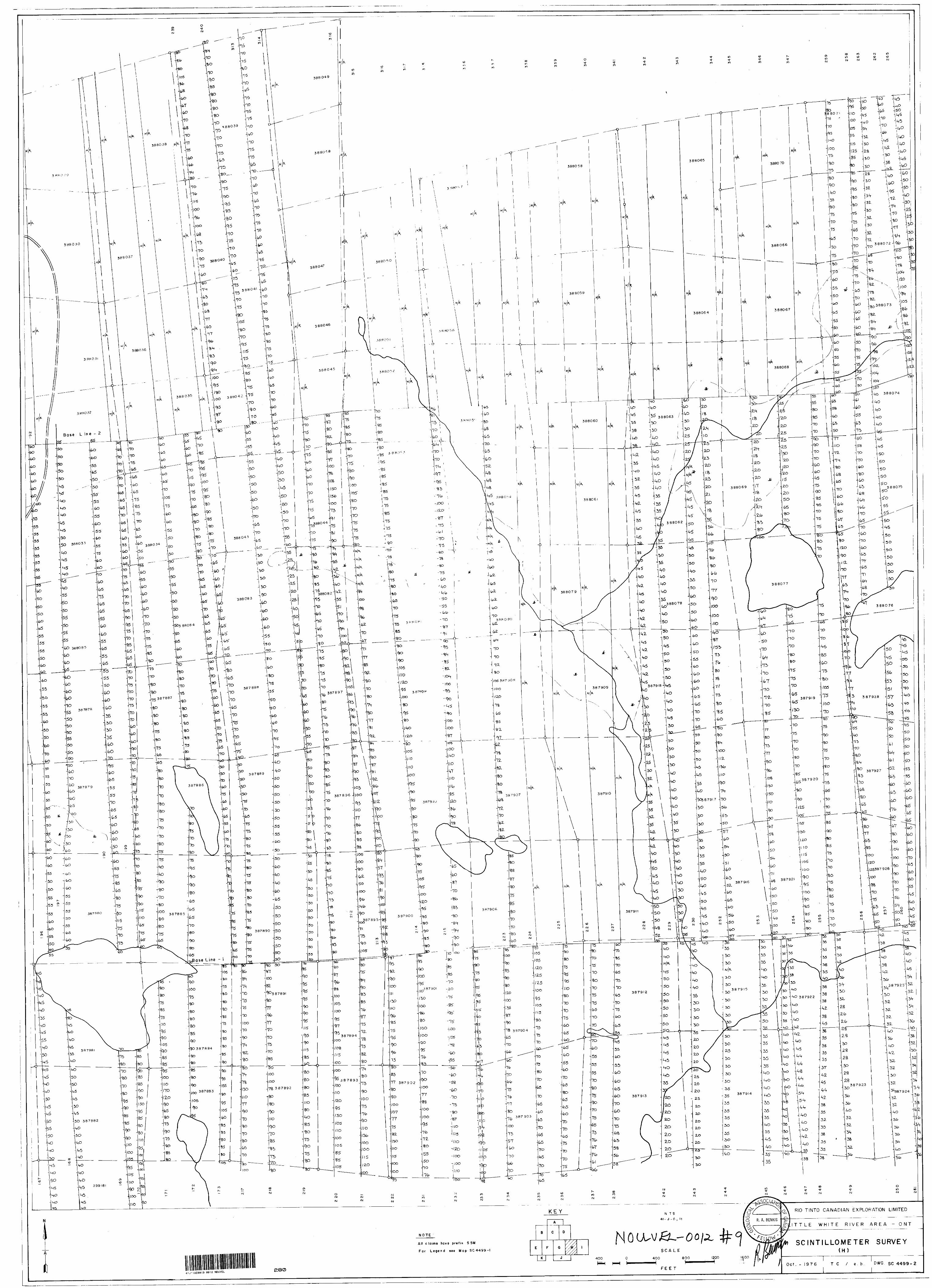
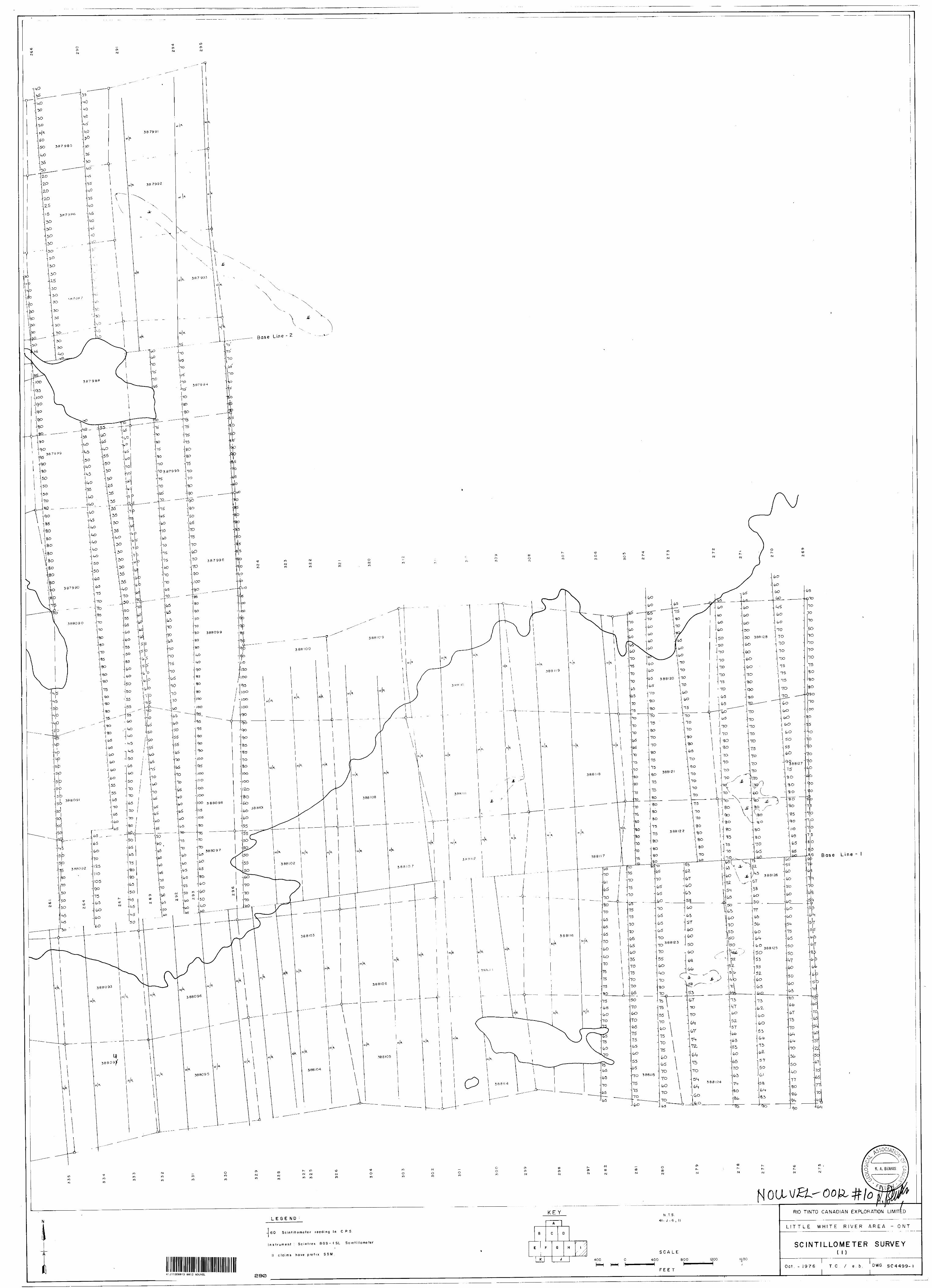
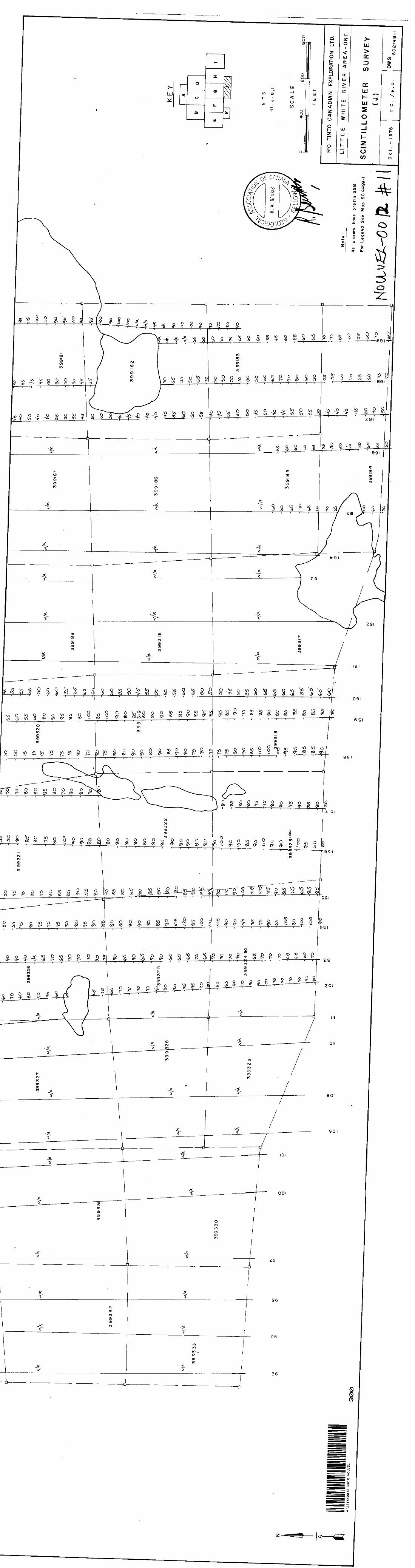
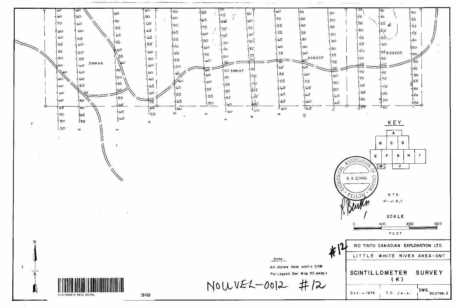
SCINTILLOMETER SURVEY
A scintillometer survey of the claims was carried out in conjunction with geological mapping. The survey was done along the same traverse lines and scintillometer readings at waist level were recorded at 100-foot intervals. However, because of frequent equipment breakdowns, often the geological mapping had to progress without the benefit of a scintillometer and consequently the scintillometer maps lack coverage .in certain areas.
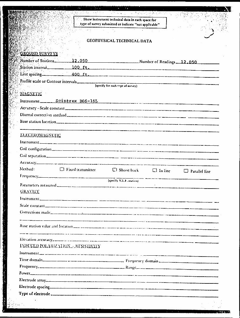
The instruments used throughout the survey were Scintrex total count scintillometer, Model DGS-1SL, which are equipped with 1.5" x 1.5" thallium activated sodium iodide crystal detectors. The readings are recorded as counts per second (cps), where l cps ^ 2. 5 x 10~ mR/hr.
The scintillometer background count: in toe Little White River area is 4 0 t o 70 cps. considering the size of the area, a remarkable feature in an almost total lack appreciable scintillometer relief. Generally the- count would be within the background range or slightly above; readings below the background range were also encountered. Readings of 130 to 180 cps occur near the bottom of map sheet B over an area underlain by grey-black sandstone and grey-green siltstone of the Lorrain Formation. Along the east side of map sheet "F", north and south of BL # 2 , readings are in the 100+ cps range with erratic highs to 210 cps; the area is underlain by Gowganda arkose and polymictic paraconglomerate.
S..'- ' :-fi-..-'-. RIO UNTO CANADIAN t IIMOHATION UMITtD
13
RECOMMENDATIONS
If a programme of deep drilling is to be initiated, the easternmost portion of the property would be the best target area. This area has the lowermost member of the Gowganda present on the property, thus a shorter depth to basement would be anticipated. Structurally, the area is not complex. No faults or folding have been indicated.
December 1976 Toronto, Ontario
.S t '/.':,-,,y
T. G. Chapman
DID TINTO CANADIAN CXPIOKATION UMITCD
PA O t
••':f,:'f,*ffi3:.^--'"--:.,lP-Vmmmm-' ;iMf^feV'V ;V "
l i"'*;'"'" ' i" ' "
J '^i-S ' '
li:;.:"Card, K.D., 1965:
Robertson, J.A, 1969:
Robertson, J.A, 1963:
Siemiatkowska, K.M., Grunsky, Eric nnd Berger, B.R 1975:
REFERENCES
Geology of tho Espanola-Whitefishfalls AreaO.D.M. Geological Report No. 40.
Geology and Uranium Deposits of theBlind River Area, OntarioC.I.M. Bulletin, June 1969, Vol.62, No.686.
Geology of the Iron Bridge Area O.D.M. Geological Report No. 17.
Endikai Lake Area (Western Half),Sistrict'of Algoma;O.D.M. Preliminary Map, p. 1001.
NIO TINTO CANADIAN tX 'I.OH ATION IIUITIO
eeia NOUVEL 900
Ministry of Natural Resources
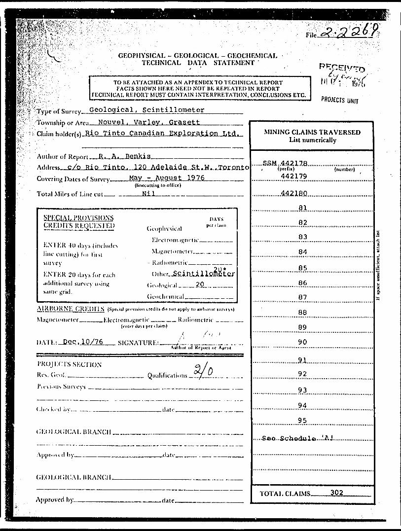
GEOPHYSICAL - GEOLOGICAL - GEOCHEMICAL TECHNICAL DATA STATEMENT
TO BE ATTACHED AS AN APPENDIX TO TECHNICAL REPORTFACTS SHOWN HERE NEED NOT BF. REPEATED IN REPORT
TECHNICAL REPORT MUST CONTAIN INTERPRETATION, CONCLUSIONS ETC. PROJECTS UNIT
Type of Survcy(i) Geoloqical, Scintillometer
Township or Area No* v-tji, Kamichisitit, Montgomery
Claim Holdcr(s) Superior Northwest Inc.v t
Survey Company JBl5
Author of Report ^.^ Address of Author -c-/
Covering Dates of Surv
Total Miles of Line Cu
SPECIAL PROVISOCREDITS REQUKS'
ENTER 40 days {inc line cutting) for first survey.
KNTKR 20 days for additional survey usi same grid.
AIRBORNE CREDITh
M.i['netomeler
DA-IT.: Dec. 10/76
R.-s. Gcoi......^., ..
Previous SurveysF i Ir No. Type
1L. -
Tinto Canadian Exploration Ltd.
JL-A*.-J3fiJlKis __ ..... __ ..- . .. ..^.... . ...
(!mrrullin| lo office)
Nil
Vi5 OAYSFI) /-- i - i iifr I'ljiiri -JL. Geophysical
hleclromagnetic...... . lucks
-M,ipni'|iinic'!rr..,..,.... . ... ,...,,
- K.iilinmririr,
, . 20* cjch -nilirr Sclnt.i. 1 J,omnfnr
IR r.,.,,1,,!-!,.!! 20
Gi-iiclu-niic.il , , , . . .. , . .
(Special pruviiion trediti do not apply to xi'bornc turvryi)
Electromagnetic . ... . .. Radion^etric . . ,. . ..., (enter diyi pet lUim)
, -, , /* \*''l (fi'^AutliDi of Rr|iutl M Ag'nl
'~f/ 'J . Qualifiralions c /..'... .. .. . . ..,..
Date Claim lloldri
1
iiEo:::::::::::::i*fc H \^^*^
\ ^^*
MINING CLAIMS TRAVERSED List numerically l
S3M 38782?(prtfu) (numbtr)
30
31
,...,......,.,.,....,.,,,,,,,,,.,,3.3.,...,....
34
................................................^5............
36 ....
..................,......,.,,.,...,...,...3.7.............
..........................,,.,,.........,,3^,,,,,,
39
40
42
... ..... . 43
..............,....,..,,,....,,,..,..,4.4...,.,,,.
..............,,,..,..,,,,,,,,,,,4.5.,,,,,,
46
^e, Sfi^dU^ 'AJ
im-Ai .ri.Ai\iK 402
WK^i^:"^K? ?cKGEOPHYSICAL TECHNICAL DATA
^fe*-^'-^lll?^^^ one sui'voy. specifydata fur each type of survey
m&^mi-^---::•of Stations. .;.l?JZQ
|w-'^'\ Station interval.ftv;e;'' /- '-•••' ' , 1^.;?^ Profile scale^^
inn f t-.
. i' G)ntour interval.'-"' 1 -
. 'S,
Instrument, Scintrex BGS-1S1Accuracy - Scale constant. Diurnal correction method.Base Station check-in interval (hours), liasc Station location and value ———
.Numl)cr of Readings
.Line spacing.————-.
1270-400 ft.
JJJ InstrumentCt-il configuration Coil separation ,— Accuracy ———— Mclhoil:
Frequency-—.—.—
Parameters measured.
CJ Fixed transmitter O Shoot back O In line
(ipfcify V.LK i
Paralic! line
Instrument _..-— Scale constant ,™ Corrections i
Base station value and location —
Elevation accuracy____._.. .——
Instrument __.Method D Time Domain Parameters - On time ——.
-Off time ——.
O I'Vequency Domain .___ _ Frc(|urncy _____
— Delay time ^—. -—^- Integration Jime_.
Power.Electrode array — Electrode spacing. Type of electrode ,
Claim' No Days
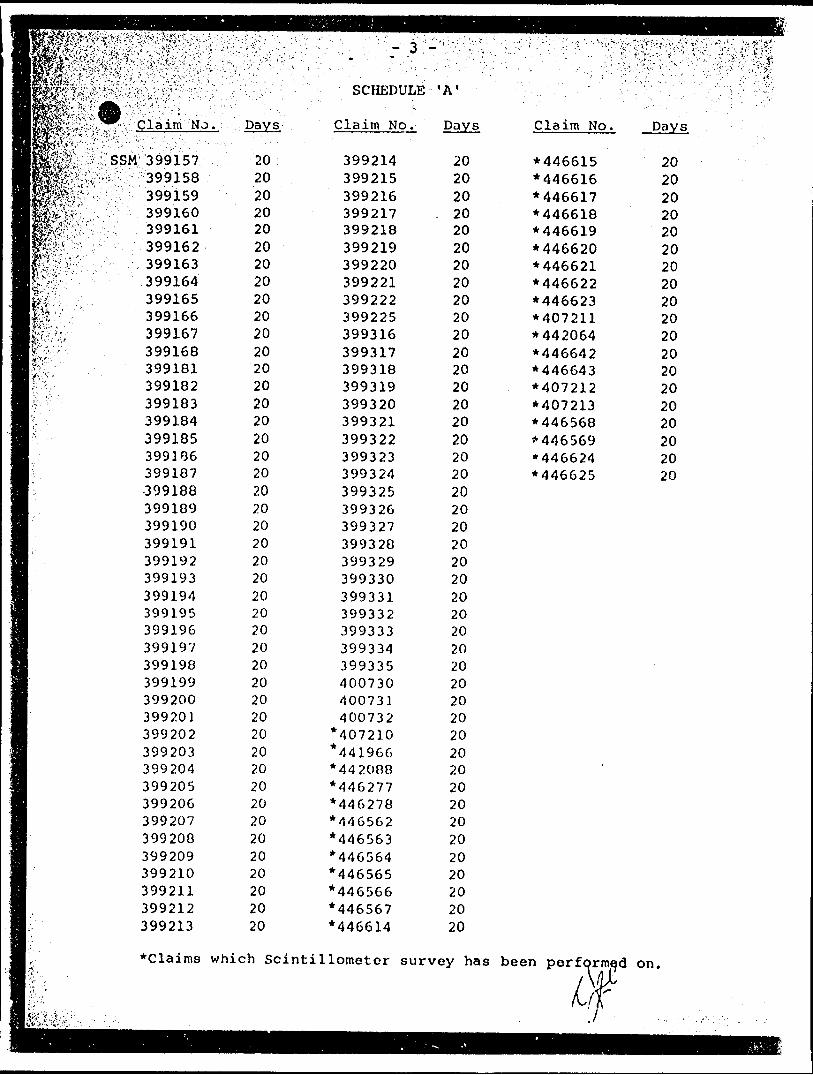
SCHEDULE ' A 1
Claim No Days Claim No.
SSM 387847 .387848387849387850387851387852387853387854387855387856387857387858387859387860387861387862387863387864387865387866307867387868387869387870387871387872387873387874387875387876387877387878387879387880387881307882307883387884387685387886387887387088387839387890
20': 20
2020
. 20202020202020202020202020202020202020202020202020202020202020202020202020202020
387891387892387893387894387895387896387897387898387899387900387901387902387903387904387905387906387907337900387909387910387911387912387913387914387915387916387917387918387919387920387921387922387923387924387925387926387927387928387929387930387931387932387933387934387935
202020202020202020202020202020202020202020202020202020202020202020202020202020202020202020
387936387937387938387939387940387941387942387943387944387945387946387947387948387949387950387951387952307953307954307955307956387957387958387959387960387961387962387963387964307965307966307967387968387969387970387971387972387973387974387975387976387977387978387979387980
202020202020202020202020202020202020202020202020202020202020202020202020r.o2020202020202020
No.
SCHEDULE 'A 1
Claim No Claim No.
S-*.':' f*!:--..--
SSM 387847387848 '387849387850387851387852387853387854387855387856387857387858387859387860387861387862387863307864387865387866387067387868307869387070387071307072307873387874307075307076387077307070307879307000307081307002387003307084307005307006307887307088387009307090
2020202020202020202020202020202020202020202020202020202020202020202020202020202020202020
387891387892387893387894387895387896387897387898387899387900387901387902387903387904387905387906307907307908387909387910387911387912387913387914387915387916307917307910307919307920307921307922307923307924307925307926387927387928387929307930307931307932307933307934387935
202020202020202020202020202020202020202020202020202020202020202020202020202020202020202020
387936387937387938387939387940387941387942387943387944387945387946387947387948387949387950387951387952387953387954387955387956387957387958387959387960387961387962307963387964387965387966307967387968387969307970387971387972387973387974387975387976387977387978387979387980
SPt-n,
202020202020202020202020202020202020202020202020202020202020202020202020202020202020202020
Hi l^ S",-. .V 1 "'--" t'
No.:
mmmmmmmmmmmmav*v-';J --^--*-'
•; '.-i '.'-. -~''.-' ,. T *'-fi*..
SCHEDULE 'A 1
Claim No.
^399V157399158399159399160399161399162399163399164399165399166399167399168399181399182399183399184399185399186399187-399188399189399190399191399192399193399194399195399196399197399198399199399200399201399202399203399204399205399206399207399208399209399210399211399212399213
202020202020202020202020202020202020202020202020202020202020202020202020202020202020202020
399214399215399216399217399218399219399220399221399222399225399316399317399318399319399320399321399322399323399324399325399326399327399328399329399330399331399332399333399334399335400730400731400732
*407210*441966M42088*446277*446278M46562*446563*446564*446565*446566*446567*446614
202020
. 202020202020202020202020202020202020202020202020202020202020202020202020202020202020
Claim No.
*446615*446616*446617*446618*446619*446620*446621*446622*446623*407211*442064 M46642*446643*407212*407213*446568*M46569*446624*446625
20202020202020202020202020202020202020
*Claims which Scintillometer survey has been performed on.
GEOPHYSICAL - GEOLOGICAL - GEOCHEMICAL TECHNICAL DATA STATEMENT
TO JIF. ATfACMED AS AN APPENDIX TO TECHNICAL REPORTFACTS SHOWN HERE NEED NOT BE REPEATED IN REPORT
TECHNICAL REPORT MUST CONTAIN INTERPRETATION, CONCLUSIONS ETC.PROJECTS UNIT
^Typc of Survey Geological, Scintillometer Township or Ar.M Nouvel. Varley. GrasettClaim hnlrW(*) Rio Tinto Canadian Exploration Ltd.
Author of Report— Address C/O Ri O Covering Dates of Survey
Total Milrs of Line cut —
a.JJtoJ^dalad&a^i.K^JTQriuito May - August...1.9.76___^_
(linccutting In office)
S]^:C1A1. PROVISIONS CRKDITS RKOL'KSTKD
DAYS,, . ,Cieopliysii.Ml
KNTKR -H)*l;iy line cutting) fm In si snivcy
ENTER 20 .lays for each .nlditional survey usiiij; s.une grid.
- R .idiunuMtic ____ ——™
o i h.:r.-ScinJJLl lc&i tor{ jci illicit", il. - __ 20 M ^ ,-—,
A l R HO R NE CREDITS (Spnii) piovuinn irtdiU A it m il apply lo MJrlxir ne tiirtryt)
(i-iilrf iljyi prr iljim)
l )ATK: -Doc, SIGNATURE: ™ ___ -Auilior of Krpori nr
1'RUJi -.C IS SECTION Res. C.coi. ___ 3.1 h
^.^^ Qualifications ^J ®
l'icMt)us Survevs —. —^—M..
_date
OEOI.OCJ1CAL1J RANCH.
(;EOI.()(;K:ALHRANCII.
Ajjproved by^.. .{late.
MINING CLAIMS TRAVERSED List numerically
..SSM..4421.7.8........, (prefix)
442179(number)
82
83
84
85
87
88
89
90
.9.1.
92
93
94,
95
.Seo..Schedule...'.
TOTAL ri .A IMS. 302
i.'VKv-'fy'^iS.V.K;1../^ 1 ;1 . " "--V 'f -. Show instrument technical data in each space for
type of survey submitted or indicate "not applicable"
GEOPHYSICAL TECHNICAL DATA
.SURVKYS
. Number of Stations^ fcv '' :; ' '-.'-' '1?^:, Station interval —-—ffi^'V'.-'' '"; - - . ' '"•'
v.v,J' Line spacing .^.^...
A2.Q50 .Number of Readings 12 f O'iO100 ft.
4QQ ft.lpc-'-; '' ~\JHfyji ^ Profi'c scalc w Contour intervals.
i(ipccify for each tvpc of lurvcy)
"MAGNETIC Instrument . Scintrex BGS-1SLAccuracy - Scale constant — Diurnal correction method. Base station location-.——.
InsirumcntCoil configuration,...—..———.—-™—™- (-oil separation—™—————————————Accuracy———-——-^—————~~^— Method: CH Fixed transmitterFrequency——-.,.—..—..—. —.—.-..-———.—.
O Shoot li.ick O In line D Parallel line
(iprclfy V.I..K. lParameter^ nidisurcd.
InstrumentScale constant.Corrections mad(.-— ._________^.
Base station value and local ion__ ...
F.le\ation accuracy
Instrumcnl _ ^ Time domain. Frequency ,— Power -^..—-
domain .. Ranjjc —
Electrode array—. Electrode spacing. Type of electrode.
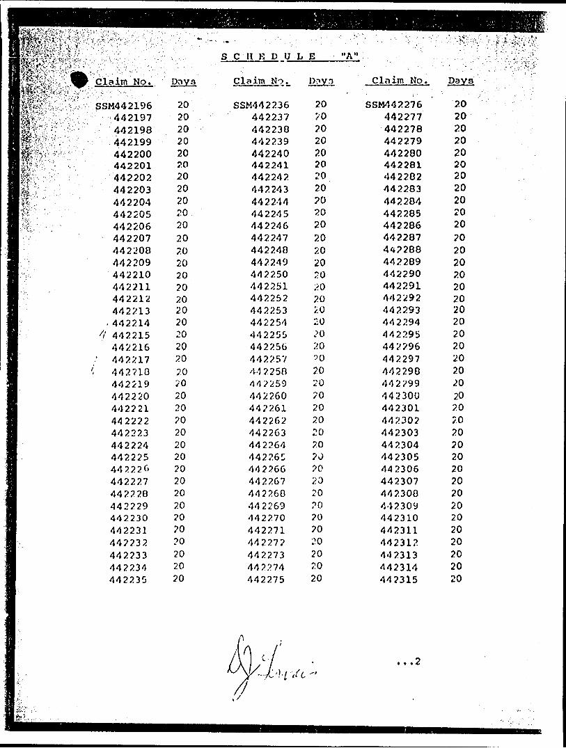
S C H K D U L E "A"
Claim No. paya
SSM442196442197442198442199442200442201442202442203442204442205442206442207442208442209442210442211442212442213.442214
'i 442215442216
' 442217( 442710
442219442220442221442222442223442224442225442226442227442220442229442230442231442232442233442234442235
2020202020202020202020202020202020202020202020202020?0202020?02020202020?0202020
Claim No.
SSM4422364422374422304422394422404422414422424422434422444422454422464422474422484422494422504422514422524422534422544422554422564422574-1225044225944226044P26144226244226344226444226C44226644226744276044226944227044227144227?442273442274442275
P?.V3
20?0202020202020202020202020202020/:o20'0:'.o?02020/o202020202J?02020PO?070L'O
202020
Clnim No.
SSM44227644227744227844227944228044228144228244228344228444228544228644228744228844228944229044229144229244229344229444229544229644229744229844229944230044230144230244230344230444230544230644230744230044230944231044231144231?442313442314442315
20202020202020202020202020202020202020202020202020202.020202020202020202020202020
...2
;: 442319 442320
'442321442322442323442326442327 442320 442329 442330-442331442332442333442334442335442336442337442330442339442340442341442342442343442344442345442346442347442340442349442350442351442352442353442354442355442356442357442350442359442360442361442362
2020202020202020202020202020202020202020'/O
2020202020202020202020202020202020202020
s c HE' ri 'i; L:." ' ..- '. ' ' . ' ",
Claims No;
SSM44236344236444236544236644236744236844236944237044237144237244237344237444237544237644237744237844237944230044230144230.74423034423U4442305442300442307442300442309442390442391442392442393442394442395442396442397442398442399442400442401442402
E -- ^ "A"
Days
20202020202020202020202020202020202020?020HO202020202020?.o2020202020202020202020
Claim No v
SSM442403442404442405442406442407442408442410442411442412442413442414442415442416442417442410442419442420442421442422442423442424442425442426442427442420442429442430442431442432442433442434442435442436442437442430442439442440407146407147 4U7140407149407150407151407152407153407154407155407156407157
20202020202020202020202020202020202020202020202020202020202020202020202020202020202020202020202020
Kls
ff,
,yrv; f;o)v-
•W
•"•- Q
v ' w'•"••-' "K
•; v CO
o zE•H
(O
r-H
O
. -H(C rH
U
enE-H(Cr-1O
ra Qooooooooooooooooooooooooooooo
oCO
^S
f^
ftt
l -ItLaS
i* - A.^.-'.-i '*:-..i
, vo r* vo vo vo vo
•;O"4 O
J r-t r-(
r-4 (H
VVD
-AO
O
I W
d
CM
i;-sv':l'i;:^-:!::. v'--;:.,:-rw
:;^i -J~-•\.--y.~-i",--^:'rn ::' " '
- -
••-.-' ----,—
C*vro
VO
(O
4JO•acO

XX
XX
XX
l '
l
--.-x- -
^^l&^'Sc '"'k.' 1"U'?4'J"^!"^I* l^S*ft^|S*wN. is*yJH jjsJiS^I '^.^r'' l ^B l"w ;gSs5* ...,i t, ,.i i u." A em&p'sL---^ ^
MONTGOMERYDISTRICT OFALGOMA
SAULT STE. MARIEMINING DIVISION
/'l w(a cS. SCALE: ^!NCK = 40 CHAINS
.-•.. -:V7. :':. v:r*i'-DISTRICT OF'ALGOMA., v
"SAULT STE, MARIE
MINING DIVISION '.
SCALE: 1-INCH 4Q^CHAINS ,
, wt,r ^. --.--.-^ - '-• ::^,^^^
. : . .
•T*SftiWai'.; cjrg,. y , - ;;, -•,-"*;^--;:'-' l .v i v;v",--
ALBANEL TR M. 1611 "J :W-" ^' I 'l,
ea
SCL V-
.J LU
O
KAMICHISiTIT(Former TP 168)
DISTRICT OF ALGOMA
^^ -————T—r .
5U\ ' v SSiX-Uy.*!?!/''^\ V"—\\ '7 SAULT STE. MARIE" 1*"
MINING DIVISION
SCALE: 1-INCH-40 CHAINS l
55M ,SSM X
74V; J .3768 /^
T^Ii^:/* -.
v-X'.'v :'OC-:,X,: V •K! ": u*o5*; 5*^*4 : v/k f^t - *^** ' ^^" •'"*00'| ' MMTOH ' VWOI6 i^" l 'j 1"HO
^ " ~ ' ~ " r SSM ~* SSW C-/I S SM
, "- - SS* ~N"^~
K 'i^K^50"OO *i l 381025 ' , -rv:
1 ,V--/ -.5V - ; isV - "ss5 ' "TV
SSM 5 SM, ' 5SM
42V 3 94* ISJ
SSfcl , SSI* ' 55•'ve ^* ;t /y.^i, i^ yvo 3T^9I l .3T n*'* i 3"5 "fi ' ^' , jvvj^tf - JDTW ' p*' ' JITTJ. ^i .^i w. H. , vi o 11 ' ' J^vv^i^* r J""'^v
....-•- --..----'-.--JV------- -Bjipy - -'-.--'----/----'----i----^---j.^..^*lf f *'* "'J" S i- . VPS' . ri?*"—-^rir^'~r^c ^ 'SSM ^ SSM .SSM ' SSM , 5SM i SSM SIM I
'-- "v^ X' Vi ' V ; 5^/Tc 'X. :'v'ss^X; X ' vC ' v. X. ! X ' X' V' JS/901 J W*N ; V*SS ', ^V[ 3*^9?** ;3er9j5 l 3810^3. ^3/sN*; 5^,10*5 i jAiSi l 3**^13N ! 3*4llV ' 39*12*5 ' 38812?
JUILLETTE TR M. 1609
J A C K SON
i SCALE : i INCH - 40 CHAINS
o——roo 00 *co oo
\CRES HECTARES
GRASETTDISTRICT
A LGOMAMINING DIVISION
SAULT STE. MARIE
Ministry of Natural Resources
Ontario Surveys and Mappirvg BranchPlan No
M. 1267
li PARKINSON Tp. M.1328 712
VA
RLE
Y
(TW
P.
176
)JA
CK
SO
N
(TW
P.
182)
A M
ICH
ISIT
IT
(TW
P. 1
68)
GR
AS
ET
T
-SM
oso
1588
0^7
1388
056
|
UjV
ElL
'T
WP
1387
-7&
3 l 3
*
(|TW
~P.
1,75
)
,
-^—
J-
—
— -l
— —
H —
—
—
l
^ -.----I"--! —
-
- - -
J - -
l- —
""""
ON
TA
RIO
Sca
le -
|"^I
2Q
Mile
s
TW
P.
167
MO
NT
GO
M E
R Y
O
R. A
. BE
NKIS
Q
M o
ntg
o m
ery
Tw
p
RIO
TI
NTO
C
AN
AD
IAN
E
XP
LOR
AT
ION
LI
MIT
ED
L i t
tle
White
R
ive
r
C la
ims
LIT
TL
E
WH
ITE
R
IVE
R-
PR
OJE
CT
- O
N T
LO
G A
TI
ON
S up
er io
r
N A
C la
ims
jAN
—
1976
R. C
. H
. /e
.b.
DWG.
L
4500
41
JI1
SE
00
13
0*1
2
NO
UVE
L
\
X Ul 1 o
o
ffi
-
T
O
u.
u
-9
*
or
UJ
ro
SIS
Q oo -O
S 3 P 3 -9
IIZx9
- Q •*-.9 v9 v9
C- rAg fi? S S
in c- -T*-3 jo in
~T l i
86 l
sS ^ ~in in ^
in
661^ 9 ^s9 ^ in
co r- vn -9
003
•ft ^\oz
02
'o
o^ O Y* ^9
t-
P? "O
18
Q ^ *f) O (P•i s9 ^
98 S IS 9 S ^ in ^ ^
in O O -S
— l ——
00 .^ITl lo
ffl unw sa*^^.
-i- - tfx rO cs( O•S ?h ^ s3 ^s
Od H"\ Q 'O -~-sS r- t- v9 v9
^-^
O ^ in
c^ O O w r- in T) 'o T- ' i-
8 ^ 8
oo
S SI
ESI
.in -jO w
s? S 3 S
442294
oro C\J
toto IO
5--
50
4*
SO
T5fo
si53
57
54
•hfa60
50
50
50
50
57
SO
jO
5
.7
4s 4*50
51
S3
52.
5'
Sfa
^
5f
57
5?
442303
/X
4422 95
-kl-5
442302
jfo
55-57
50,
Base
Osr
•i ^-
,o , _oO \* — r5fc
fcO
y ^(oi.
60
5S
5a55
5k
foO
35
5Z
r^ ——— c53
5H
loio
54?
fcO
57
fcO
SO
- ^4 ^~
- 5fo
- 6O
- (bO-ir-i-- tz
--
-
-
-
-
-
3— ——— .
^- —— ———— —^
- 5fc 1
-fei *
-5(p \
-ta \- s -a i-5Co 1
- 5"a '- 56 \
- 53 l
-60 1
-59 1- 5-^^
. foo - fo5
- &Y
h o'L
Co
O
o2L
fe
feO
*t50
2.
5^t
5fo
5O
toi)
56
5fo
5^
fcfc
55
5S
5Z
55
5Z
S^f 5fcT~'~~
ST5^
52.
5to50 442
6^
(bO
54
5Z
5HtoO
feC?
S3
5Z'N'SO O
foZ
^;r -
sa.
j Wo Lo0 .Uss - .L^ \T -\59
55 Ato5 l
-\5fofo 1
foo Y59 ^
fcZ W
5^ \7
55 ^
55 4
57 -'
5ft 442306
fei .
59fe/
55 5? —— ———W '
30
Z5
io^5 -5^
to5fo
55
5to
5^
50
^5Co
5O
50
52.
Sfe
feO
54-
50
^i
V
9fcO
54-.44218
CoO
5fo
5;
V^^9V95fc
5^
50
53
50
5O
50442U
53e:/-
flft
^5
to
442301
442296
R,
M Ik
442307
52-•fsr
Base
5^
tbO
90fcO
J 2.0
/SO 120
7S
7S S?
5fc 50
55
GO
5fc
o*
76fe*
442224 55
60 QN
72 /P-;
-
SO
7Z
71fott
65
to 53 fco(pif55iaO
N/a. N ft.
52.
t*
O
50
O
(o
4
fcp
6
.442218
y
3b
:O
(o
fcloO
(b
442 223
toO ^9
55
442293
442290
S
N R,
K R
442297
442300
W*. 442308
*R
442182
442185
442194
442219
70
54
57
5ii
5054
53
55so
50
50
5S
50
56
70
^
4422895ft
-o
-
^.
^M^l•^7 1 55 __ J..^ n ' L-- T-
50 X^Ts^ 1
fo E ' 1 '
50 g
T* W j '
0T. l 1
S/ J5Q 1.
50 J t
Sfa -j
i h
S3
50
5' -U/ P' 1S3 J
52
Si
5/
54
50
6,0
fcZ.
4a j53 i
50 '
50 i
53 i
54•fe3
-55
H5O
Hfl
442292
U5D
442298
442299
M 1-.
-.f
-
^
m
^ t
'
m T
, *
1
1
~bS~^ — ^~
53]fcOj
5fc
58 ^ fc3
53
3H3S
K 442309
30
^•5
r7fo
i t
f1/9-
I4fc
JS2
Jso
l53J50
Jso-J5D
js^•J53
4^8
33
fcott -^^51
^
VT
50
3748
5Z
50
47
55
SO
57
51 fifo
3CJ
55
Si
So — -— ,^^
•50
50
5O
5Z
51
34
30
5^
4'475050
^^ .-., J :n* ————— iM ———— -rrr
, -W *v - rB
460 H^ol J456 w soJfeO J^J
t] J 4 421 83 1 OV
V8 -lfc5 l 50155 fV 52.-so -Ws
50453 ^i
50-b7 5t
50
52 V -|toSL -JS^ ^,
ISOSfc
442 I84
5-5
J 60
Sfo
5S
to
;50
5O
50
56
5S 50
50
50
442I95
58
Uo
|S7
53•50flit
•70
5360
57
TO52.
50
80
/(O
442220
To
1/20
Us[T3
53
TO
T5
rro 'to Jss.
ro 157442221
KEY
NOTE -'
All claims have prefix SSM
For Legend see Map SC4499-I
N . T. S.
41- J - 6 , II oQ R. A. BENKIS
400
SCA LE
400 800 1200 iOO
53
5O
Tol*/
72ss
rbl
-Si
70
(aO
6)4
5Y
foO
50
50
50
llt-v
55
foO
RIO TINTO CANADIAN EXPLORATION LIMITED
ITTLE WHITE RIVER AREA - ONT
SCINTILLOMETER SURVEY( B )
41JIISE0013 0812 NOUVEL aao FEET Oct. -1976 T. C. /e. b. DWG. SC4499- 6
442259
50
141
51
14ft56
52.
4,0
SG
2260
SG
4o
442267
442264
so442268
53
442271
1.59
442275
442279
tfco
442283 J 59
— — ~
— . --
-
----
-------'
------
---
~~
-
-
-
~-
5
5y
50ST
50soS3
sob"/69-—-H) ————^0
575053
49
51
59
56
5653
42
63
CoO
4s 1^ — r4*52
5O
5fc
55
(at
54
56
SI
50
4652————— (1 —50
4fcr '44
51
SO
56
55
54
S/
(iO
60 J
sft 1i {
feo ~/
5759
53(bO
55
5S
tb3
61
tbO
55
5T
ifi —————— ,
-53
-W
-60
-55
-&0
-65-60
-49
- CoO
-51
-49
-51
-53
-47-32
^.Q- D o
- SO
-44- 51
- 50
-M
-4*
-Vfo-4*-51
-63
-to-45
-50
-f*
-53
-so- 53
- 50
^7-44-50
-53
-56 X-52 X
-6fc 7
- 6o y-57 7-^
/-(oO
-&Z.
.601— — —— ' —— ~"
-5fo
- 61
-57
- (b/ 1
-fe6
-60
-62.
-57
-53
-50
- 37
1-53 - ir^^^fe
442261
50
4*50
Si.
(pO
442265
442272
5-350
r47
S/
Wf
4150
50
S2.
S"
60-iSO 442266
53,4422 6 9
44227 3
p9
P5
57
5ft
SI
50
SI
442270
st.
52.
442262
442336
442335
fJ *^,
-^
f5O
50
45
V3
442276
5/
SO
S7
47
Isz
50
47
50
50
442277
50
515O
44
50
442281
442284
442285
6/
in J
"54
53
442196442203
56-
57
53lin
to T5
442204
442 202
5558
5956
5ft
15344219 8 442 201
44220563
52.
50
so
52
53
50
30
53
55
-O
555
50
55
'50
53
49
58
52.
50
50442278
60
64
52
153
56
S3
57
50
56
54
55
442282
so
ss
442286
\SS\5\
4s
-57
-50
50-
so-
50-
&I Base L
156
153
49
49
50
[SO
5(o
4422 II
5O
Iso
65
57
50
442210
442199
\(aO
67
73
W)
442251
Base-3
~o
442206
50.
tso
44??
5)442207
-4 ? ;' i -4
442344
S&.
442246
442247
^
^7
N
NOT E :
All claims hove prefix SSM
For Legend see Map. SC 4499
41JI1SE0013 0012 NOUVEL 230
- 28
55
57
Sfo
442360
•53T
446568
S6
KEY
400
53
442337
62
26
25
502.7
Zo
442338
442342
67
6/
6'
442346
442353
442357
442361
60442350
442354
442358
'57
53
56,
^J
CDoo H6O
442317
442319
446569
36
60
/57
4S
-
-
'~
'
-
67
^
^
?372
^
?377
0 ^
7 -(
o* -51
06
ol
59
^ -^62fei
5ft
60
56
52
(bO
fei
6*
5^ ^efe ^^-60
62.
65
^8
62
(0.*? le f
61
^a^6(
~ie8 63^^" ^
66
62.
6^
6S
7J
10
6^
56
6Z
ss52.
56
62^^.
"to
6465^^
5S
5953
5S
St?rs 9Uoj 60
]w
J57
J^o
|^•53
-SZ
-fe/
- 6CD
-ss
50
442387
ecr
N/A
446623
fjffl.
w R,
442322
Njft
442321
442 288
MR.
44 2320
446624
w/R
fefc
442397
O)
44228 7
uk
M P,
—Q
446621
W/A
w P,
446622
446614
"A,
446642
N*.
CO
5fc -i
NTS.
41 - J -G , IICD
SCALE
400 800 1200
3 R- fl - BENKIS
^o^v x cINfJ
I60O
FEET
RIO TINTO CANADIAN CXPLOKATION LIMITED
oLlTTLE WHITE RIVER AREA - ONTii
SCINTILLOMETER SURVEY
Oct - 1976 T C X e b sC 4499-7
RIO TINTO CANADIAN EXPLORATION LIMITED
O R. A. BENK1S O
WHITTLE WHITE RIVER AREA - ONT
All claims have prefix SSM
For Legend see Mop.SC4499-lSCINTILLOMETER SURVEY
D)
Oct. - I976 T. C . l e . b. DWG. S G 4499-841J11SE00I3 0012 NOUVEL
NO T E :
All claims hove prefix SSM
For Legend see Map SG 4499-1
4IJ11SE8O13 0012 NOUVEL 250
407157
RIO TINTO CANADIAN EXPLORATION LIMITED
O R. A. BENKIS LITTLE WHITE RIVER AREA - ONT
SCINTILLOMETER SURVEY(E
e. b. DWG. s c 4499.5Oct. - 1976 T .C
-1(00388873
4--—Tr5J l -
55 388879
6O
RIO TINTO CANADIAN EXPLORATION LIMITED
LITTLE AREA - ONT
All claims h ove prefix S SM
For Legend see Map S C4499-1SCINTILLOMETER SURVEY
F)SCALE
400 800
SC 4499-4
(D
CD
y in - , . 0001
RIO TINTO CANADIAN EXPLORATION LIMITED
LITTLE WHITE RIVER AREA - ONT
AH claims hove prefix SSM
For Legend see Mop SC4499-I
B
E
A
C
F
K
D
' /
G
/;
H
J
1 SCINTILLOMETER SURVEY(G
4IJI1SE00I3 0012 NOUVEL
| K | -± ___ 400 0 - 400 - 800 I200 I600 7\ t l
FEET
J- ————————————f
Oct. - I976 T.C. / e . b. DWG. SC4499-3
RIO TINTO CANADIAN EXPLORATION LIMITED
jf/ITTLE WHITE RIVER AREA - ONT
All c loims have prefix S SM
For Legend see Map SC4499
SCINTILLOMETER SURVEY(H)
DWG SC 4499-2
41J11SE0013 0012 NOUVEL
Base Line -
-IOO 3 8809B
Base Line
RIO TINTO CANADIAN EXPLORATION LIMIT
-|60 Scintillometer reading in C. P. S
Instrument : Scintrex BGS- l SL Scintillometer
claims have p re fix SSM.
LITTLE WHITE RIVER AREA - ONT
SCINTILLOMETER SURVEY (D
e. b. DWG. SC4499Oct. - 1976 T. C
41J11SE0013 0812 NOUVEL
4IJ
11
SE
00
13
0812
NO
UVE
L
7*5 te 'SO
50
5O 4o
3991
81
39
9 1
82
1 ——
——
Iso
55" 4o
•/s 55"
50
50
O 5"
55" 'O )5 70 O 50
50
55 50
5O
o 5 70
90 so
3991
83
w? 70
. oo
95
i(S 12.0
110
//o
go
^Q
6
bQ (t0
o 75
&S
bo
leo 55
fca
foO 55
fcO
^oo
^o (oo
/CO
A^/
4,
^A
w/R * ^0
//O (00
l*ff
/OO
?0
70 TO
(bS to 55"
feO
,7O
*D
fN
ote
All
clor
ms
hove
p
refix
SSM
.
For
Lege
nd
See
Mop
S
C44
99-I
KE
Y
N . T
. S .
41-
J-6
,
SC
A L
E
400
80
0
FE
ET
1200
RIO
TI
NTO
C
AN
AD
IAN
EX
PLO
RAT
ION
LT
D,
LIT
TLE
W
HIT
E
RIV
ER
A
RE
A-O
NT
SC
INT
ILLO
ME
TE
R
SU
RV
EY
(J
)
Oct
. -
1976
T
.C.
/e.b
.DW
G. S
C27
48-I
^399203
RIO TINTO CANADIAN EXPLORATION LTD
LITTLE WHITE RIVER AREA-ONT
All claims have prefix SSM
For Legend See Mop. SG 4499- SCINTILLOMETER SURVEYK J
DWG. Oct. -1976 T. C. /e, b. SC2748-2
1 o
o
ffi
-
I
CD
tL.
u
-9
ii
o
(O 10 o
112
in L
O
8 61o
66
003
102
208
E 02
ffi
s o z
902
esi
5 l
Base L ine - 3
RIO TINTO CANADIAN EXPLORATION LIMITED
LITTLE WHITE RIVER AREA - ONT
GEOLOGICAL MAP(B
For Legend See Map G 4496-
Maple , Pop l cir, B ir
l For Legend See Map G4498-I
B
E
Af / s/
e ./,
F
K
G
D
H
J
l
N .T. S. 41- J - G , II
400fc-H
SCA LE
400 800 1200
41J11SE0013 0912 NOUVEL 340 FEET
RIO TINTO CANADIAN EXPLORATION LIMITED
LITTLE WHITE RIVER AREA - ONT
GEOLOGICAL MAP( c )
Oct. - I976 T . C . l e . b. DWG. G 4498-7
KEY
For Legend See Map G4498-I
N .T. S.
1- J - G ,
SCALE
400 400-t
800 I20O
FEET
350
RIO TINTO CANADIAN EXPLORATION LIMITED
LITTLE WHITE RIVER AREA - ONT
GEO LOGICAL MAP(tt ) ———13———
Oct. - 1976 r .C . / e . b. DWG. G 4498 - 6
Birch.Mople, Popla
Spruce. P*p l ar
KEY
l For Legend S ee M ap G 4498-
N.T.S.
41- J -6 . lO
o400
SCALE
400 800 1200
41J11SE0013 0012 NOUVEL 160 FEET
RIO TINTO CANADIAN EXPLORATION LIMITED
LITTLE WHITE RIVER AREA - ONT
GEOLOGICAL MAP( E )
Oct. - 1976 T .C . / e. b. D WG. G 4498 - 5
Pine. Birch, Pbplar
Pine, Birc|h,Popla
400730
Pine, Poplar
NO OUtCROP
RIO TINTO CANADIAN EXPLORATION LIMITED
LITTLE WHITE RIVER AREA - ONTO R. A. BENKiS
GEOLOGICAL MAP F)
For Legend See Map G 4498-
Oct. - 1976 T.C. / e . b. DWG. G4498-4
Poplar.i Birch
Pine, Birch, Poplar
Poplar, Birch, M ape
Poplar, Birch
chl Poplar, Pine
TINTO CANADIAN EXPLORATION LIMITED
LE WHITE RIVER AREA - ONT
GEOLOGICAL
DWG. Q4498-3
388030
Maple, Poplar
'1[V/fi^-j, i
.-., , ' t
,,- ---y ^-
•^ ^ X /"•' ^" ; /'0r- N \ " \ N CO o*
— — \ [^- — — —
^ A-cvjCM CM 0- N
j W W CM 10
7/ ^
N ro *- ro m W
^ \ \ ^ J , \ w W W fMM WW
v j : J -s j \\ j ] J ^' J \ ,. ., -j s f , . . ———————————— . — - — ——————— - ——————— — ——————————————————————
in roCM
IDtoCvJ
r-ro(M
00rOCM
rotCM
in 10^(M
N 00tf -*CM CM
O* fl-
CM
OinCM fM
KEYN
39®For Legend See Mop G4498- 1
N . T. S.
41- J - G , M
SCA L E
400 400 800 1200
FEET
RIO TINTO CANADIAN EXPLORATION LIMITED
LITTLE WHITE RIVER AREA - ONT
GEO LOGICAL MAP( H)
Oct. - 1976 J .C . / e . b. ' DWG. G 4498-2
NO OUTCROP
Maple, Poplar
e Line - 2
NO OUTCROP
Maple, B irc
NO OUTCROP
poplar, Maple
NO OUTCRO
B ose Line
N O O UTC R O P
Poplar, Maple
NO OUTCROP
RIO TINTO CANADIAN EXPLORATION LIMITEDL EGEN D ; Argillite- grey-block,thinnly l aminated
Polymictic paraconglomerate
Quartzite : pink, hematitic, med. groined, N .T.S.
41- J -6 , IIno cgl. beds
Jasper pebble conglomerate
INTRUSIVES
Olive ne d iabaseLITTLE WHITE RIVER AREA - ONT
^0012.Sandstone: Intbd. purple(hematitic)and
grey- green members Geologi9ol contact (appro*, l
Fault
GEO LOGICAL MAPLORRAIN FORMATION
Quartz pebble conglomerateSCA LE
400 800
Sandstone ' g re y-black sd st.. grey-green s It s t All Claims have prefix SSM
GOWGANDA FORMATIONQuartzite : w hite t o pink,weathers off w hite ,
med. crs. grained, minor cgl.beds a nd lenses^ , X Outcrop Oct. - 1976 T.C. / e . b. DWG. G 4490 .Arkose- pink, fine - med grained
41
JH
SE
00
13
0
01
2
NO
UV
EL
PO
PL
AR
.MA
PL
E
399322
^*
RIO
T
INT
O
CA
NA
DIA
N
EX
PLO
RA
TIO
N
LTD
.
LIT
TLE
W
HIT
E
RIV
ER
A
RE
A-O
NT
For
Le
ge
nd
S
ee
Mop
G
44
98
-
RIO TINTO CANADIAN EXPLORATION LTD.
LITTLE WHITE RIVER AREA-ONT
For Legend See Mop G 4498